Mount Fryatt
3361m | 11027ft
July 31 2025
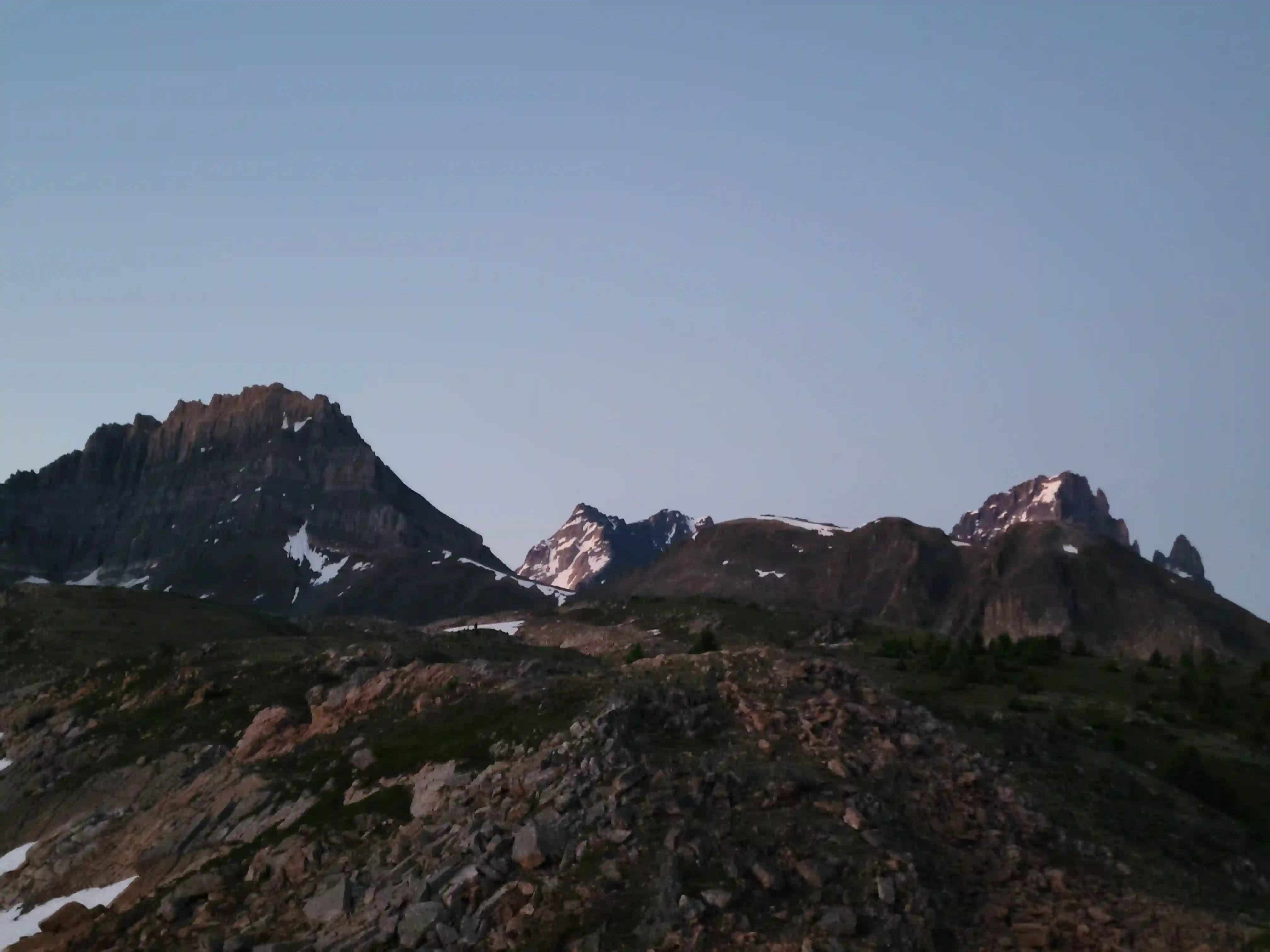
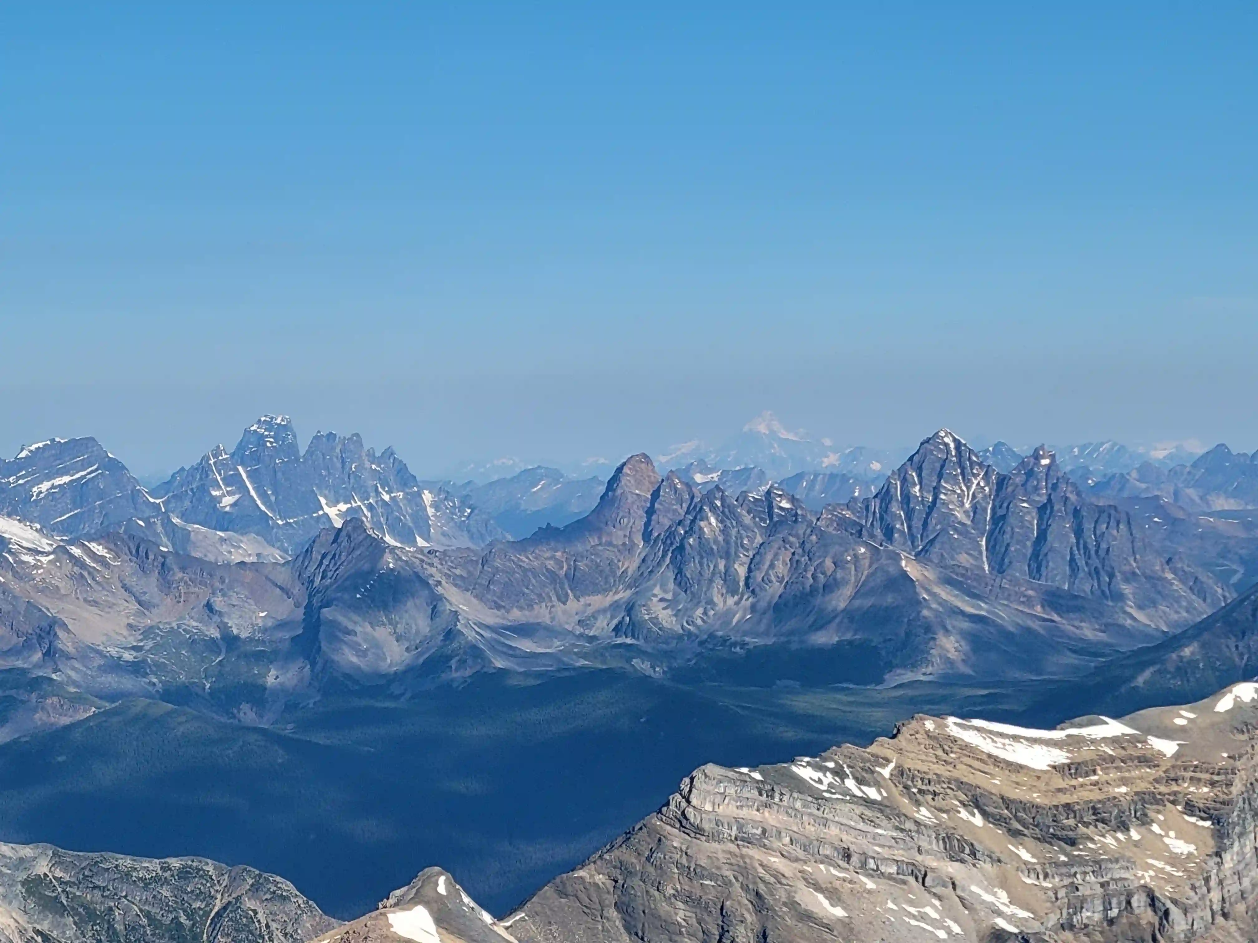
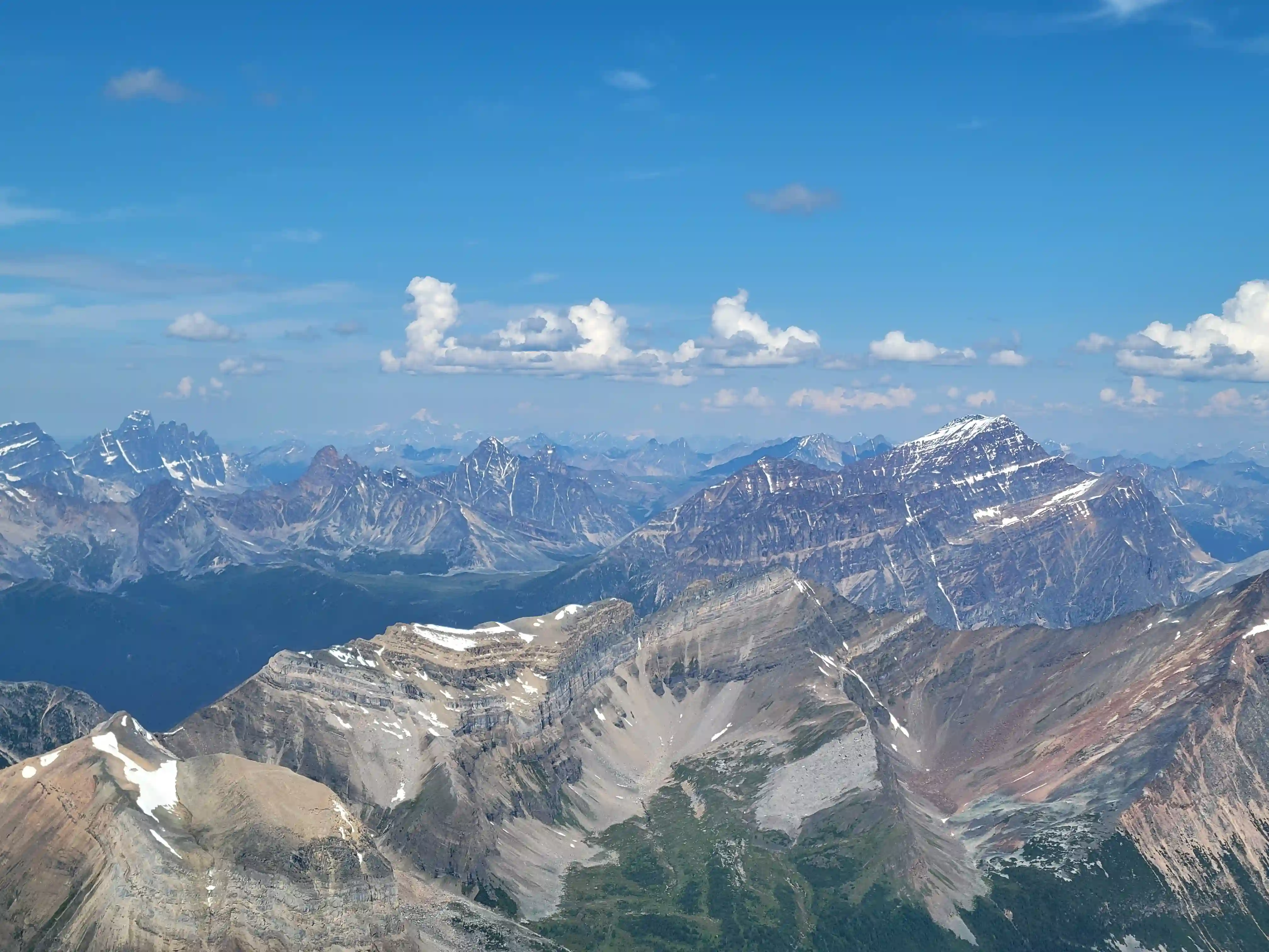
Just south of Jasper alongside Mount Edith stands Mount Fryatt, a quite seldom done 11000er. Although it's visible to the west of the Icefields Parkway, the approach for Fryatt is quite lengthy, passing the Geraldine Lakes on a long trail interspersed with boulder hopping, and with a total distance of around 30-35km to cover regardless of the route up it's easy to see why this peak isn't the most popular on the list.
Likely because of its unpopular nature Mount Fryatt also seems to be one of the more underestimated peaks on Bill Corbett's list and even the easiest route up is rated 5.4, quite convoluted, and holds snow late into the summer which can making timing tricky.
After Ian Matthews and my trip up
Whitehorn Mountain
the forecast was still looking good in the Jasper area for the next couple days, and given that I was already up north it seemed like a good opportunity for Fryatt! William Hammond and I had already been messaging back and forth about getting a trip in so when I brought up an 11000er he was keen!
The majority of parties doing Fryatt take 2-3 days to get it done but Will and I both prefer the fast and light approach in a single push so although we knew it would be a long day, we decided to get it done in one fell swoop. We weren't sure how long it would take but given that some cloud cover was forecasted to come in by around noon we played things conservatively with a start time of 12:30 and were up in the middle of the night for an epic push! Looking back on it it's good that we started so early because although the cloud cover never showed until late in the day, the descent and exit took us much longer than expected and we would've been doing most of the latter in the dark without getting going early.
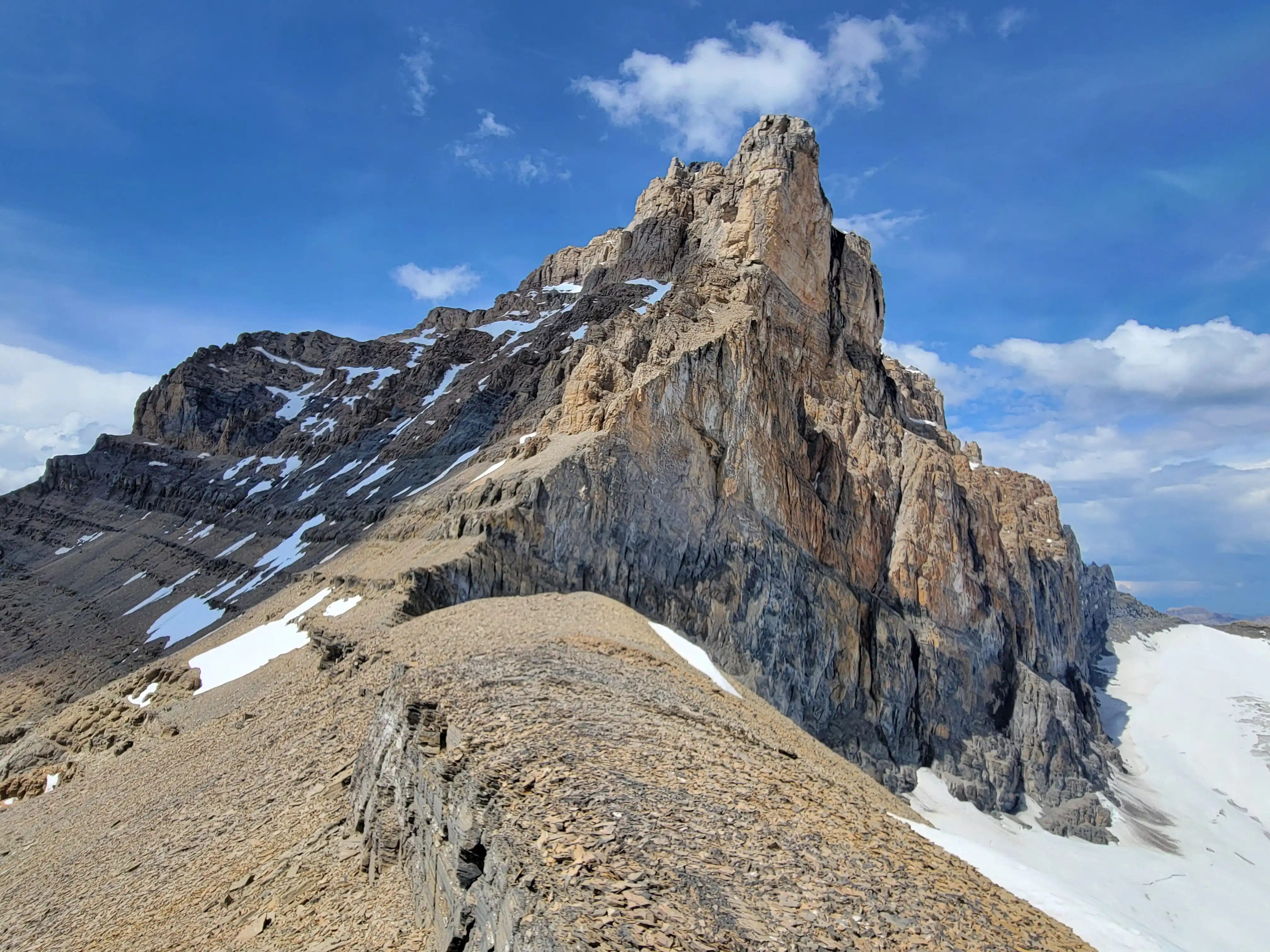
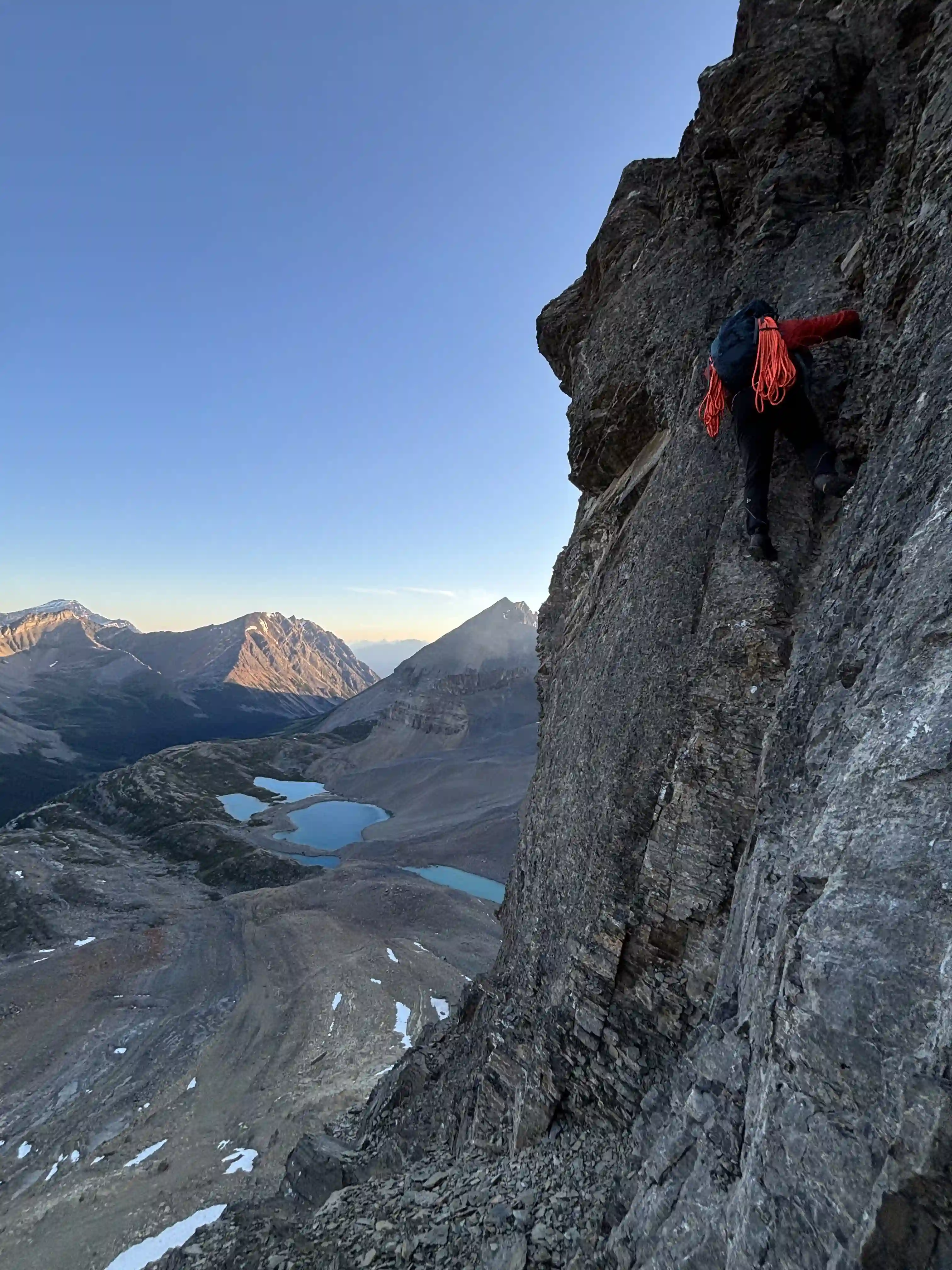
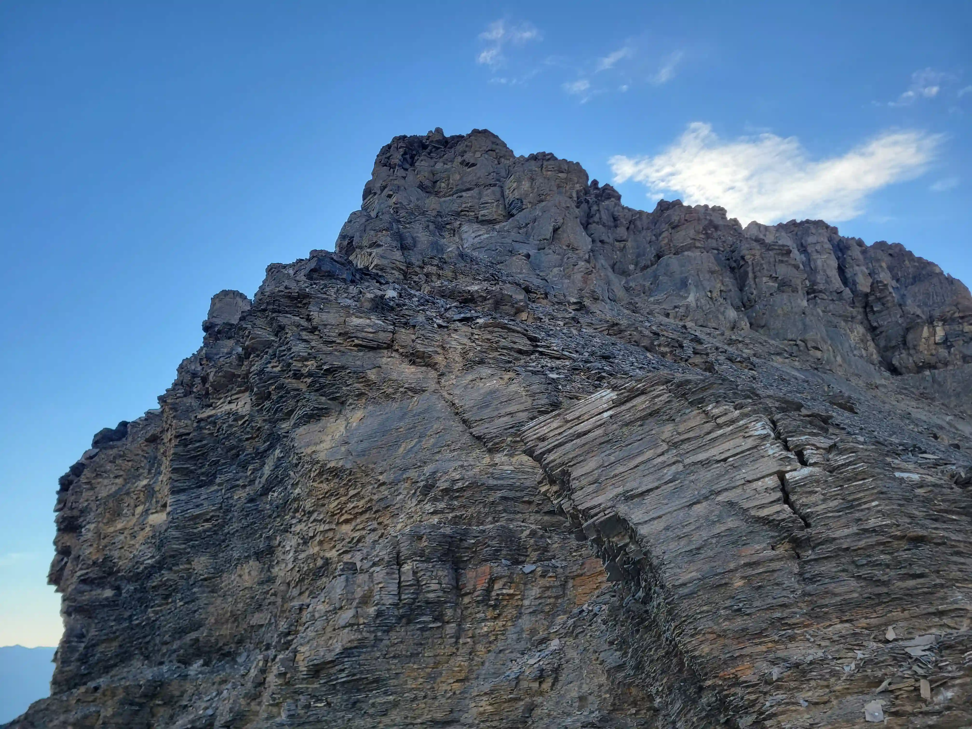
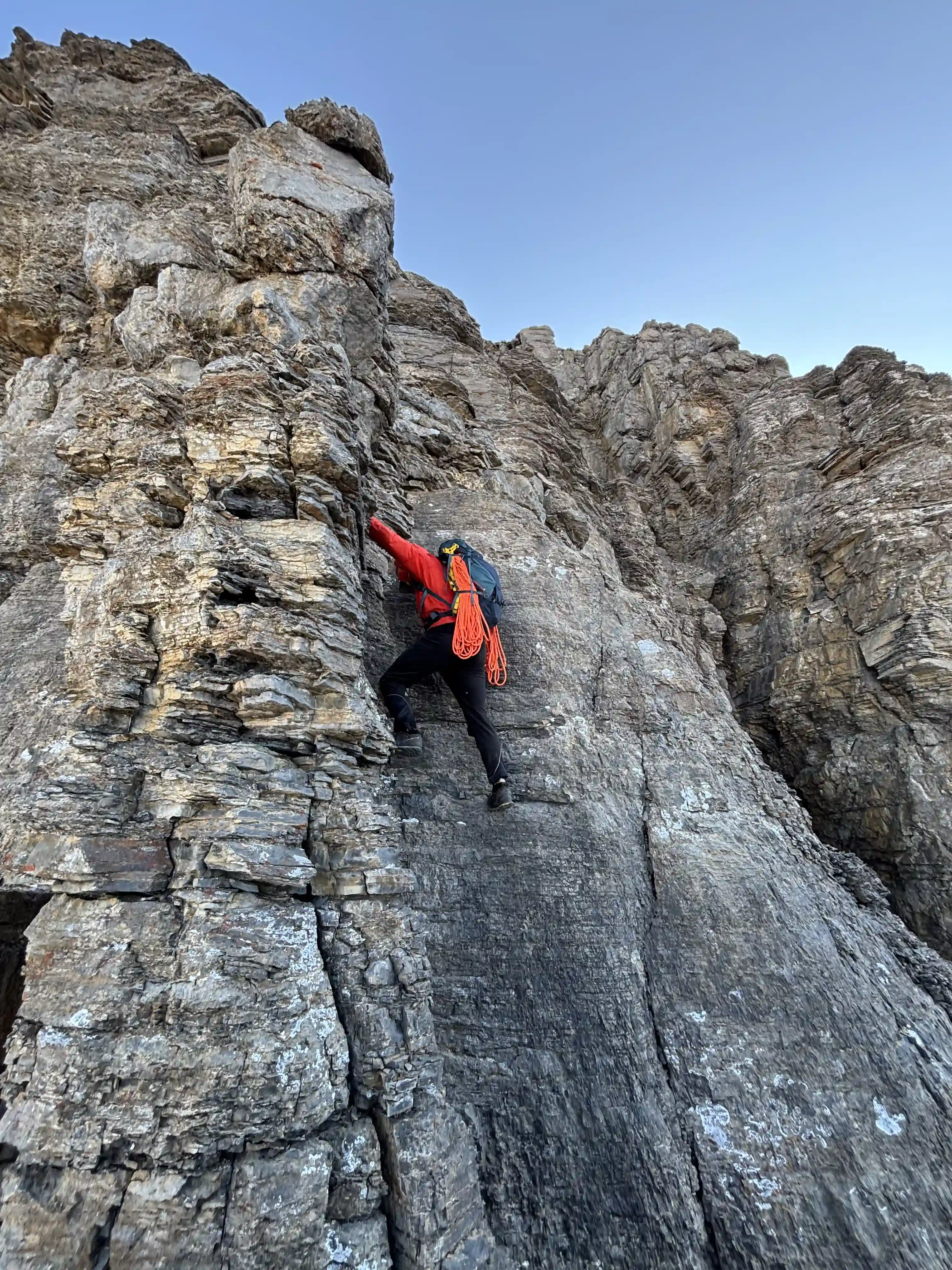
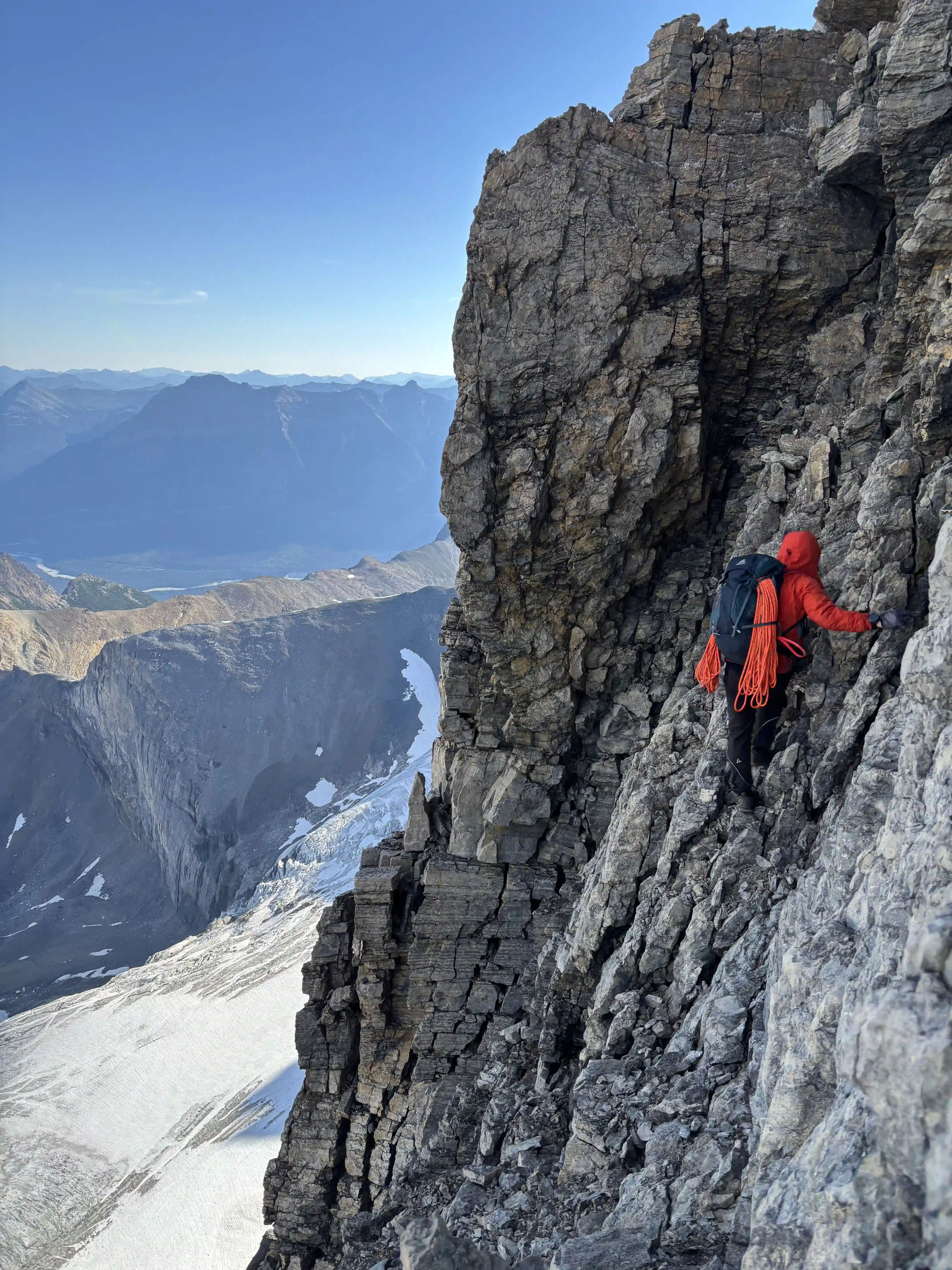
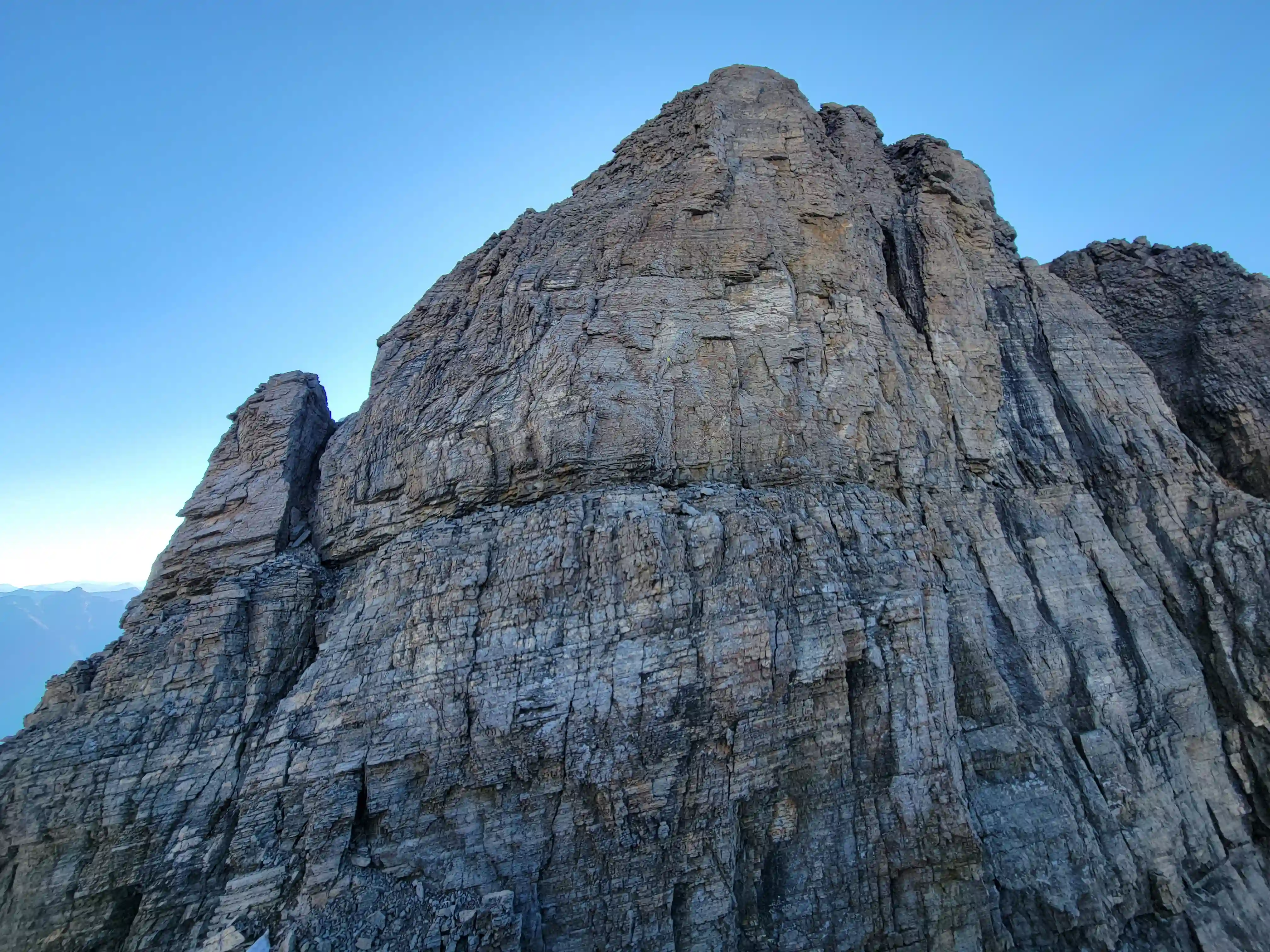
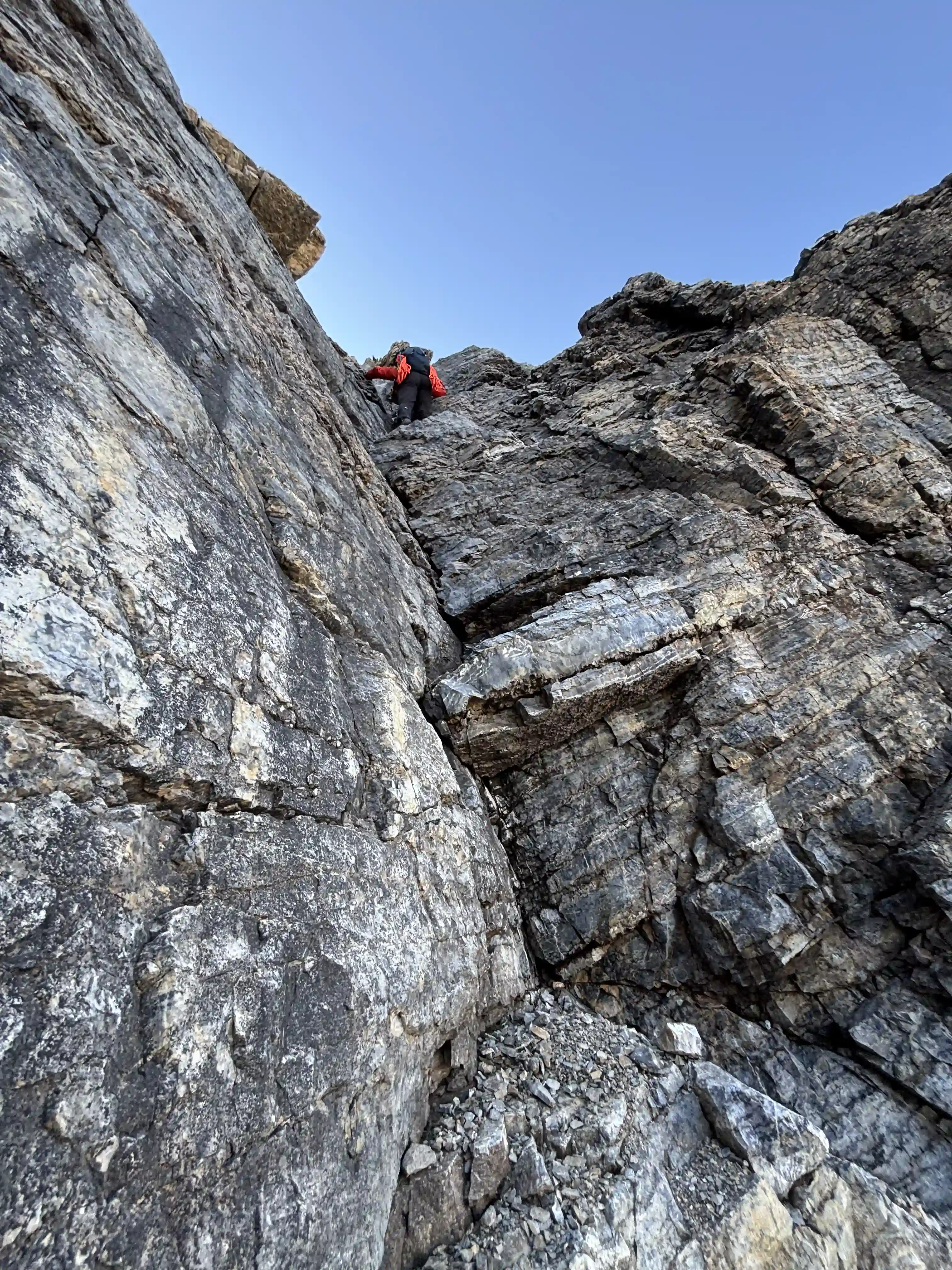
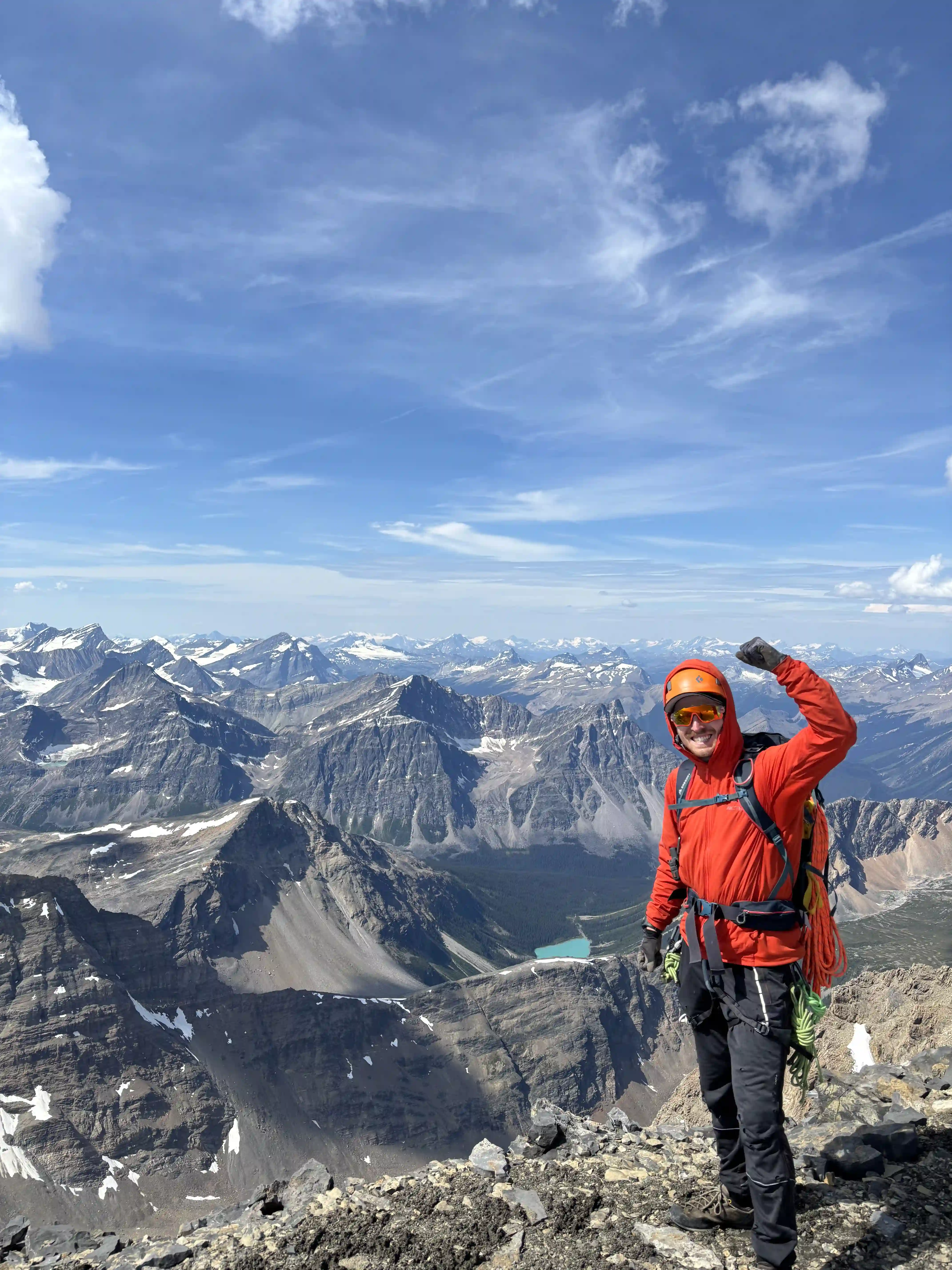
Previously I had written off Fryatt as a casual ascent that I would check off when an opportunity came up but Ian and I had chatted about it on Whitehorn and as a result I brought a rope and was glad that we had it. We ended up opting for the more aesthetic and technical west ridge direct line up that goes at 5.8 (felt more like 5.6) and would take the SW face down, and while it is by no means an extremely challenging climb, if a bad situation arose and you didn't have a rope this would be an easy mountain to get stuck on, don't underestimate it!
links:
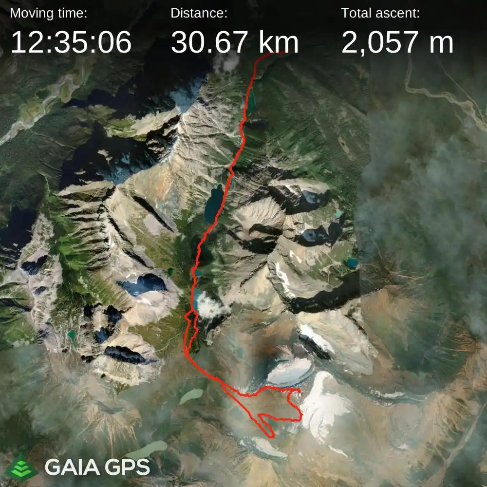
STRAVA
|
GAIA
elapsed time: 22 hours
DIFFICULTY: AD+/D-, sustained 5th class, typically multiday, mixed rock quality
Use the following links to jump to:
Follow the journey
I'll send you an email when a new trip report drops.
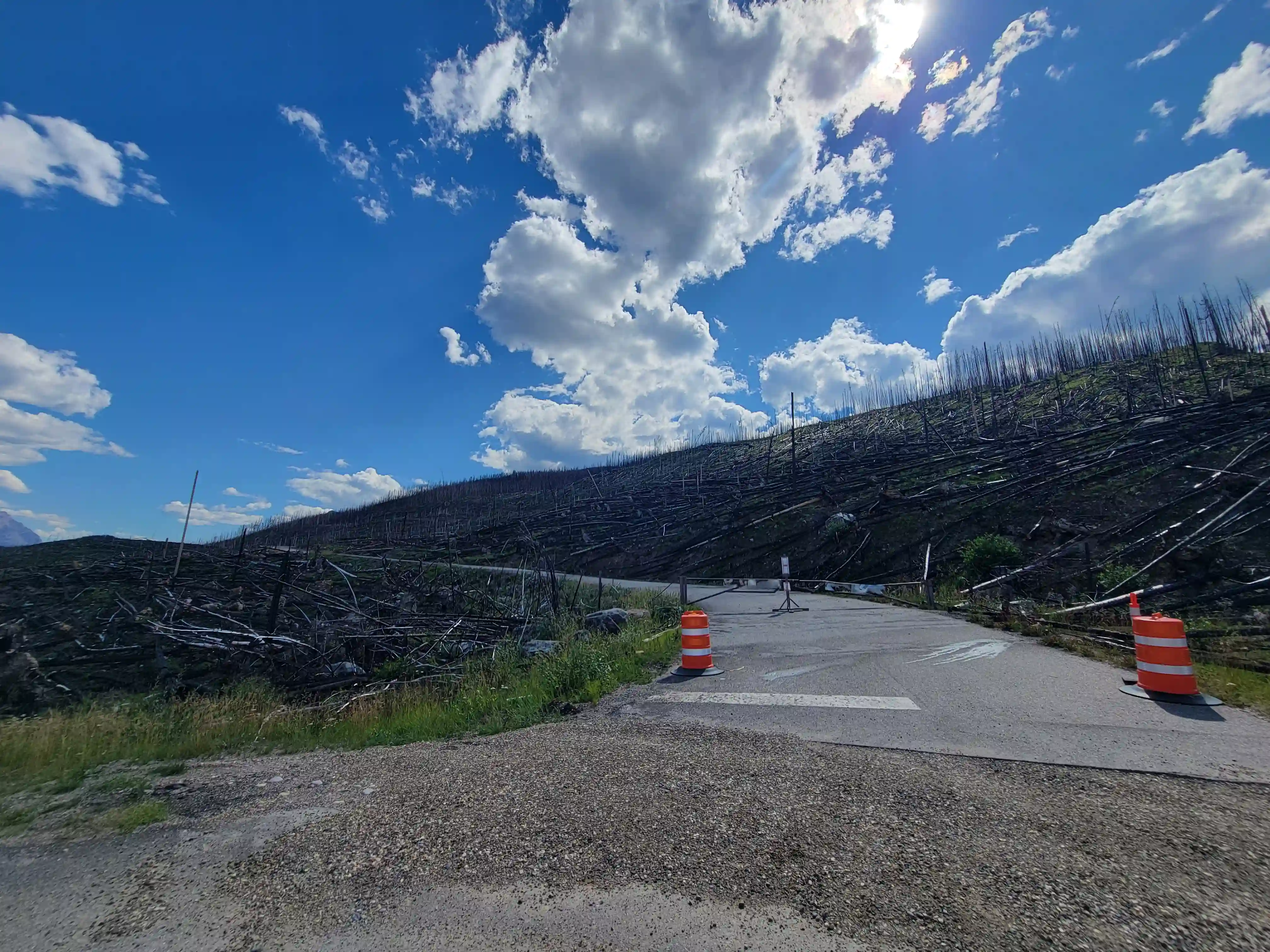
next few years after the fires closed it for the foreseeable future
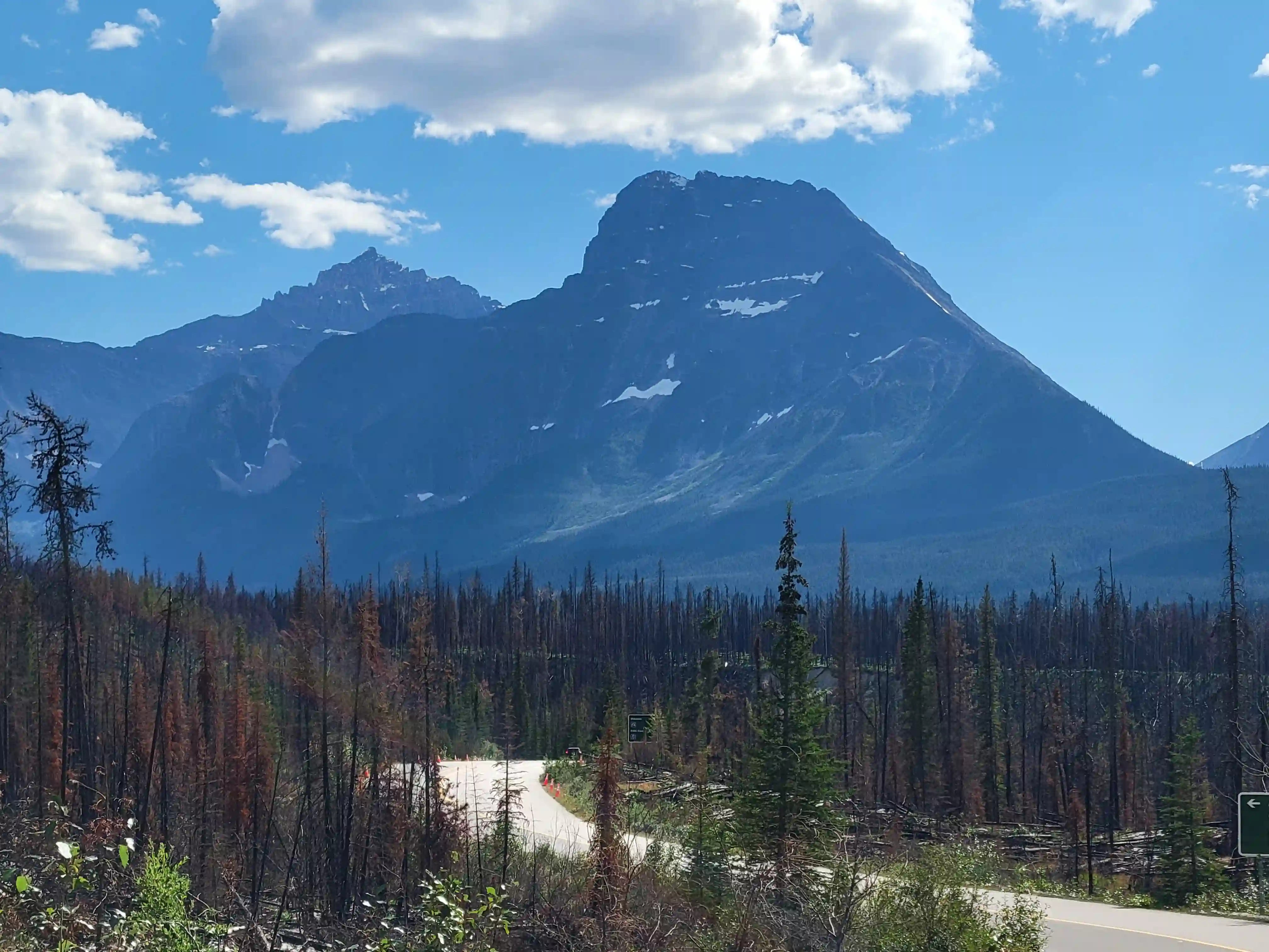
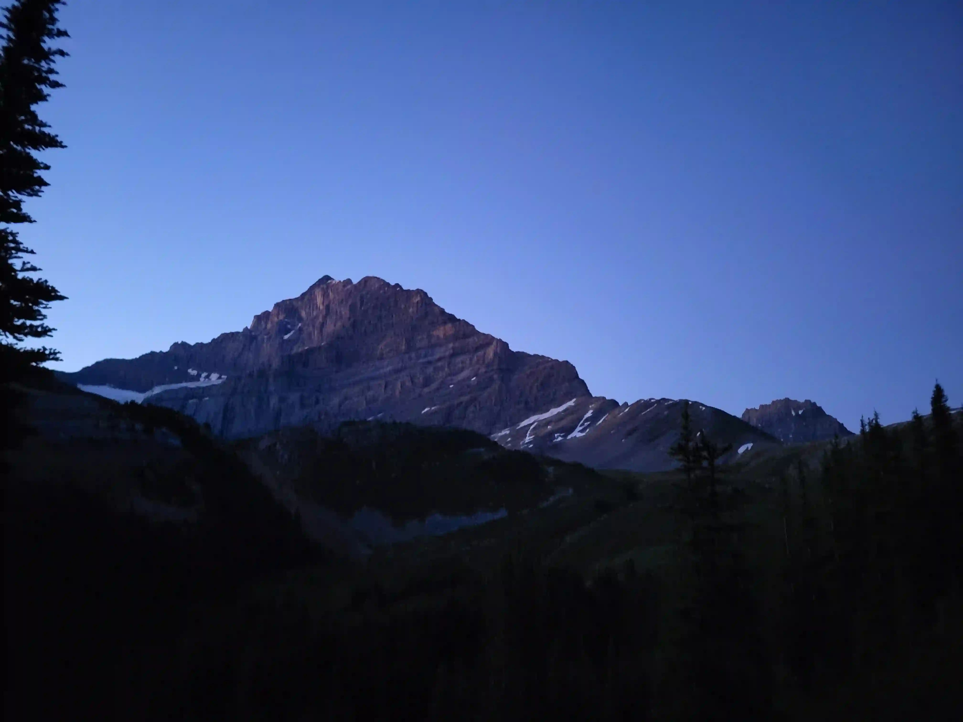
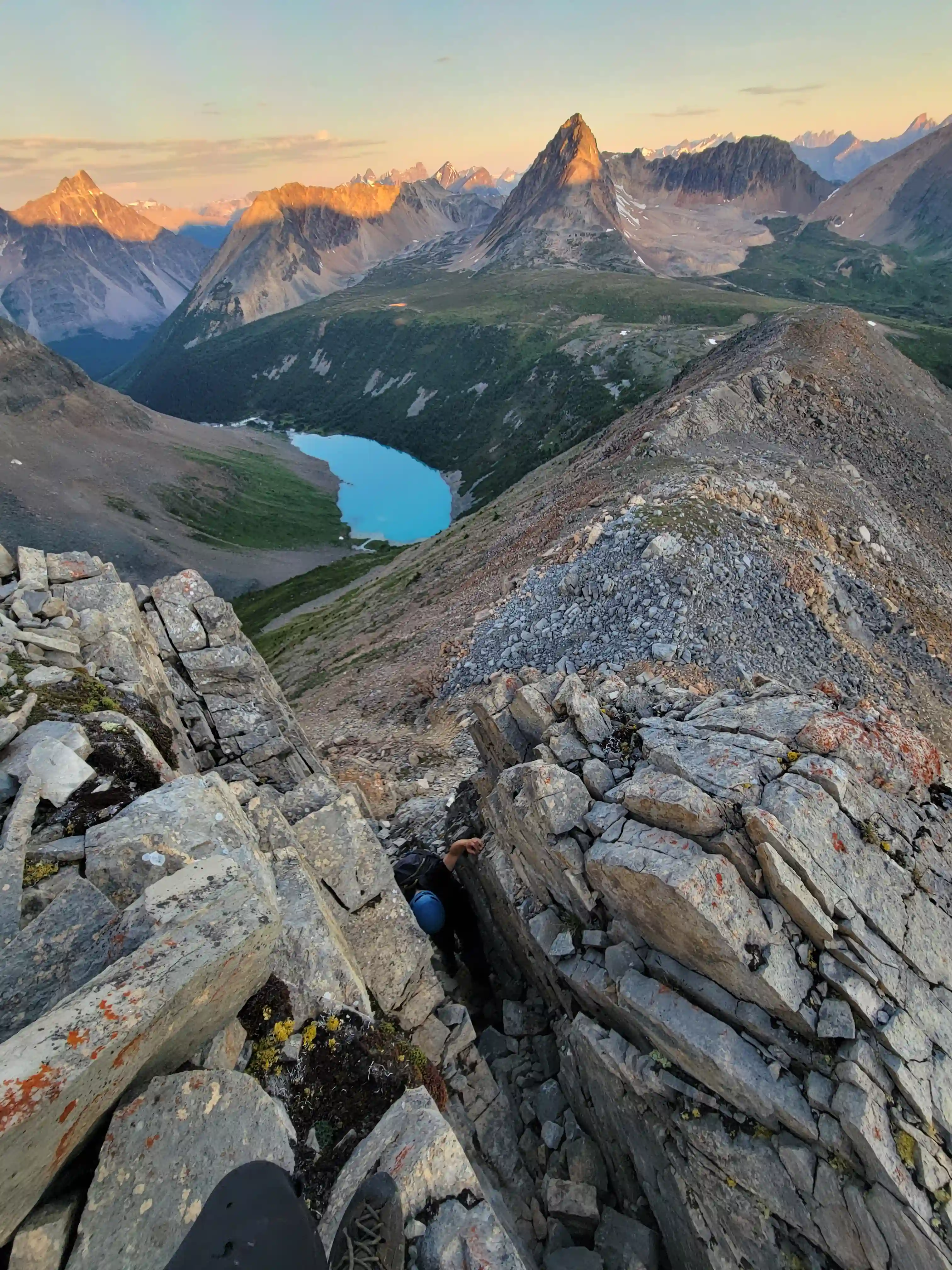
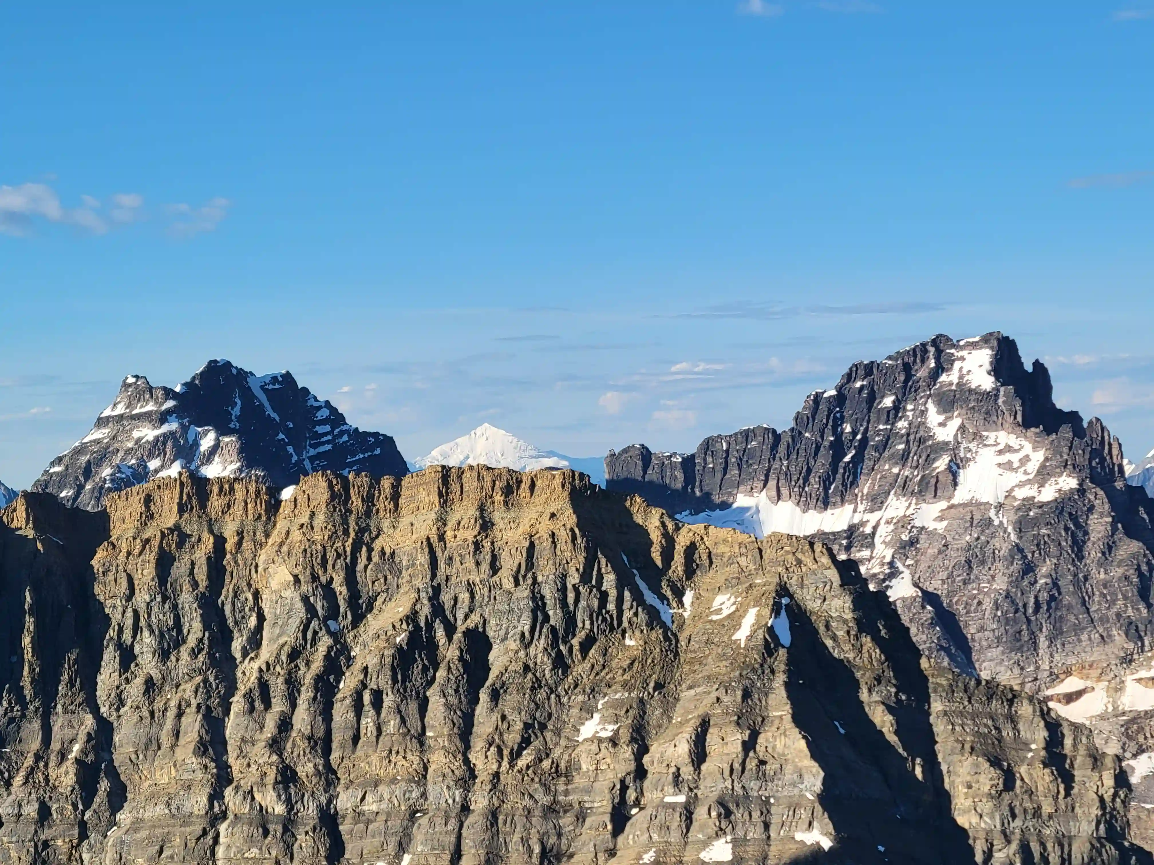
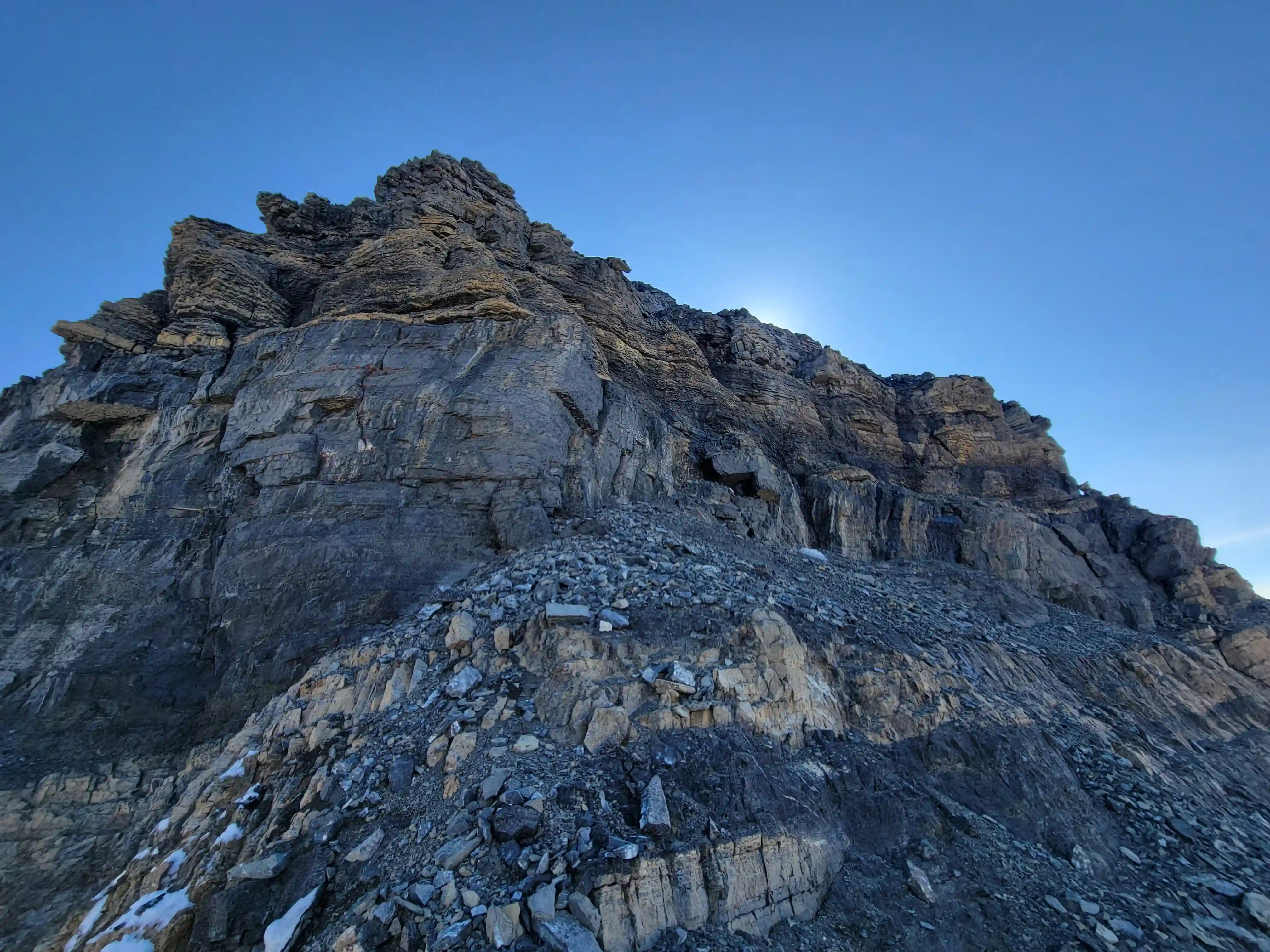
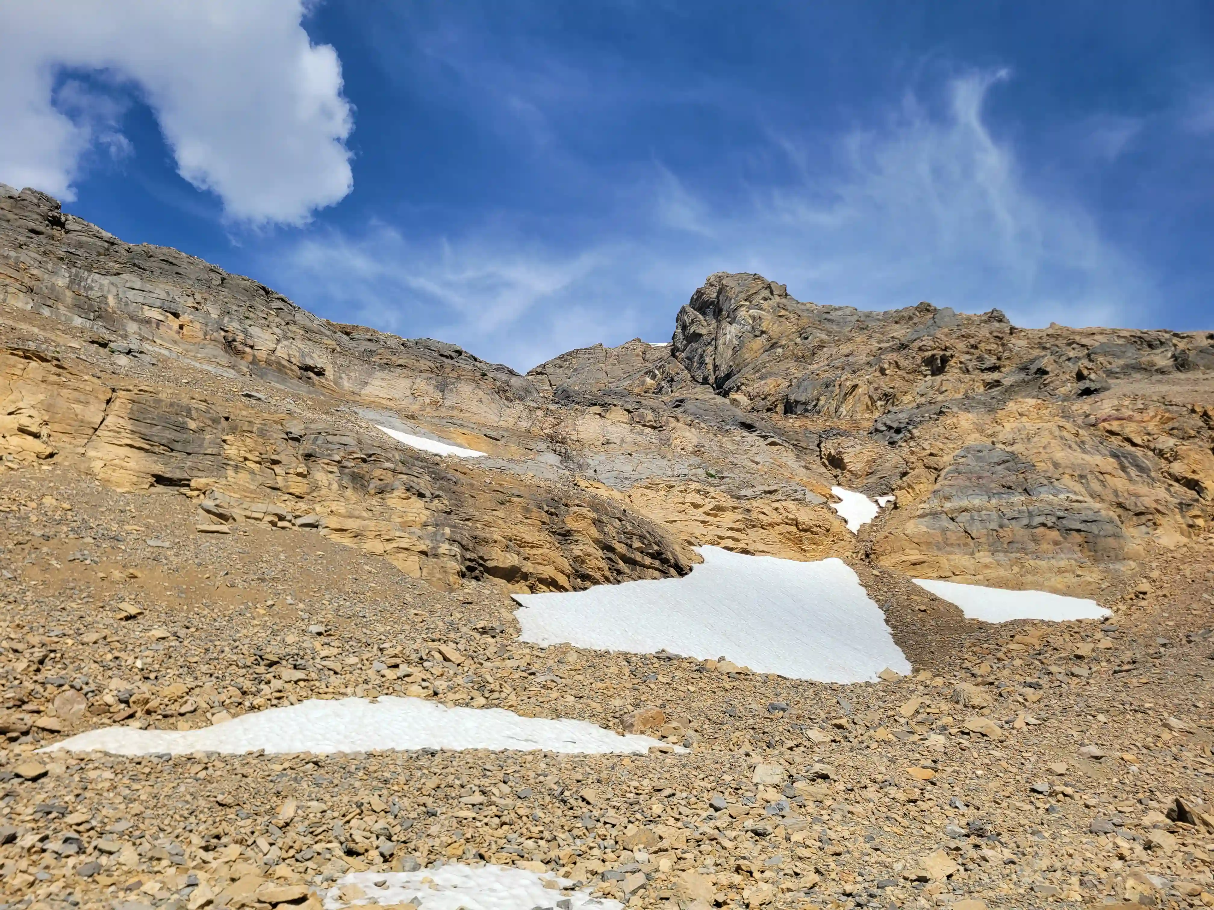
THE APPROACH
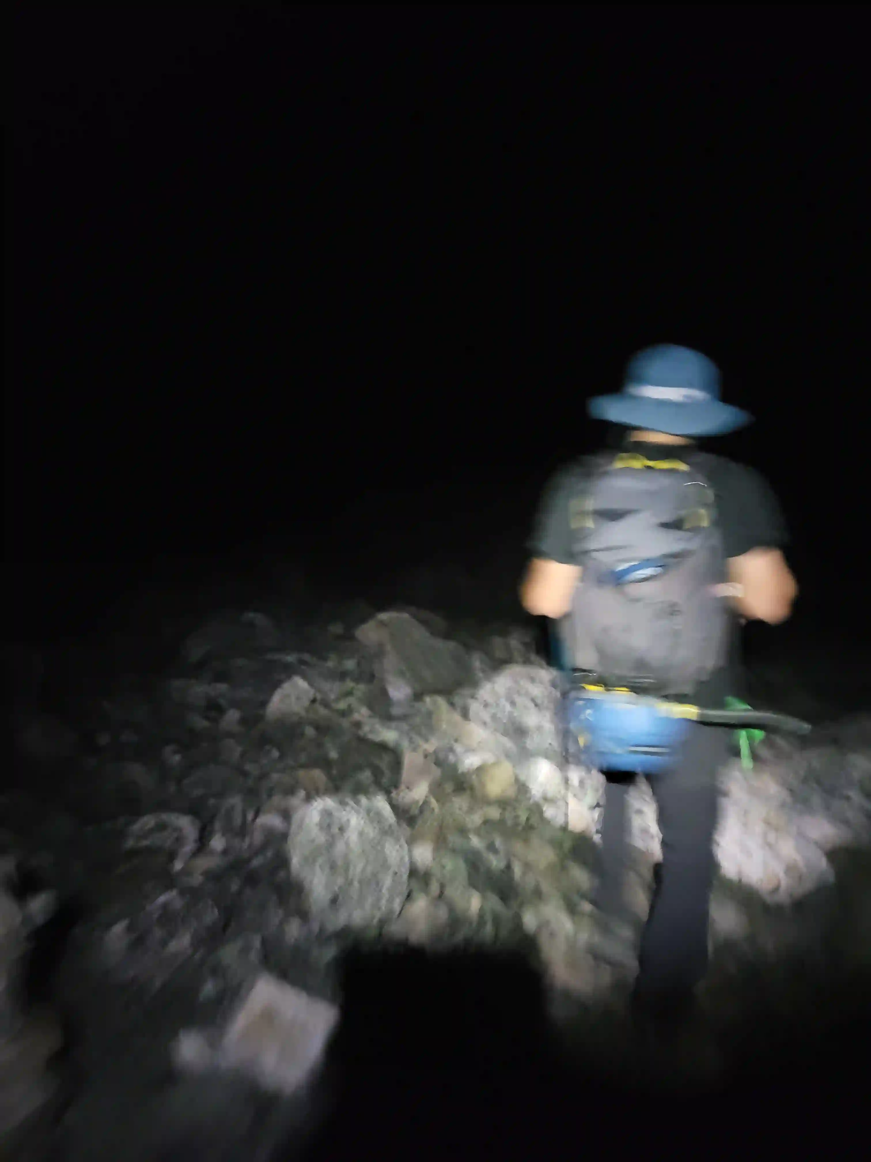
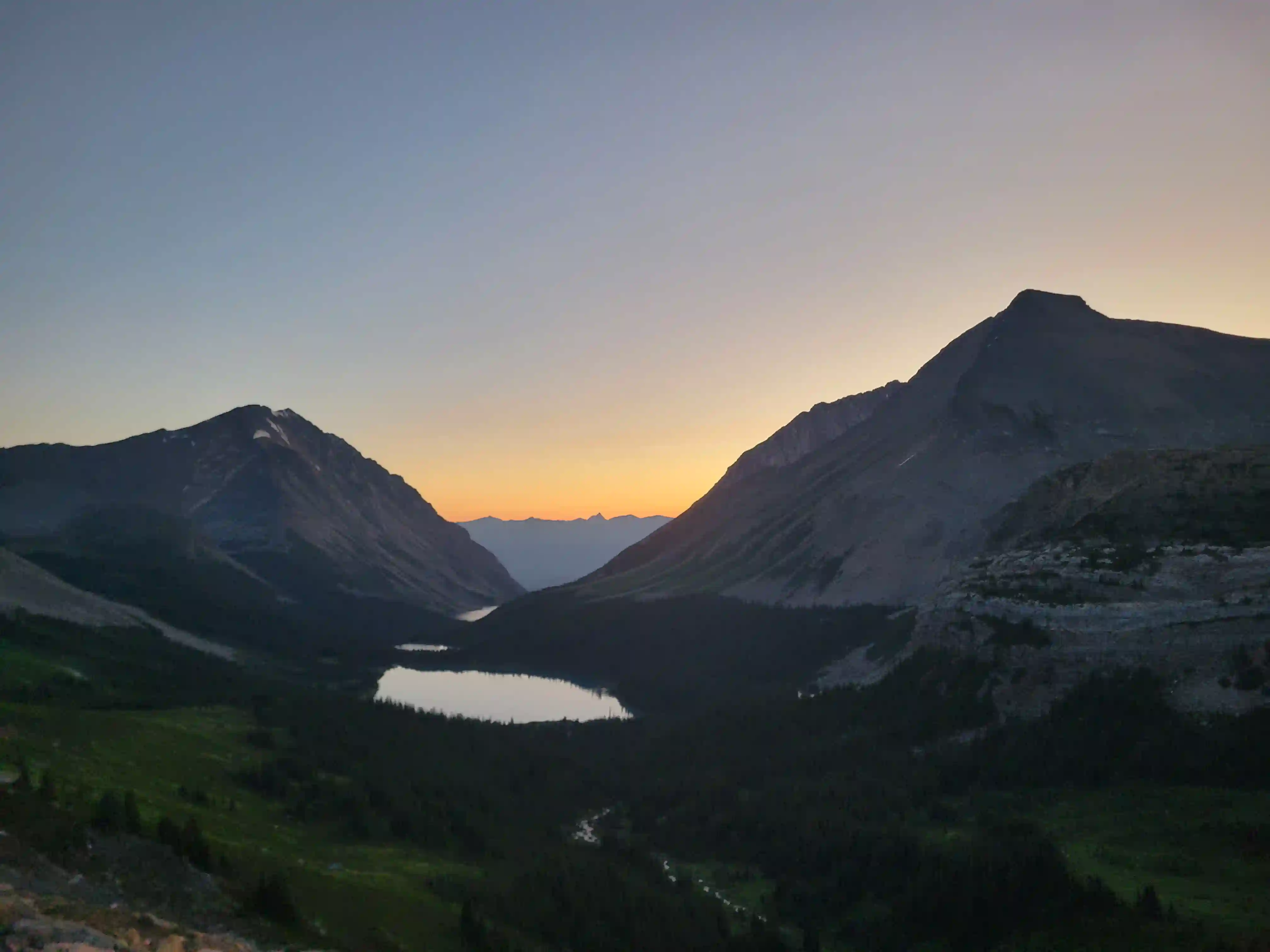
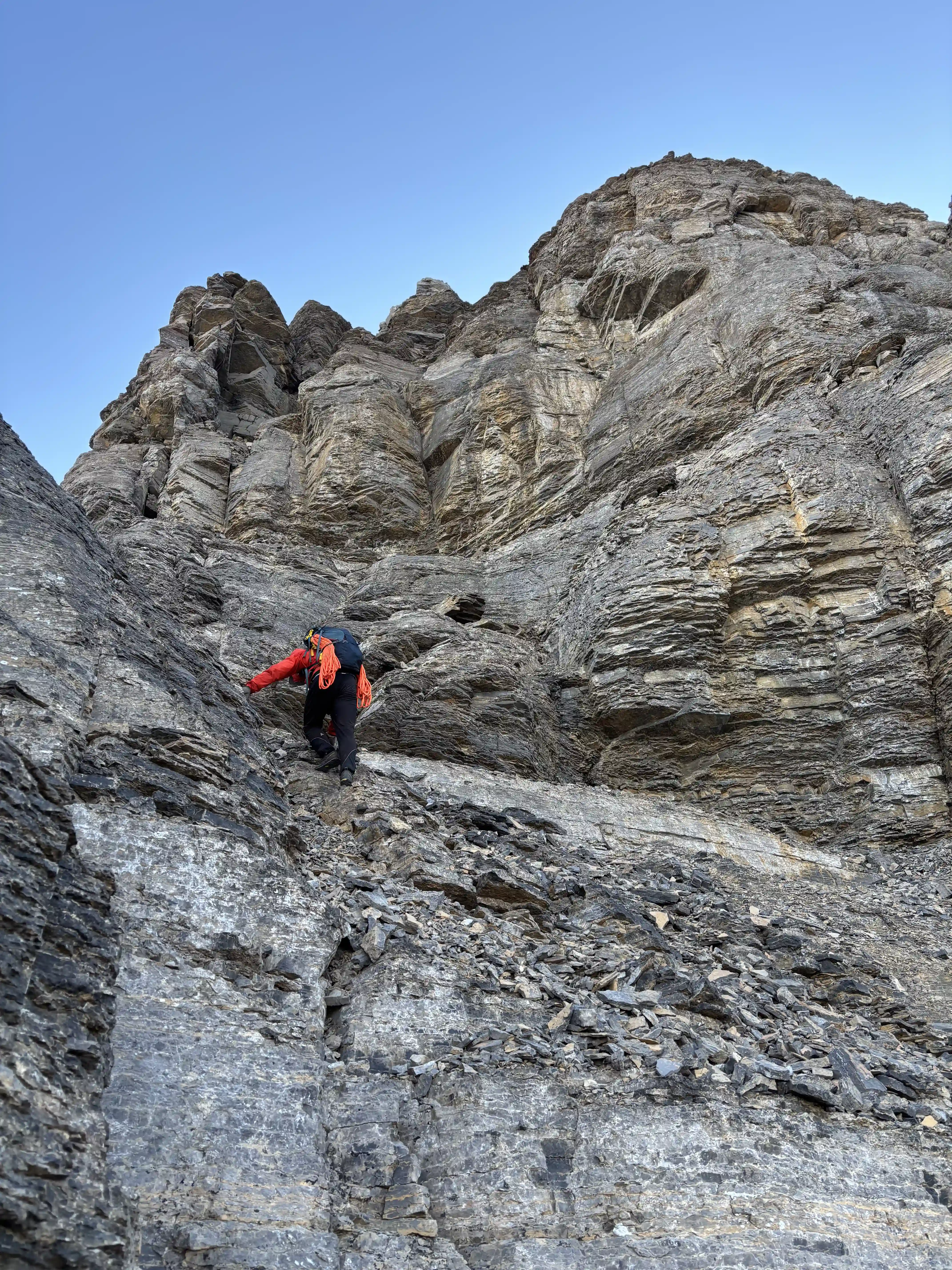
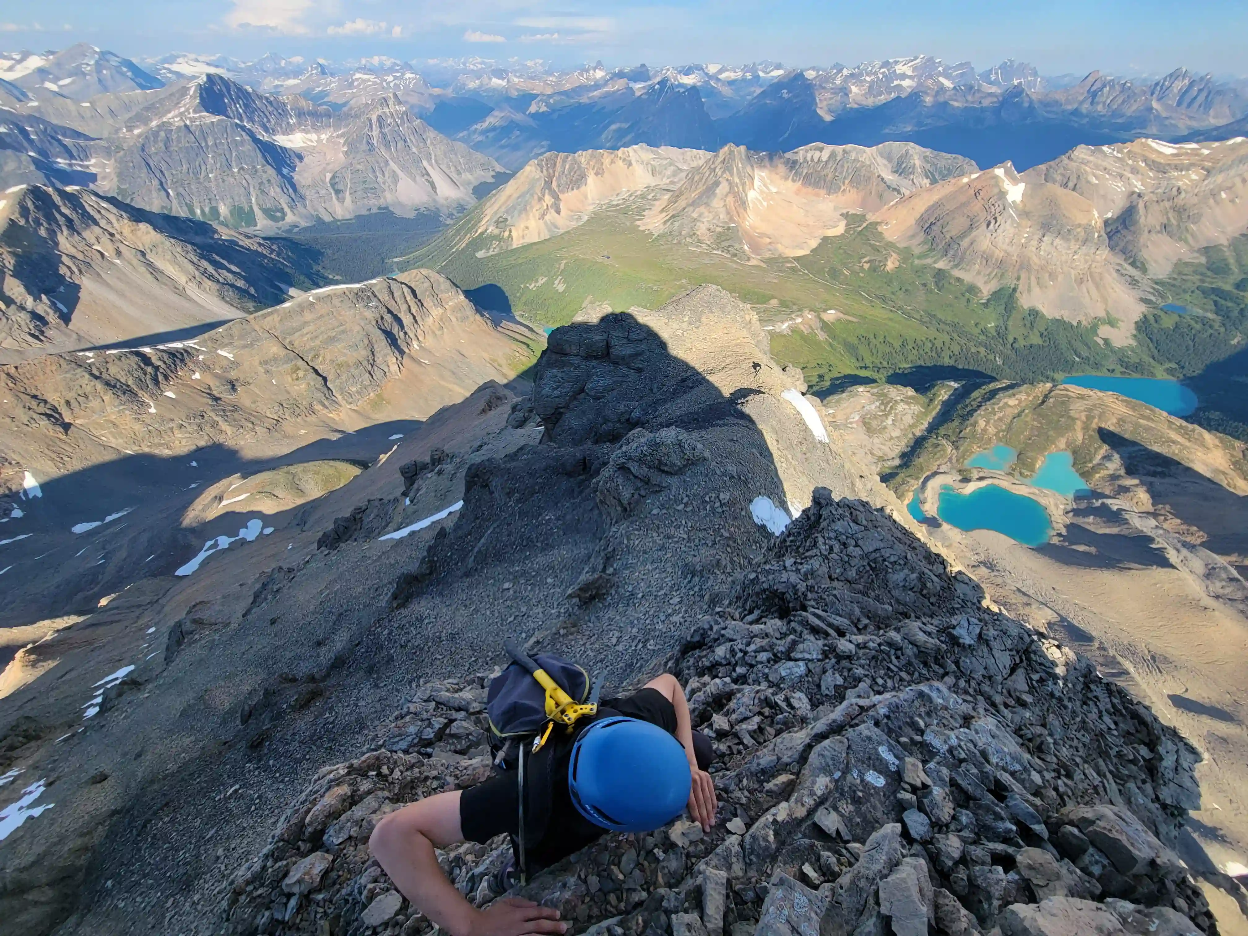
After our extremely early start the kilometers racked up quickly and before we knew it we were passing the 4th and last Geraldine Lake we'd have to skirt around. For the most part the trail was easy to follow but we did lose it a couple times with the lack of light and recent bush growth so having GPXs available was handy for that. After filling up on water one last time we headed up towards the slopes that eventually lead to Fryatt's west ridge and this is where we picked up the mosquito horde. It was surprising that they hadn't been an issue for us earlier but once we noticed them they were bad. A few minutes later we arrived at the spot on the lower grassy ridge that we'd merge with and I opted to cover up all my skin cause they bugs were so nasty. After that and ditching the crampons, bear spray, and poles we headed for the main event of the day!
going for 3 hours
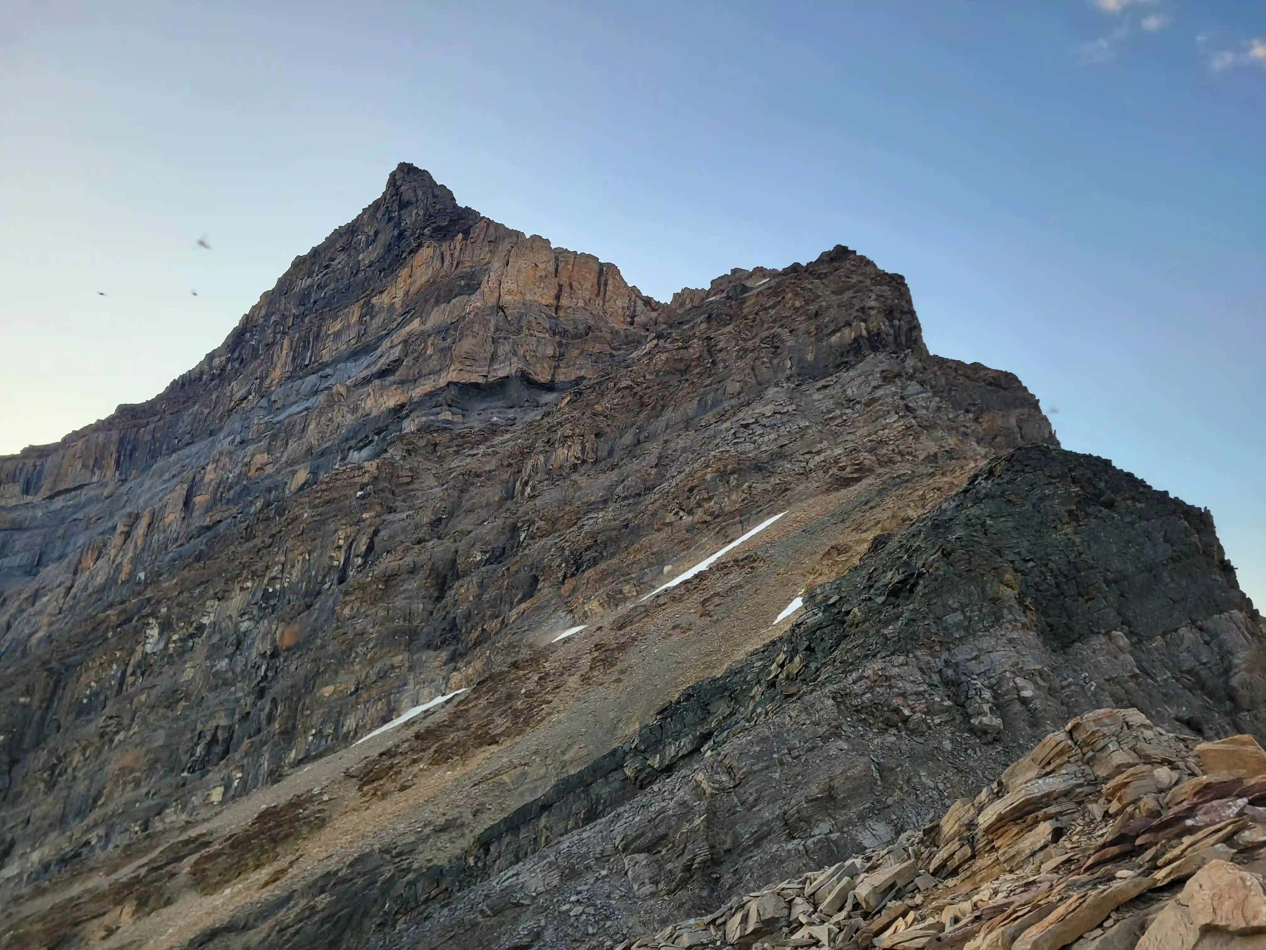
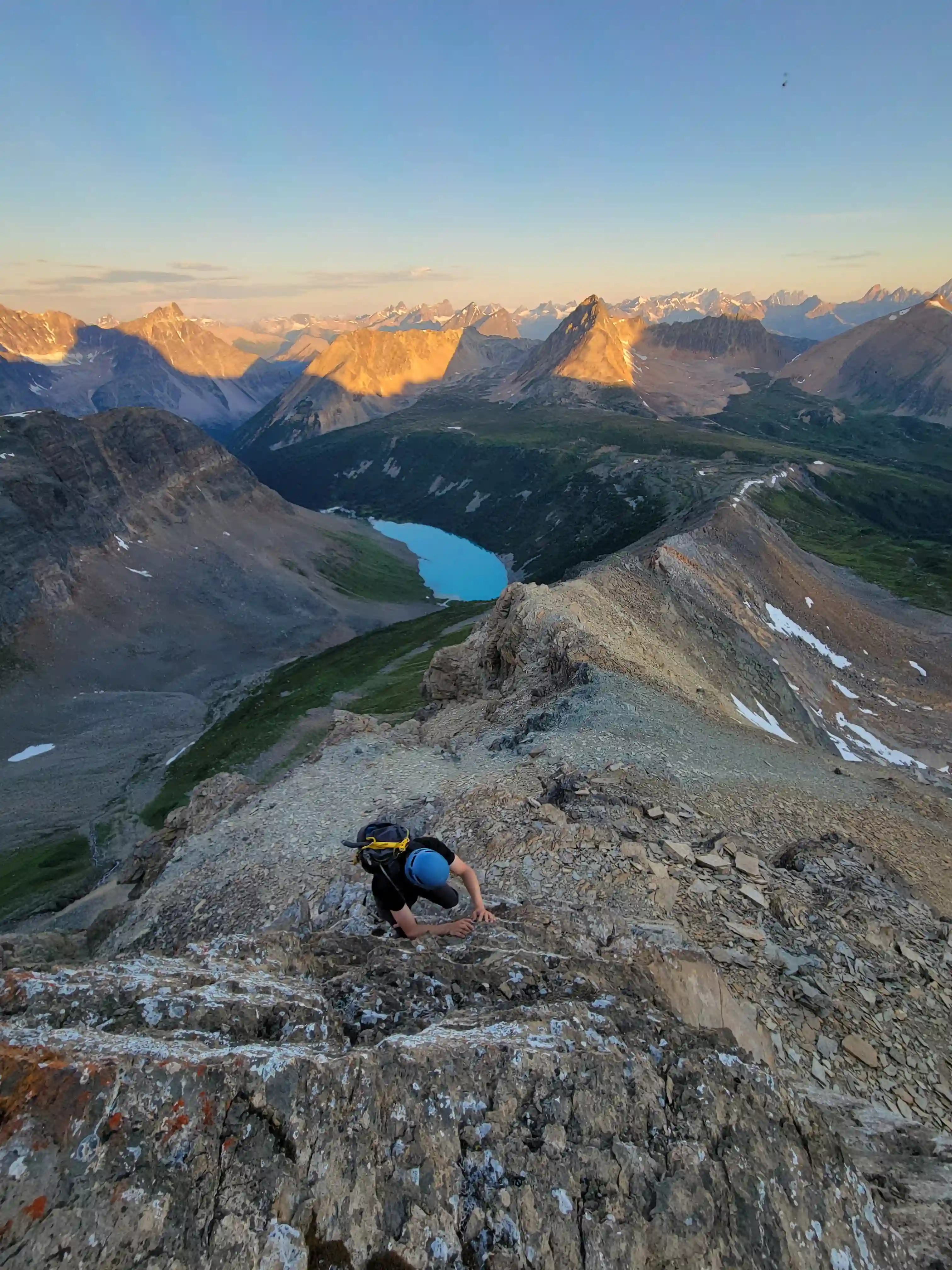
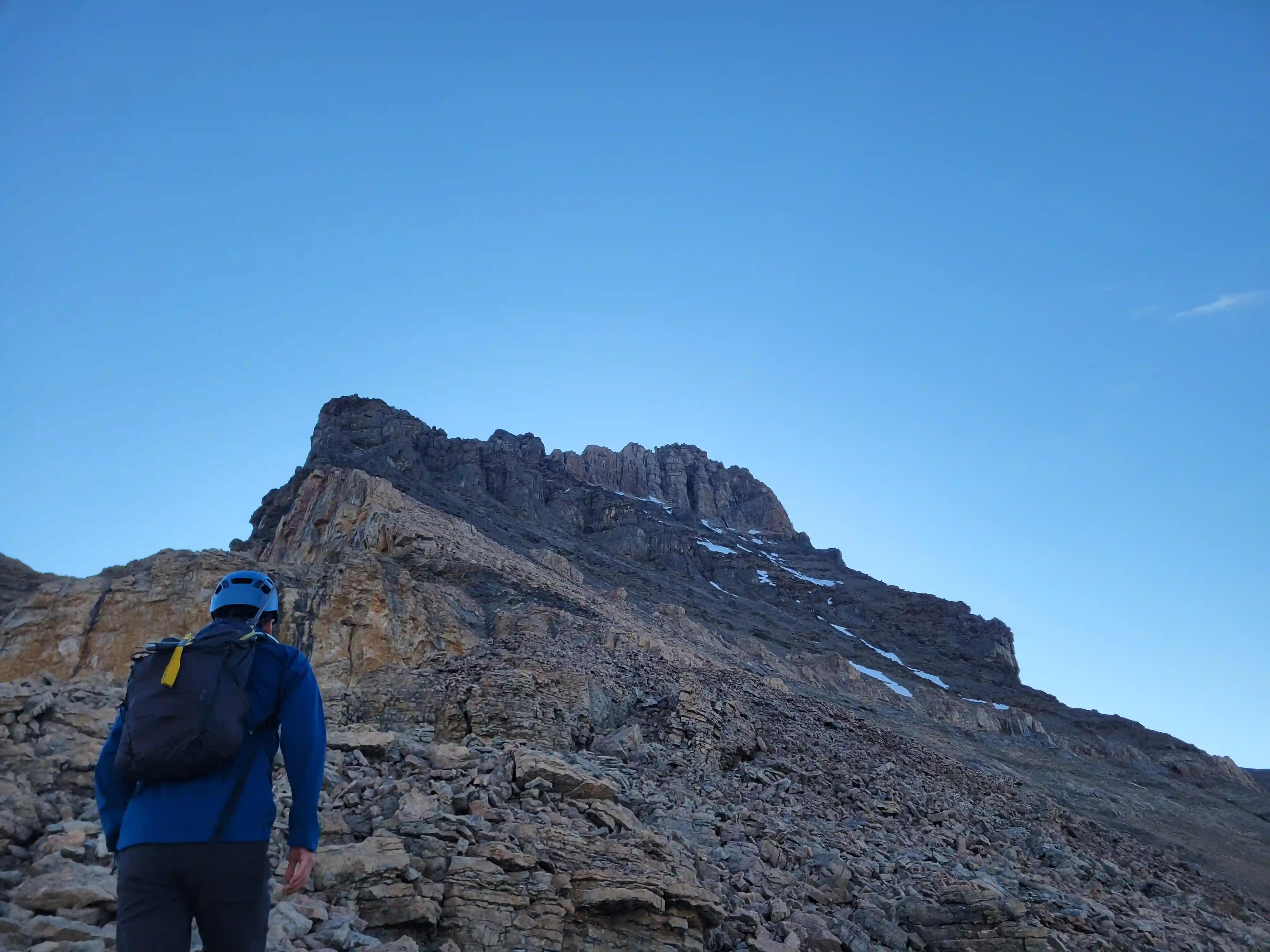
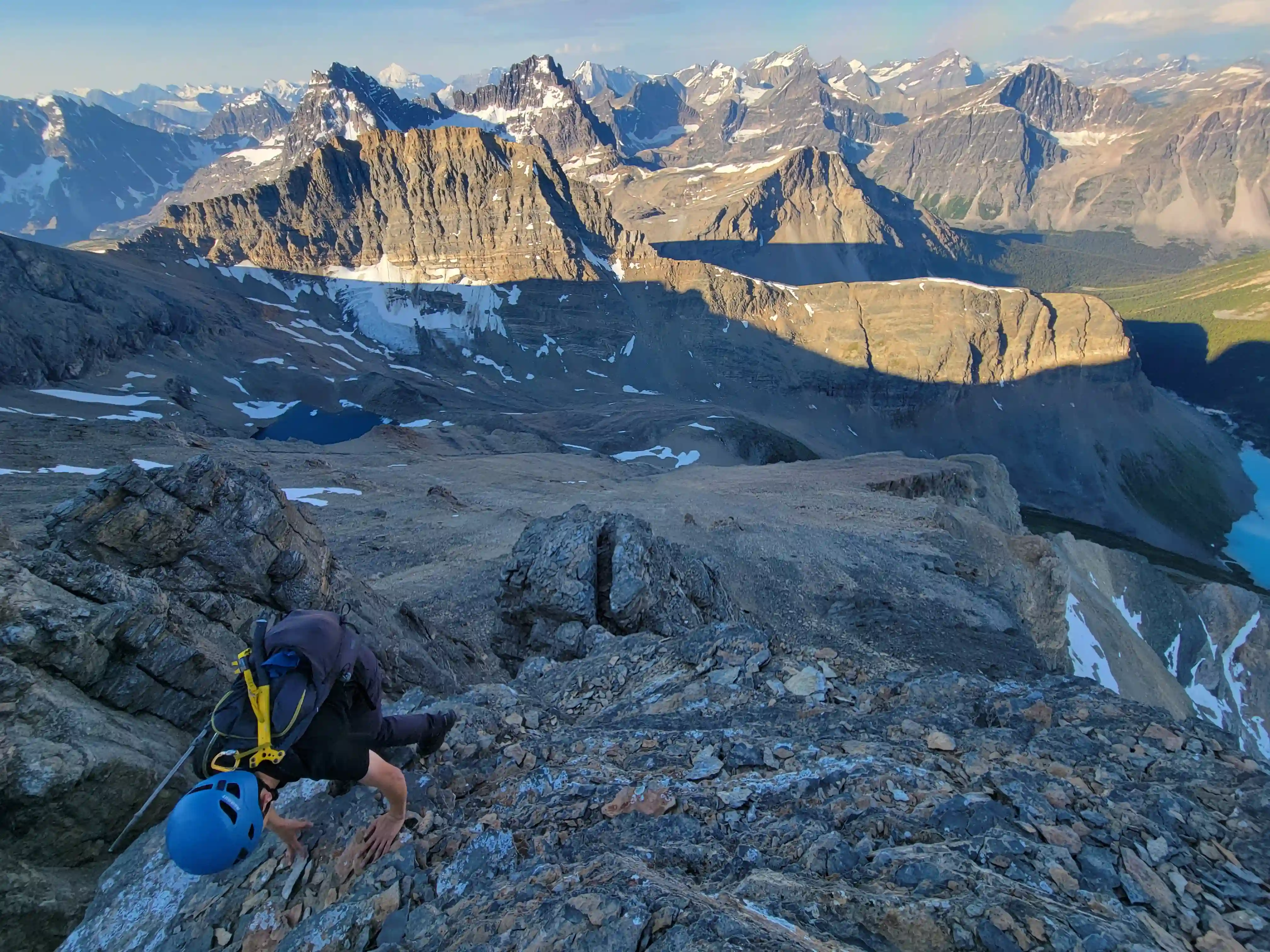
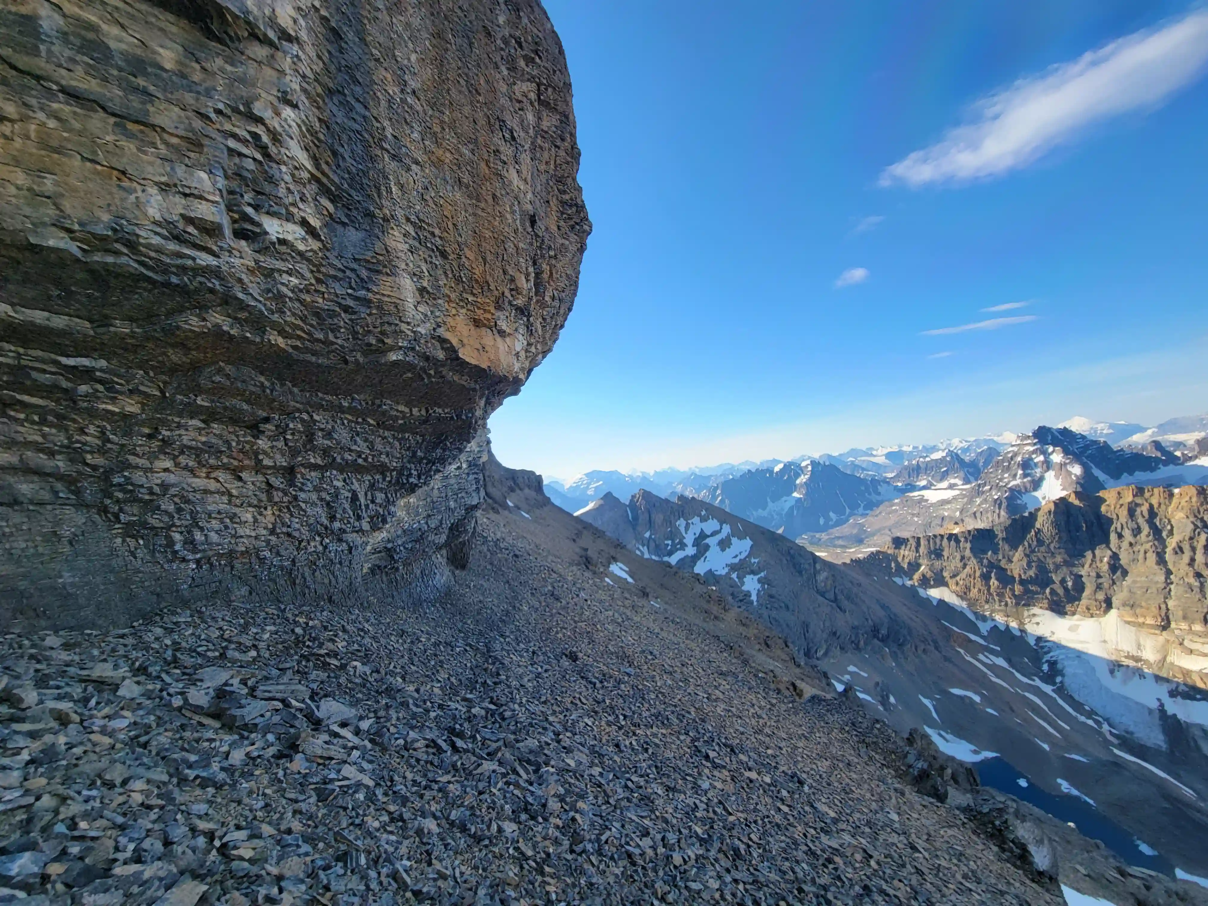
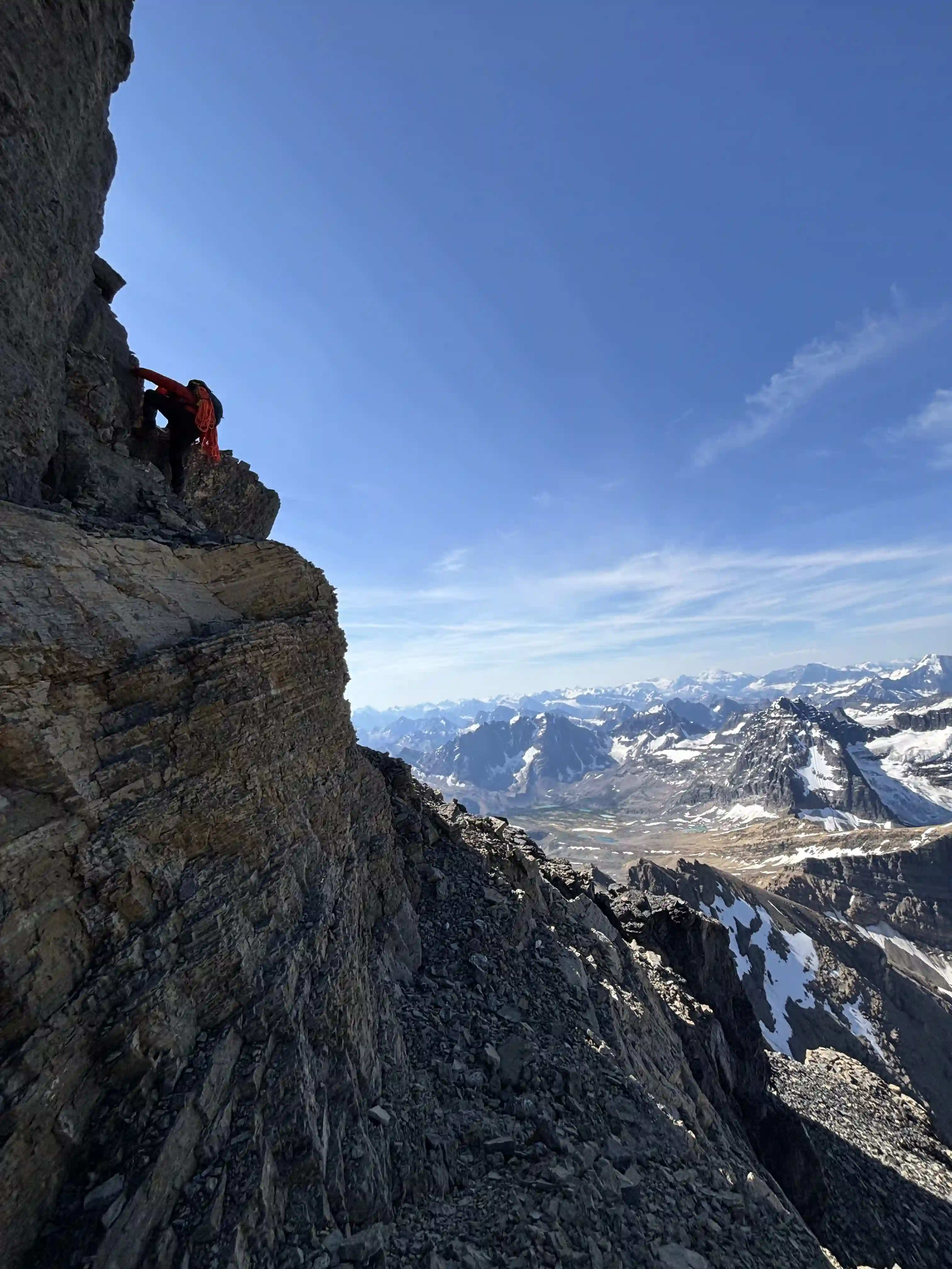
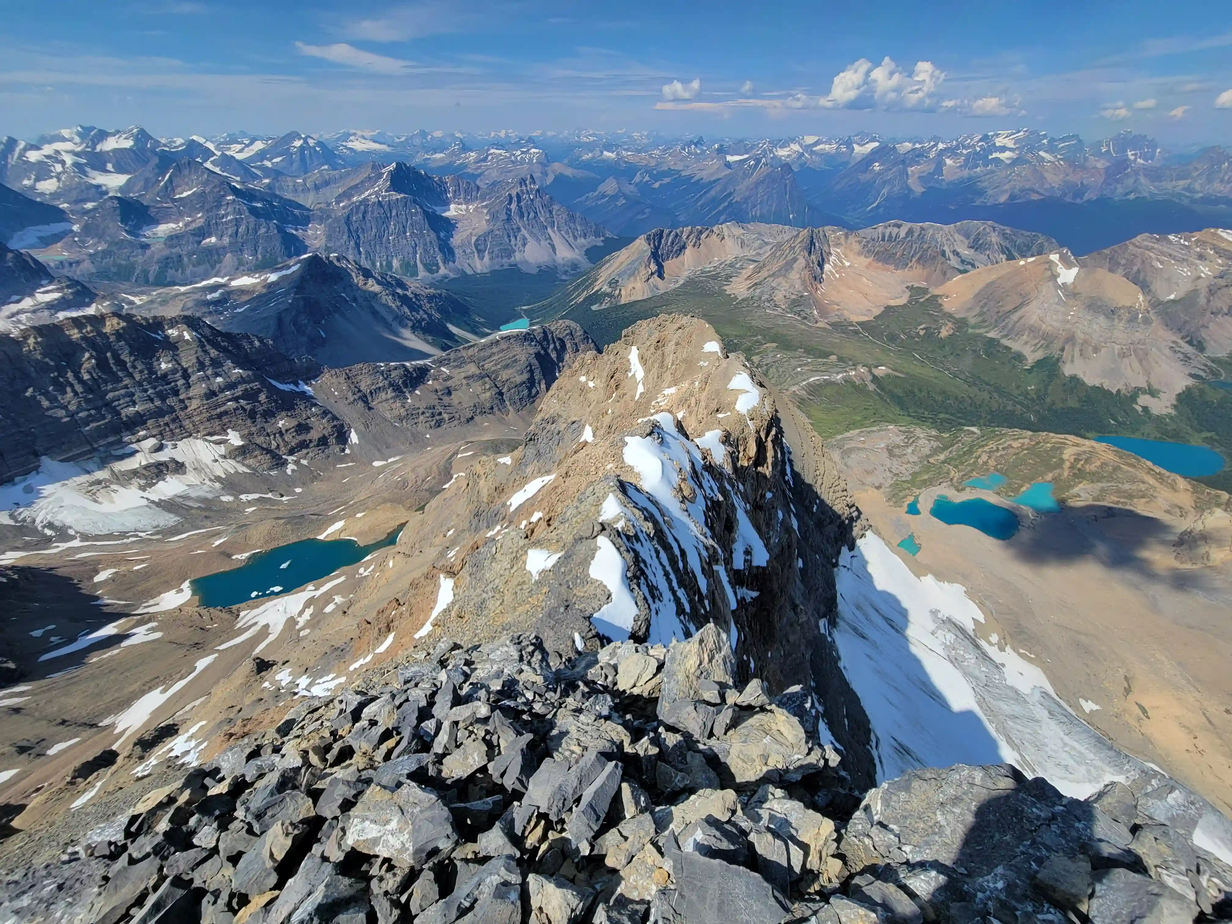
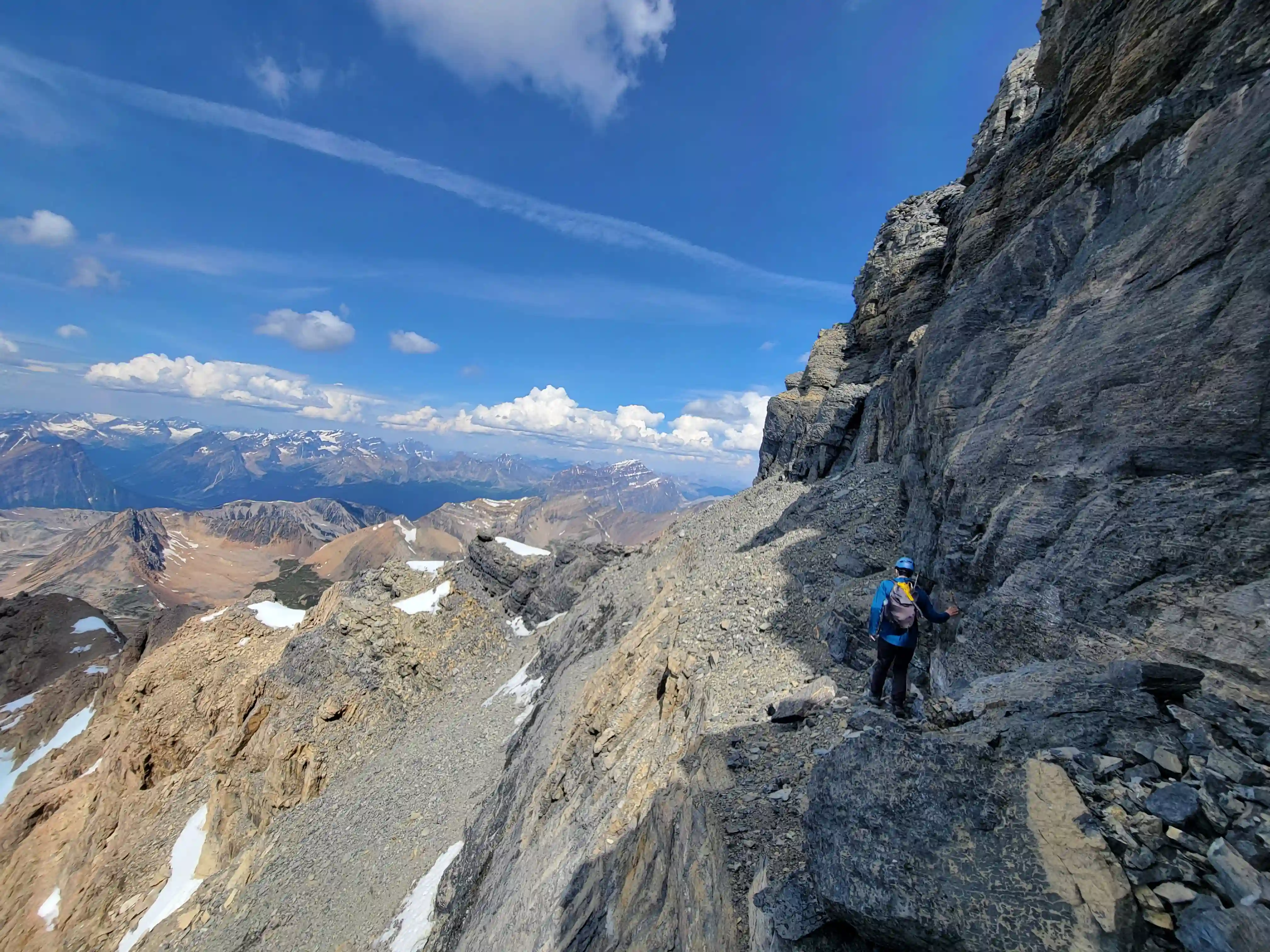
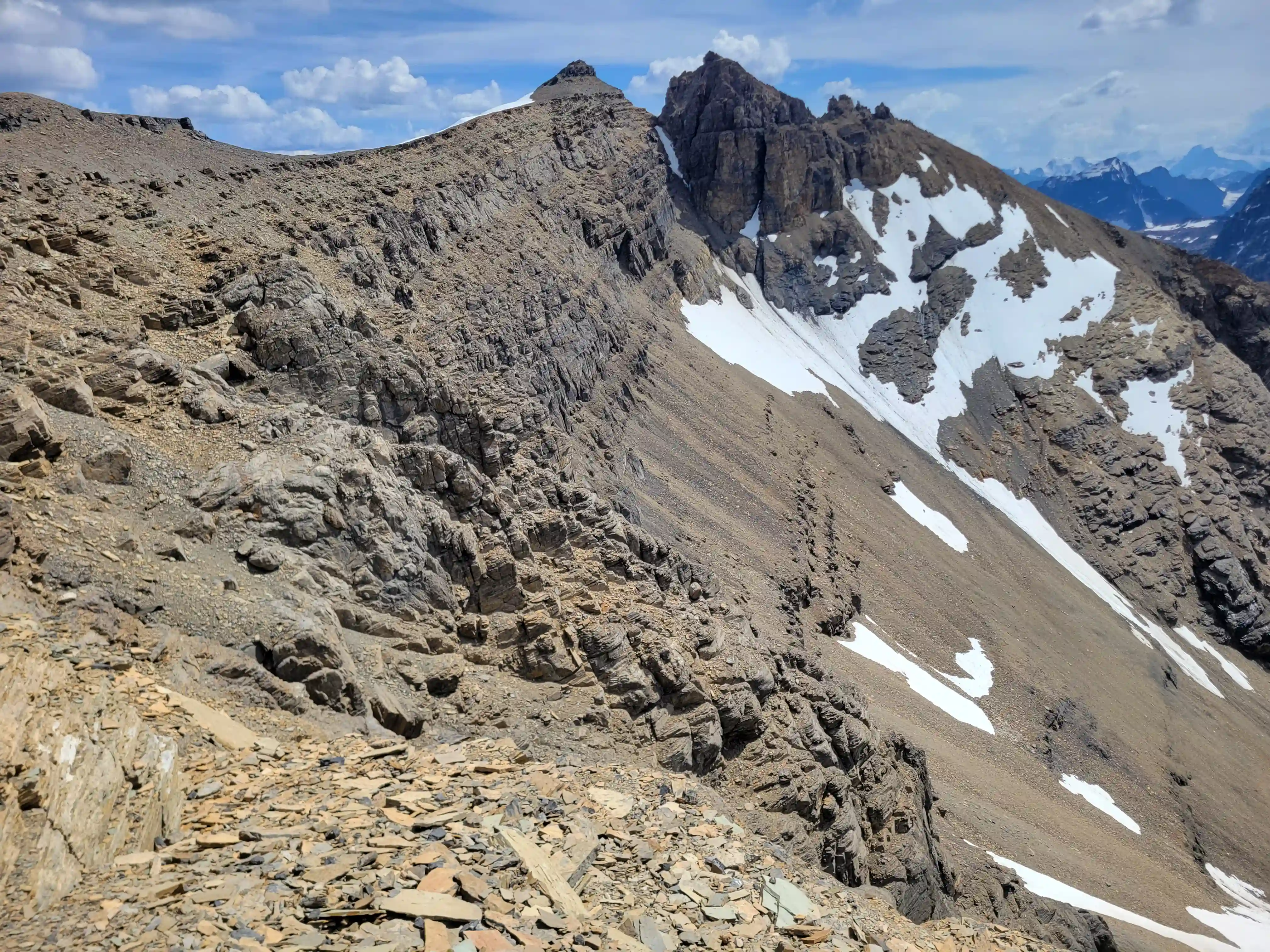
THE WEST RIDGE DIRECT
before the upcoming gain!
sun coming out
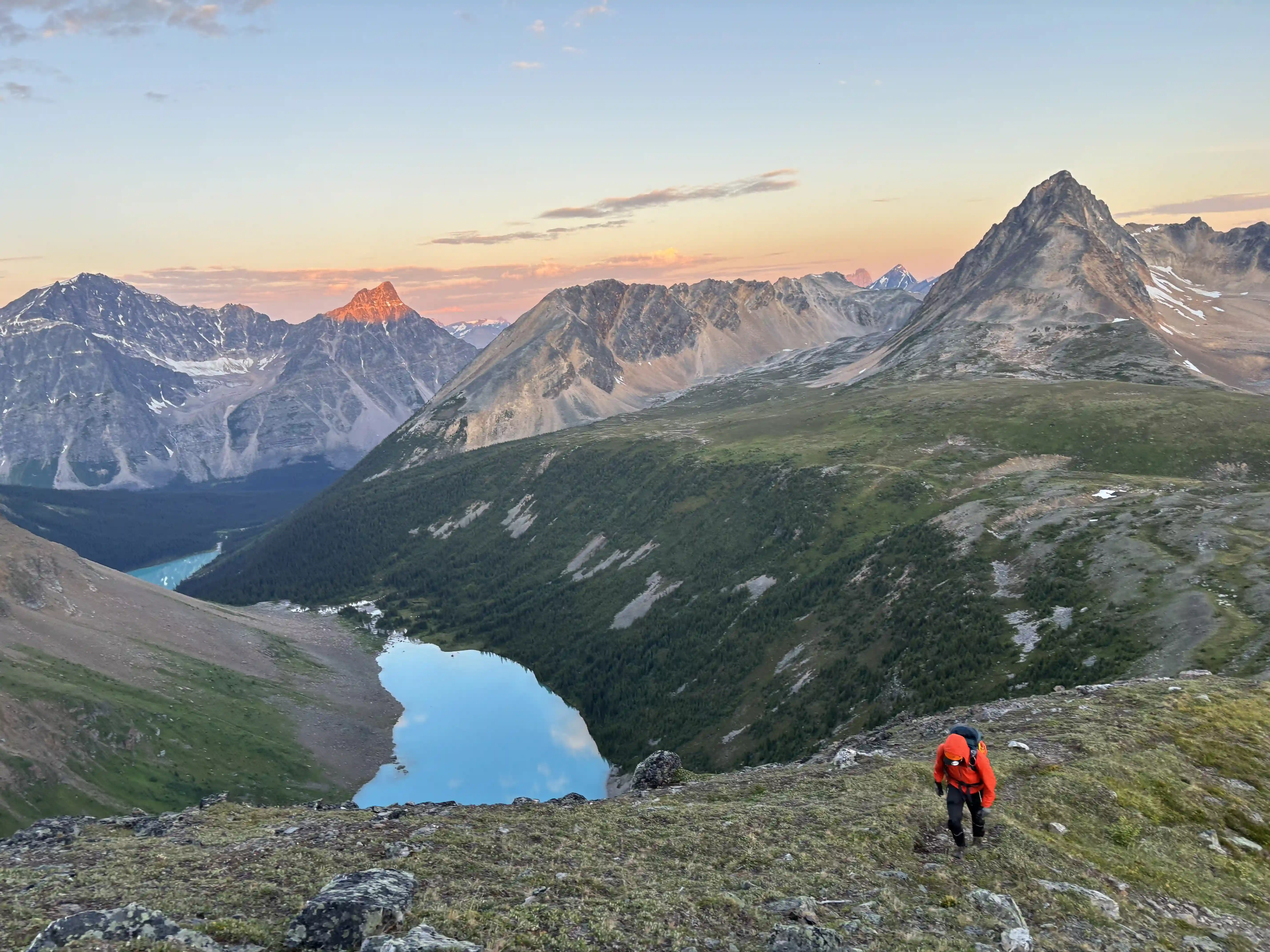
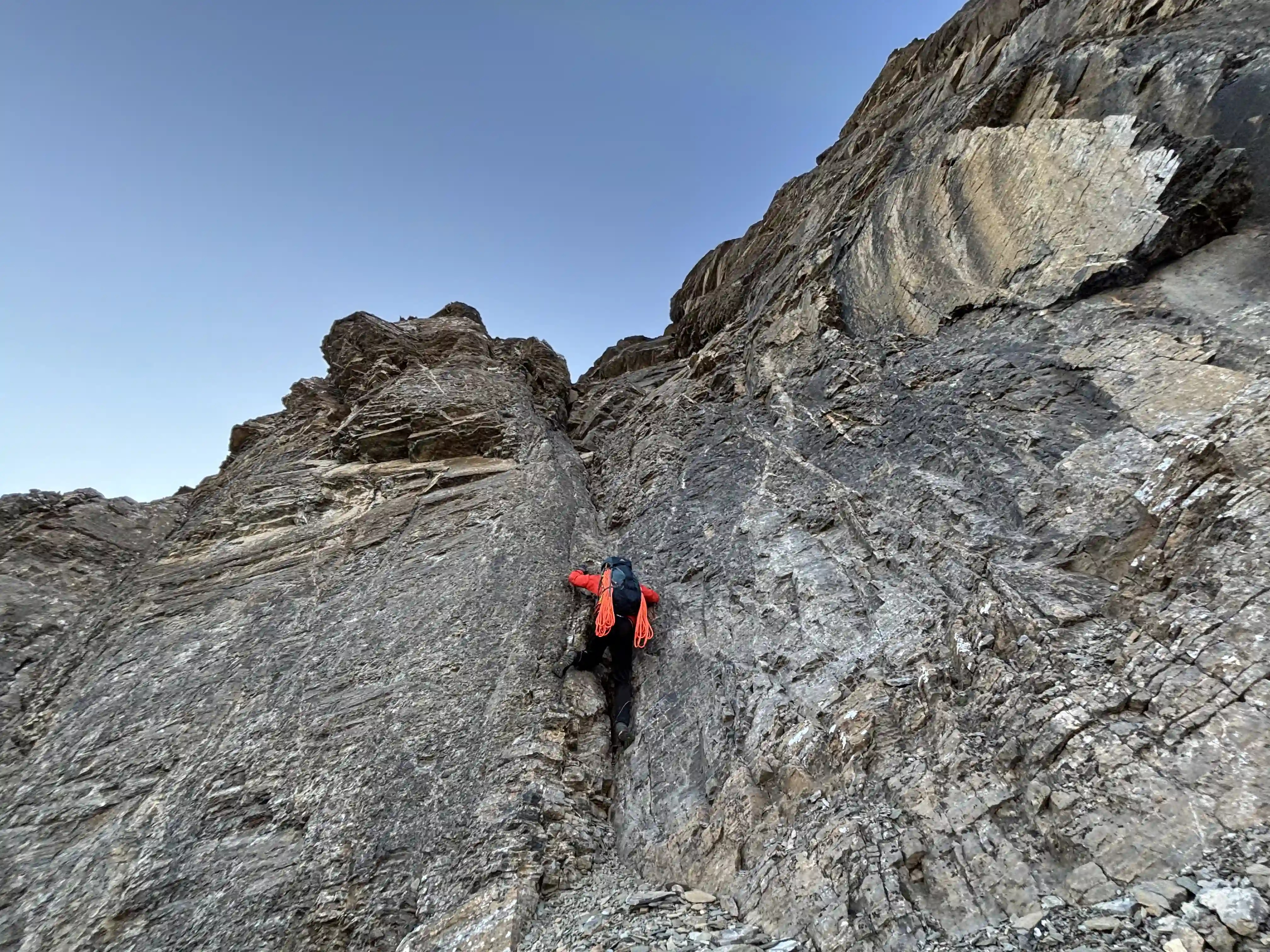
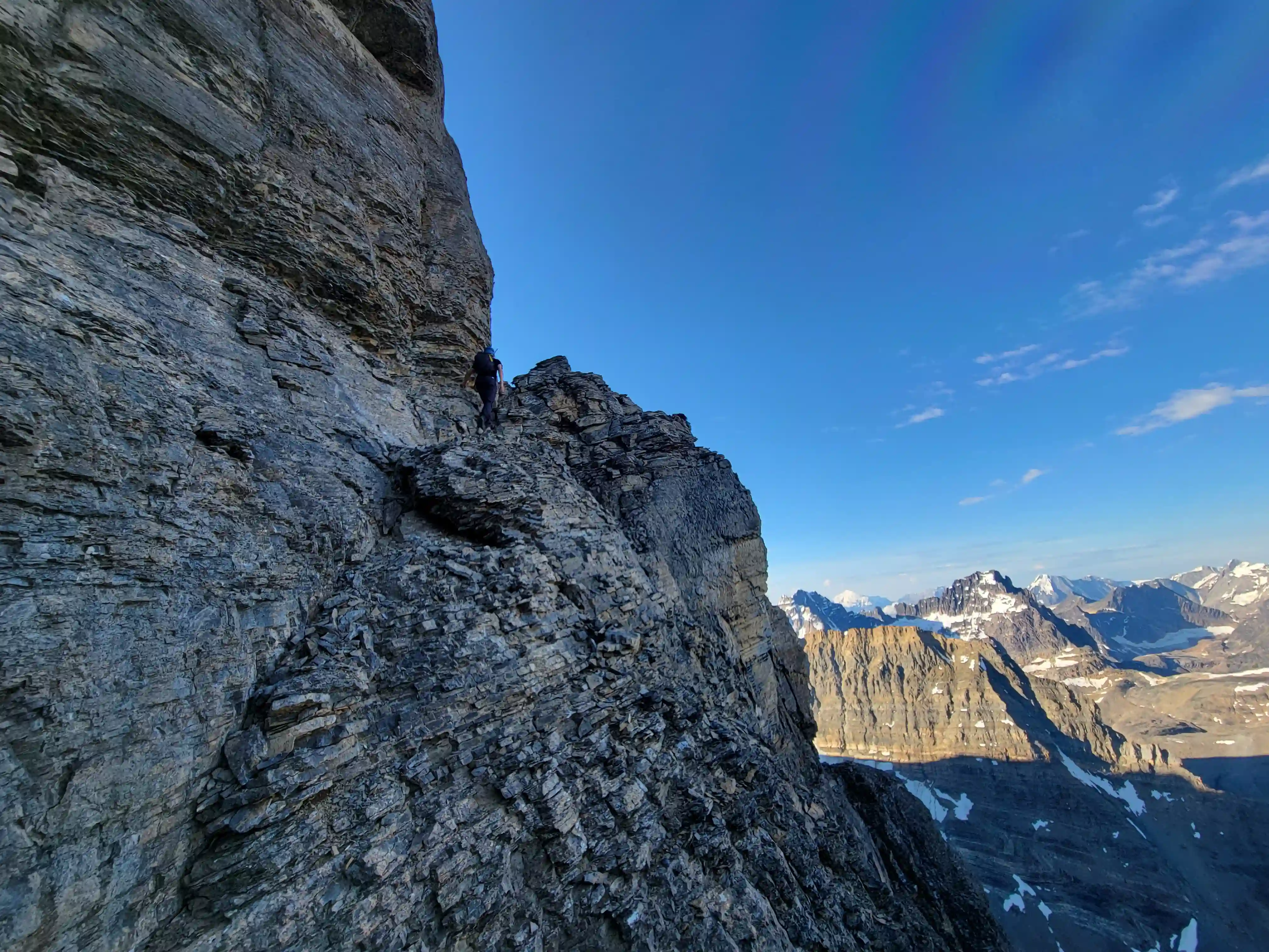
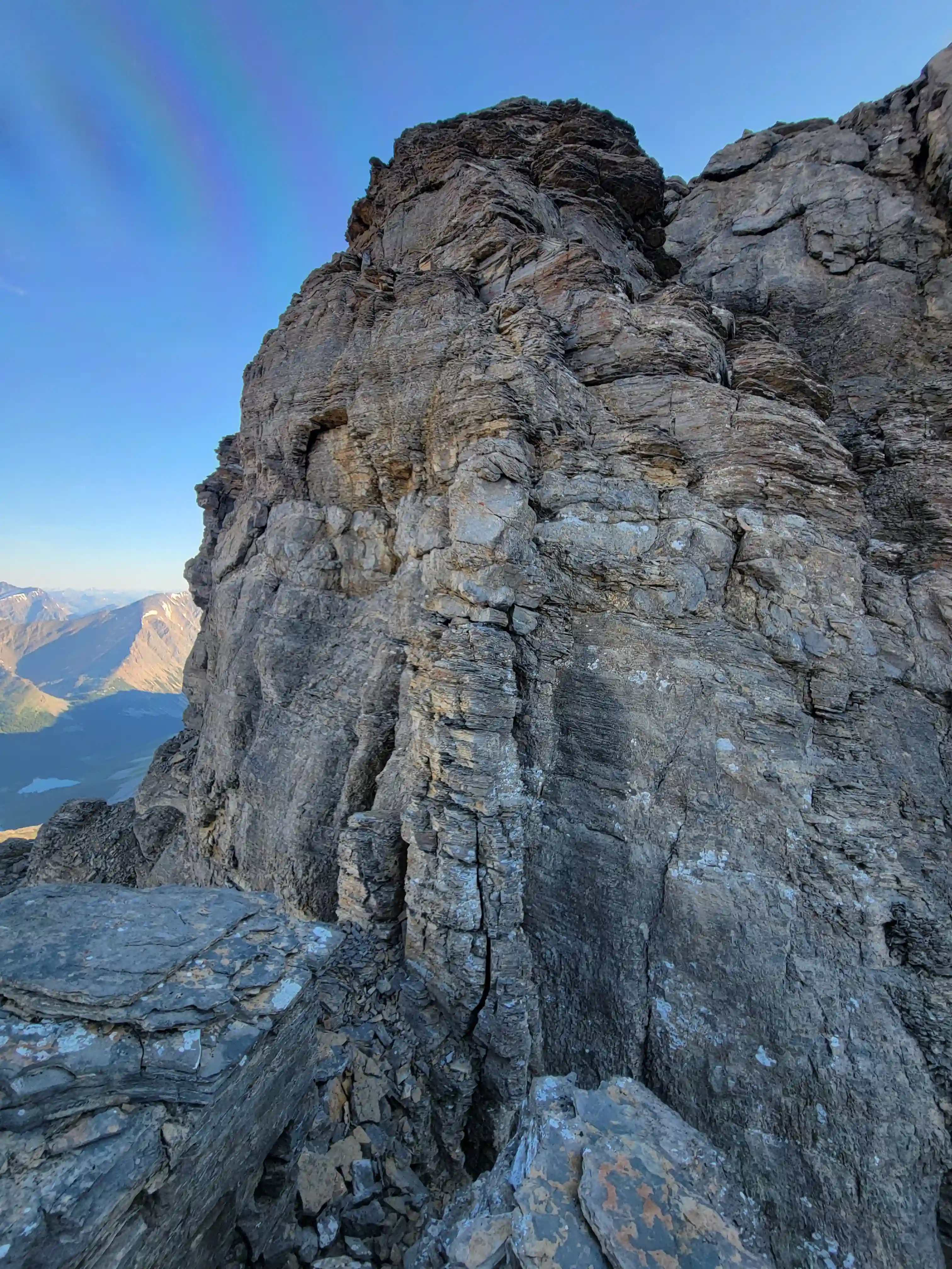
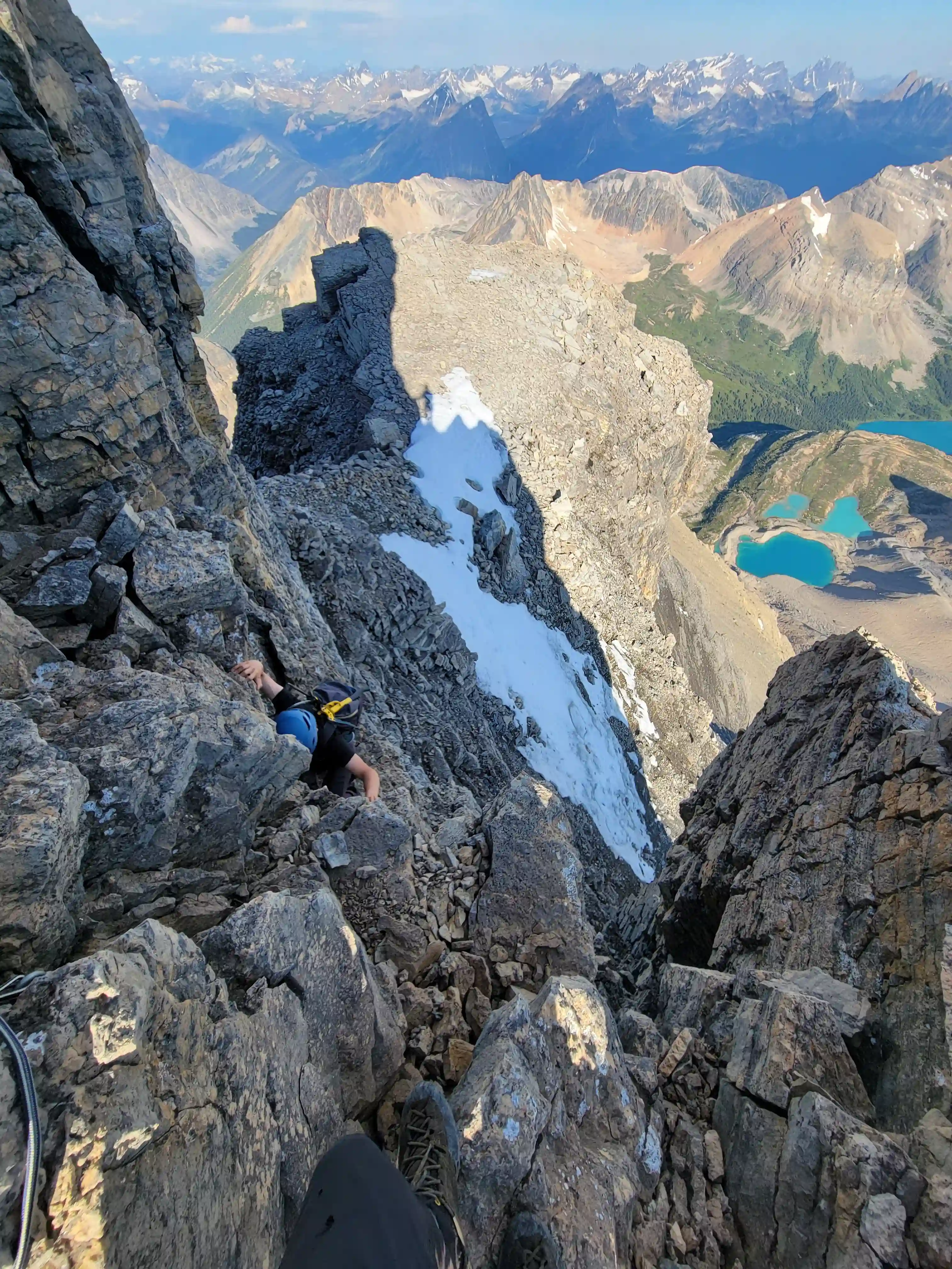
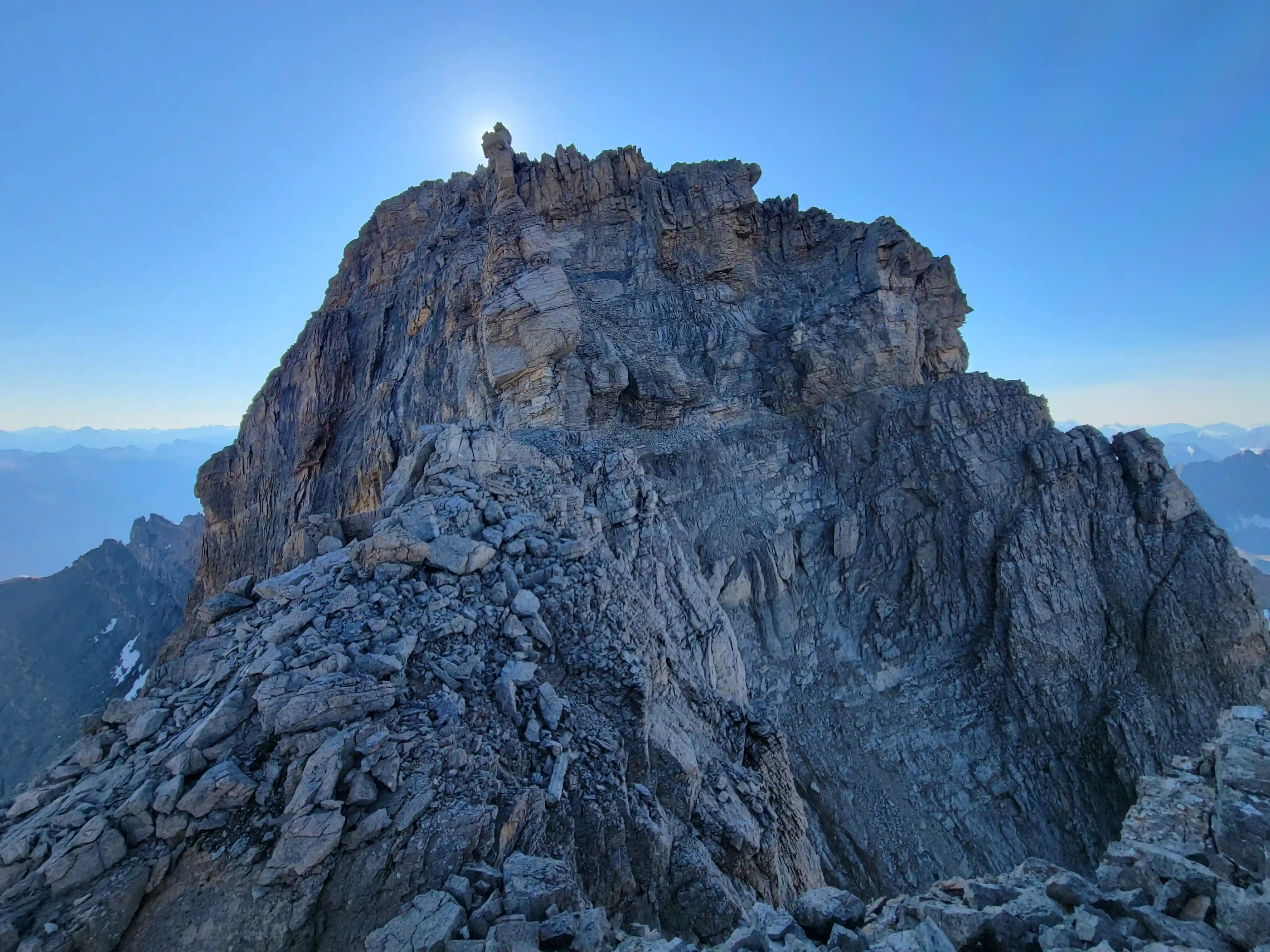
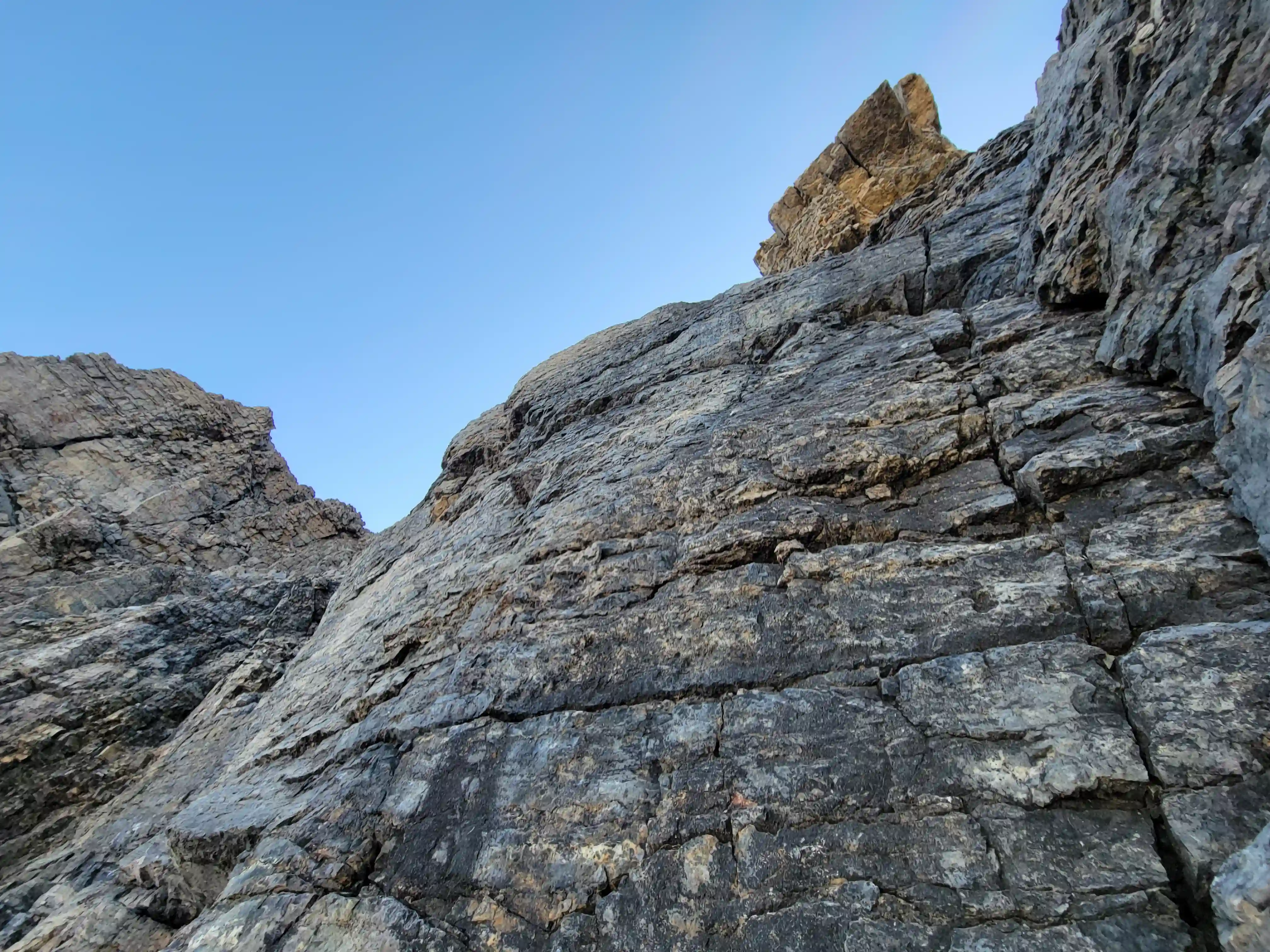
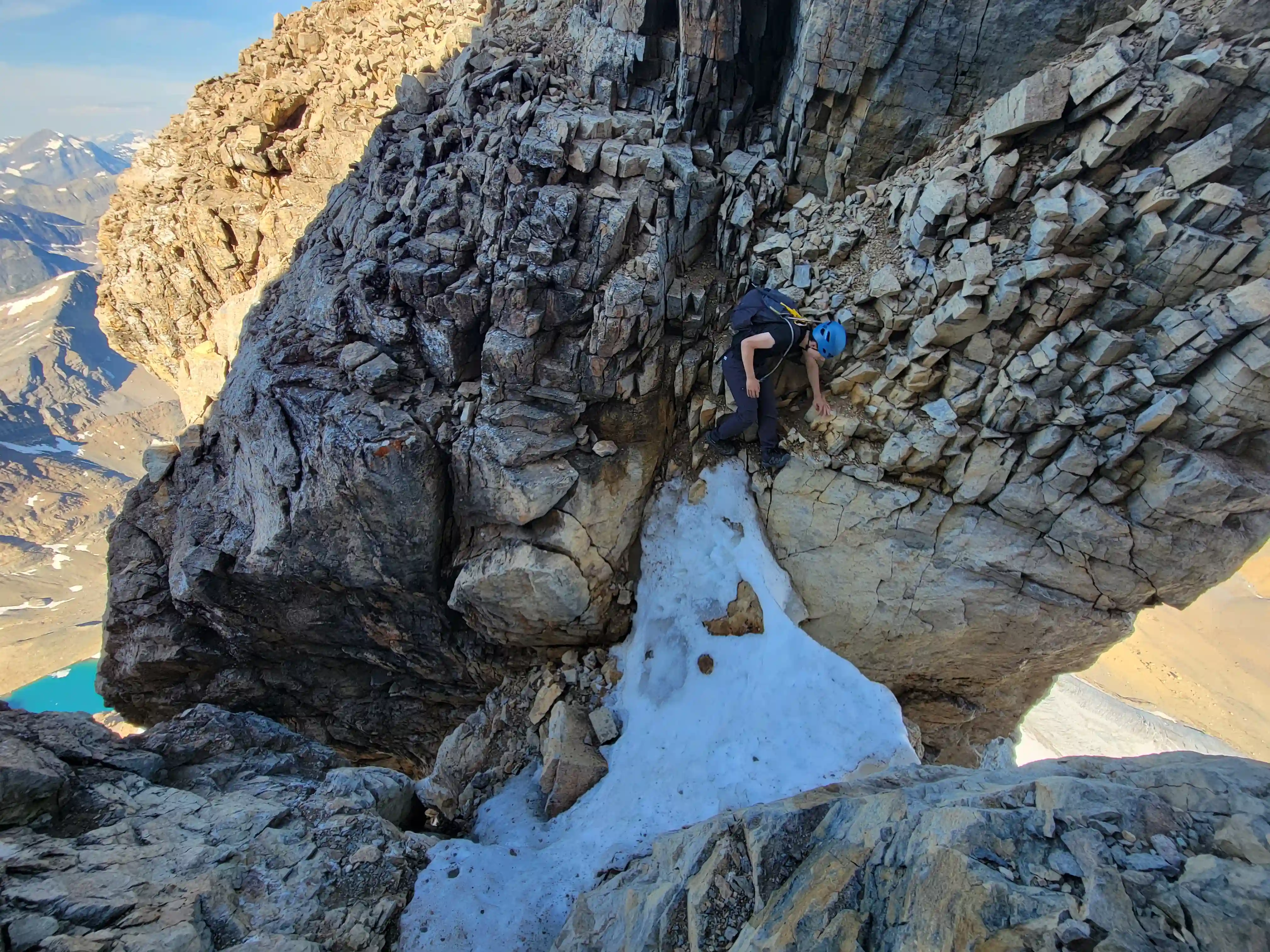
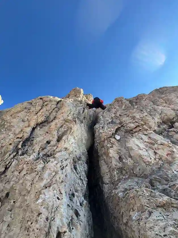
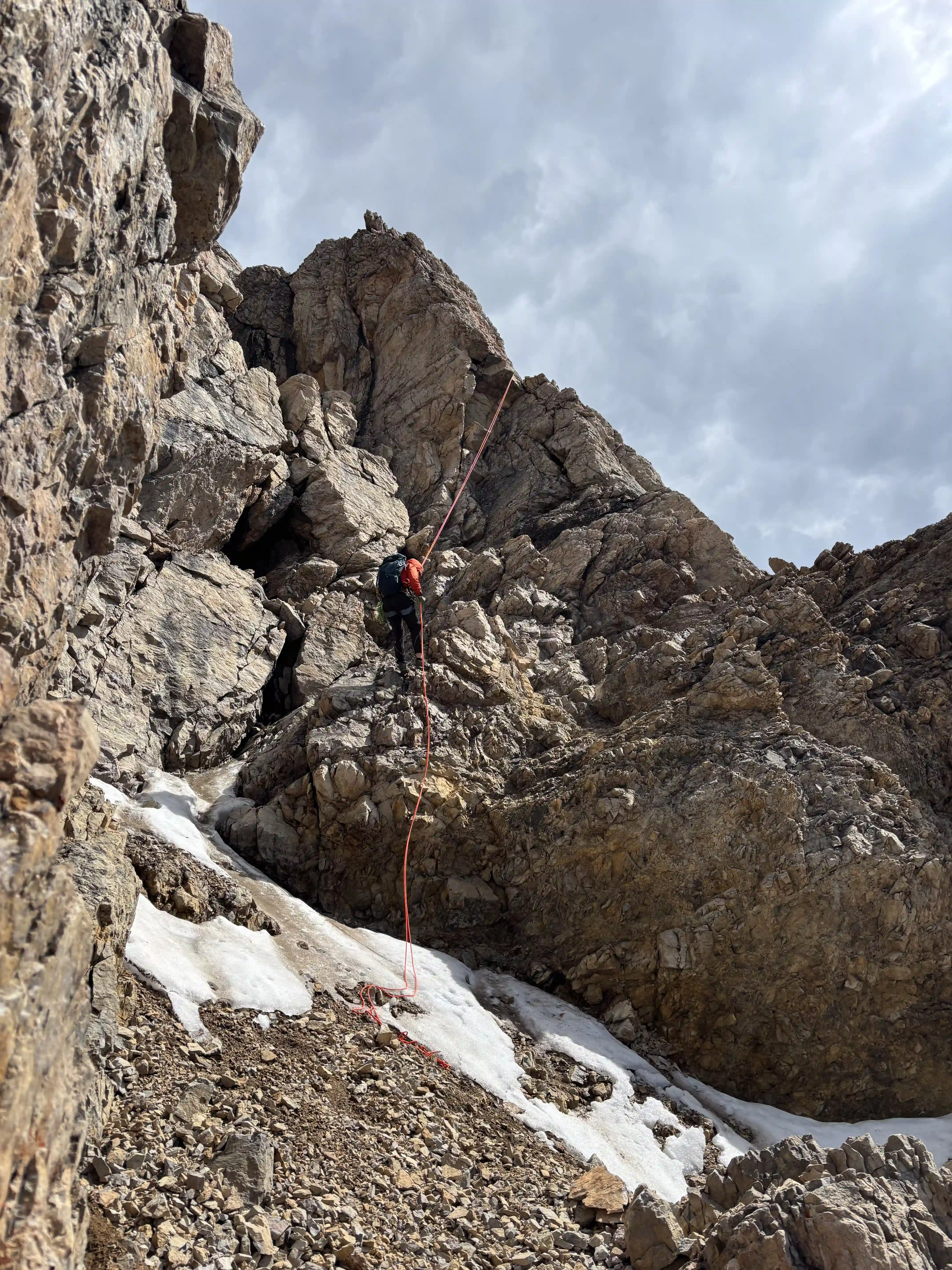
The west ridge direct ramped up very quickly with the supposed crux within the first few minutes, although I personally found a couple other section more exposed or harder. The climbing never felt terribly sustained with a number of walking sections along the way but there were far more technical steps than I had realized prior to going for this route so be ready for a sizable amount of hands on terrain with this ridge direct line! Above pretty much every difficulty there was some good tat so protecting the climb would be relatively easy, even so Will and I ended up keeping the rope on the pack until the descent but use your judgement!
previous section at low left
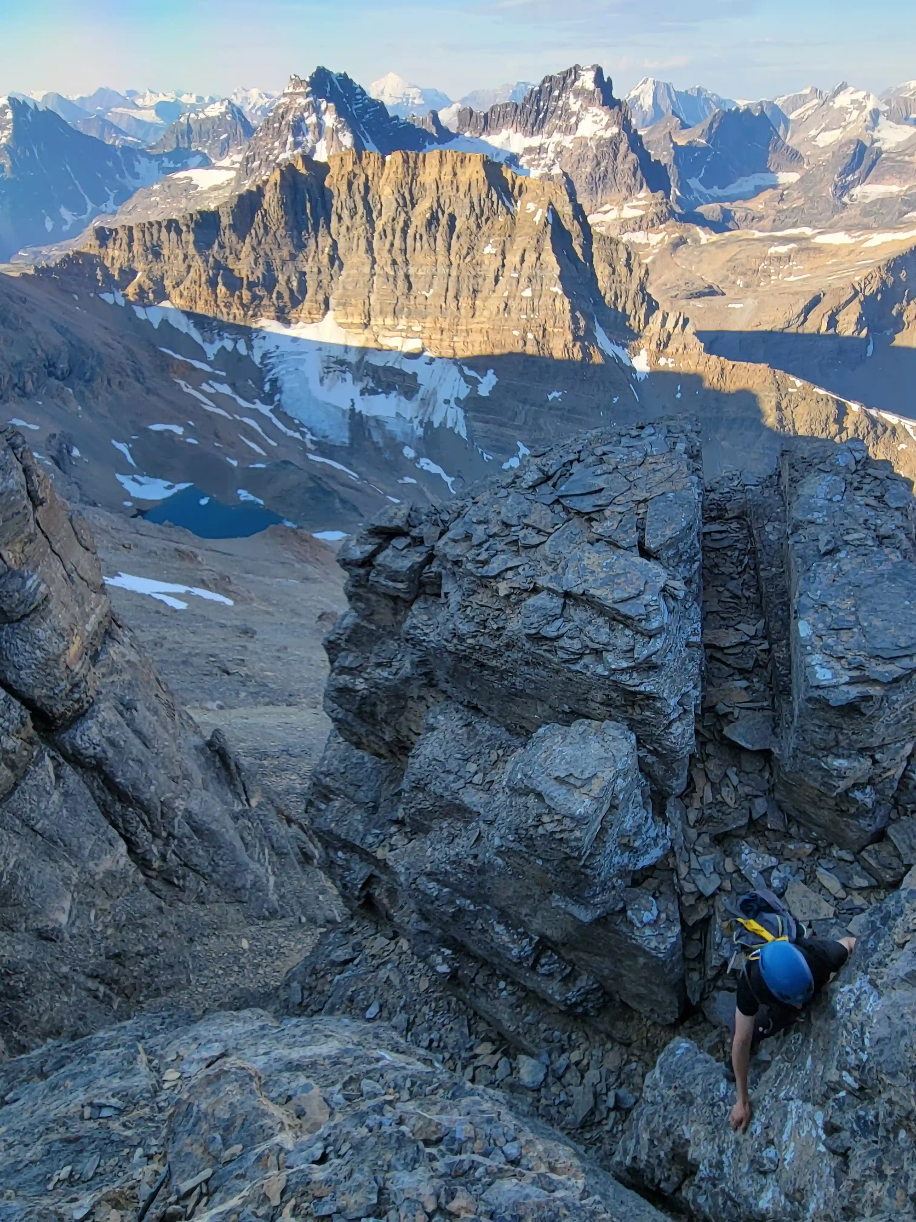
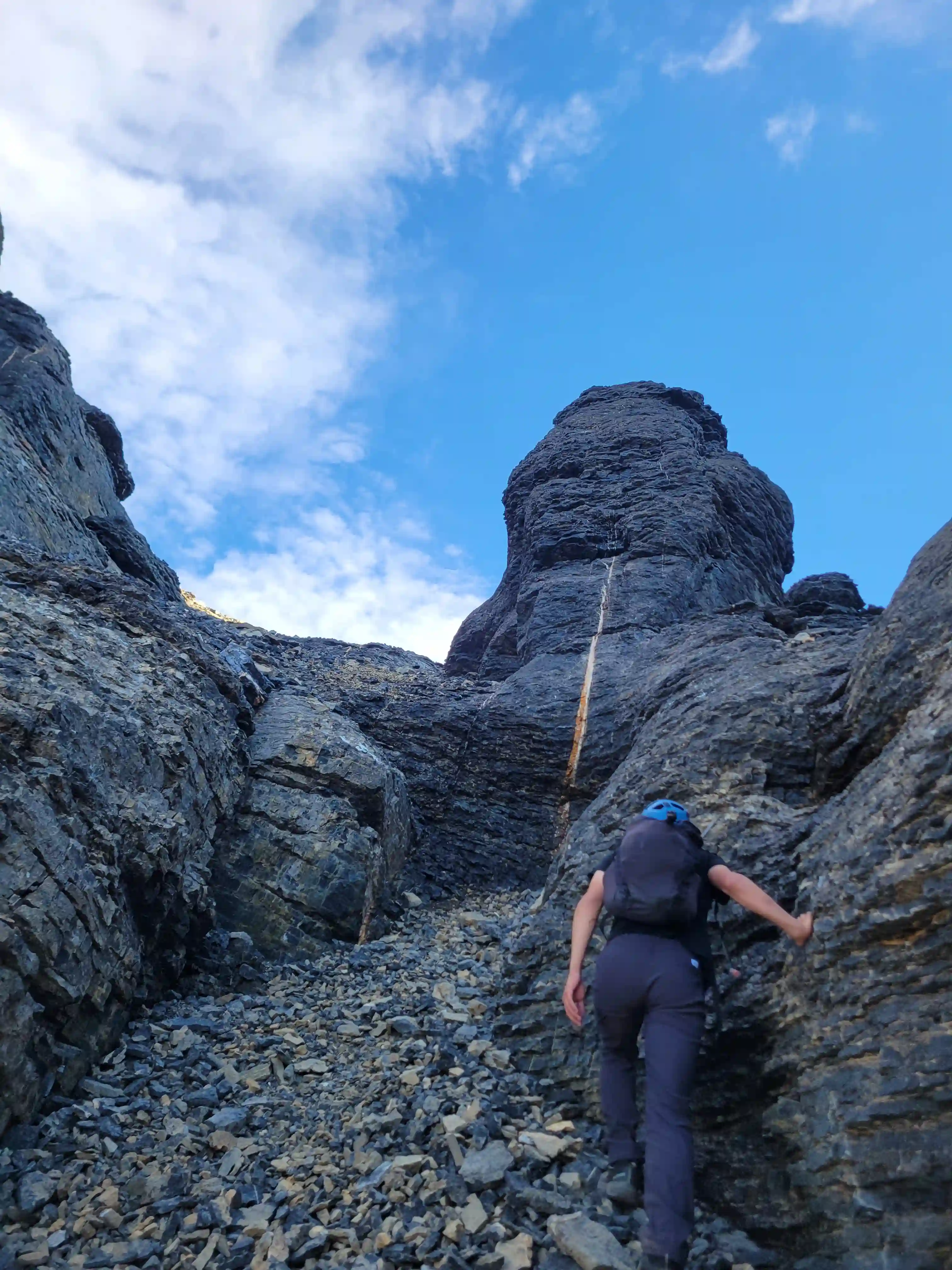
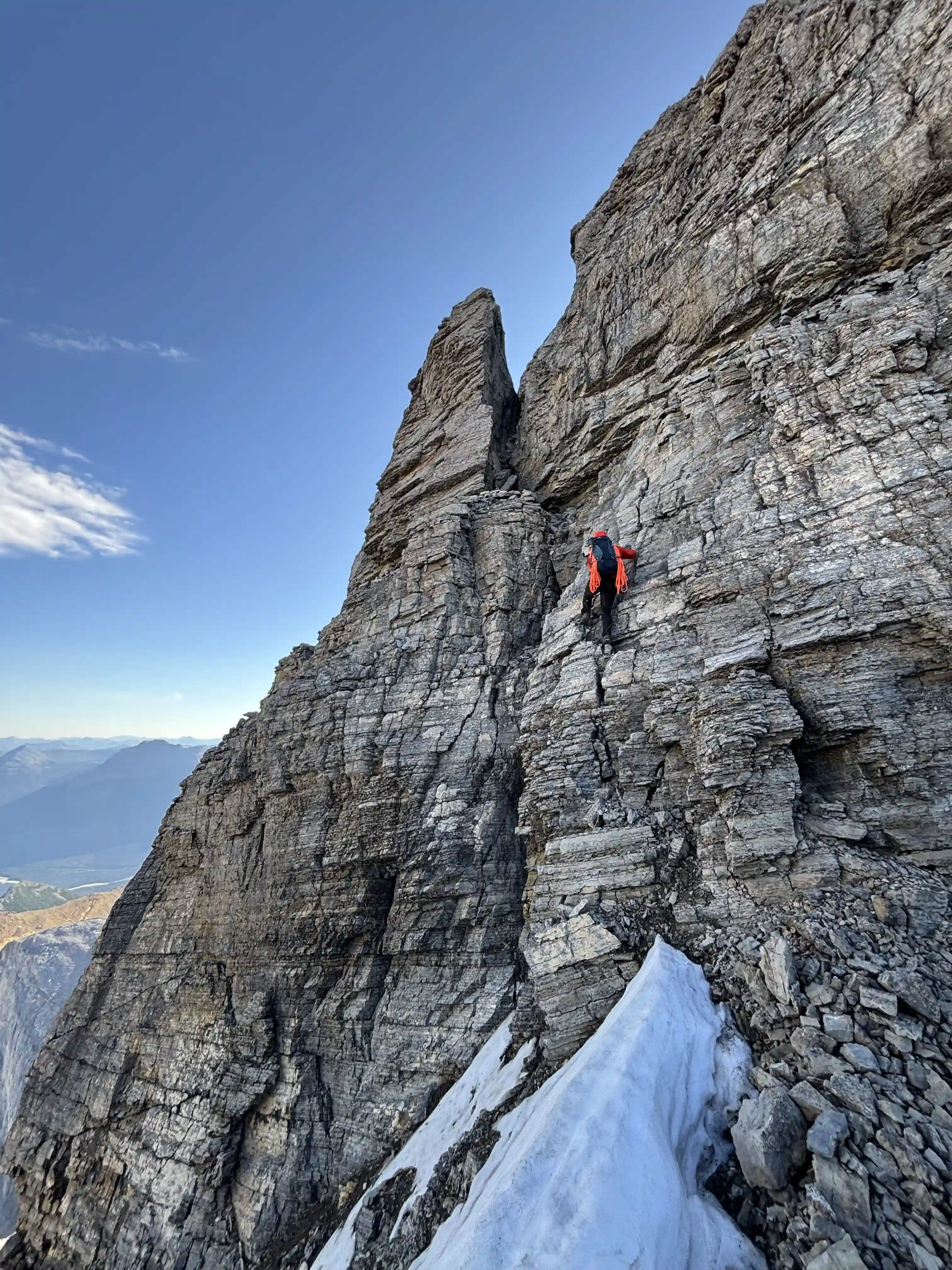
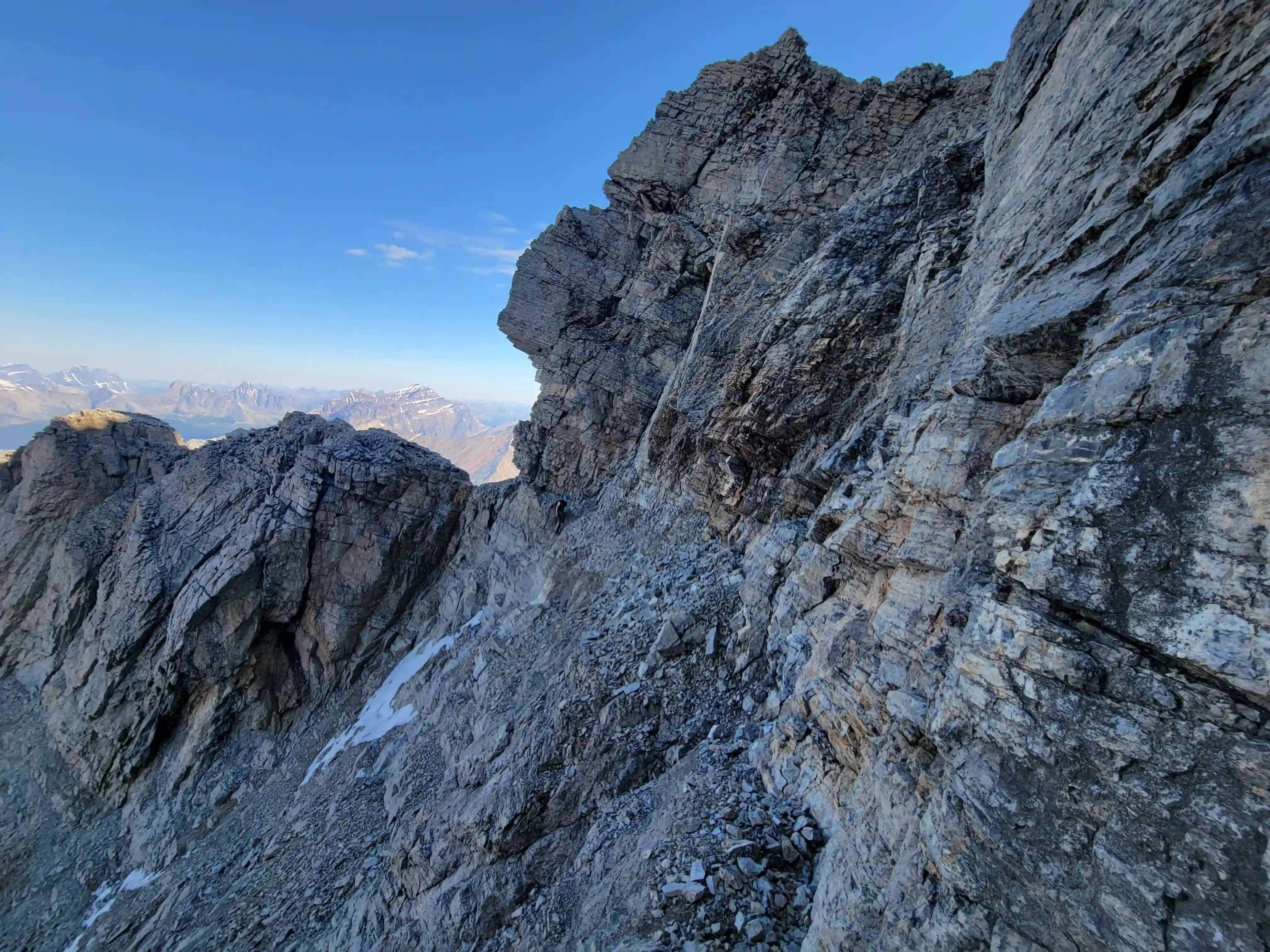
section we went climber's right to avoid the
overhang above
Into trips like this?
I'll send you an email whenever I publish a new trip report.
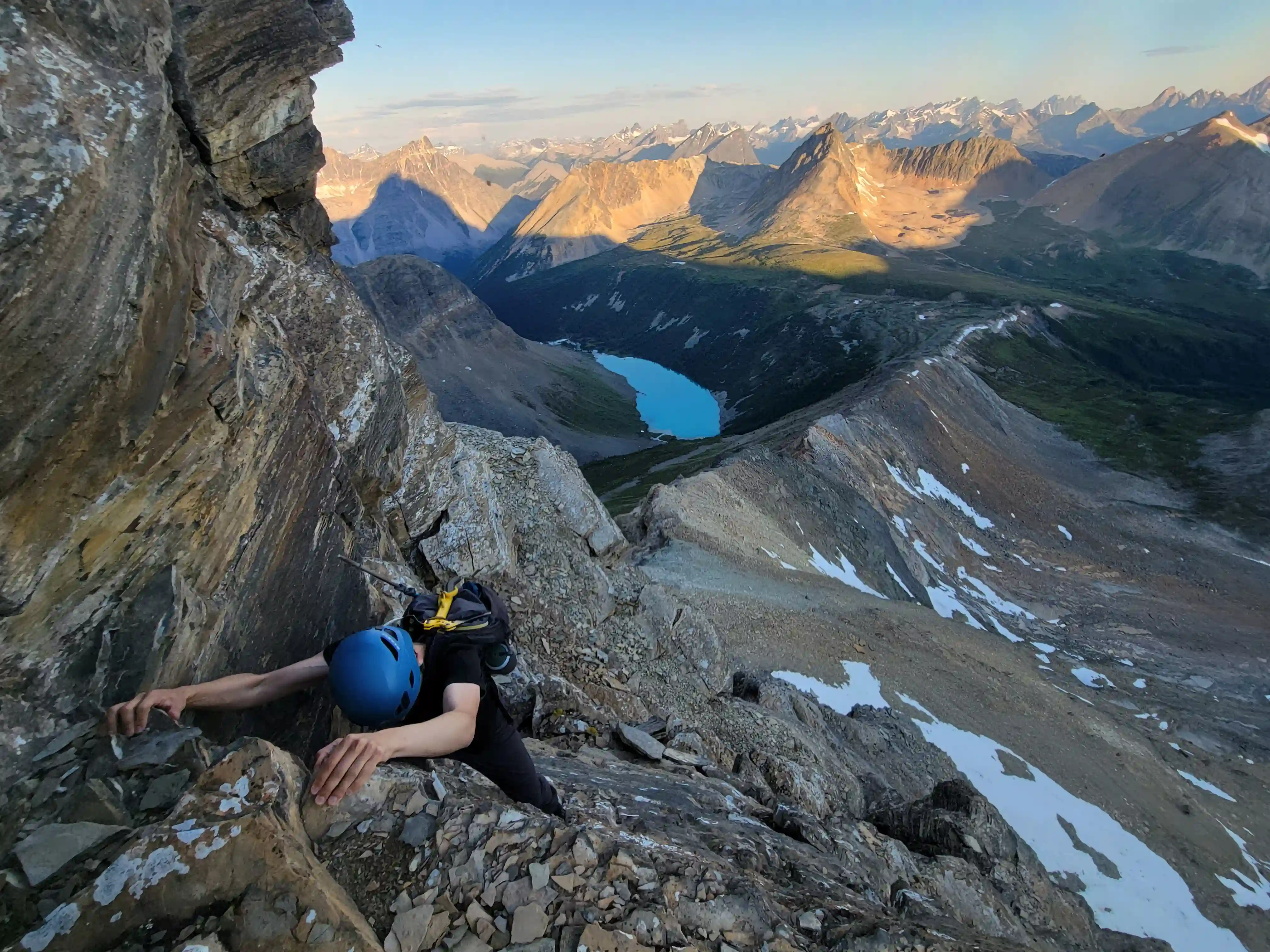
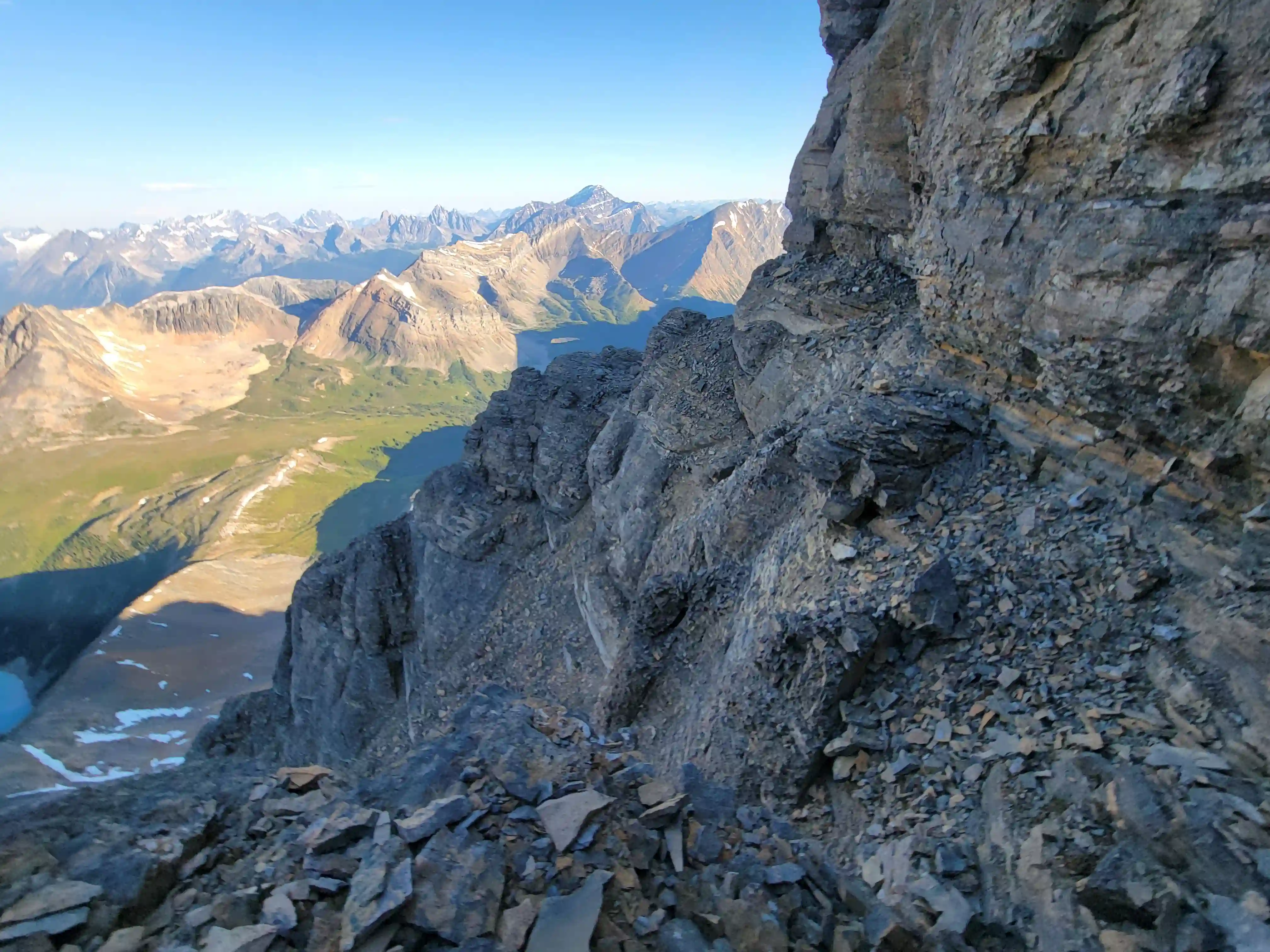
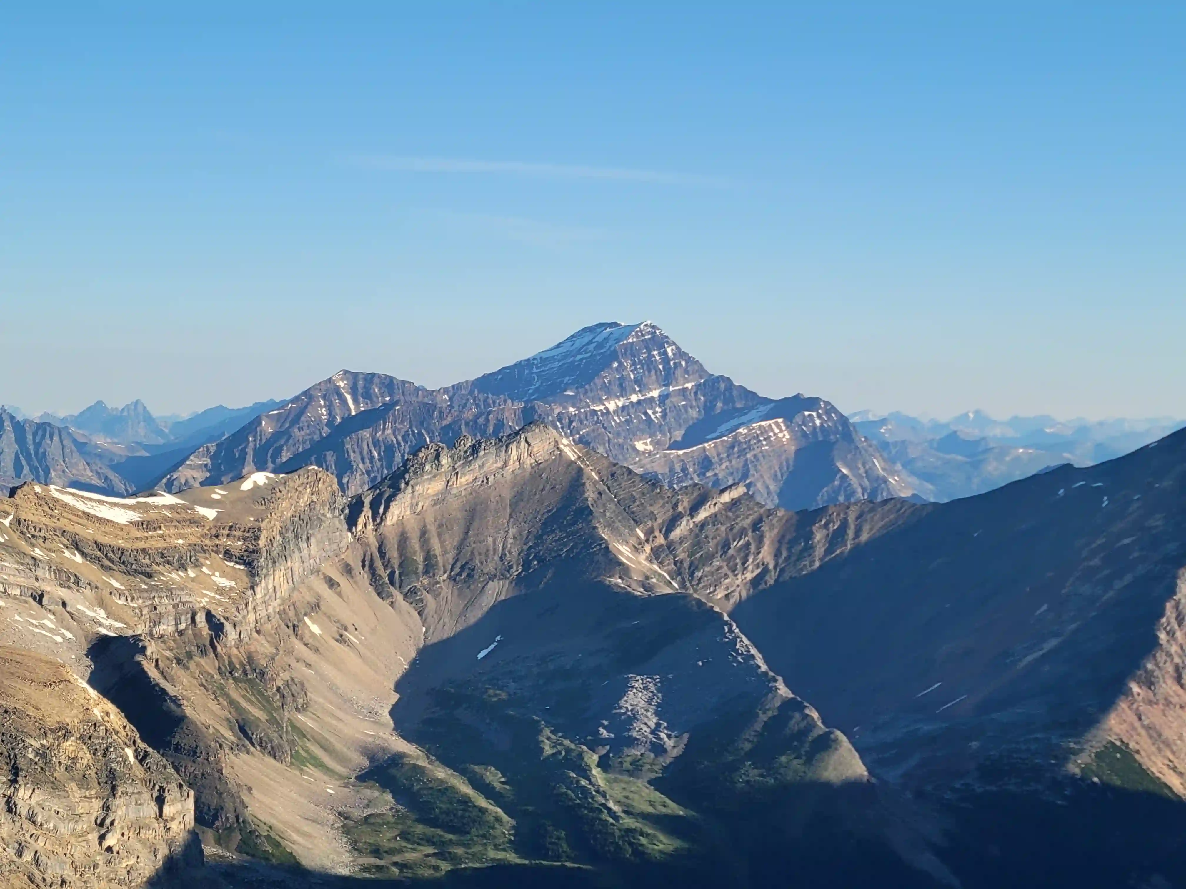
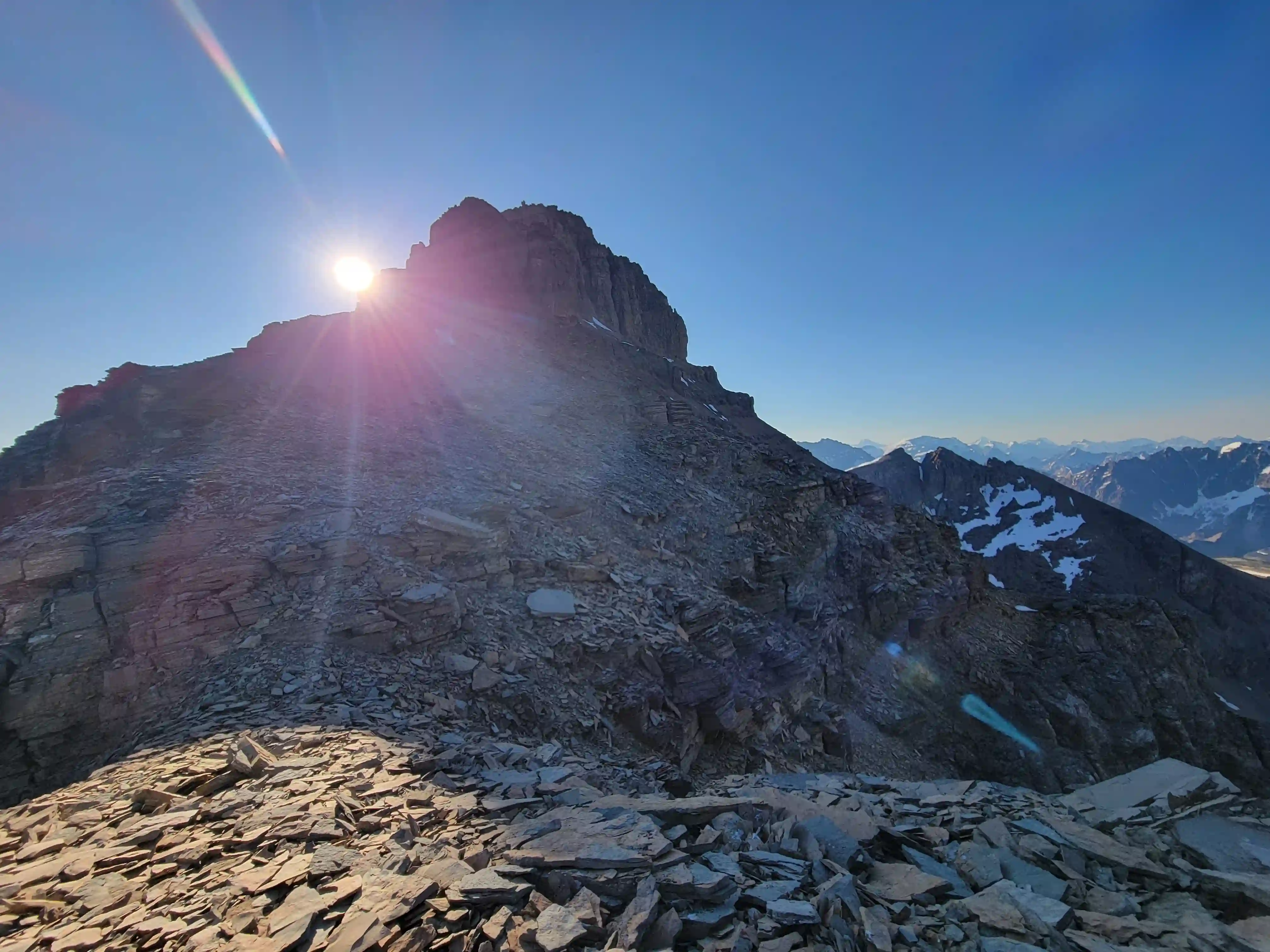
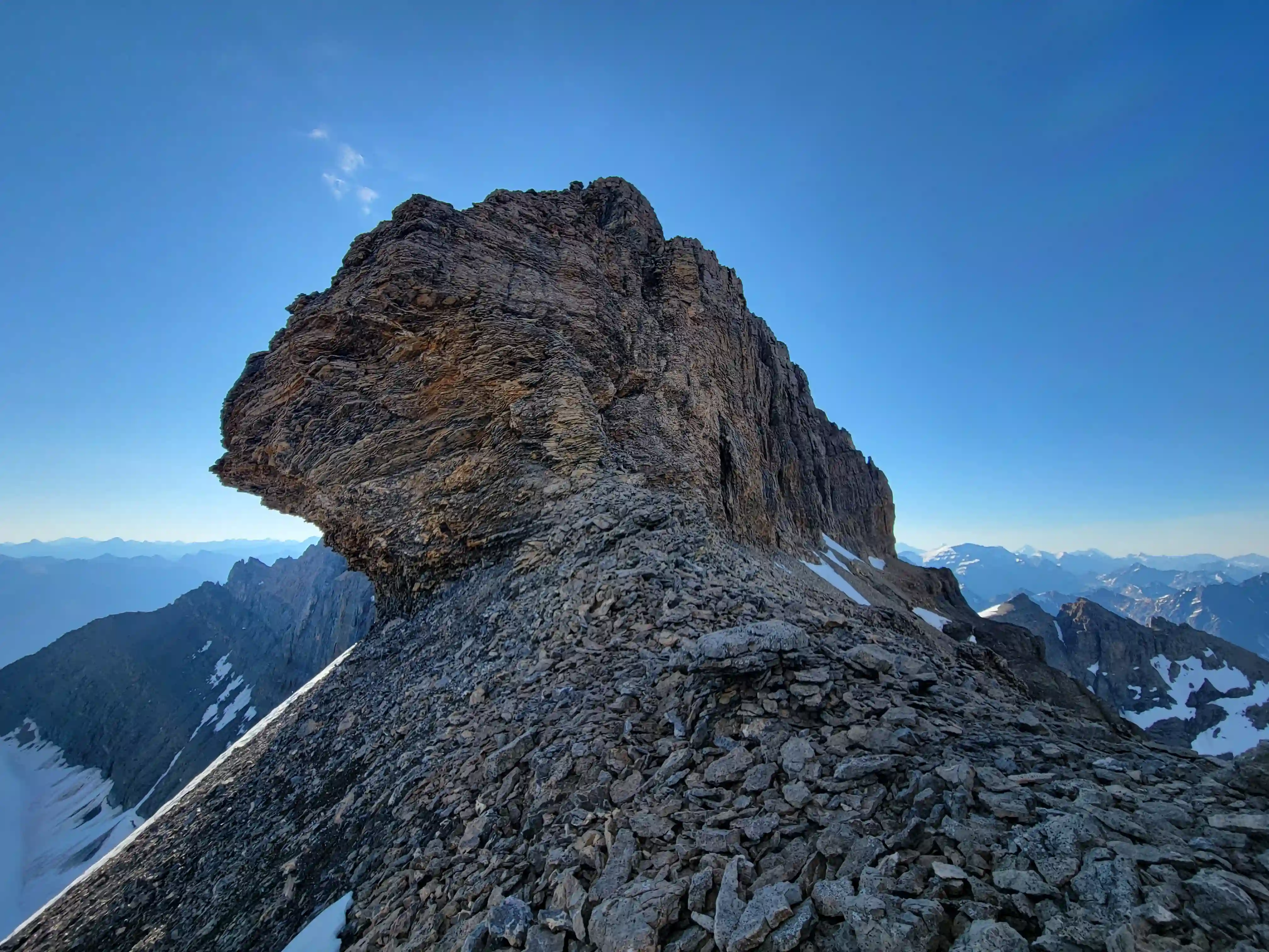
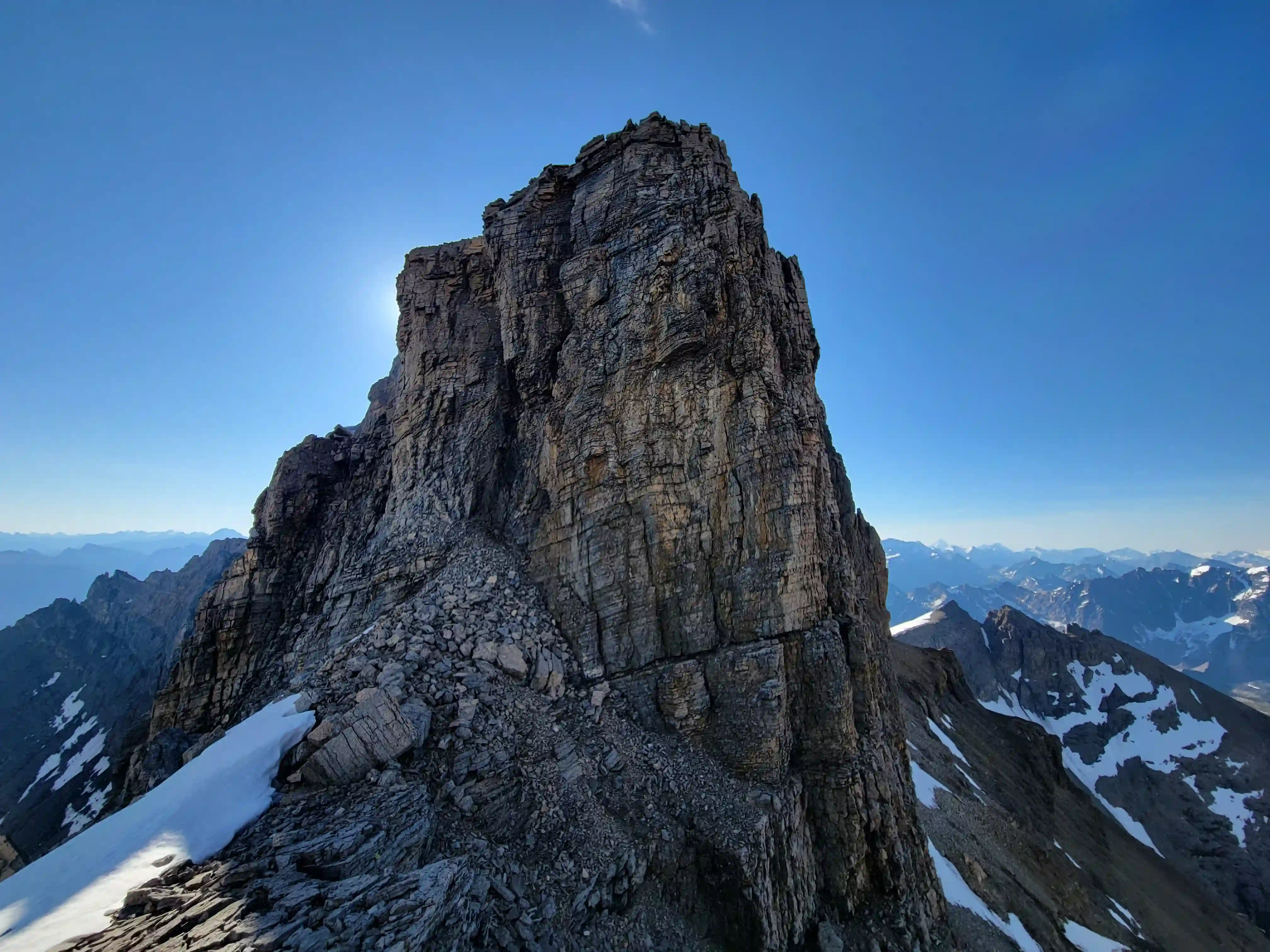
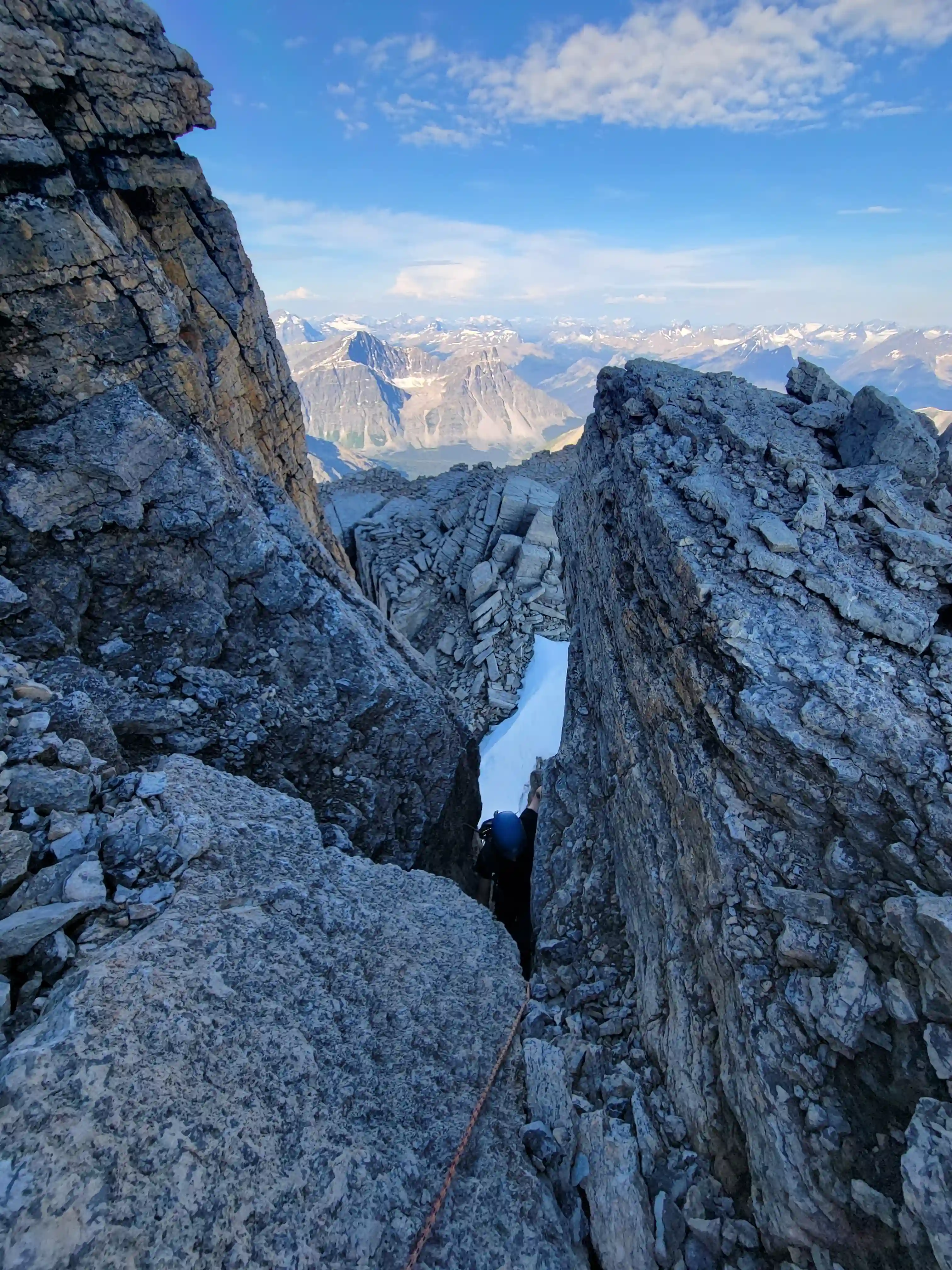
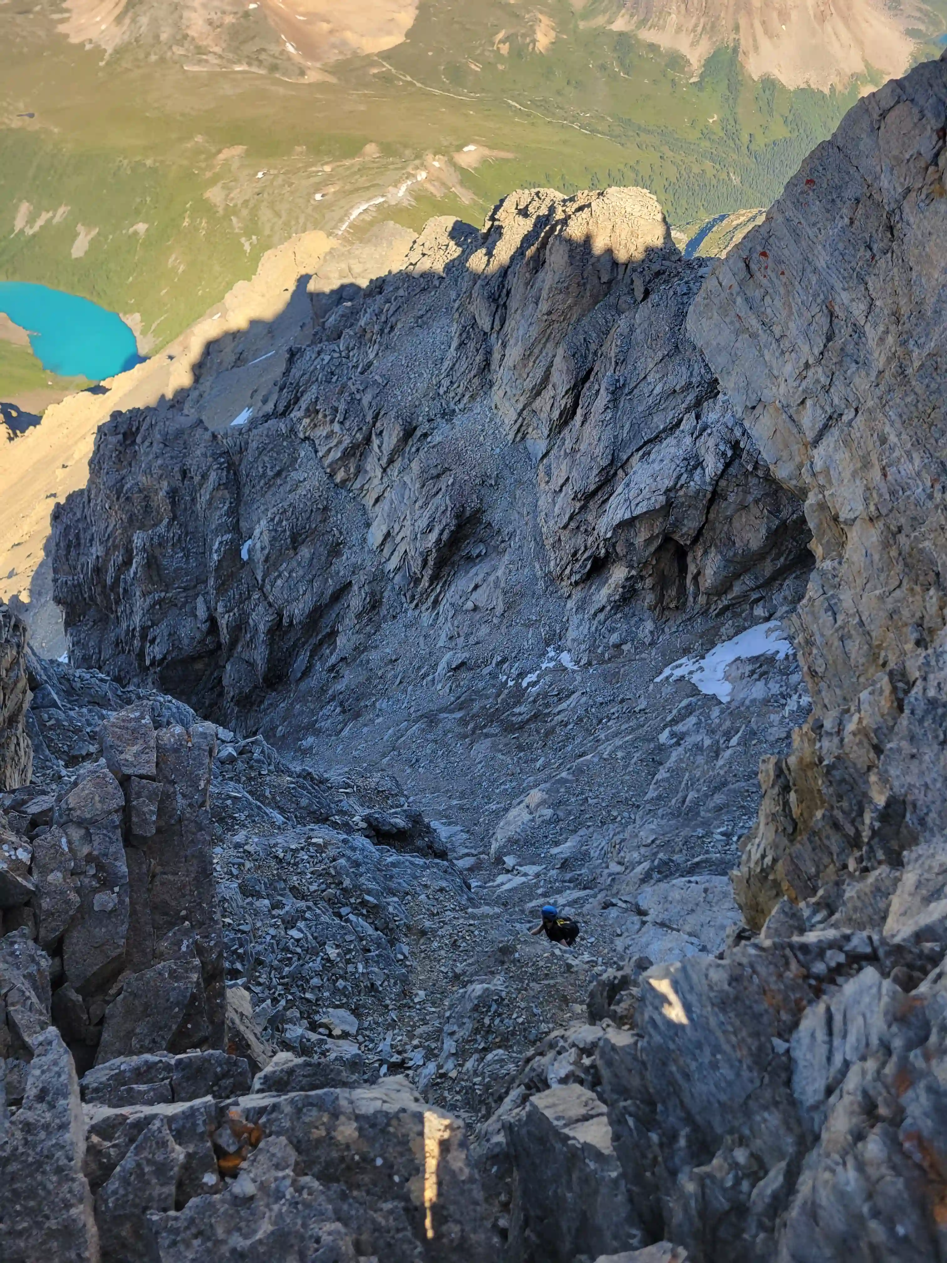
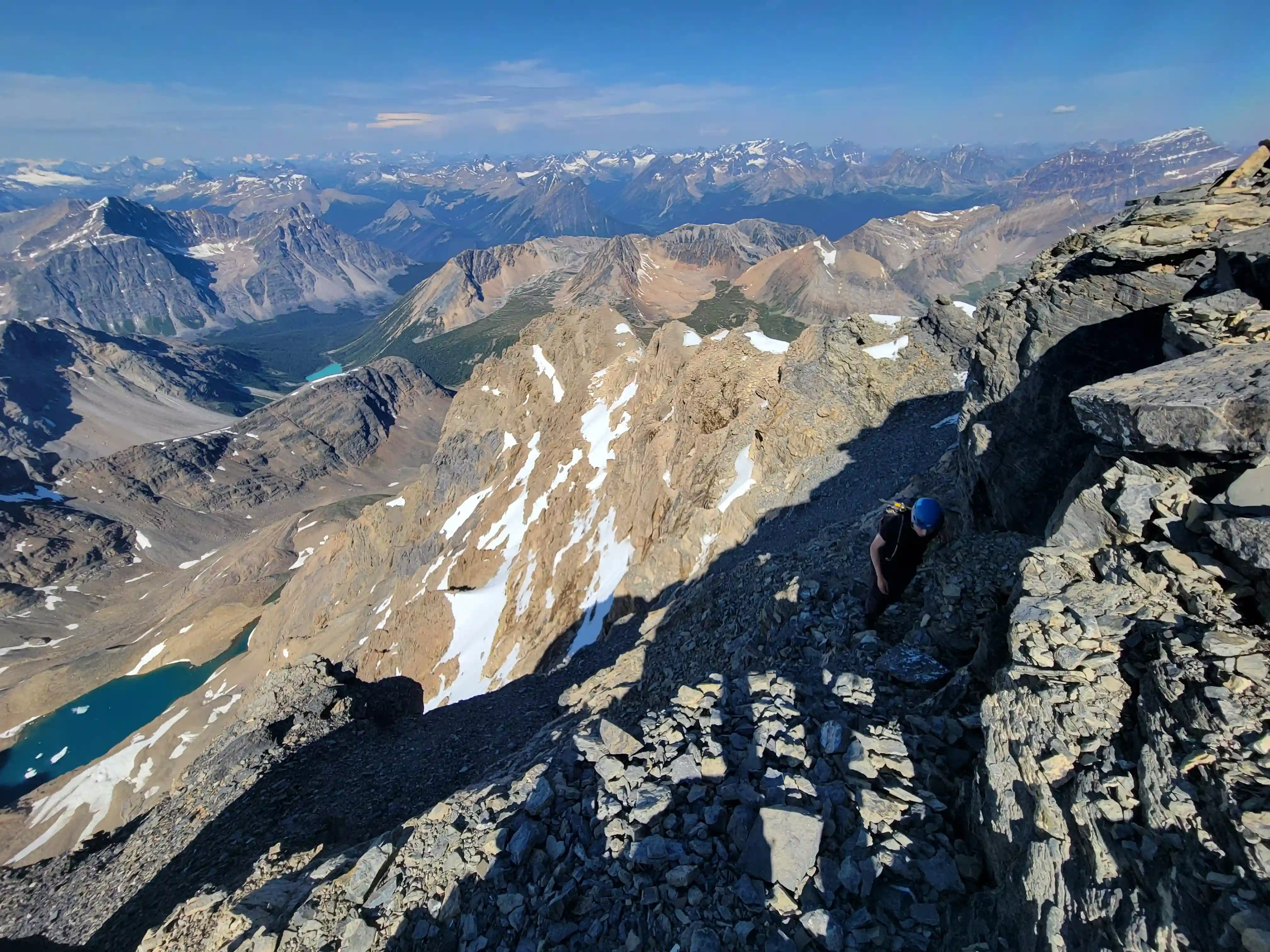
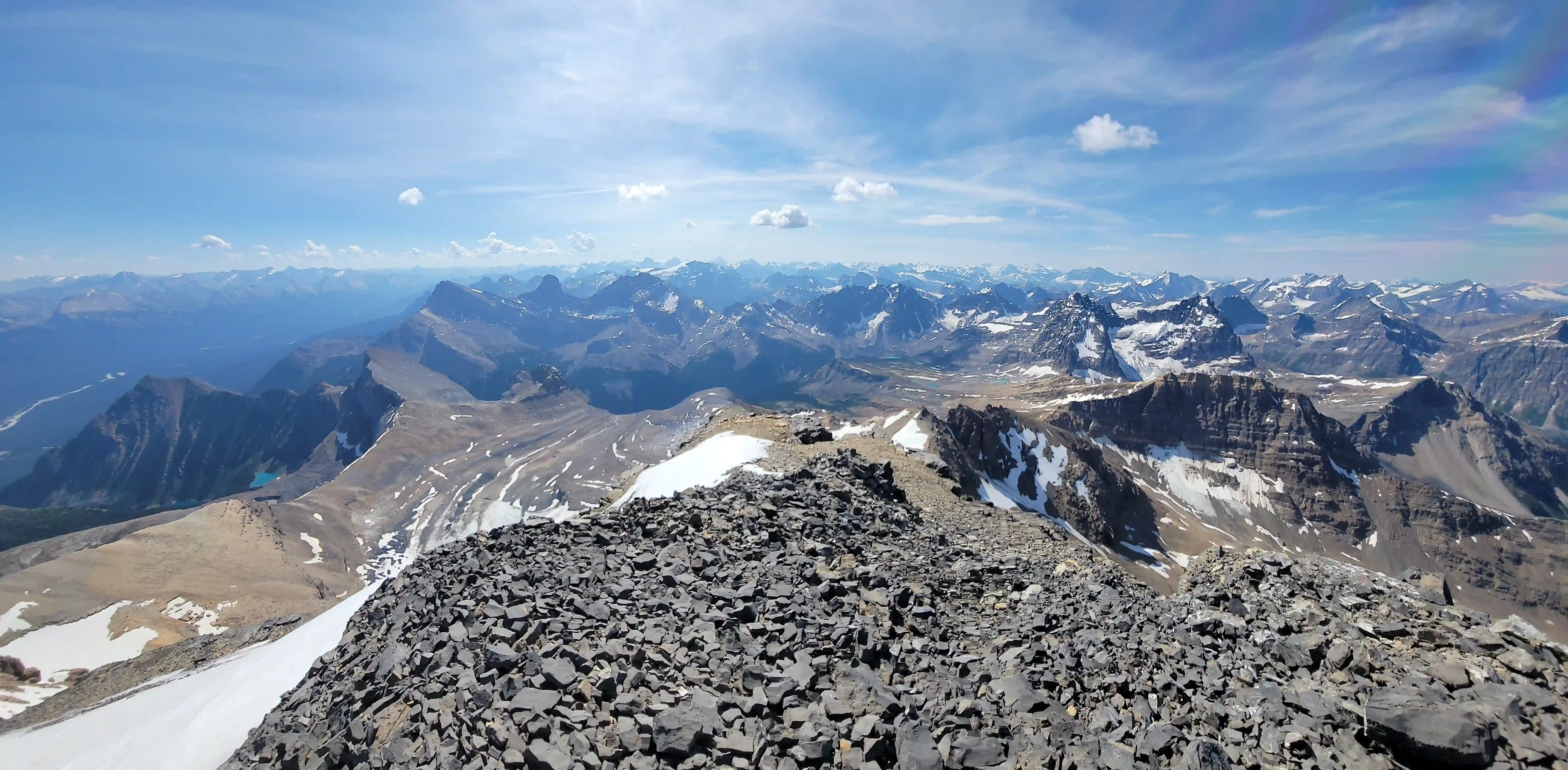
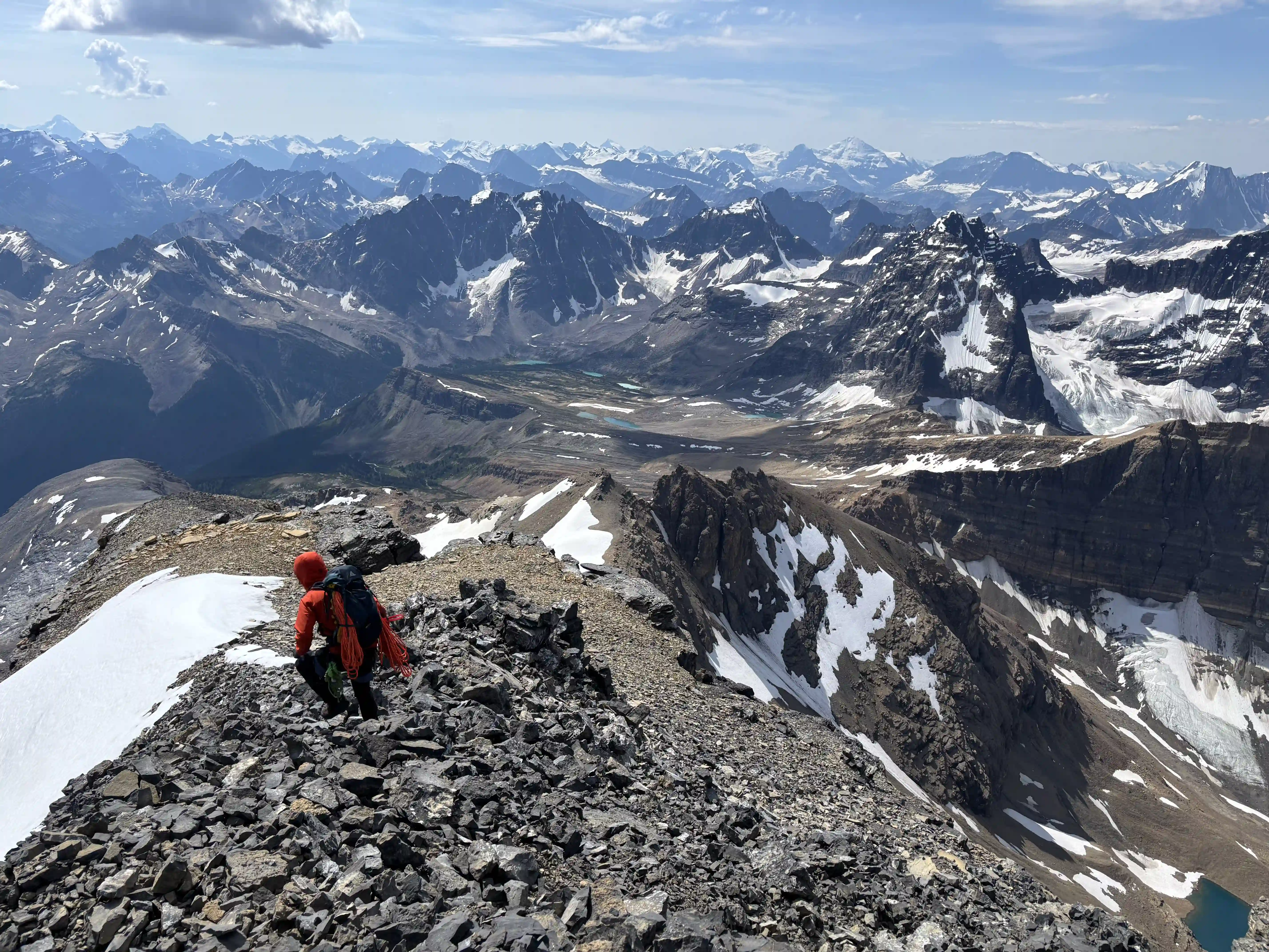
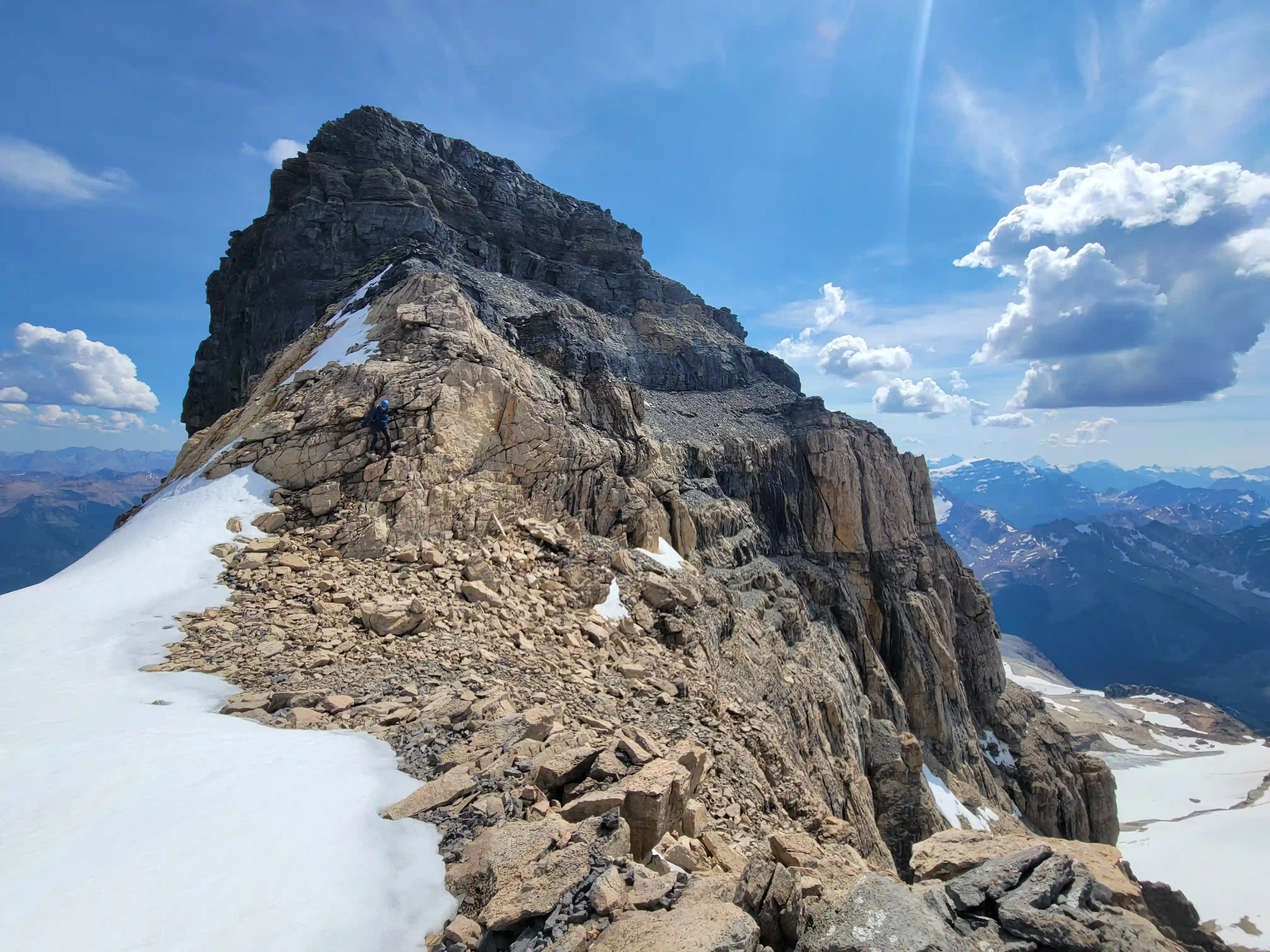
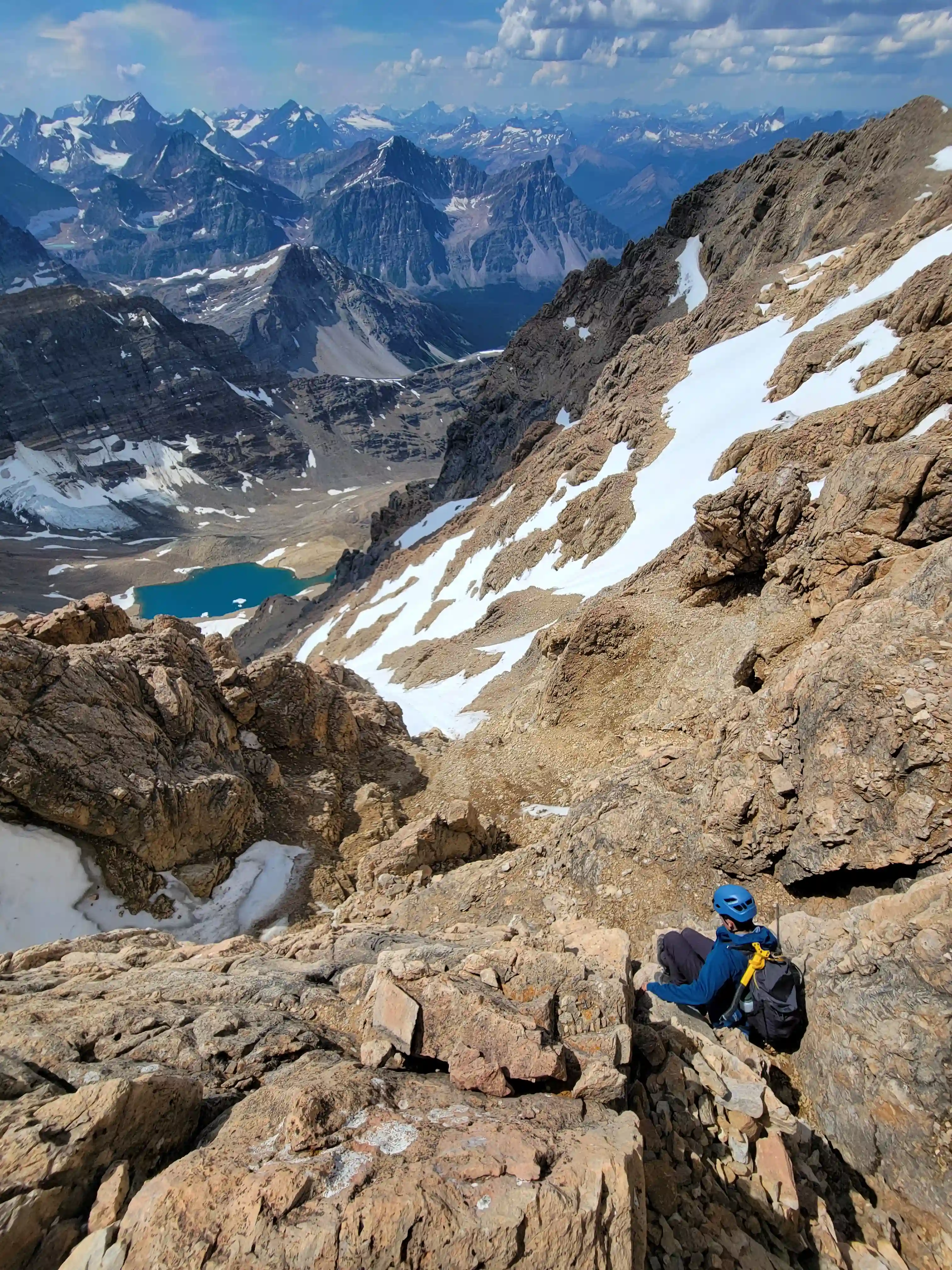
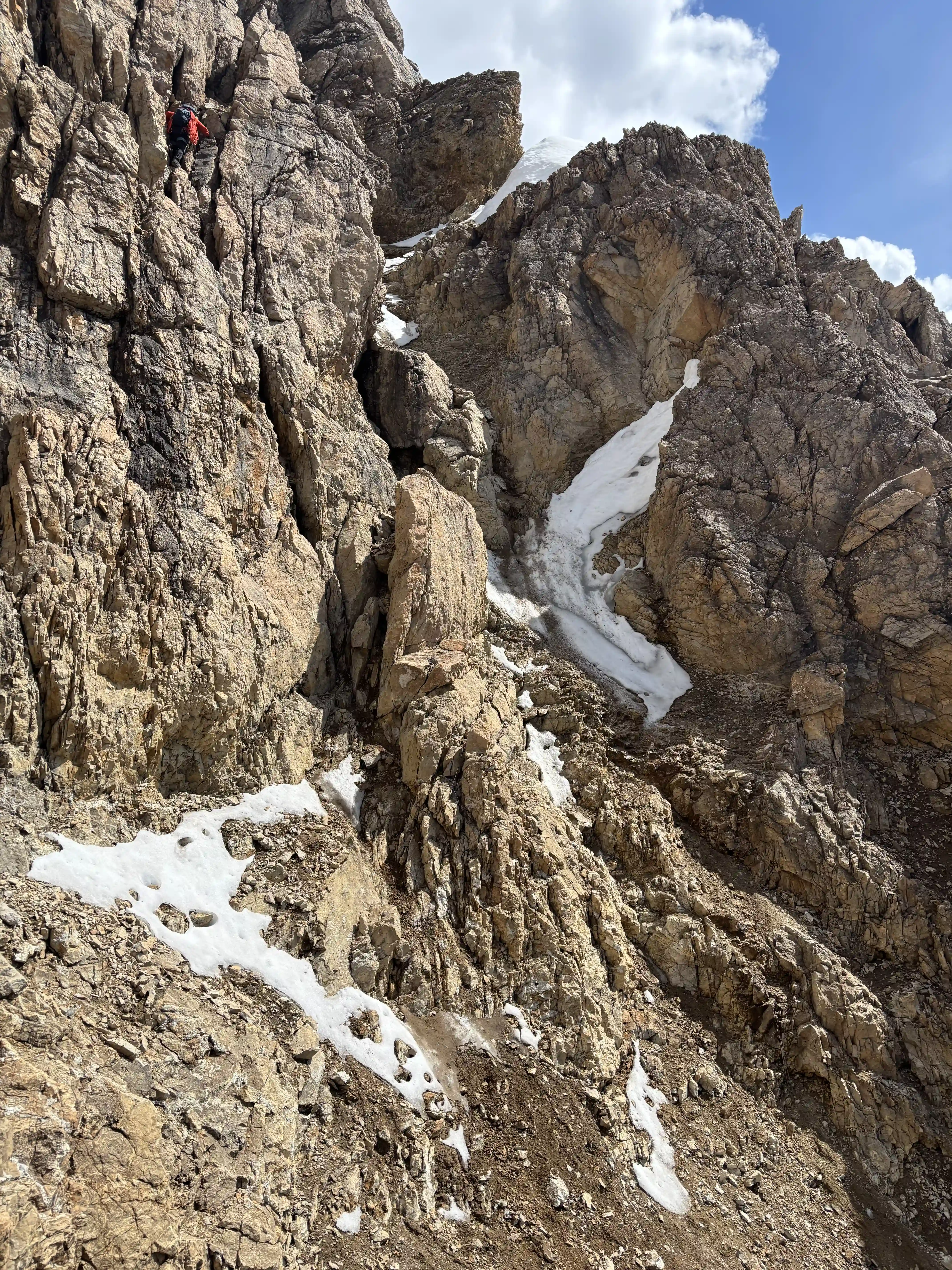
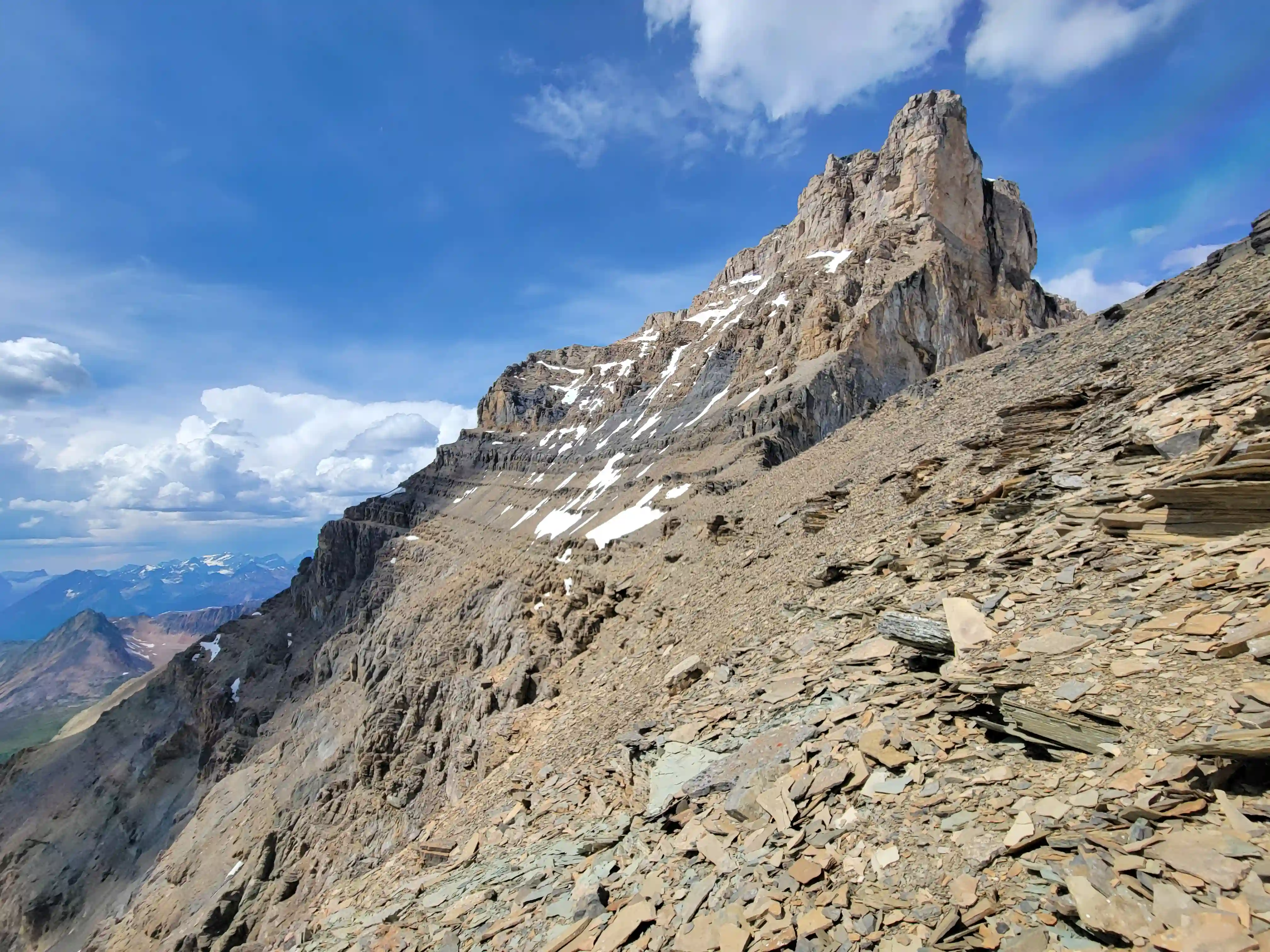
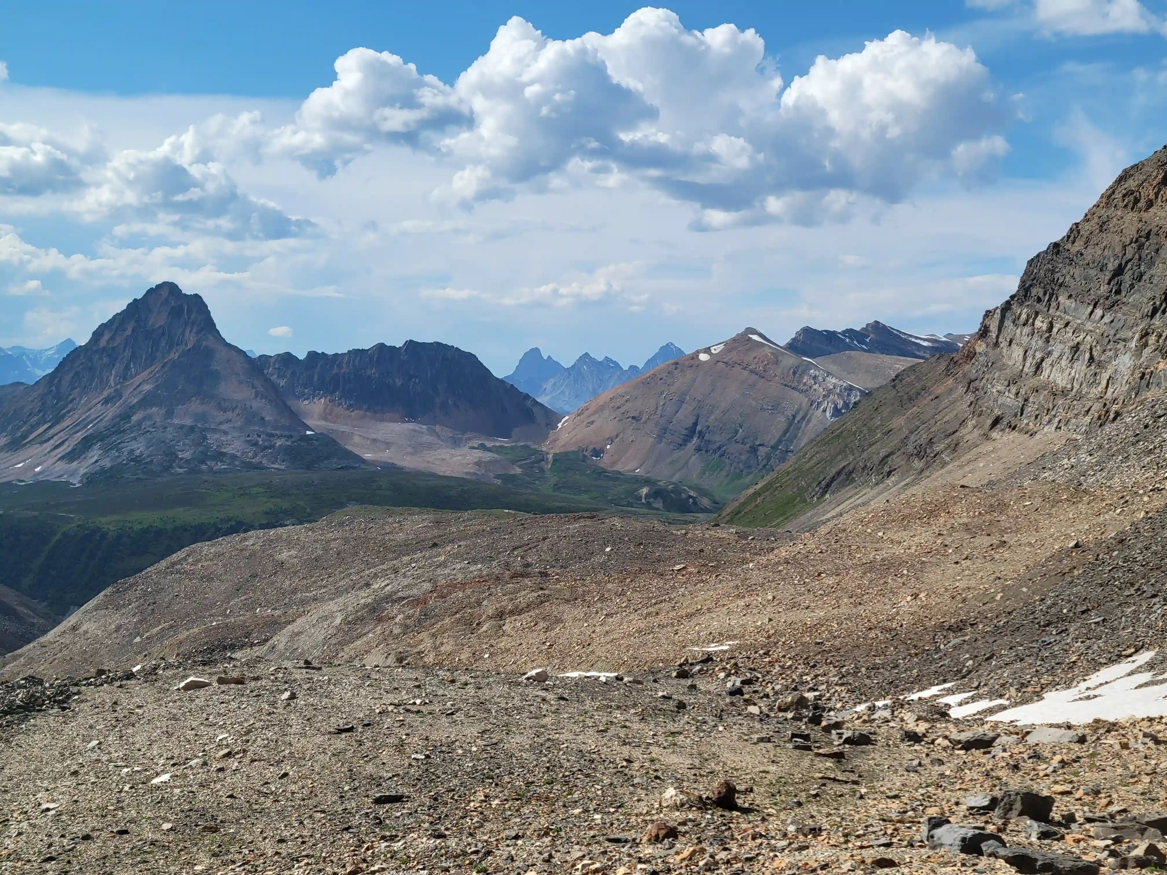
For the final portion of the ascent once we could finally see the summit in the distance we first had to cross the notch which was a bit awkward with snow in it but manageable, followed by a series of bypasses climbers right to find the easiest line which wasn't always easy to locate. After 2-3 bypasses all that was left was the final dark colored summit block. We initially looked for a route on the west side but nothing appeared 5.6 or easier so we looked and found a scramble line on the south end to take us to the summit!
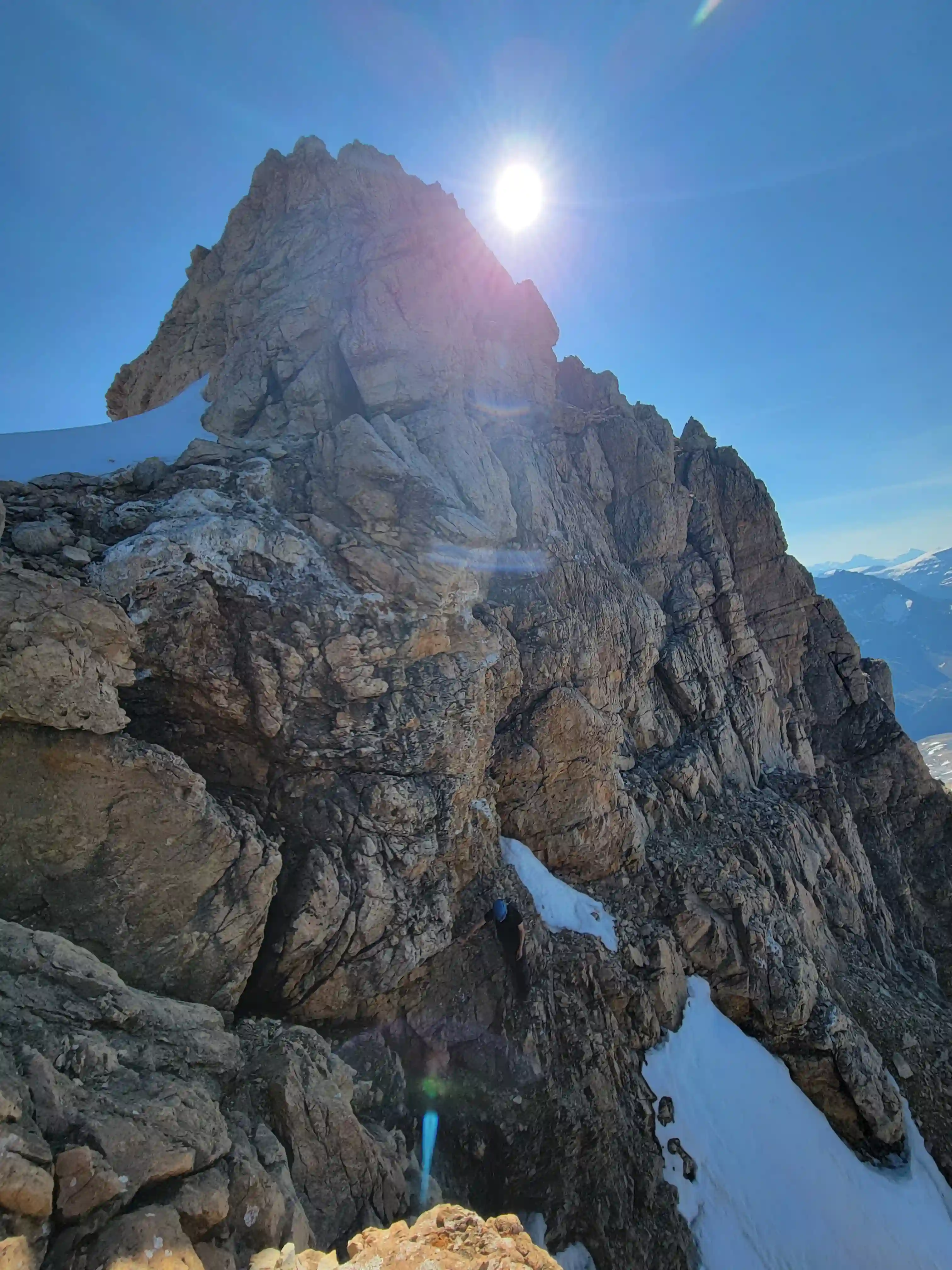
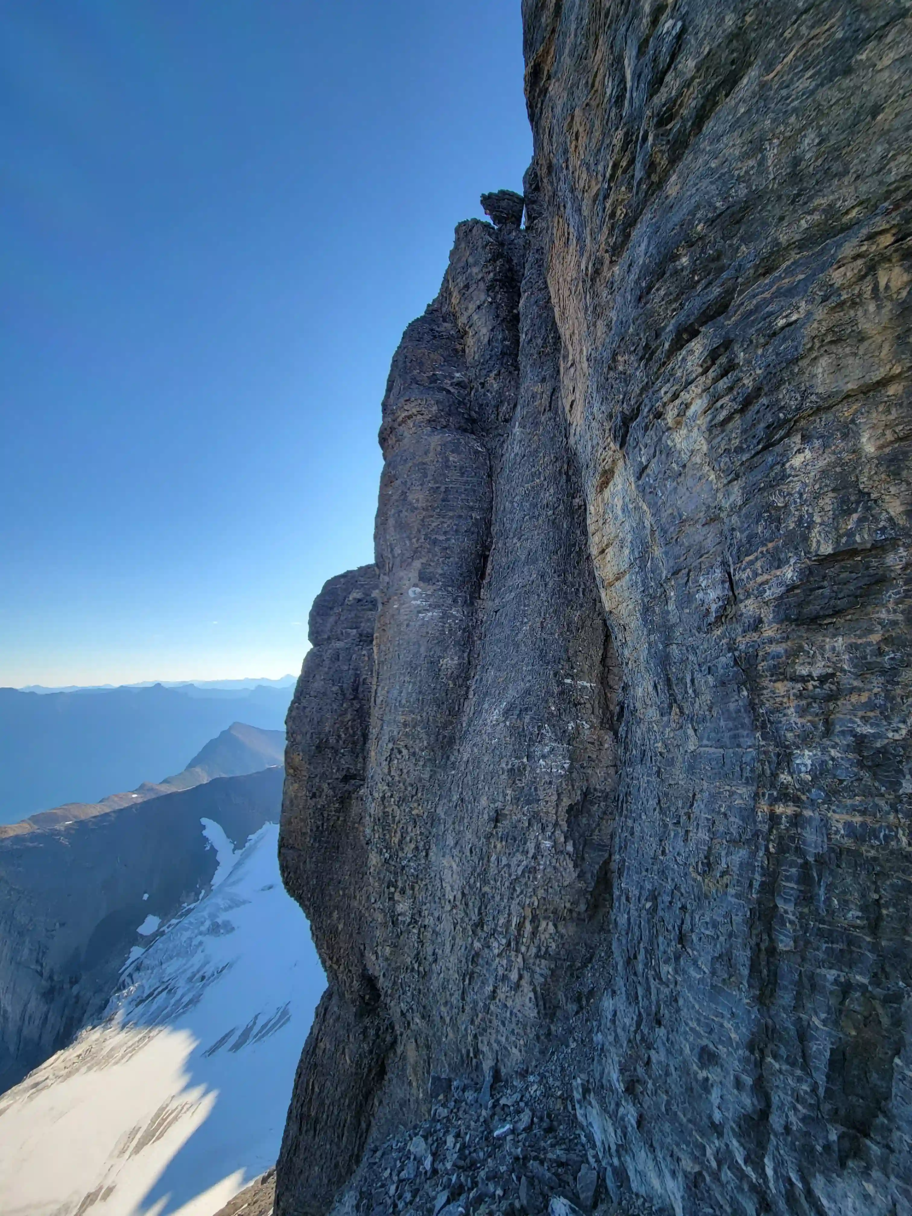
section with bypasses right
5.6 on route we had but solid rock
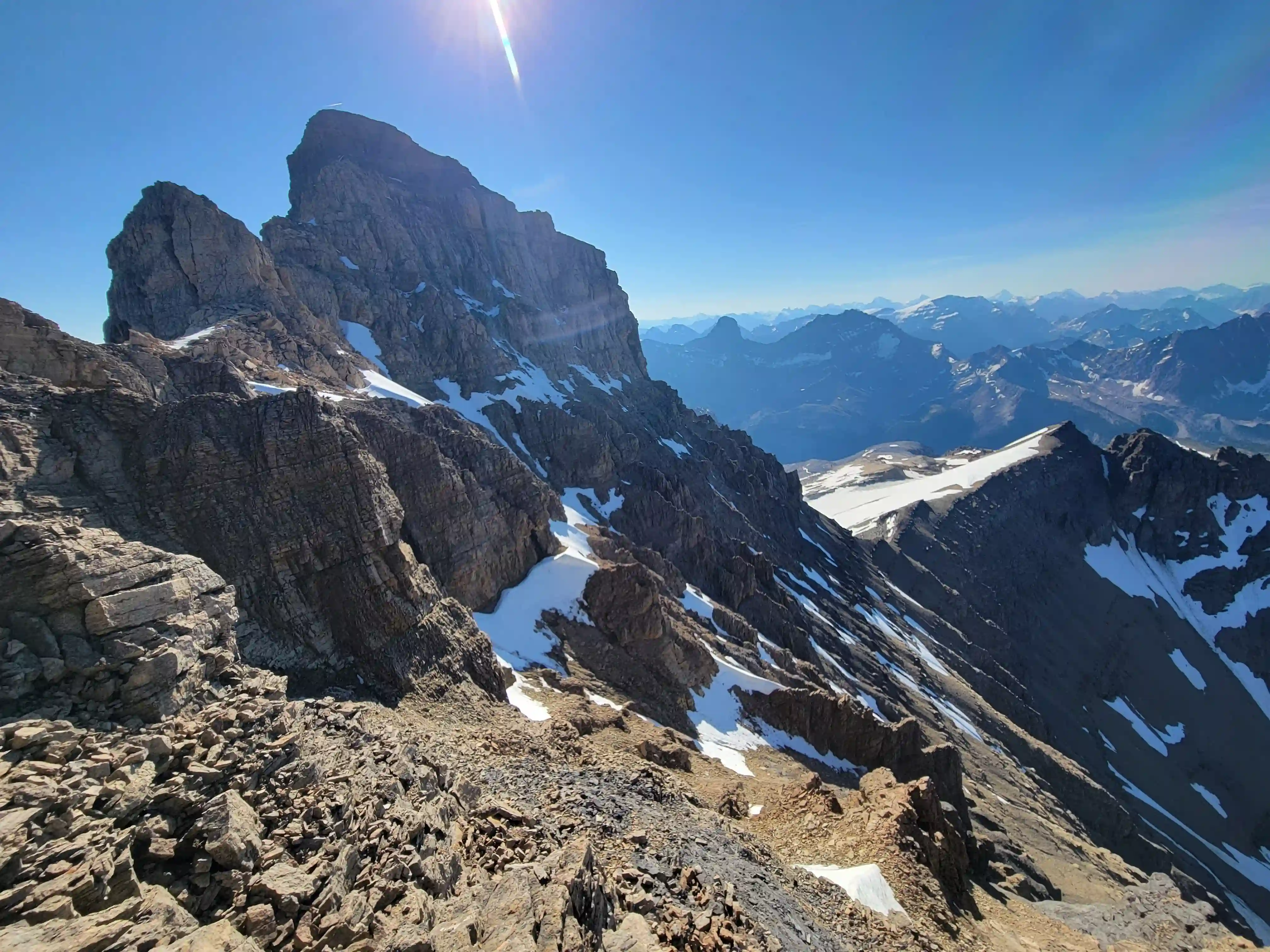
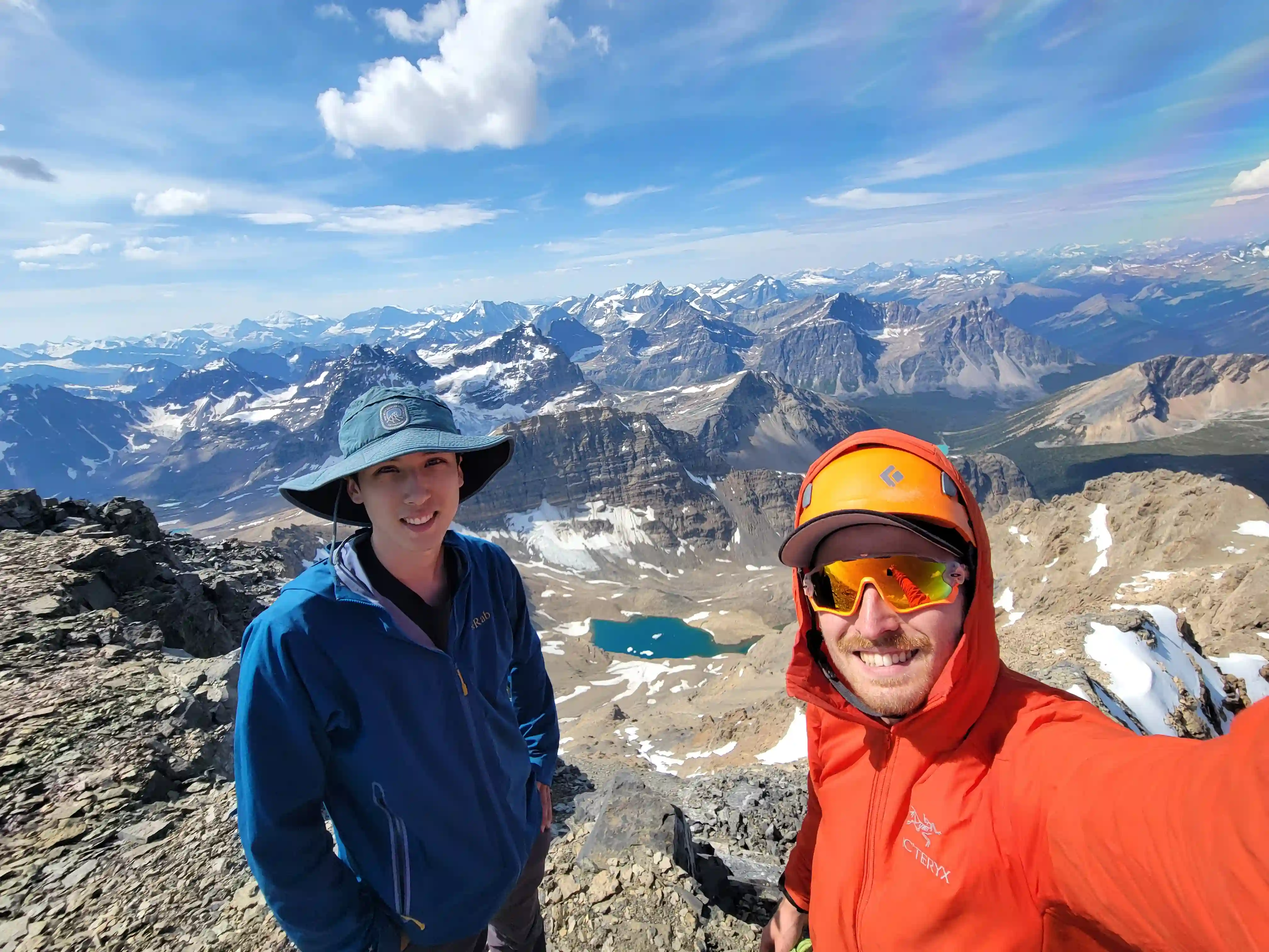
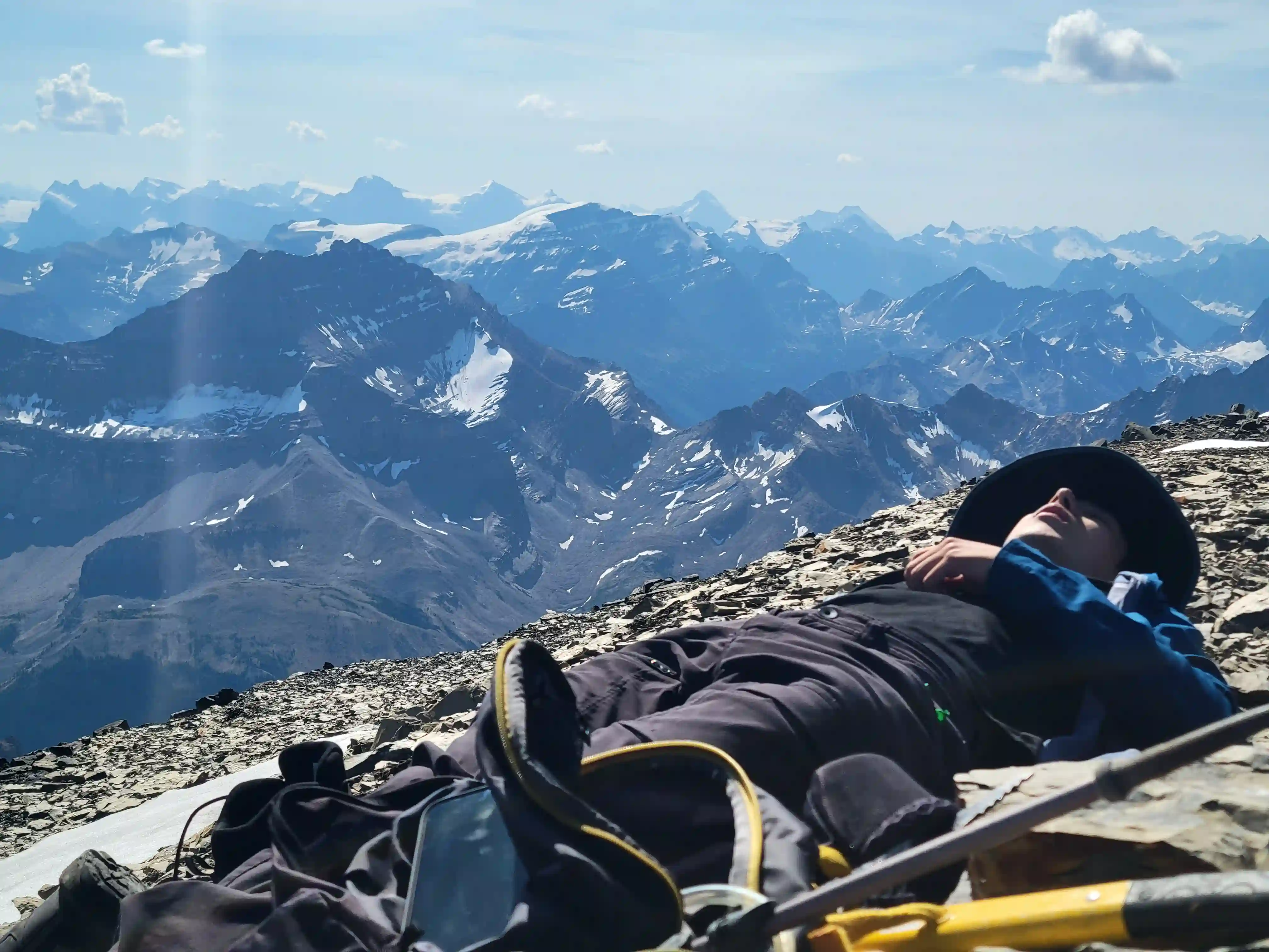
THE SUMMIT & DESCENT
a hard time finding it but it's in there!
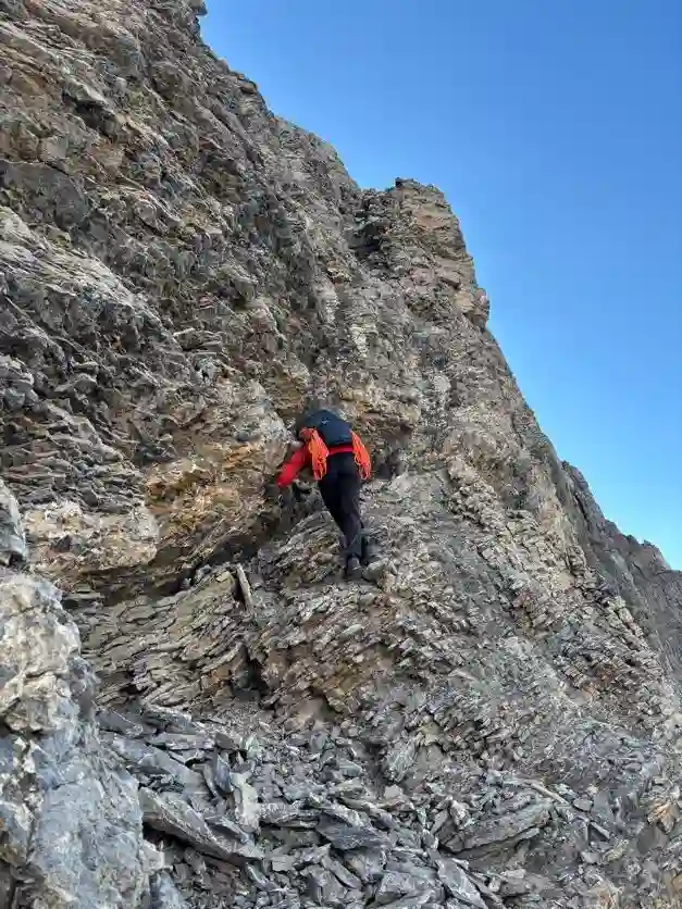
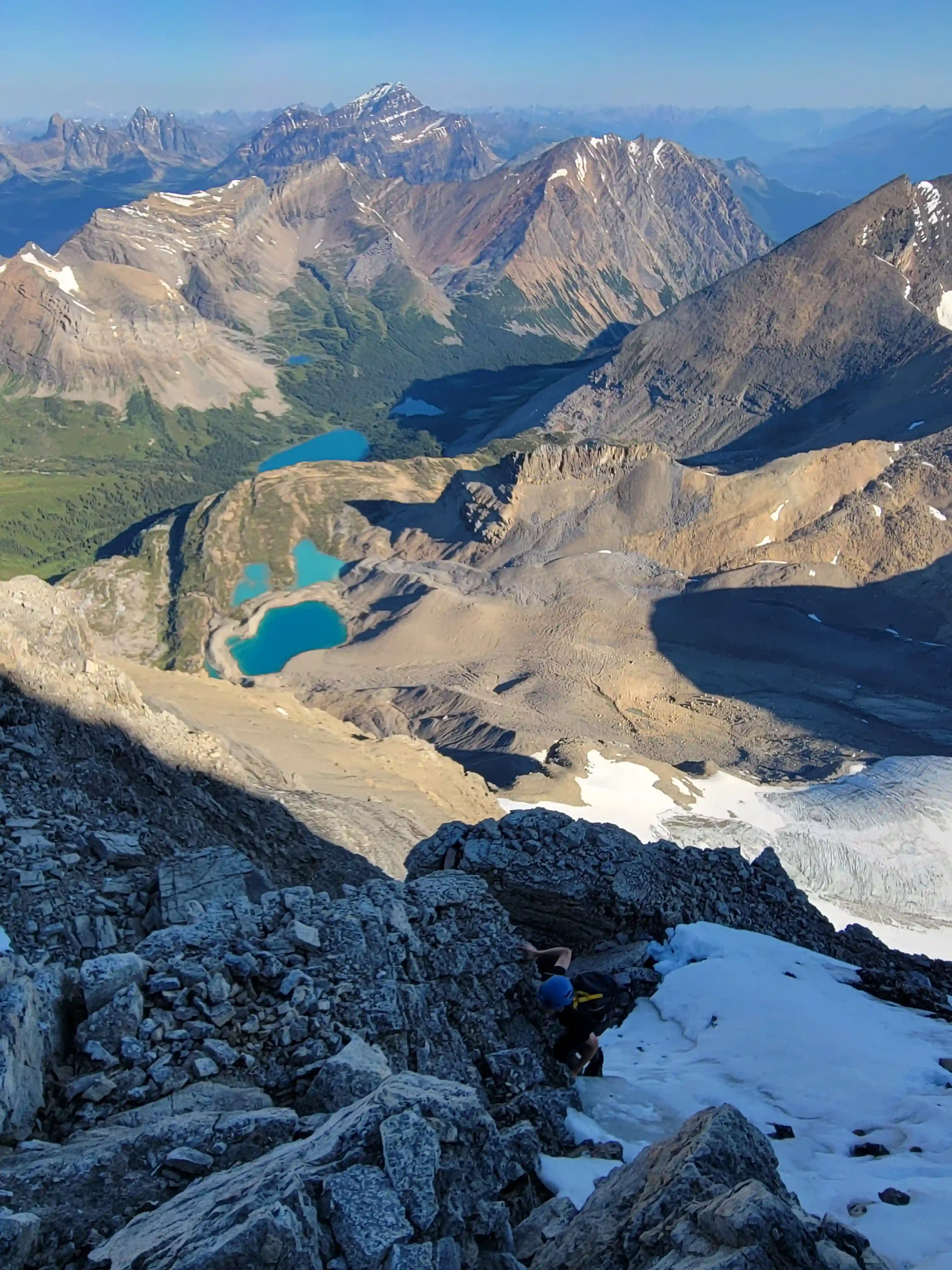
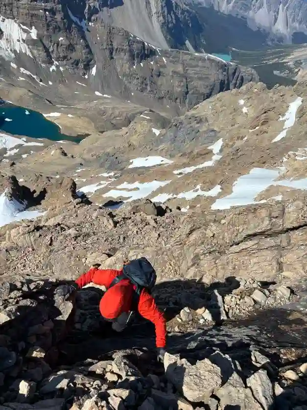
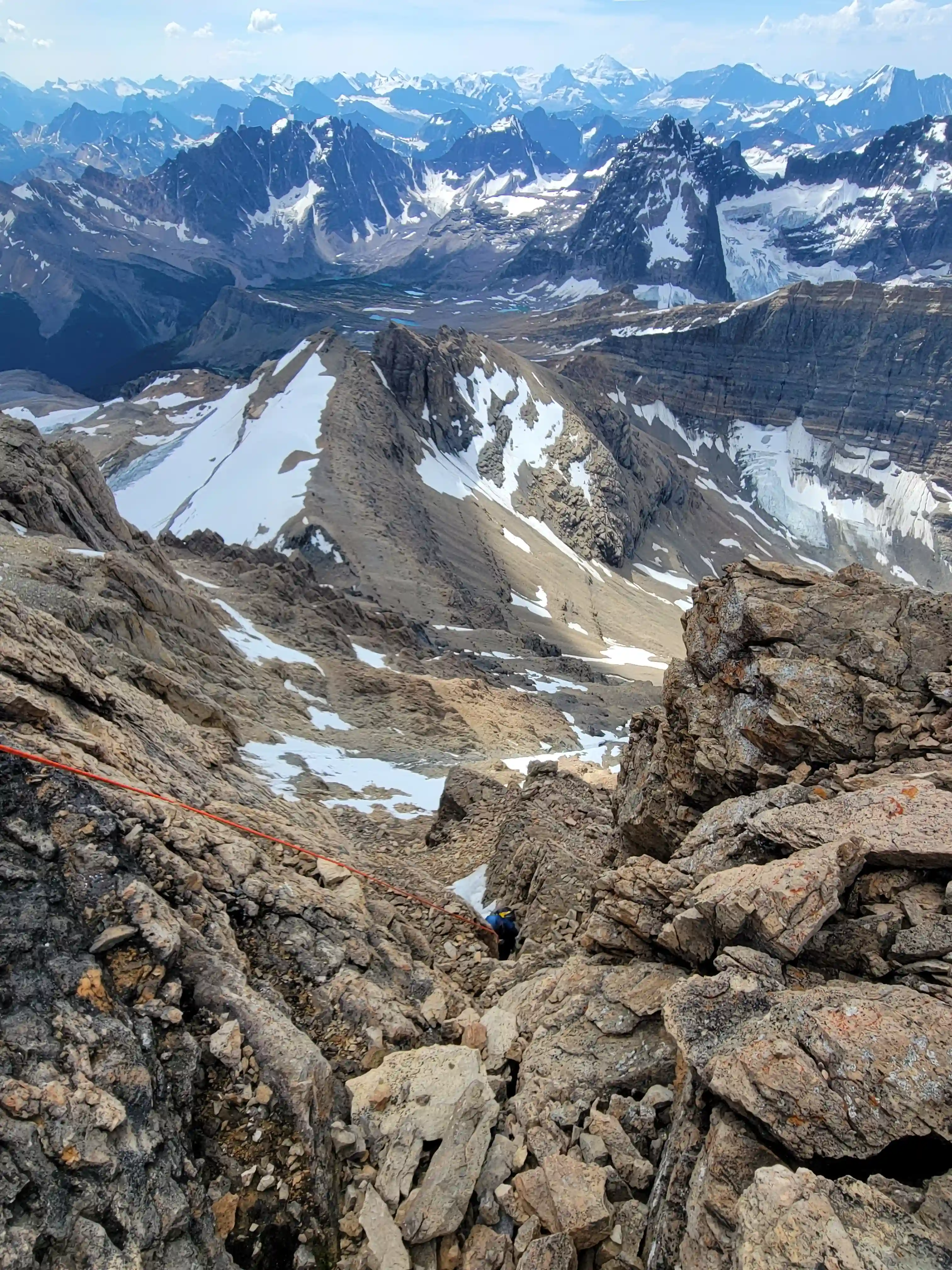
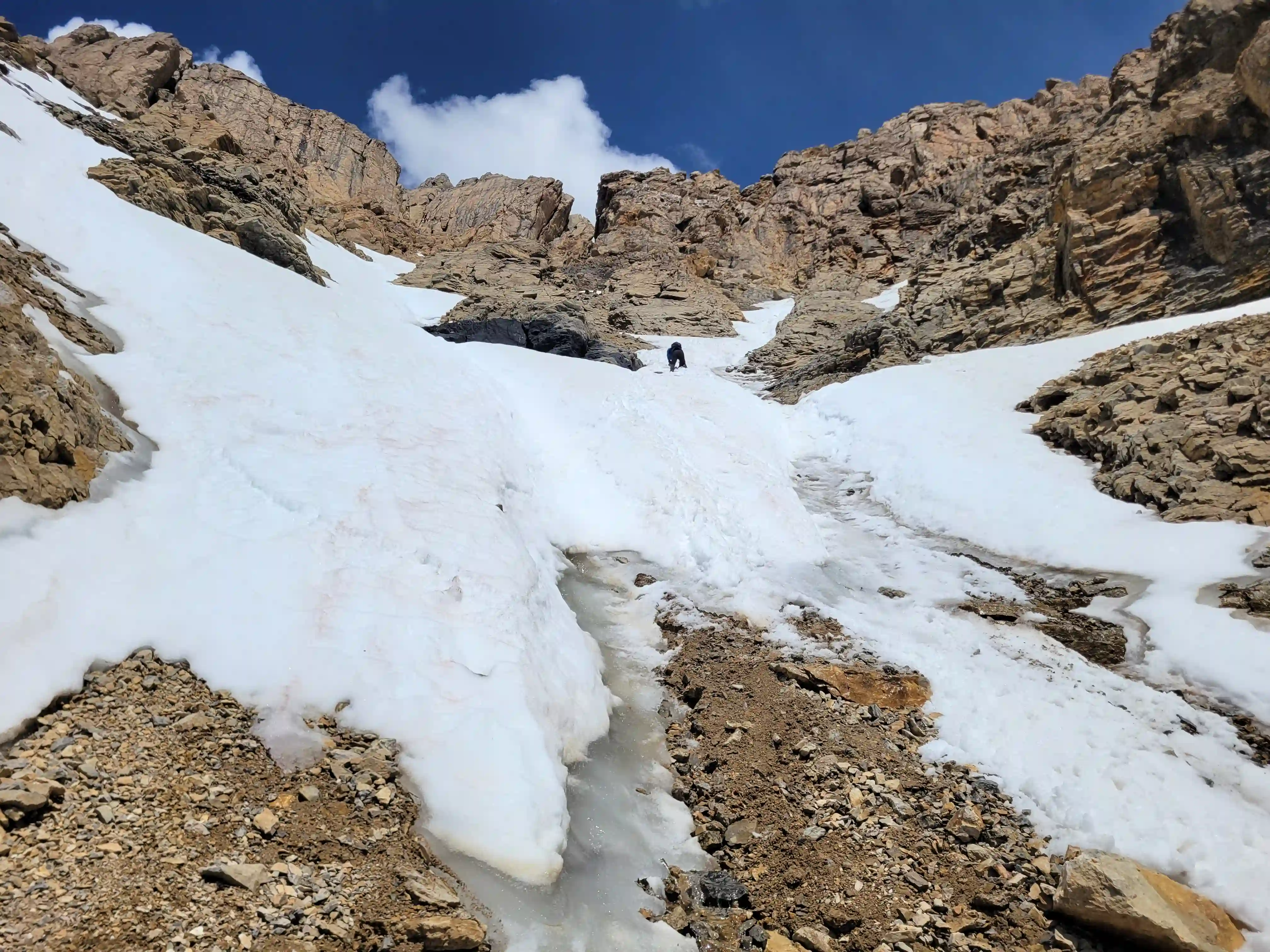
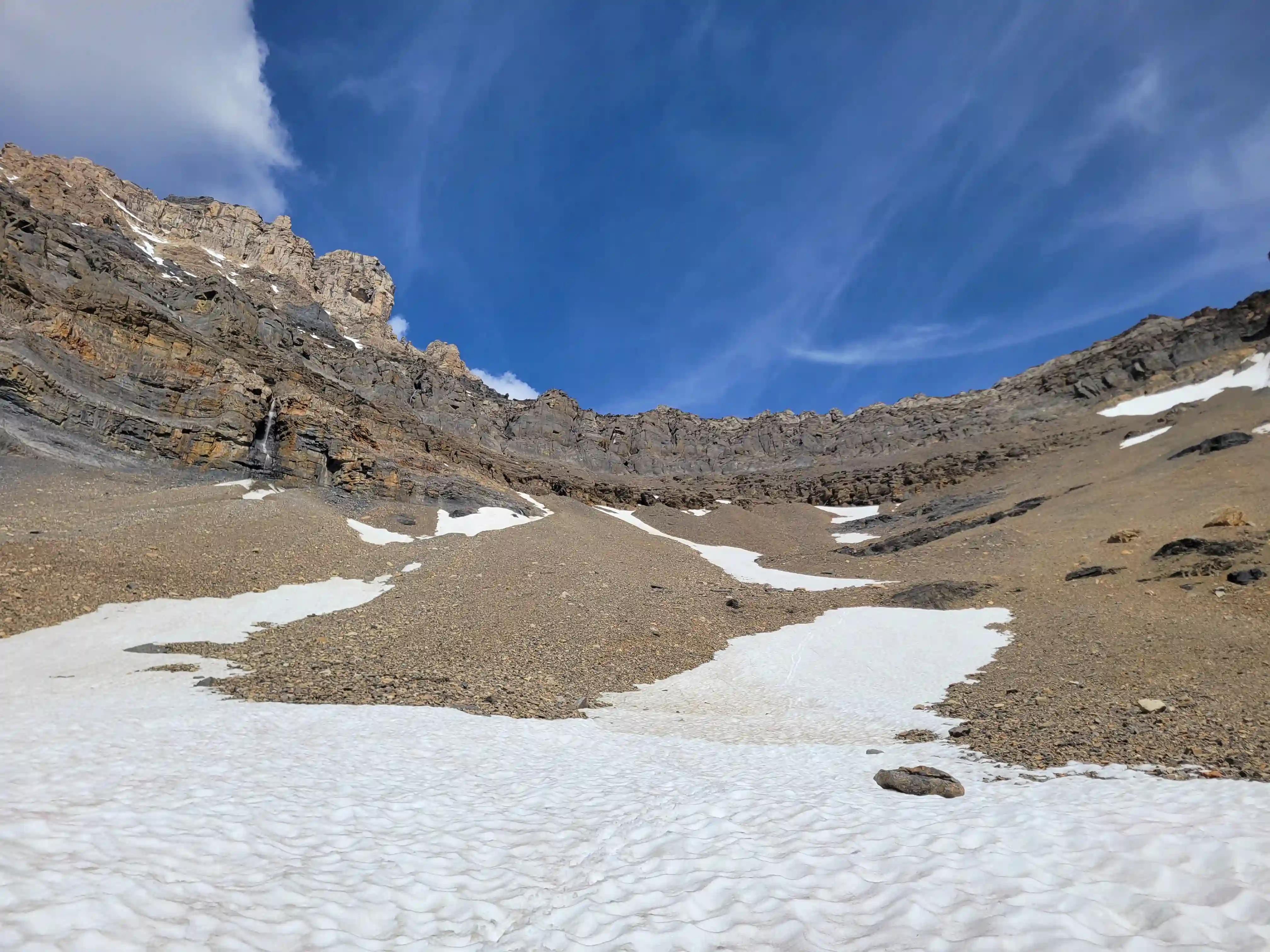
For our descent we probably could have located a downclimbable line had we looked for long enough but following the ridge back down once we located a solid anchor I thought it best that we just rap as it would minimize the risk given the unknown factor. 2 rappels later we were through what seemed to be the worst of the steep terrain and after 1 more challenging downclimb we reached the snow on route. Will didn't have much experience with snow climbing so it took him some getting used to but we made good time down this section and once we reached the bottom we just had some simply scrambling left before the routefinding portion of our descent to the bivy site.
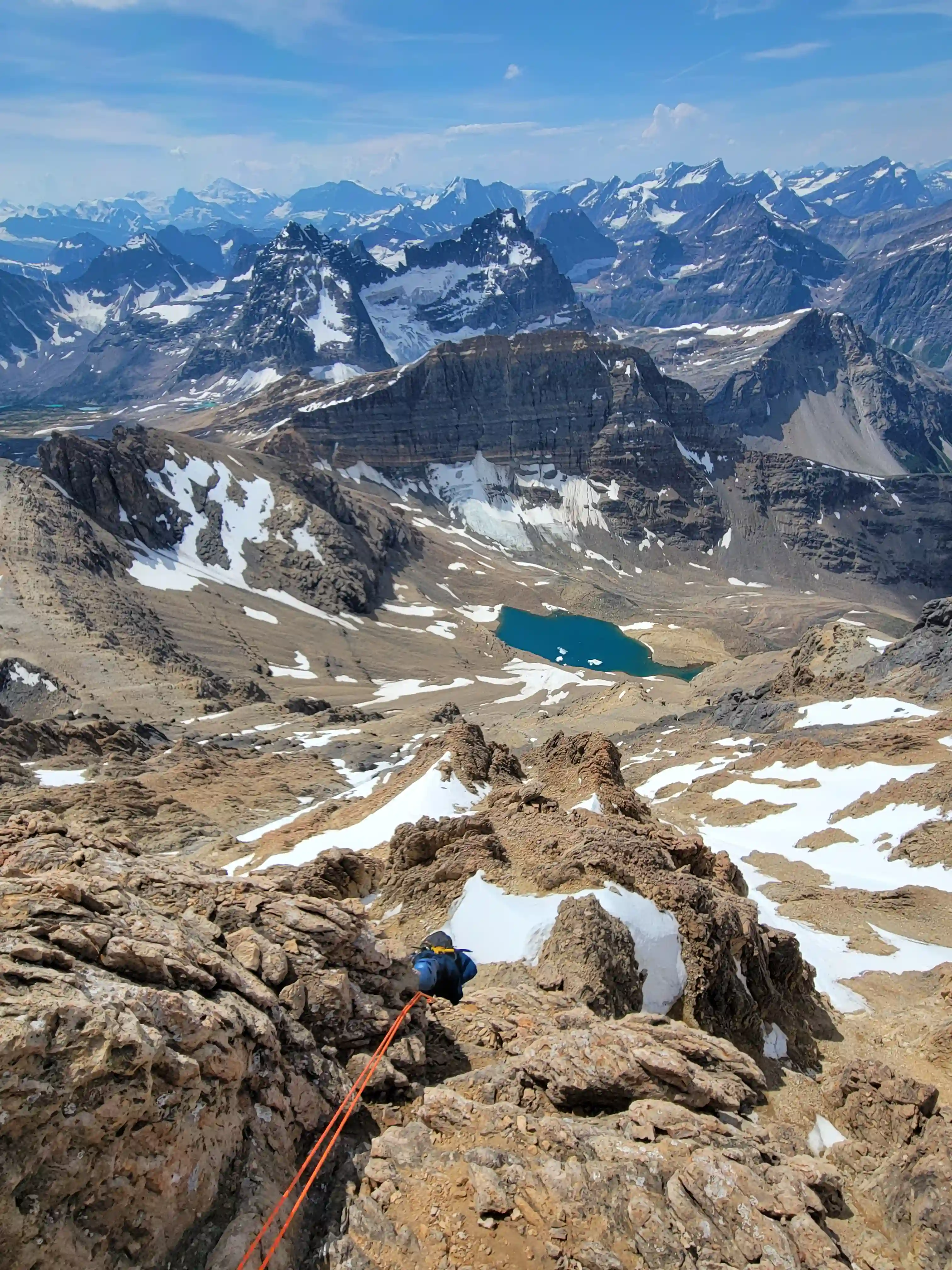

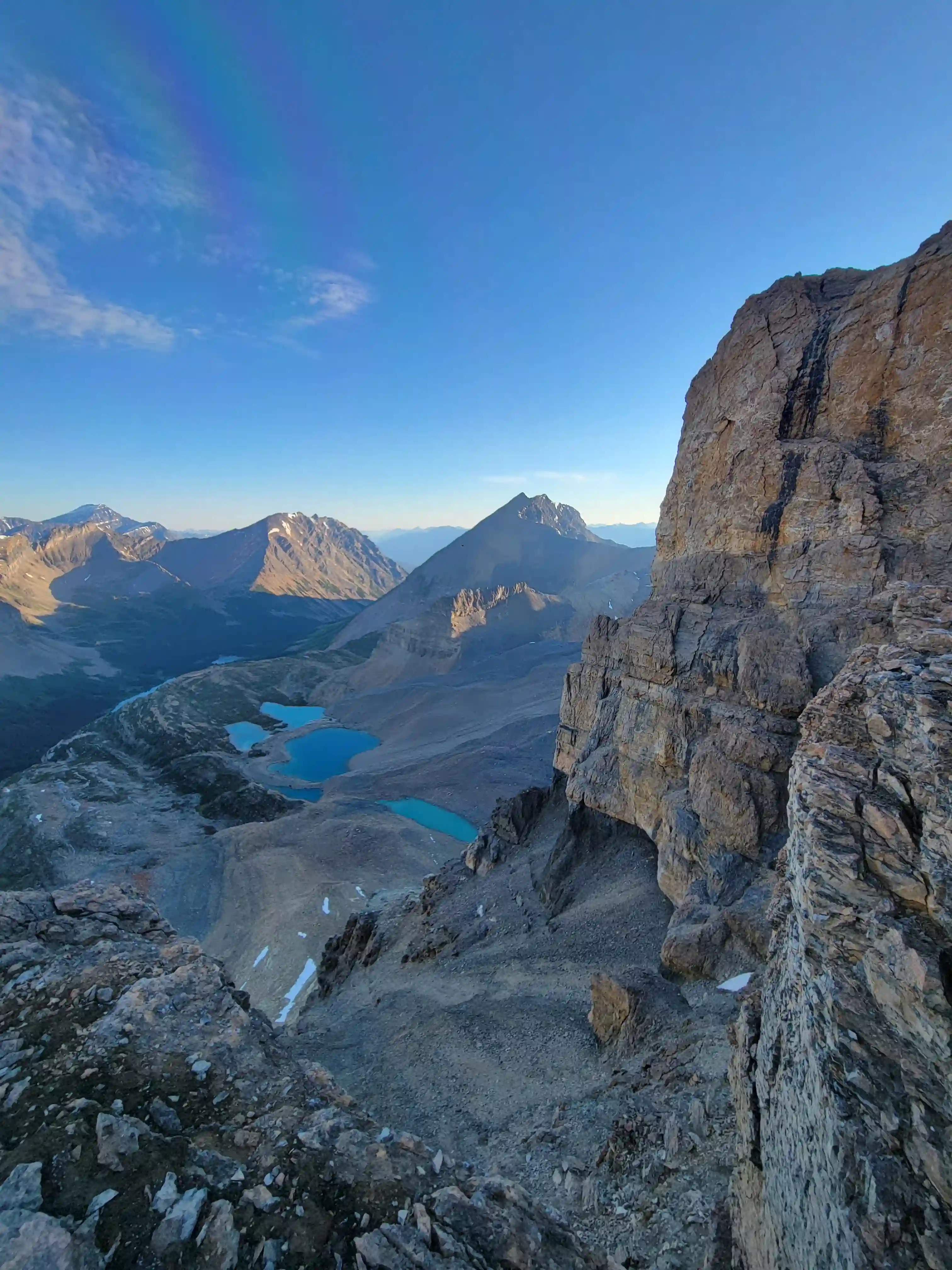
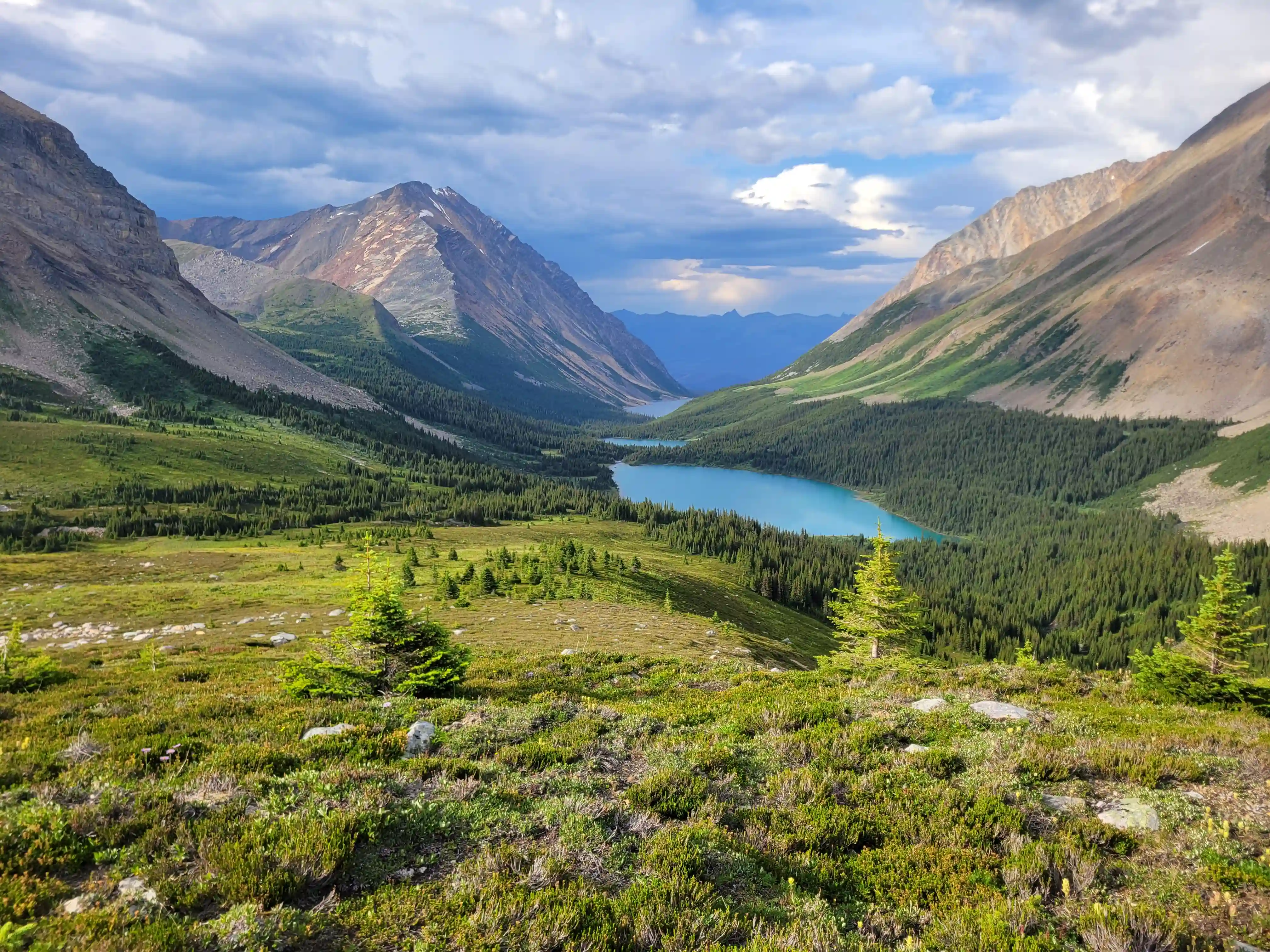
Once we were below the hands on terrain we could start traversing south towards the line we would take to reach the bivy site. It was tempting to start descending earlier down a gully that looked like it might go but given that we couldn't see the bottom I thought it best we stick to the GPX track we had and take the long way and this was probably for the best. The numerous channels on the SW face often funnel water and as a result end in slabby and cliffy terrain so it would not be fun to get dead ended to have to reascend one of those! After heading south for a while we finally reached some cairns which sent us down the slope at a SW angle and once we were through the band we had a bit of bootskiing and scree shenanigans to deal with before reaching the lakeside bivy site.
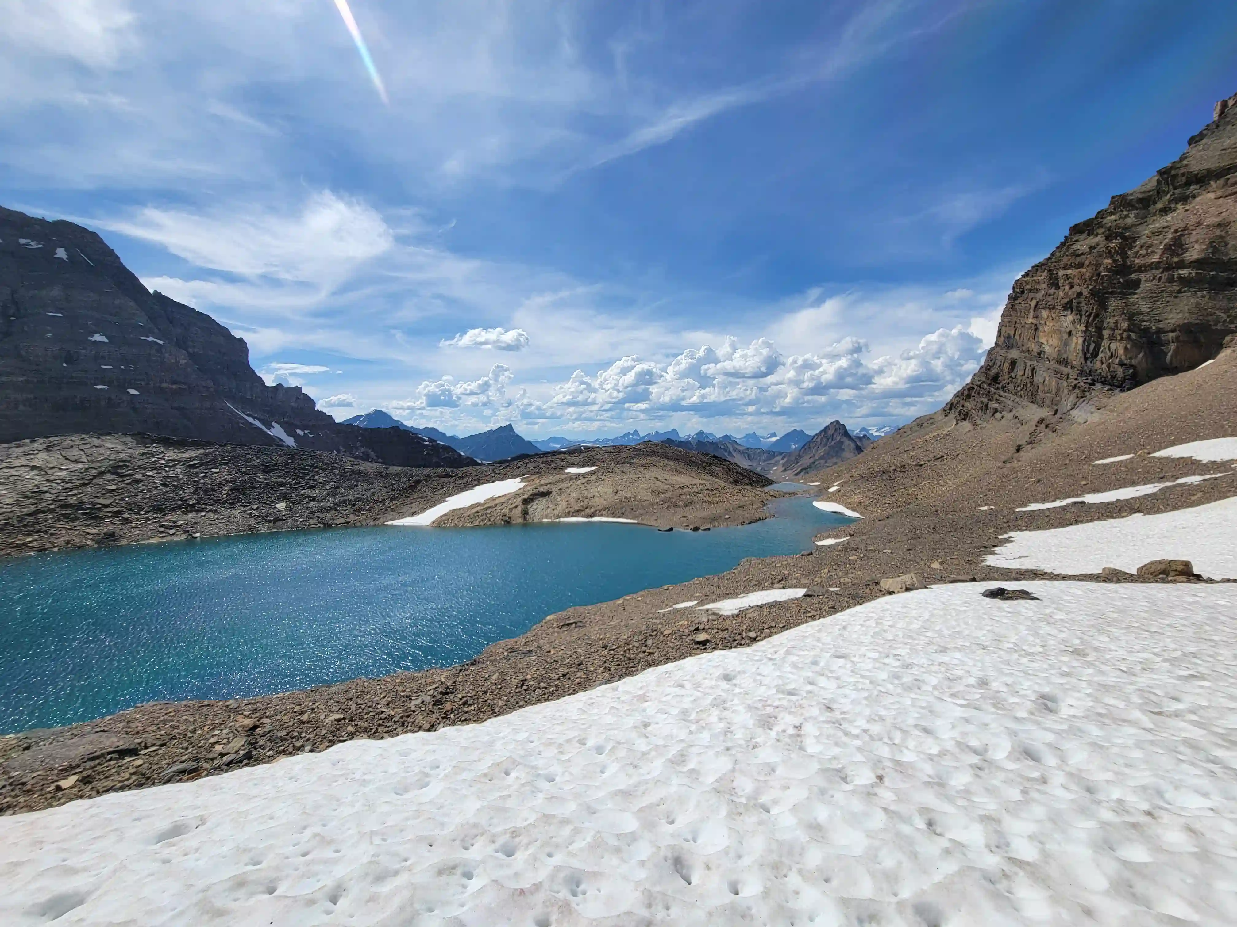
Flat ground was very welcome after all the descending but here we made our first key routefinding error of the day and attempted to cut some distance and head straight for the ridge merge point of our ascent on the east side of the lake. What we didn't know is that there's a long cliff running below and the GPX descended on the far south side for a reason so we felt pretty dumb when we had to backtrack a good kilometer to make up for this. Once we got through the final downclimb below the lake the hands on terrain was done for the day but there was a good amount of suffering yet to come.
The subsequent section was particularly frustrating with awkward sized scree traversing and sidehilling that lasted far too long and eventually transitioned to grass sidehilling which was at least a bit better but still a grind to get through. After all that we finally returned to our ditched gear and just had the entire trailed exit left to deal with... it was around 6:30pm by this point so we were 18 hours in and definitely feeling it at this point but after a short break and an emptying of the shoes we made haste as we didn't want to get benighted.
an angle at the far side near the snow
slope at right to get back to our ditched gear
THE EXIT
Our trip came to an end by 10:30pm so we didn't quite beat nightfall but we didn't have to do any boulder hopping in the dark on the way out which was the main goal. The exit was much tougher than the approach for us as they usually are but passing the 20 hour mark and the awkward boulder hopping sections definitely took a sizable toll on our pace. Regardless we got it done in a single push!
After the close proximity of this trip and the trip up
Whitehorn
I needed a good break from the mountains and car camping but a bit over a week later when a window appeared and the snow melt levels looked good it was time to gear up for the alpine again for one of the
most iconic peaks in the Canadian Rockies!
Follow the full progression
I'm working through all 58 11000ers of the Canadian Rockies and beyond. You'll get notified when the latest climbs go live.
Other related trip reports:
Mount Alberta |
Deltaform Mountain |
Mount Assiniboine & Lunette ||
Whitehorn Mountain
11000ers of the Canadian Rockies
© Haldan Borglum | Peak by Peak. All rights reserved.