Mount King George
3422m, 11227ft
June 20-21 2024
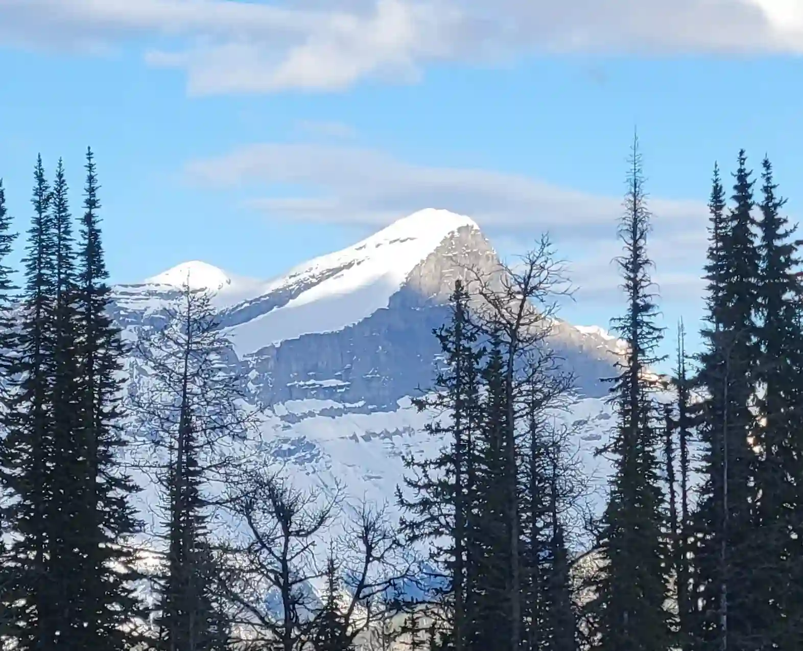
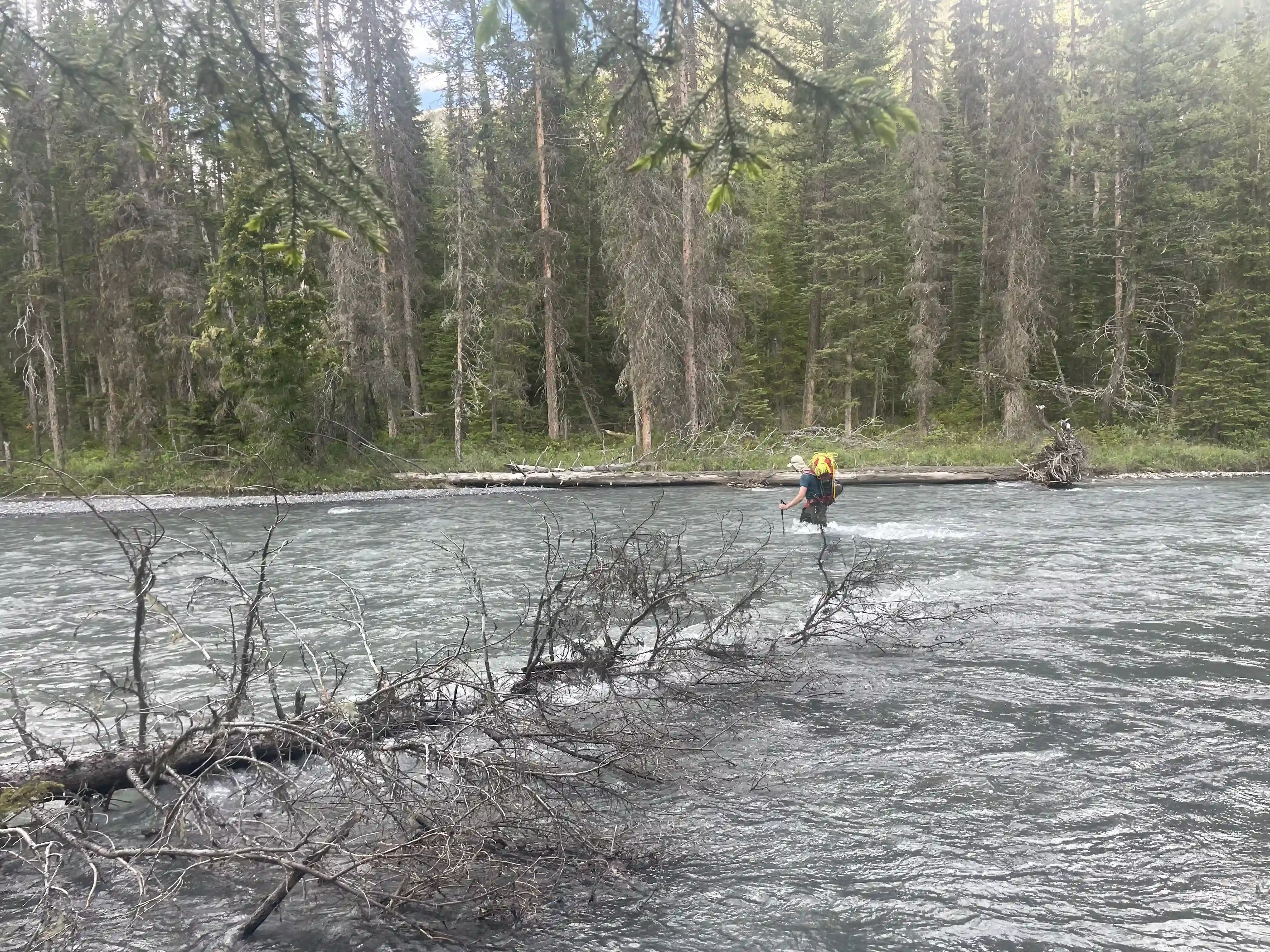
Positioned at the southern end of the Canadian Rockies and just a couple dozen kilometers west of the Kananaskis Lakes is Mount King George. Despite its relatively close proximity to some of the most frequented areas in Kananaskis, King George sees quite little attention even compared to it's close neighbor Mount Joffre due to it's more remote and rugged nature. Getting up King George can vary in difficulty greatly depending on the time of year and conditions it's tackled in and crossing the Palliser River at the start of a trip for this peak can prove to be one of the cruxes of the entire outing. A 55km drive out Settlers Road and the Kootenay Palliser Forest Service Road is necessary to reach the standard start point giving this peak the true wilderness feeling.

After my first more serious 11000er trip up
Mount Forbes
a couple weeks prior Brent DeWolff and I had been in touch and when he expressed interest in going for Mount King George and had another friend that was also interested I was on board! Brent had taken an all encompassing mountaineering course the week before and met
Jøsiane Bēgin, another avid mountaineer keen on checking off 11000ers so with that we had our crew!
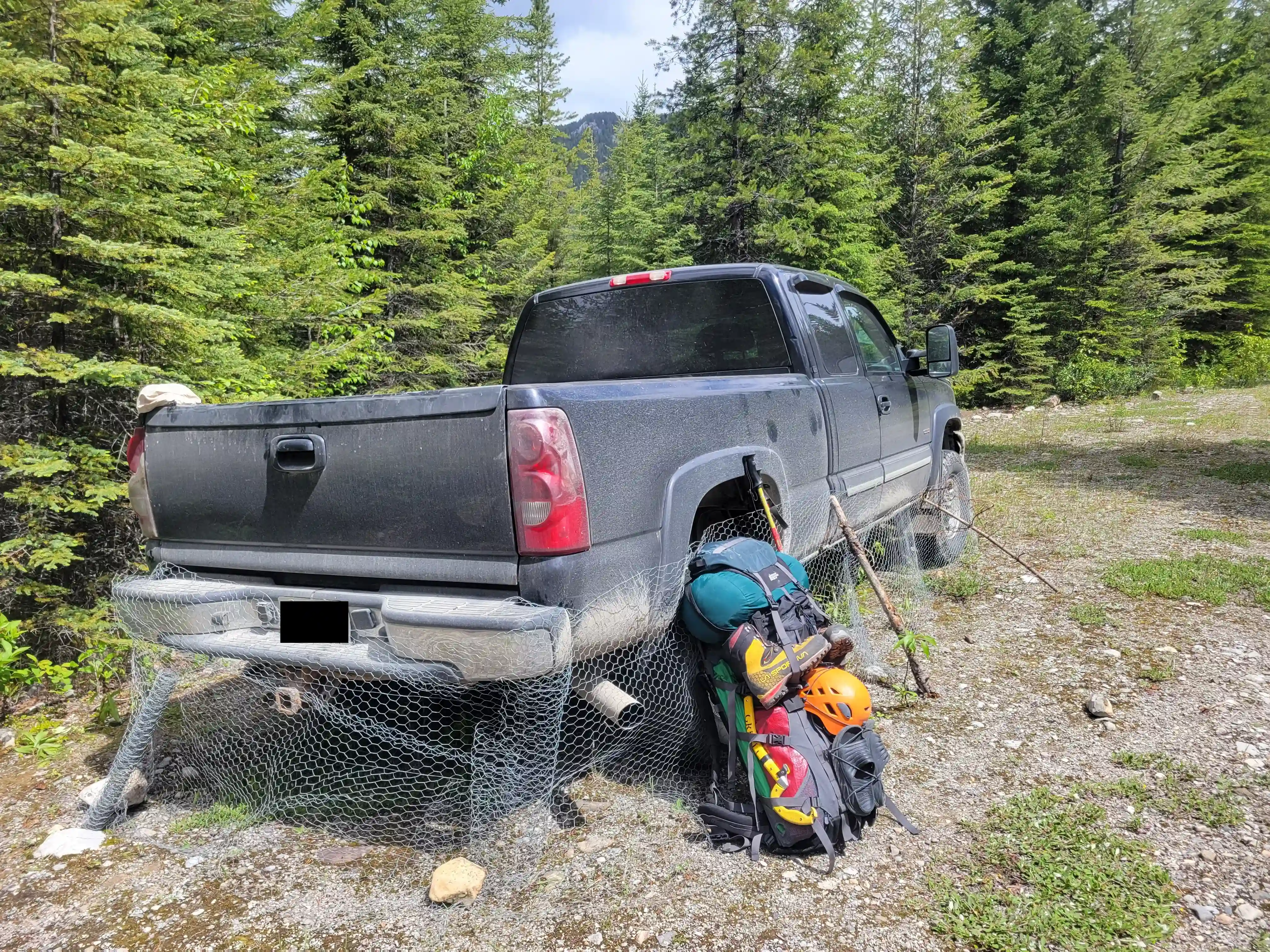
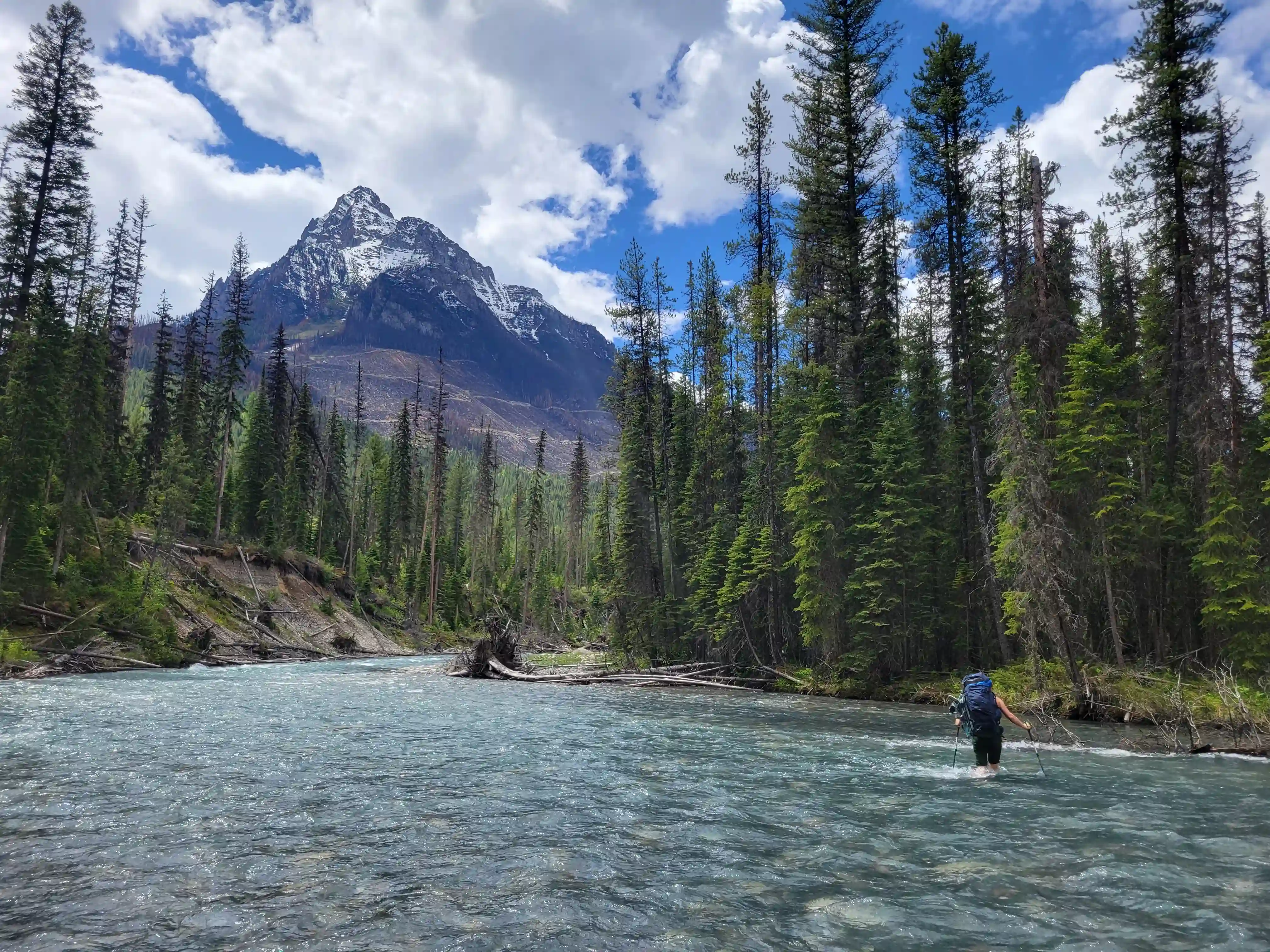
We met at the start point of Settlers Road off highway 93S and Jøsiane and I ditched our cars soon after since Brent had a truck and there was no need to drive multiple vehicles out the Kootenay Palliser FSR. The road was in quite good condition and after arriving, getting our gear packed, and porcupine proofing the vehicle we set off following a GPX track. The Palliser River crossing was early on which seems to be the standard with the 11000ers and after wading across slightly above knee deep water we were onto the approach.
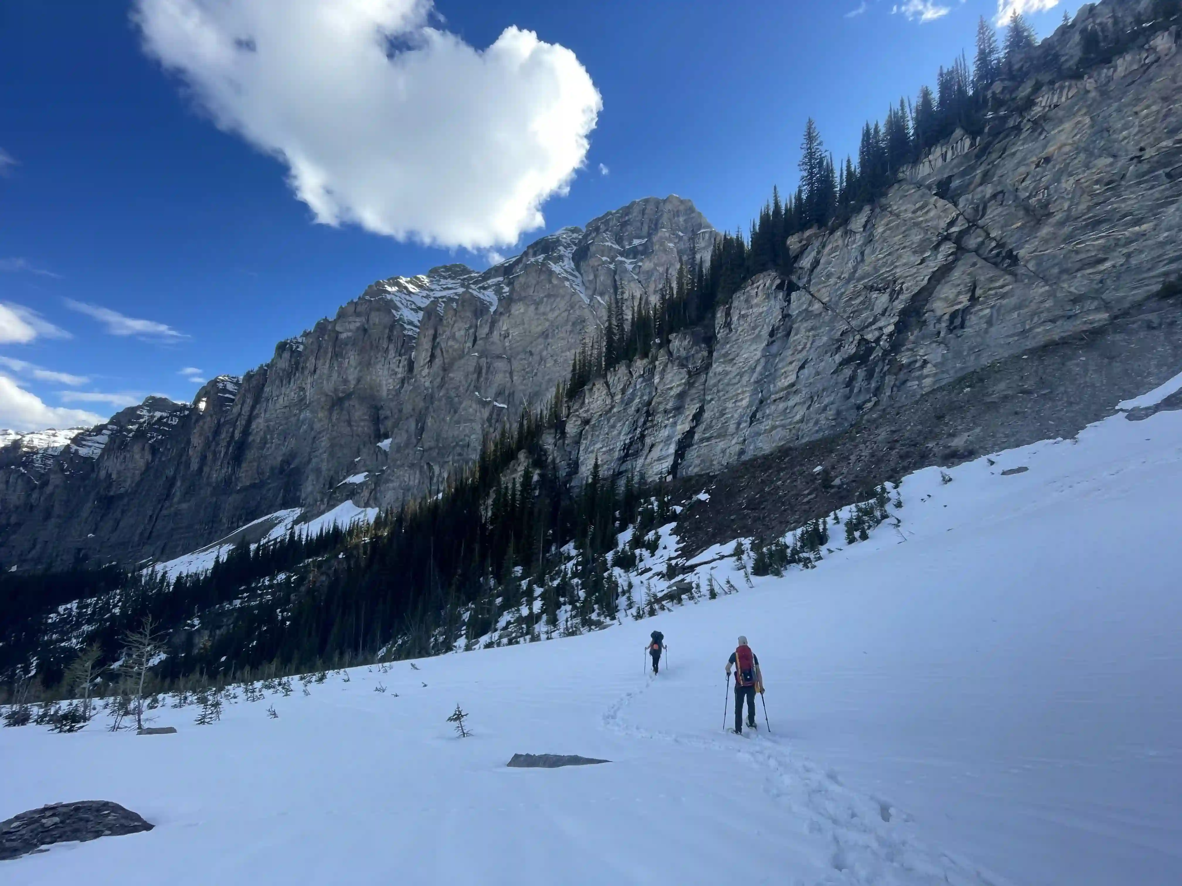
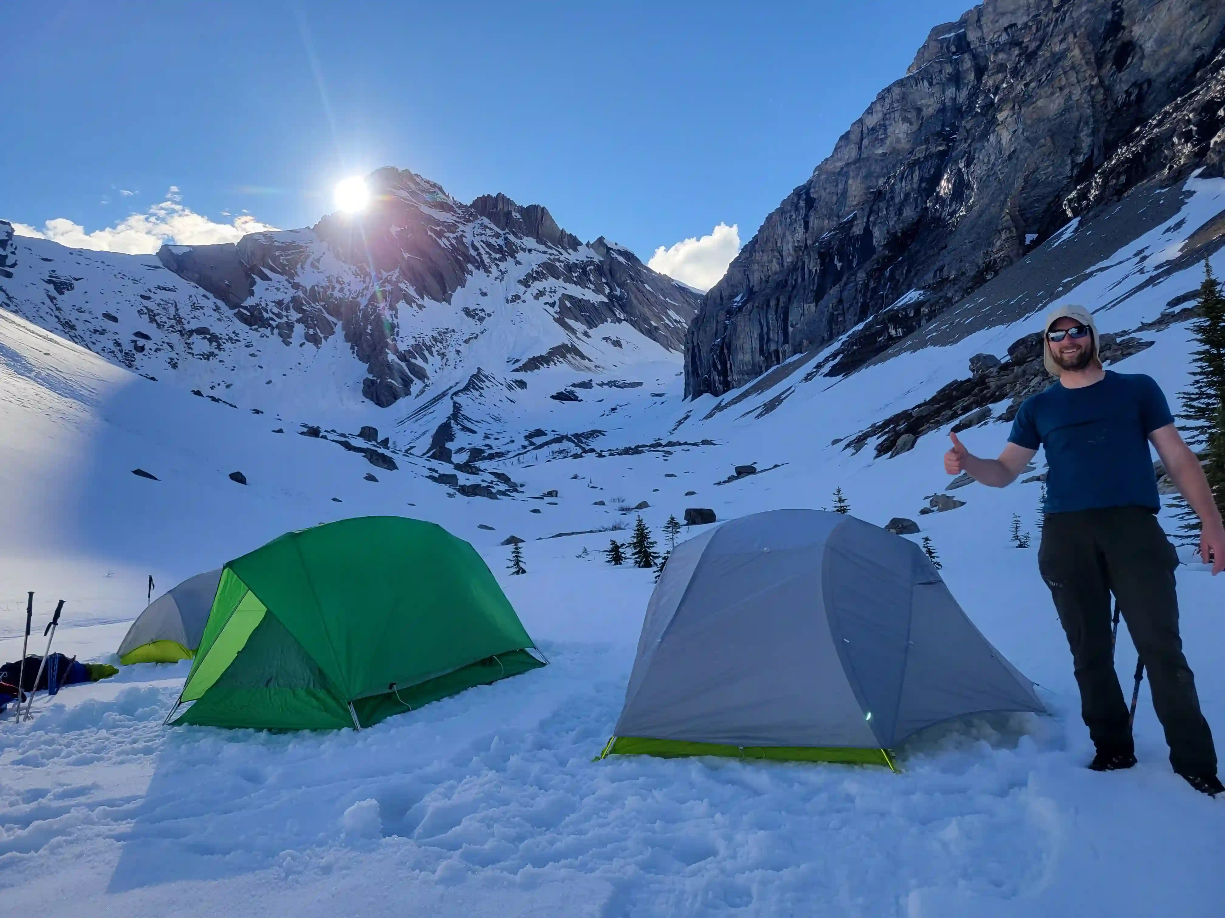
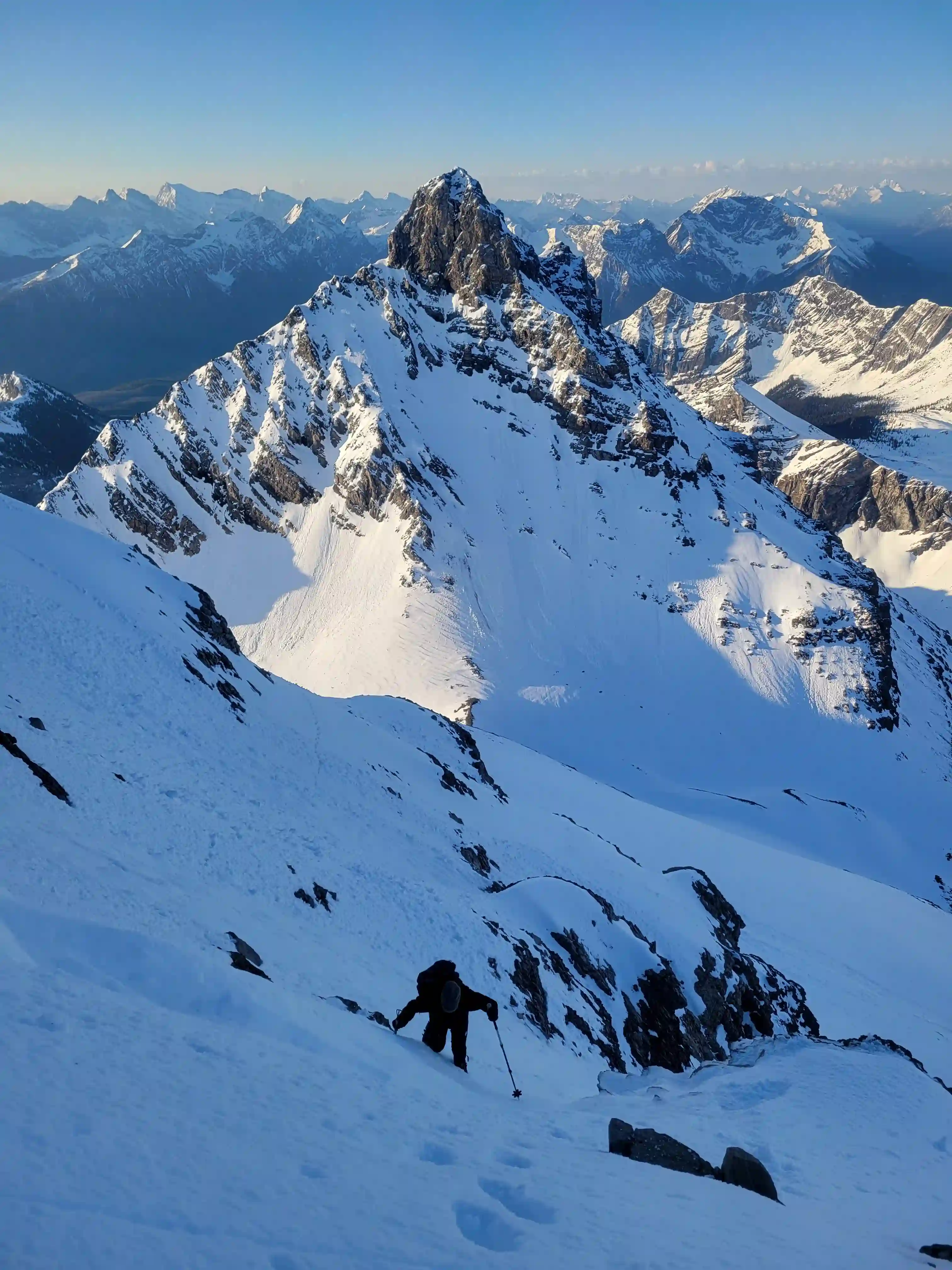
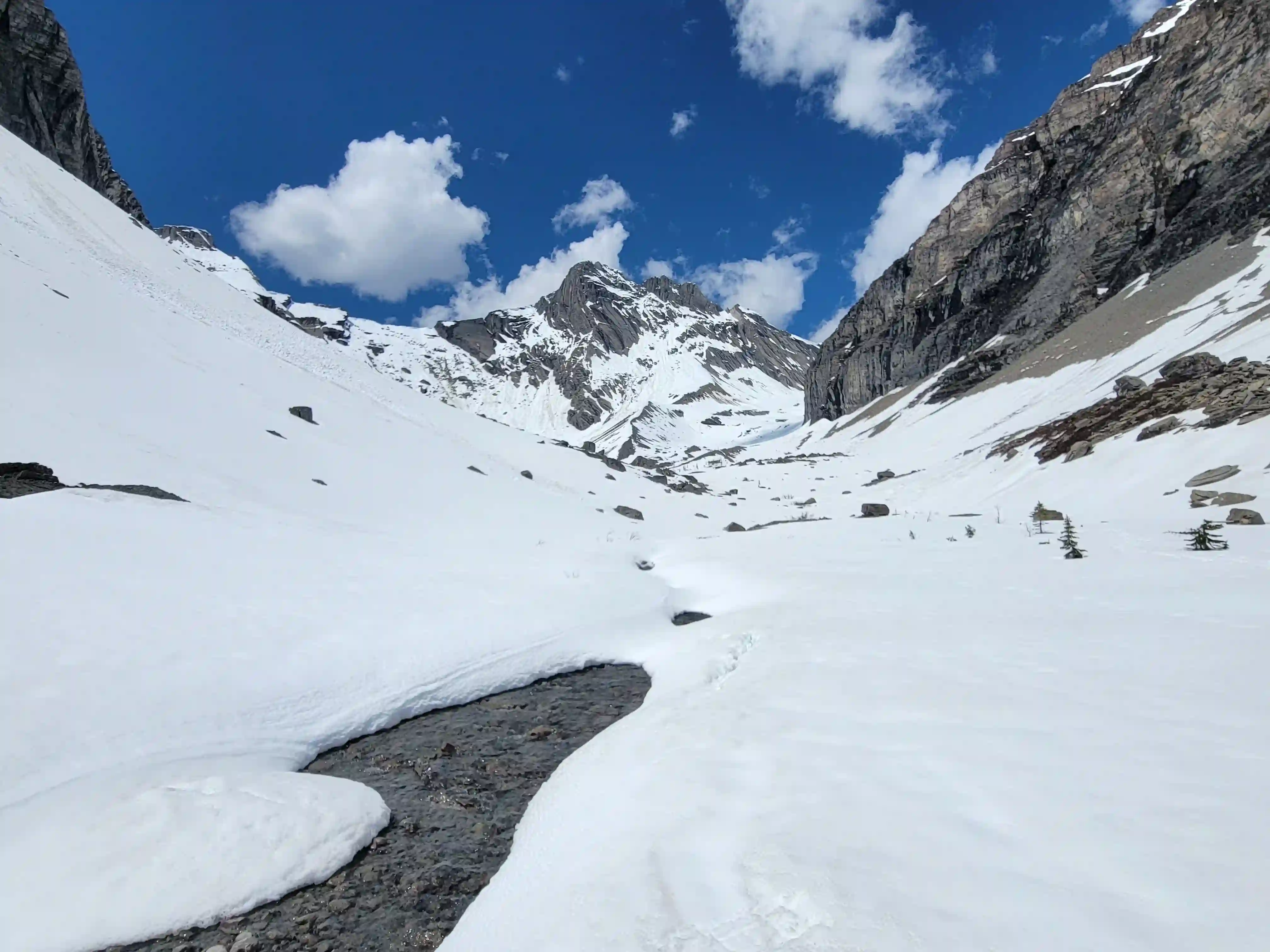
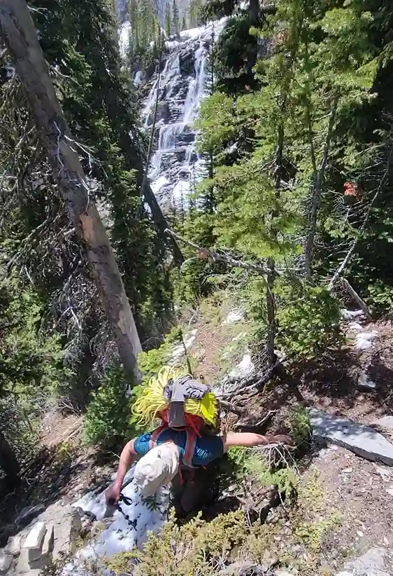
Thanks to some upkeep from Foresty Forest and other kind folks the trail was quite pleasant most of the way aside from one grown in section and reaching the alpine meadows was about as straightforward as it gets. This is where snow was still sticking around and where things got a bit tedious for me. Brent and Jo brought snowshoes but I didn't feel like renting a pair again after Forbes especially considering we'd be using crampons on the upper mountain so I went for it in my approach shoes and while the postholing wasn't terrible, it also wasn't great. Following this section we reached the headwall which was a bit tedious to get up since we had a hard time finding the route but after gaining the necessary elevation we had reached our camp spot just above it.
links:
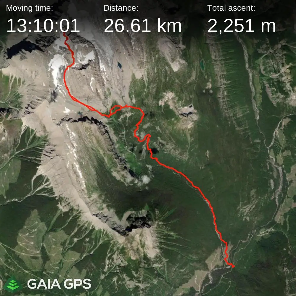
STRAVA
|
GAIA
elapsed time:
DIFFICULTY: AD-/AD, glacier travel, multiday, steep snow / ice climbing / 5th class
Use the following links to jump to:
Follow the journey
I'll send you an email when a new trip report drops.
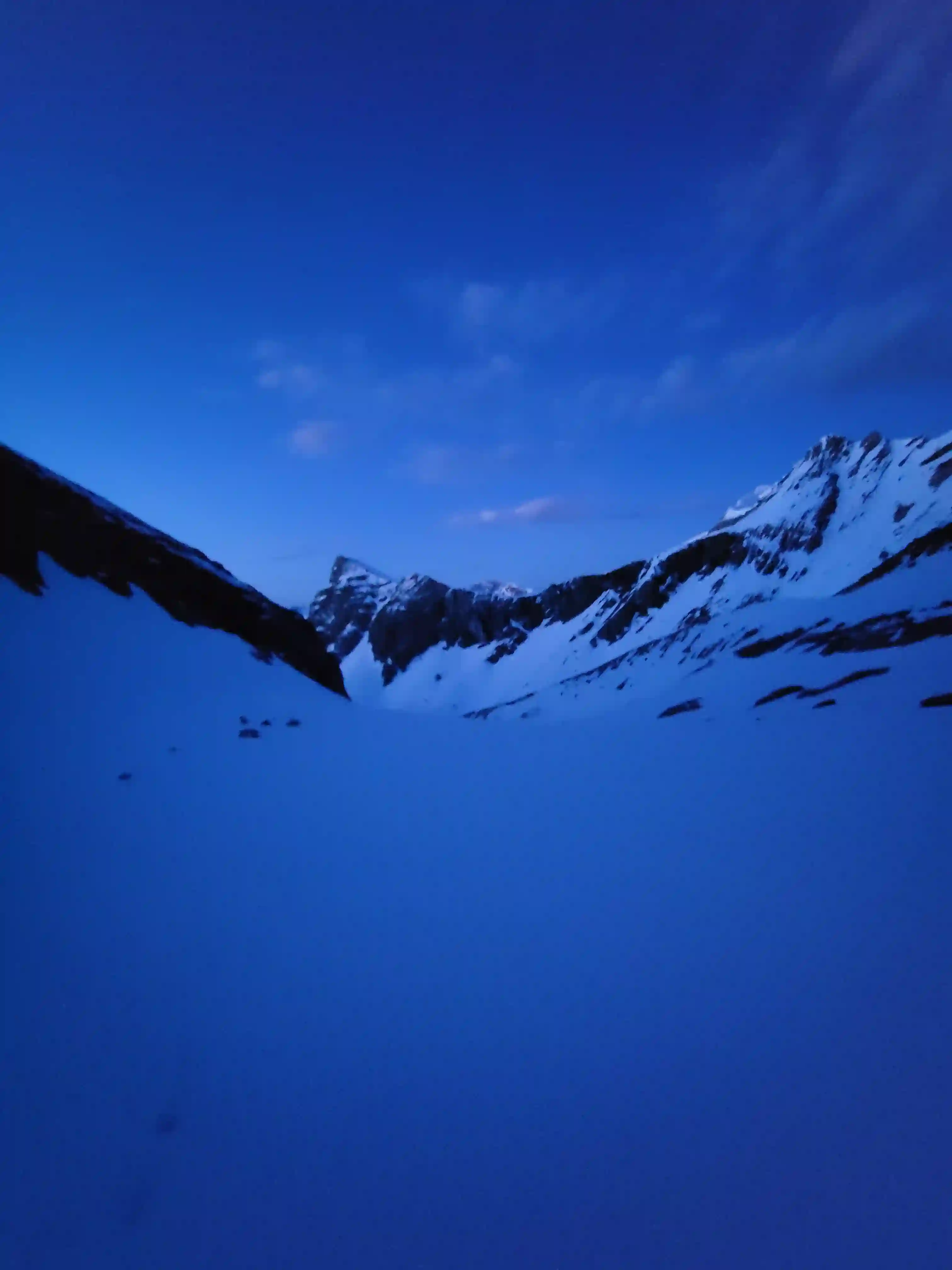
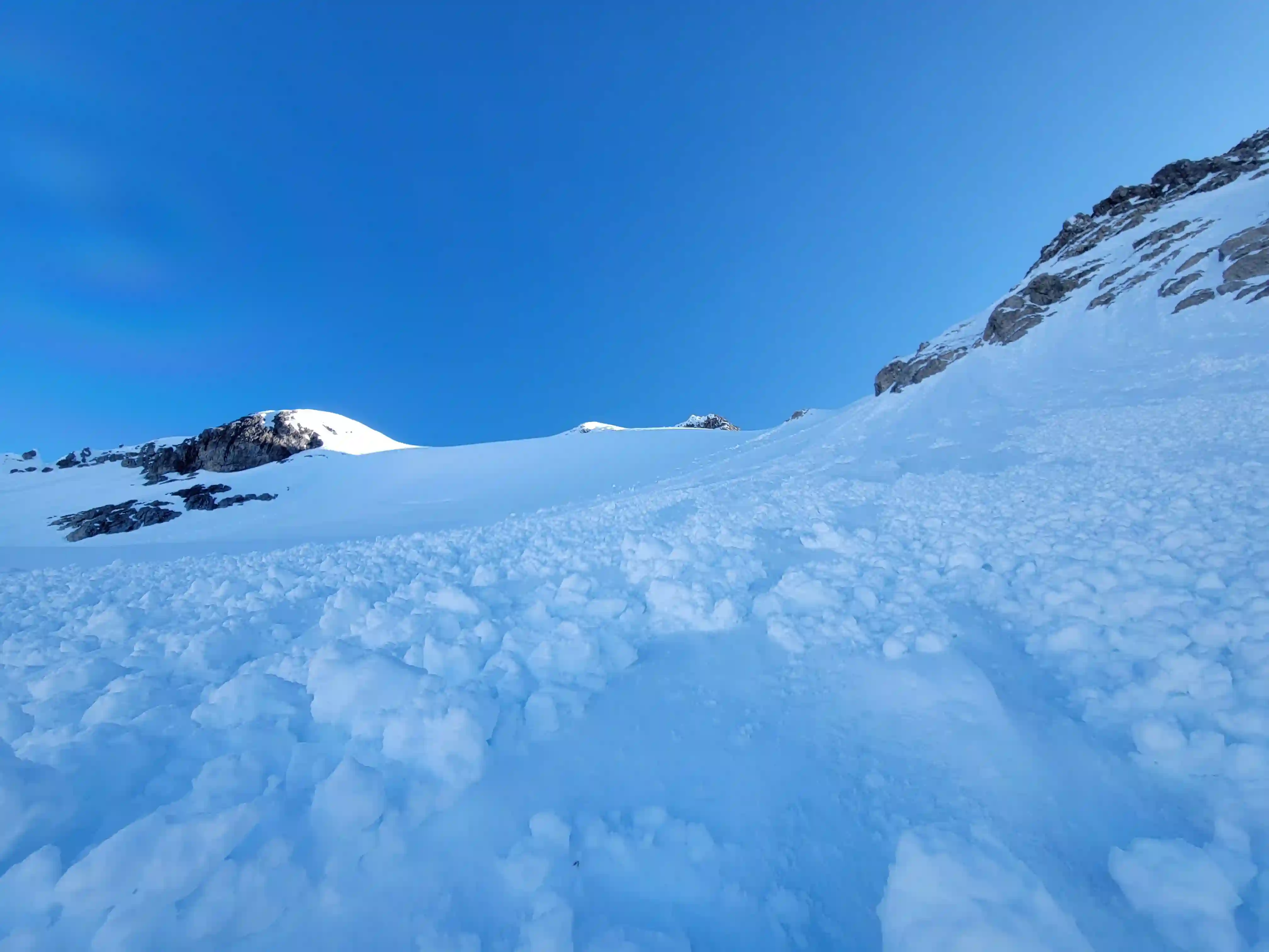
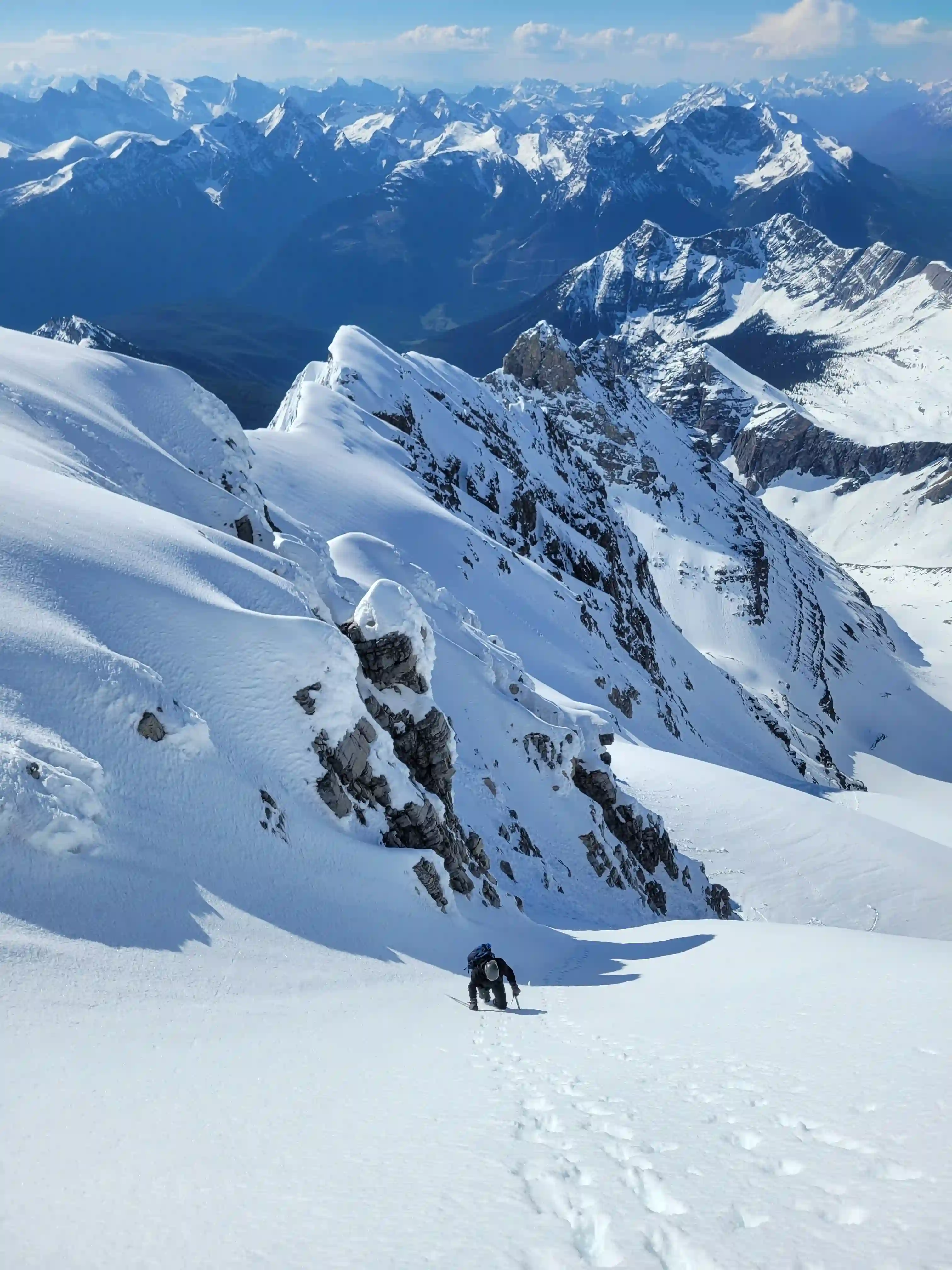
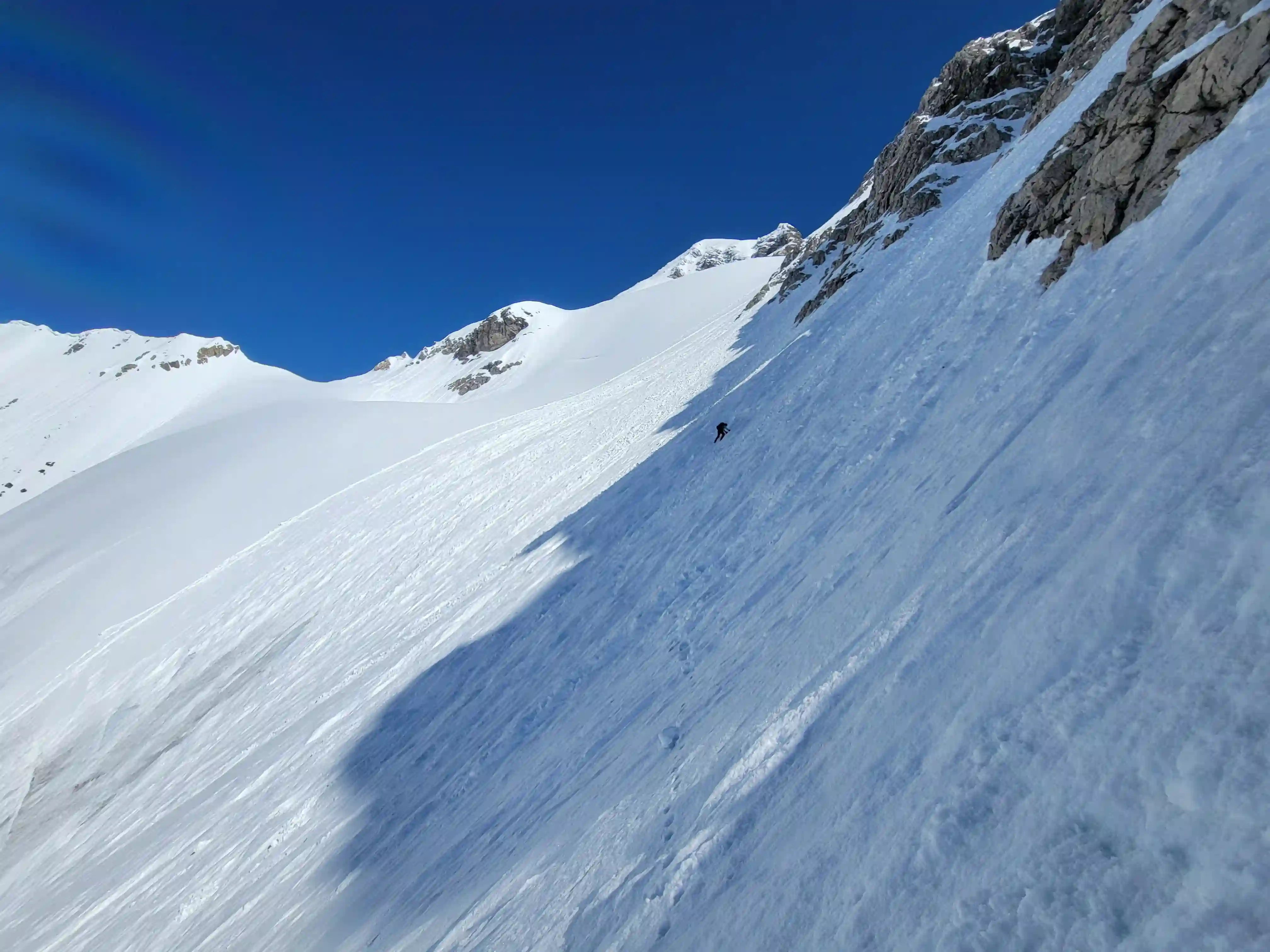
THE APPROACH
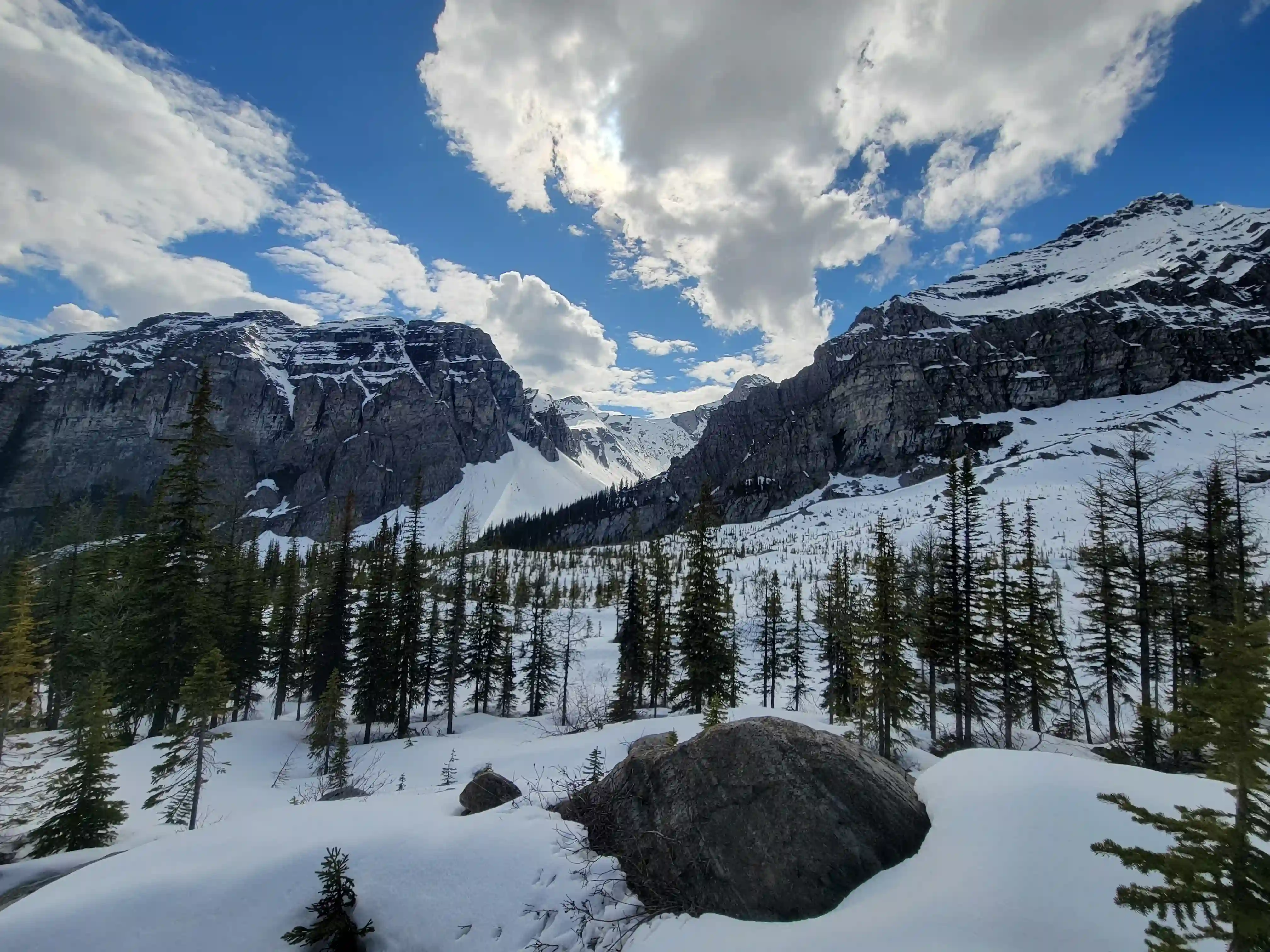
to the camp spot
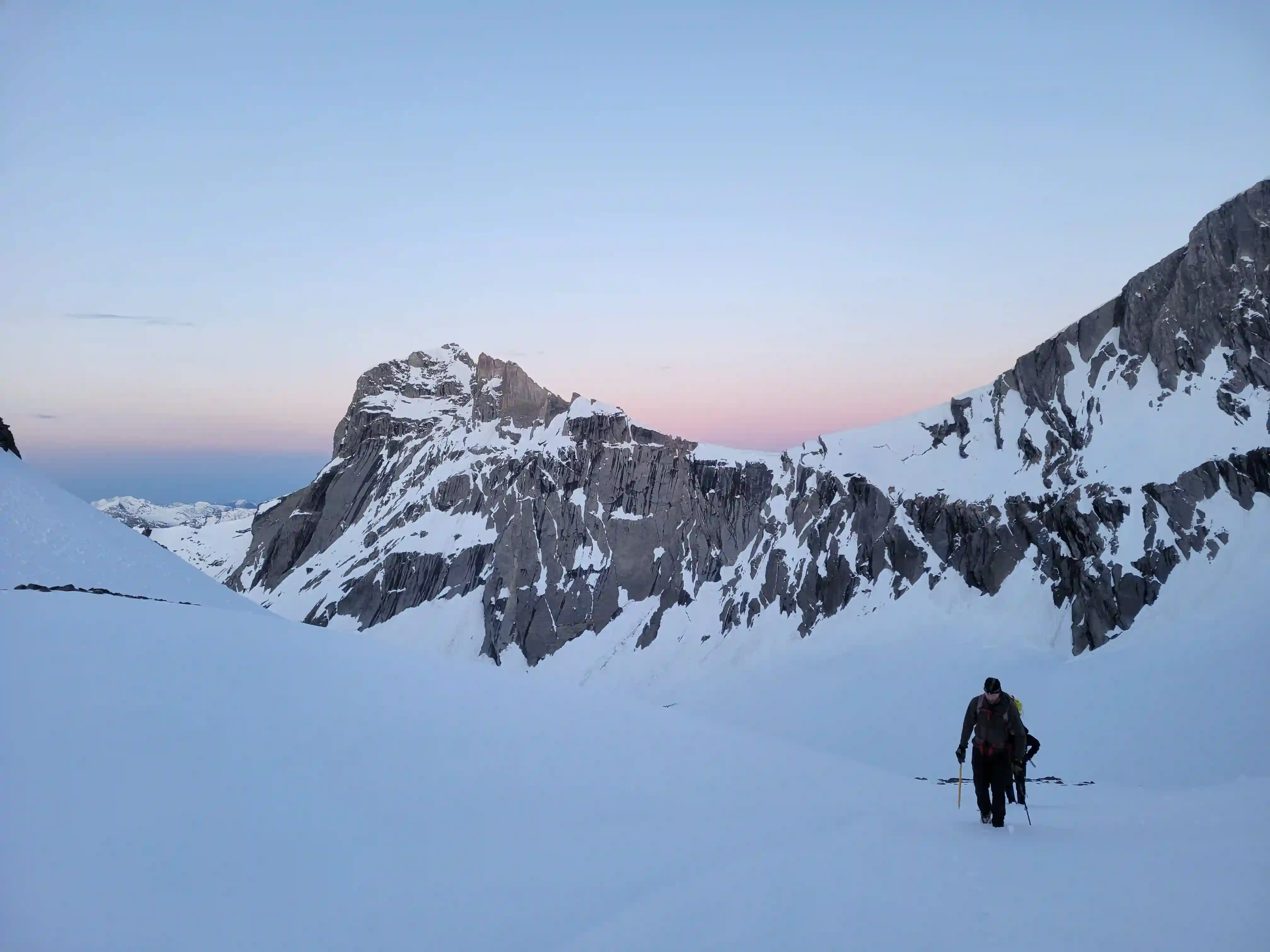
THE CLIMB
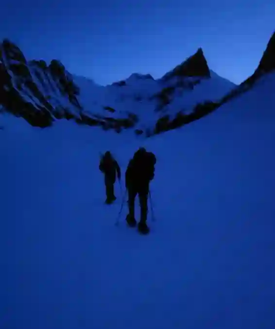
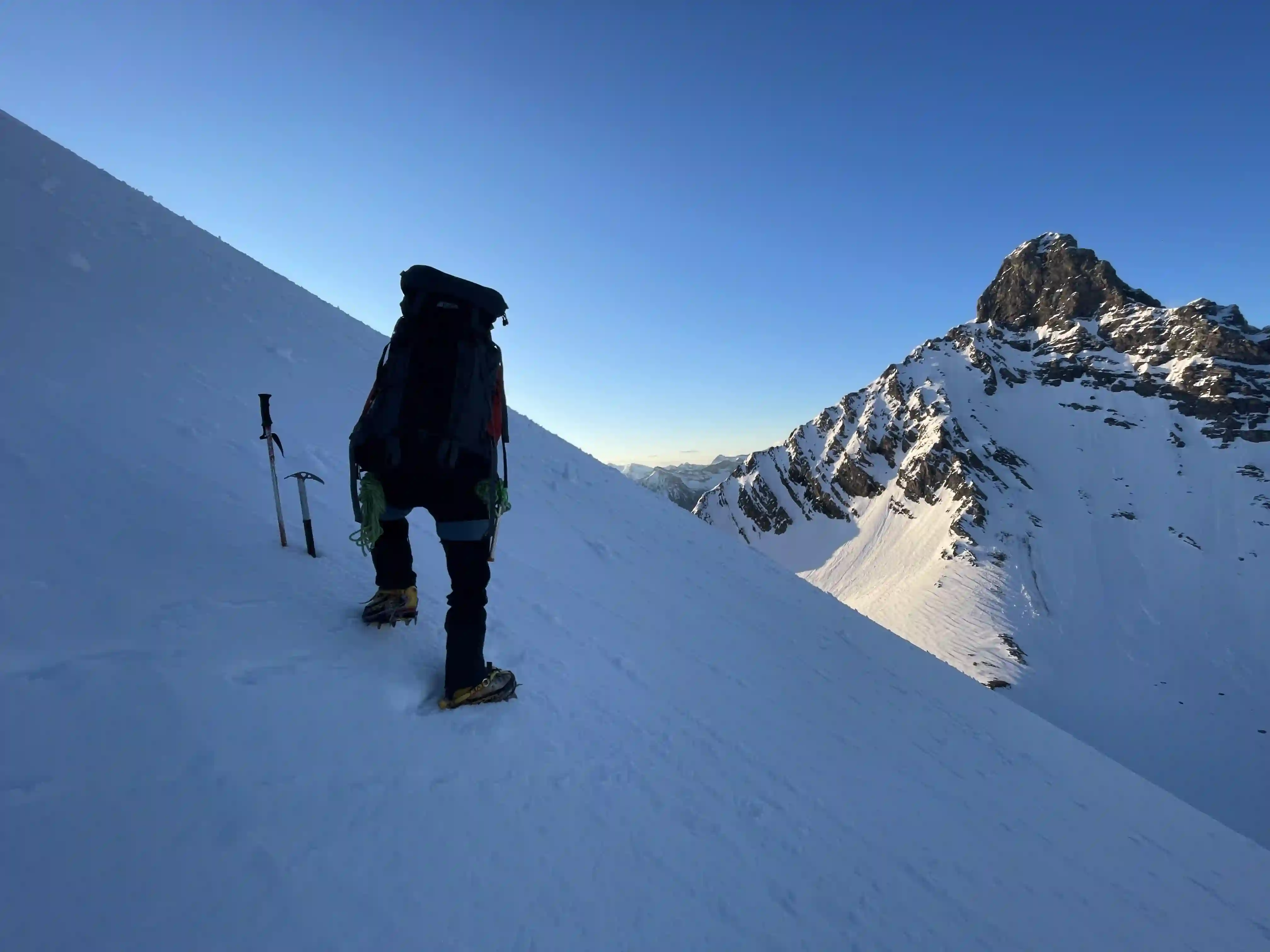
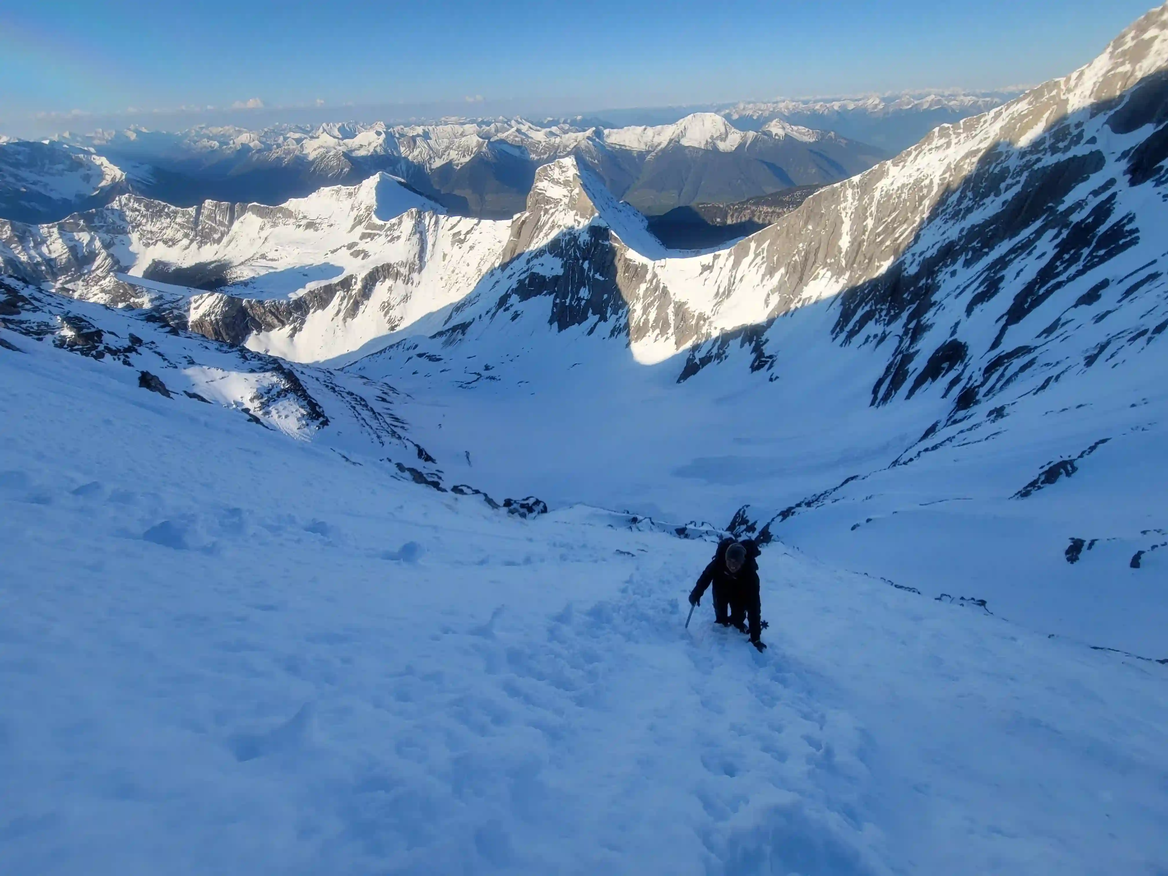
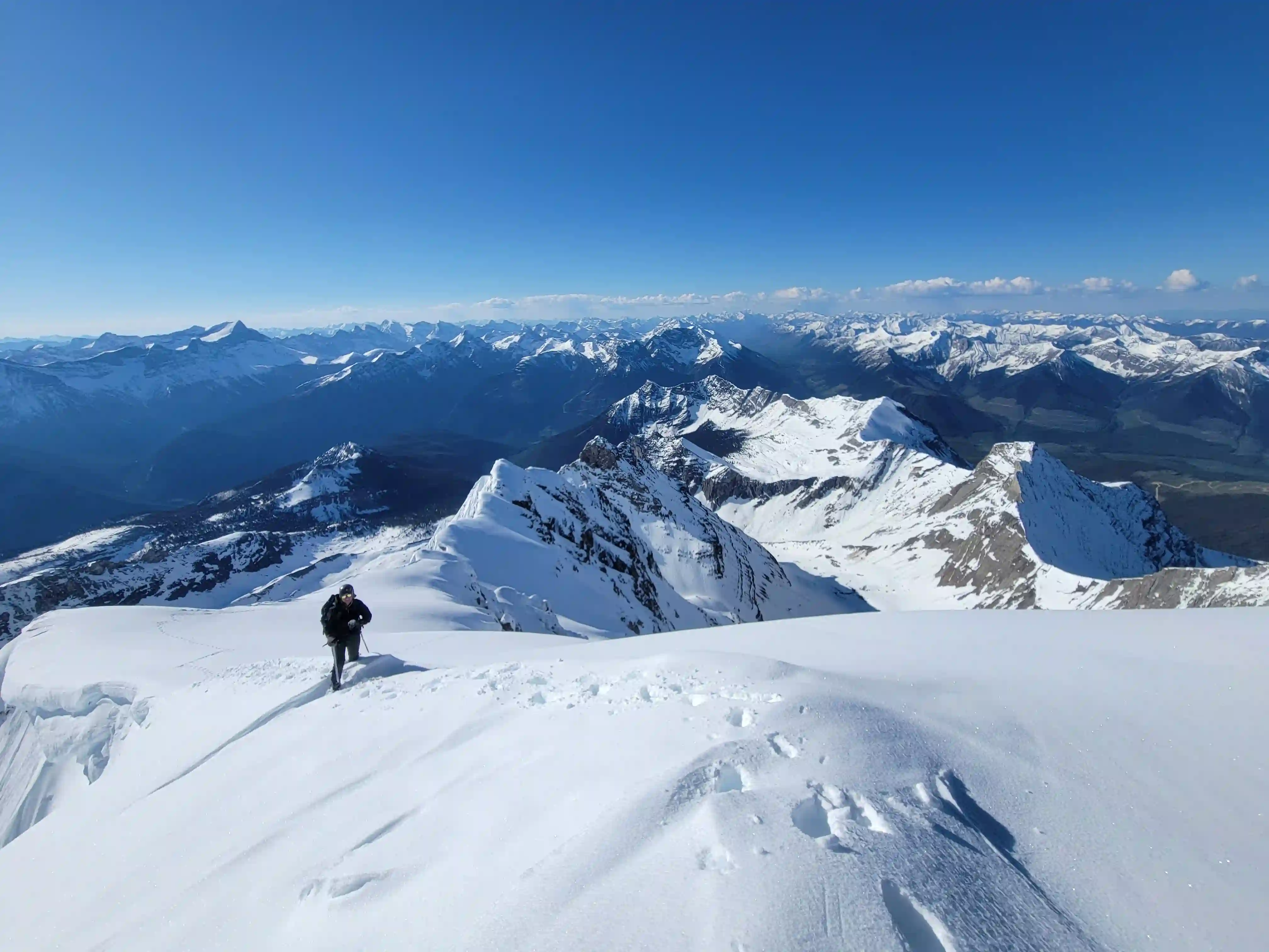
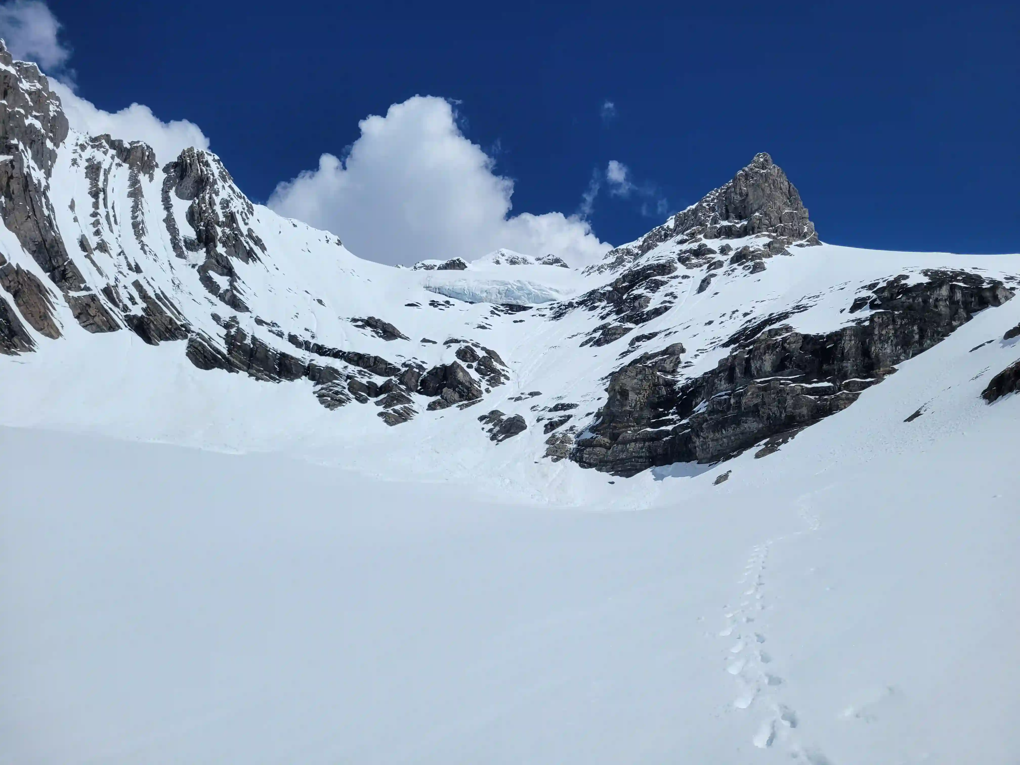
The next morning we were awake by 4am and headed up for our ascent by 4:30am. Although there was a bit of a freeze I was punching through a bit and had to deal with the consequences of not having a high surface area way of getting across the snow, and this made for some tough travel to start the day. The valley terrain as we got closer to King George was the worst for postholing since it had accumulated snow but once we reached where we cut east to head for the Princess Mary-King George col there was a better crust and we switched to crampons soon after so that was the end of that until the eventual descent.
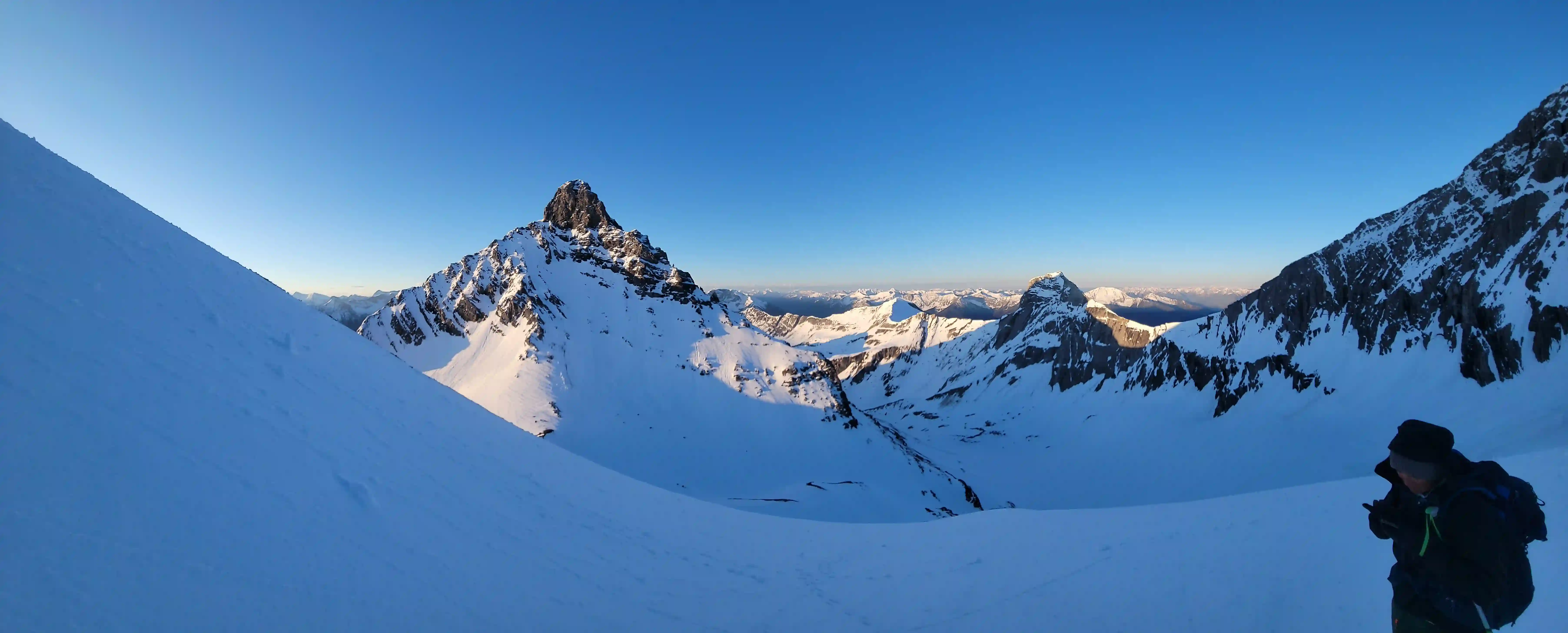
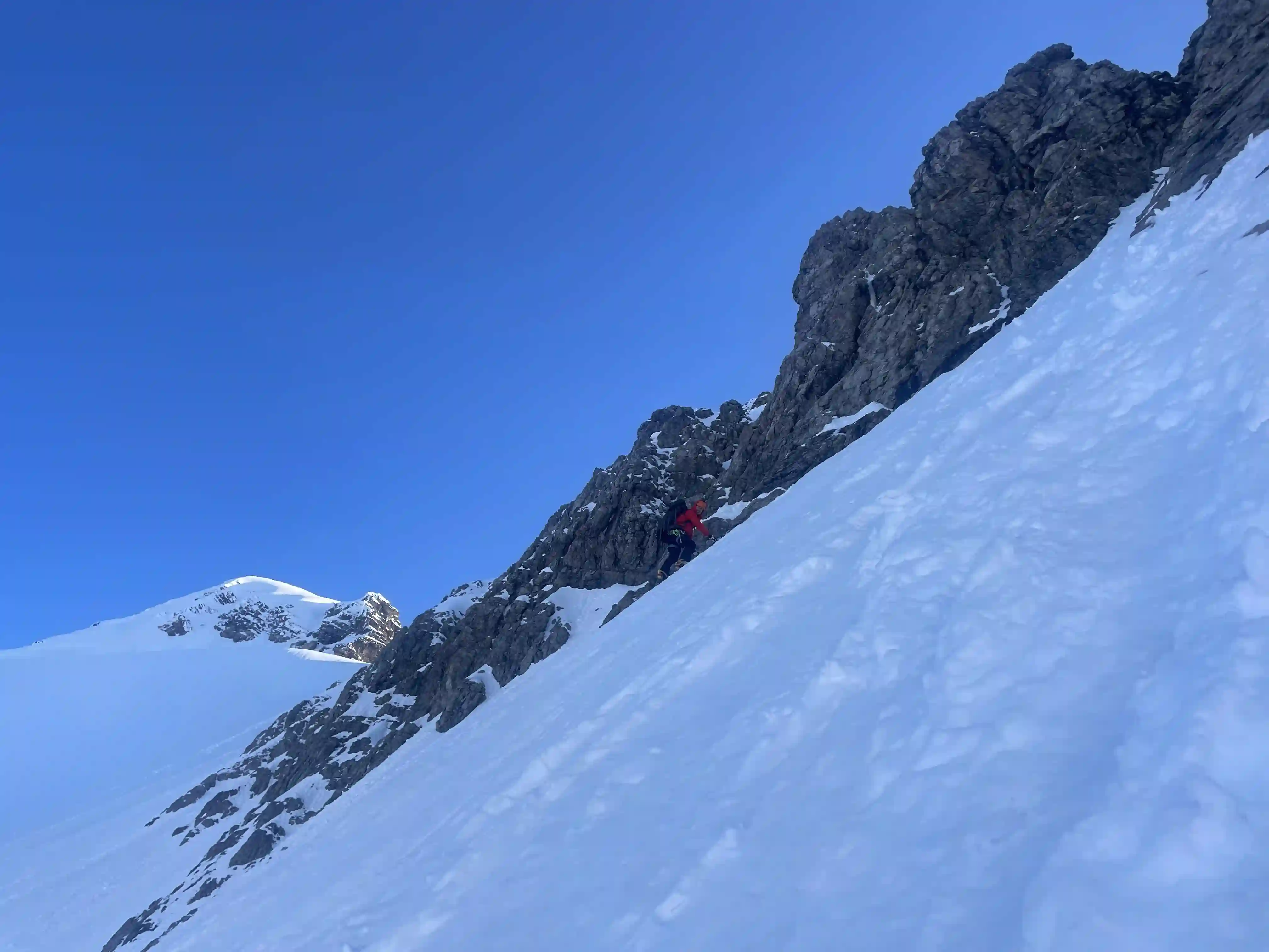
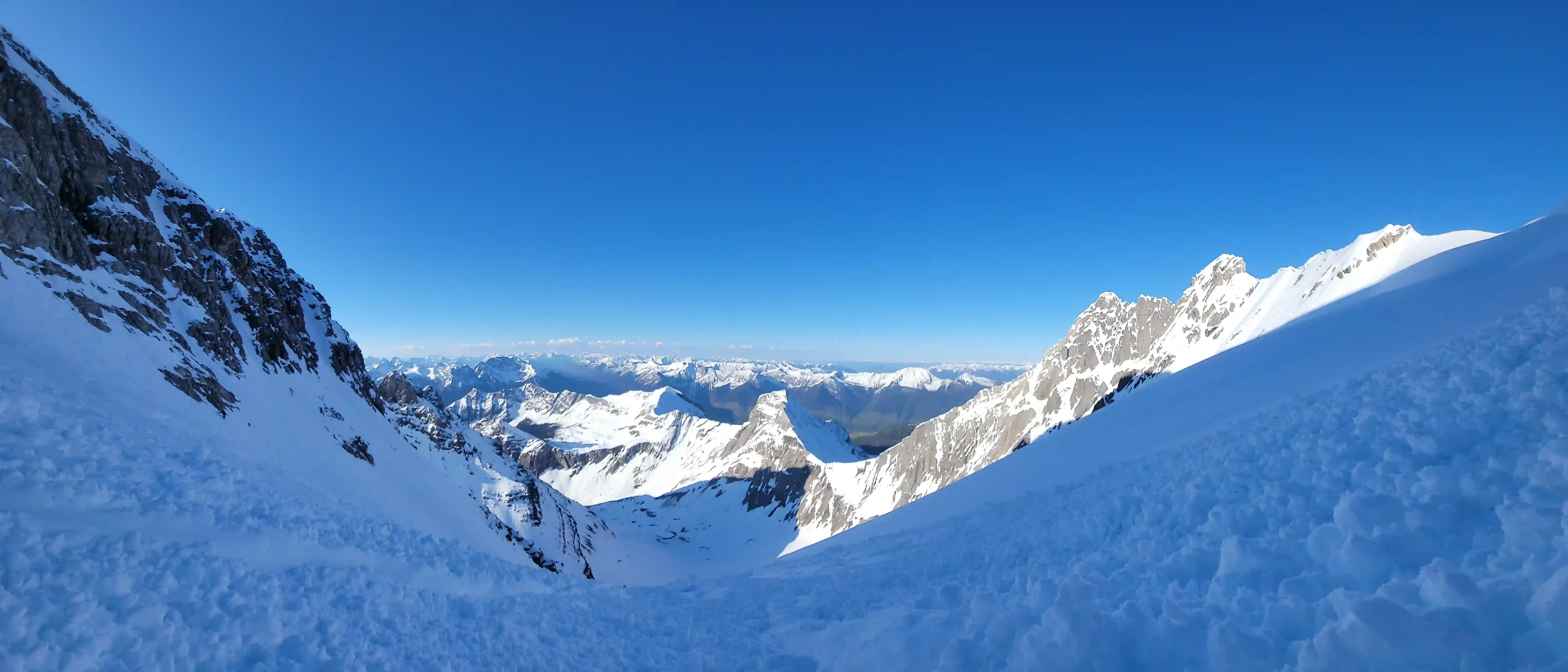
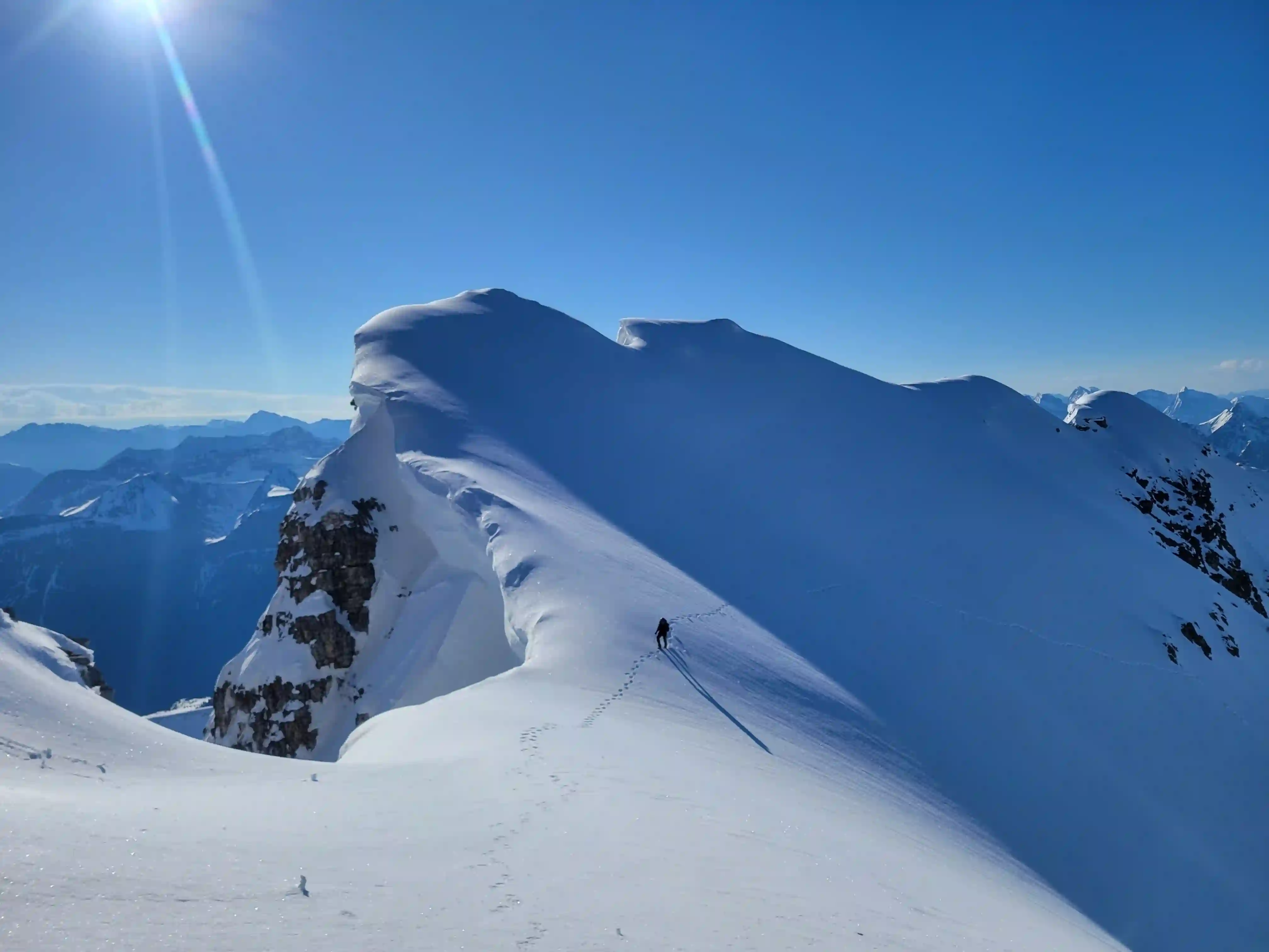
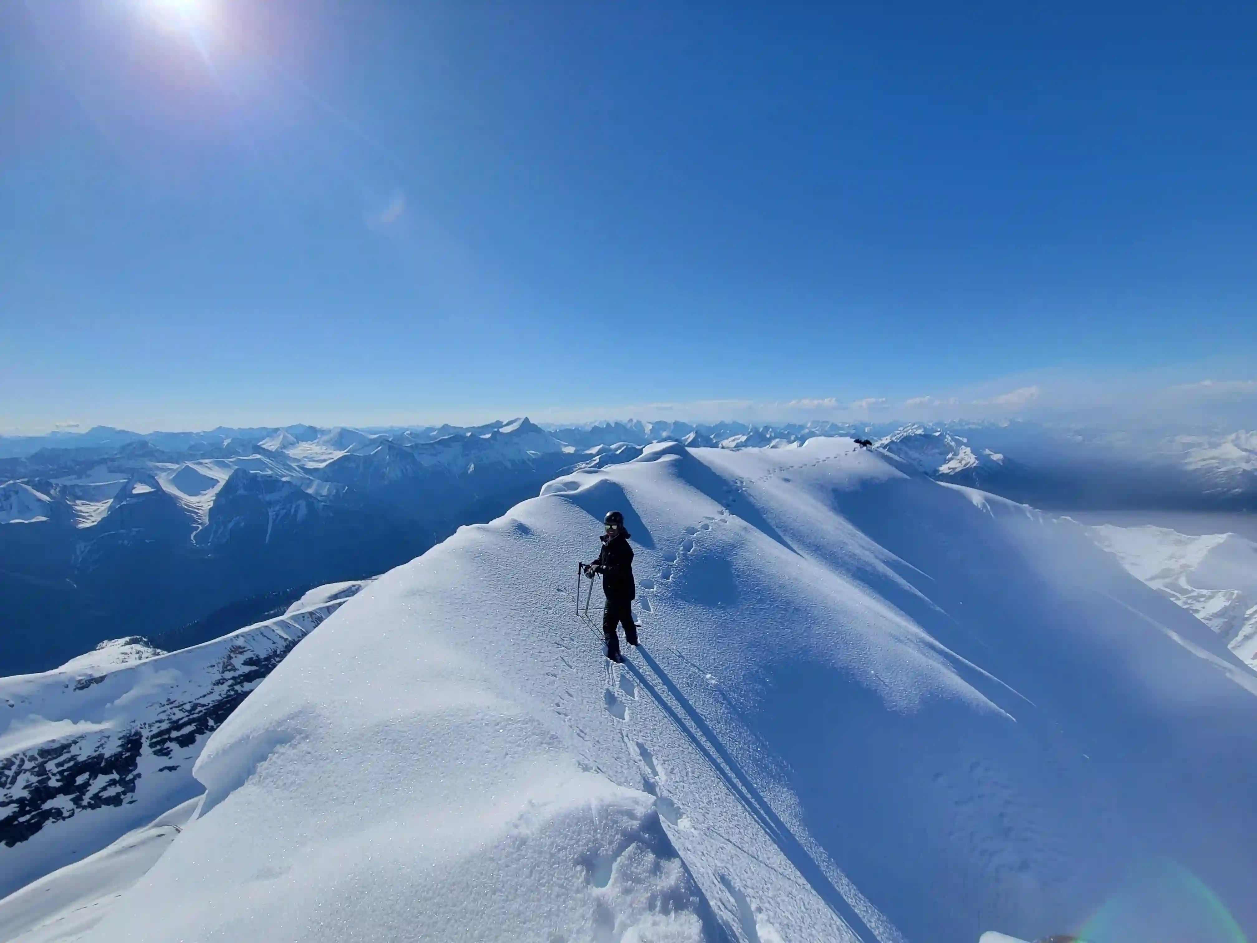
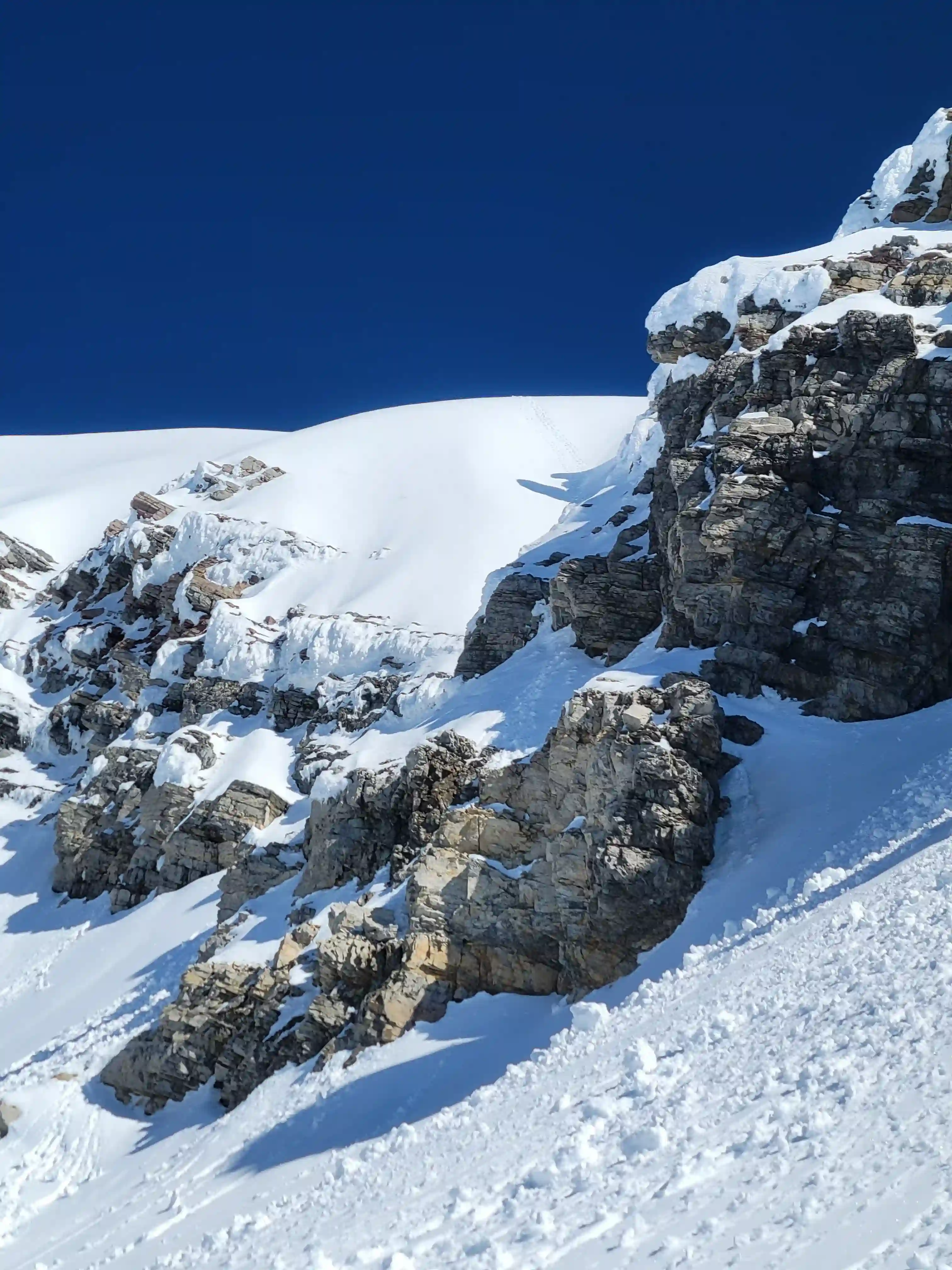
After reaching the point where we branched off to start heading up King George Brent wasn't feeling well so he decided to hang out at the col for a bit before returning to camp while Jo and I continued up. The intial section was a slog but eventually transitioned the facing in traverse that King George is known for and I wasn't very used to this kind of hard packed snow terrain on a steep snow slope so I was pretty focussed on getting across quickly. After getting across to the glacier and resting a bit we thought about roping up but given the solid snowpack decided not to and continued up steep terrain before reaching some sub ridge that lead to the summit block. This section ended up being severely corniced which we had some idea of but not fully until we looked back and saw the true size of the overhanging snow, we gave the ridge more space on the way down.
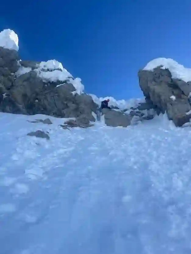
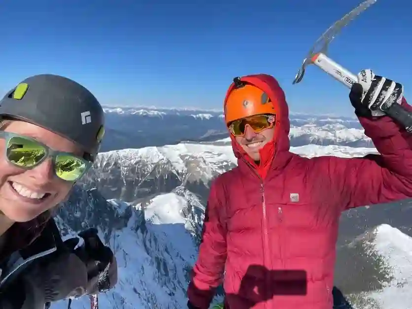
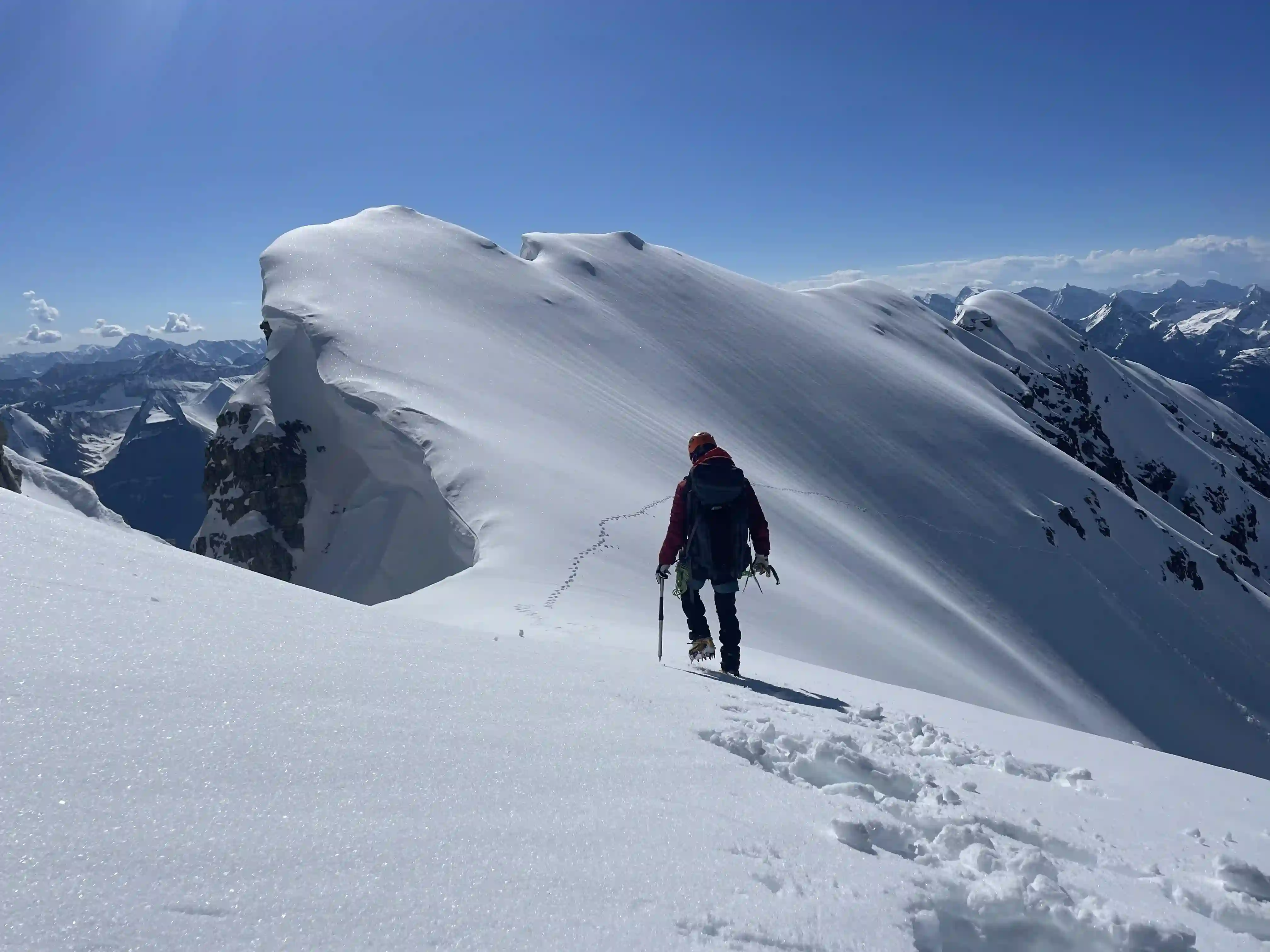
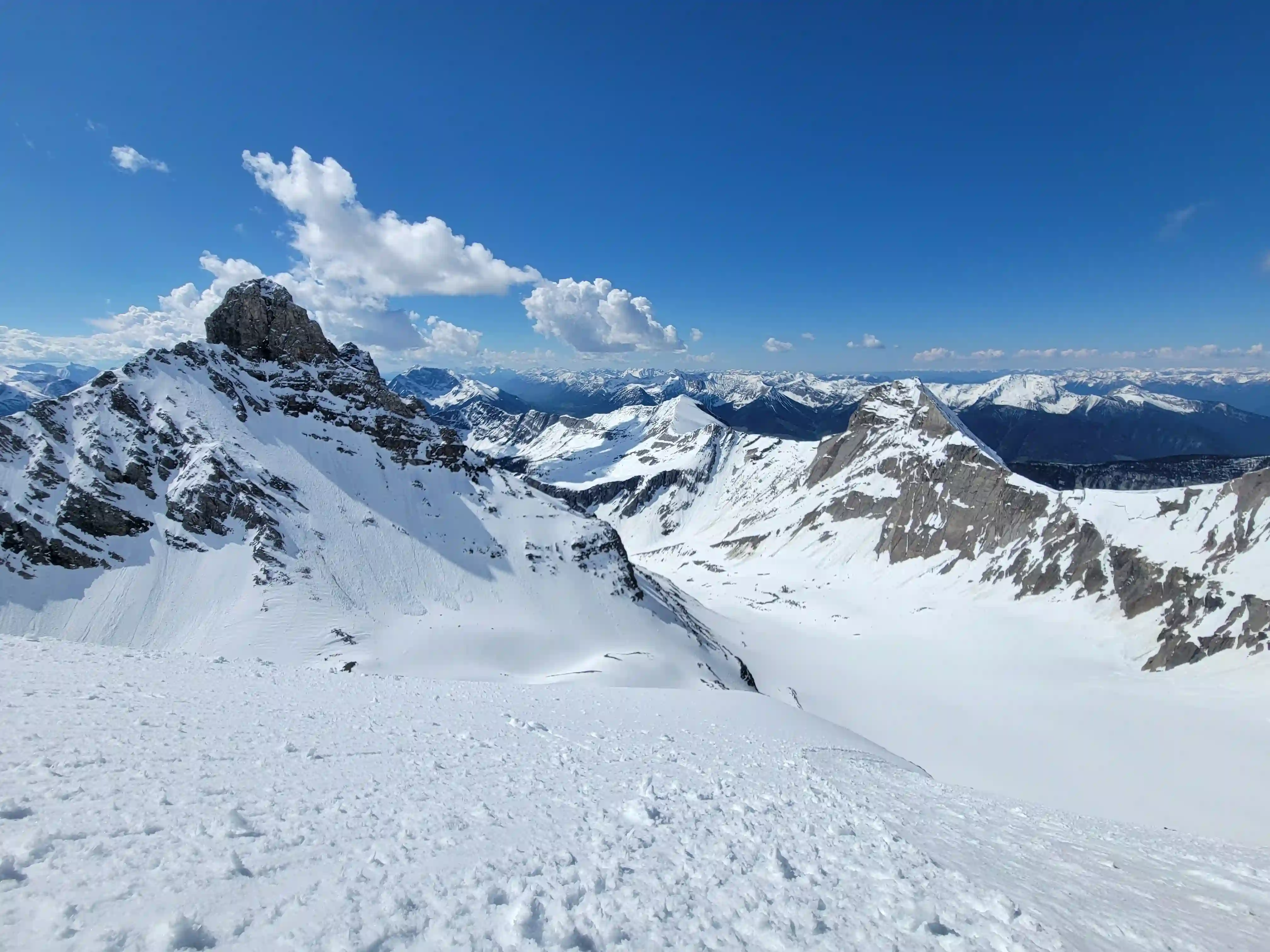
Following this section all that was left was the summit block and with a short section of steeper climbing we were on the summit ridge that slowely tapered off until it eventually reached the summit!
center
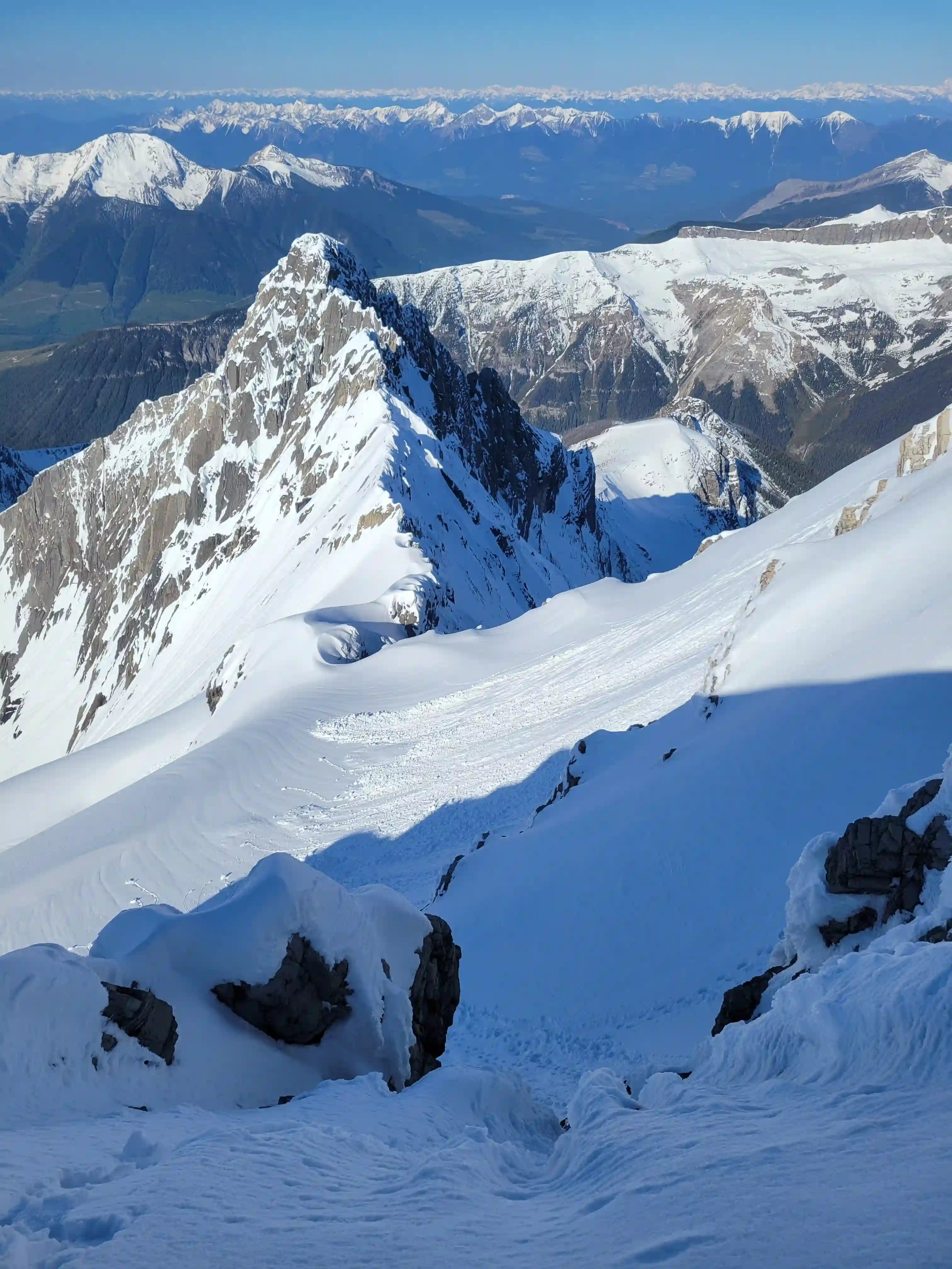
THE SUMMIT & DESCENT
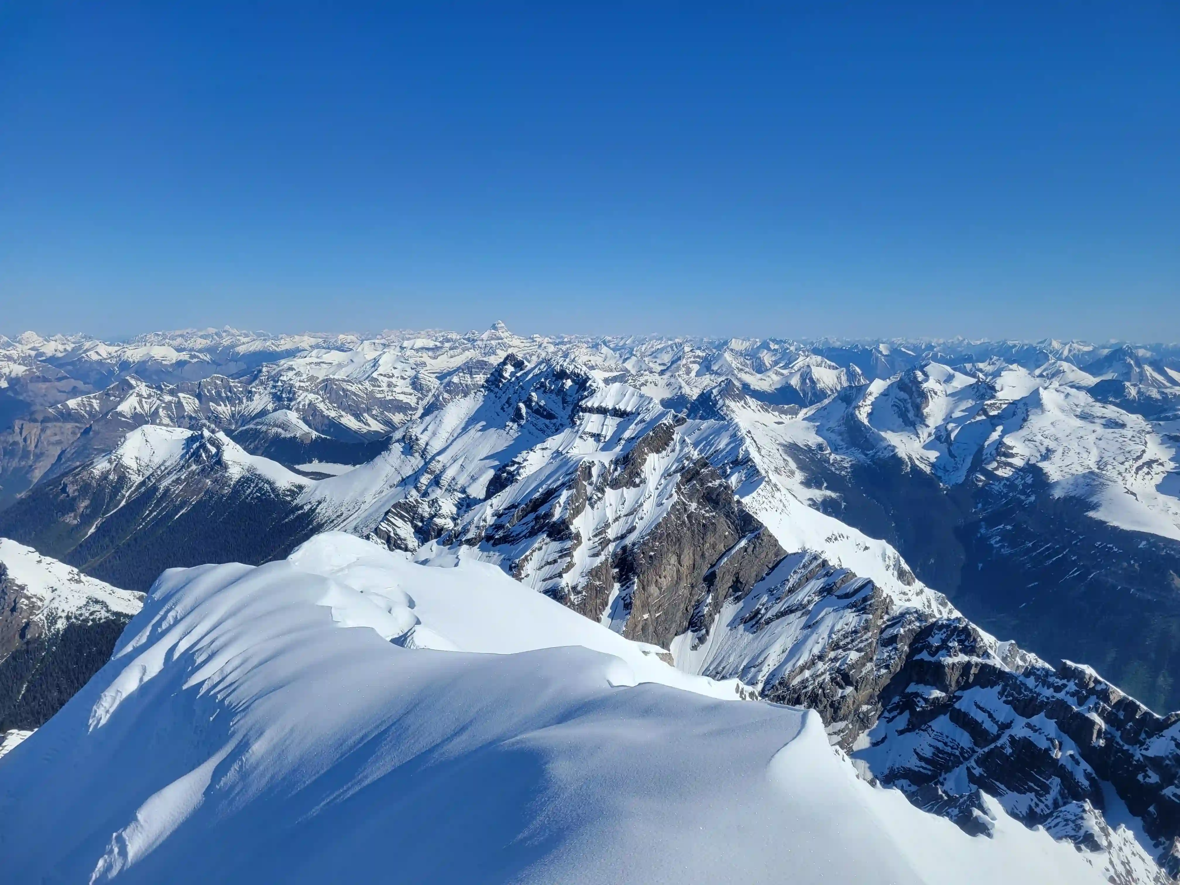
peaks behind
Into trips like this?
I'll send you an email whenever I publish a new trip report.
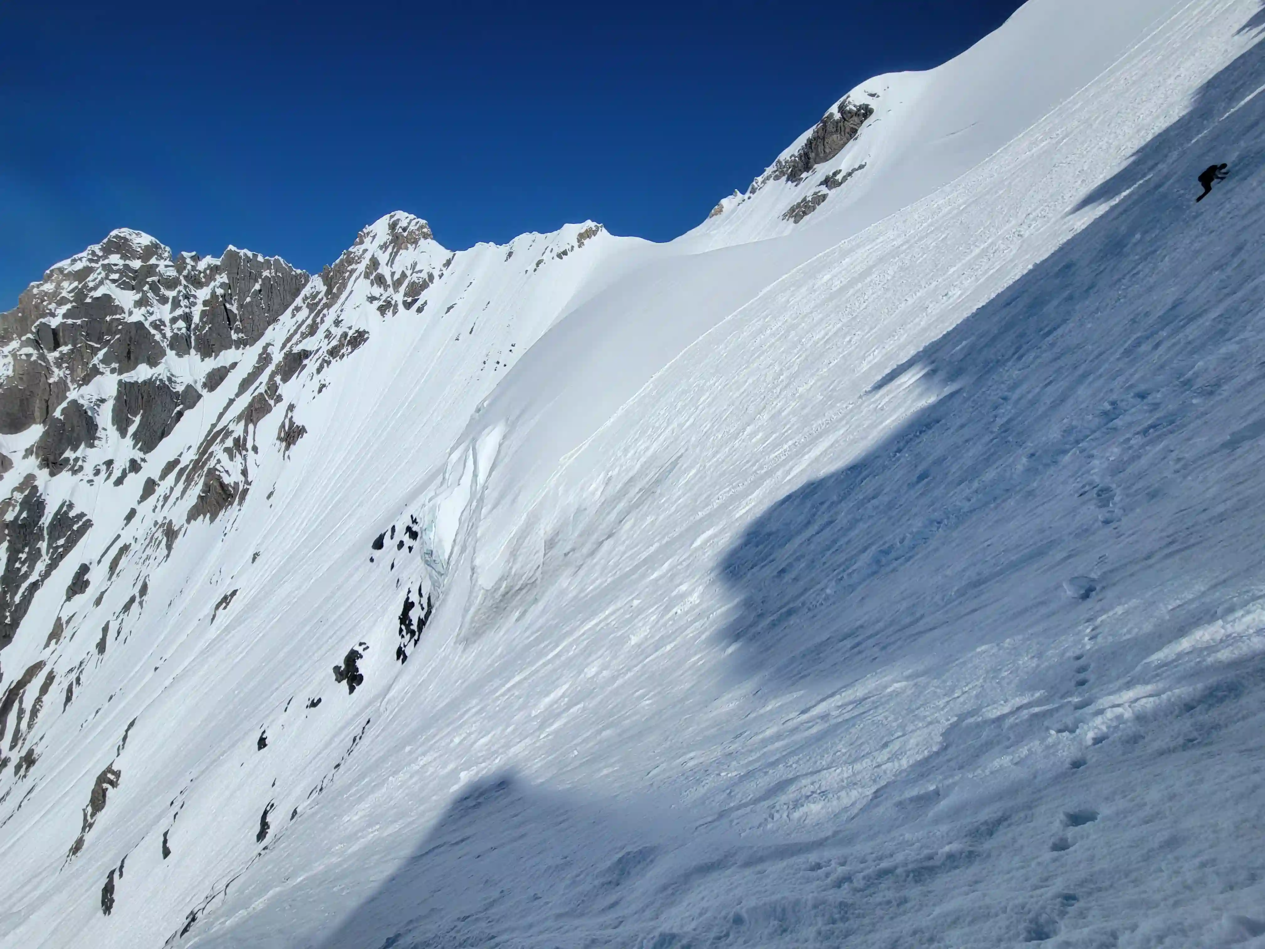
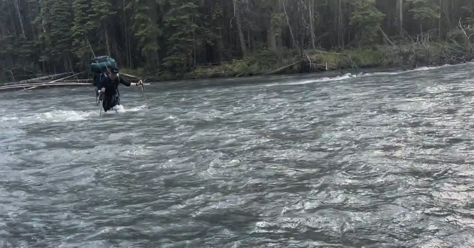
After soaking up the perfect summit conditions we had we started the trek down and this is where I realized how nice having a pair of skis would be on the nice powdery conditions. We were able to reverse our ascent rather quickly aside from the traverse section which took about the same amount of time as on the way up, and what followed was even worse postholing cause of the even warmer conditions. After meeting back up with Brent at camp and a bit of refueling we got packed up and started the exit. Although there was still a bit of snow in this section it paled in comparison to the other worse sections of the day so it didn't seem all so and all that was left after that was the trail out and one last river crossing to wrap up a sweet trip!
THE EXIT
This trip served as the confidence booster that I needed to be comfortable on steep snow climbing terrain, as well as being a good kick in the ass to start bringing backcountry skis on these trips especially with my uber light setup to take advantage of a fast descent. Headed into this trip I wasn't exactly sure how it would go since I'd never met Brent or Jøsiane before but part of mountaineering is teaming up and working with new people and I'm stoked to have gone two for two with
Mount Forbes
followed by this trip, a good sign for things to come and keen future partners!
A week later I was looking to get out again with my newfound confidence and
this next trip
served to set me up very well mentally for the remainder of the peak bagging season ahead!
Follow the full progression
I'm working through all 58 11000ers of the Canadian Rockies and beyond. You'll get notified when the latest climbs go live.
Other related trip reports:
Lefroy, Victoria South, & Huber Linkup |
Mount Alexandra |
Mount Andromeda & Athabasca ||
Mount Forbes
11000ers of the Canadian Rockies
© Haldan Borglum | Peak by Peak. All rights reserved.