Tsar Mountain
3424m, 11233ft
May 21-23 2025
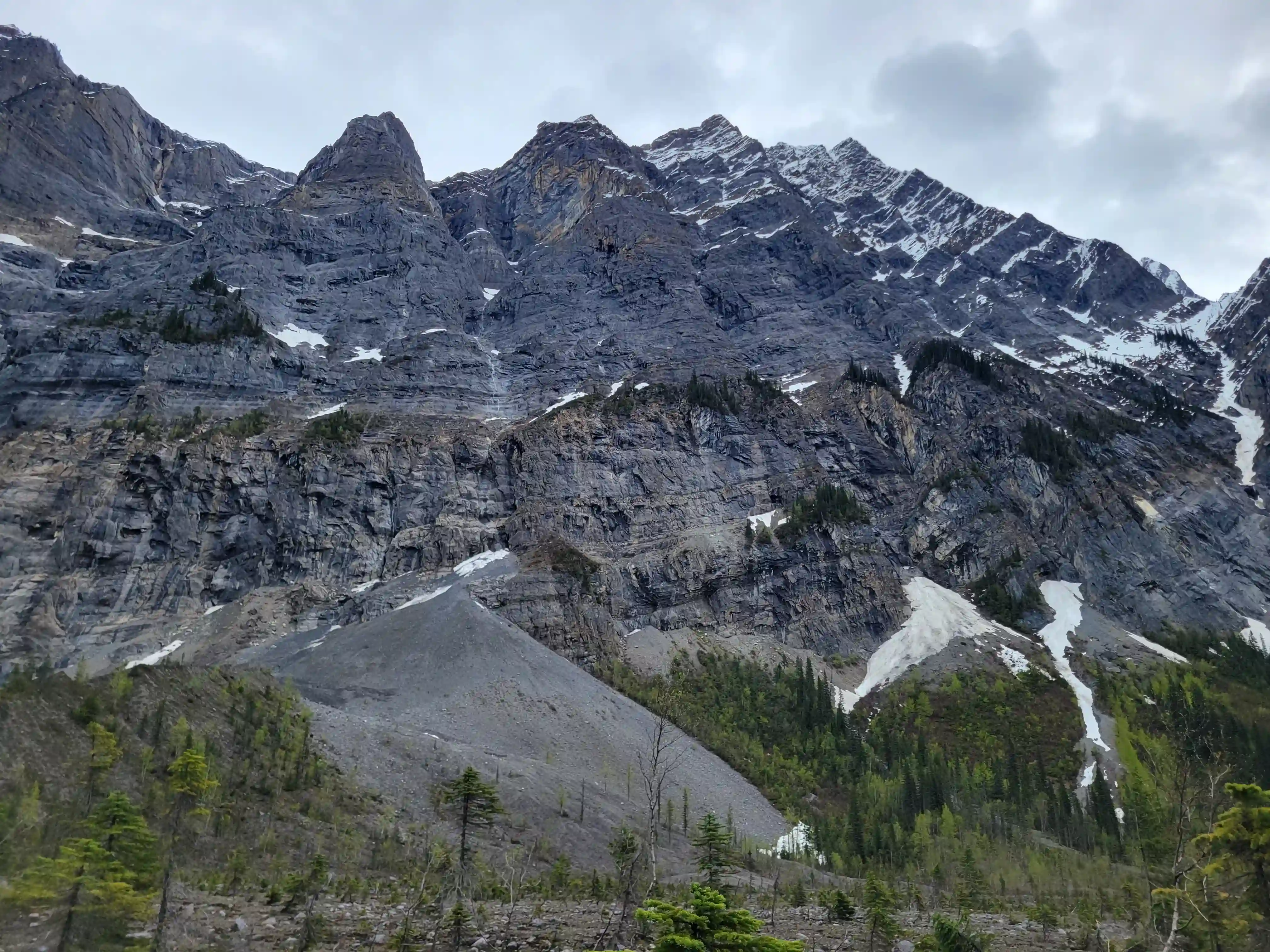
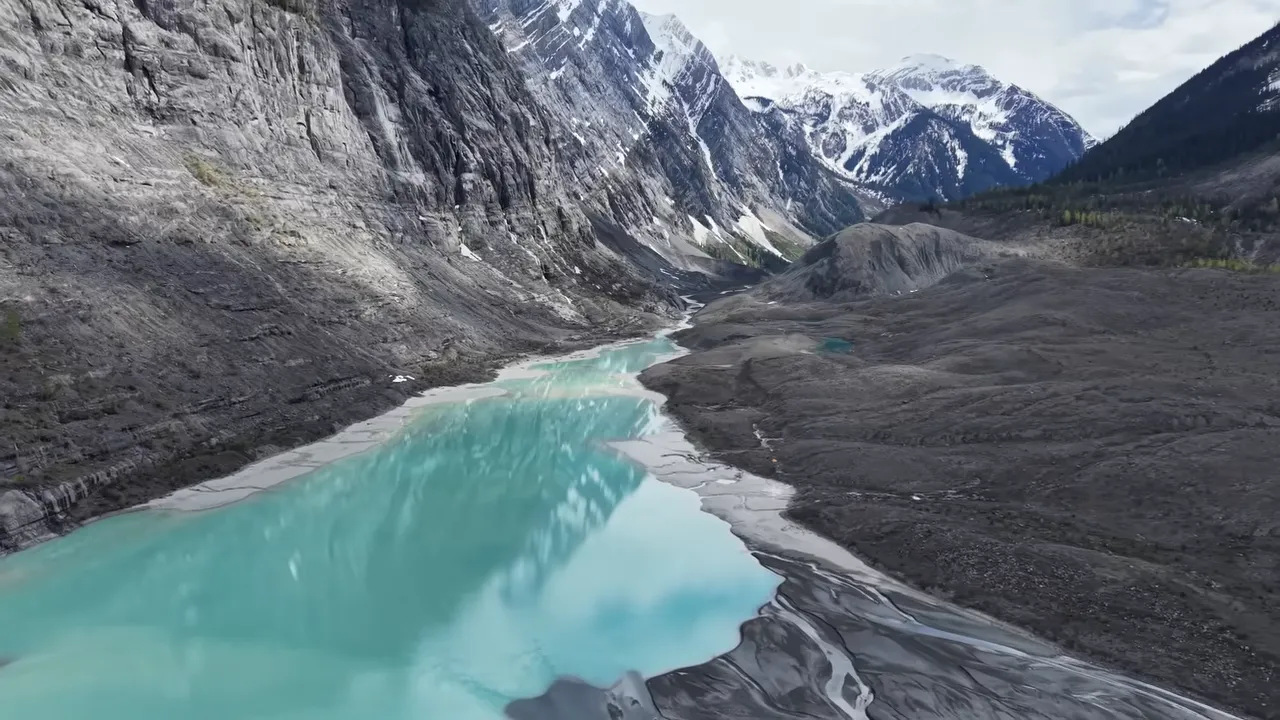
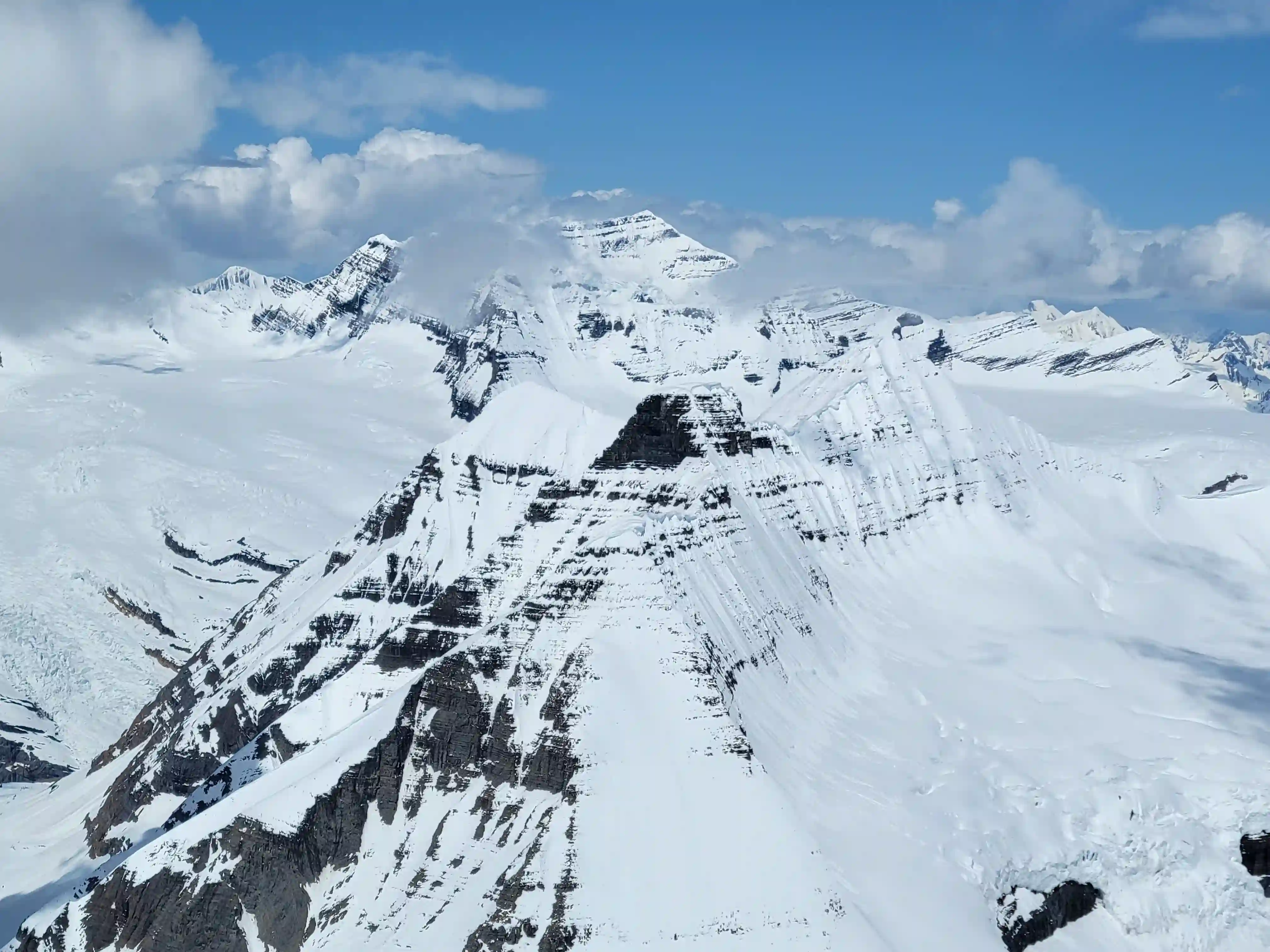
Tsar, a term for emperor in antiquity is a fitting name for Tsar Mountain's remote and guarded summit. Claiming the title of one of the most remote 11000 foot peaks in the Canadian Rockies, Tsar Mountain lies deep in British Columbia wilderness and the vast majority of attempts made on its elusive summit are via a heli approach. It has an impressive tetrahedron structure, with vast rocky cliffs and reliefs alongside overhanging seracs and sharp ridges present on all sides and compared to other mountains in the region seems like it might fit better in the Cordillera Blanca. It rises quickly from valley bottom, featuring a whopping 2300 meter elevation difference from the remote Kinbasket River valley to the summit only 4 kilometers away.
Following an ascent of
Mount Victoria North
a week prior in socked in conditions I still hadn't satisfied my itch to get back into the alpine and with what looked like a pretty good window approaching I started looking into making plans for an ascent of
Mount Bryce or
Mount King Edward.
Funny enough, the next day I got a message from Simon aka
Foresty Forest
about a wicked looking window for Tsar Mountain and he wanted to go for it so that made making plans nice and easy! I had been in touch with Simon for a while through Strava and we had been messaging back and forth about going for some big peaks together eventually so this was the perfect opportunity!
The two of us were up for it but thought having a few more strong mutual mountaineer friends of ours on the trip would be a good idea, the only problem was we were cooking up extremely last minute plans. In fact the morning that Simon gave me a call was the same day we ended up meeting in Golden to drive out the forest service roads to reach the start point for Tsar so we weren't sure if the others would be able to make it. Thankfully everyone was able to clear their schedule for a badass peak like Tsar and Devan Peterson a mutual friend of ours and Tim Hryshchuk a friend of Simon's were in for the big plans!
Until recent years a self propelled push for Tsar Mountain seemed all but impossible aside from those willing to commit to a multi week expedition. In 2018 Ben Nearingburg and Liam Harrap set aside 2 weeks to get it done, starting from the Icefields Parkway and finishing off their trip rafting out the Kinbasket River to the Kinbasket Lake over 70 kilometers west as the bird flies. A massive effort and one of the first well documented self propelled trips of Tsar in recent history.
links:
STRAVA
|
GAIA
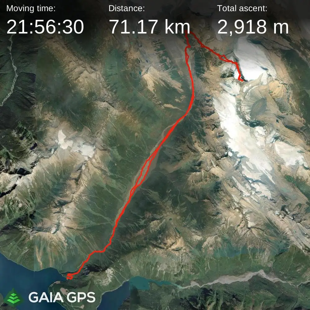
elapsed time: 57hrs
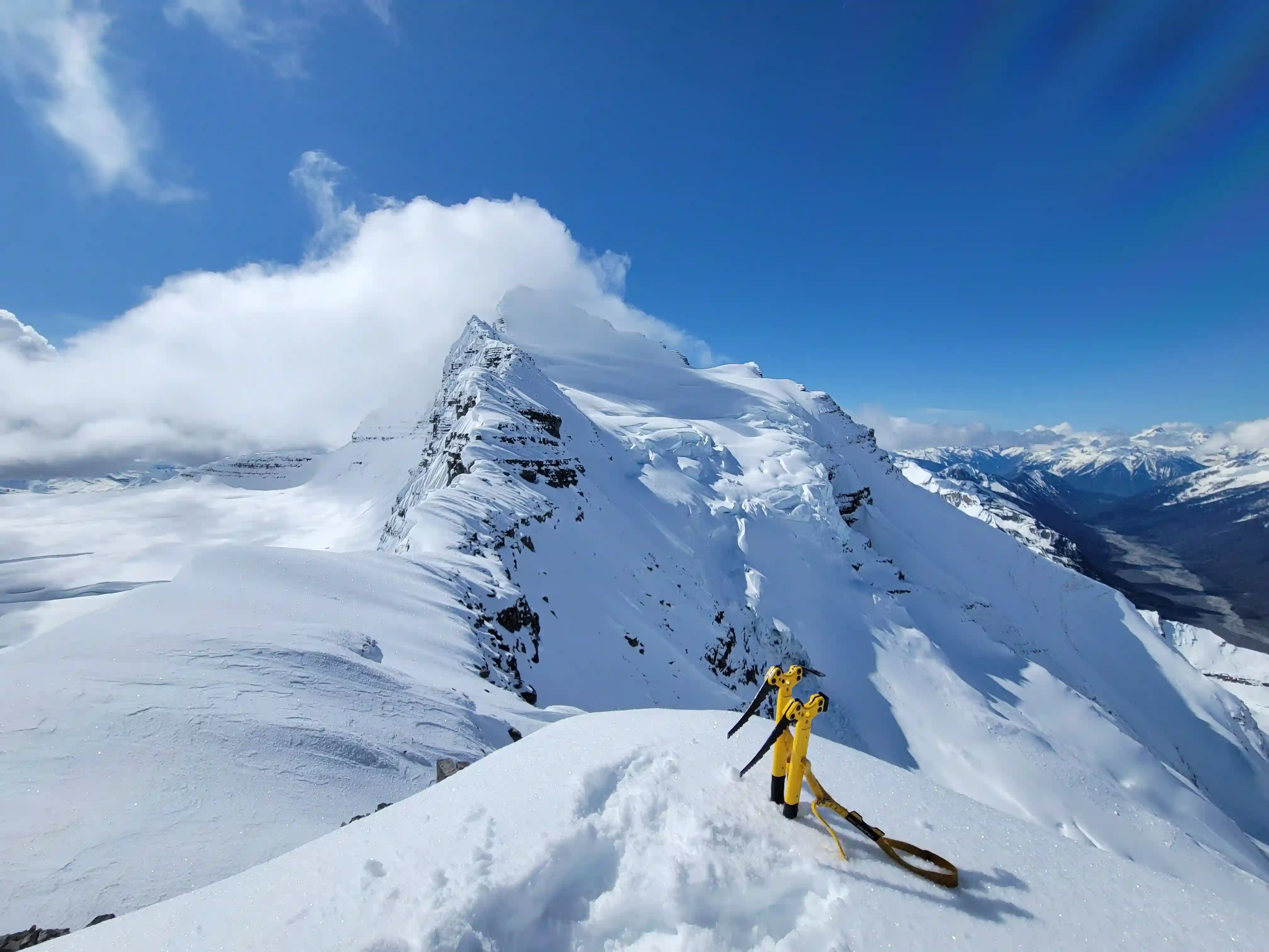
DIFFICULTY: AD-/AD, remote, multiday, glacier travel, steep snow / ice climbing, 5th class
Use the following links to jump to:
Even so Tsar remained this somewhat unsolved puzzle for a number of years until 3 years ago when Simon set his sights on it and figured the Kinbasket River valley would be a good option to approach with the recent extension of the logging road to the Kinbasket River drainage. Obviously given the name the main thing that comes to mind is the Kinbasket River and this route does involve going up the river bed so timing would be imperative for this route to work out without a means to float out if the levels rise while you're upstream. In 2022 Simon scoped out the Sullivan River forest service road all the way to its end point 140km out remote logging roads and began working on an access trail! In May of 2023 he went for it solo but ended up turning around due to the scale and difficulty of the mountain so our attempt was redemption!
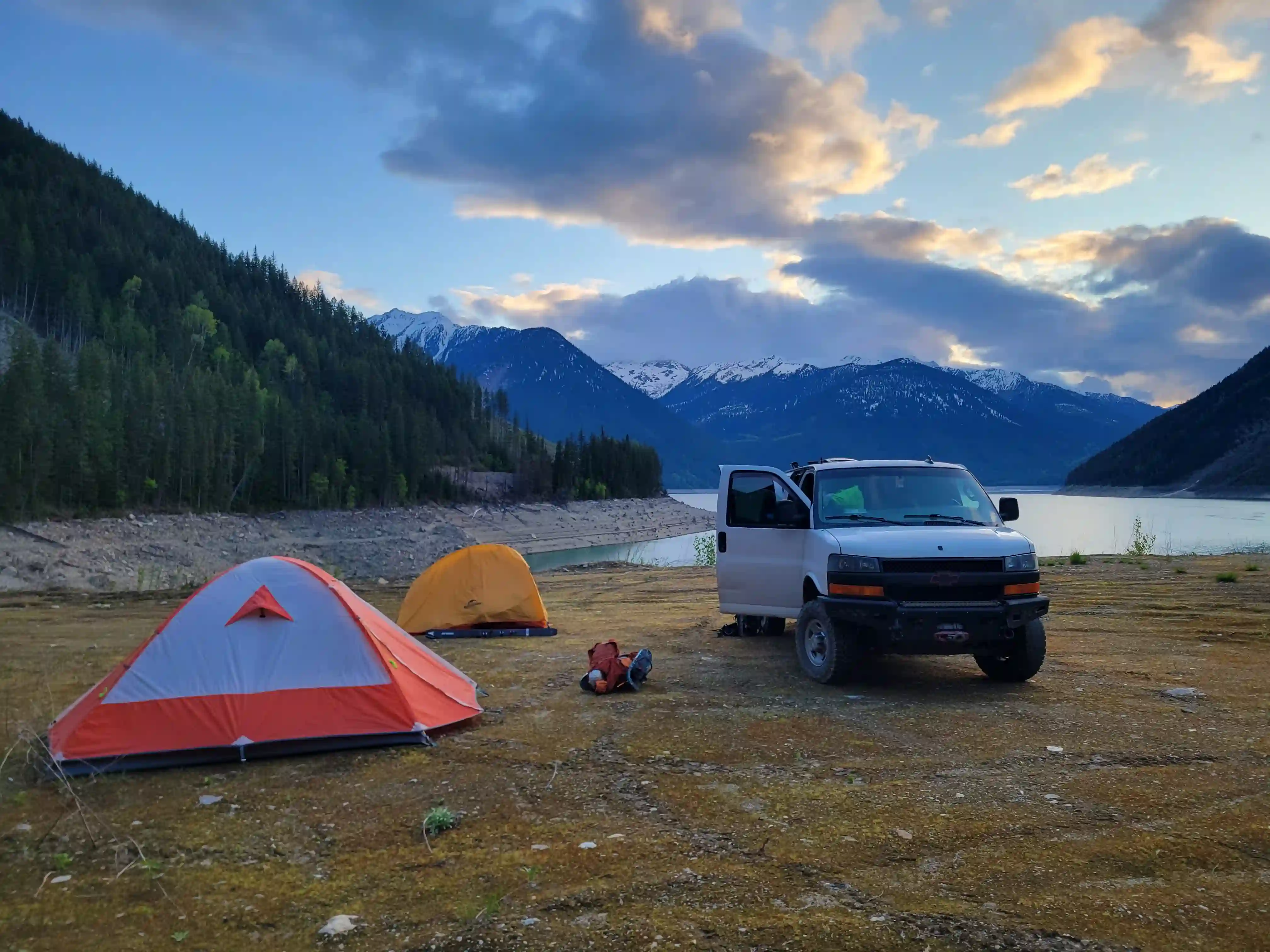
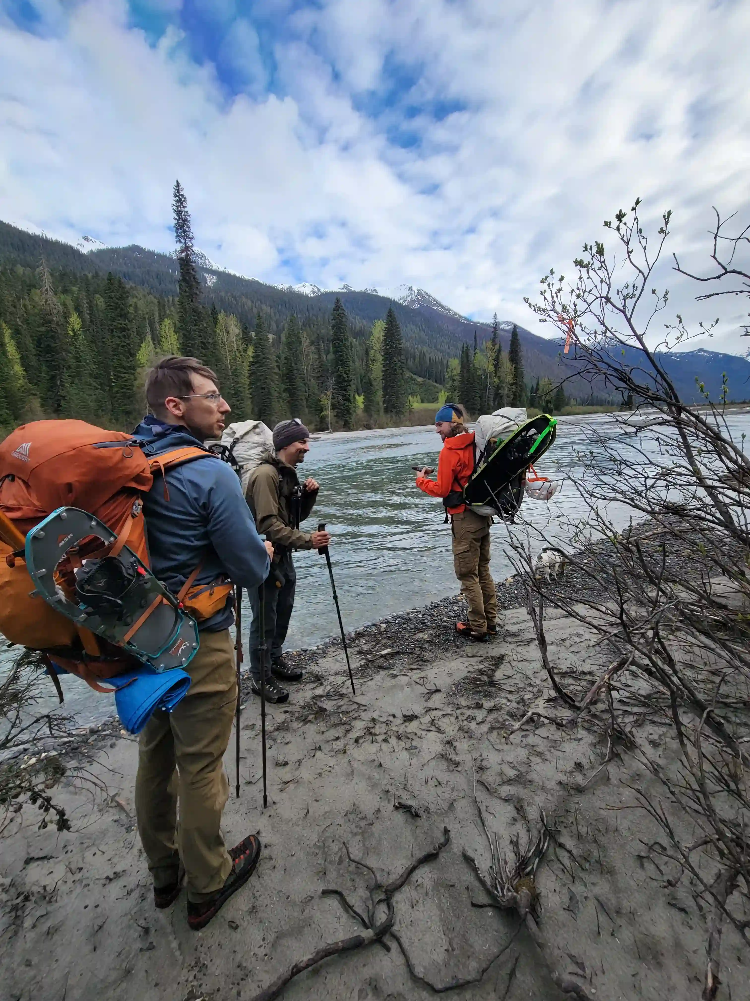
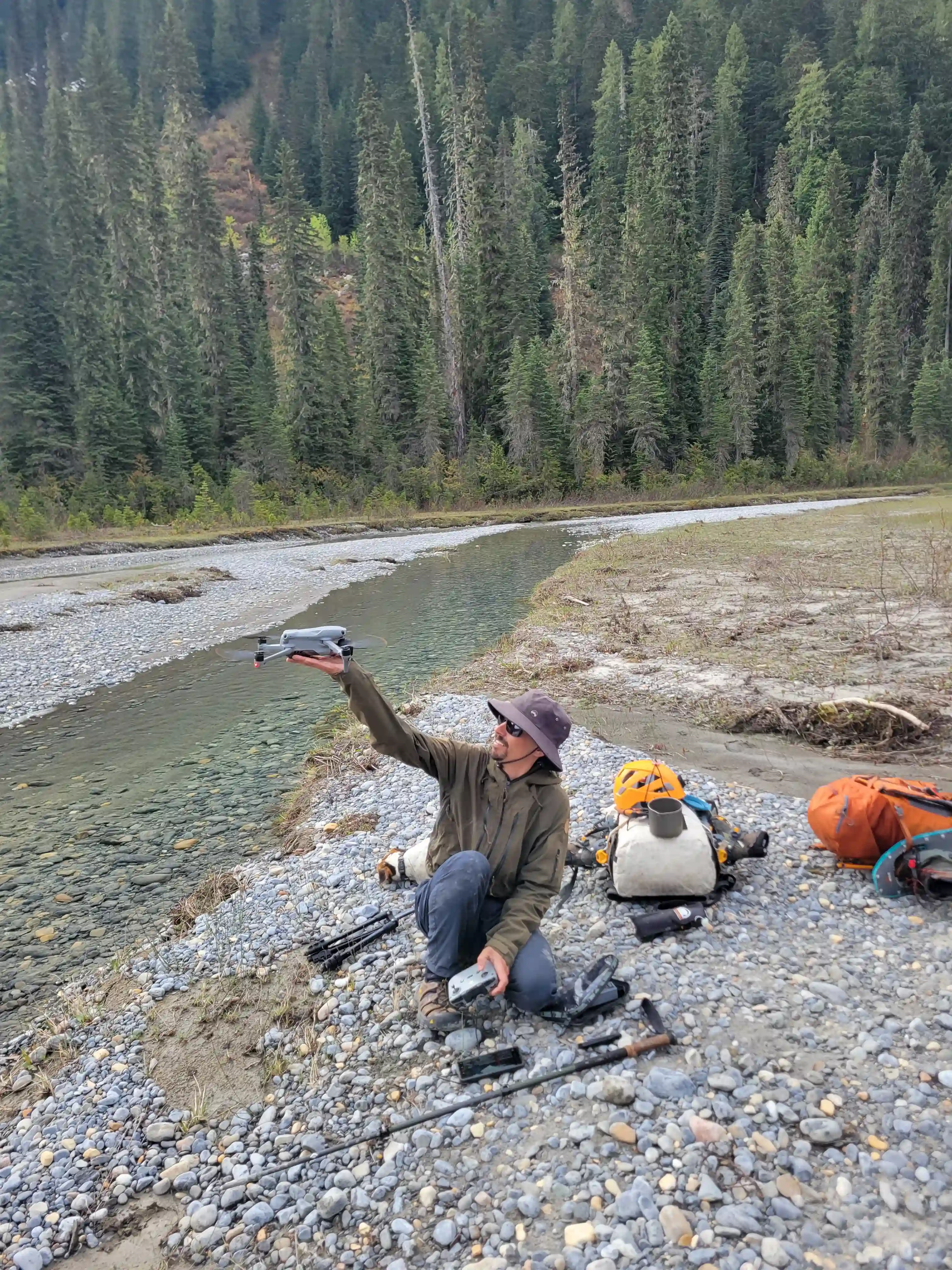
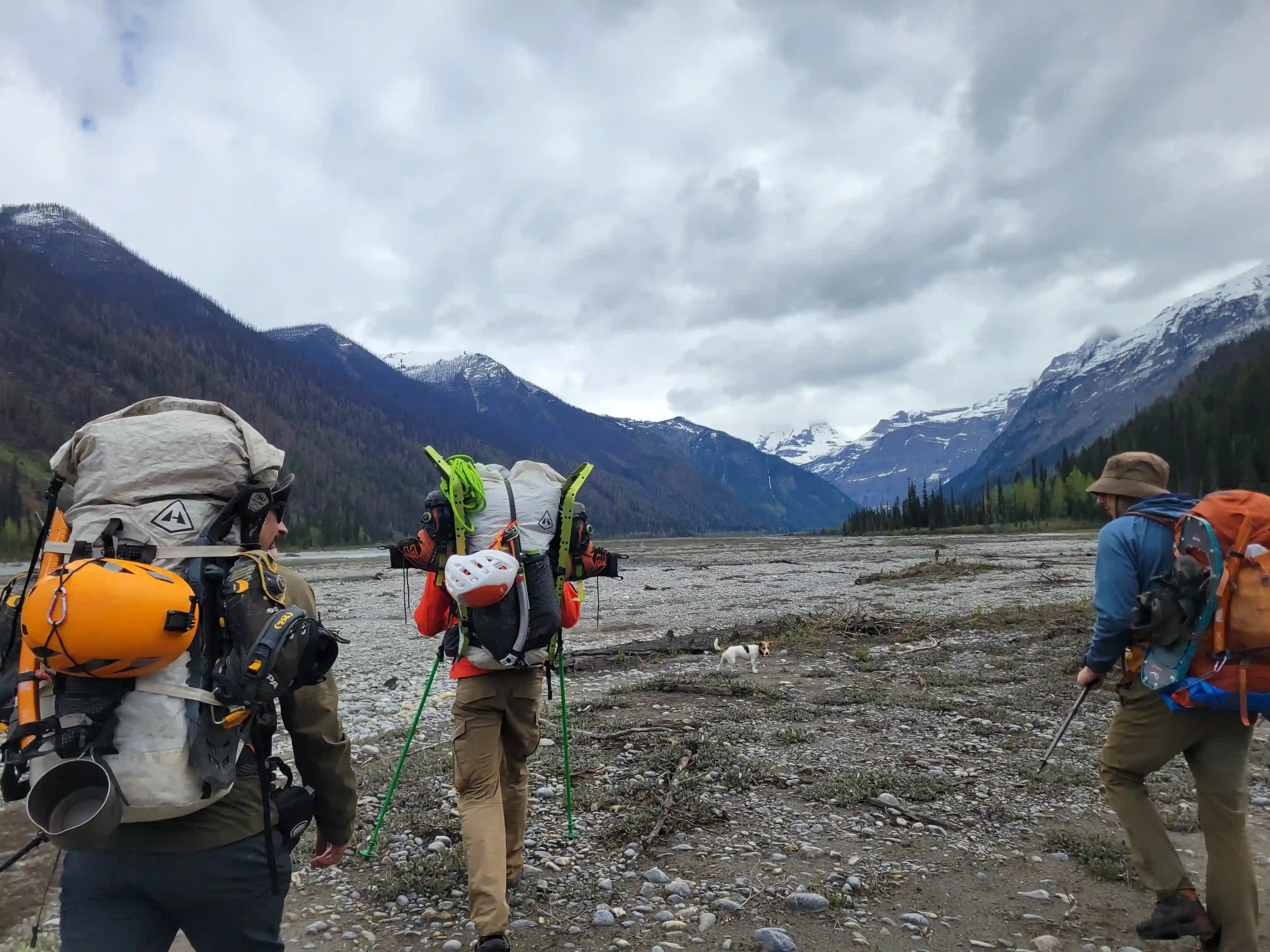
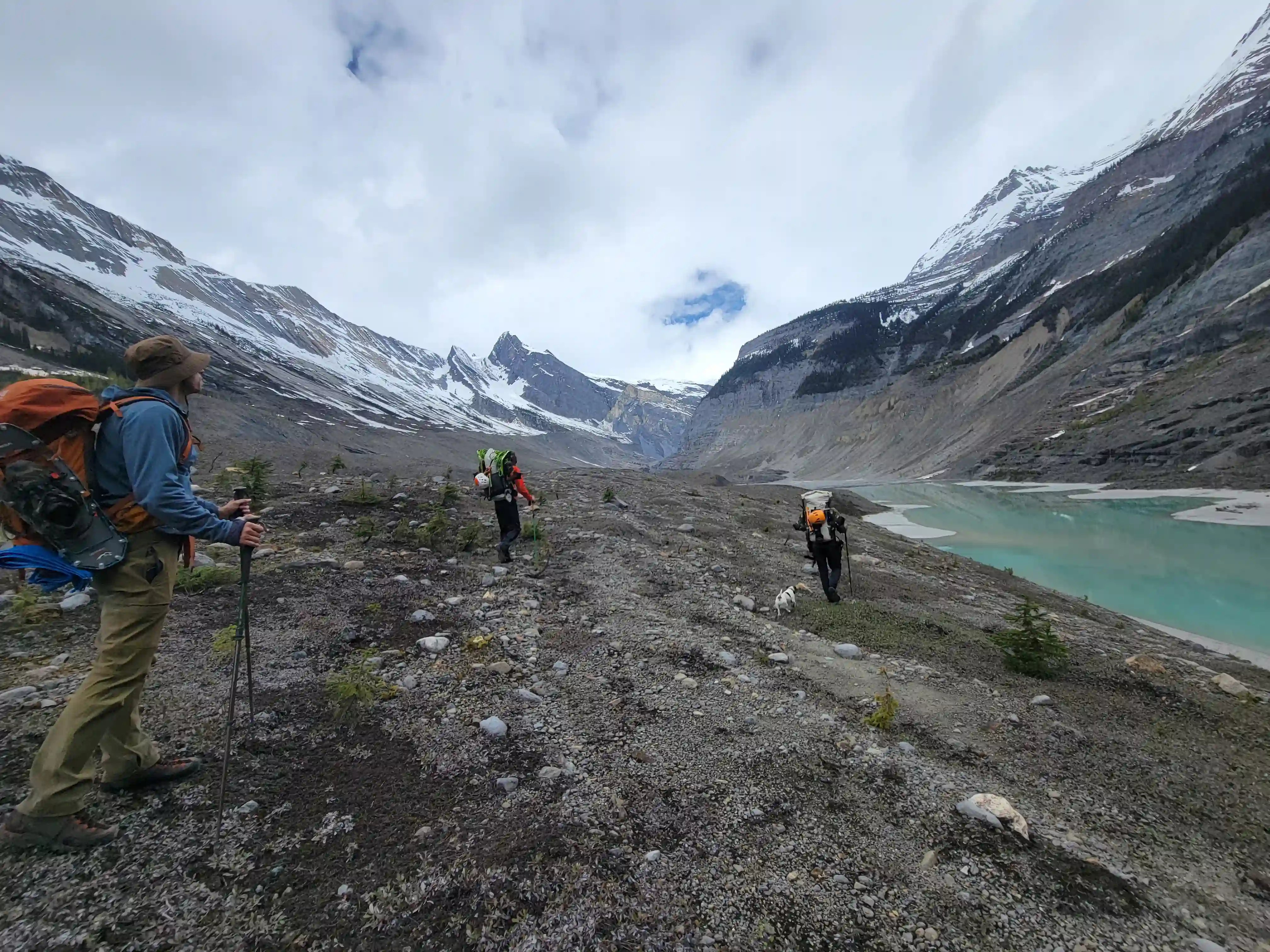
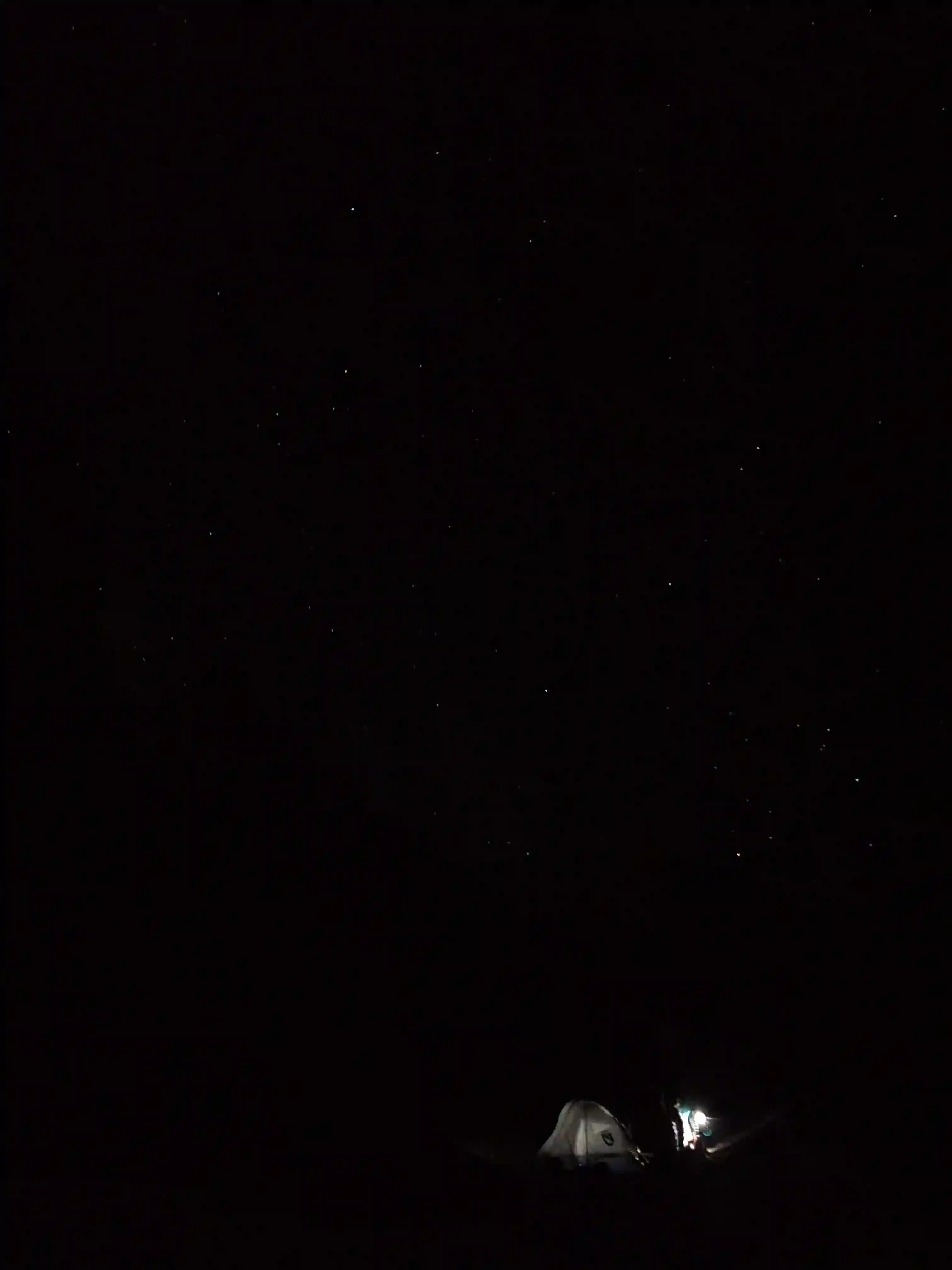
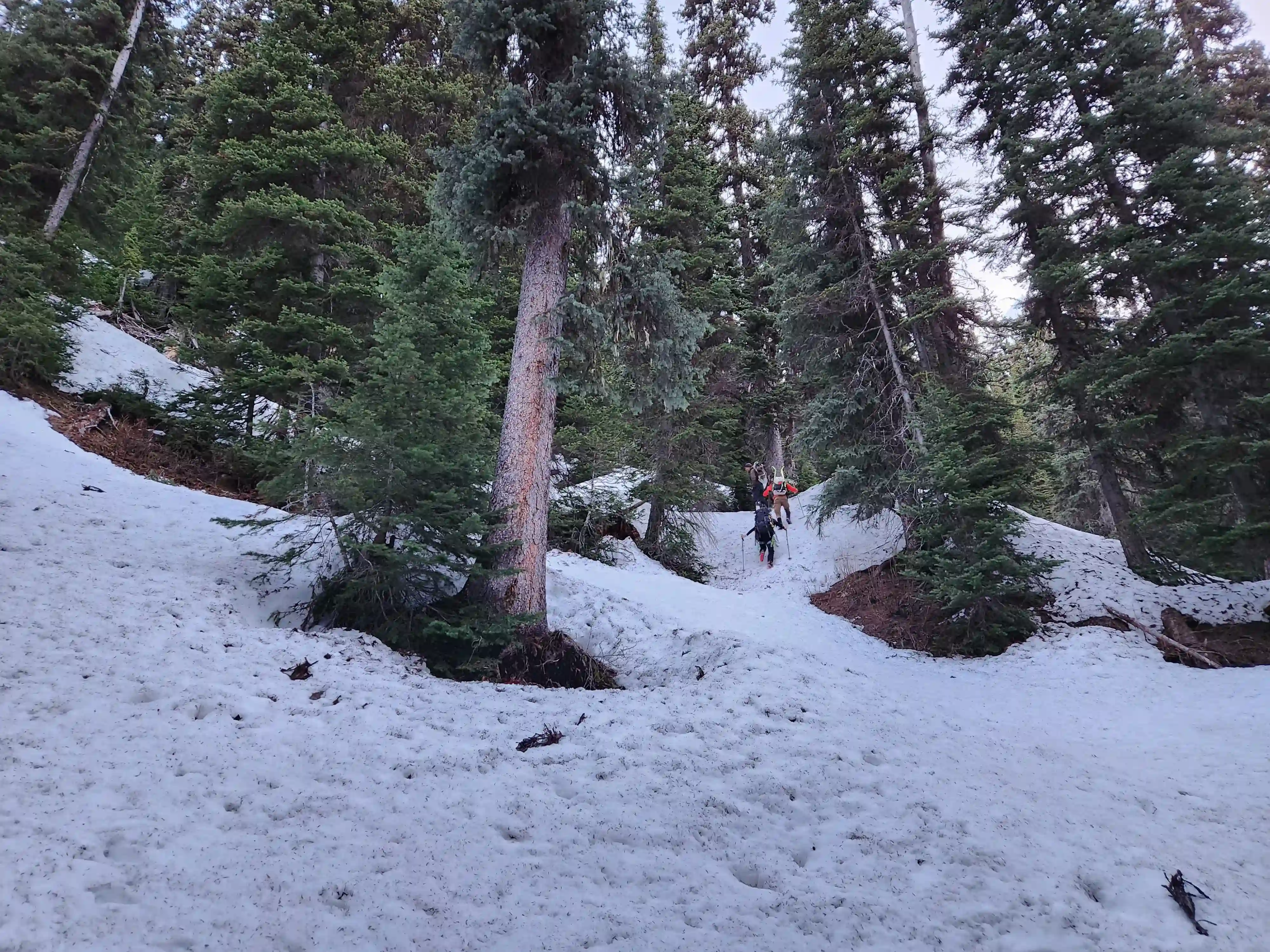
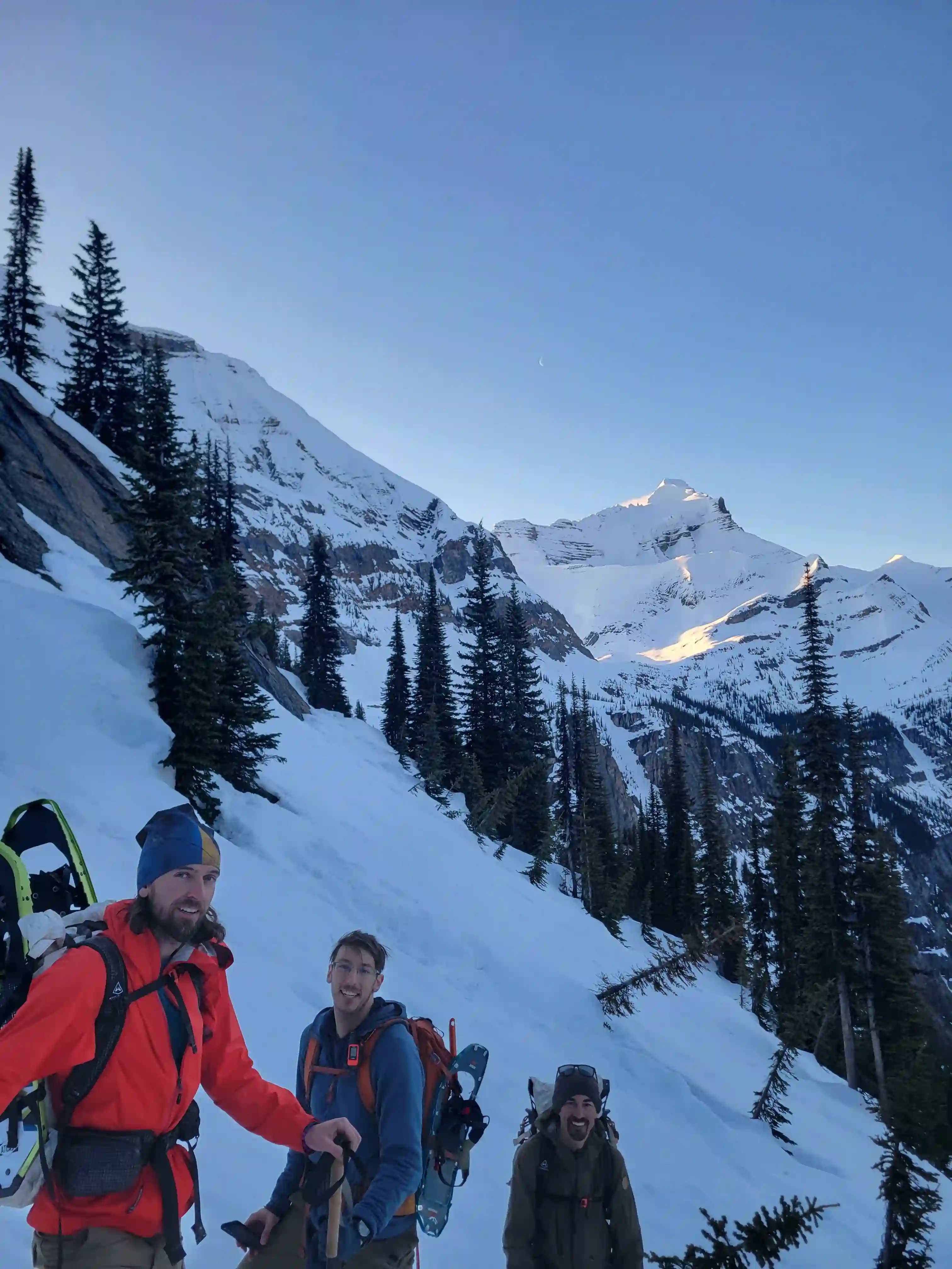
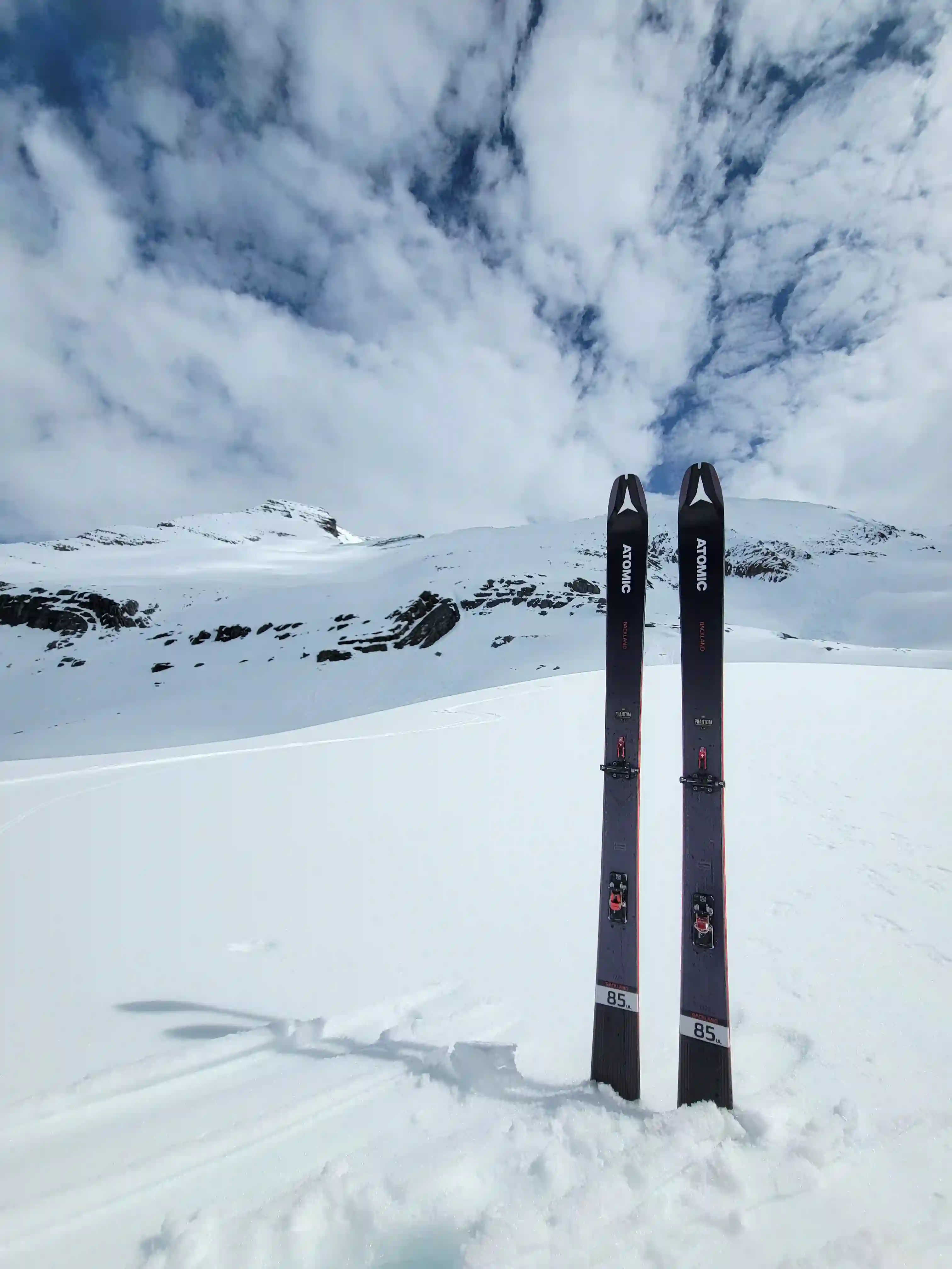
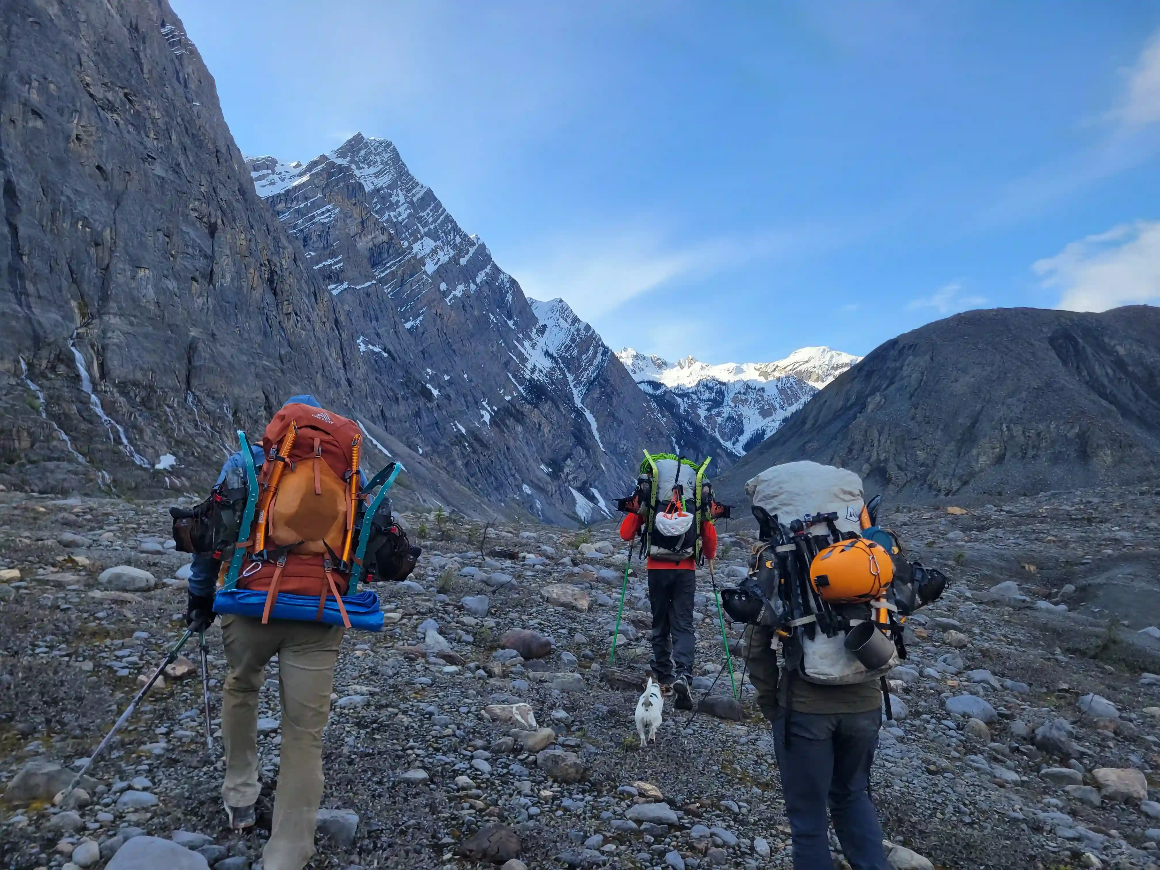
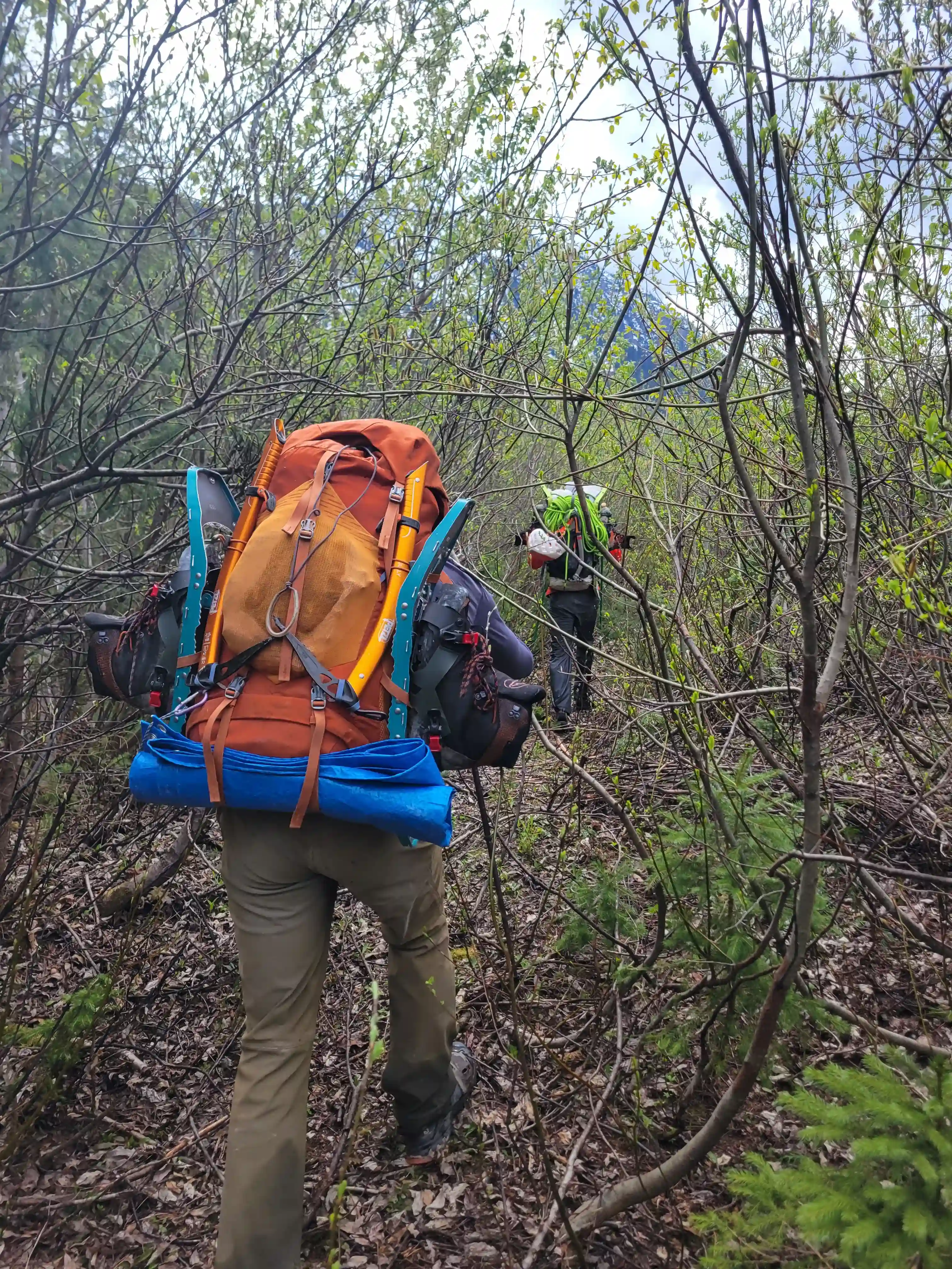
After throwing our packs together we were on the move and met up in Golden by the early afternoon before heading out the Bush River Forest Service Road followed by the Sullivan River Forest Service Road for a grand total of 140 kilometers before reaching the drainage point of the Kinbasket River which we'd be headed up towards the next day! It was already late by the time we arrived so the first night in the boonies was spent camping on the road / in our vehicles and getting our gear organized before waking up early the next morning to begin our trek! Simon, Devan, and Tim were opting for snow shoes for the upper snowy sections on the mountain but what I've learned from past trips is that it's always nice to have the option to ski so I decided to bring the skis in for the long haul.
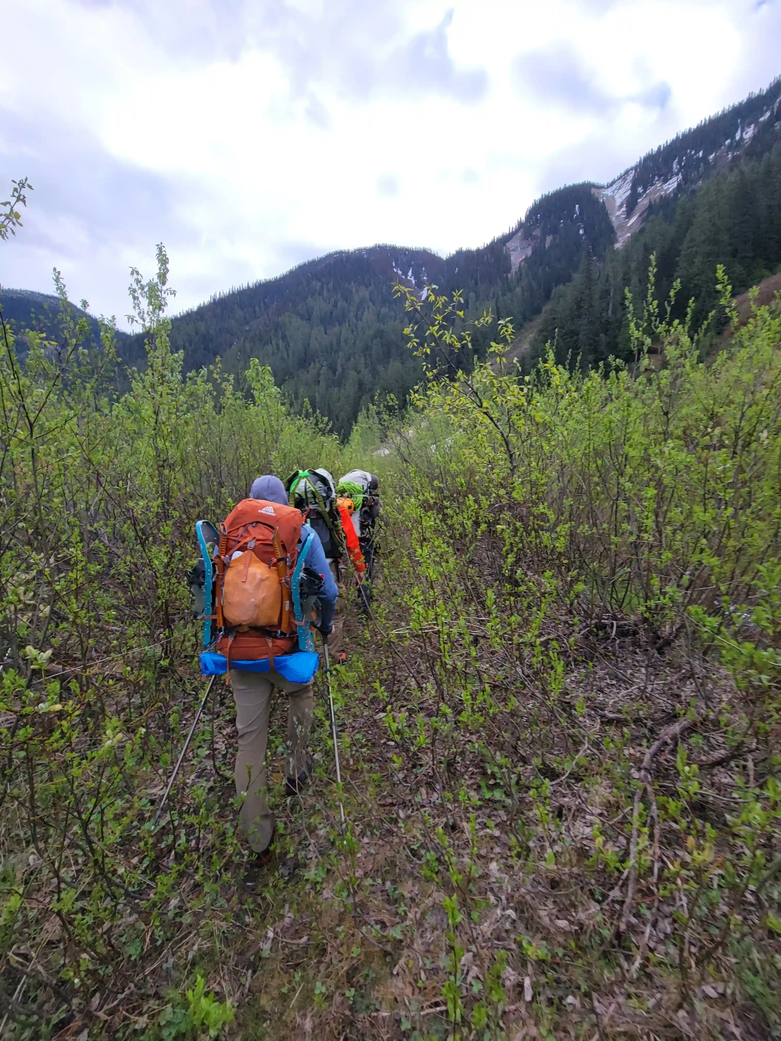
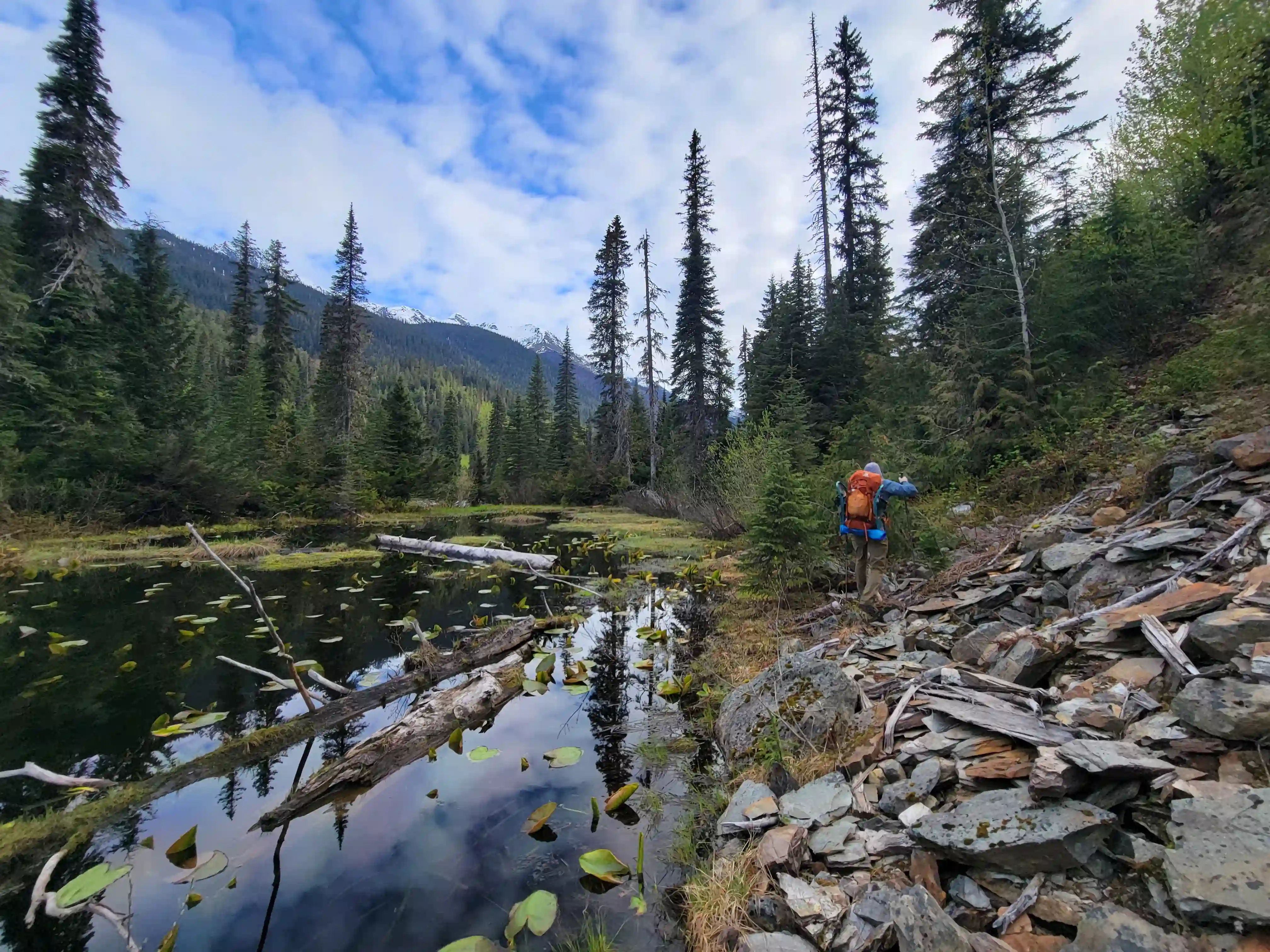
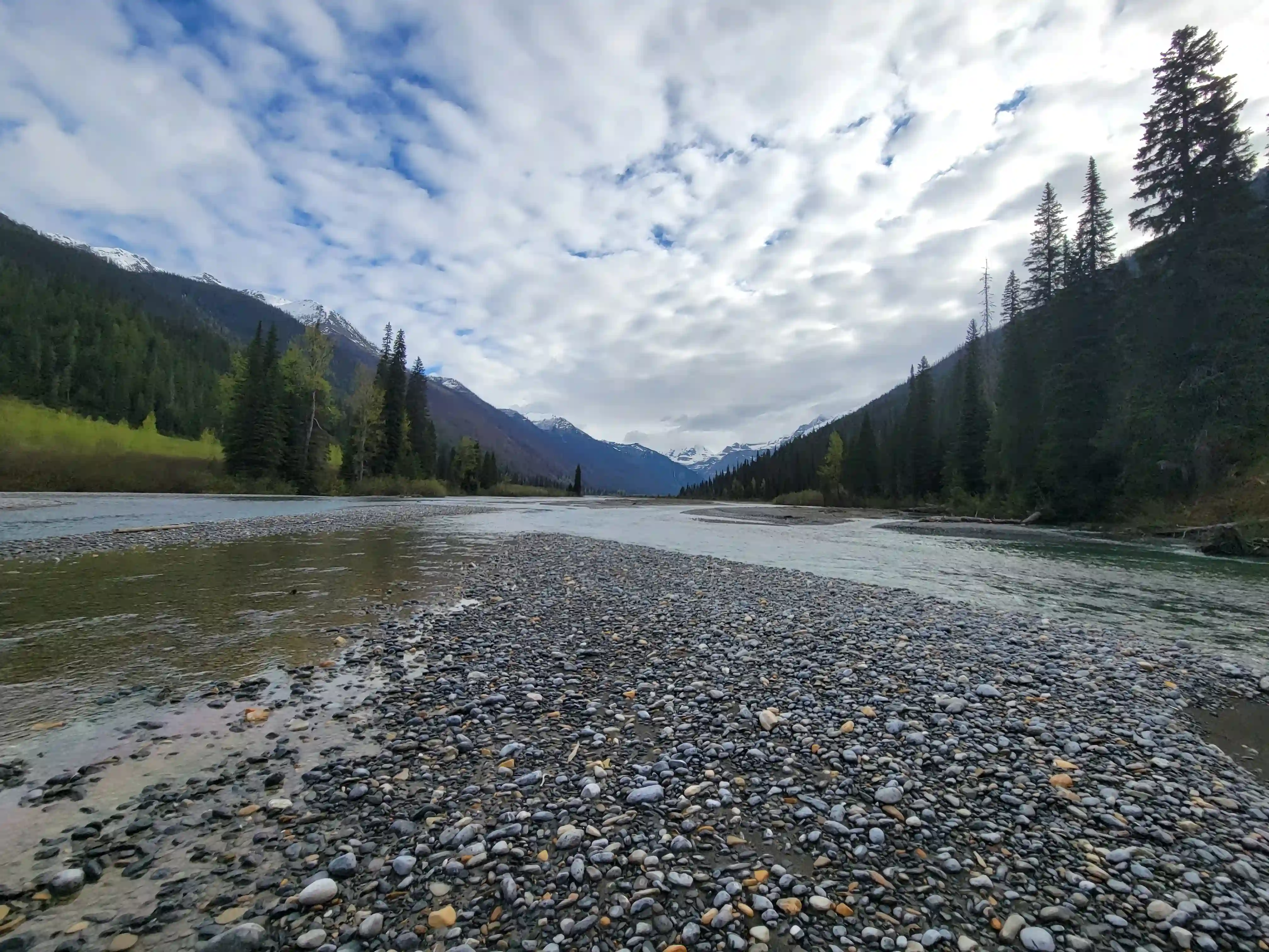
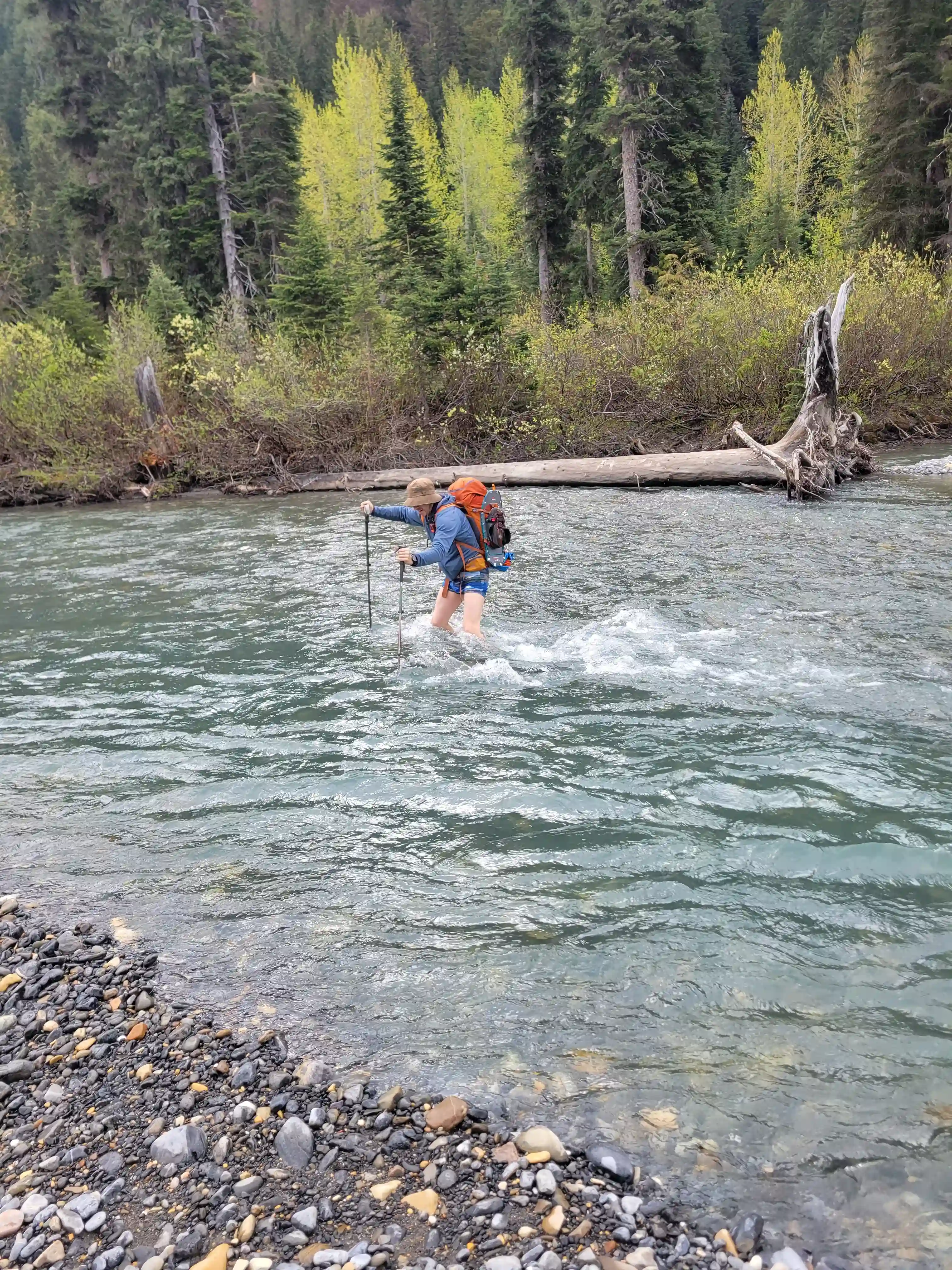
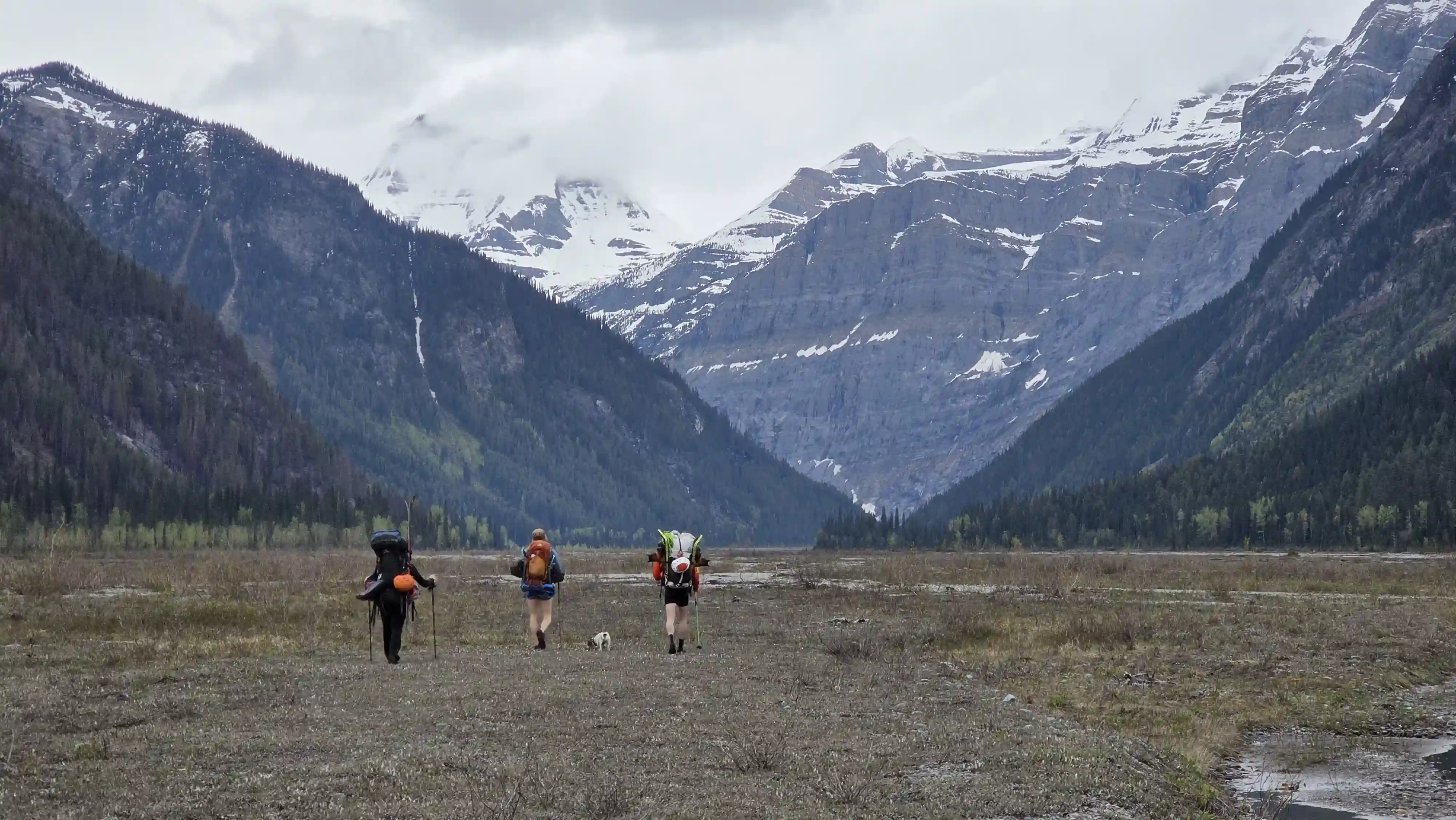
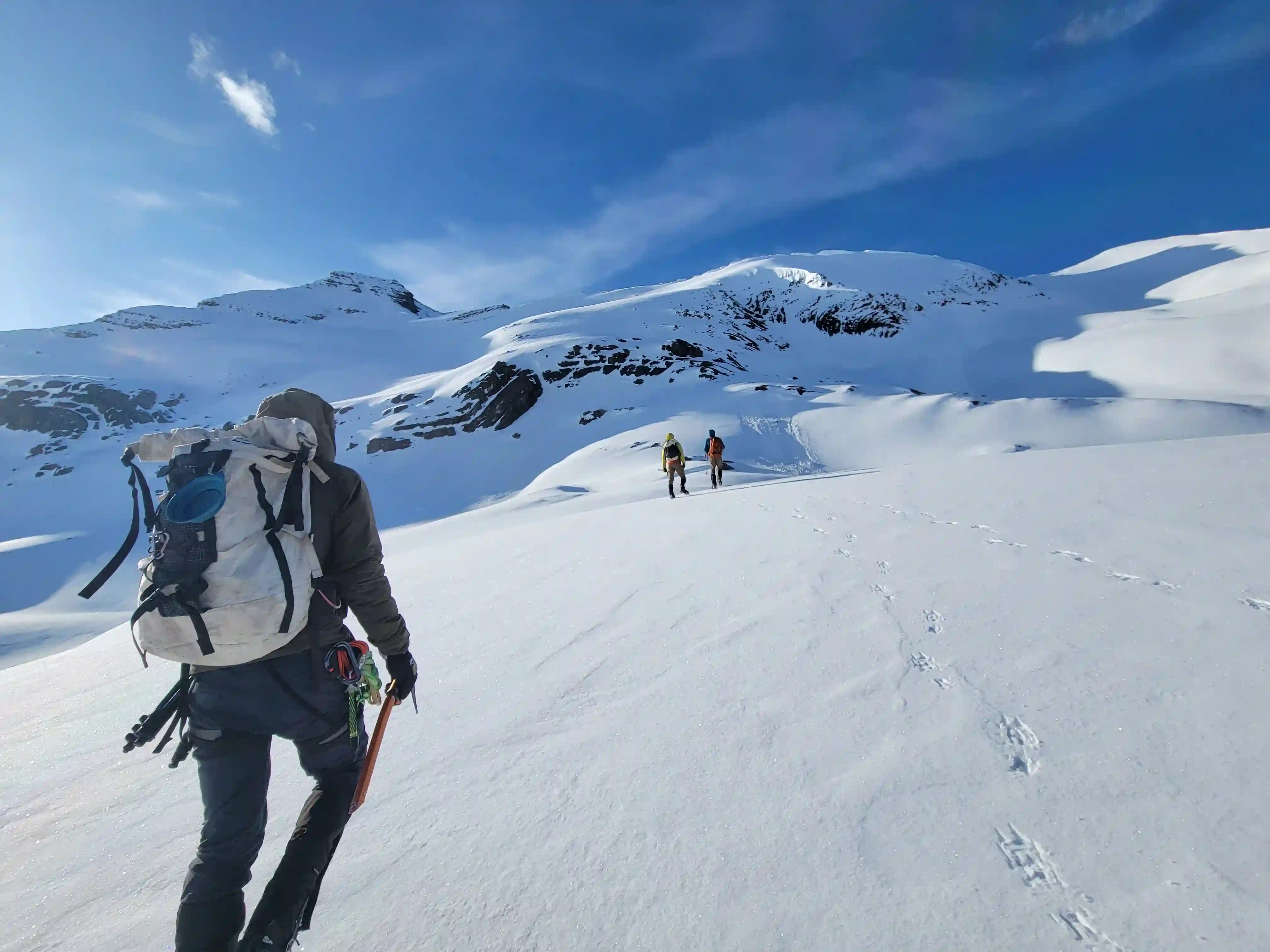
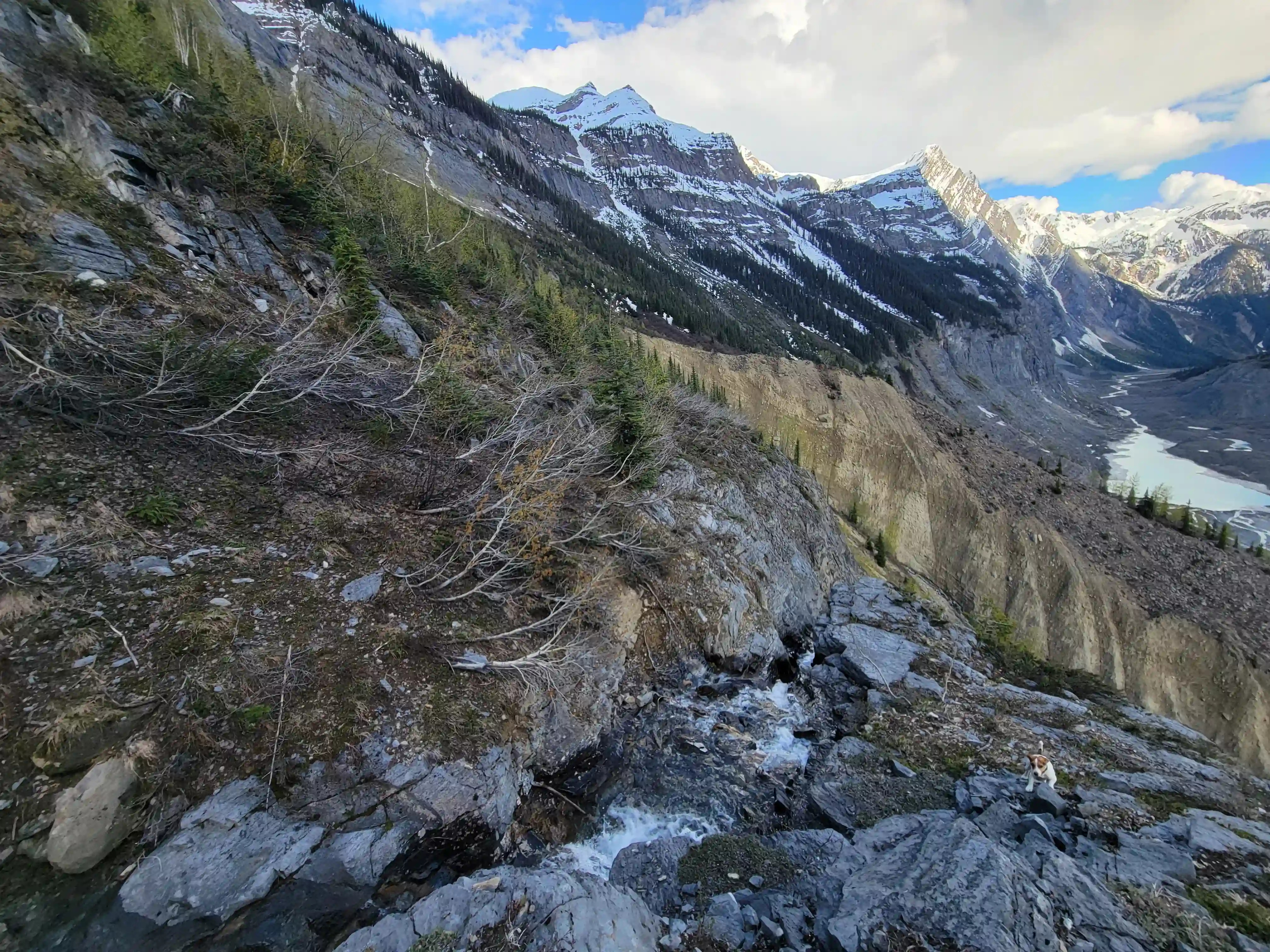
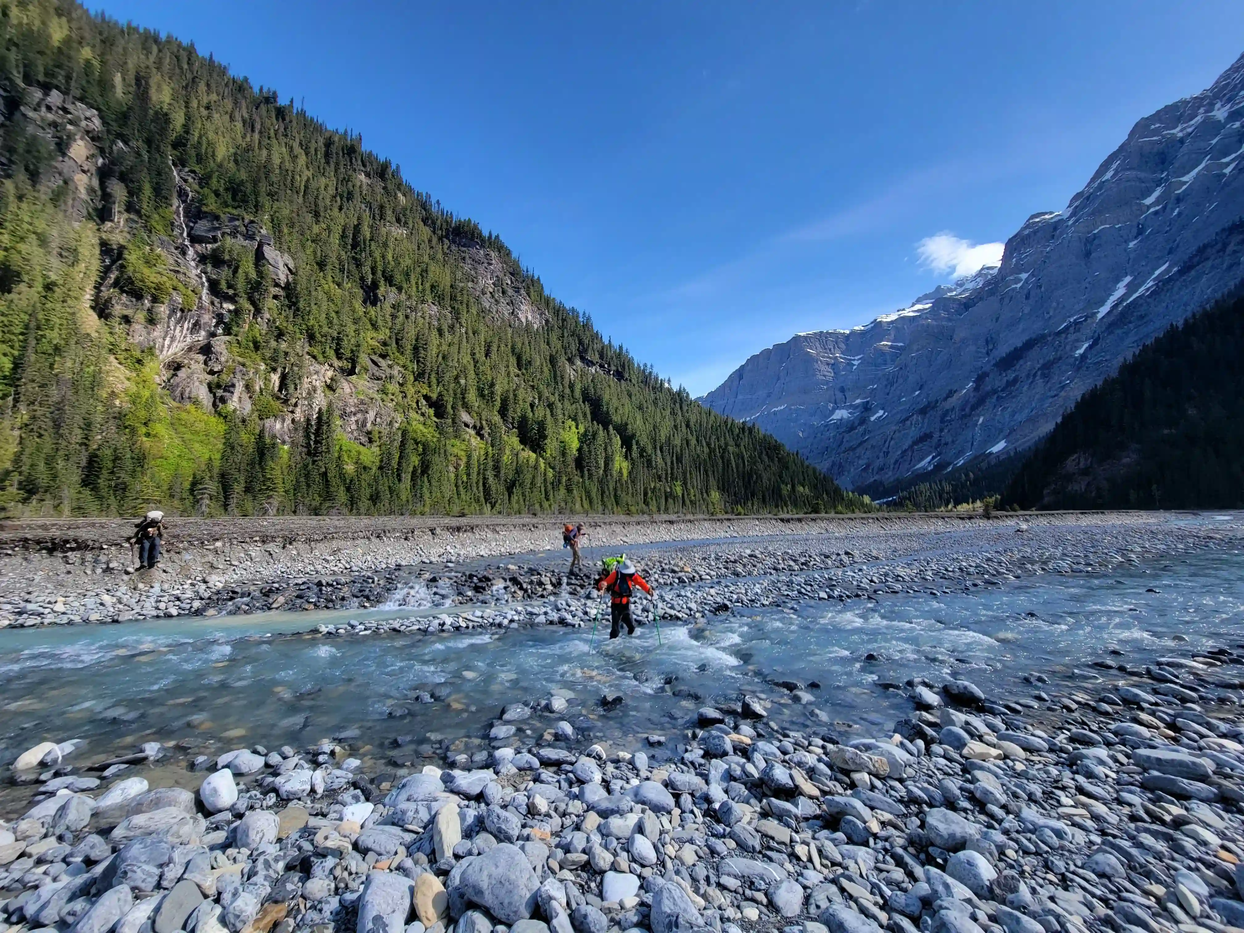
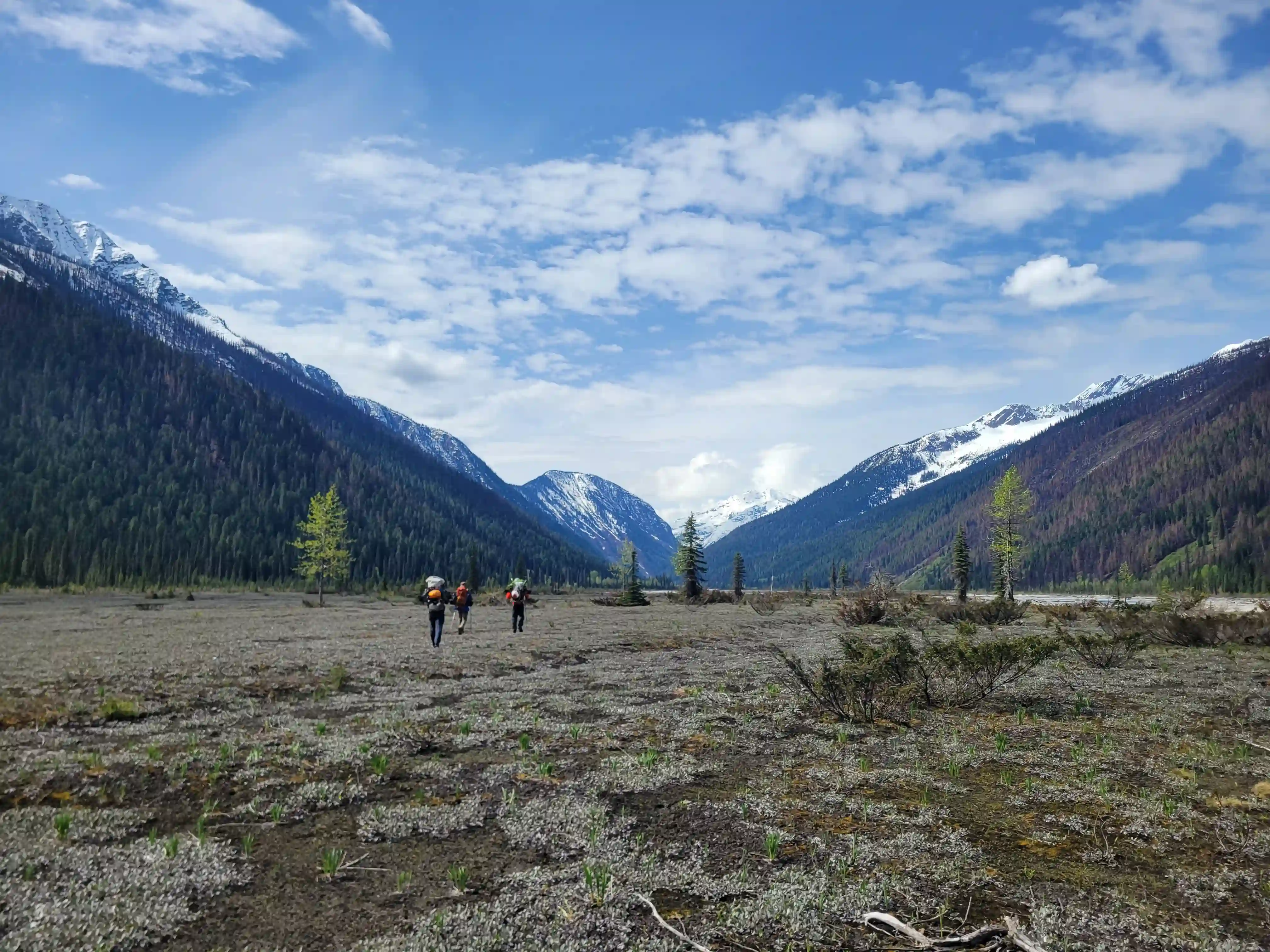
The next morning we were off with high stoke and made short work of the bushy portion of the approach to reach the river. The work Simon had done in 2023 had made things extremely manageable and despite some alder annoyances this section was much better than what I had been expecting. From the end of the treed section all that was left of the approach was a long walk along dry riverbed with the occasional water crossing as we made our way to our camp at the end of the valley!
Follow the journey
I'll send you an email when a new trip report drops.
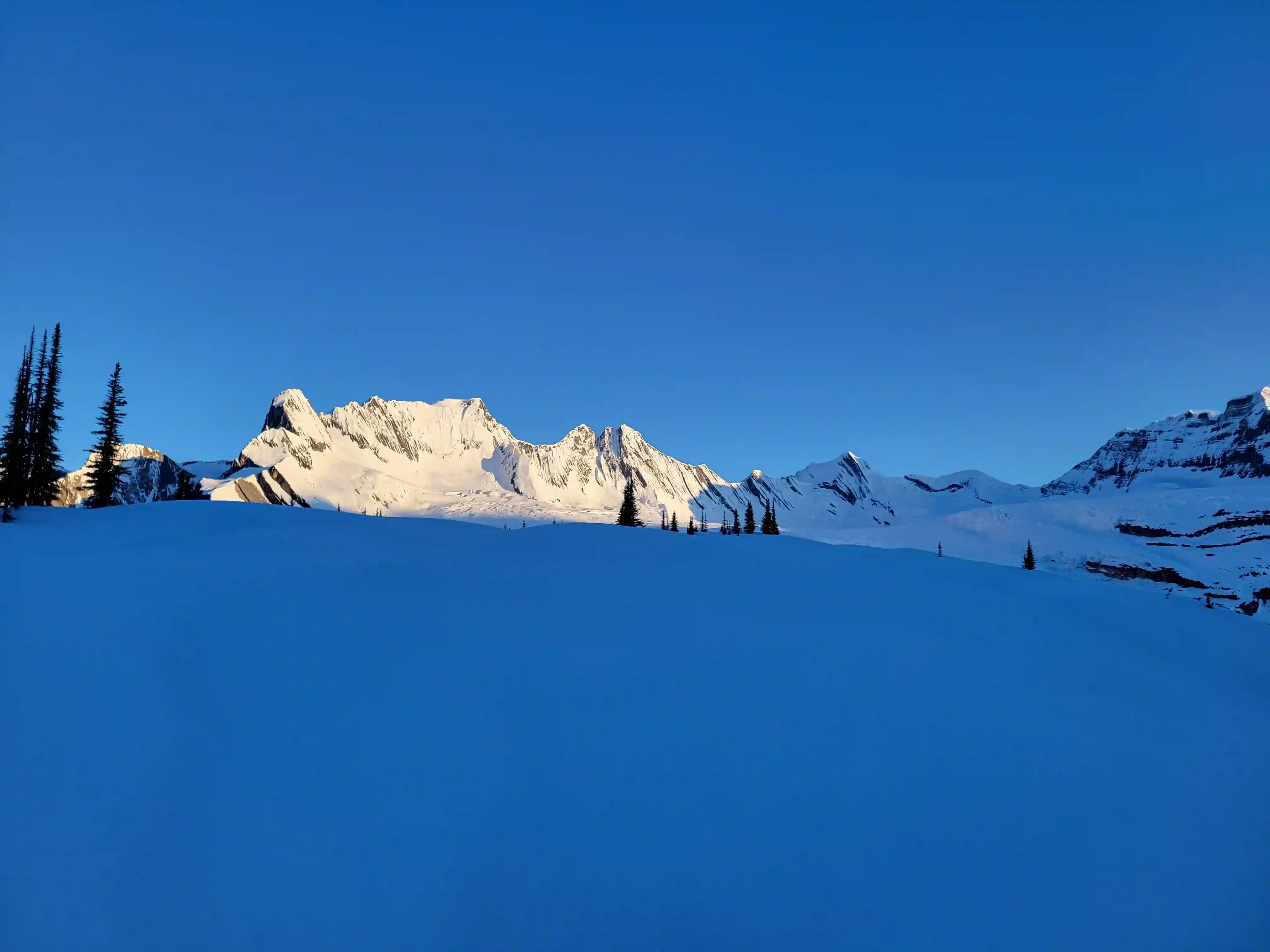
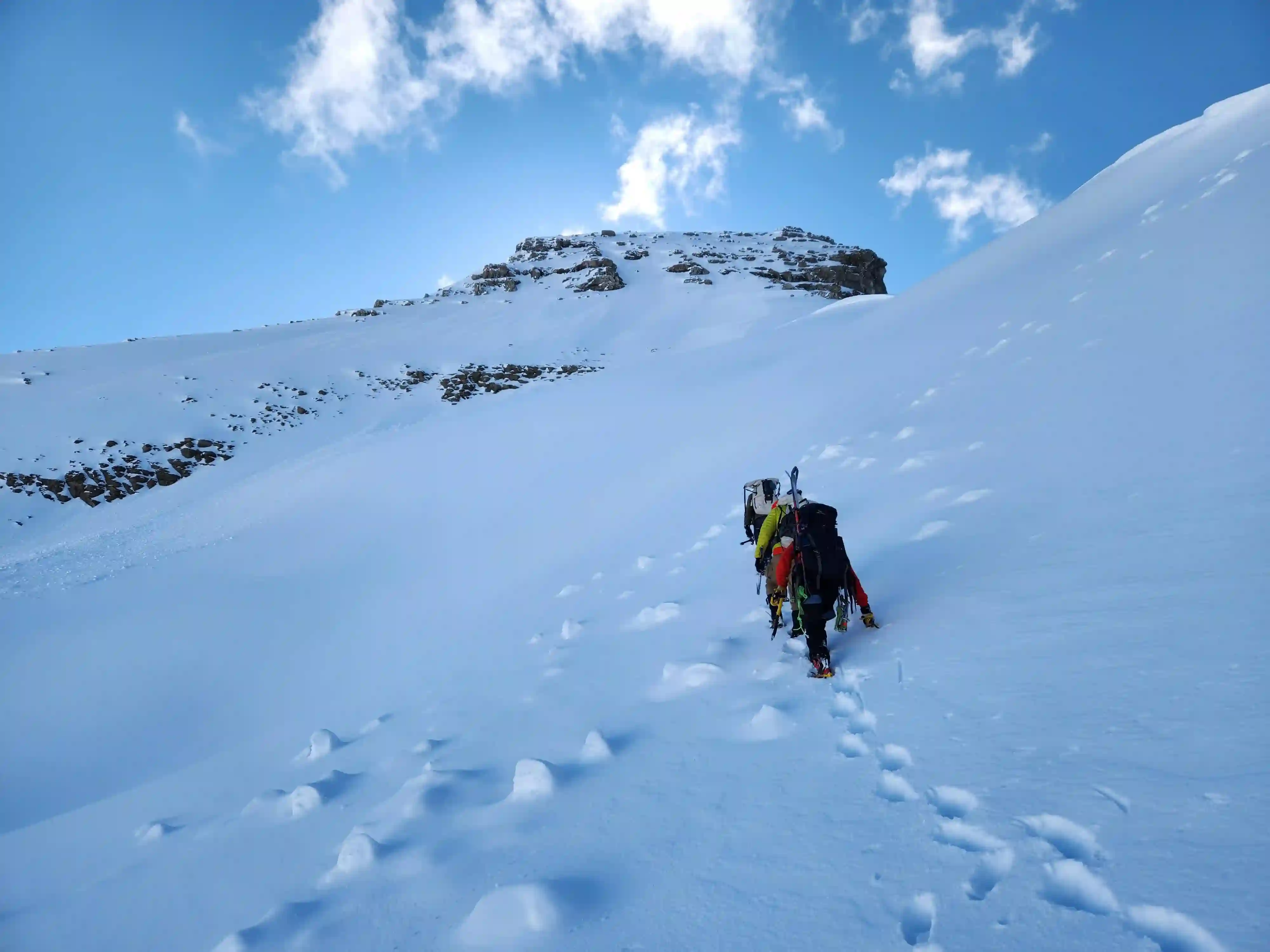
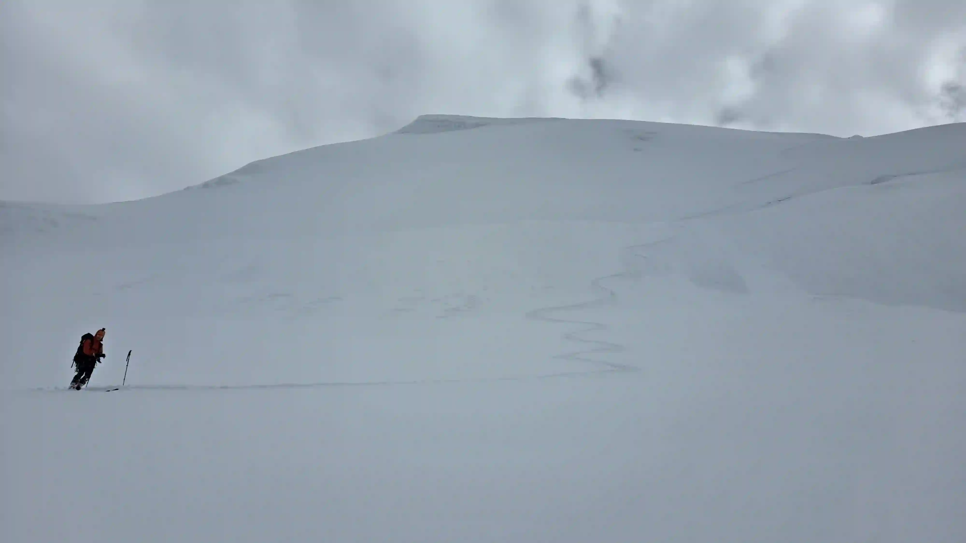
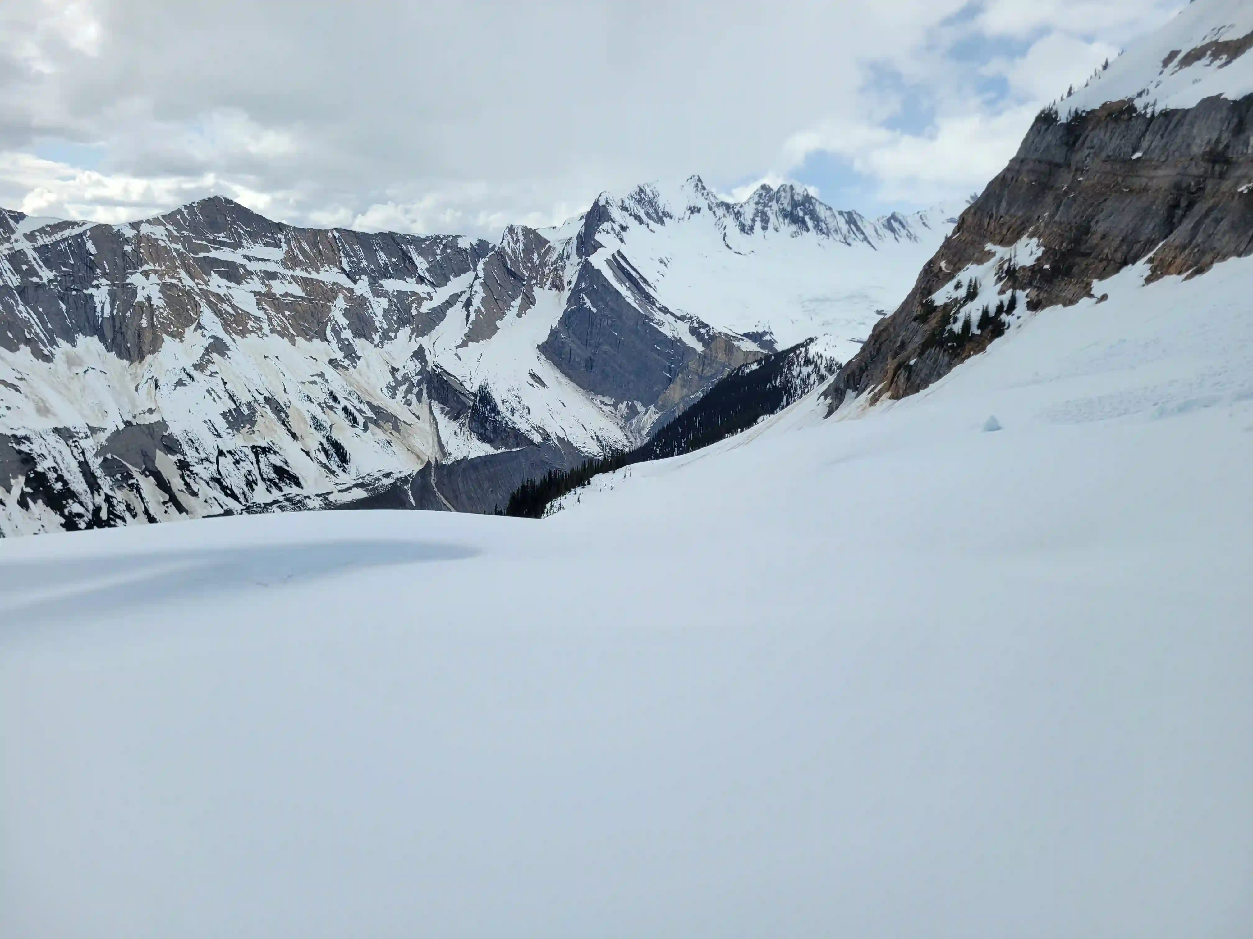
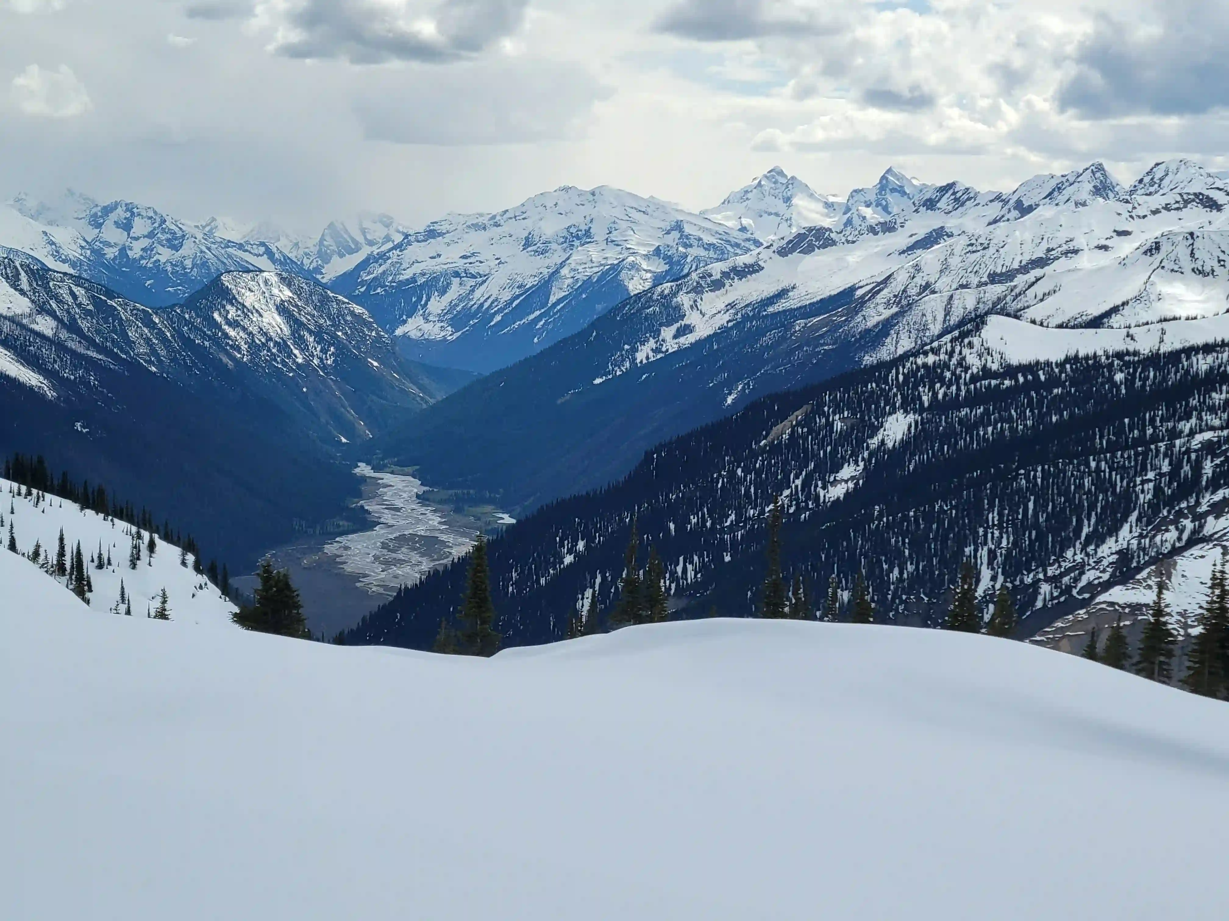
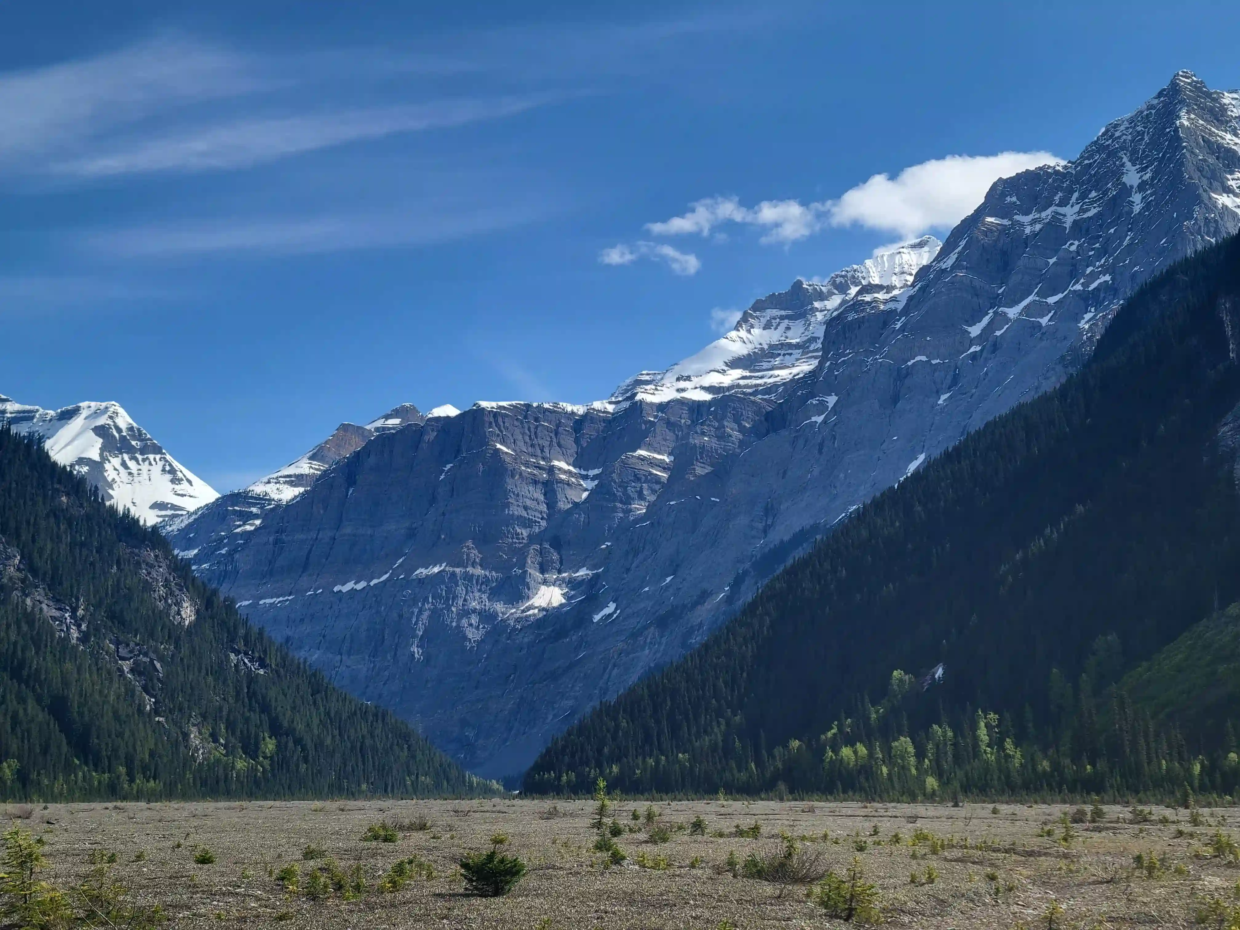
THE APPROACH
mountains, it's pretty nice!
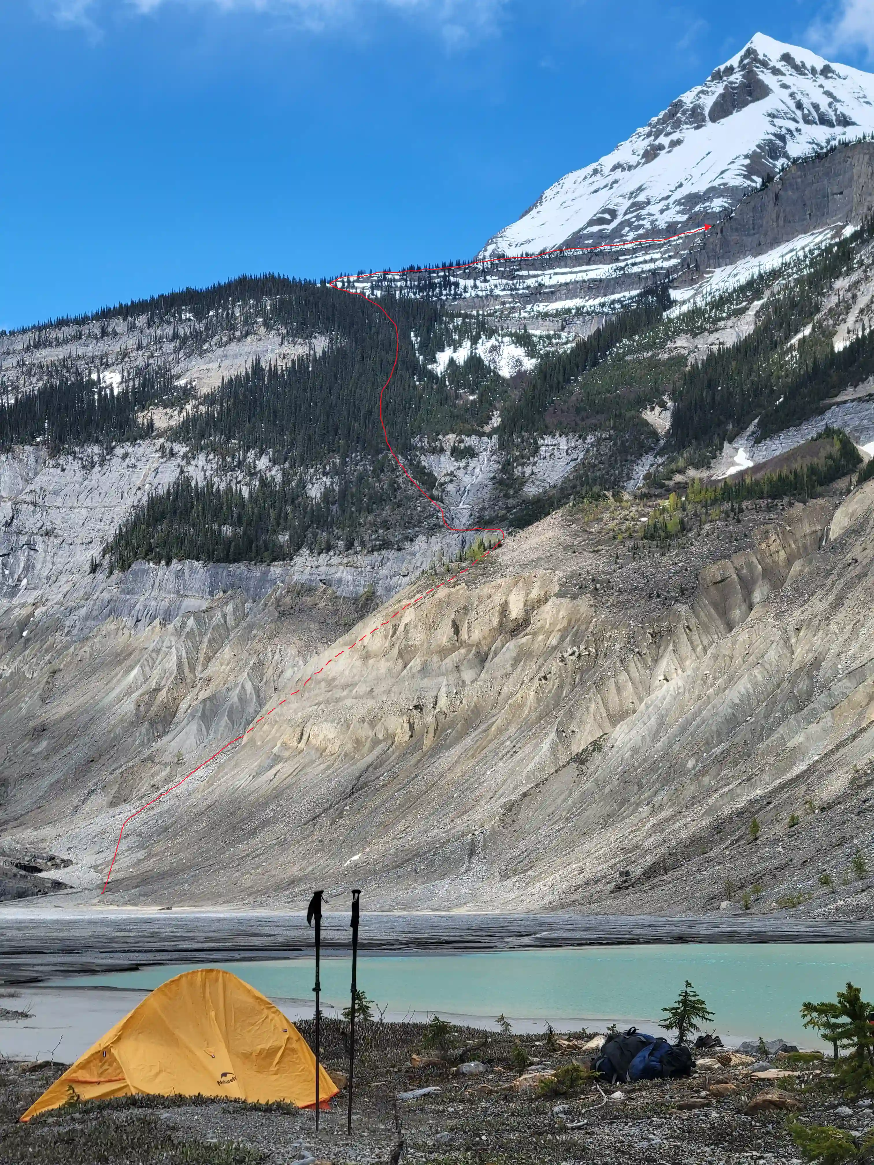
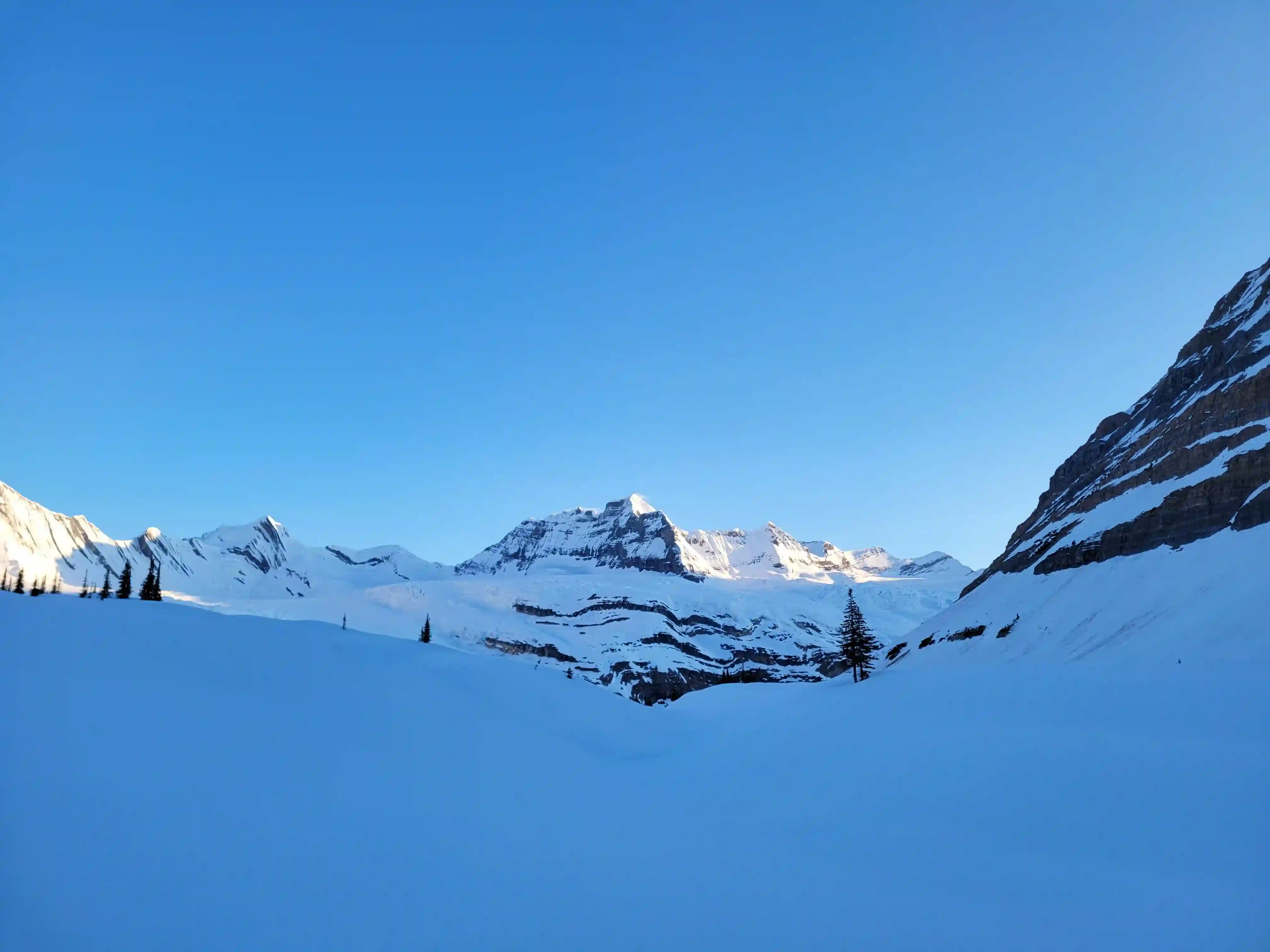
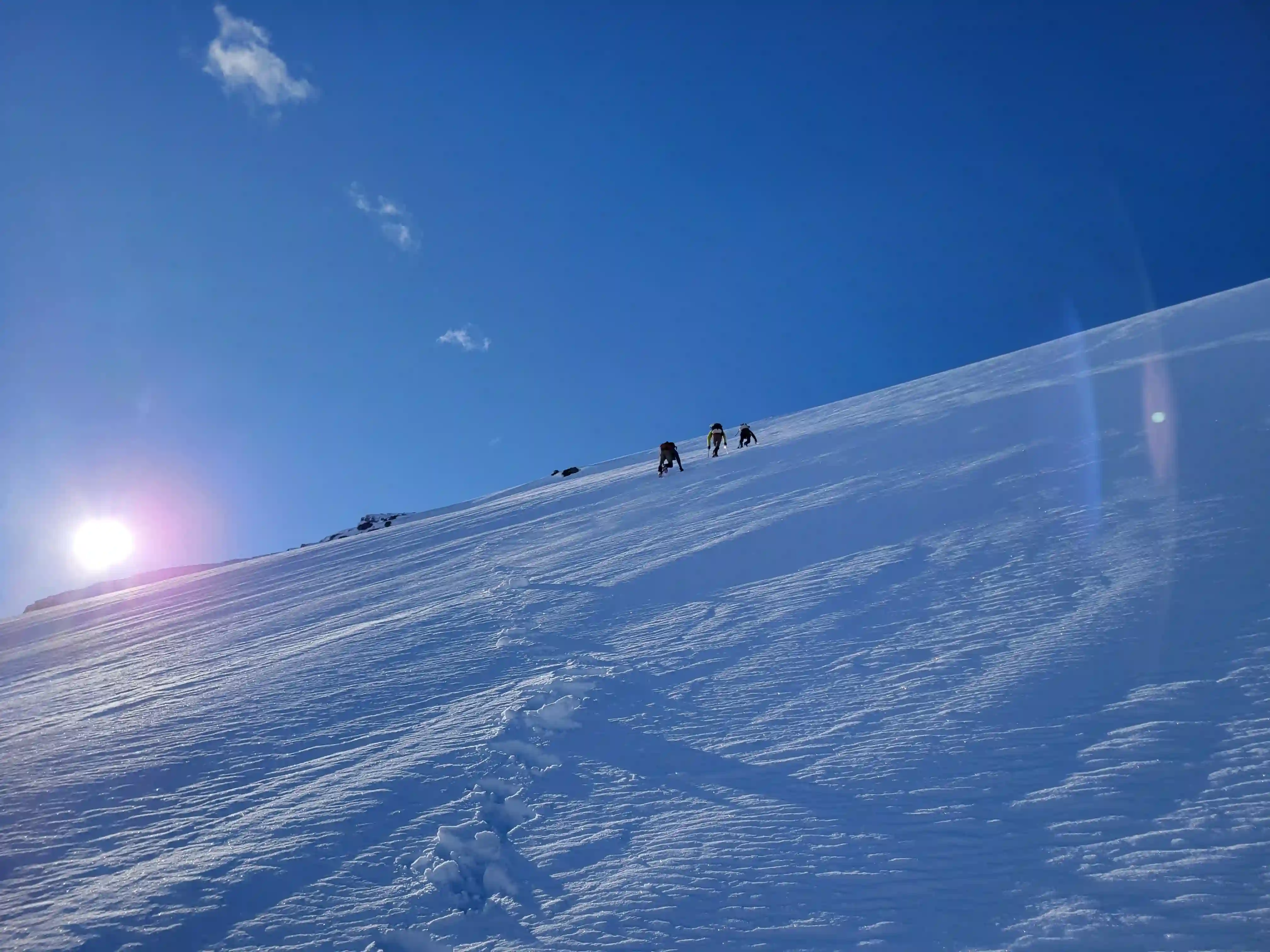
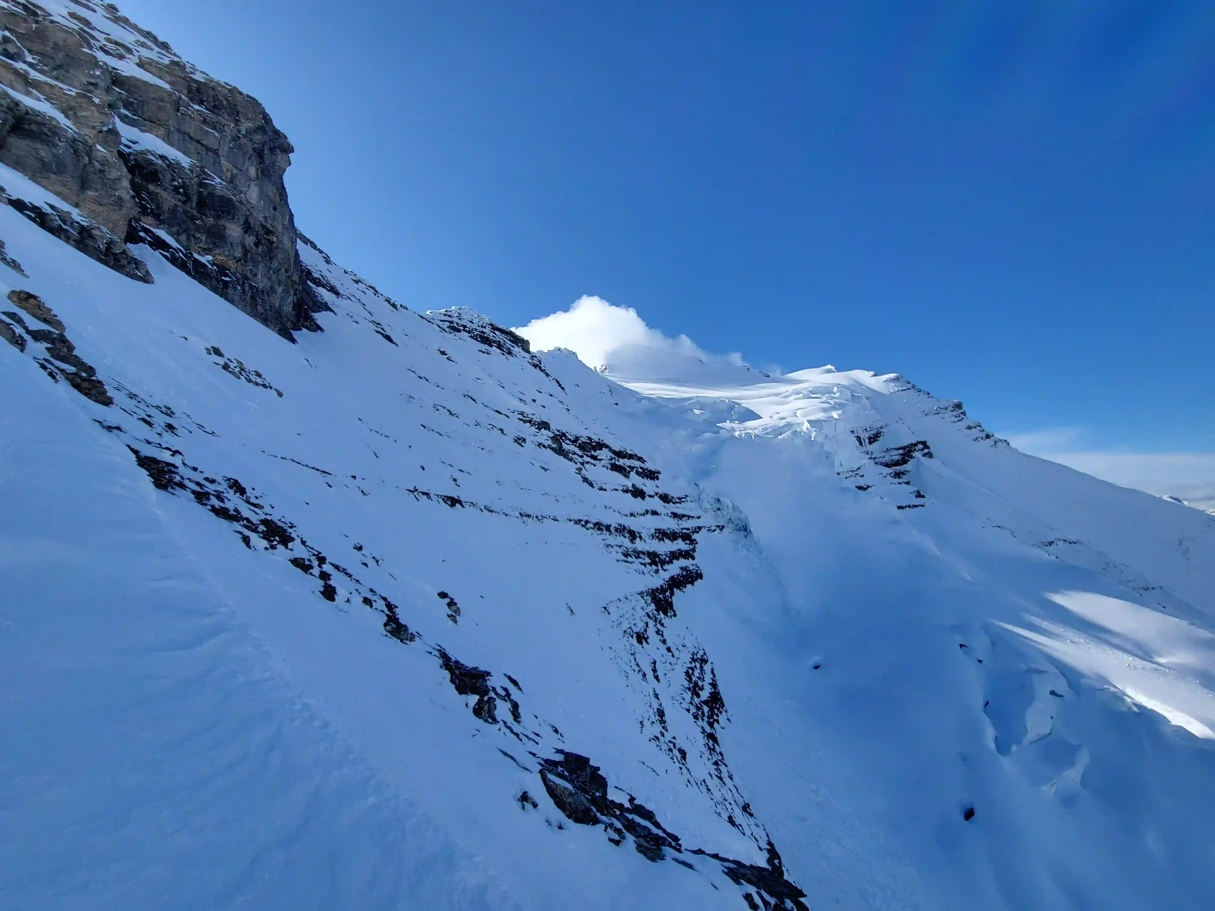
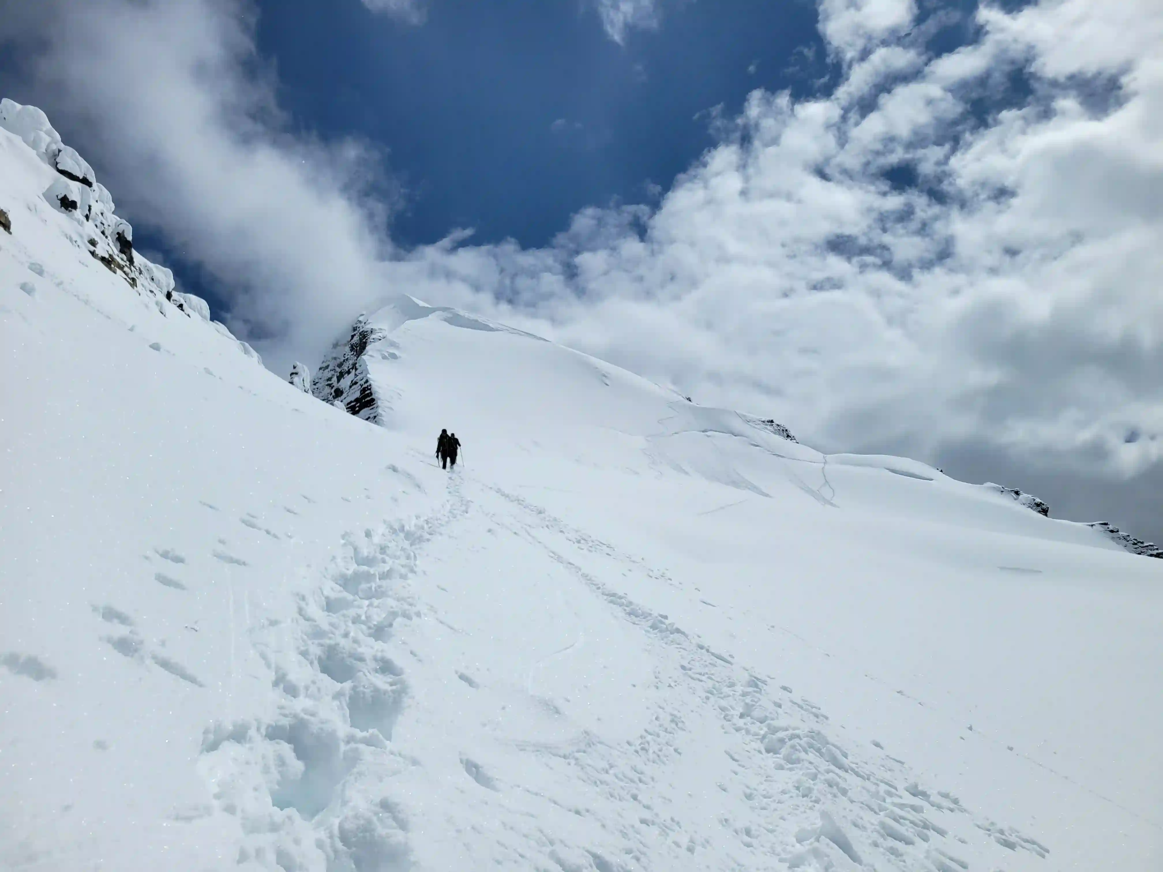
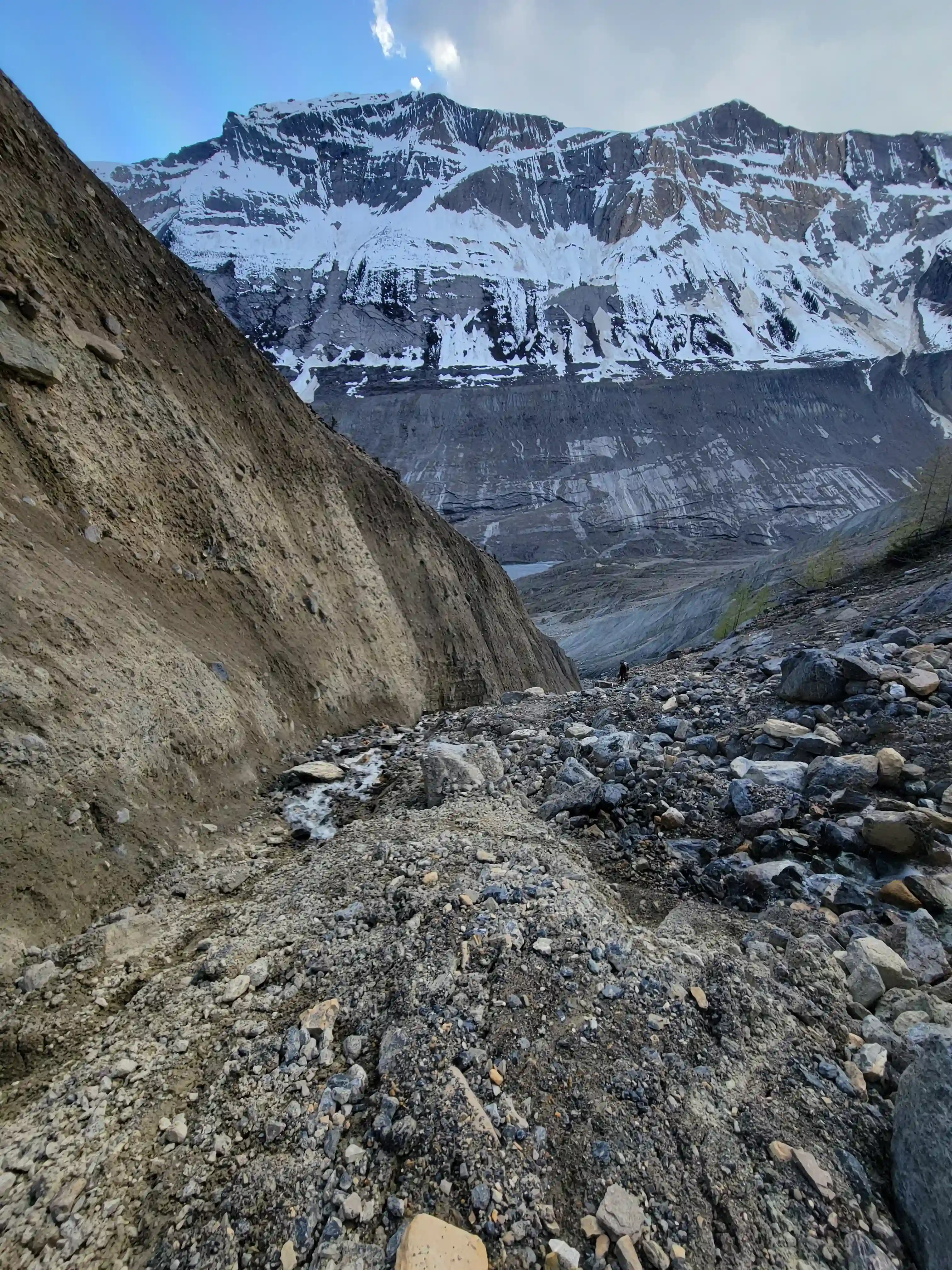
THE HEADWALL
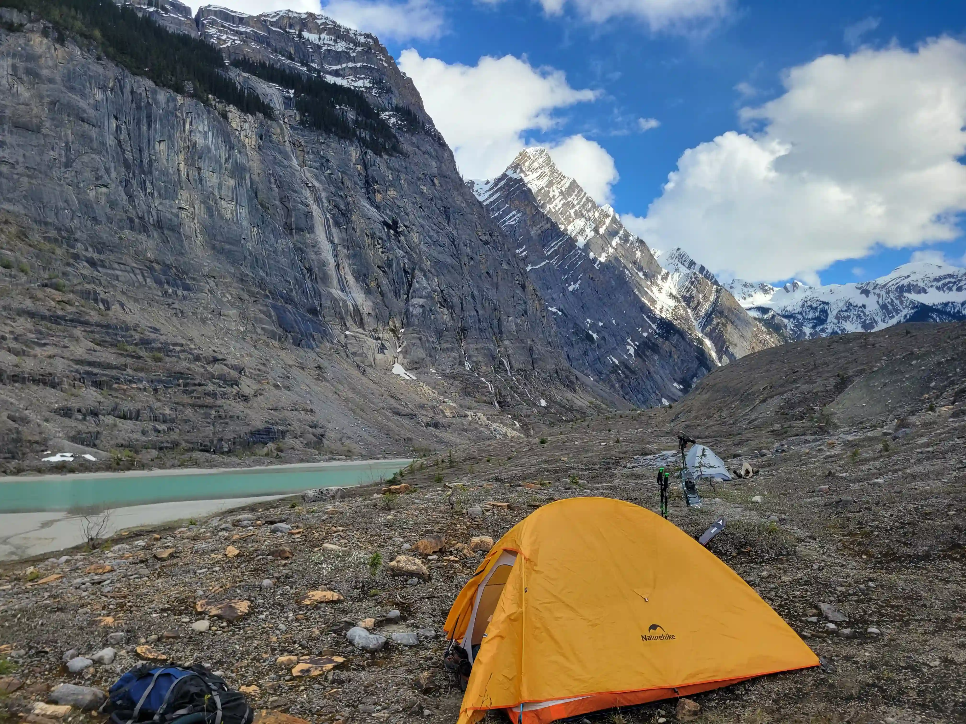
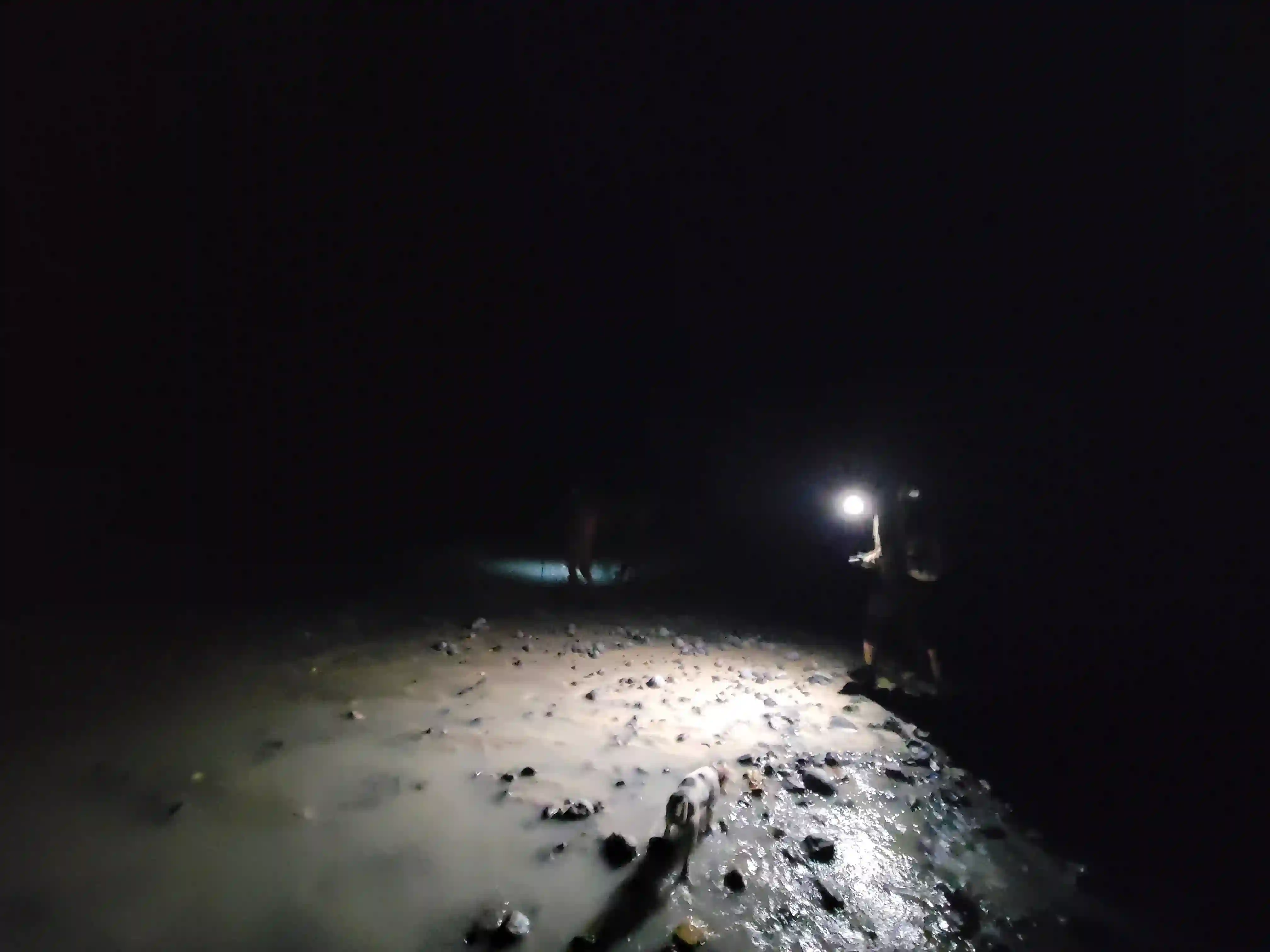
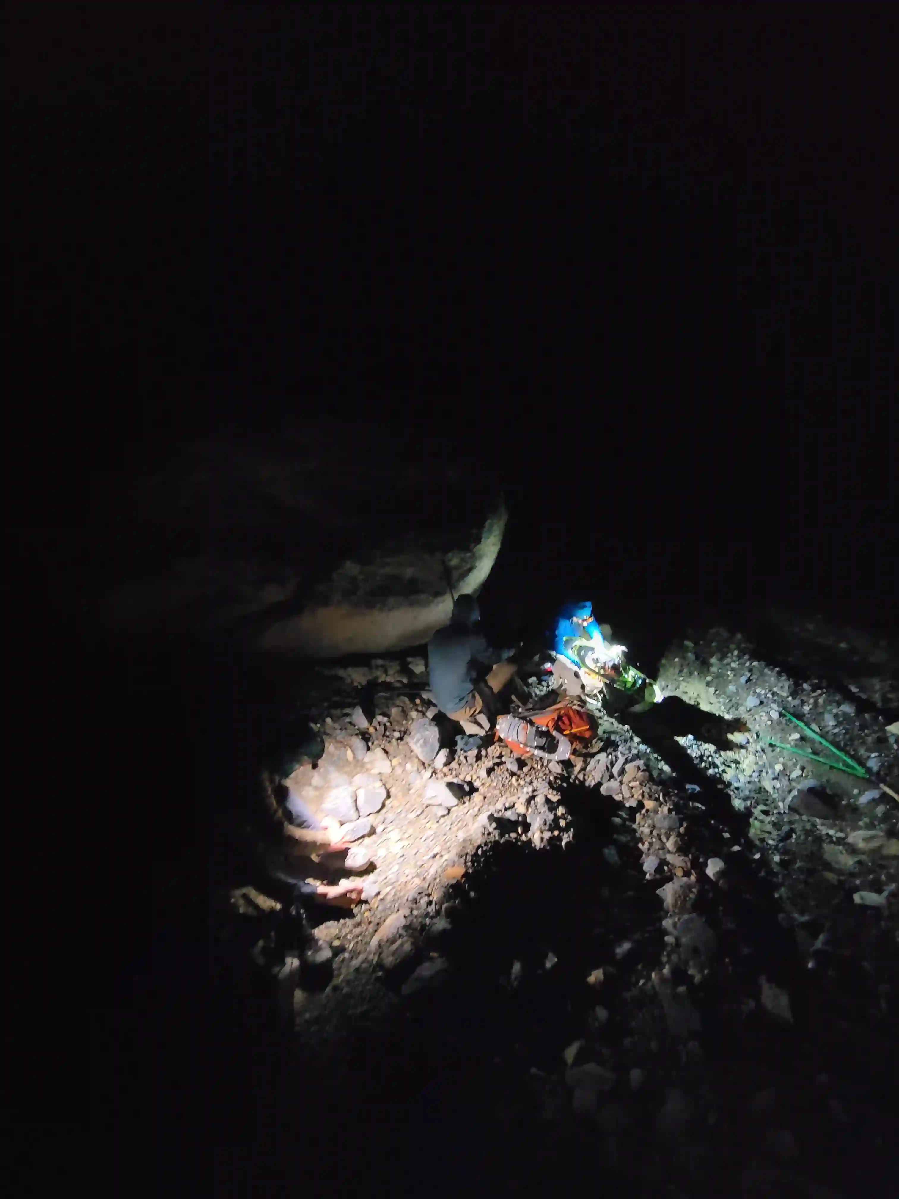
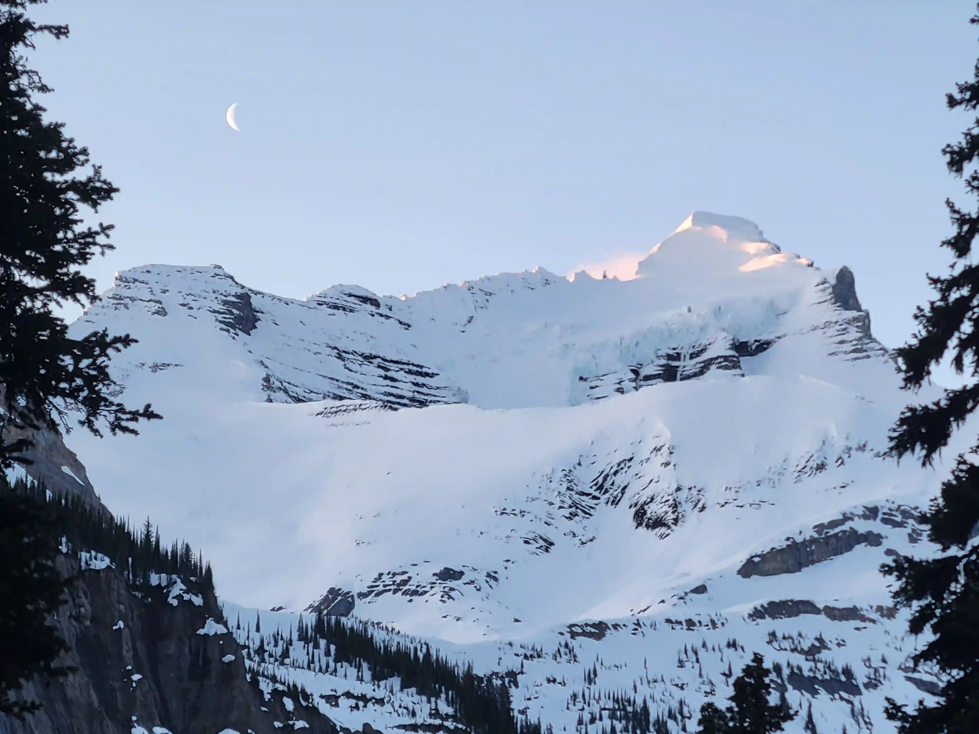
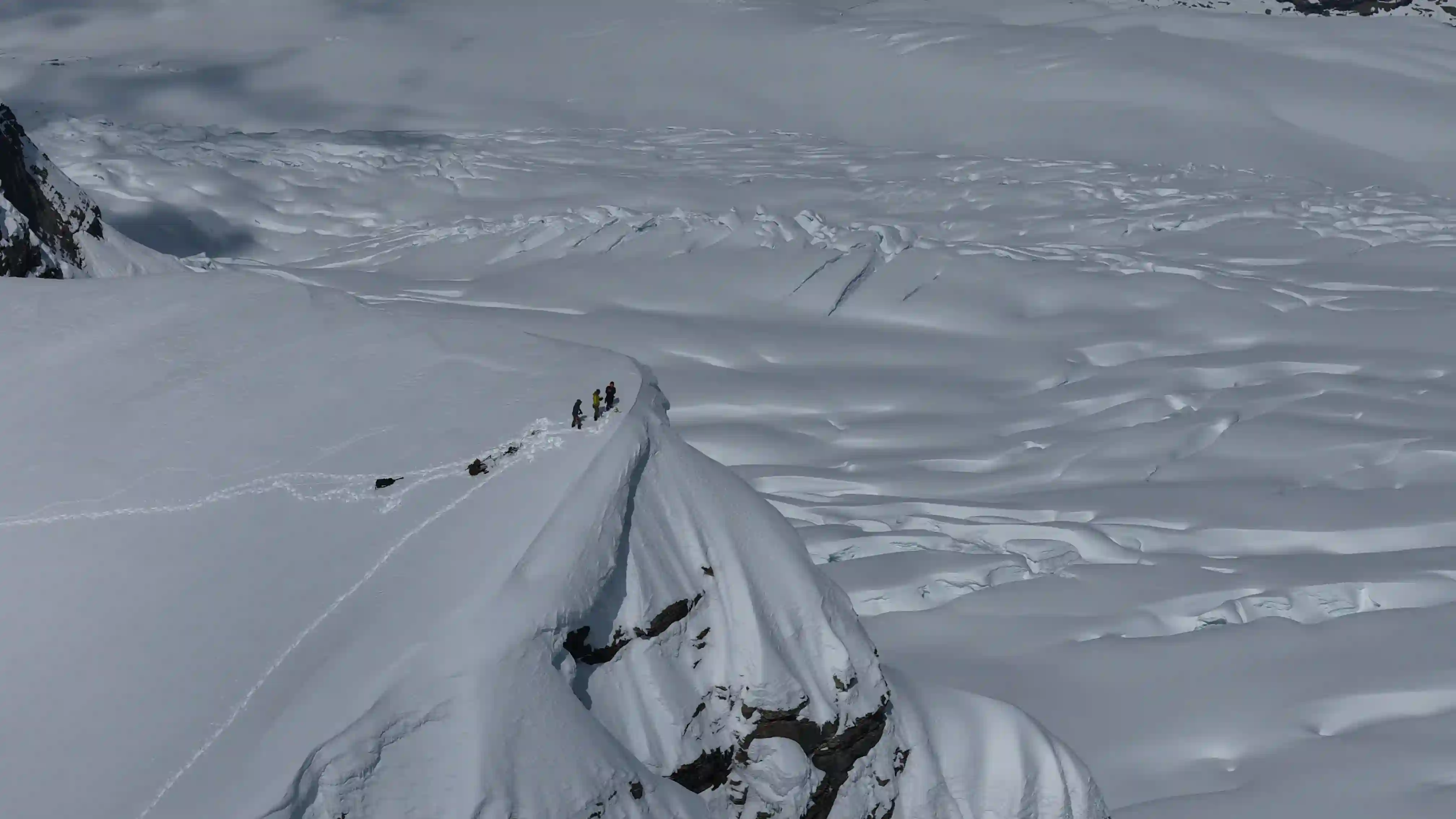
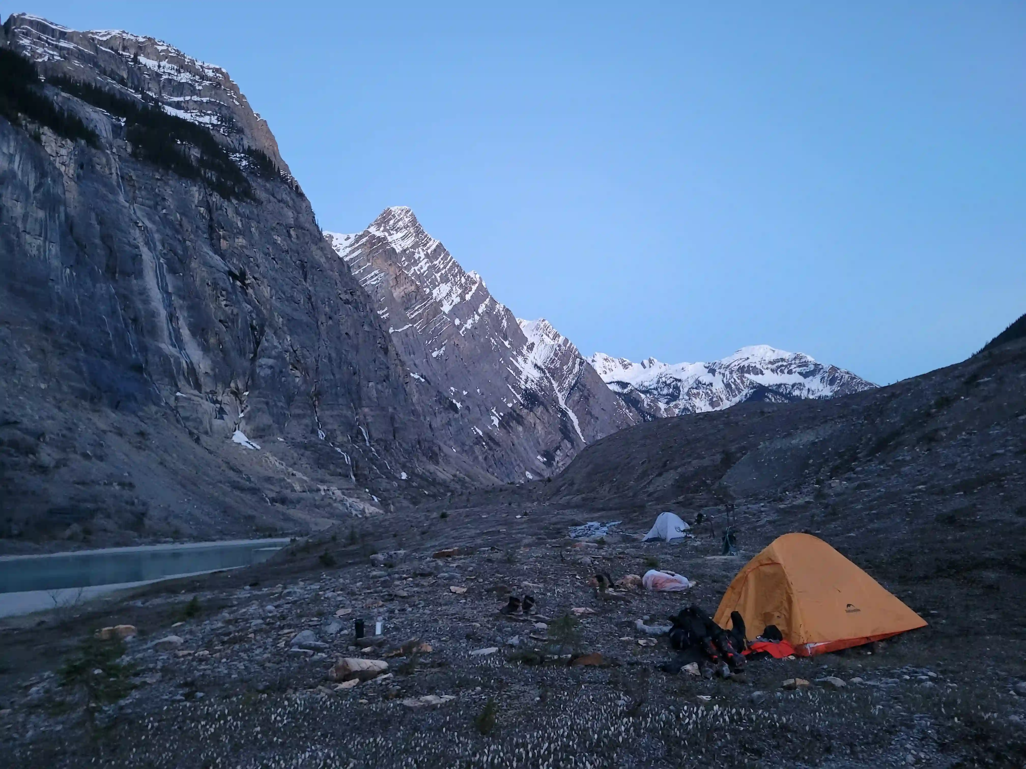
Because of the steep nature of the headwall and Simon having past experience from 2024 hauling camp gear part way up it we made the call to camp at the lake below to move more efficiently on summit day and not waste energy carrying the extra weight. This meant that our summit push would be quite huge, having to gain the 1000 meter headwall before doing the final 1300 meters of gain from the col and getting back down it all in one go but we felt this was the best option and were off to bed extra early as we'd be waking up in the middle of the night to get it done!
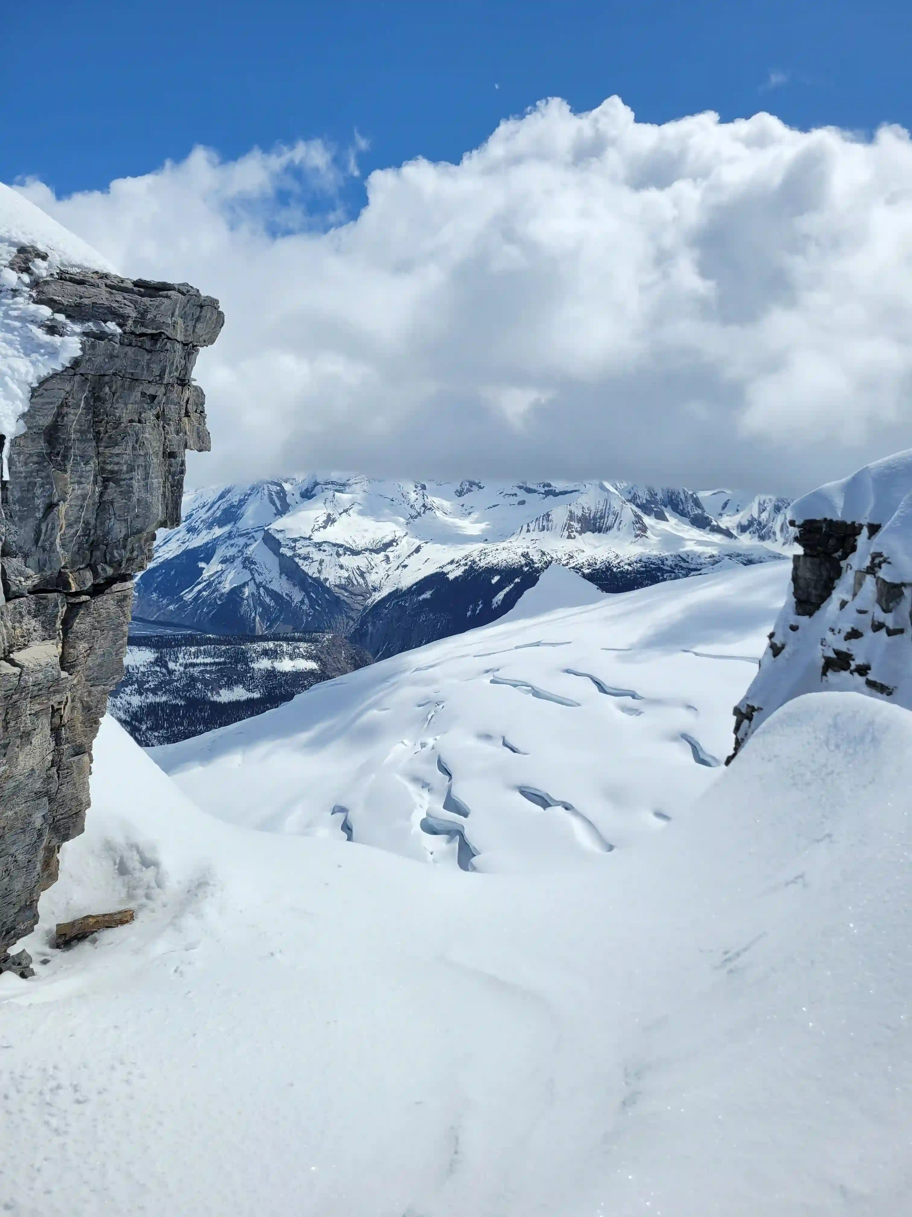
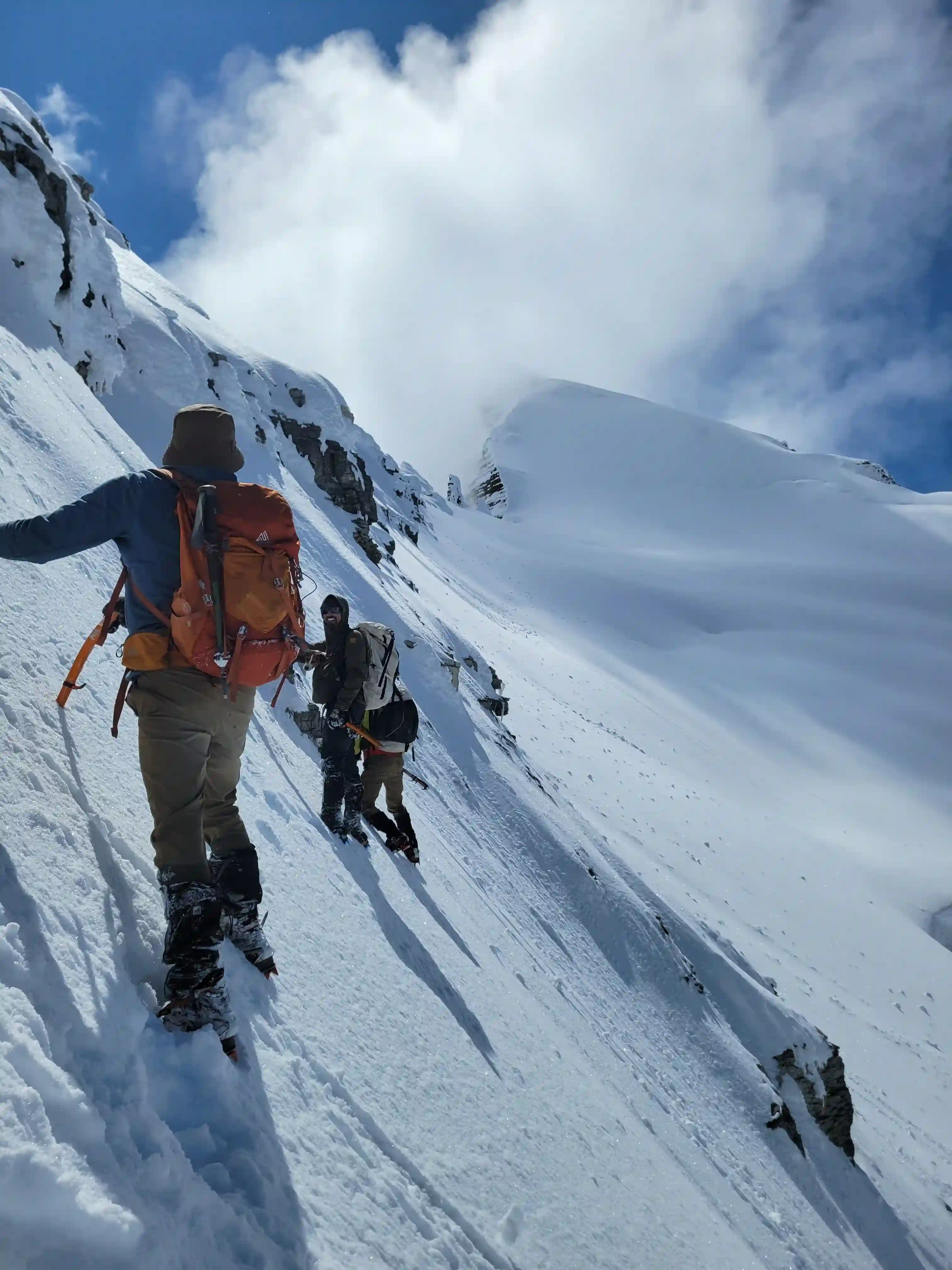
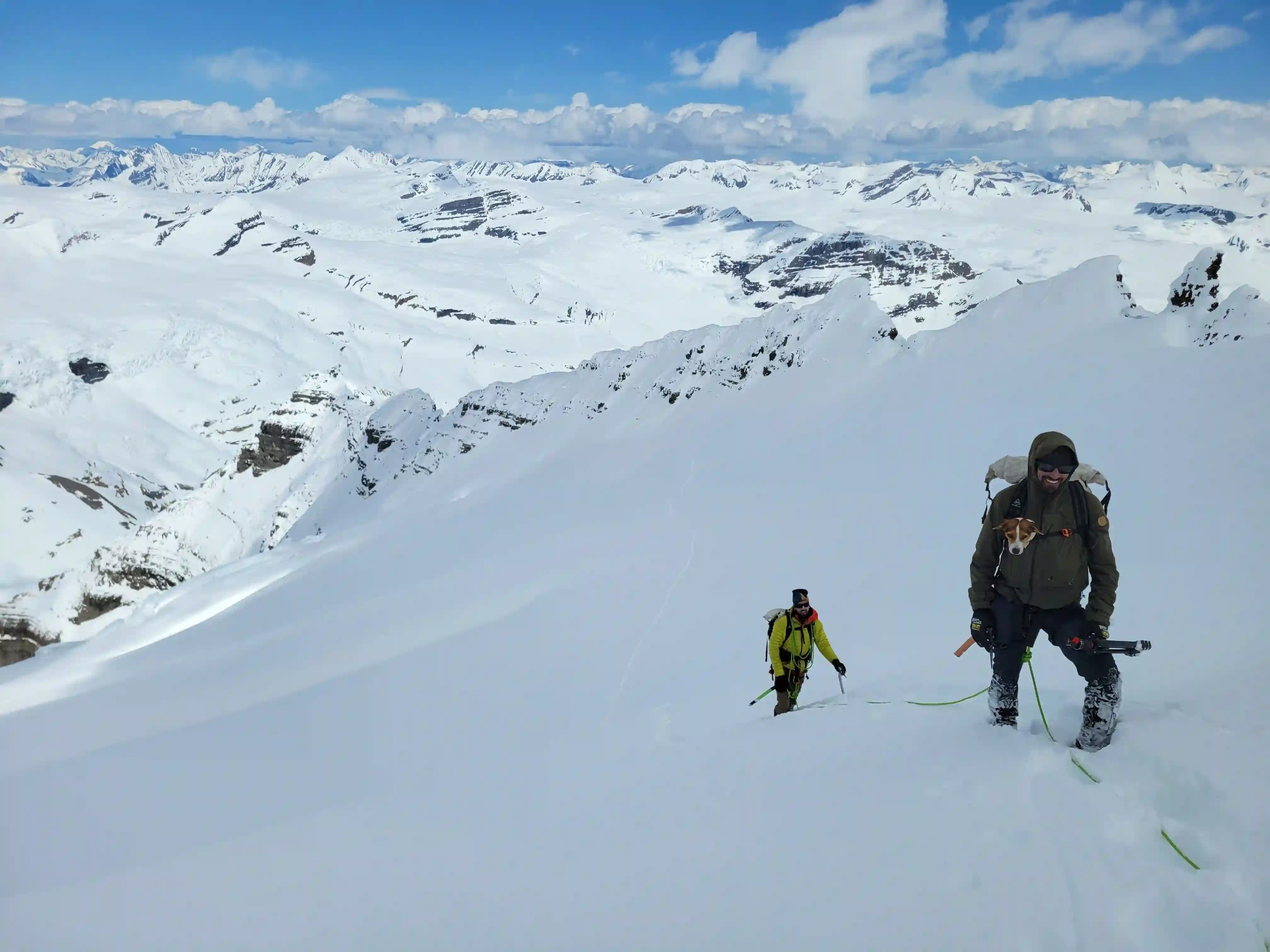
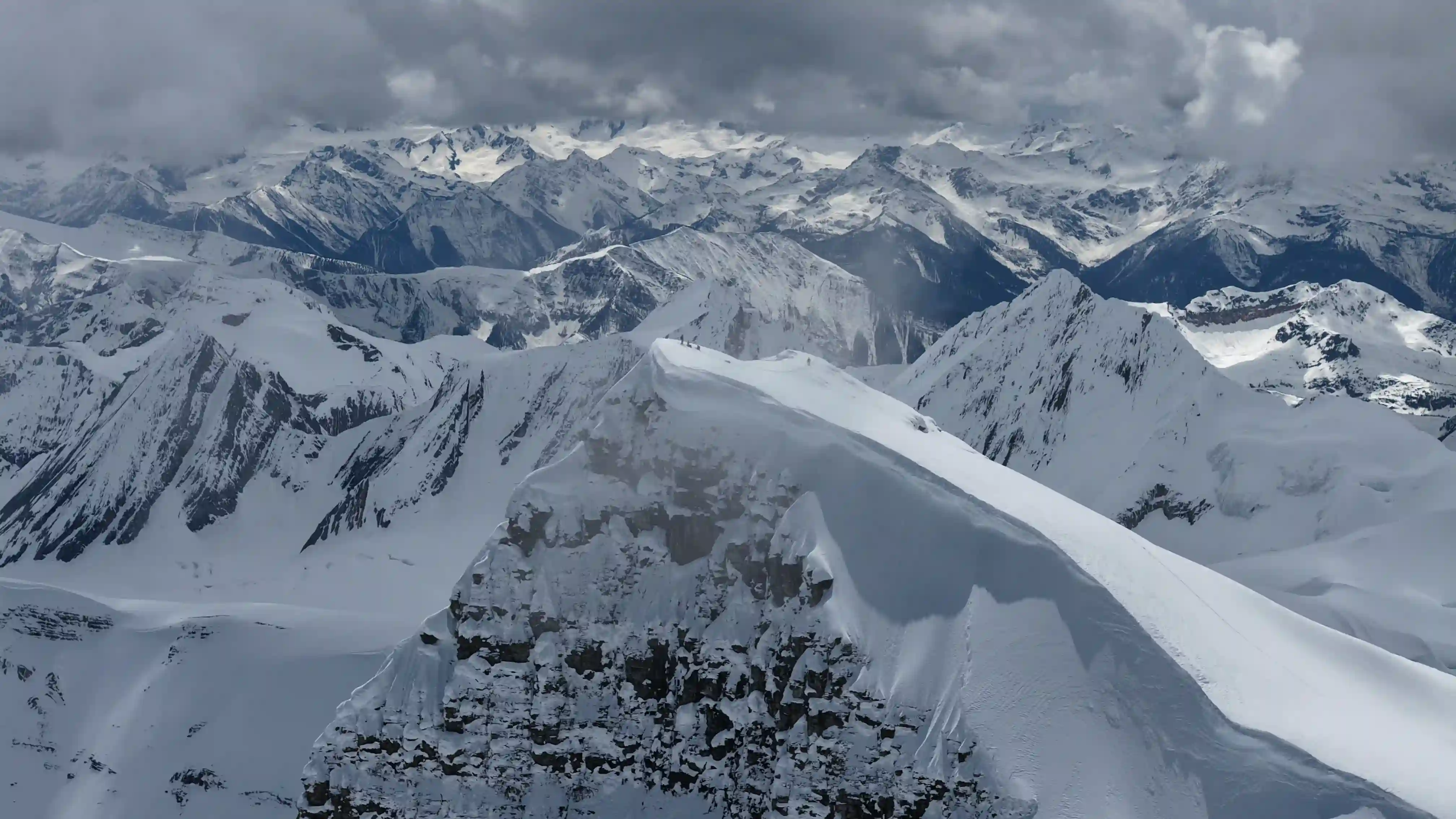
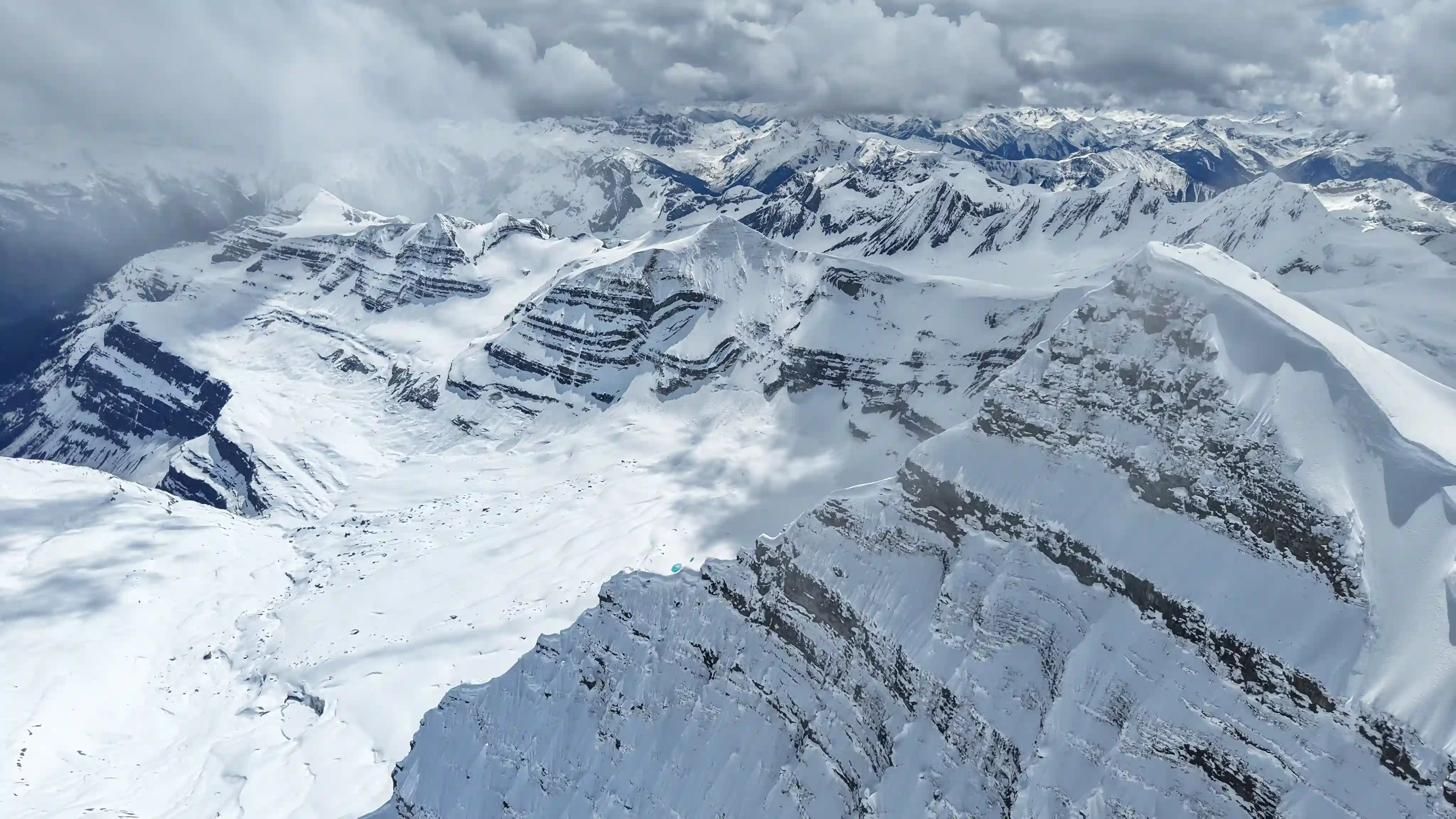
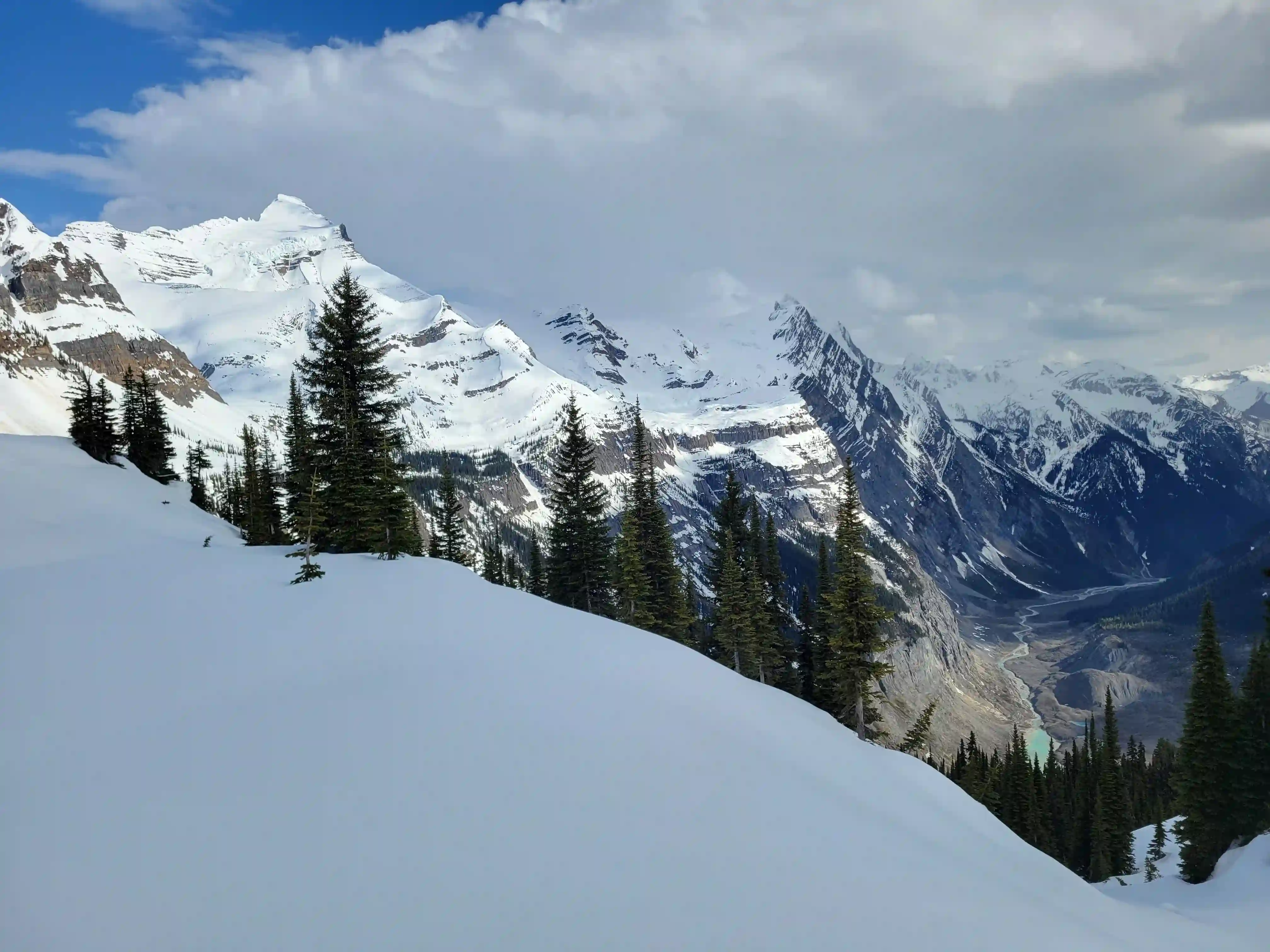
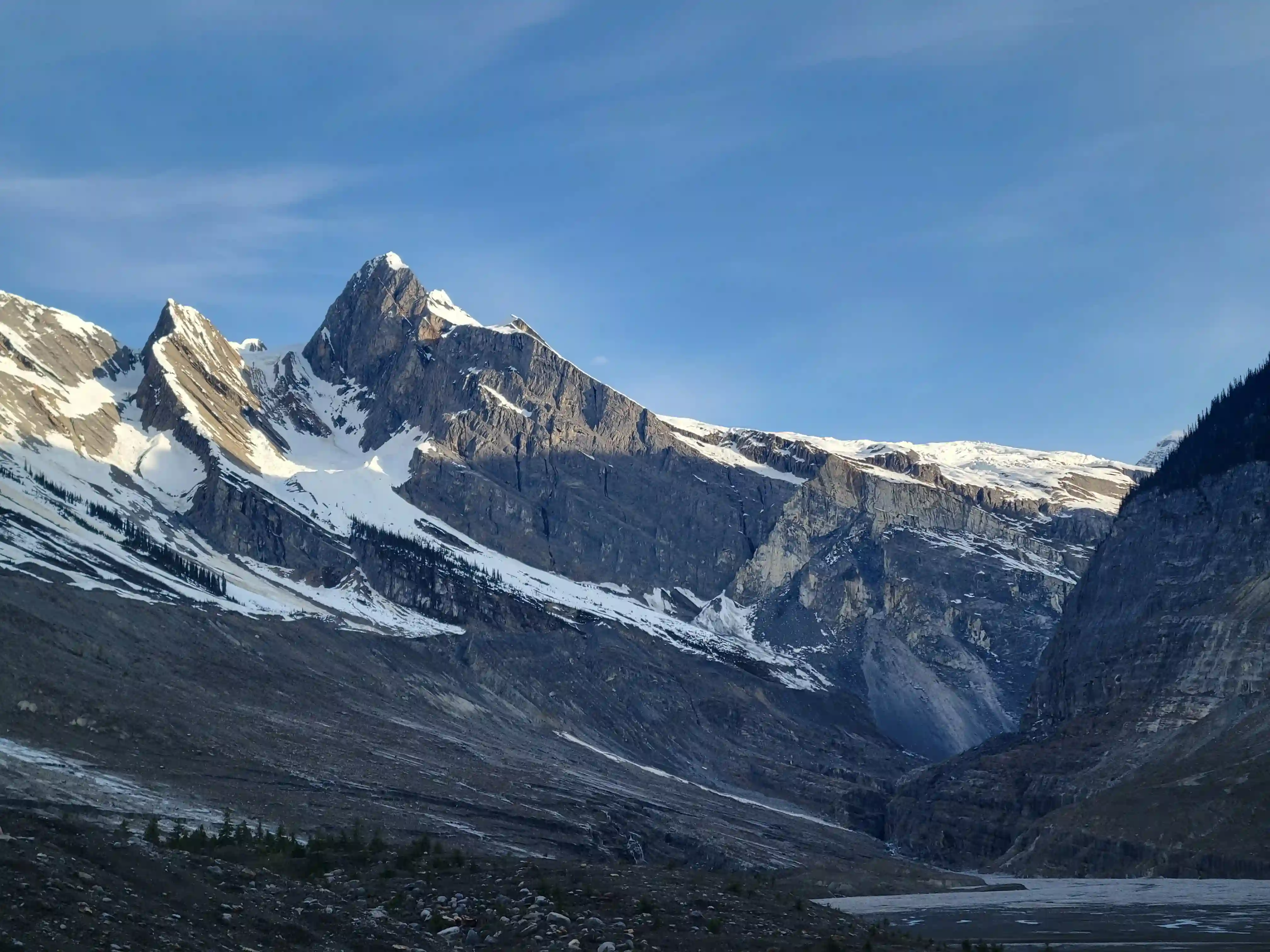
After a short sleep we were up again and by 3am we were headed out! We quickly made it across the valley to the base of the headwall and began our ascent up the choss gully which was horrendously loose but what we couldn't see was the full scale of the overhead hazard in this spot with all the loose debris above us. We moved quickly and it wasn't long before we reached the top of the cliff feature and traversed over to the waterfall. Above this the occasional bushy section was tedious to get through with skis on my pack but this didn't last long as once we reached the half way point up the headwall the snow started and we were able to kick steps nicely all the way to the bench. The views really opened up at this point and we were looking into the ultra remote corners of BC with eyes on Mount Shackleton and Pic Tordu. We followed the bench and I managed to ski the downhill portions of it and then we did the last bit of climbing to reach the Tsar-Somervell col where heli supported groups get dropped off at 8am.
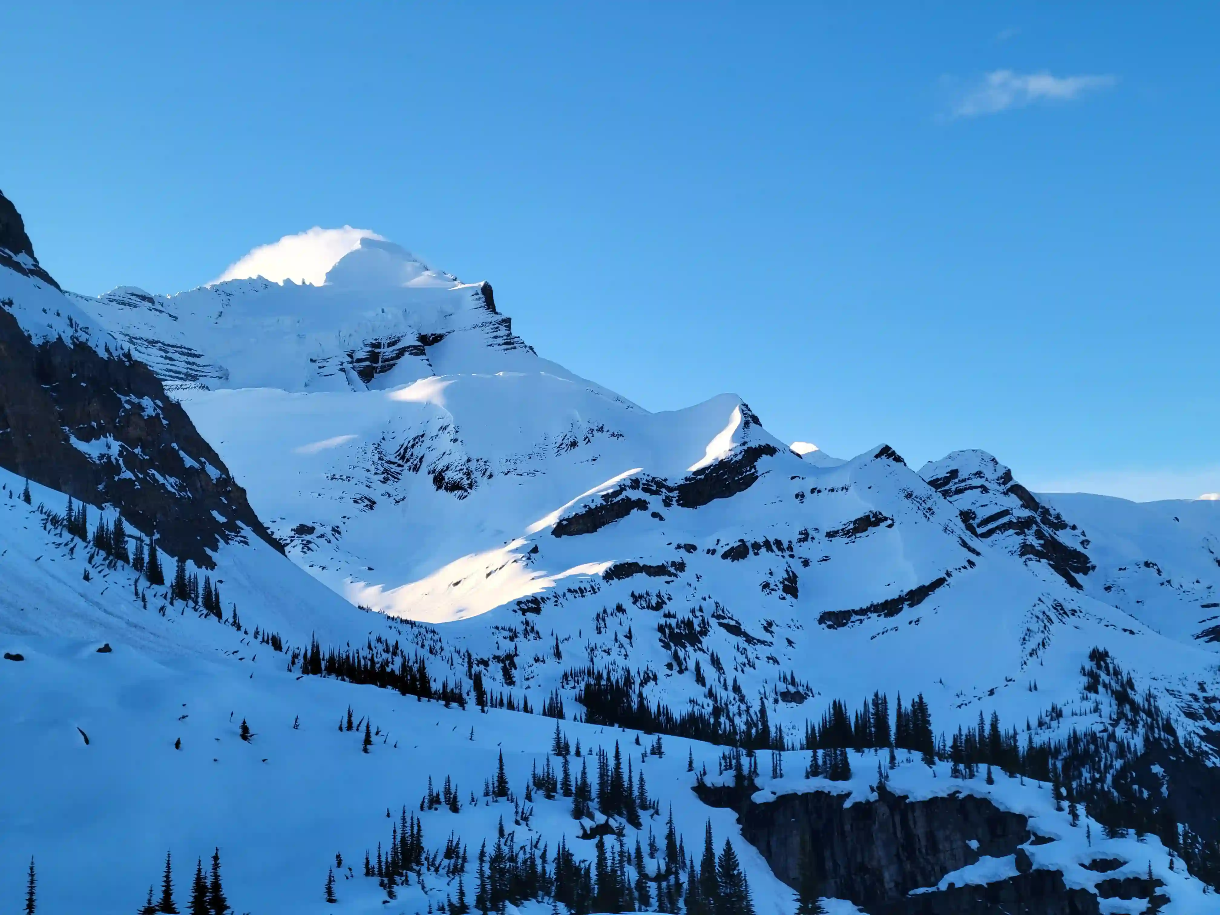
impressively above
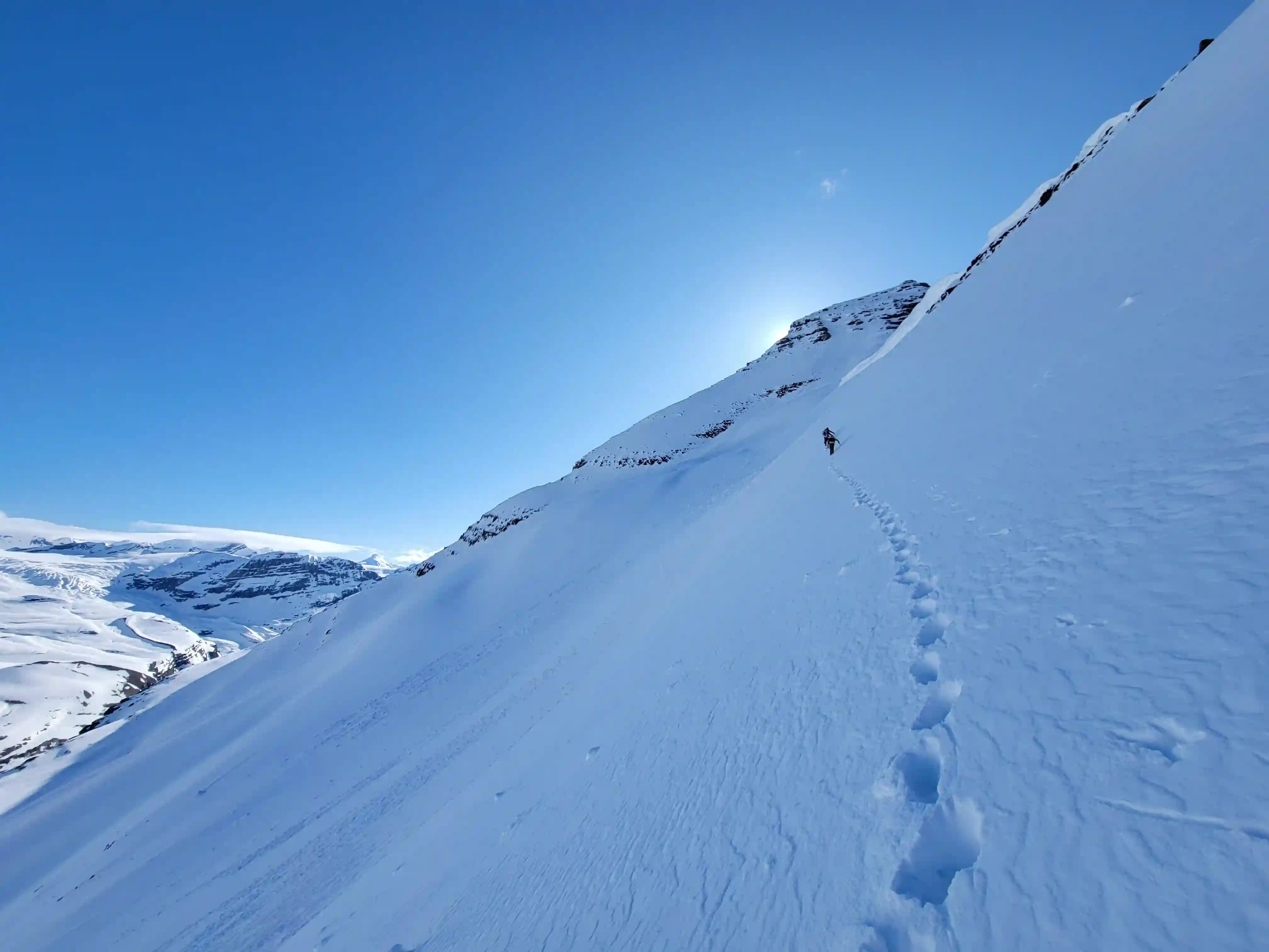
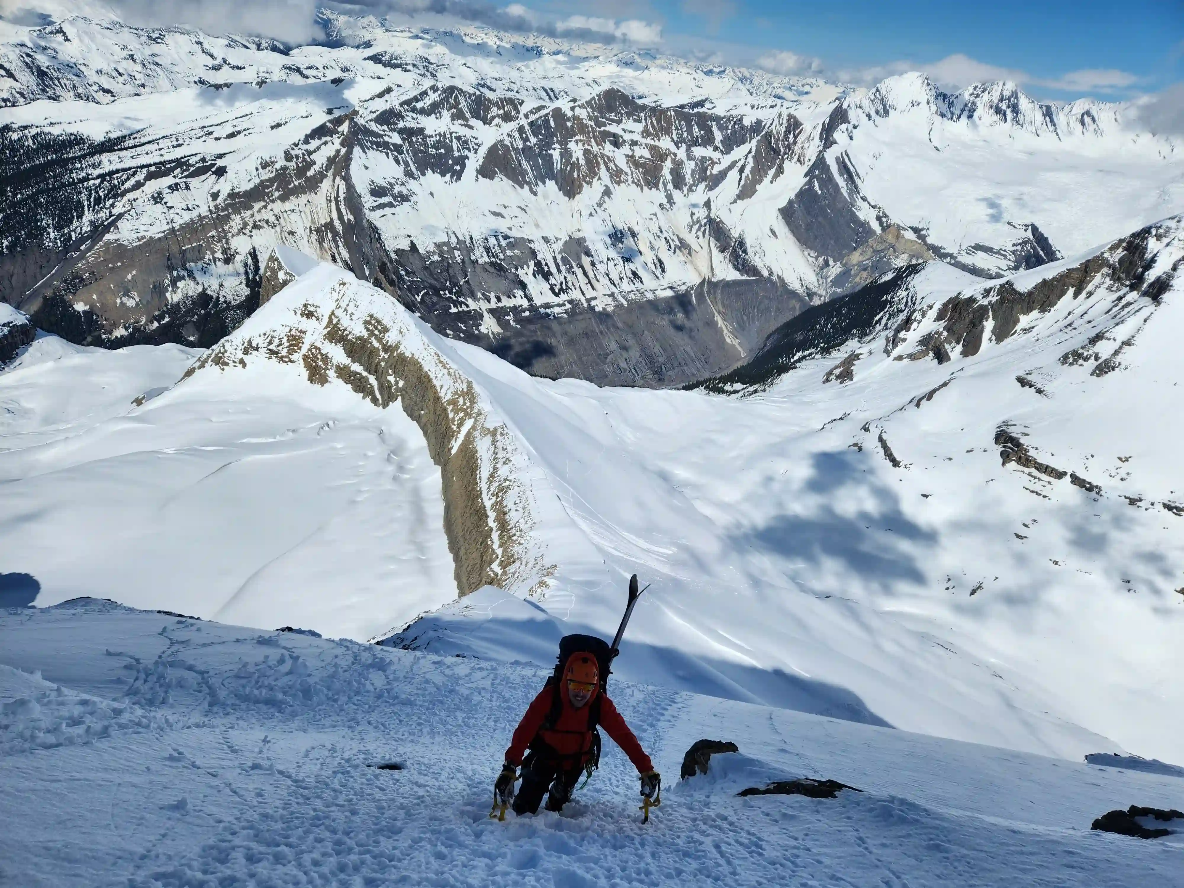
THE UPPER MOUNTAIN
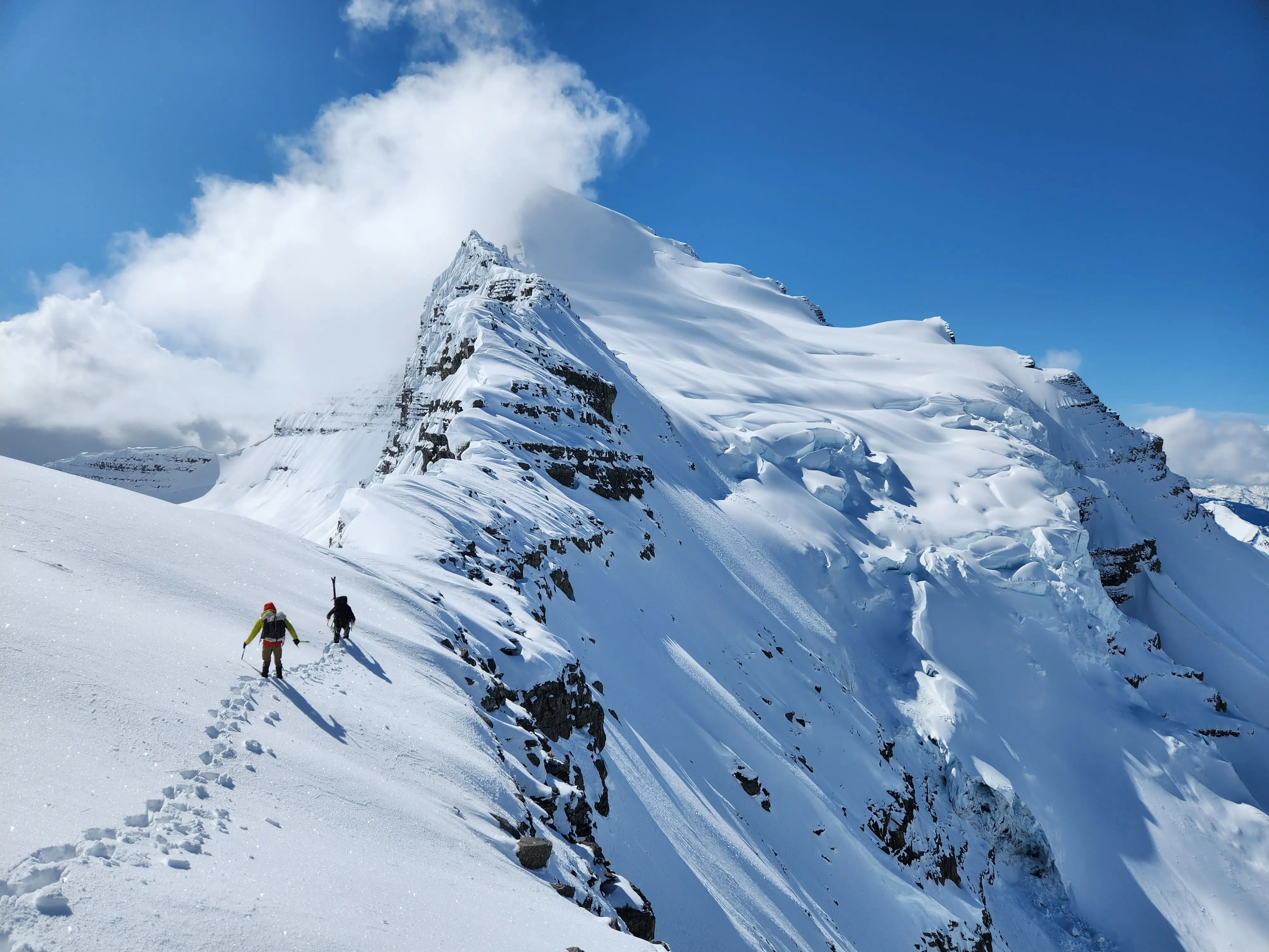
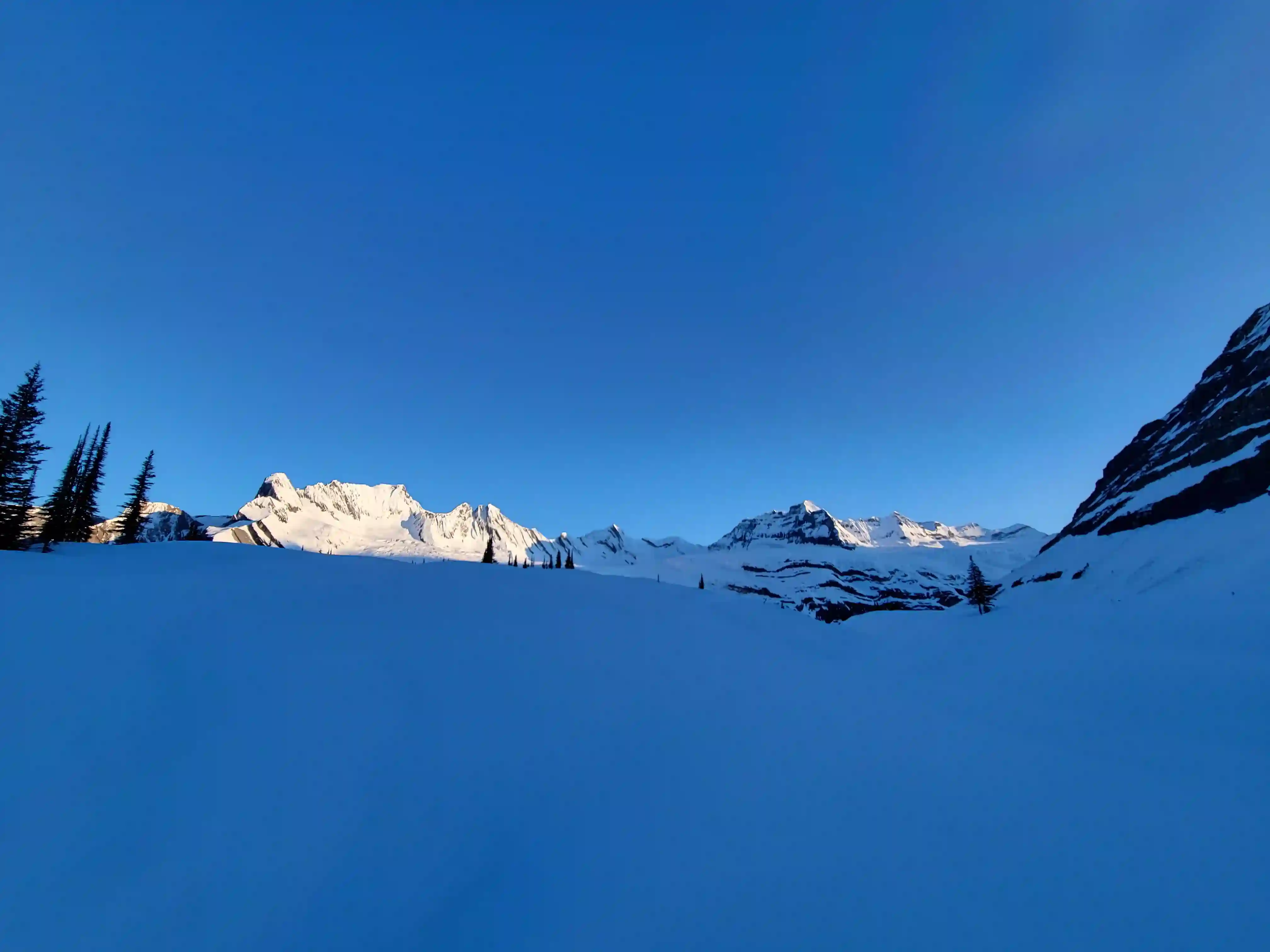
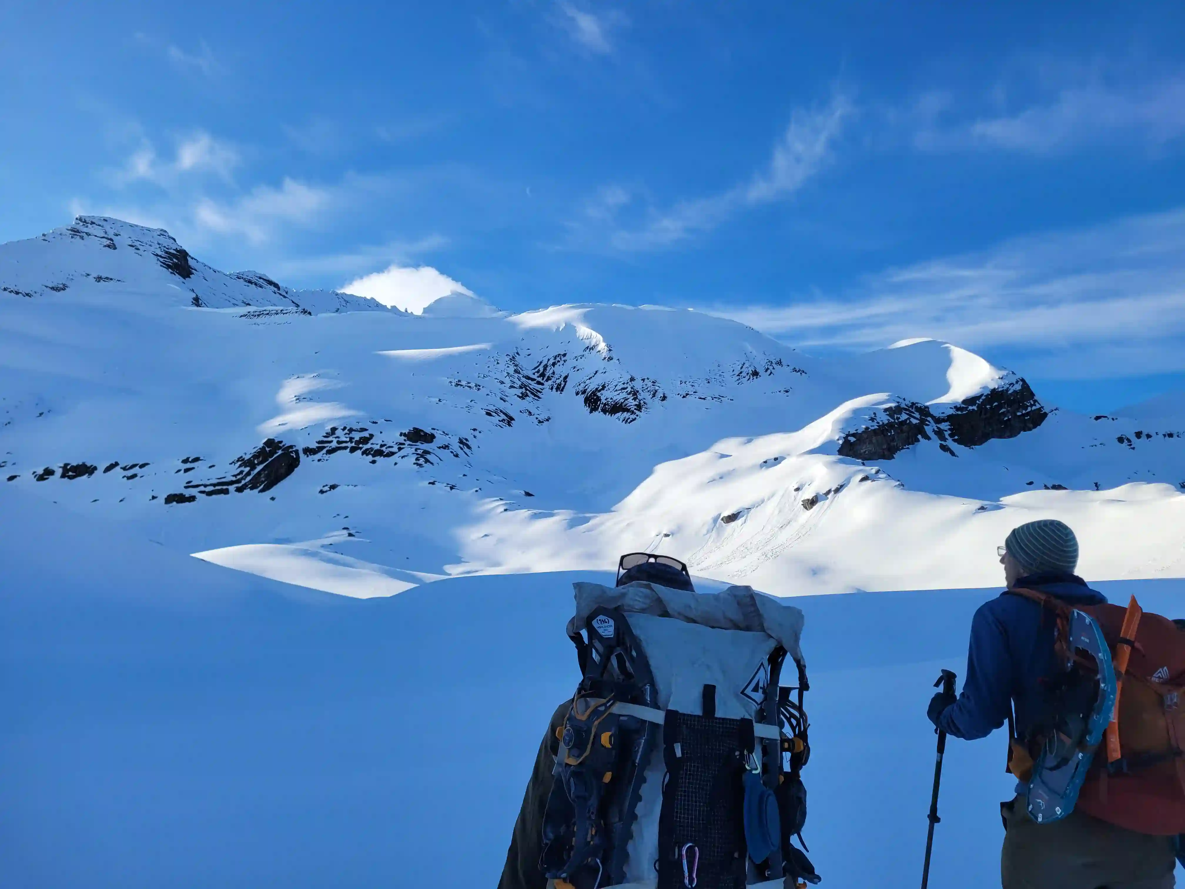
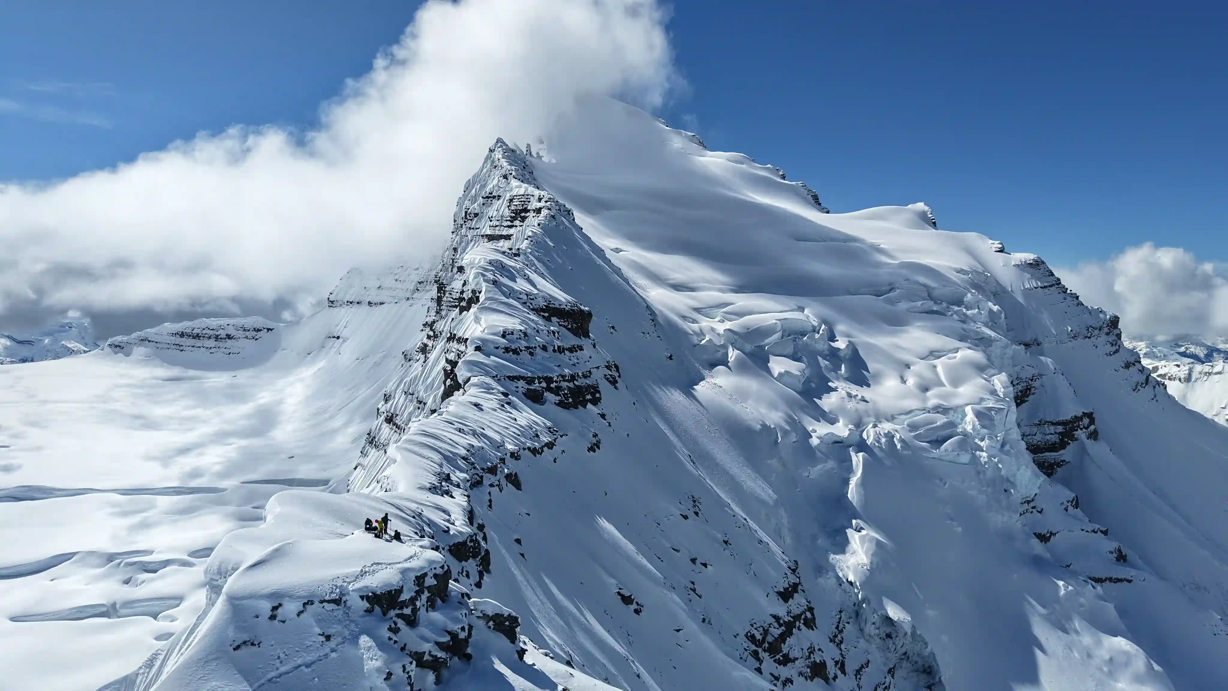
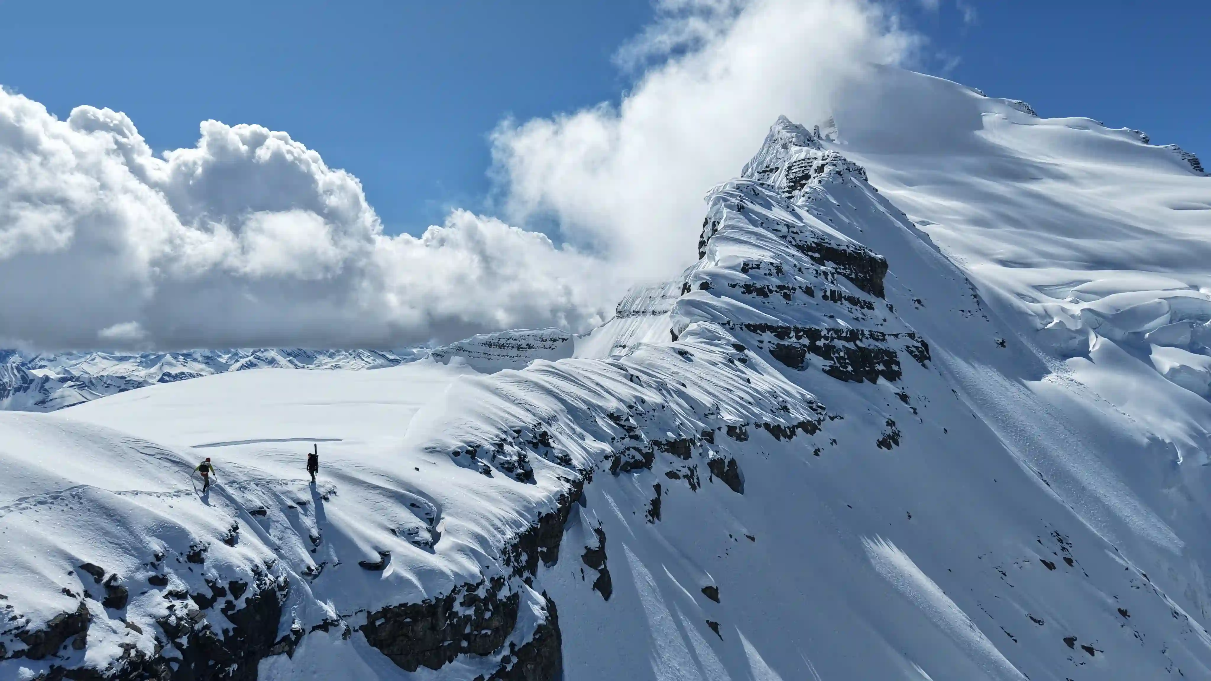
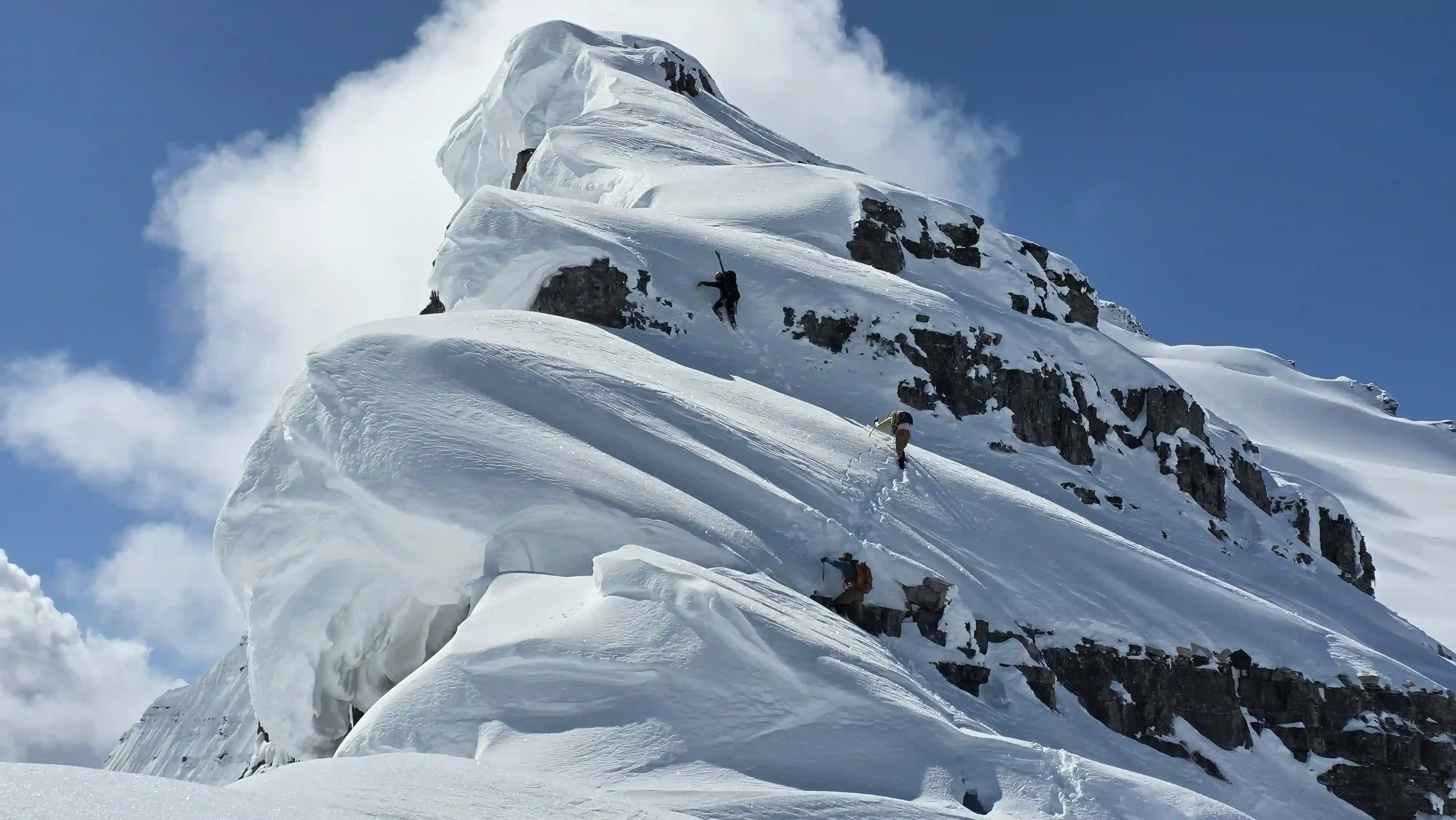
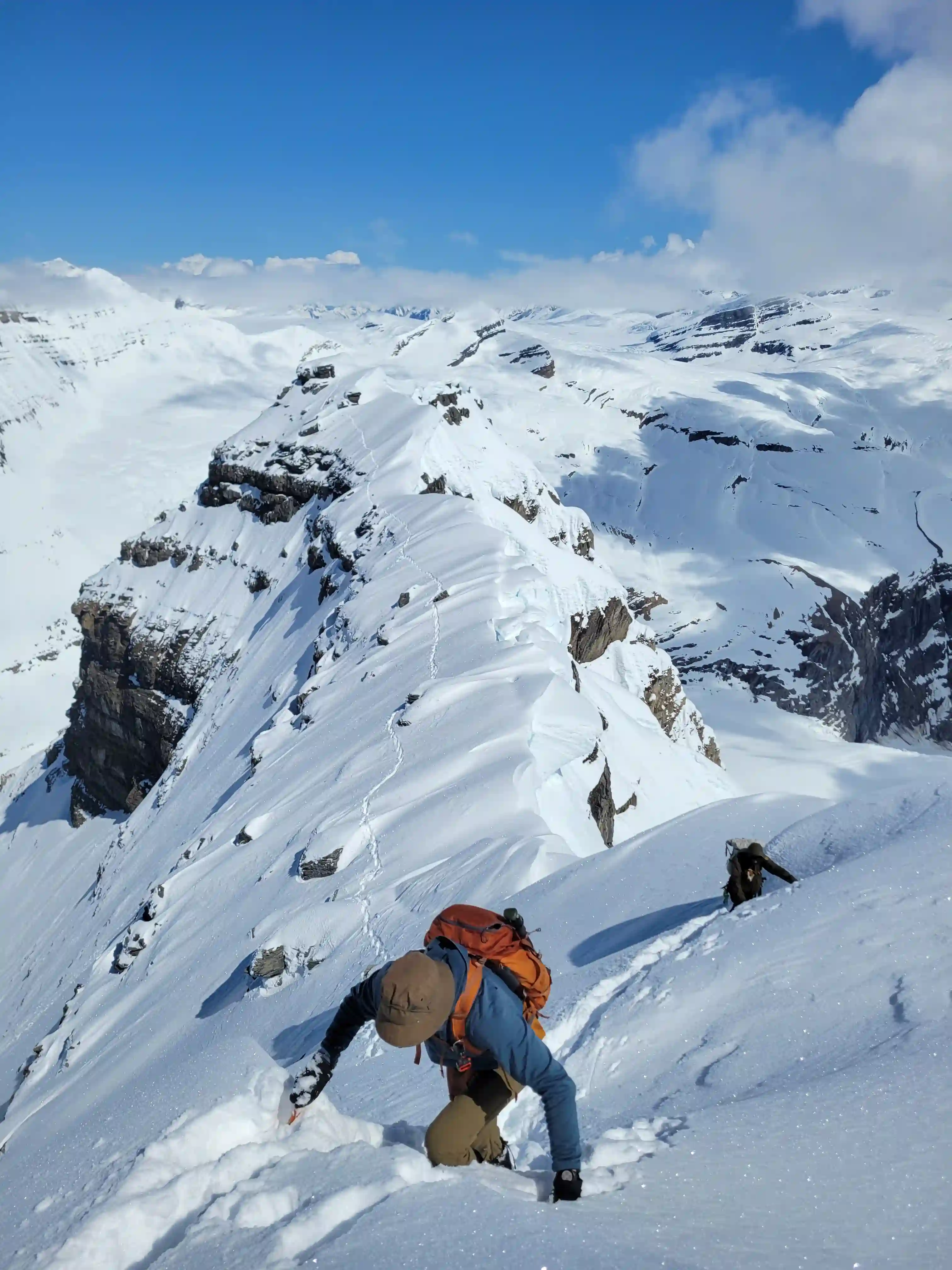
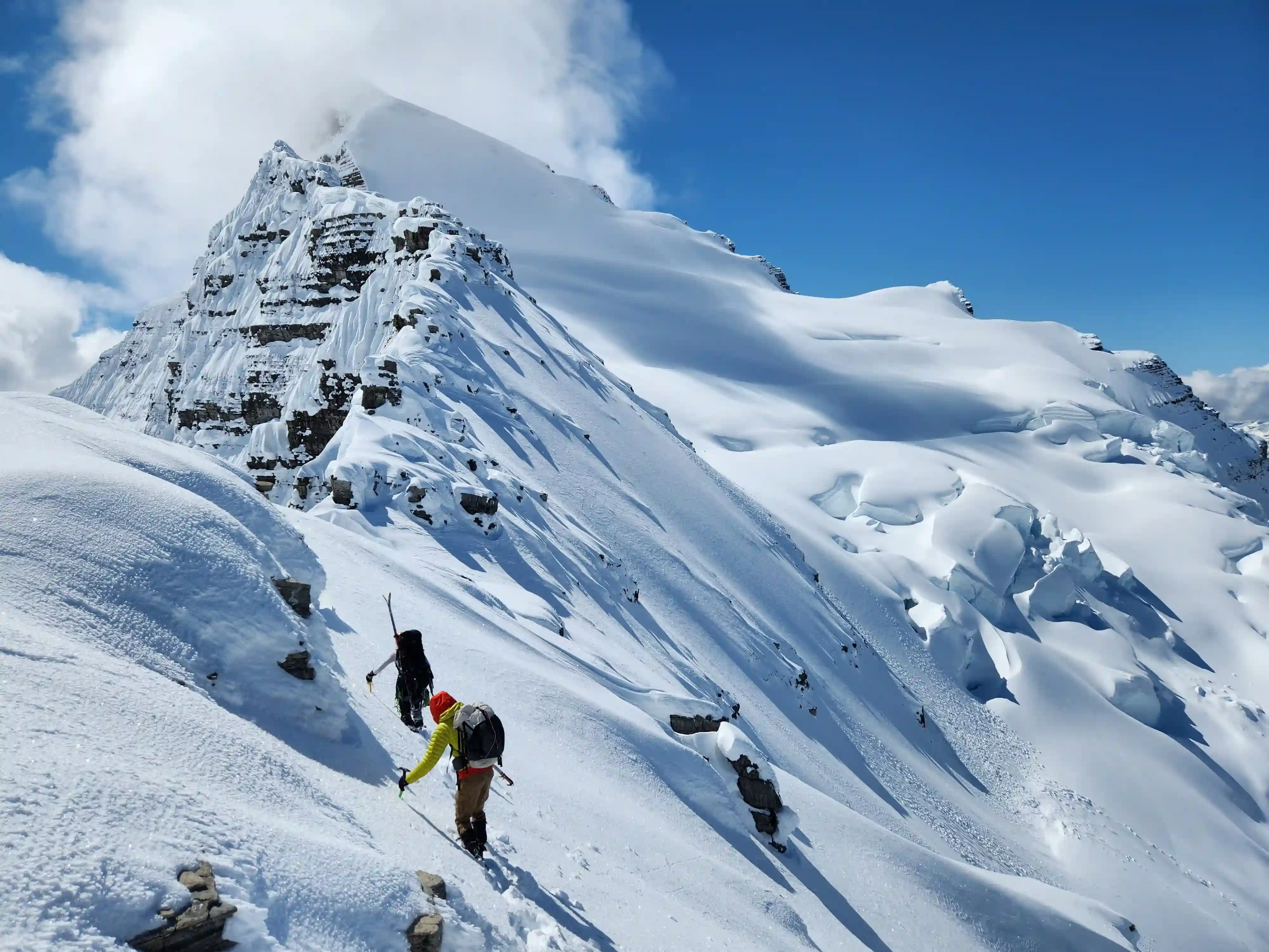
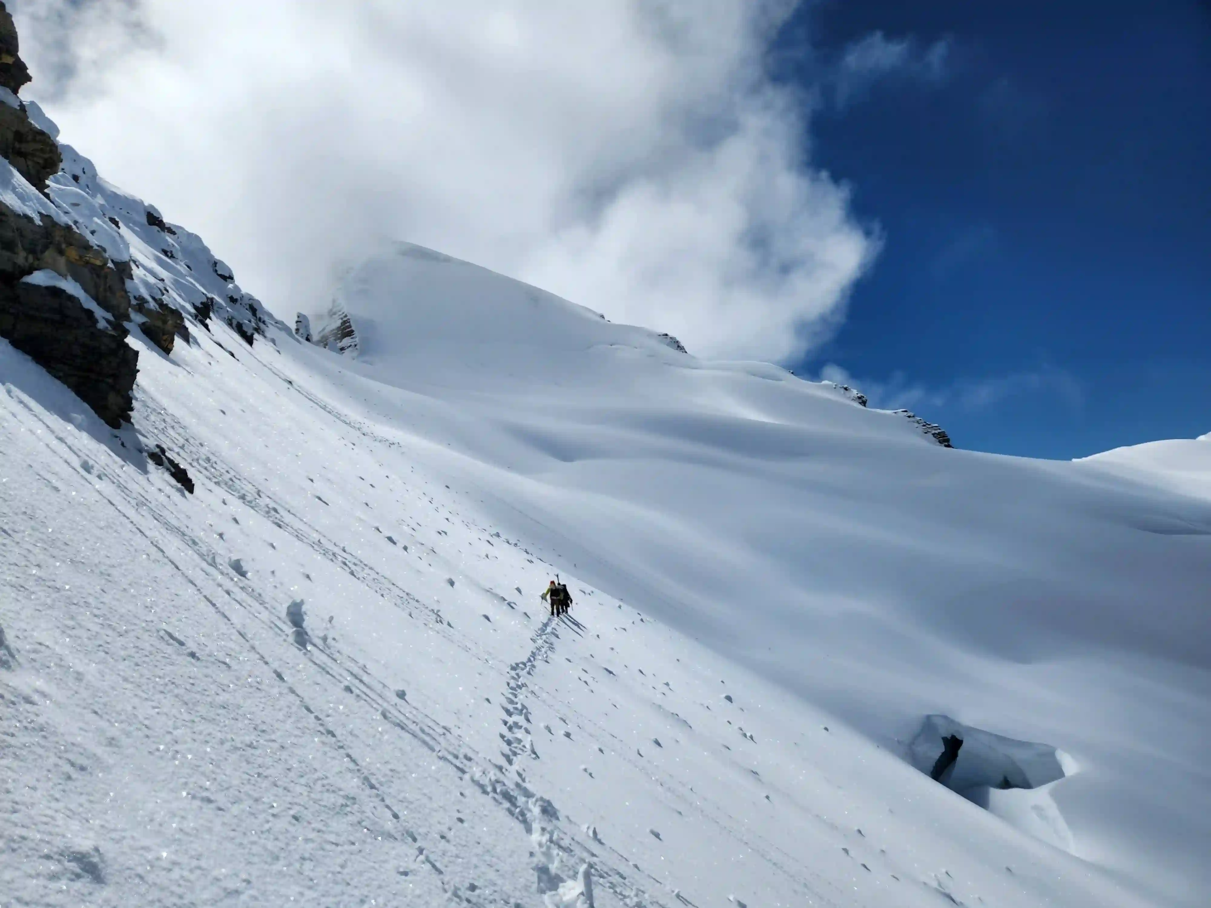
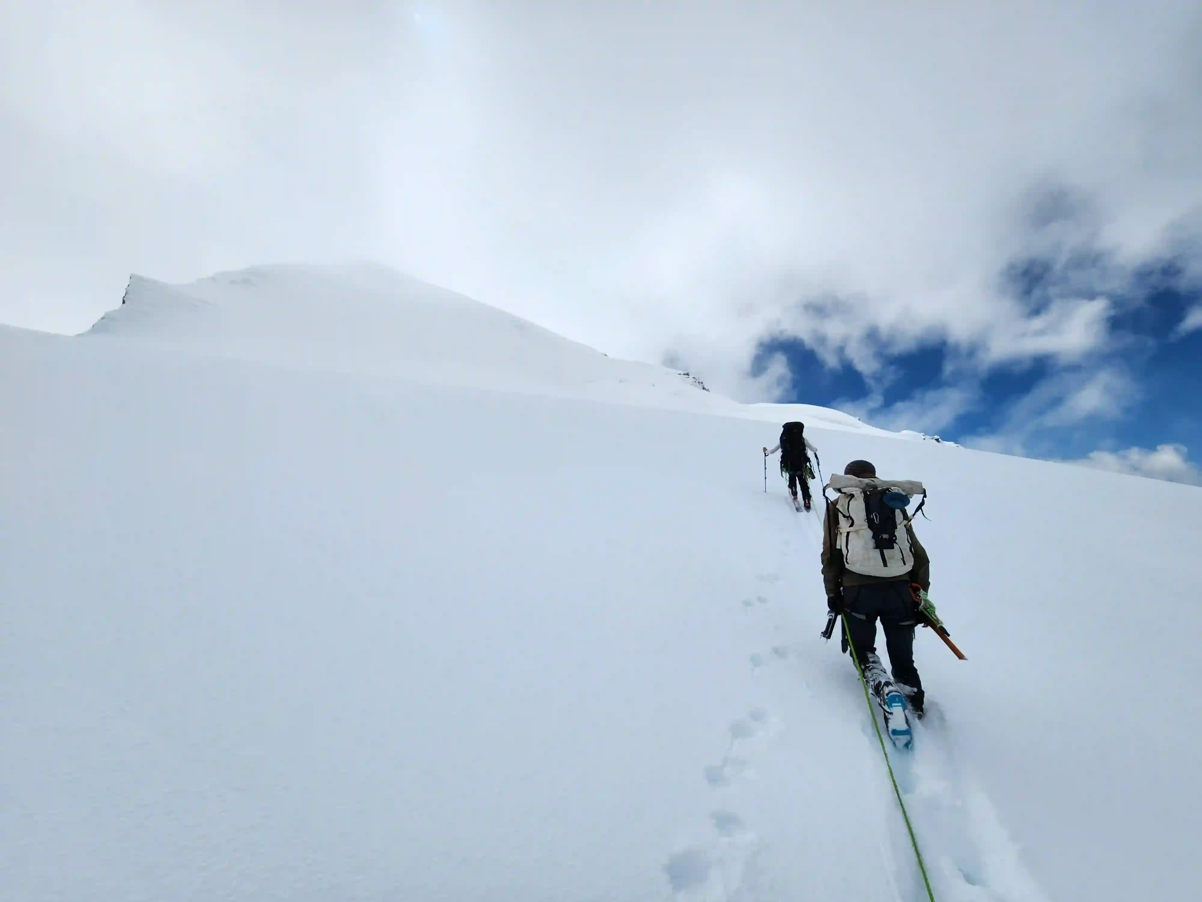
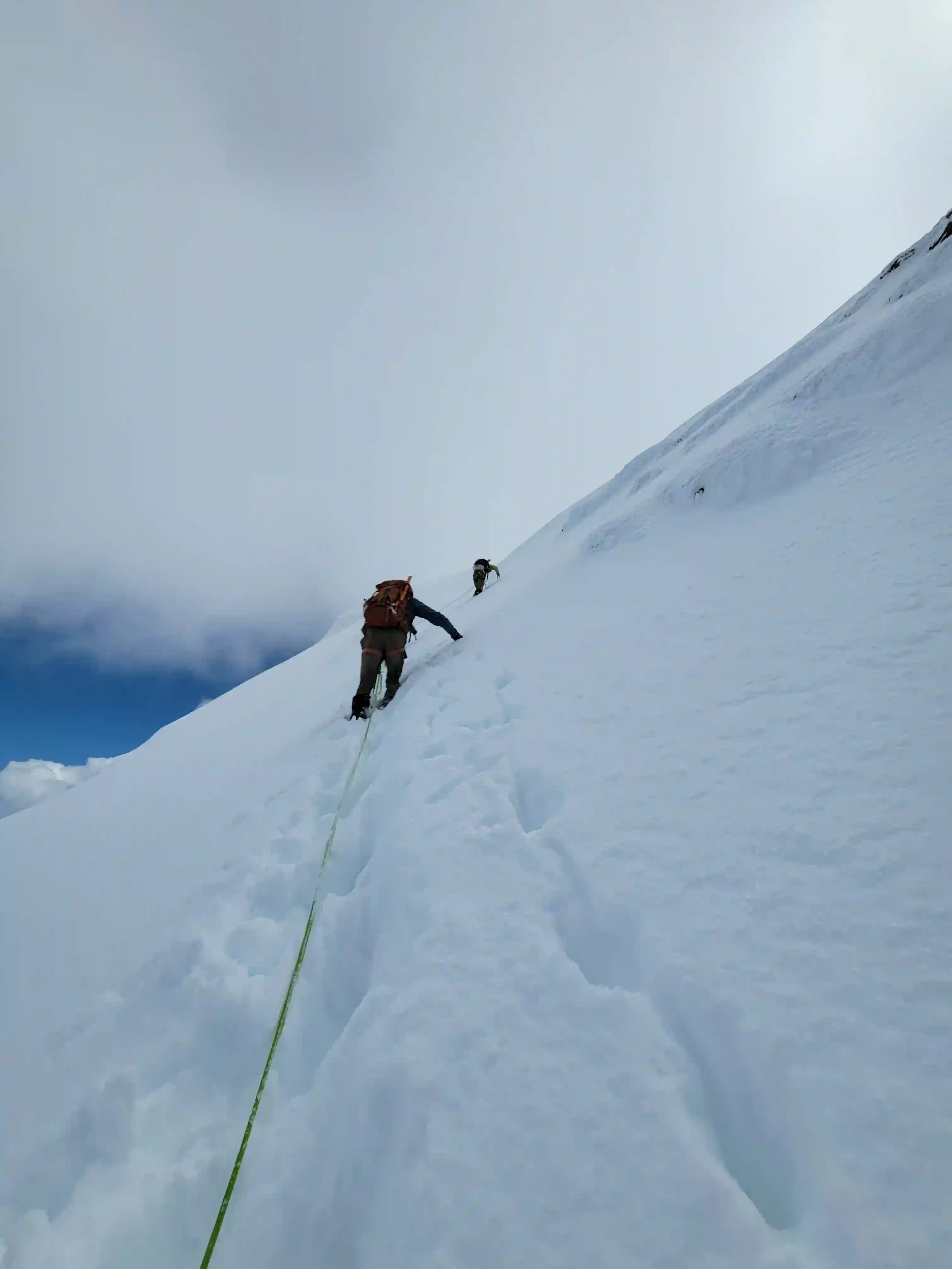
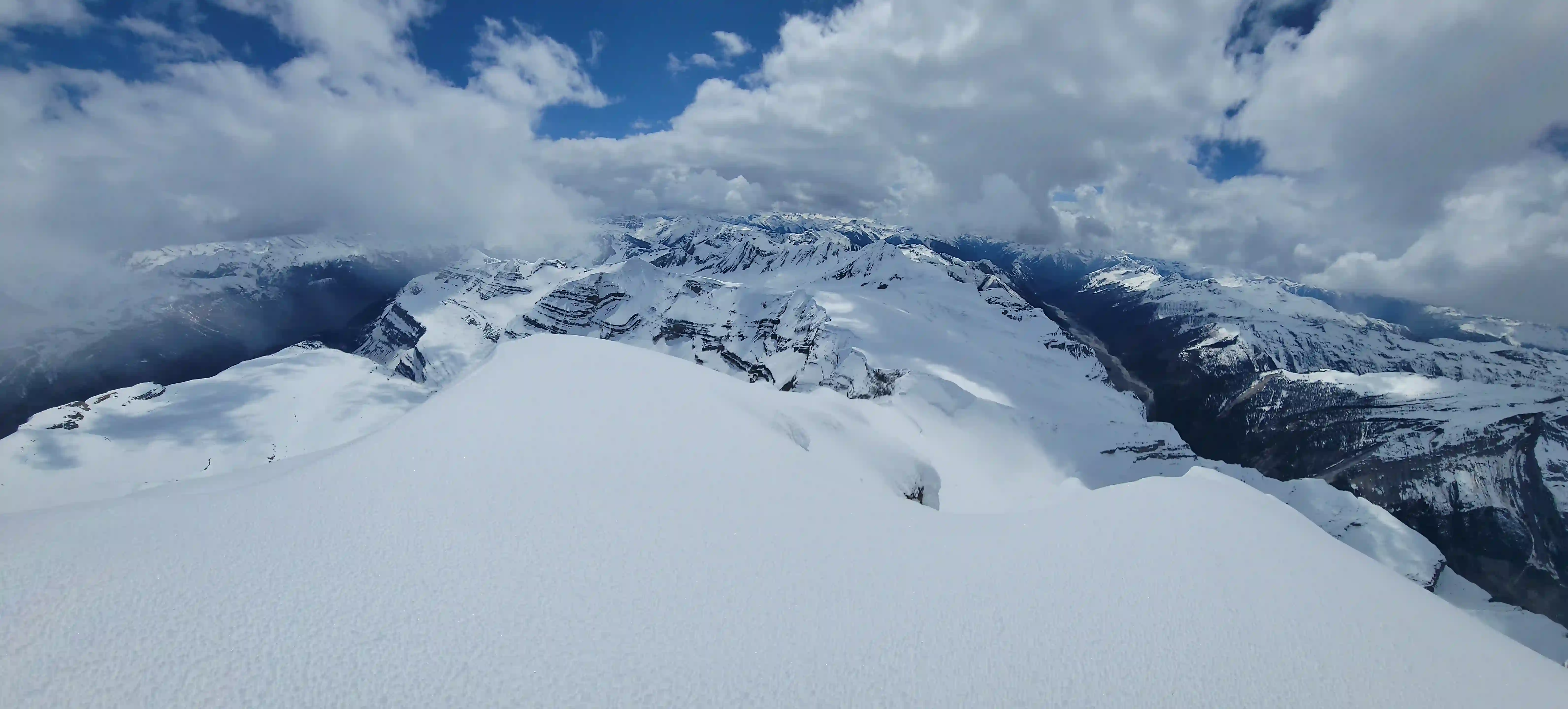
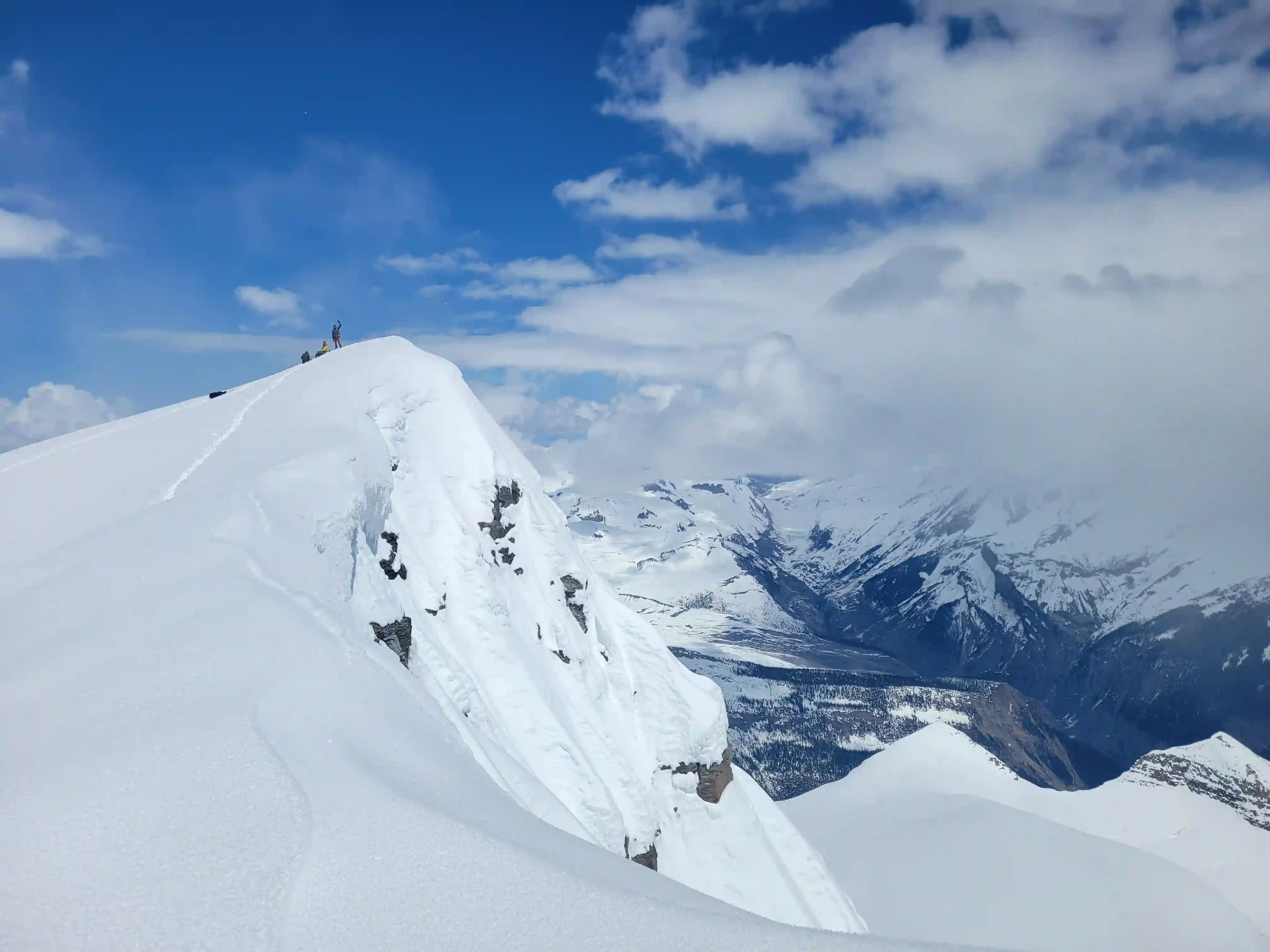
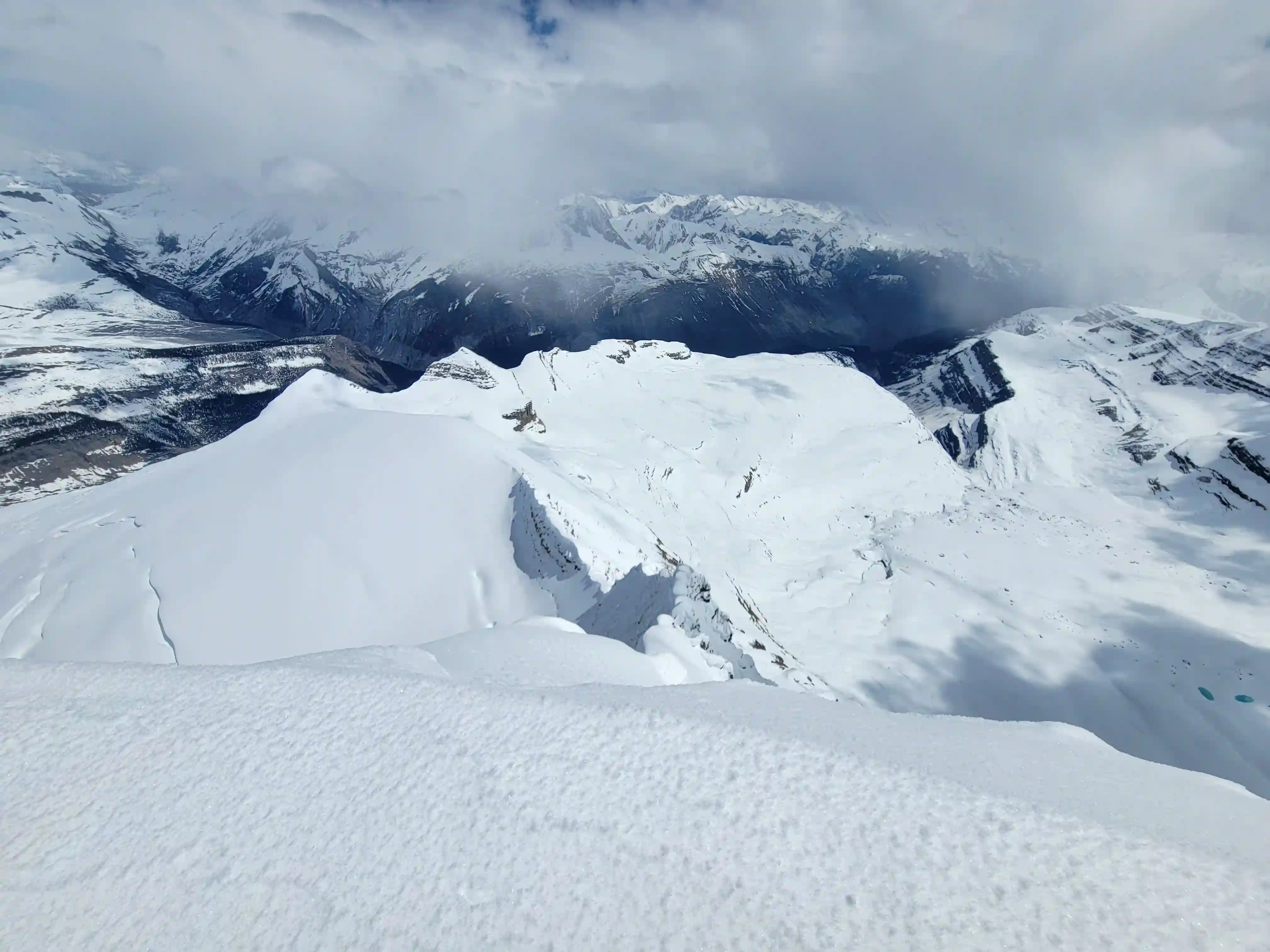
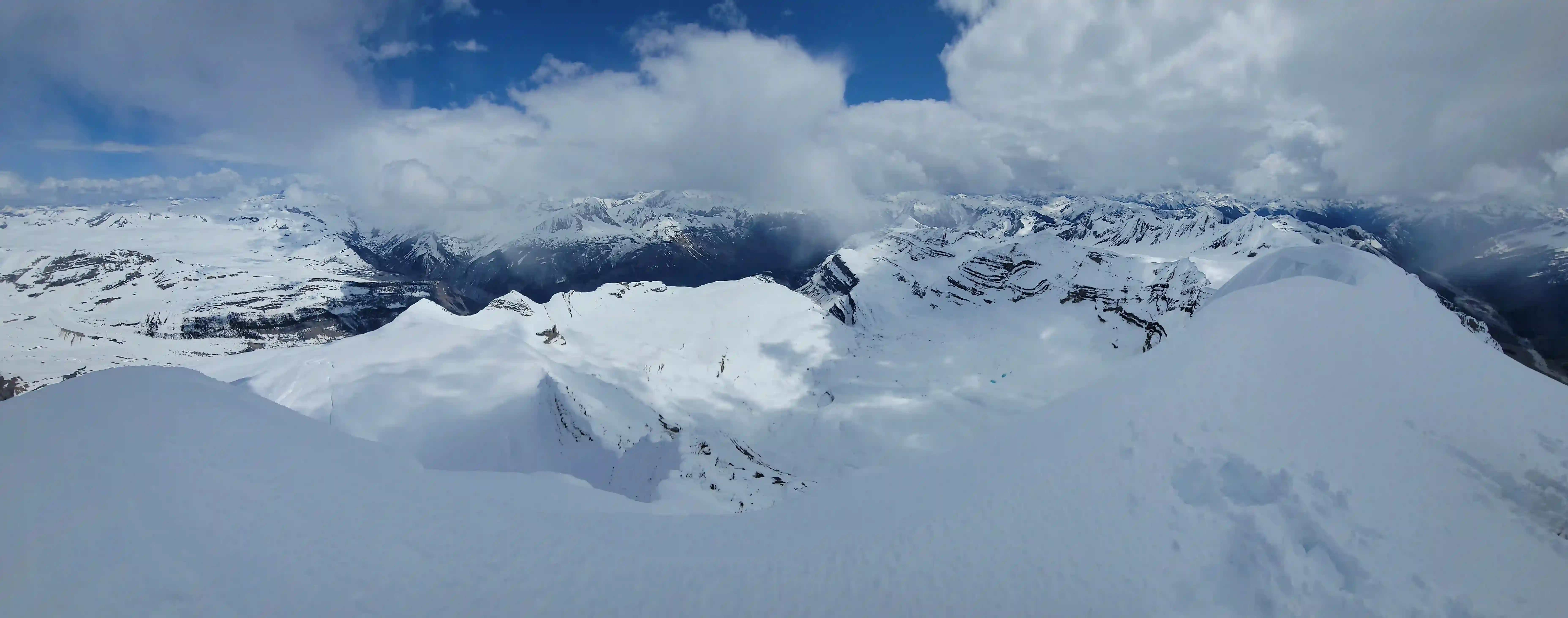
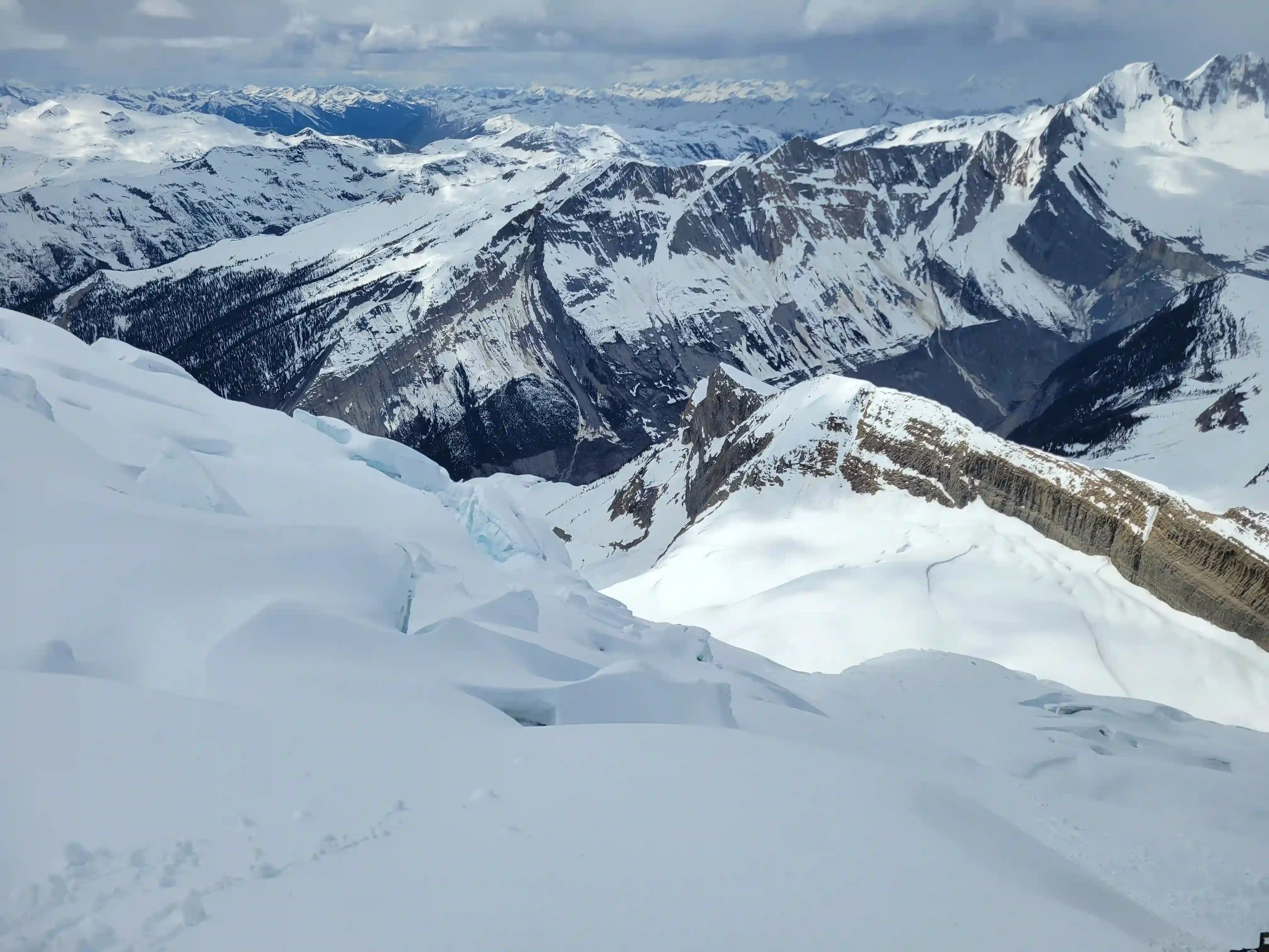
Next up was the proper ascent and we were excited! Conditions on the headwall and bench were nice and firm so we got our hopes up about efficient travel but we didn't consider the fact the most of the ascent is north facing and gets less crusty so as things got steeper we were greeted with deep powder. After gaining a sizable amount of initial elevation we traversed east towards the first high point on the ridge and after ascending a rather steep section were greeted to some of the wildest views I've ever seen in the Canadian Rockies.
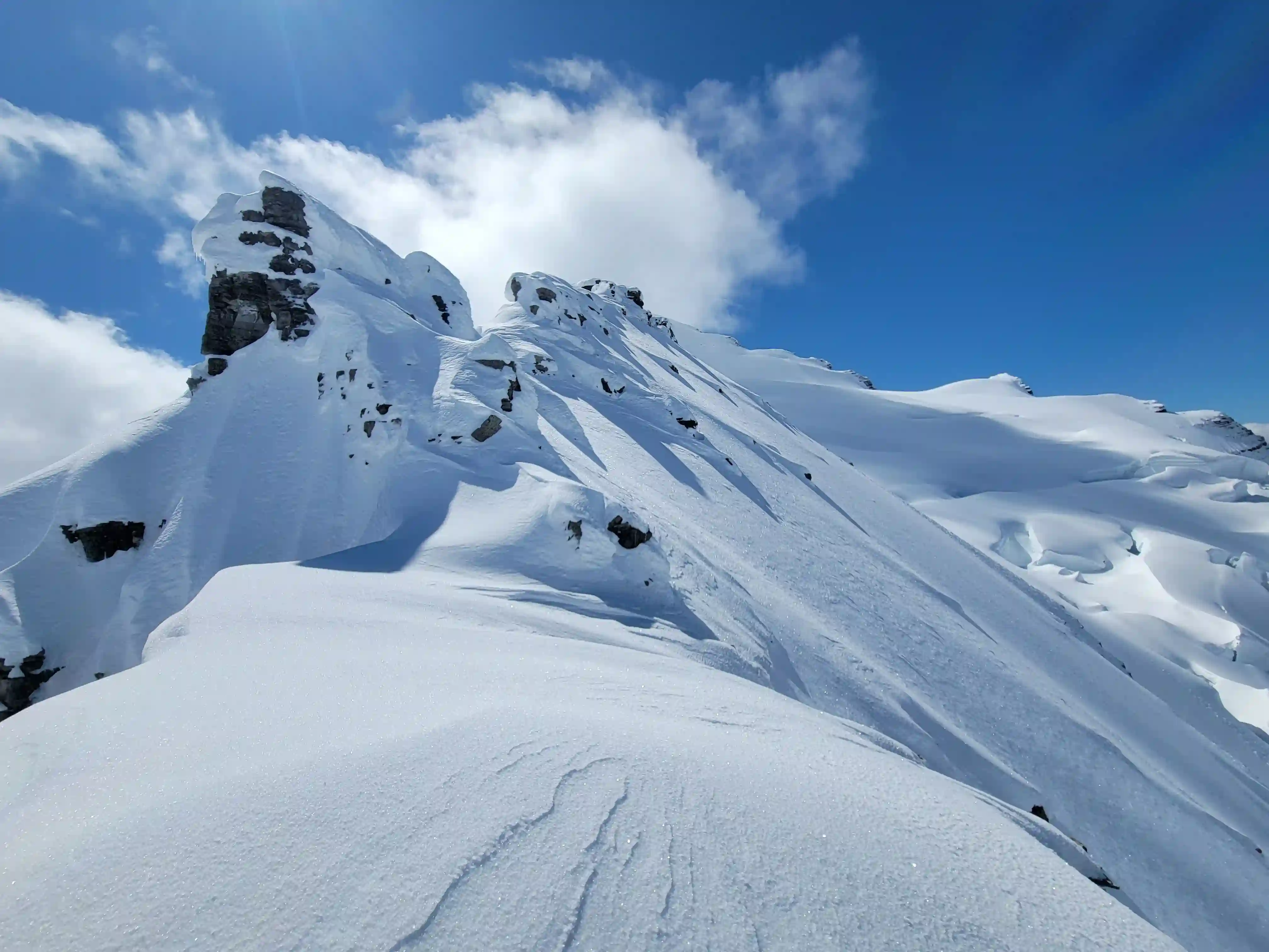
With the spring conditions Tsar Mountain's north ridge was heavily cornices and looked like a peak taken straight out of the Andes. I'd be lying if I said we weren't a bit intimidated but after a short break we continued and were able to break it up piece by piece and it ended up being manageabkle. We did have to give the cornices excessive room though with some of them school bus sized and after pushing through deep powder up the ridge we eventually cut across the west slope and headed for the glacier below to beeline for the summit block. This final portion of the ascent was definitely a slog but given the snow coverage all the difficulties were completely buried so we were able to walk right up what is typically an ice climb in the summer on one of the final sections of the ascent and made our way to the summit!
Into trips like this?
I'll send you an email whenever I publish a new trip report.

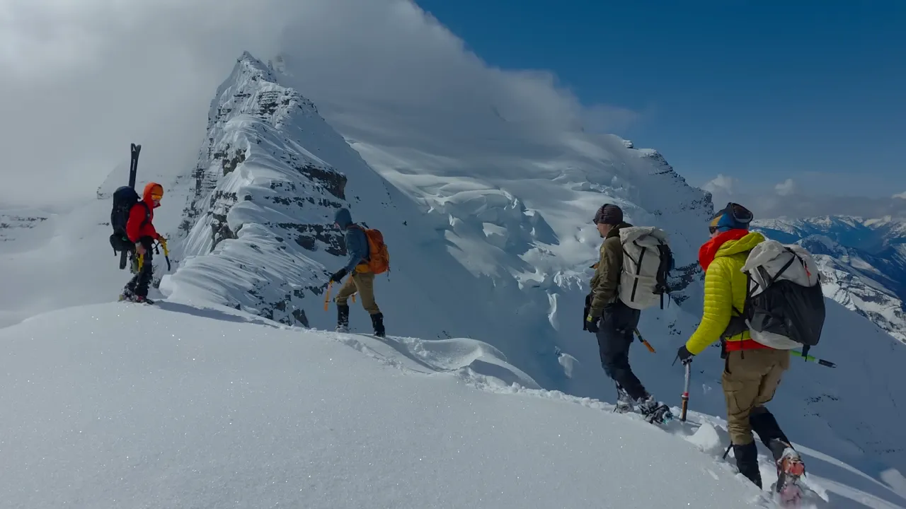
THE SUMMIT & DESCENT
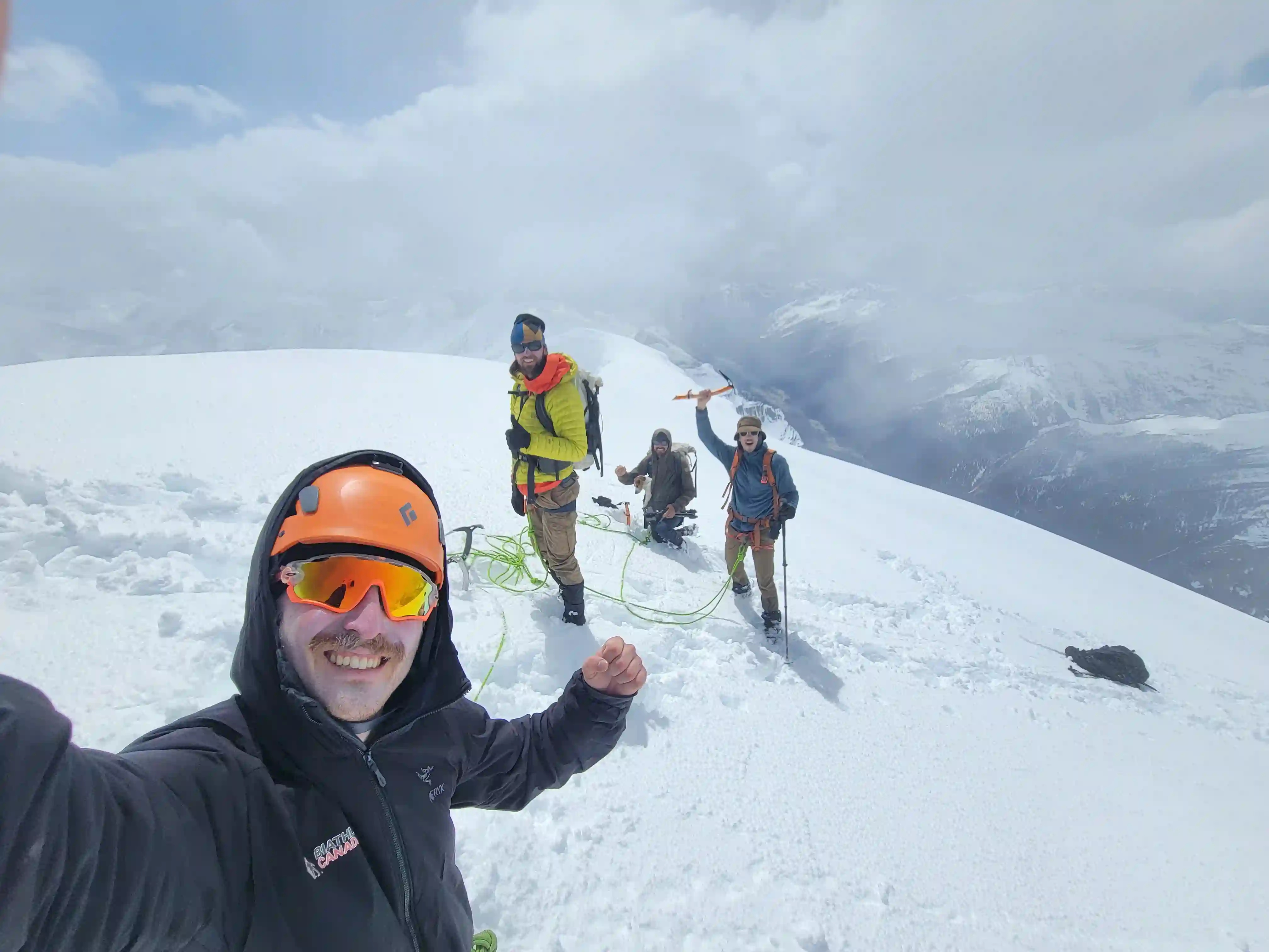
Rocko's 2nd!
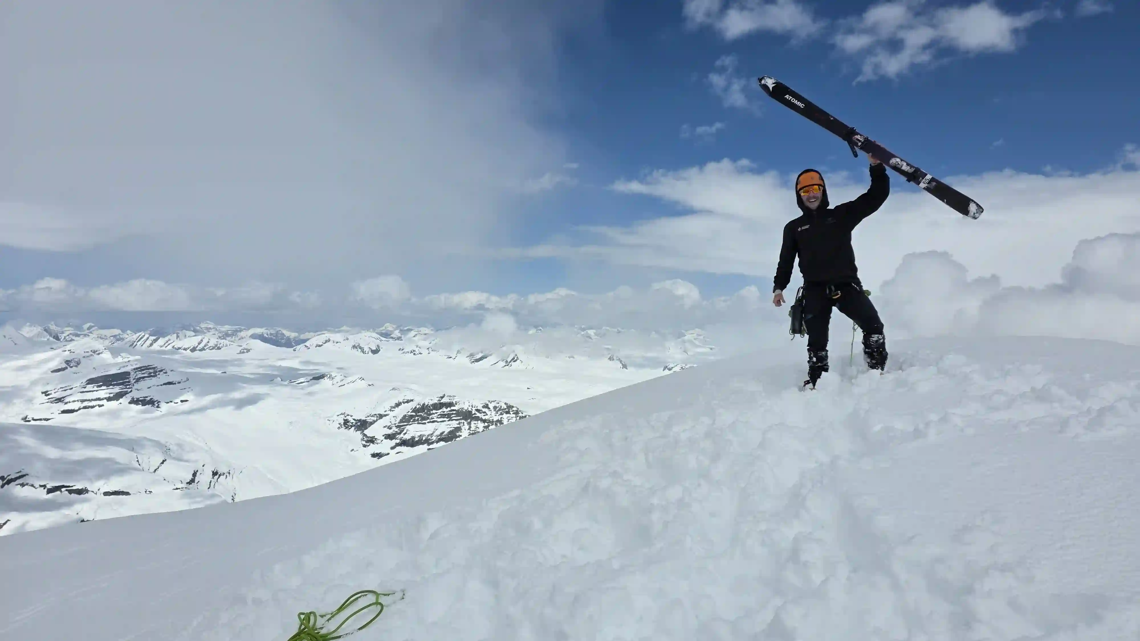
I had lugged my skis all the way to the summit and now it was time to use them! I was optimistic about the descent with the powdery conditions but it had been a while since I skied any steep terrain so the excitement was there! I let Devan, Tim, and Simon get a head start and once they were clear of the north face I went for it and got some wicked turns in! The bergshrund part way down the summit block was well filled so I didn't have to worry about that much and then next section was awesome cruisy skiing.
Following the upper portion of the mountain was where things got more serious and the next portion of my ski line traversed the west face of the north ridge to reconnect with our ascent route before skiing straight down to the col. This part was severely exposed compared to the rest of the ski and was most definitely a no fall zone so I had to be on my game but after a few focussed minutes I was across and could enjoy the chill remainder of the descent. By the time I reached the col the other three were still high on the ridge so I had plenty of hang out time and ended up melting some snow to get the group some much needed water after over 12 hours out!
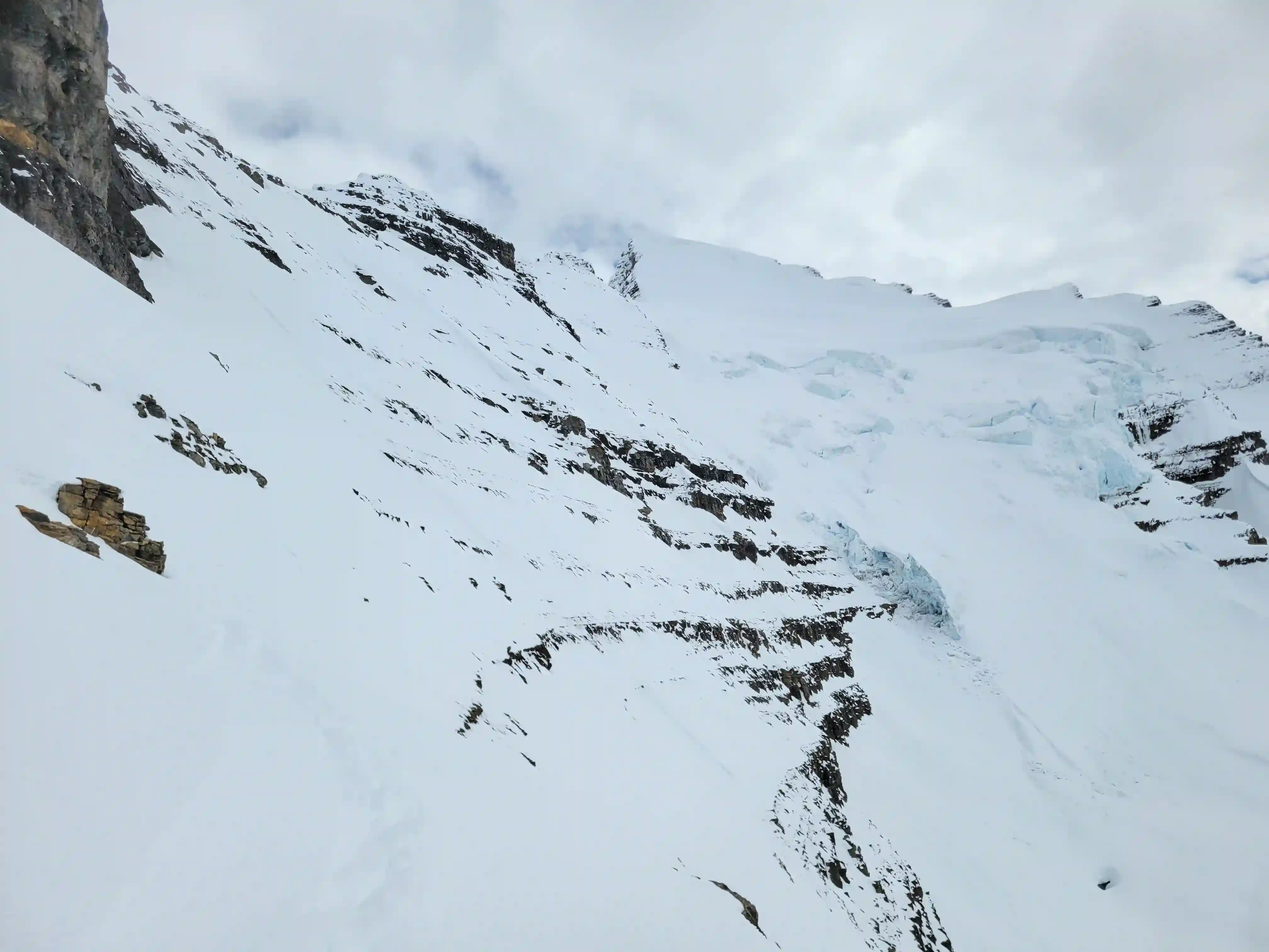
Once the crew arrived we hung out for a bit to recover before continuing our descent. The skiing wasn't done yet and I was able to keep them on for the entirety of the bench although not all of it was descending, and all the way to around half way down the headwall. I would've skied a bit further but there was more and more debris as I got lower and what ended the skiing for the trip was a log I was trying to maneuver over and I ended up getting caught on a piece of it and got flipped into an empty treewell. Thankfully the only broken equipment was a pole but this was the sign I need to ditch the skis and the focus was on getting back down in one piece the rest of the way. The snowy section was no longer nice and crusty and ended up being quite slick so this was tricky to get down and after reaching the waterfall we had to get back down the extremely loose choss gully before returning to camp.
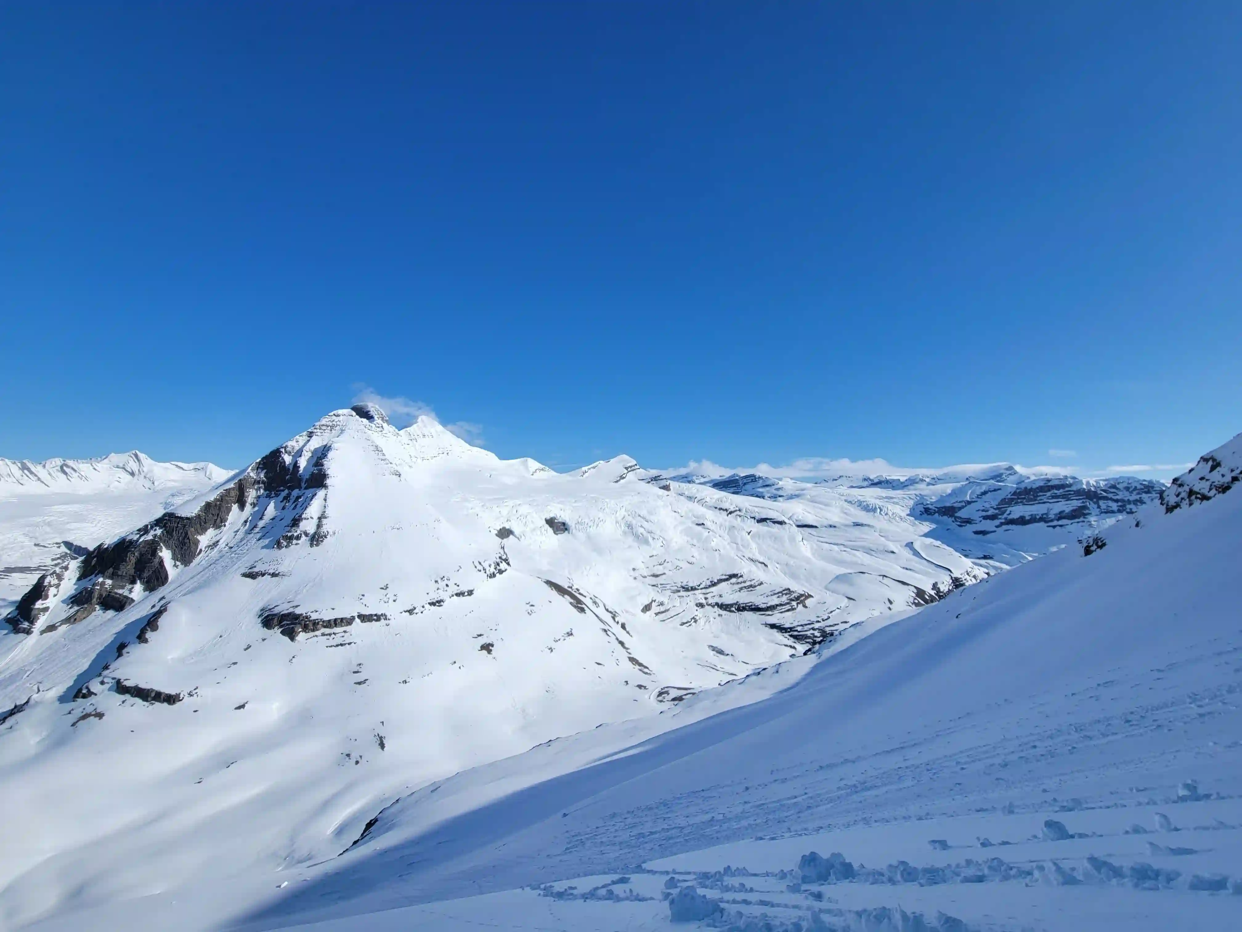
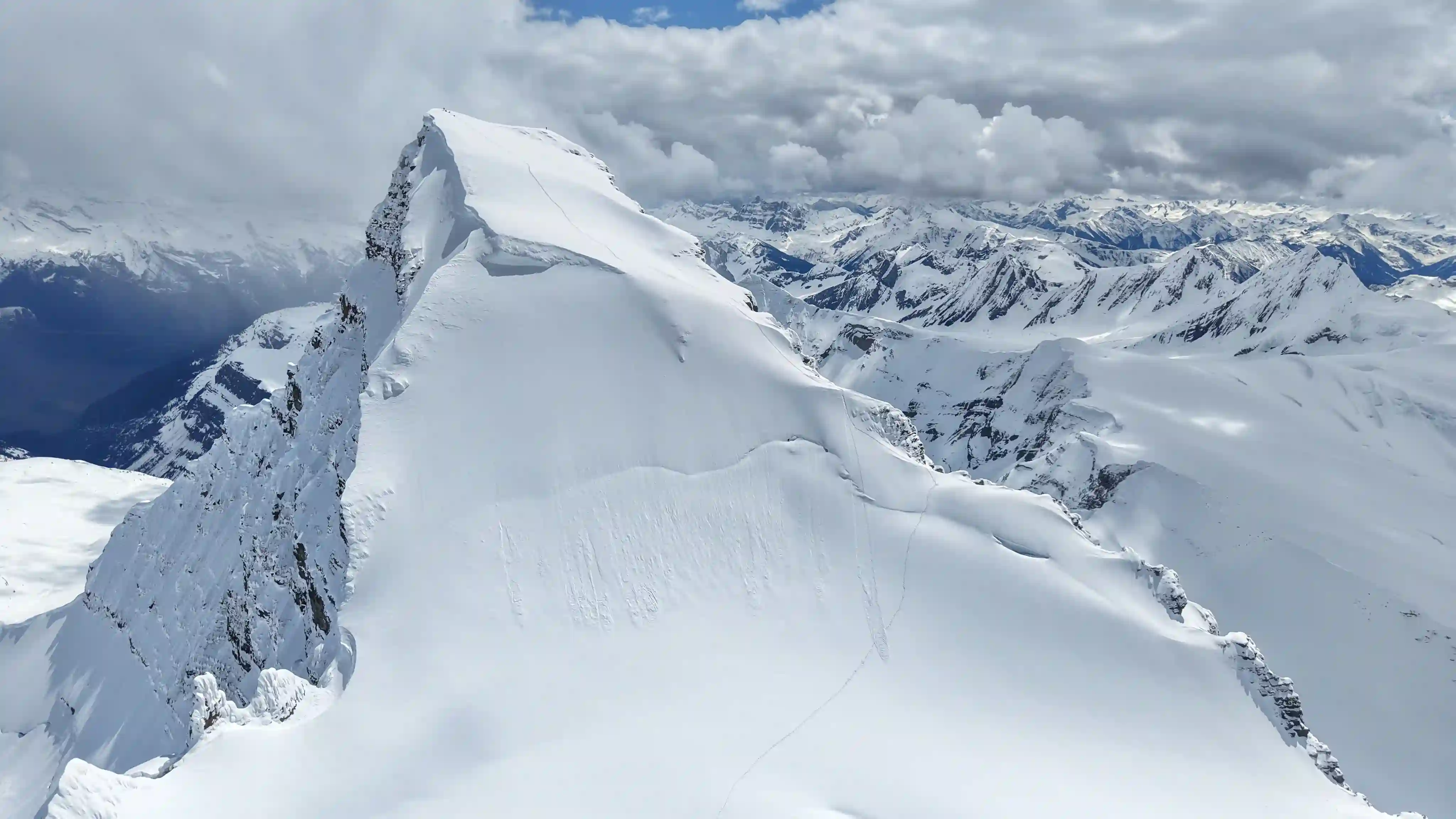
Mountain summit 1000m above and the lake 1000m below
THE EXIT
After a huge summit push day we ended up sleeping in a bit but were still naturally awake with the sunrise because of our early start times the past couple days so we packed up camp and started the hike out. The exit took us about 6 hours so not so bad in the grand scheme of multiday 11000er trip exits and aside from the skis getting caught on a few alders through the bushy section it felt quite chill.
I wasn't planning to go for Tsar Mountain in 2025 but when you get an invite for a peak like this you don't decline! We had an awesome crew and despite some adverse conditions with the deep snow we got it done! Big shout out to Simon for the invite and to Devan and Tim for joining in and making this such a memorable trip! Make sure you go check out Simon's
video,
not one you wanna miss!
Just a few days after getting out from Tsar Mountain another amazing window showed up around the Columbia Icefield and it didn't feel right to let it pass by without going for something so less than a week later I was back in remote BC for
another 11ker trip!
Follow the full progression
I'm working through all 58 11000ers of the Canadian Rockies and beyond. You'll get notified when the latest climbs go live.
Other related trip reports:
Mount Bryce Main & Center |
Mount King Edward ||
Mount Victoria North |
The Twins, Stutfields, & Cromwell
11000ers of the Canadian Rockies
© Haldan Borglum | Peak by Peak. All rights reserved.