Sundance Peak
August 7 2025
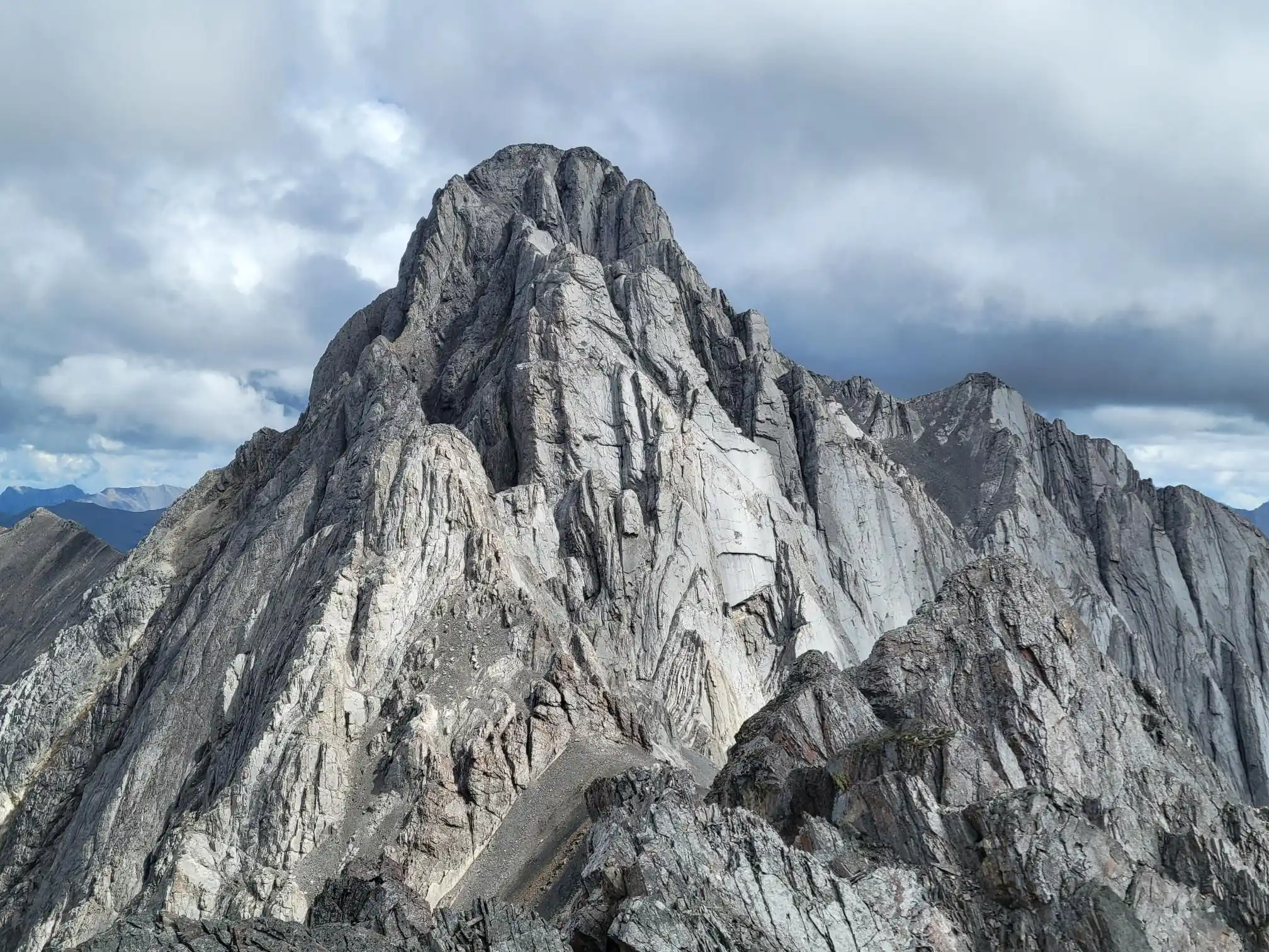
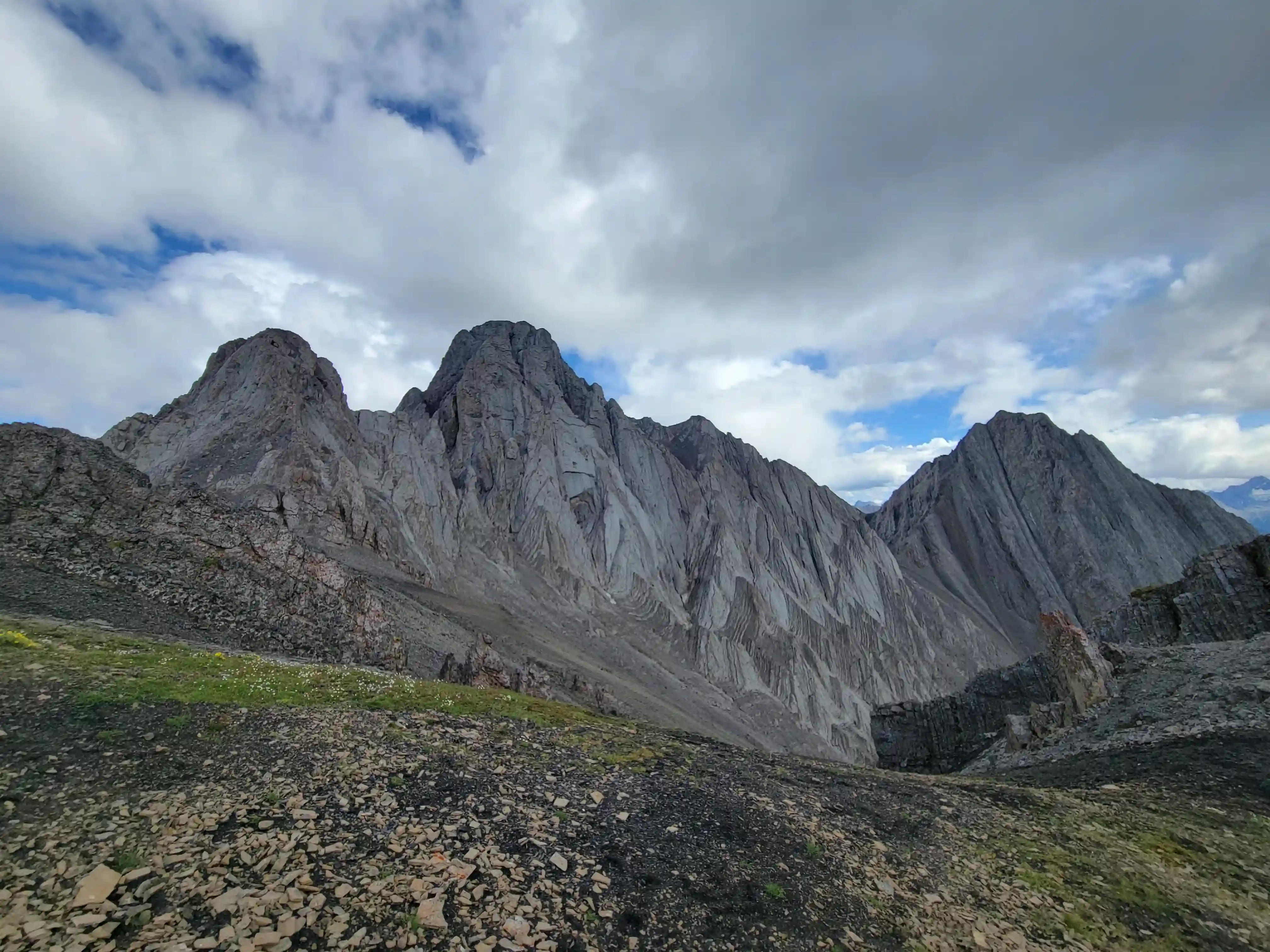
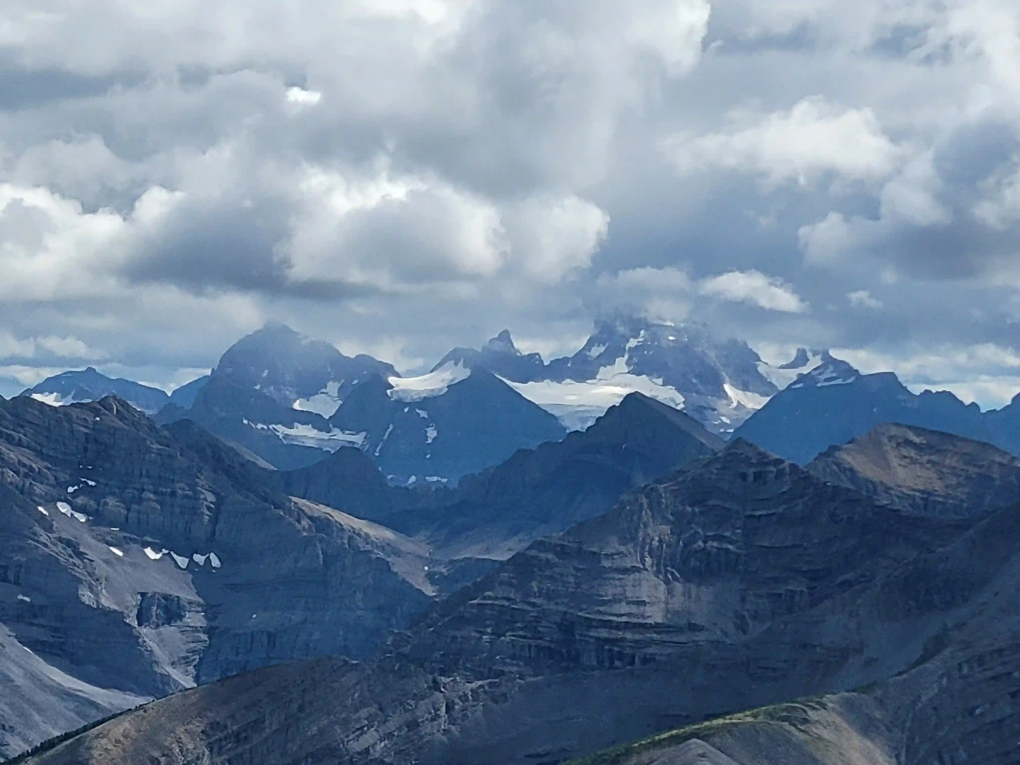
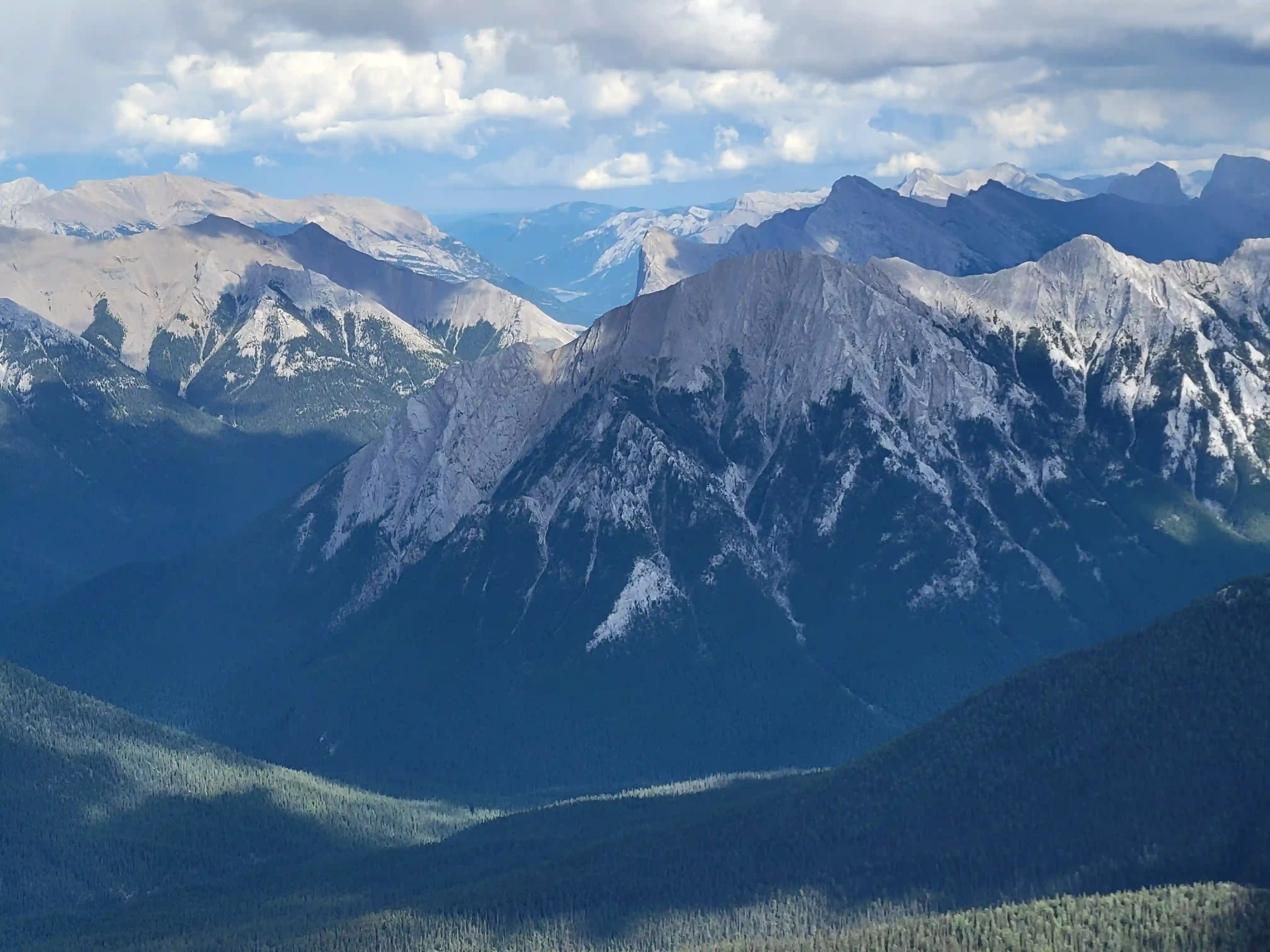
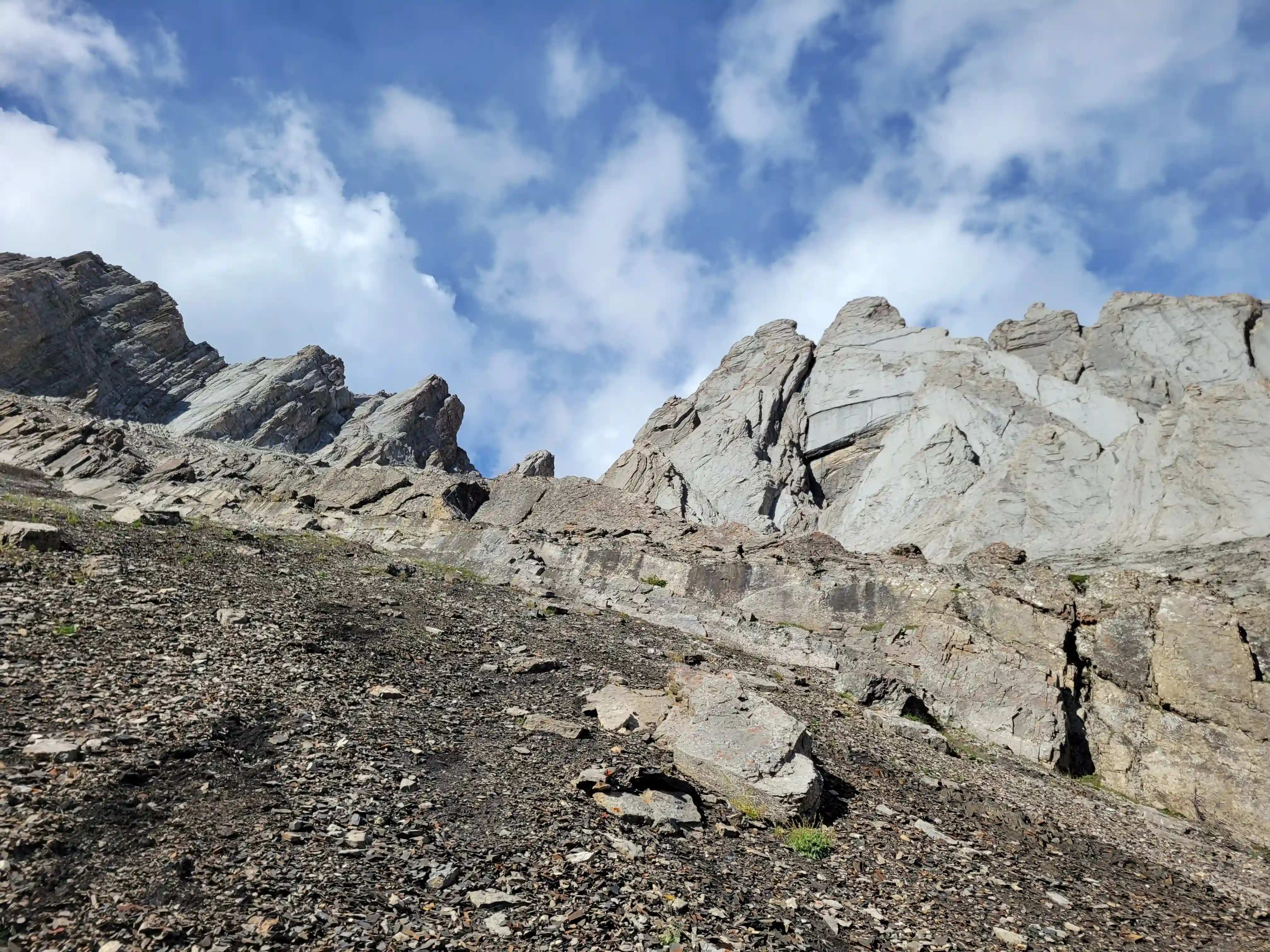
Just southwest of Banff lies Sundance Peak, a practically untouched high point along a 24km stretch of ridges and peaks making up the Sundance massif that has been attempted by few and summitted by even less. Given its visibility from Banff it's a bit surprising that Sundance doesn't see more visits but given the lack of route information, the technical nature of the ascent, and a decent amount of distance to cover to reach it despite being alongside Banff it's easy to see why this mountain would go largely unnoticed. The slabby nature of Sundance's SW face is very much reminiscent of the more technical peaks in the Opal Range in Kananaskis or the Sawback Range of Banff National Park and with its striking appearance it makes for quite the prize for those that reach the summit!
Sundance Peak had been on my radar for the past few years and I knew I wanted to give it a try at some point so when Devan Peterson reached out about wanting to go for it I was keen to get after it! We made plans for a few days later when the weather looked like it would be decent and we didn't stress about starting too early but that morning it was quite overcast and seemed like we might get socked in up high. We took a few minutes to think it over but since we were both already at the Healy / Brewster trail starting point and all geared up we decided to just go for it and if we had to turn around cause of weather it wasn't the end of the world.
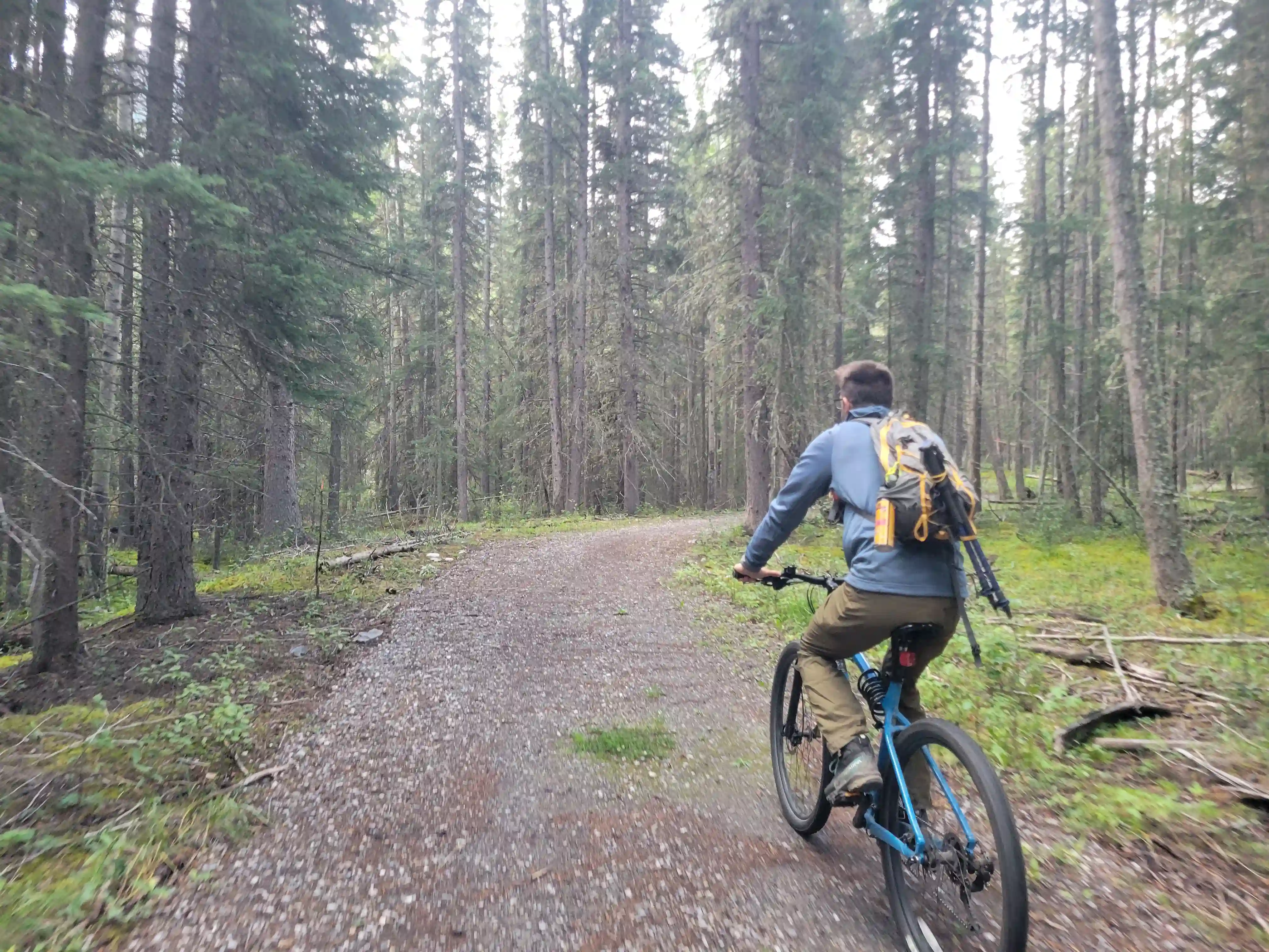
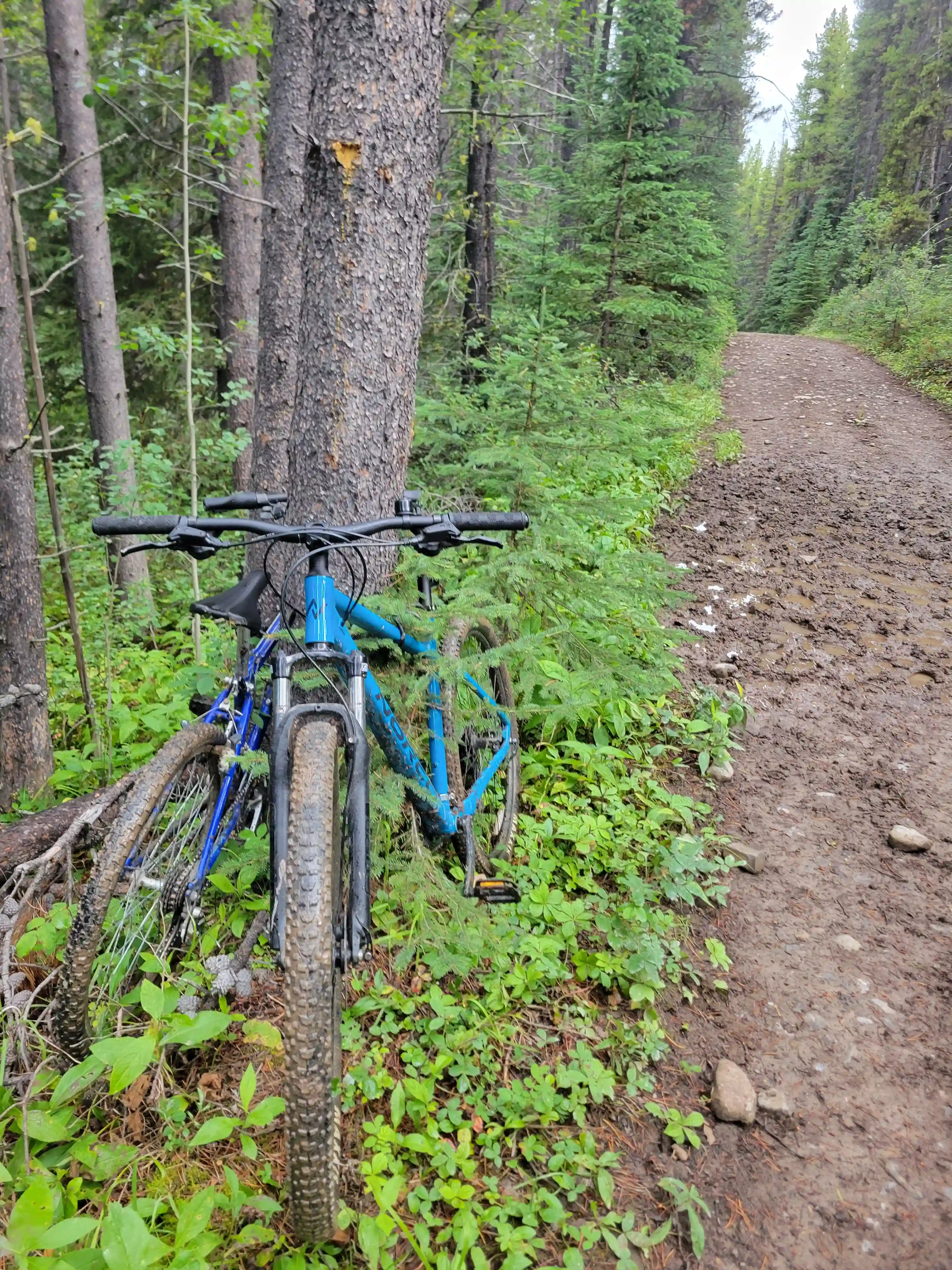
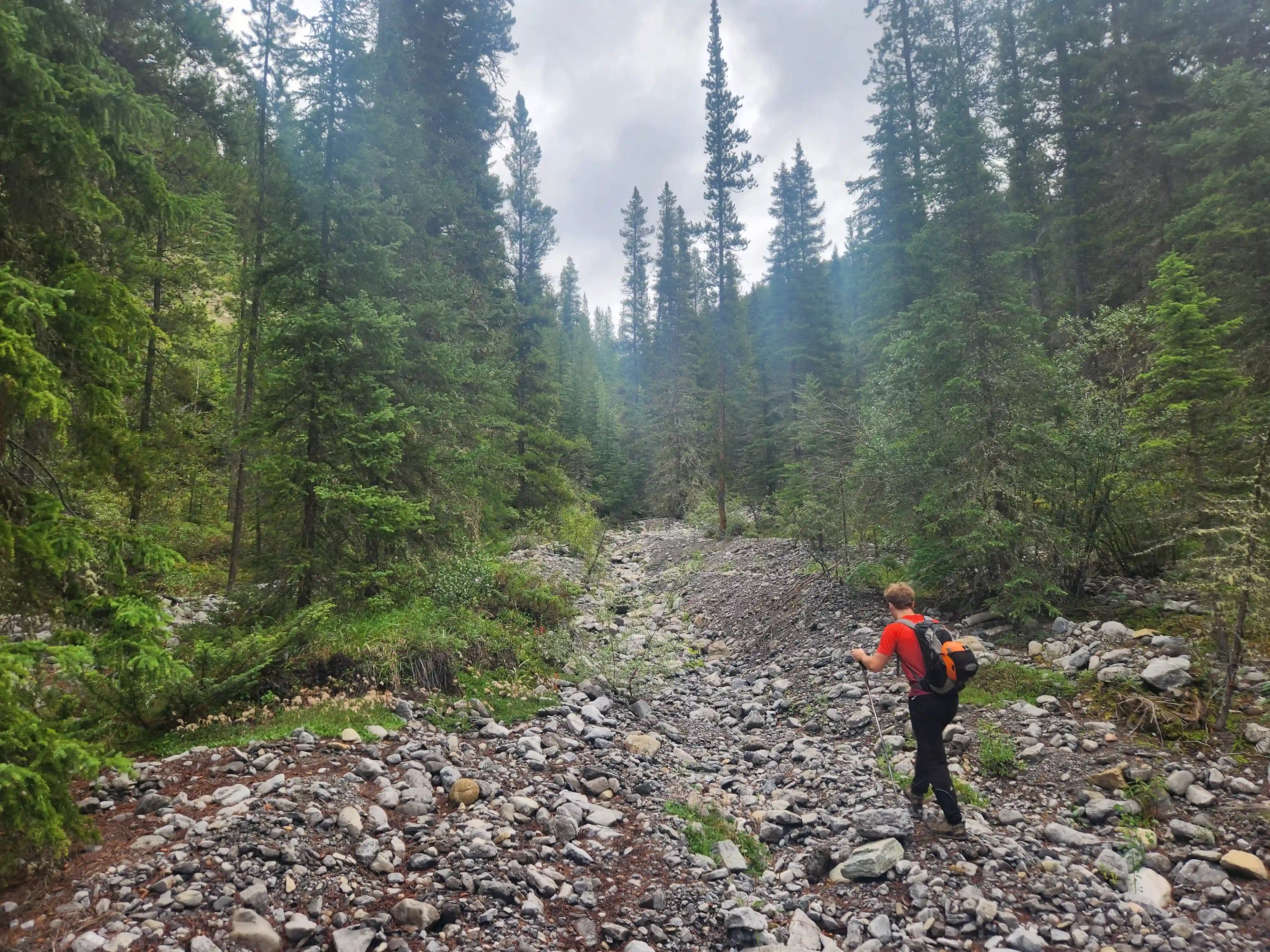
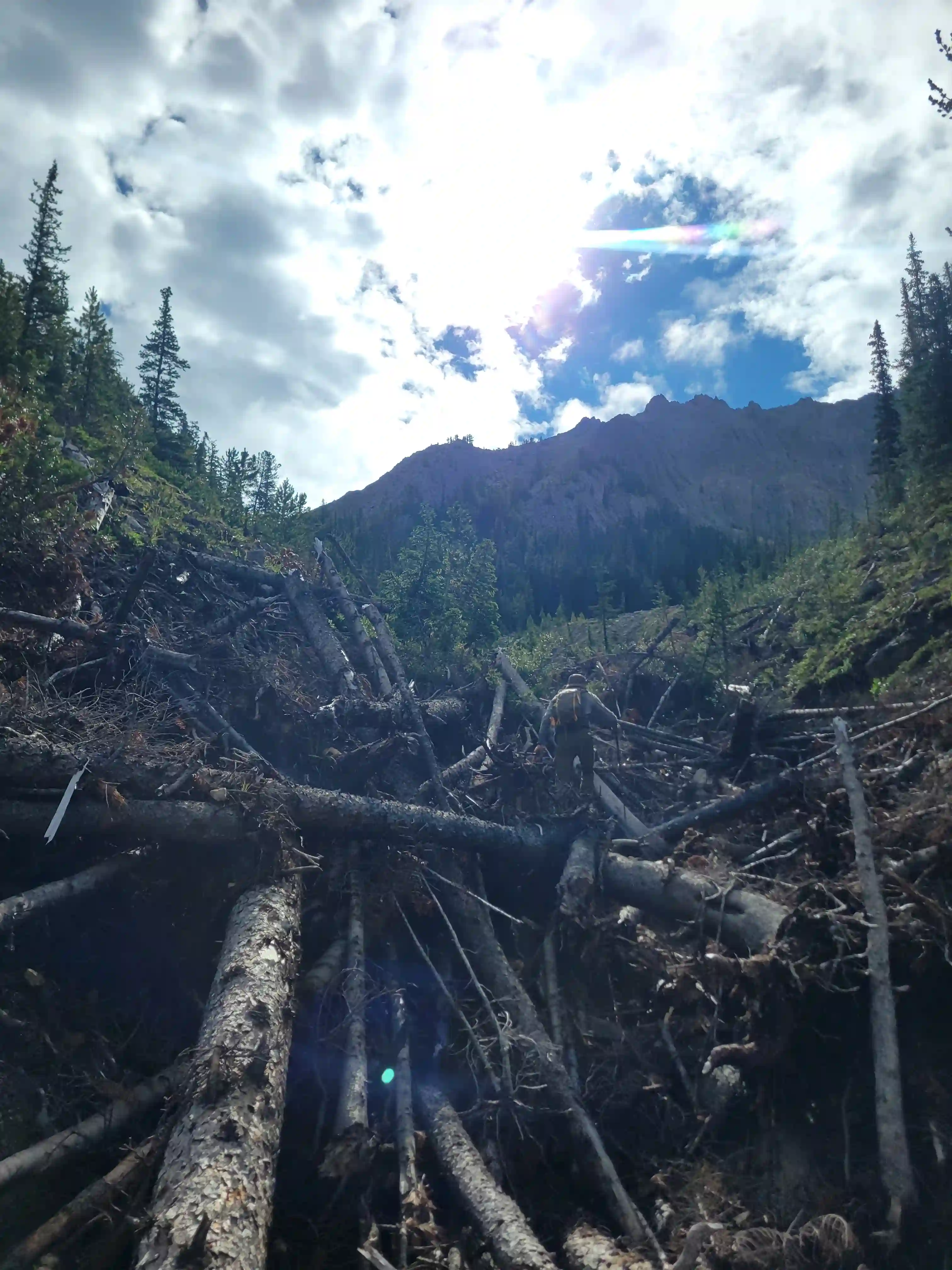
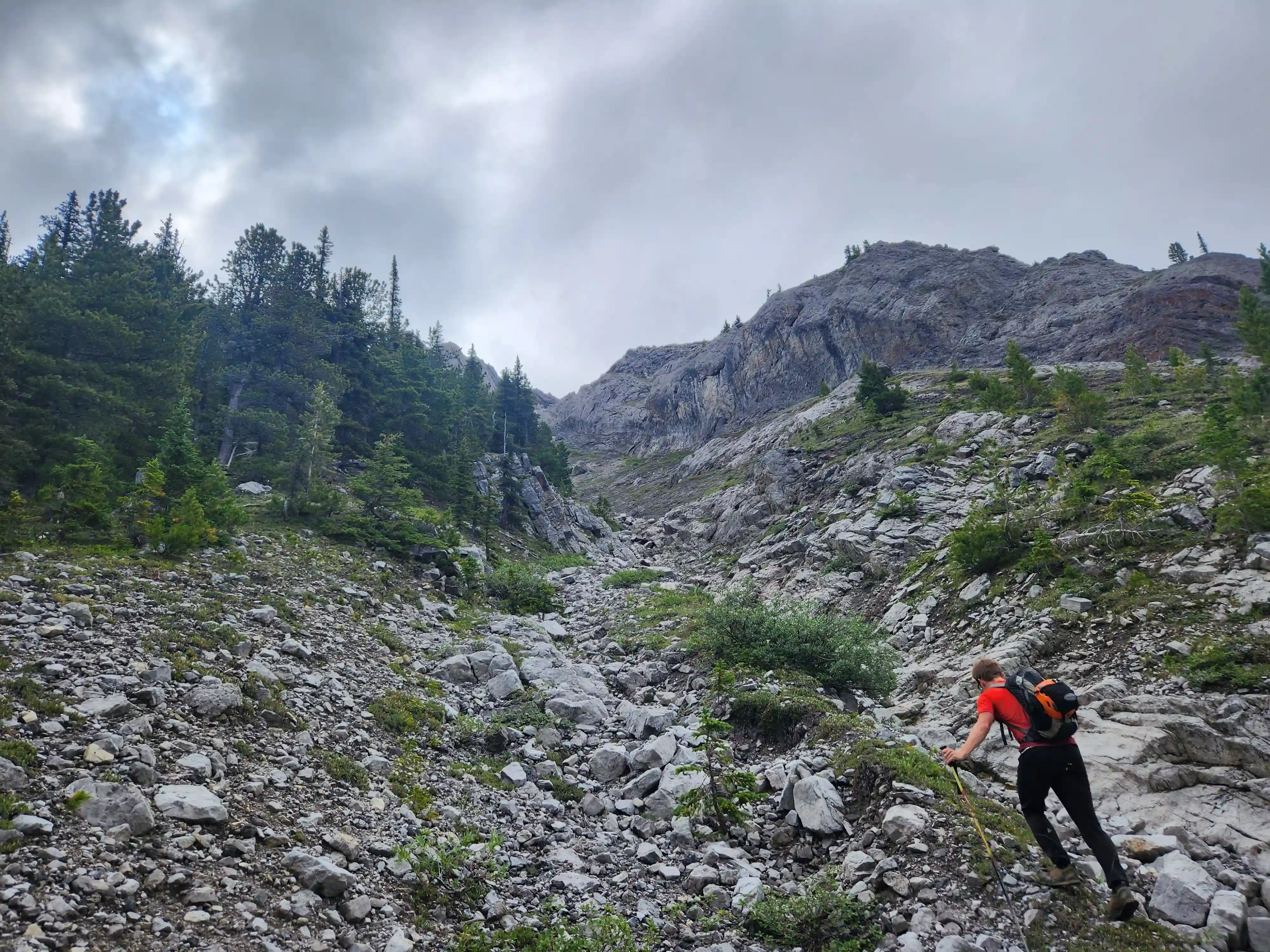
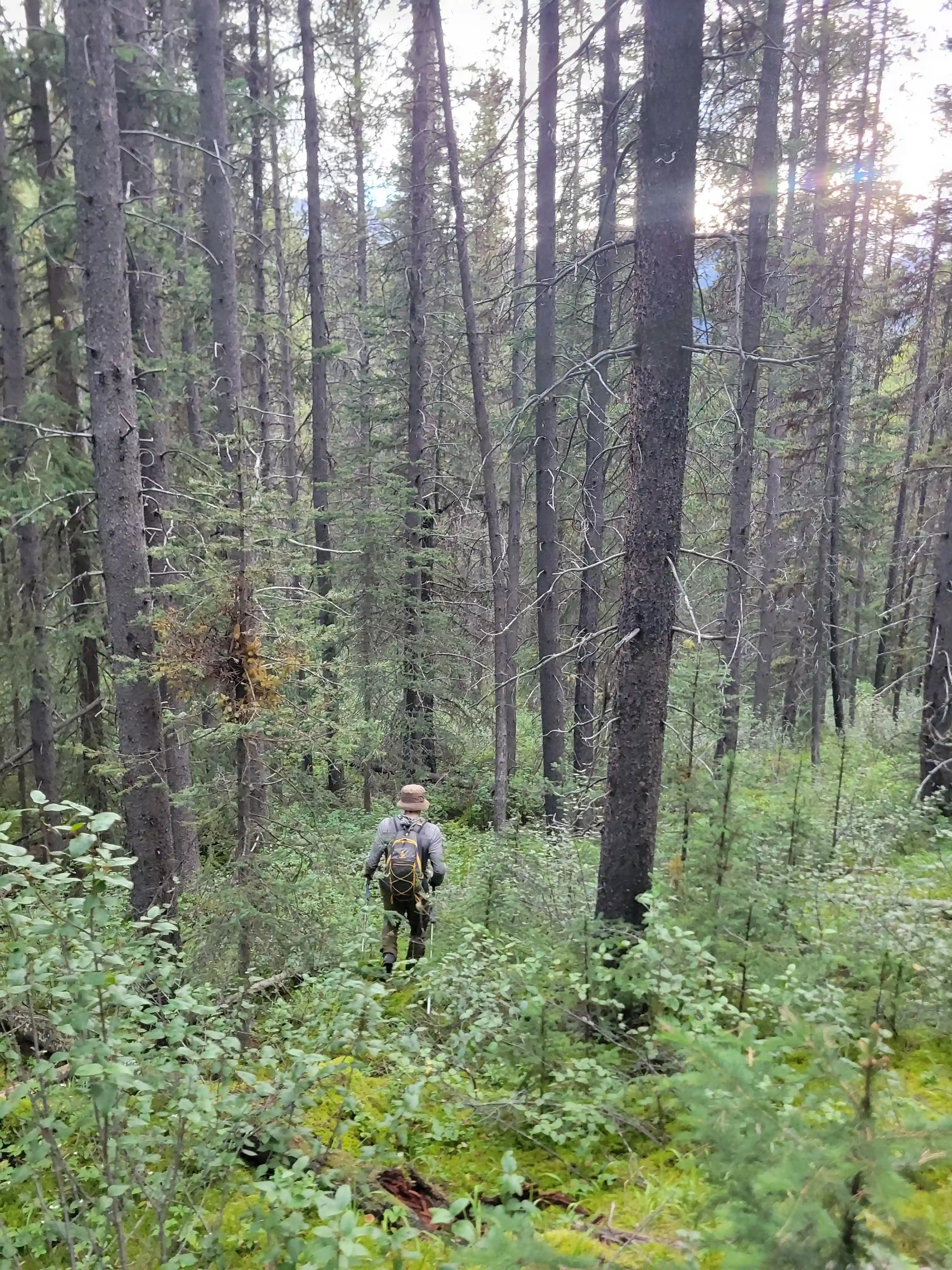
Devan had a gpx for someone that had gone for one of the lower peaks along the Sundance ridge and they had gone up the Brewster Creek Trail for a number of kilometers before heading up the mountain aiming for the ridge. As a result we decided to go for a similar strategy and started the day off on biked headed up the trail. It didn't take us long to put two and two together that this trail was primarily a horse trail and just after a few minutes of biking conditions went from bad to worse as we had to frequently avoid rutted out and muddy / horse crap sections. After around 7km we gave up on biking given how much we were having to hop off the bikes to avoid the nasty sections and we walked the remainder of the way before finding a scree drainage that looked good for ascending and started up towards the ridge there around 9-10km in.
links:
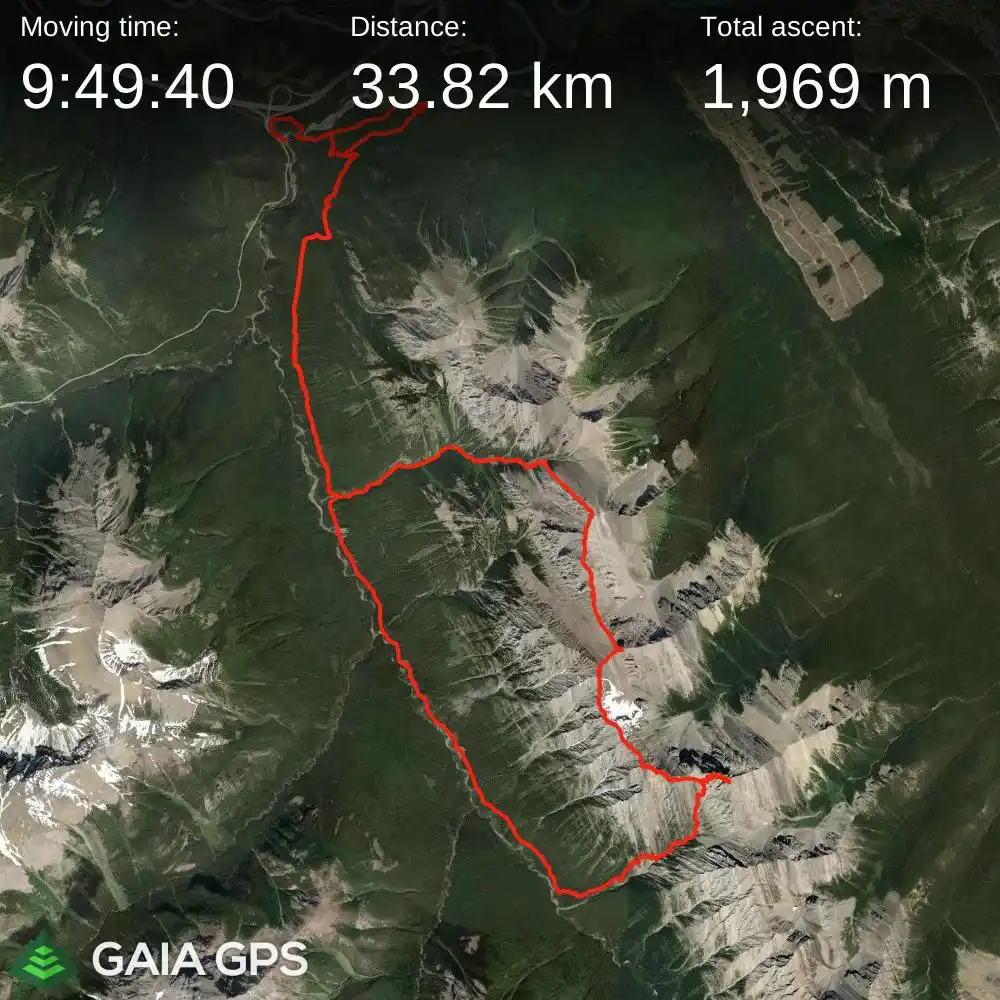
STRAVA
|
GAIA
elapsed time: 14hrs
DIFFICULTY: 5th class, some significantly loose terrain
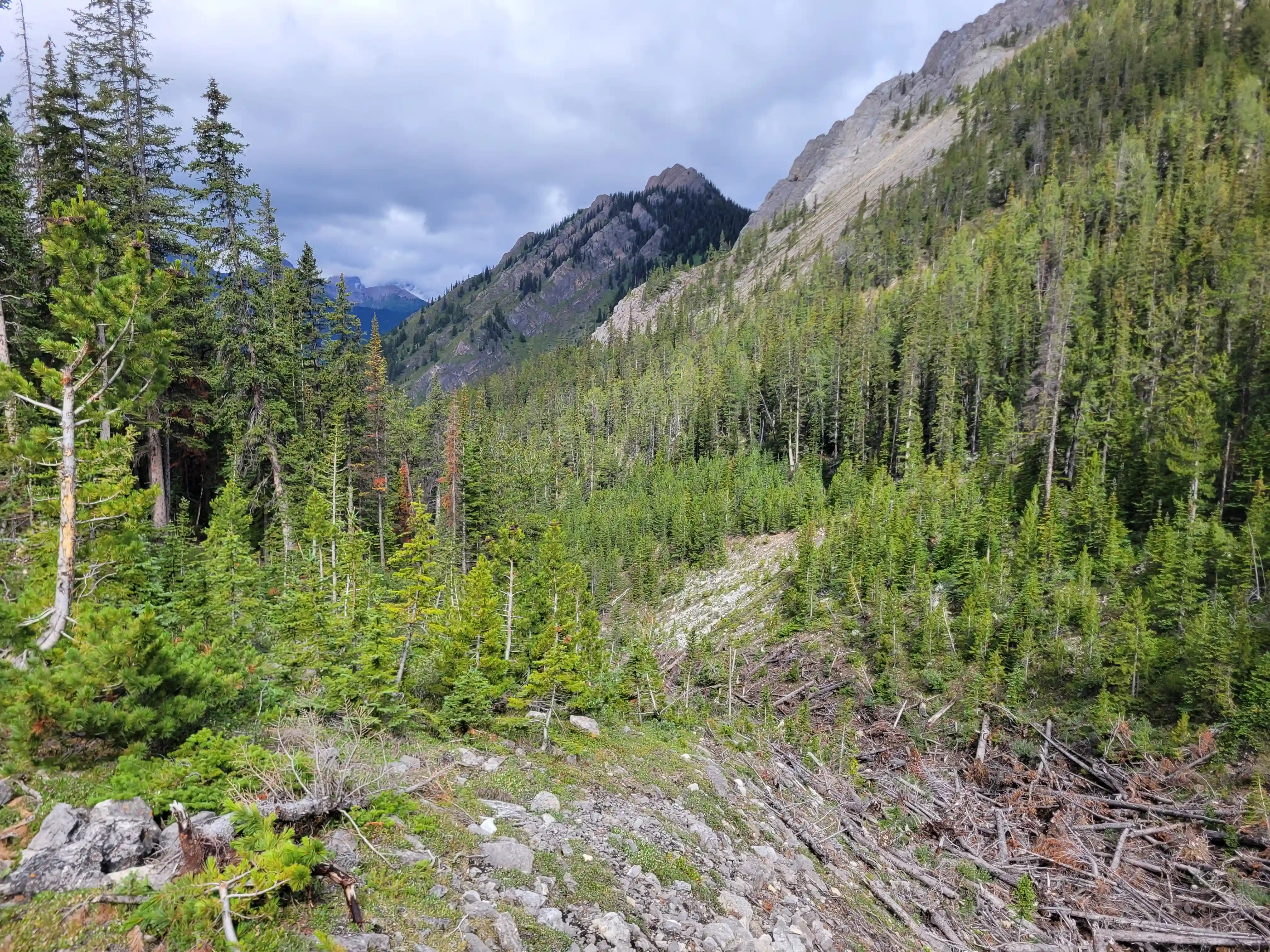
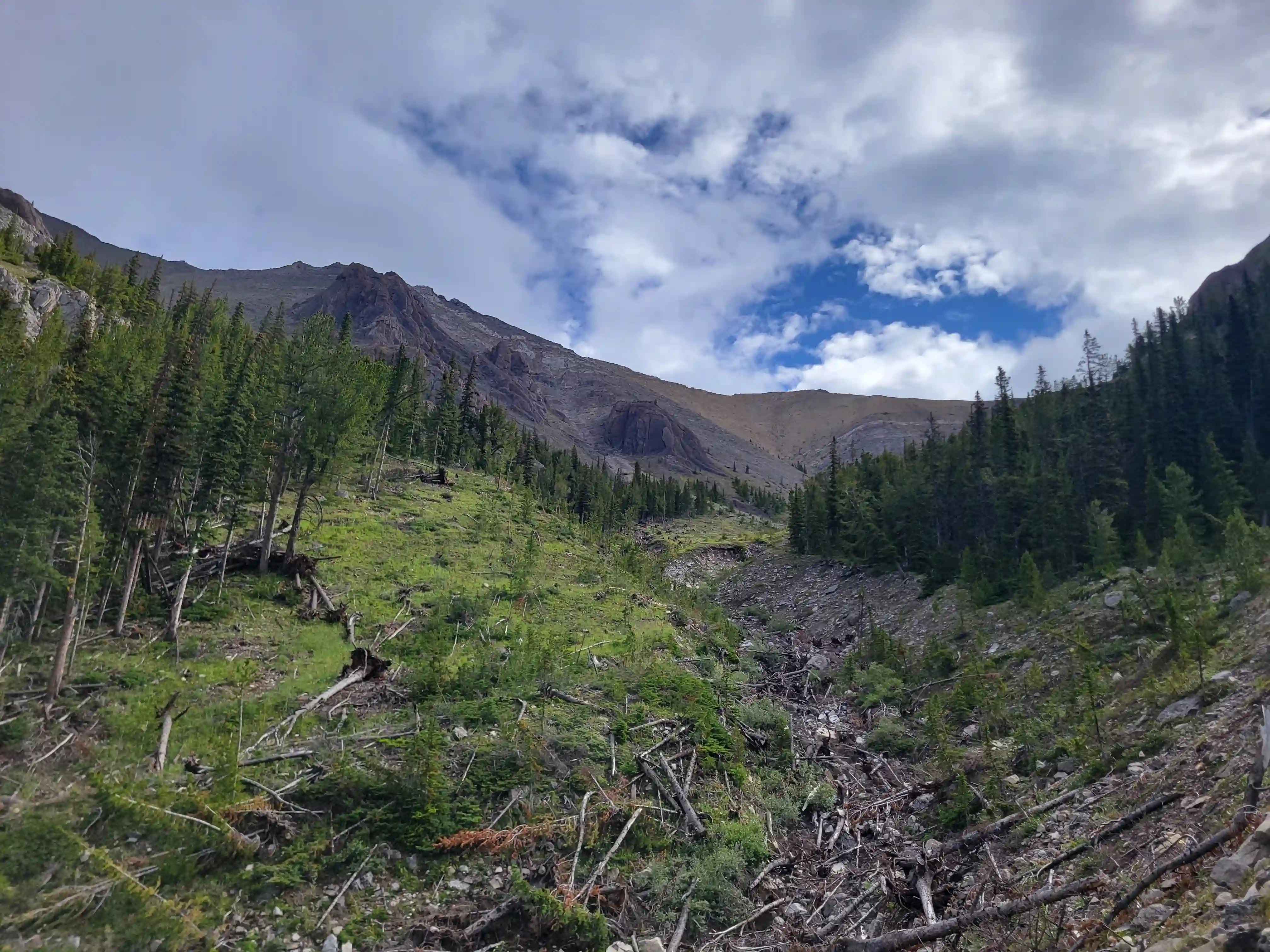
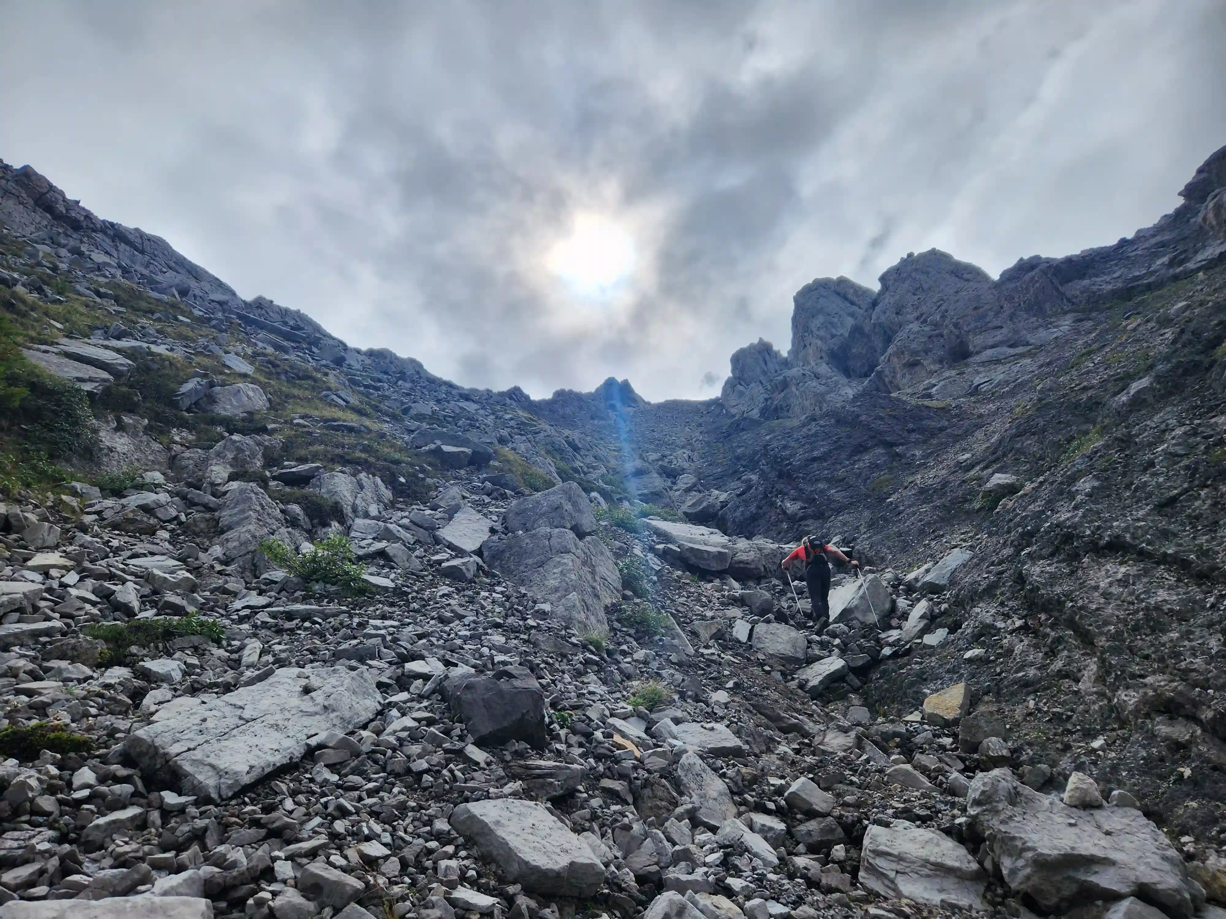
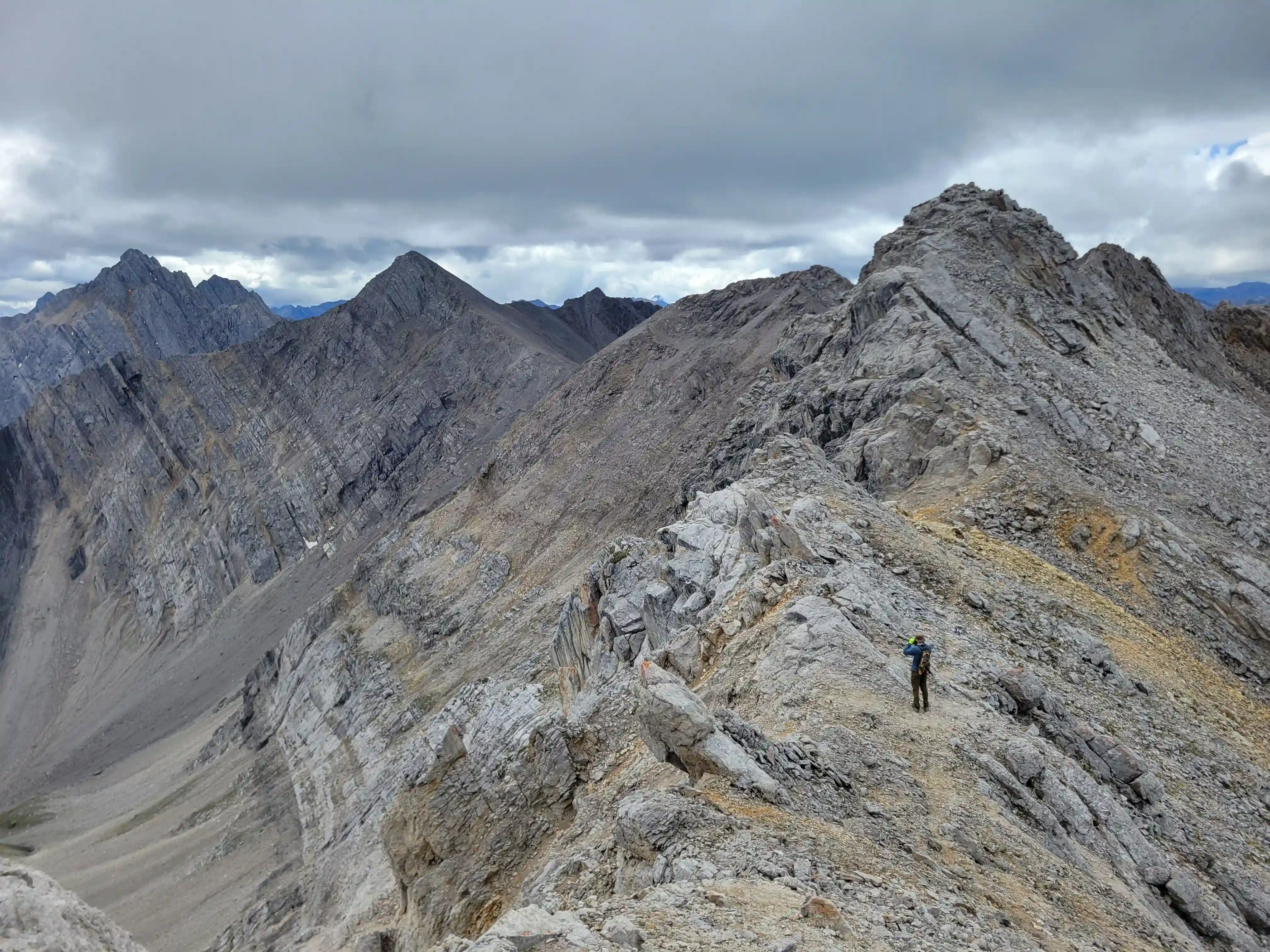
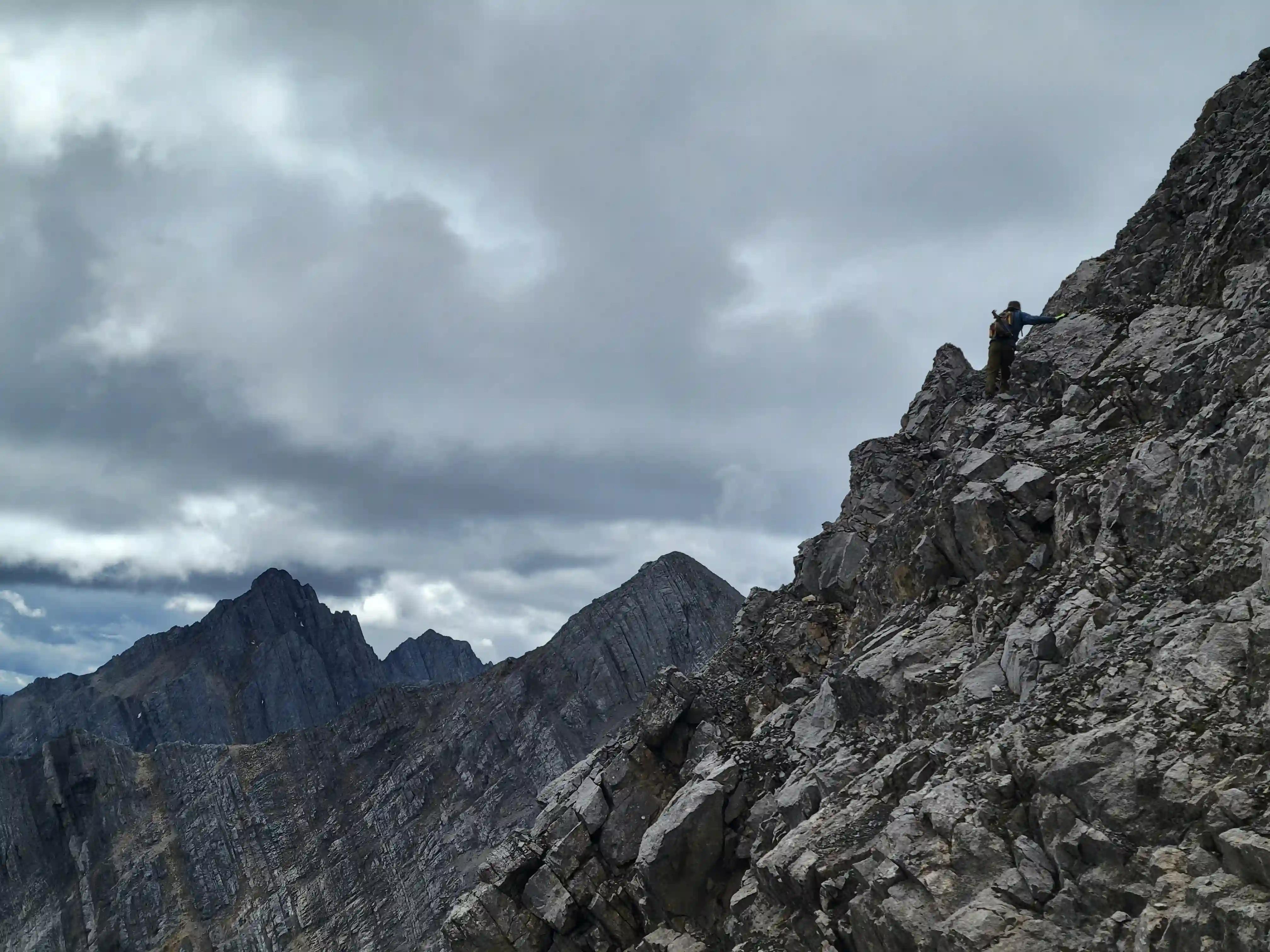
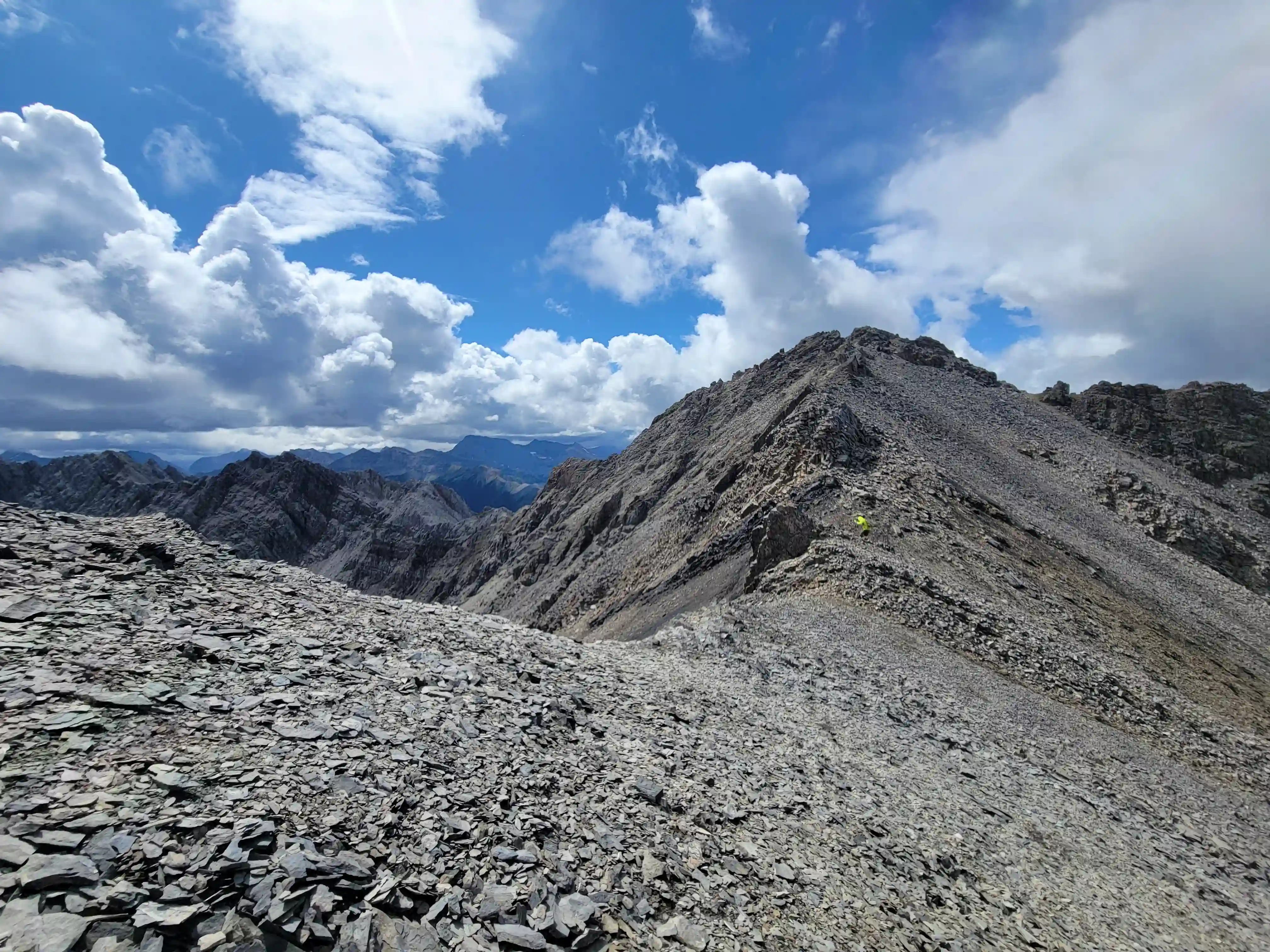
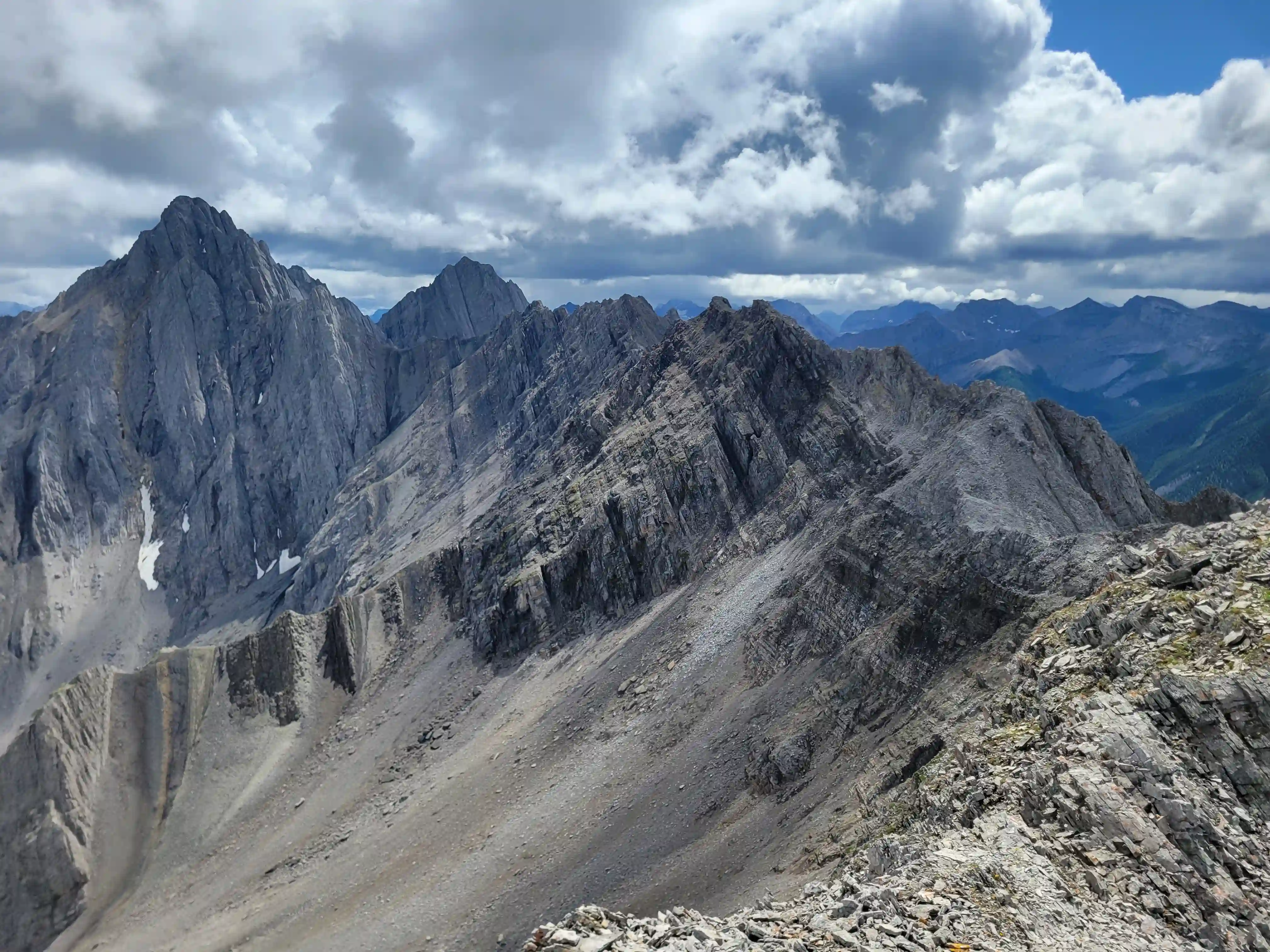
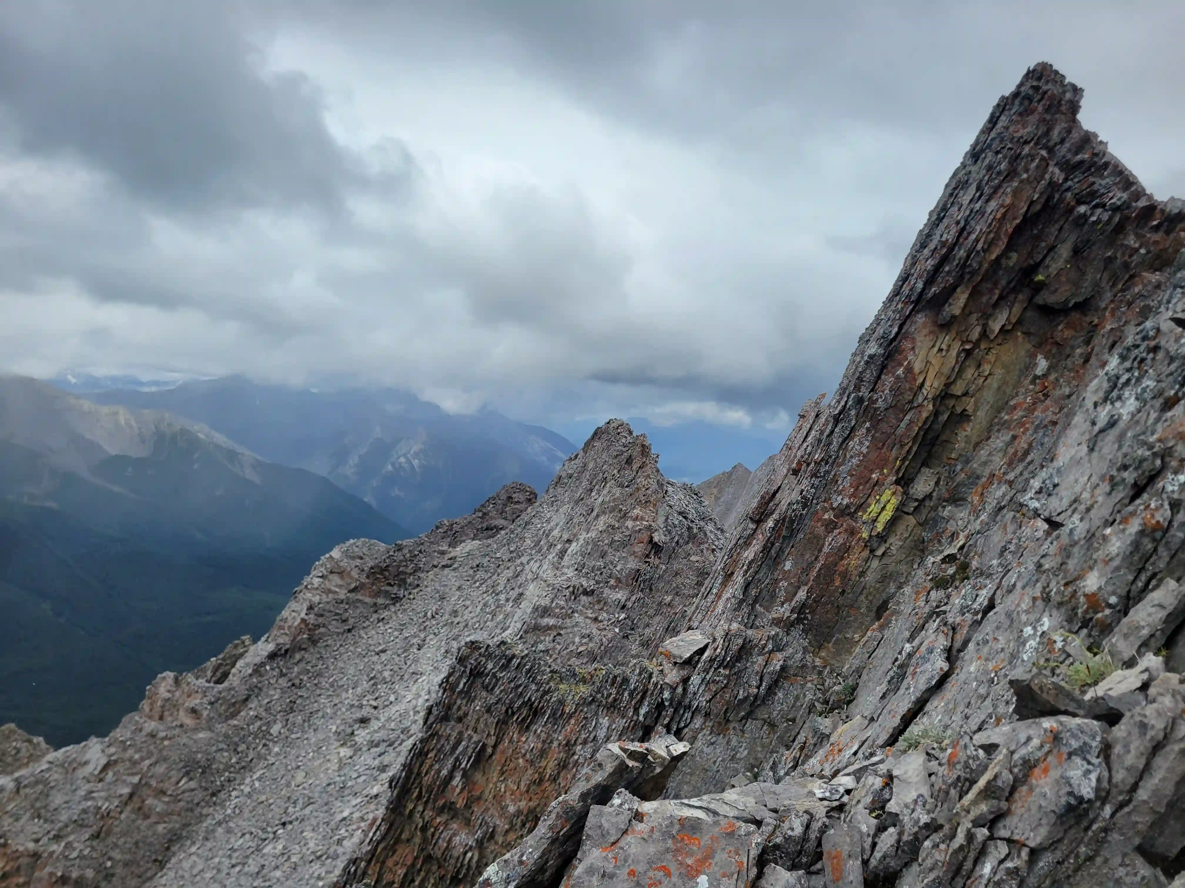
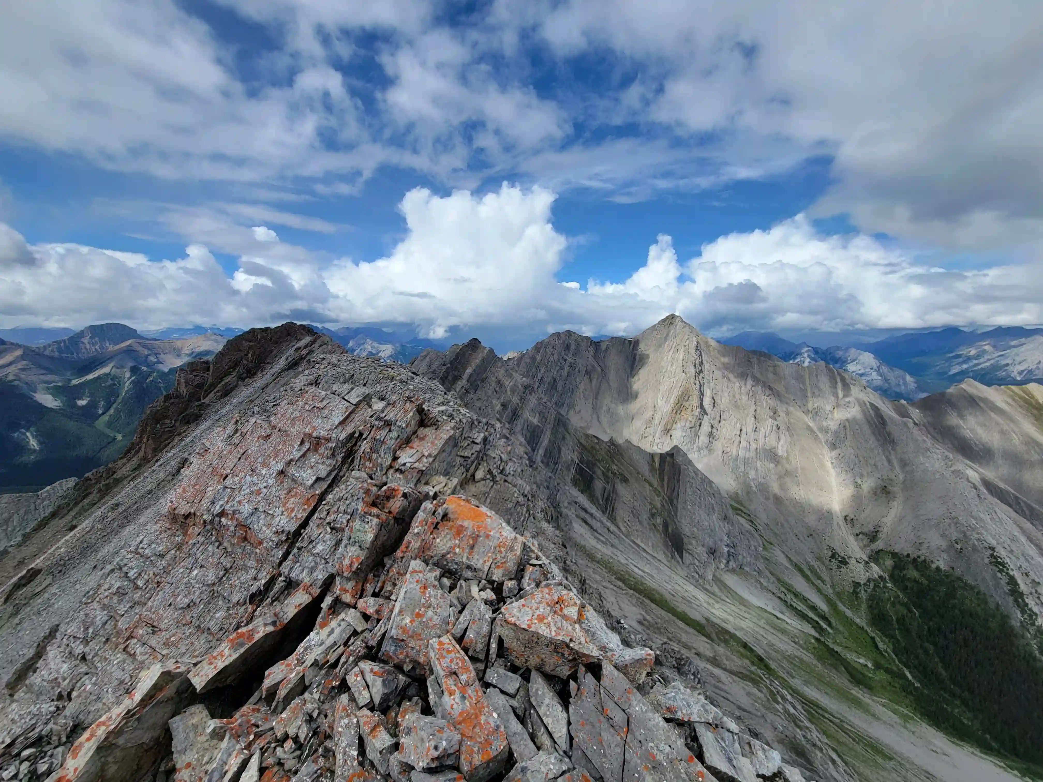
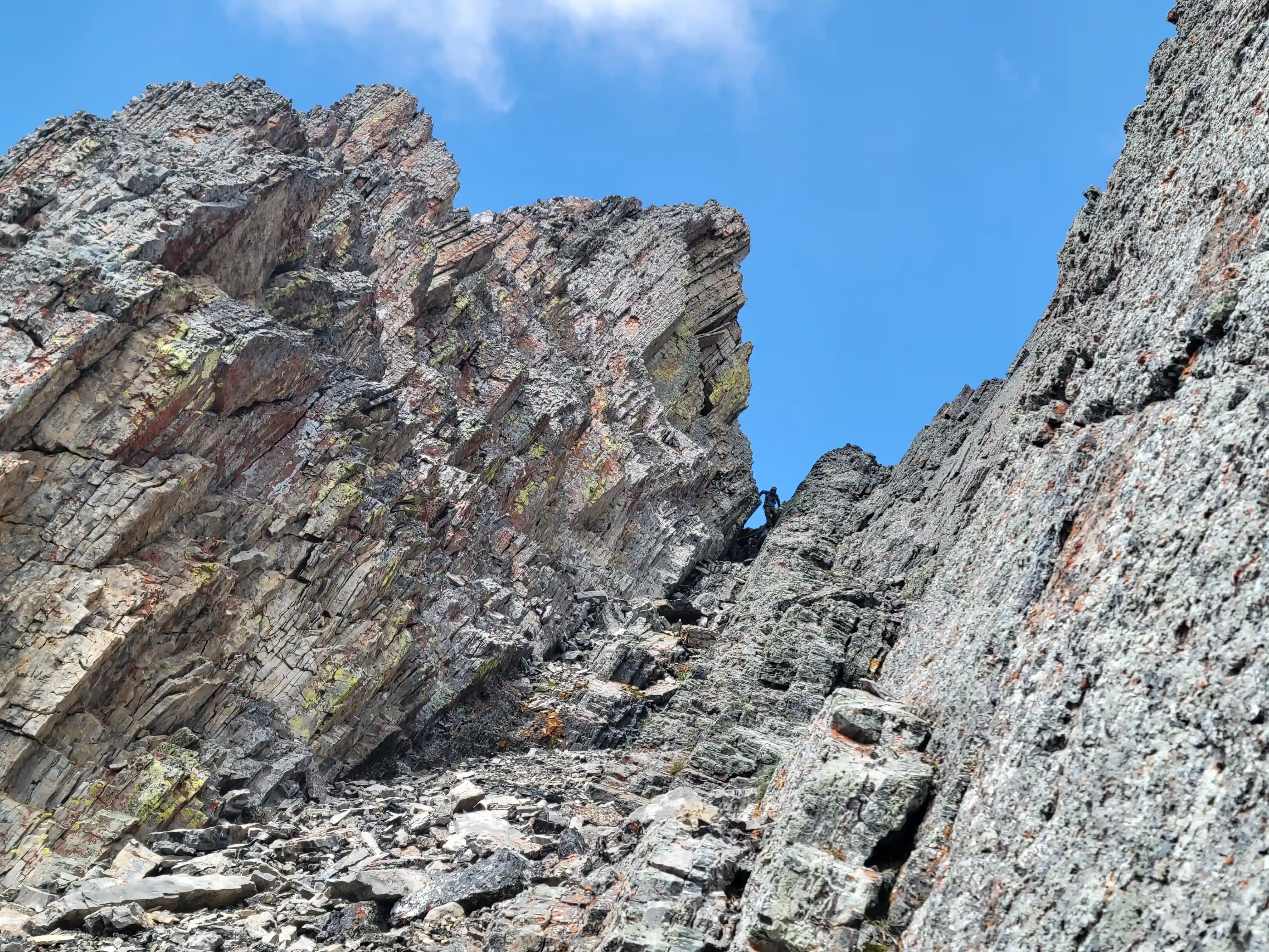
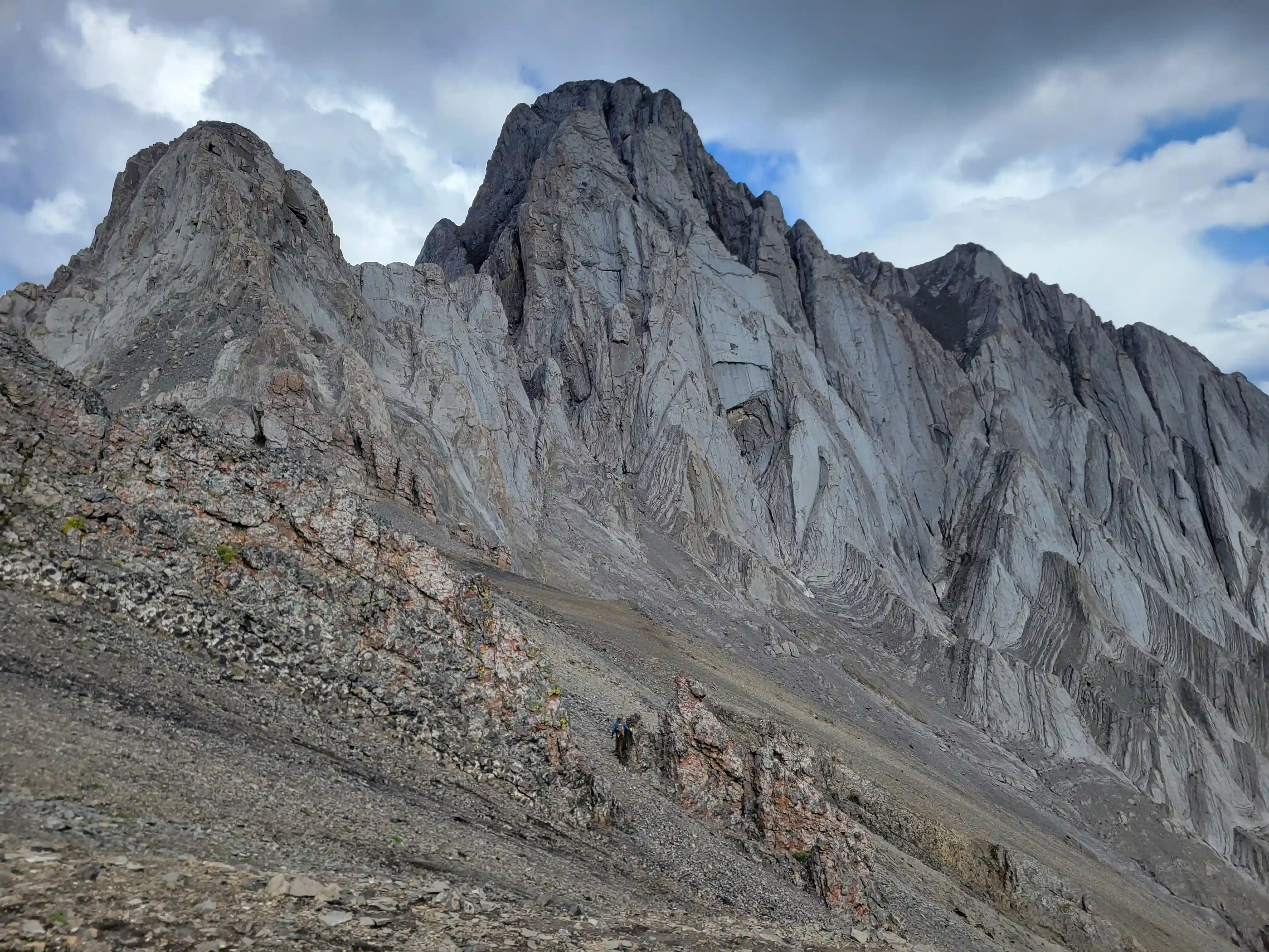
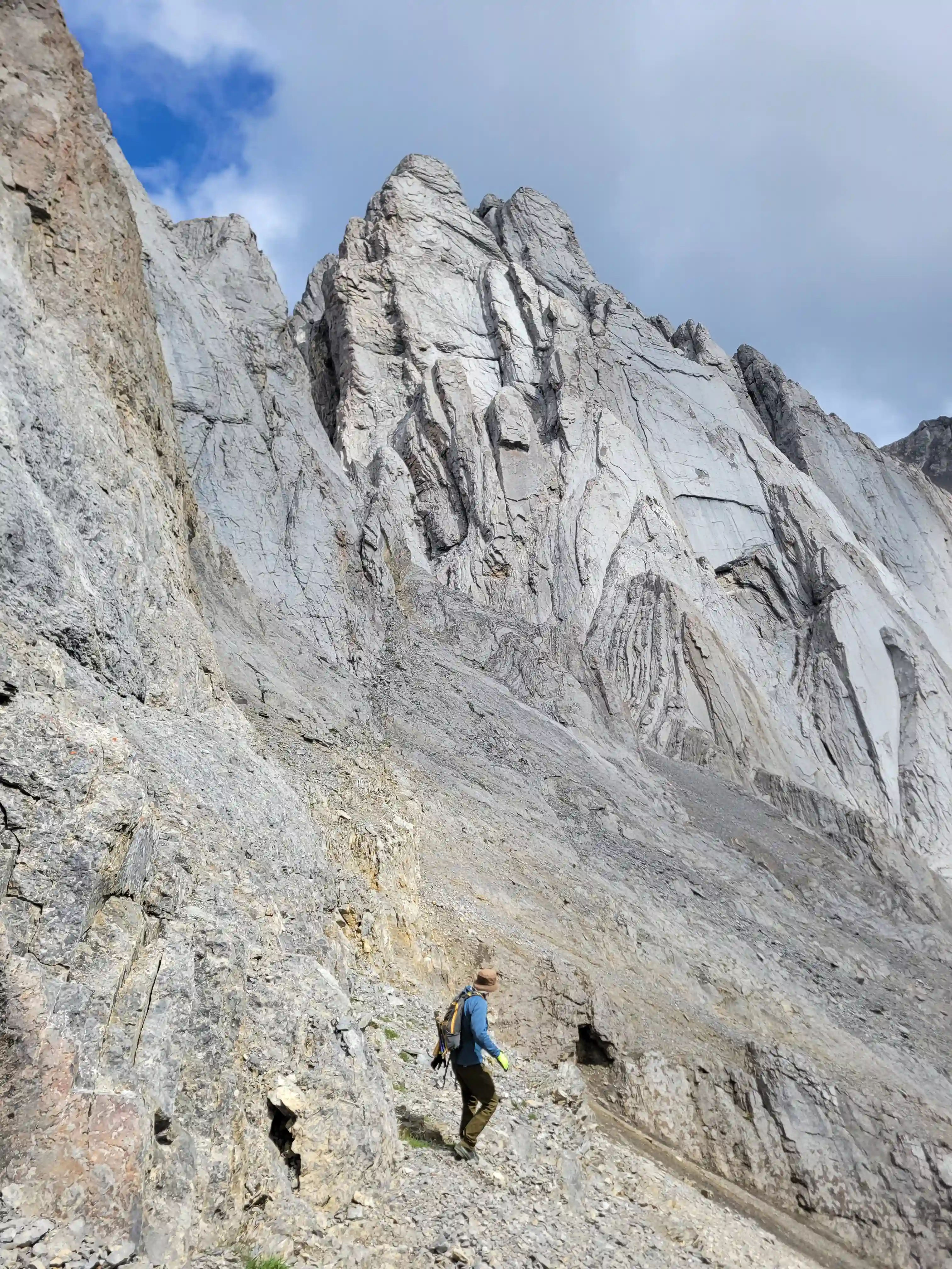
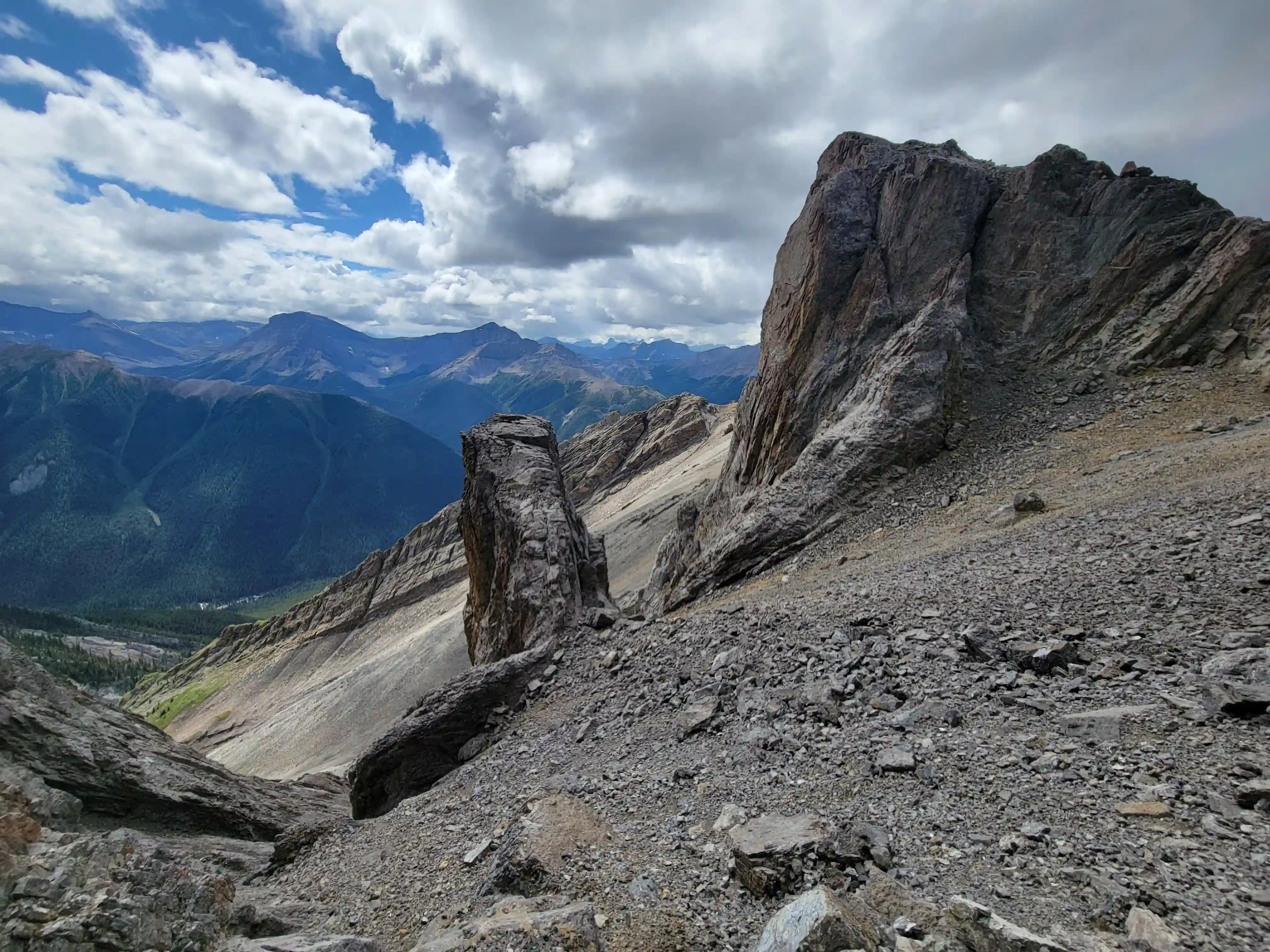
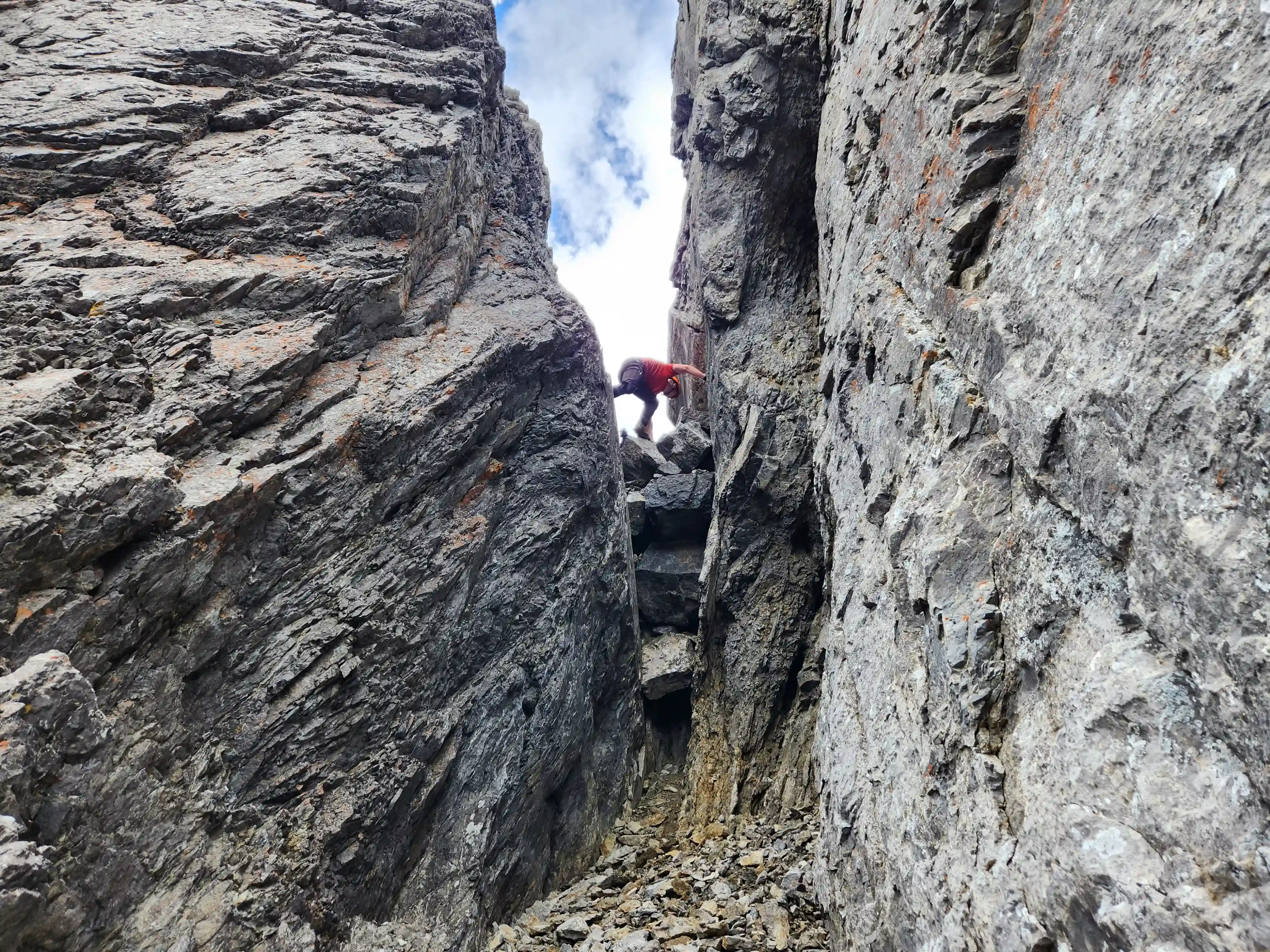
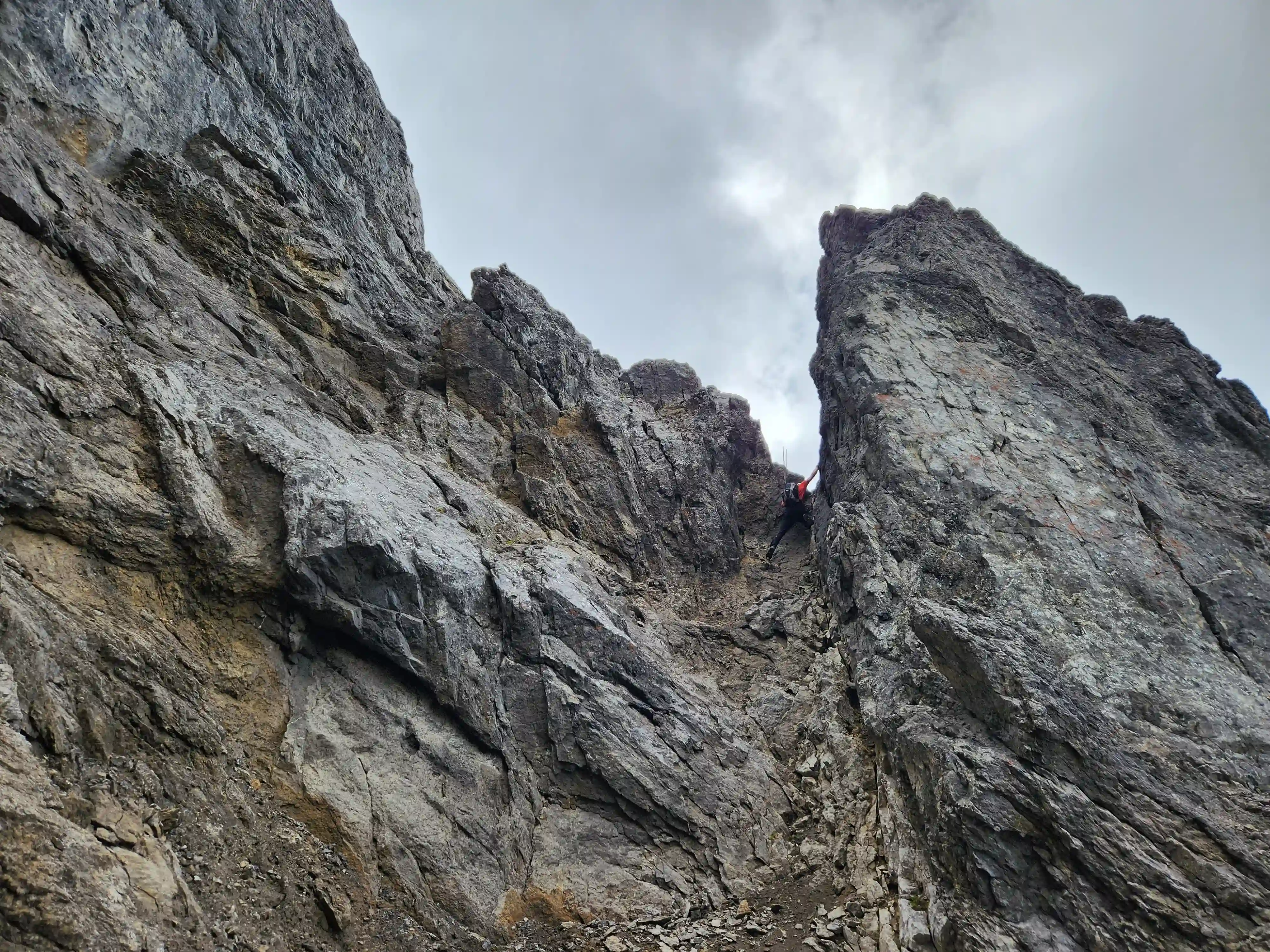
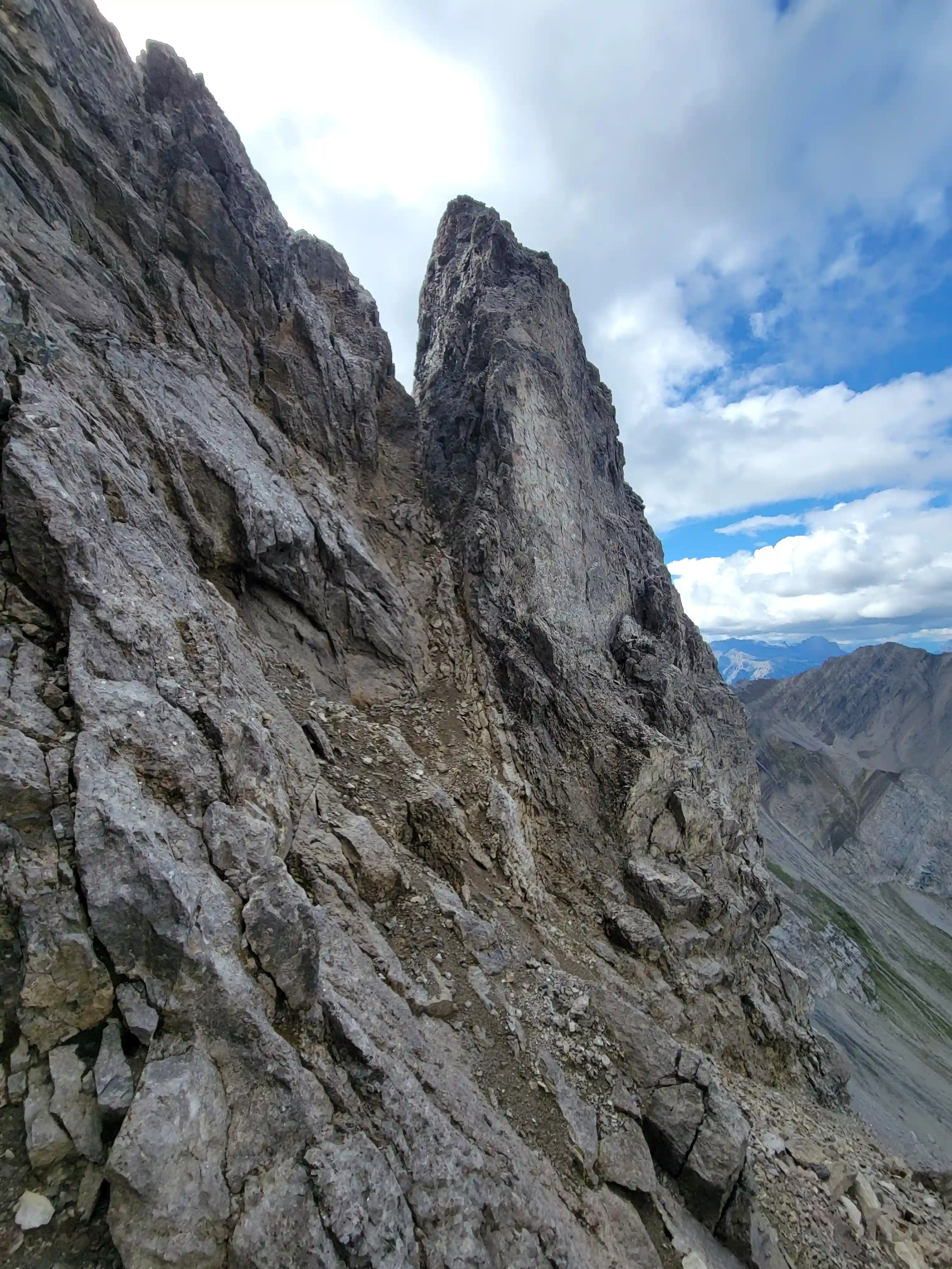
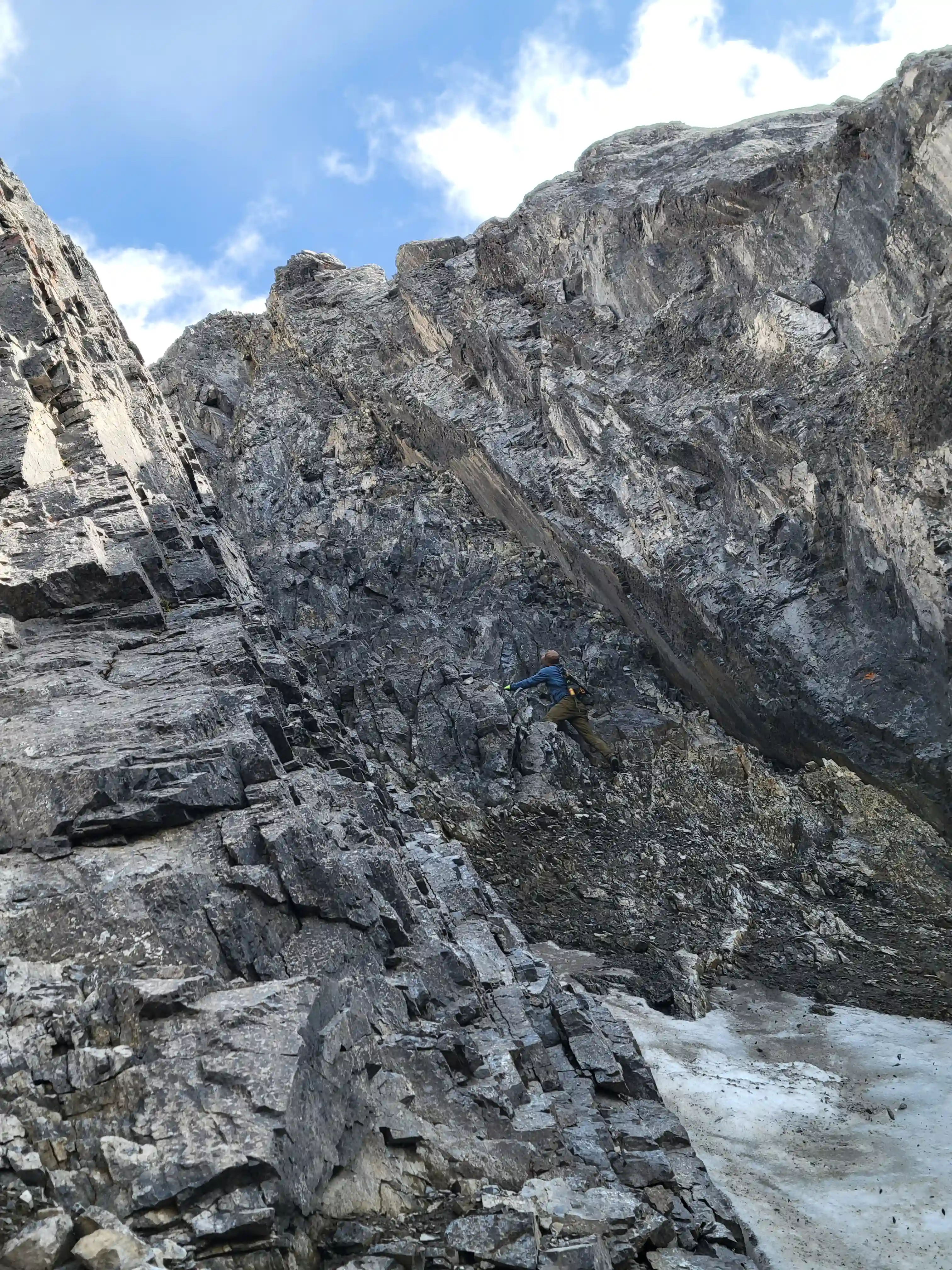
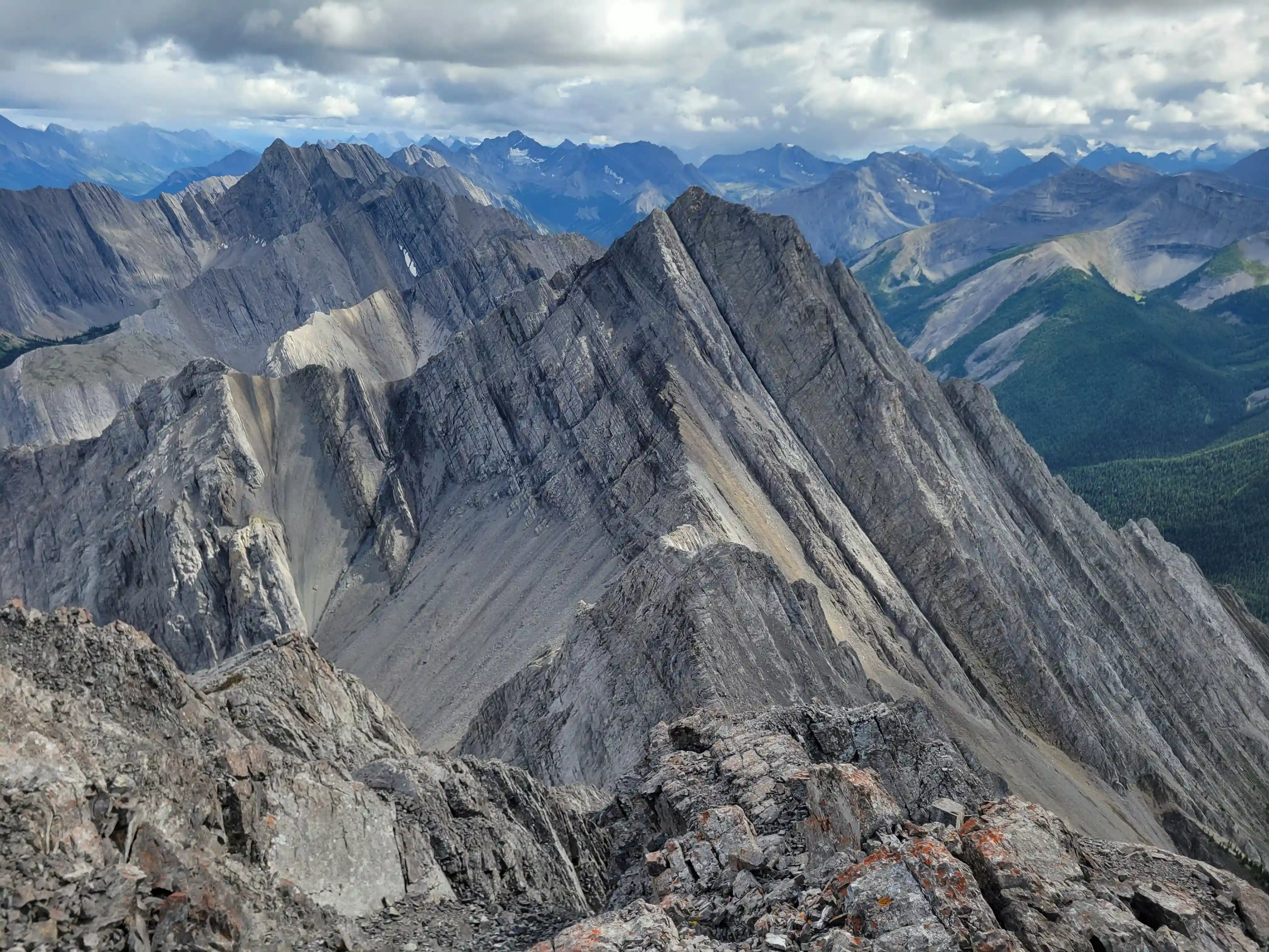
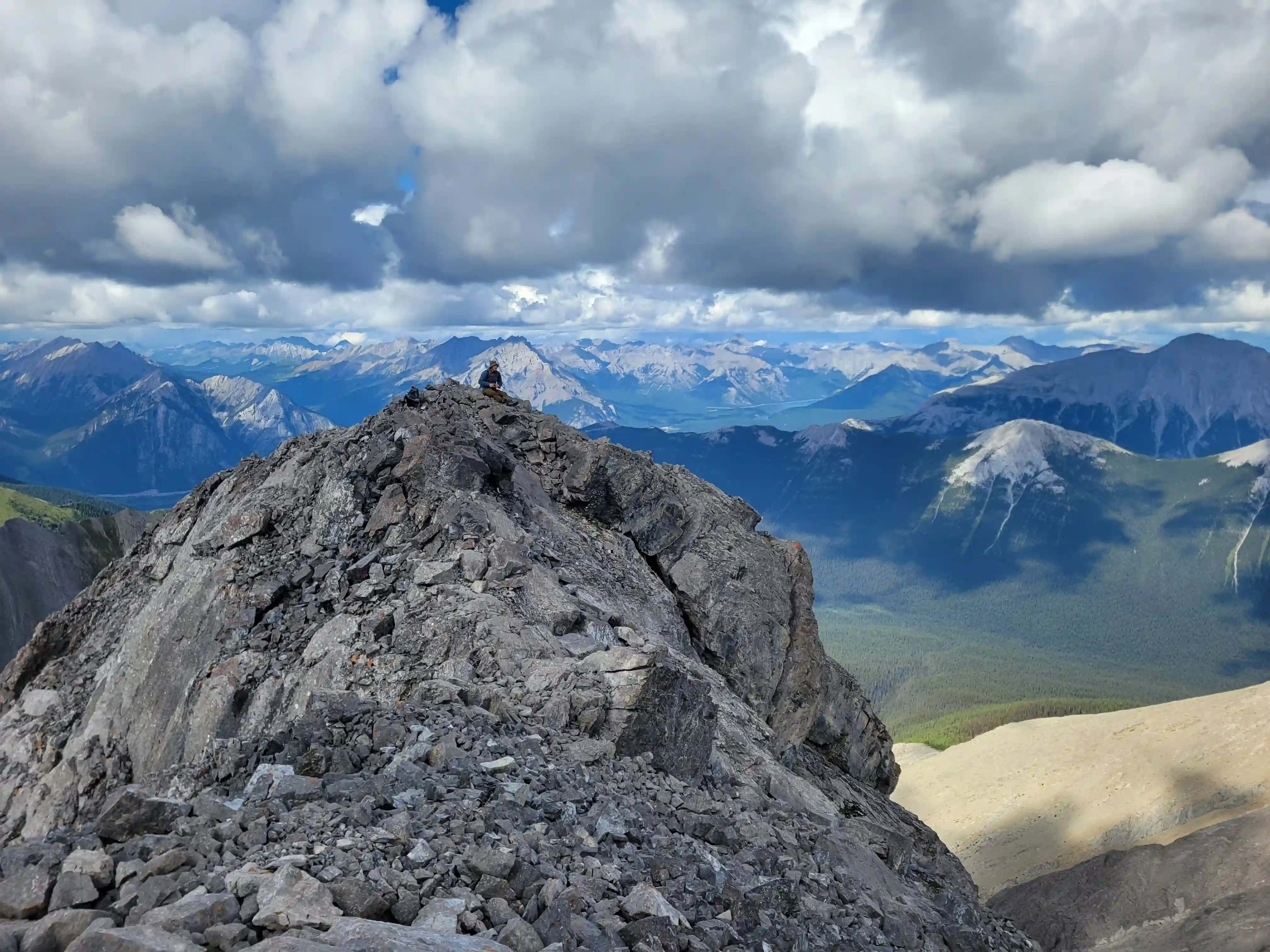
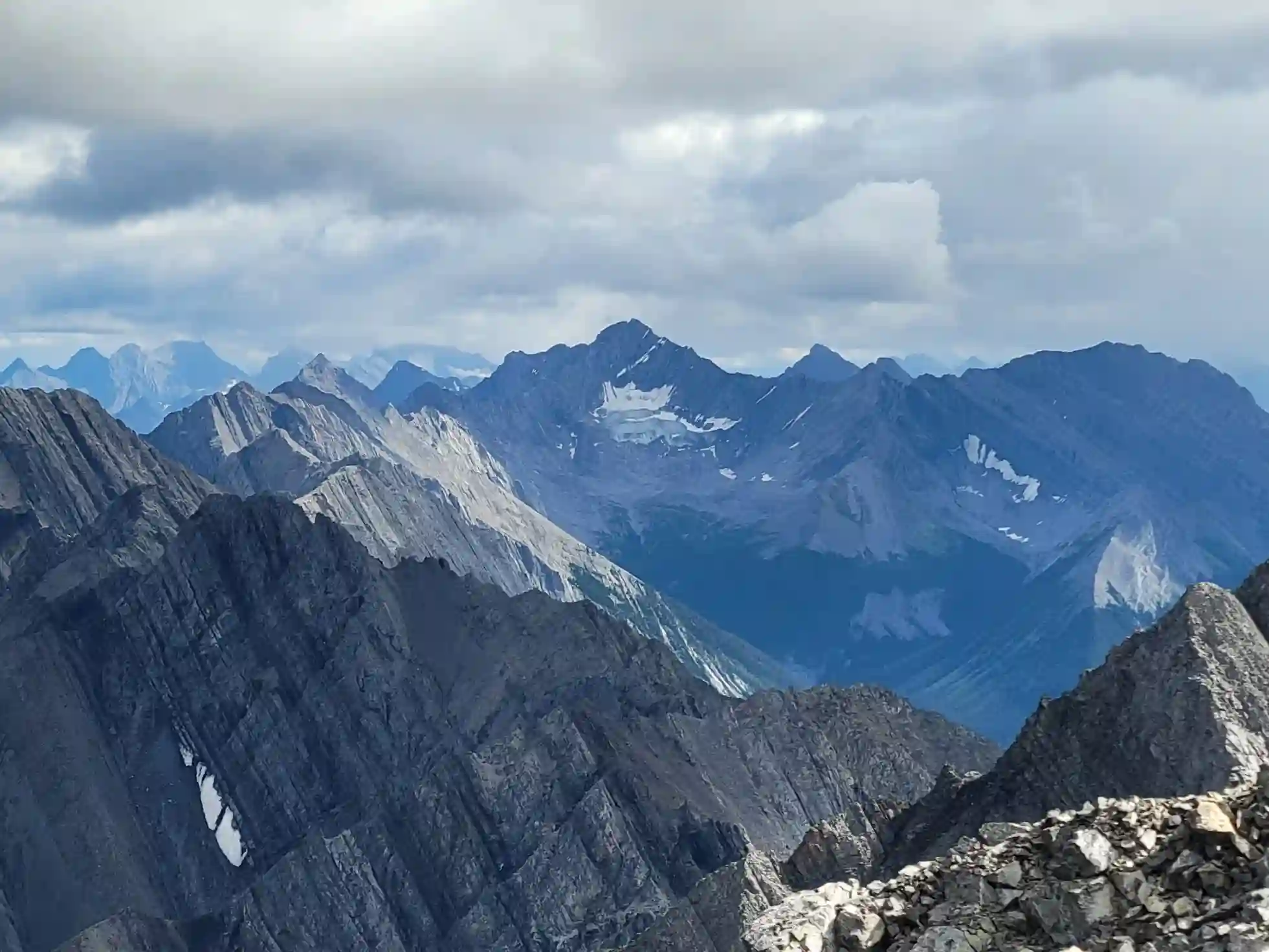
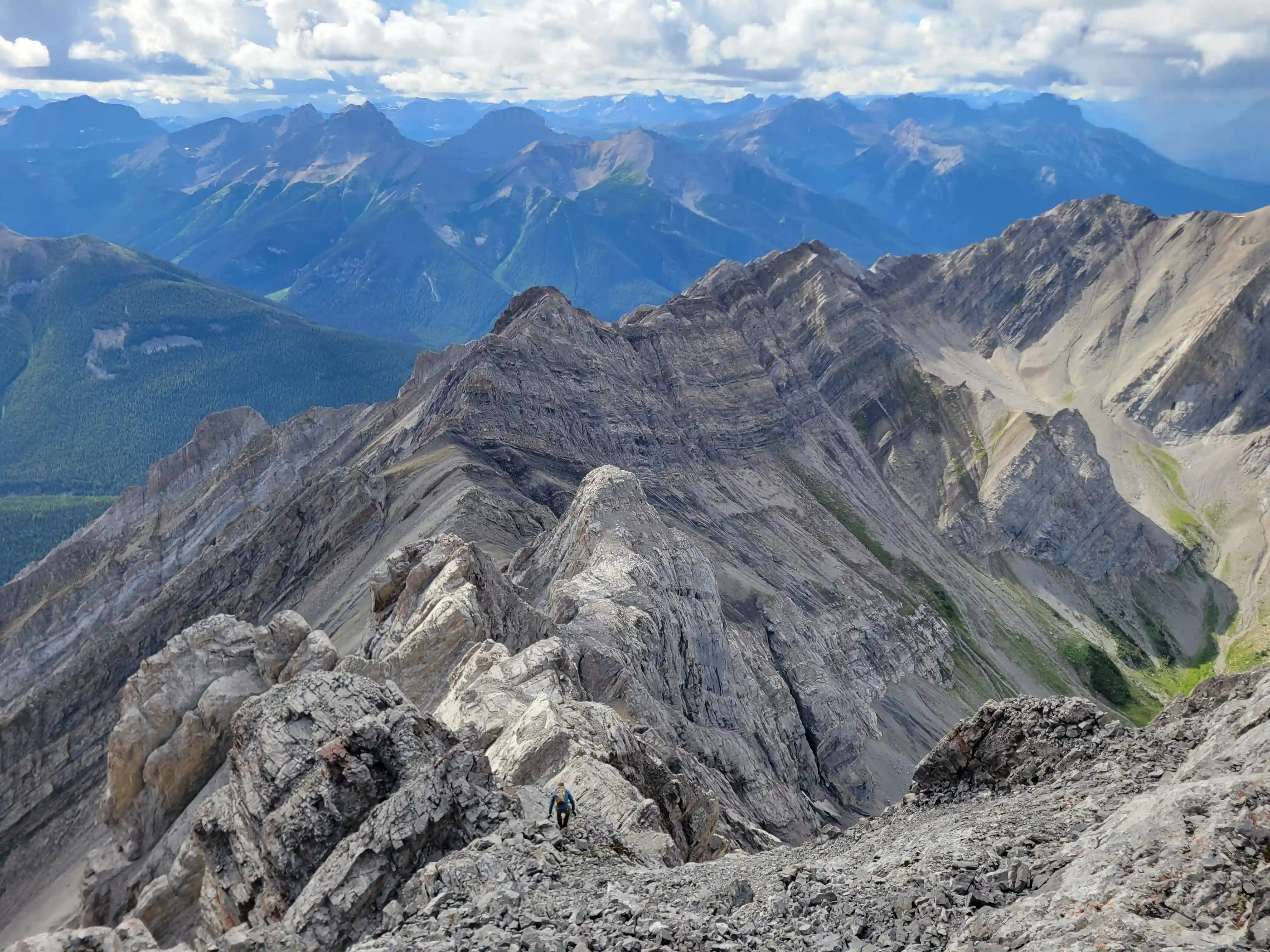
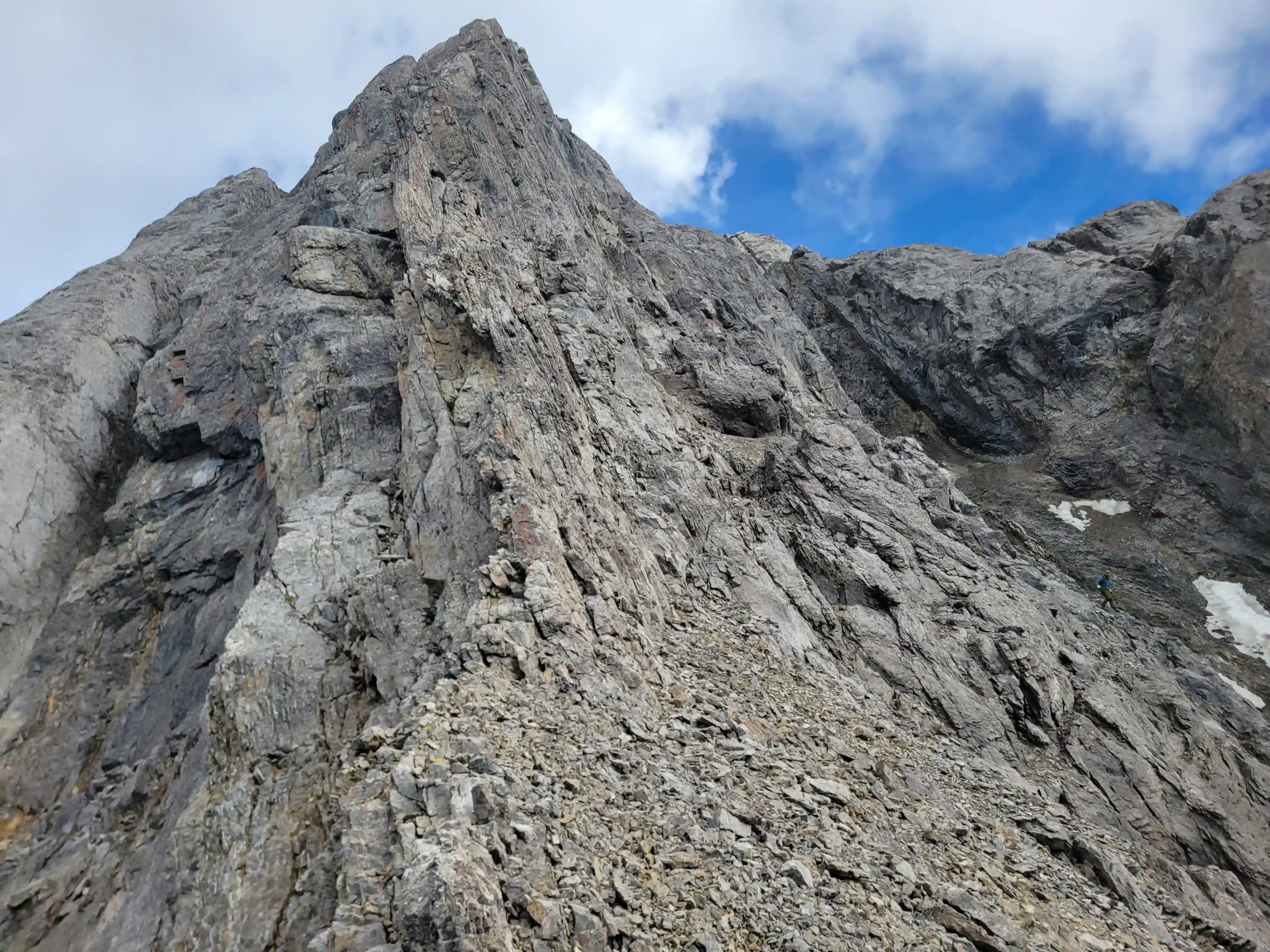
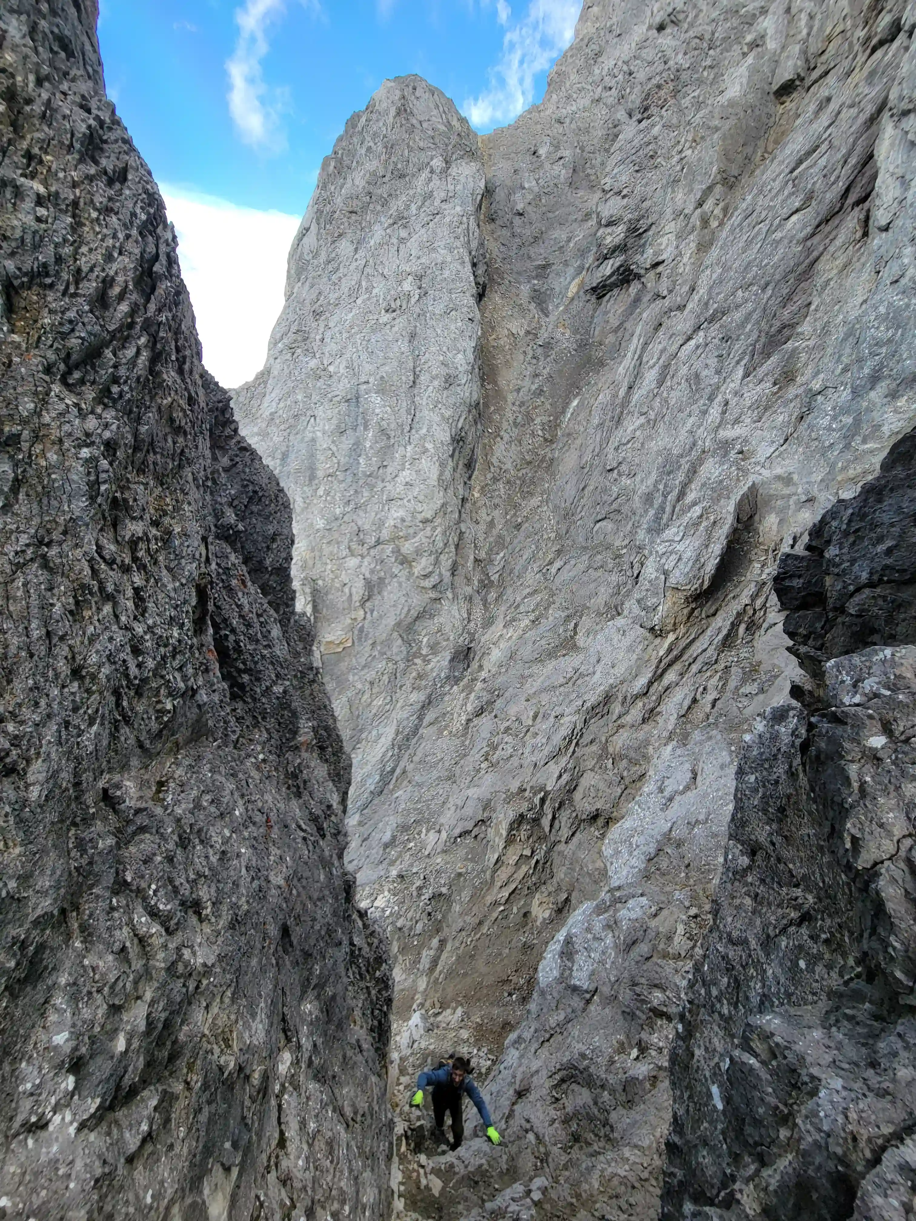
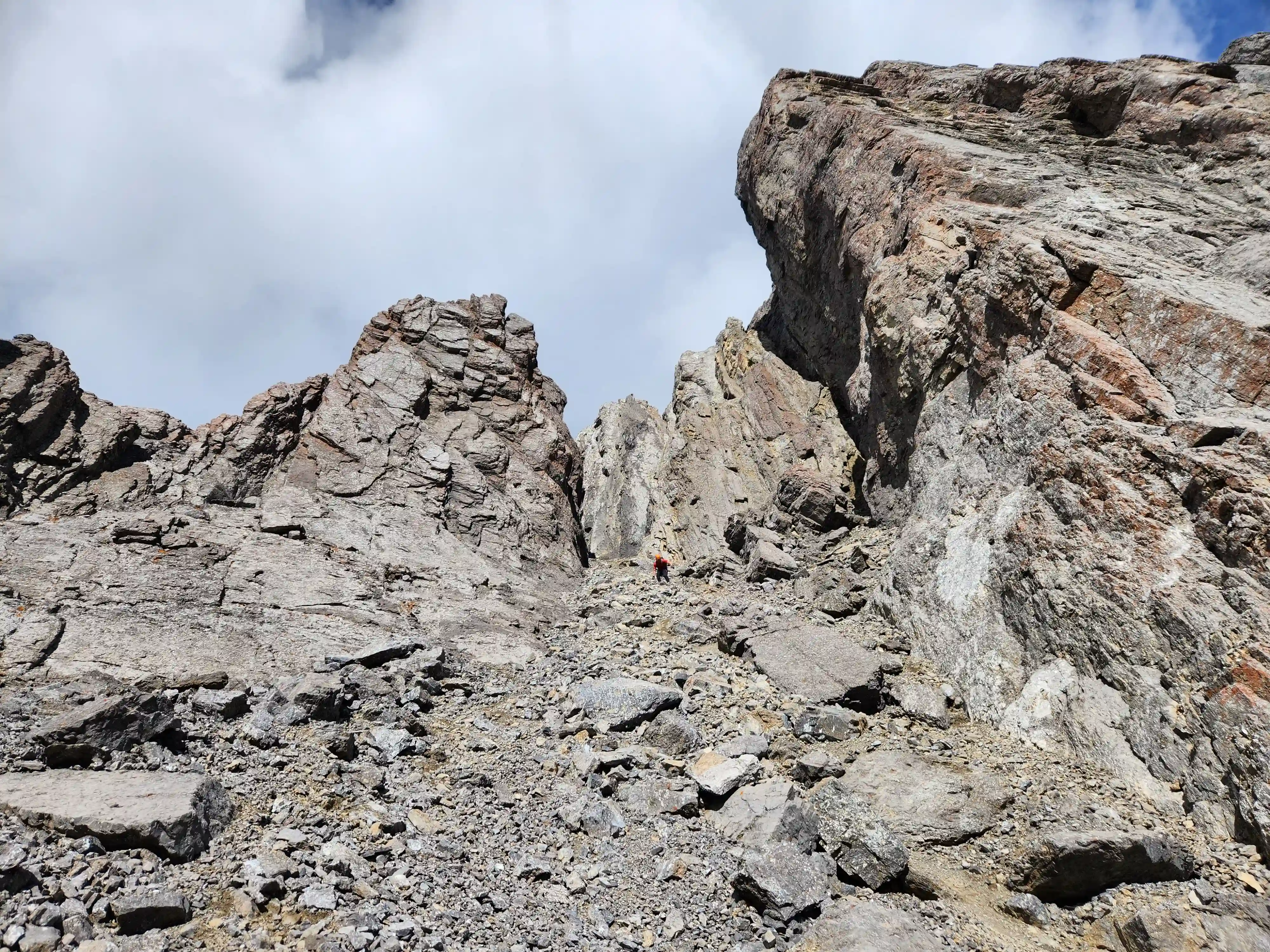
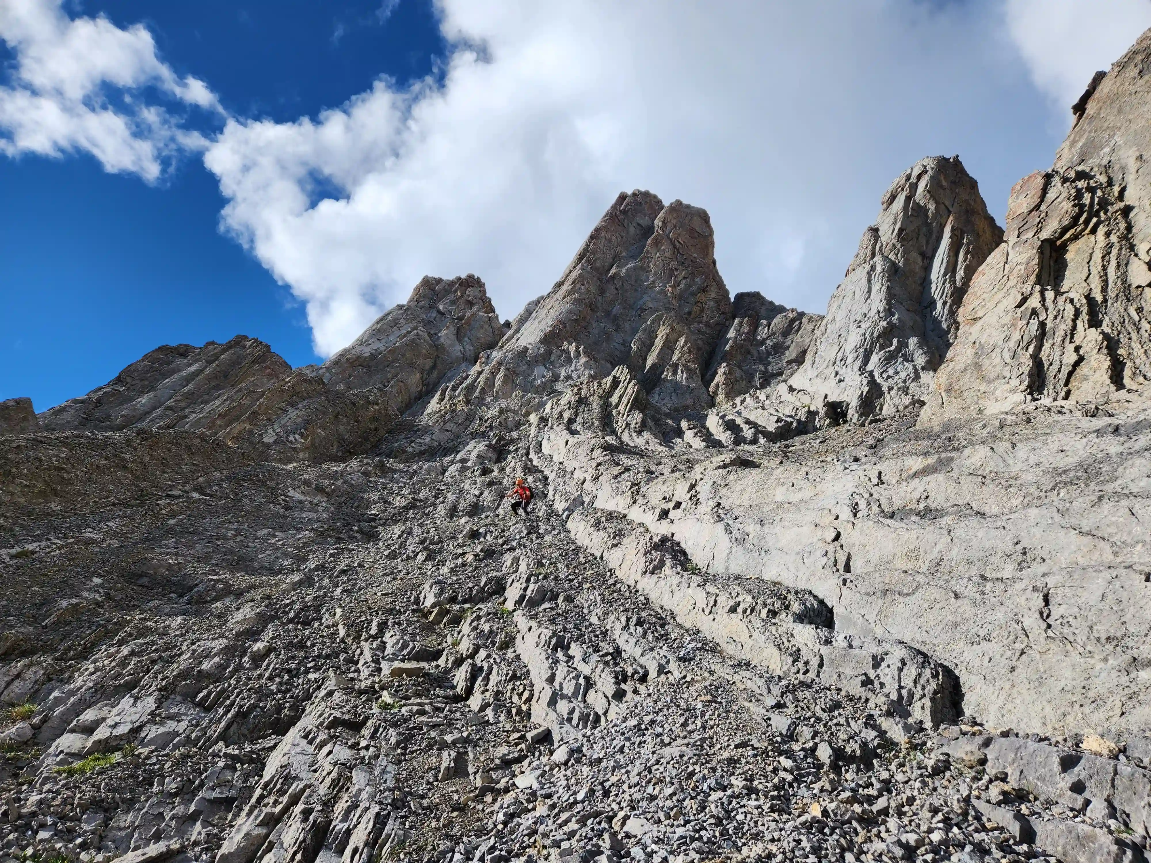
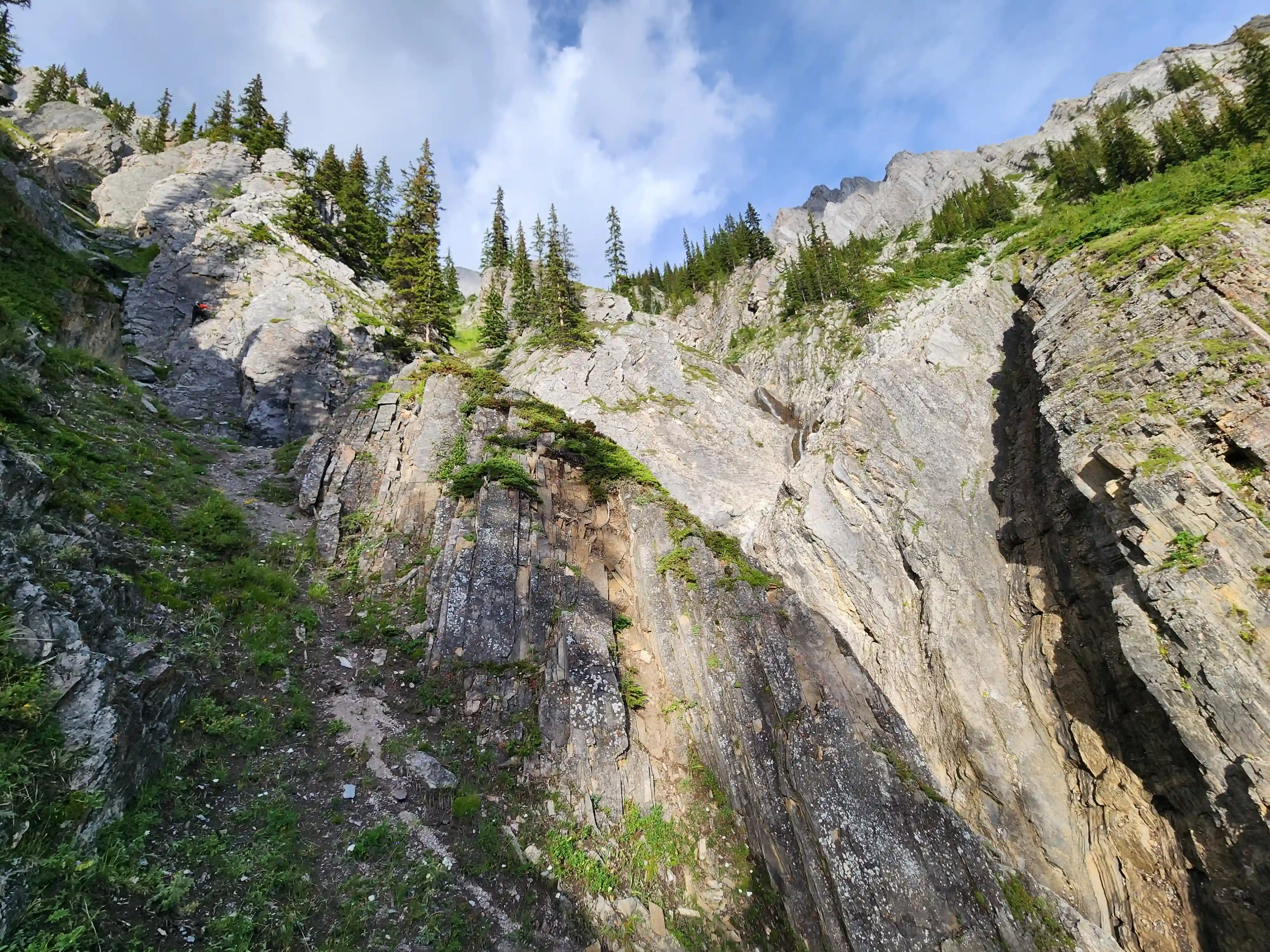
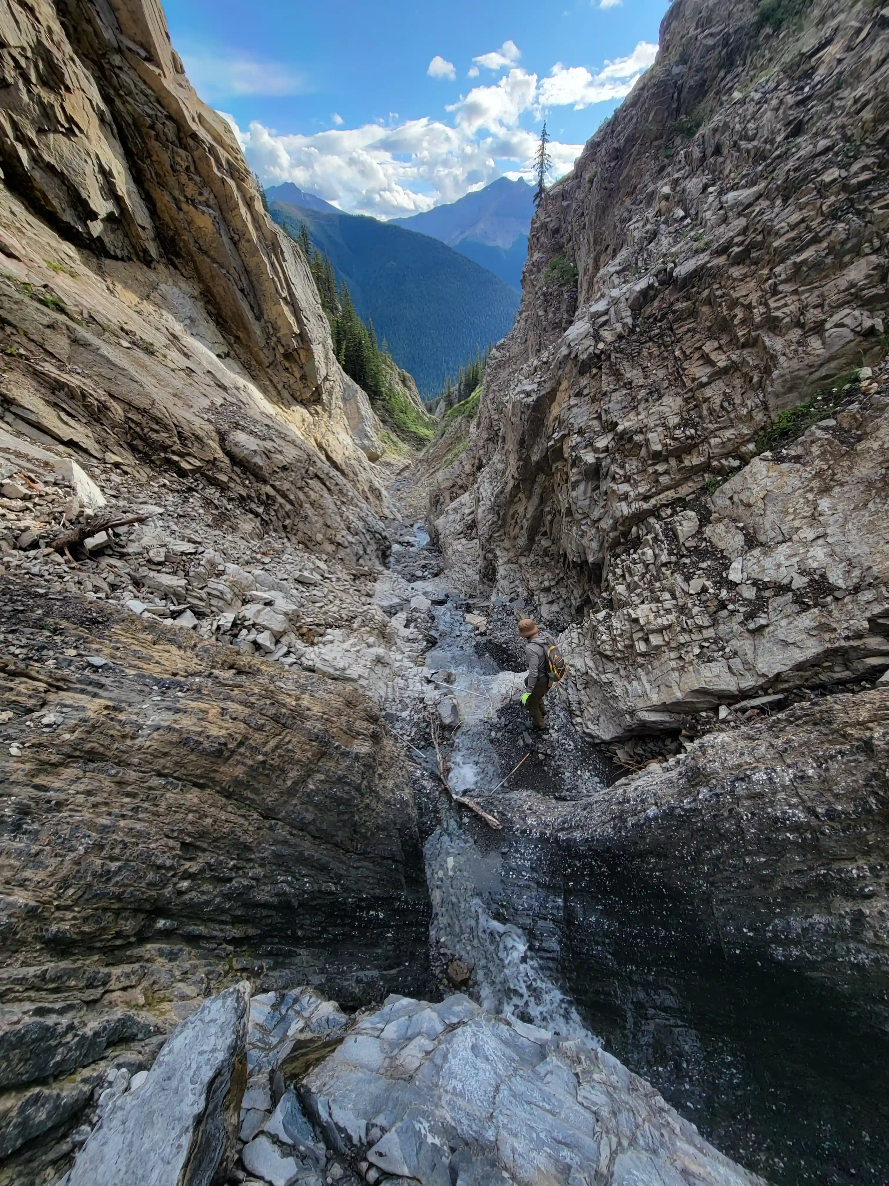
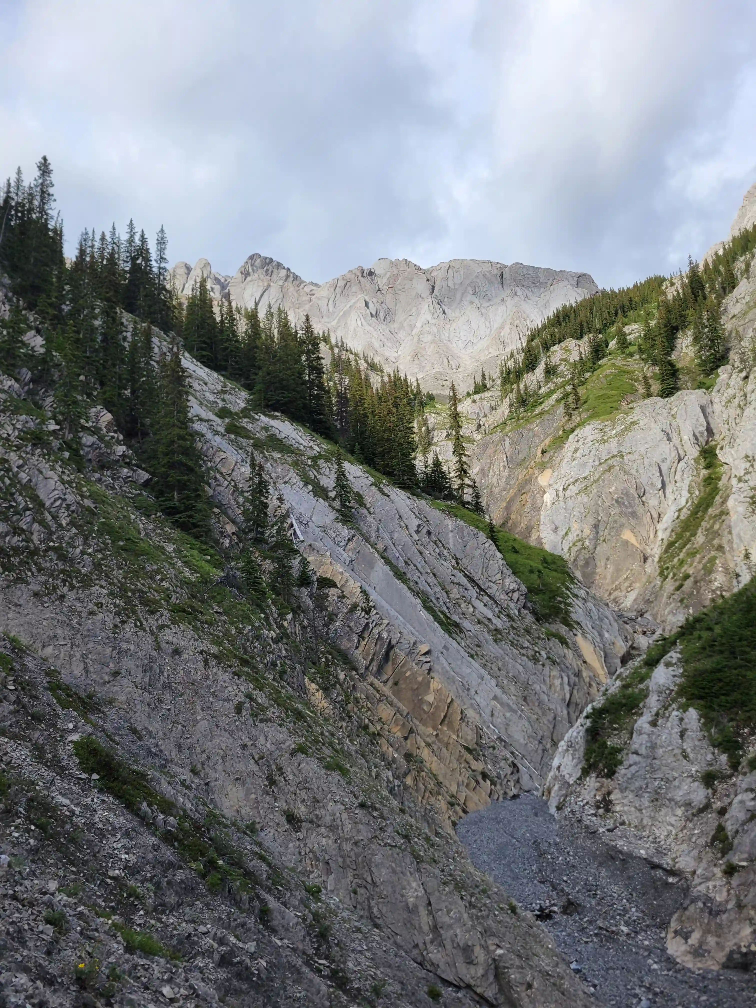
Our ascent line followed an obvious drainage until we reached a section with nasty deadfall and from there we deviated to slopes on the right of it until we found a line that looked like it would take us all the way to the ridge. Not long after we were on the ridge and could see the upcoming ridge and pekas that would be the next section of our day. The ridge started off relatively tame with a few bypasses making things a lot easier but once we got past our first high point of the day things got more technical. Following the first peak we had one 5th class downclimb before more technical ridge followed which wasn't too difficult with some detouring from side to side. Once we had gotten properly close to Sundance Peak however things got a bit more complicated with a downclimb and a gully feature leading us around a difficulty that closed the final distance between us and our main objective for the day!
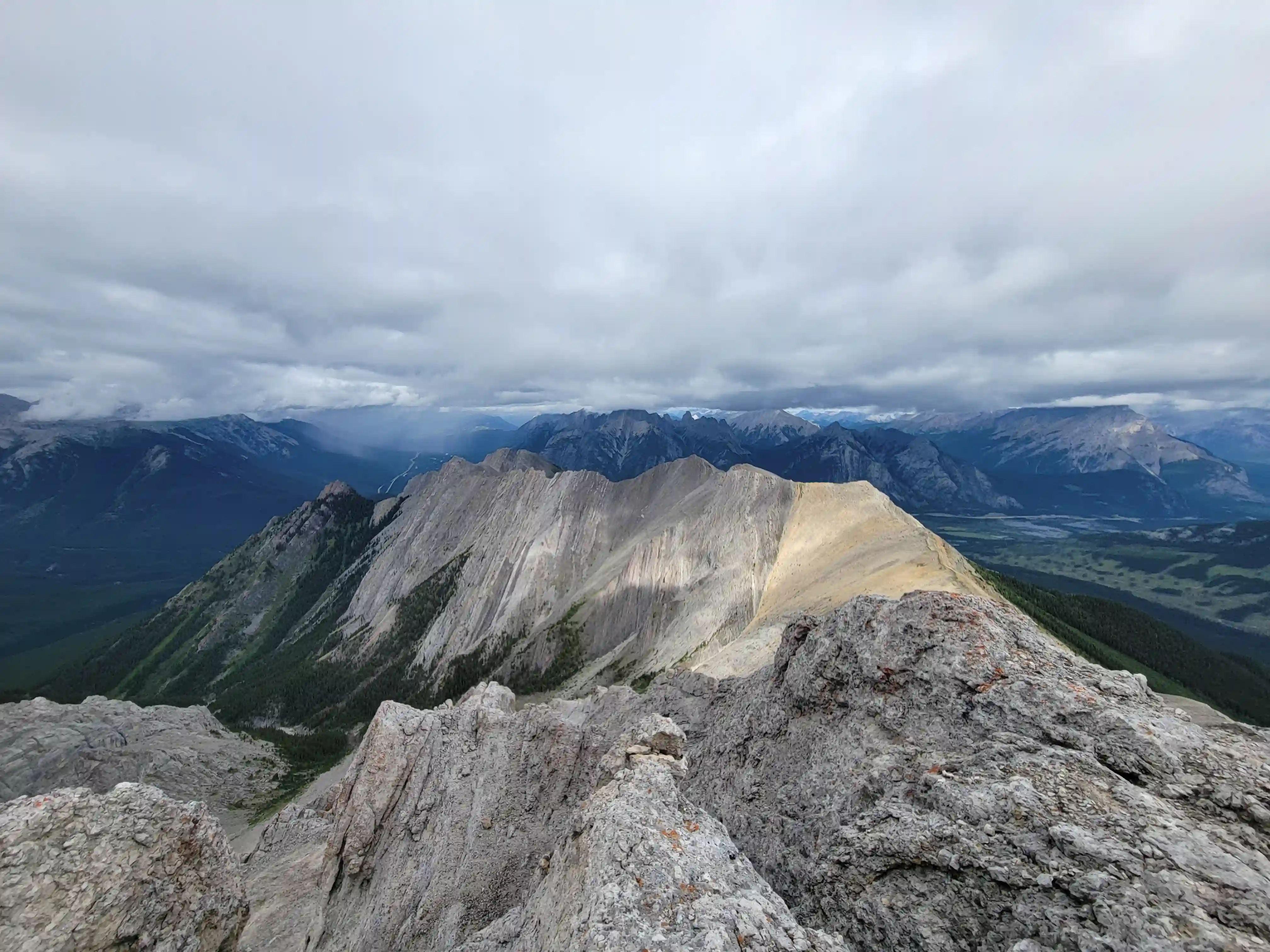
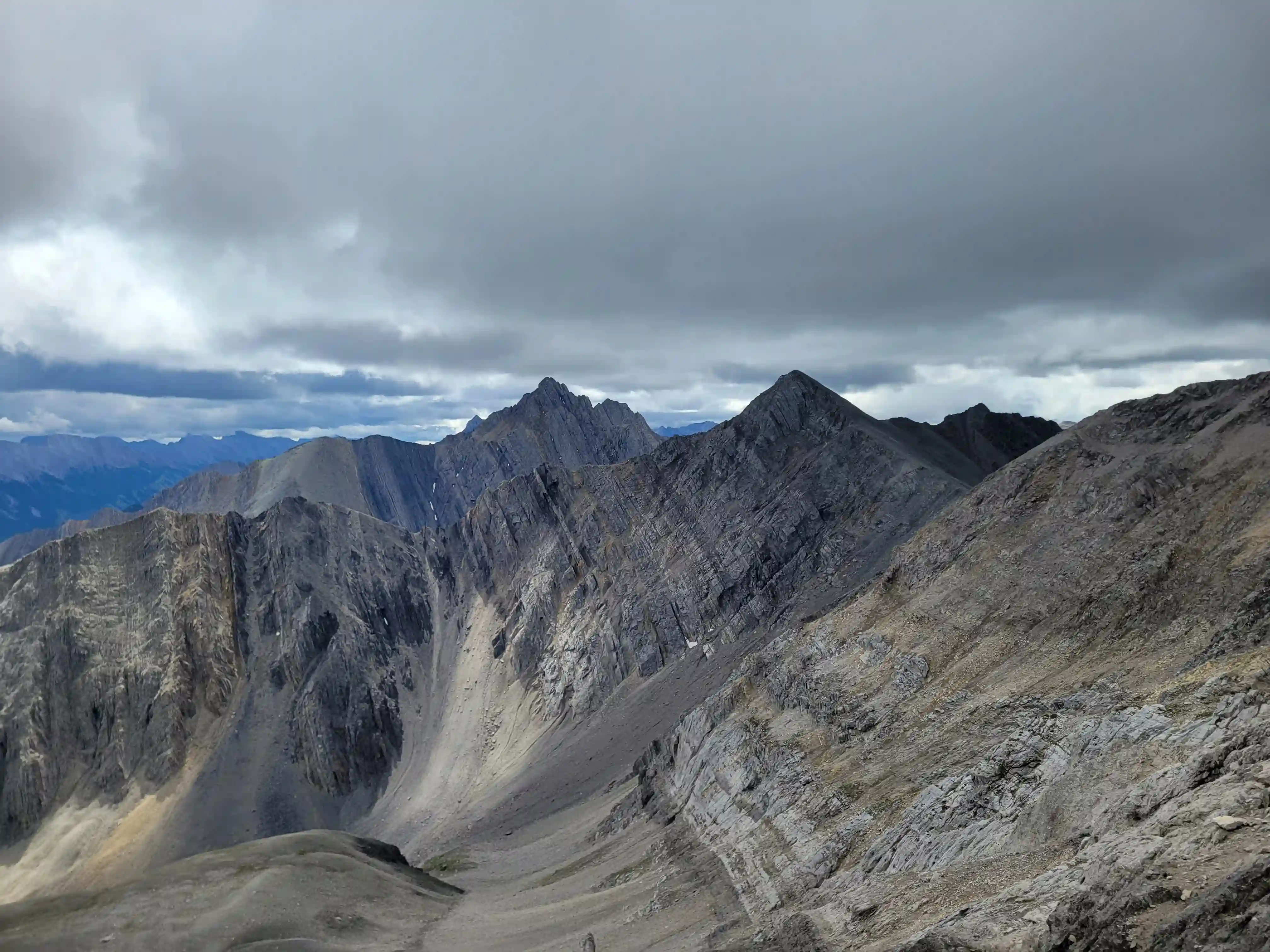
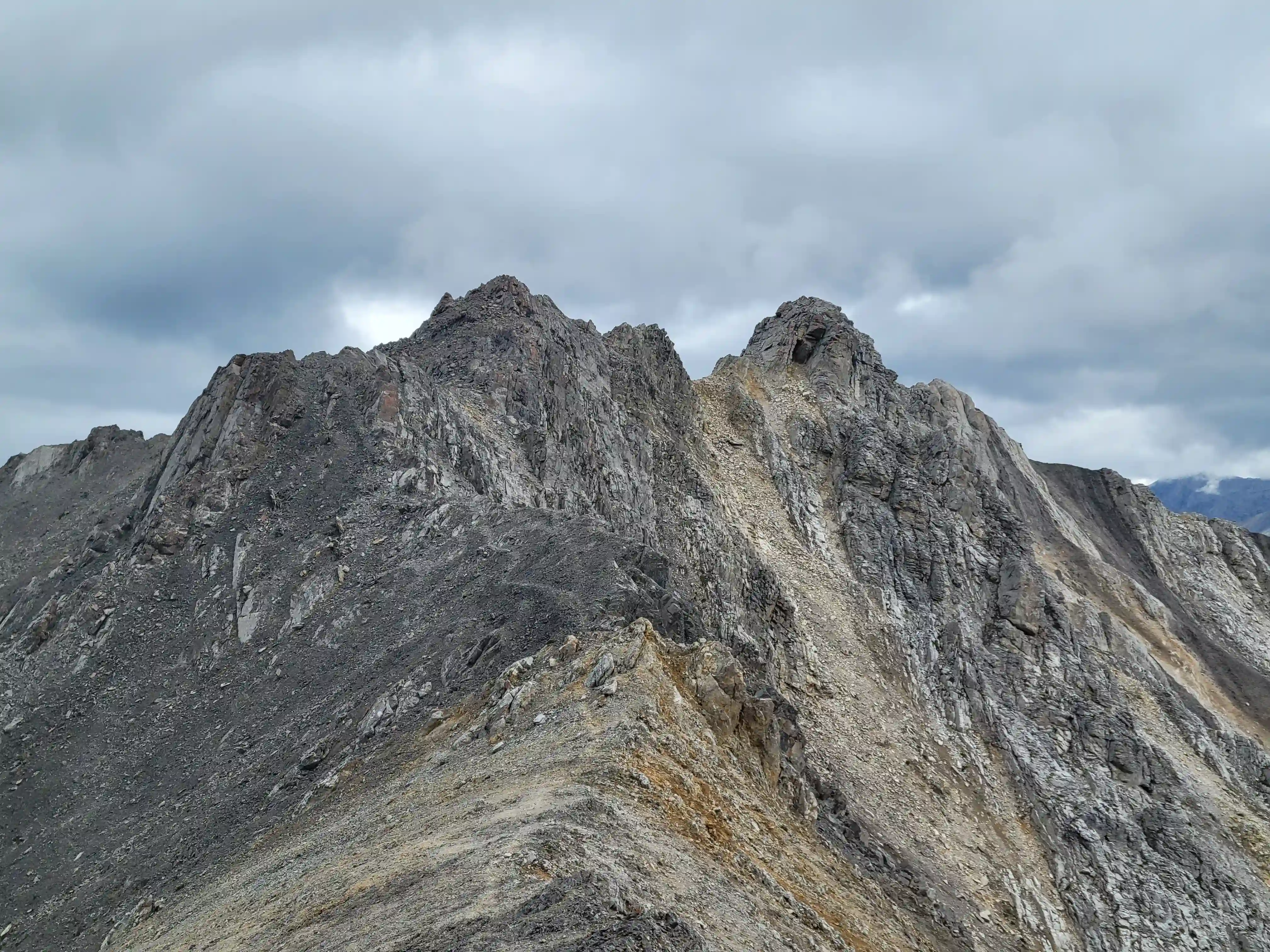
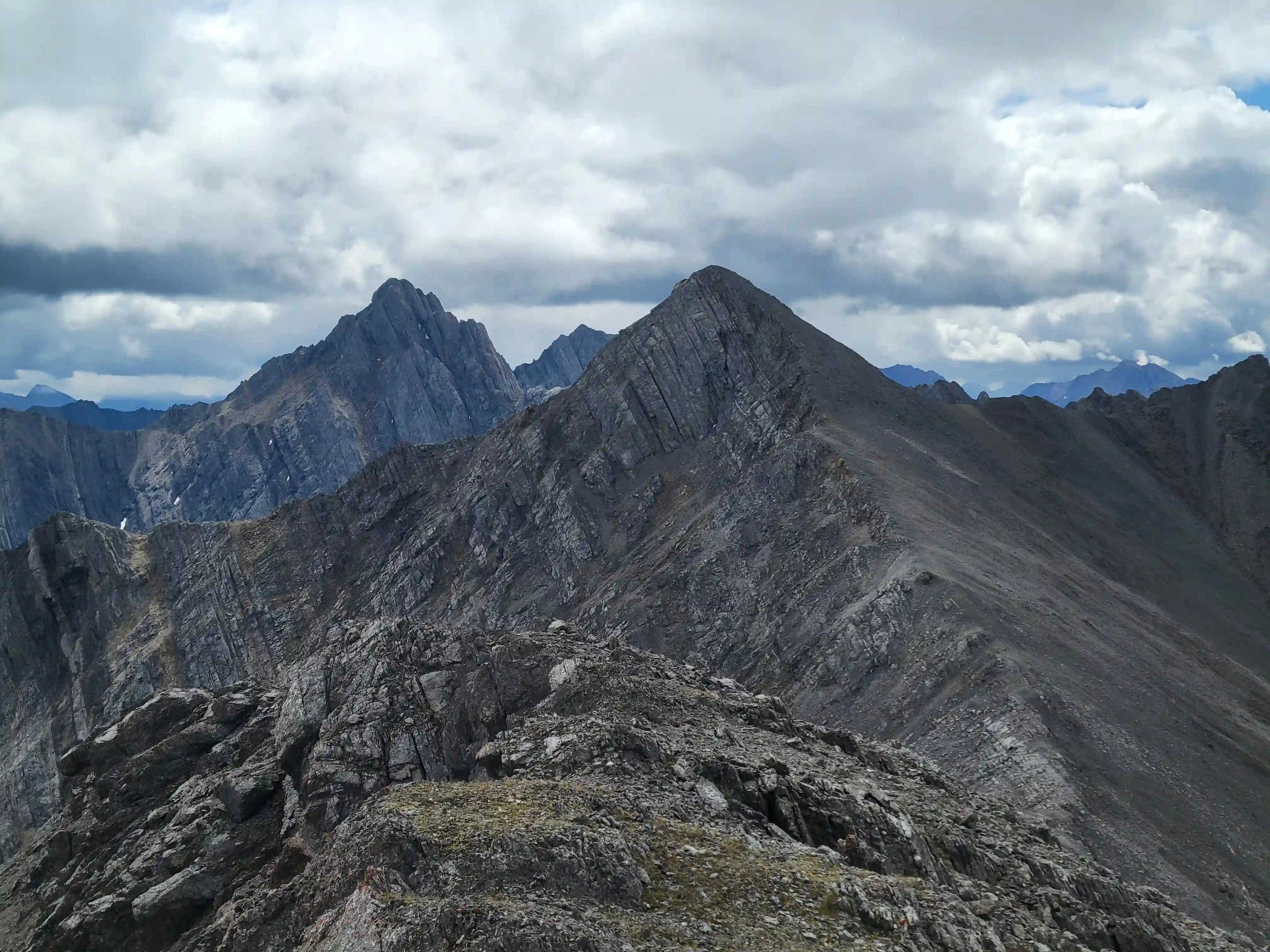
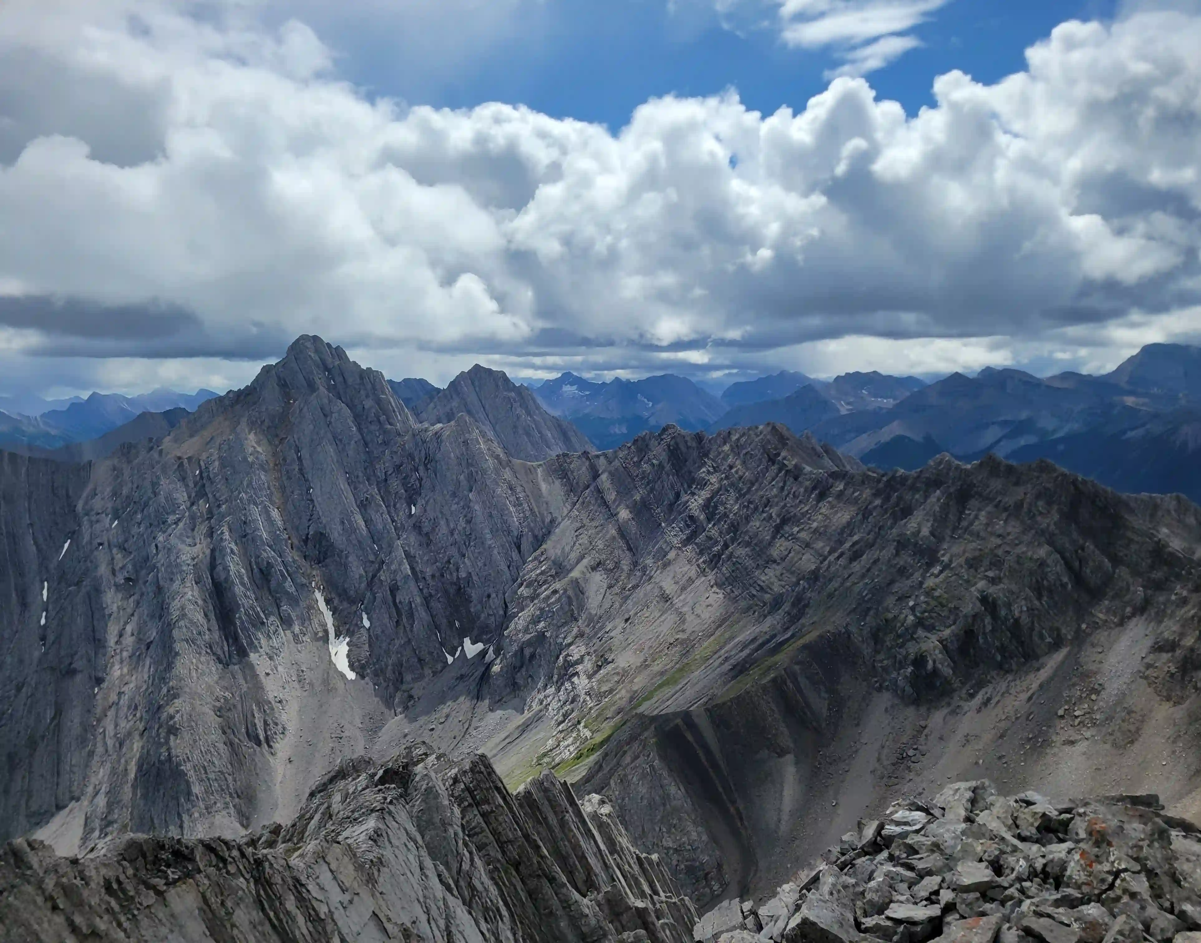
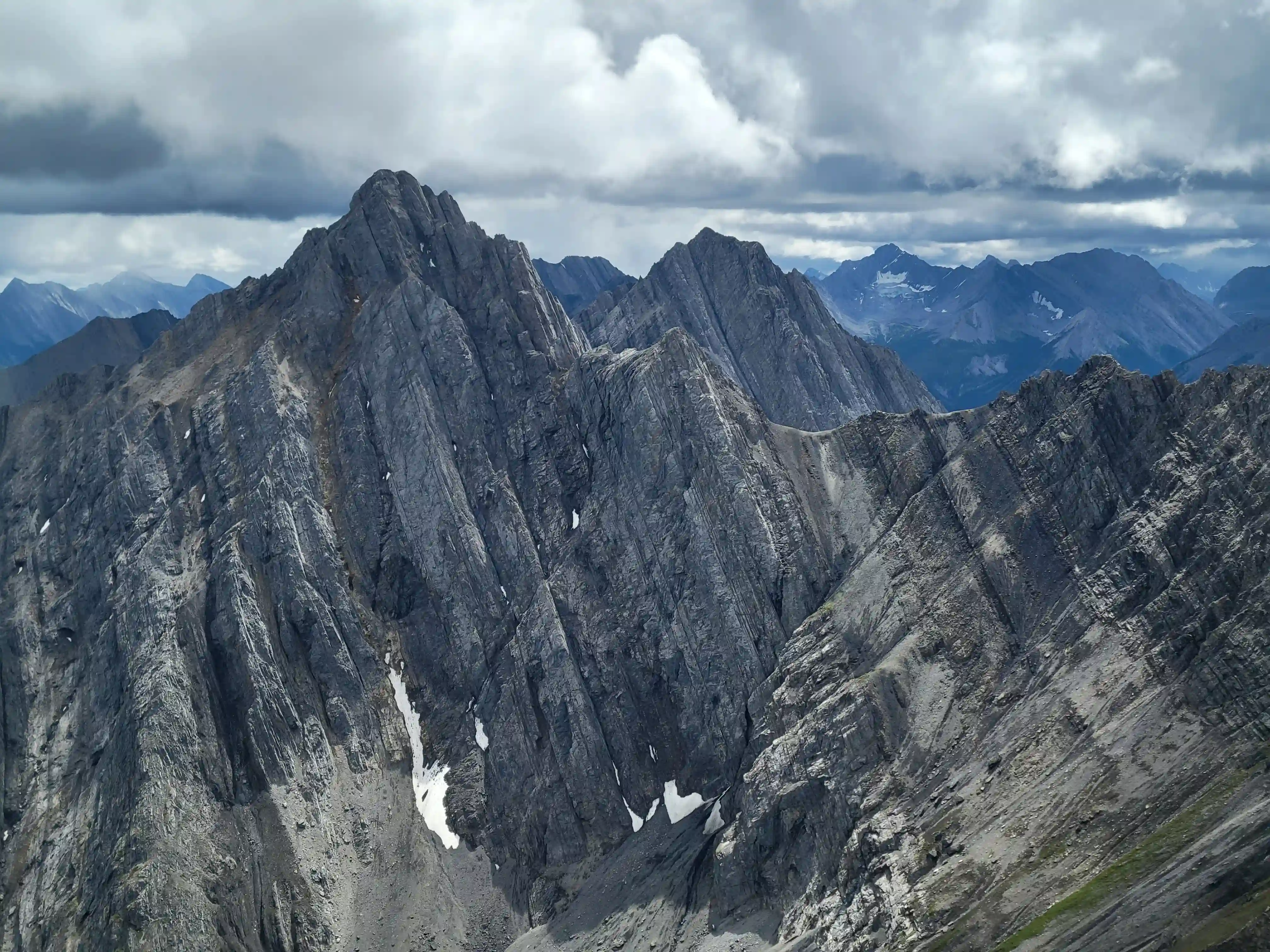
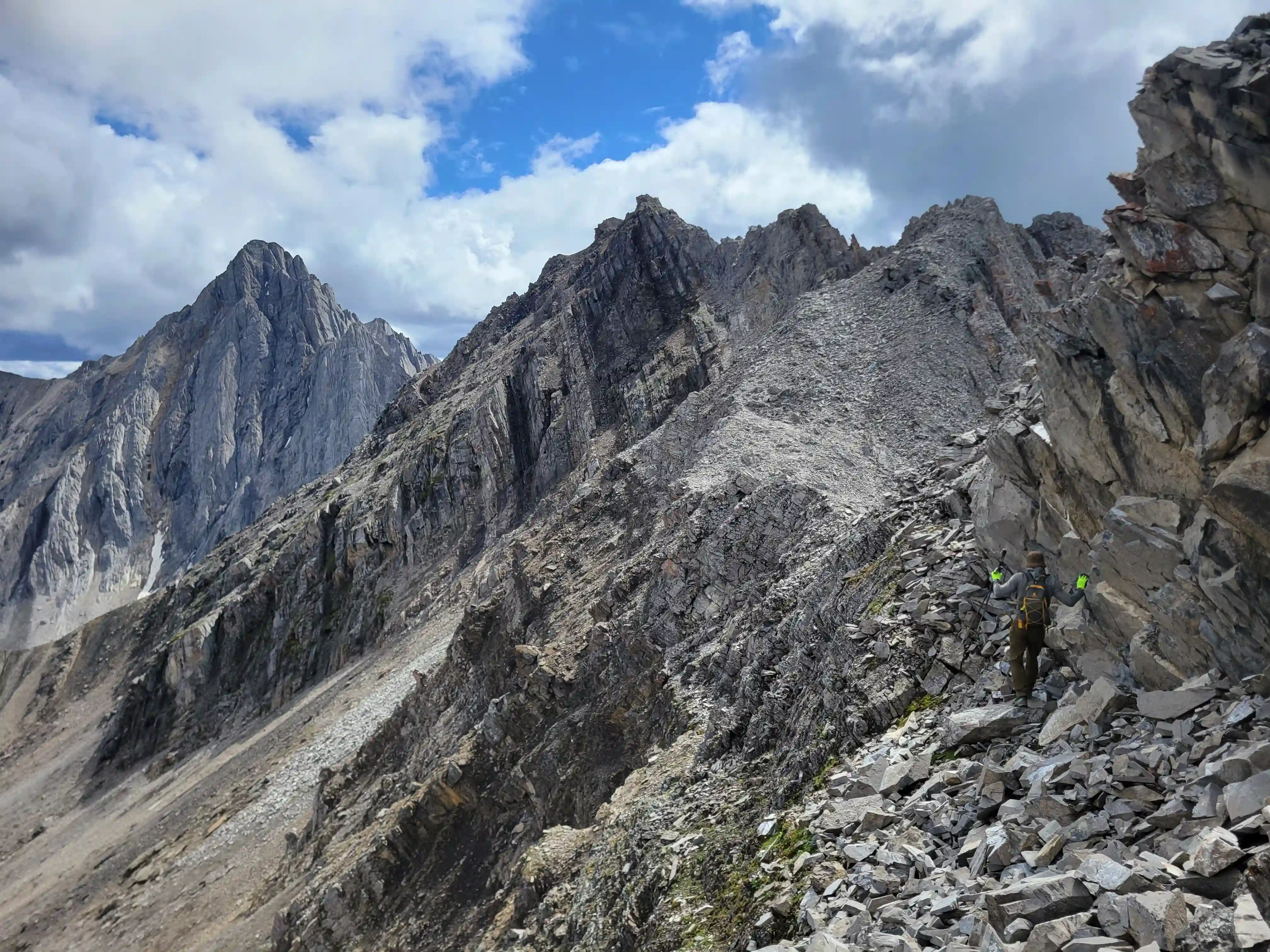
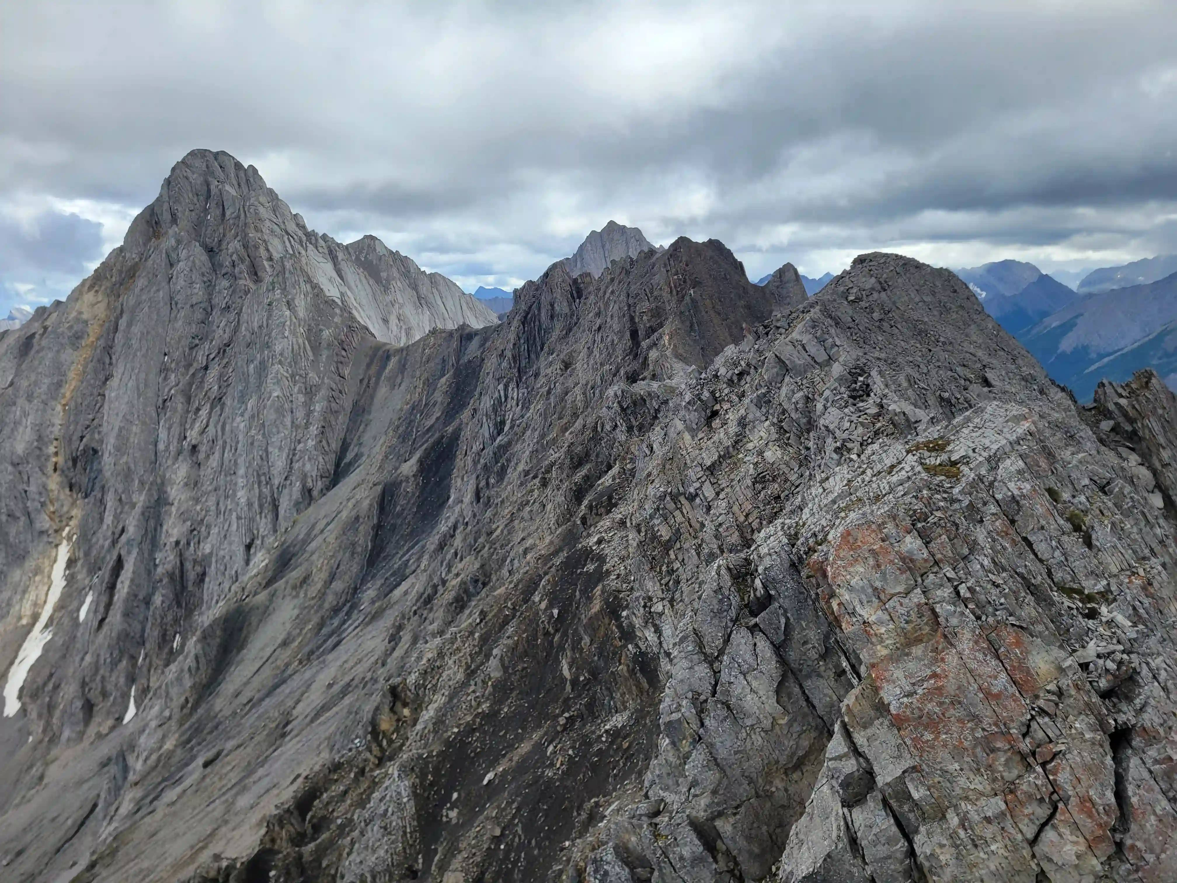
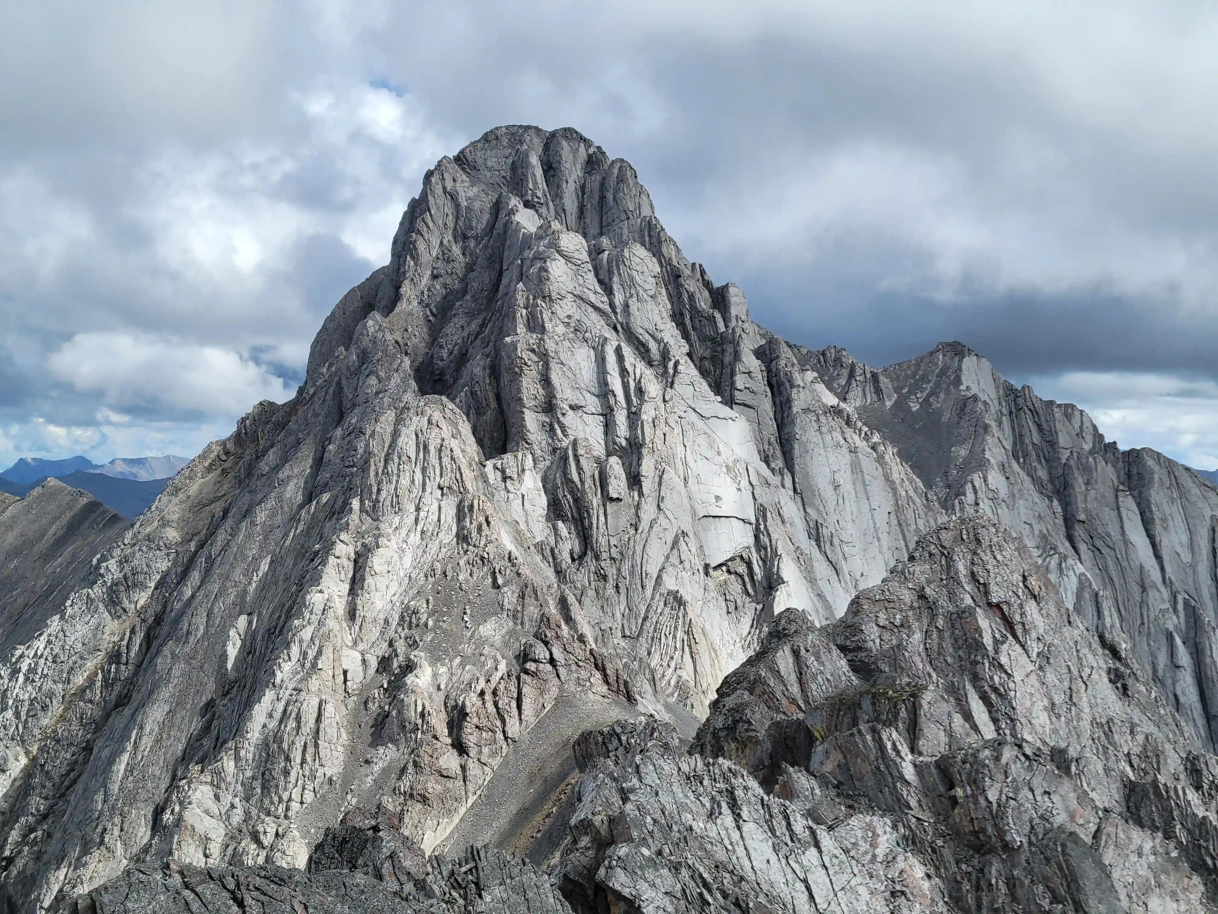
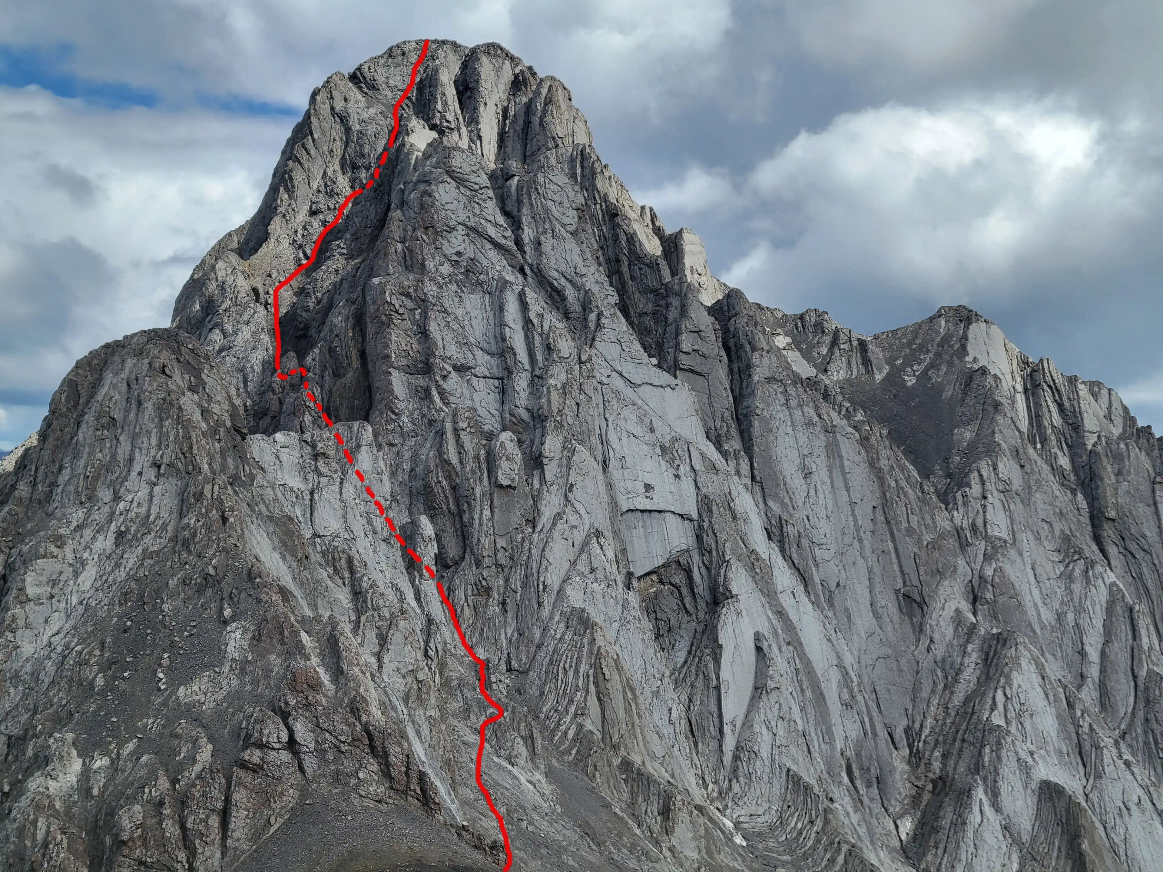
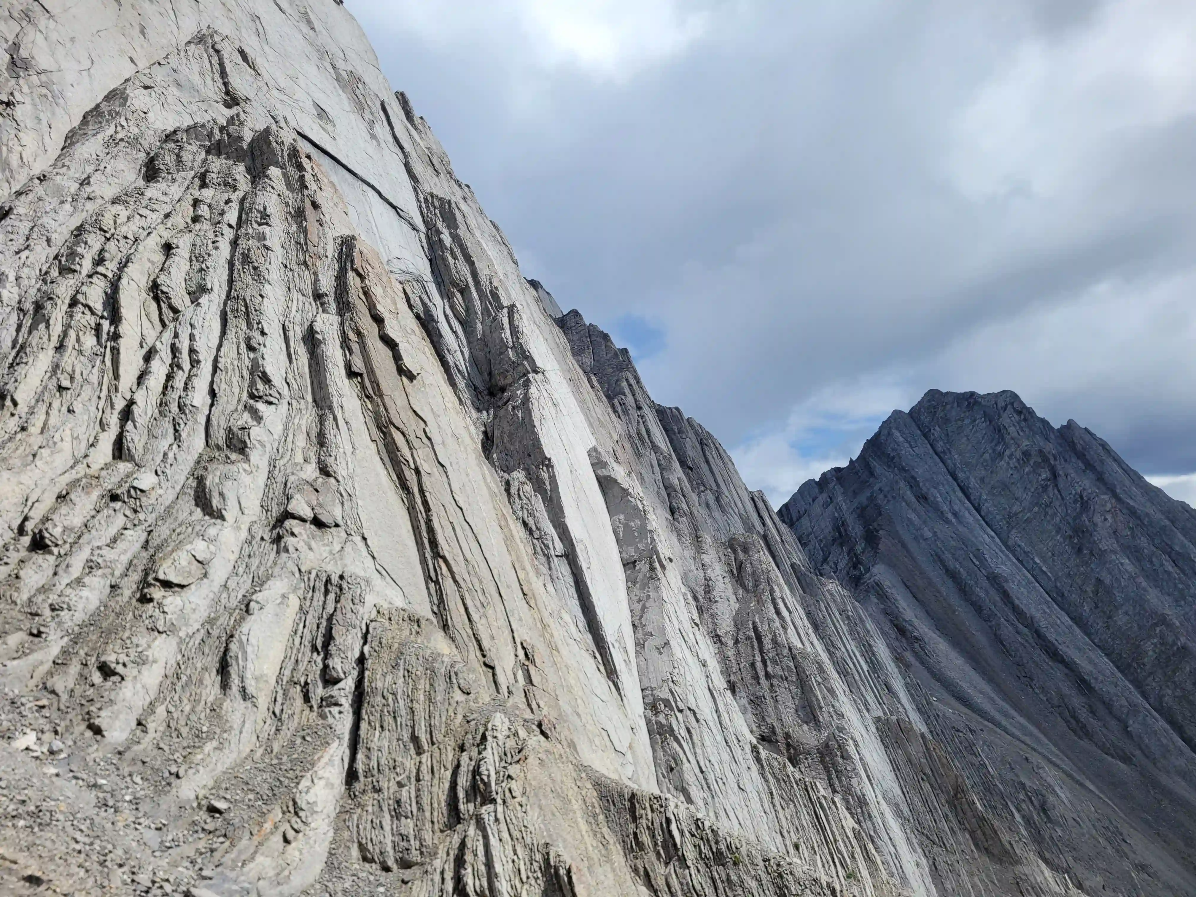
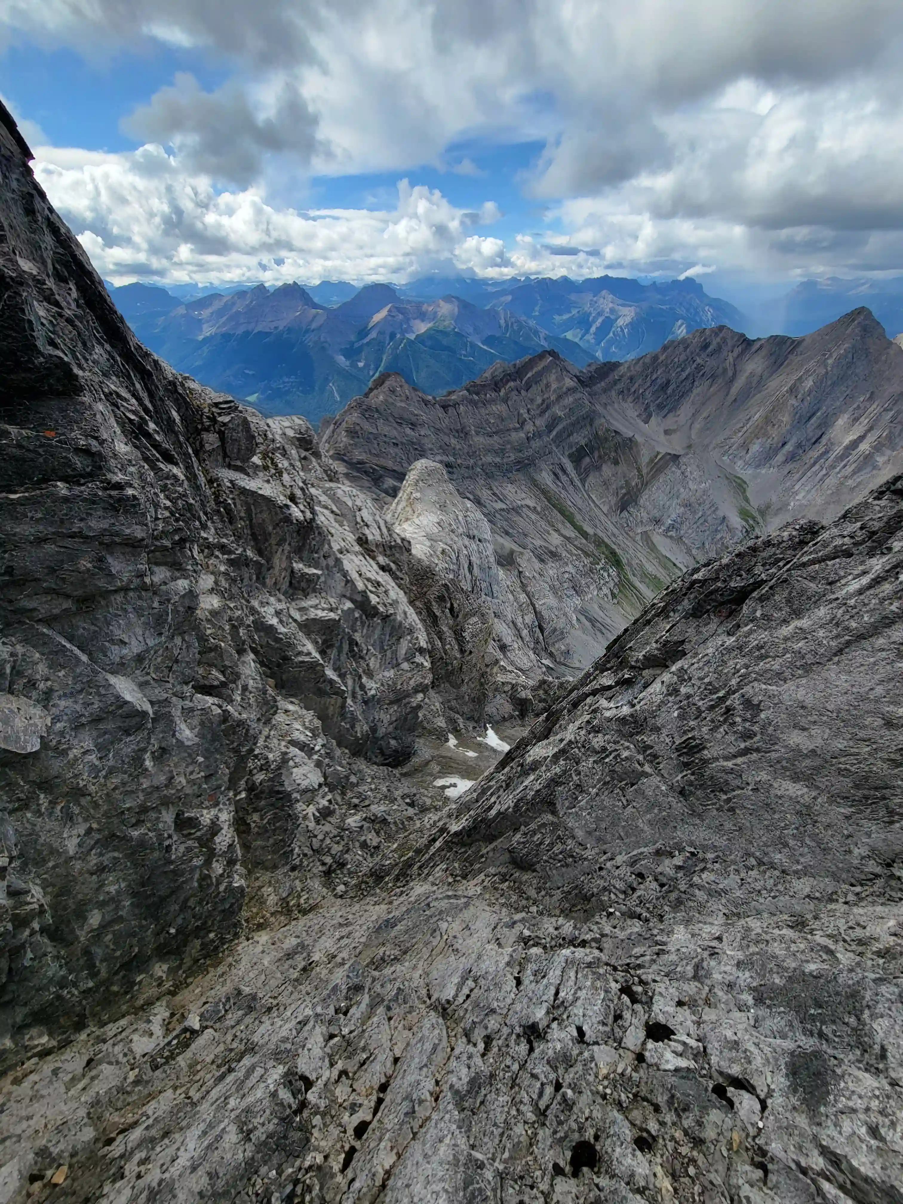
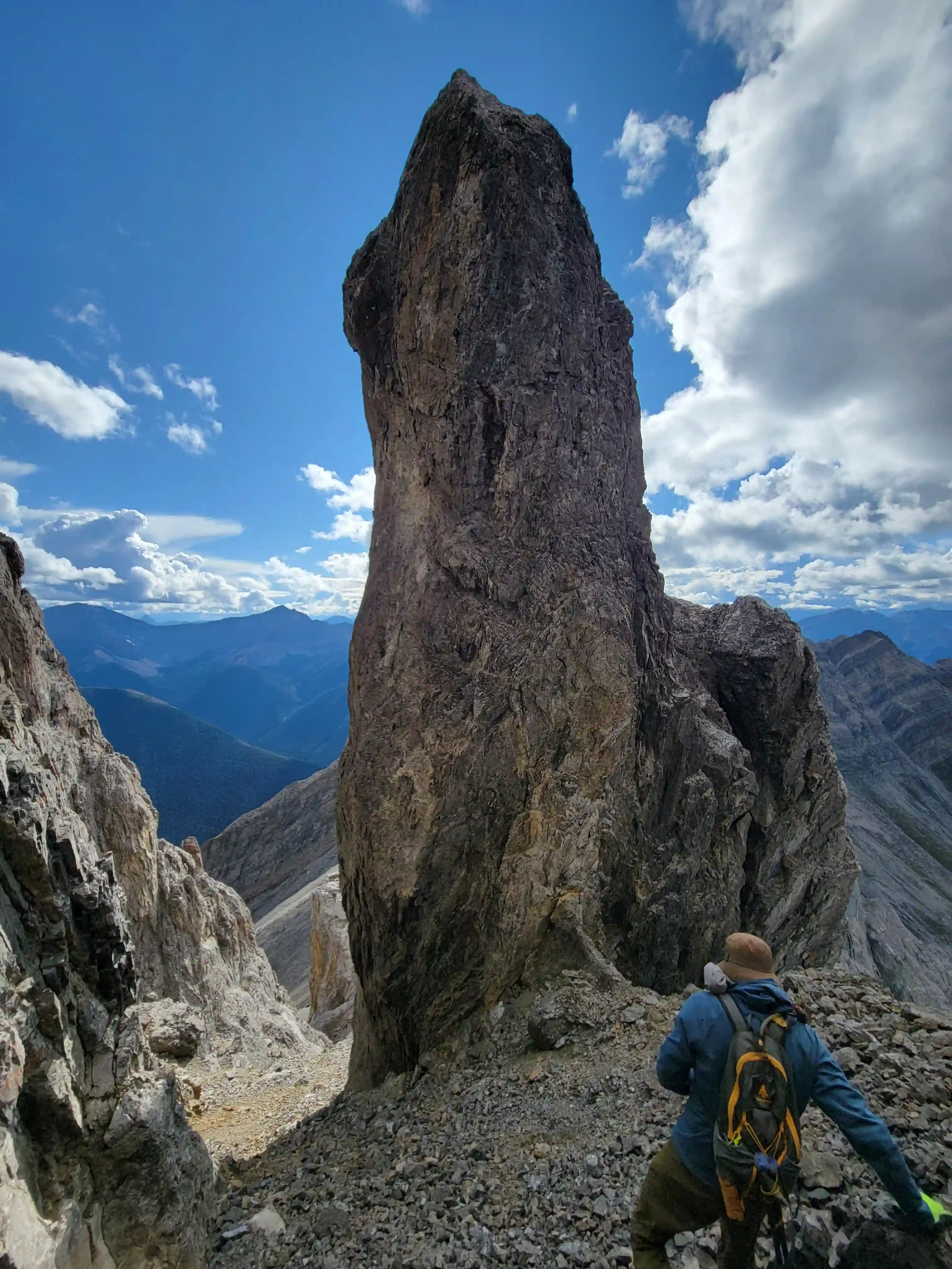
While traversing the long ridge to reach the main peak we had been scoping out potential lines and one particular gully feature on the NW side looked promising but we were unsure how challenging it would be to reach it and the close up view of Sundance Peak didn't exactly make it look any easier. From pictures I had seen online I knew that going up and over the small bump attahced to the NW side of Sundance Peak was likely quite technical so Devan and I were both hopeful that another option would present itself.
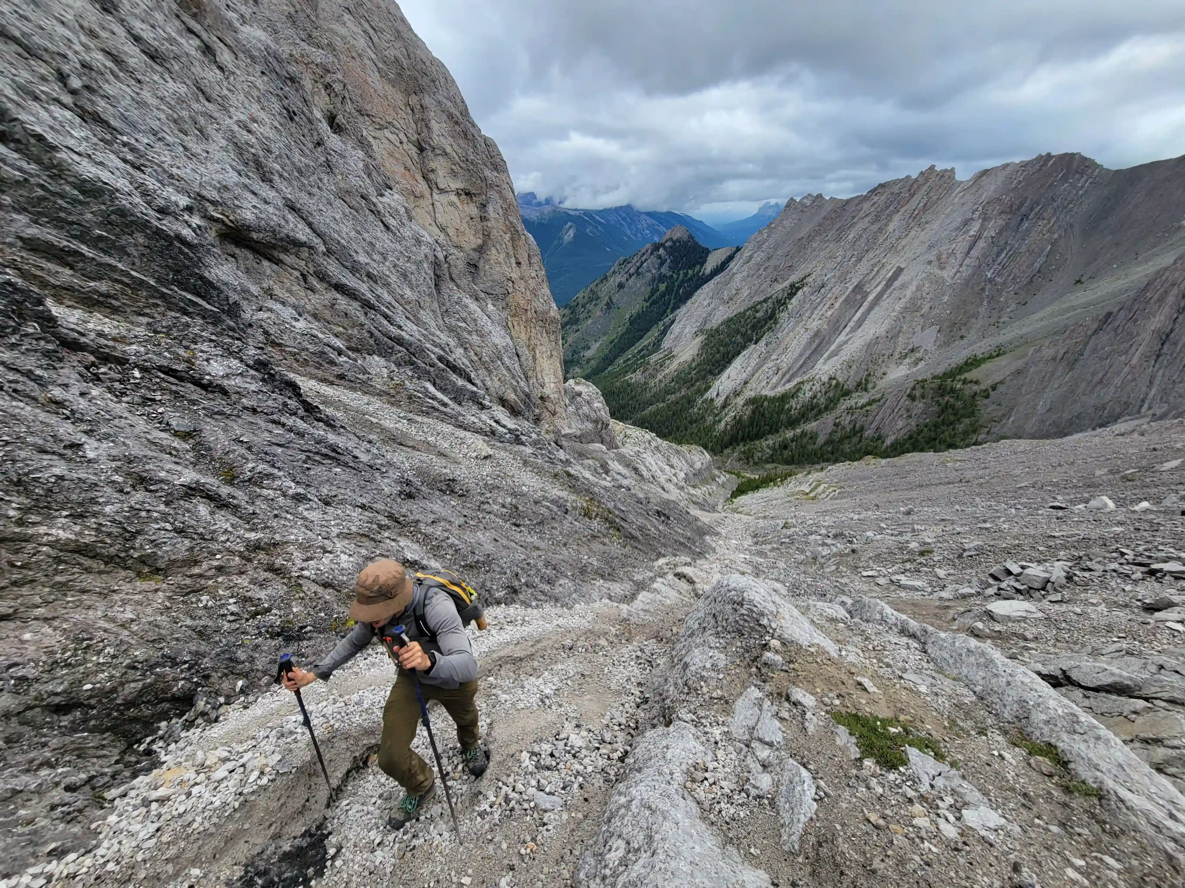
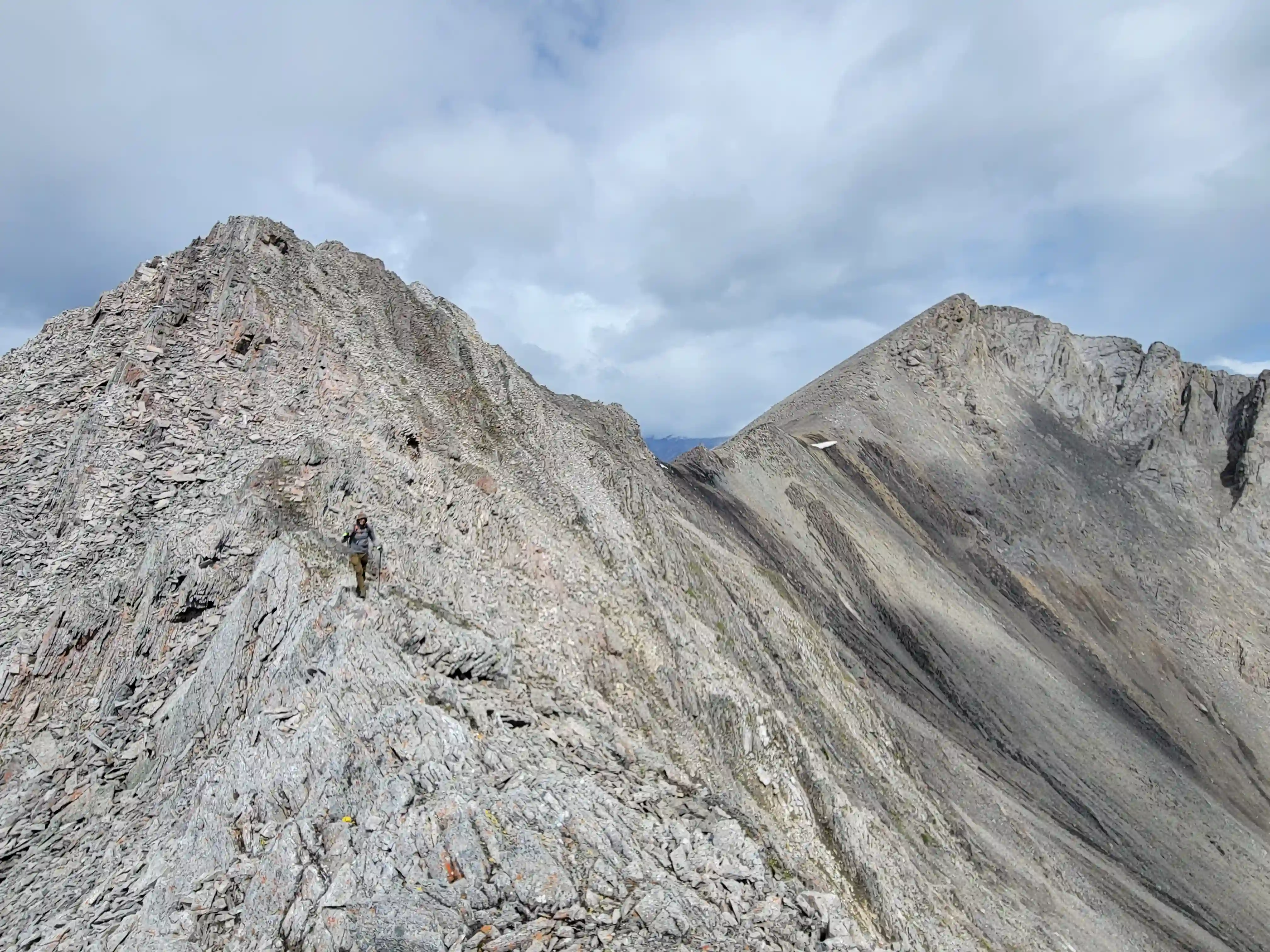
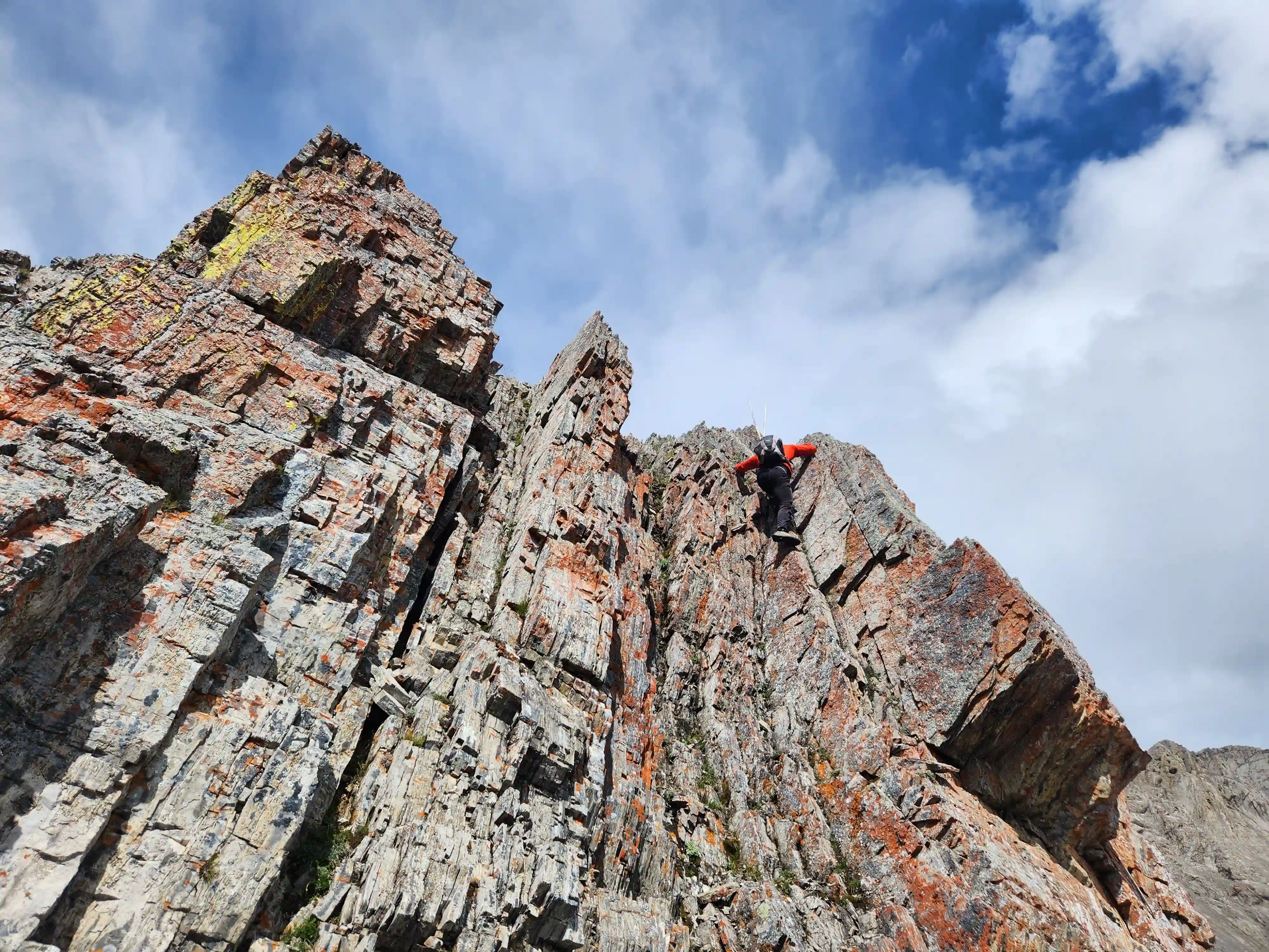
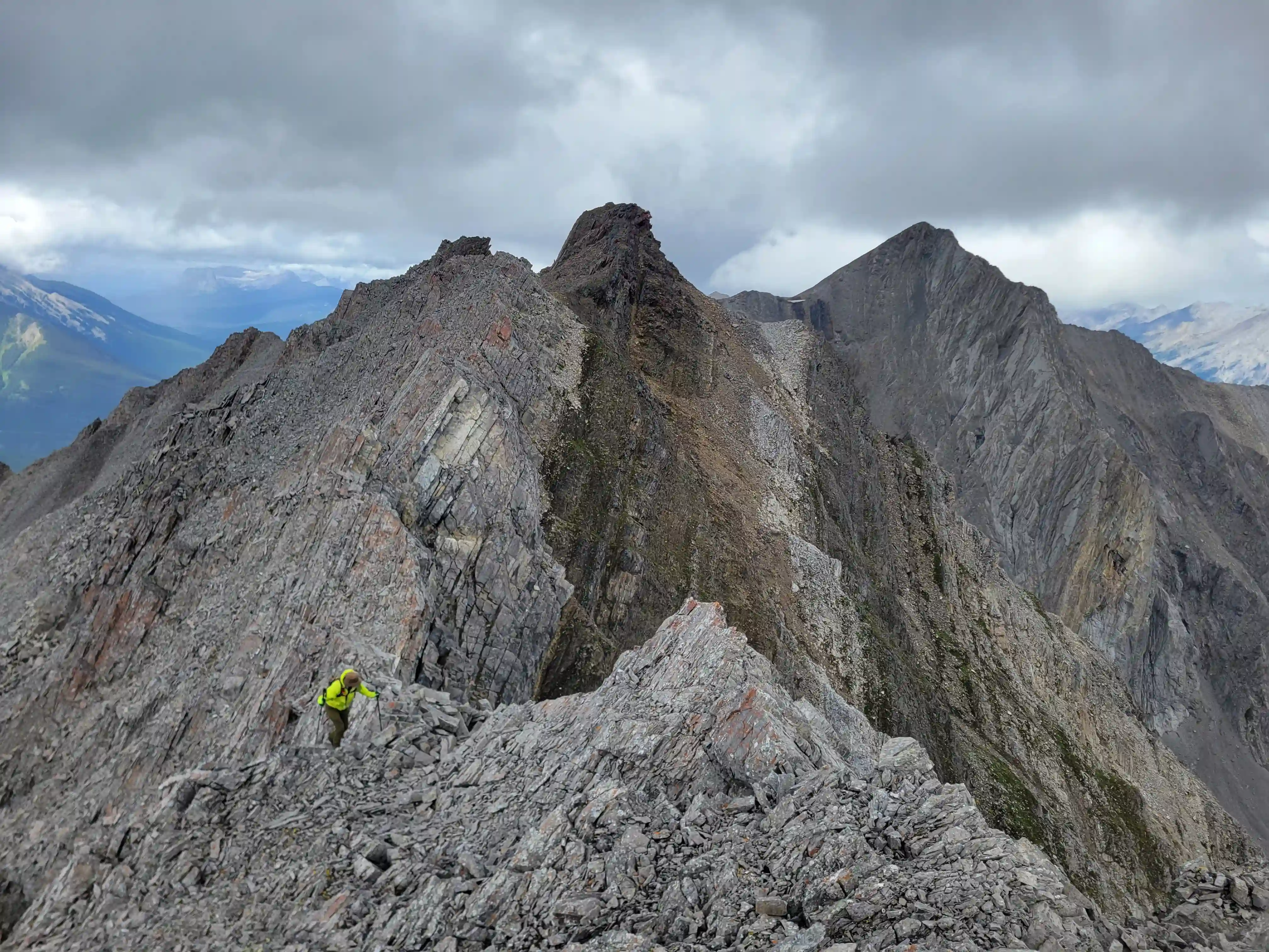
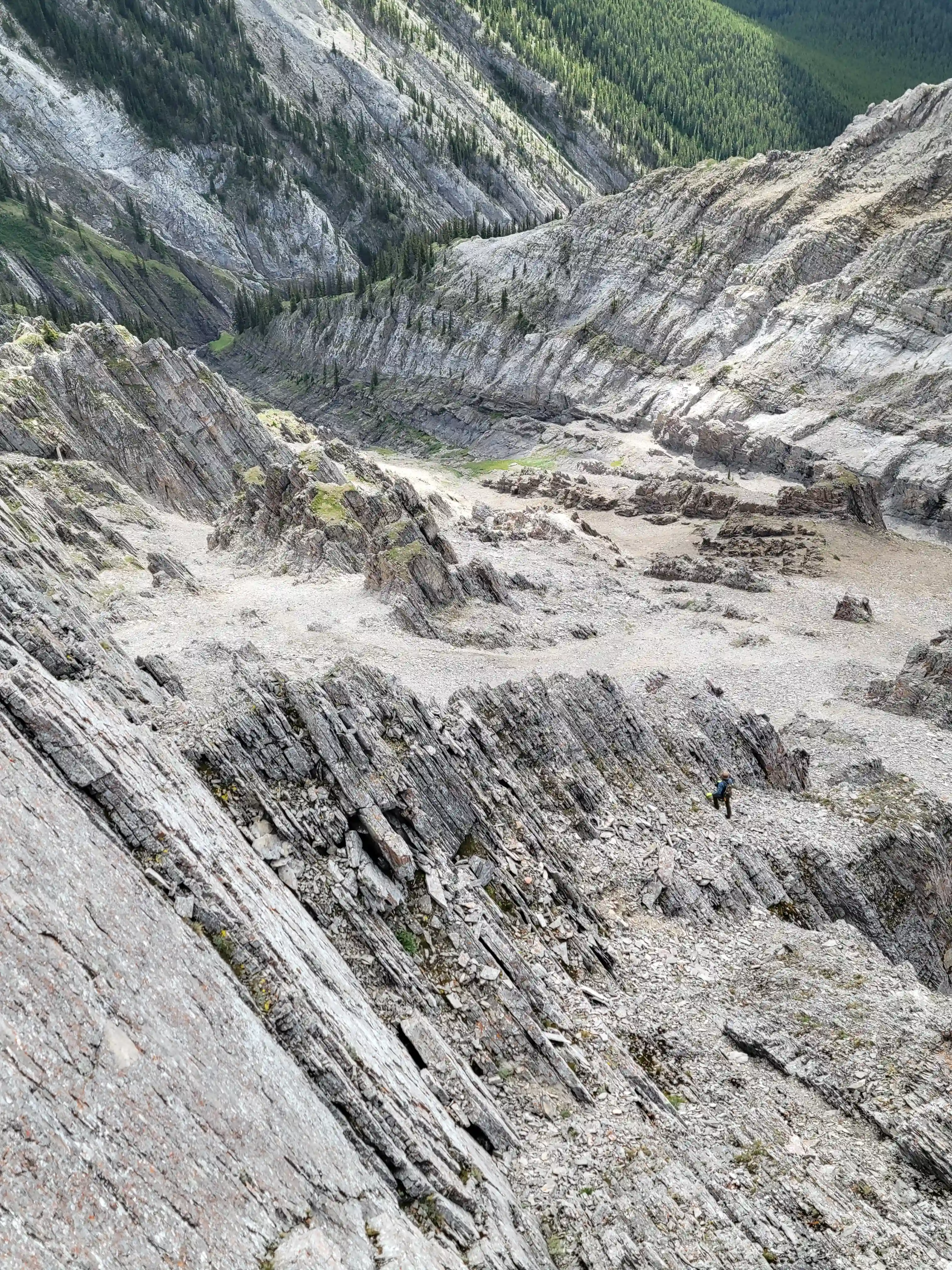
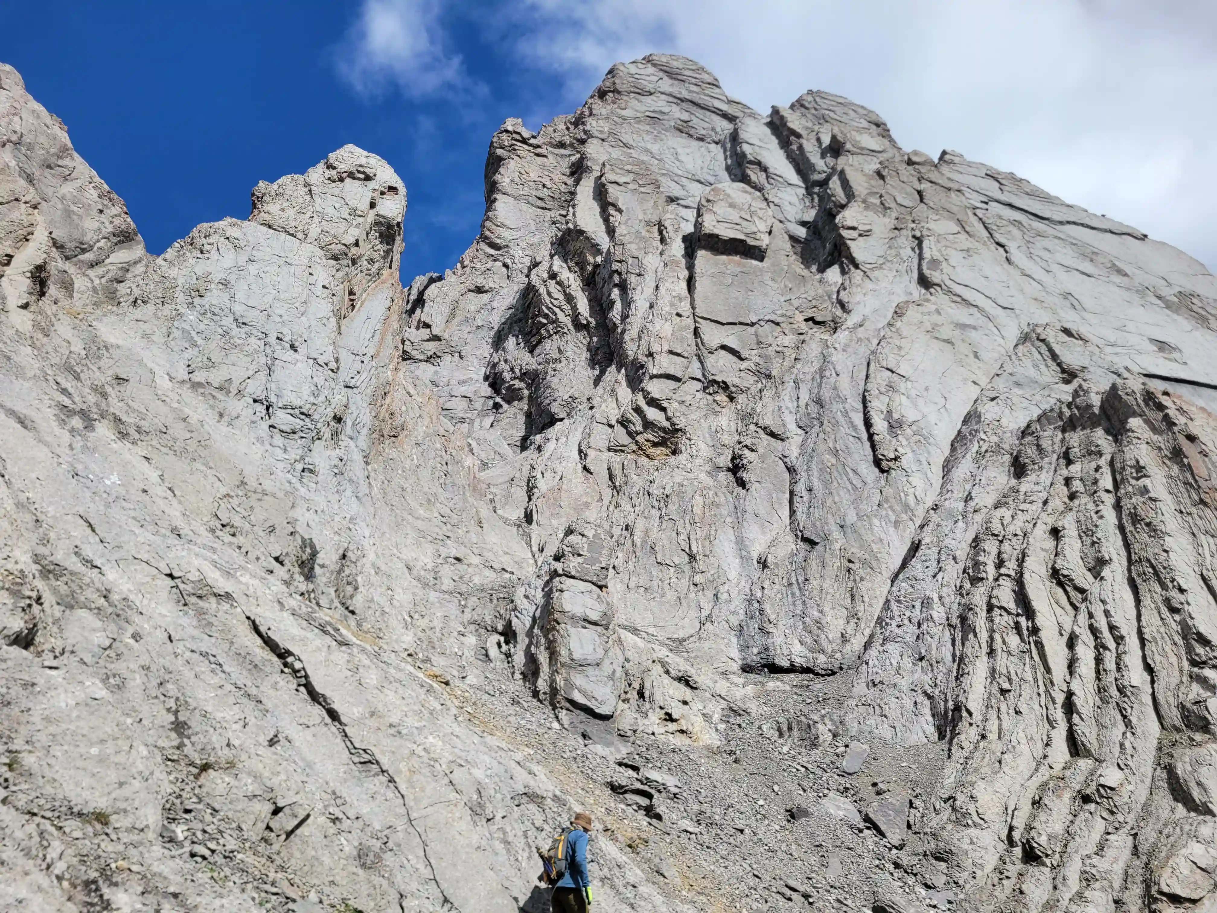
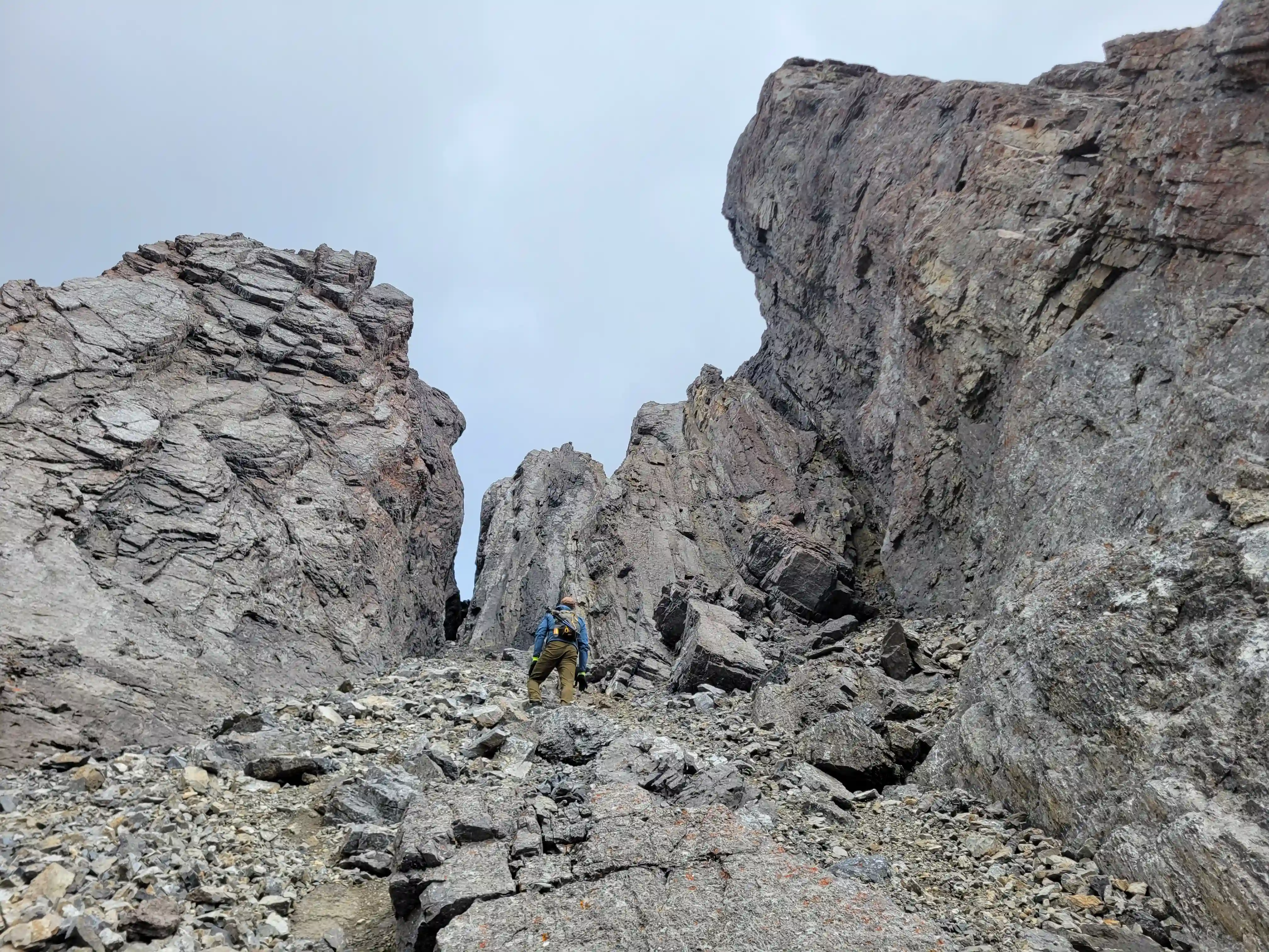
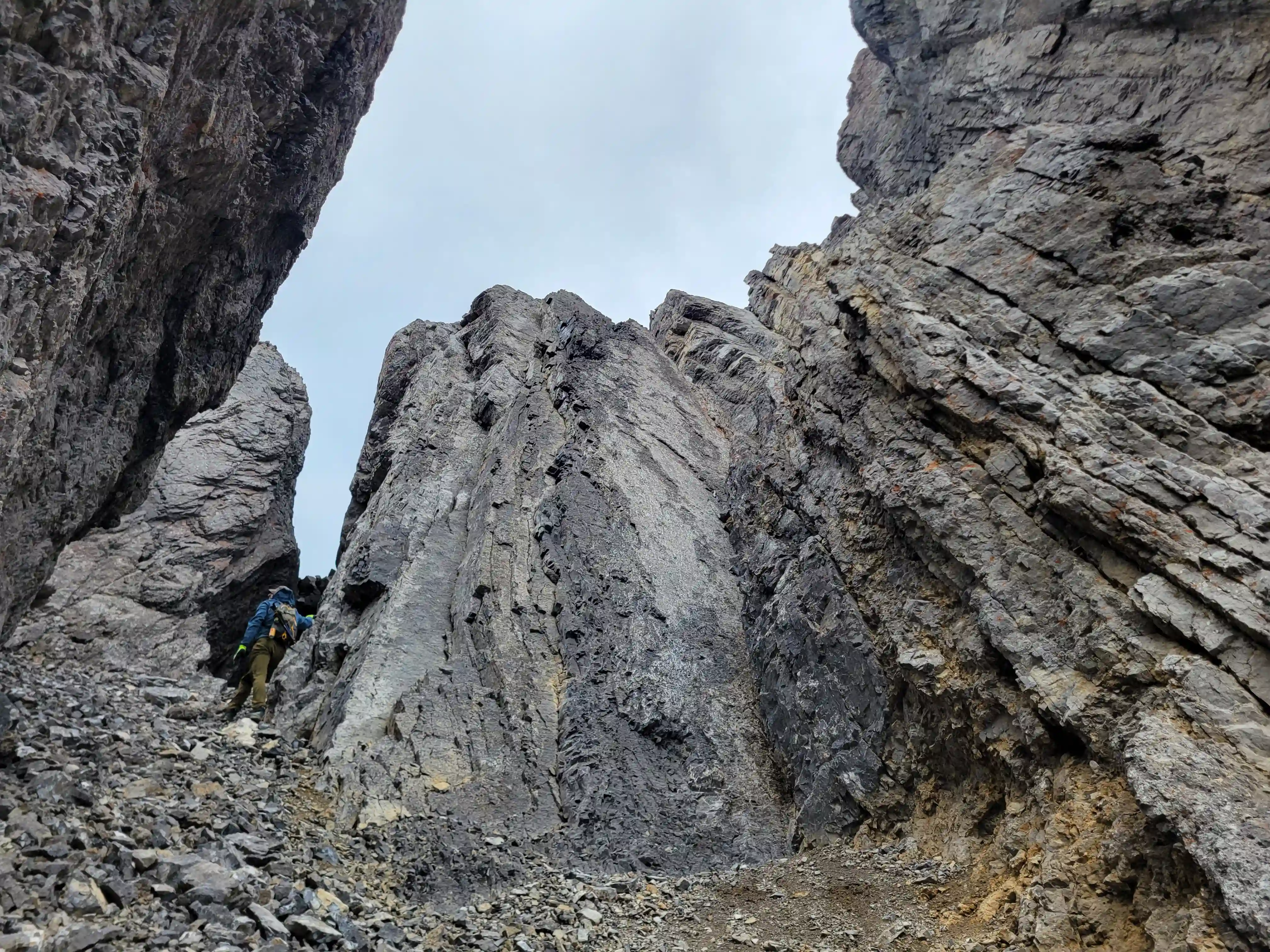
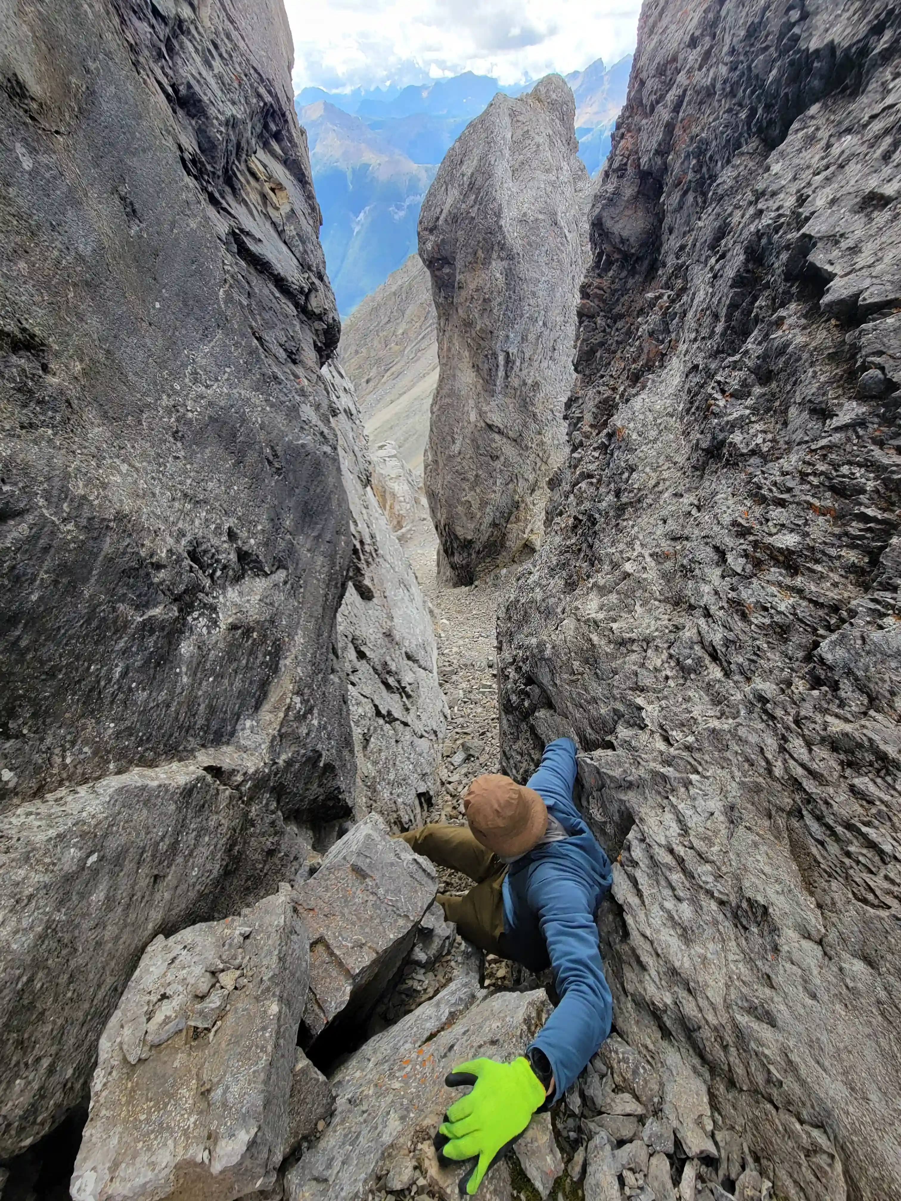
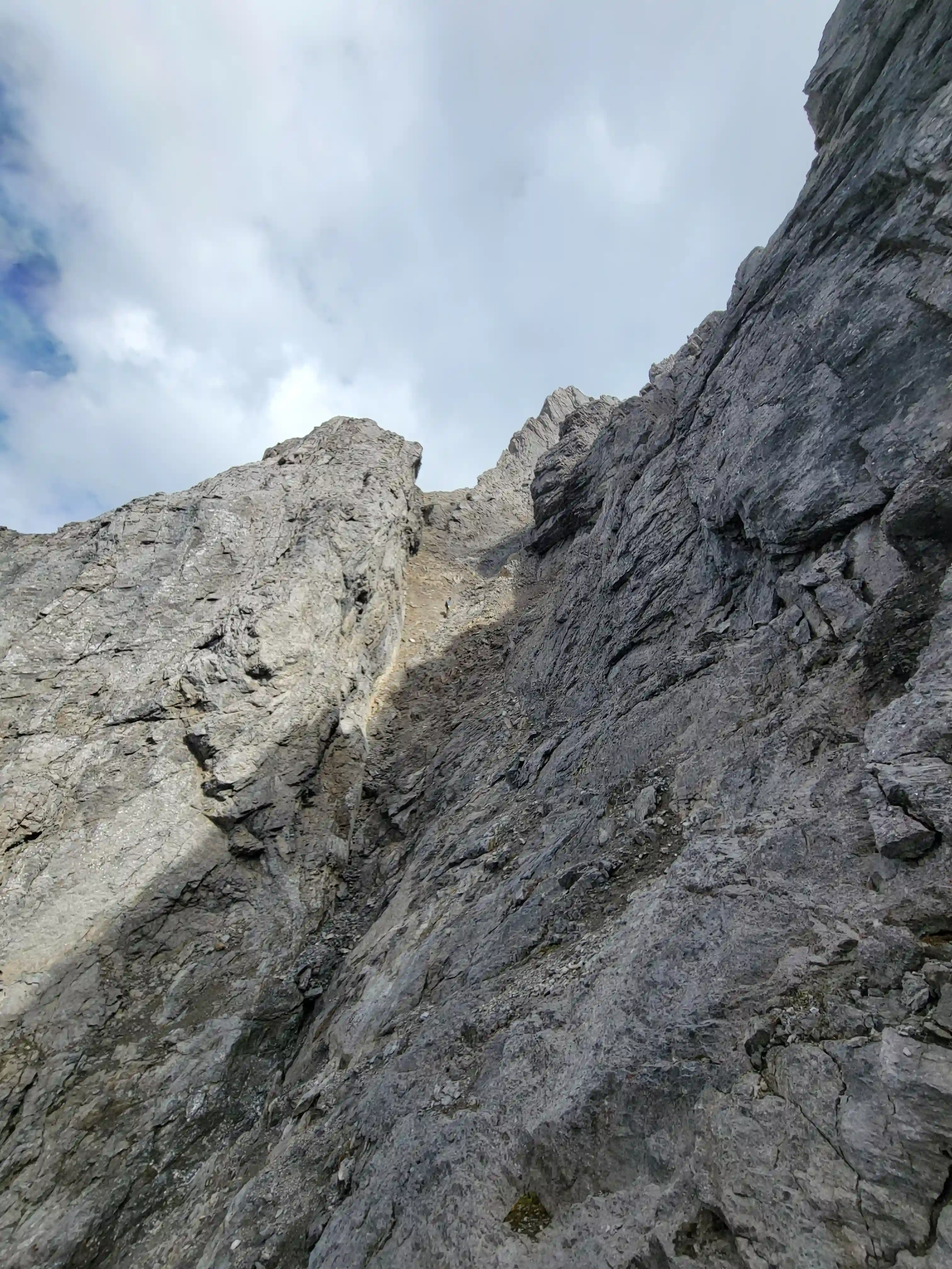
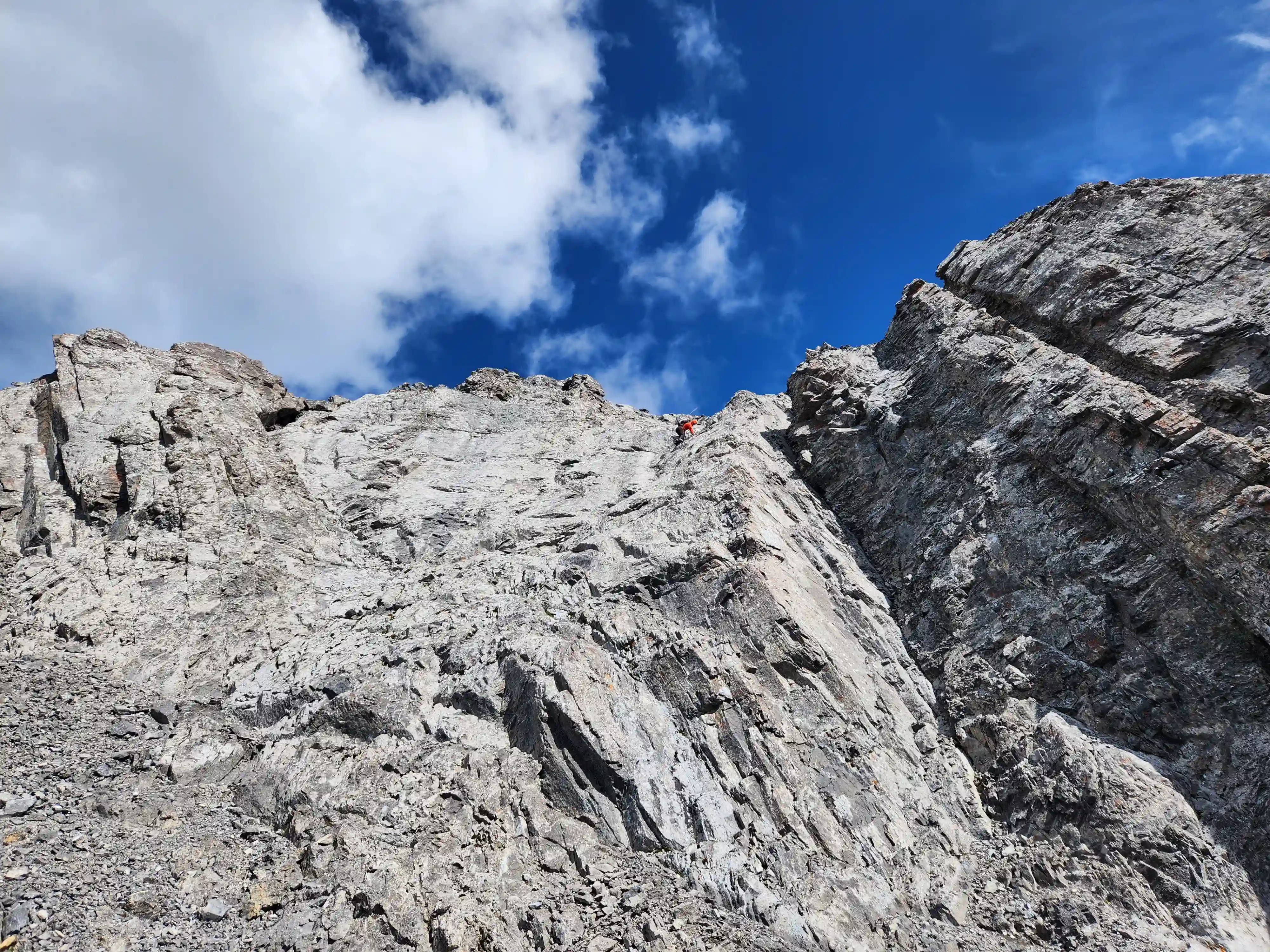
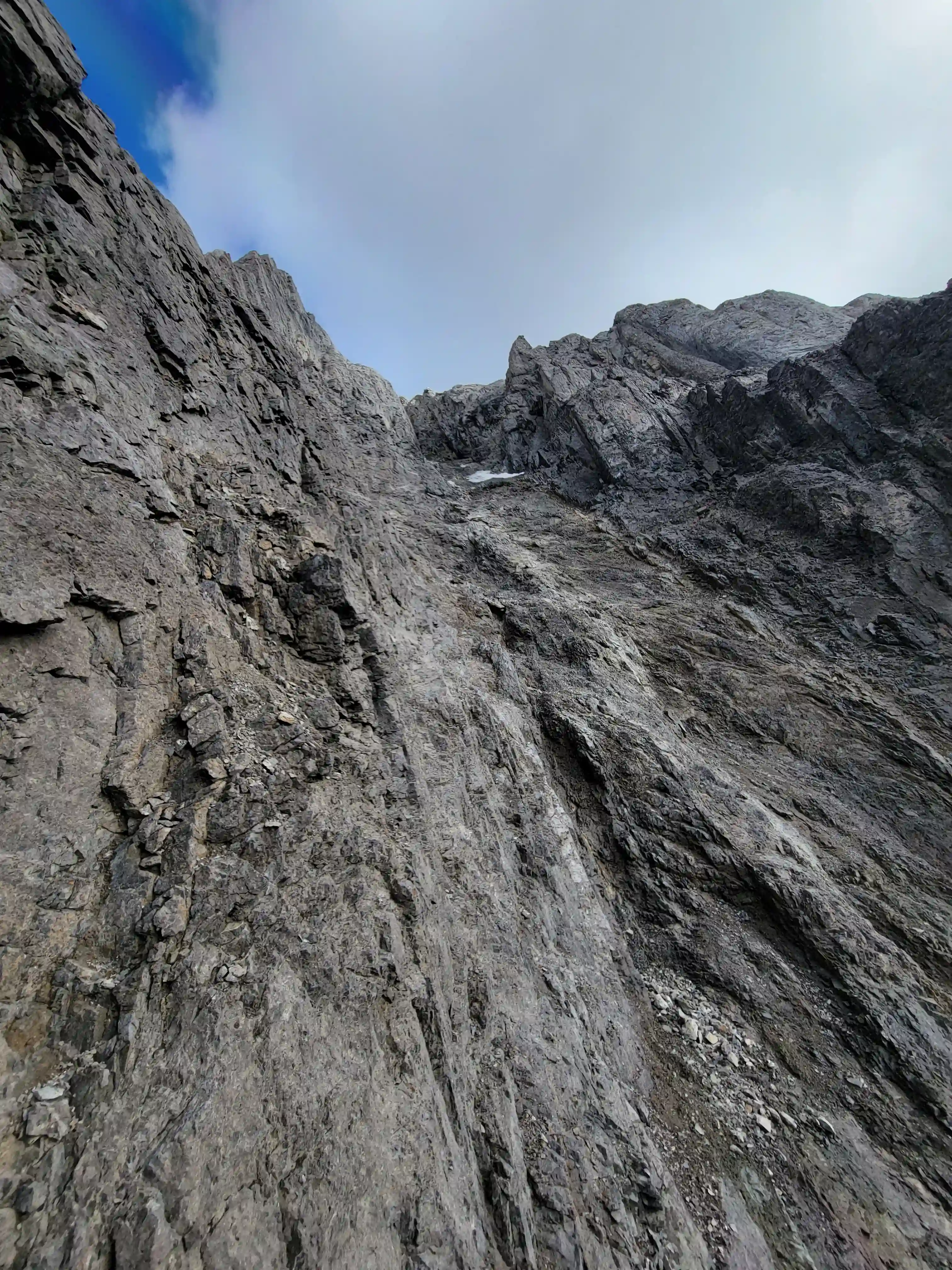
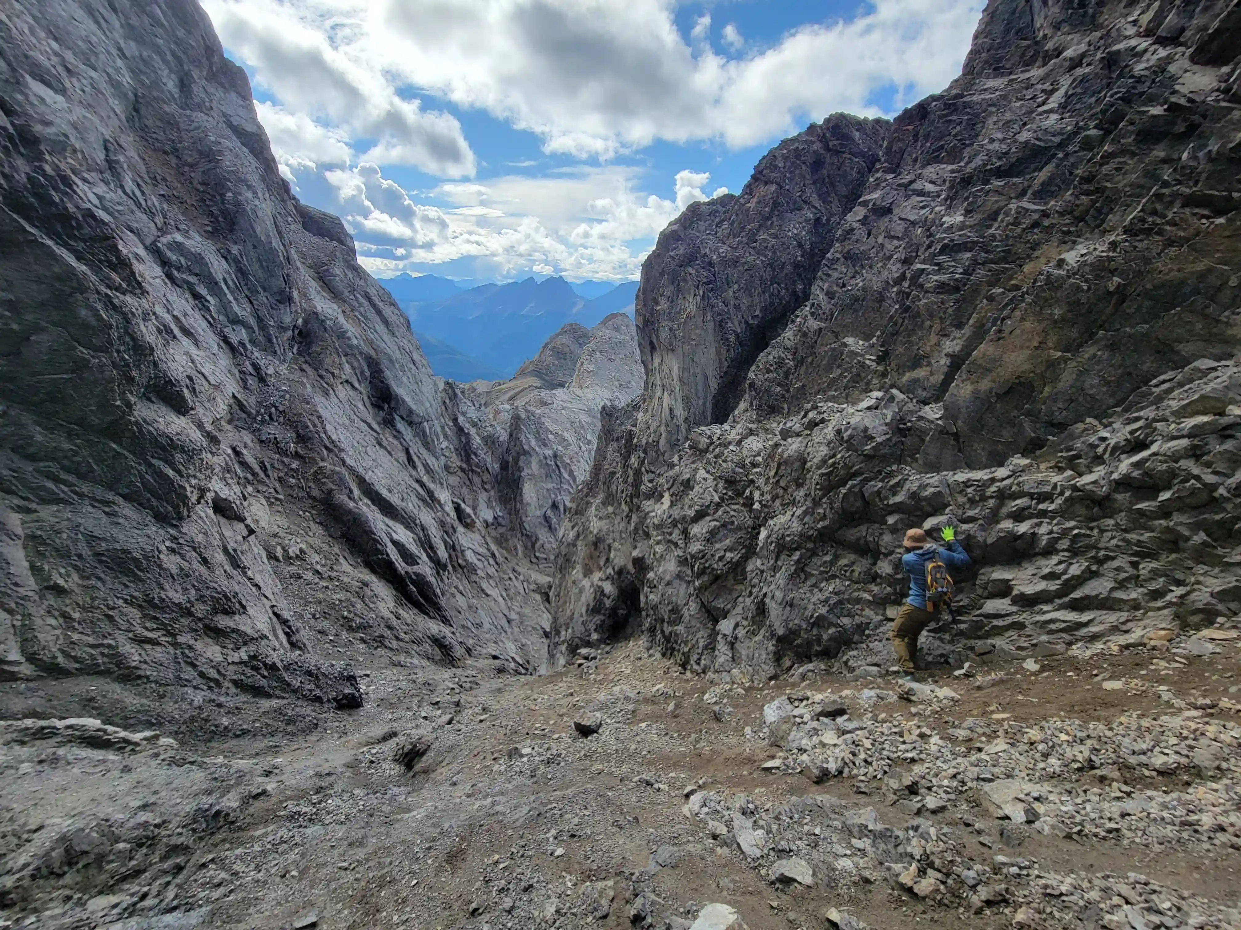
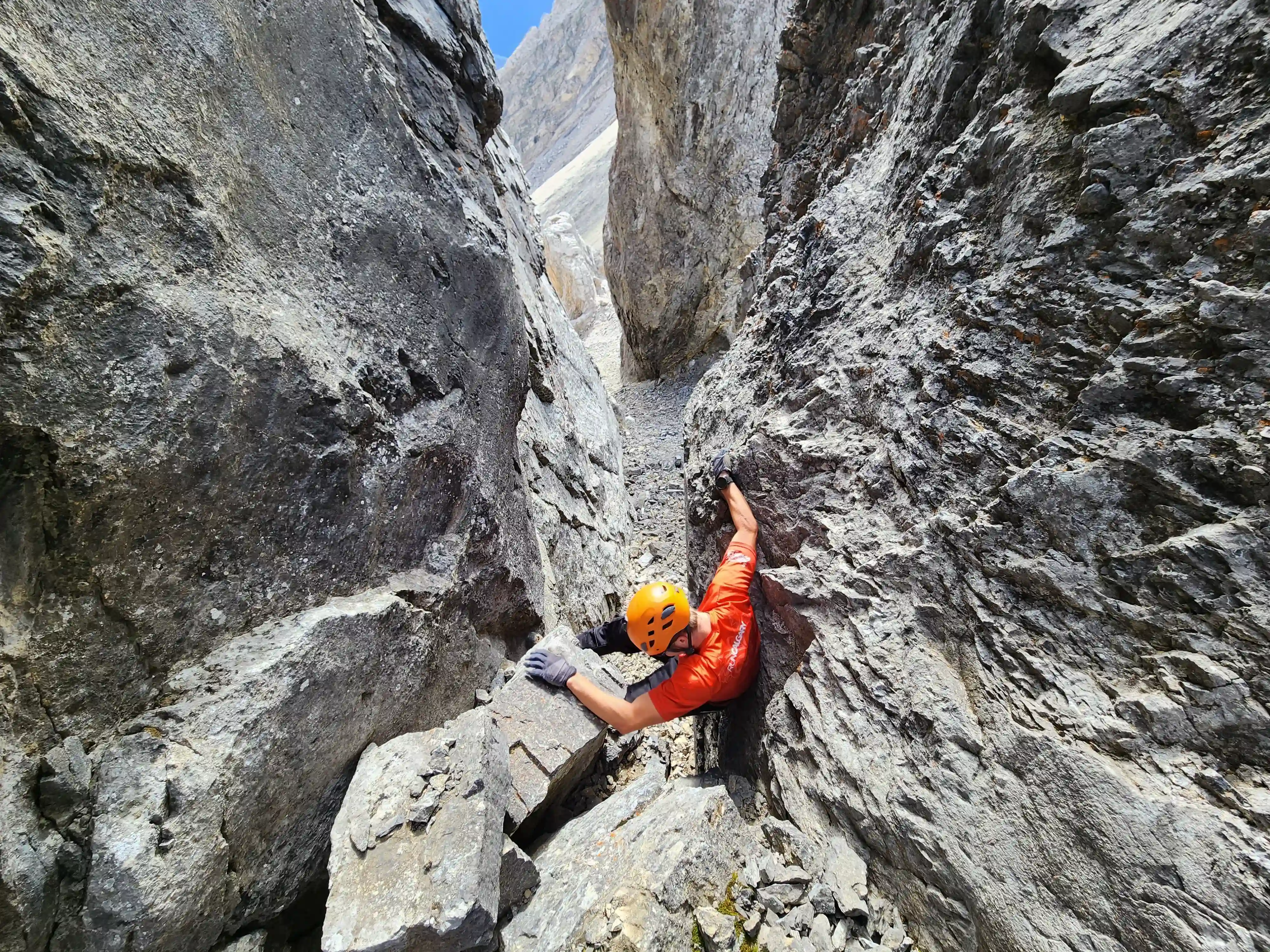
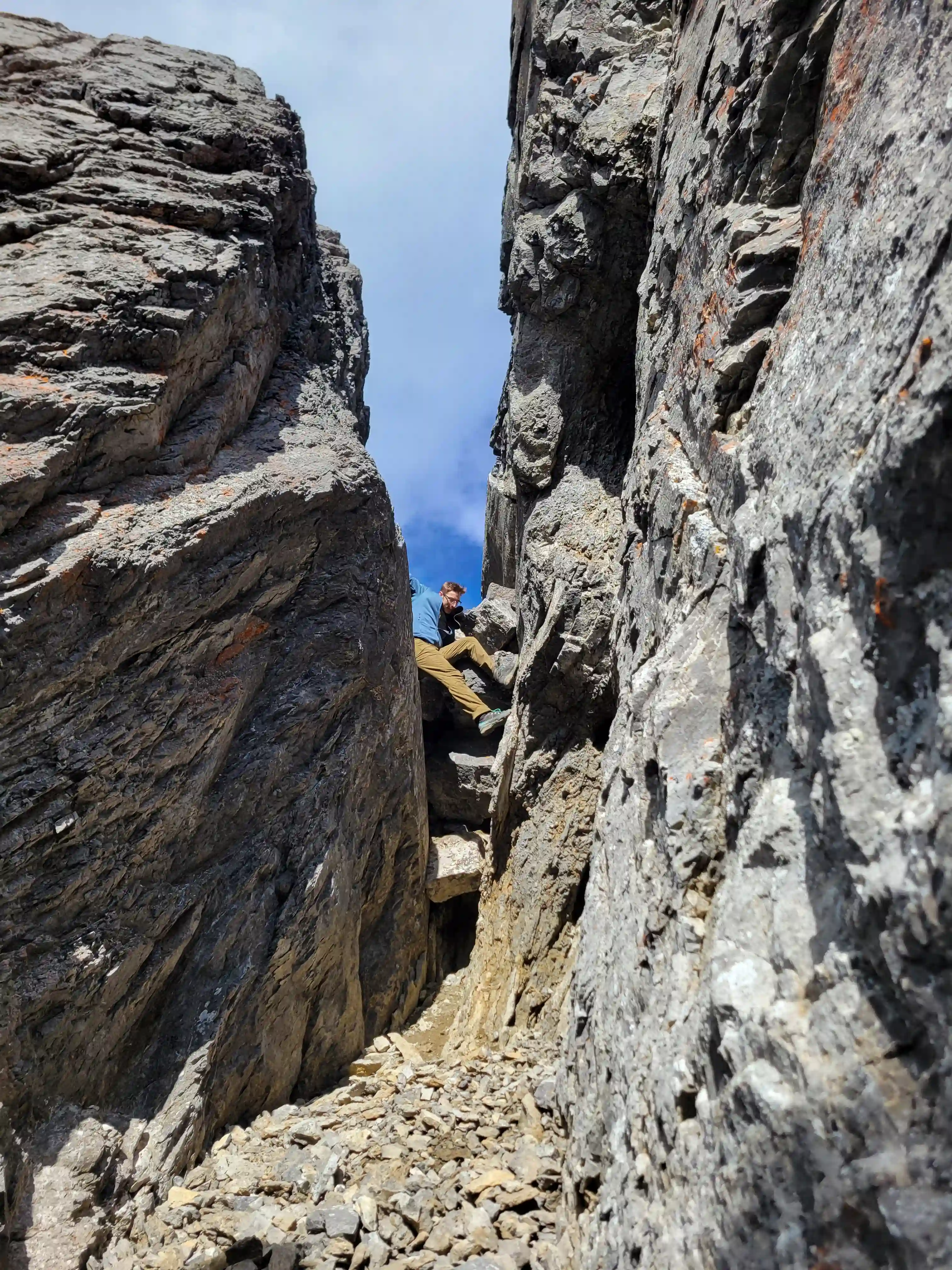
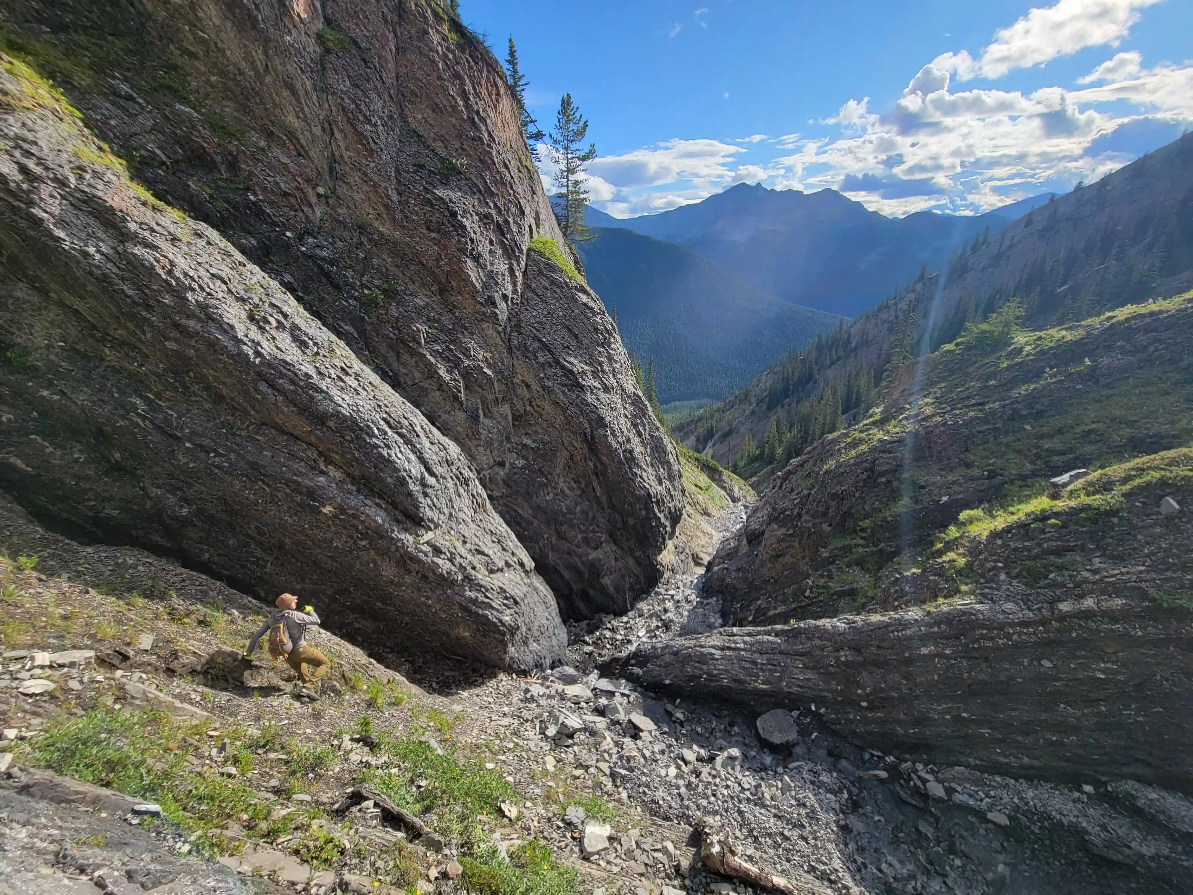
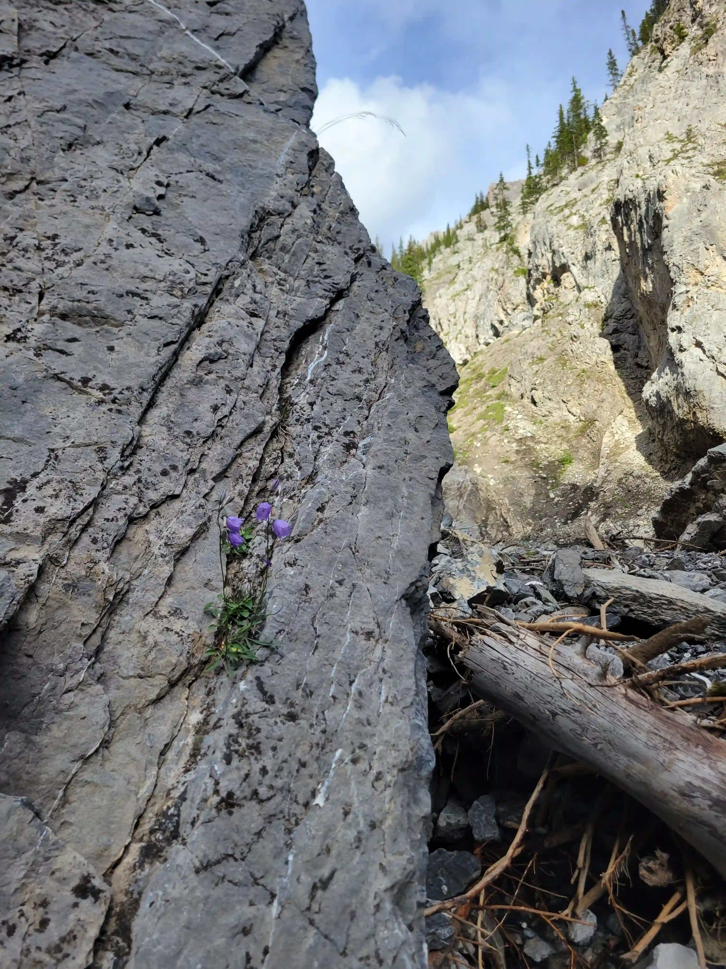
Once we got closer to the slabby face of Sundance a weakness looked like it could go although we weren't entirely sure if it would lead to a dead end but we didn't really have any other options so we decided to go for it. It started off as low 5th slabby moves until we reached a bit of a plateau where scree terrain resumed, then we followed it into a narrow gap between the mountain and a pinnacle and that's where things got interesting. The was another gap that lead to a low point between another pinnacle and the upper mountain with a chockstone in it but it looked decently technical and we weren't sure it would lead us anywhere. We did some looking around and once we were sure that we had no other options we decided to check it out as it was either that gap would go or we'd have to turn around and thankfully it ended up being the key to our route's success!
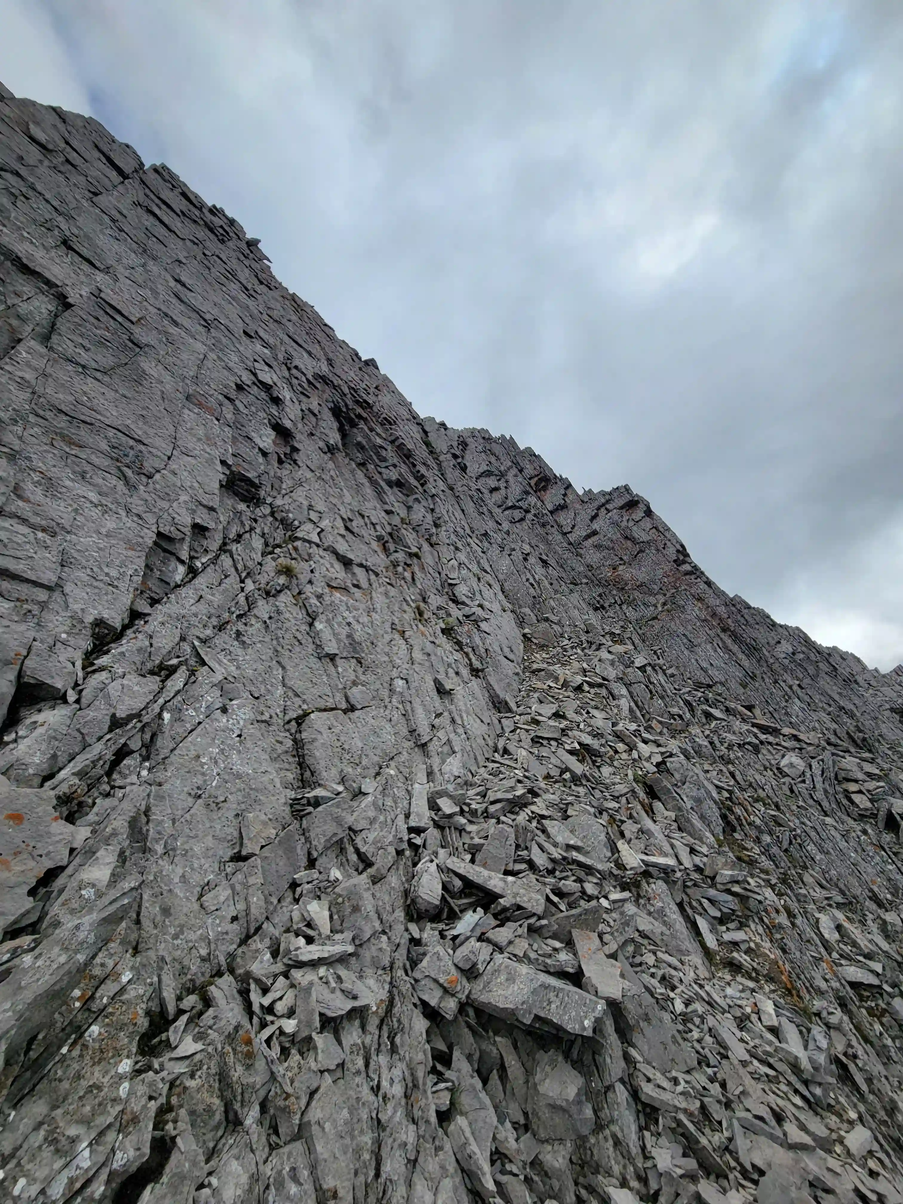
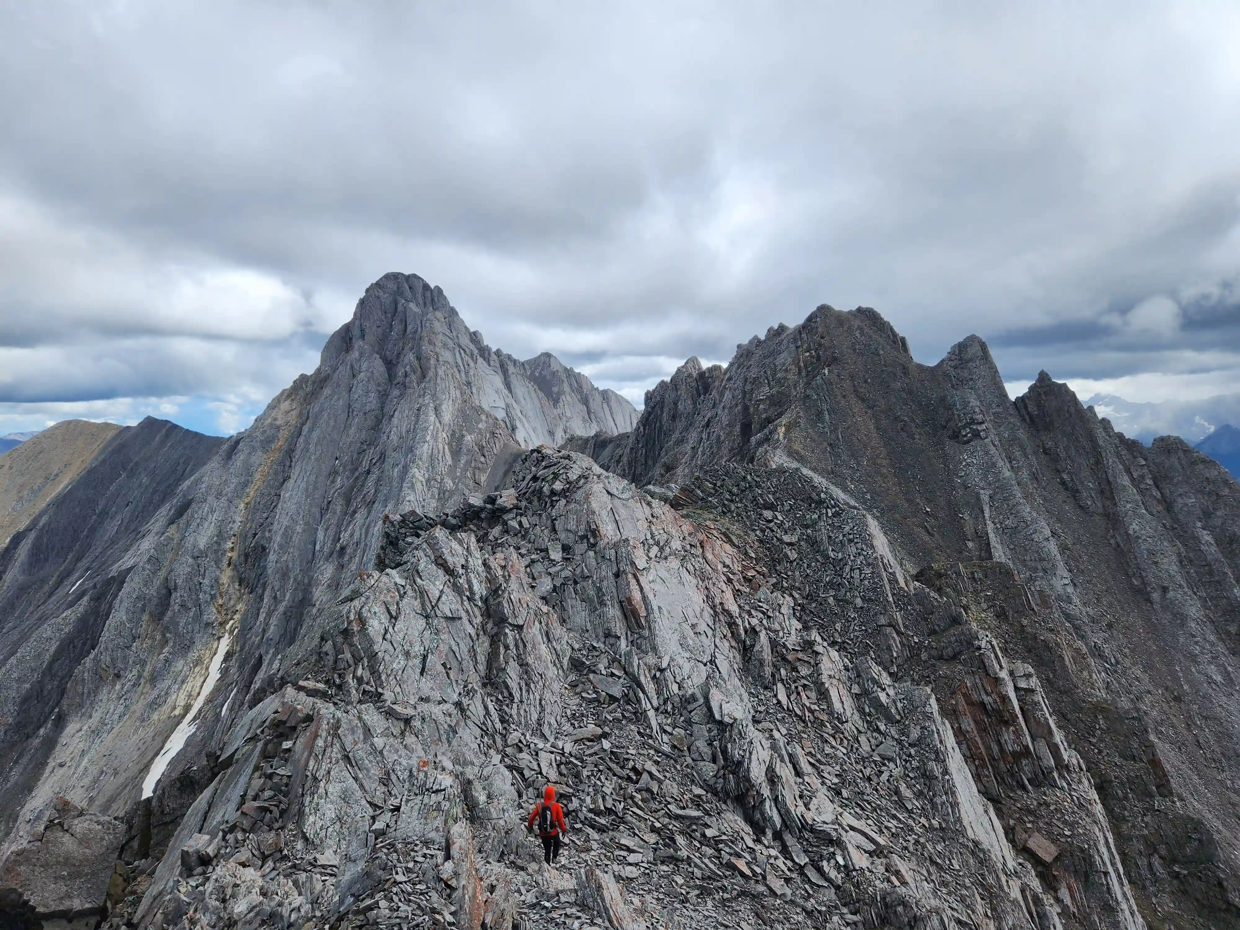
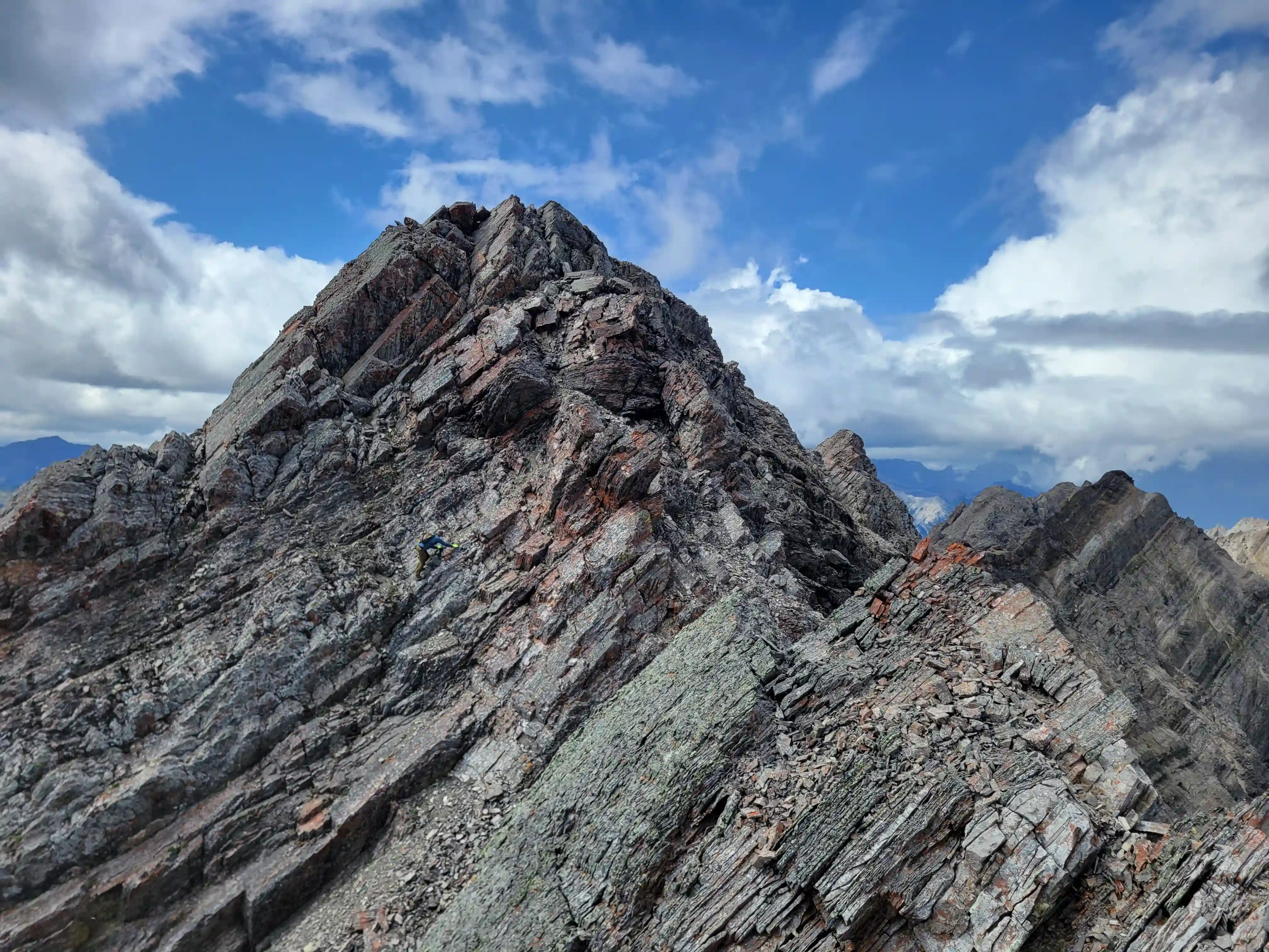
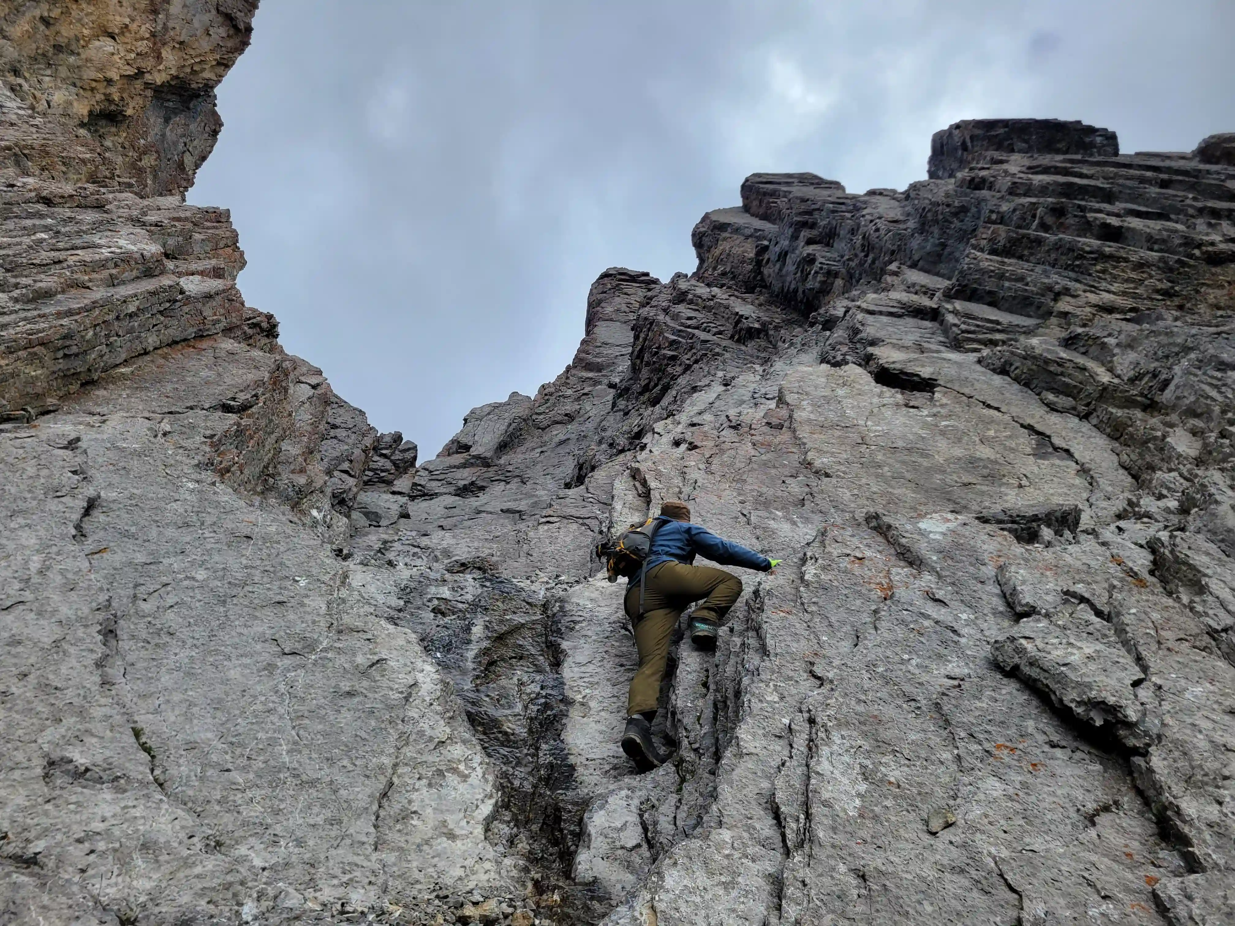
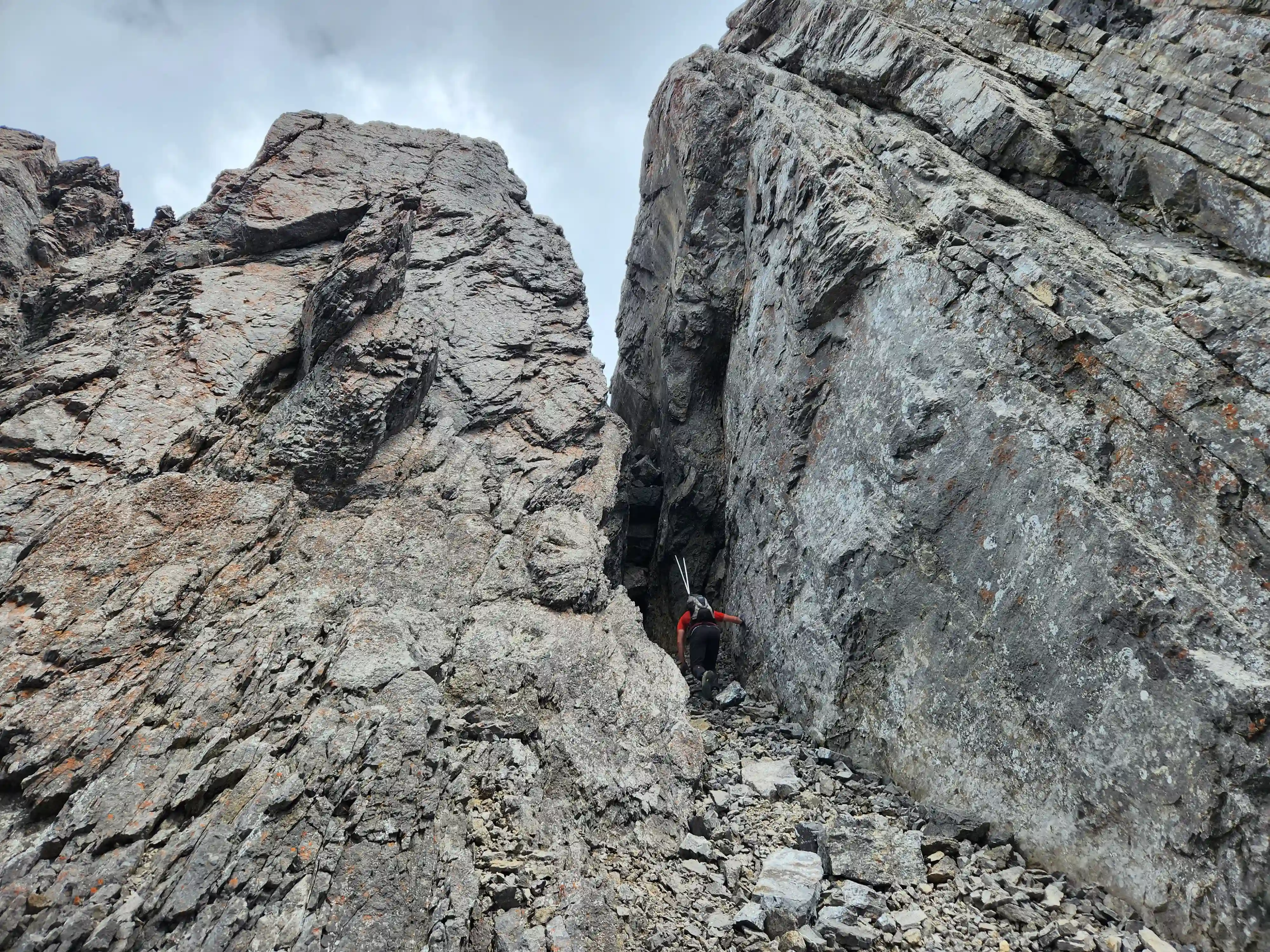
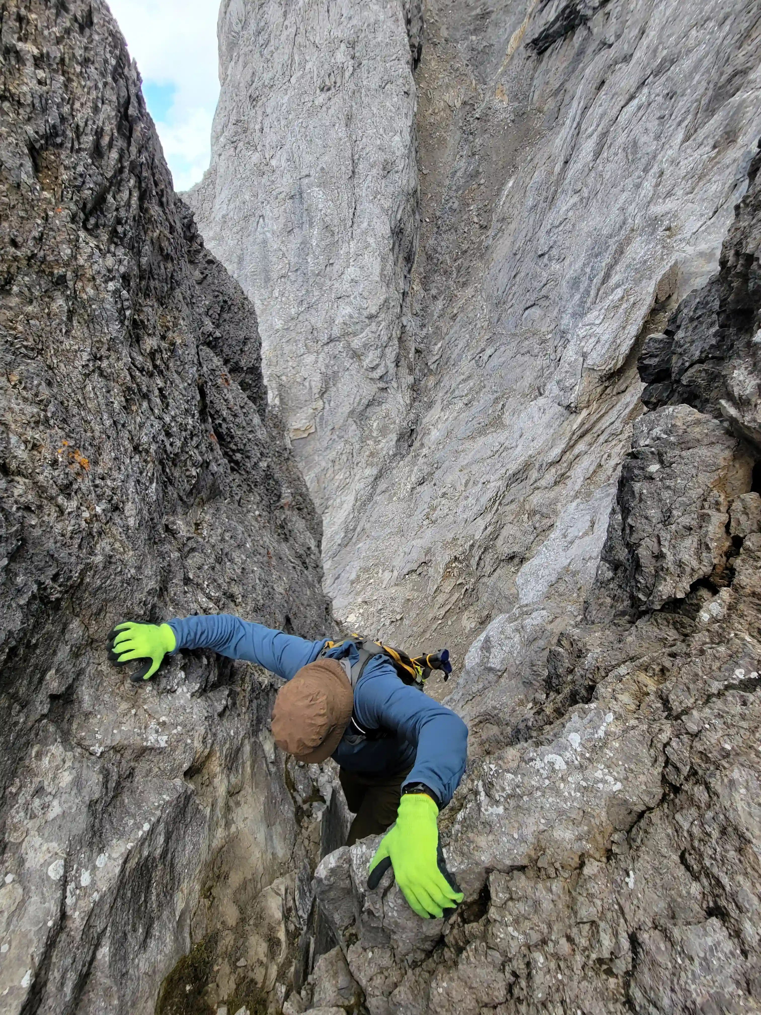
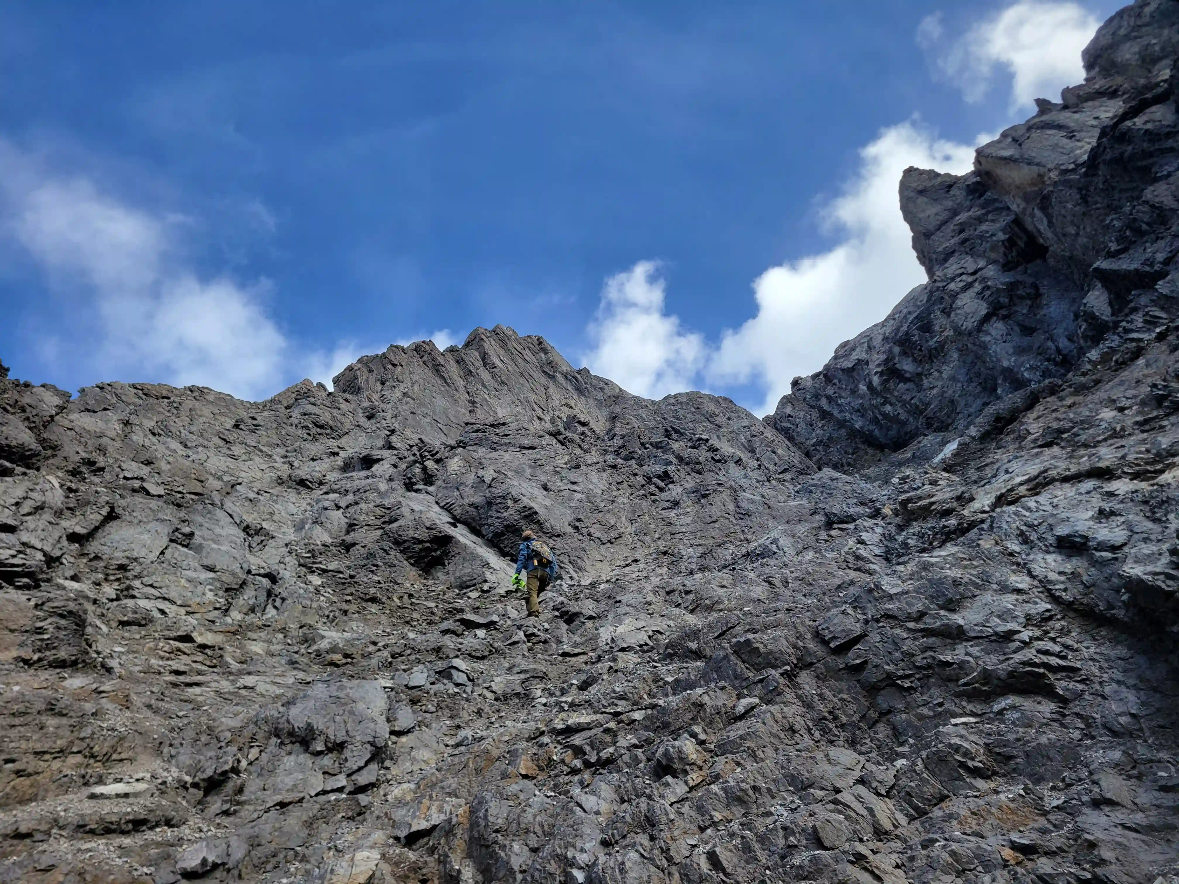
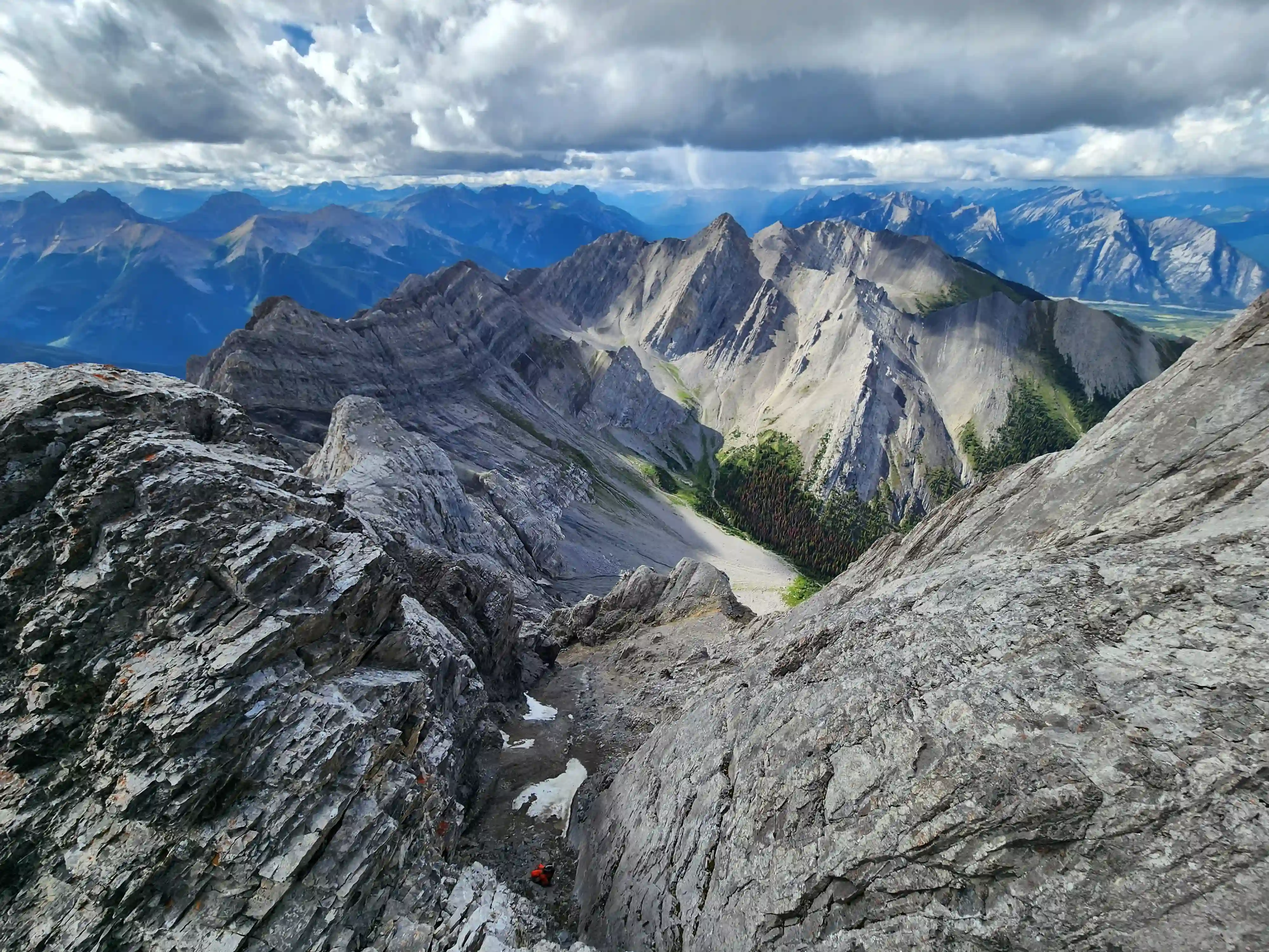
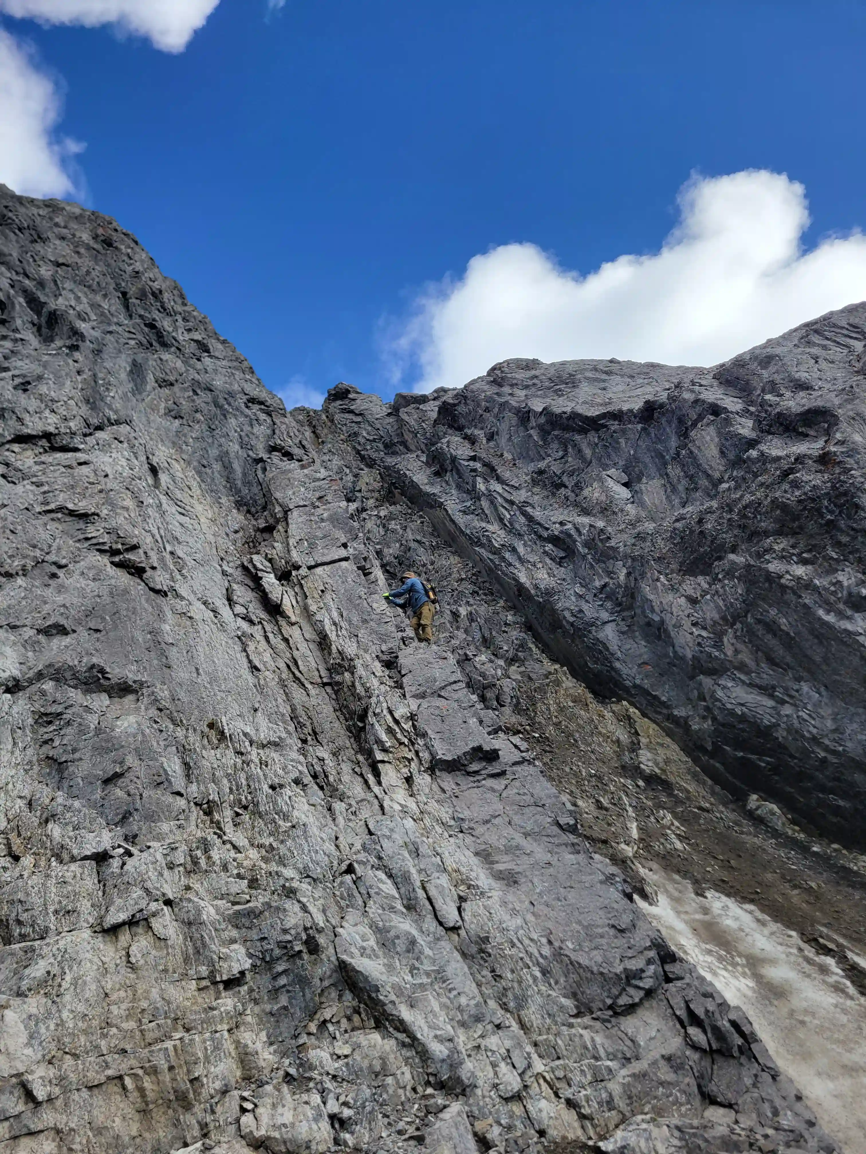
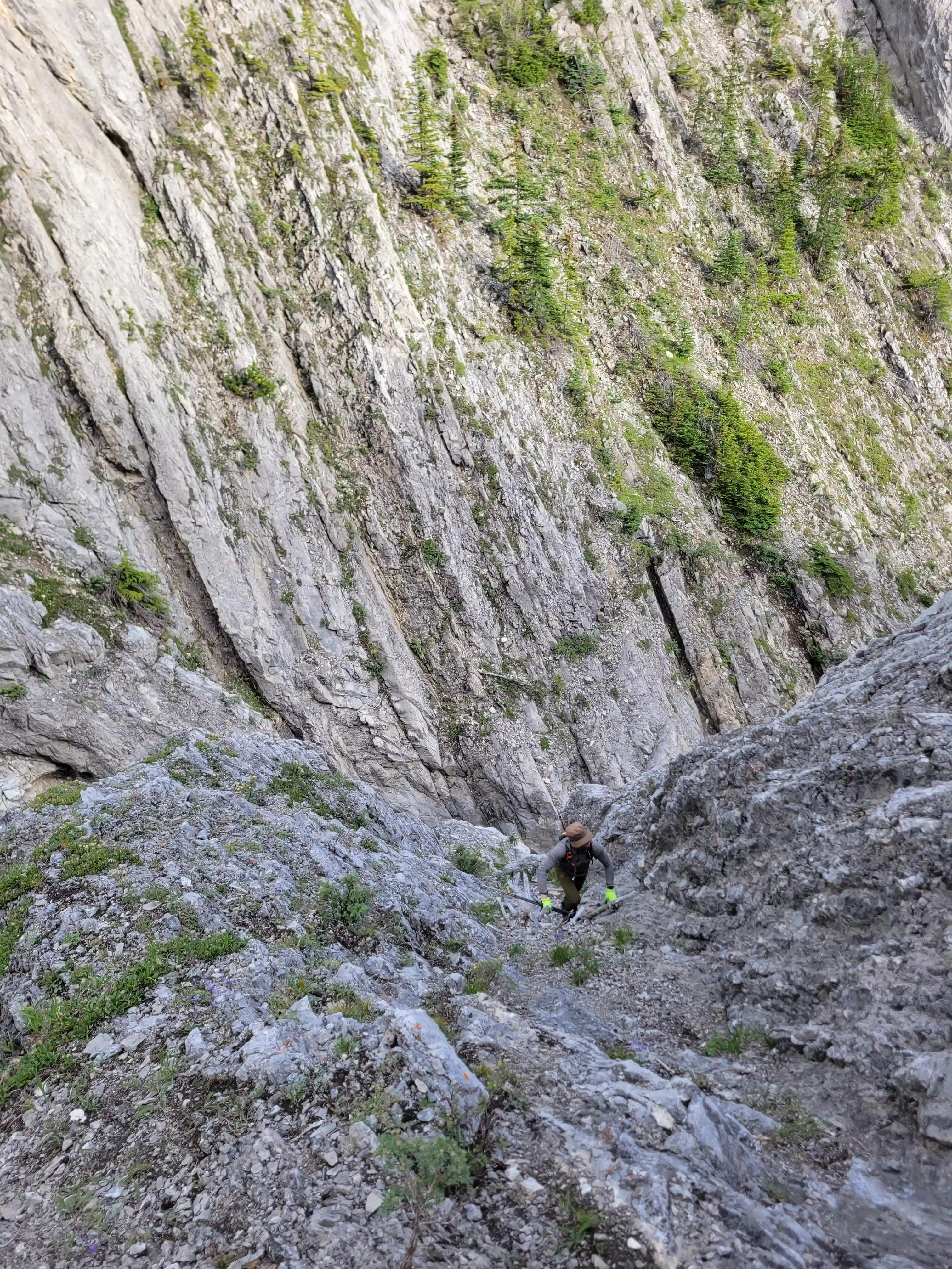
We were able to wedge ourselves nicely in the chockstone gap making it quite secure and once topped out we could see that the other side although a bit technical was downclimbable and lead to the gulley feature we had scoped out from afar. After downclimbing we started up the gully which was a particularly bad bowling alley for rockfall and ascending was pretty easy until we reached an upper section with some persistent snow, awfully lose rock, with some stiffer and steeper moves above it. Devan and I took turns through this section as to not launch rocks into each other and once we were through this difficulty which we both considered the crux of the day all that was left was some low 5th slabby terrain before a bit of scree to reach the summit!
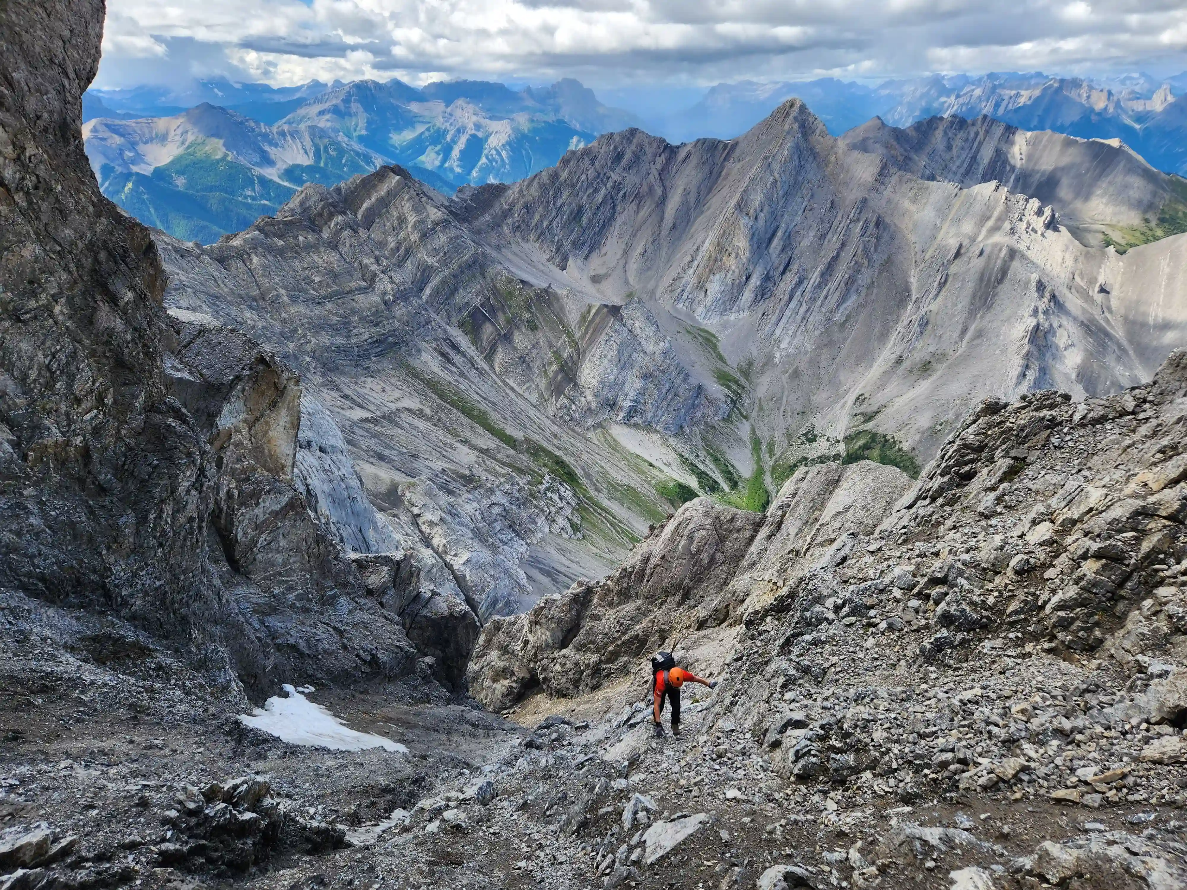
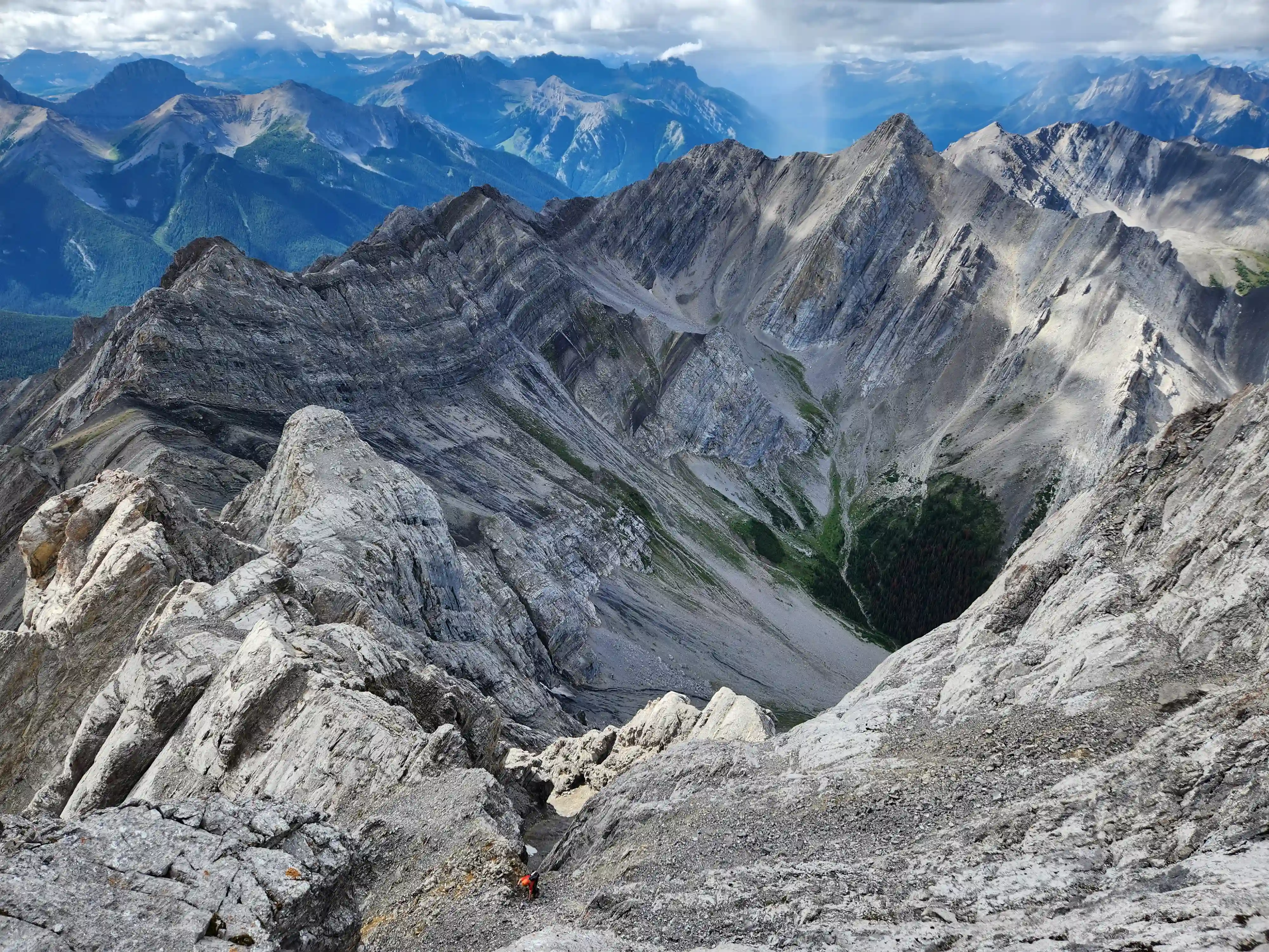
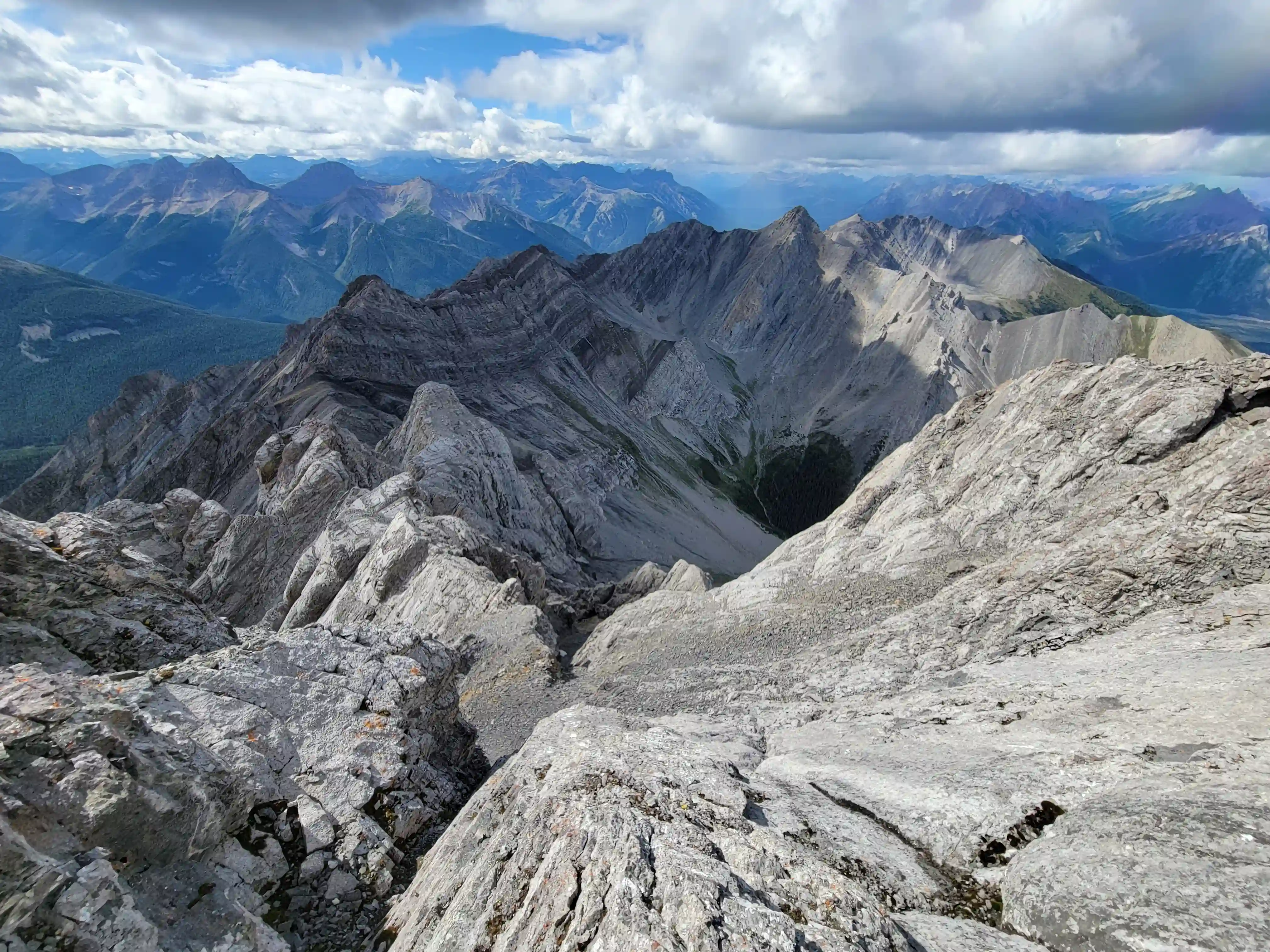
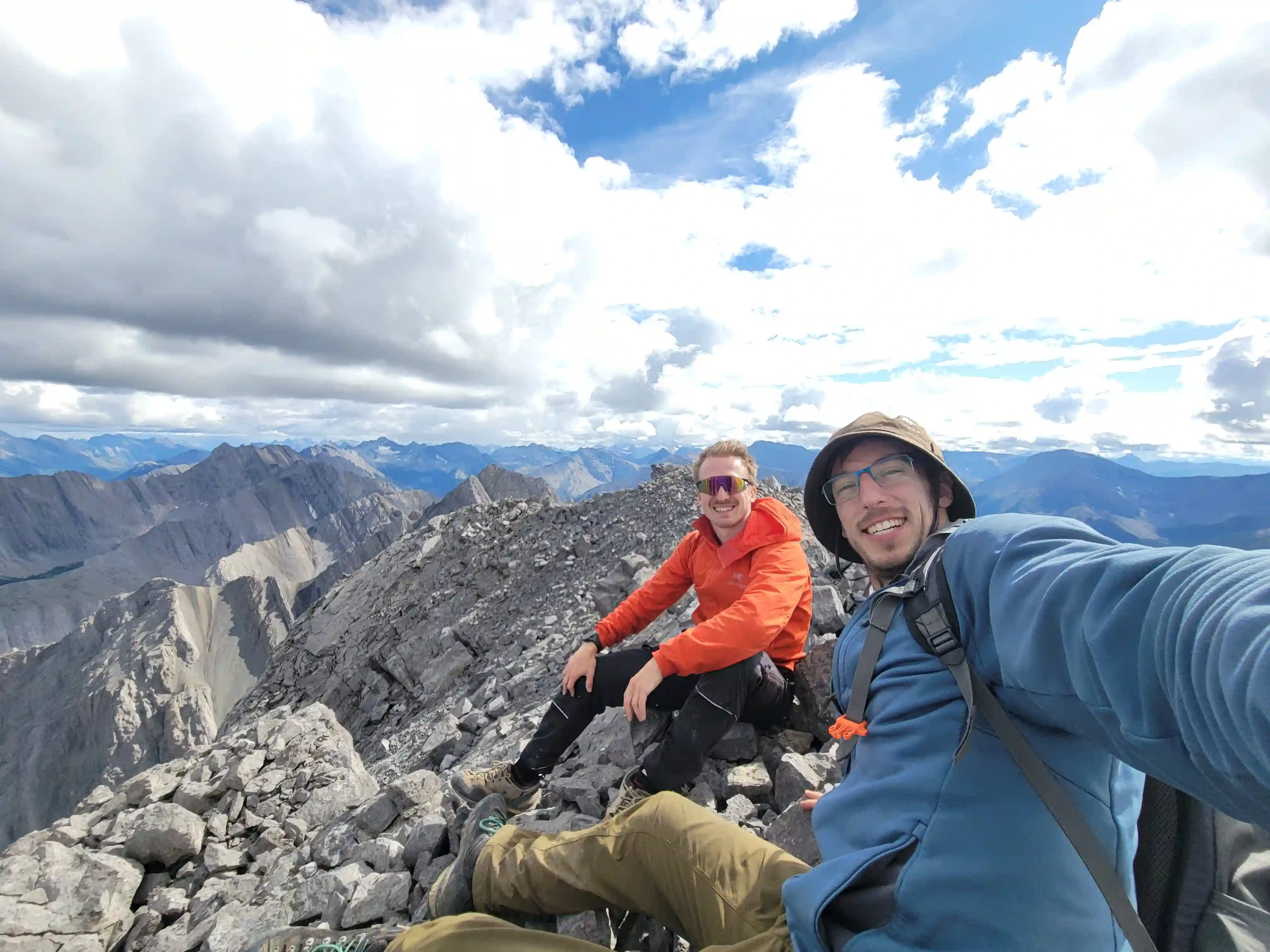
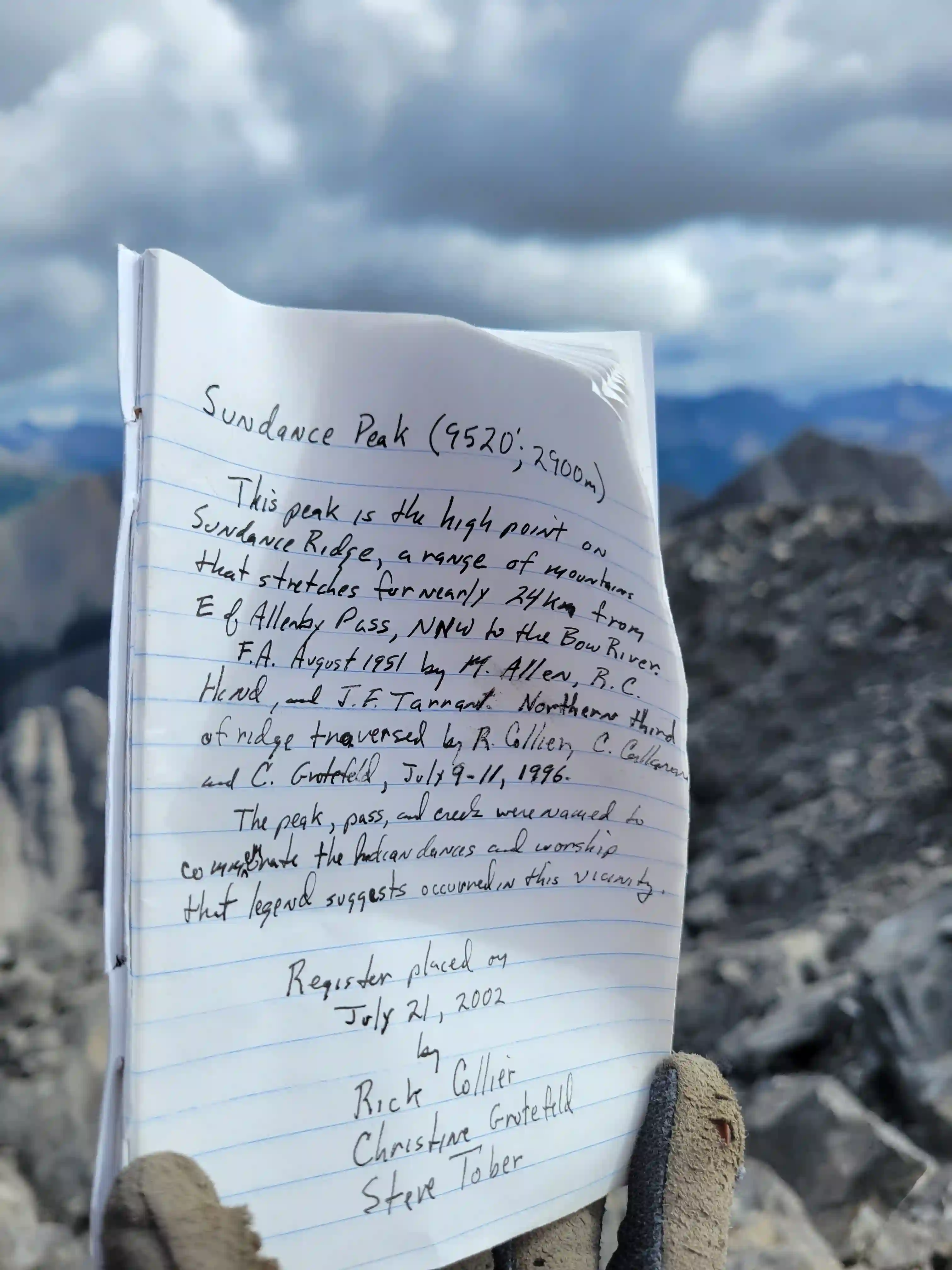
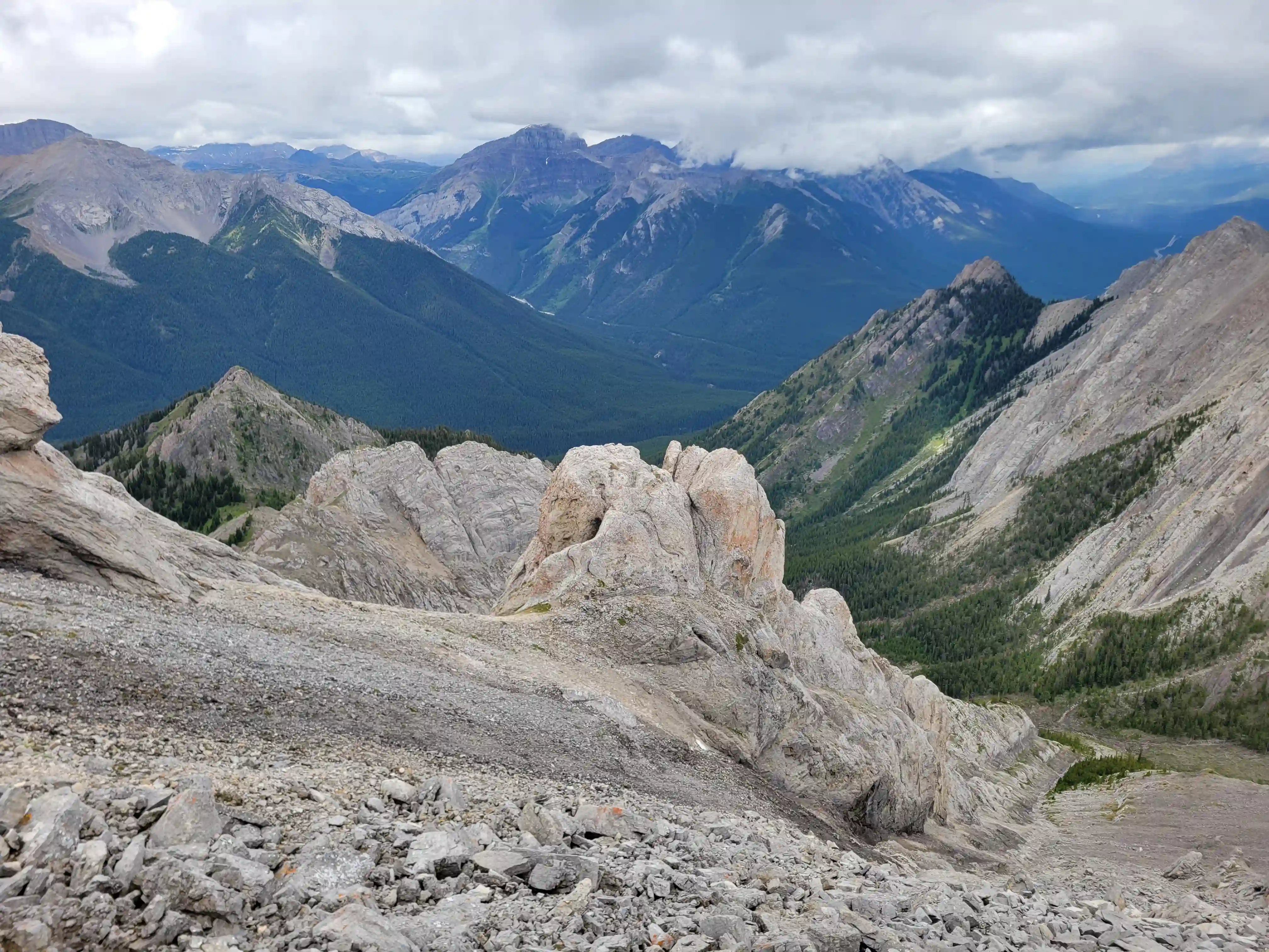
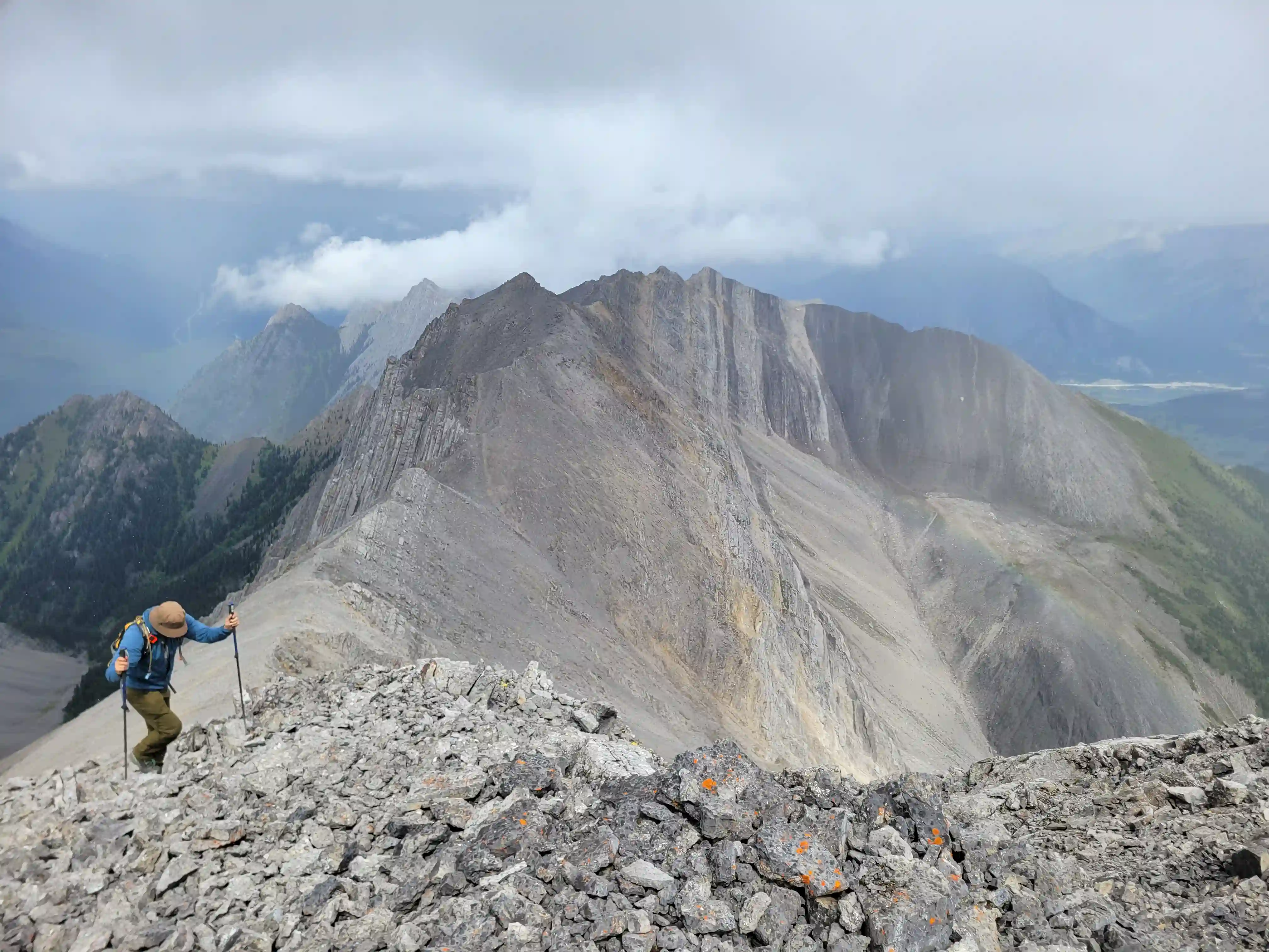
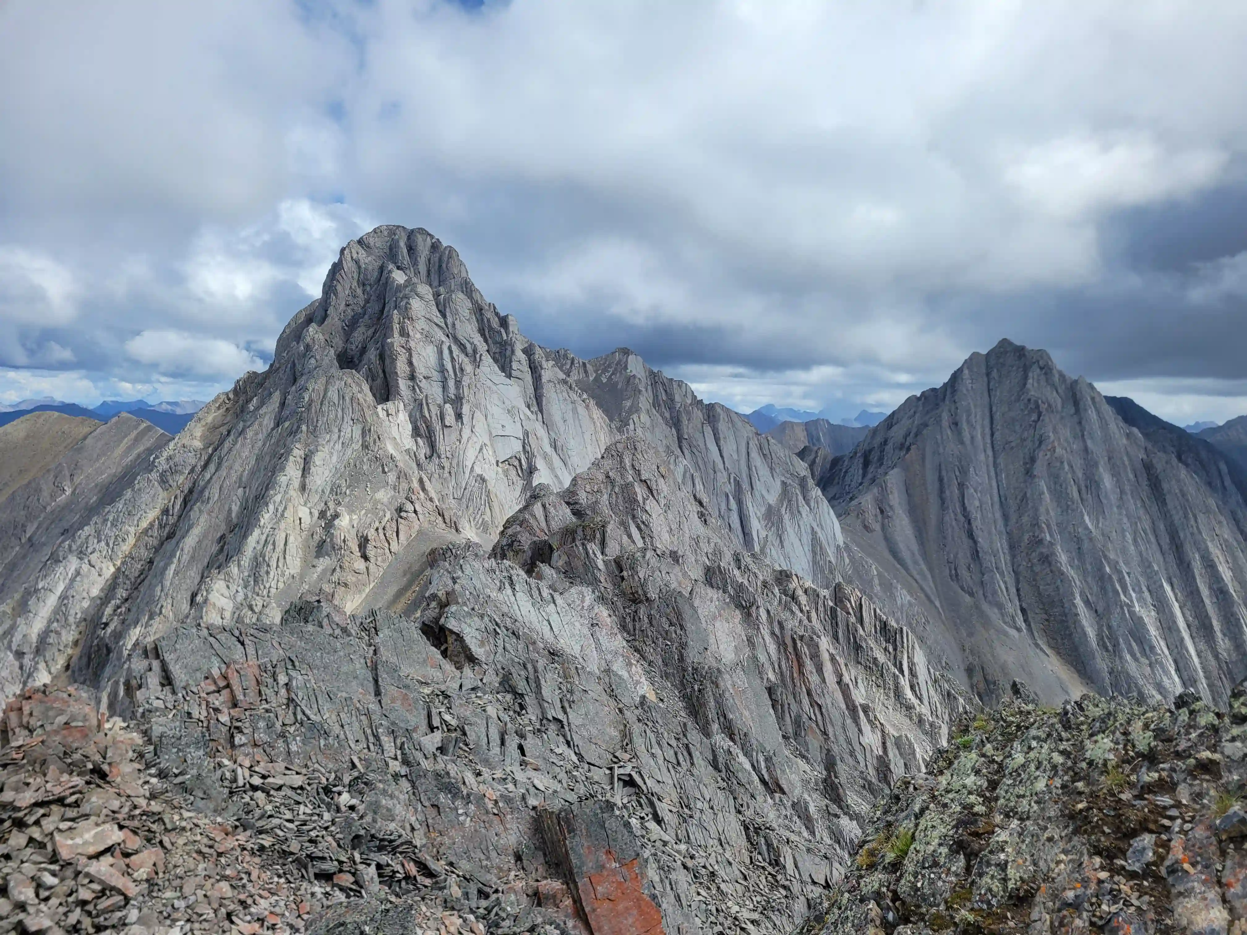
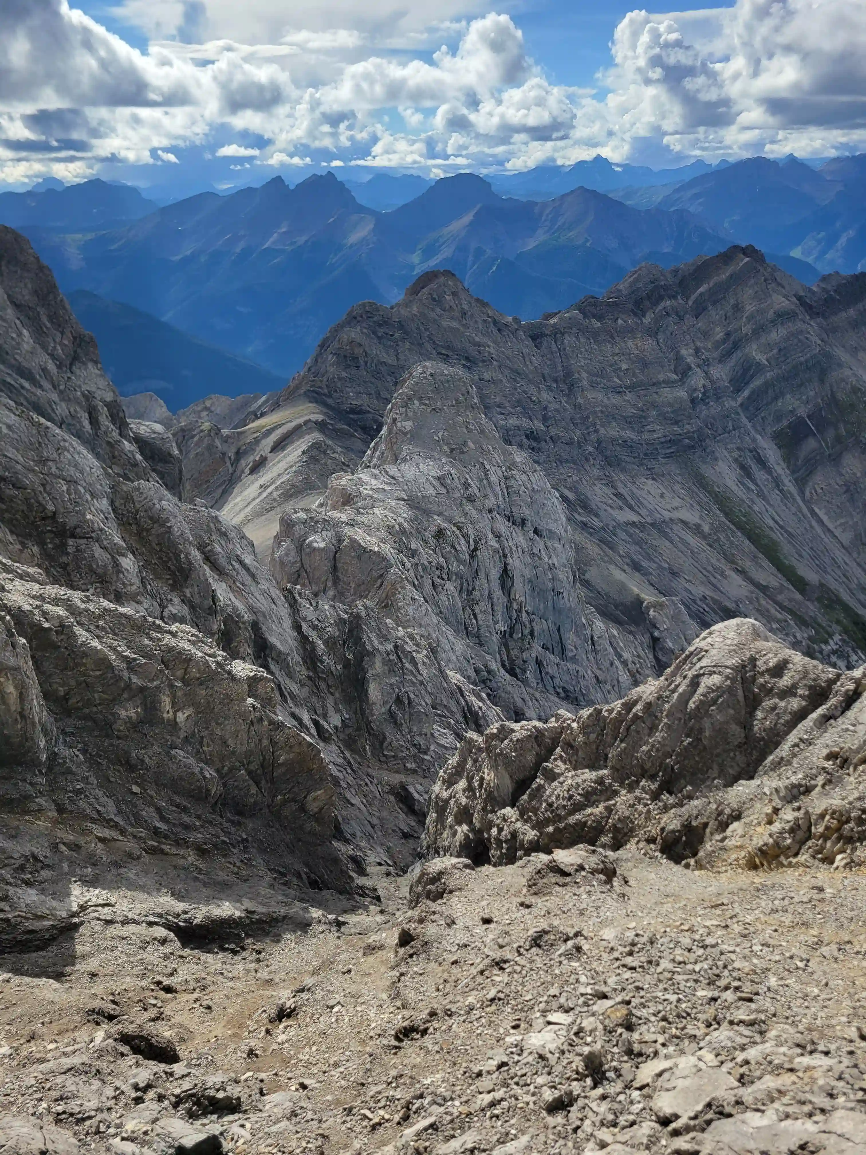
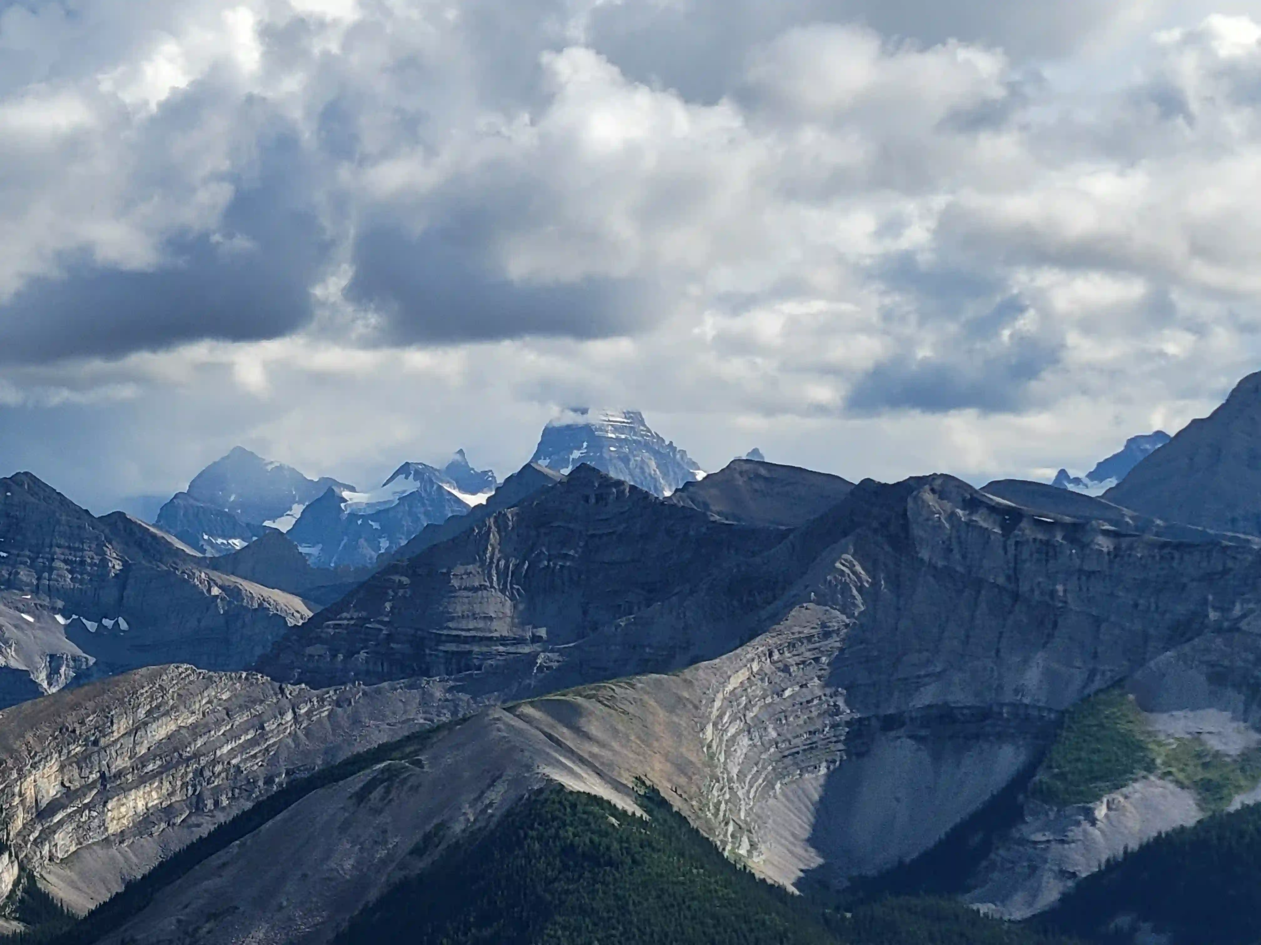
Neither of us realized truly how little Sundance Peak gets done and we were pretty stoked to be the first to summit in 23 years following Rock Collier's group in 2002 as well as potentially being the 3rd summit ever! Views from the summit of the numerous lower Sundance Peaks were a nice reward after a tricky ascent and the seldom done Beersheba Peak was nicely visible in the distance, might have to try for that one one day! After chilling at the top for a bit we started the downclimbing and while it definitely required more focus, aside from the crux which definitely felt a bit sketchy on the way down the rest of the mountain felt relatively chill in comparison and not long after we were back at the base of the mountain and out of technical terrain.
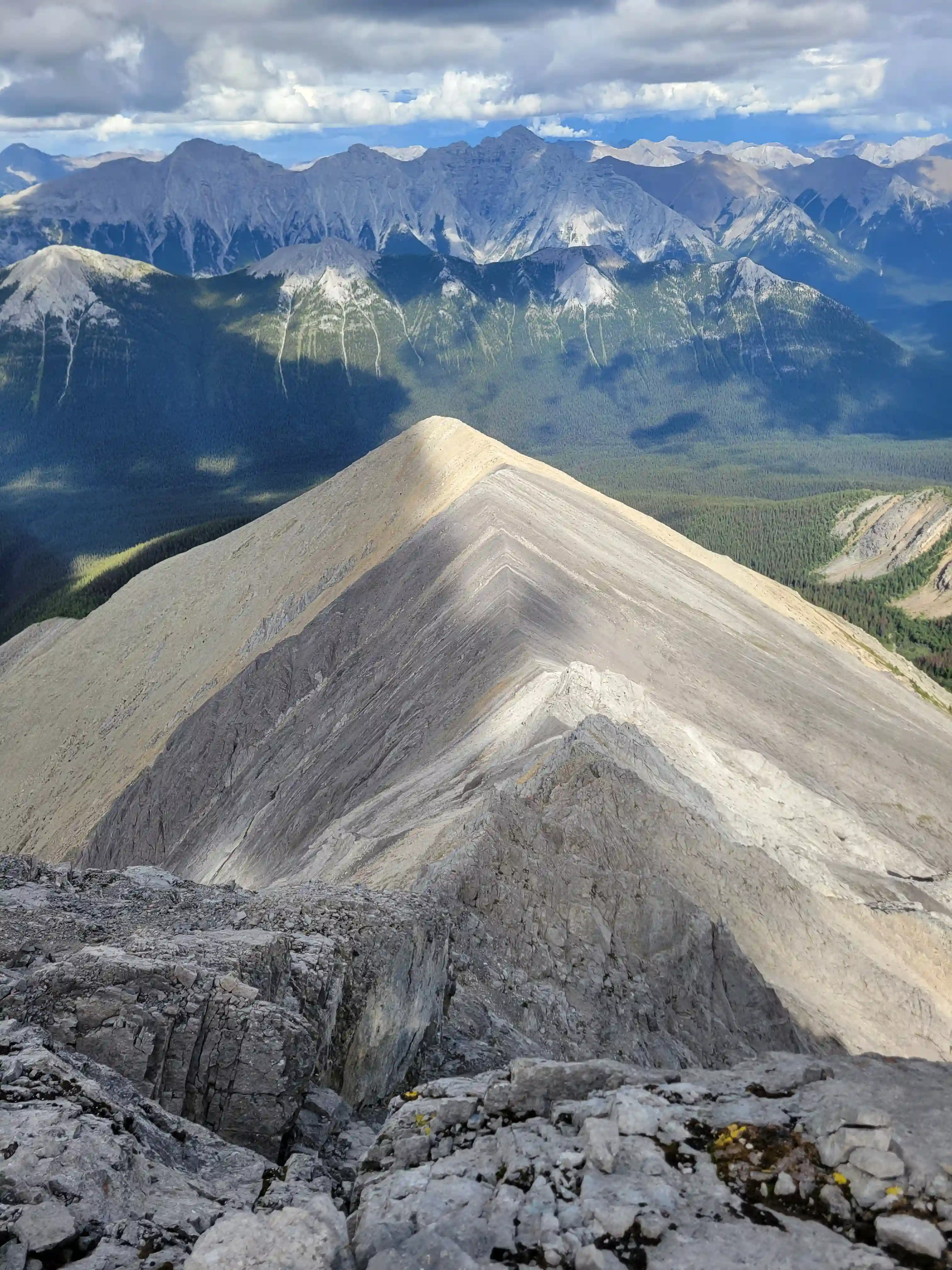
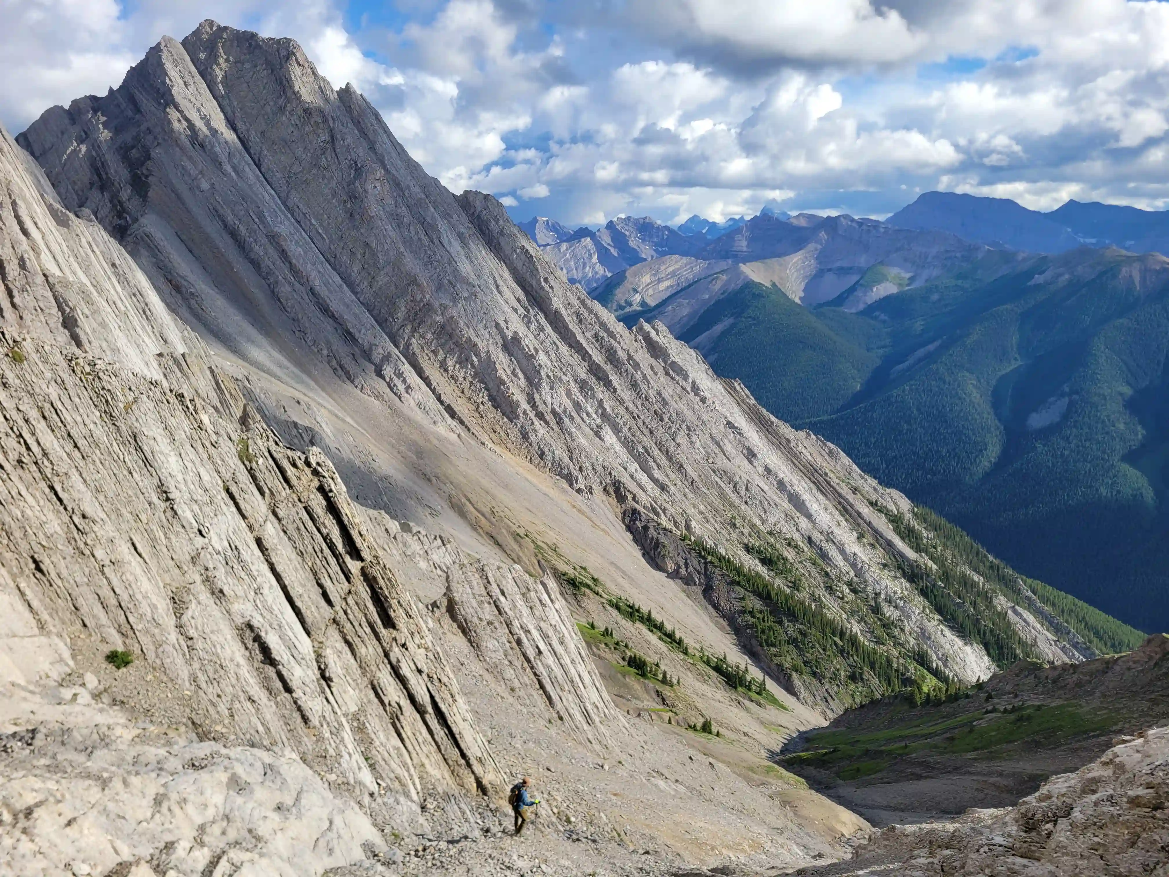
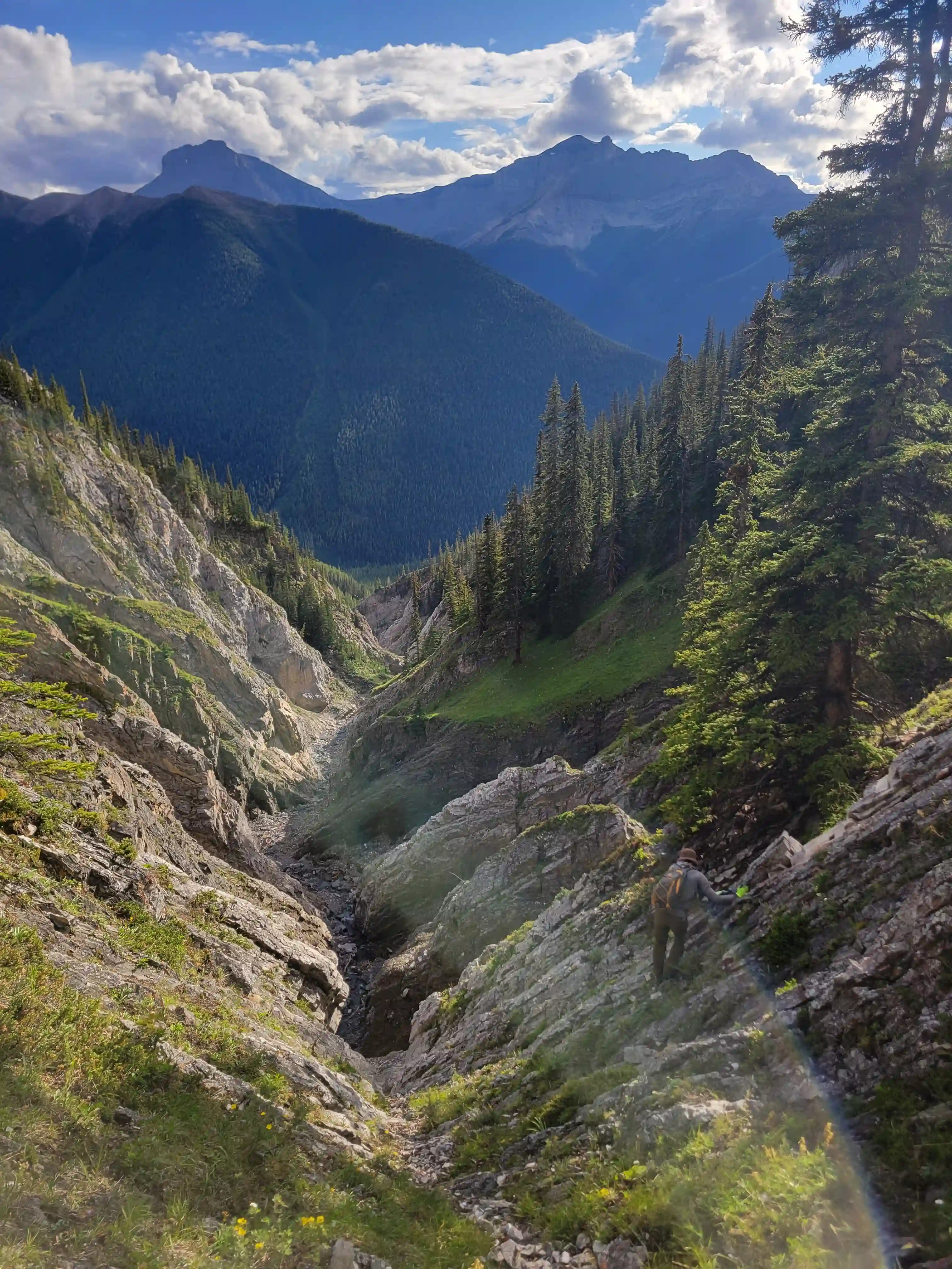
The true crux of the exit for Sundance Peak was probably the getting back to Brewster Creek Trail section. Devan and I were hoping that we could just follow the drainage below the peak back to valley bottom but the mountain had other ideas and we ran into a number of cliffy features as we descended and eventually were convinced it would get worse so we had to do a tedious amount of sidehilling north to get out of the guts of the drainage and finish the descent with some bushwhacking before we regained the trail. Once back on the trail the long plod out began and we were especially annoyed with the horse trail by this point. We had about 15km to cover including the biking section and the nasty state of the trail definitely didn't help to speed things up. We ended up reaching the bikes by around 8pm which wasn't the best sign, and despite our best efforts we got benighted during our bike out and ended up walking the last kilometer or two before reaching the lot.

From the pictures I had seen of Sundance Peak beforehand I definitely didn't think the line Devan and I took would've gone but the route goes and it's relatively enjoyable besides the crappy loose section near the top. Our time spent on Brewster Creek Trail was definitely the worst part of our day so if I were to do Sundance again I'd get onto the Sundance massif as early as possible and traverse to the main peak from there, but the exit will still be gnarly with that strategy given that Sundance Pass to the NE is often closed because it's a wolf habitat making Brewster Creek the only realistic way out unless you reverse all the ridge!
Pretty sweet exploring such a wild looking and seldom visited peak near Banff! This was my first technical peak of the year that wasn't an 11000er but it was well worth it! It wouldn't be the last thought as less than a month and a half later Devan and I ended up teaming up for one of the
most iconic peaks near Canmore
and made for an epic wrap to my peak bagging season!
Other related trip reports:
Mount Birdwood
||
Mount Robertson |
Wetterspitze | Cima del Tempo |
Chancellor Peak |
The Armchair Traverse
Other Sends
© Haldan Borglum | Peak by Peak. All rights reserved.