

Mount Woolley & Diadem Peak
February 11-12 2026
Just north of the Columbia Icefield, Woolley and Diadem make up 2 of the 58 11000ers of the Canadian Rockies and given their close proximity to
Mount Alberta
and the black hole beneathe
The Twins
they provide some fantastic summit views when conditions are right. In the grand scheme of 11000er approaches they're pretty good being only about 7km west of the Icefields Parkway as the bird flies with a decent amount of traffic but the Sunwapta River crossing to start off the day can prove challenging depending on the time of year you go for these peaks.
While Woolley and Diadem certainly can be day tripped by fit parties the east facing nature of the most frequently done routes on these mountains makes an early start crucial especially in early season so two days allows for a more lenient start time.
I hadn't been expecting to get out on an 11000er trip in 2026 until March-April but with avy conditions in the green, some surprisingly spring-like conditions for February, and a couple days with decently low cloud cover and high pressure to work with I thought a winter ascent of Woolley and Diadem could go and with Rob Walker who I had team up with for the first time a week before on a chill alpine outing available on last second notice we were headed for the Icefields Parkway!
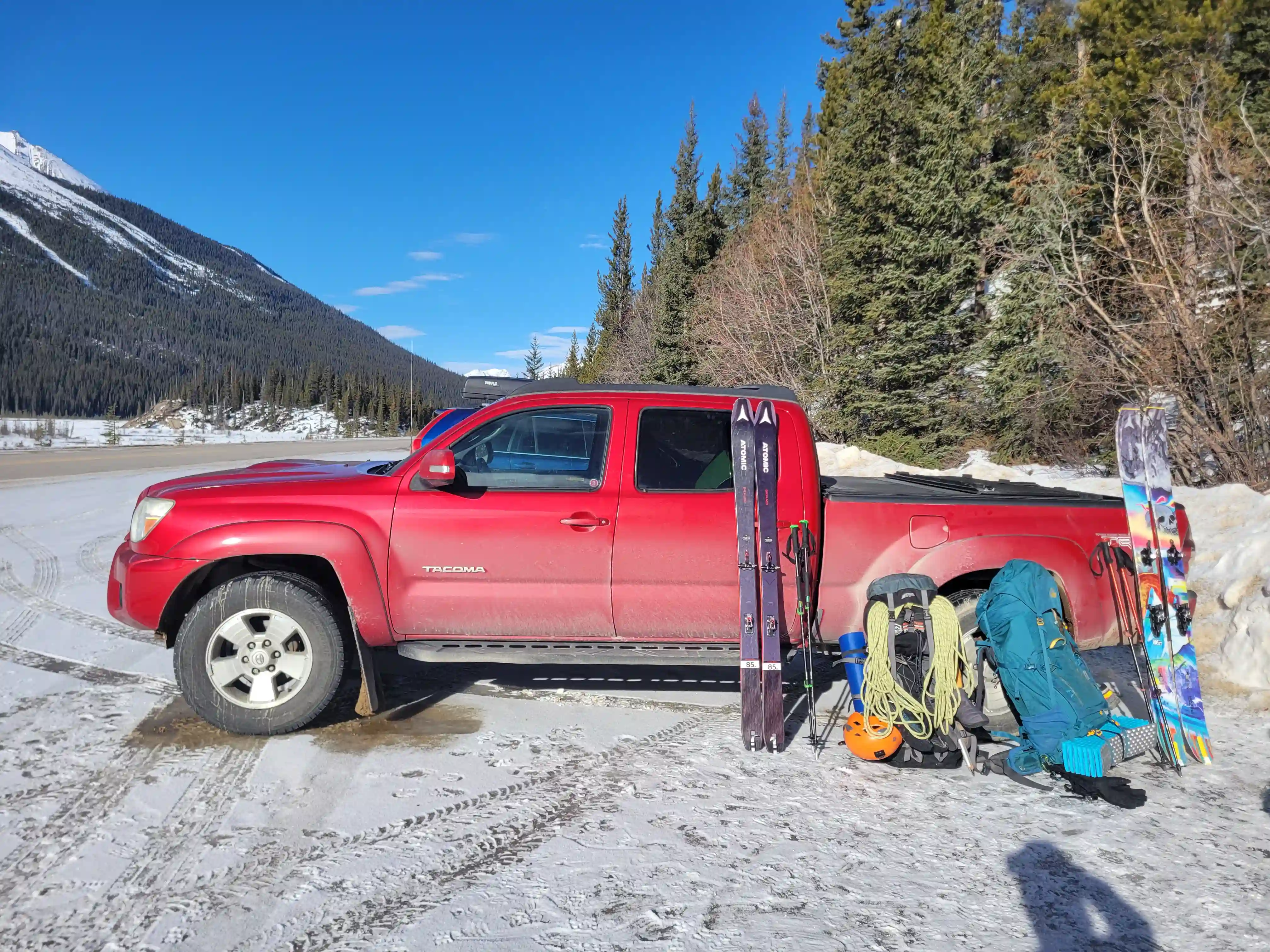
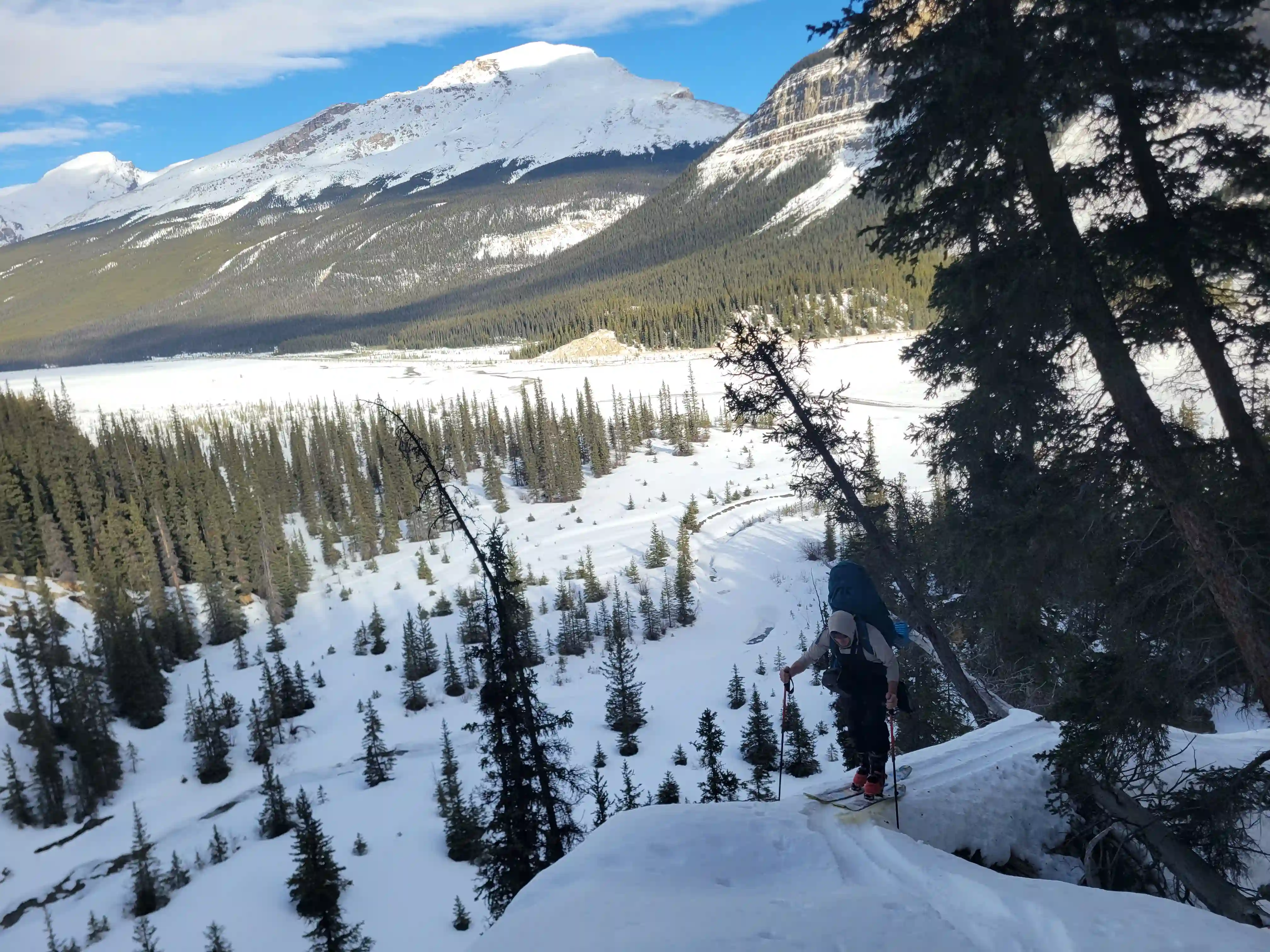
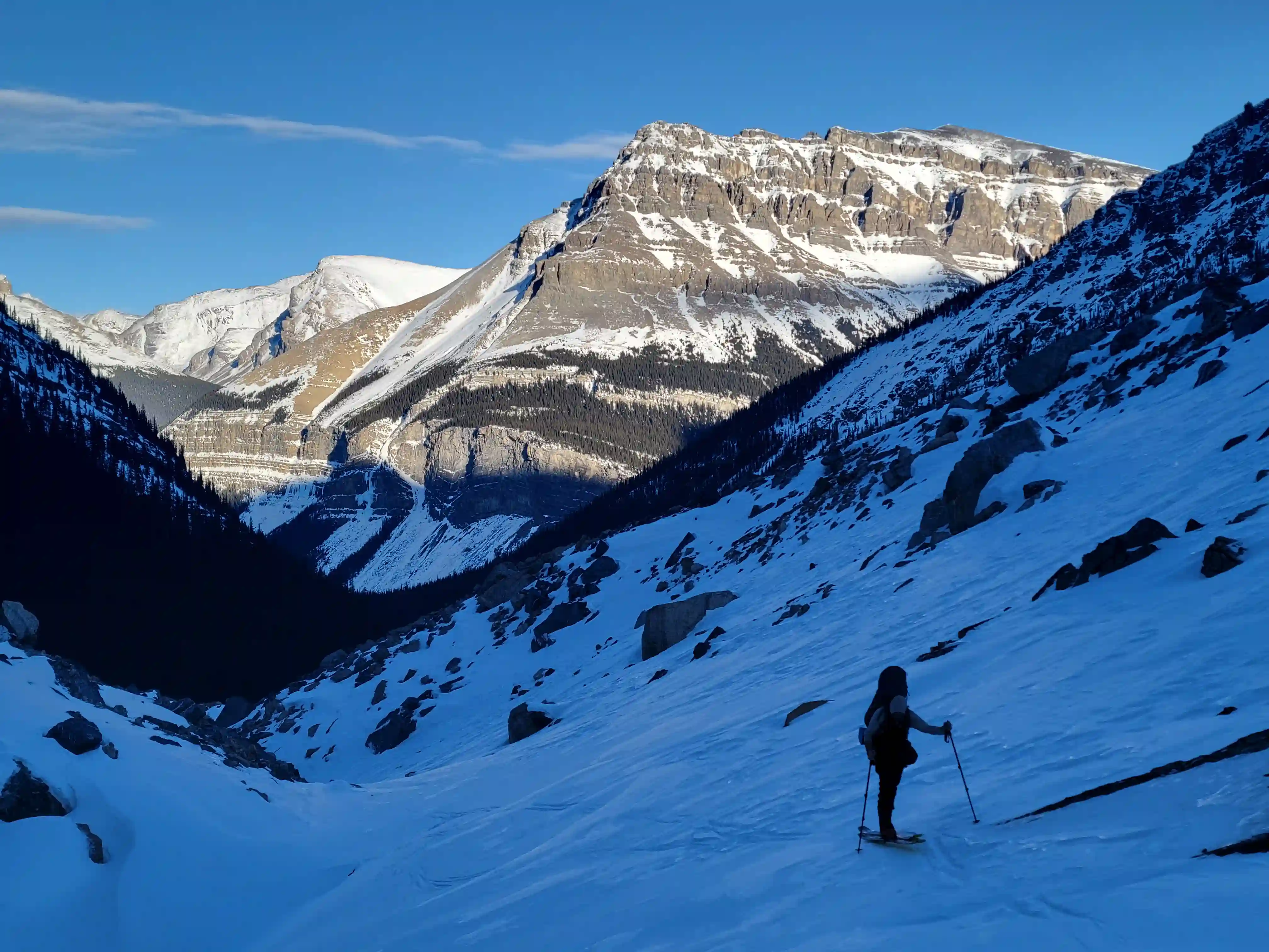
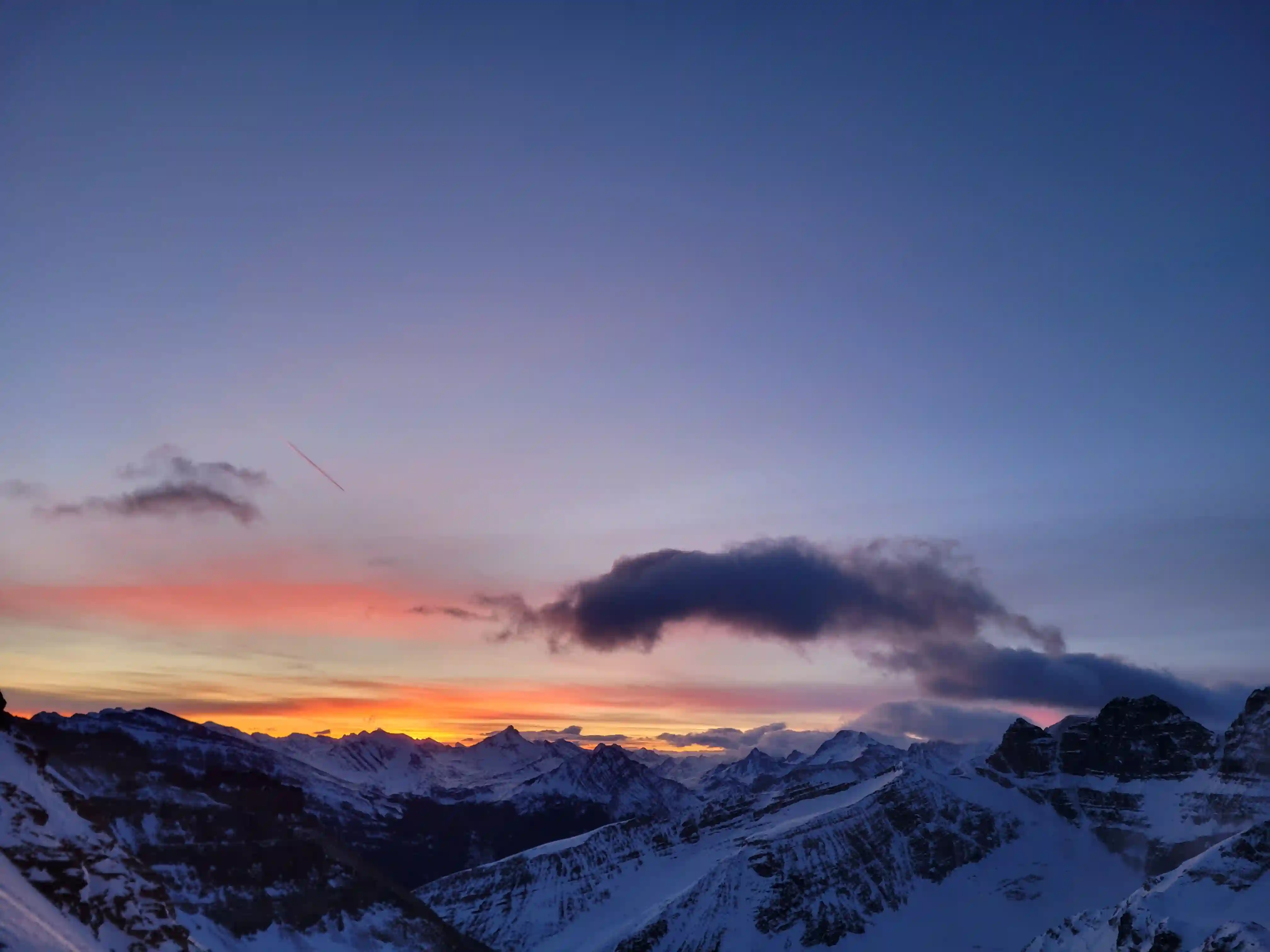
Conditions were mint for our drive in so in hindsight this would've been the day to ascend the peaks but the forecast still had good conditions for the following day so we had our fingers crossed it would be more of the same. As we neared the start point along the highway we tried scoping out the mostly snow-covered Sunwapta River to see if we'd need to do any frigid winter crossings but we couldn't tell from afar so water crossing shoes were on our packs when we started. After getting all the gear ready and donning the skins we started across at 2pm and to our surprise the Sunwapta River was completely bridged with a set of tracks already set so we knew this would make our lives easier for the approach and ditched the water crossing shoes on a tree before continuing up the valley.
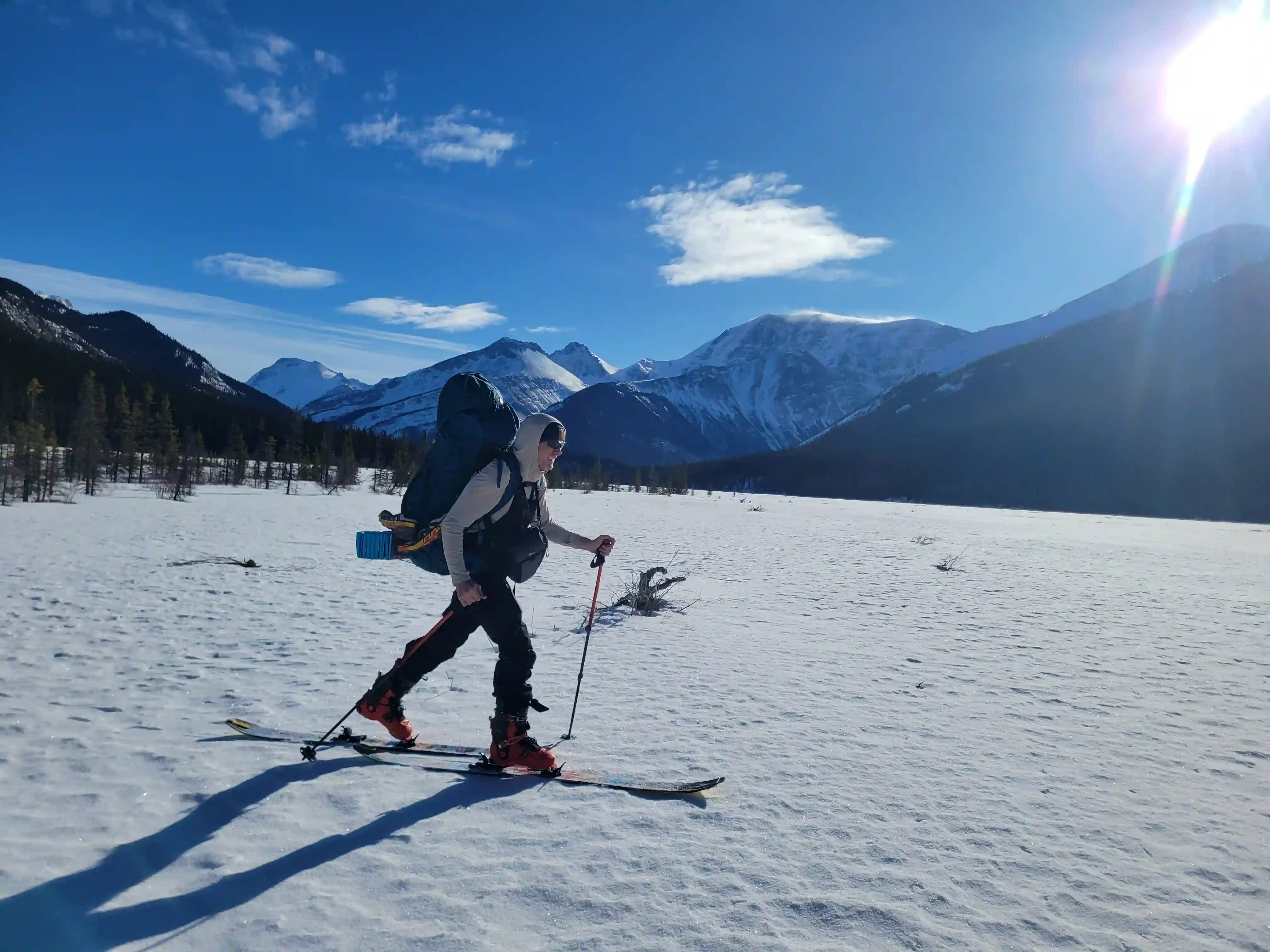
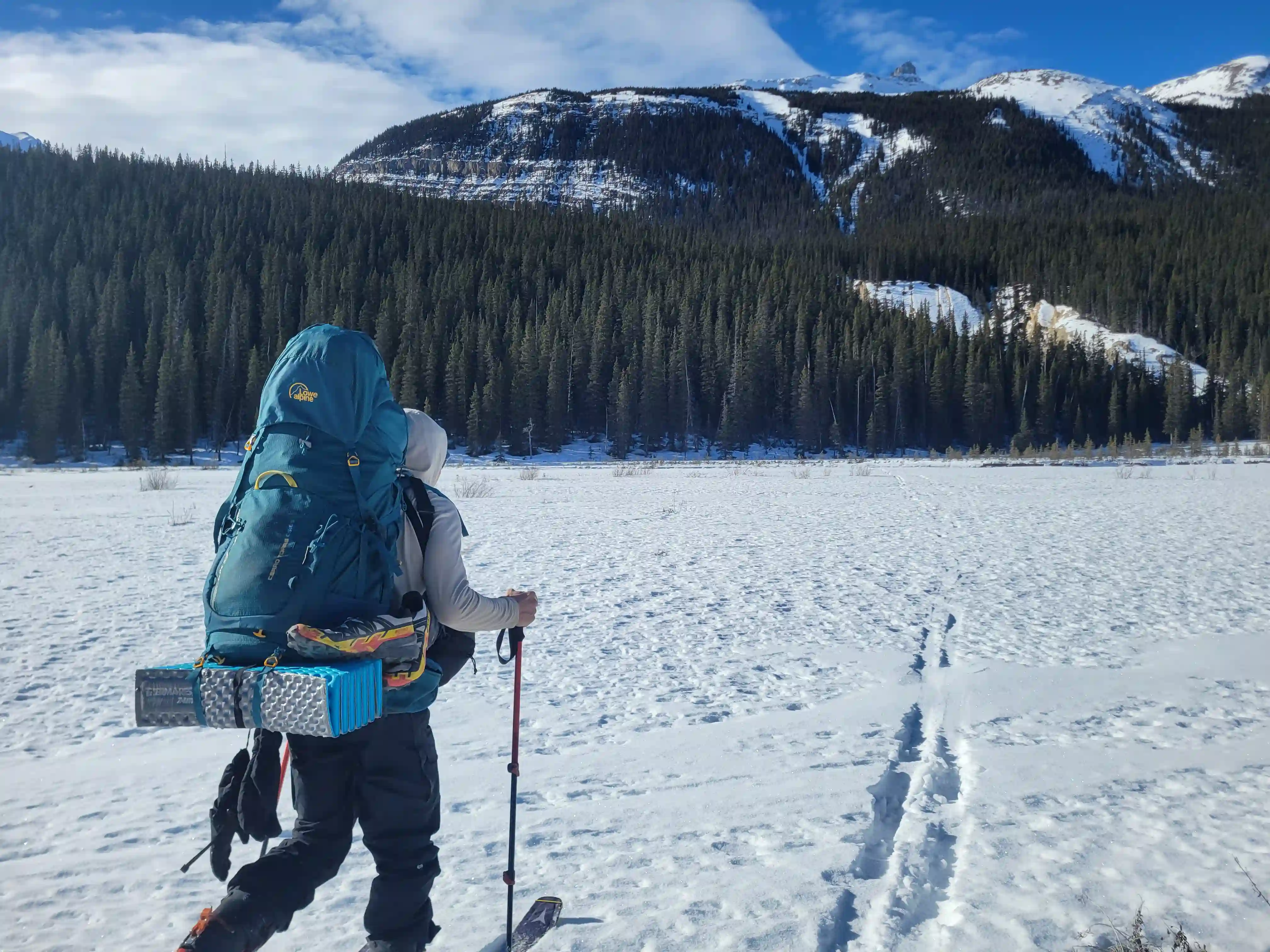
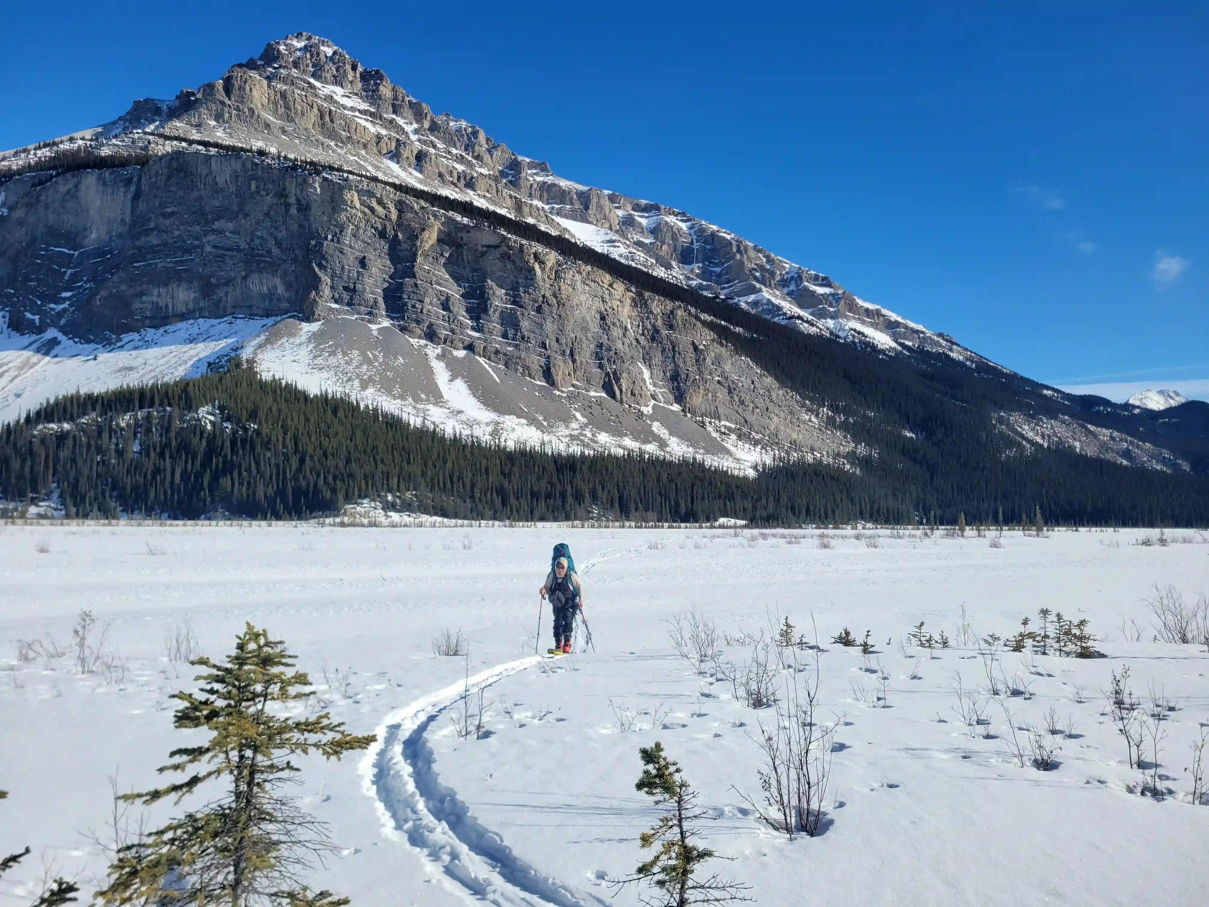
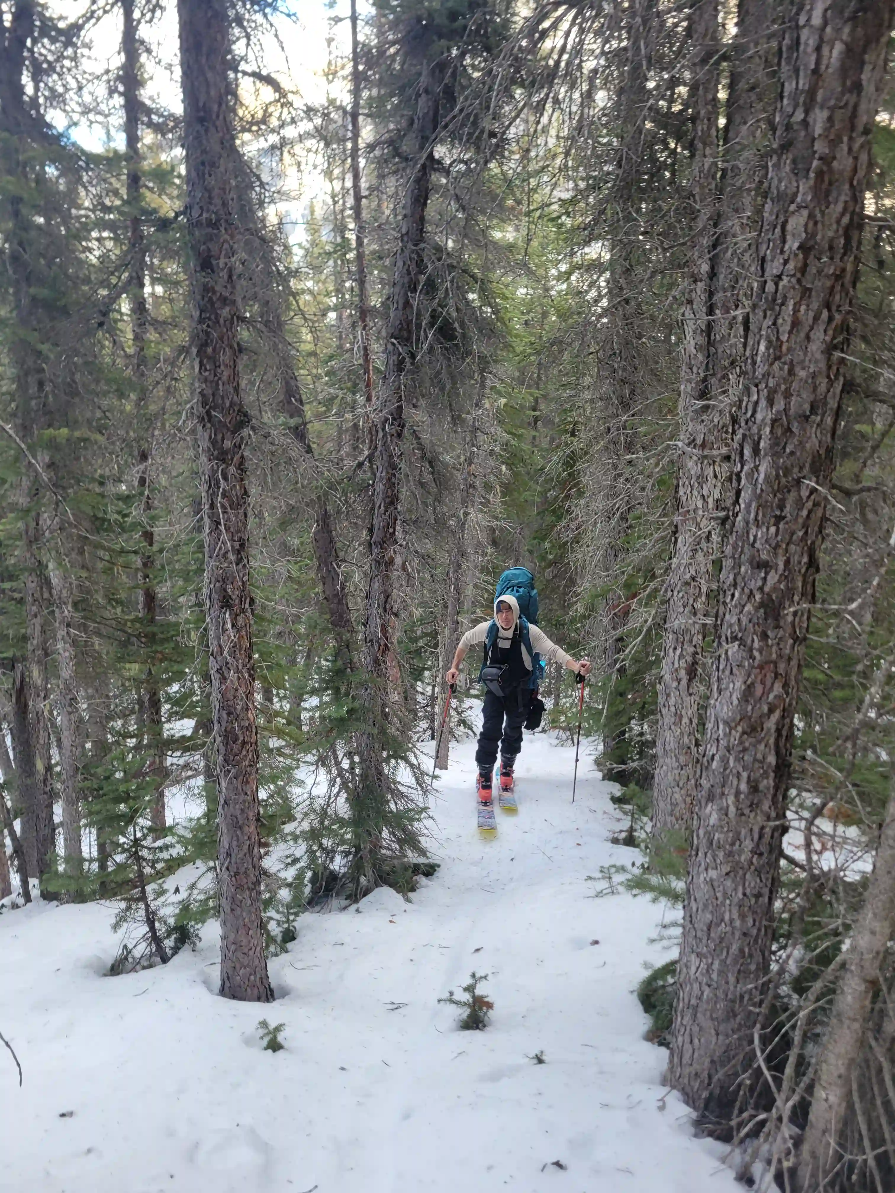
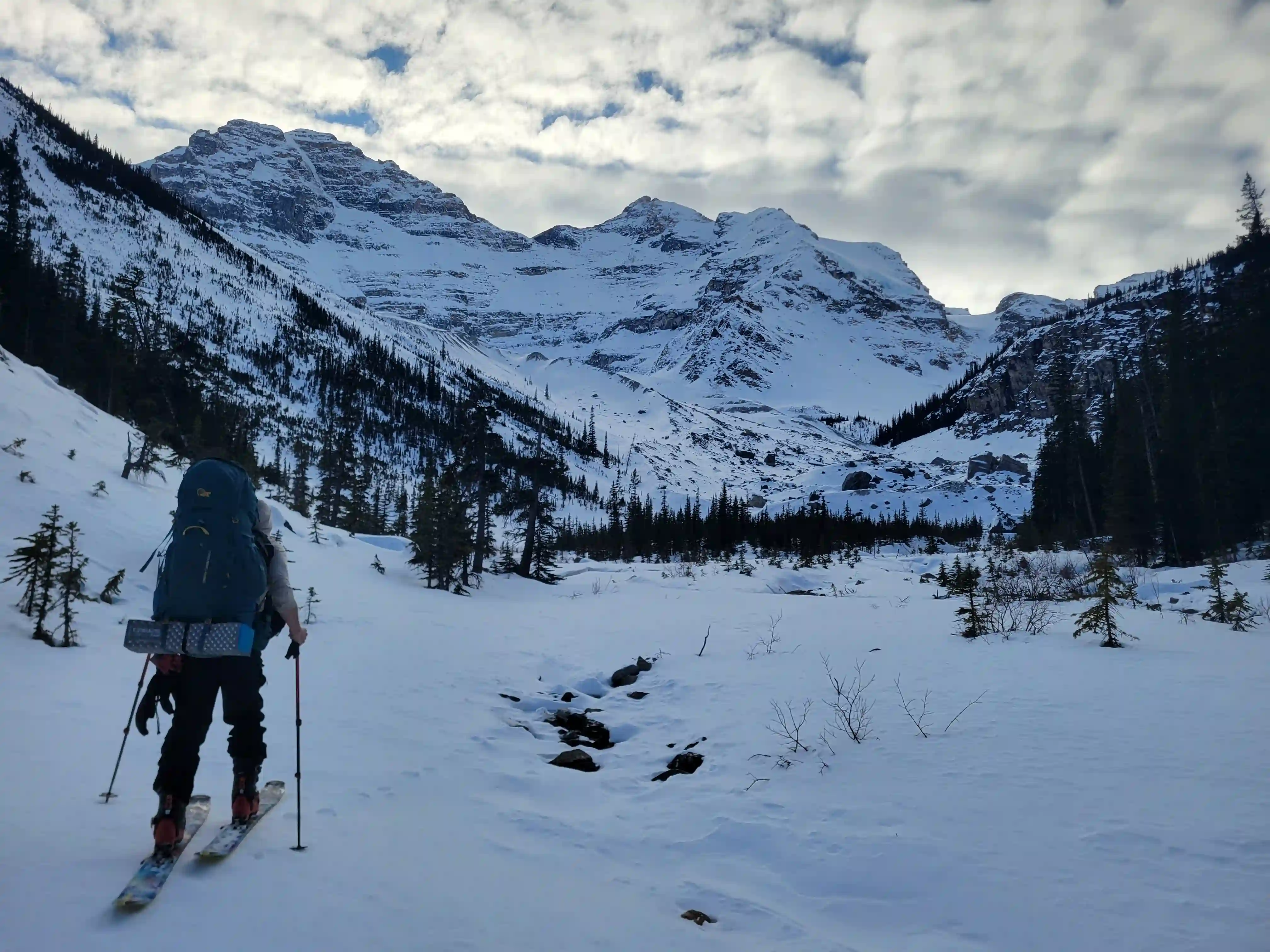
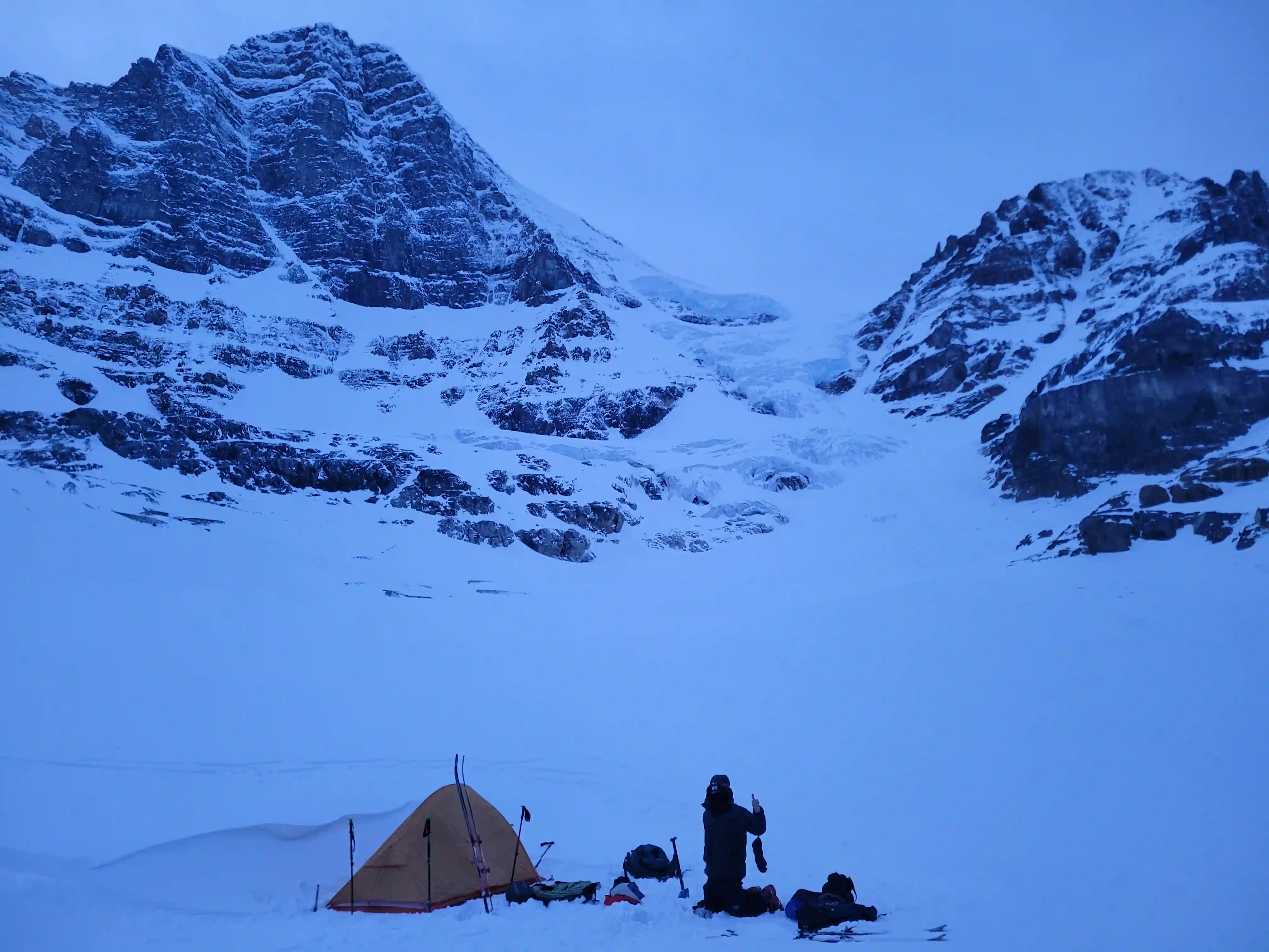
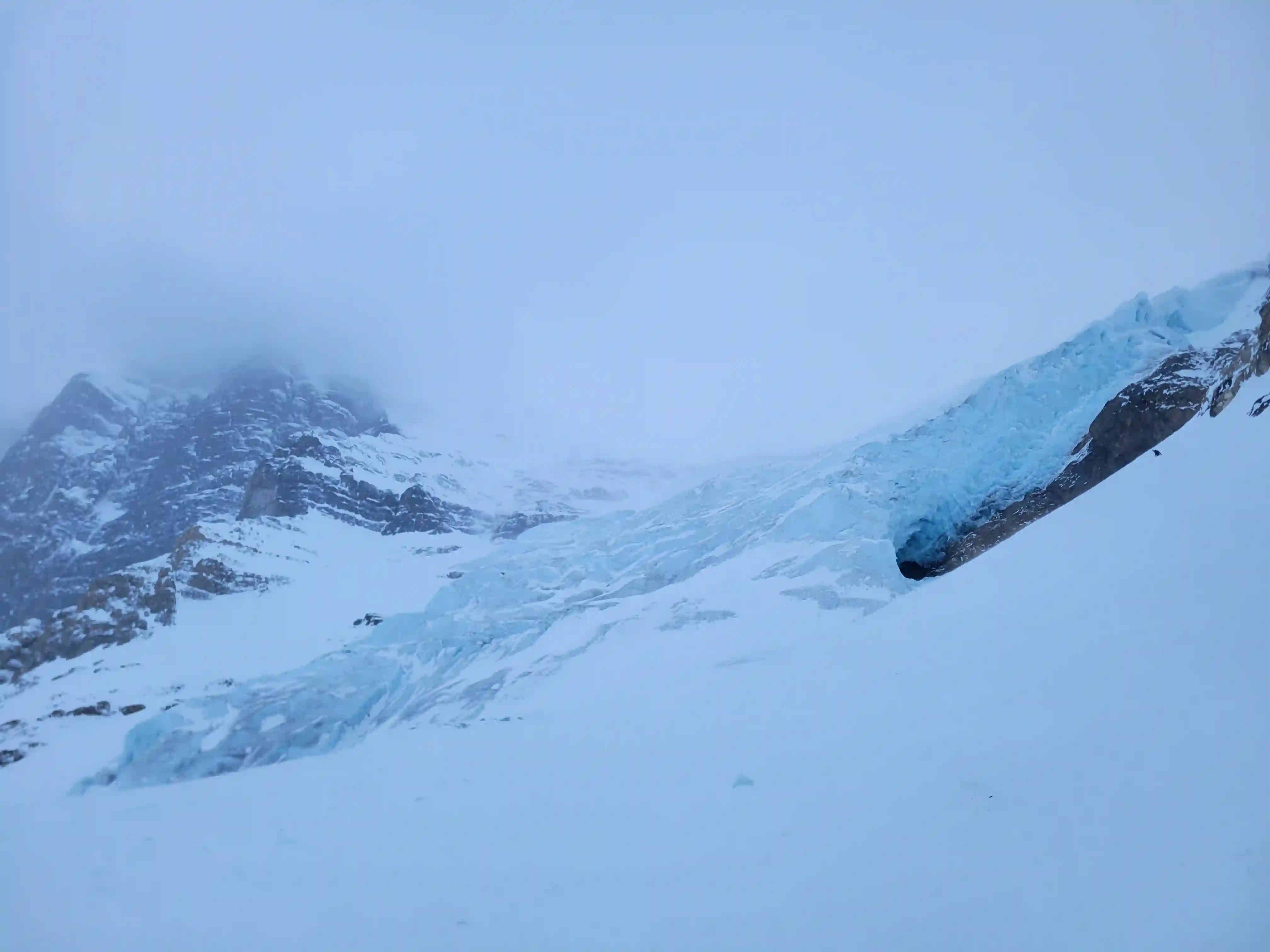
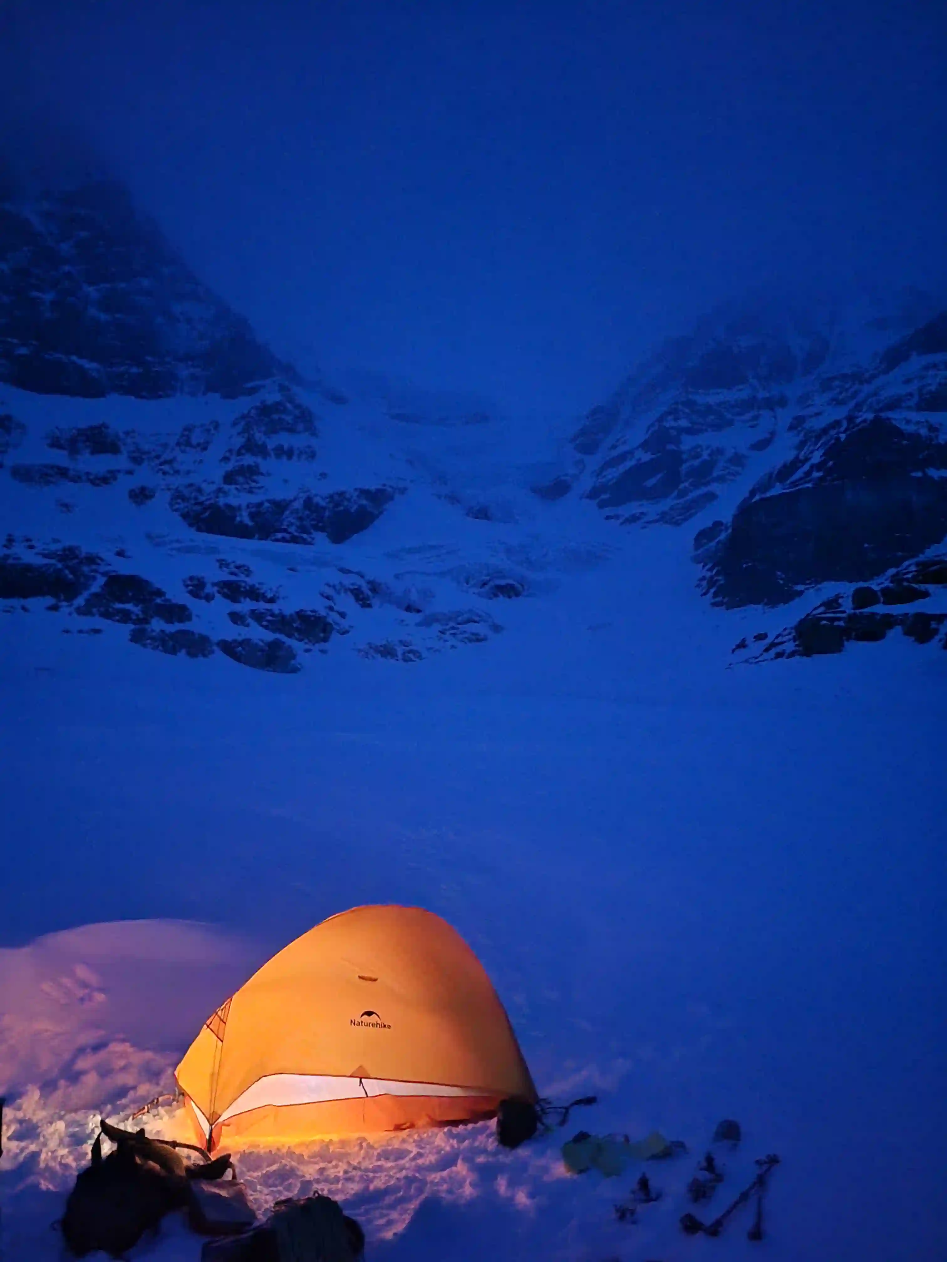
Following the Sunwapta River is one of the steeper sections of the approach and there was less snow in this area so the skin track meandered quite a bit. After the initial climbing section things flatten out for a while until another steep section with a boulder field but most of the annoying terrain was snow covered so this made for easy travel. After gaining the last steeper portion after this we just had the upper valley to get through where the views open up to Woolley and Diadem and not long later we had found a good wind sheltered camp spot next to the frozen tarn immediately below our objectives for the trip by 5:30pm.
links:
STRAVA
|
GAIA
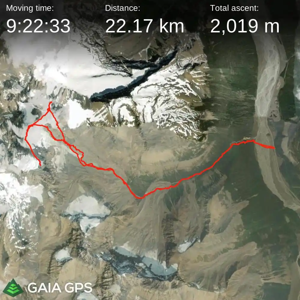
elapsed time: 33hrs
DIFFICULTY: AD-/AD, steep snow / ice climbing, 5th class, glacier travel, often multiday
Use the following links to jump to:
Follow the journey
I'll send you an email when a new trip report drops.
ramp for February
THE APPROACH
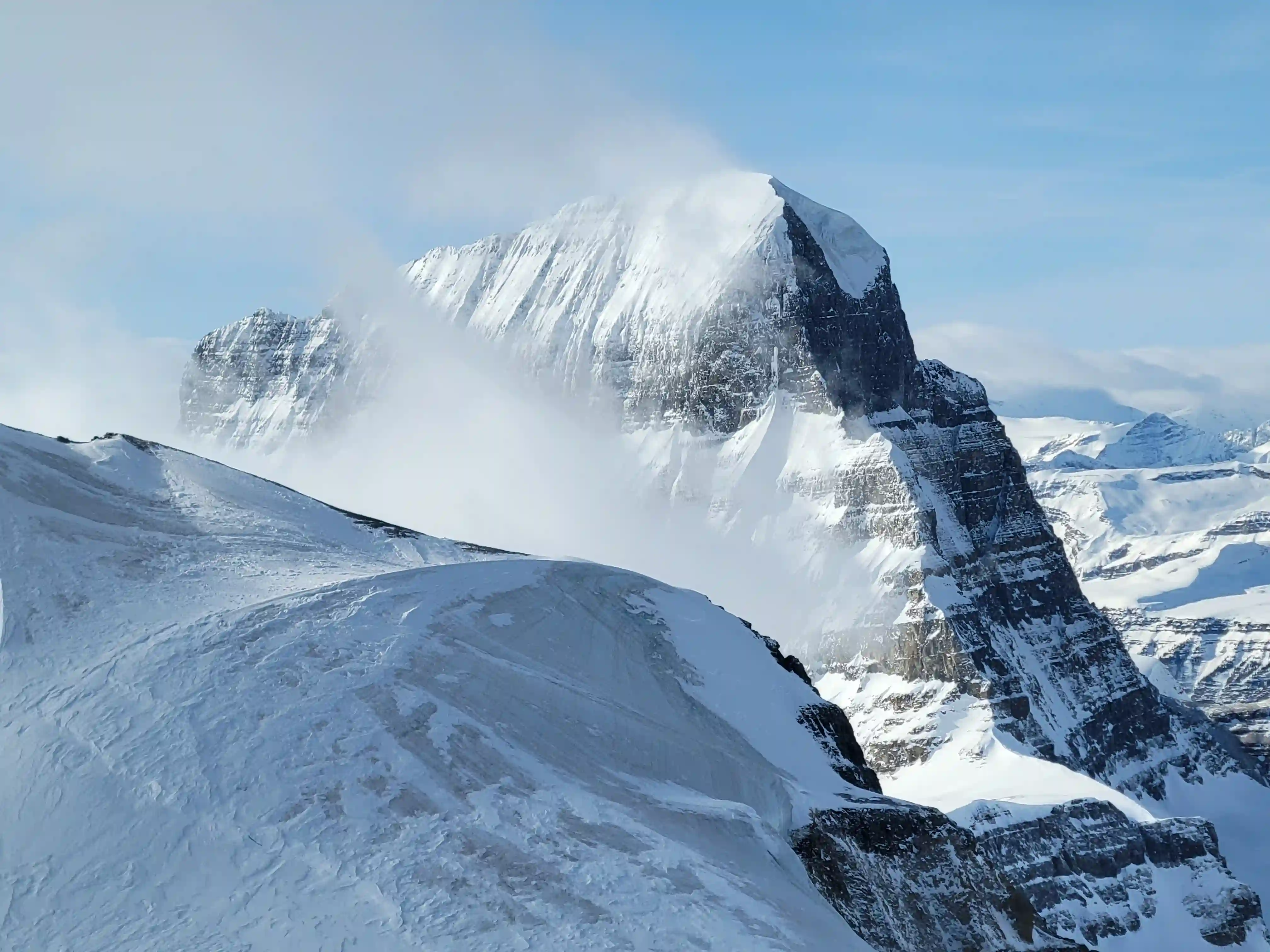
DIADEM PEAK
3371m, 11060ft
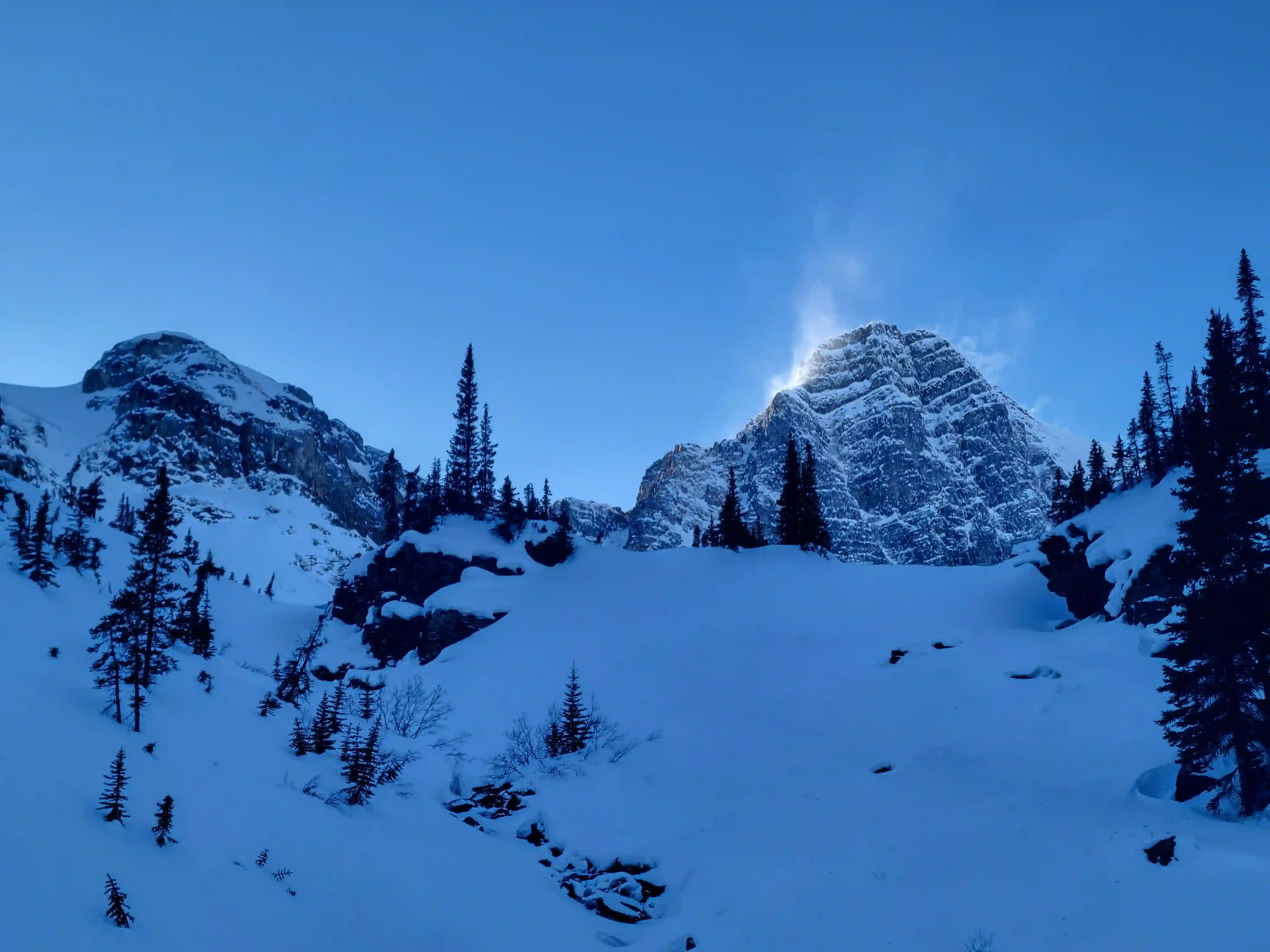
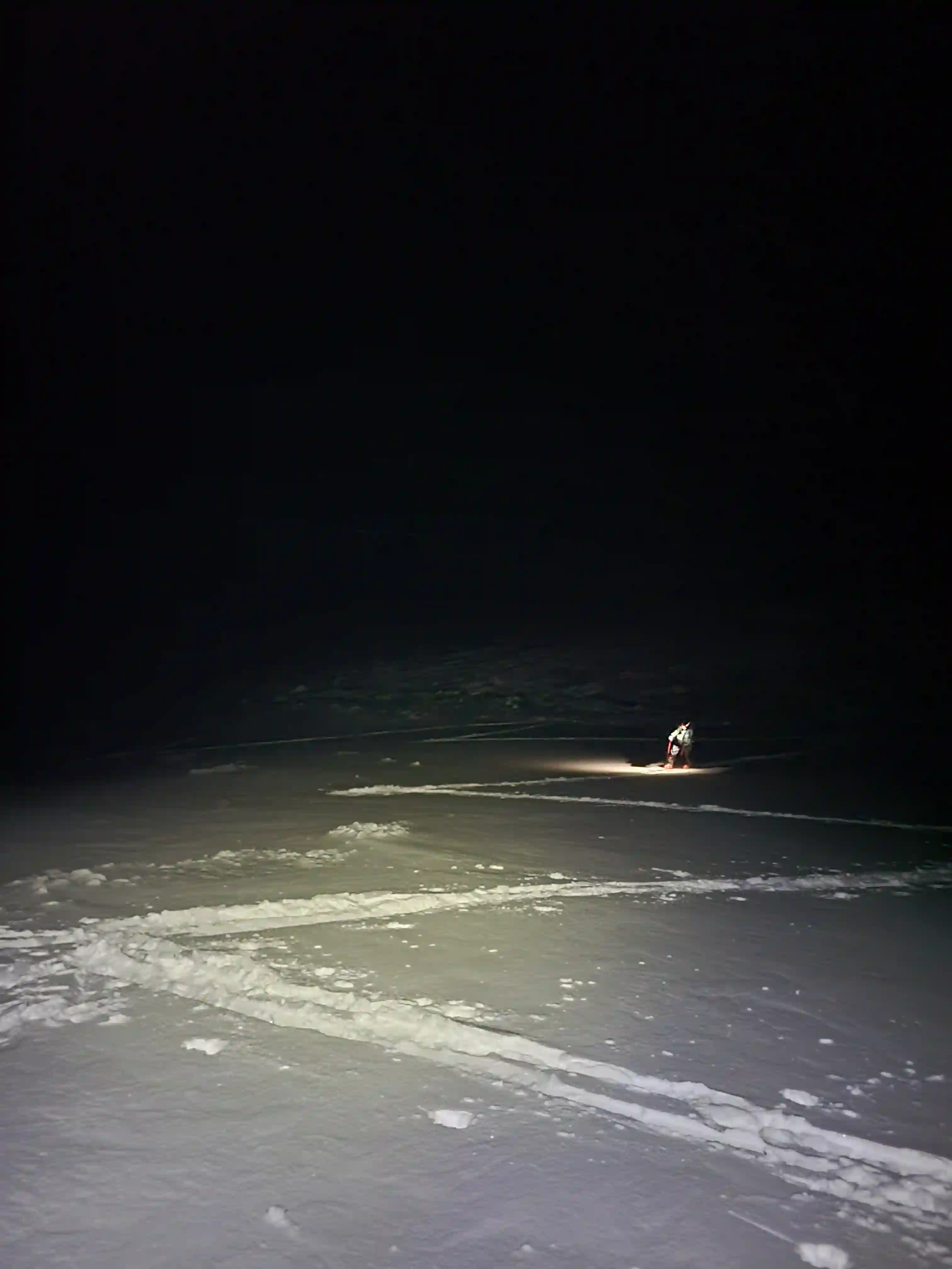
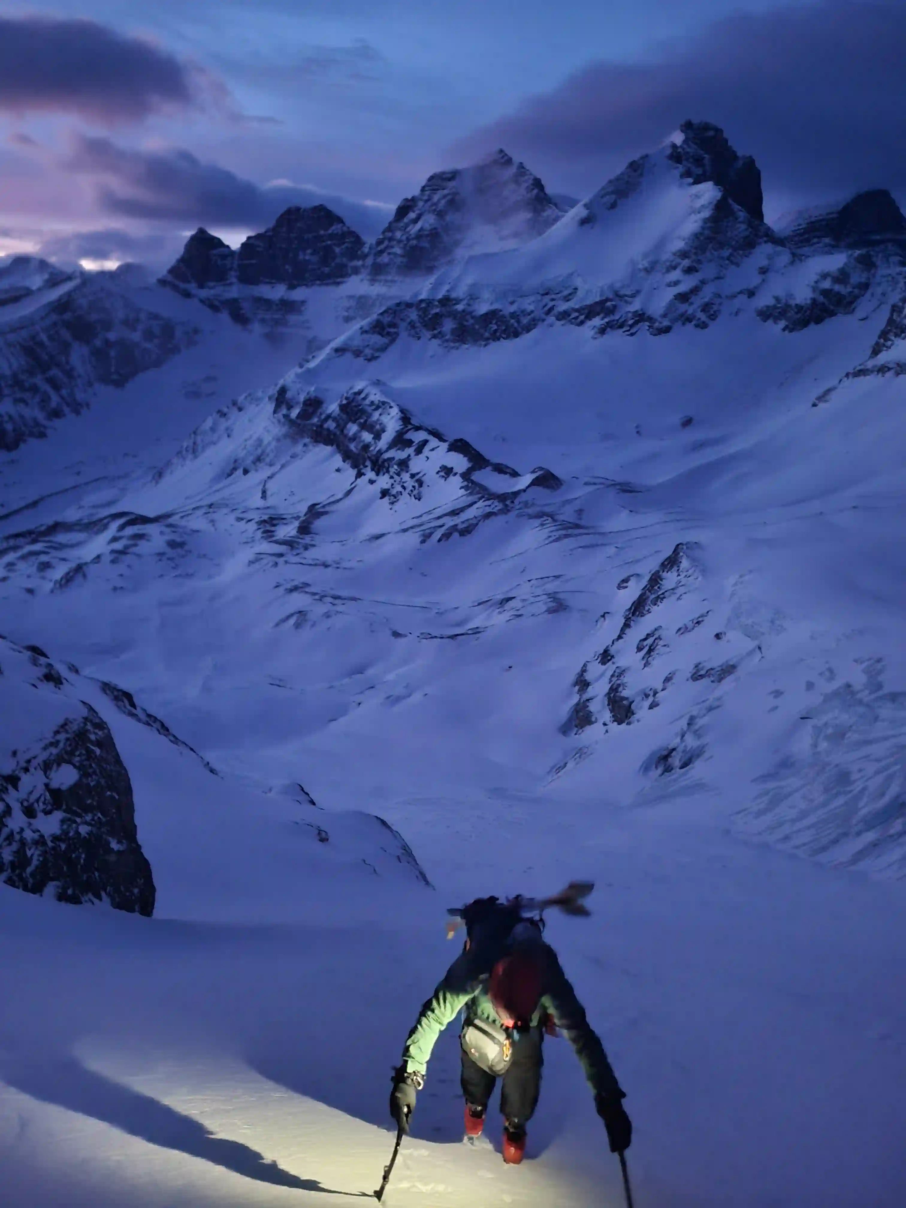
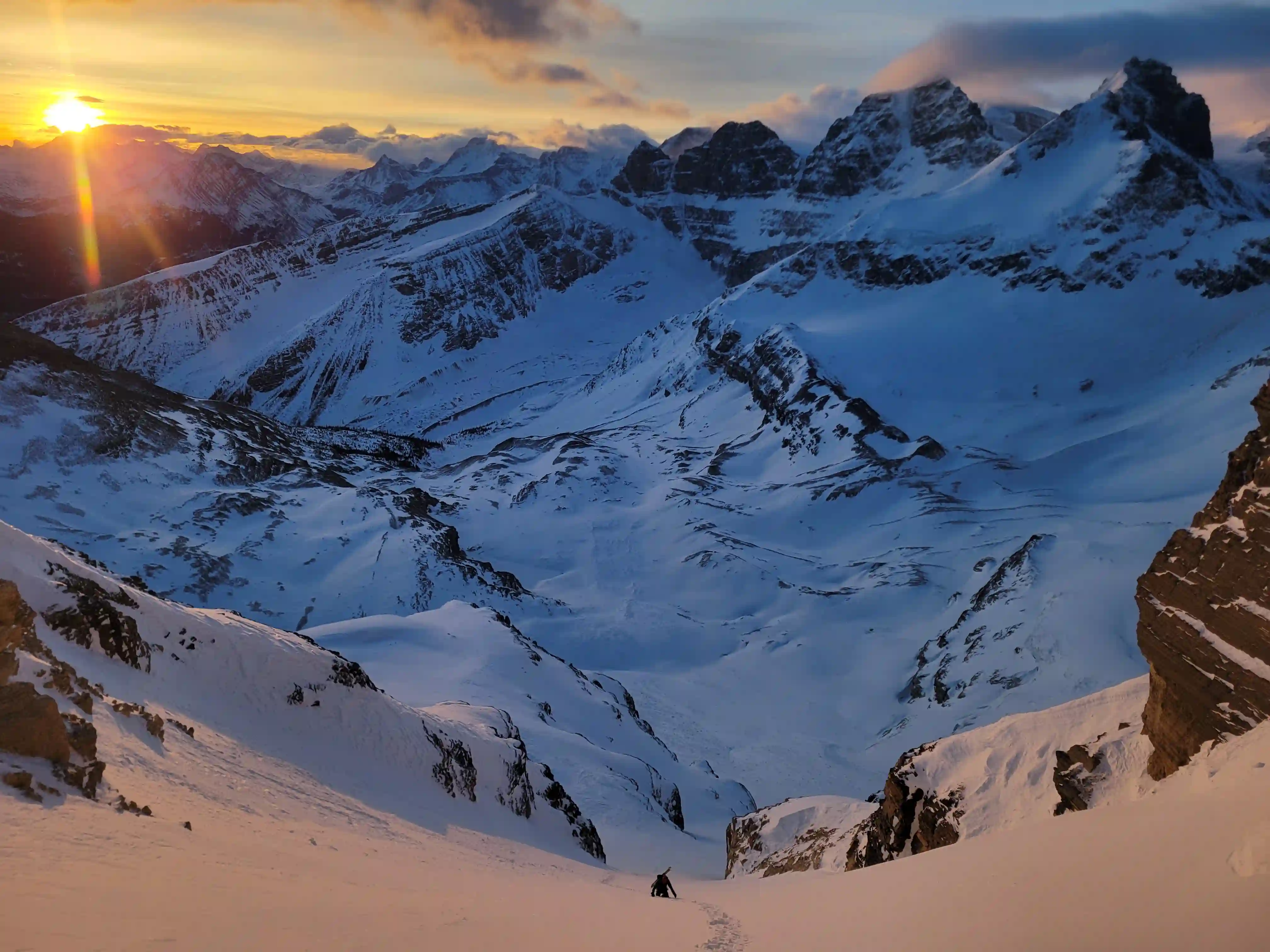
The spot we ended up picking to camp was pretty well wind sheltered which made things a lot easier. Additionally we were able to dig into the snow on the tarn for easy water access in the evenings so we didn't have to worry about melting a bunch of snow which was nice. With the short winter days we decided that around 5am was an early enough start time and after getting to bed early around 9pm we were well rested in the morning and started making our way towards Diadem's SE face direct couloir in the dark.
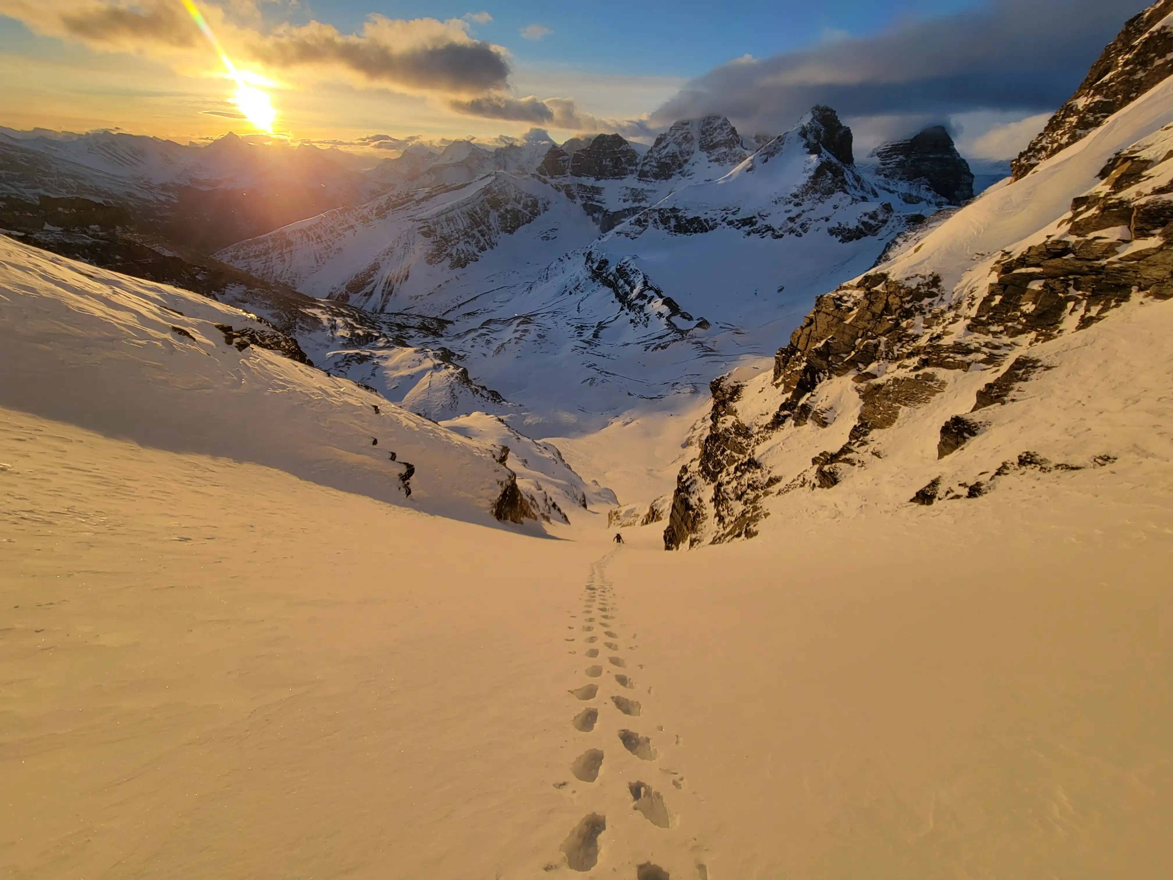
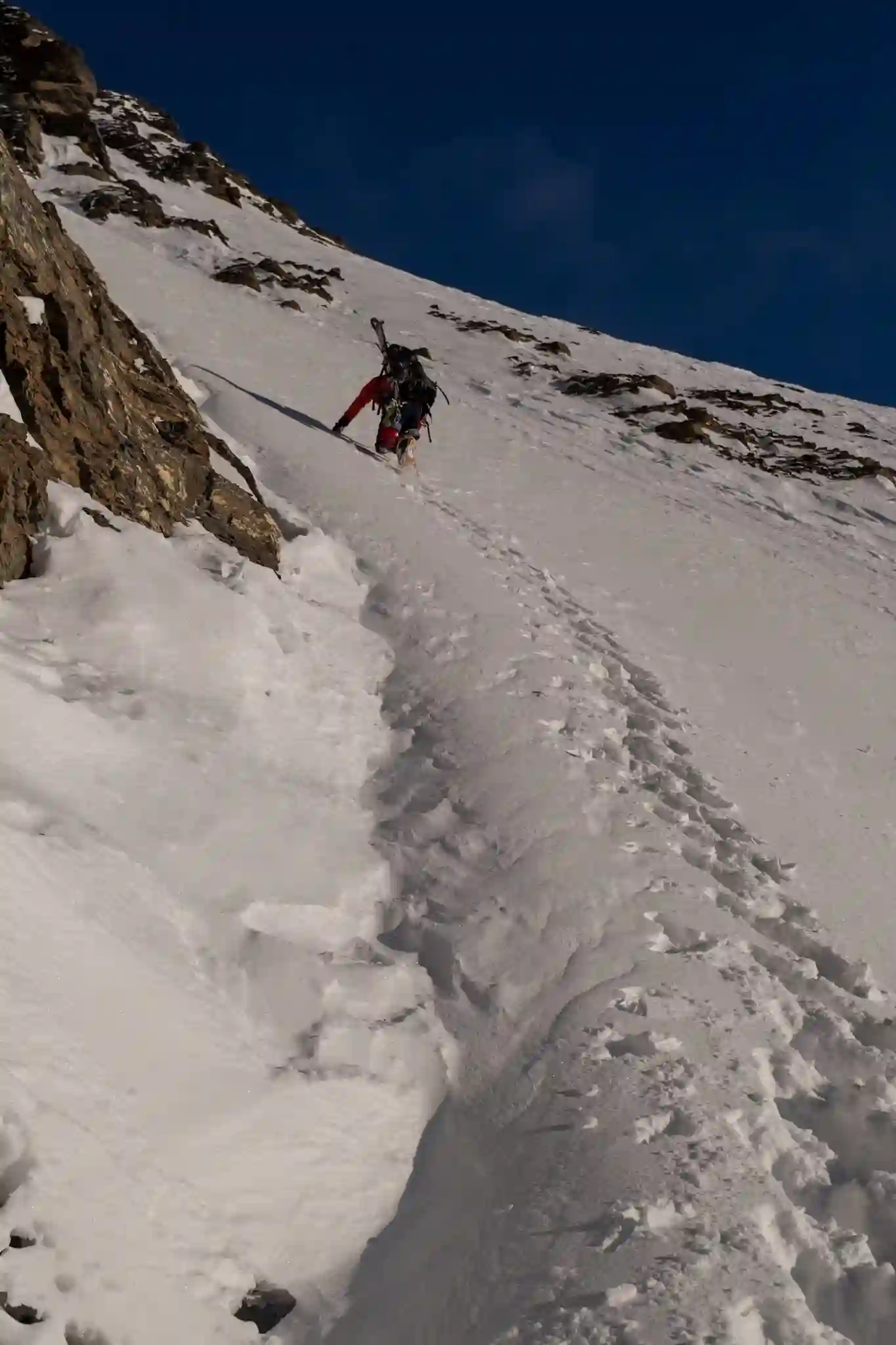
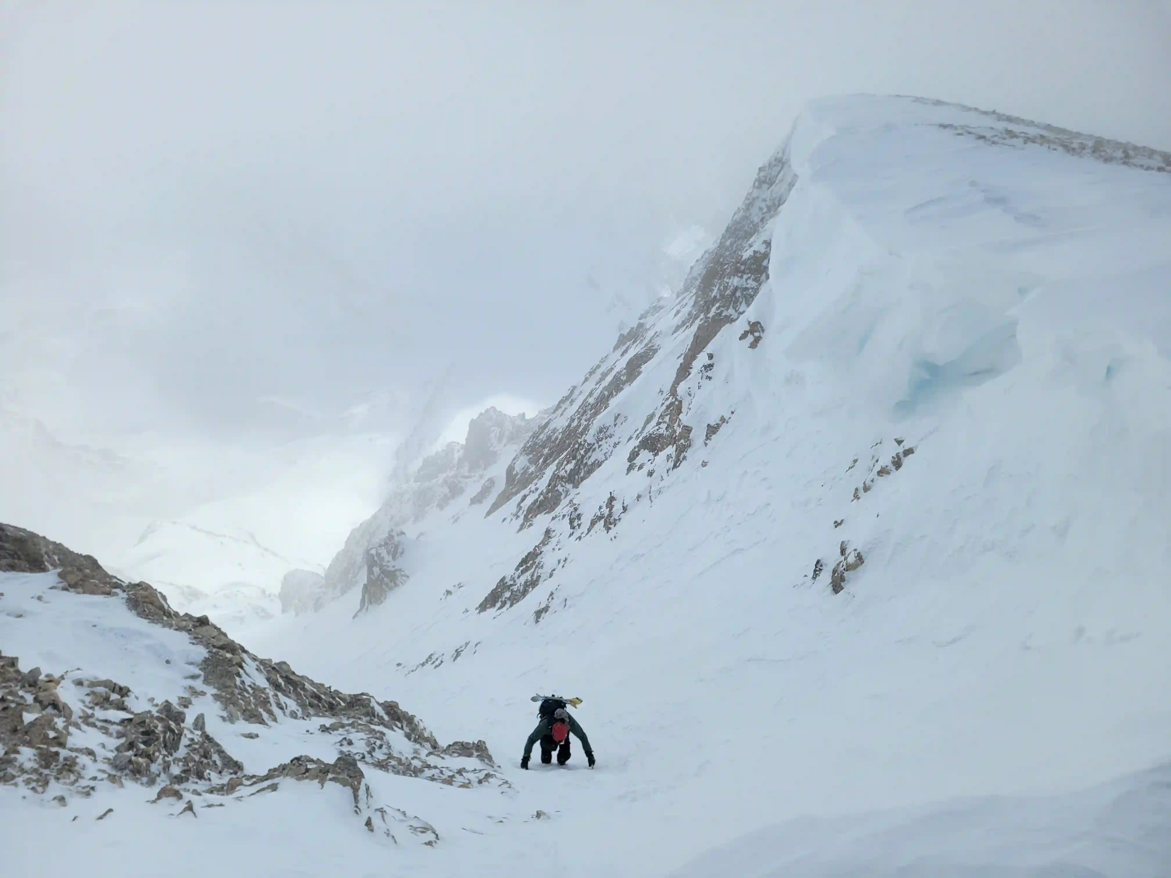
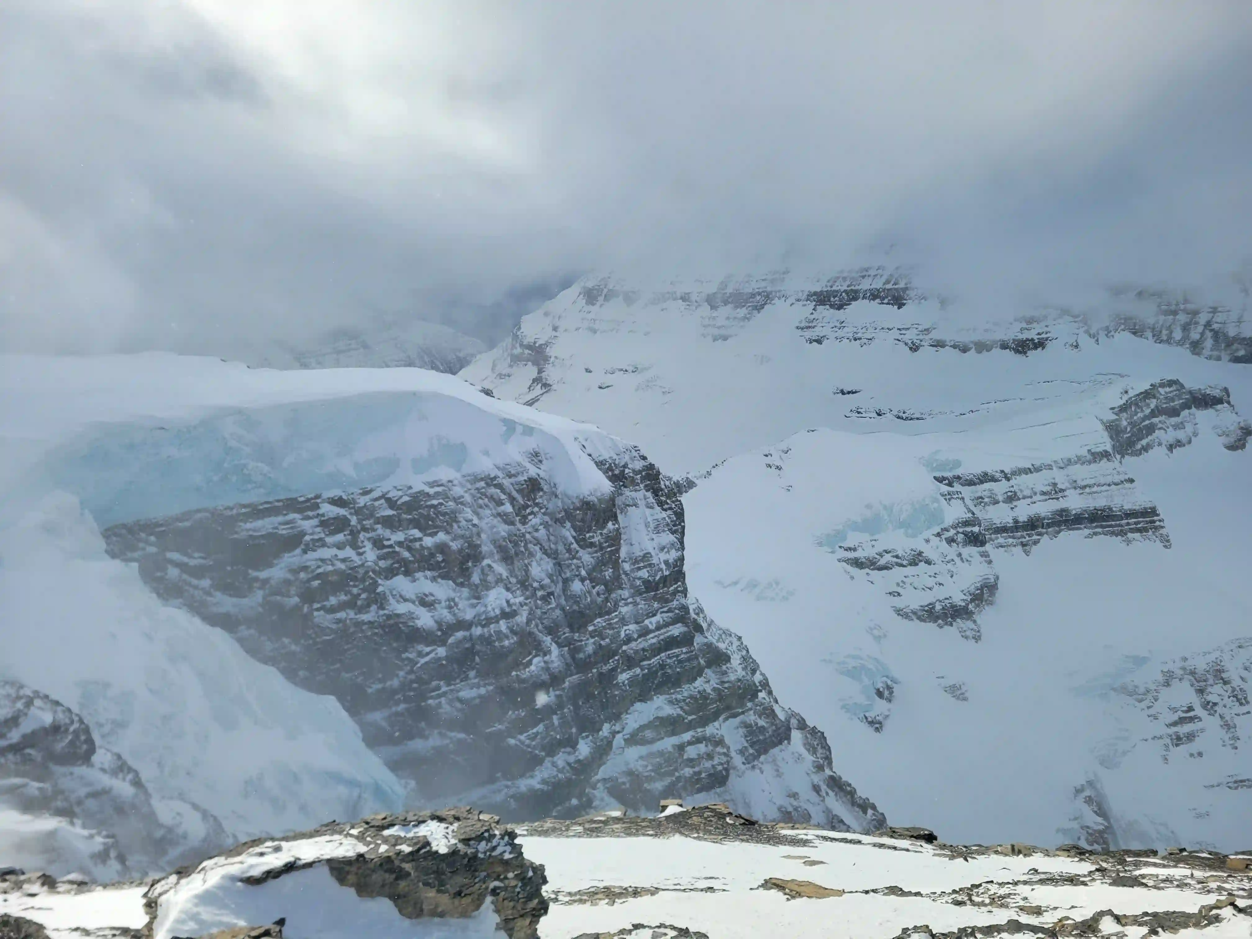
I had forgotten to download a GPS track leading into this trip so navigating in the dark was a bit trickier than it needed to be but turning off the headlamps allowed us to get a sense of direction and once we started getting close to the rocky features at the base of Diadem we were able to get our bearings and reach the start of the couloir relatively easily. There was a sizable icefall section below this slope before we started ascending and it definitely has some big slides so we were glad avy conditions were low risk.
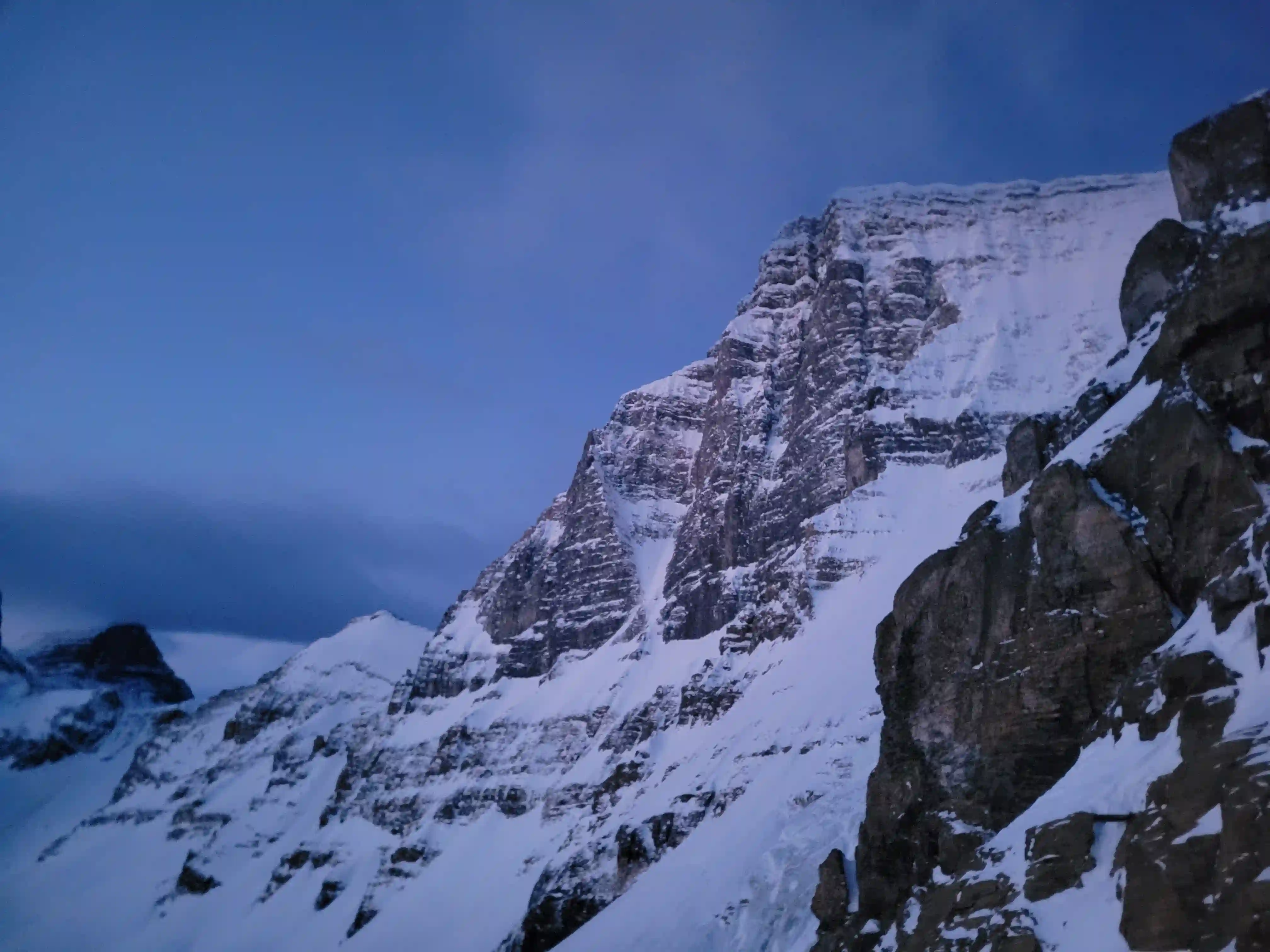
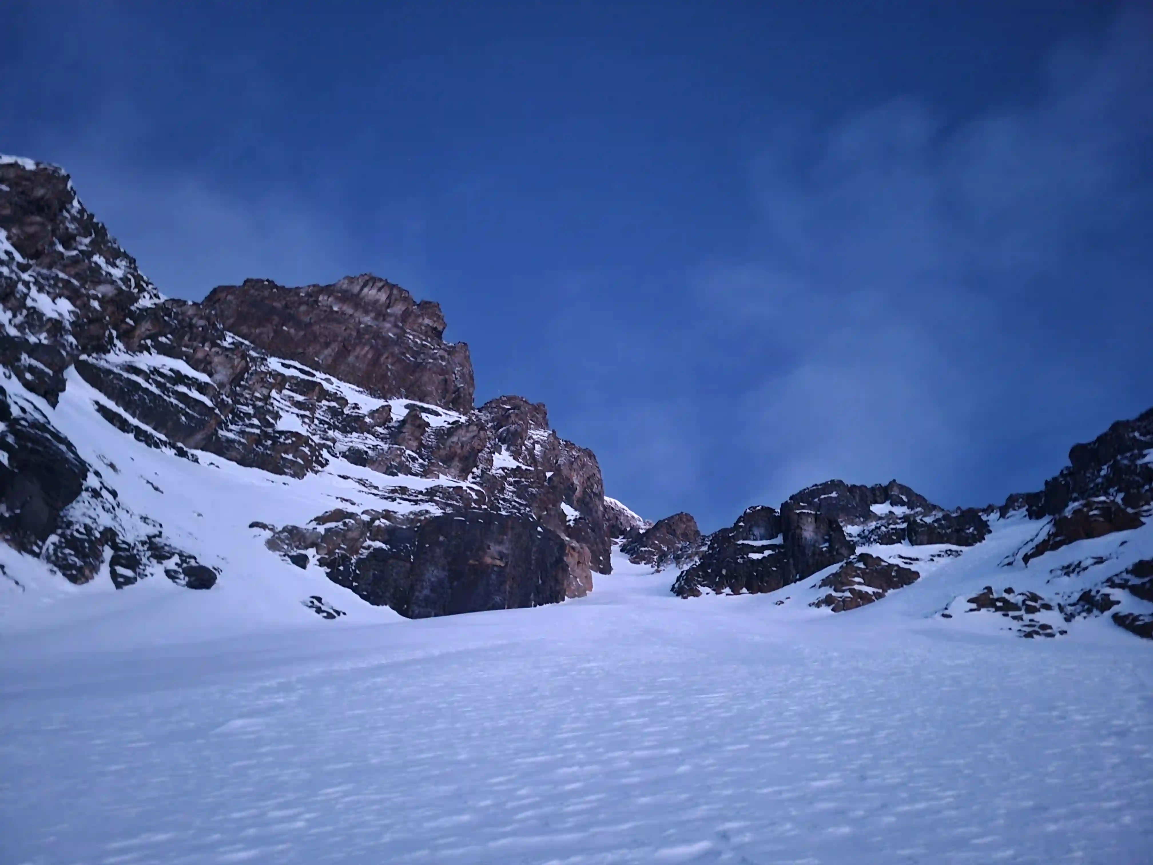
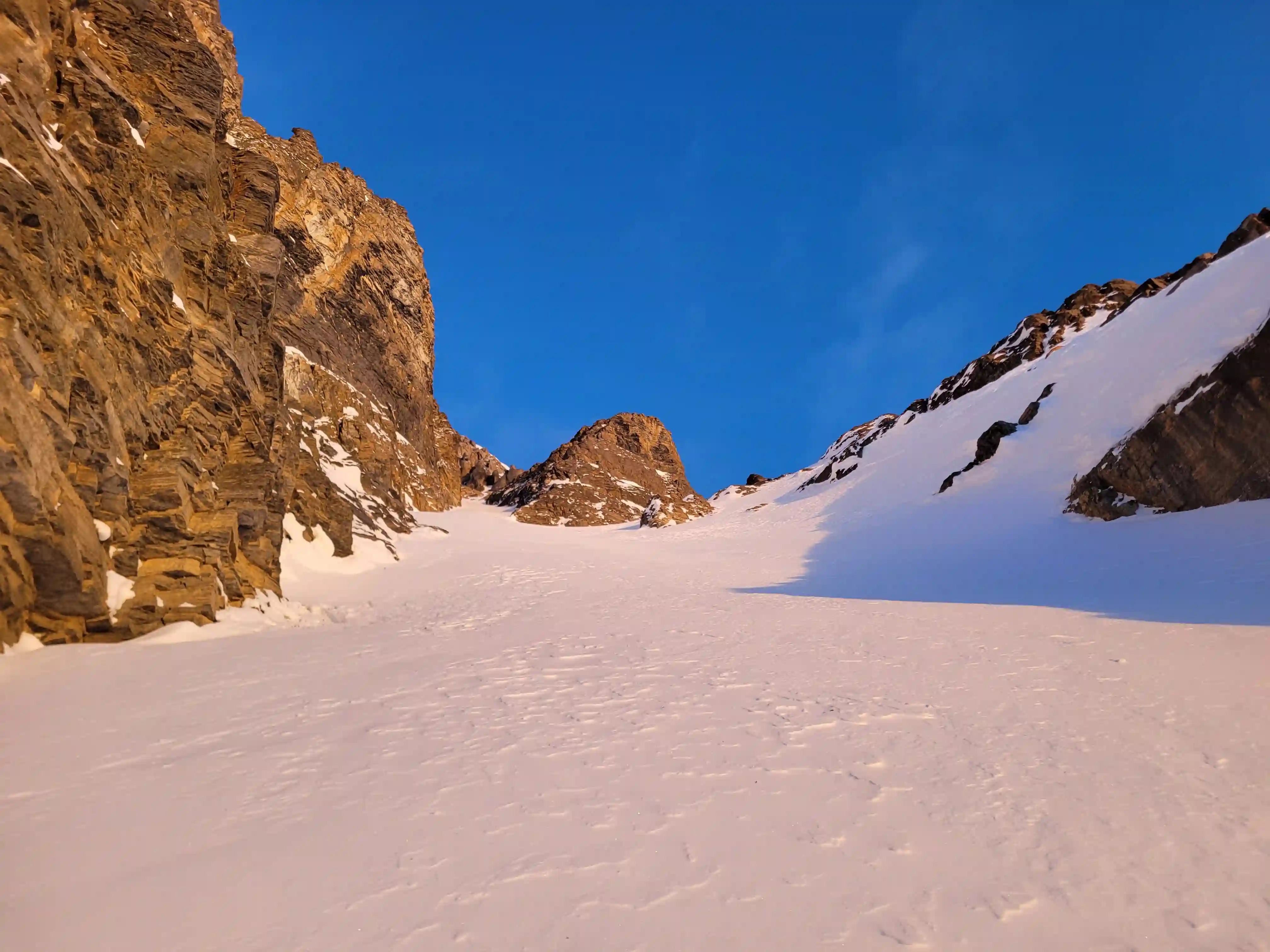
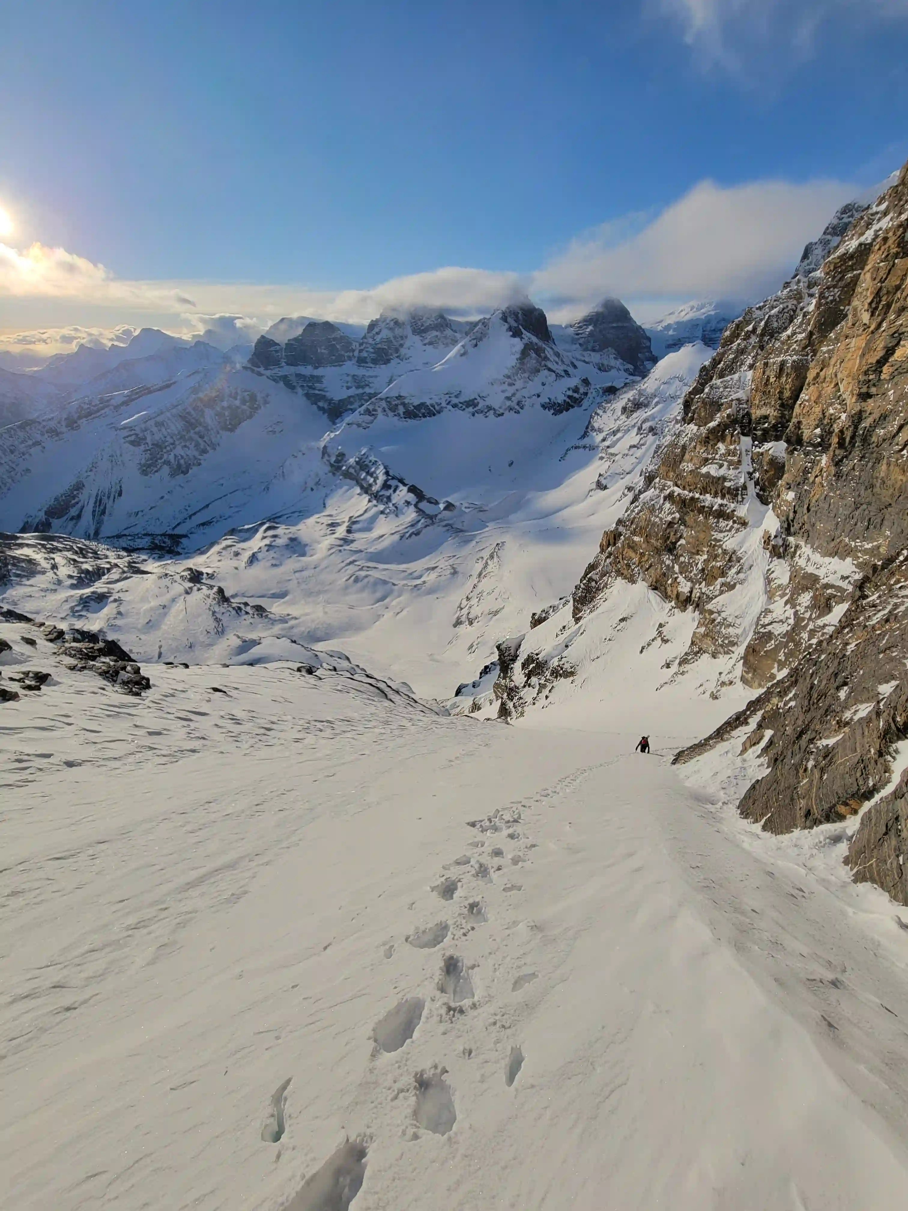
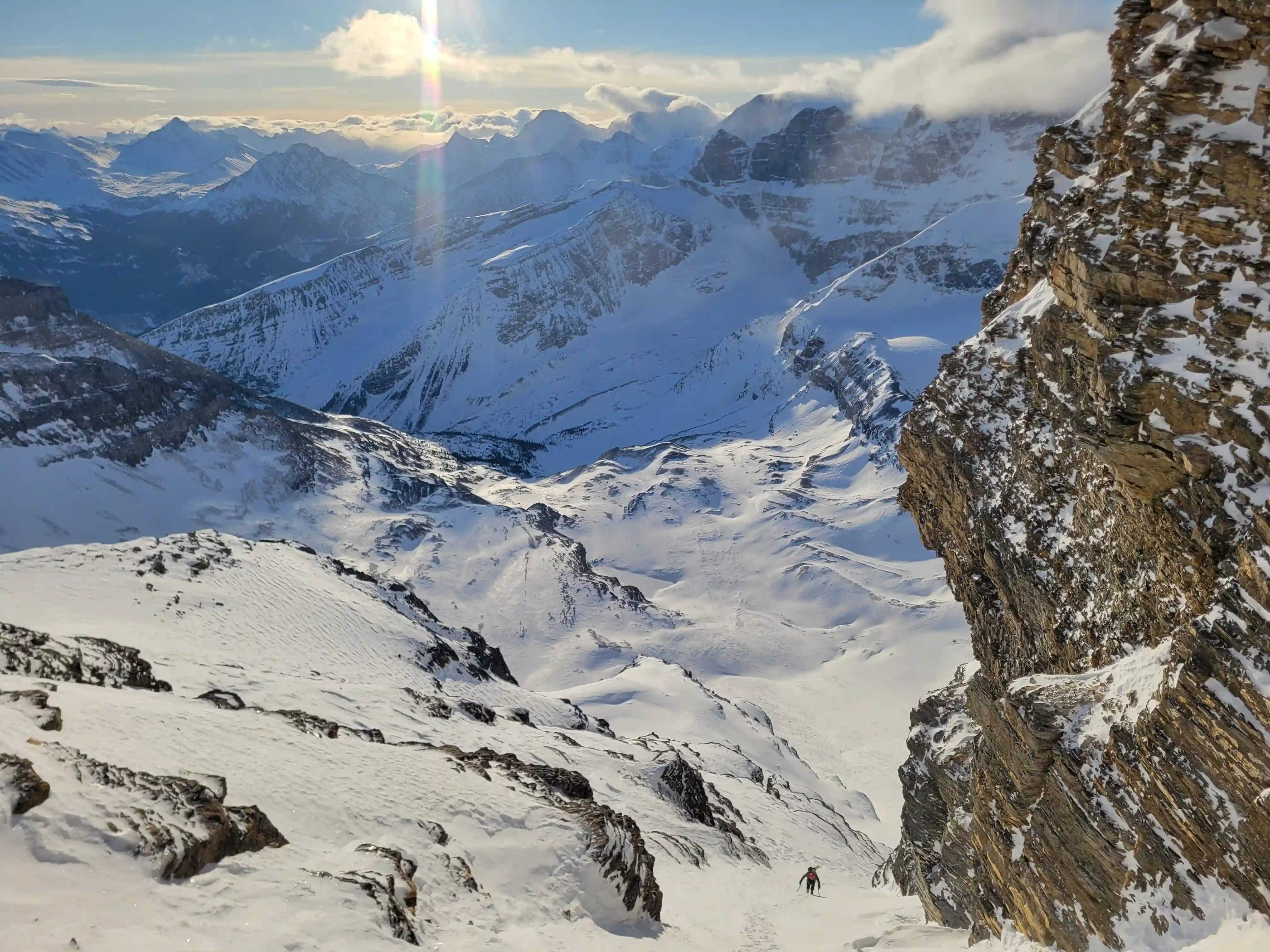
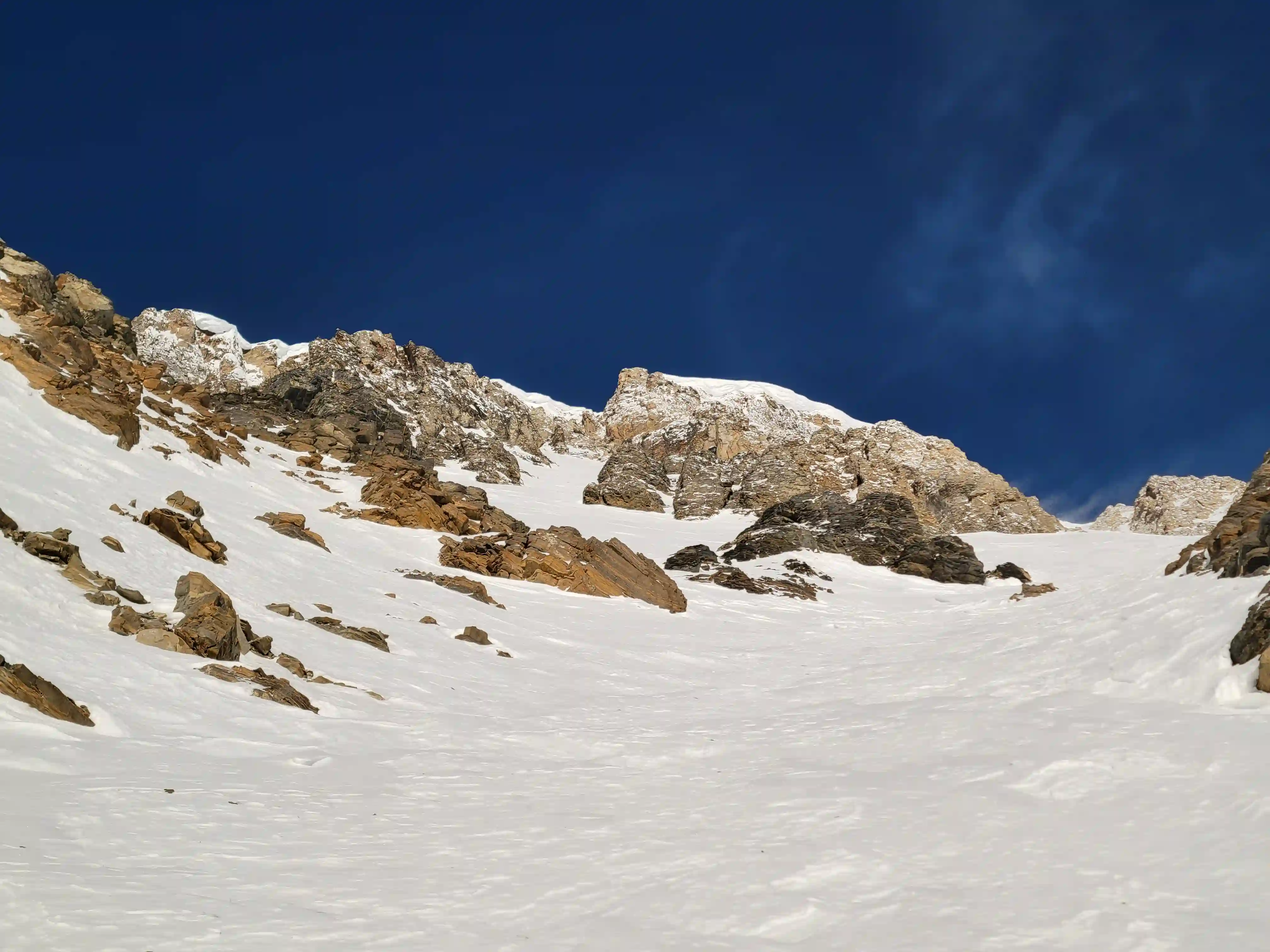
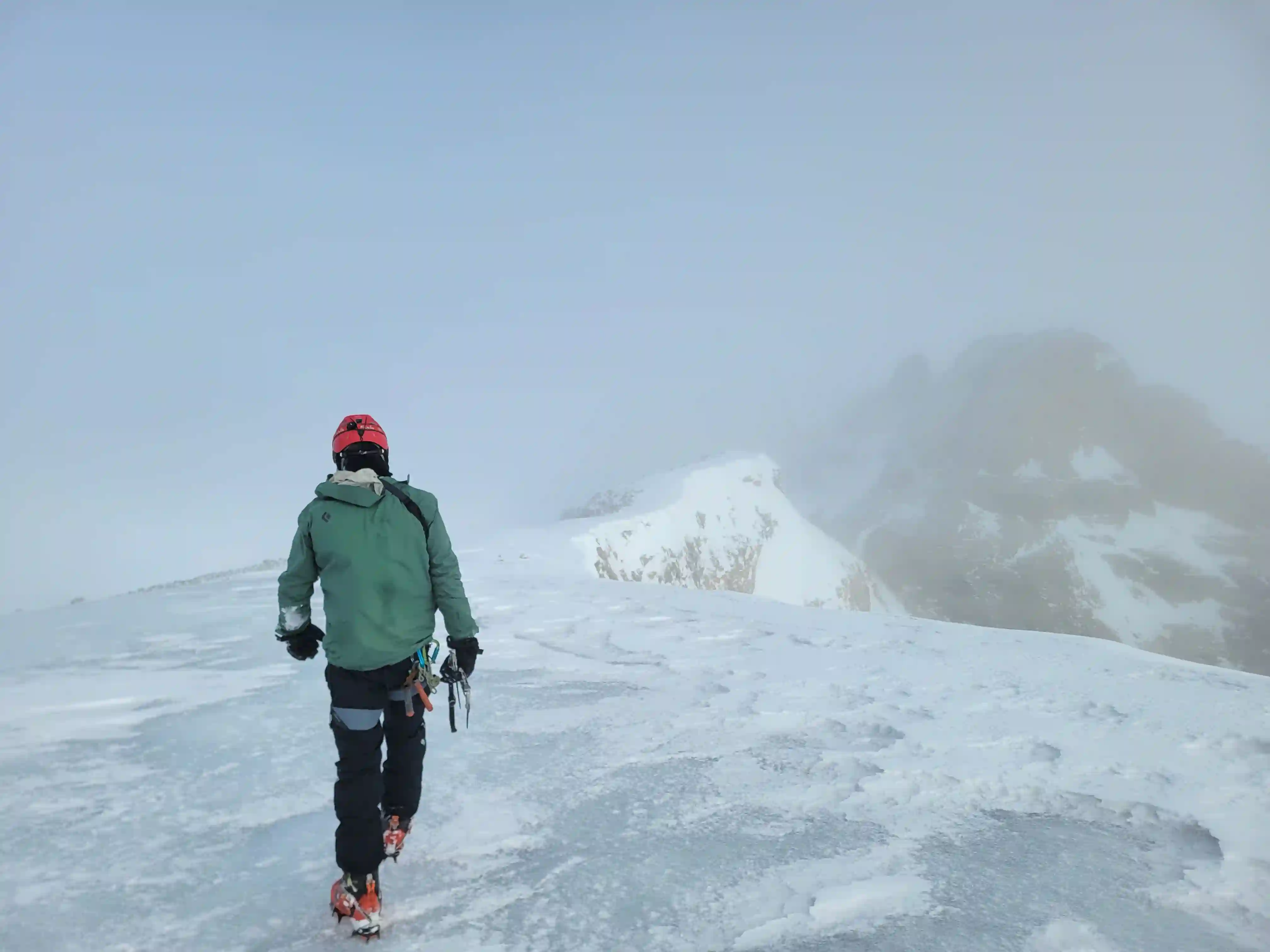
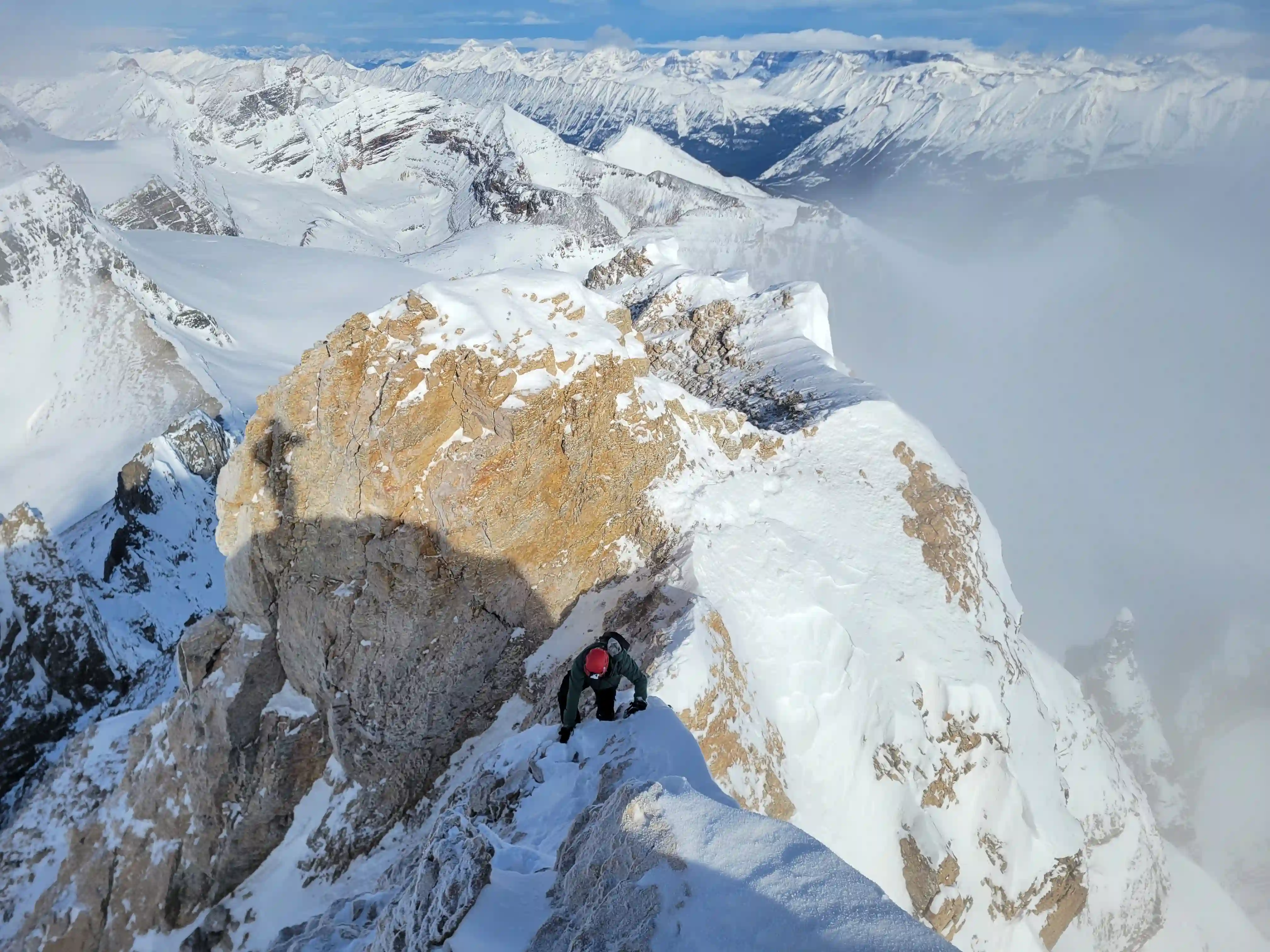
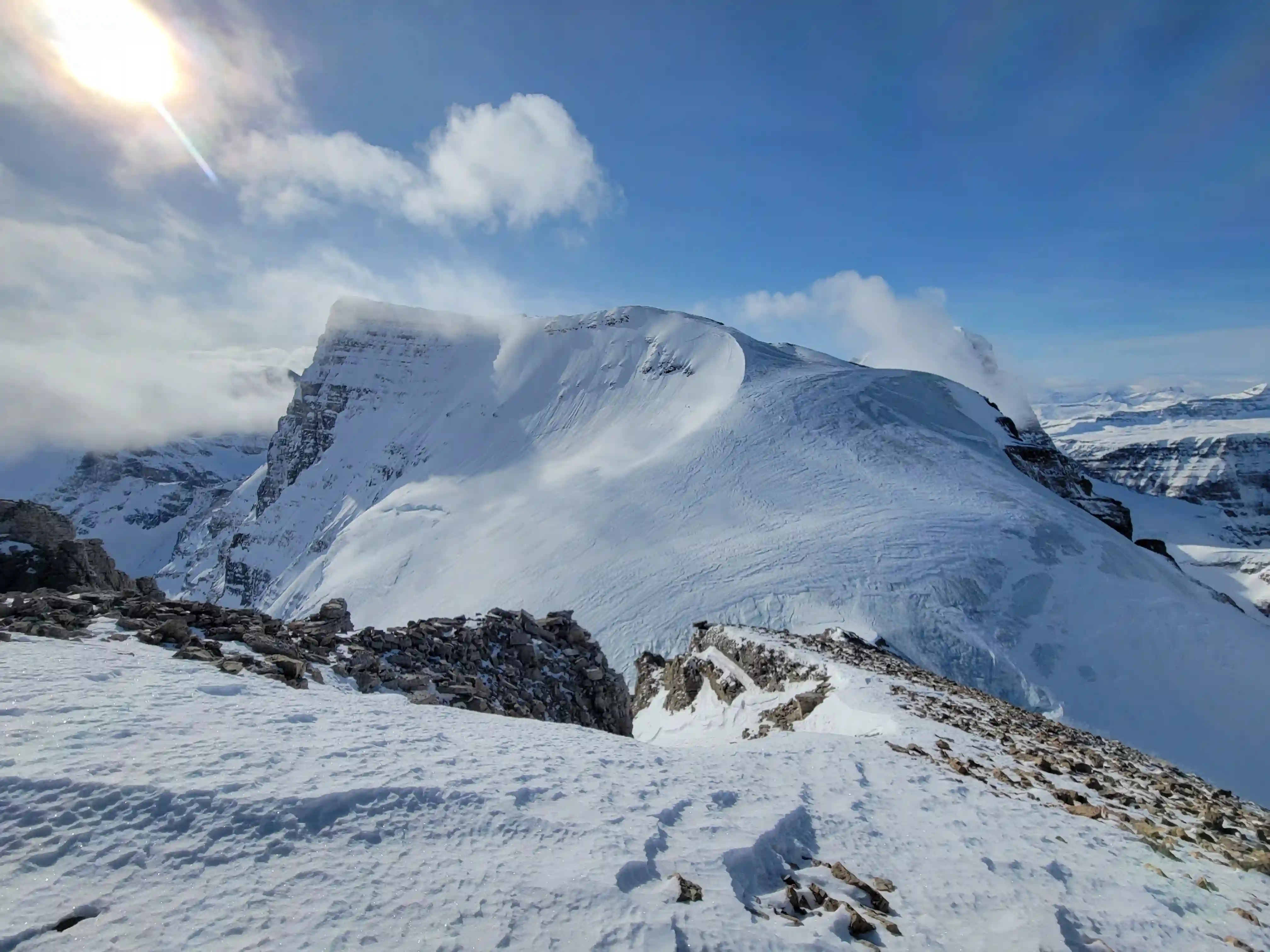
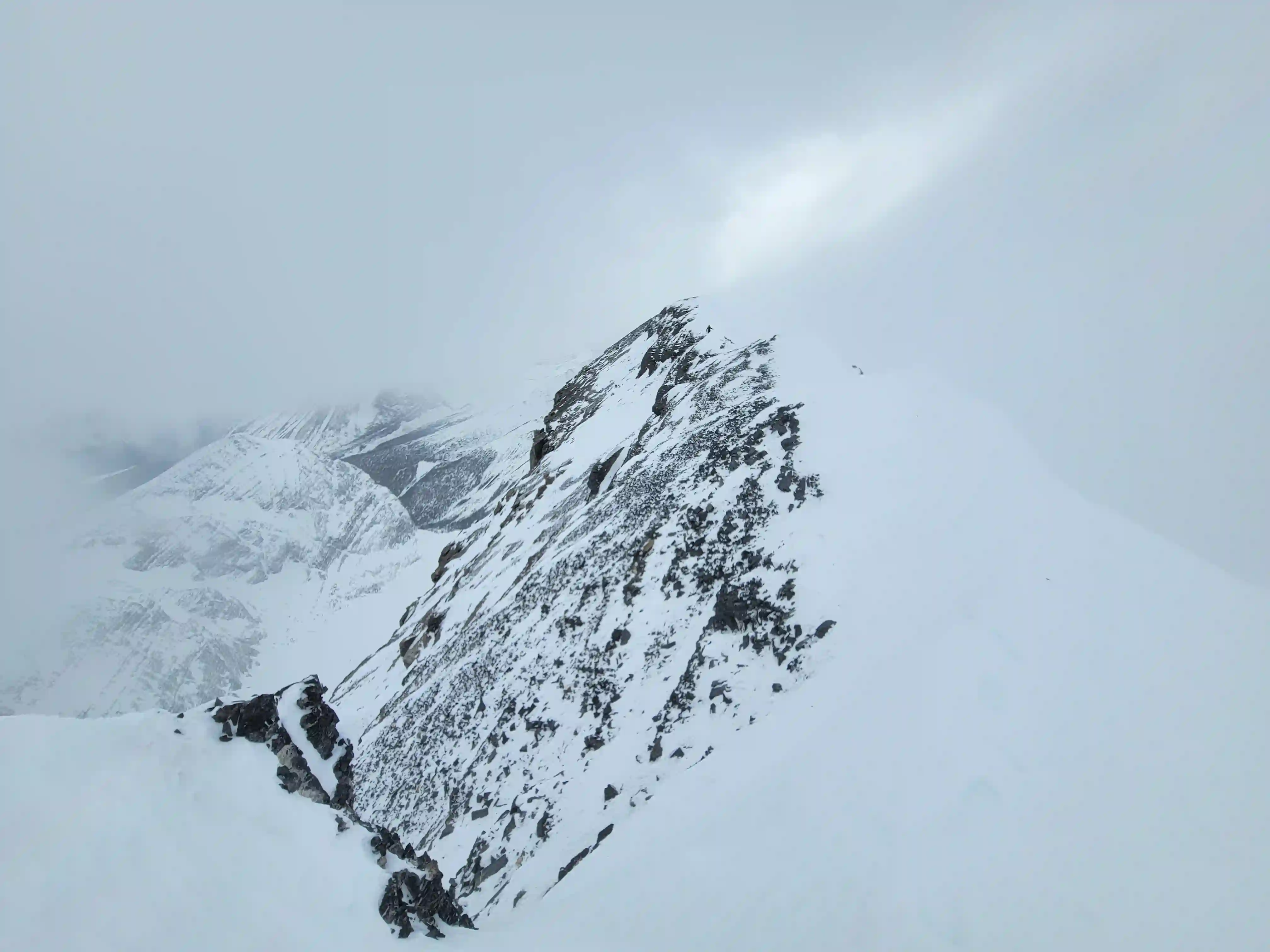
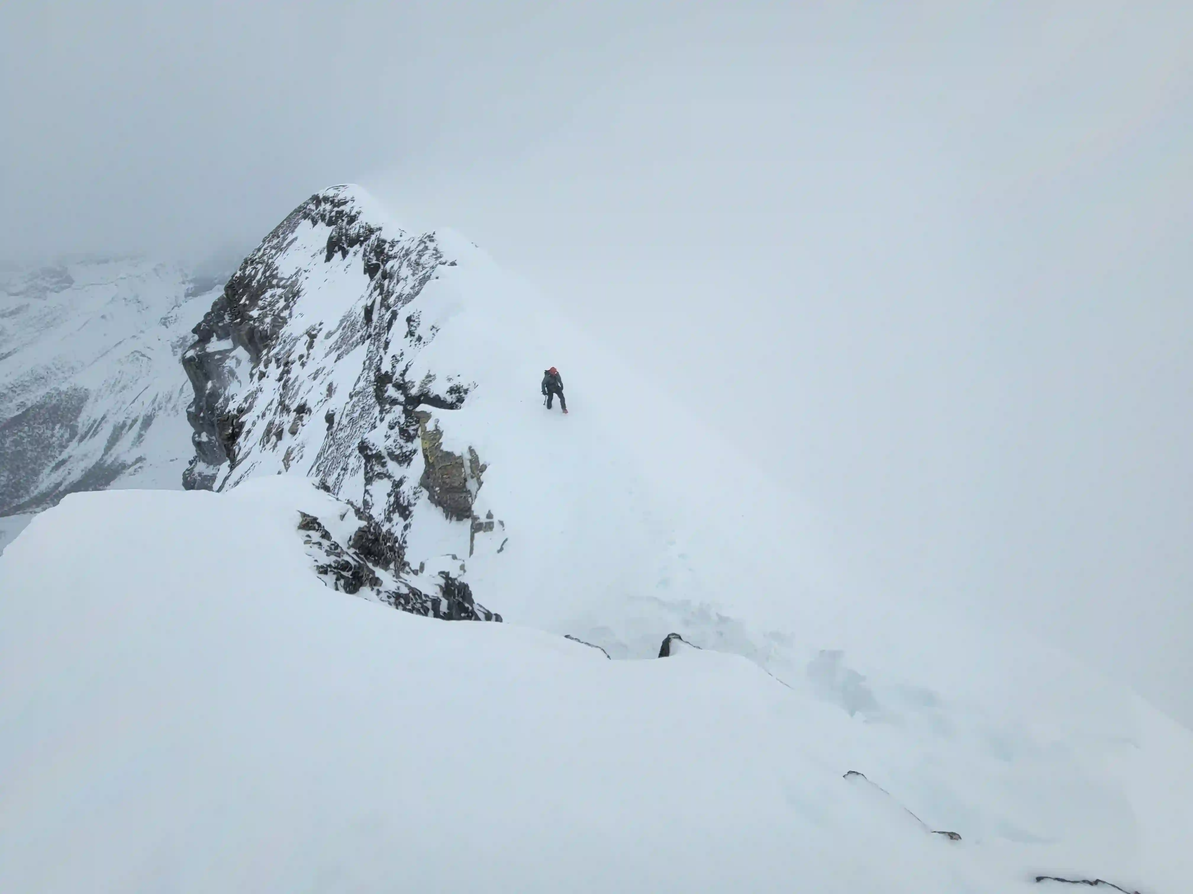
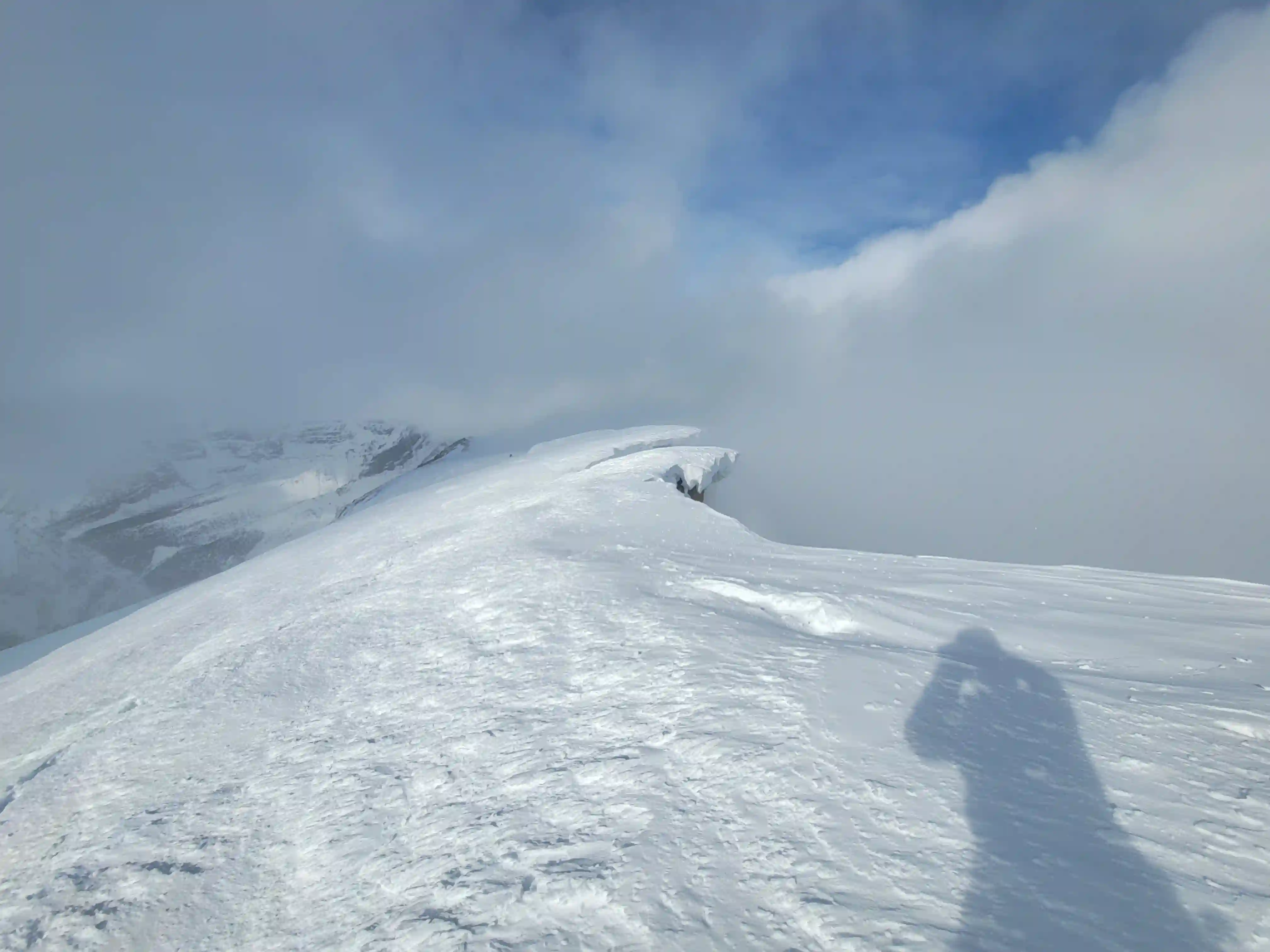
One thing we didn't realize was that even once you're in the base of the SE face direct couloir you're still technically on glacier but the snowpack was pretty good so it didn't seem like the most dangerous terrain to be unroped on. Once we were about a third up the couloir we got a sweet sunrise which helped with navigation and after branching right at an obvious rock feature the couloir continues at a steep grade until you reach the ridge at an access point where you don't have to break through a cornice.

break through
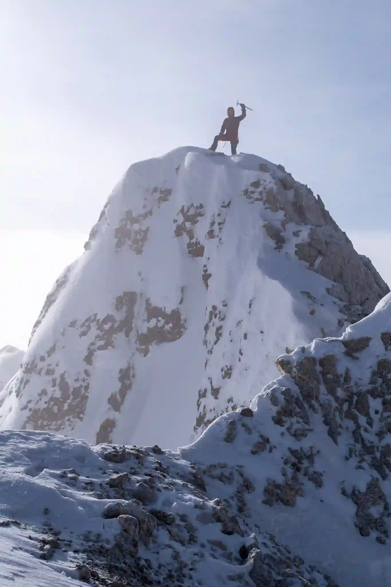
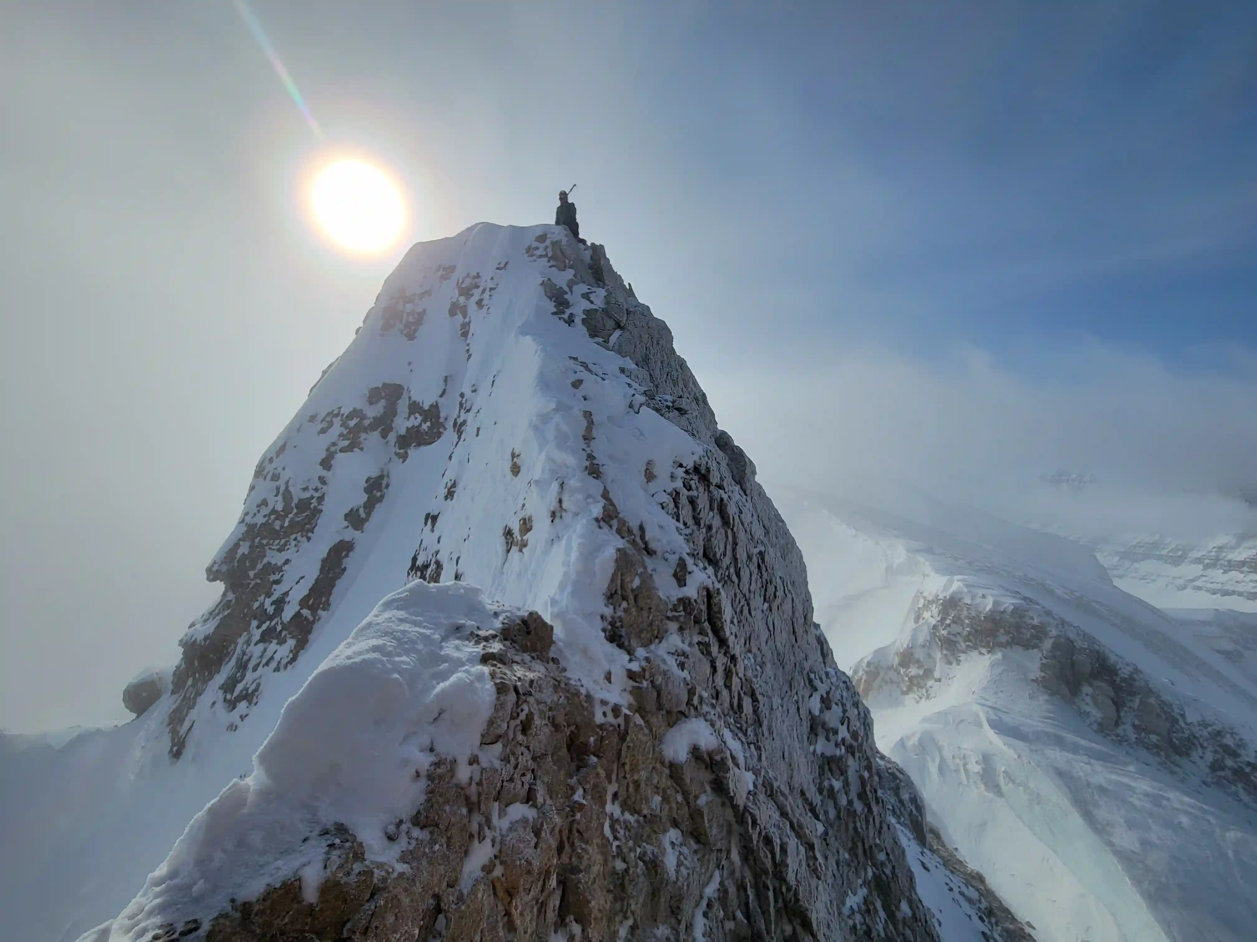
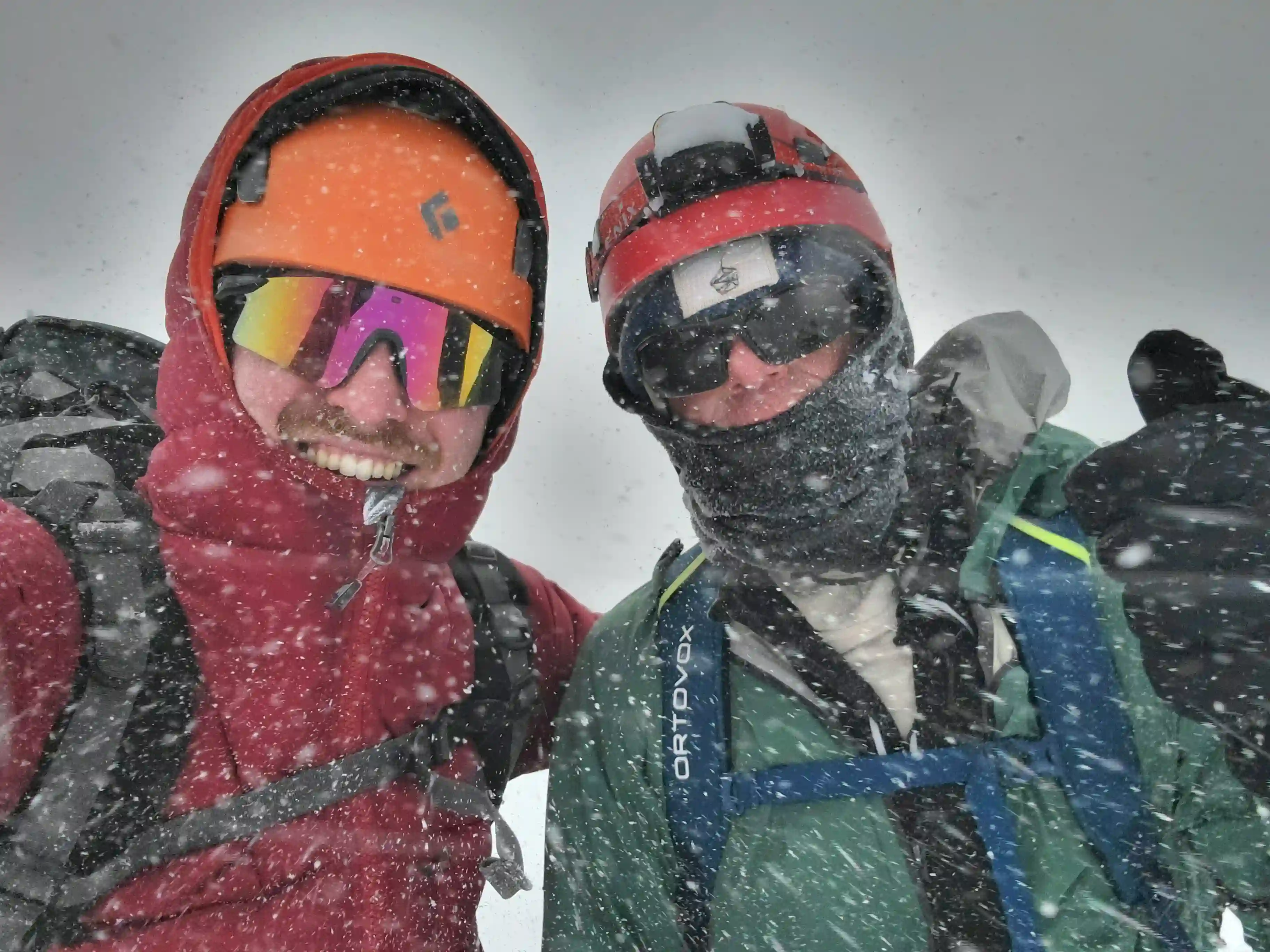
DIADEM SUMMIT & DESCENT TO COL
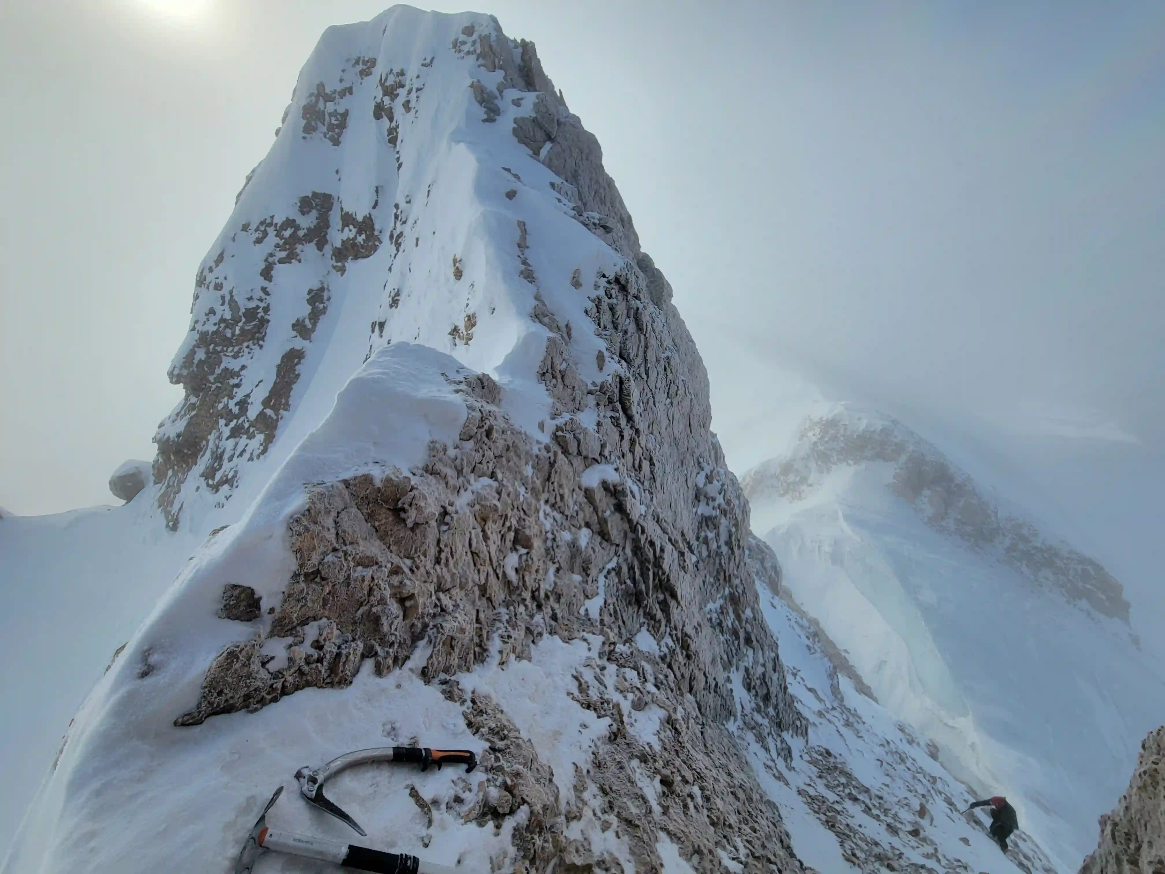
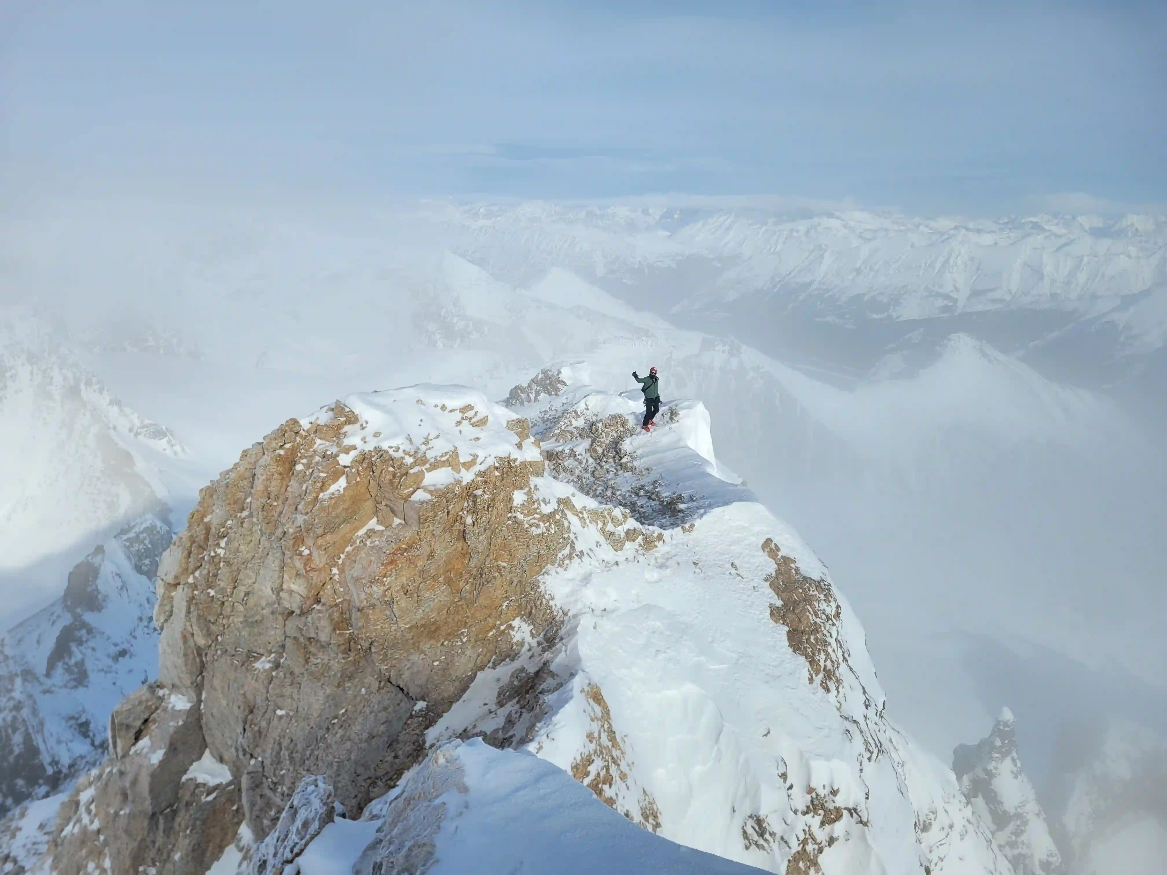
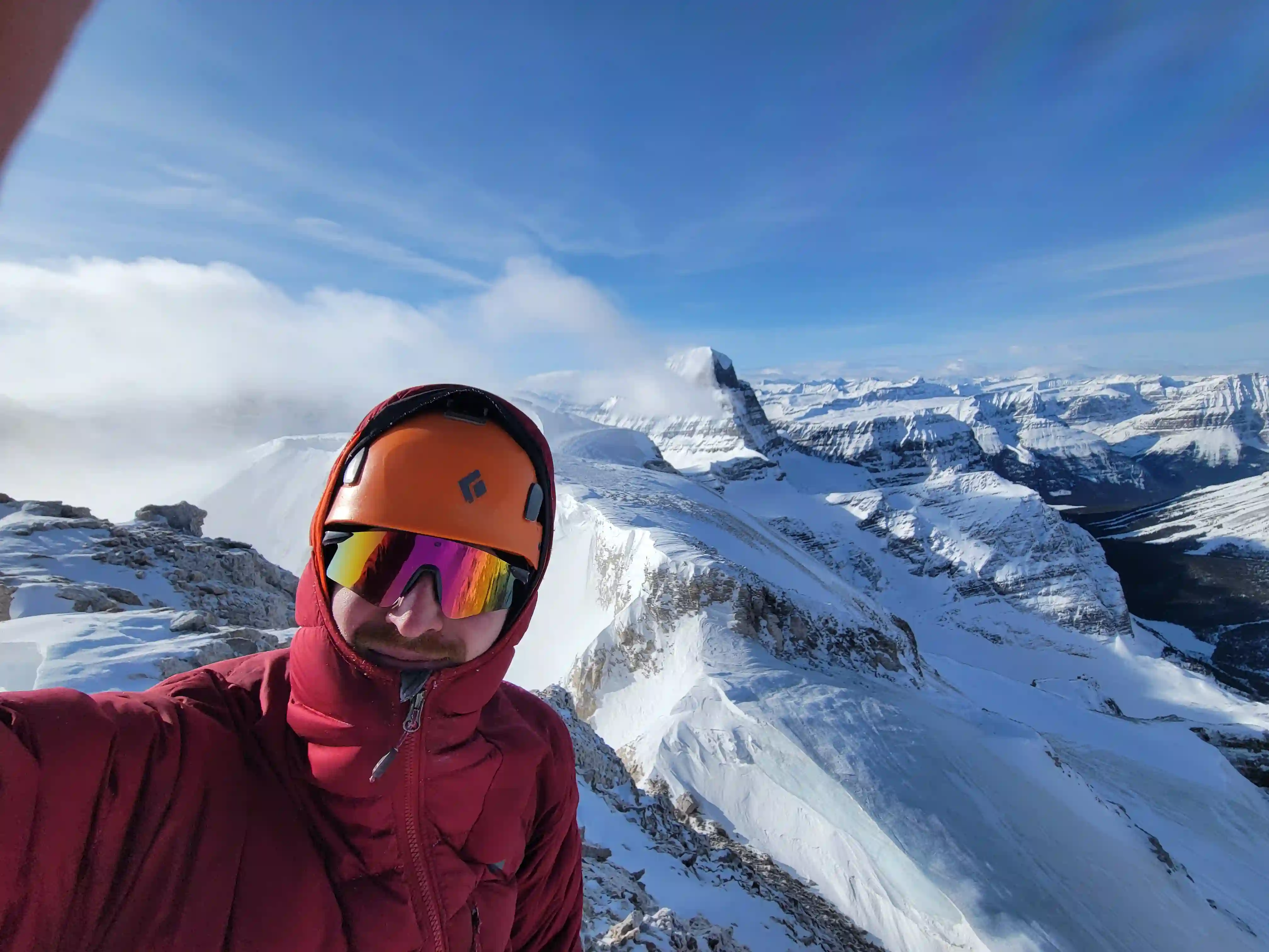
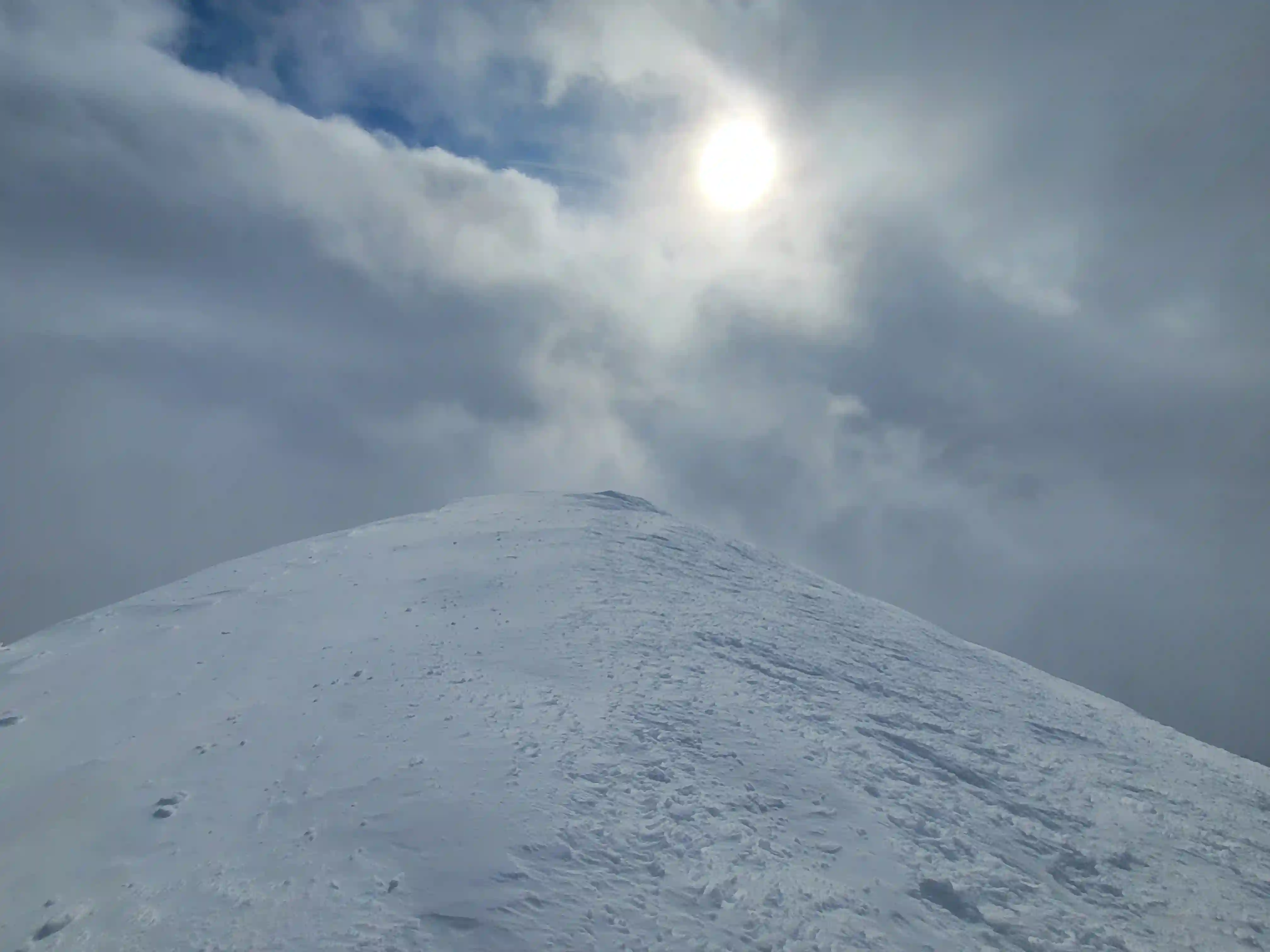
After topping out on the bulk of Diadem we ditched the packs and started heading for the summit block. Diadem's summit is a rocky outcrop to the north of its massif that's a bit airy and is definitely the crux of the peak but in the grand scheme of things isn't that technical but makes for a fun finish to the ascent. With a few hands on moves we reached the summit and after taking a number of photos we reversed our line back to our packs before starting the descend down to the Woolley-Diadem col. I was hoping to be able to use the skis for this descent but unfortunately the SW side of Diadem Peak was covered in exposed rock so the skis stayed on the pack and we slowly worked our way down on foot.
Into trips like this?
I'll send you an email whenever I publish a new trip report.
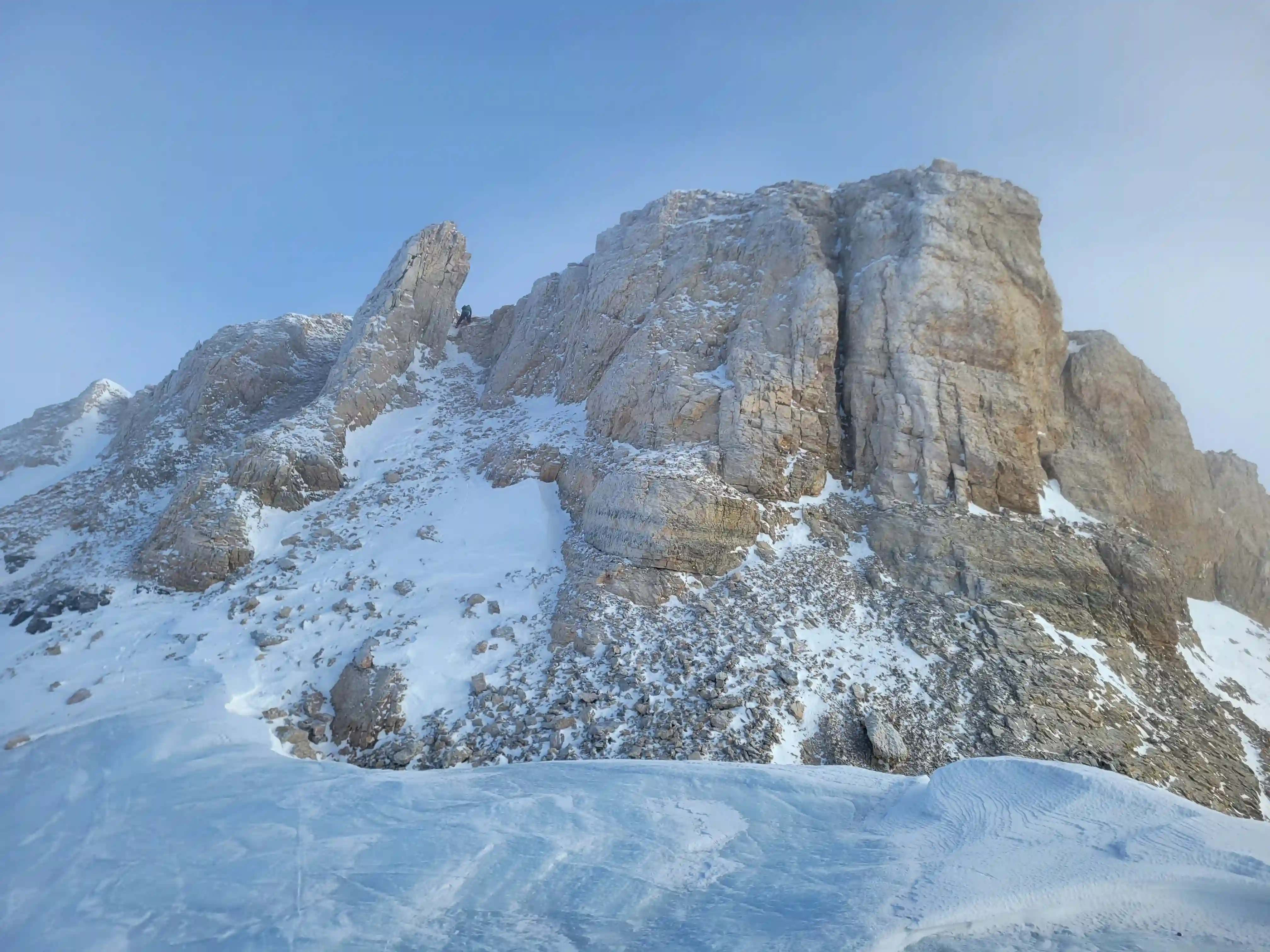
MOUNT WOOLLEY
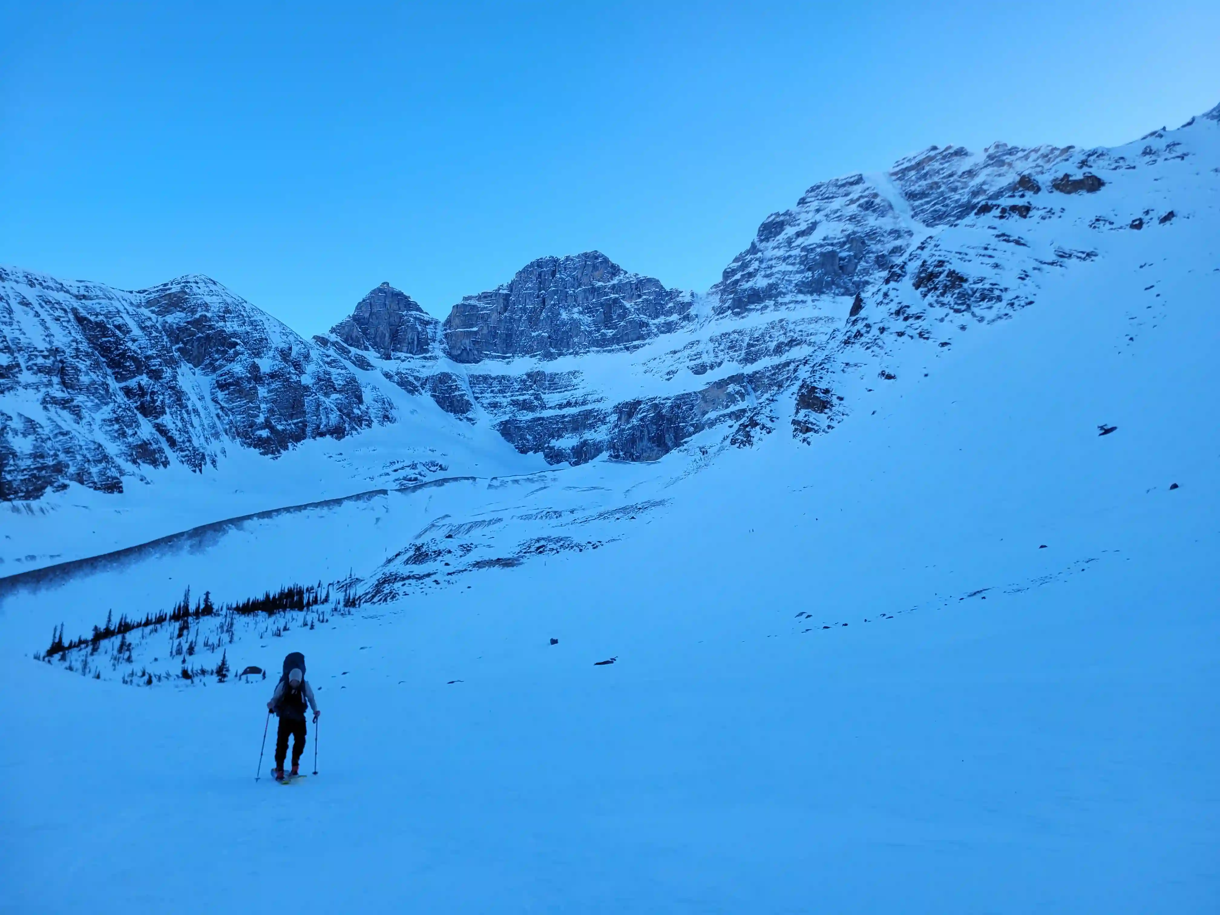
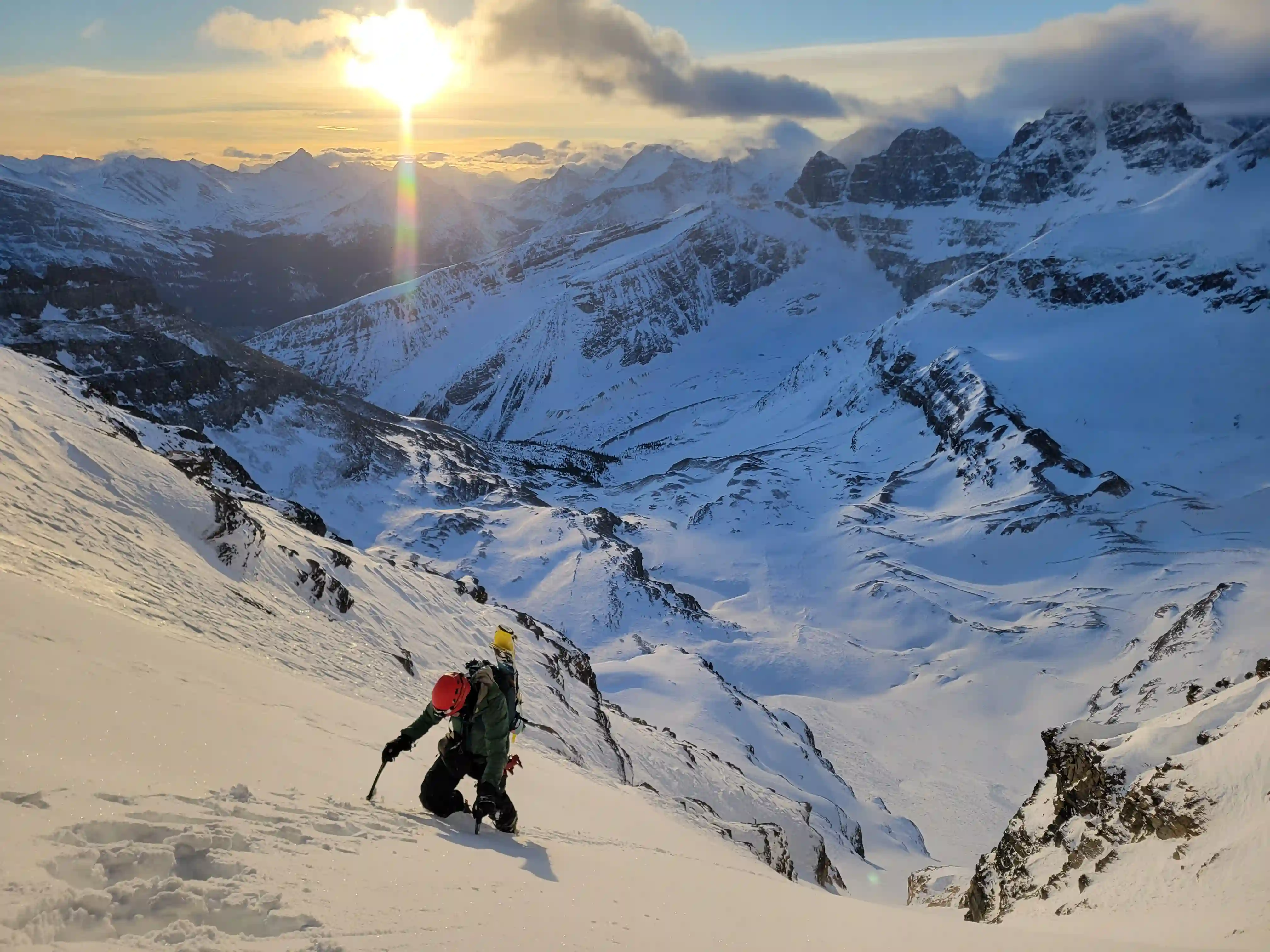
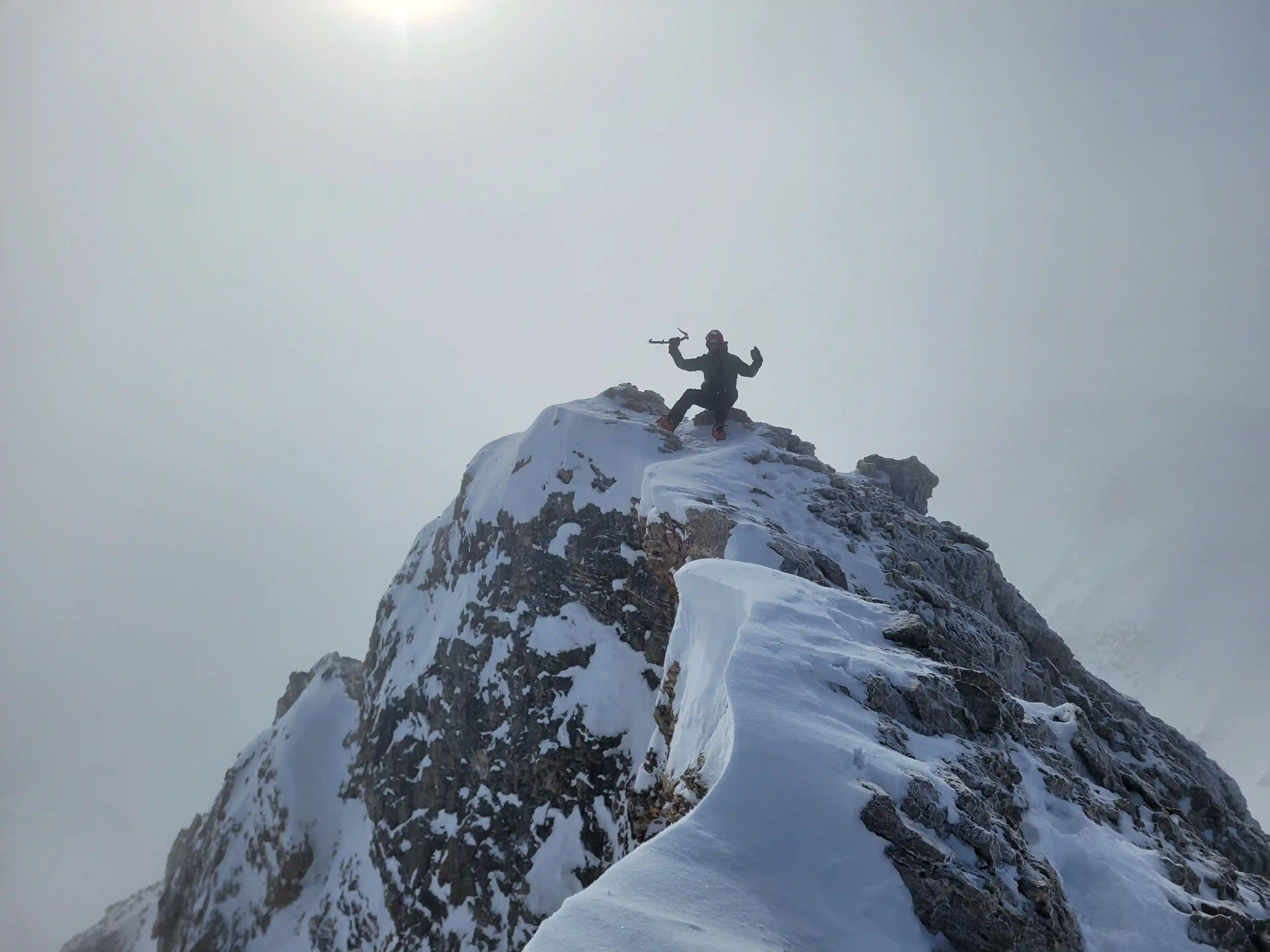
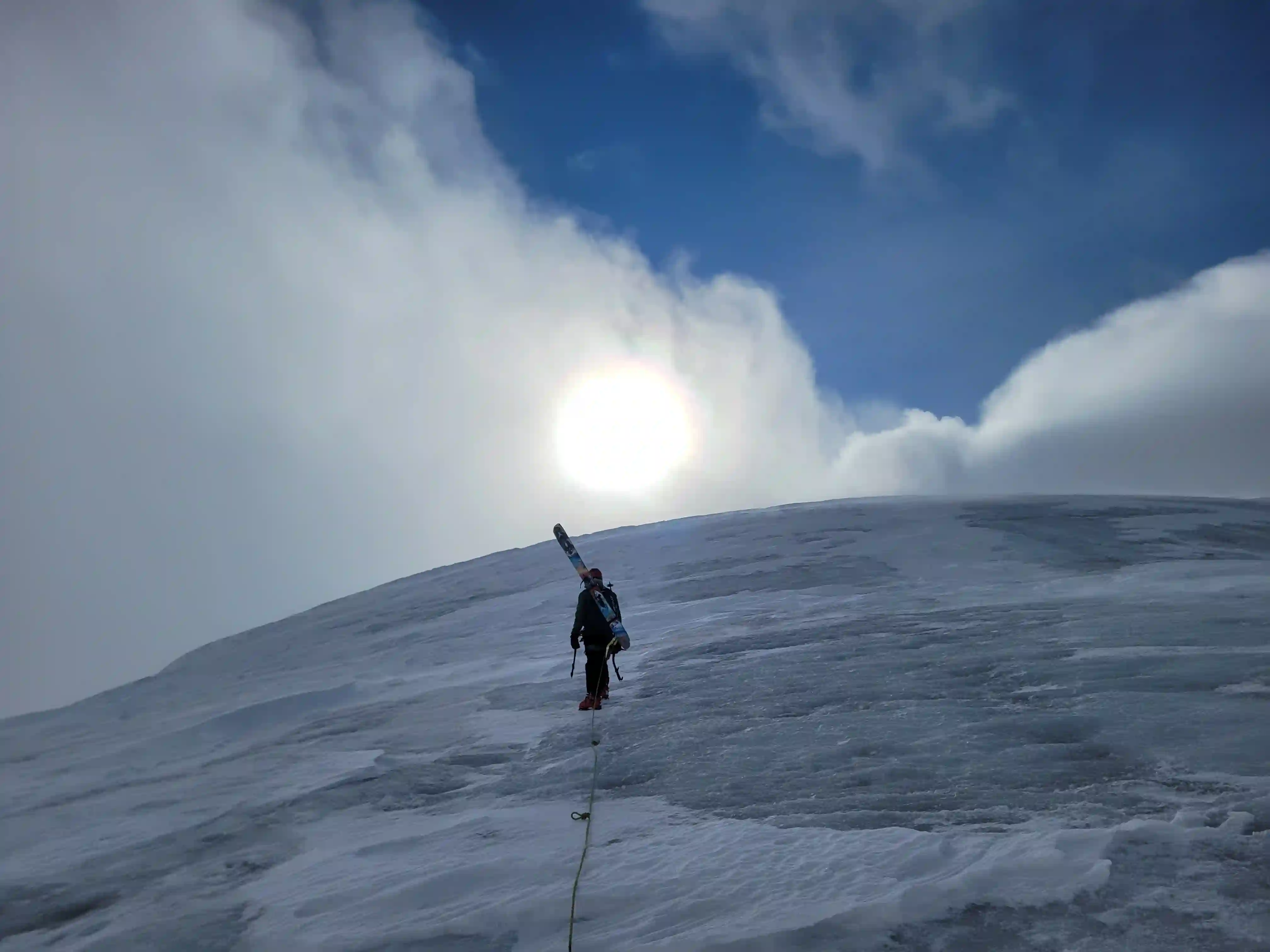
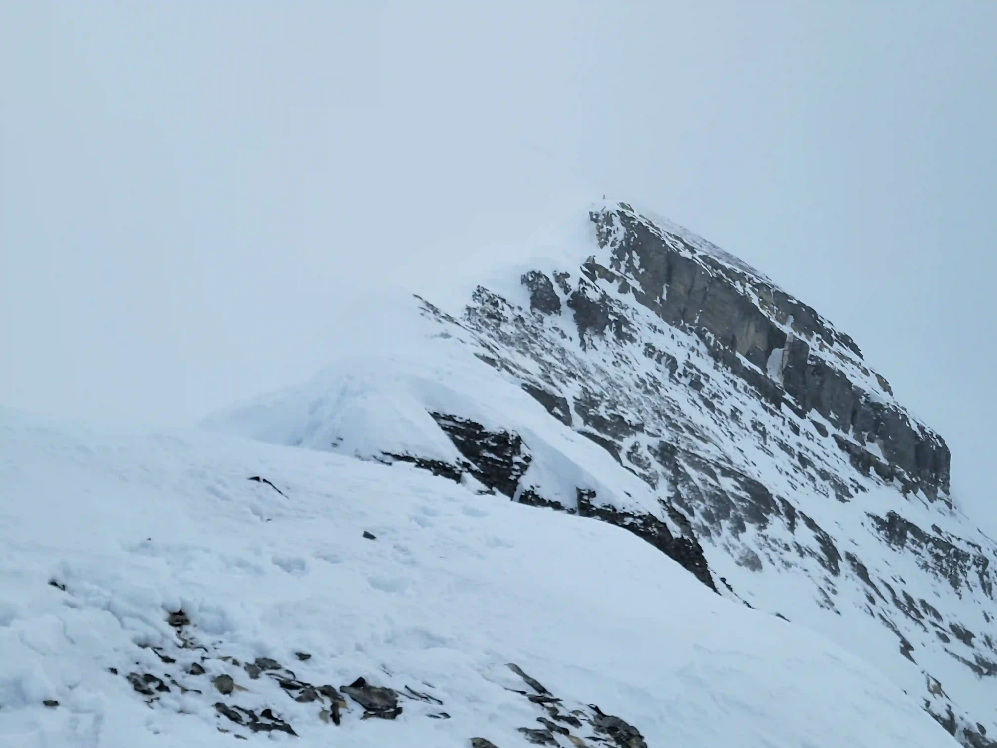
3405m, 11171ftAfter reaching the col we roped up and headed for Woolley's ridge sticking mostly to ice so that we could see any gaps on the glacier nearby. This section didn't last long and once on the ridge we ditched the skis and headed for the summit. This is where the galeforce winds started so we decided to unrope and Rob and I ended up going at different paces to the summit but aside from some sharp wind this final portion of the ascent was straightforward. It's worth noting that the upper mountain is glacier so in an ideal world you stay roped up for the upper mountain but with the wind we were dealing with this would've proven to be a pain in the ass and given the decent snowpack on the upper mountain we decided not to bother.
expect on Diadem but I guess it is February
come in in force
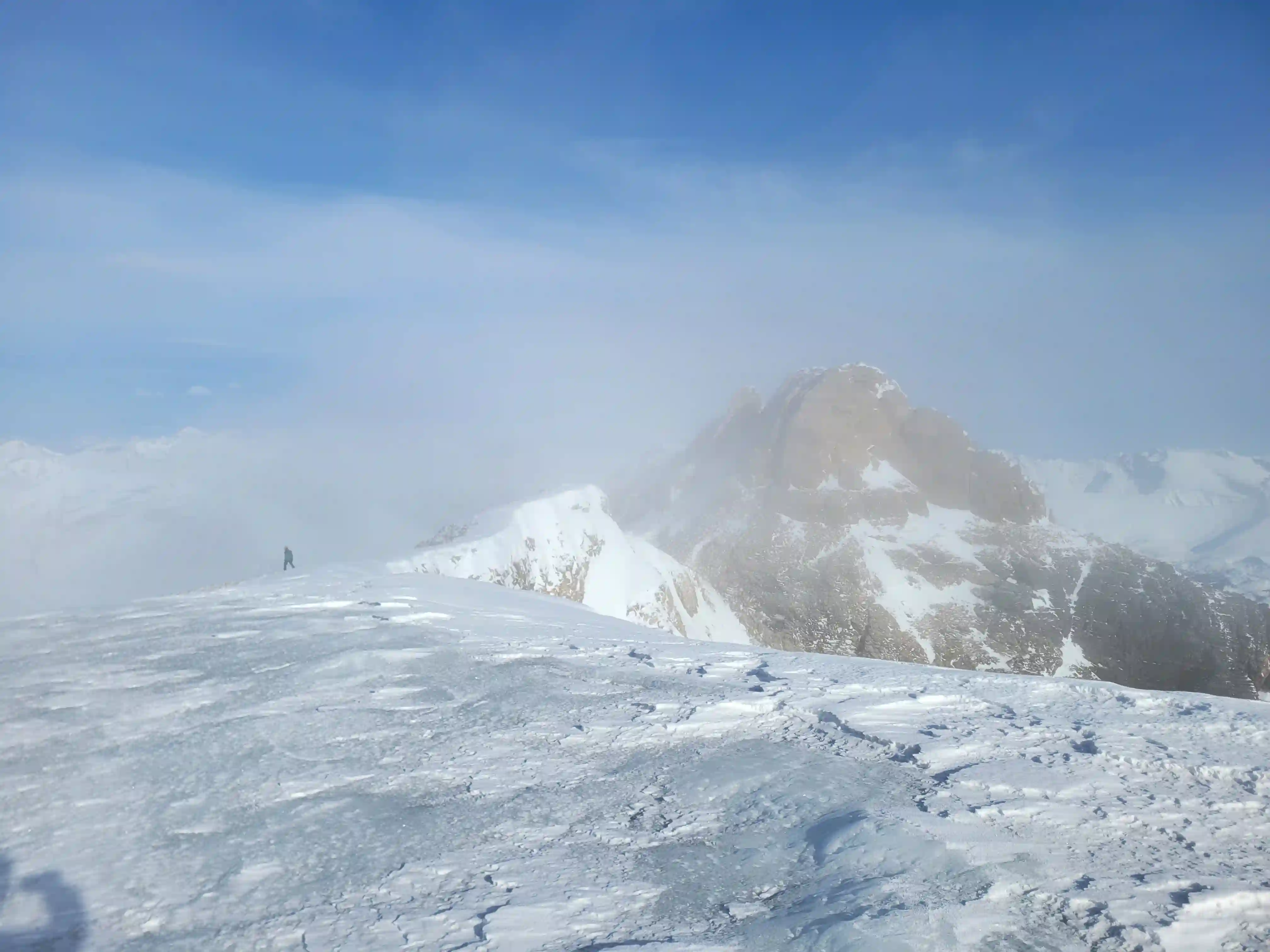
THE DESCENT & EXIT
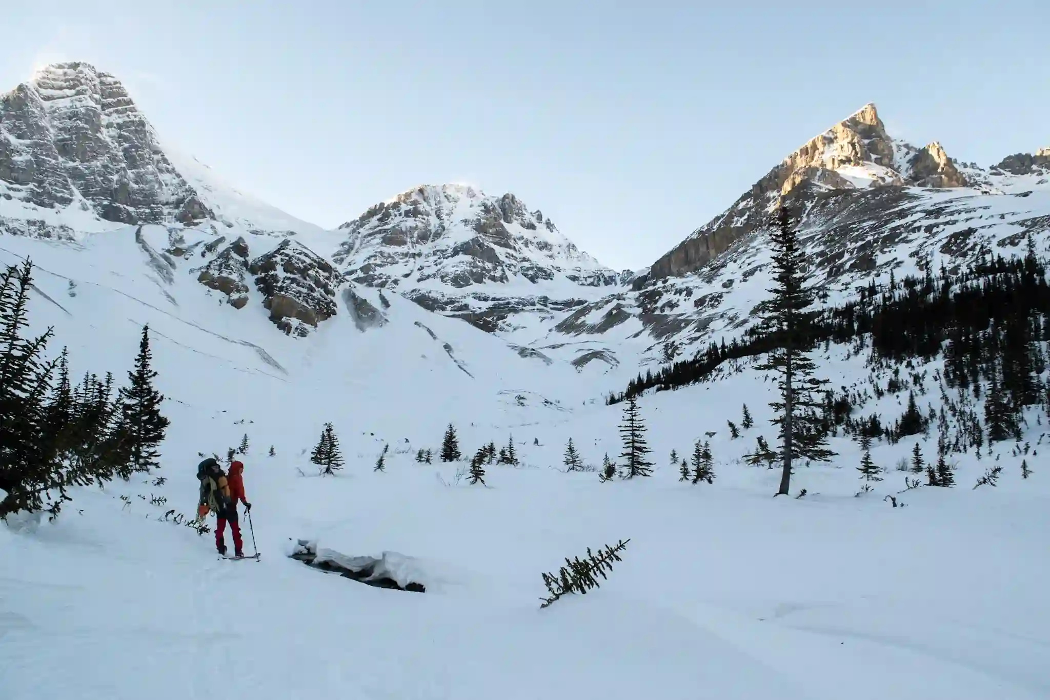
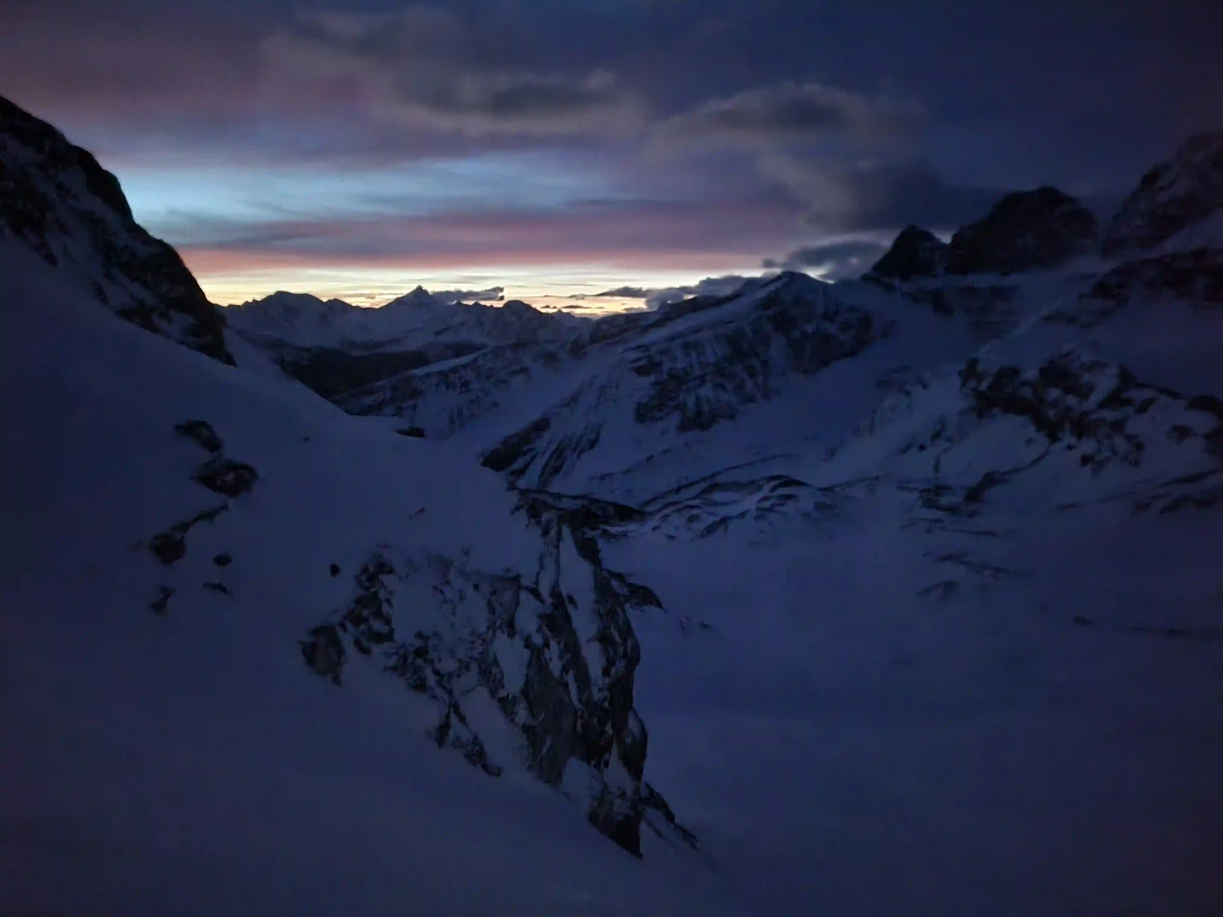
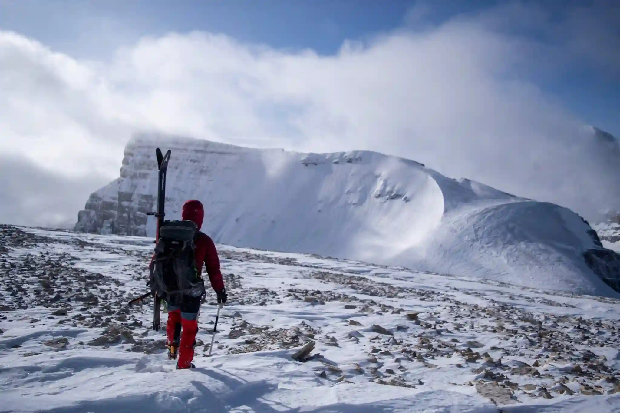
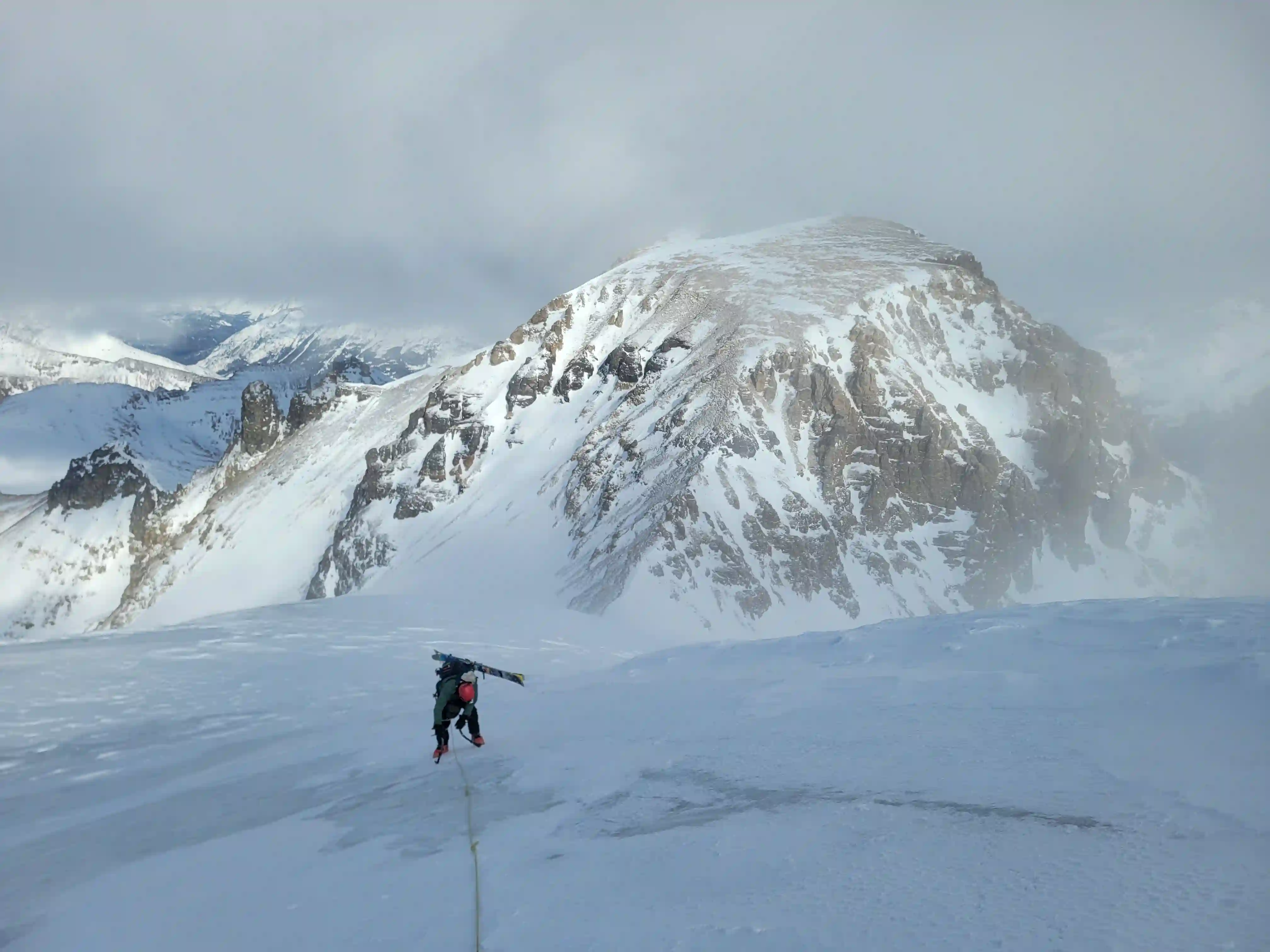
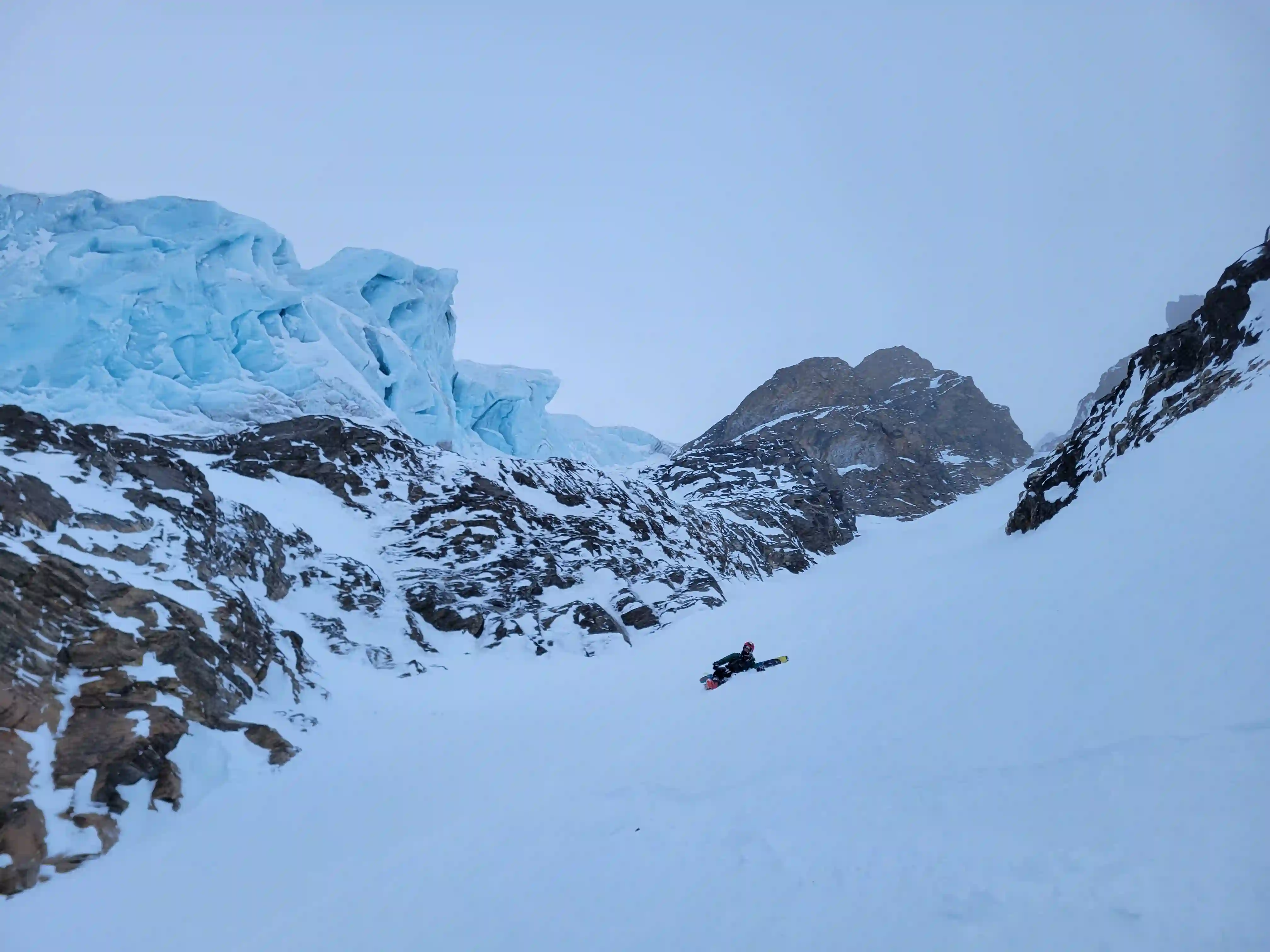
After Rob reached the summit we didn't hang around for long before heading down. The thing about mountain conditions in February is that when it's good it's fine, but when it's bad it can get serious quickly. We made our way back to our skis but by this point cloud cover had moved in enough that visibility was quite poor so we decided not to ski from the ridge with all the icy sections below. Once we returned to the col I used some photos from our approach day to navigate to where our descent couloir was and after 400-500m of side hilling we were right above it.
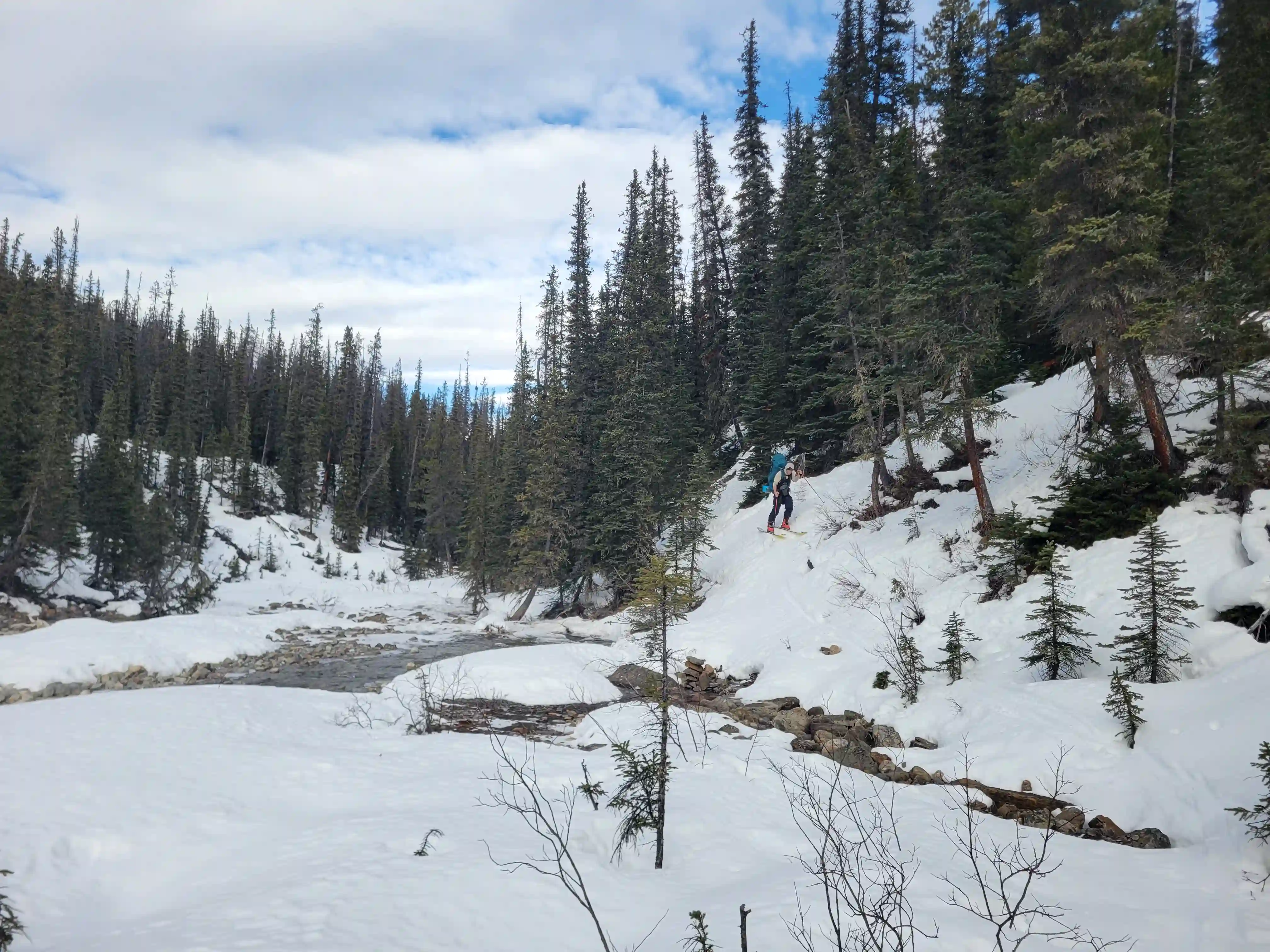
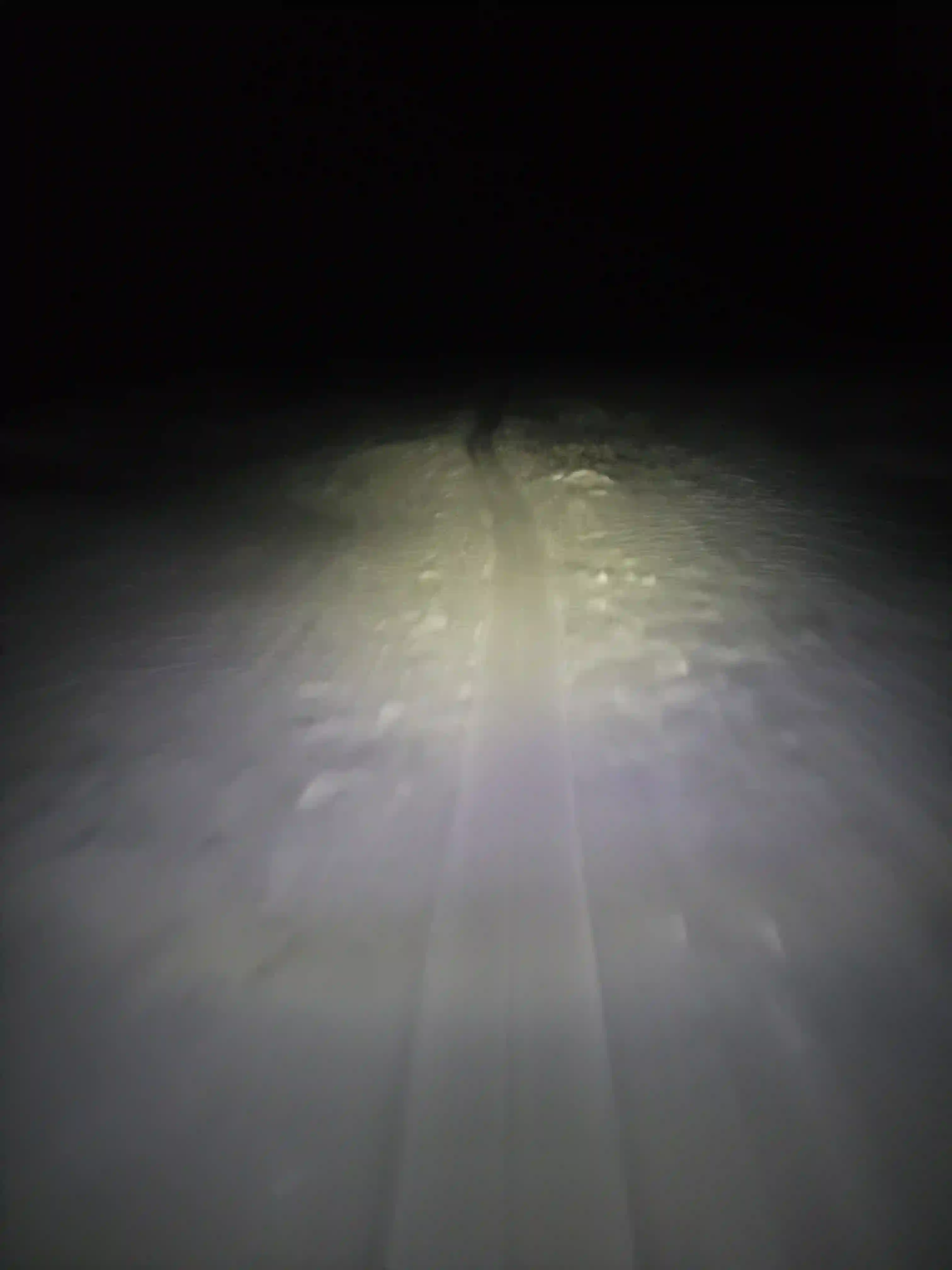
Unfortunately the couloir got a sizable amount of wind which caused it to accumulate a bunch of small rocks so we downclimbed the upper half before conditions softened and I threw the skis on for the bottom portion. From this point the descent to camp was pretty chill although the snow conditions weren't great in places and once we got back we were focussed on packing up quickly before making our exit in the dark. The steeper sections of the exit were a bit tedious with a heavy pack given the mixed conditions but once things flattened out travel was fast and easy. All that was left was the final treed steep portion which was about as annoying as you'd expect to descend and took a decent amount of time but once we were back at the Sunwapta River it was just a few more minutes before we were back on the highway.
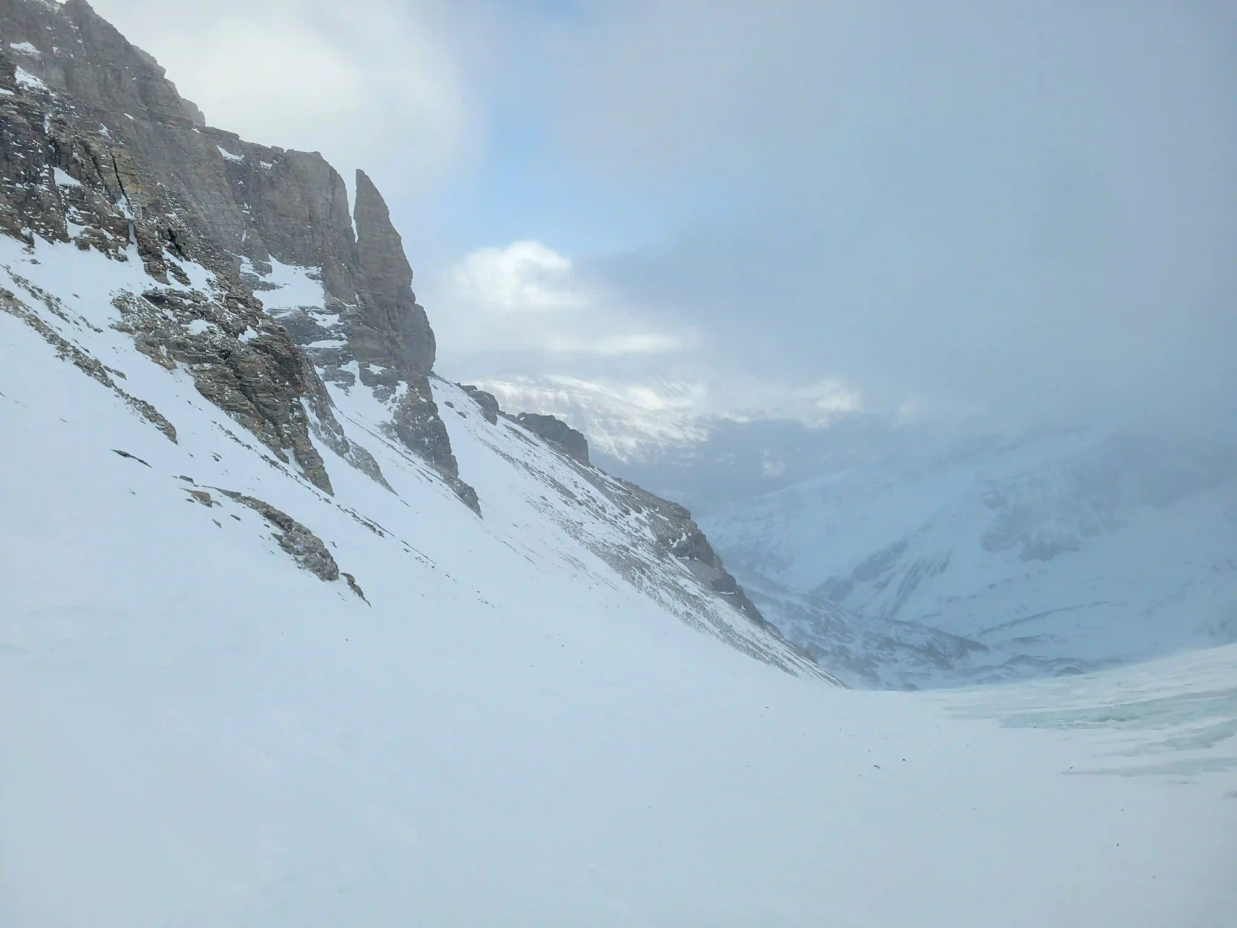
reach the couloir we'd be descending
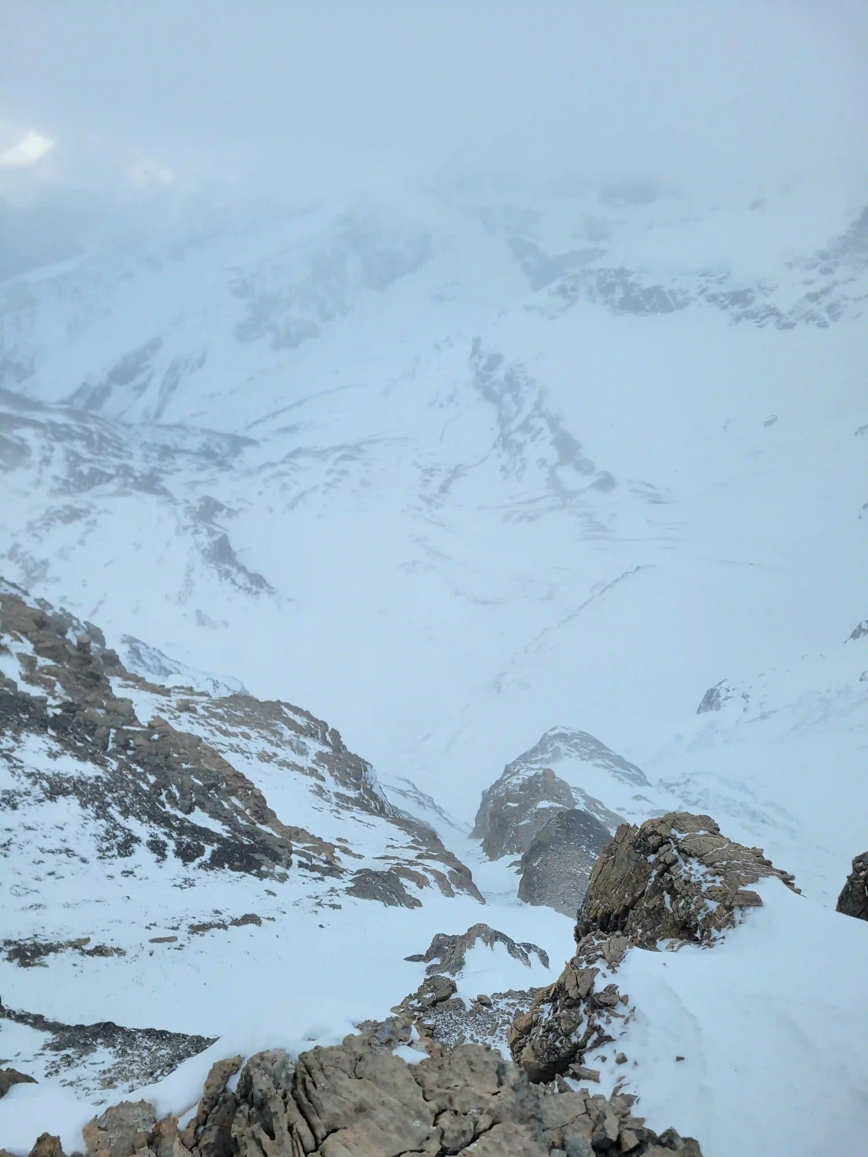
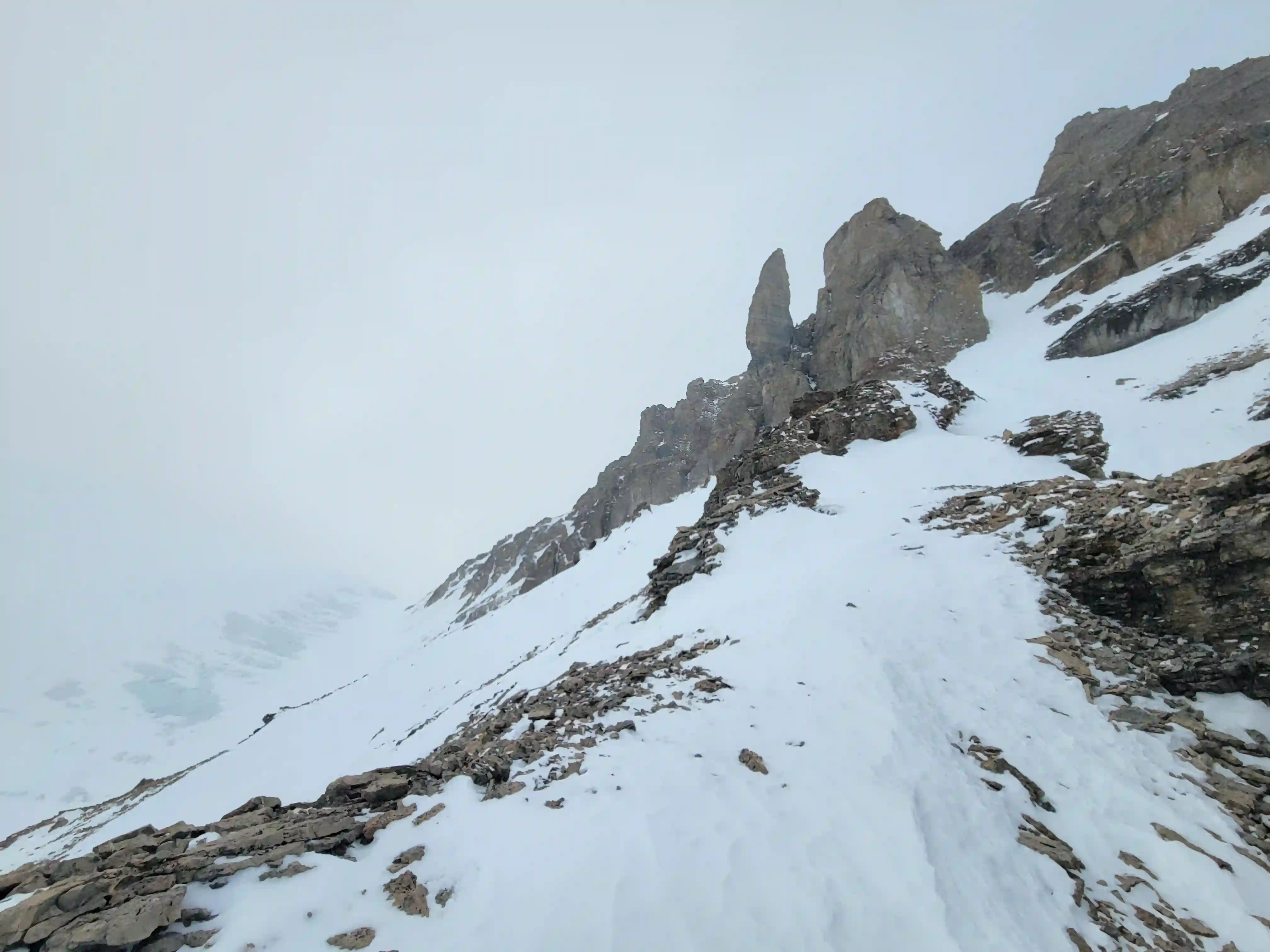
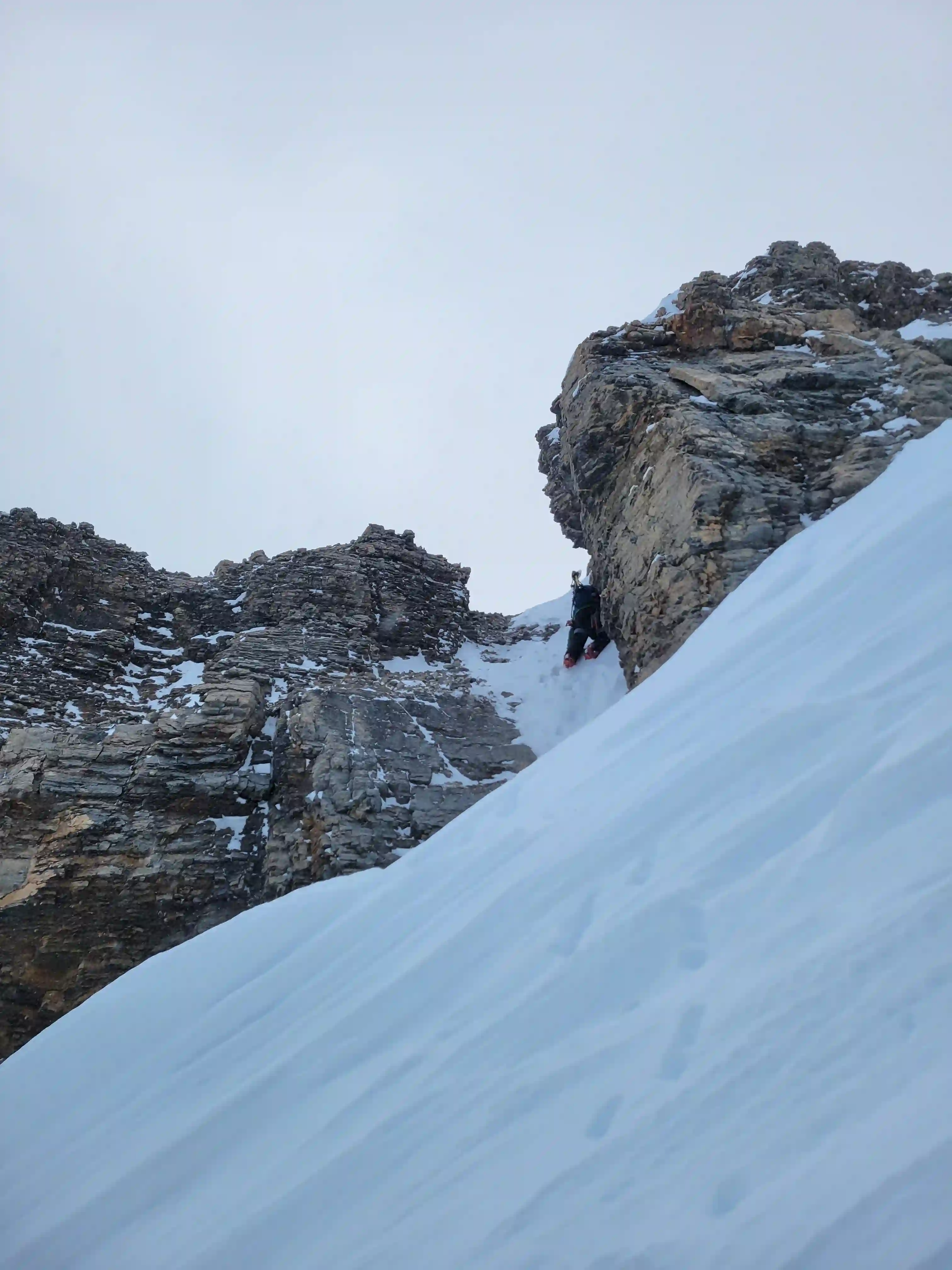
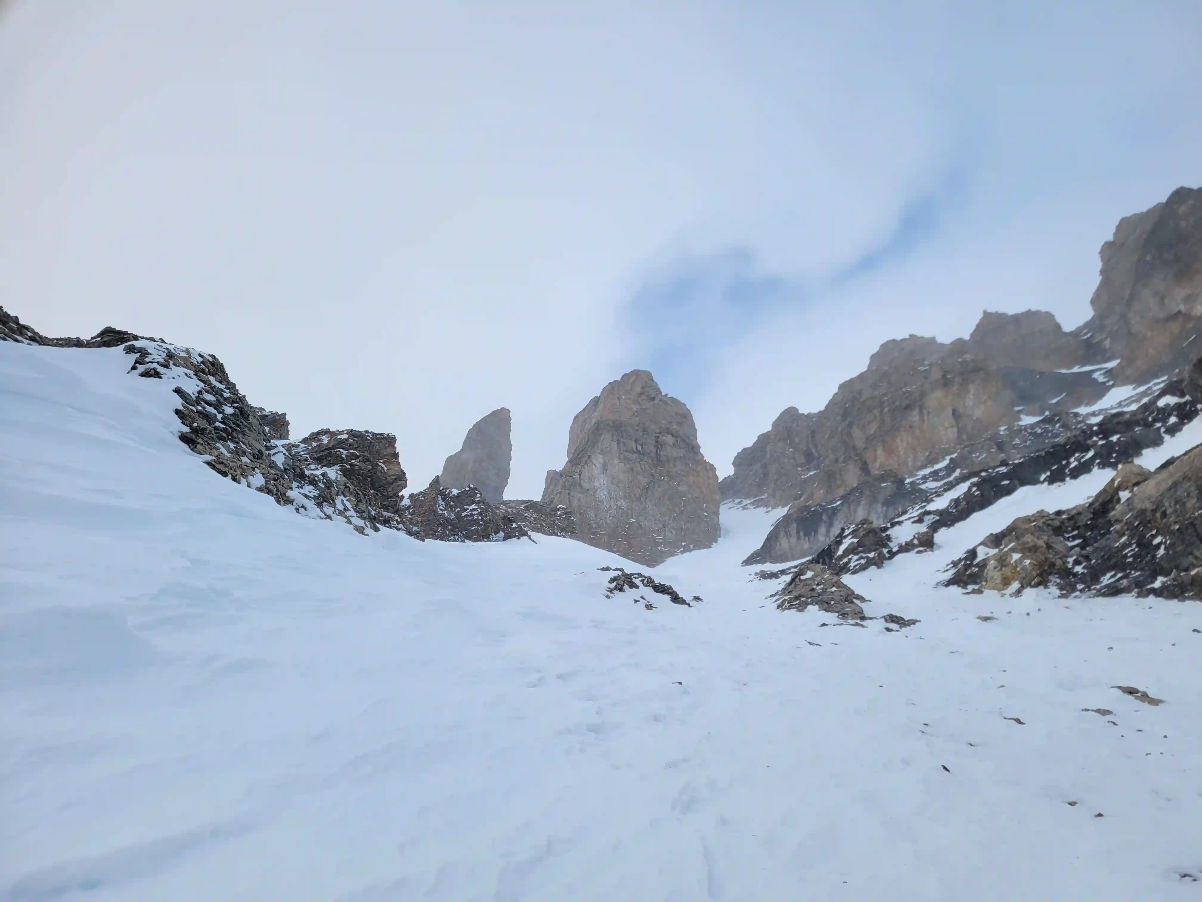
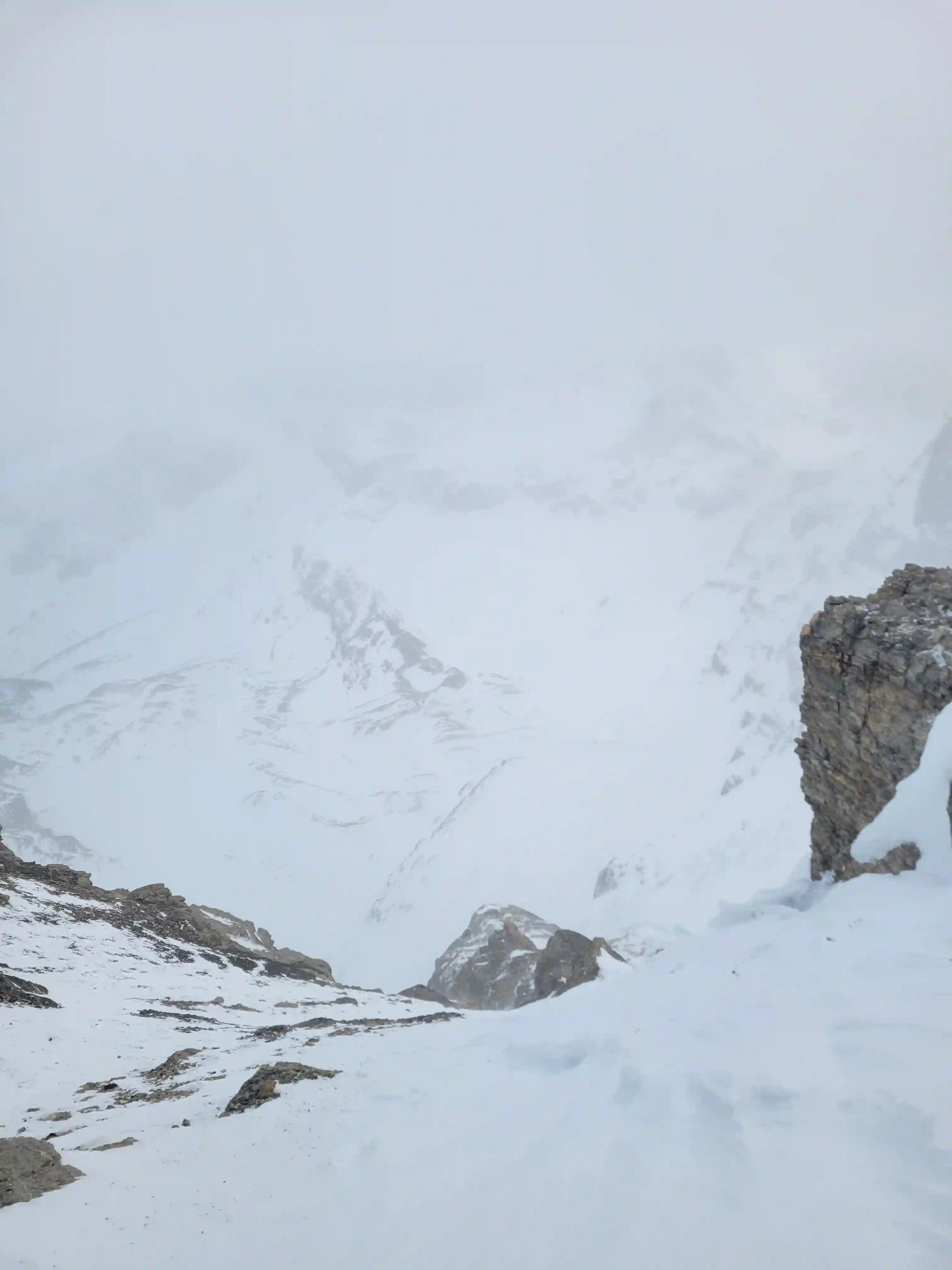
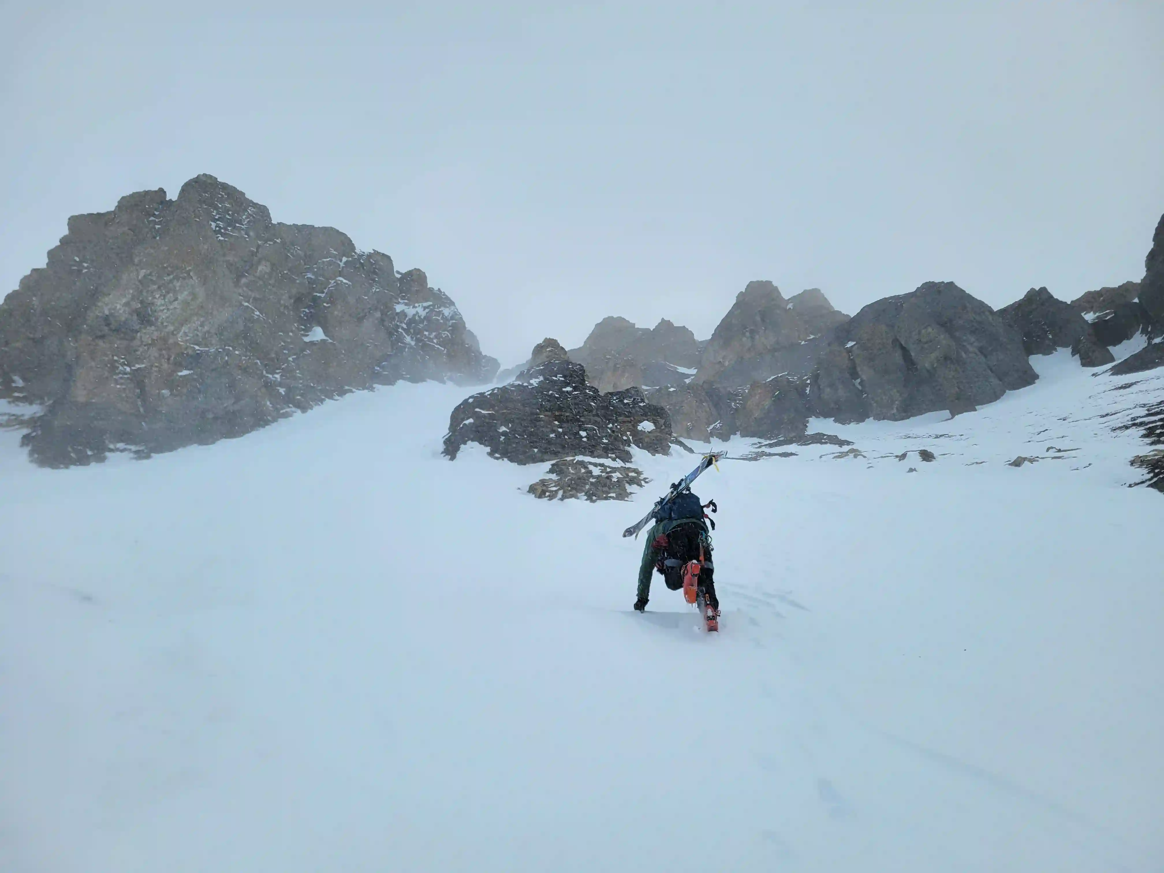
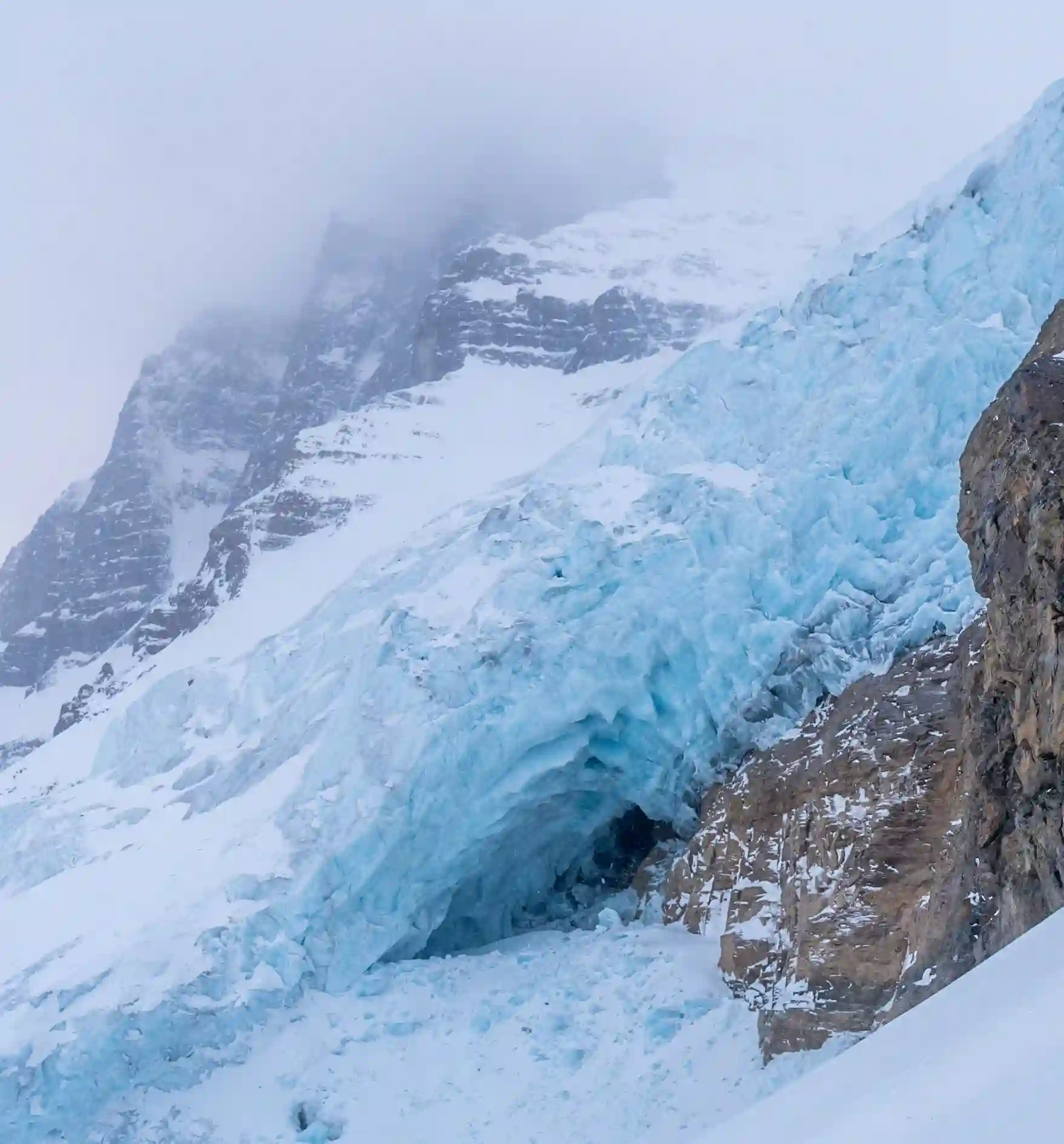
photo by Rob Walker
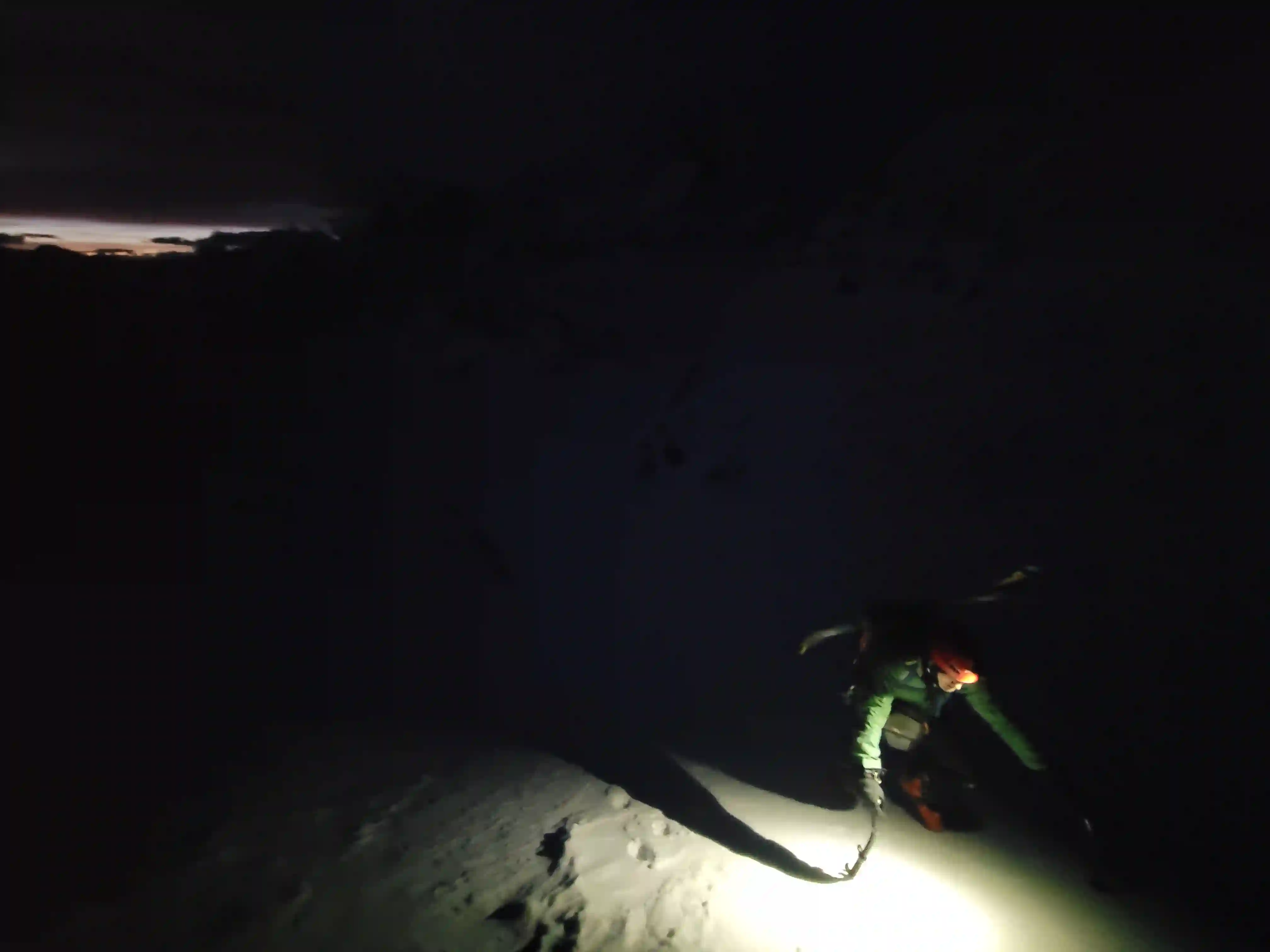
exit in the dark
of the exit could be straightlined but the final
treed section was pretty painful
Heading into this trip I wasn't exactly sure how accurate the forecast would be for February conditions above 11000 feet but for the most part we lucked out. Although weather was a bit more variable than expected the views we got as we ascended Diadem's SE face direct couloir were stellar and when the clouds did occassionally lift from Diadem's summit it made up for being fully socked in atop Woolley.
Thanks to Rob for teaming up with me to check off these two, it would be a solid couple months before my next visit above 11000 feet but what came next was a trip for my
last remaining giant on the Columbia Icefield!
Follow the full progression
I'm working through all 58 11000ers of the Canadian Rockies and beyond. You'll get notified when the latest climbs go live.
Other related trip reports:
Warren & Brazeau |
Mount Joffre |
Mount Columbia ||
The Goodsirs |
Mount Alberta
11000ers of the Canadian Rockies
© Haldan Borglum | Peak by Peak. All rights reserved.