The Goodsirs
August 24-26 2025
Also known as the choss bosses of the Canadian Rockies, The Goodsirs make up 3 peaks on the 11000ers of the Canadian Rockies list and are infamous for their loose rock with the south tower holding an exceptionally bad reputation. With the combination of technical terrain, insecure and frequently breaking off footholds and handholds, and the occasional rock whipping down from above these 3 peaks are considered the russian roulette of the entire 11000ers list and see very few visitors as a result. While the technical climbing on these peaks isn't all that difficult, only reaching the 5.4 grade in a handful of sections, the amount of rockfall prone terrain on all 3 of them and the focus required to get up and down the largely unprotetable south tower without incident speaks for itself.
Following Darren, Tim, Mitchell, and my trip for
Mount Alberta
the bluebird window we had was forecasted to last for another 3-4 days so despite the tired legs Ian and I met up in Lake Louise the next morning to stock up on food and soon after we were headed back into the boonies SW of Field for the wild Goodsir Peaks! Ian and I had teamed up for
Whitehorn Mountain
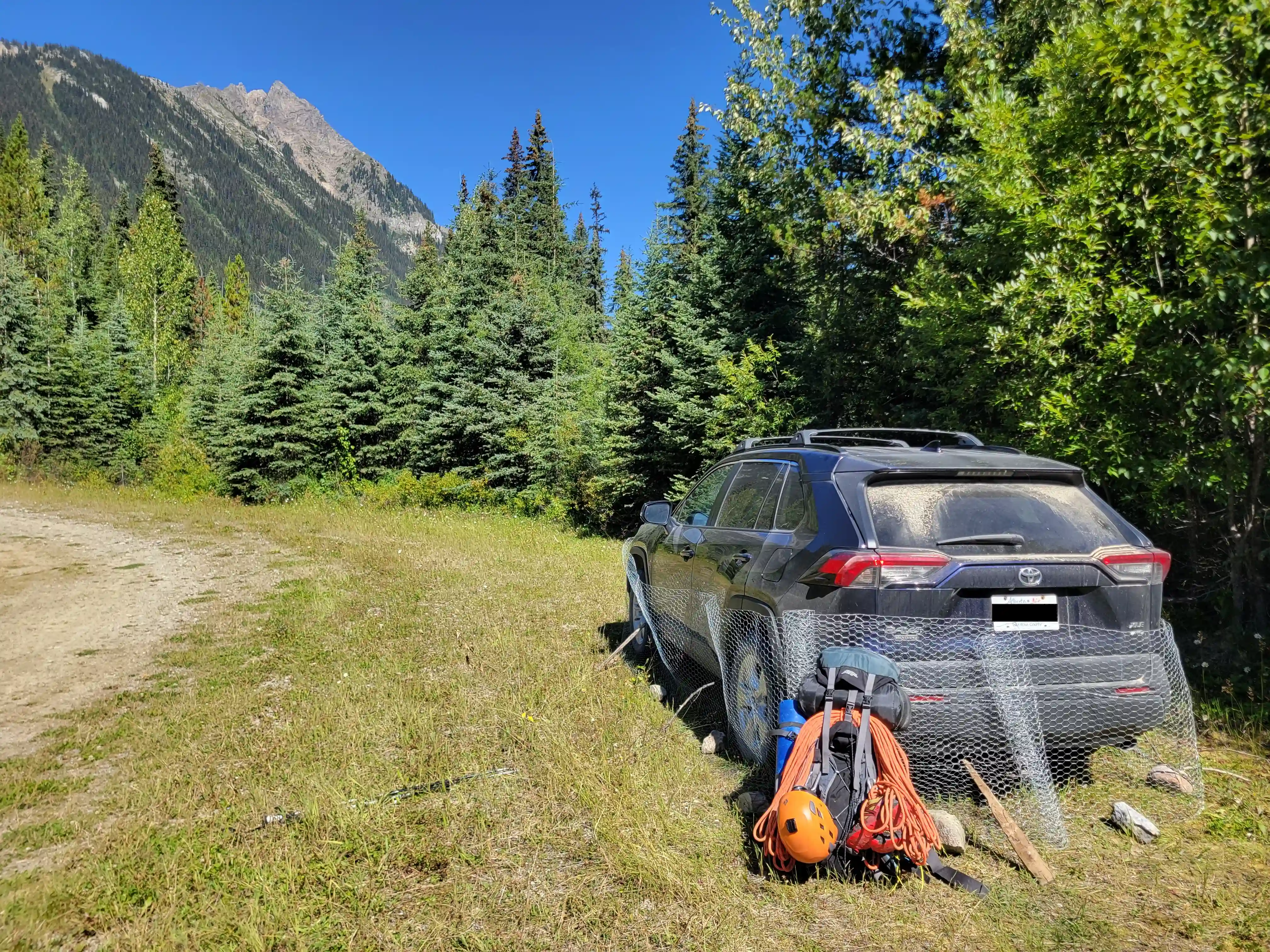
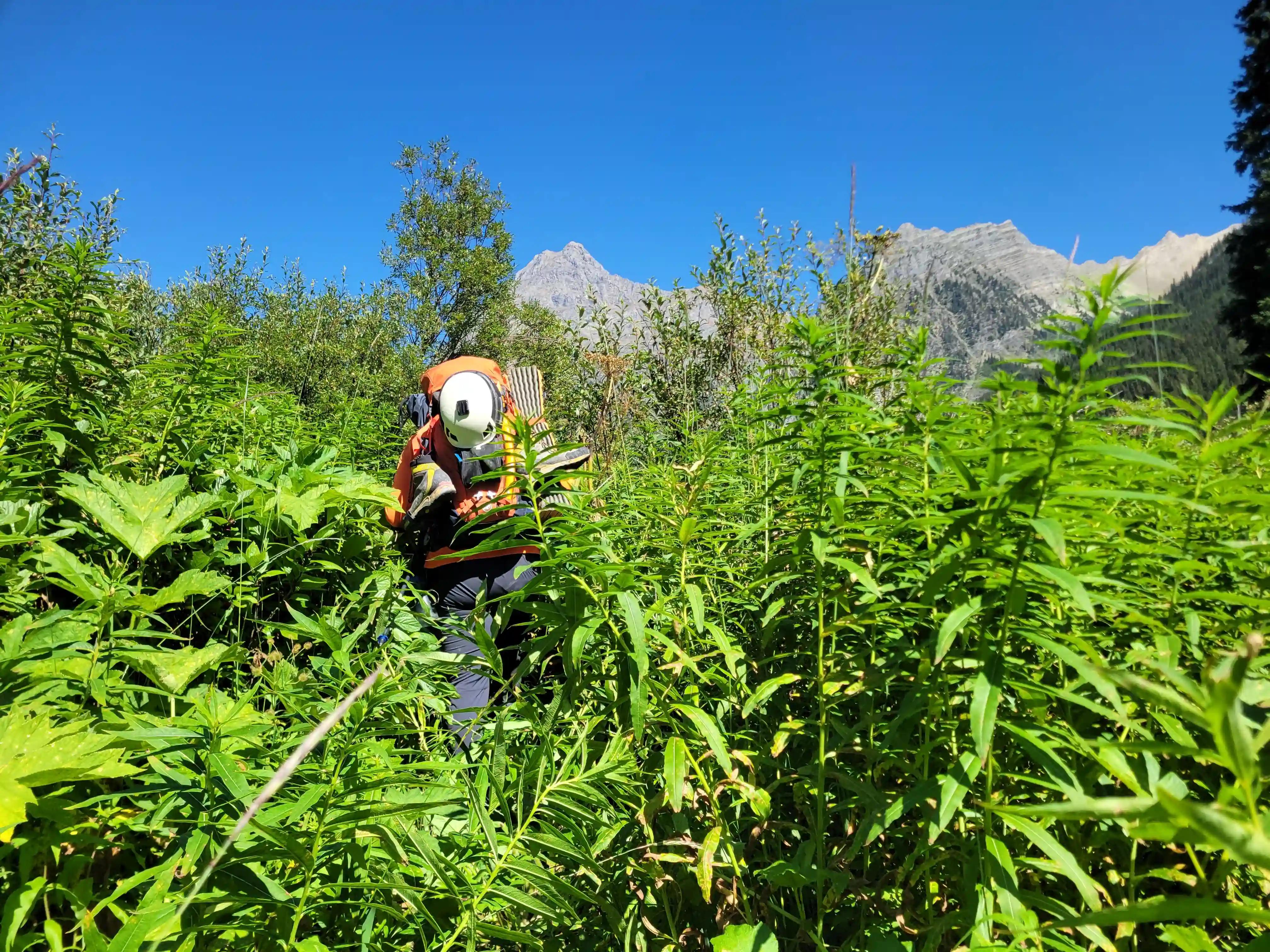
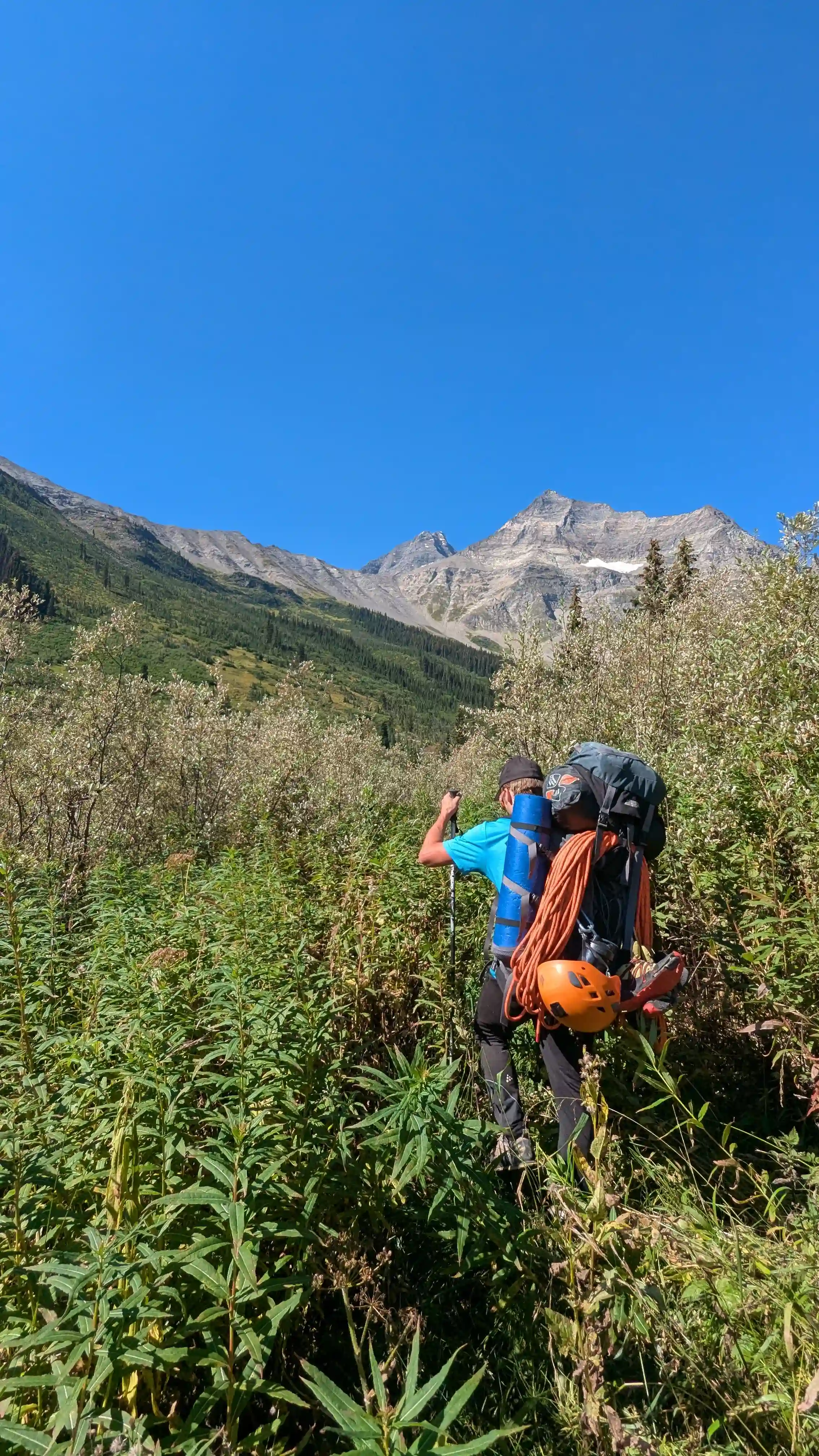
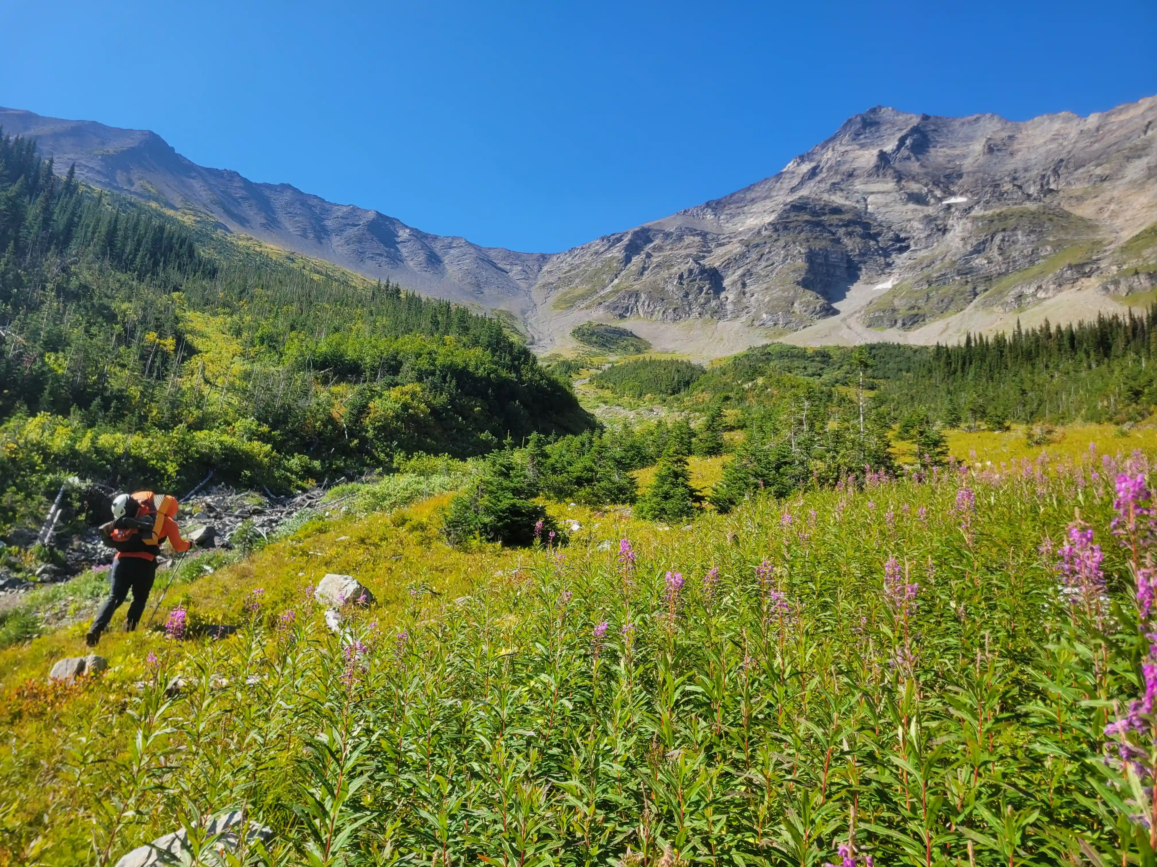
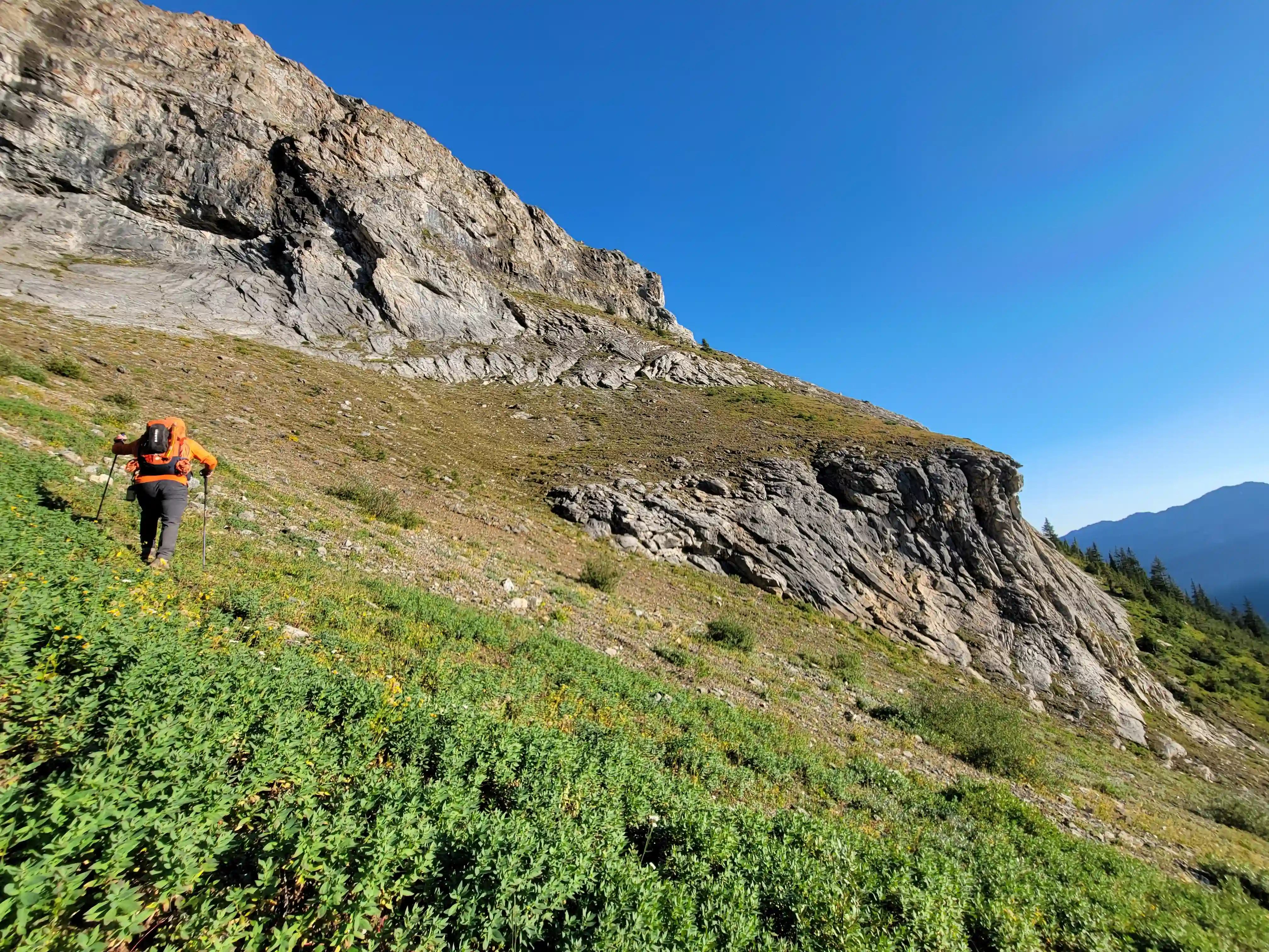
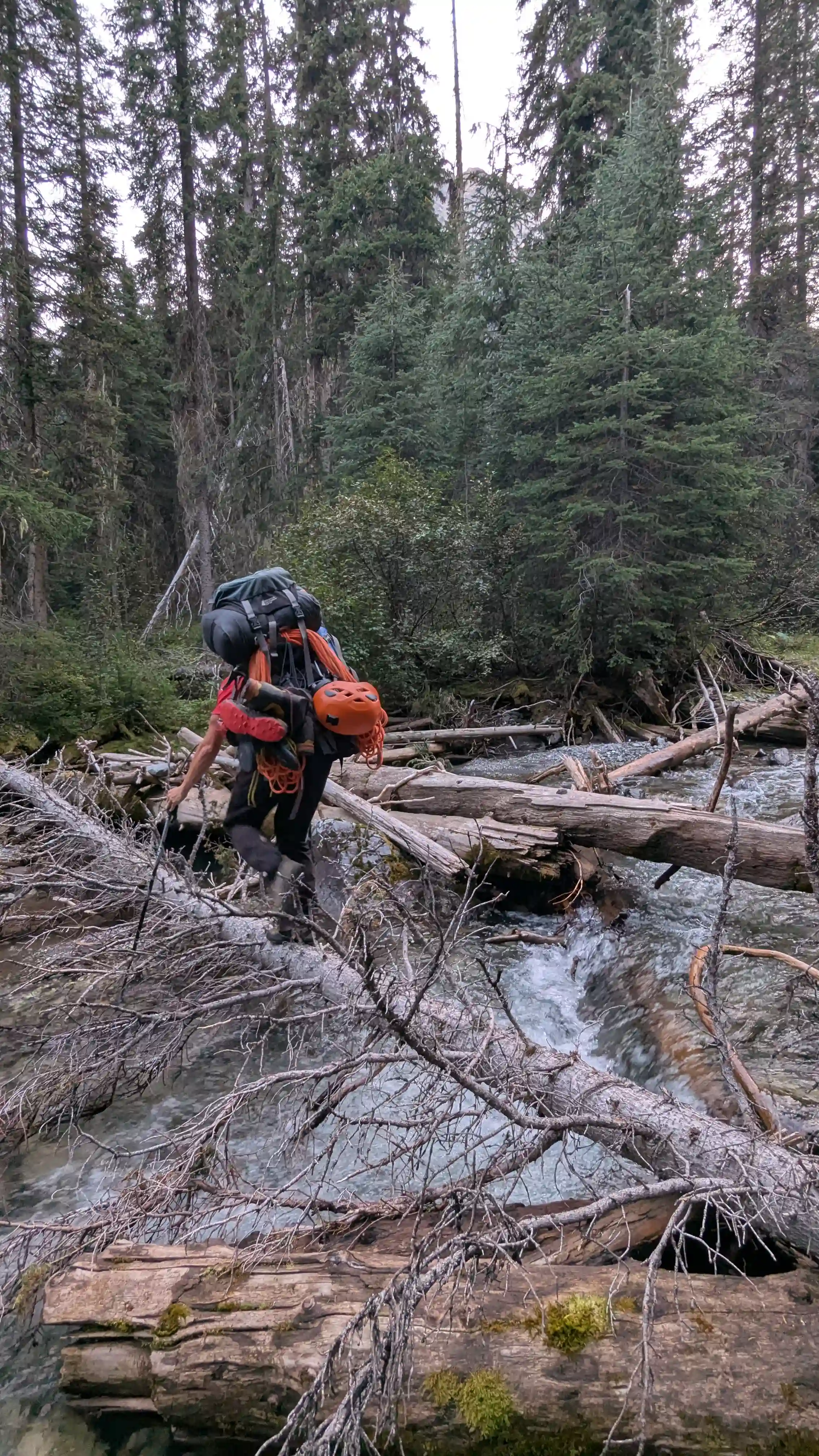
a month prior so we knew we were both capable and would make for a strong duo for an objective like The Goodsirs, and we'd been keeping in touch waiting for a window to go for it and now was the time! After heading over 35km out the Beaverfoot, Wolverine Creek, and Moose Creek forest service roads we had reached our start point and after getting all geared up and wrapping Ian's car in chicken wire just in case any pesky porcupines came around we were off a bit after noon.
The standard approach for The Goodsirs used to be via the Ice River and Zinc Creek route which is particularly marshy and didn't sound very enjoyable but within the past years the Moose Creek approach has gained in popularity given that there's a hunter / horse trail that covers a large portion of the valley bottom kilometers and the lack of swampy terrain. The trade off is that with the Moose Creek approach extra elevation has to be gained over a col to get close to The Goodsirs, and with the further SW line the camp site for this route is below the south tower instead of the north making for a tedious sidehilling endeavor to get to and from the north and center peaks. All of that being said there is no easy way to approach The Goodsirs, both routes have their positives and negatives and both definitely fall under the classification of slog so pick your poison!
links:
STRAVA
|
GAIA
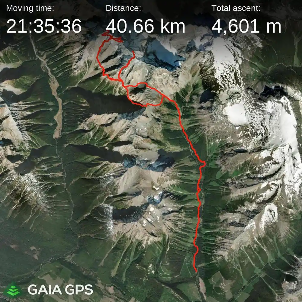
elapsed time: 58 hours
DIFFICULTY: D/D+, 5th class up to 5.4, significantly loose terrain, significant rockfall hazard, routefinding, multiday, remote
Use the following links to jump to:
Follow the journey
I'll send you an email when a new trip report drops.
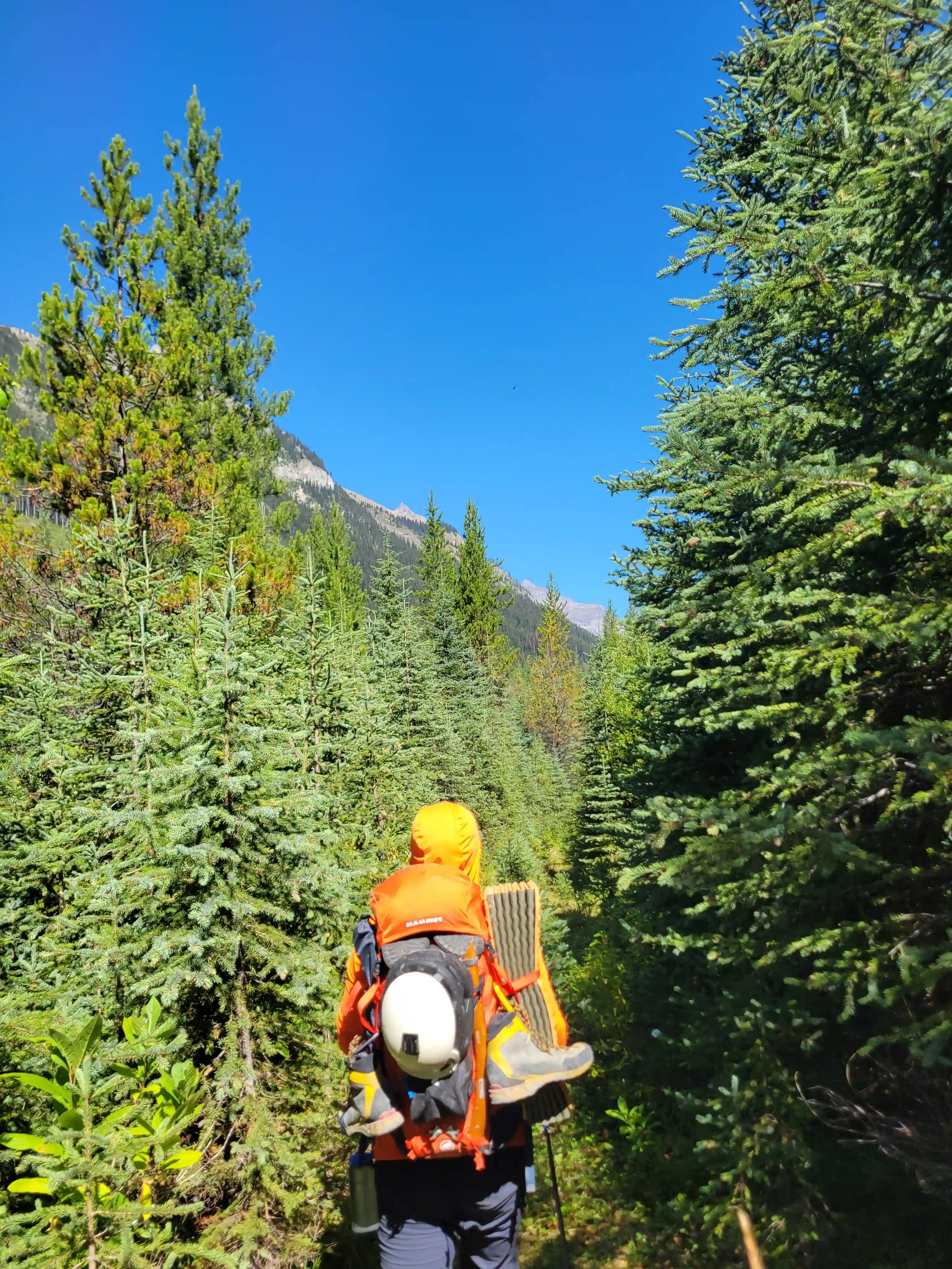
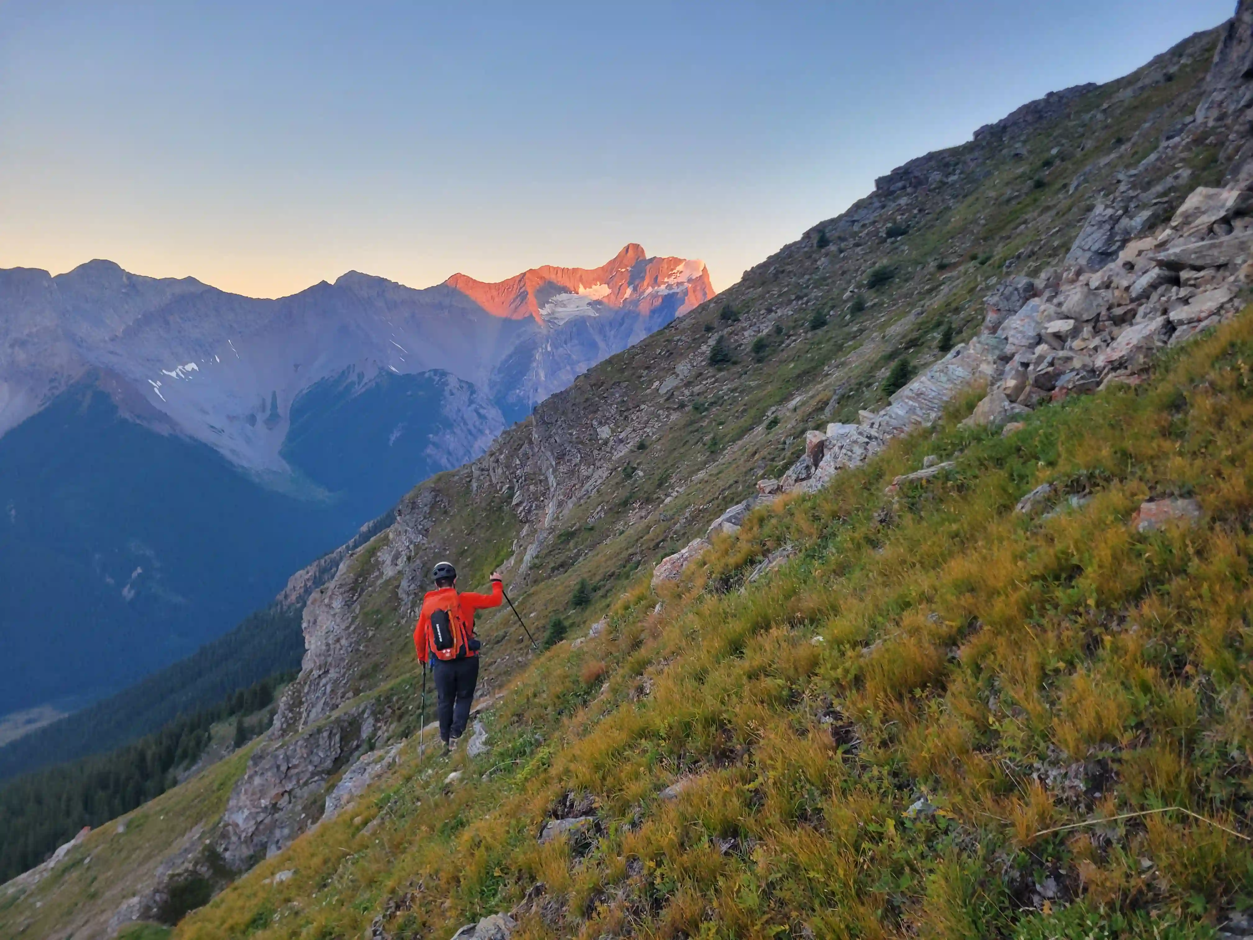
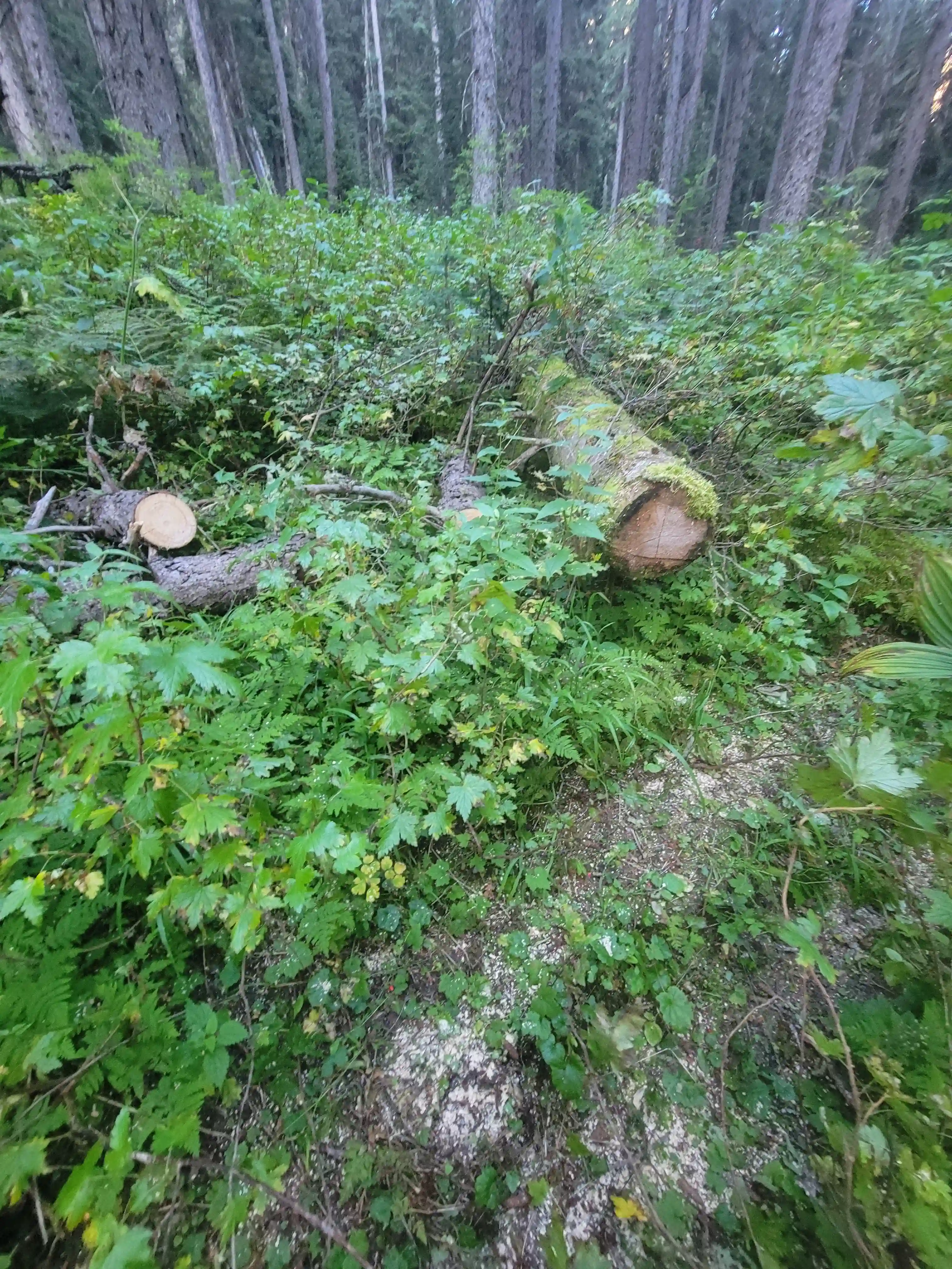
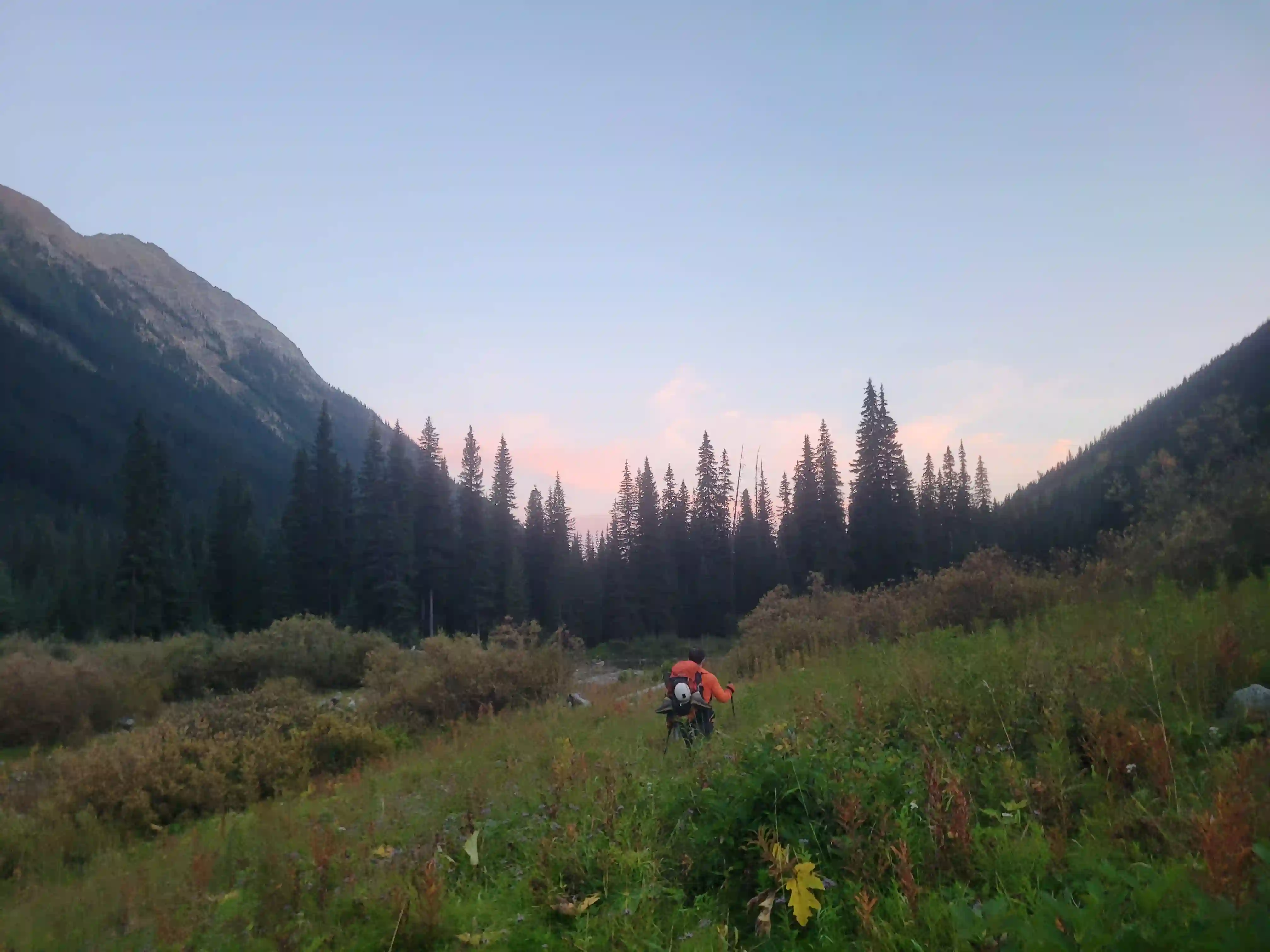
After getting started the cut trail was wide enough for a quad for a kilometer or two before narrowing down to single track and this single track lead us most of the way up the Moose Creek valley with occasional deadfall and bushy sections but with significantly faster travel than I would've expected into such a remote area. My legs were feeling it for the first few kilometers after the past 3 days out for Mount Alberta but after an hour we could see the Goodsir South Tower in the distance and the stoke was high so that made it easy to think about other things.
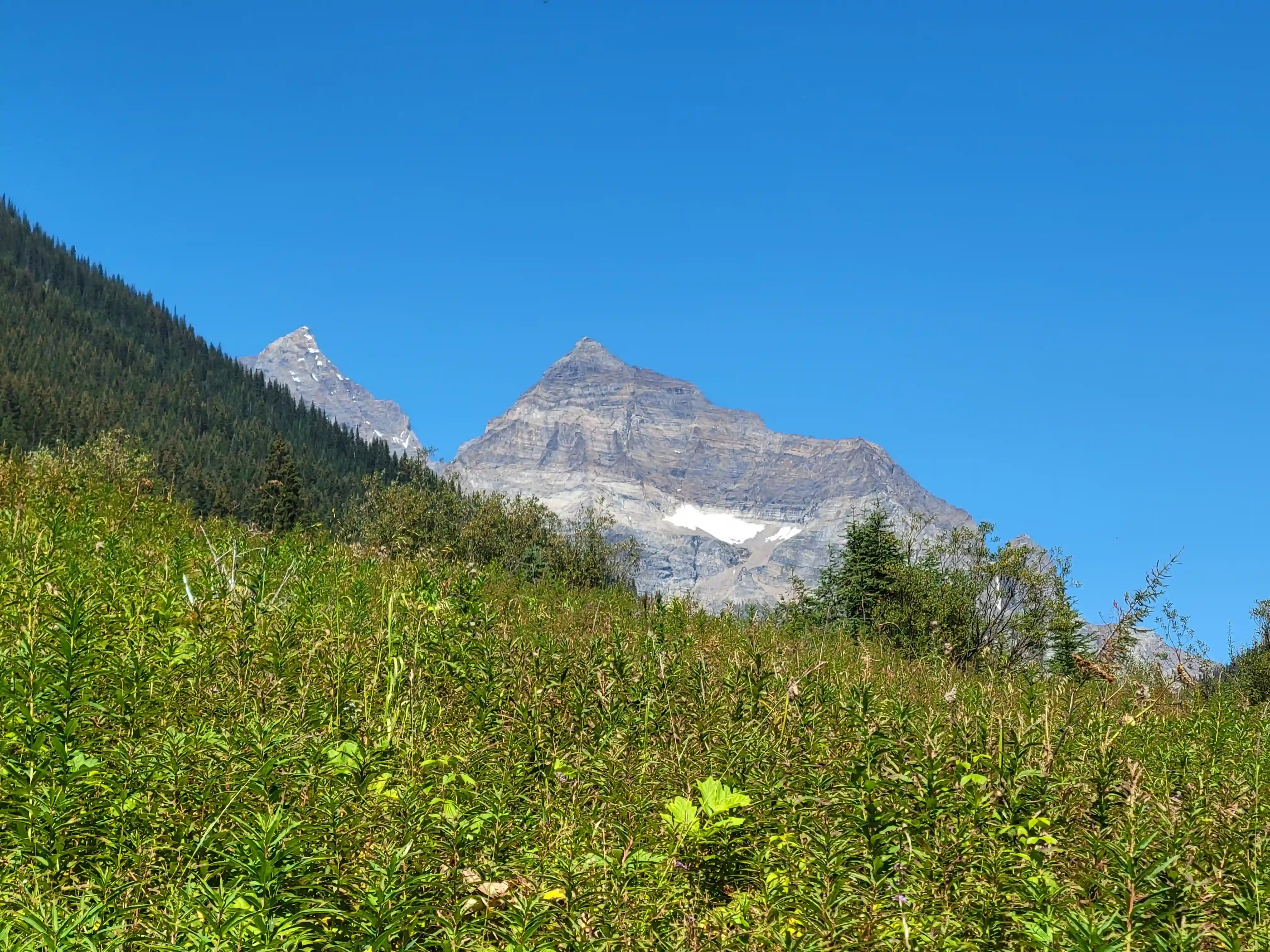
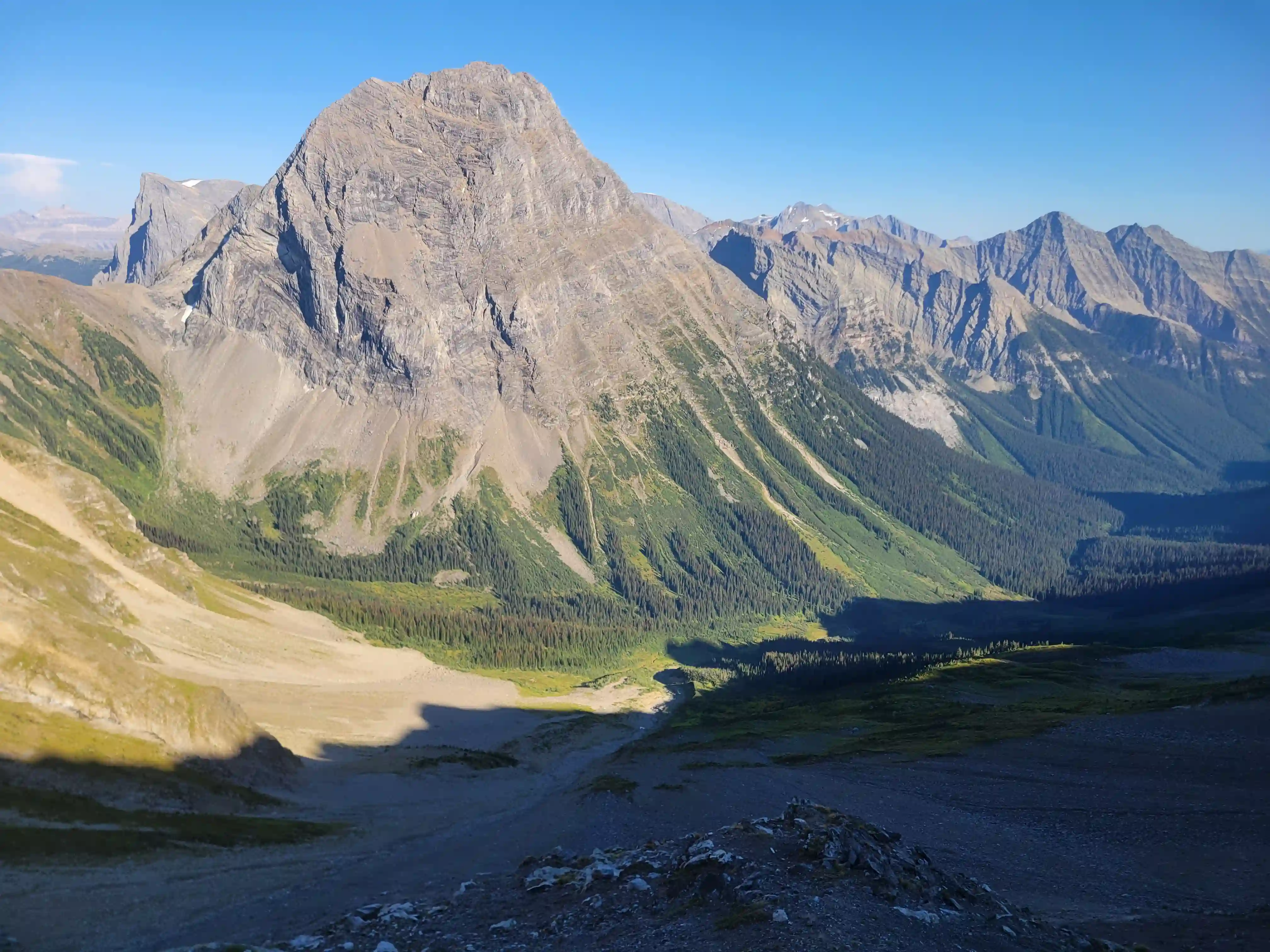
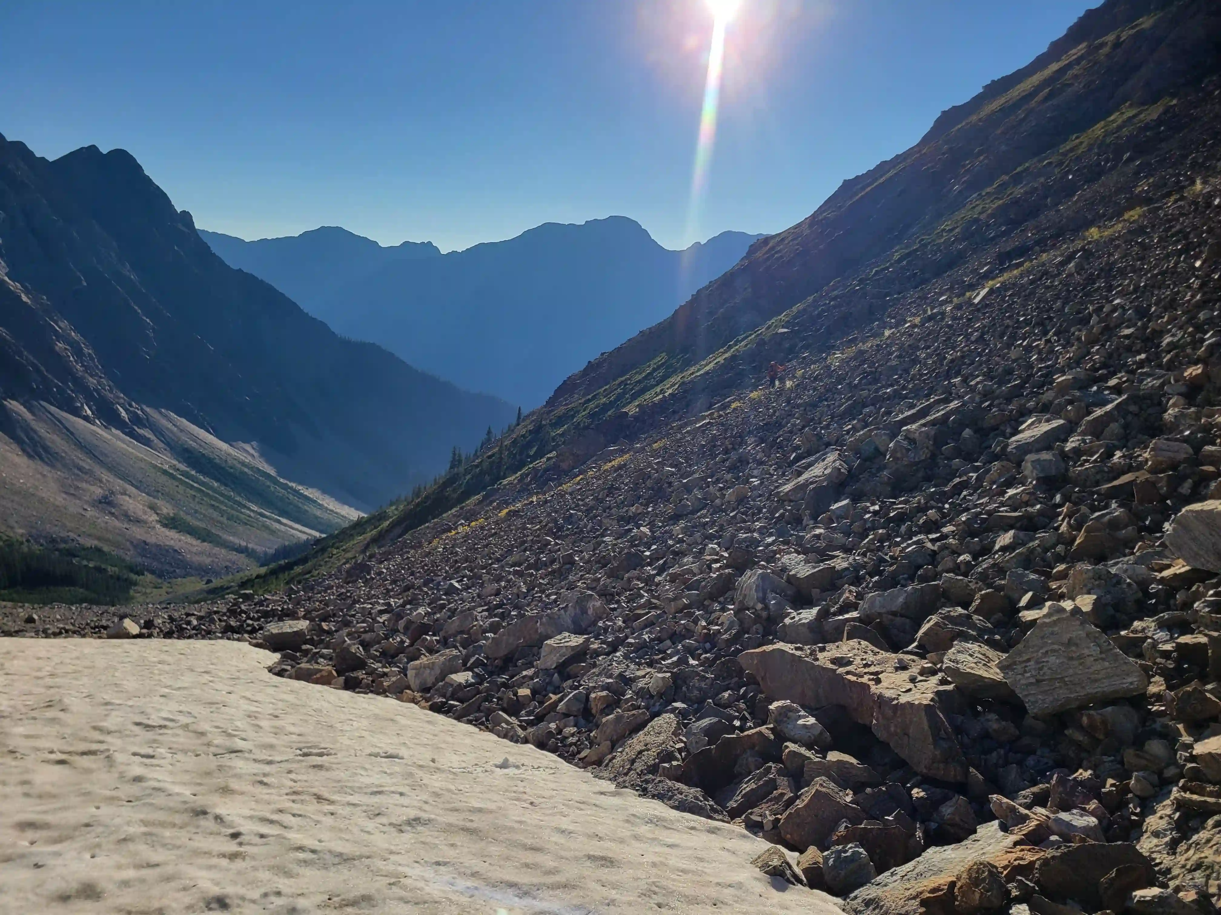
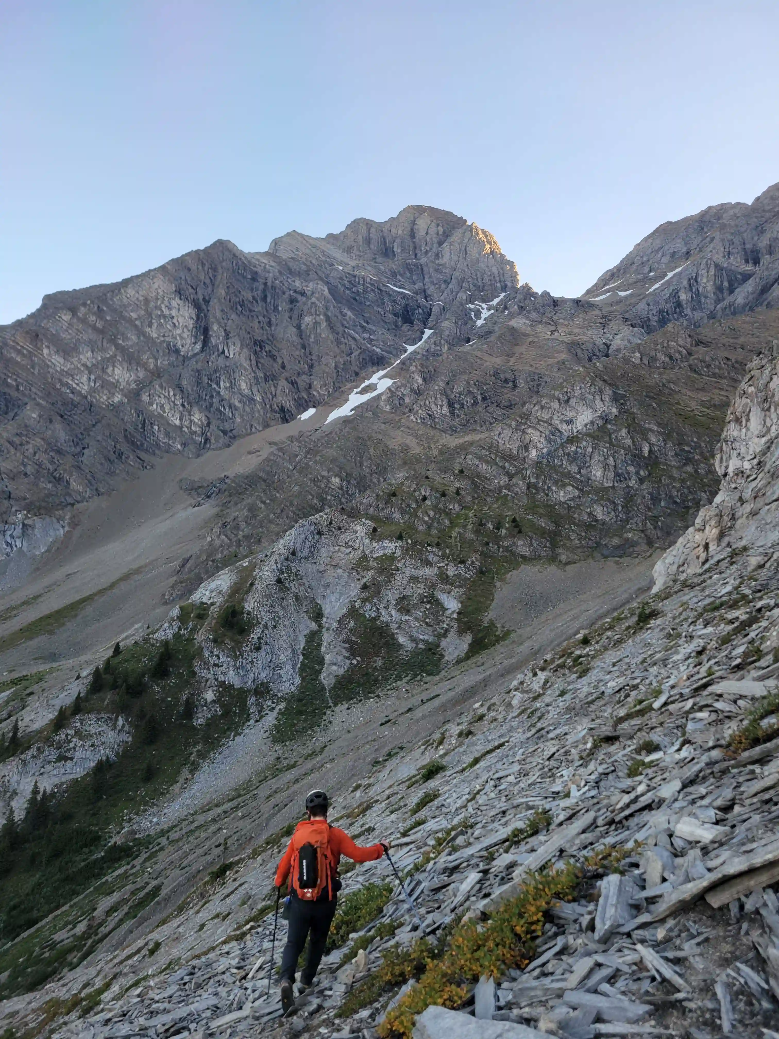
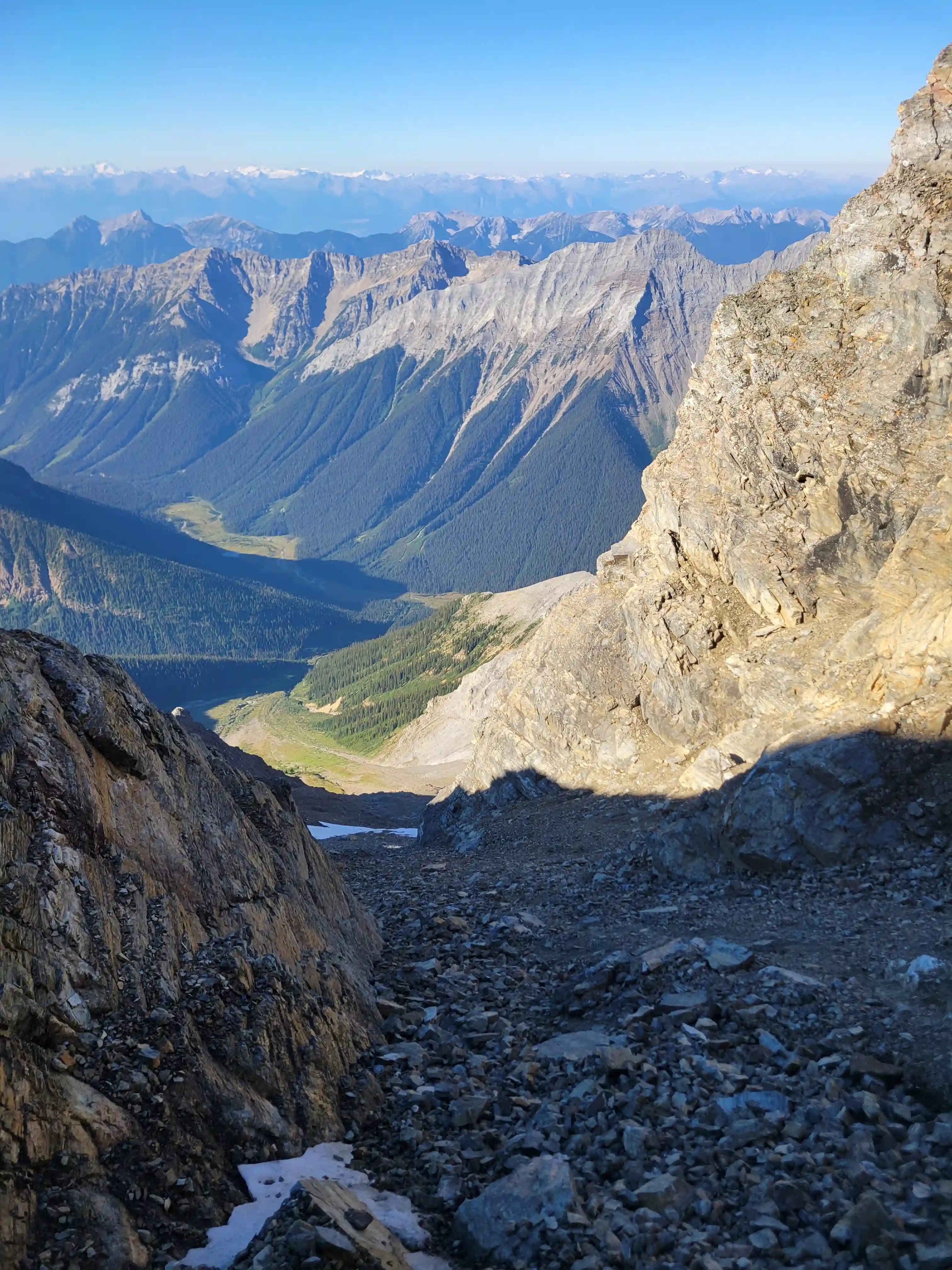
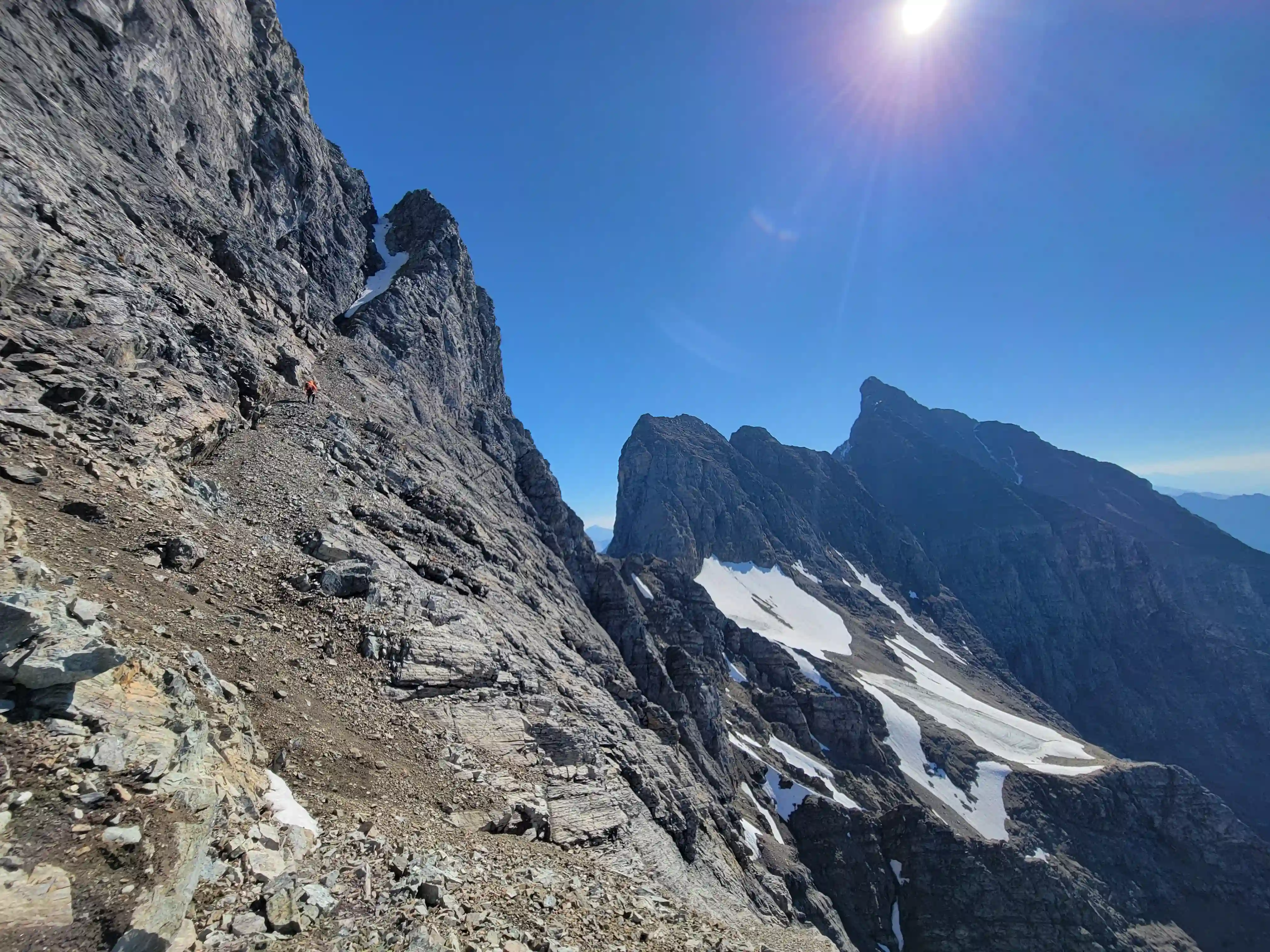
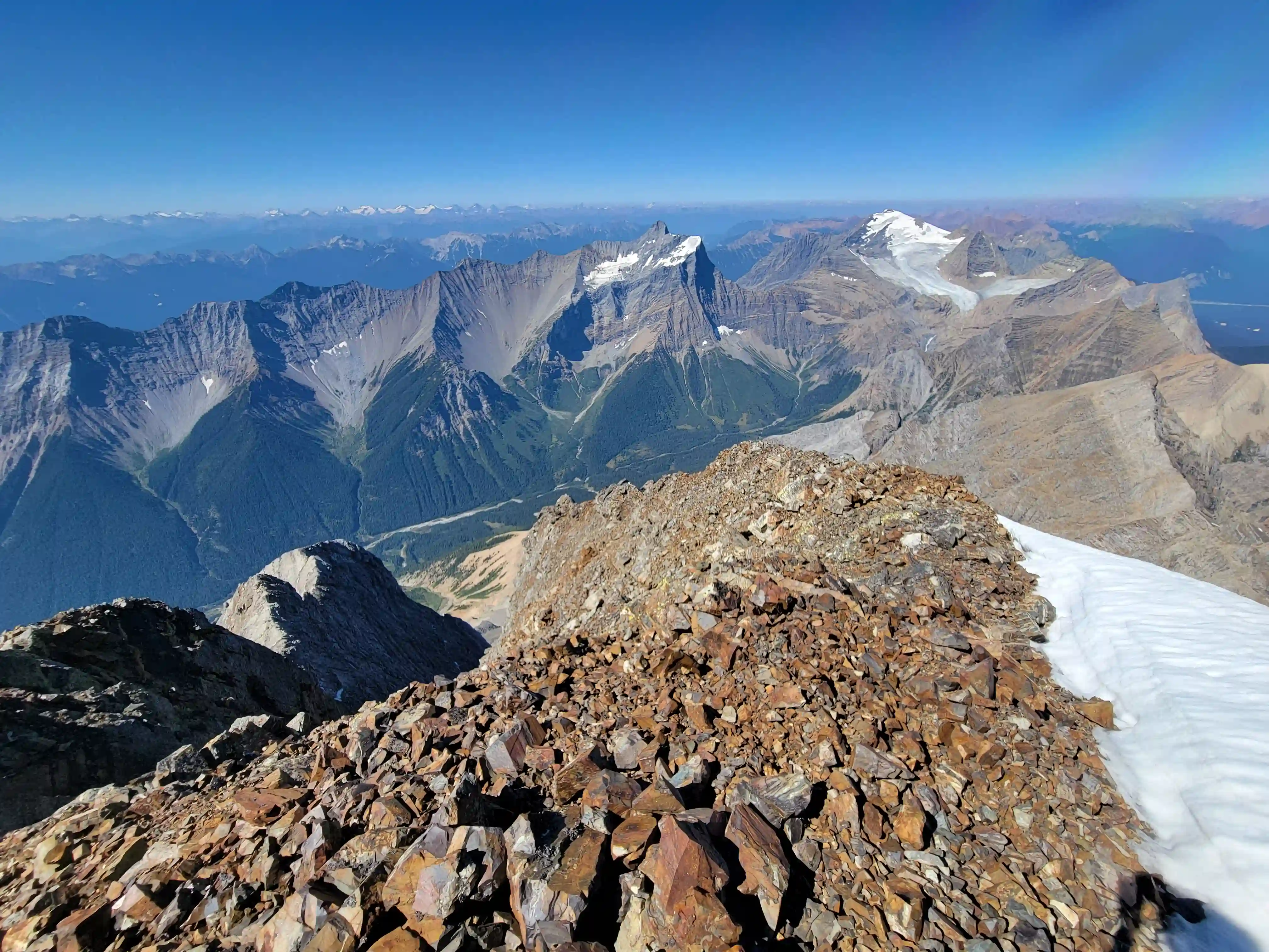
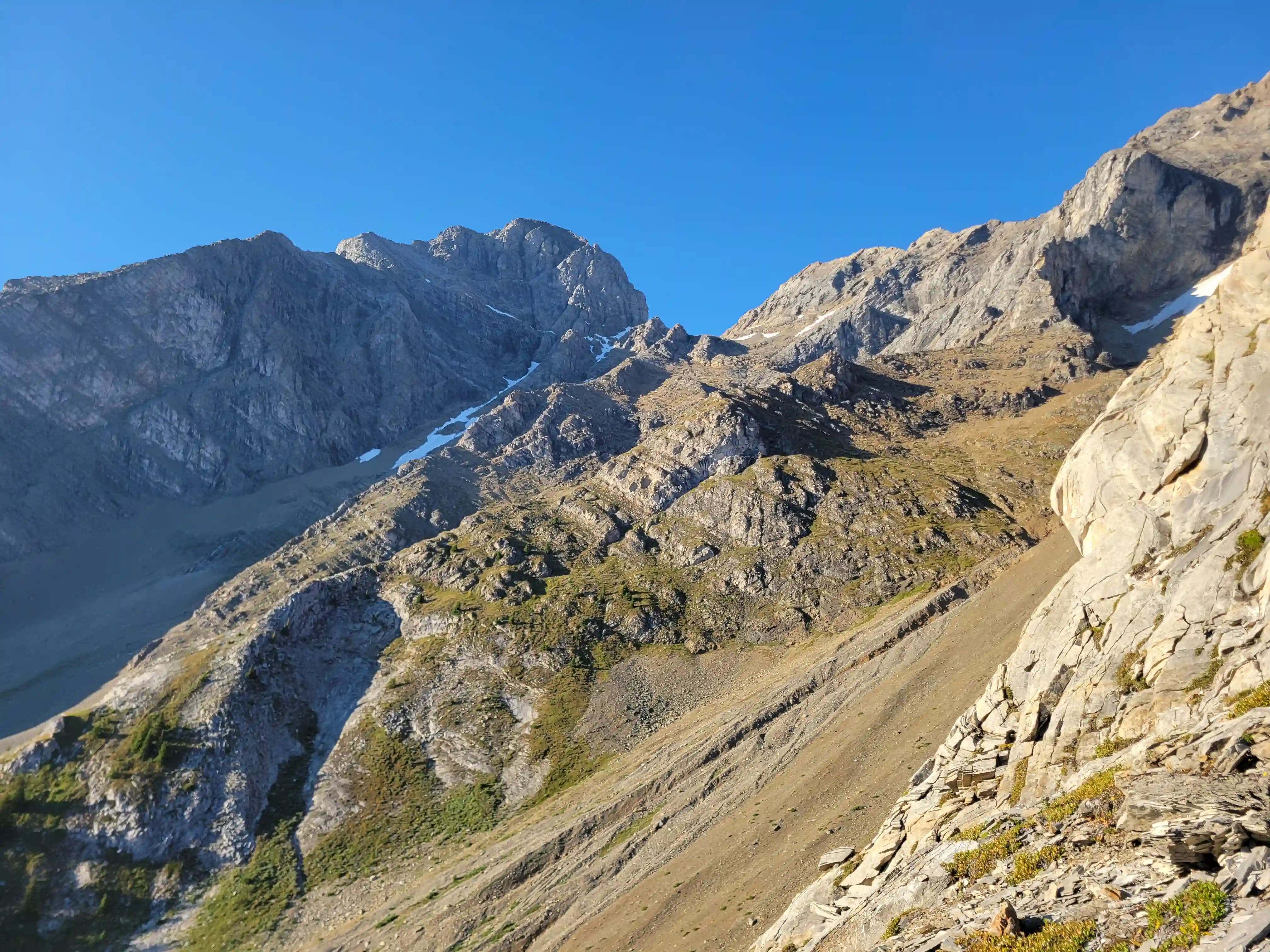
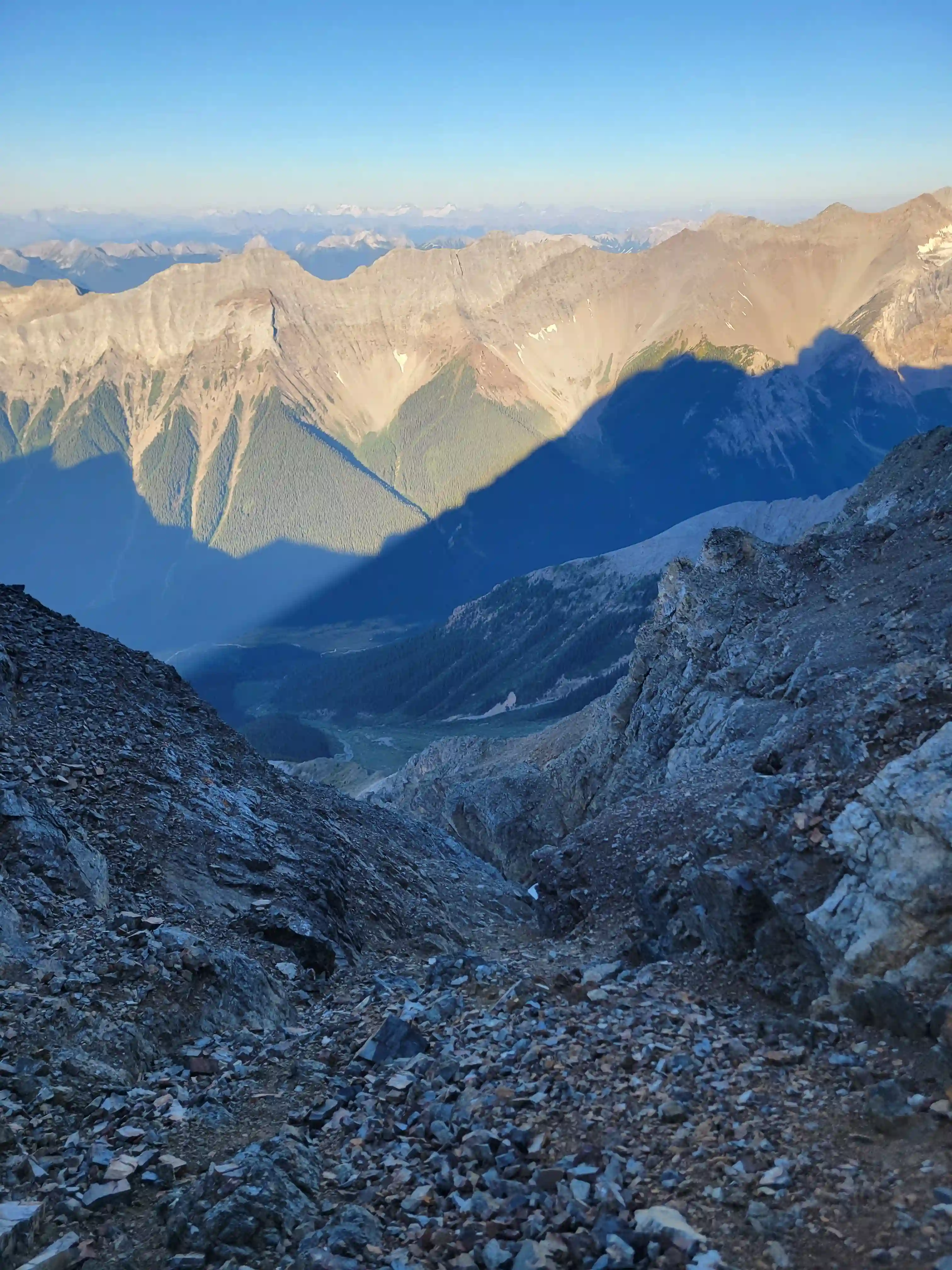
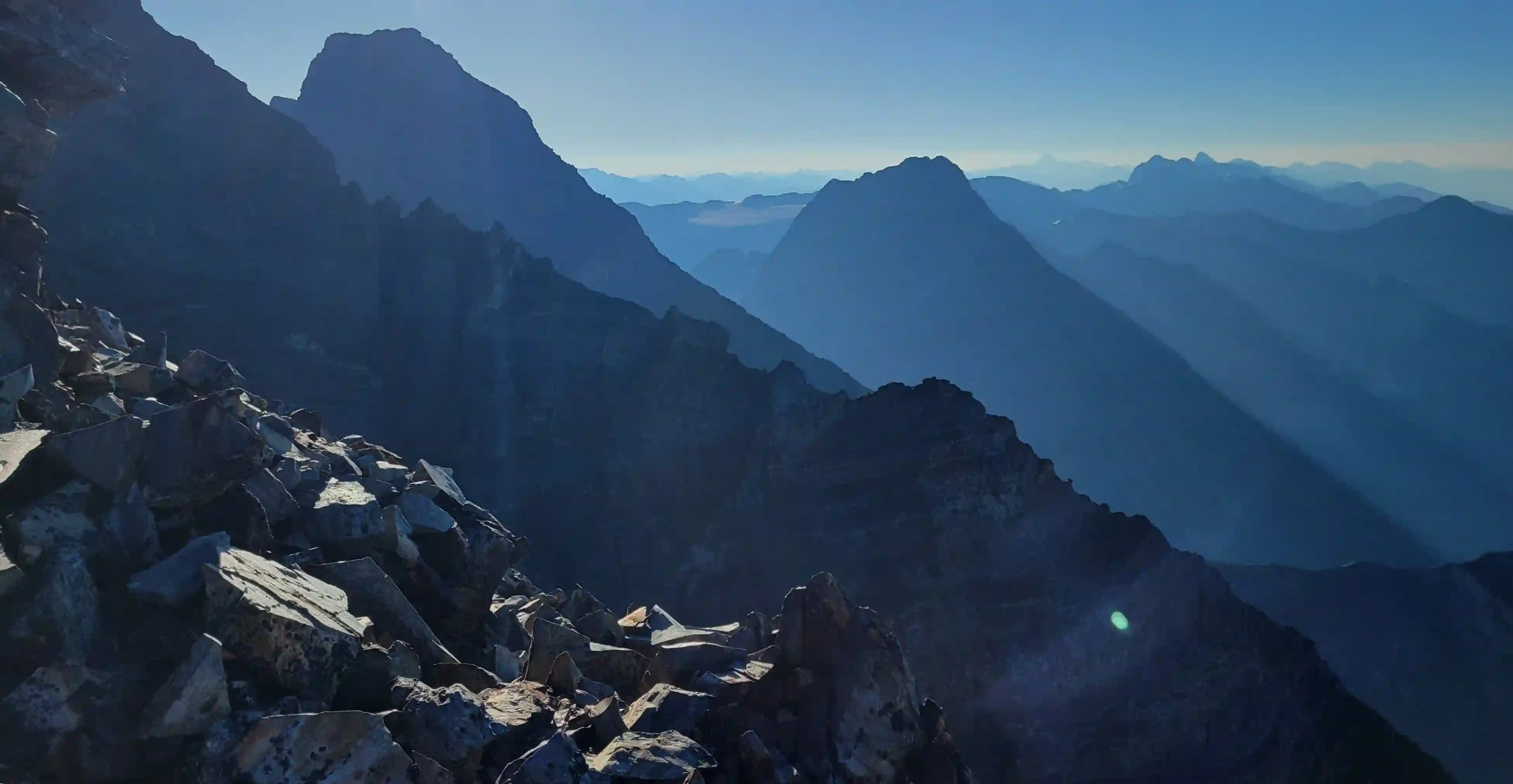
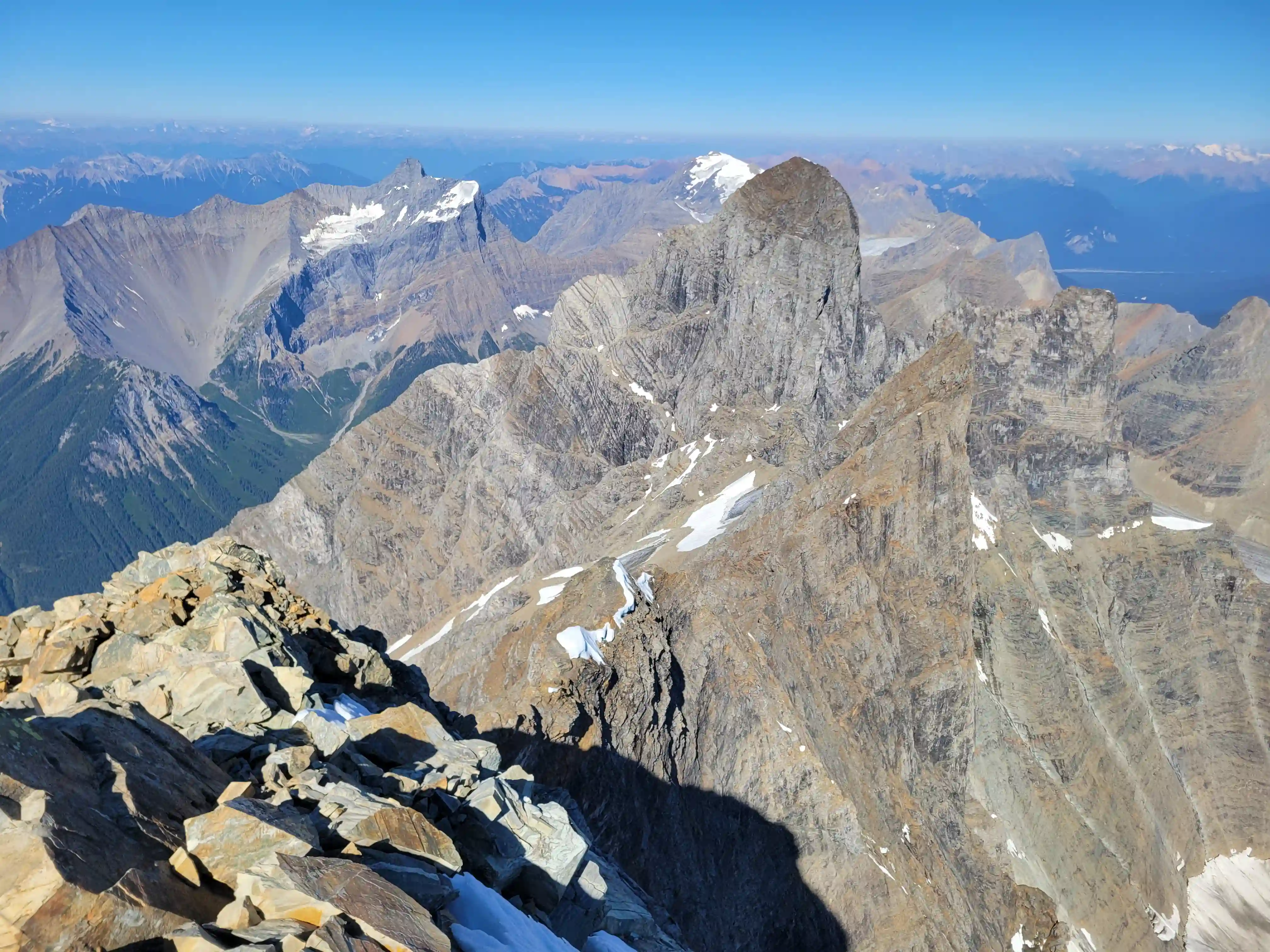
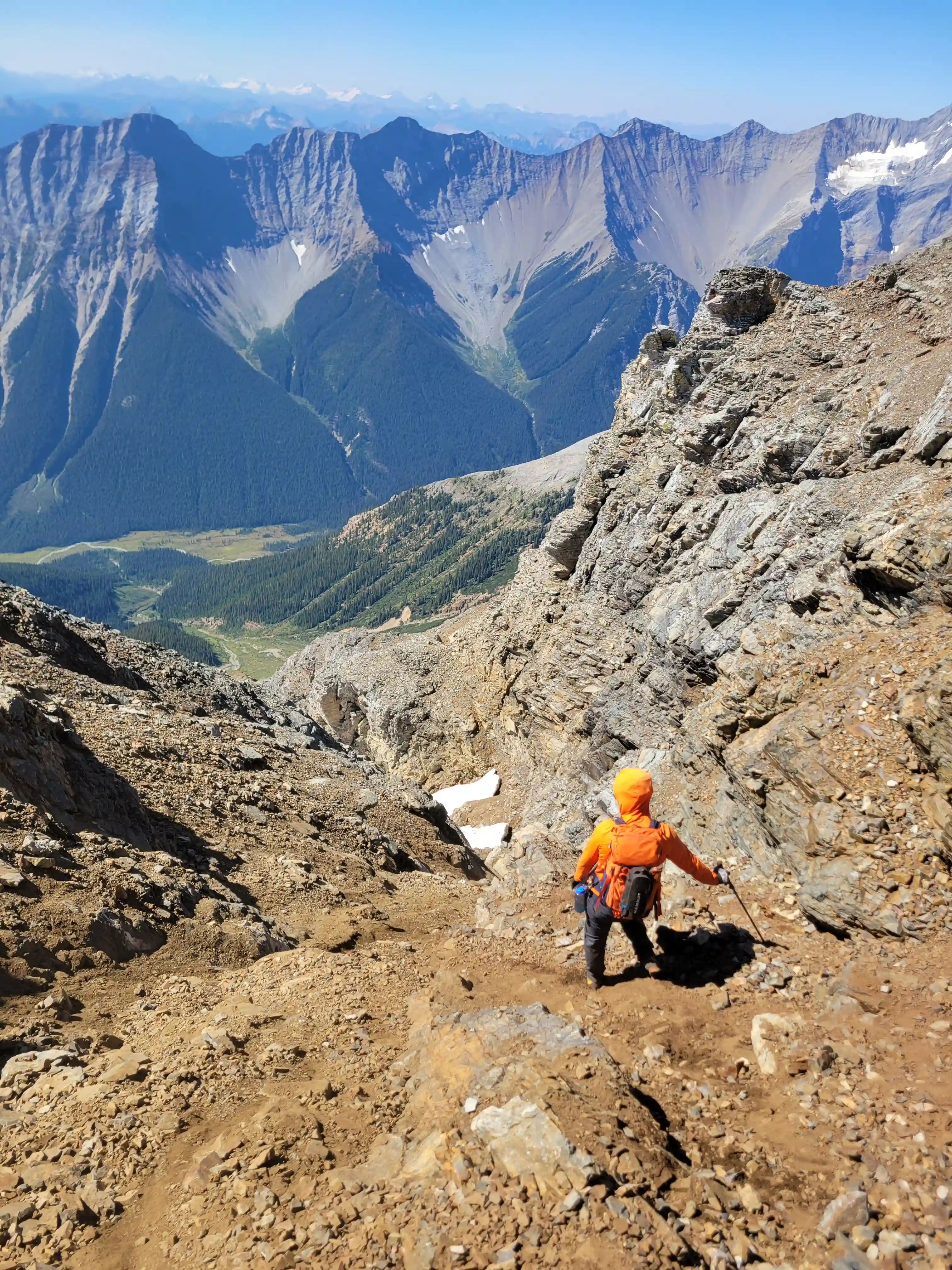
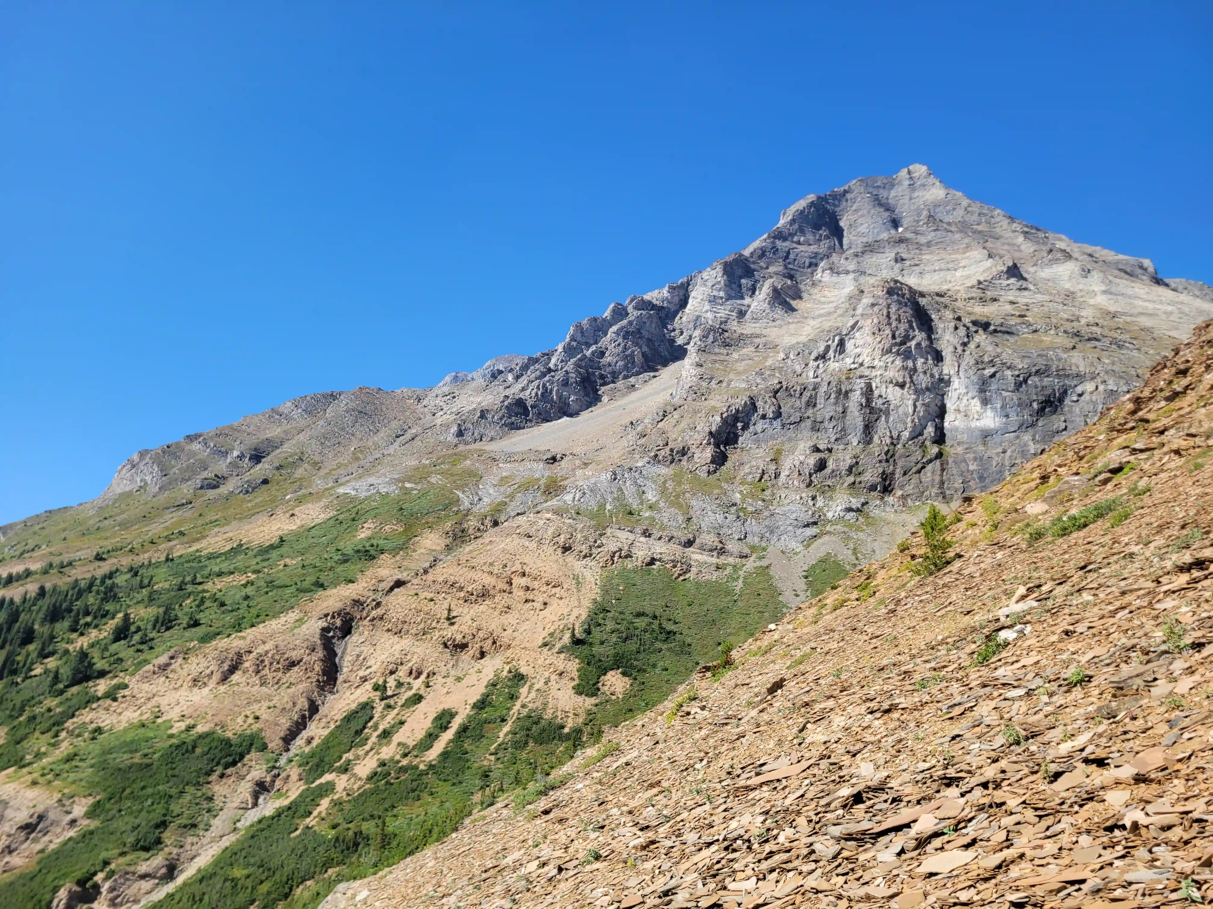
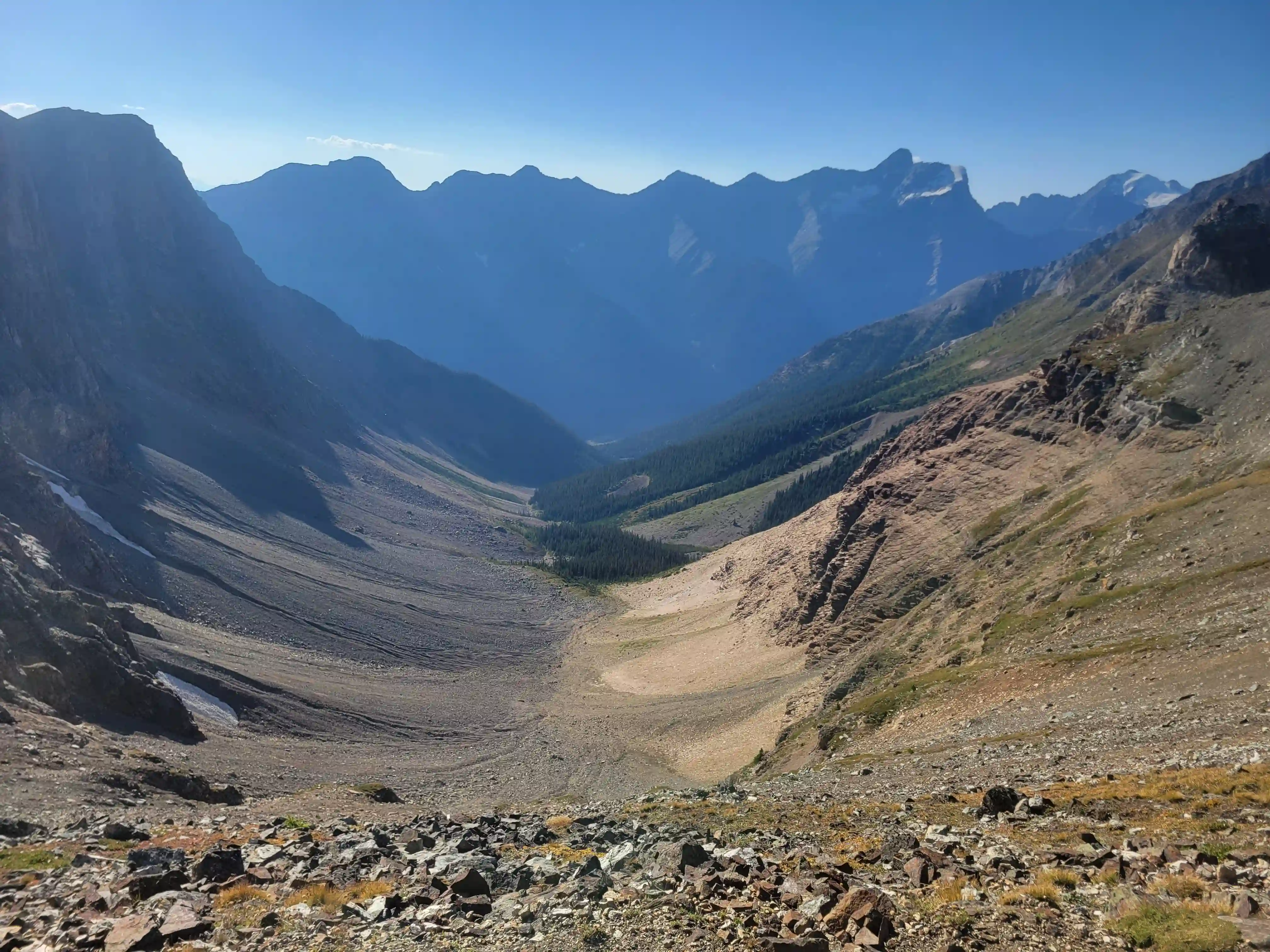
After reaching the end point of the trail our speed definitely slowed but this is where the route heads up towards the col that you need to gain before dropping down towards The Goodsirs camp so we were bound to slow down regardless. This section of elevation gain was hard work with the heavy packs and loose terrain underfoot and the col was definitely foreshortened so it took longer for us to reach than expected. A bit before topping out we realized that we had gone for the wrong col and were climbing 120m more than the proper one but it was easier to continue up at that point so we pushed on for the high point. The views of Goodsir South and Sentry Peak were great from this spot and we took a good break here before heading down the other side.
The way down started off a bit tedious with loose and steeper terrain to start followed by awkward choss boulders but after that we had some snow boot skiing and flatter ground to cover before the awkward sidehilling began. Thankfully this portion of sidehilling on the trip was pretty short lived and after a bit of this traversing we were climbing again and not longer after we reached the bivi site.
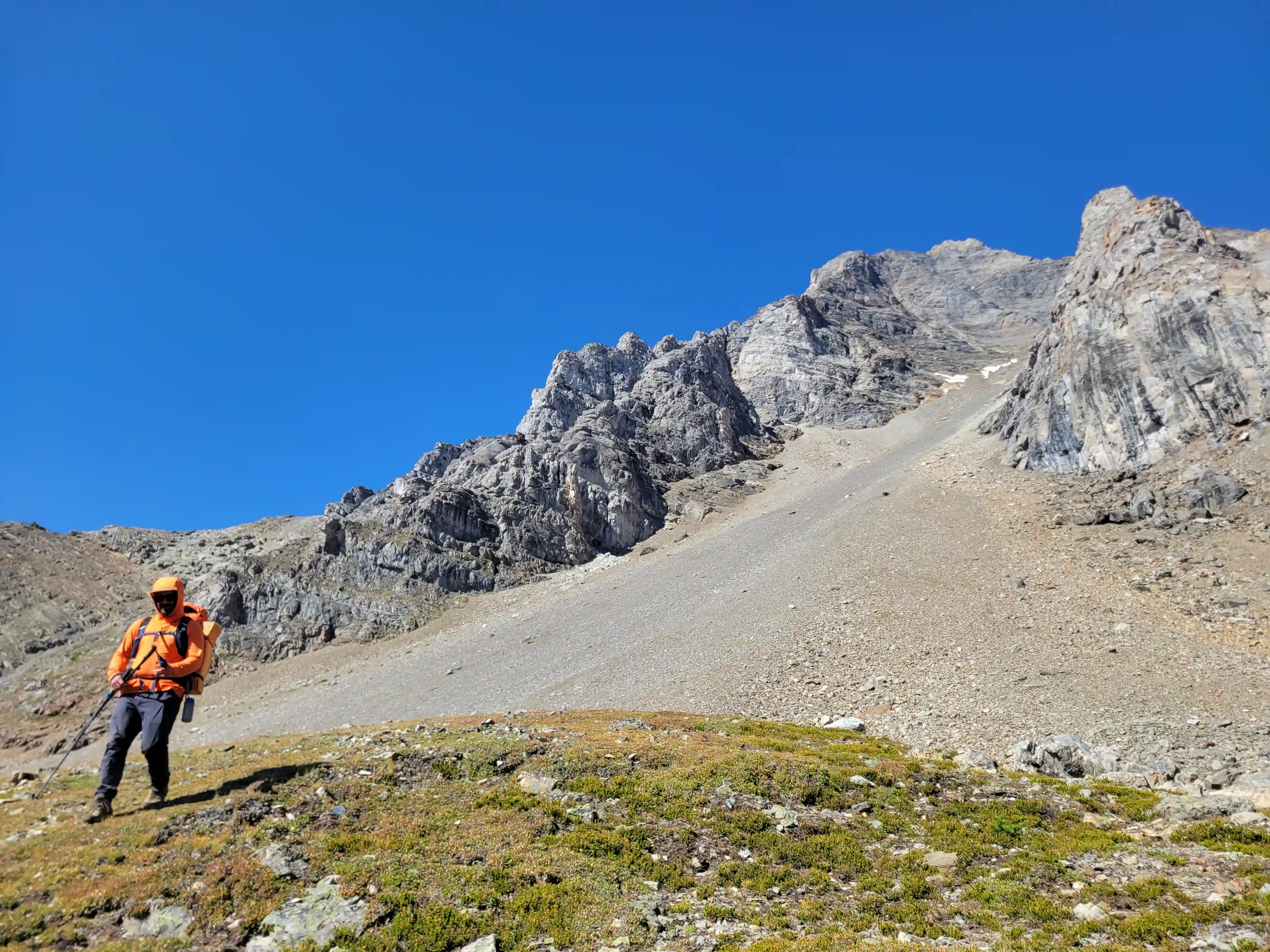
THE APPROACH
our approach col just left of Sentry
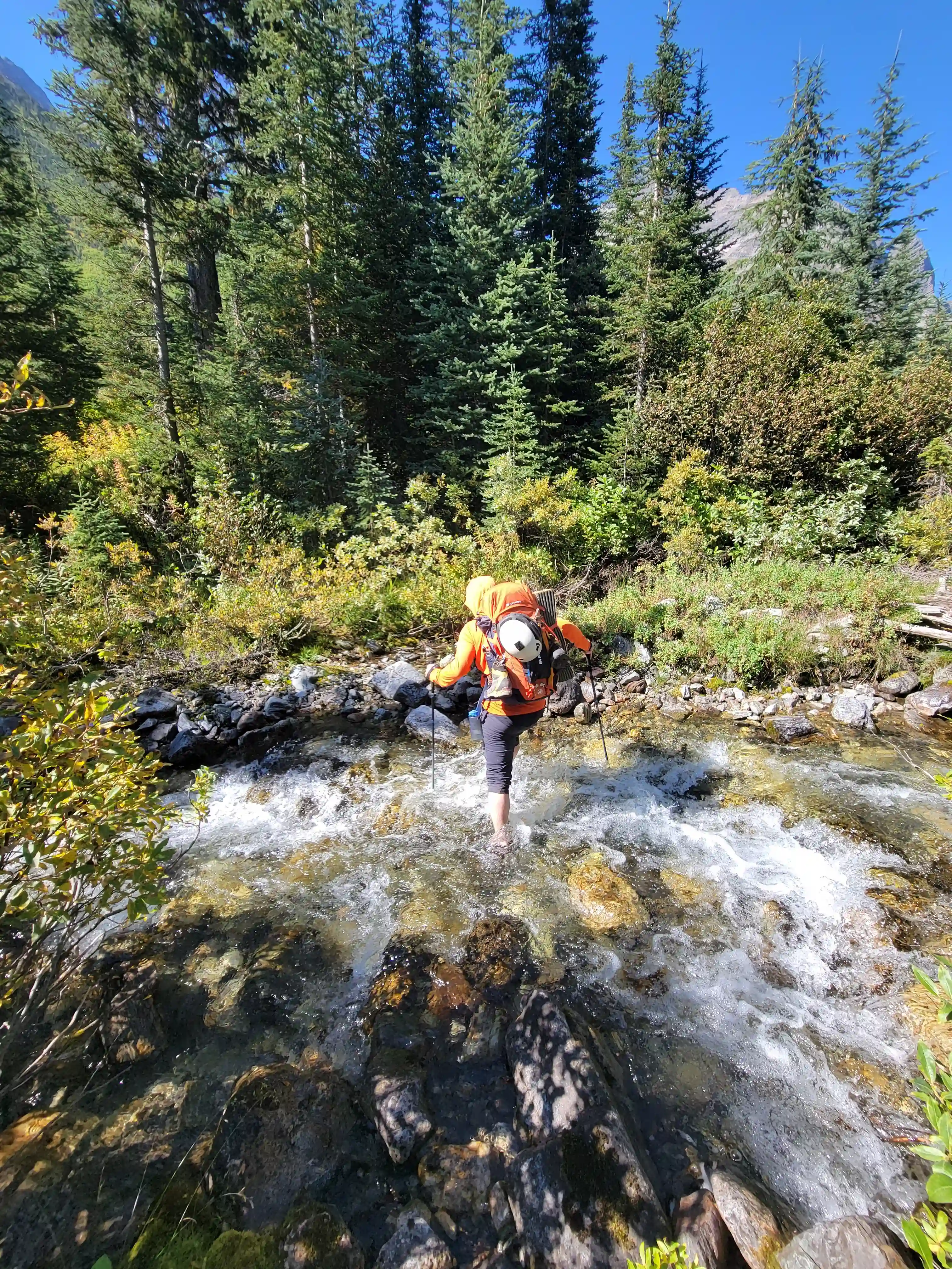
where we had to wade through
MOUNT GOODSIR - NORTH TOWER
3525m, 11565ft
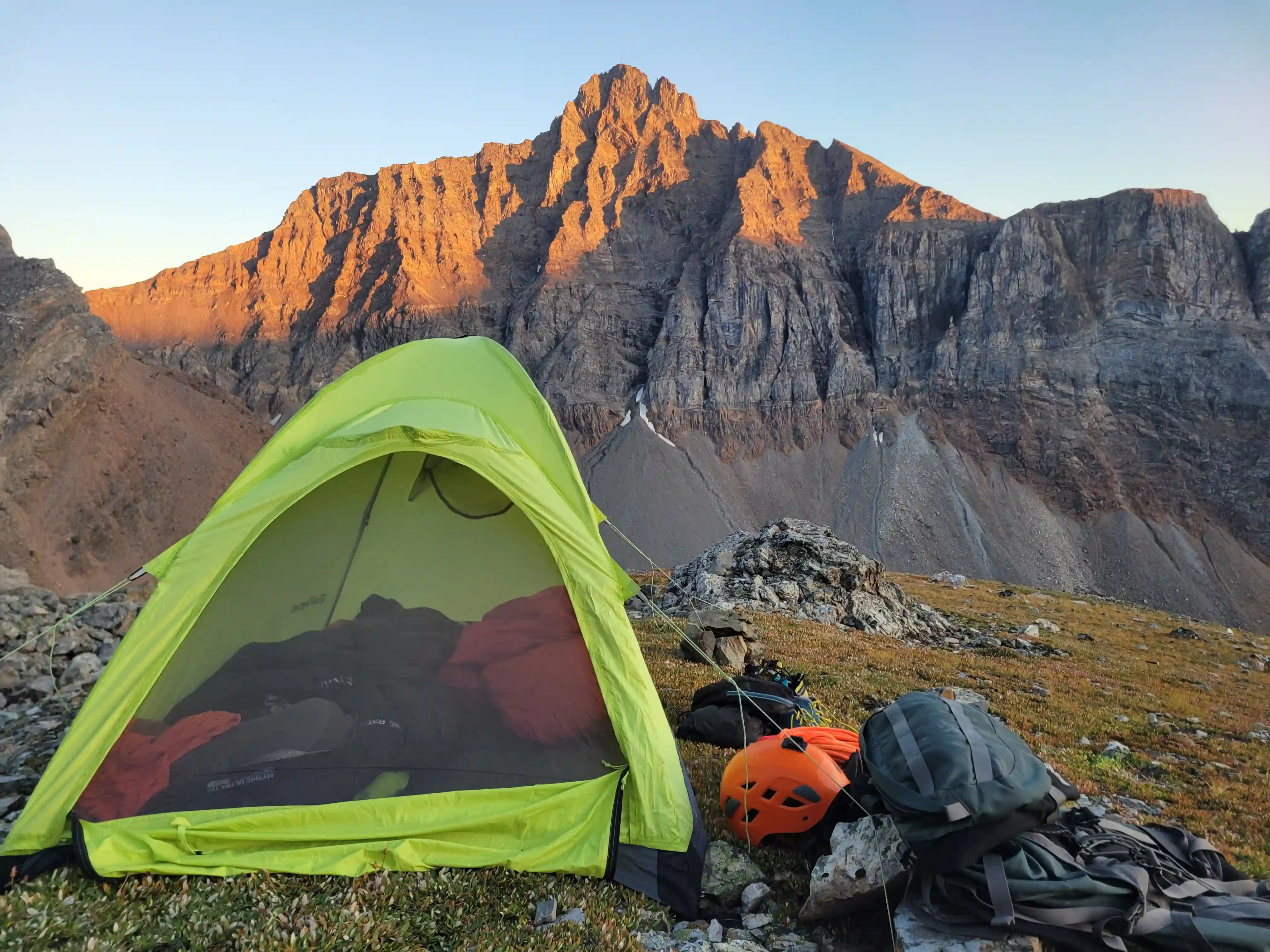
After reaching camp we were disappointed to learn that there was no flowing water anywhere nearby especially given that we had consciously avoided filling up during the sidehilling section on the way to not have to carry more weight. Ian proceeded to set up camp while I went to find water with all our bottles and I had to basically descend all the way back down to where we had traversed so make sure to fill up ON THE WAY and don't expect any water once you're up there! The views from the bivi site are quite nice but it's unfortunately not perfectly flat so throughout the night I found myself rolling off of my air mattress into the side of the tent which wasn't ideal but there aren't any other options close by so you get what ya get I guess!
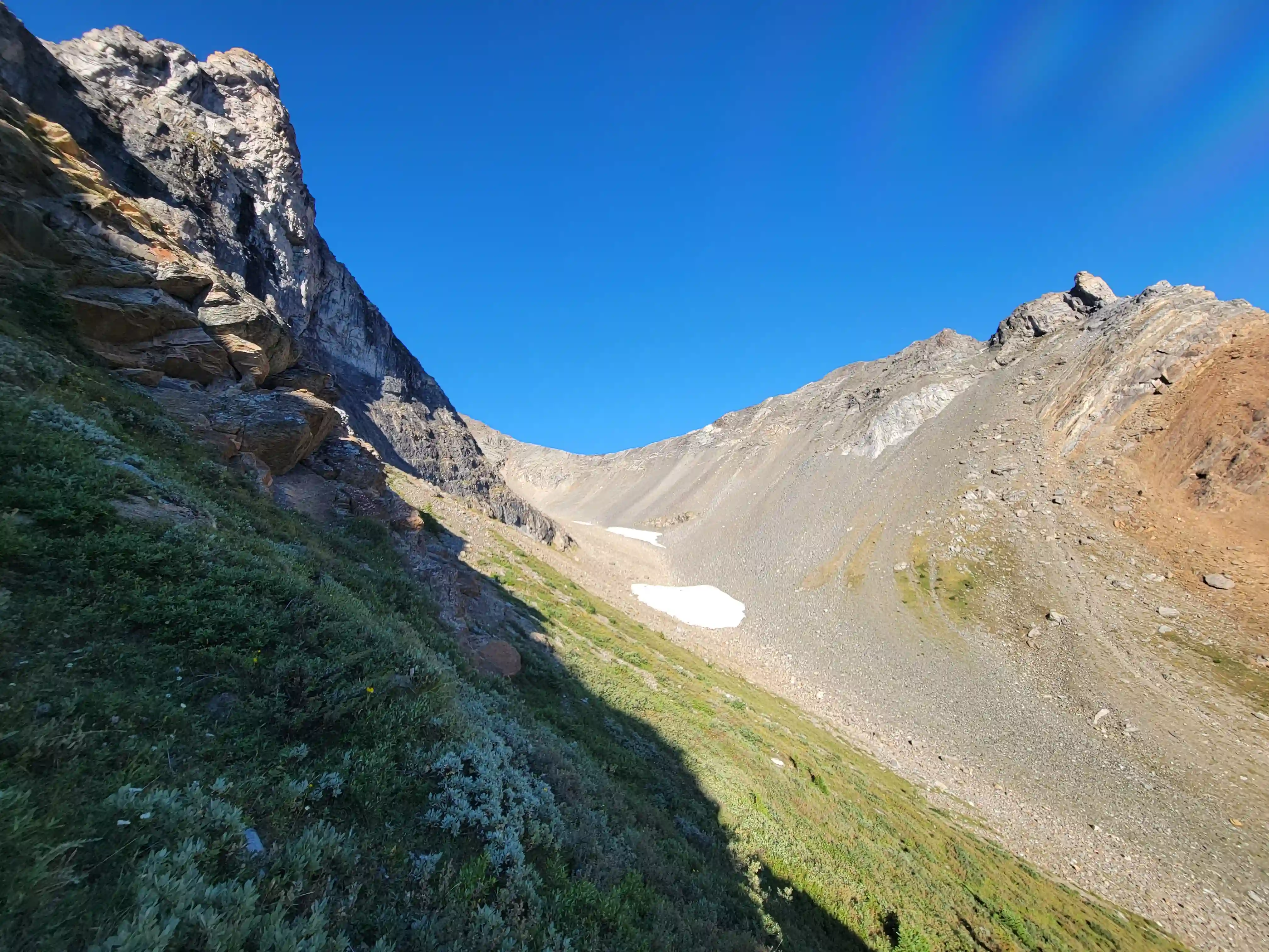
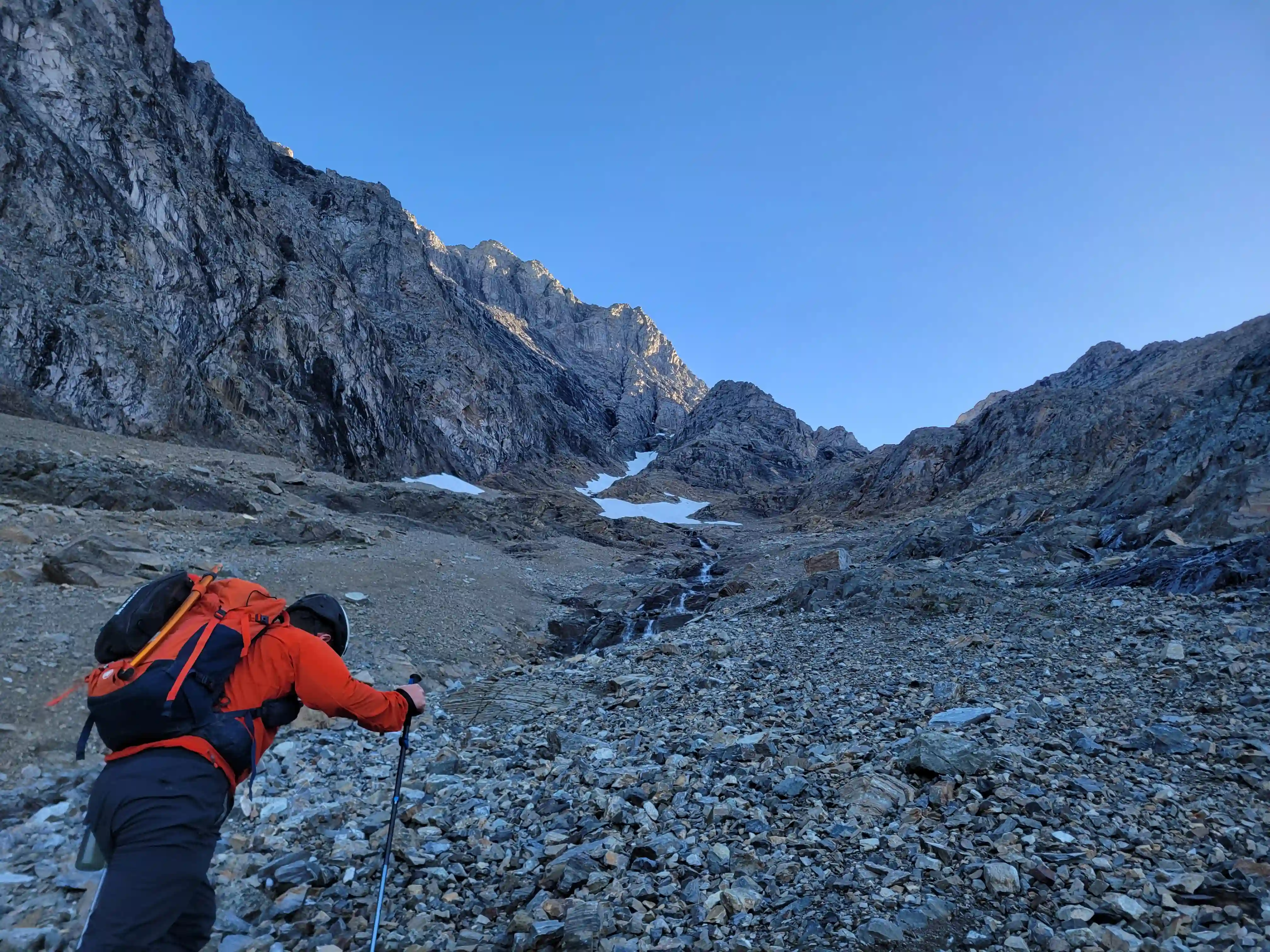
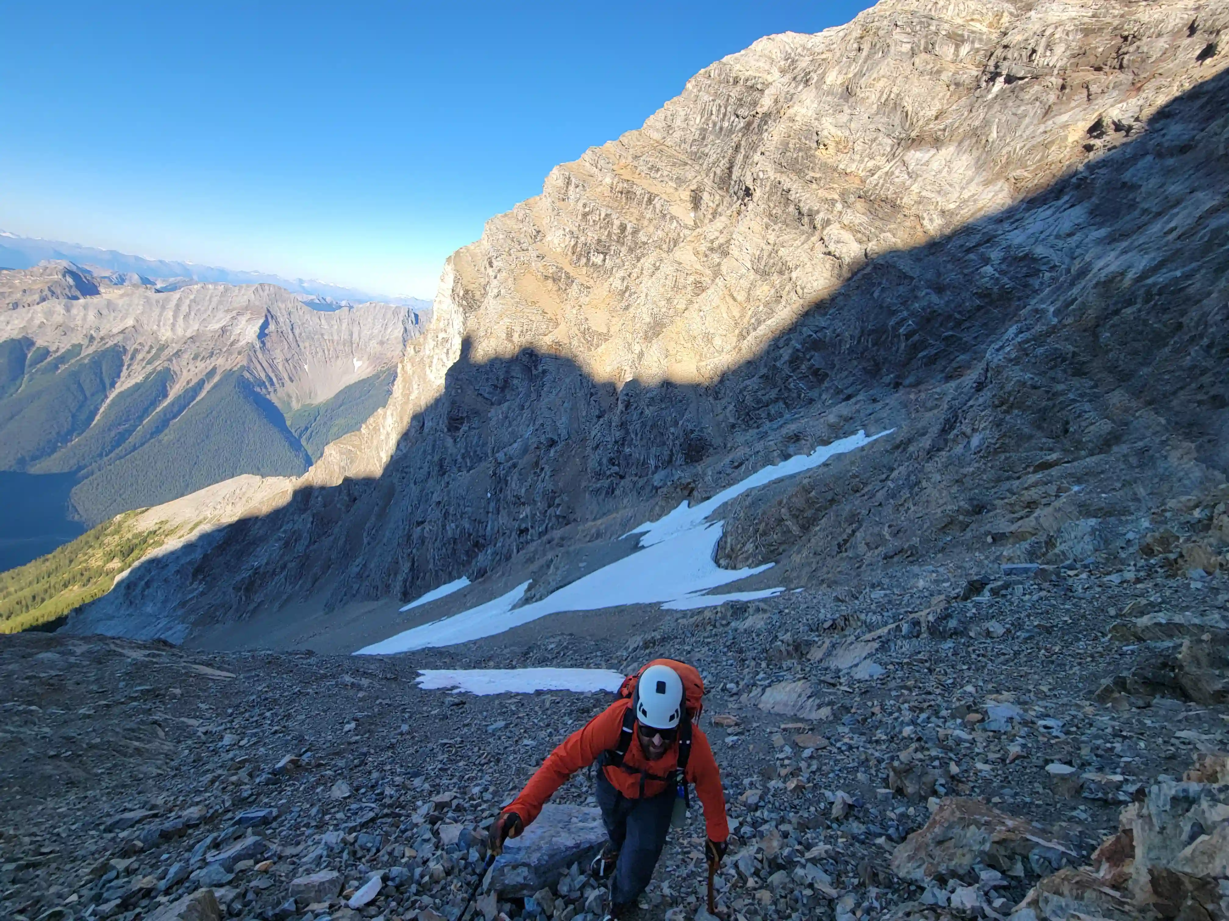
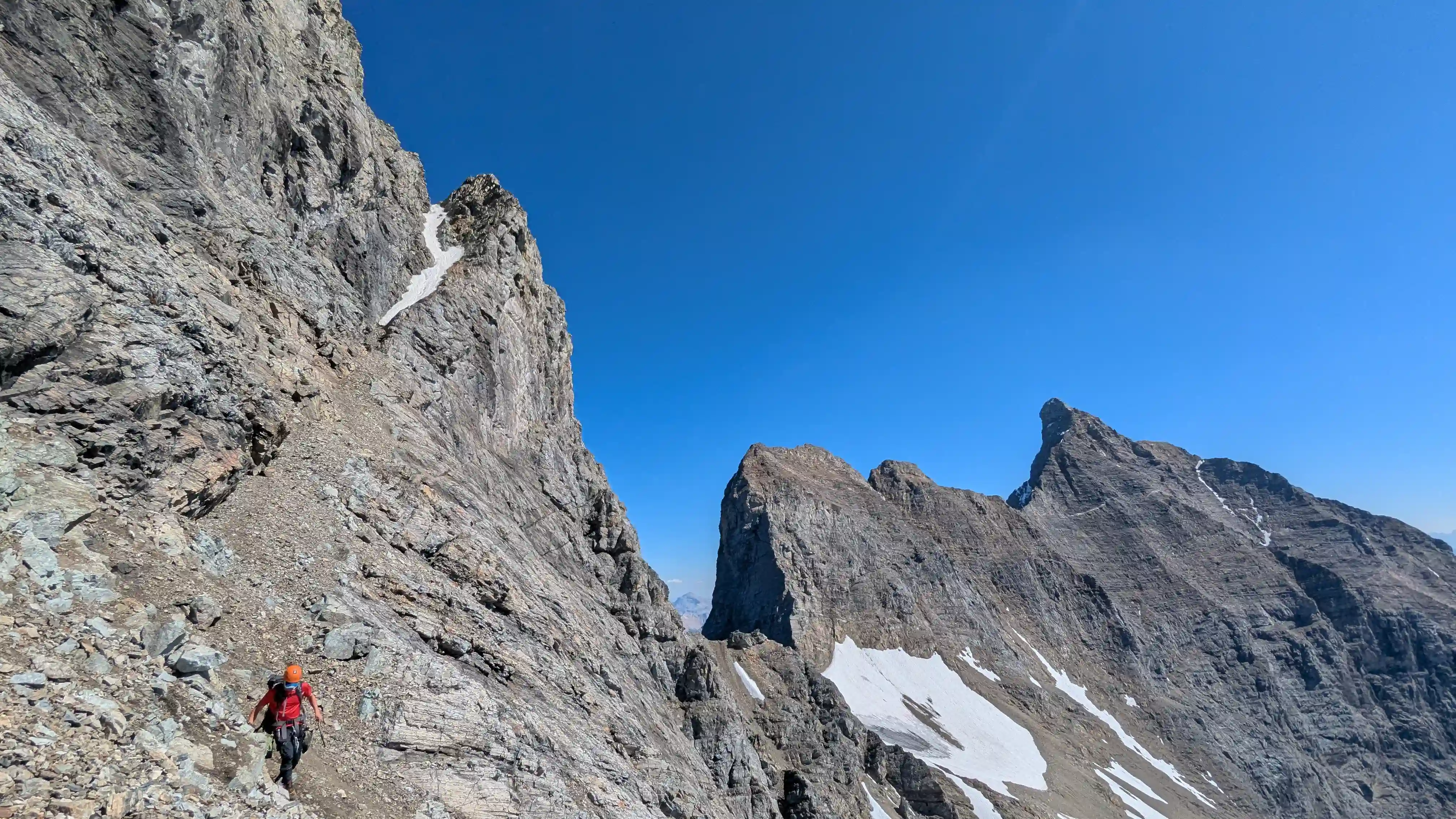
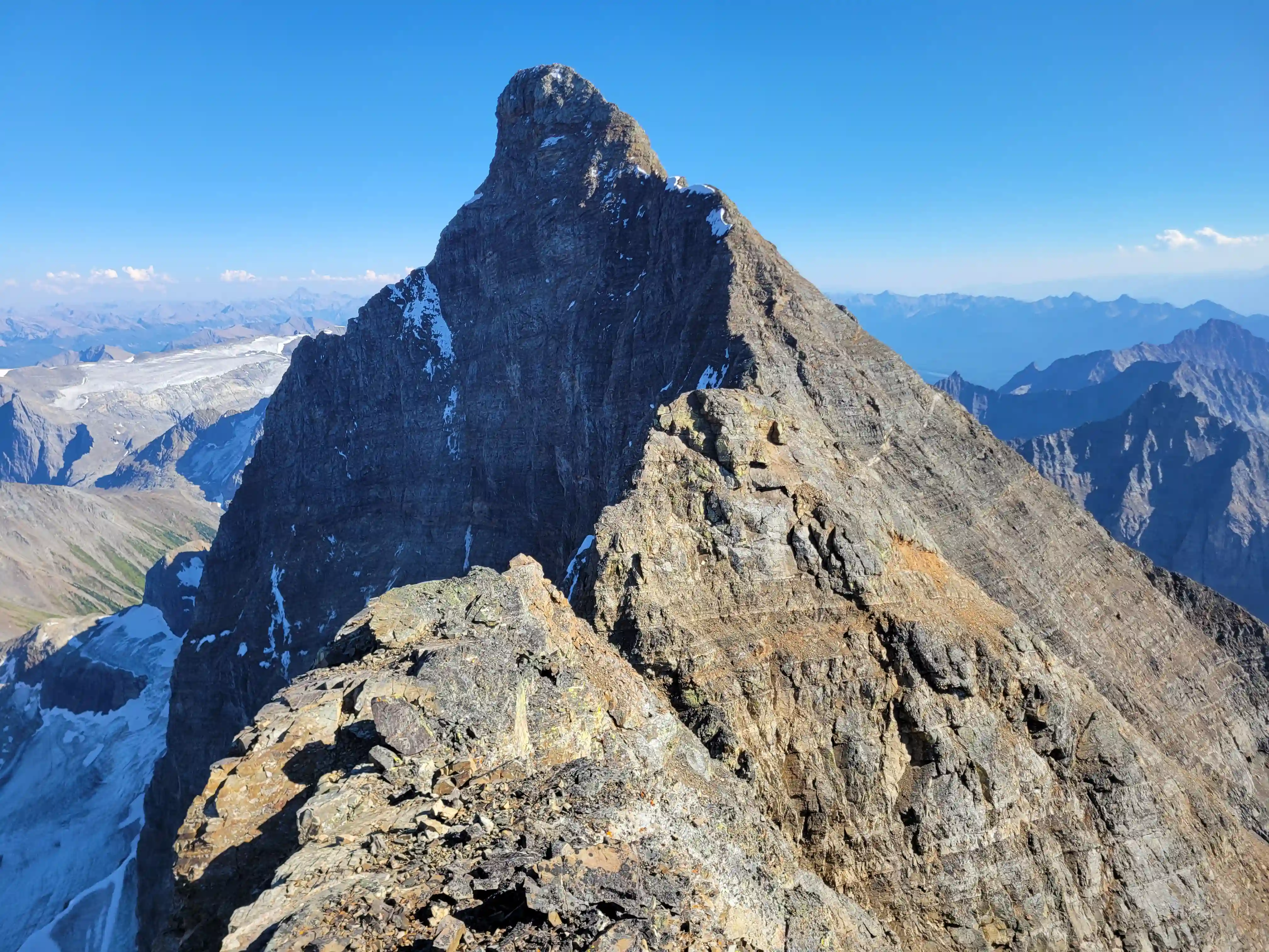
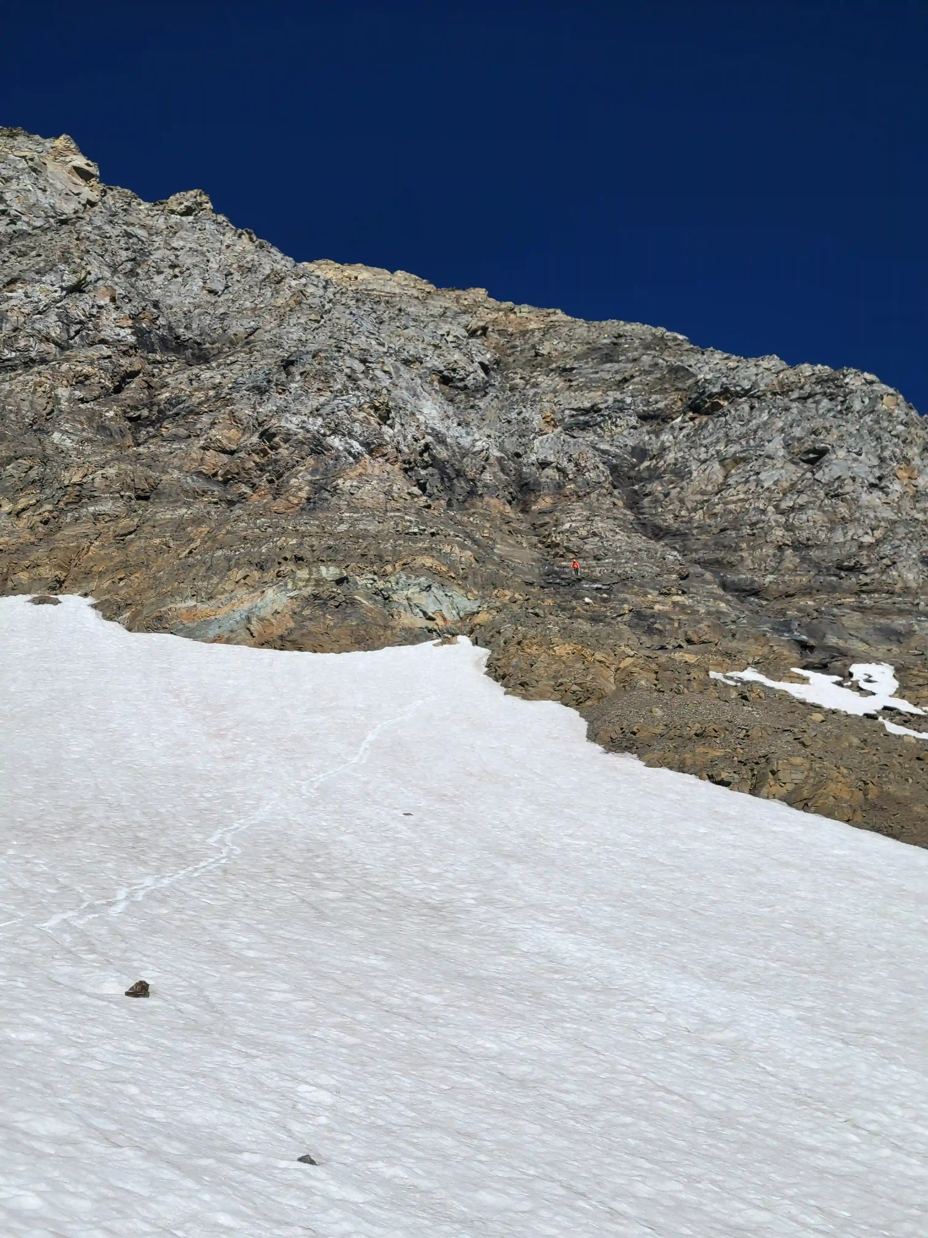
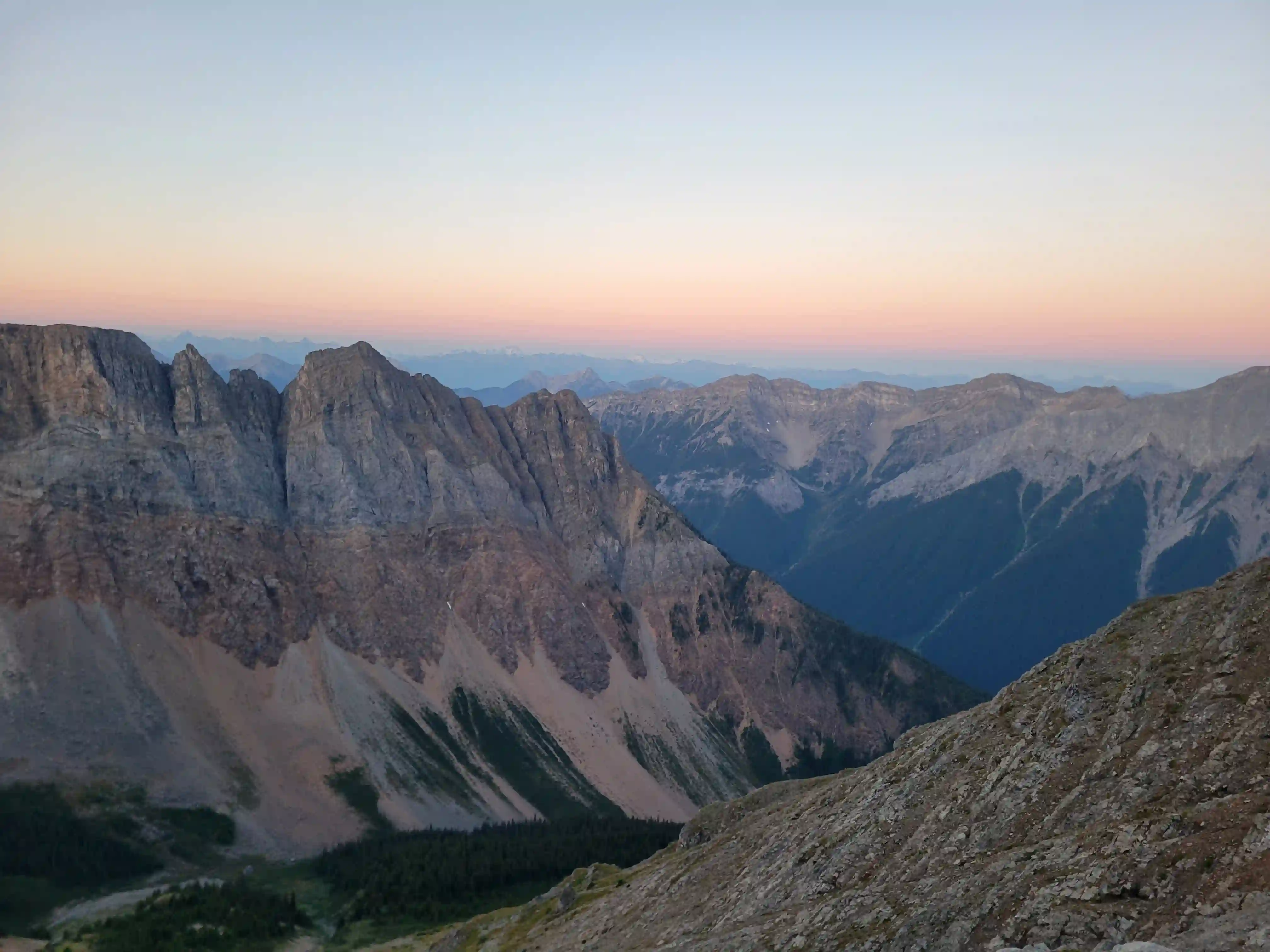
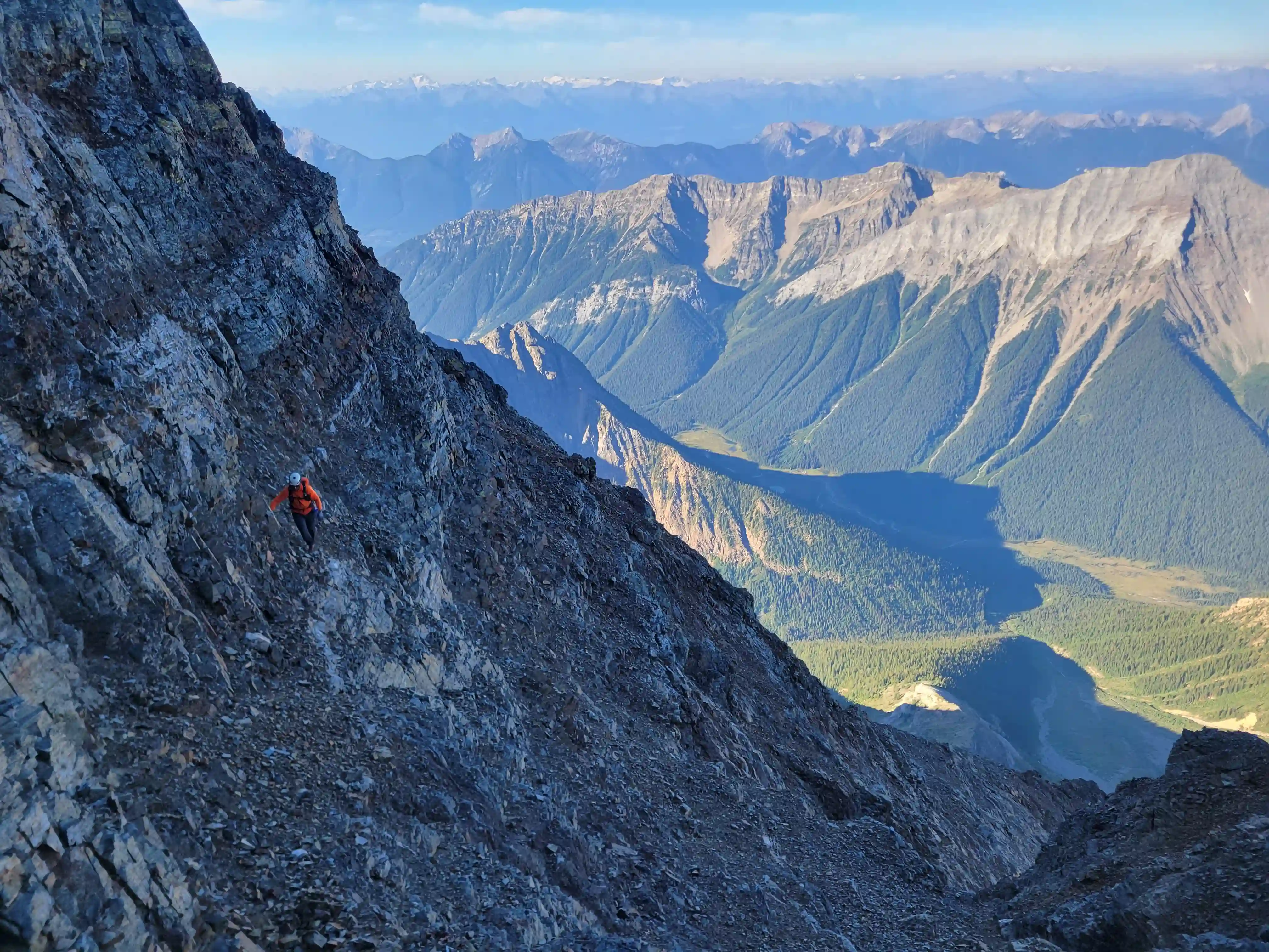
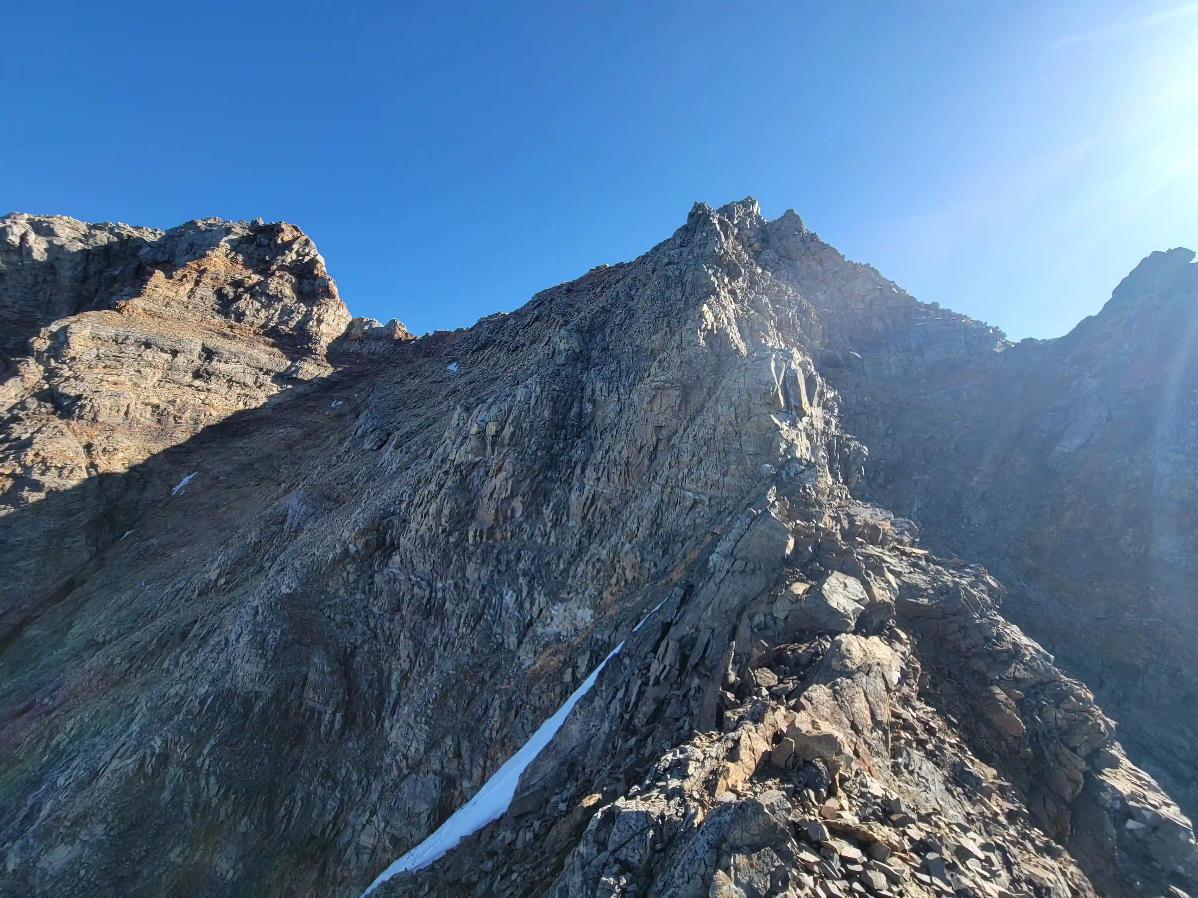
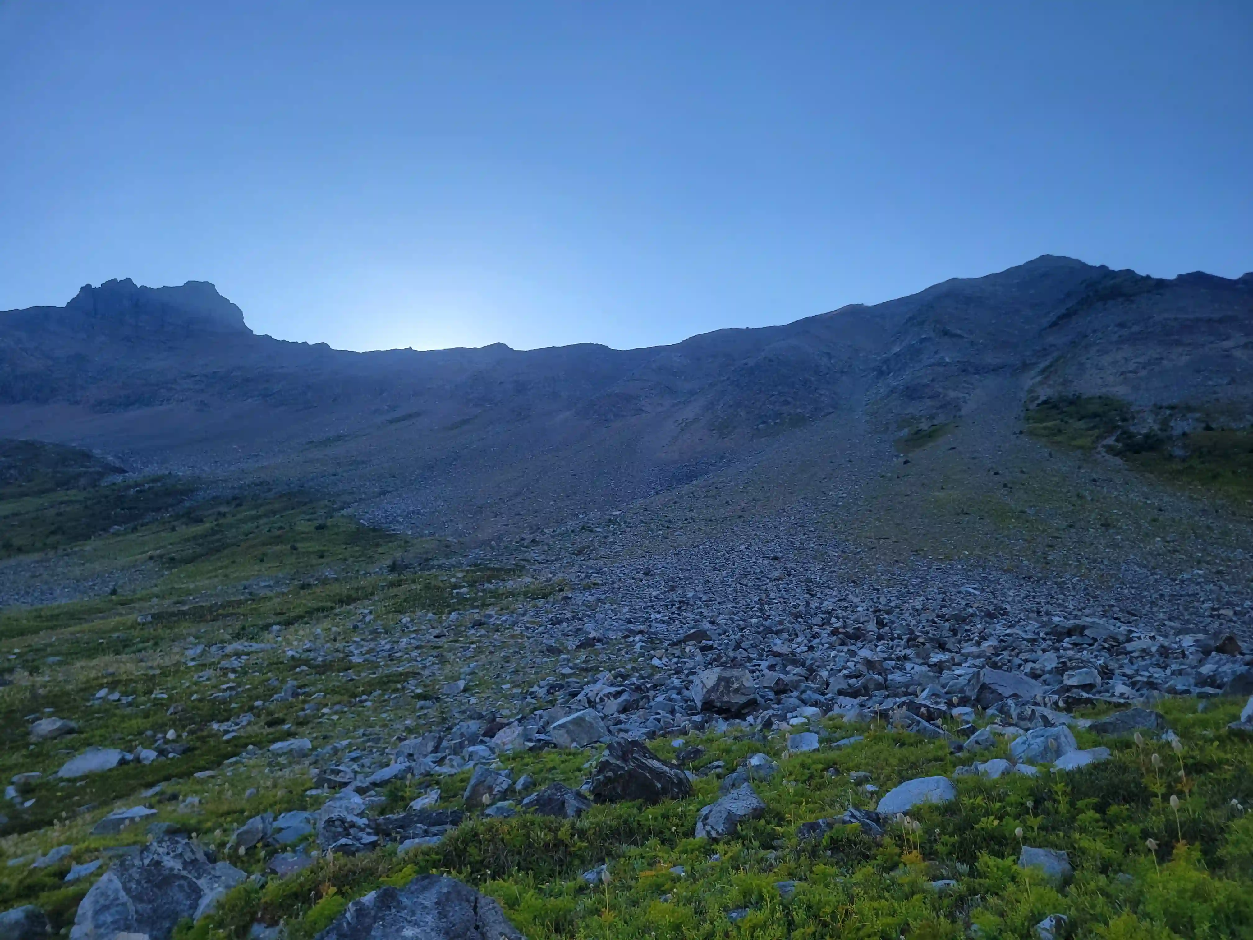
The next morning we were moving by 6:45 and the day started with a whole lot of sidehilling. The north tower ascent route is about 2km to the NW so you can probably guess how fun that was. Aside from dropping below a rocky section or two the line was pretty obvious and we managed to find a goat path eventually which made things easier. After rounding a prominent corner Goodsir North came into sight and the last section wasn't as bad with our objective for the day in sight!
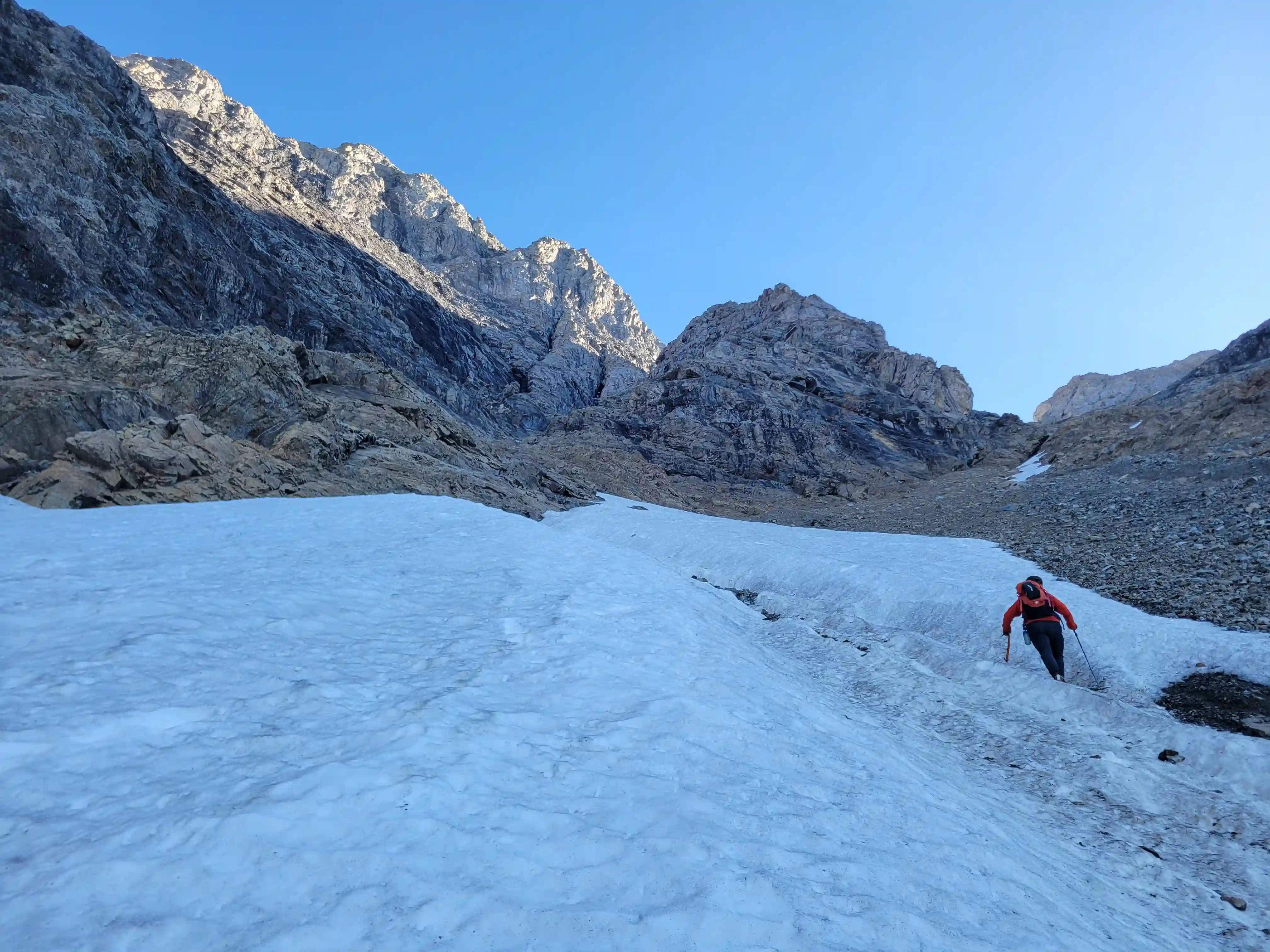
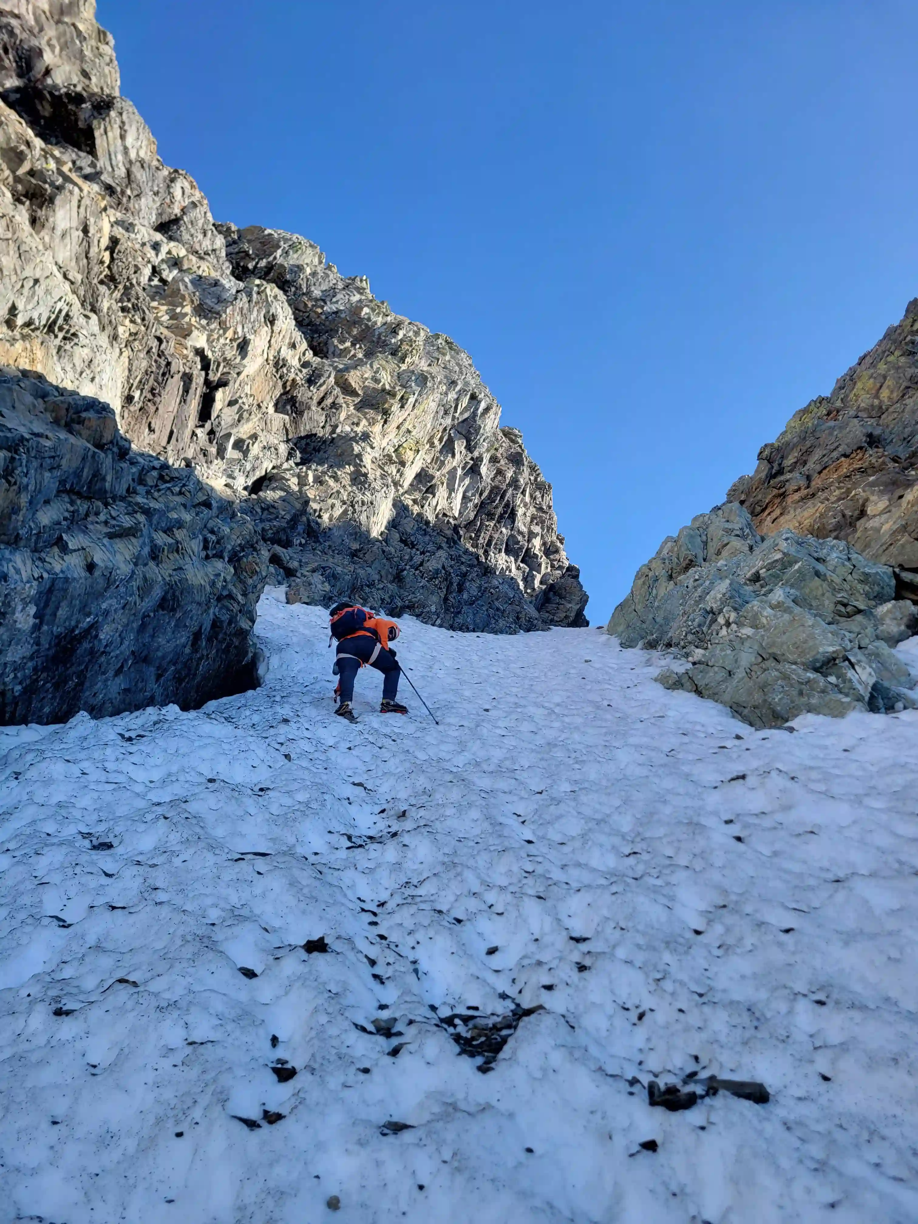
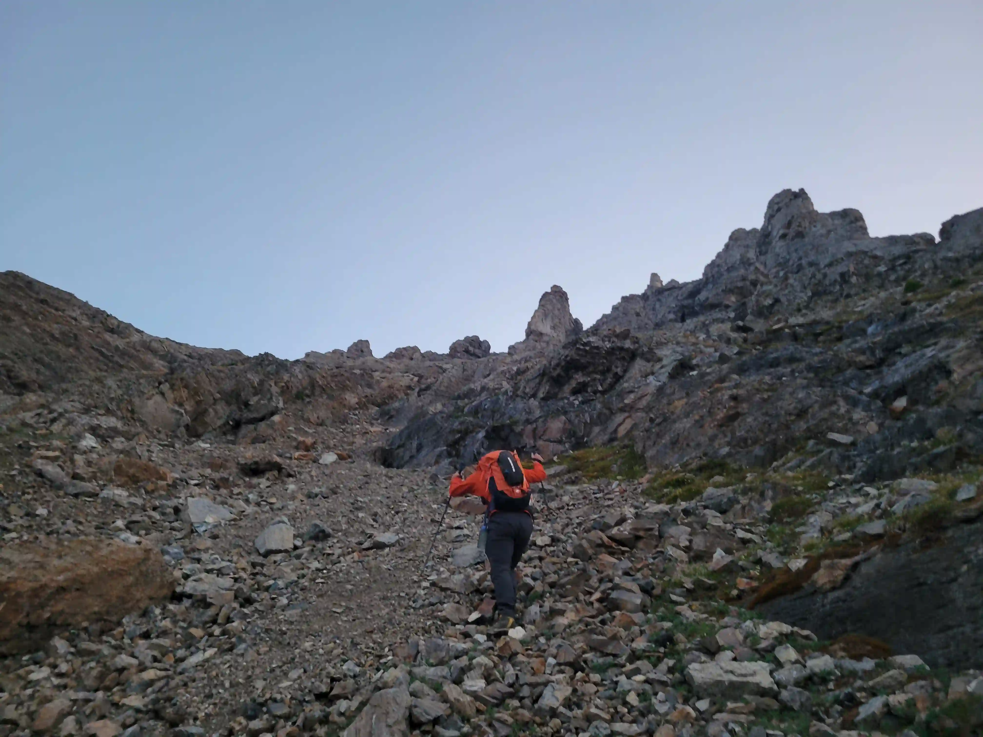
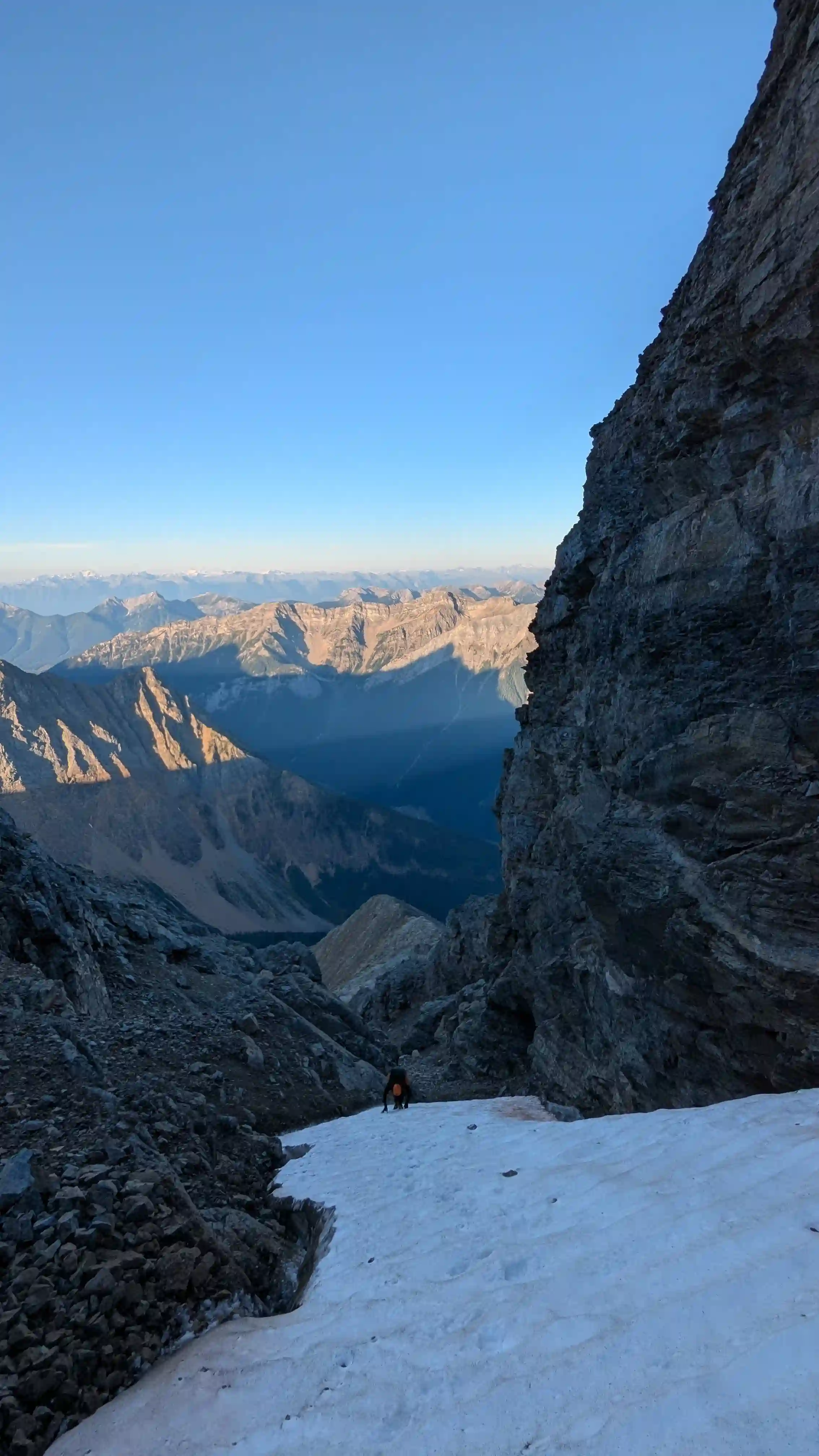
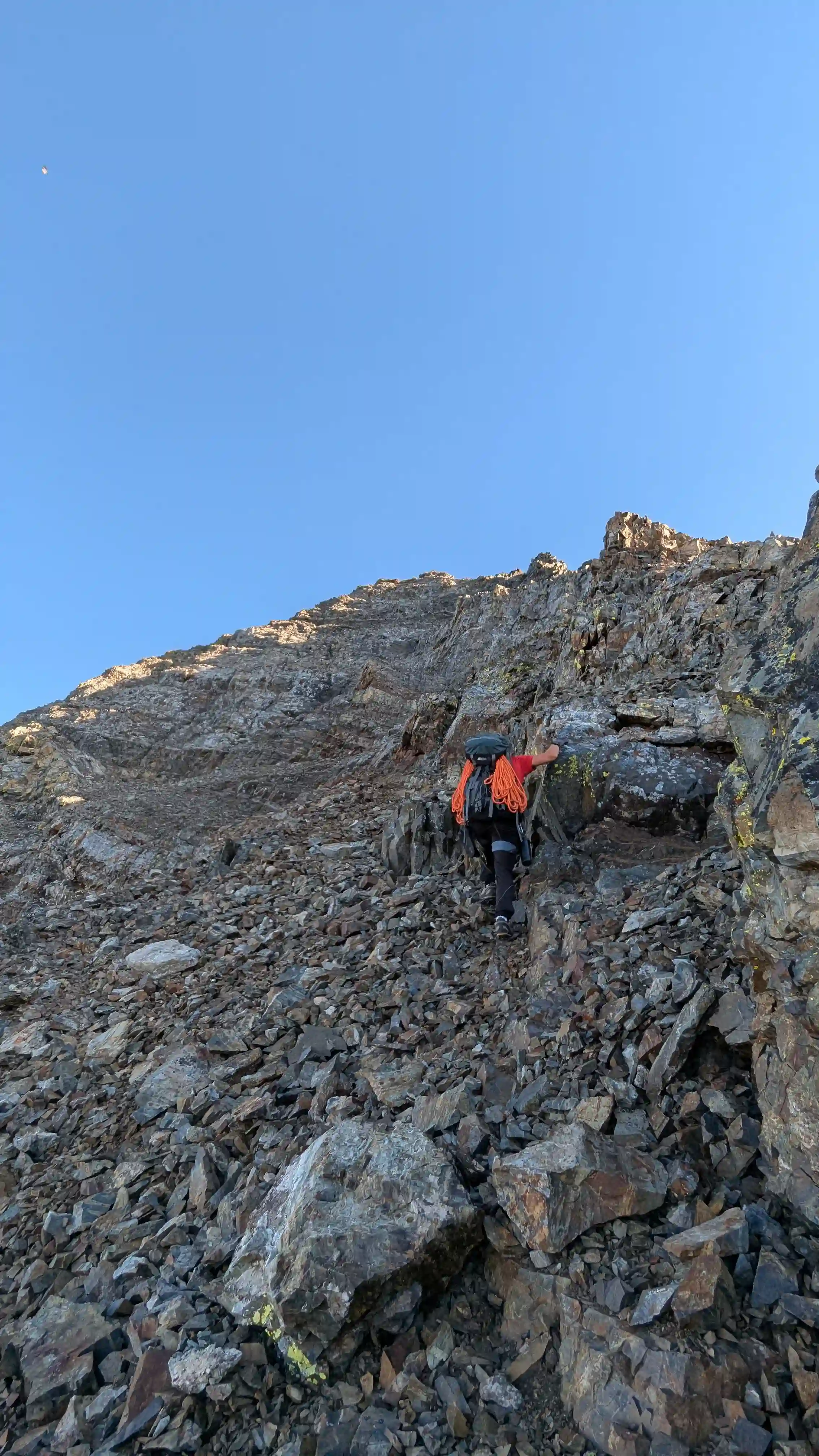
The initial ascending up the large gully for Goodsir North and Center wasn't the most enjoyable aside from some firm snow as it was quite loose scree that was tedious to get up. Additionally below the first snow we encountered a number of rocks came whizzing down the mountain towards us and we had to move fast to get out of the way so this is definitely a rockfall prone slope. After a good amount of scree grinding we reached the point where we were supposed to detour left for the sideways V route on Goodsir North but initially missed it and after a bit of routefinding we backtracked and got to a point where we could see the line up our first peak of the day!
follow the snow straight up here but the route goes right
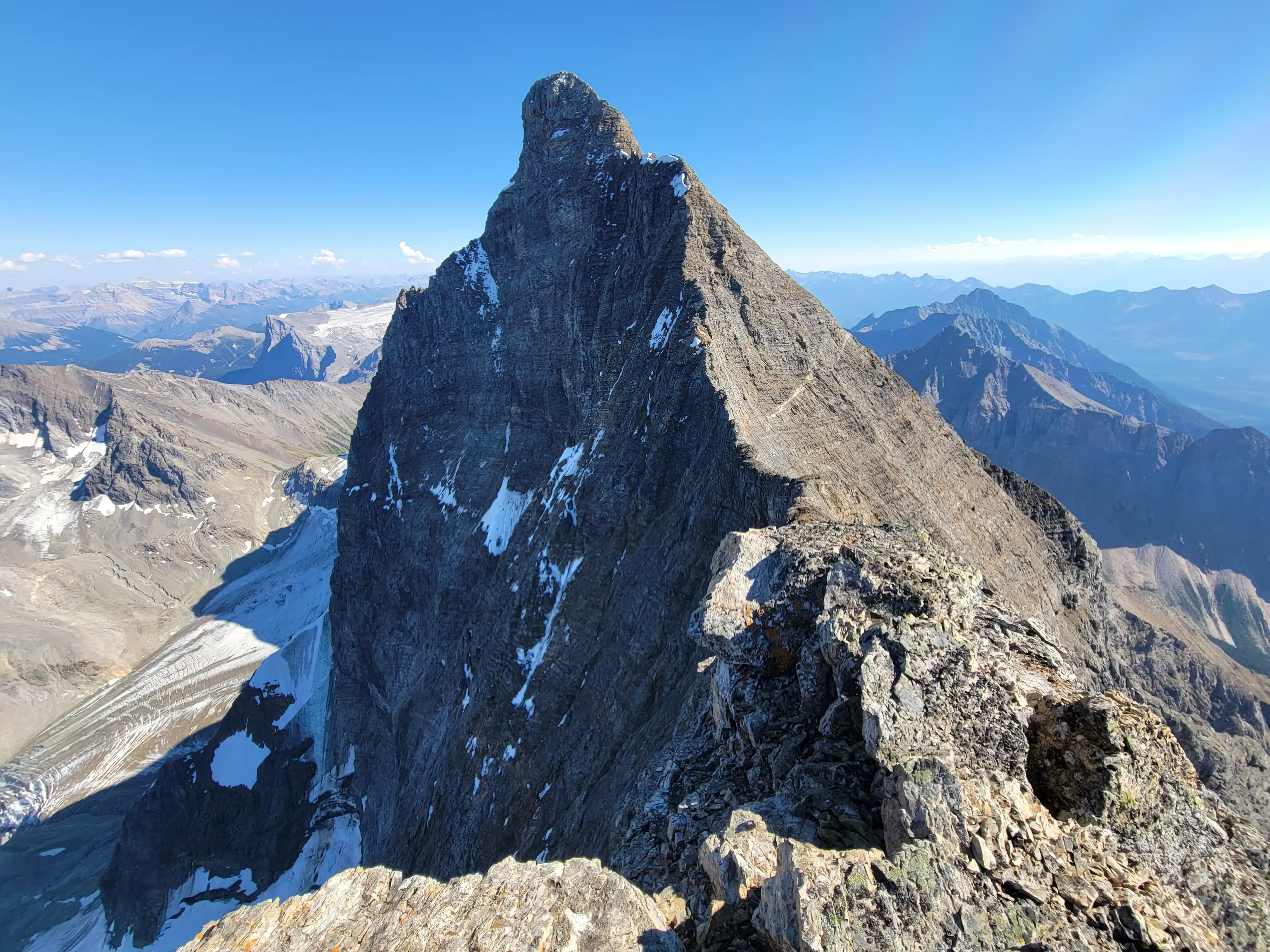
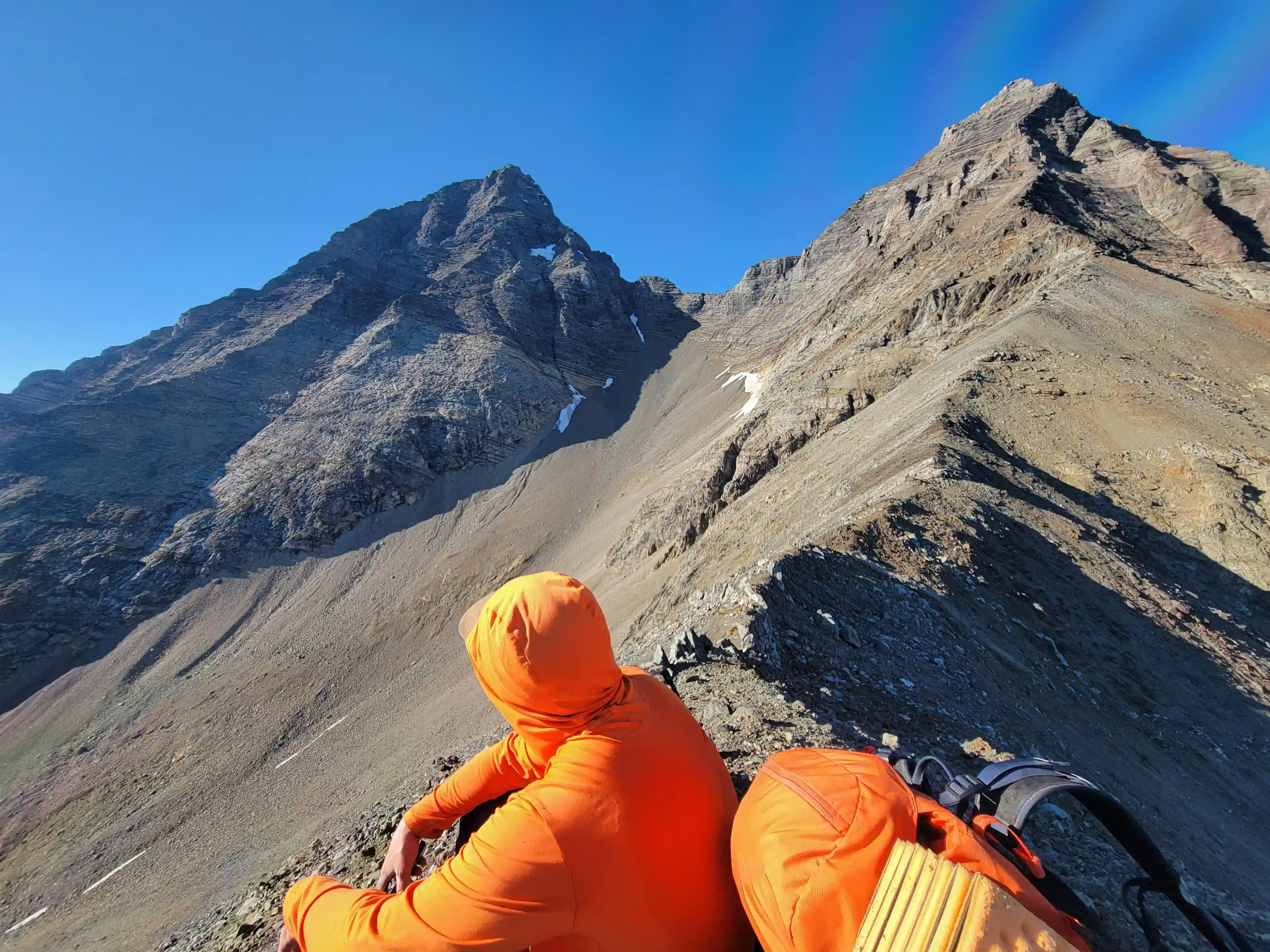
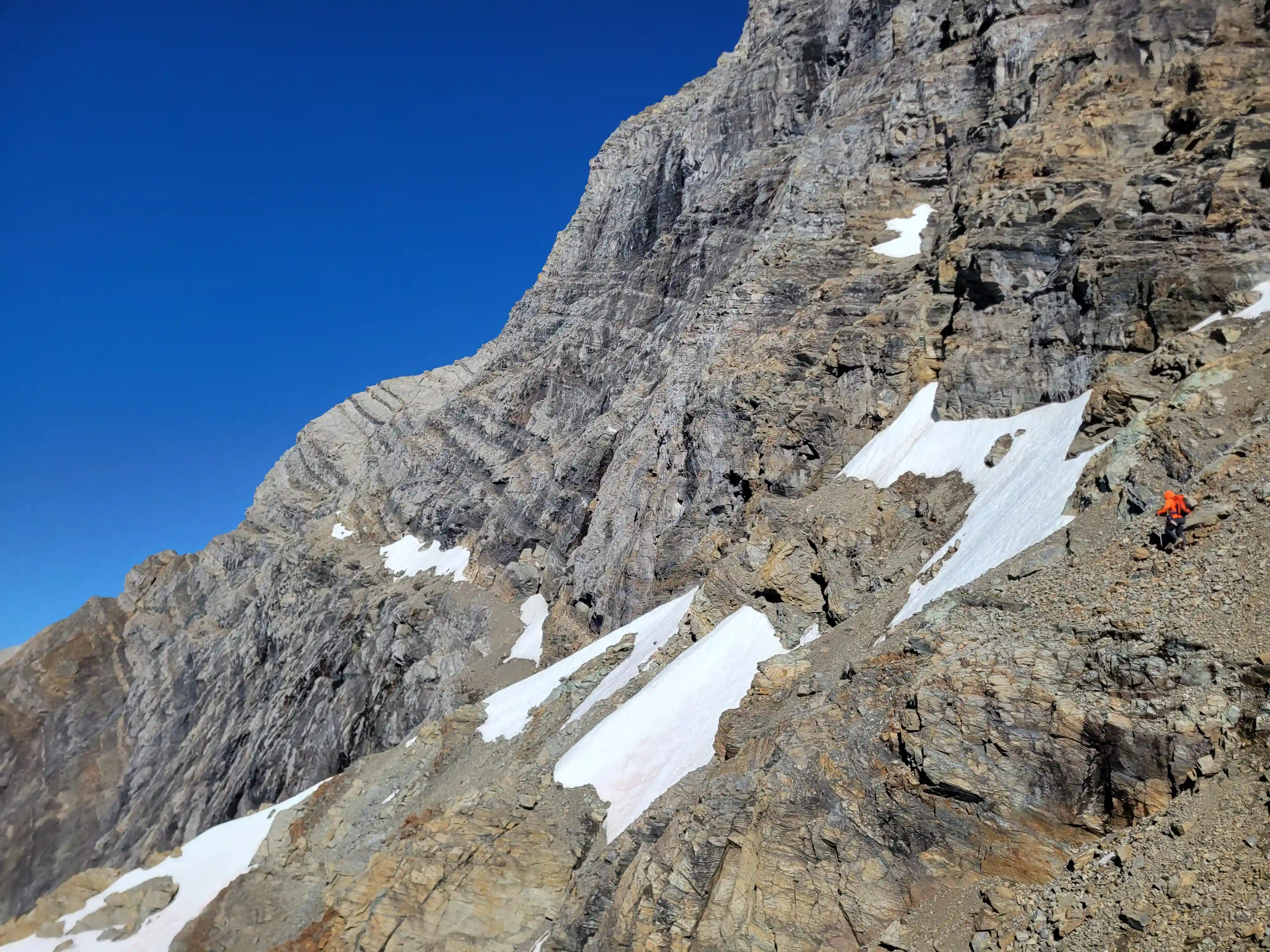
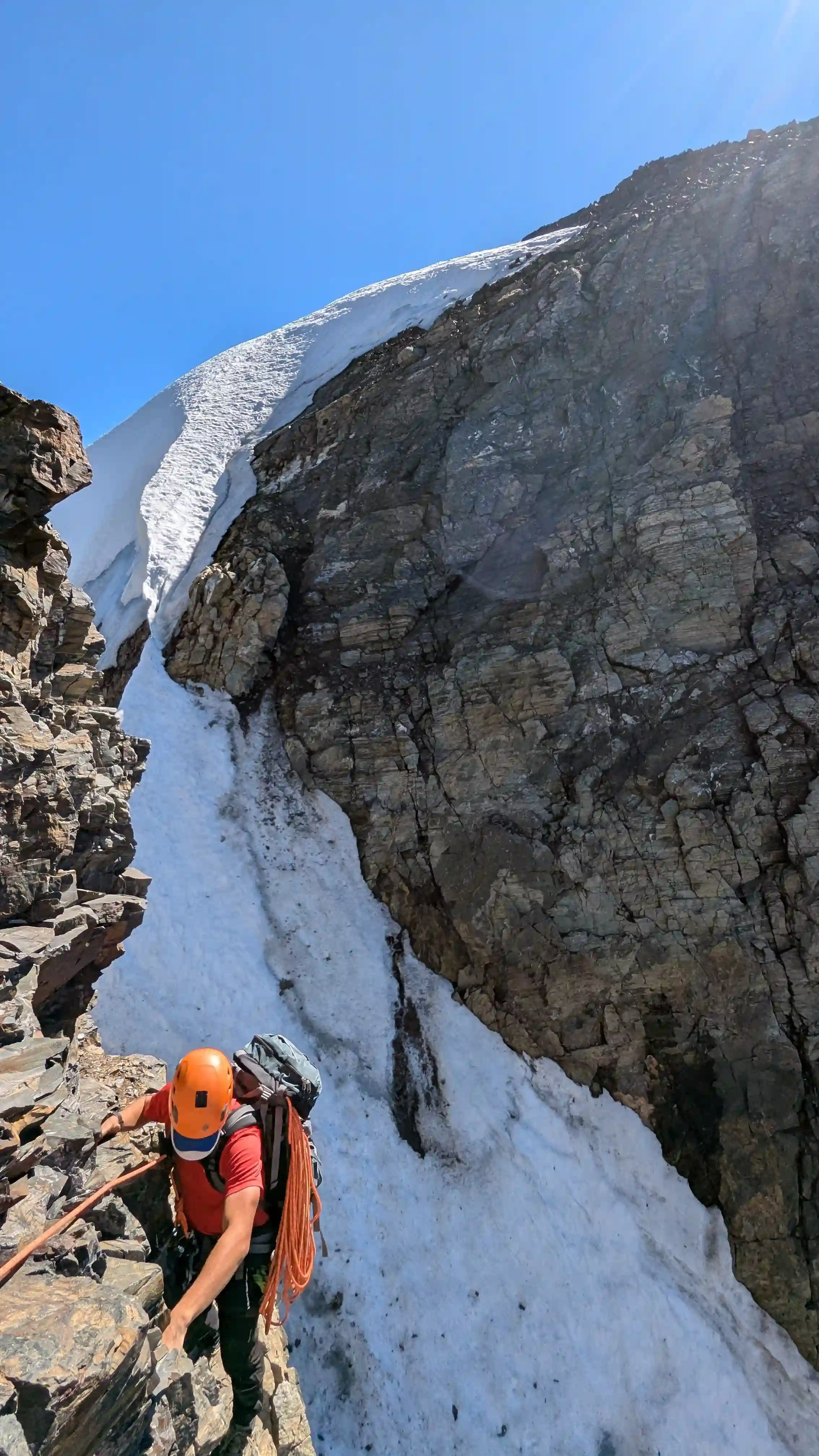
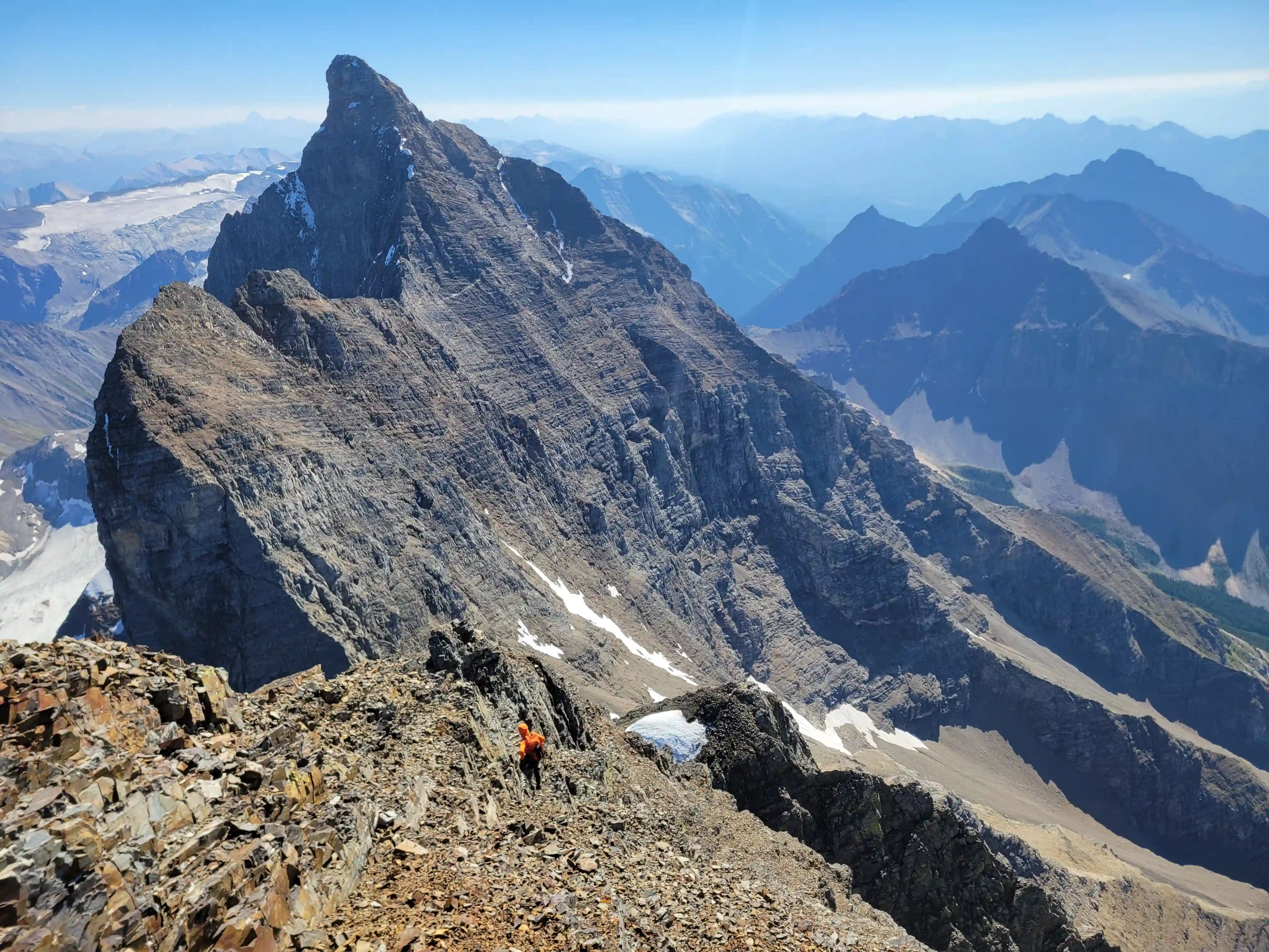
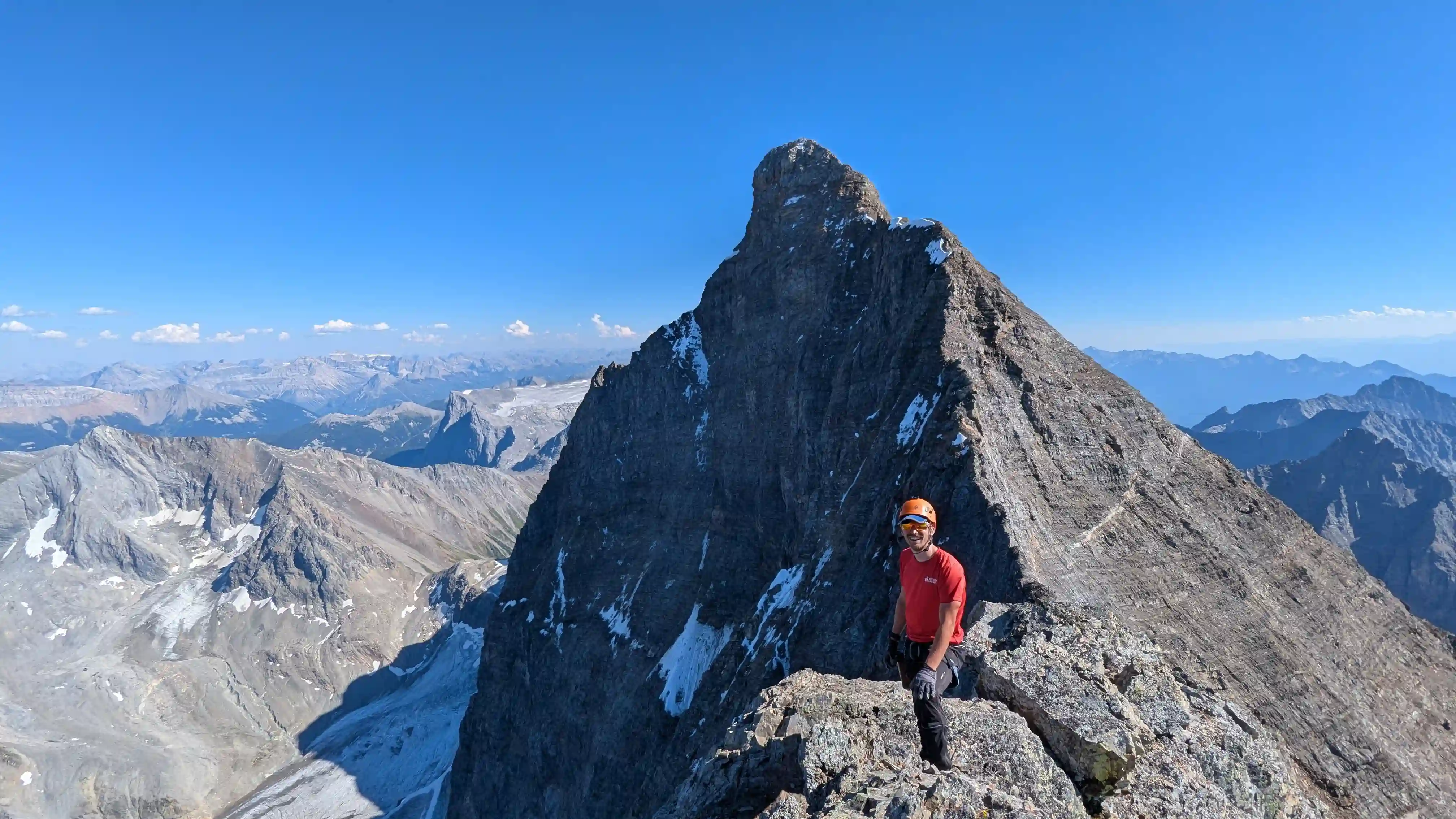
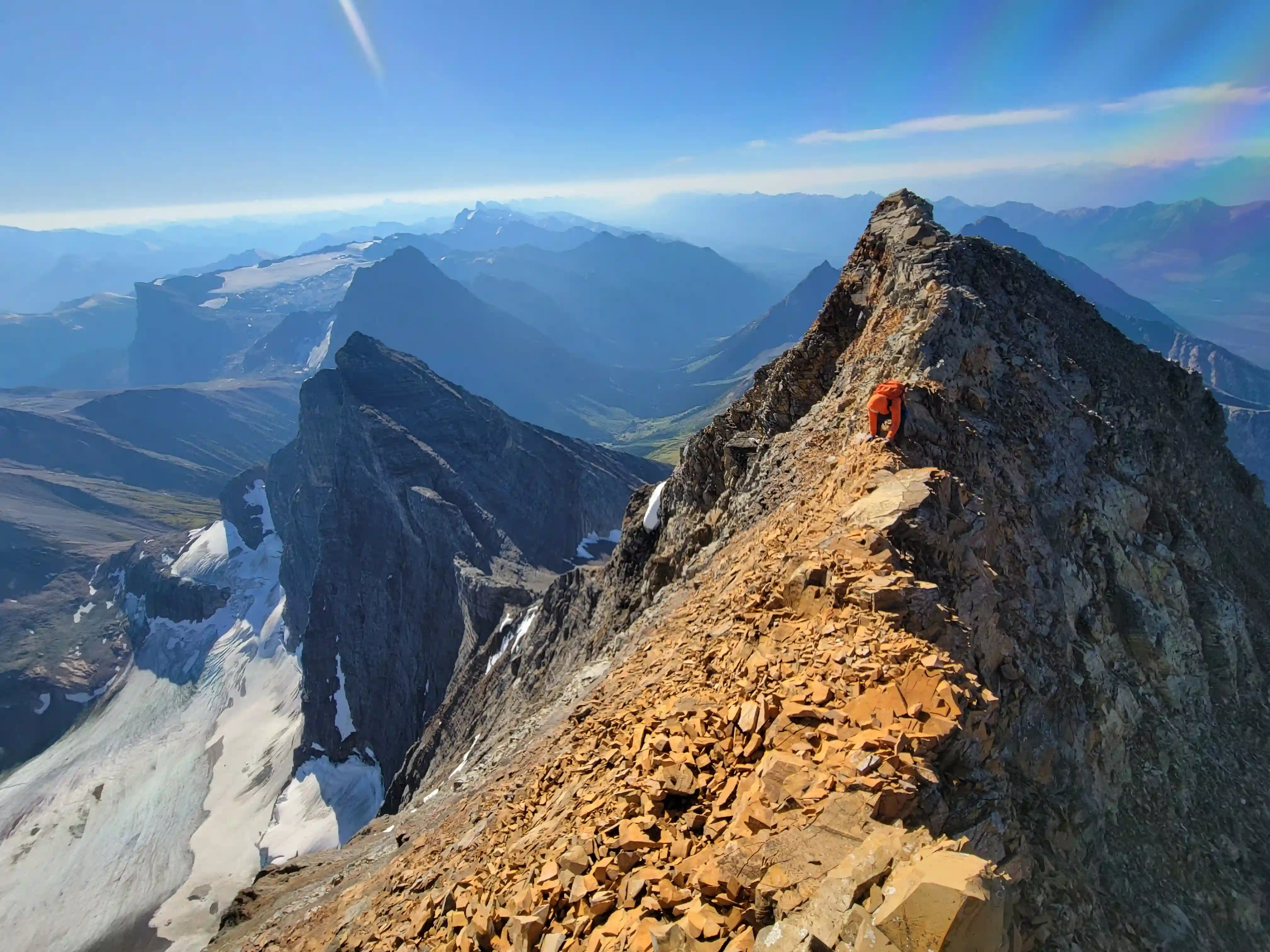
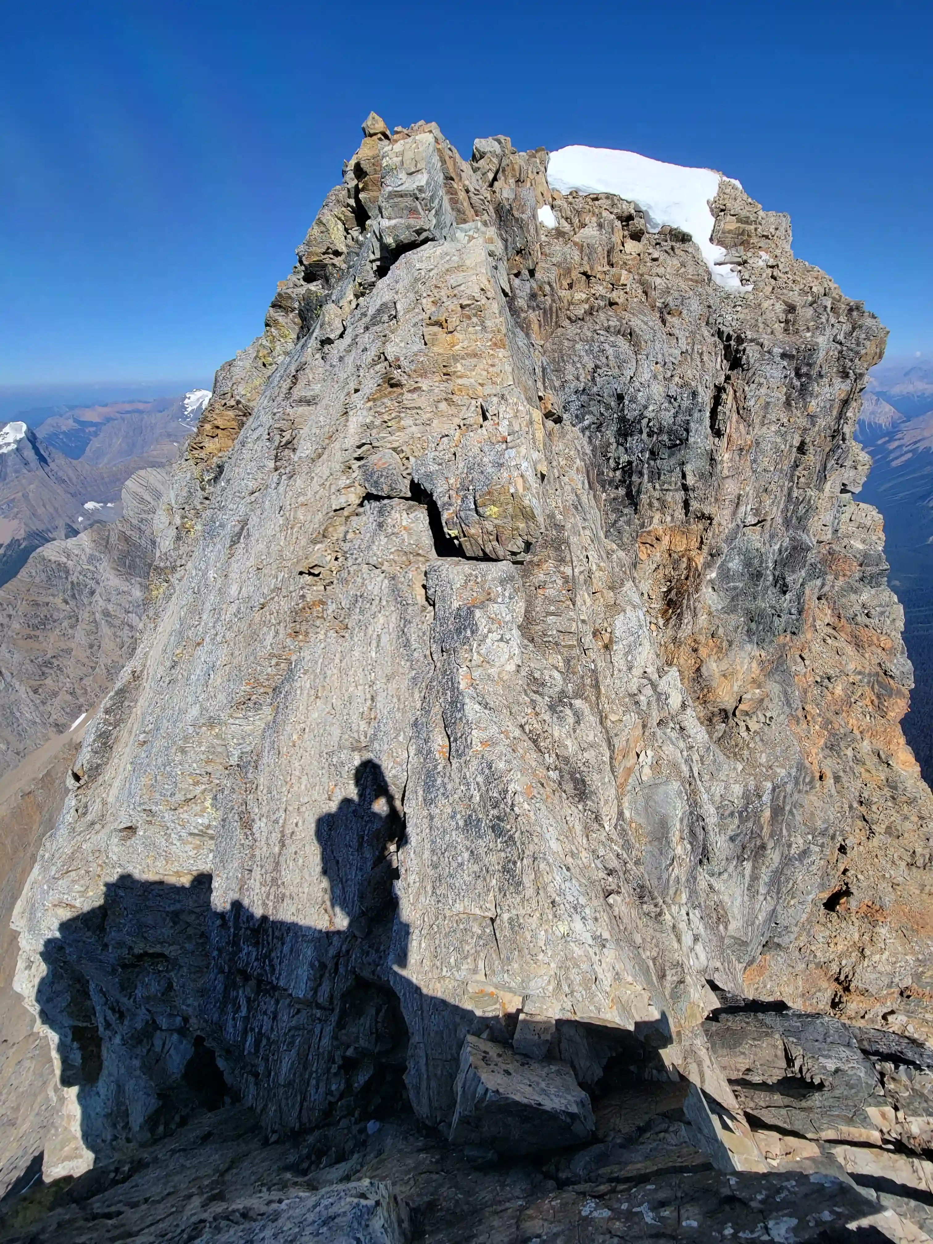
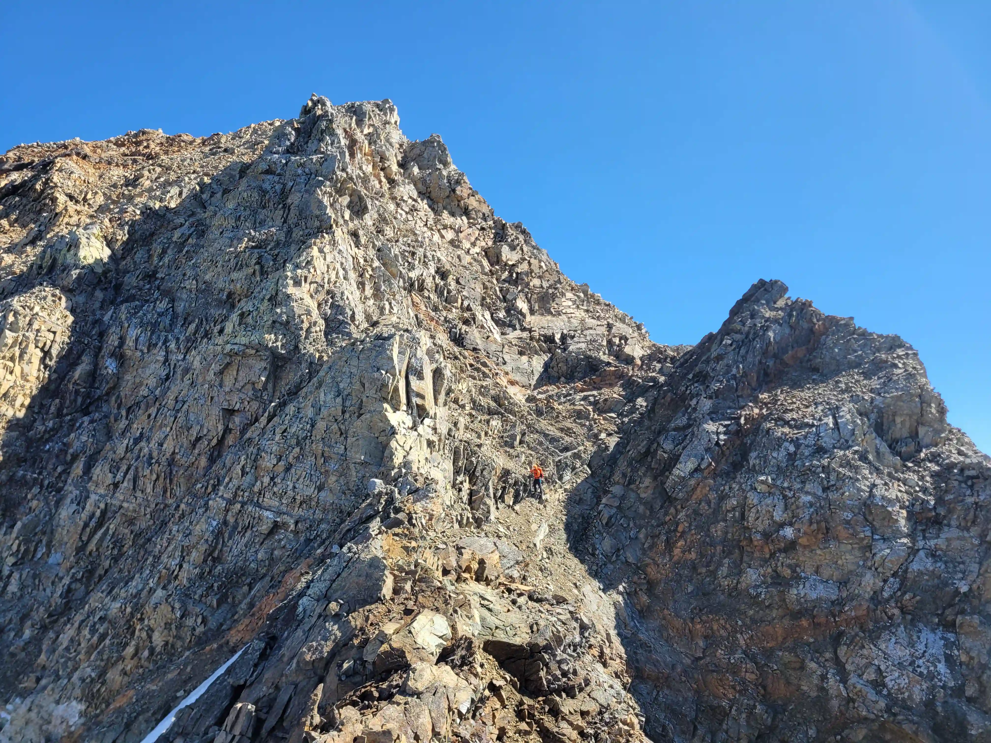
After reaching a bit of an outcrop following the scree grinding we were able to see the lower branch of the sideways V on Goodsir North and it looked exposed! But as these ledges usually go once on it it was a lot wider than it seemed from afar and after some side hilling and avoiding snow to get to the lower branch and then get across it we were at the start of the upper branch and could see that there was a solid snow deposite near the top. The lower portion of this branch was more of the same but the snow was firm making for fast climbing and it wasn't much later that we were topping out in the notch feature on the north tower and ready to go for the crux pitch.
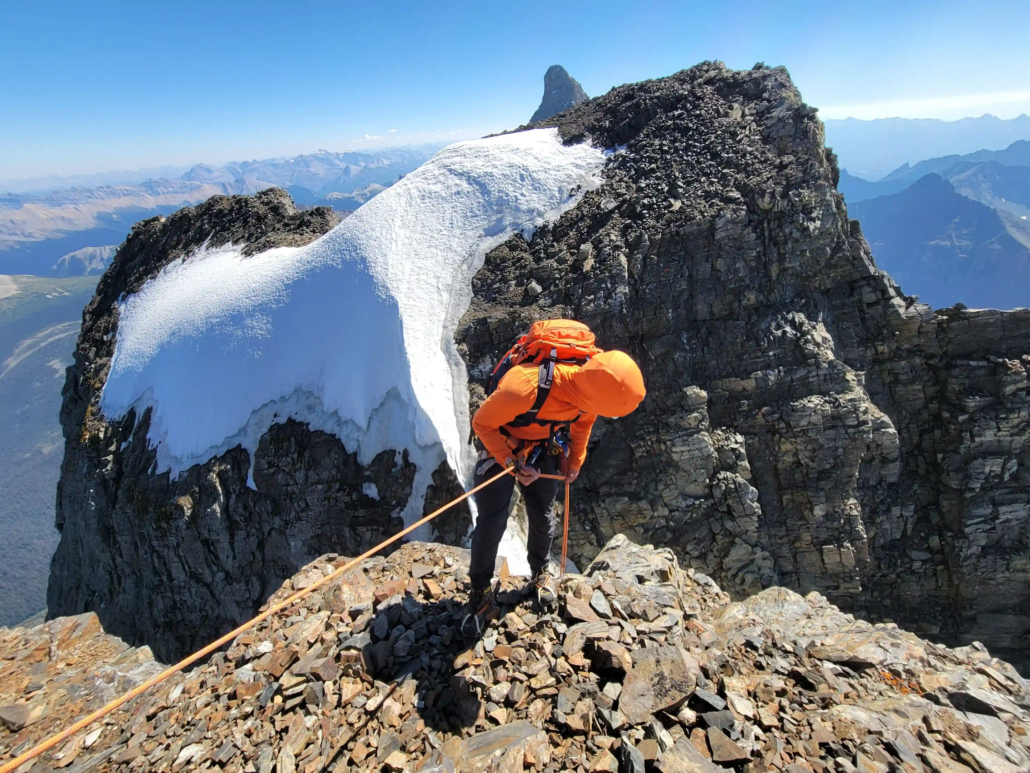
With snow all the way to the notch switching to approach shoes on a ledge that leads to the crux was a bit tricky but manageable and I opted to leave them and my axe at the anchor for when we'd be putting them on again when we returned. Ian lead the pitch which had some tat left over for protection and was very short and a couple minutes later once we were both through that we ditched the rope at the rappel anchor and continued scrambling to the summit!
and before reaching the North-Center col
conditions we could've hoped for
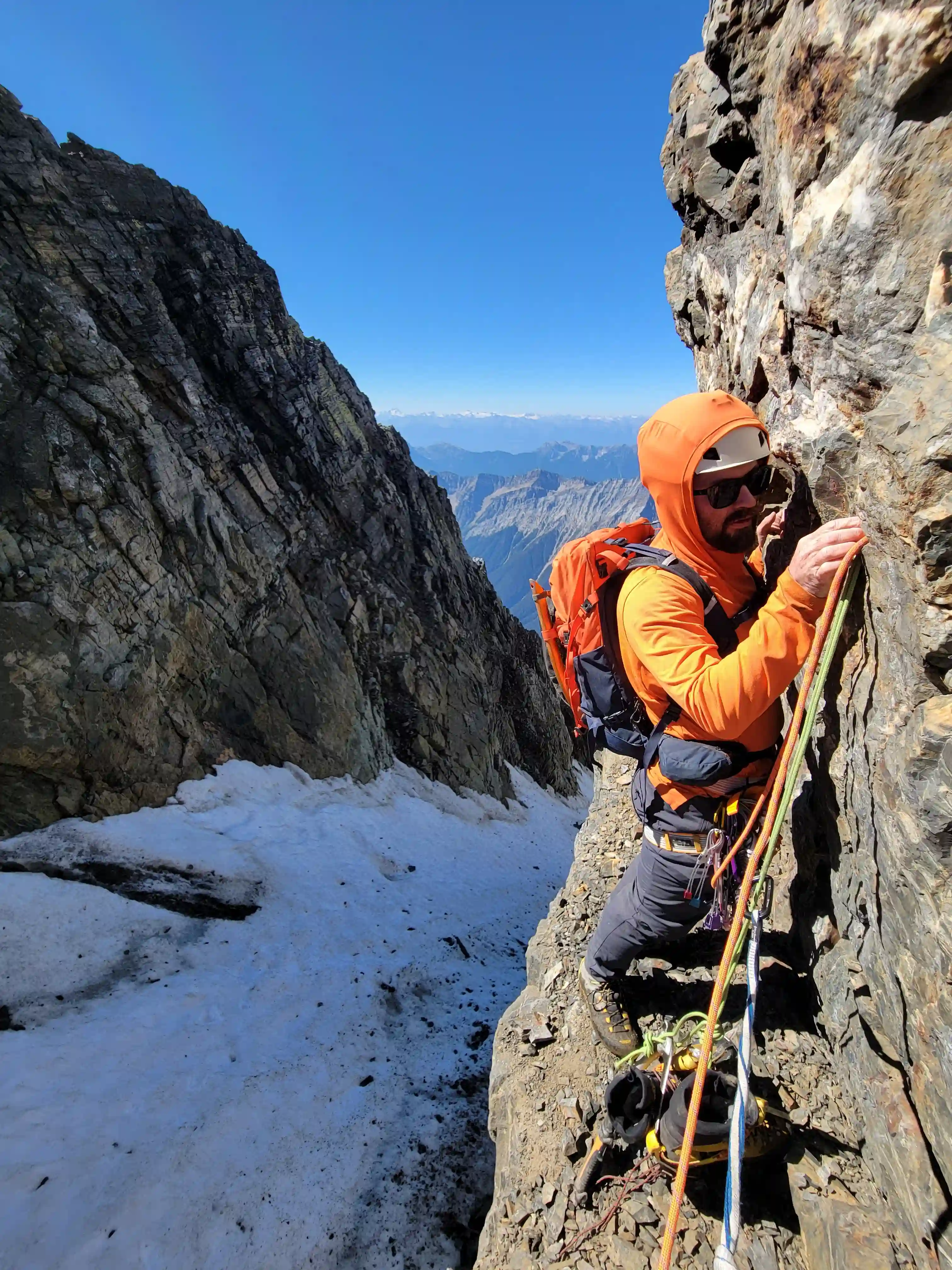
on the crux of North Tower
it's exposed and we had a rope so
we decided to protect it
these beasts
Chancellor on the other side
Into trips like this?
I'll send you an email whenever I publish a new trip report.
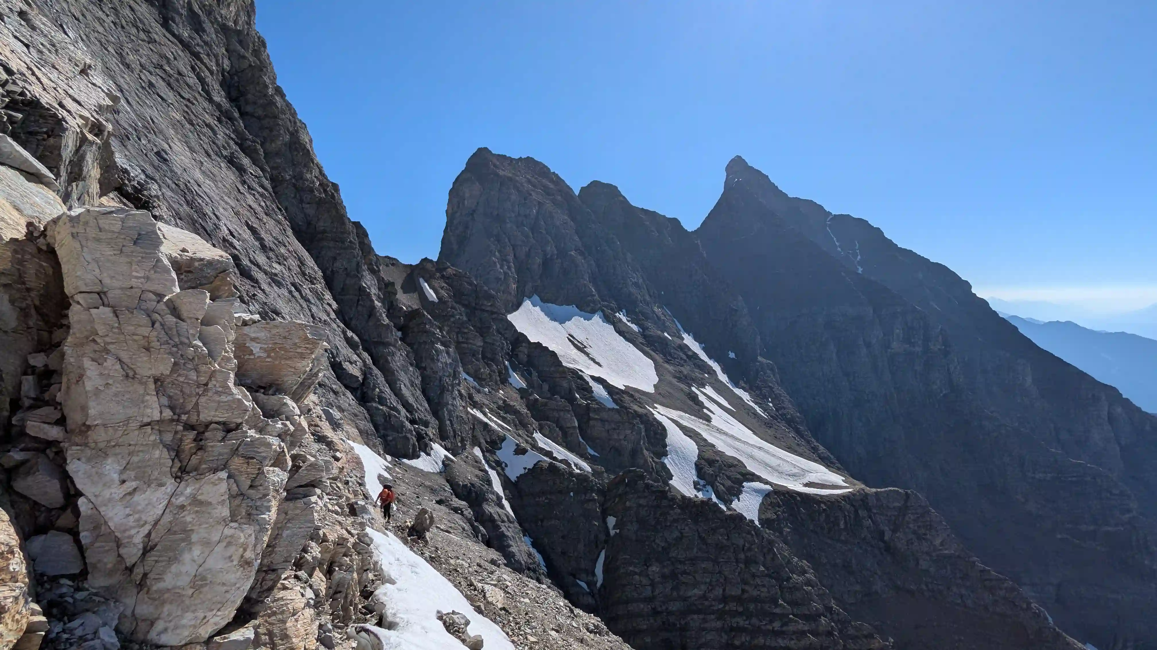
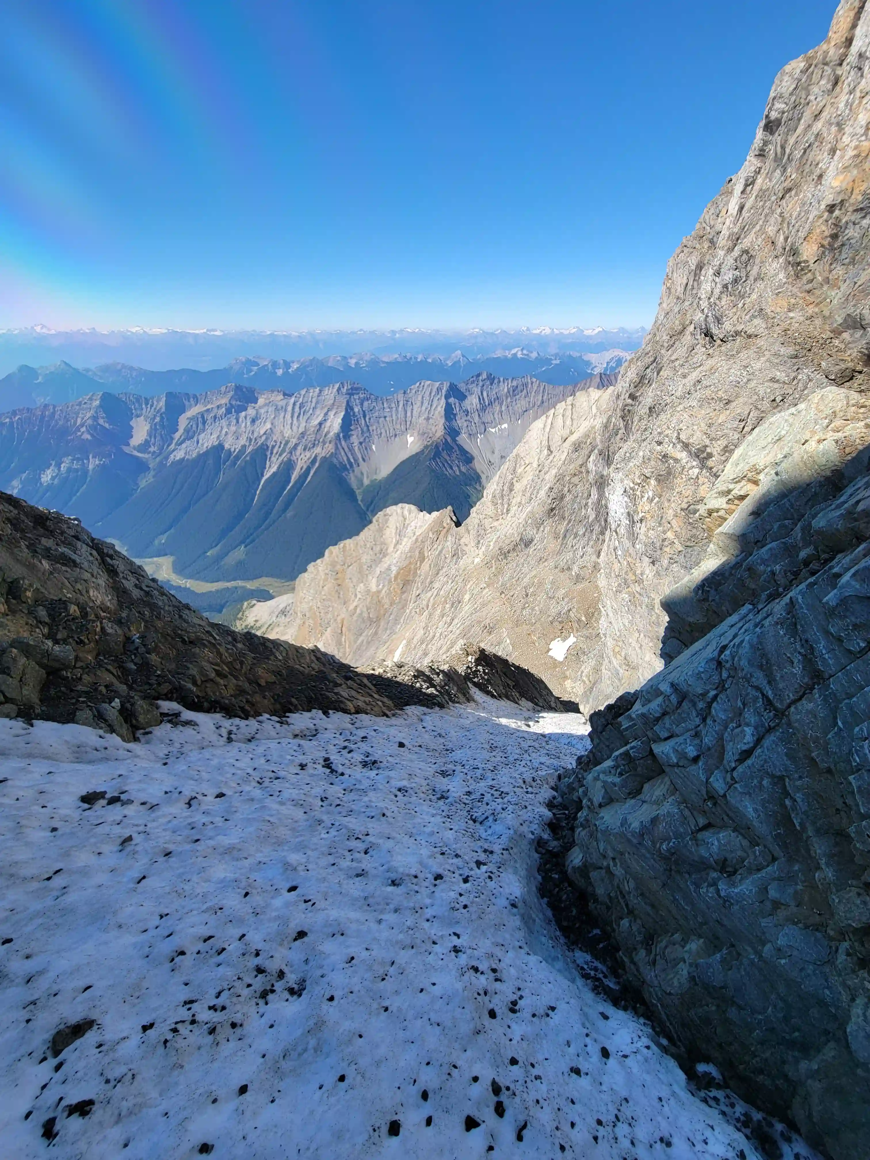
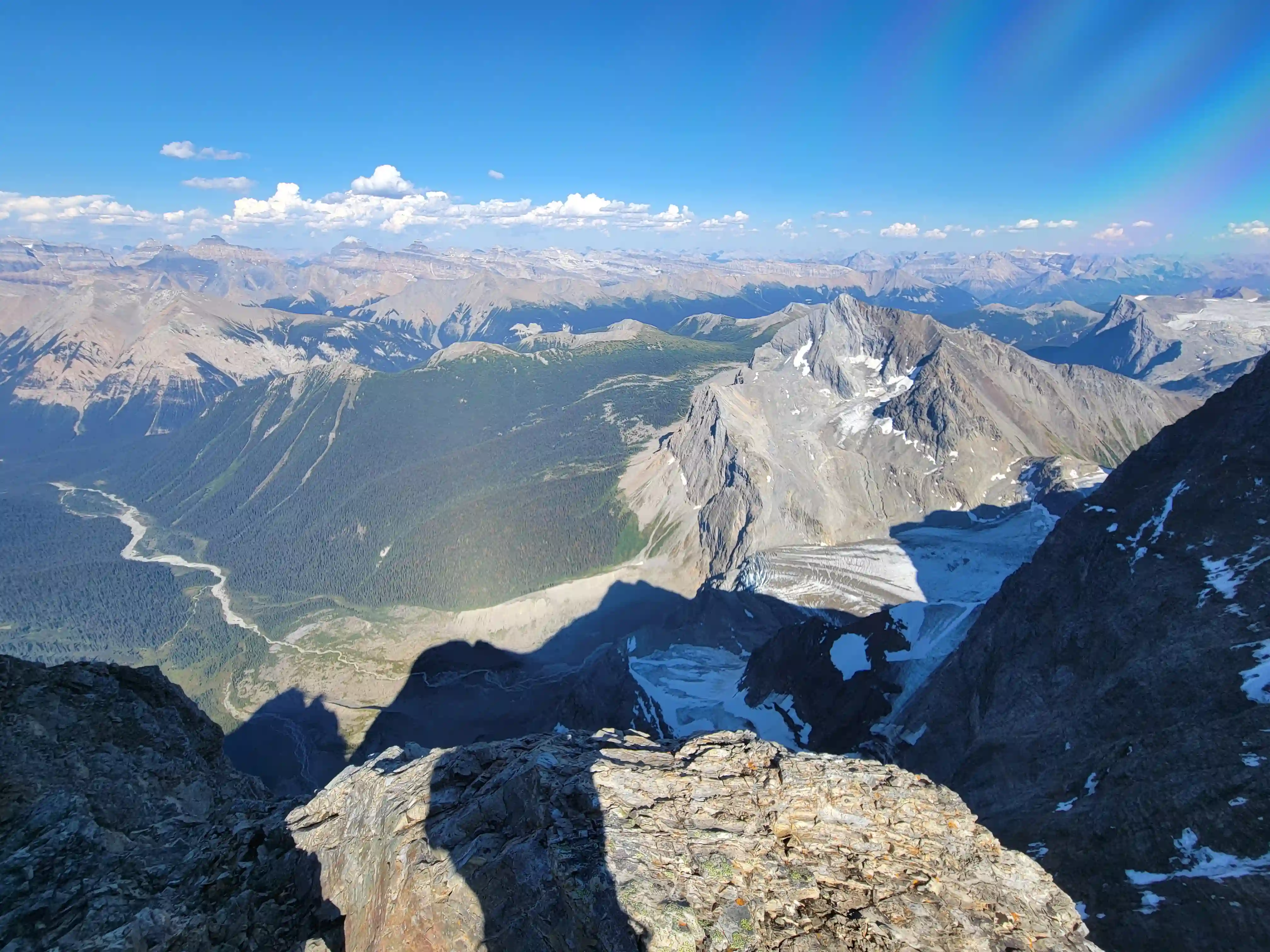
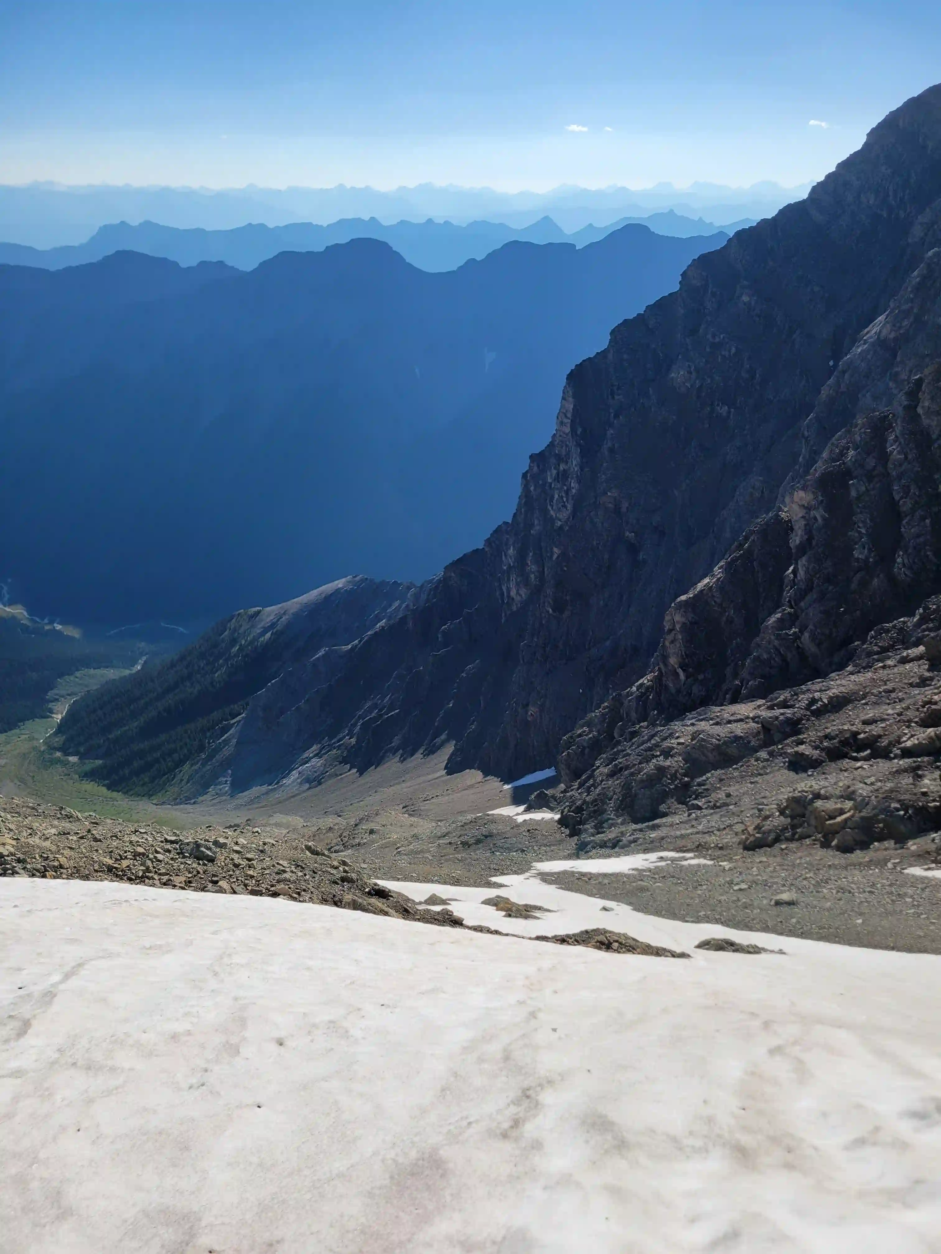
Descending the north tower required a bit of careful work near the top with not the toughest scrambling but a good amount of loose rock. The anchor that's set up to rap into the notch is quite close to the drop off so it was a bit tedious to get clipped to but the rappel was straightforward and reversing the snow climb and the sideways V went without issue. After returning to the rocky outcrop we met back up with the scree treadmill gully we had taken up and gained the last few meters of elevation to reach the remnant glacier and some persistent snow at the base of Goodsir Center.
MOUNT GOODSIR - CENTER PEAK
3384m, 11102ft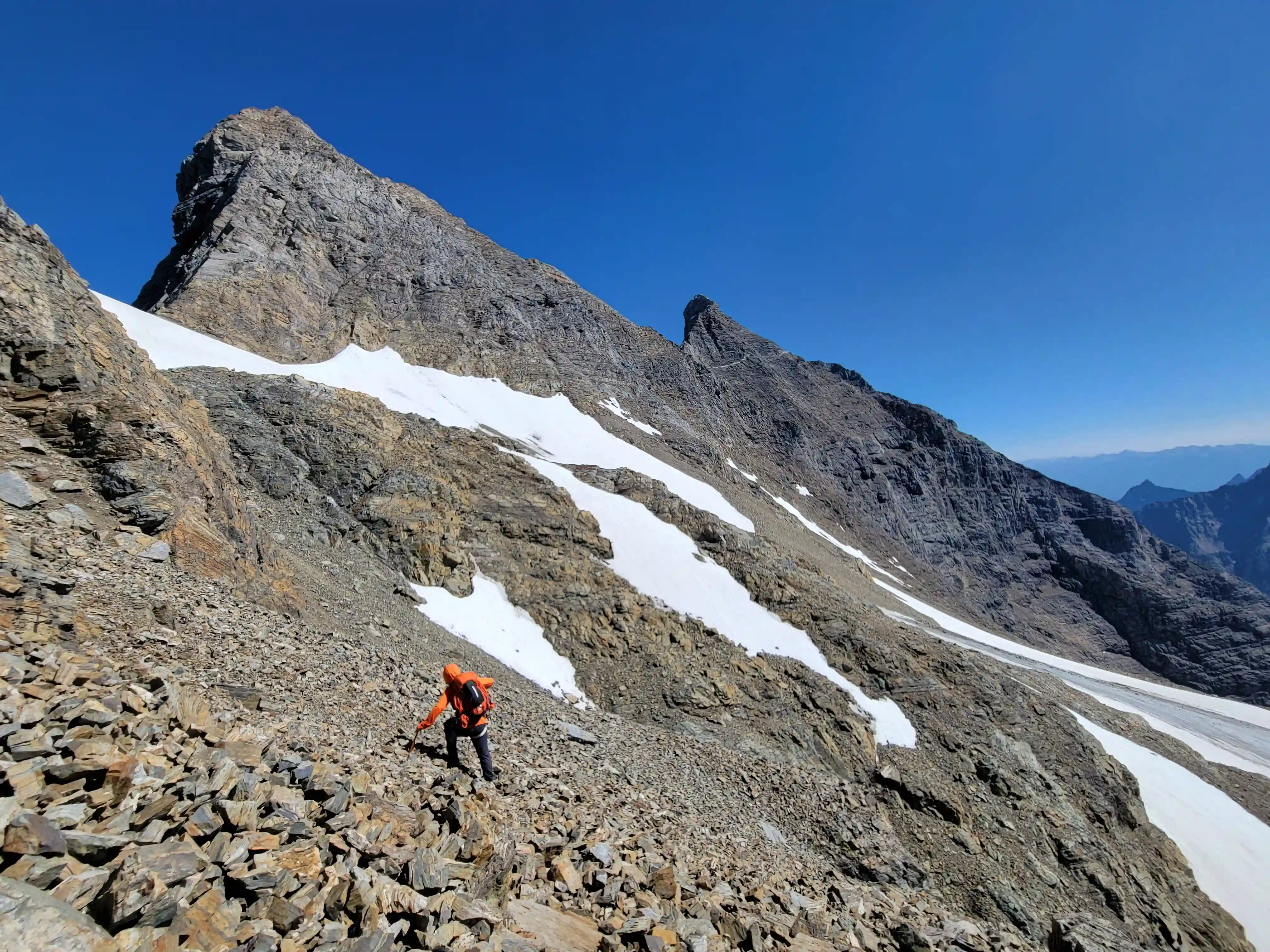
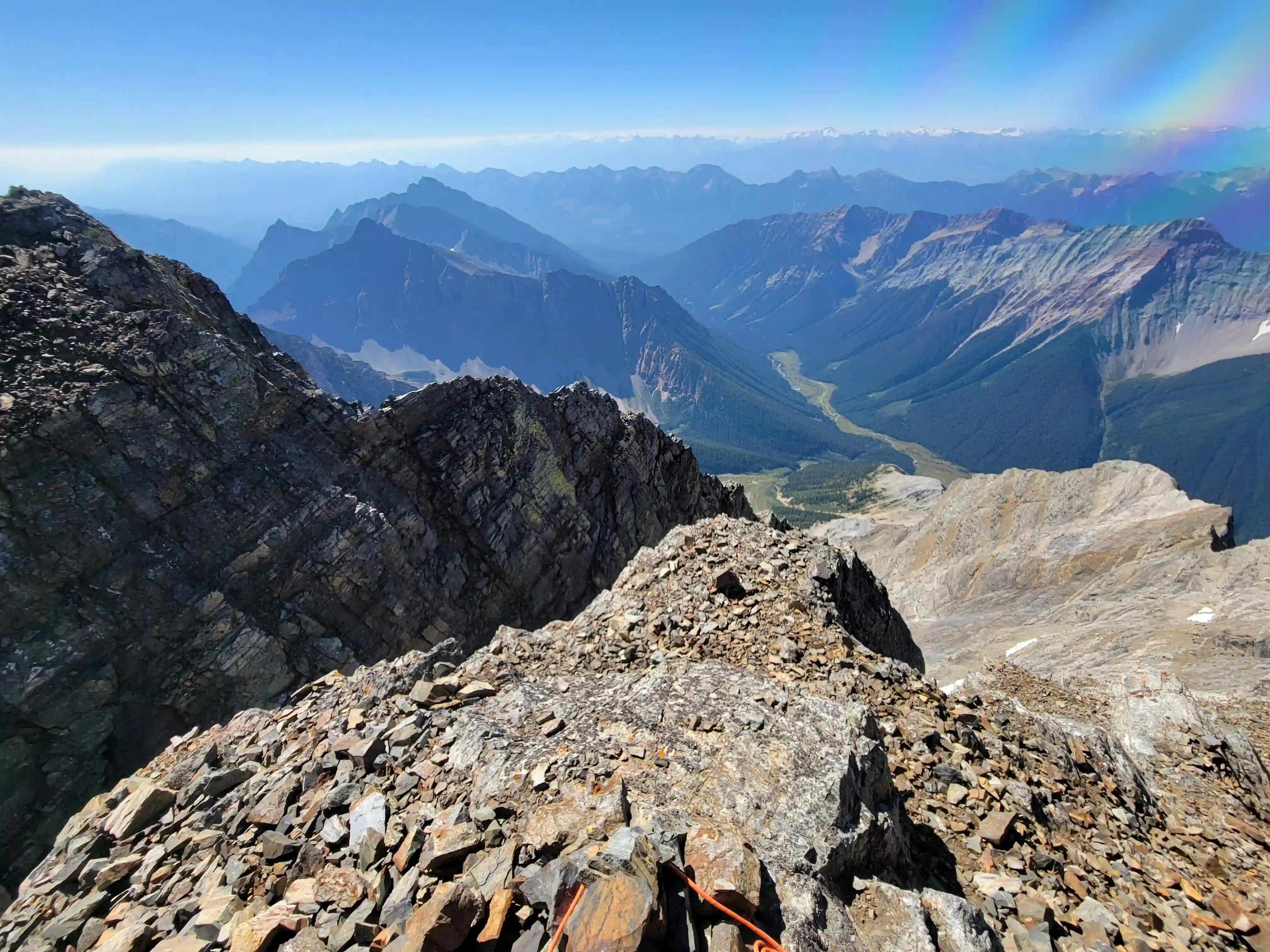
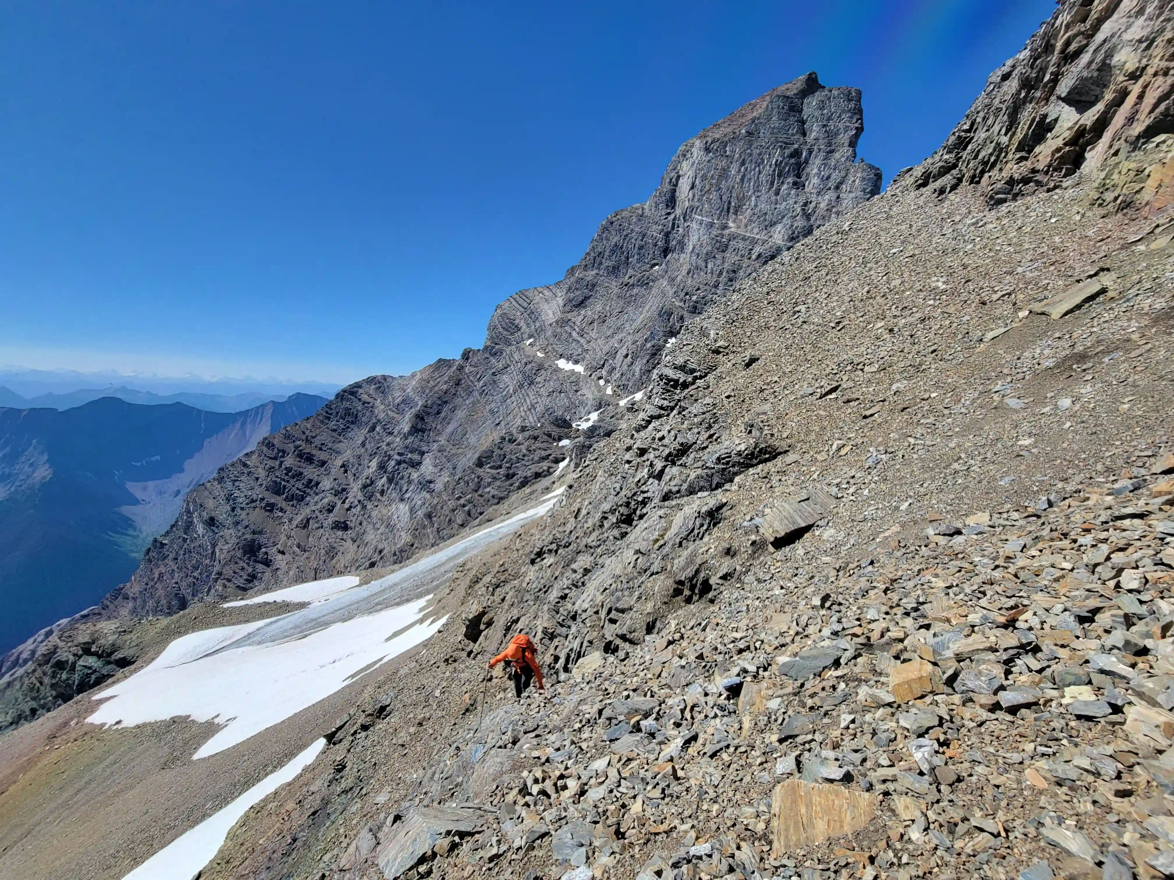
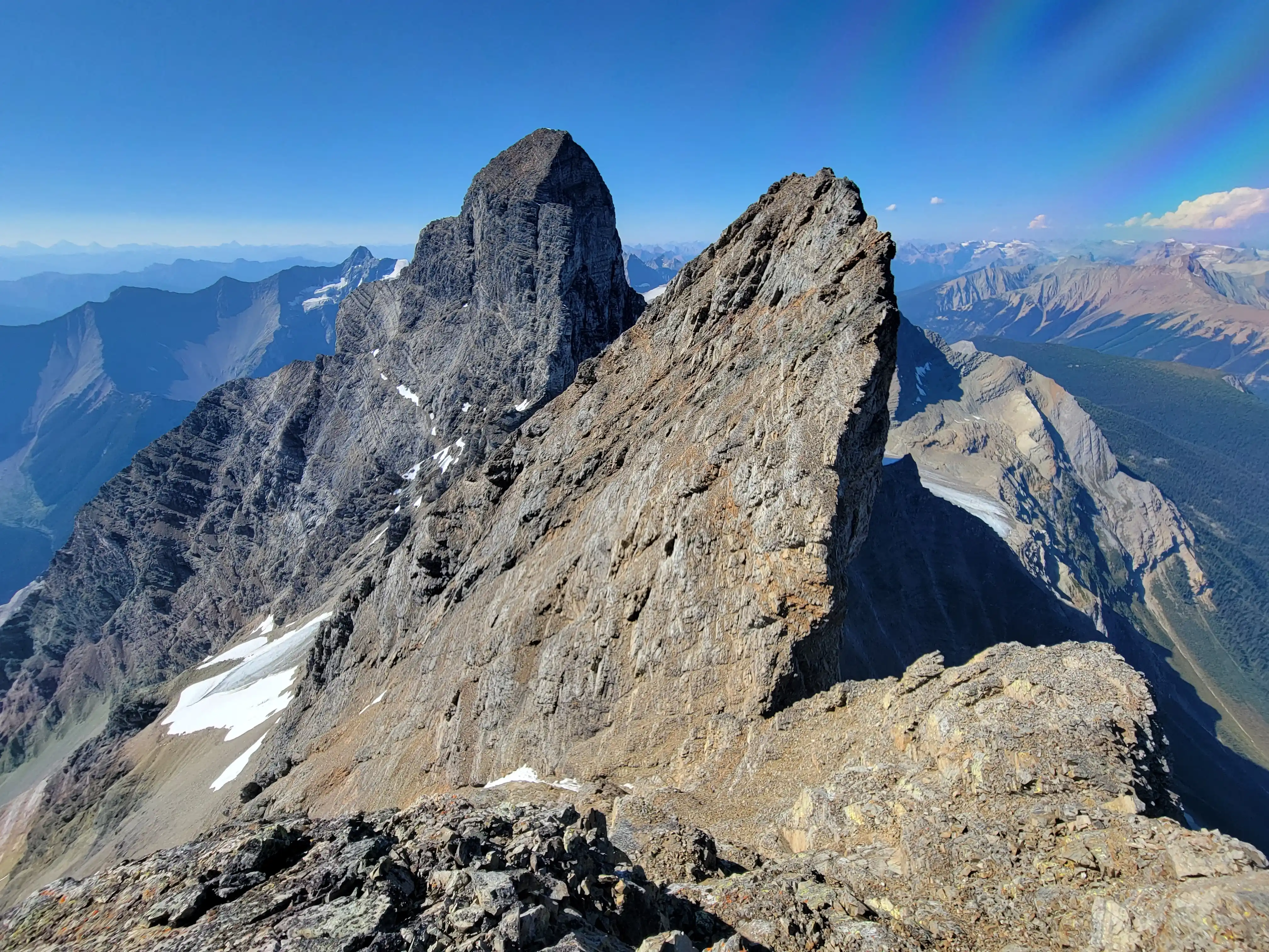
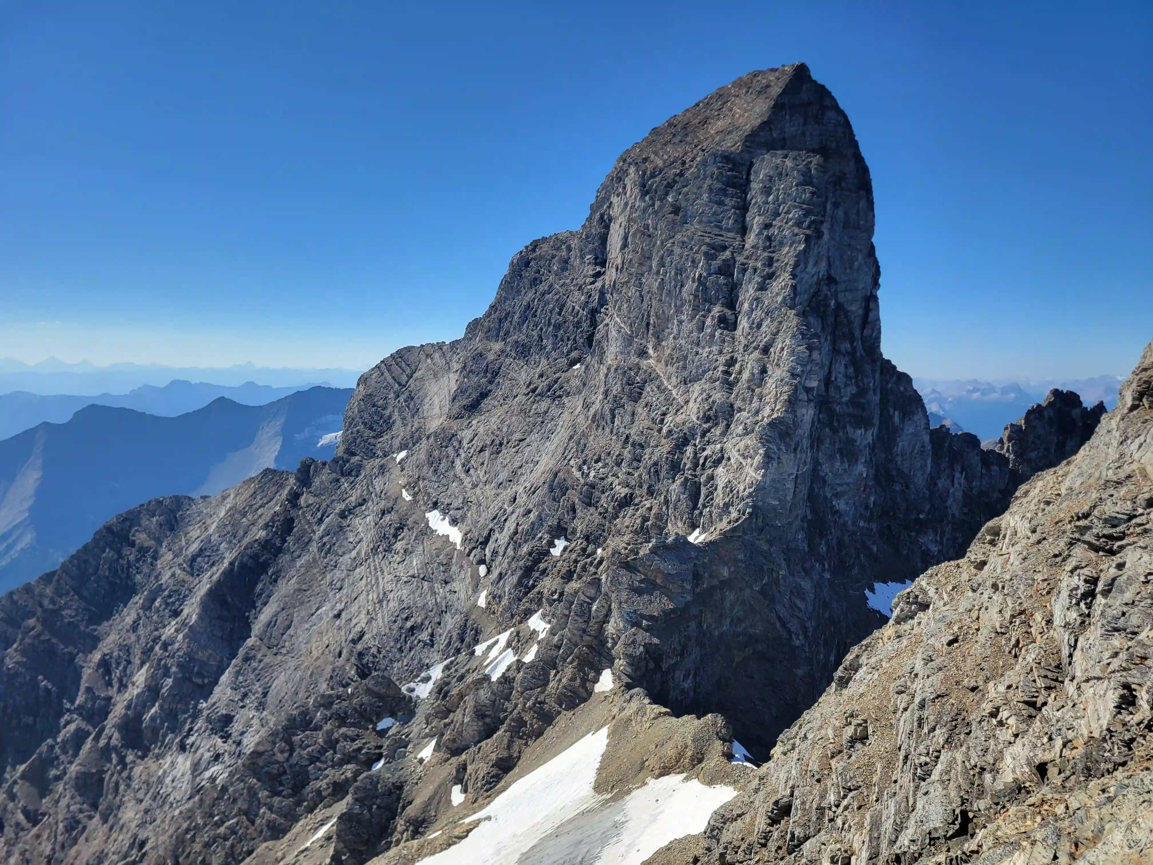
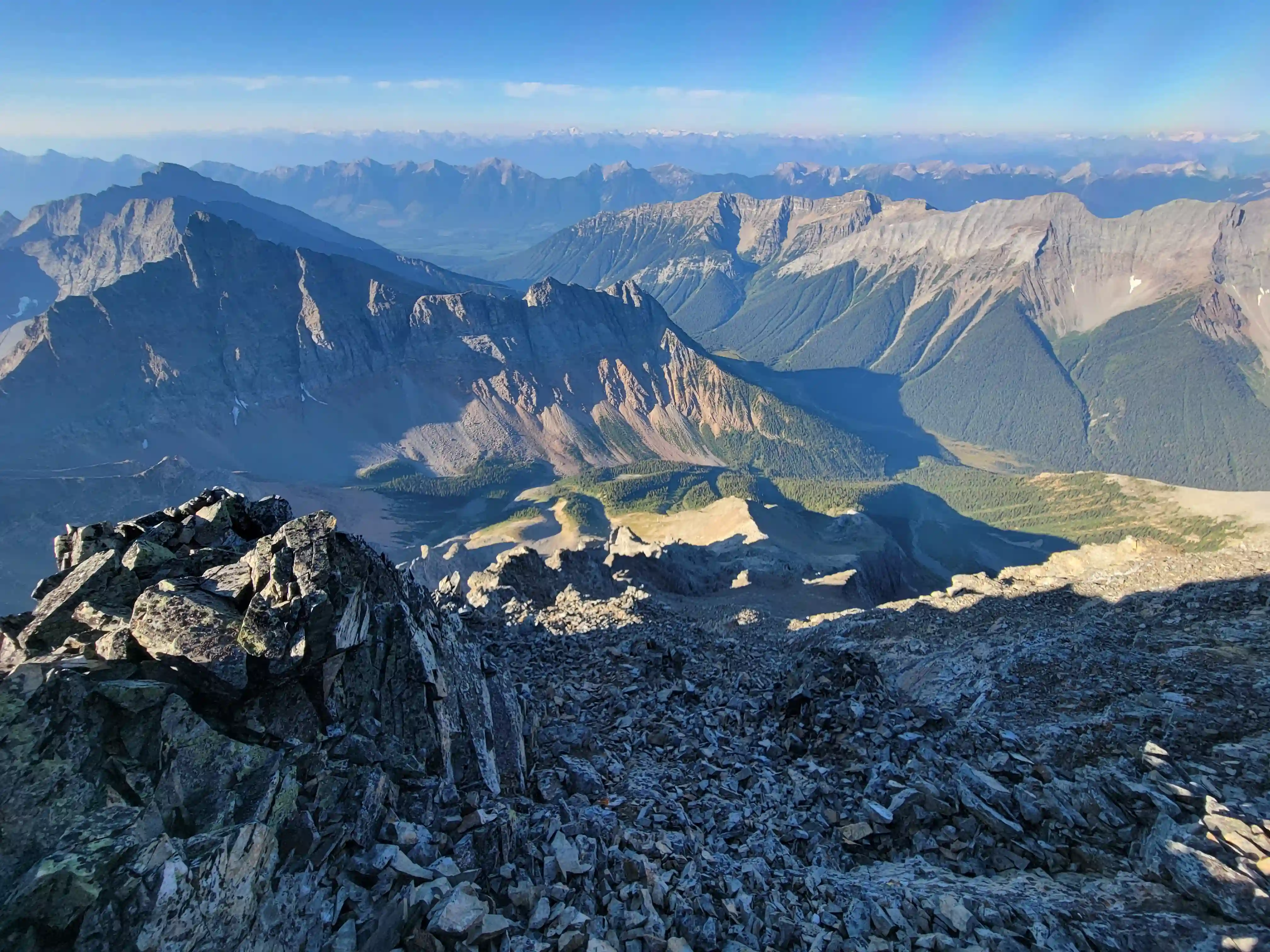
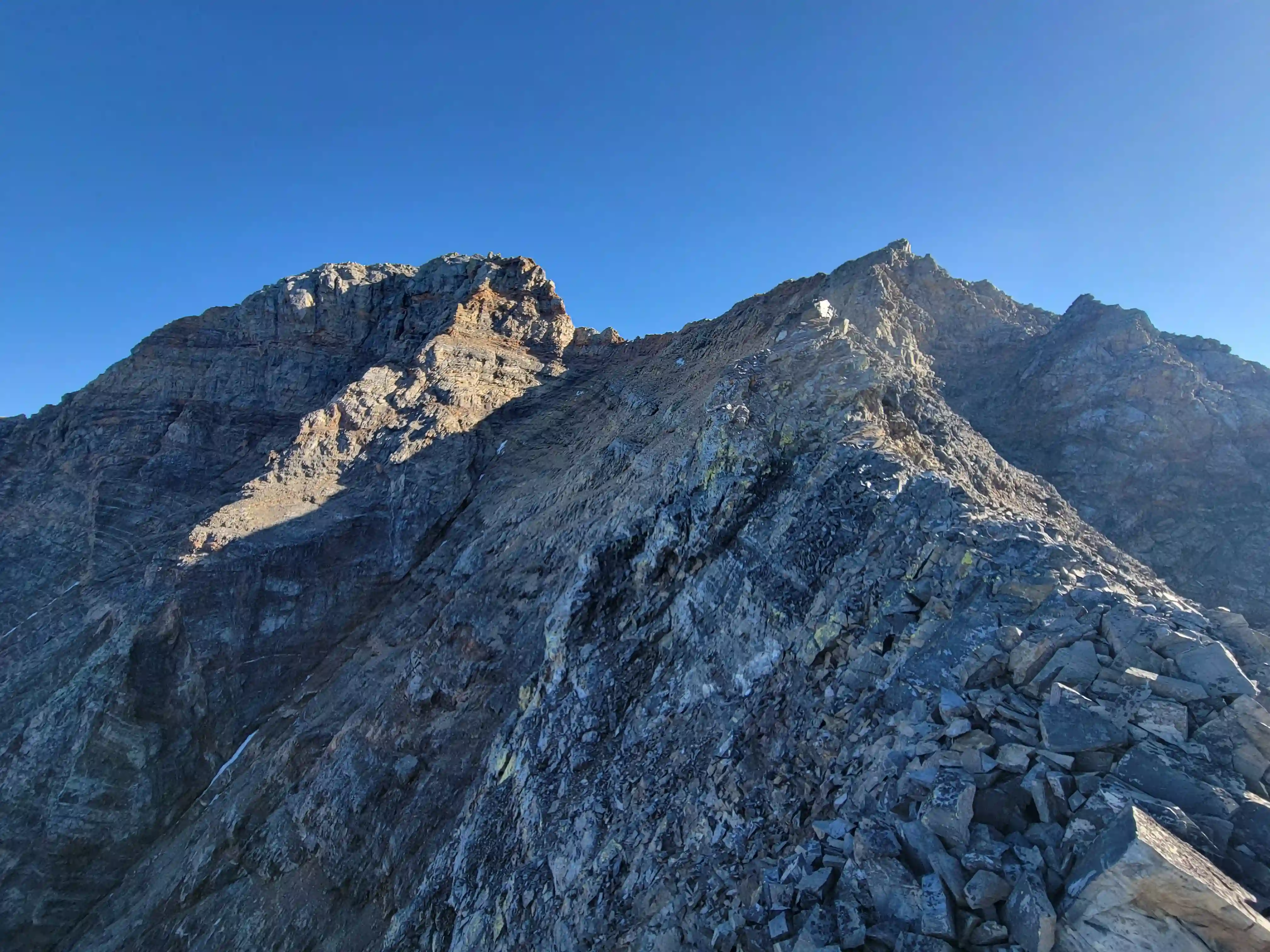
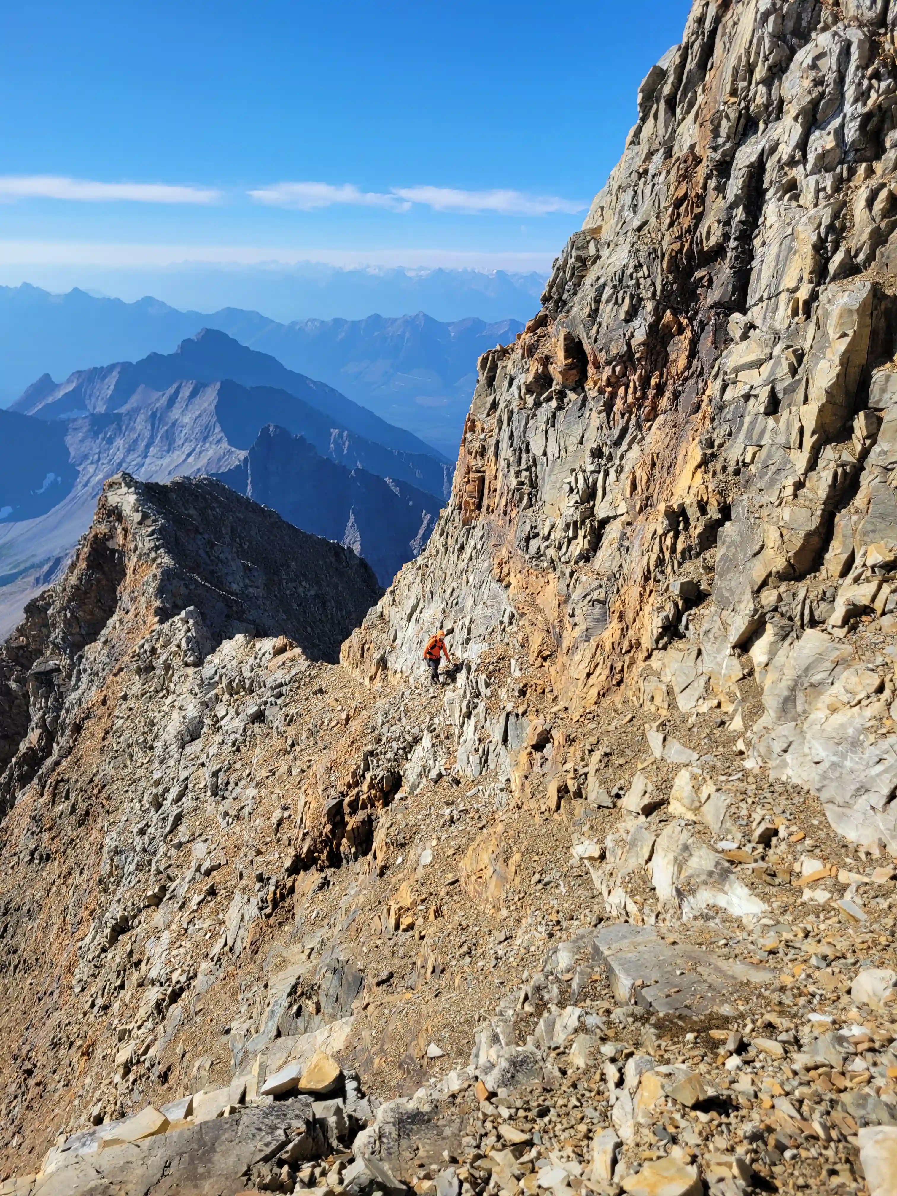
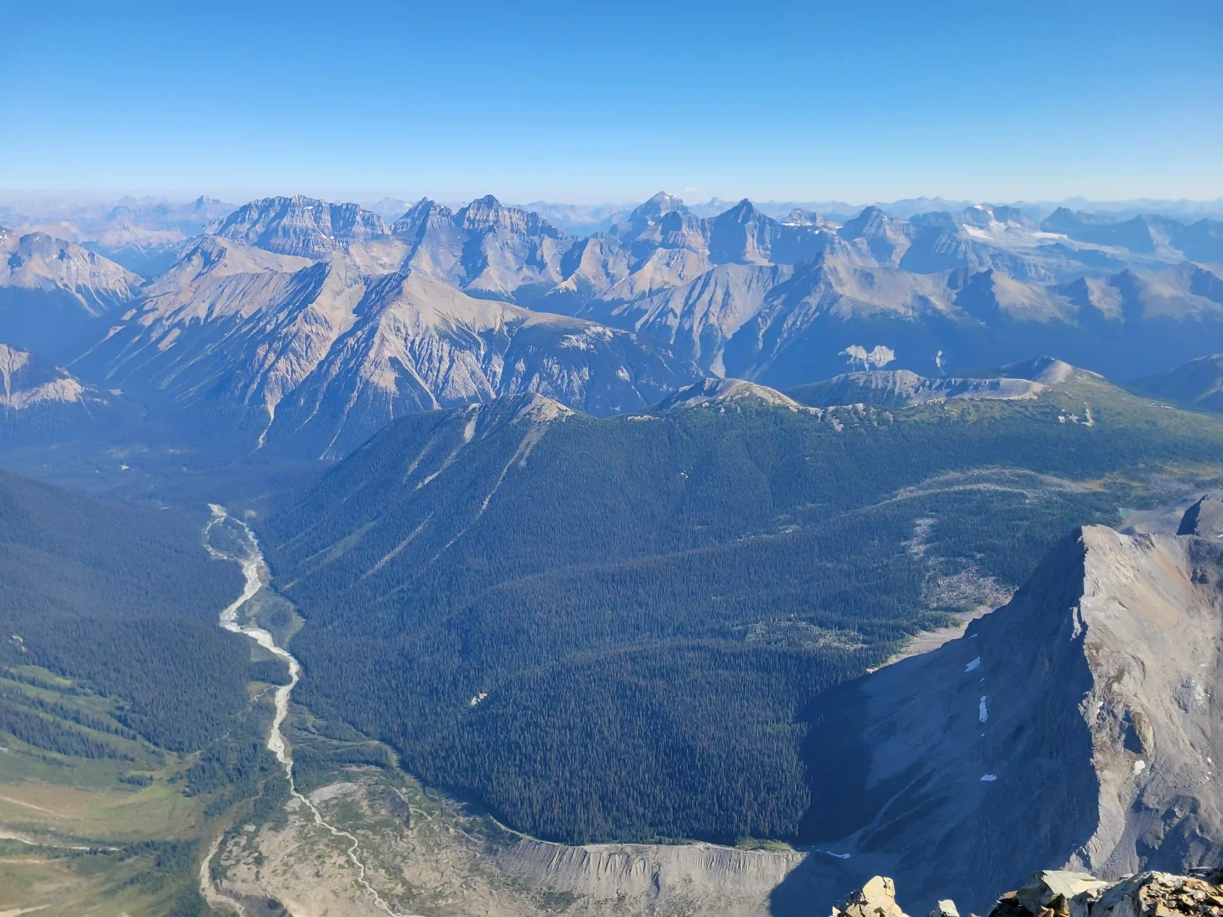
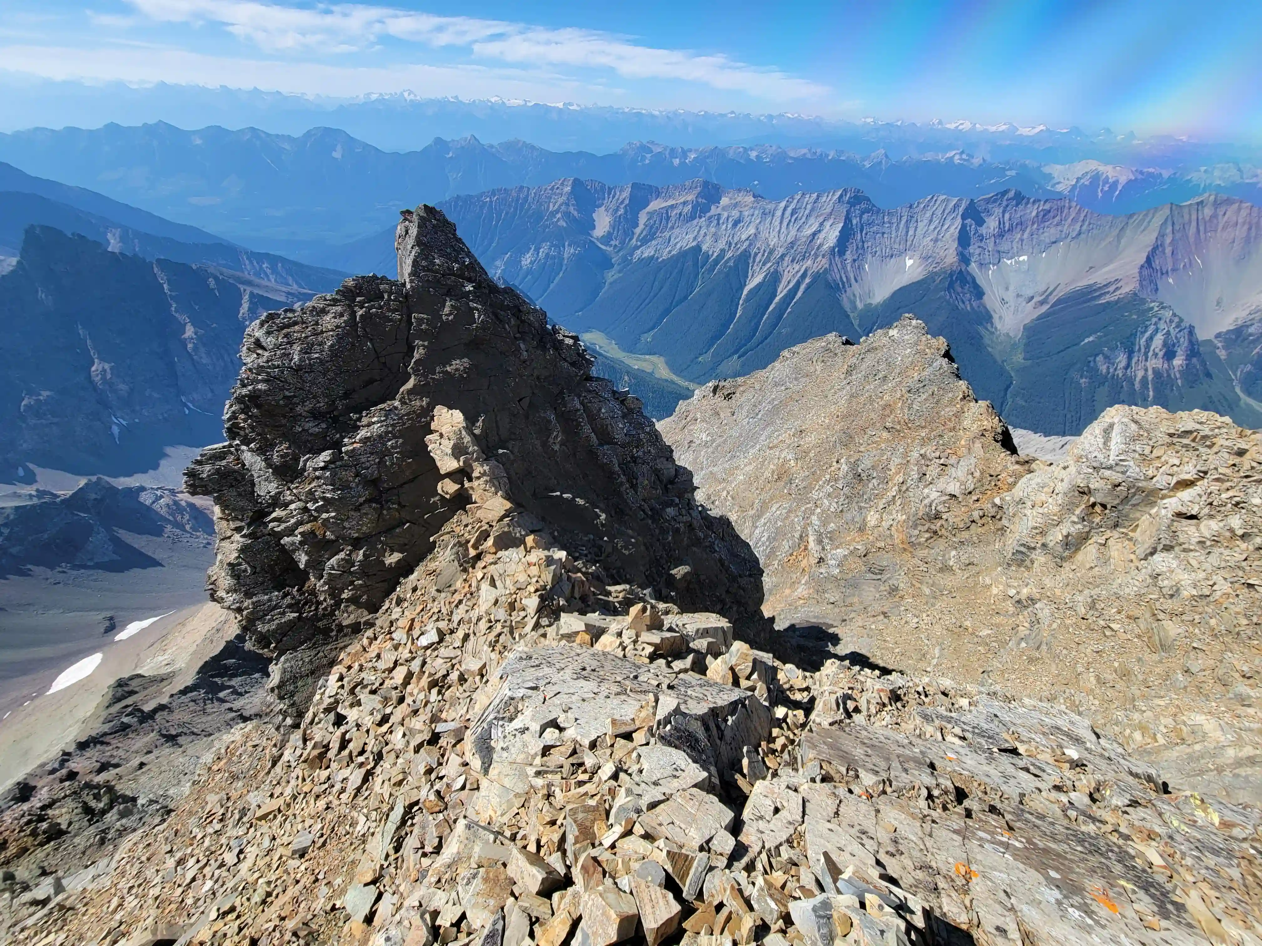
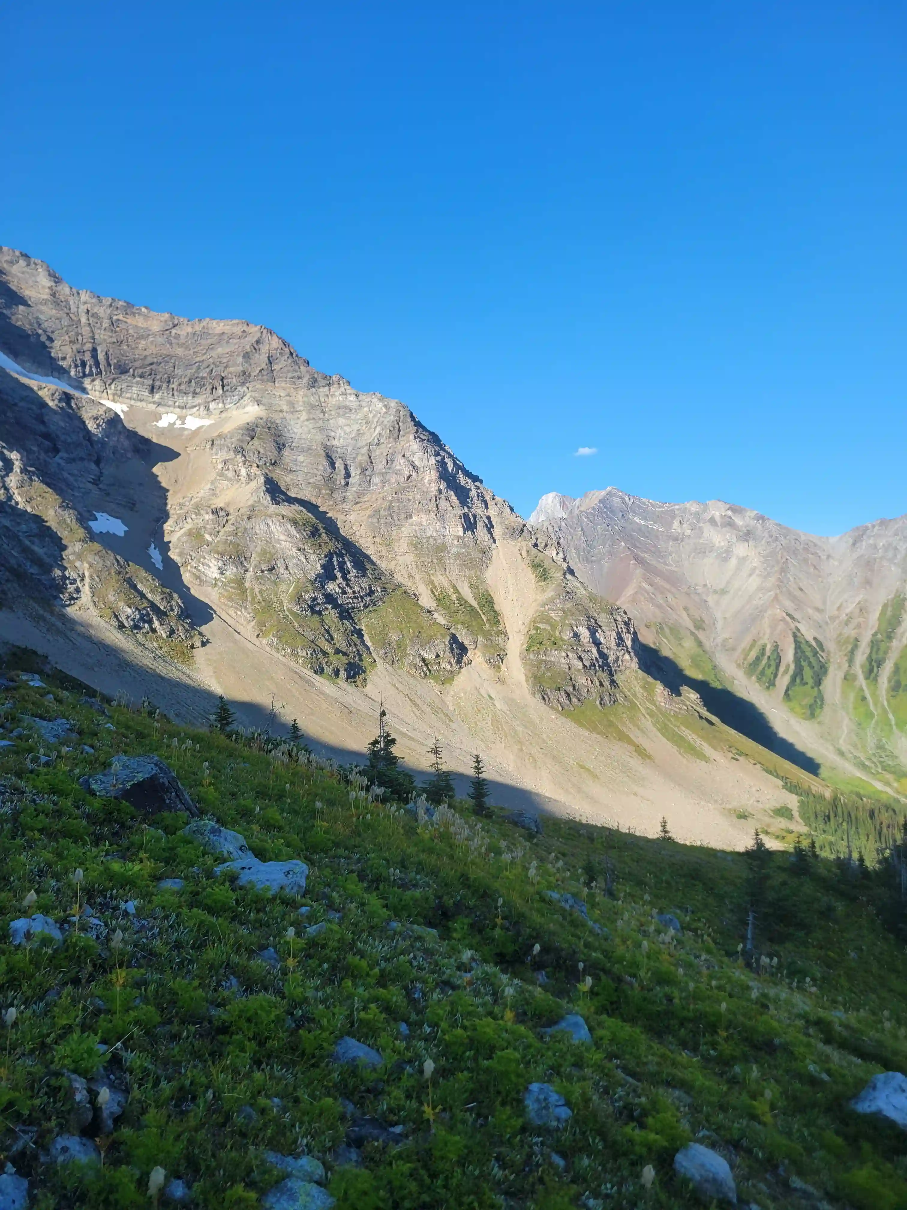
I hadn't done a whole lot of research on The Goodsirs headed into this trip with Mount Alberta right beforehand but before ascending Ian and I checked a photo he had on his phone from Dow Jones's book and it showed the further SW peak of Goodsir Center as being the summit so we started up with a right angled trajectory and made our way to the ridgeline. The terrain on Goodsir Center is predominantly 4th and low 5th class terrain in the stiffer sections so not all that technical but some good routefinding skill is definitely good to have on this peak. After reaching the ridge the view of Goodsir South was very impressive and we were able to see the entire relief off its NE face but I wasn't used to seeing this view in trip reports for Goodsir Center and we soon realized why. Just north of us was a higher point separated by a sharp notch and it took us a second but we soon realized we were on the wrong peak.
Not wanting to downclimb straight into the notch due to potentially loose rock we wrapped our way back around losing 150m or so along the way before finding a line back up and making our way for the true summit. It wasn't all that much of a detour but the extra elevation gain definitely zapped a good amount of the energy we had left and we were excited to be back at camp. We took a different line further north on the way down which required some care to not get cliffed out descending unknown terrain but we found a good line and were back at the remnant glacier where we had ditched some gear not long after. The rest of the descent was on loose scree, snow, and a bit of choss so it went by a lot quicker than the way up and that just left the traverse back to camp to end off our day.
the descent
MOUNT GOODSIR - SOUTH TOWER
3562m, 11686ft
Sidehill traverse to get back to camp was definitely a painful way to end the day but knowing that we wouldn't have to do anywhere near as much of that on our last day for Goodsir South and our exit made it easier to push through and get it done. We were just retracing our steps for the most part and had the goat trail to follow which was nice and after a couple kilometers of slogging we were back at camp and feeling it from a long day.
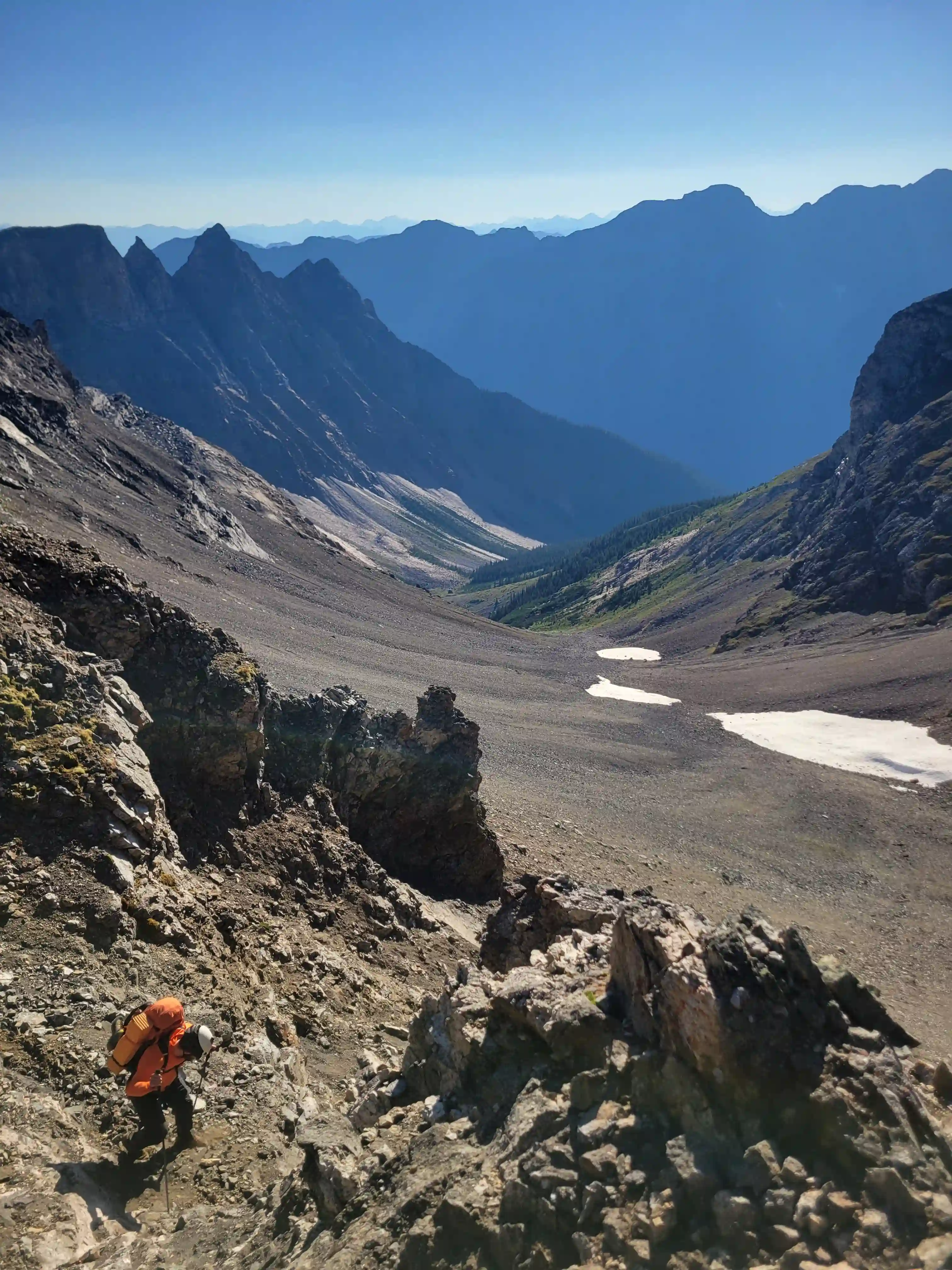
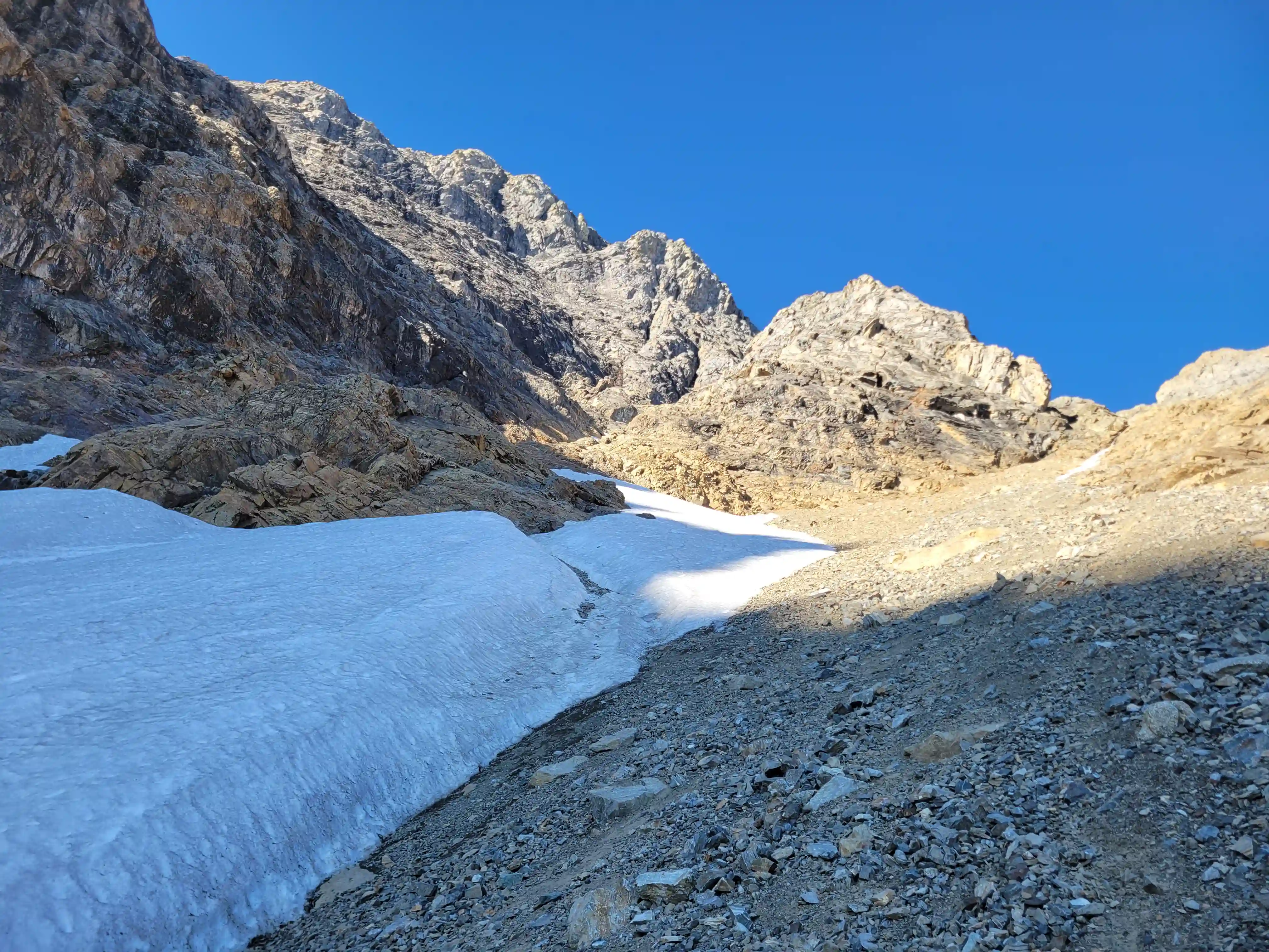
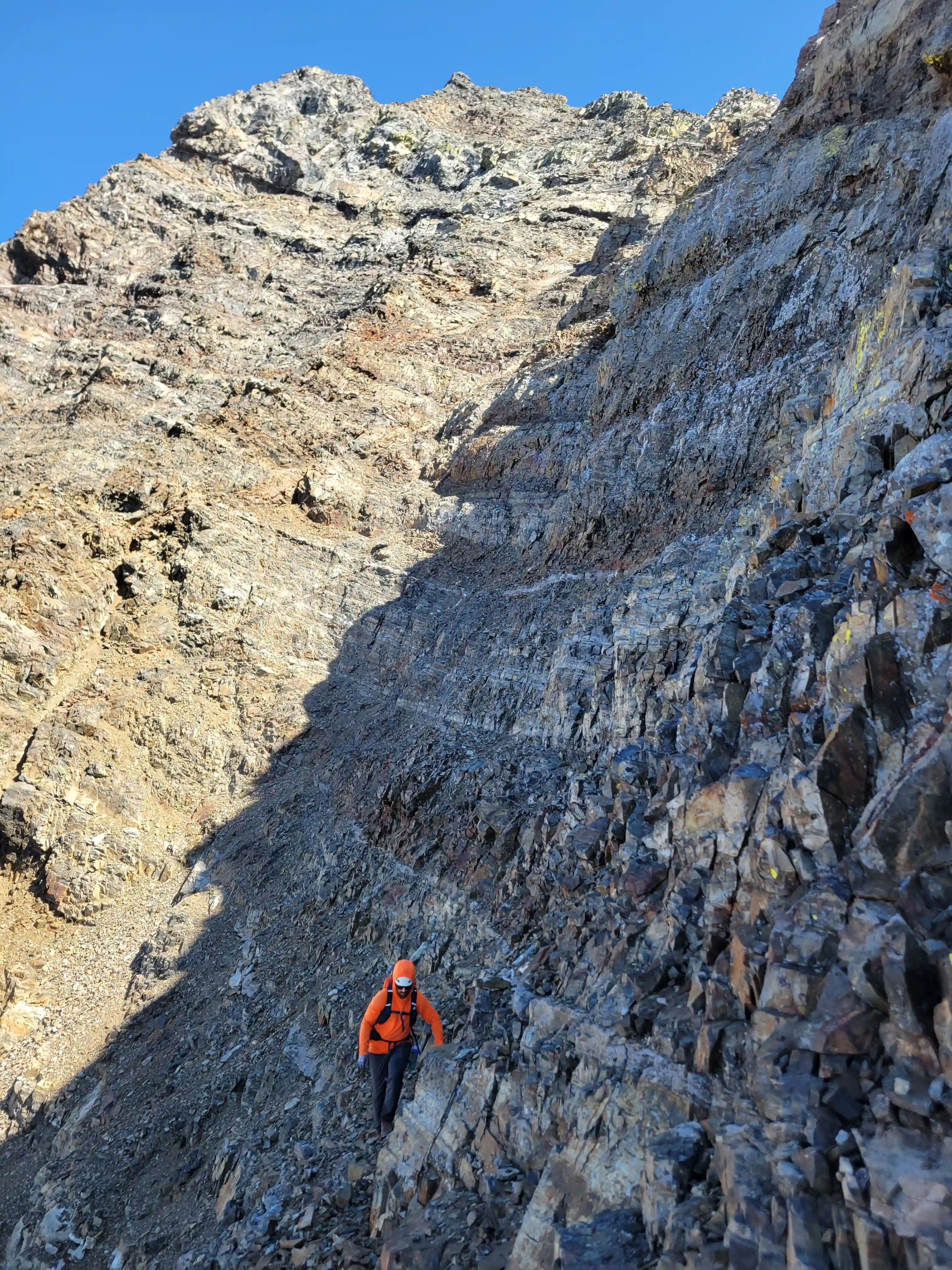
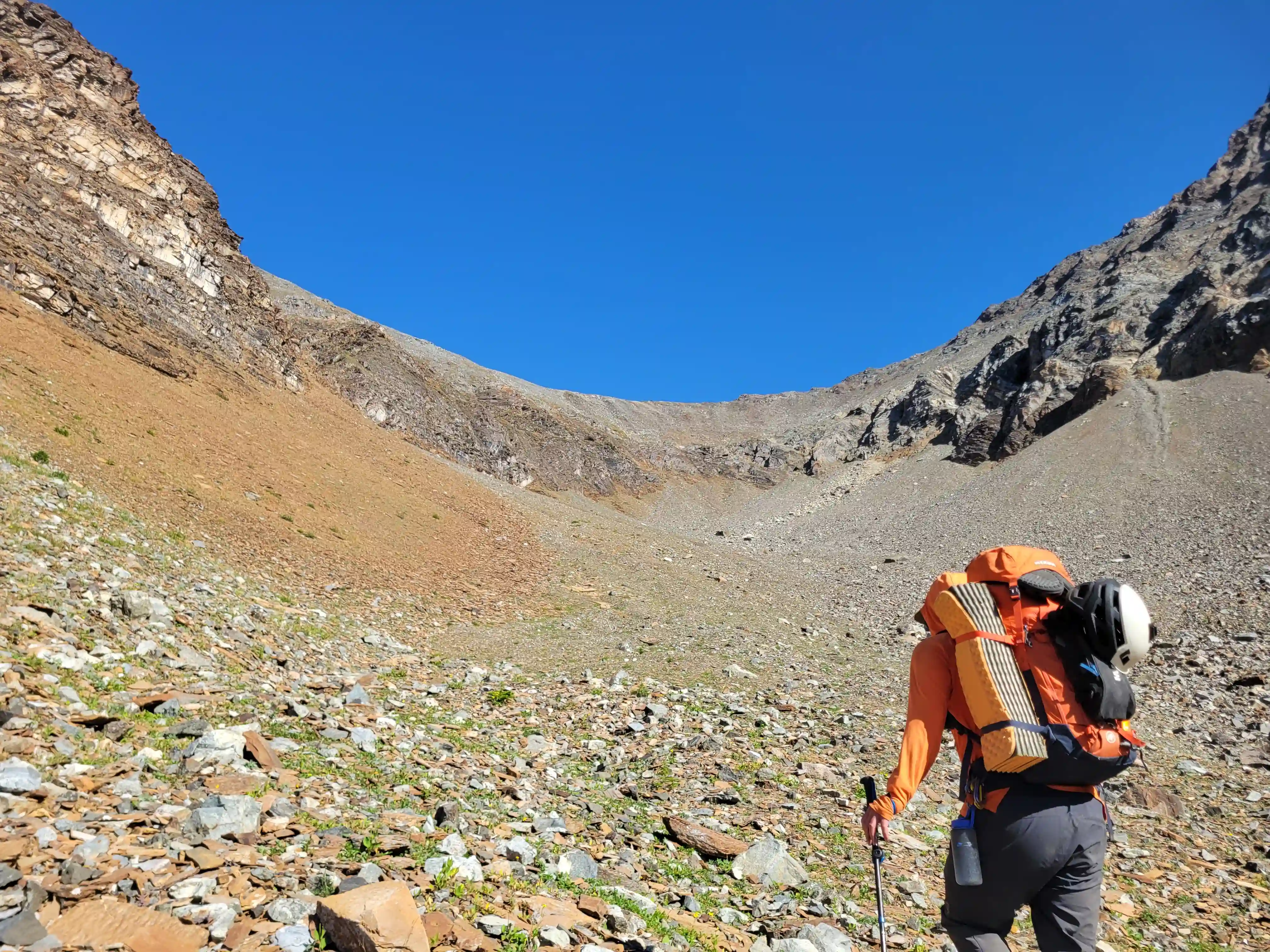
The next morning we were up even earlier as we had a long day ahead of us given that we wanted to exit after getting up and down the south tower so we were moving a bit before 6:30. The ascent of South Goodsir can be broken into 3 sections, with the lower portion involving the ascent from camp to the top of the "gully of shit" where the small bivi site is located, the second section starting from the bivi site and gaining the majority of the elevation gain climbing extremely loose rock until the upper ridge is reached, and the last part which is characterized by more exposed terrain and technical climbing but having more solid and trustworthy rock.
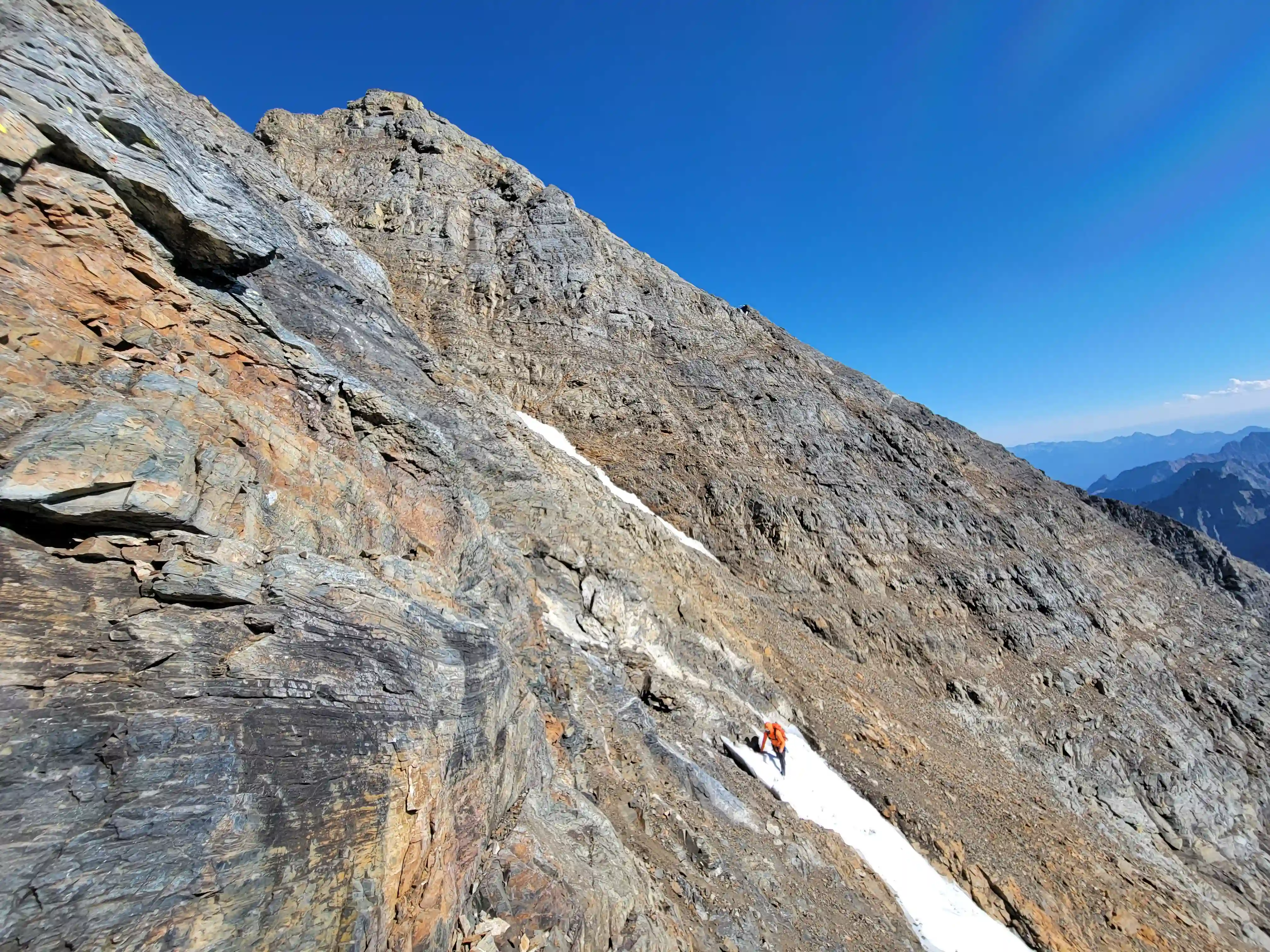
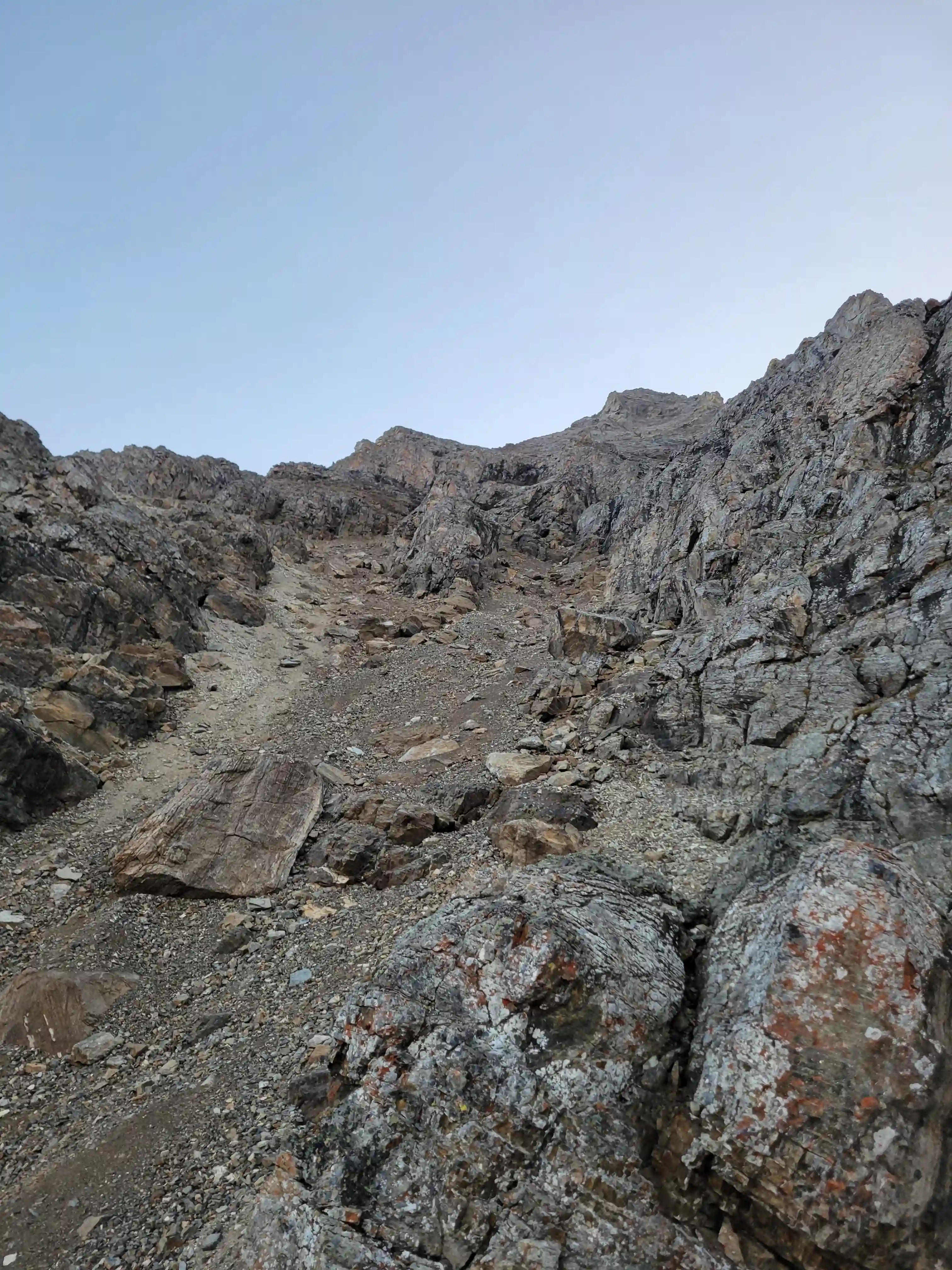
With the lower section of the South Goodsir climb the ascent line is just a couple hundred meters NW of camp so traversing is minimal and then the route heads straight up on hiking and easy scrambling terrain heading ever so slightly skiers left. The only issue we had here was not being sure whether we were in the infamous "gully of shit" or not but with the pictures below this should be pretty easy to identify for future parties. Once this gully is reach the loose rocky debris is followed up until it branches climber's right and this is where the snow started for us so this made the way to go quite obvious. Following a good amount of snow climbing with surprisingly little rock in it signifying not a whole lot of natural rockfall the gully transitioned back to rock so we took off our crampons and continued up the loose terrain until we topped out at the bivi site where we stashed all our snow / ice related gear and anything else we didn't want to bring with us before the bulk of the gain ahead.
gully made climbing quick
below the top so it was scree for the rest
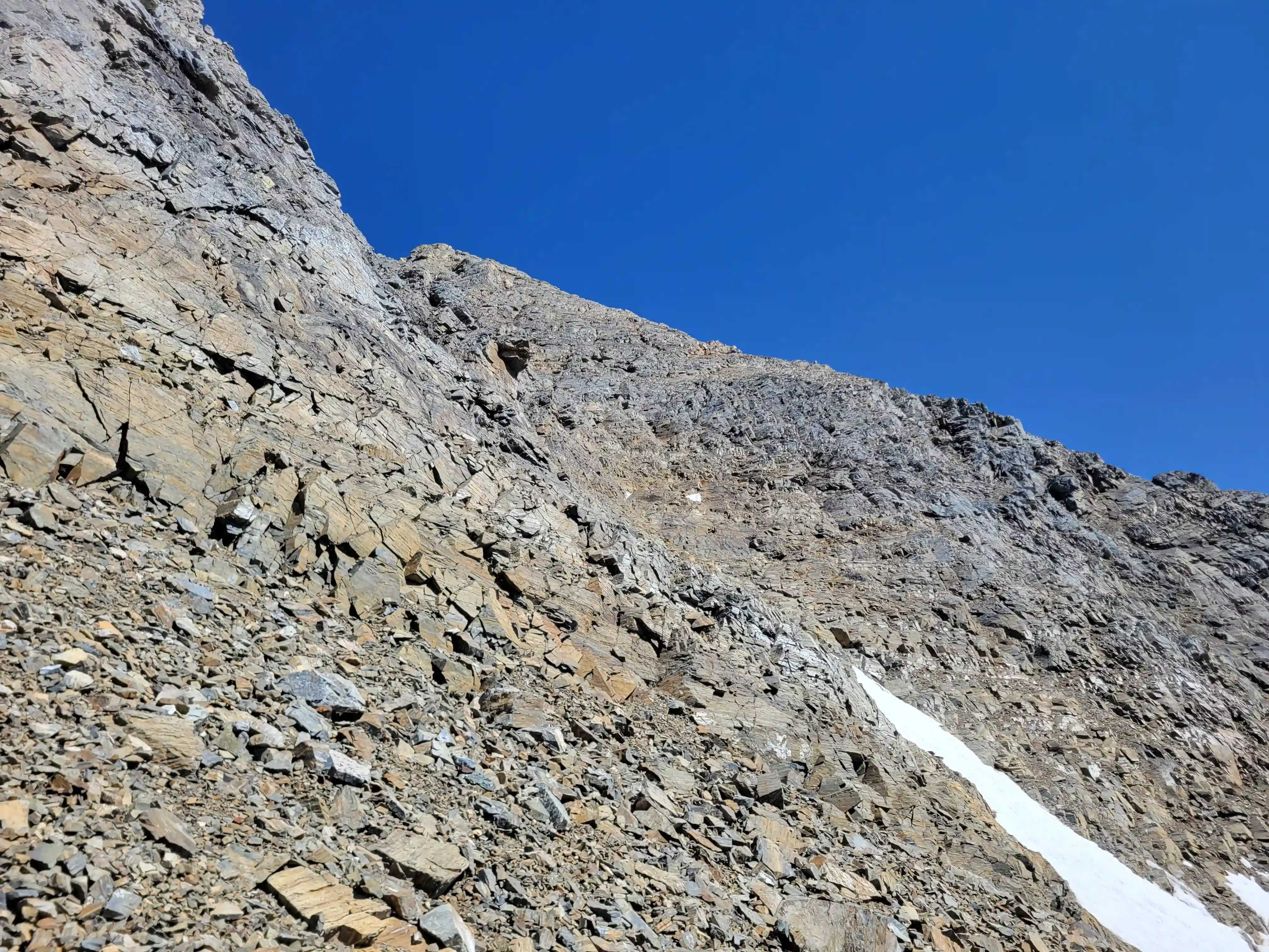
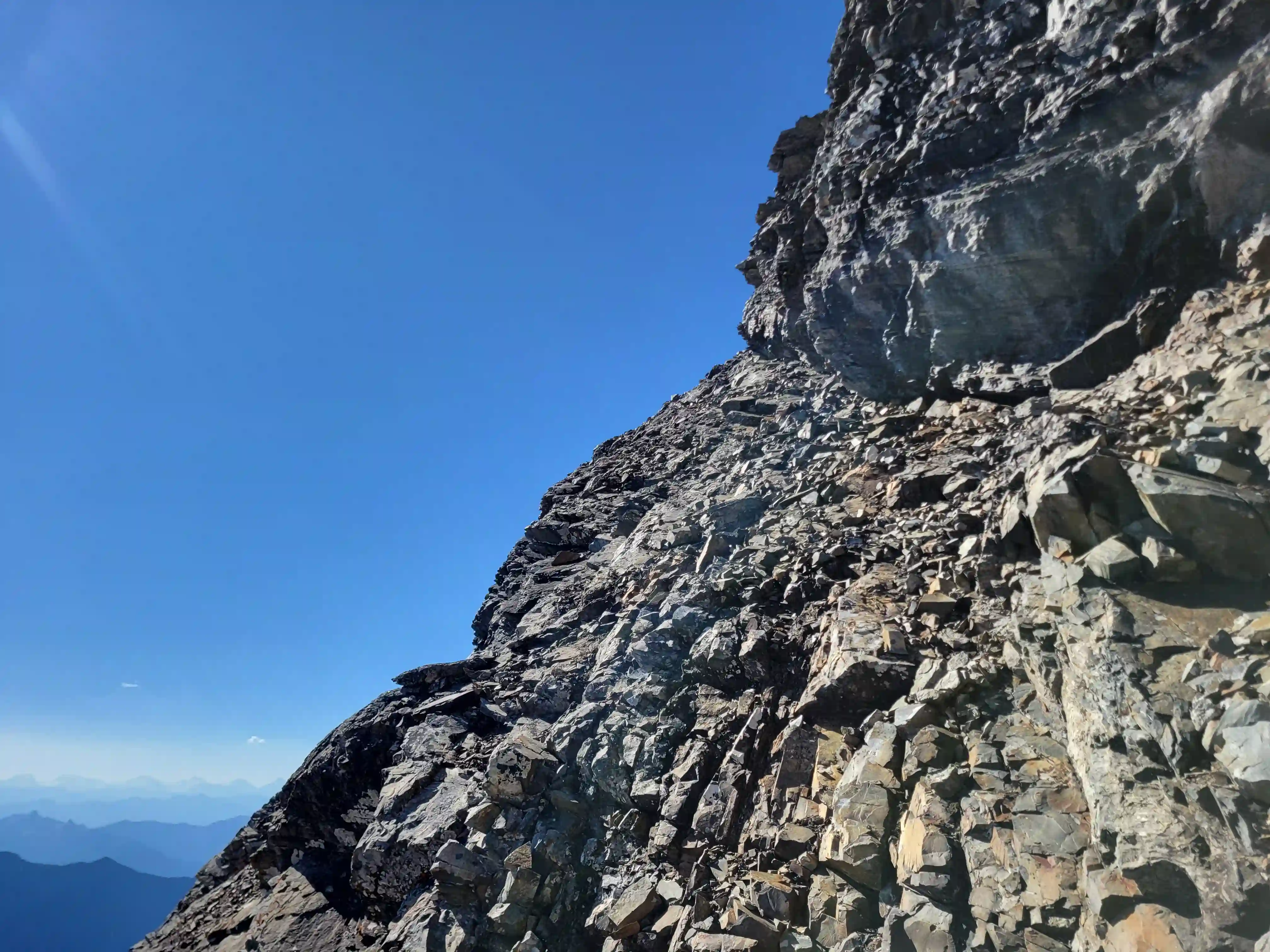
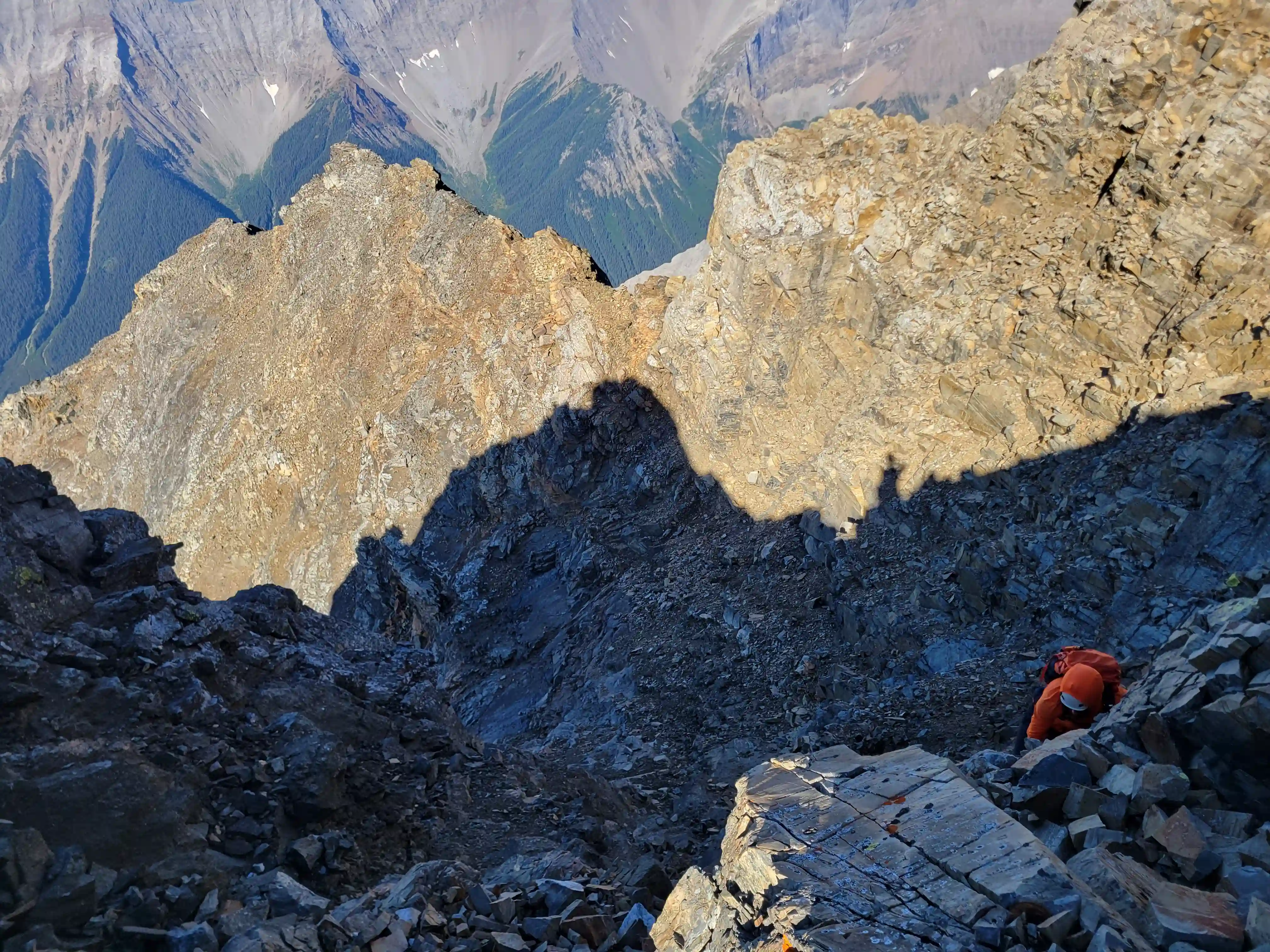
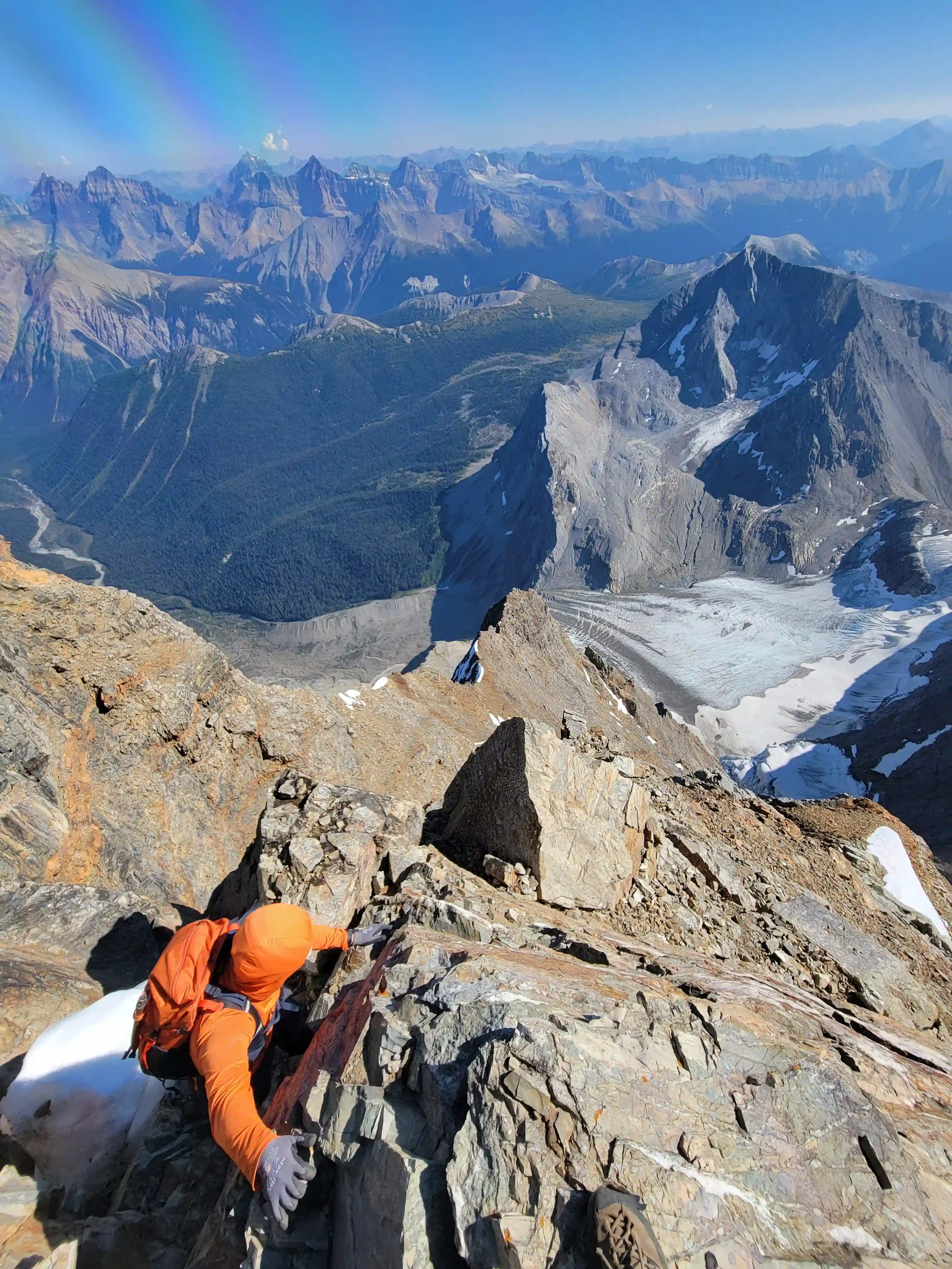
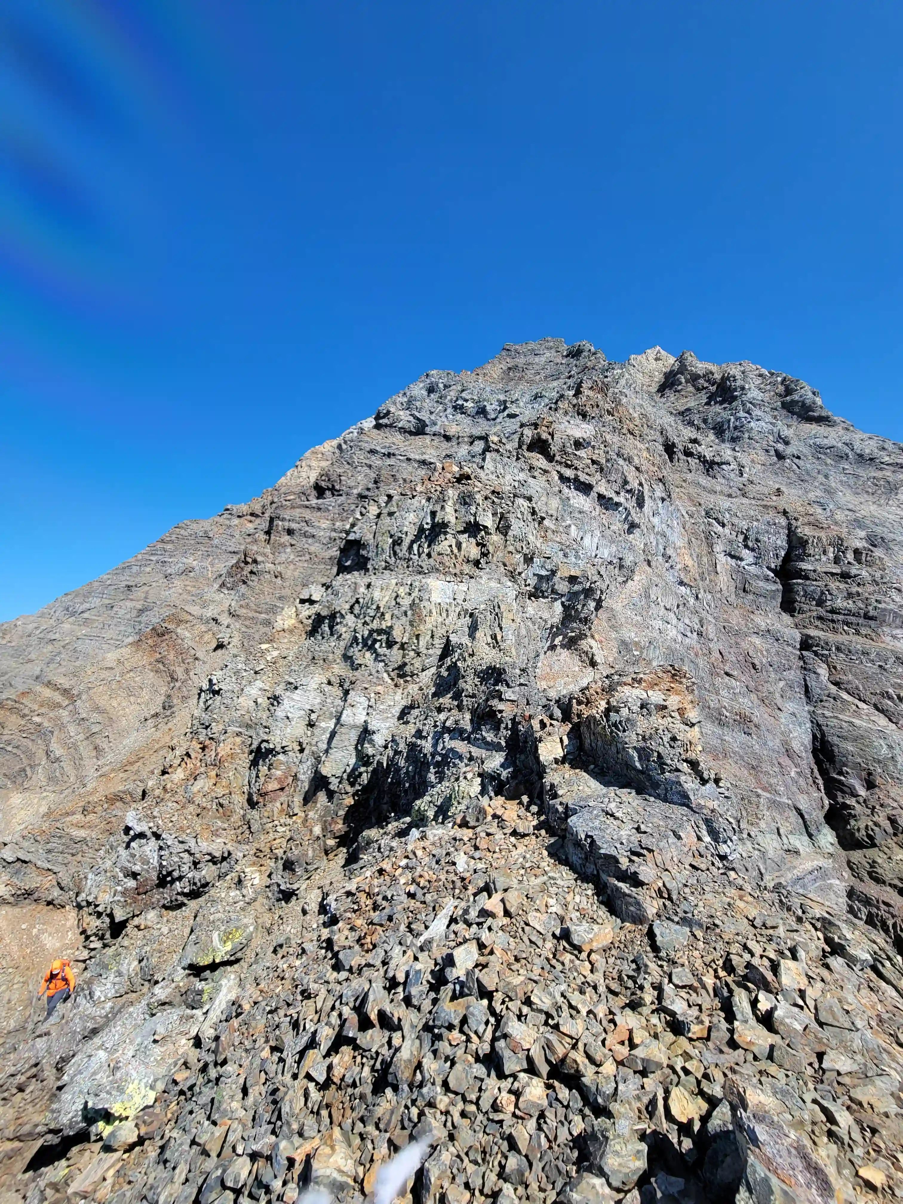
The second section of the Goodsir South ascent is what I would consider the sketchiest part with a large amount of the rocks that you'd think would be good handholds or footholds ripping off the mountain with the slightest touch. This was challenging but not especially bad for someone used to loose rock on the way up but for the descent this section is treacherous and misplaced trust in a faulty hold could turn a successful trip into a very bad situation. The route pretty much follows the sub-ridge from the bivi site directly up to the upper mountain but bypasses any difficulties in bowls, gullies, or weaknesses on climber's left.
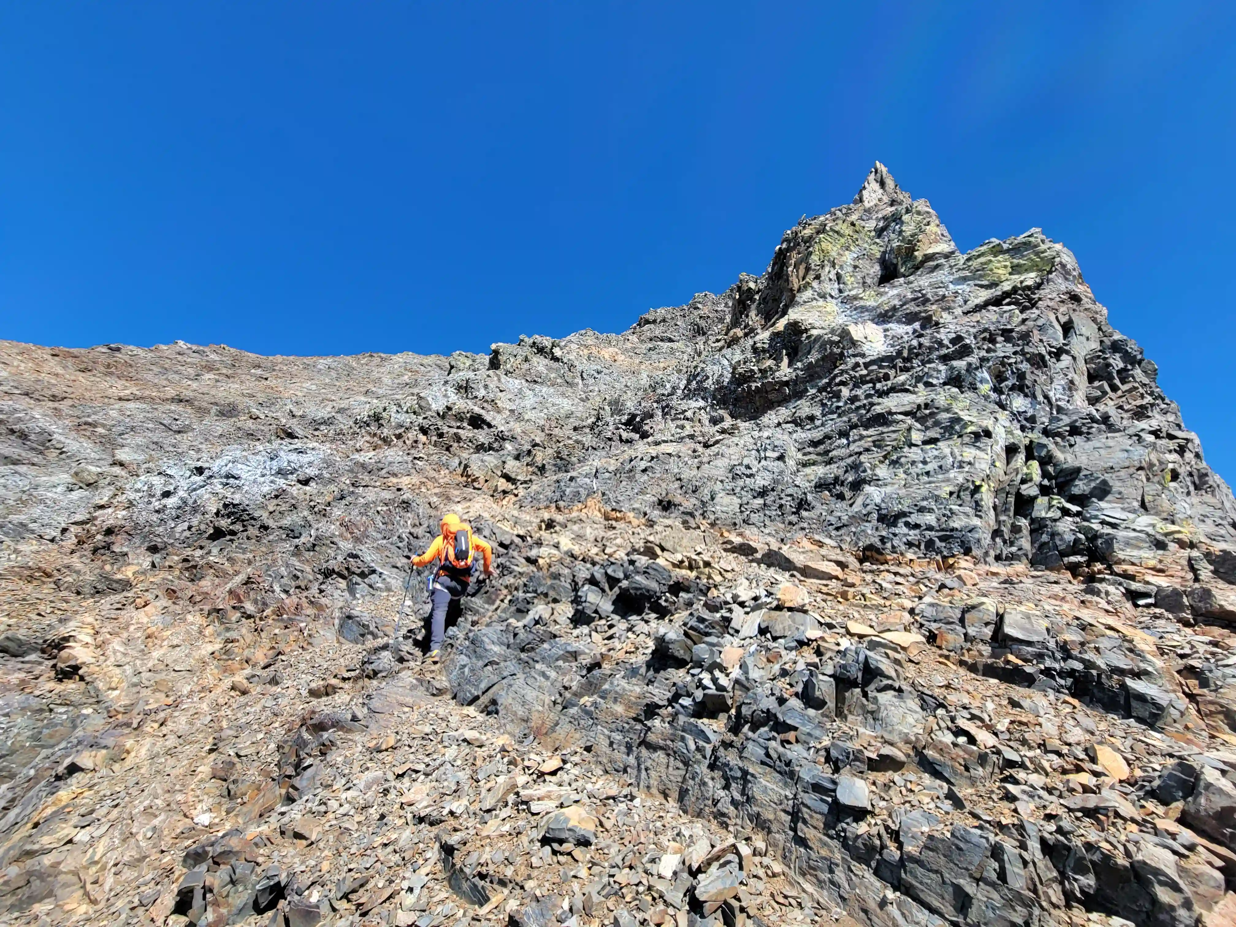
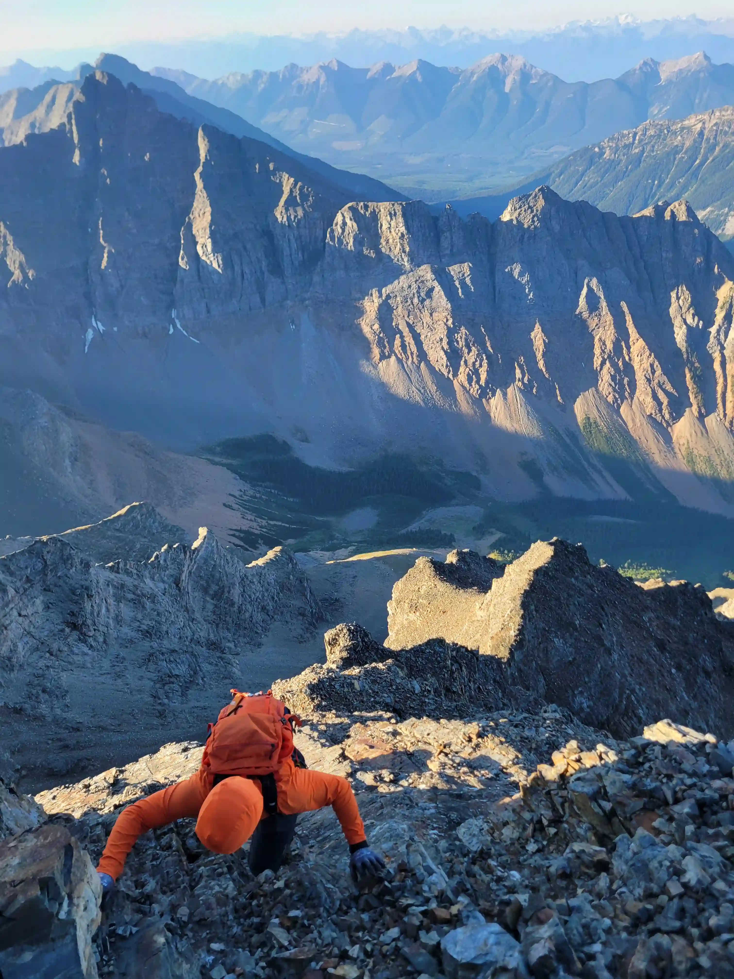
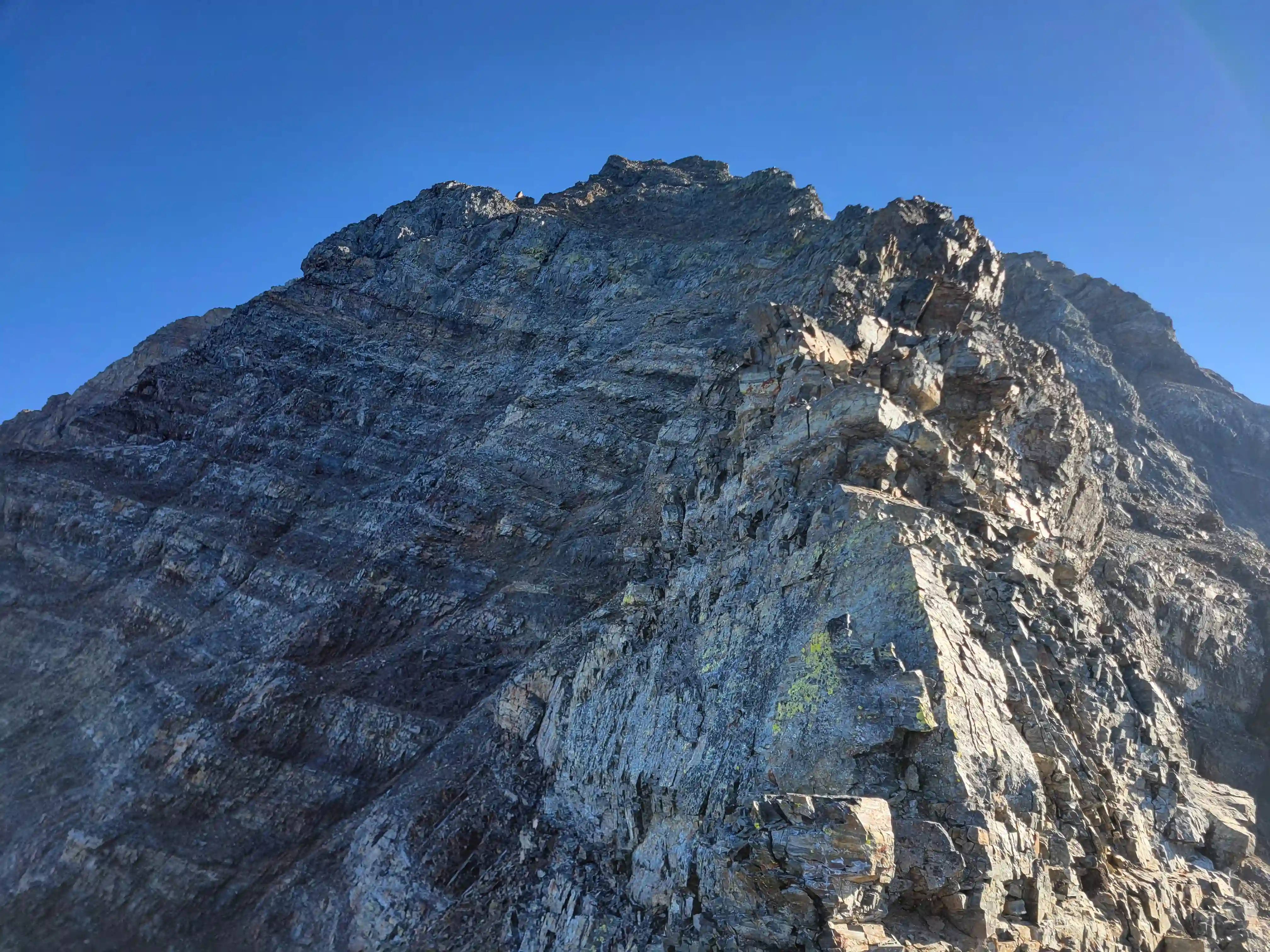
At first Ian and I were sticking quite close to the ridge but with the exposure on this line and the rank rock quality we bypassed a few technical sections on climber's left as we ascended and this kept things less exposed and more manageable albeit still low 5th in places. This trend continued until we reached a particularly stiff step and after gaining this what lied ahead was severe knife ridge to continue up that neither Ian and I were very comfortable ascending on a mountain with such a poor rock quality reputation so deciding to find another way and after reversing the few tough moves back down we were able to find a short downclimb and ledge traverse climber's left that lead us to significantly easier terrain up a bowl / gully that we used to bypass this entire difficulty.
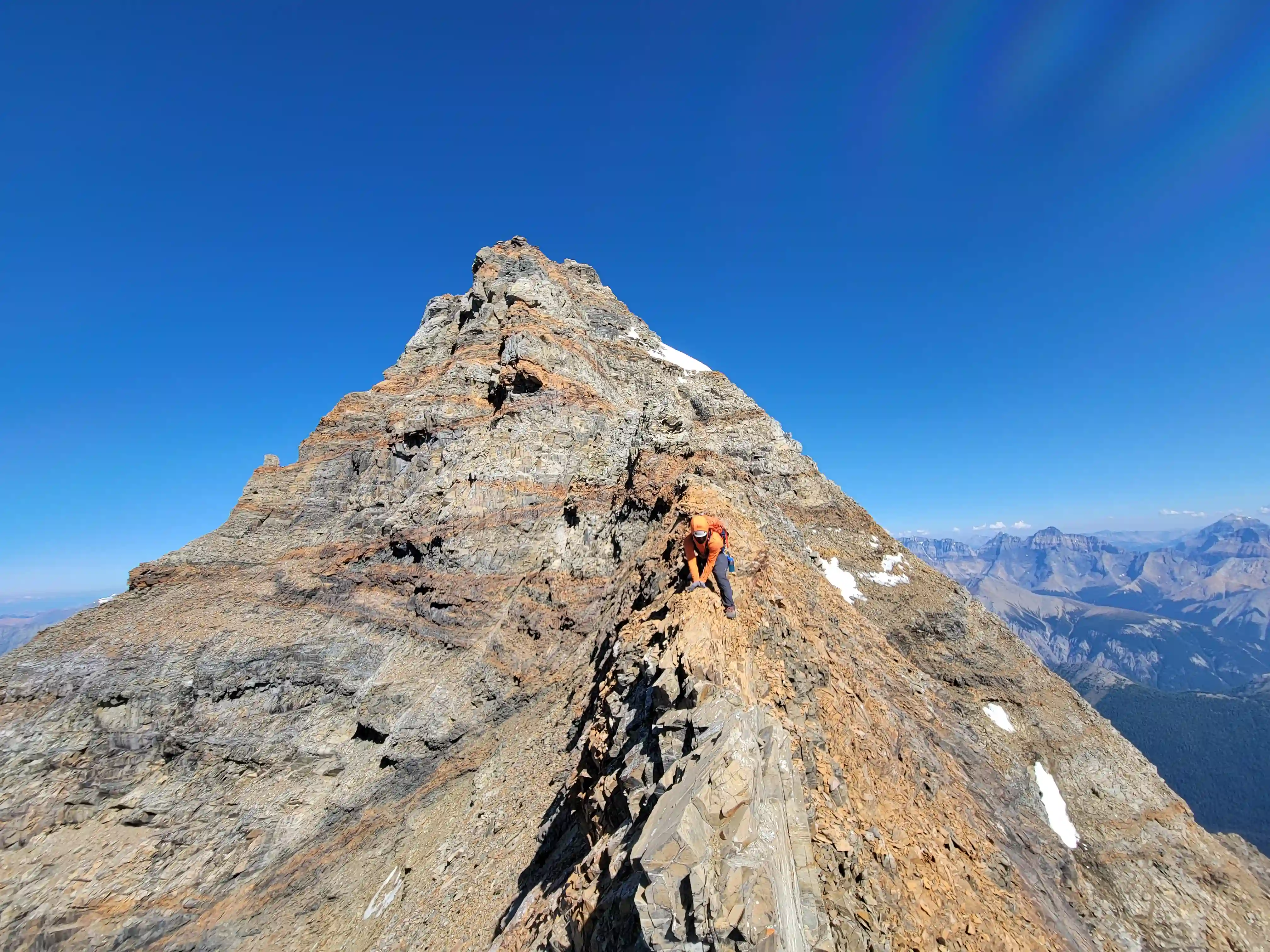
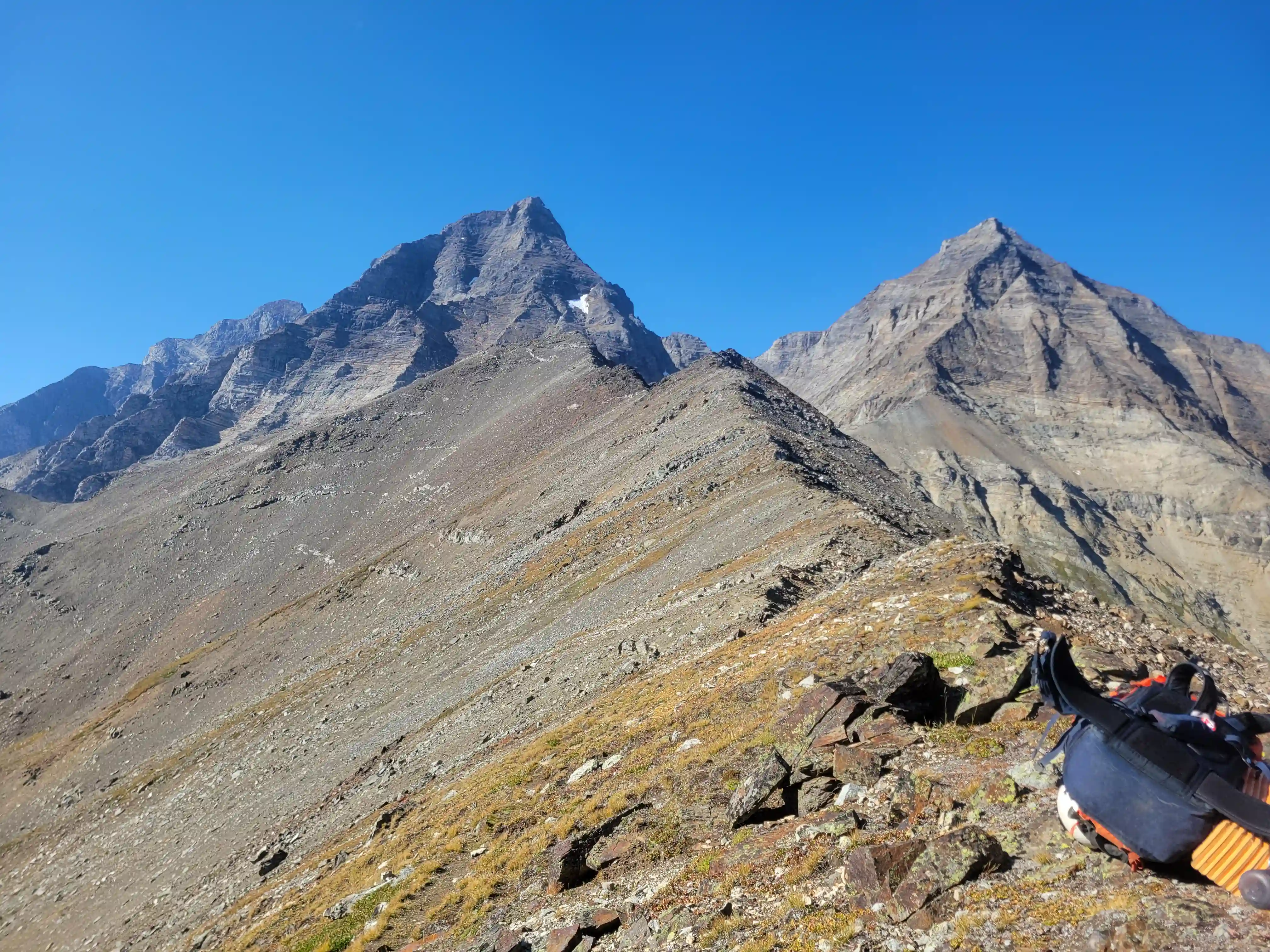
The line Ian and I took eased the ascending difficulty sizably and just a few minutes later we were above where the ridge would've taken us. Following this we reached a high point where the summit came into view and from here the grade of the sub-ridge eased off quite a bit as we headed towards the final gain before we reached the upper more solid mountain. The ridge ahead to continue up looked quite stiff so we took a line that detoured right and up to a col between the upper mountain and a tower of sorts, and the from there headed up on the face to the right on more blocky and solid rock than we had been used to to gain the ridge above.
exposure and loose rock
corner not pictured here
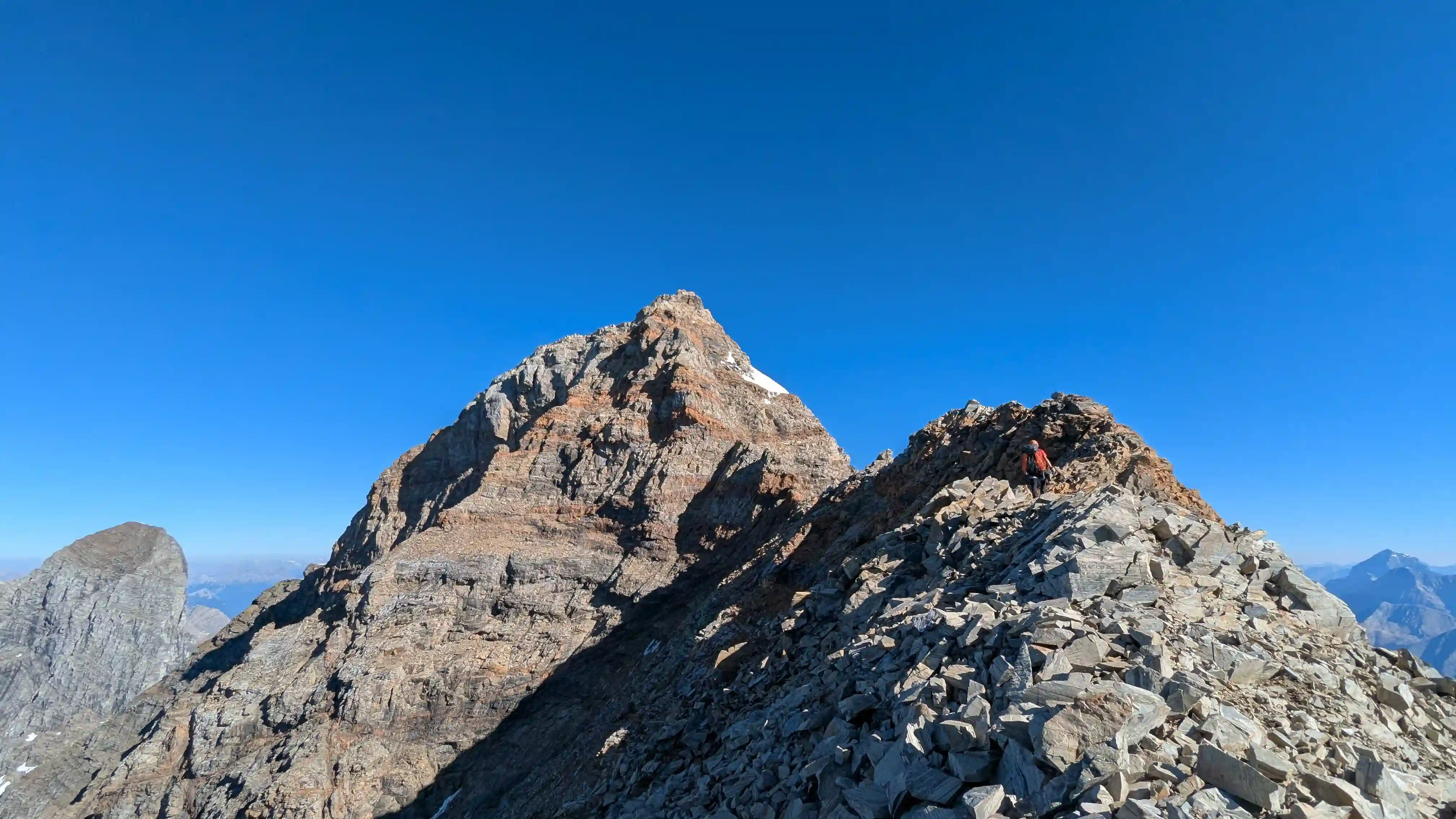
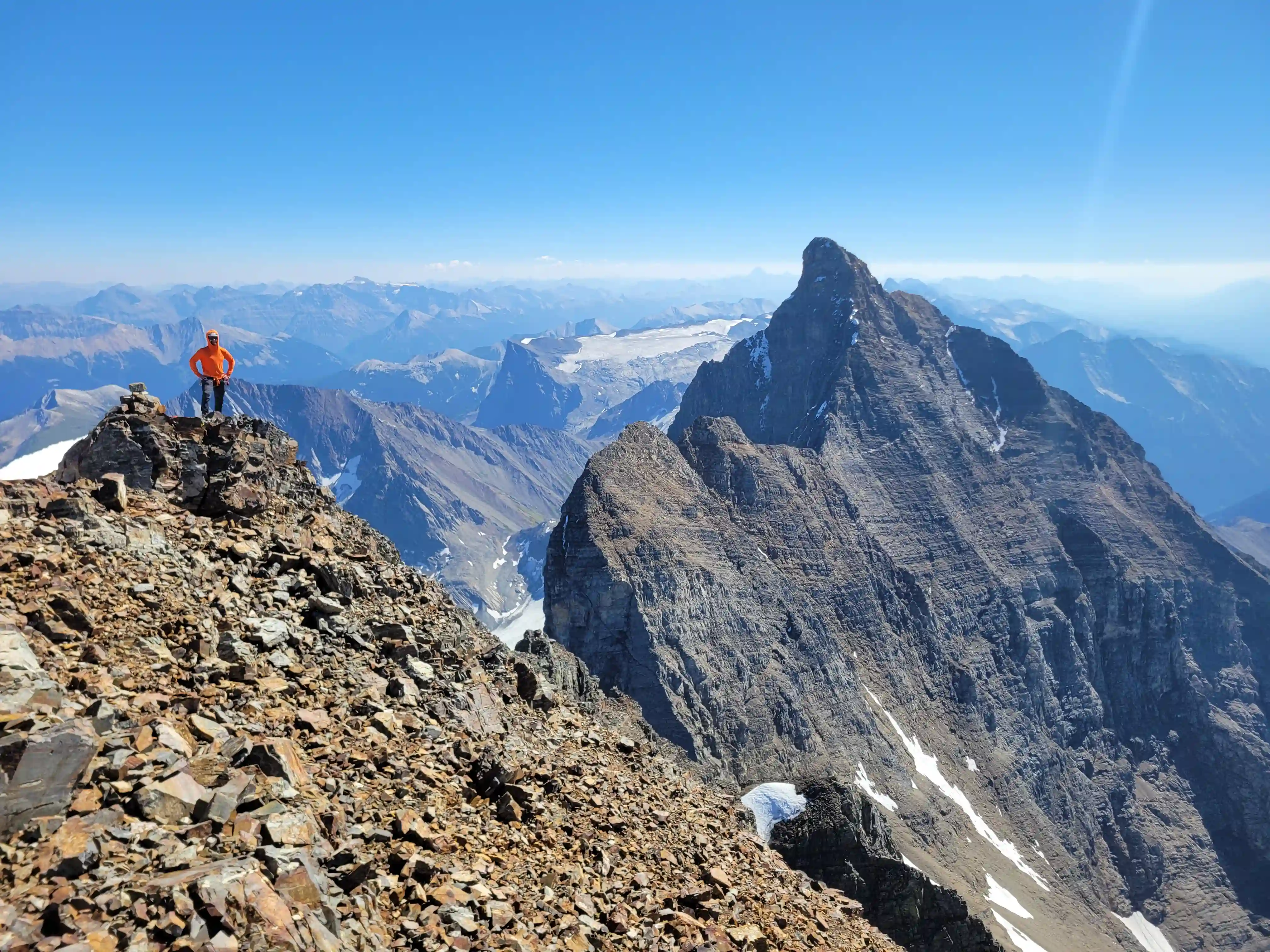
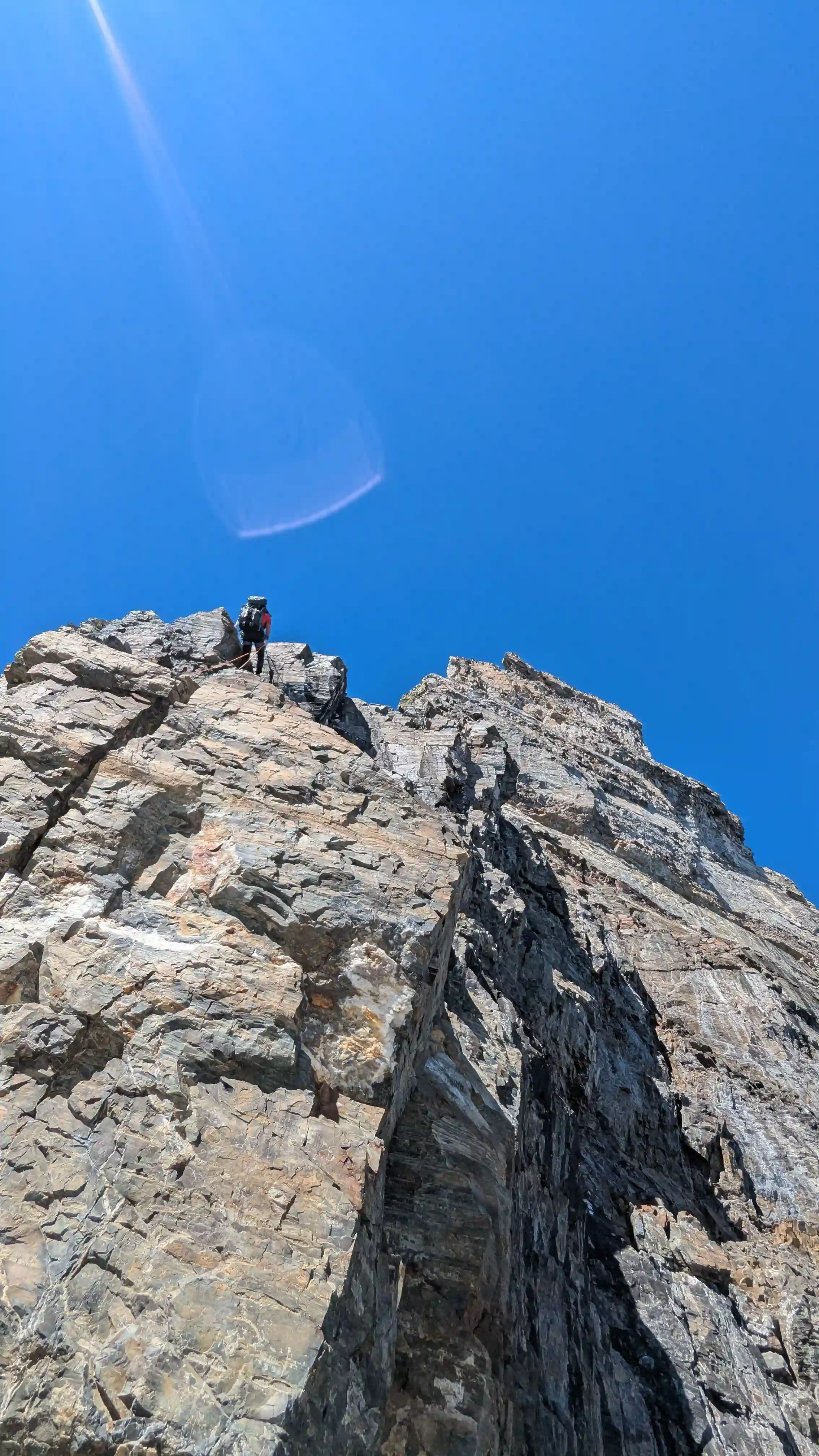
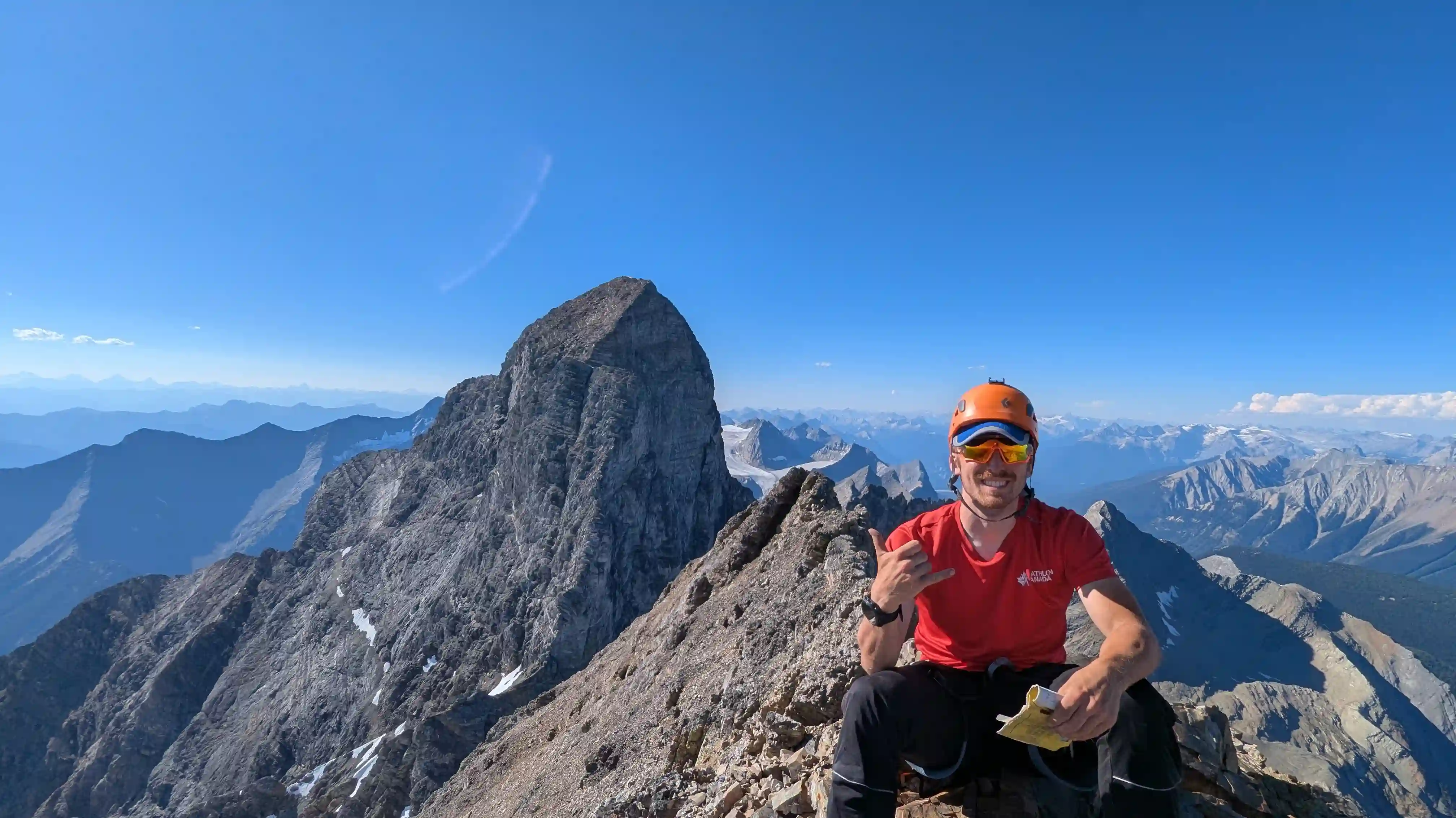
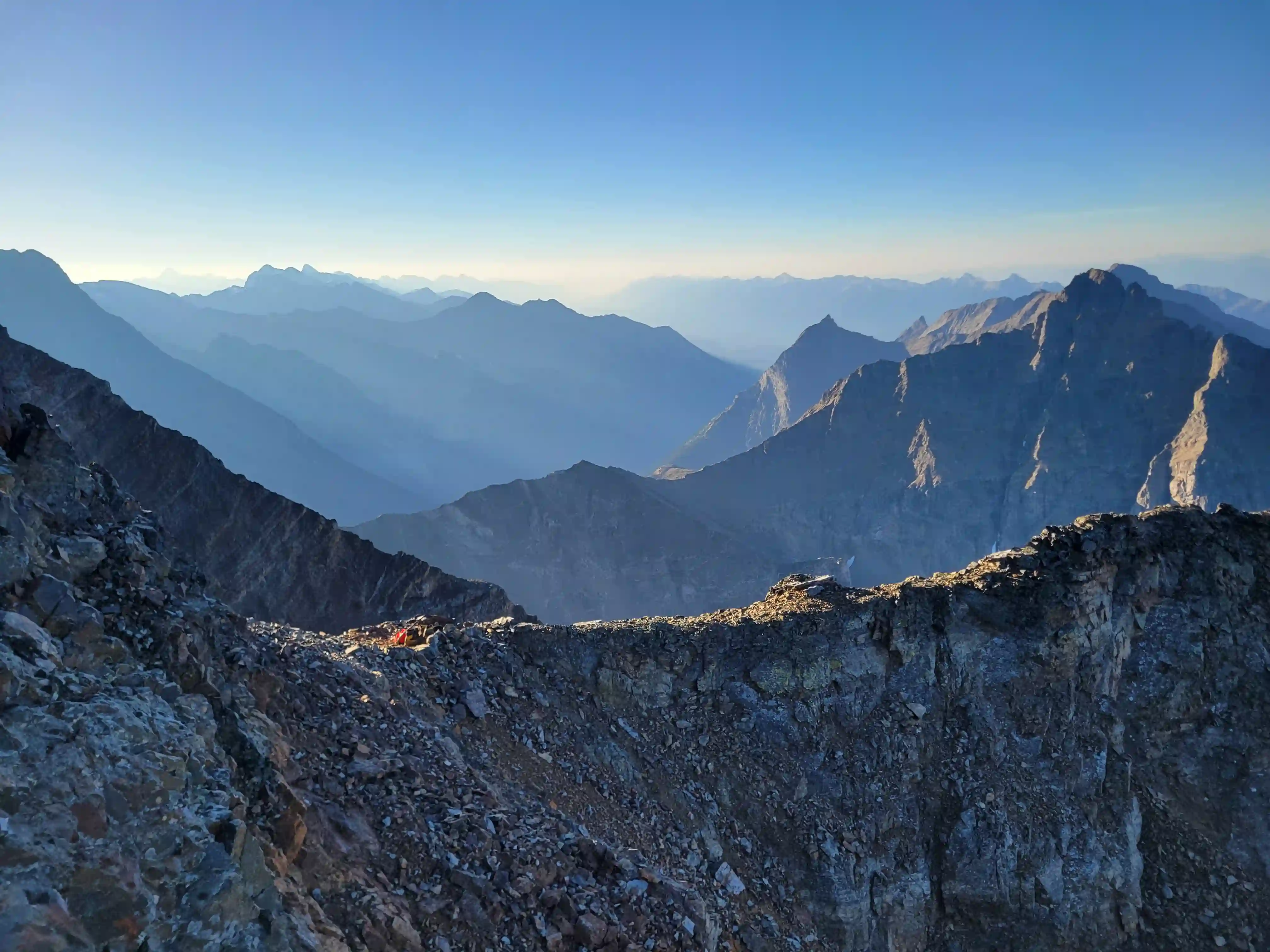
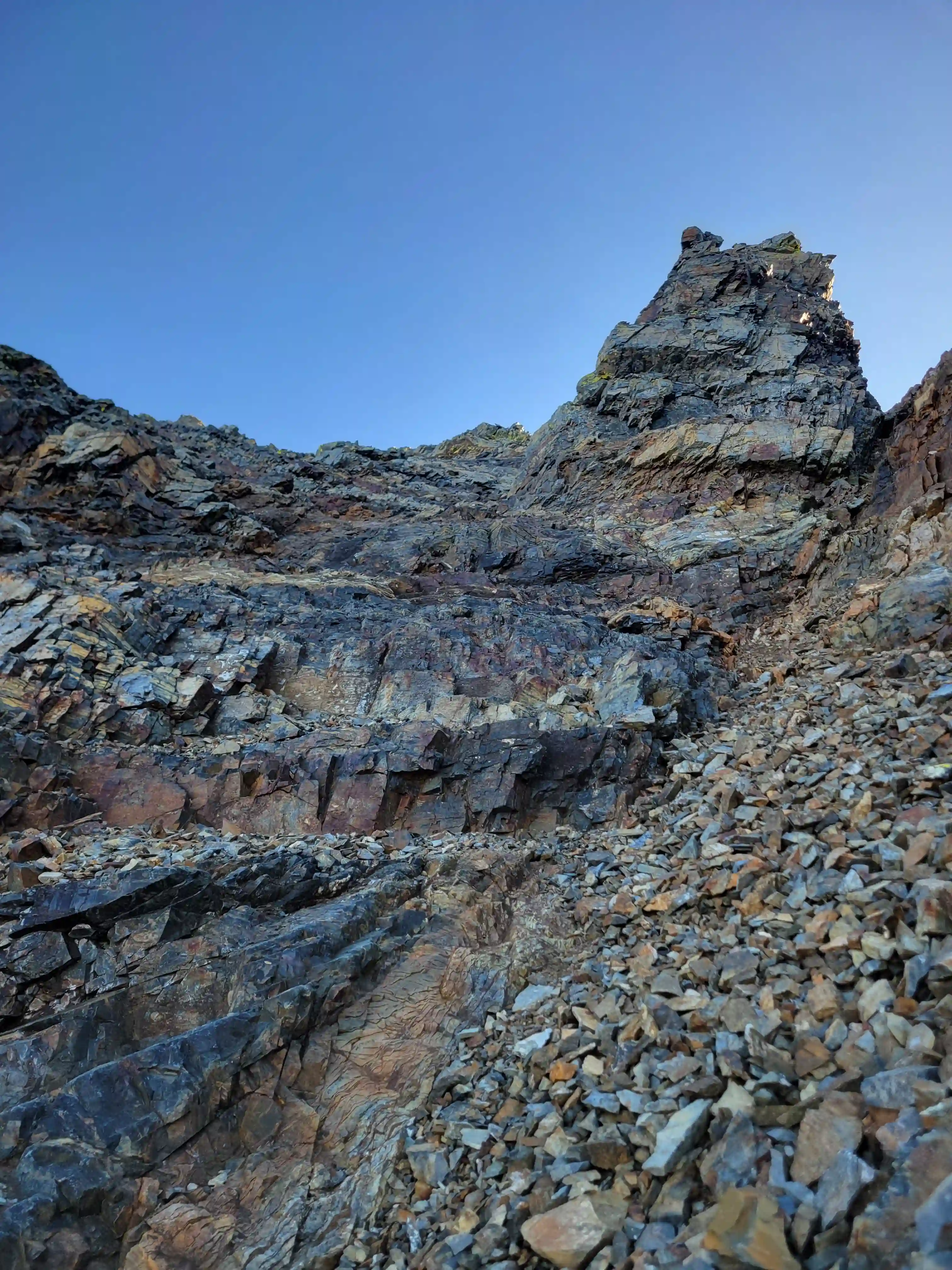
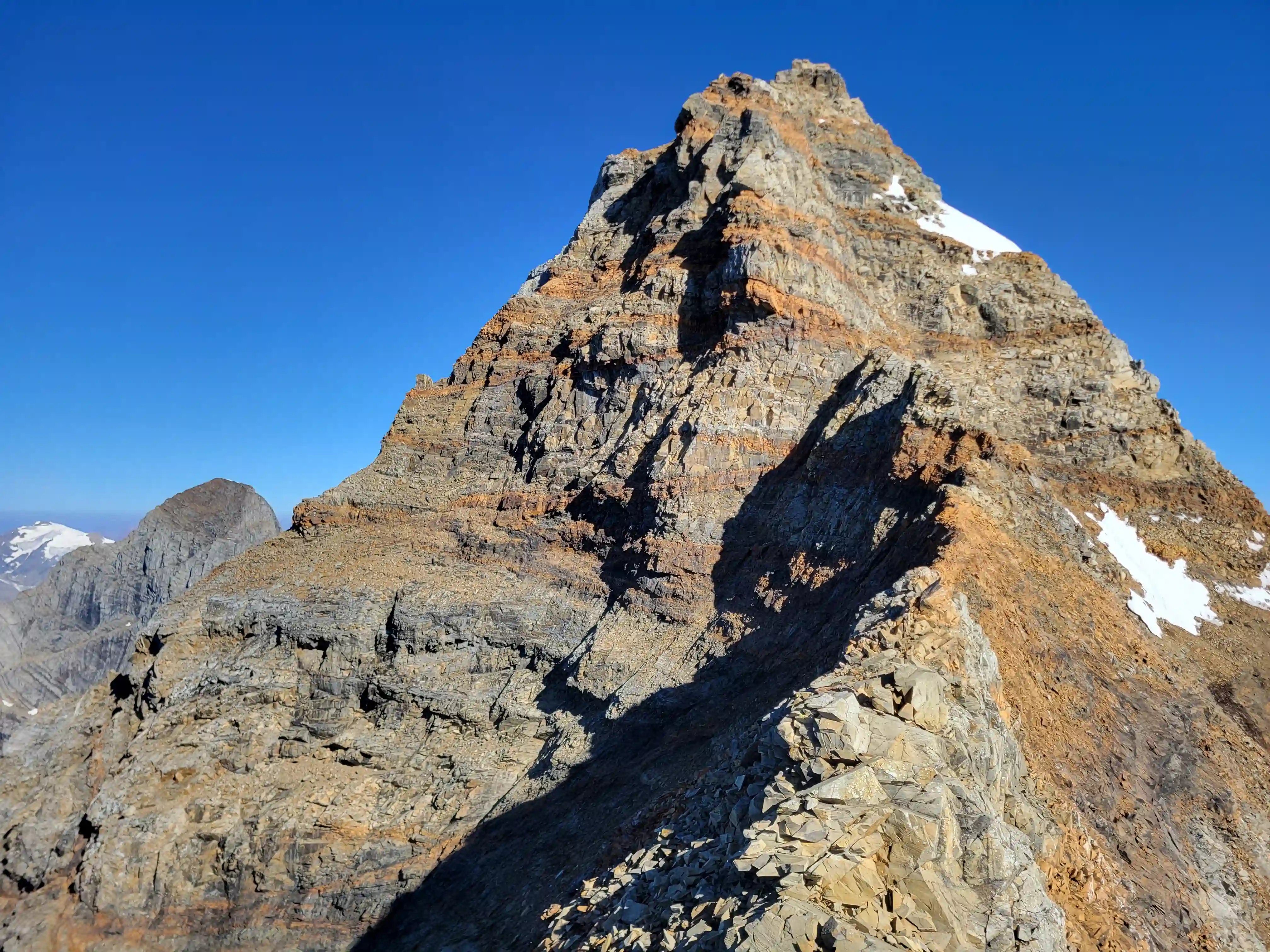
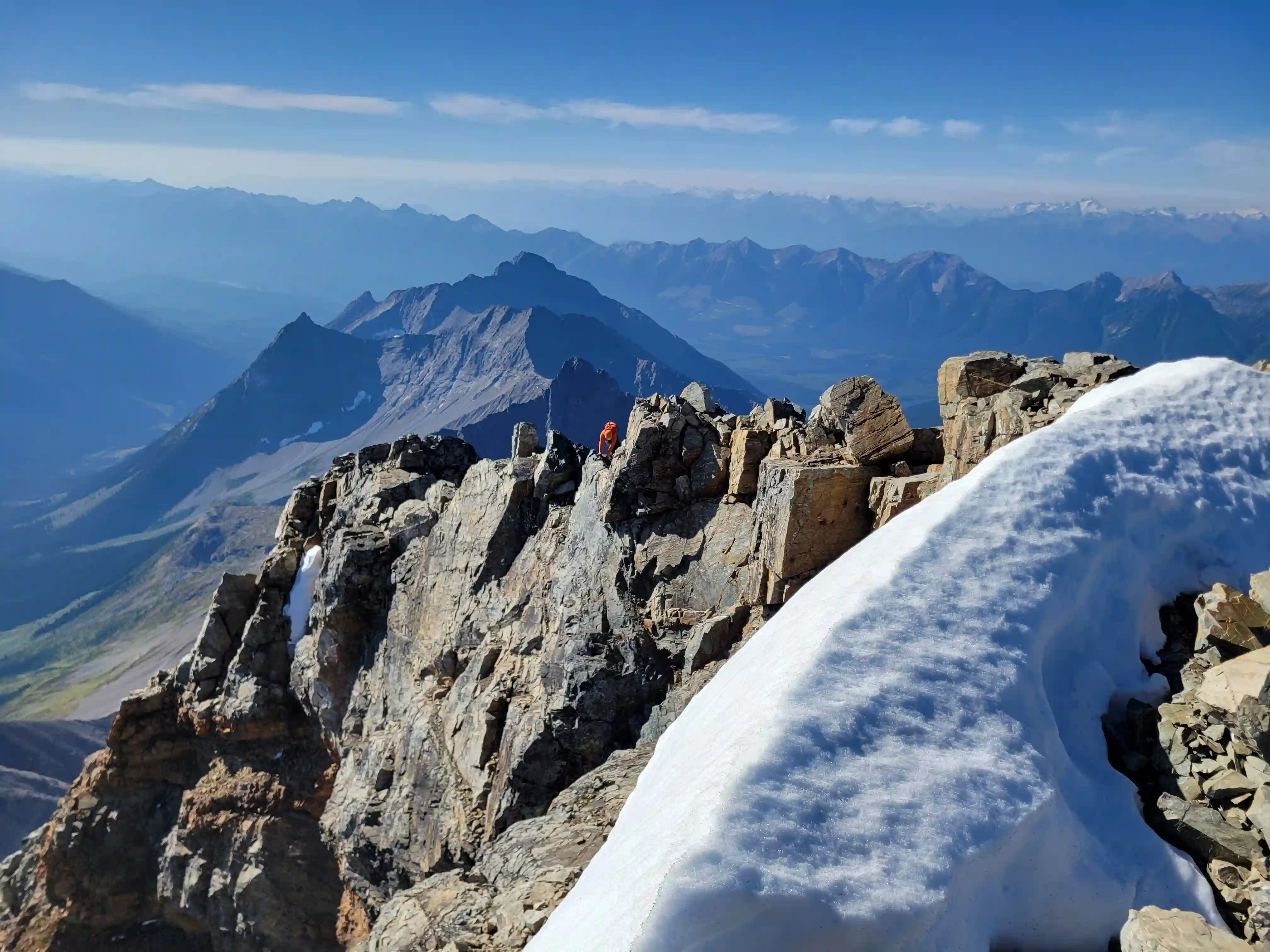
The last part of the climb ended up being much more solid than I expected but take that with a grain of salt as this is still the loosest mountain in the Canadian Rockies and there were definitely still some loose rocks up there! The initial knife ridge to get to the summit block that many people à cheval over wasn't as rotten as it looked and the following bowl type slope to gain the upper summit ridge while having some low 5th class sections and a few loose rocks was particularly solid especially compared to the mid section of the mountain. The main difficulty was finding the reasonable access point to the summit ridge which was on the far right after skirting below a number of tougher looking slabby / blocky lines above and route heads up a corner to gain the ridge. From here there are some exposed but not that difficult moves to reach the summit but the rock is solid and soon after the summit is reached!
ridge
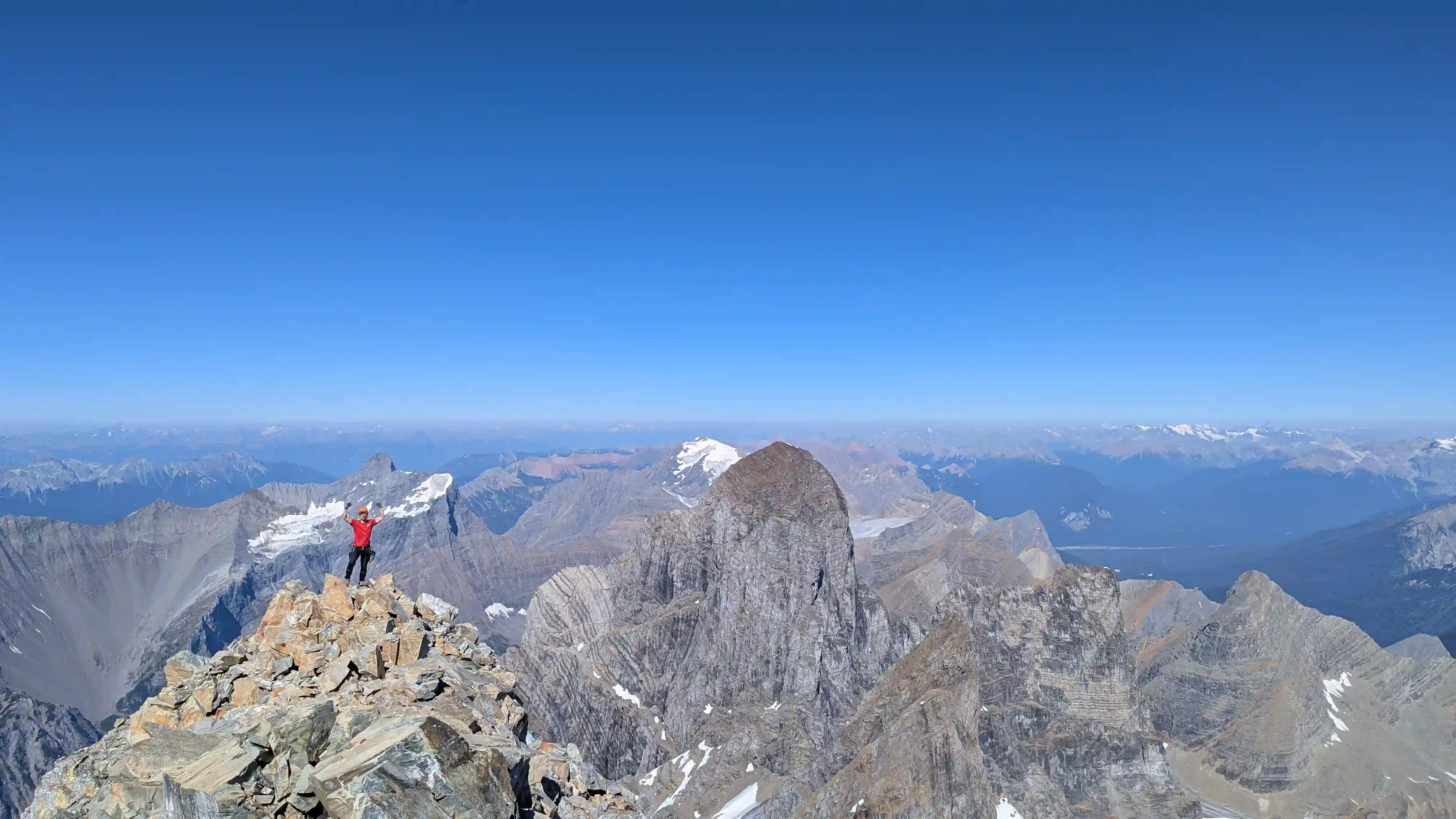
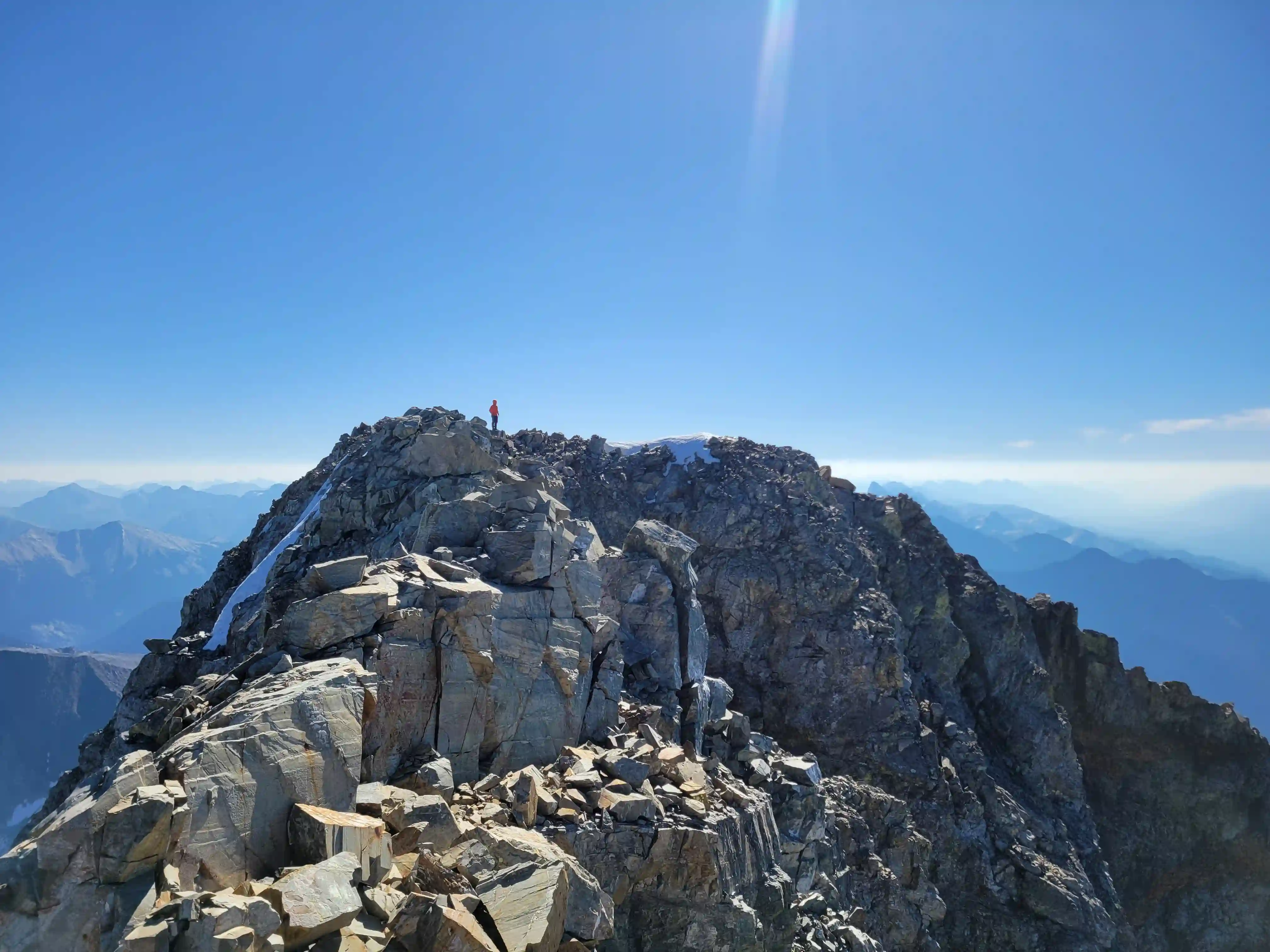
After taking in the fact that we had successfully pulled off standing atop all 3 of The Goodsirs and enjoying the clear views from 3562m it was time to reverse it all and if anything we needed more focus than for the ascent! The upper mountain was probably the toughest technically to reverse but the more solid rock made things a lot easier and inspired more confidence than what was to come. After getting back across the knife ridge we started down into the looser portion of the south tower and things weren't too particularly bad until getting down the gully bypass we used to avoid the knife sub-ridge where we accidentally took the wrong ledge to get back to the our proper line and started to encounter some of the nastier rock the mountain has to offer. This traverse section and below to the bivi site is what I would call the crux of the mountain on the way down and for good reason. The following face climbing was extremely insecure with every hold needing to be testing before committing to them and it's very easy to get lazy about doing this and make a mistake when you're starting to get tired after a long day. I think I caught myself being lazy about testing holds 2-3 times where 1 could've ended up a lot worse if I had weighted the rock a bit more than I did so this section should be descended with extreme care and that's not even mentioning the hazard having another person above you adds to the risk on this portion of the mountain.
The lower portion of the descent started with the "gully of shit" and this was relatively tame to descend in comparison to what was above aside from that fact that while we were part way down the gully still above the snow a melon sized rock whipped by Ian and I a couple meters to our left with more following close by and we had to pull some evasive maneuvers to not get smoked. While there are plenty of not all that technical sections on Goodsir South you're almost always at the mercy of the mountain above with a single loose rock having the ability to knock dozens more loose on the way down so you really cant let your guard down on this one till you're back at camp!
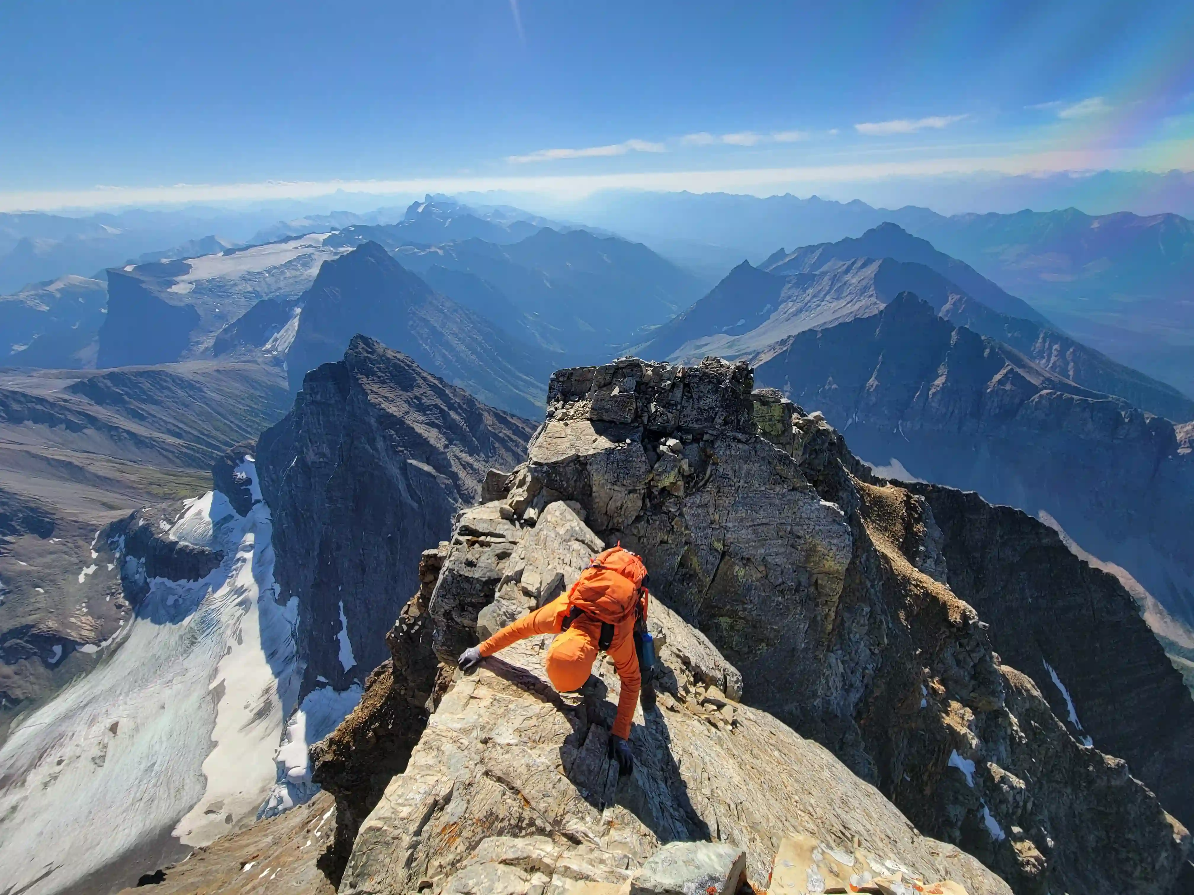
avoid the loose knife ridge
THE EXIT
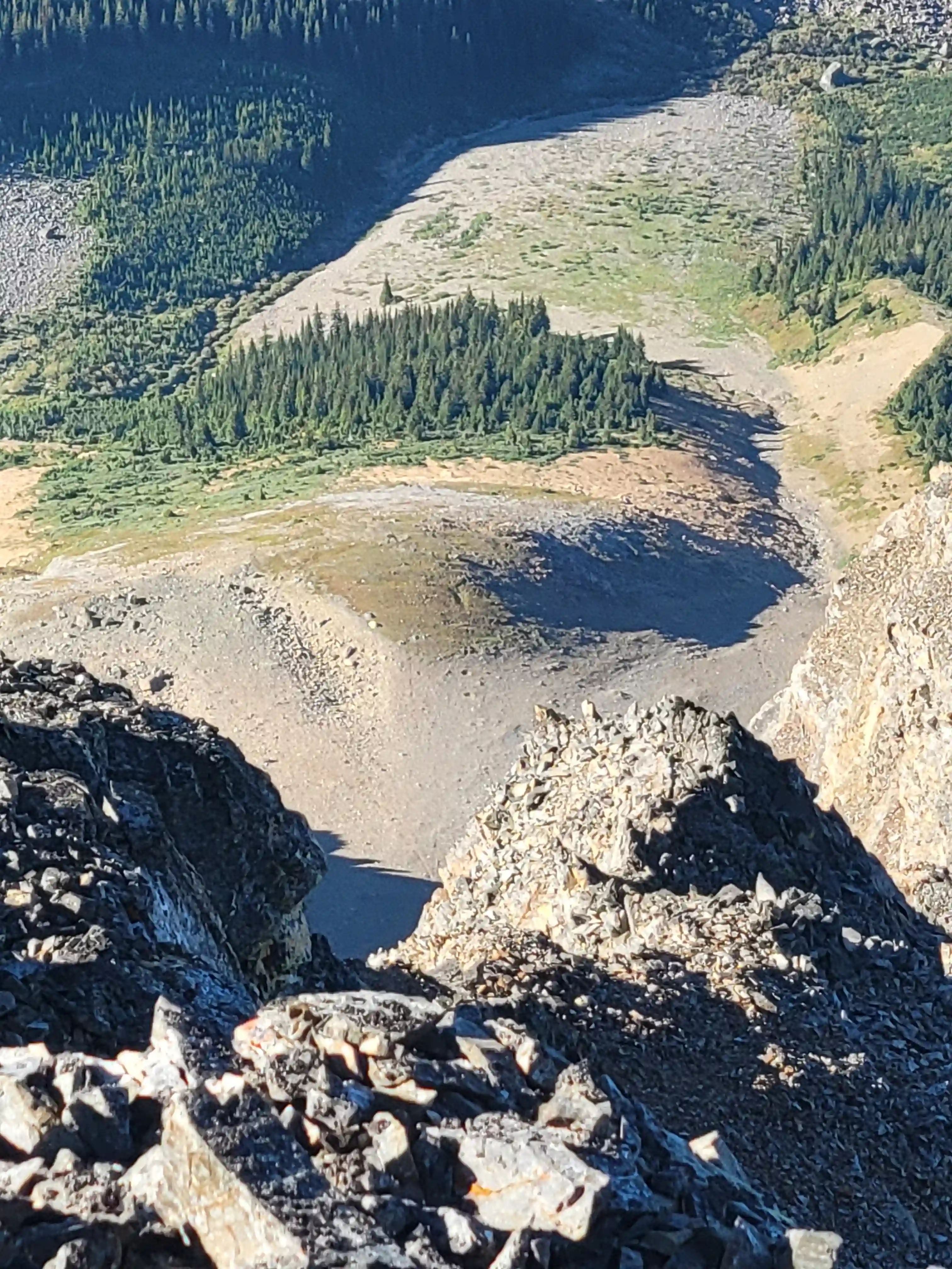
After returning to camp we relaxed for a while before packing up for the long plod out and by 4pm we were on our way with the heavy packs back in tow. We decided to go for the standard col on the way out and were thankful to be saving the legs 120m of gain but the gain we had to do hurt real bad all the same and brought the total trip stats to well over 5000m gain in total. After a short break at the col we headed down the other side on some bootskiable silty terrain before things got more chossy and once we reached an alpine meadow we traversed left to regain our ascent line and head for the trail below.
The descent from the high alpine meadow down to the trail was a bit of a grind but we made steady progress with gravity on our side and once we were back on trail our pace livened up quite a bit. We were eager to get back to the car with not a lot of daylight left and when we noticed freshly cut deadfall and cleared trail this put a pep in our step for the remaining kilometers. Some dense forest in the last kilometers forced us to don the headlamps as we closed in on the end point but soon after we reached Ian's car and that was it for our Goodsirs trip!
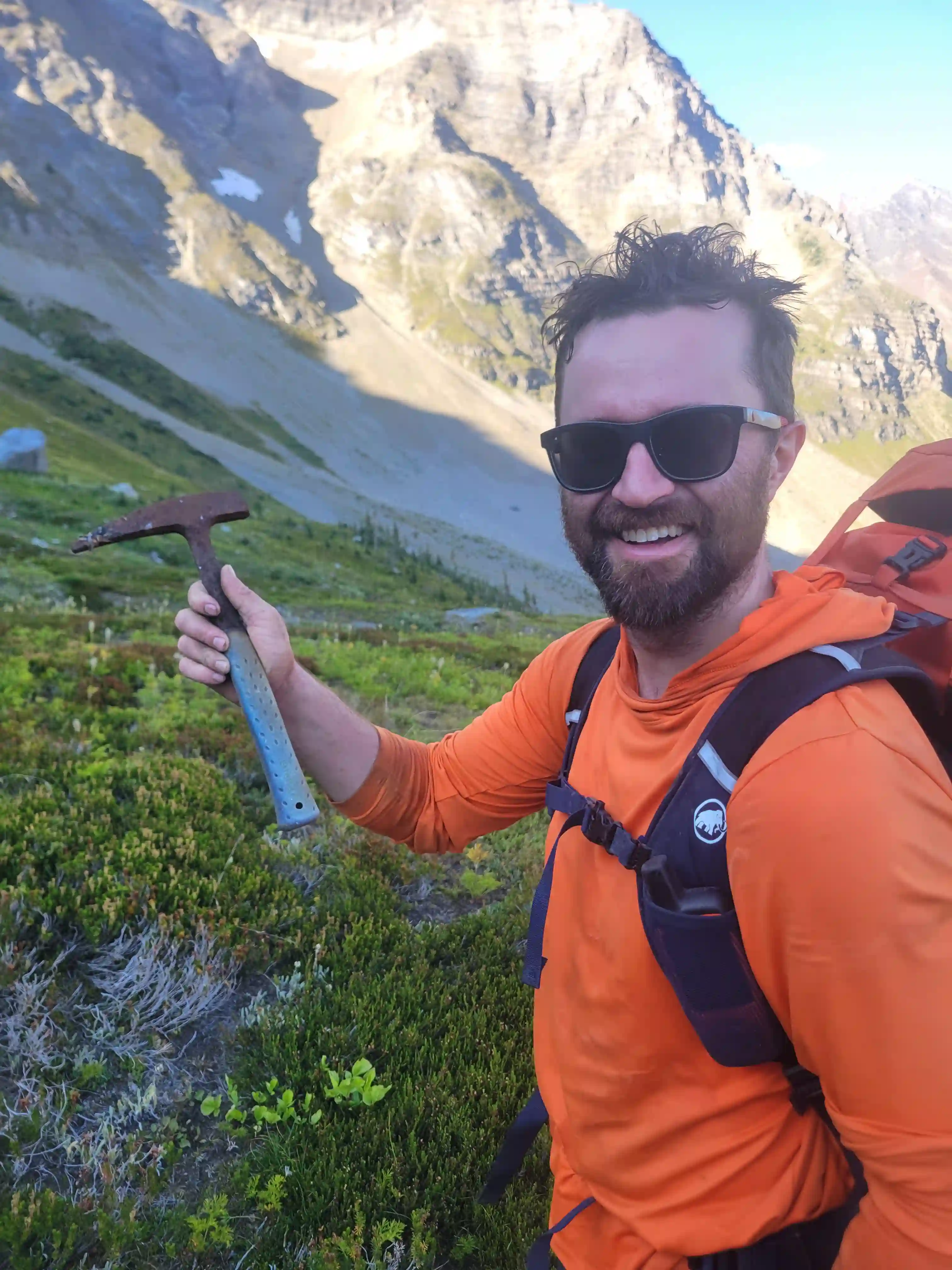
old piton hammer, wonder how long that's
fbeen here for
Creek trail helped to speed up our exit
wet feet for this one!
don the headlamps
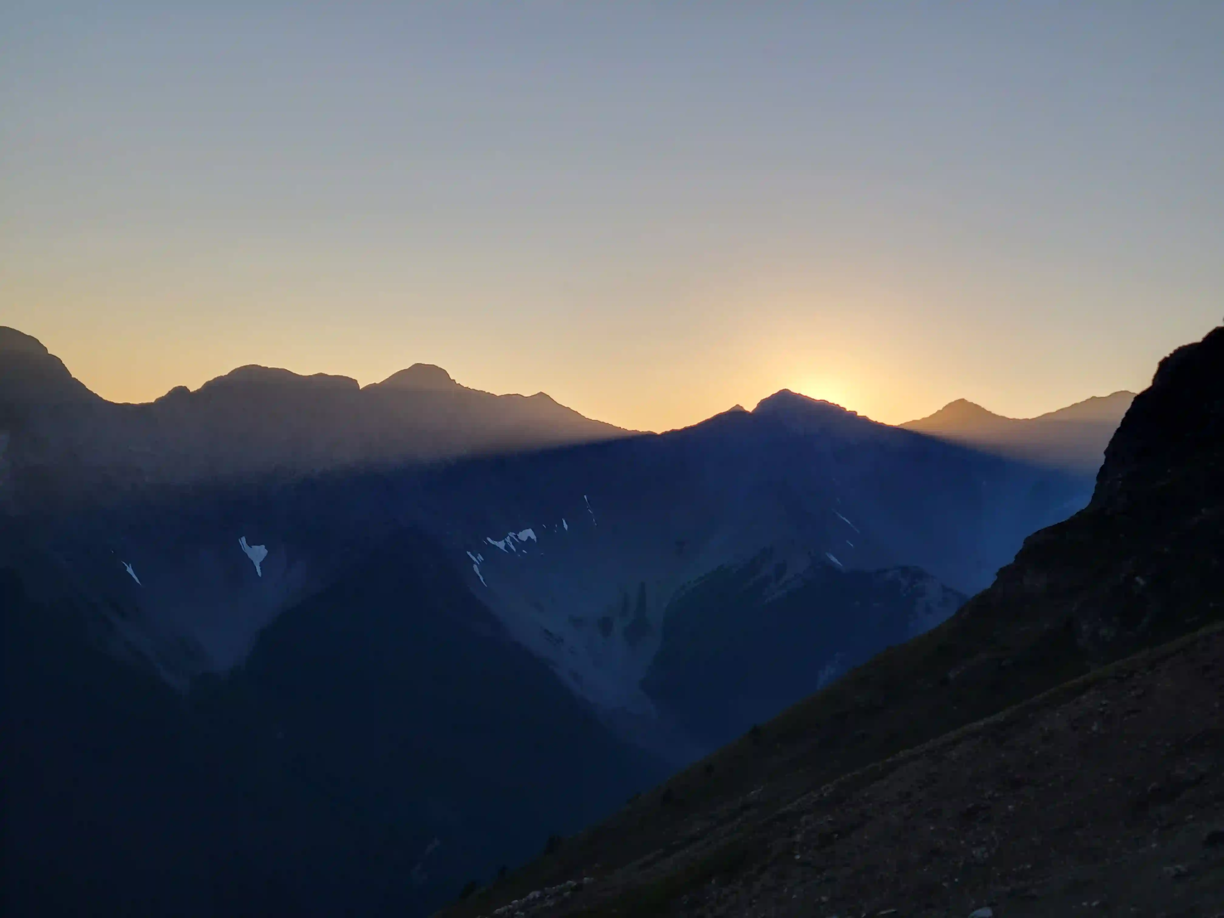
morning! Needed this after two huge back to
back trips
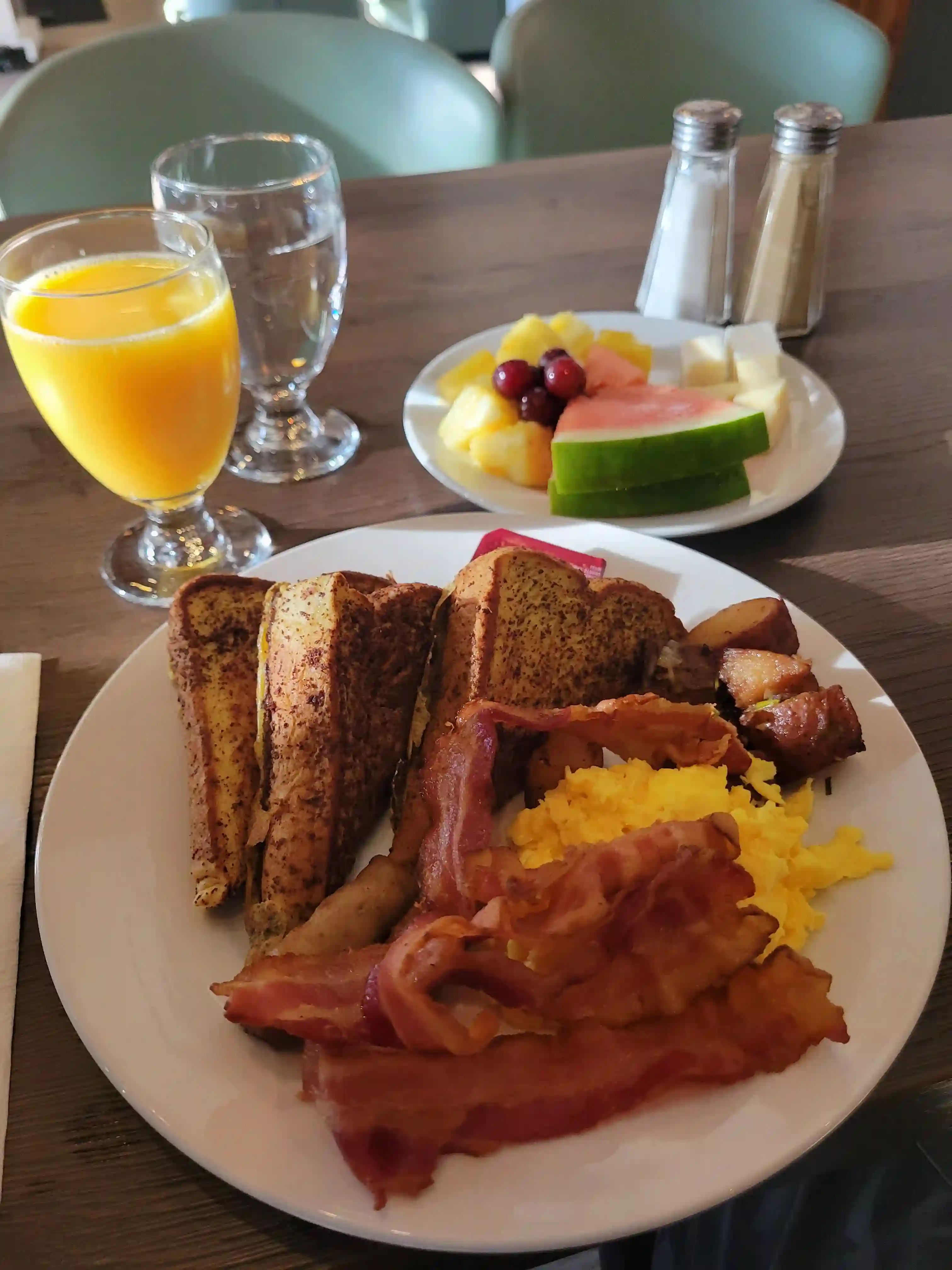
After making it out around 10pm and grabbing some much needed food and drink from Ian's car that we left for after the trip we headed out the forest service roads back to where I left my Mazda closer to the highway. It was quite late by the time we got back to my car and after Ian and I parted ways I wasn't sure if I wanted to car camp or head back to Canmore and arrive quite late. I had been car camping, sleeping in a tent, or sleeping on the ground / in a sleeping bag for over the past week and a half so I wasn't stoked about another night of it but when I remembered that the Legends Restaurant in Lake Louise serves all you can eat breakfasts in the mornings my mind was made and I ended up driving to and car camping in Lake Louise before an awesome brunch in the morning. Having just done two 3 day trips for
Mount Alberta and
The Goodsirs
back to back, saying I had quite the appetite was an understatement and I ended up having 4 full plates of food and ate until I felt sick before tapping out and heading back to Canmore, I think I got my moneys worth this time!
Looking back on it, Ian and my trip for The Goodsirs was nothing short of legendary; with the insane weather we had, to checking off all 3 of The Goodsirs without incident, to pulling off such a physically demanding trip immediately after my most technical trip to date for
Mount Alberta,
I think I can safely say that this was the craziest week I've ever had in the mountains and it'll take an insane course of events to top it! In total over the course of 6 days using my Strava stats, 96.92km of distance and 9852m of elevation gain were covered making for undoubtedly my most demanding week in the mountains to date by a long shot!
It was awesome to be able to pull off such a feat and I have the biathlon fitness to thank as well as extremely strong, capable, and supportive partners on these massive trips that make it all possible! A big shout out to Ian for teaming up with me on this one, I was definitely a hurting unit at times but the stoke got me through and for the conditions we got I wouldn't have had it any other way! This trip fittingly marked the end of my 2026 11000ers journey getting me up to a total count of 45/58 and I was very excited to check off the last 13 in the spring and early summer of 2026! Unexpectedly, come February of 2026 I wasn't competing in Europe for biathlon and a good weather window showed up so it was time for some
winter 11000er peak bagging!
Follow the full progression
I'm working through all 58 11000ers of the Canadian Rockies and beyond. You'll get notified when the latest climbs go live.
Other related trip reports:
Mount Joffre |
Mount Columbia |
Woolley & Diadem ||
Mount Alberta |
Deltaform Mountain
11000ers of the Canadian Rockies
© Haldan Borglum | Peak by Peak. All rights reserved.