Mount Robson, The Helmet, & Resplendent Mountain Linkup
June 7-10 2025
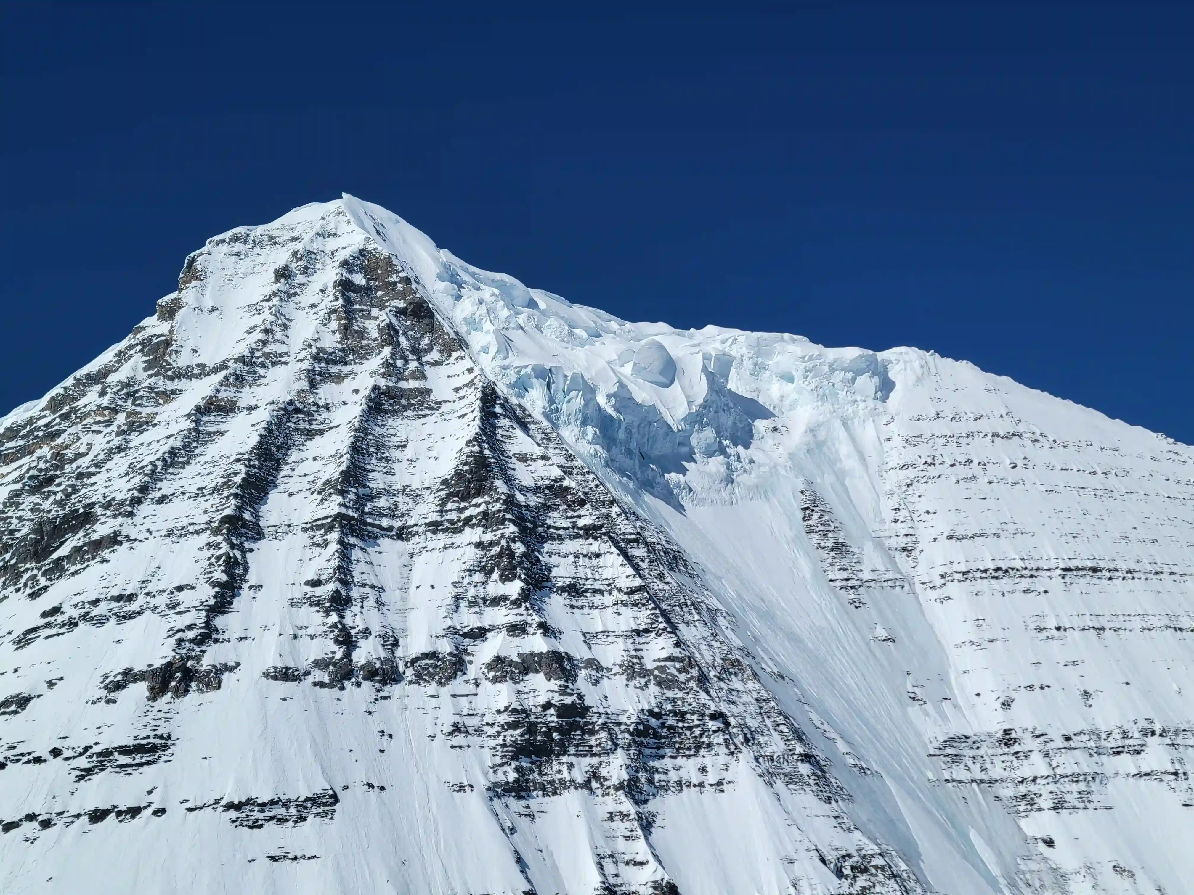
Standing at 3959 meters or 12989 feet tall, Mount Robson dwarfs the next highest peak in the Canadian Rockies by over 200 meters and is on a completely different level in terms of sheer scale. It boasts a wild 2829 meters of prominence and when it comes to elevation gain to reach its lofty summit is comparable to reaching the top of Mount Everest from base camp. Due to its height it creates its own weather systems, significantly affecting the ability to confidently plan for a summit bid with fickle conditions. Likewise The Helmet and Resplendent Mountain are also tough to time due to their close proximity to Mount Robson, and both Robson and The Helmet are considered two of the 11000ers of the Canadian Rockies list's biggest cruxes.
I had been keeping an eye on the weather forecast for Robson for a while but the windows always seemed to change for the worst. That is until a four day high pressure and zero cloud cover opportunity showed up in early June and when that continued to hold we began making plans! I got in touch with a number of strong mountaineer partners from past 11000er outings as soon as I felt strongly that this weather window was to commit for and we began planning the route we would take to get it done.
Mount Robson is a huge mountain and as a result has a number of different routes, we were all in agreement that the Kain Face was the way to go to have the best odds of getting it done but reaching to the Dome Glacier to access it was no quite as straightforward. In the past to reach the Dome Glacier groups would circumnavigate the entire mountain, passing Berg Lake and heading up the massive Robson Glacier making for quite the trek. However within recent years the Patterson Spur, an impressive line of ridge continuing SE from Robson's upper massif became increasingly popular due to the efficiency of the route. At first I was confident that this would be the route we would use but that's when Devan Peterson brought up the Patterson Couloir.
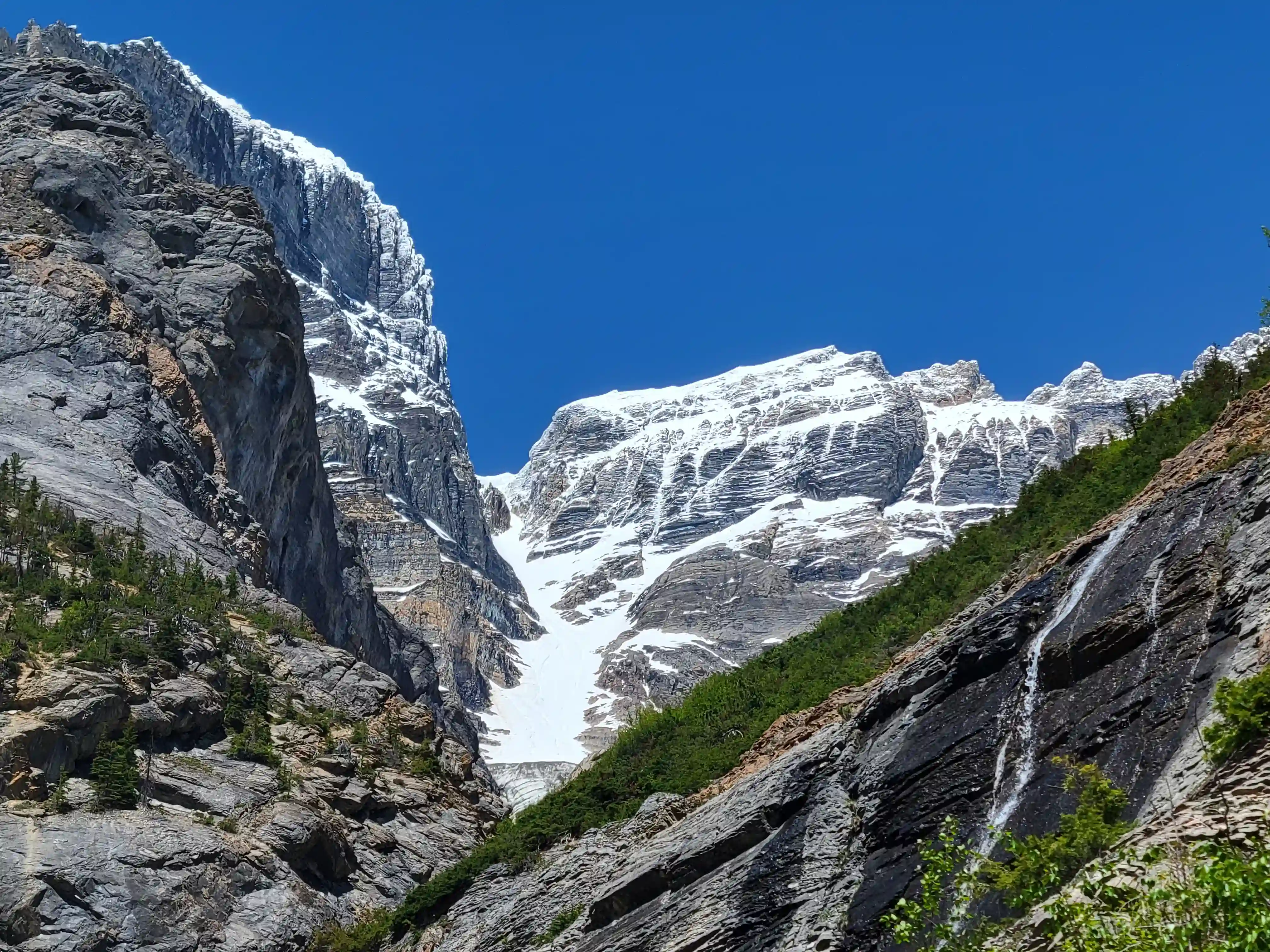
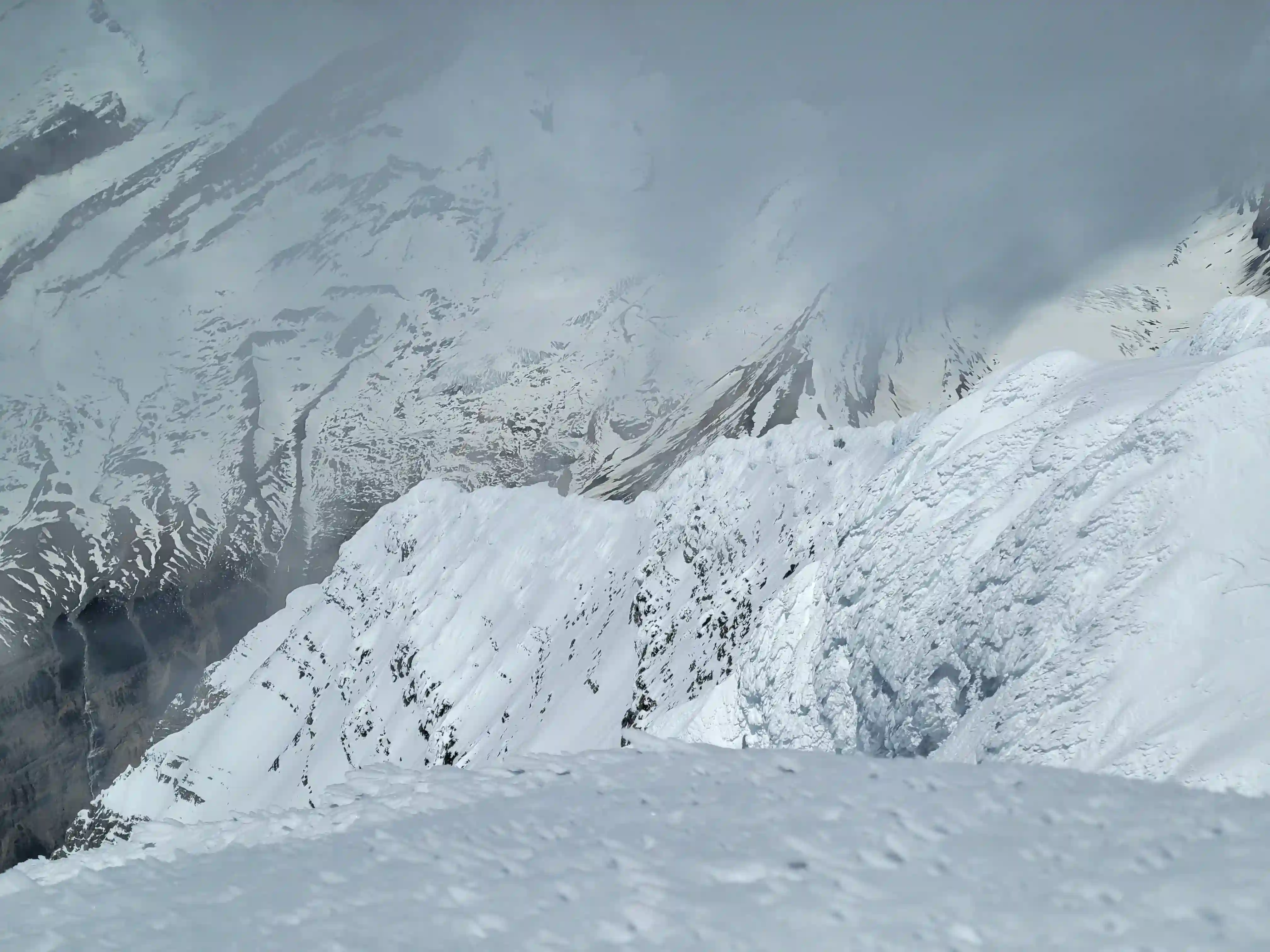
Rising 1000 meters above a bench part way up the south face, and even further down below to the base of the headwall is the Patterson Couloir, an intimidating and often dangerous line that I had never really considered due to the objective hazards you subject yourself by using it. There are plenty of stories of groups being pelted by rock and ice blocks on their way up forcing bails and sometimes even rescues so it is not to be taken lightly. I didn't much like the idea of using this route but the fact debris would be significantly reduced with a good freeze in the middle of the night and that it would avoid the Patterson Spur completely made it a viable option.
links:
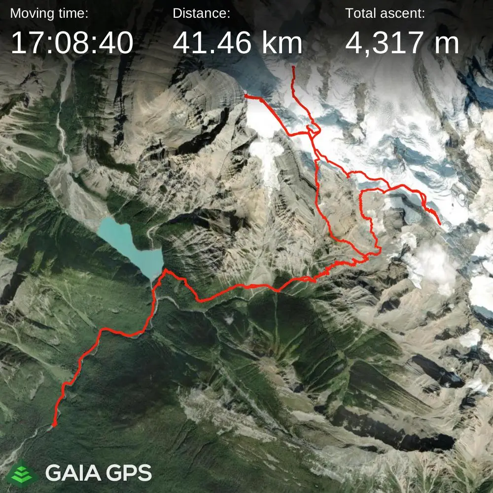
STRAVA
|
GAIA
elapsed time: 80hrs
DIFFICULTY: D/D+, significant objective hazard, steep snow / ice climbing, low 5th class / mixed climbing, extensive glacier travel, multiday, winter camping
Use the following links to jump to:
Just a few days before we set out on our trip a
mountain conditions report
was posted on Robson, a stroke of luck for us as this would turn out to be exceptionally useful for our planning. It detailed that the Patterson Spur was still snowy as it usually is in June and was very dangerous and pretty much impossible to protect so that sealed the deal for us and we decided that the Patterson Couloir was our best option. The report also mentioned some potential wind slabs on the Kain Face which cause the guides to turn around but given how rare exceedingly good windows are for Robson I didn't feel that this was enough of a hazard to cancel the trip. As the final days leading into the trip approached only Darren Steffler, Tim Hryshchuk and I ended up being in for our big plans with Devan unfortunately not feeling well after our trip up
Mount Bryce
a couple days prior, but I had just knocked out
Tsar Mountain
with Tim a couple weeks prior and Darren and I were on a legendary run of nine straight 11000ers without one failed attempt so I knew our group had what it took to get it done and we followed through with our plan to try for all 3 11000ers!
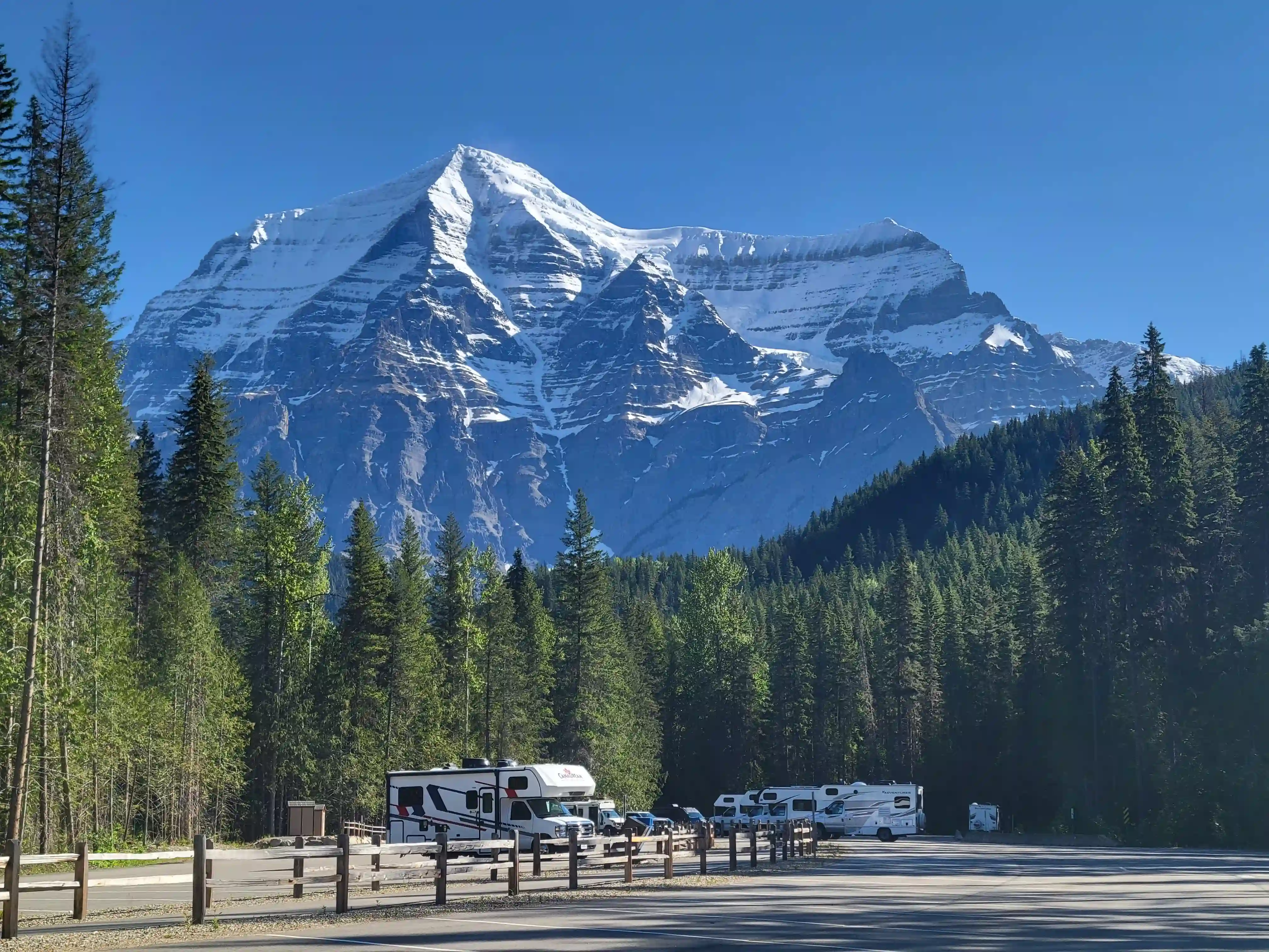
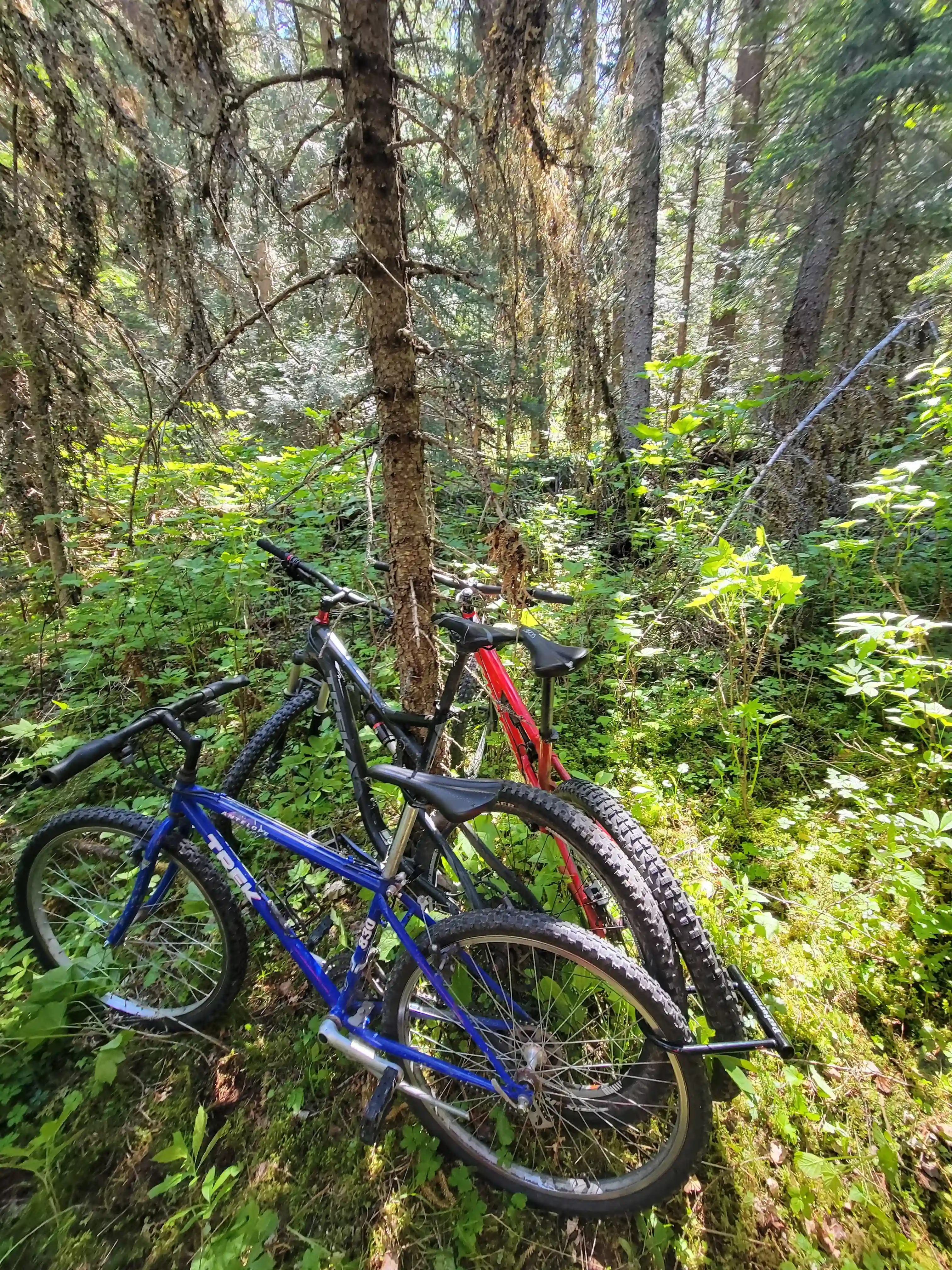
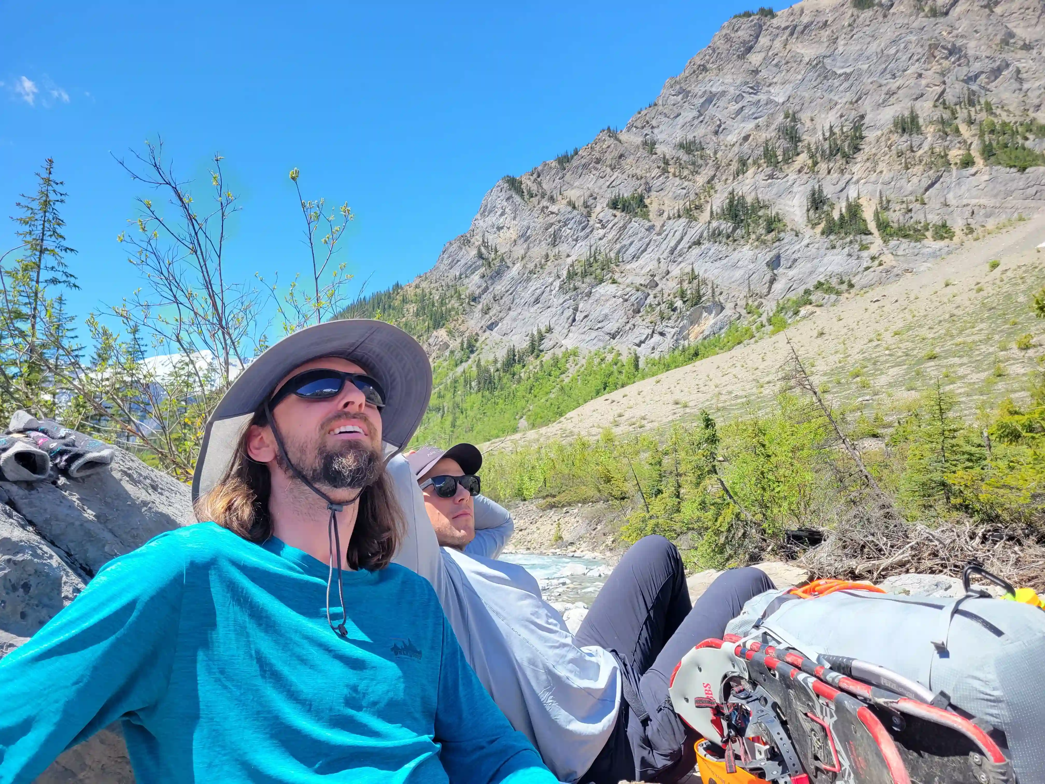
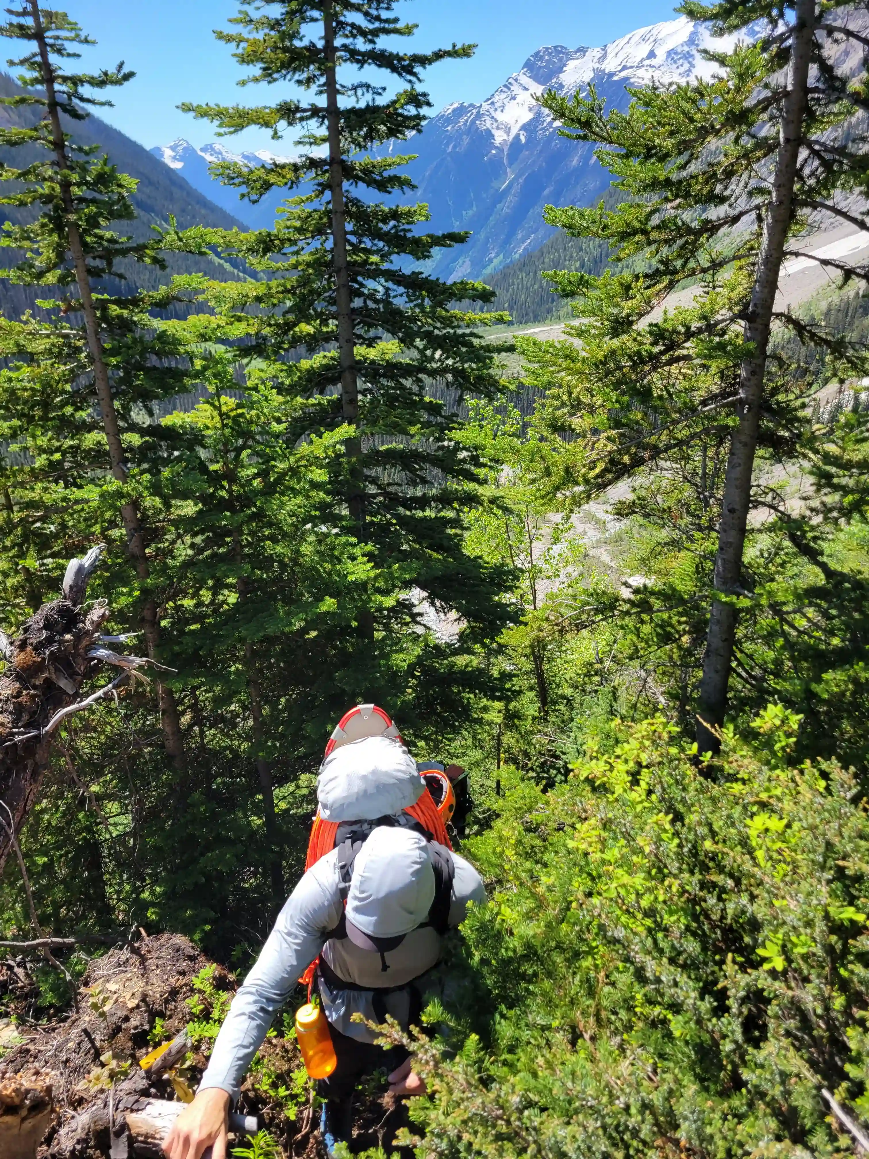
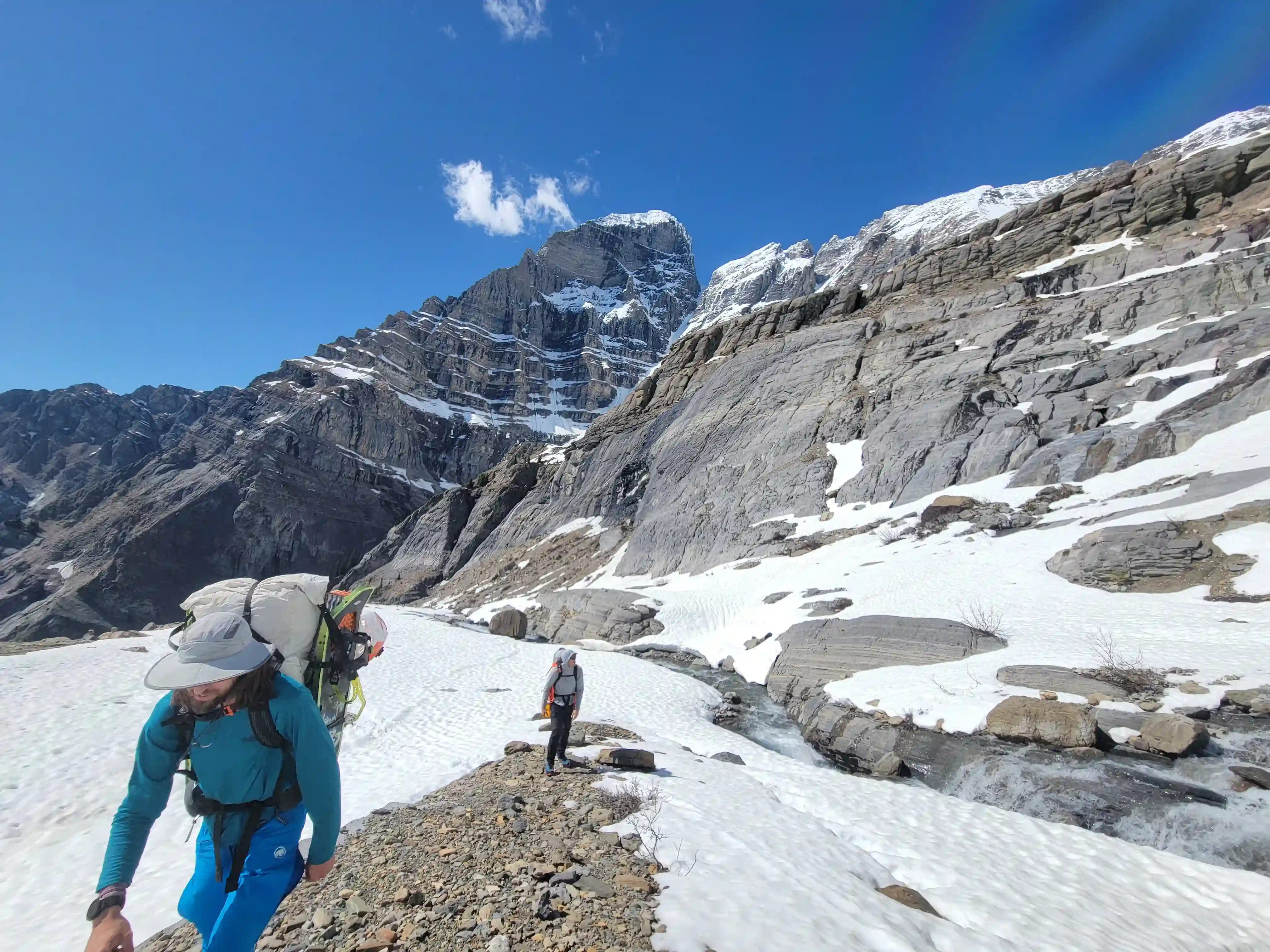
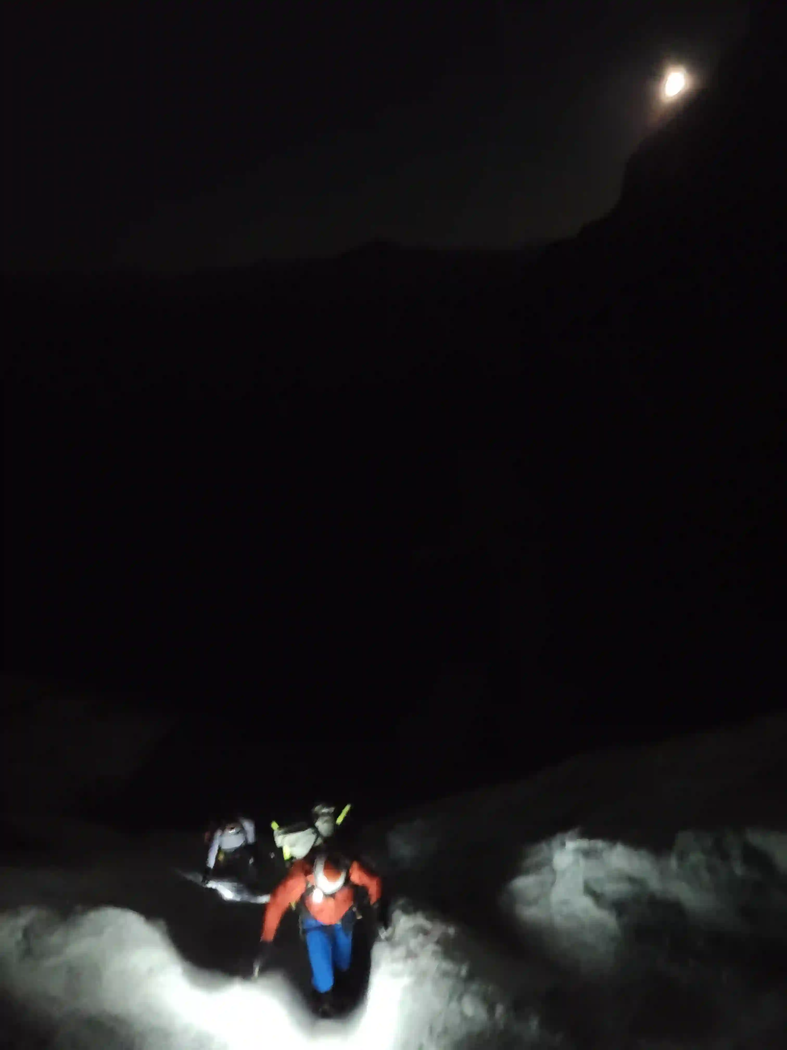
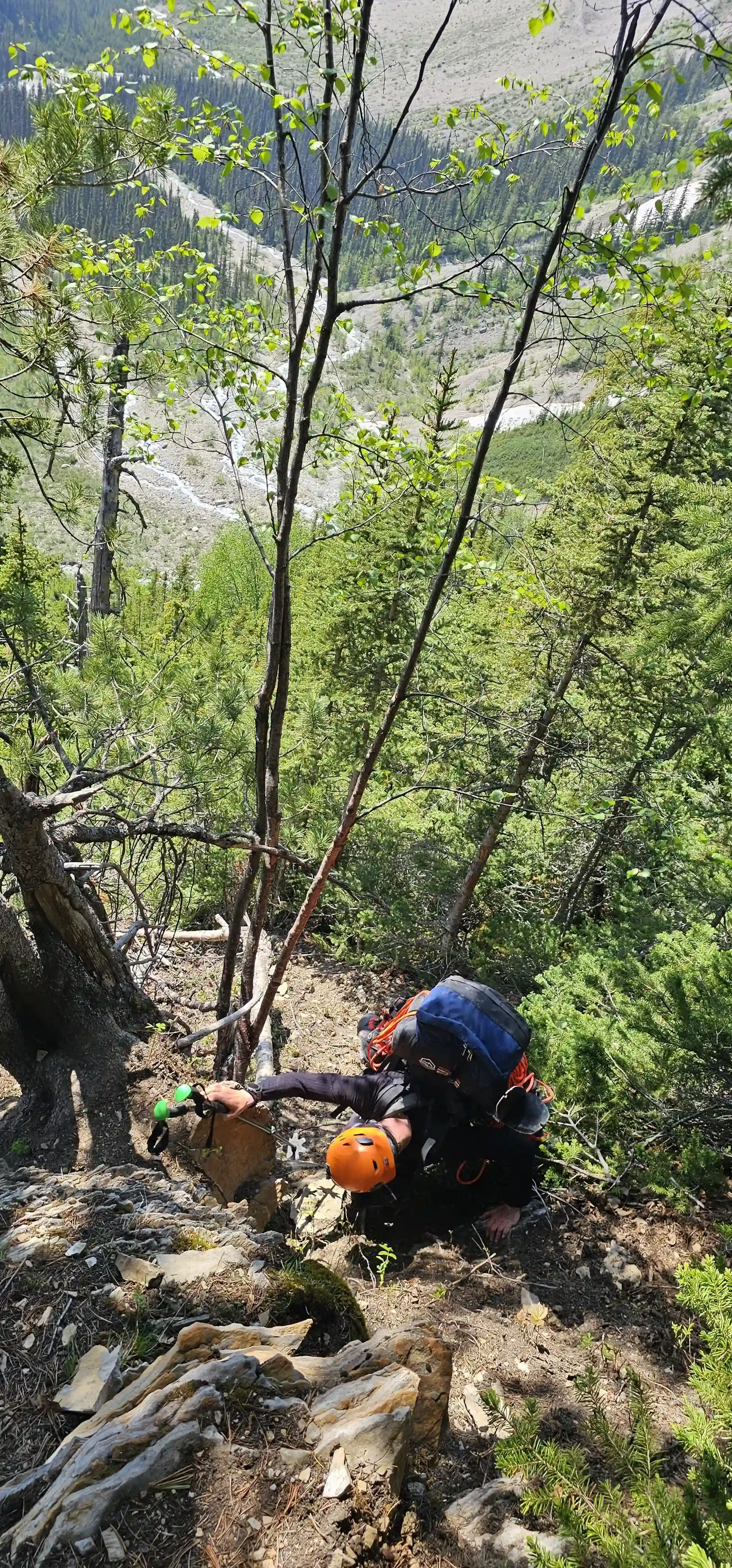
The three of us made plans to meet at the parking lot at the end of Kinney Lake Road the morning of the 7th and with a few kilometers of good wide trail before the Patterson Spur approach trail branches off we decided to bike in as far as we could to save the legs a bit and make for an enjoyable end to our exit. We were started by 11am and made short work of the bike in although it was a leg burner with a few hundred meters of gain. After ditching the bikes we were pleasantly surprised by the quality of the trail and made good ground as we closed in on the headwall, not feeling the weight of our packs too much as the stoke was through the roof!
Follow the journey
I'll send you an email when a new trip report drops.
trail to Kinney Lake
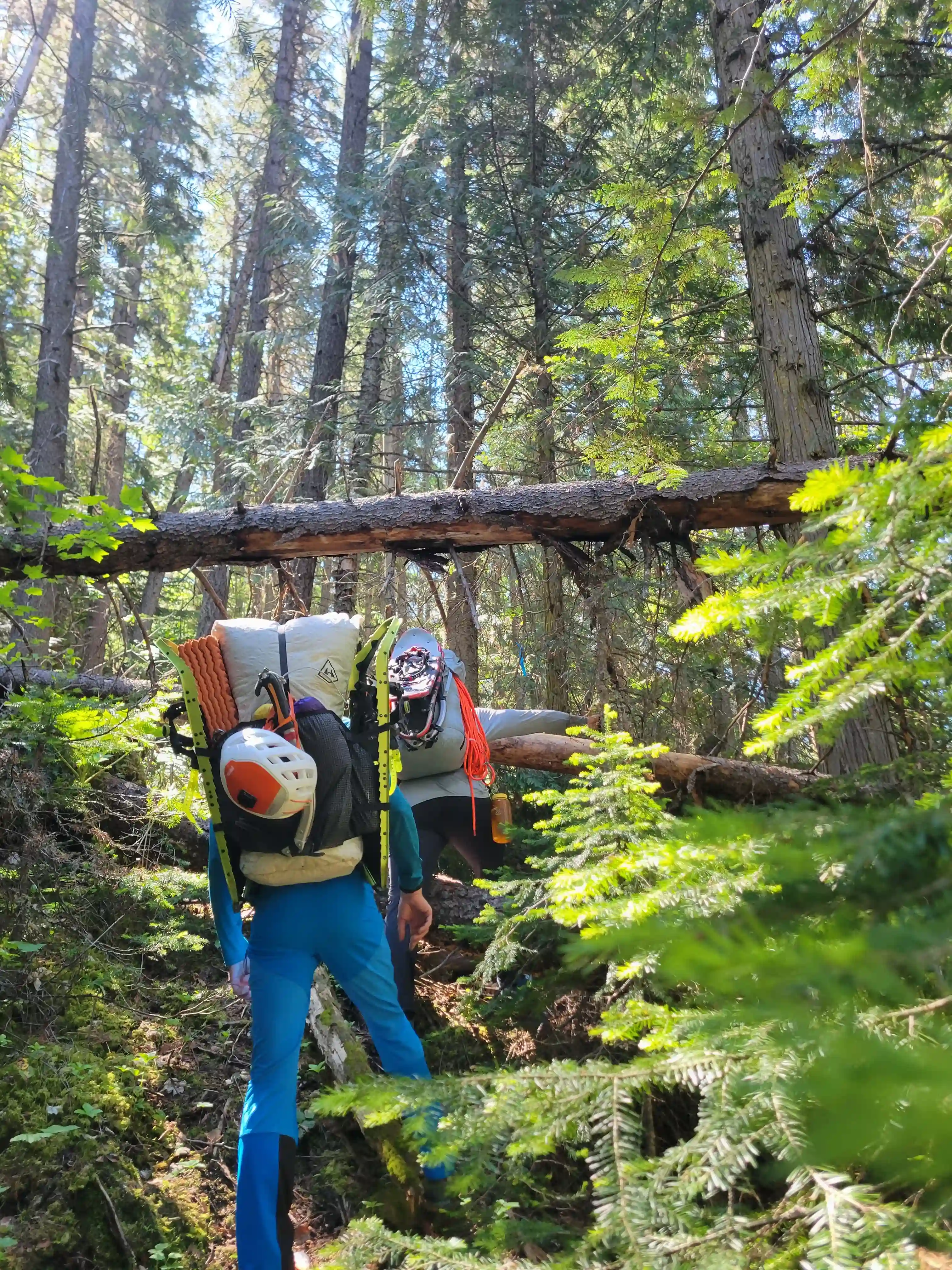
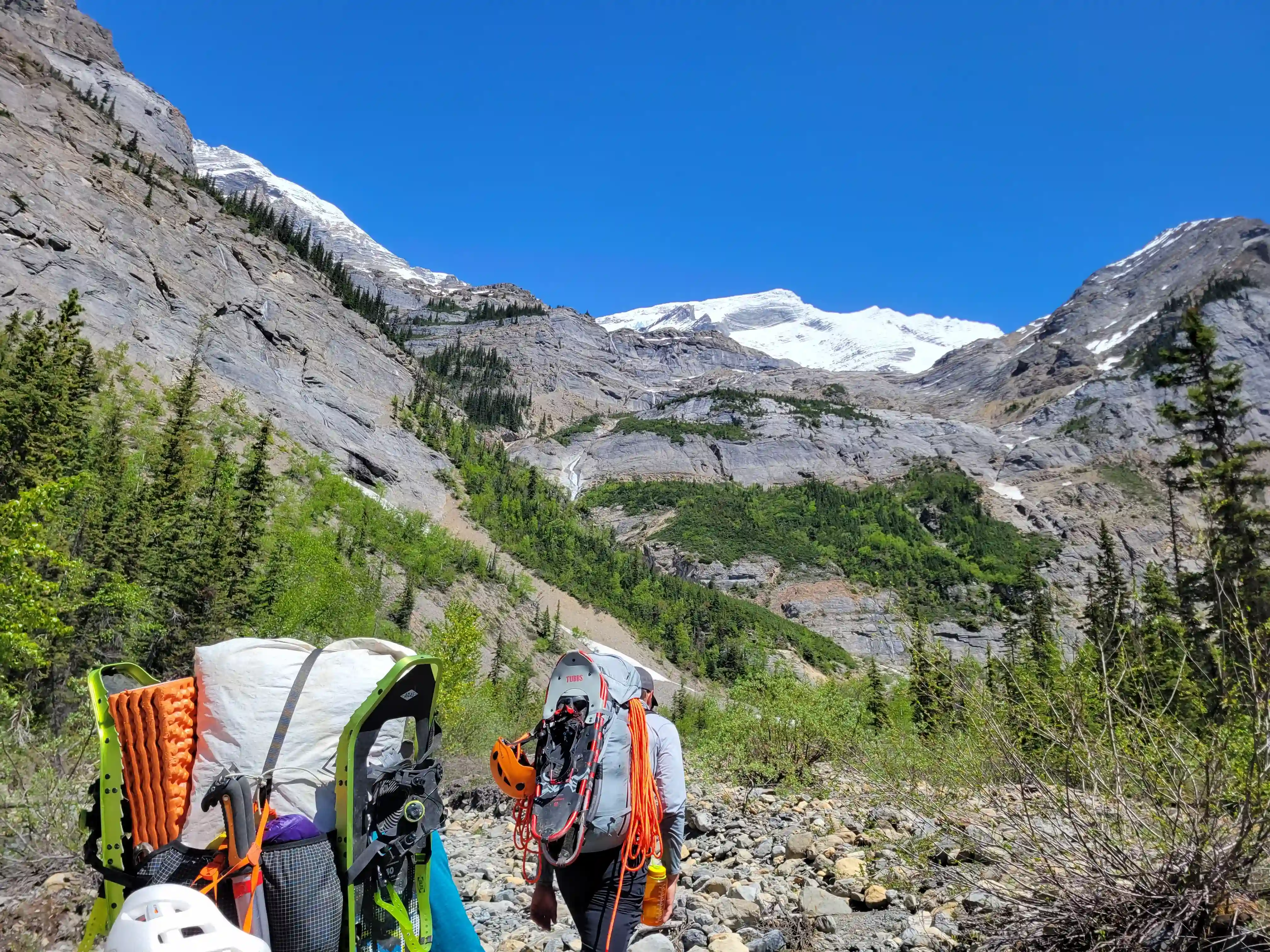
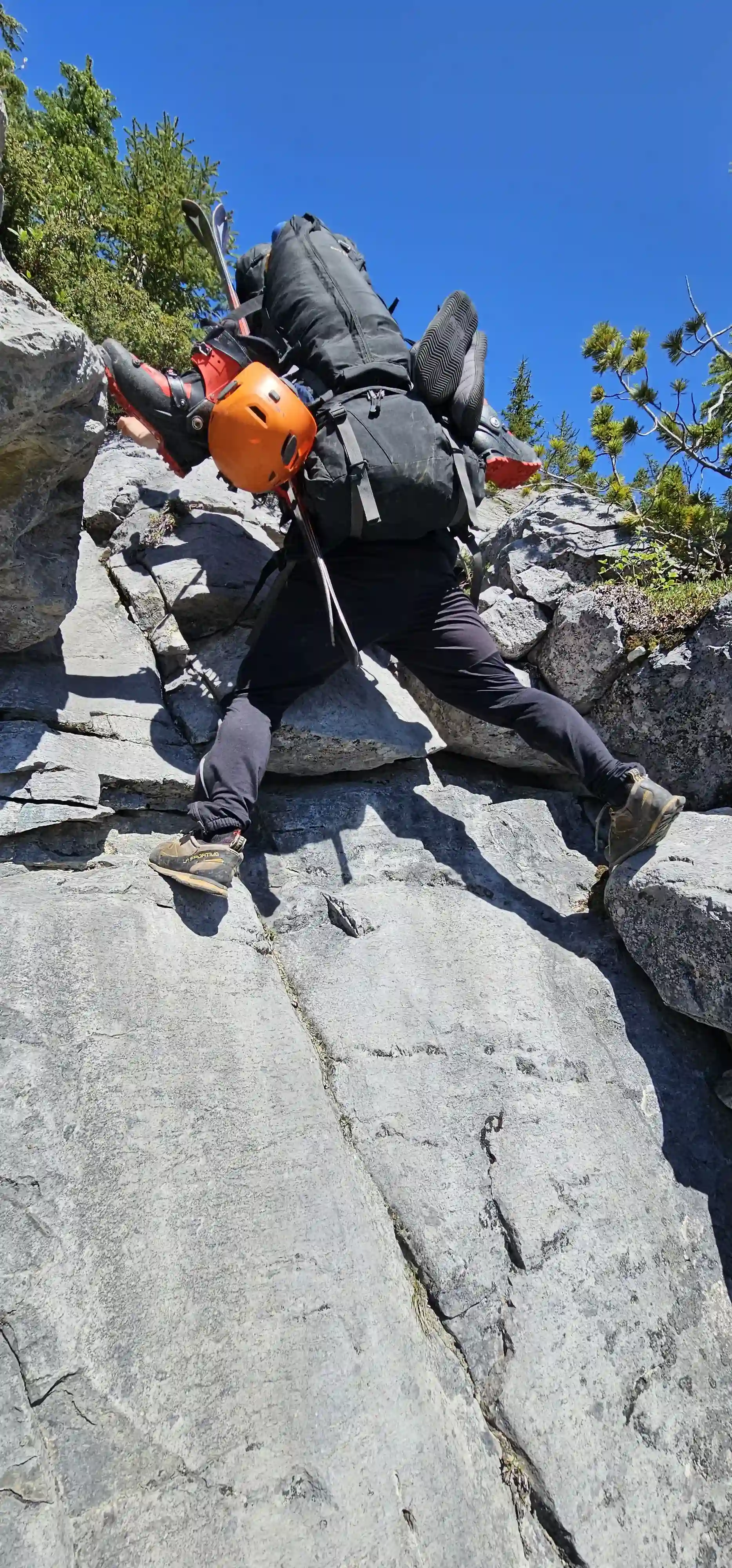
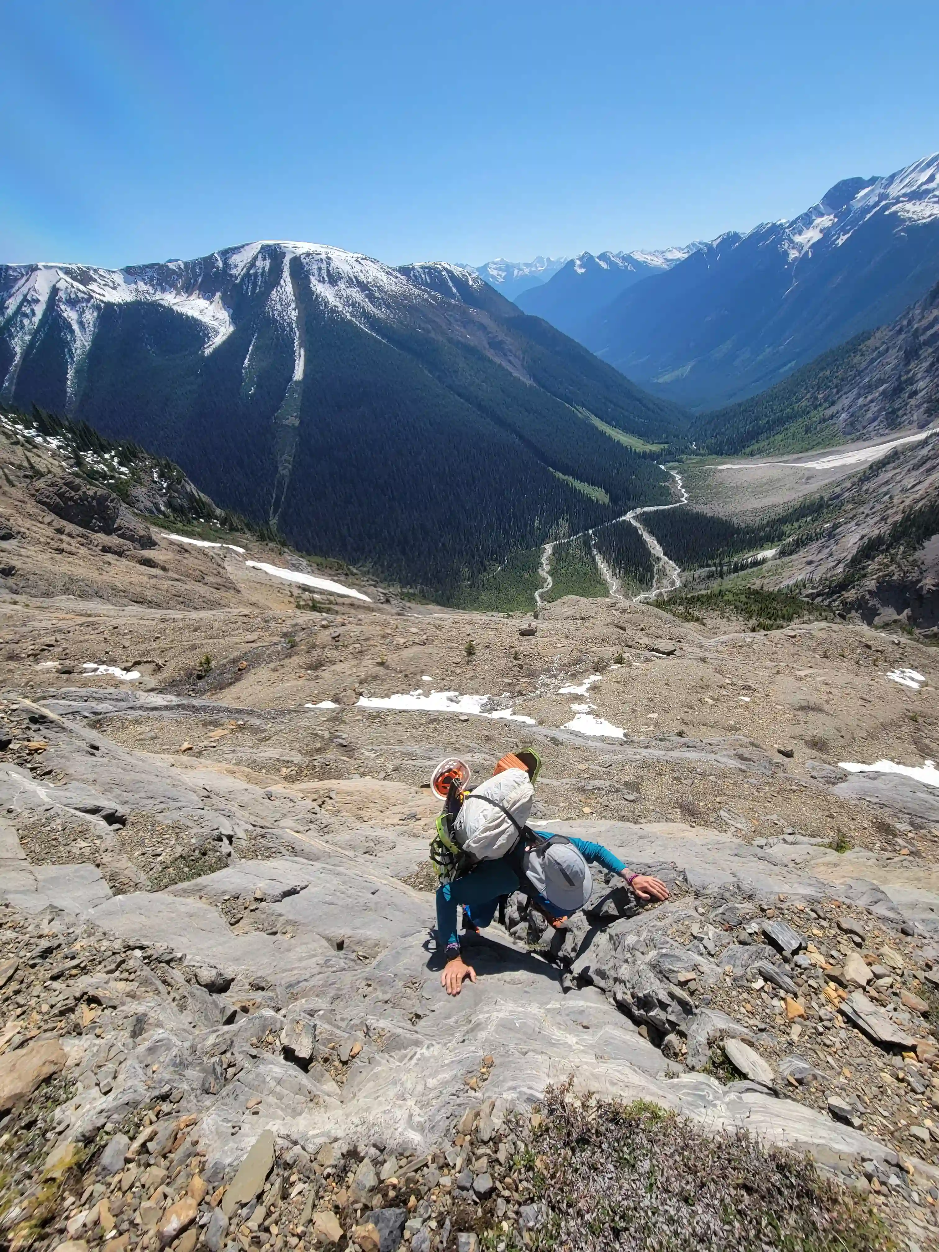
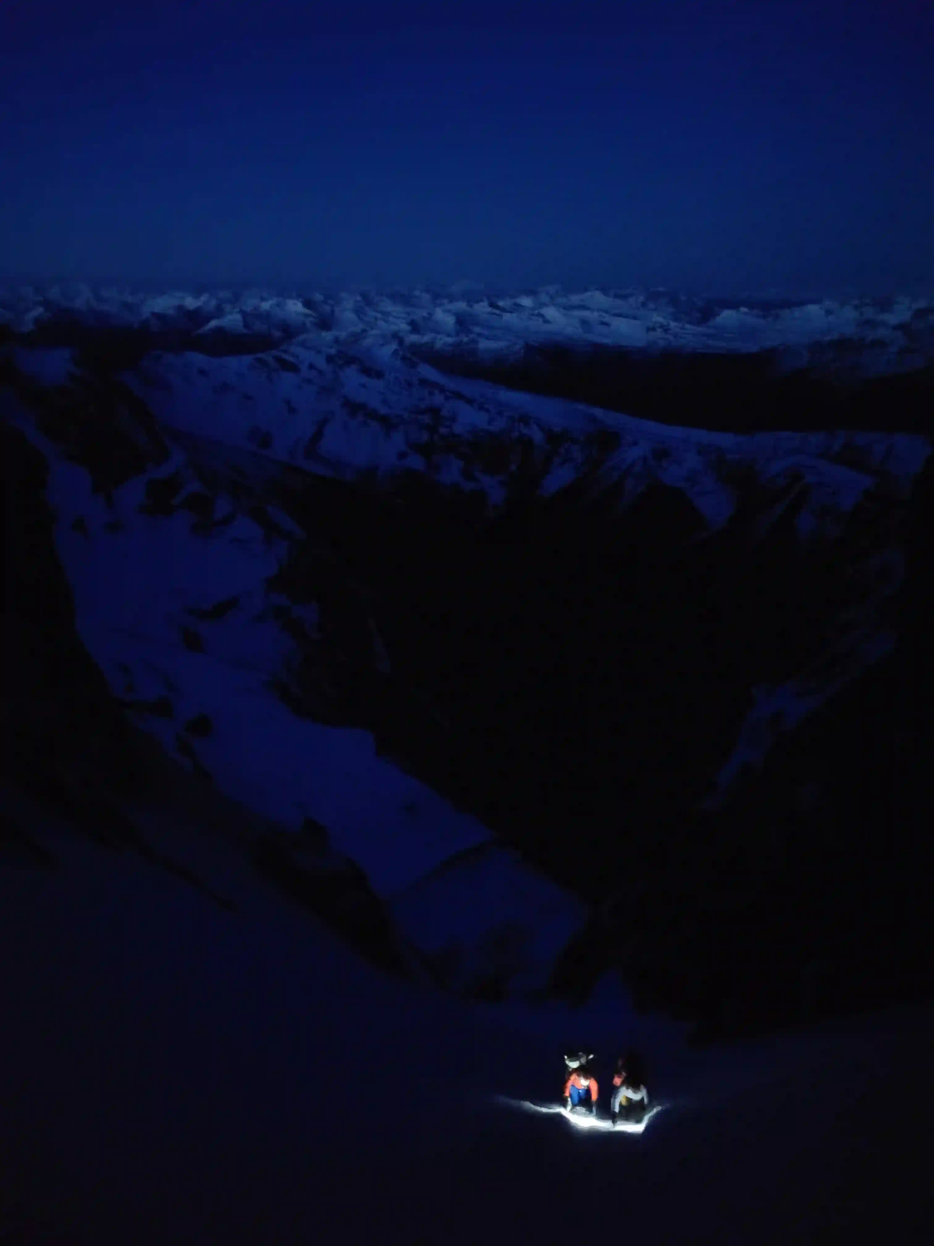
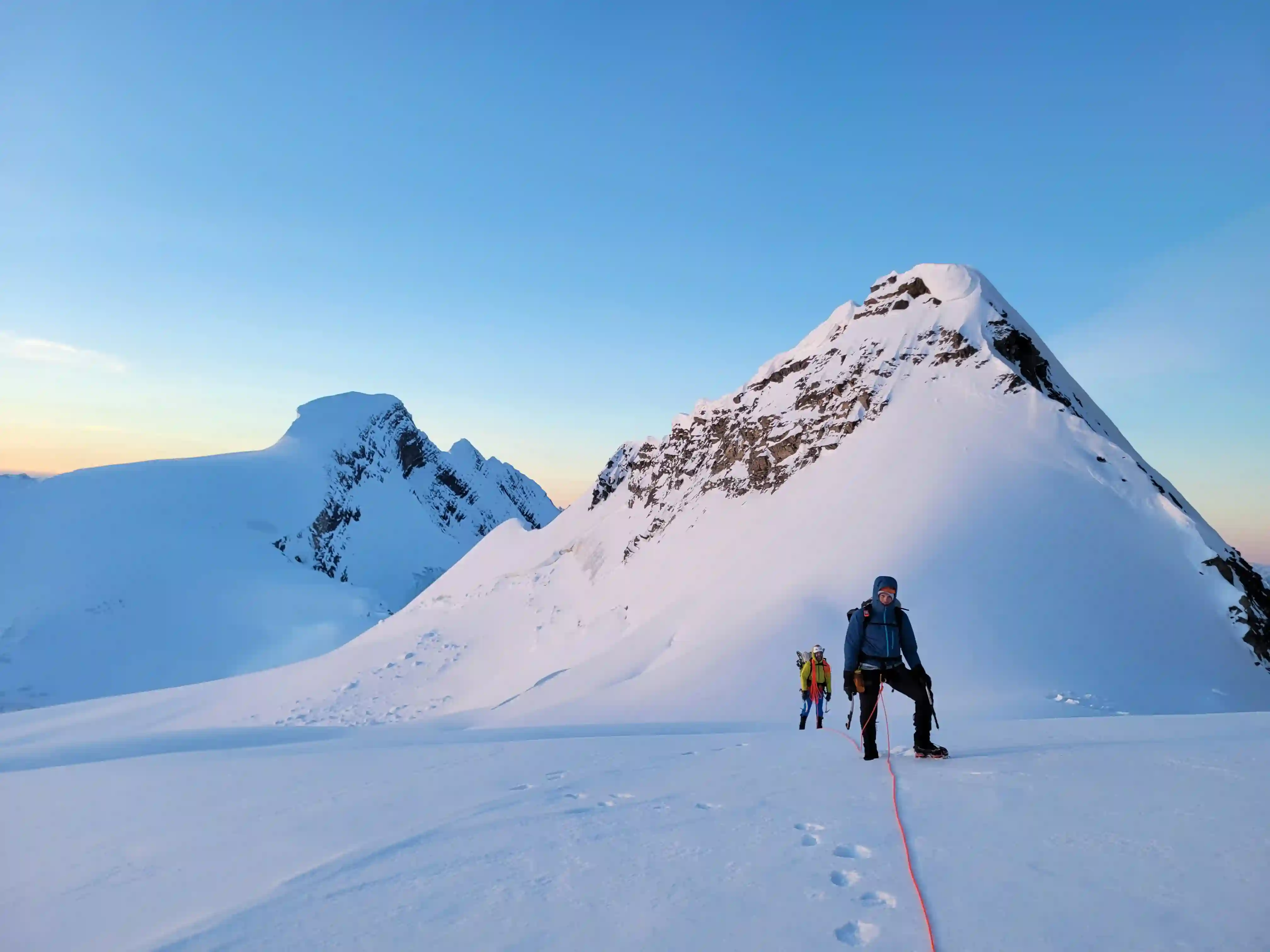
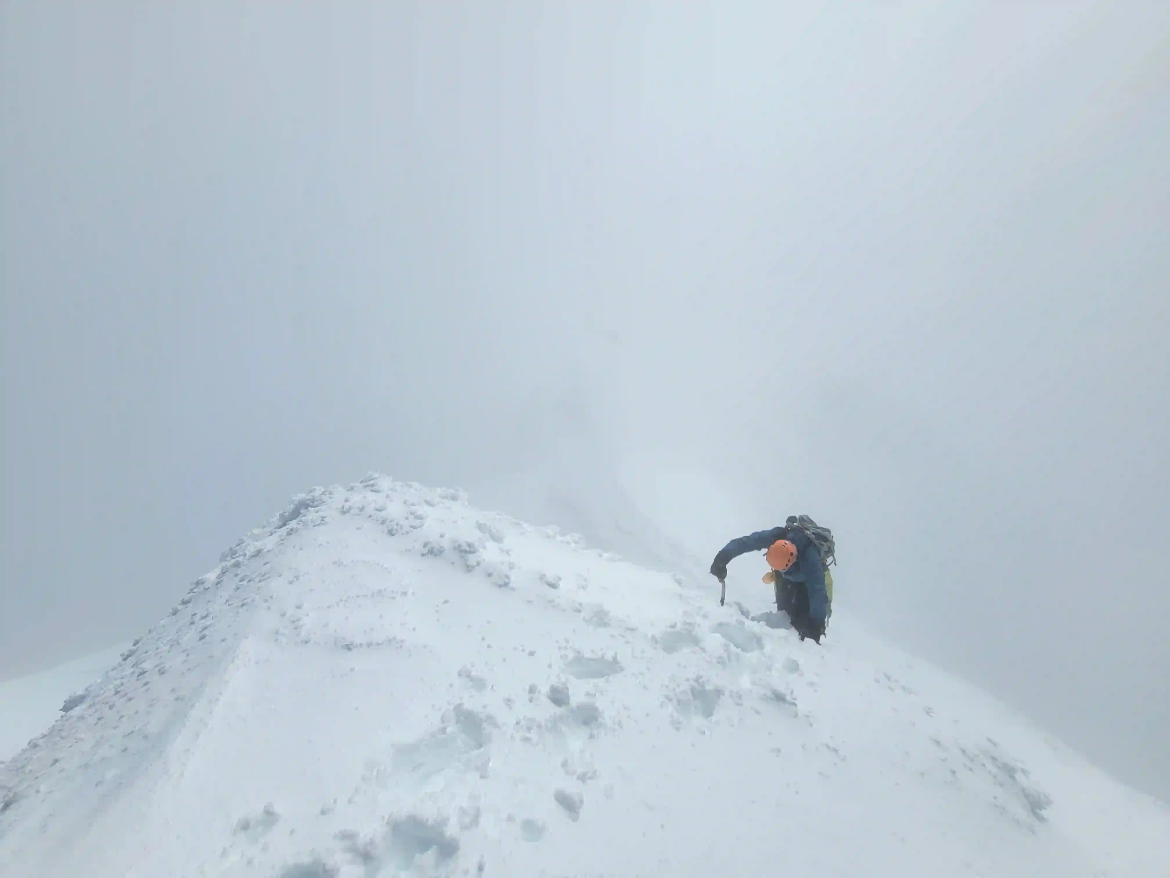
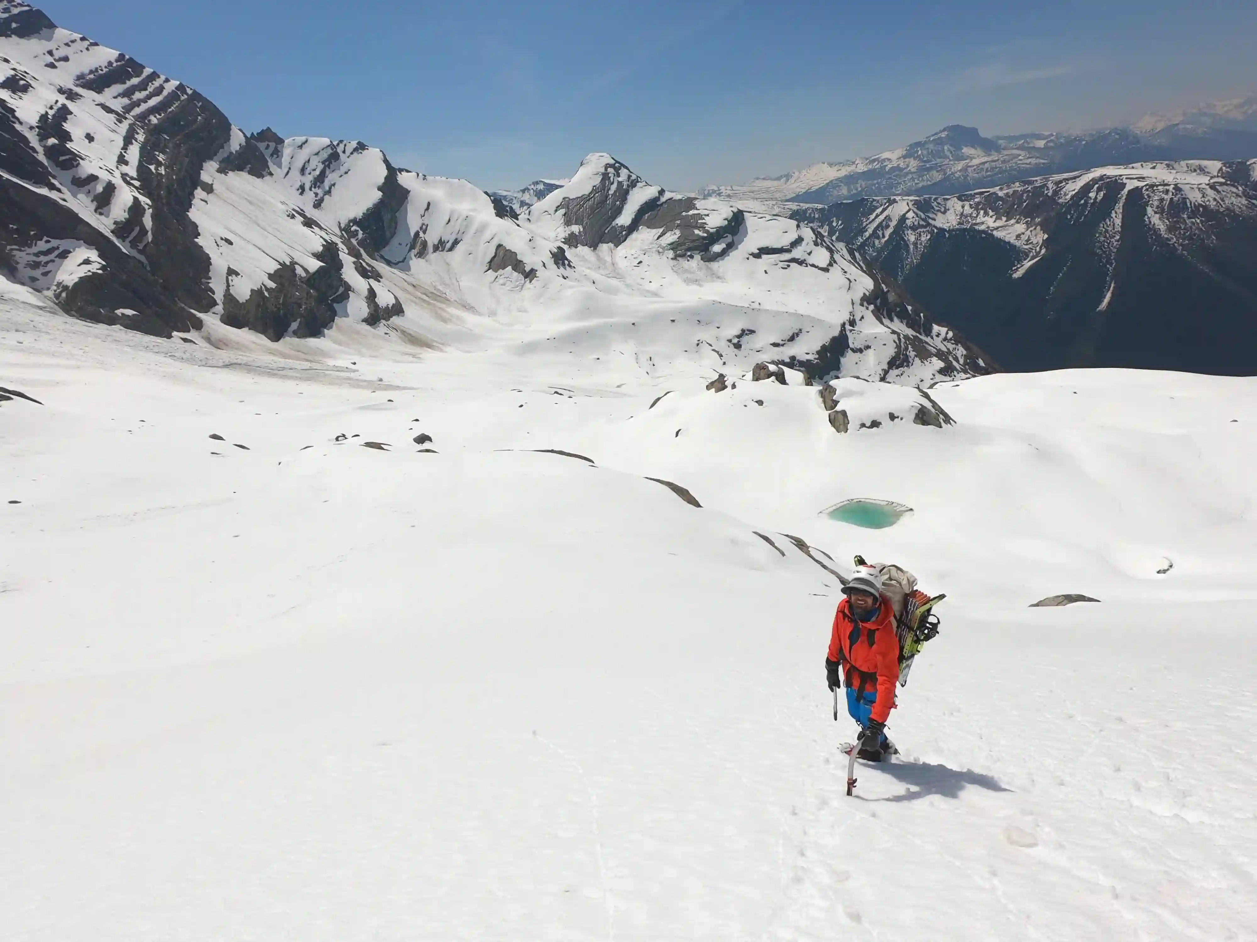
The route up the headwall ended up being quite well marked with cairns but that's not to say we didn't have any routefinding issues along the way. Before you really even start climbing the entry point isn't super obvious and it took us a bit of time to find a few cairns and a faint trail that headed into thick trees near the base of the headwall. We were very glad to have found this because without this trail the bushwhack through this section would've been miserable. Higher up on the headwall the route deviated left and right to take advantage of the easiest terrain and after after a decent amount of gain and a few hands on sections we reached the first snow we had encountered on route. Here we had to bypass cliffs above to gain the bench and once on it we got out skis / snowshoes on to expediate the last bit of our approach as we headed for our camp spot near the base of the Patterson Couloir.
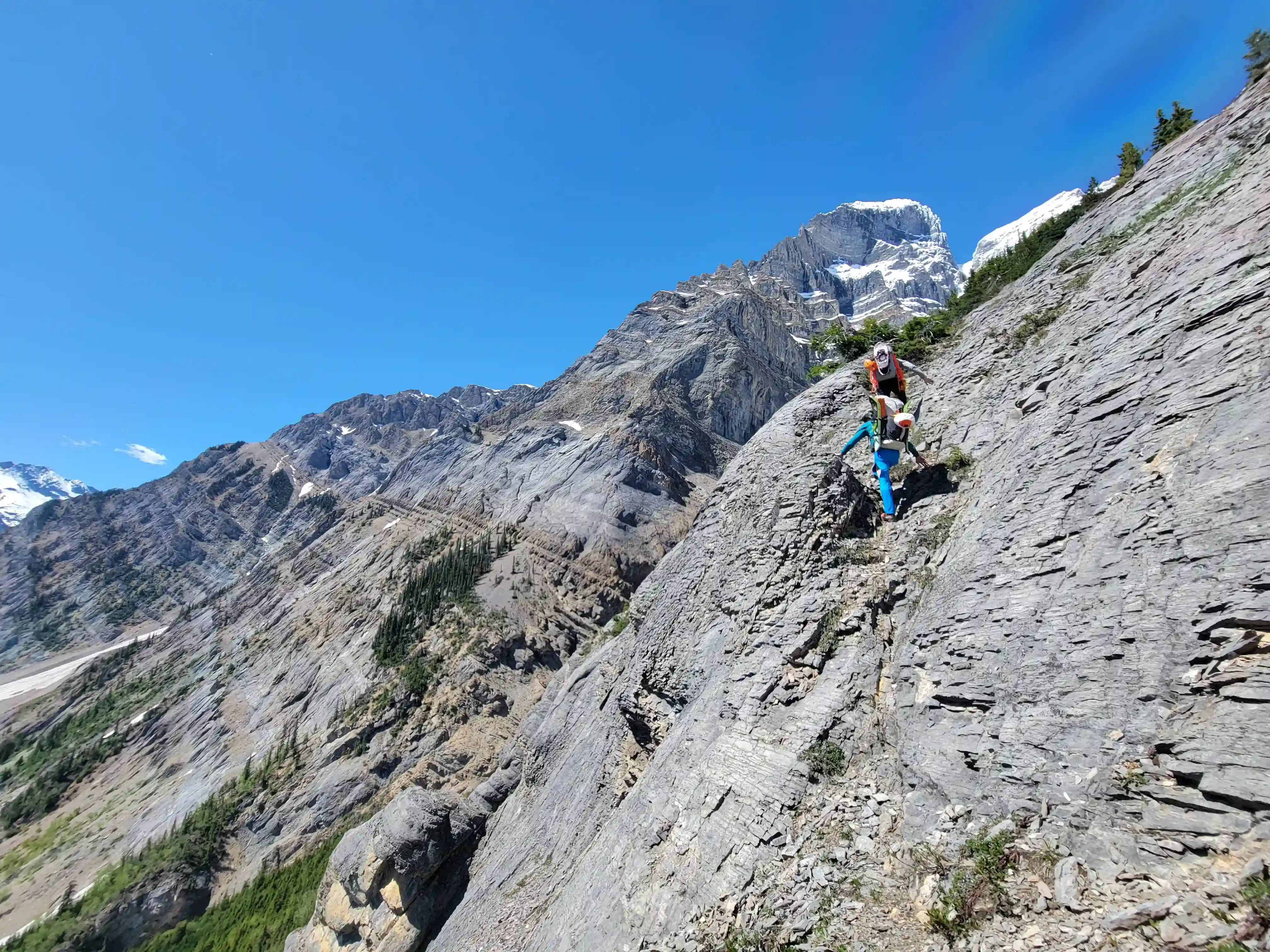
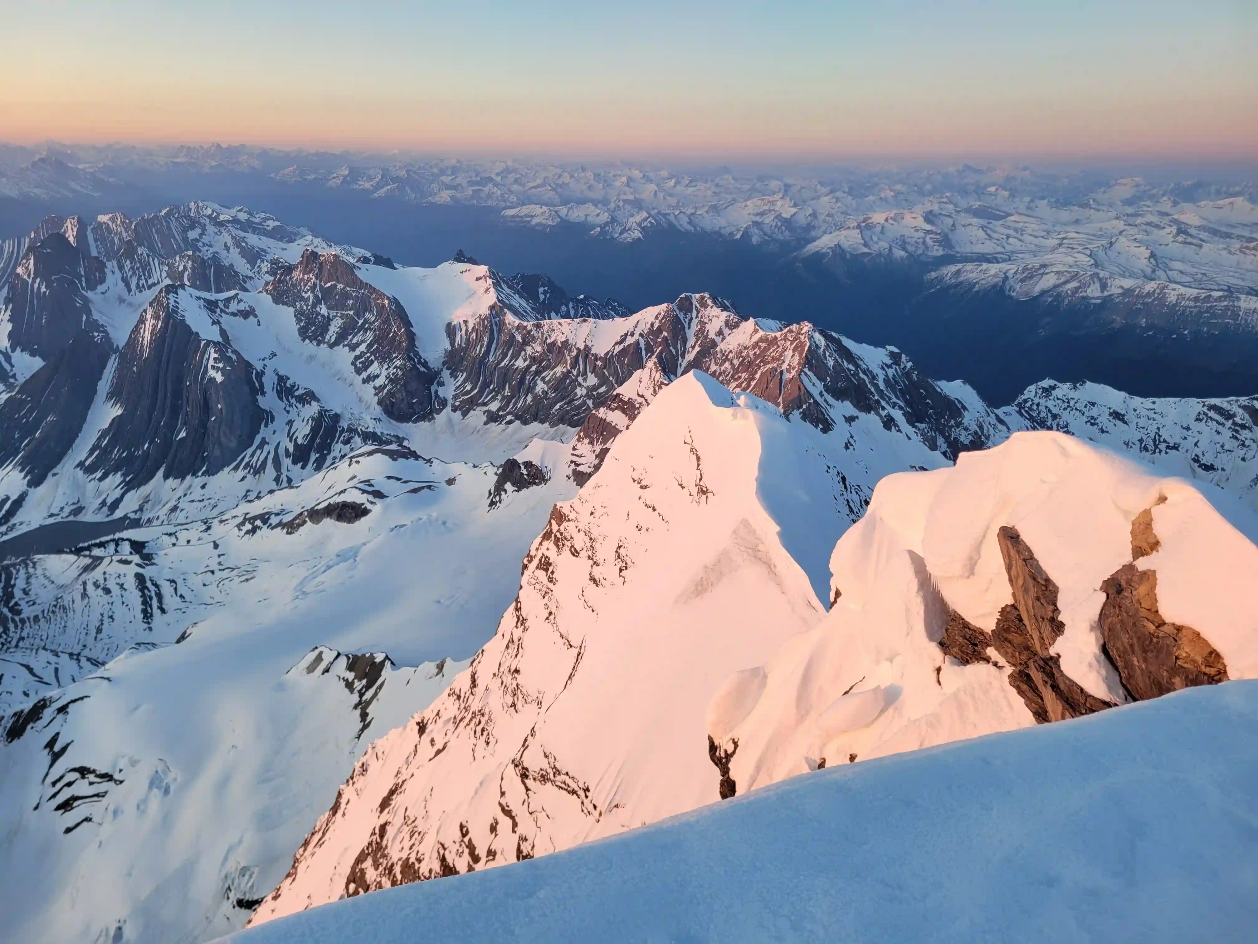
high on the headwall now
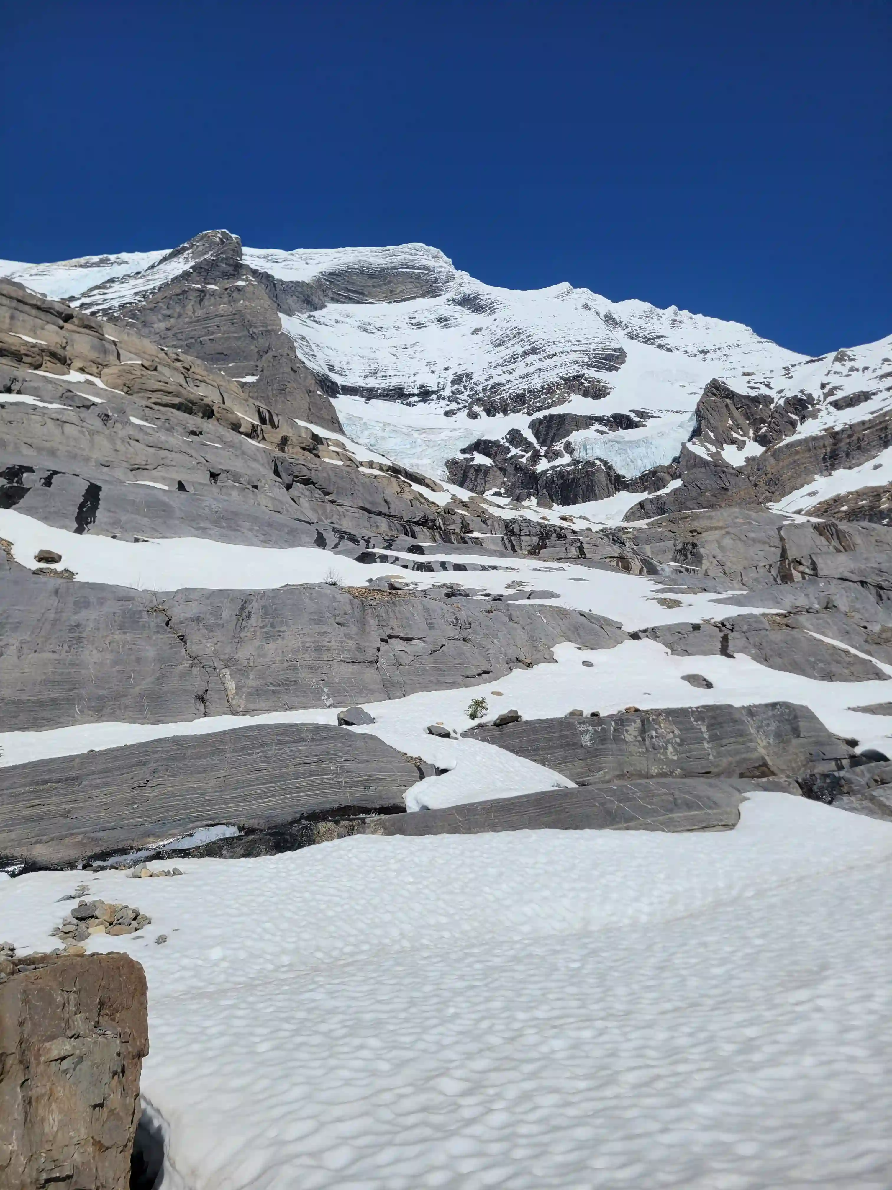
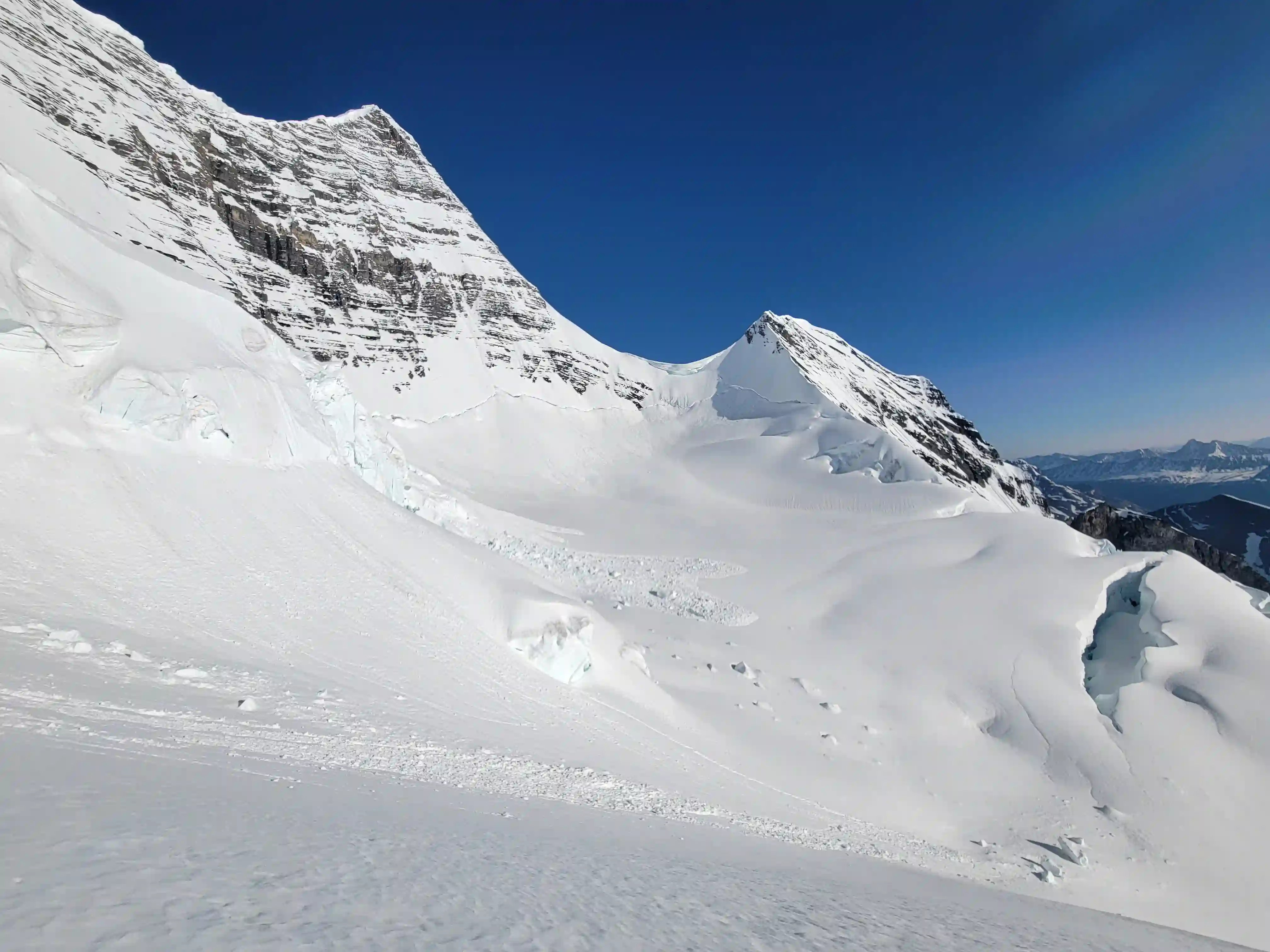
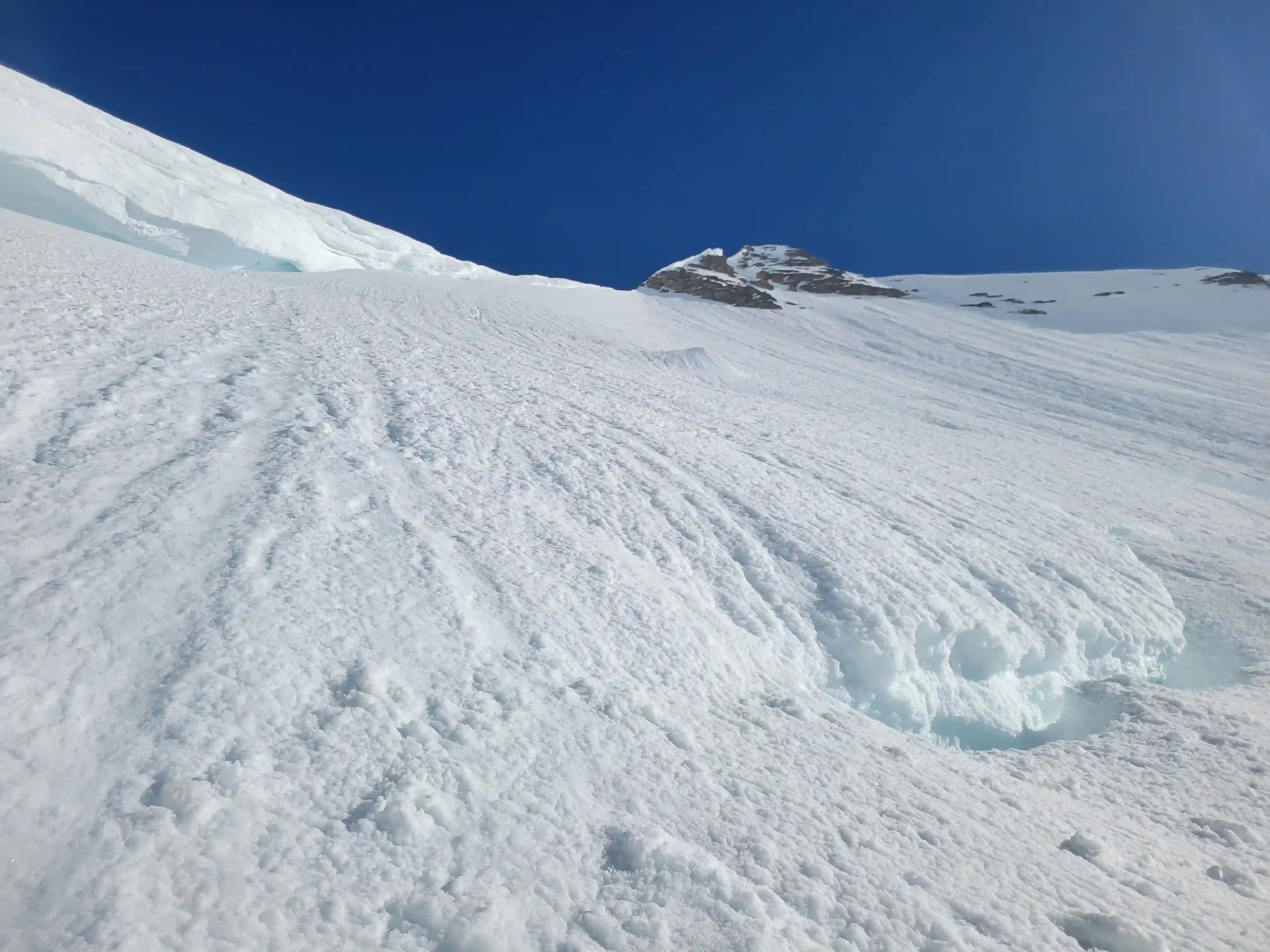
THE PATTERSON COULOIR
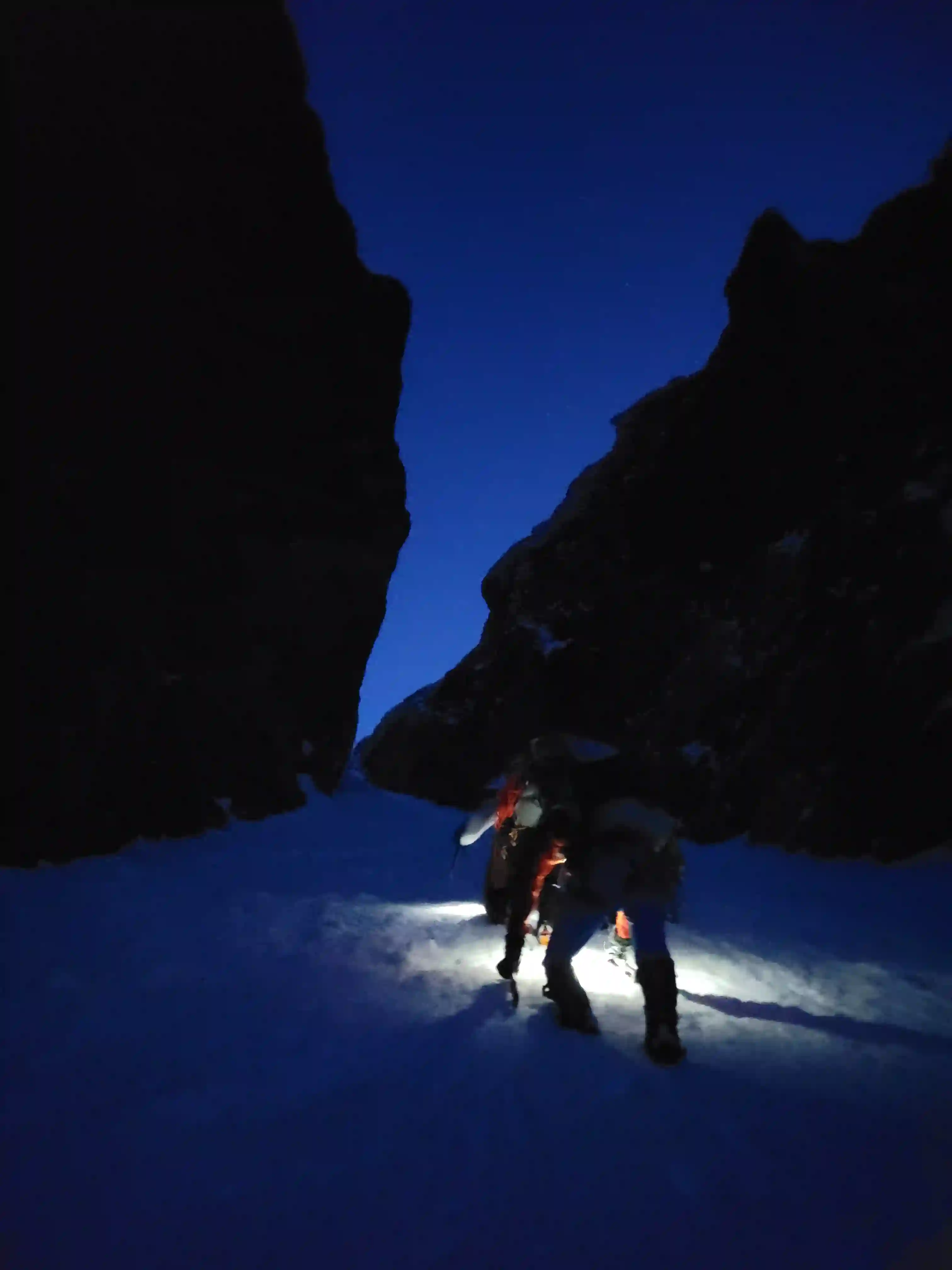
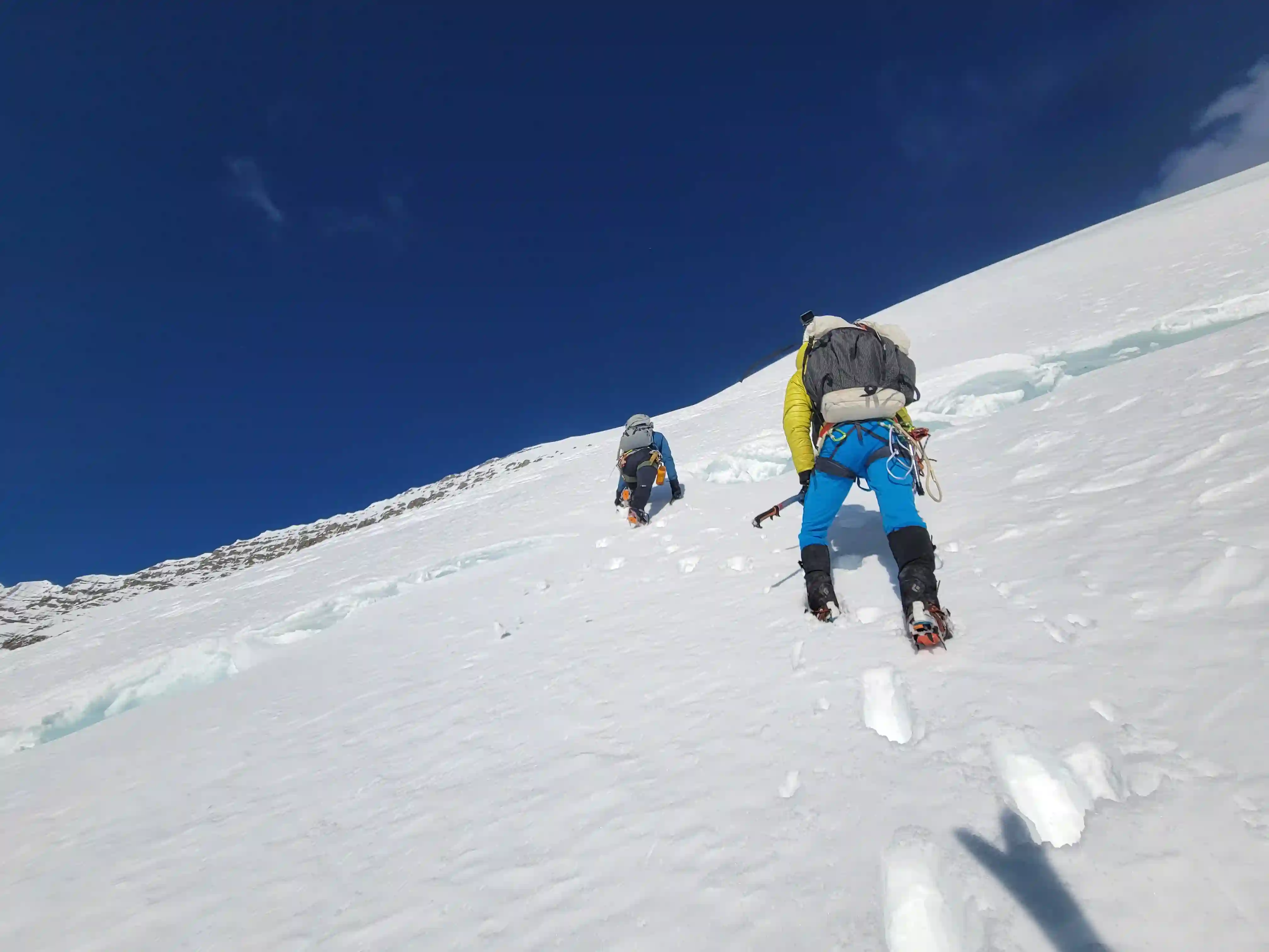
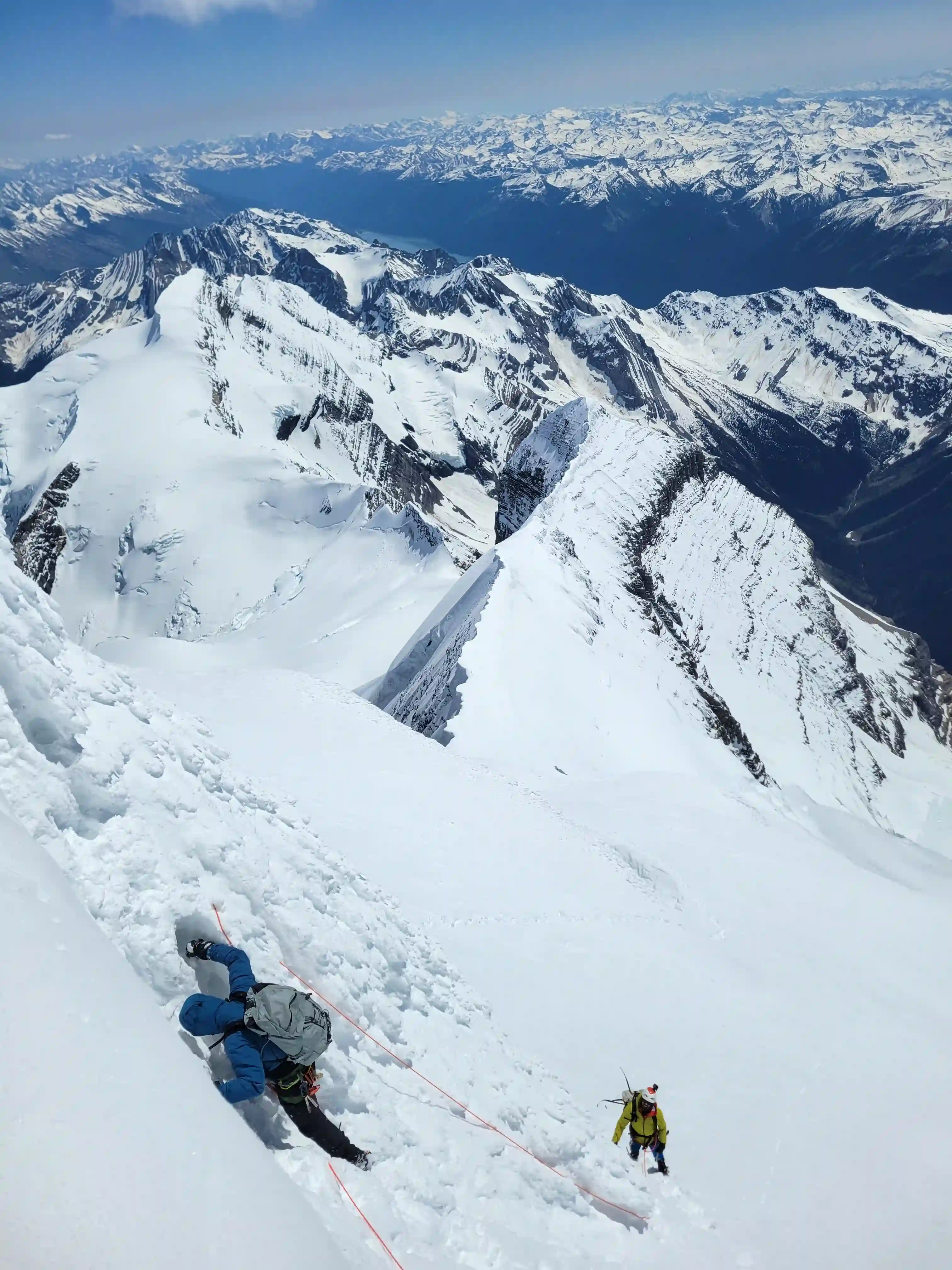
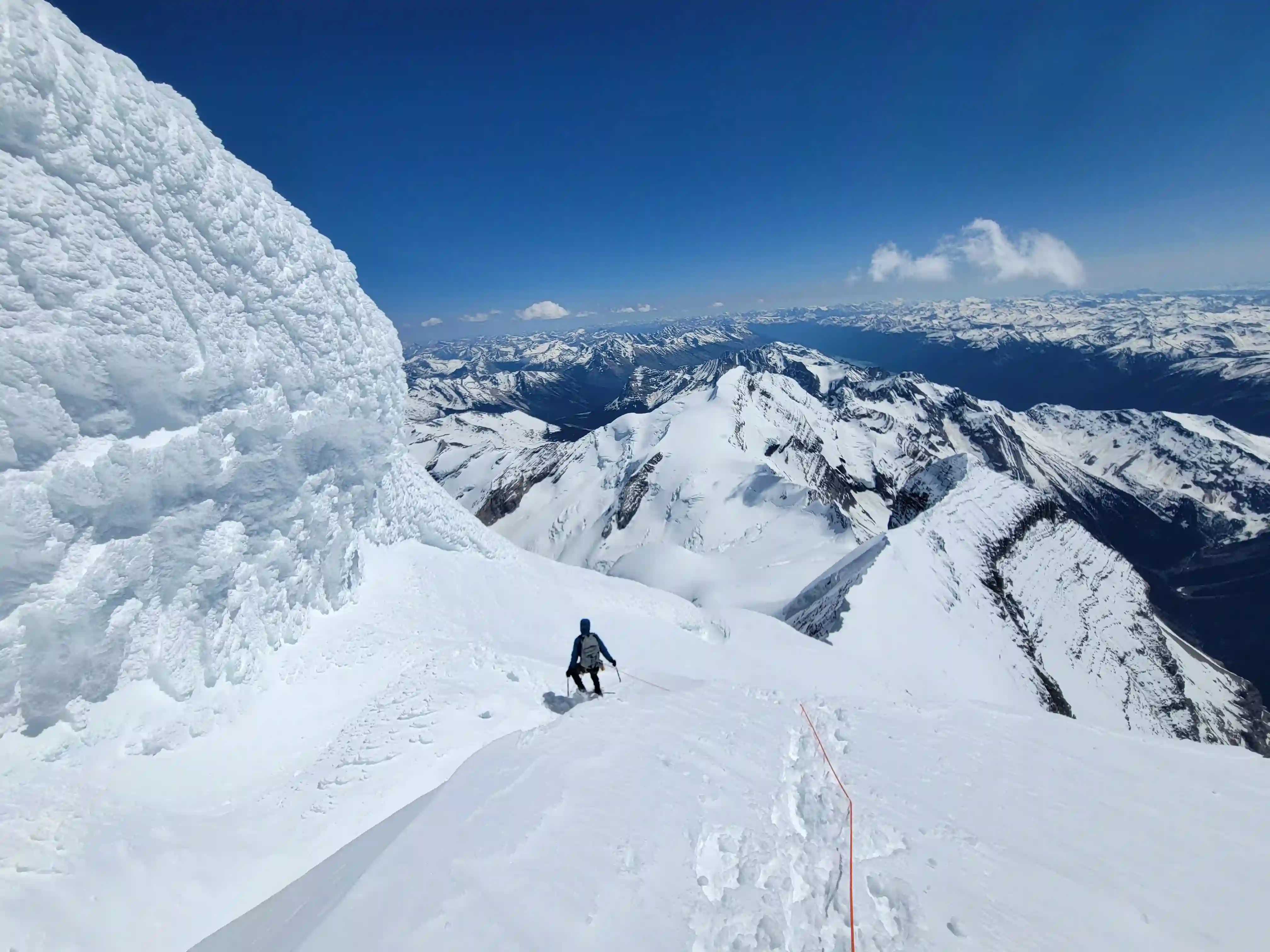
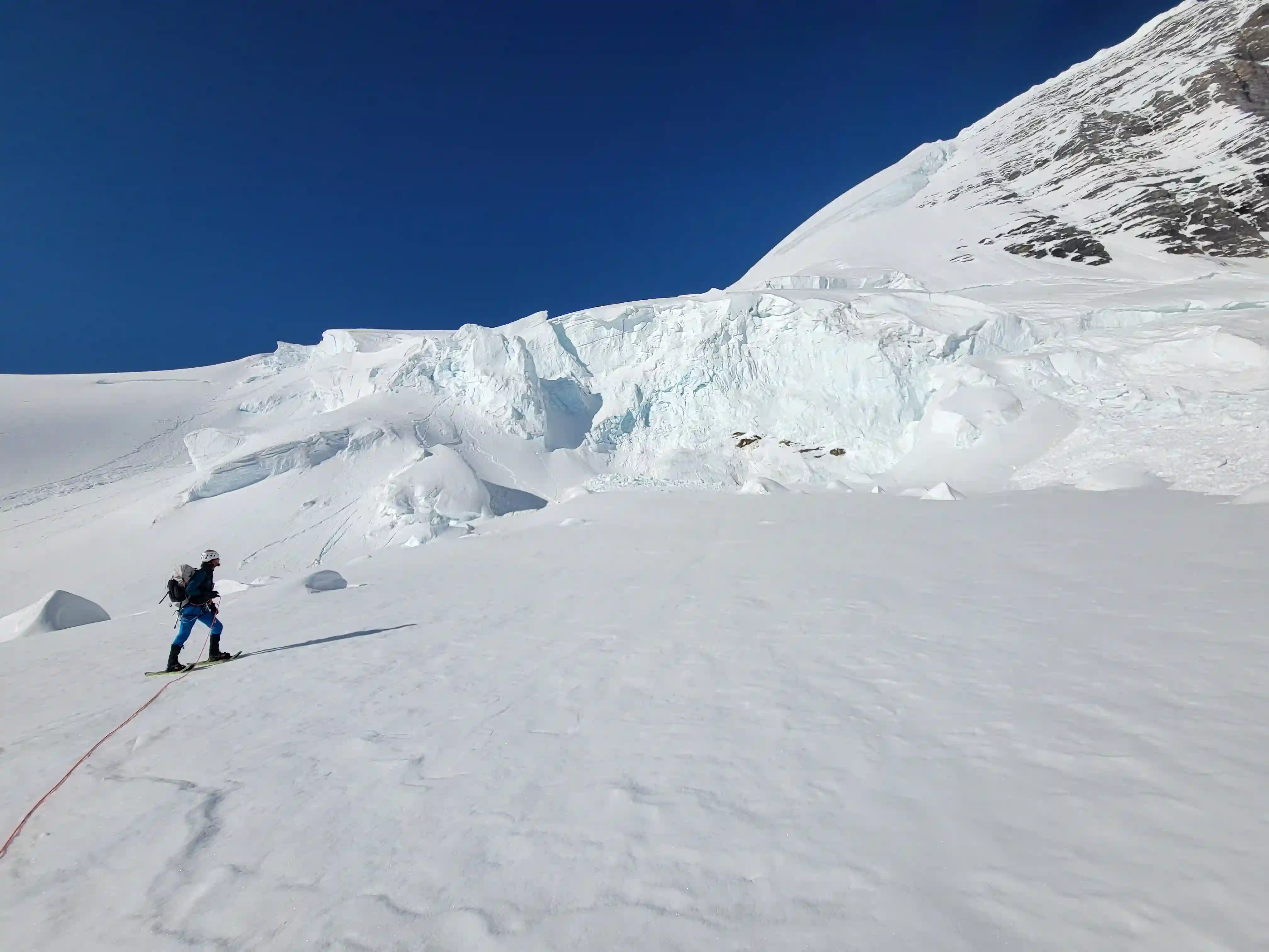
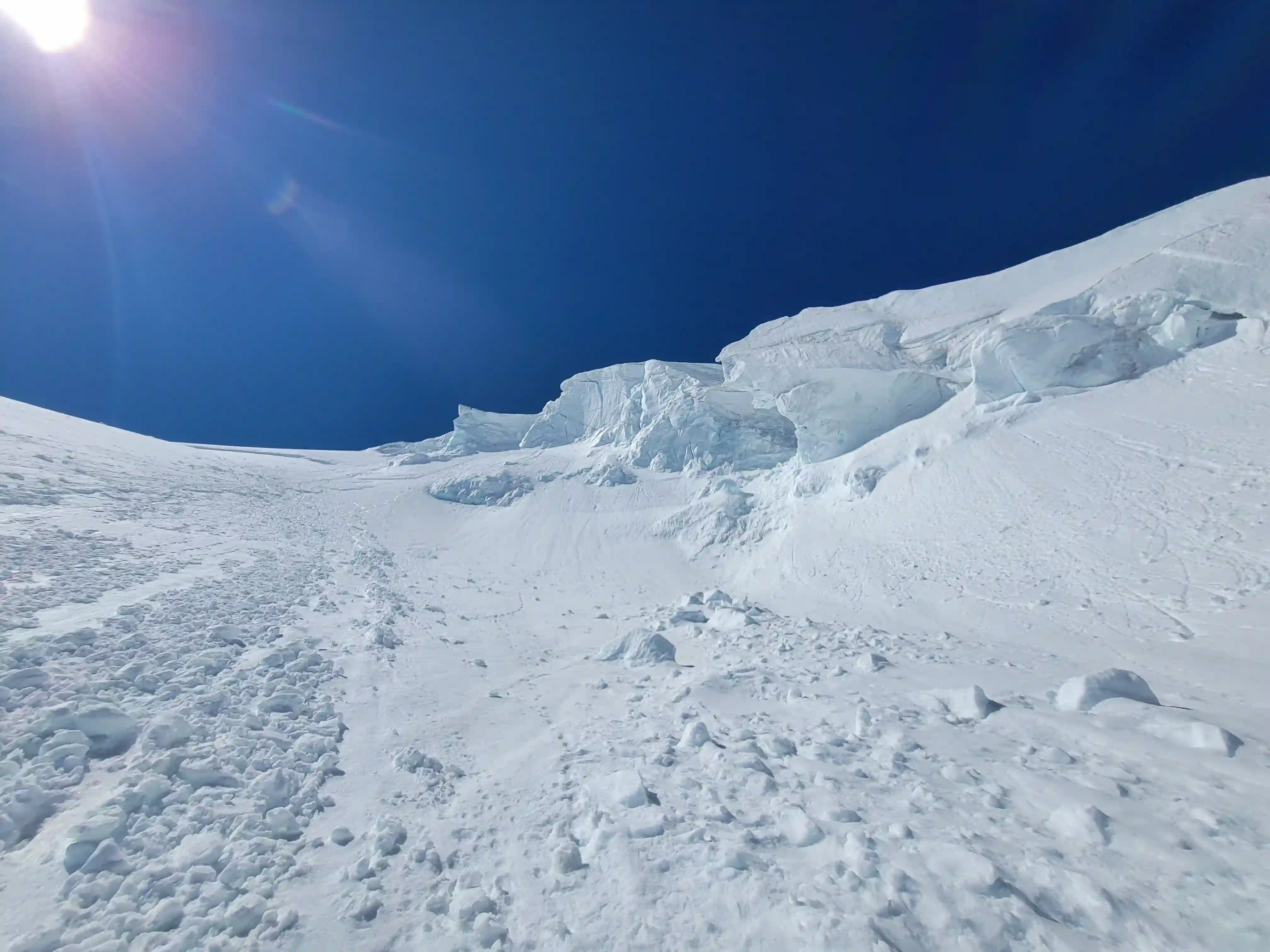
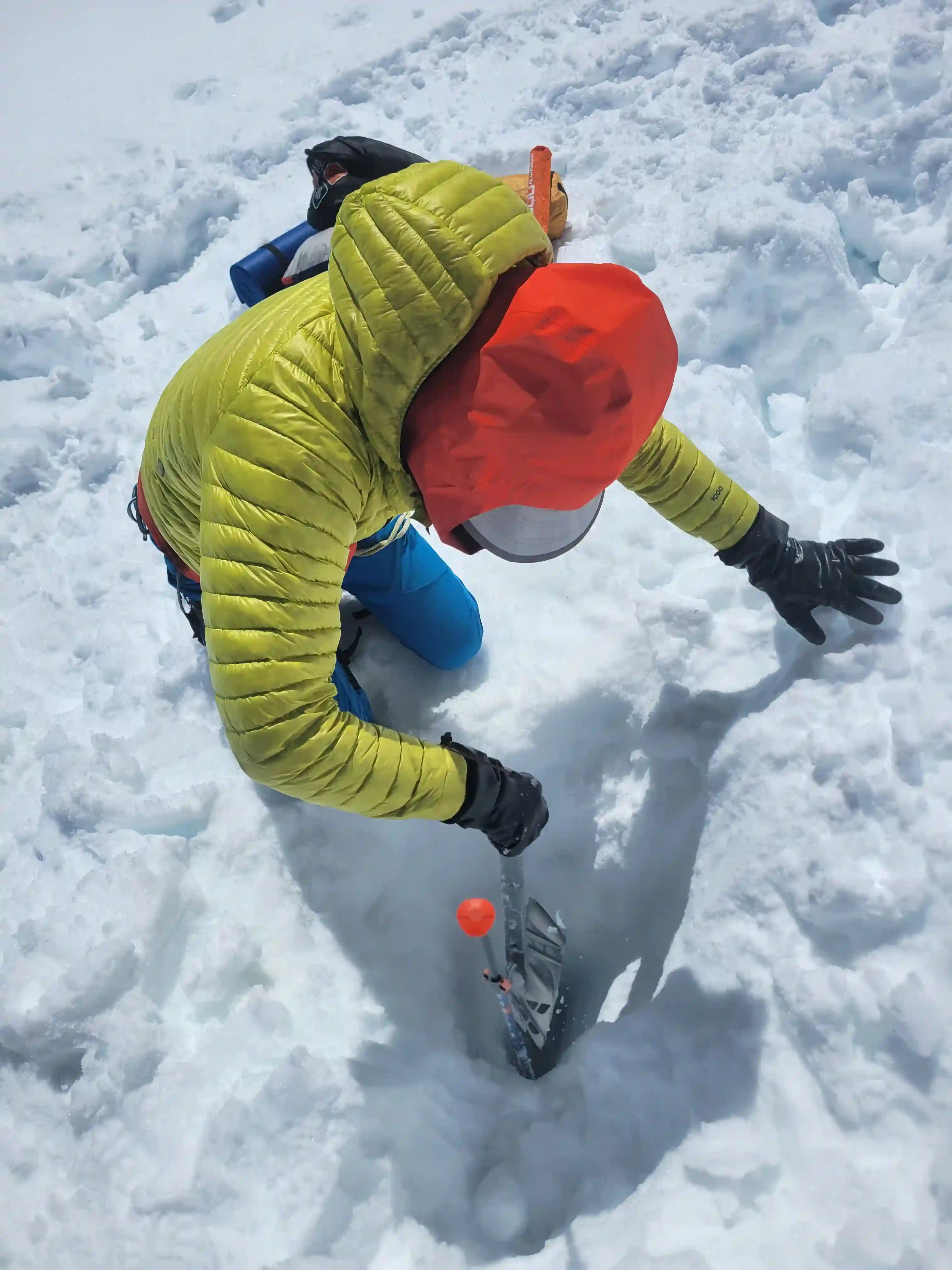
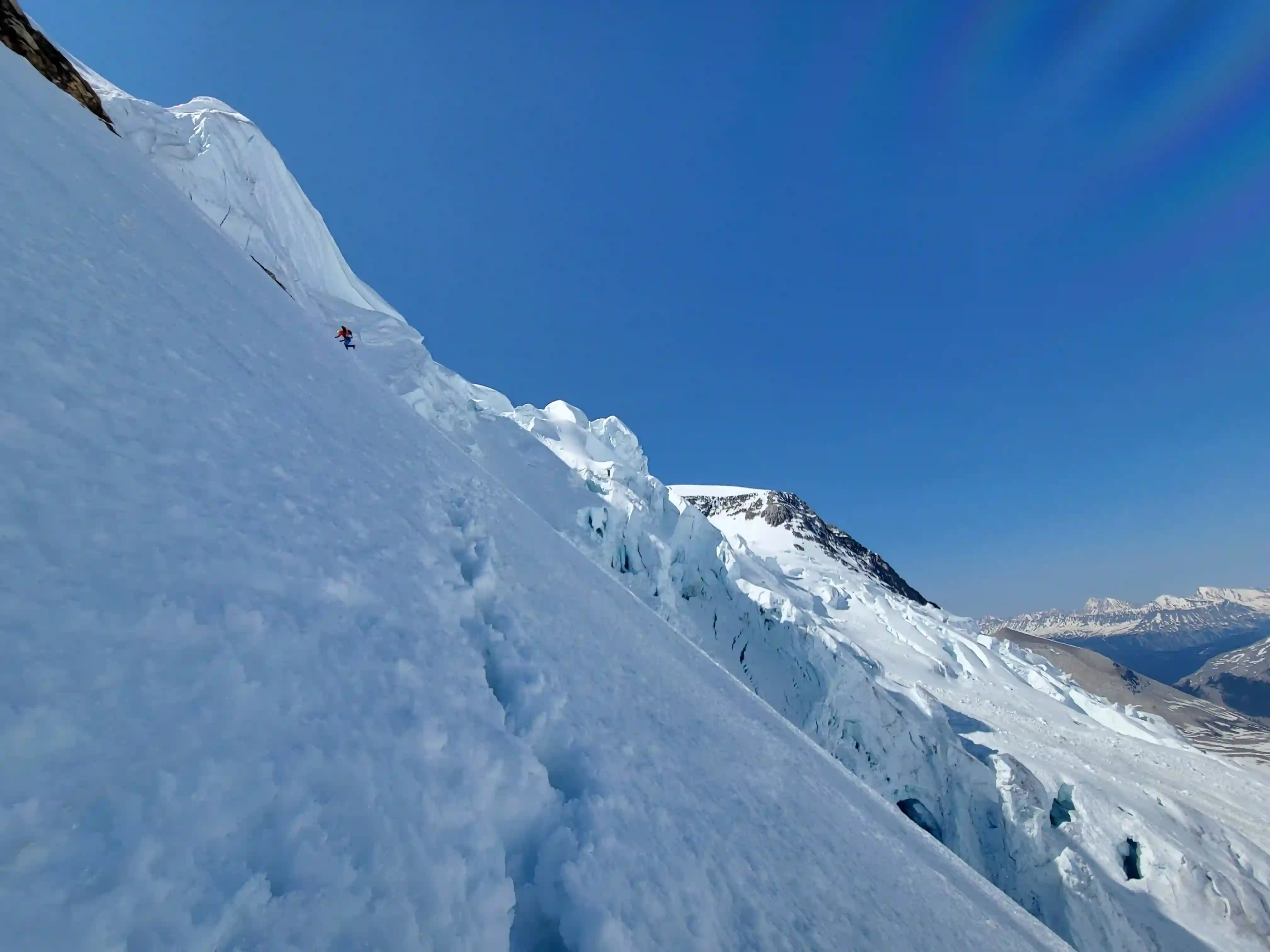
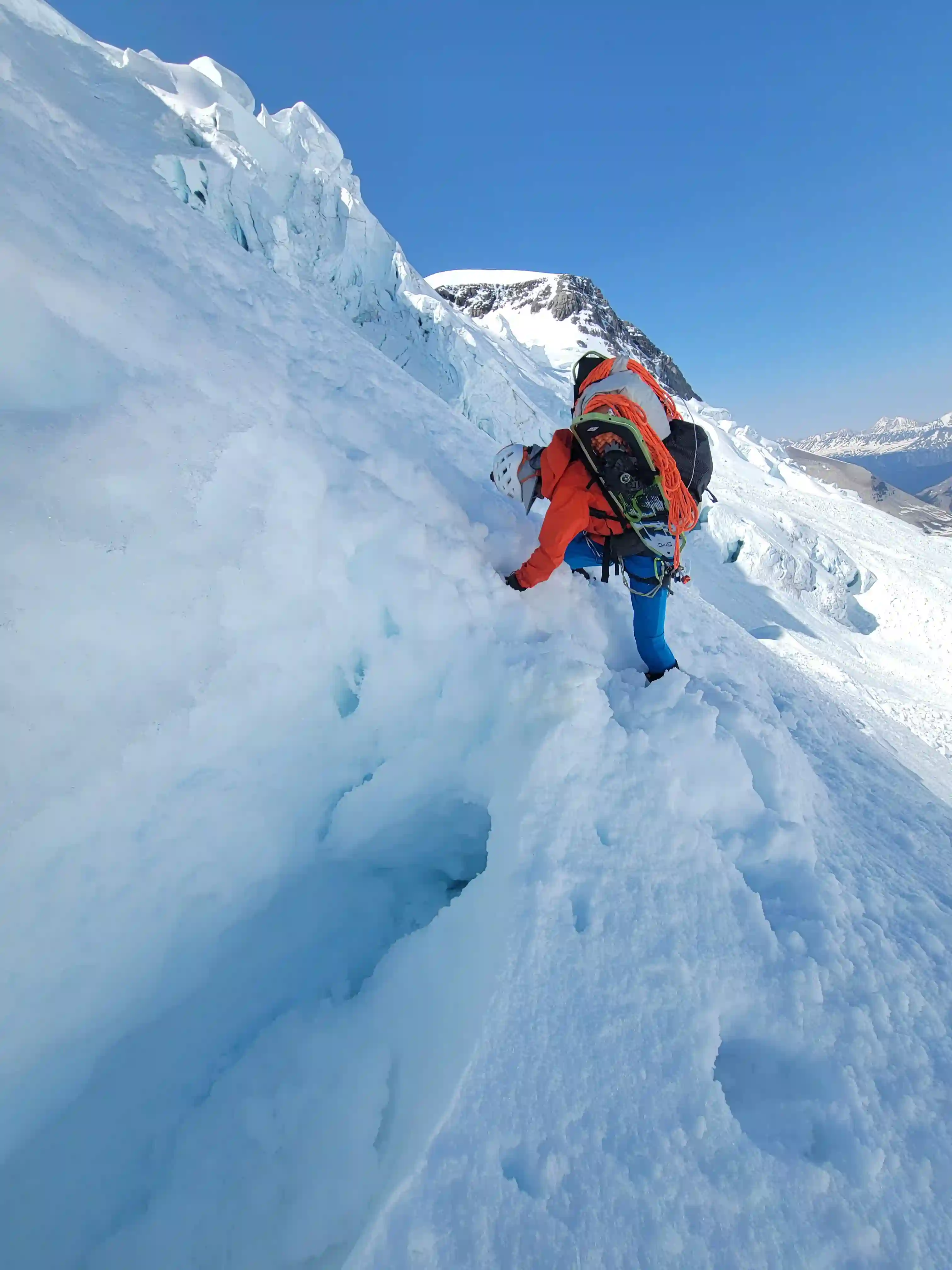
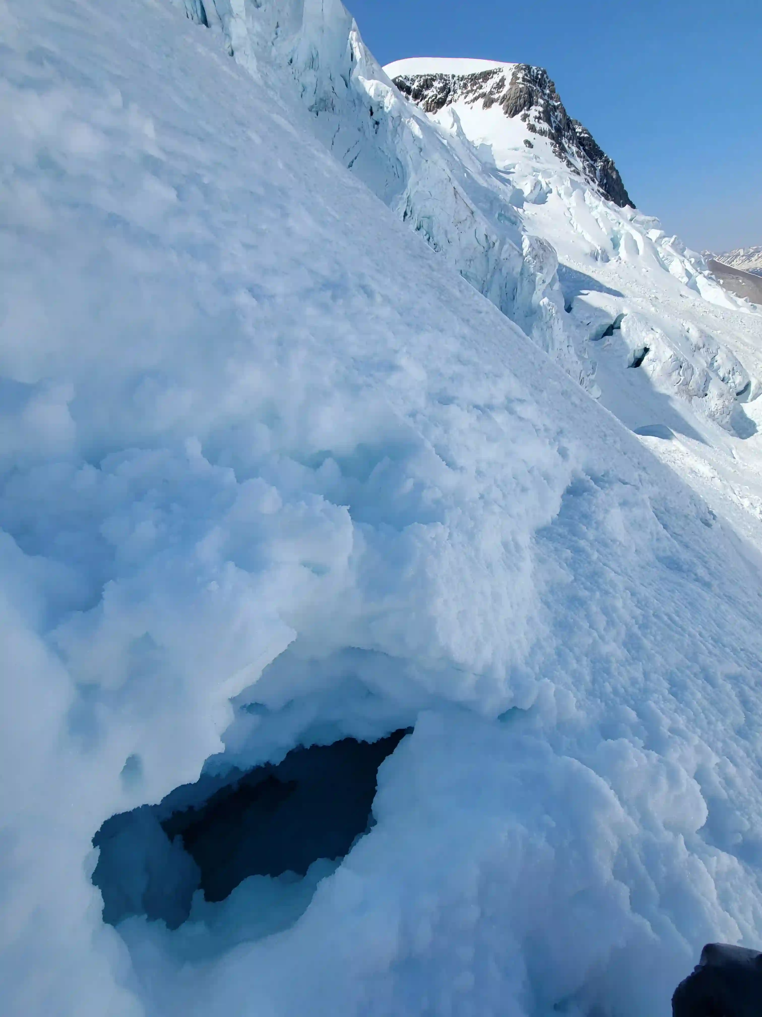
After getting to sleep around 7pm we were back up at midnight and packing up camp to head up the Patteron Couloir in the dead of night. We hadn't heard much debris falling down above us as we rested so this inspired confidence but we weren't taking any chances and heading up in the middle of the night was the best call to avoid the worst of the debris we might encounter. The couloir was very long, the grade didn't feel too severe, likely around 40-42 degrees but it was continuous and felt unending as we slowly worked our way up for 4 hours. Conditions were a bit variable and at times we were punching through more than we would've liked but avalanche runnels provided firm snow that we were able to easily ascend, although this is also where the debris was funneled.
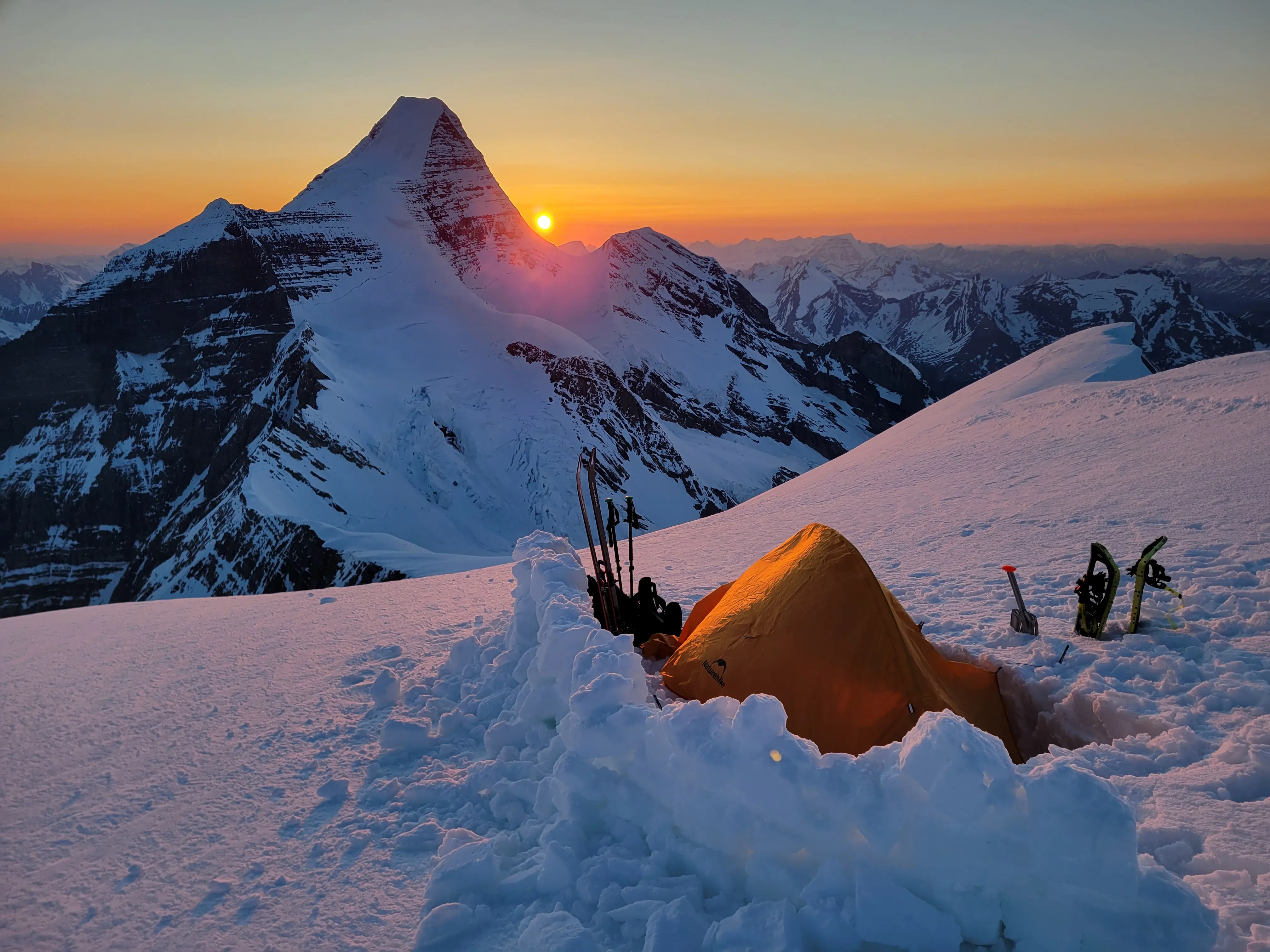
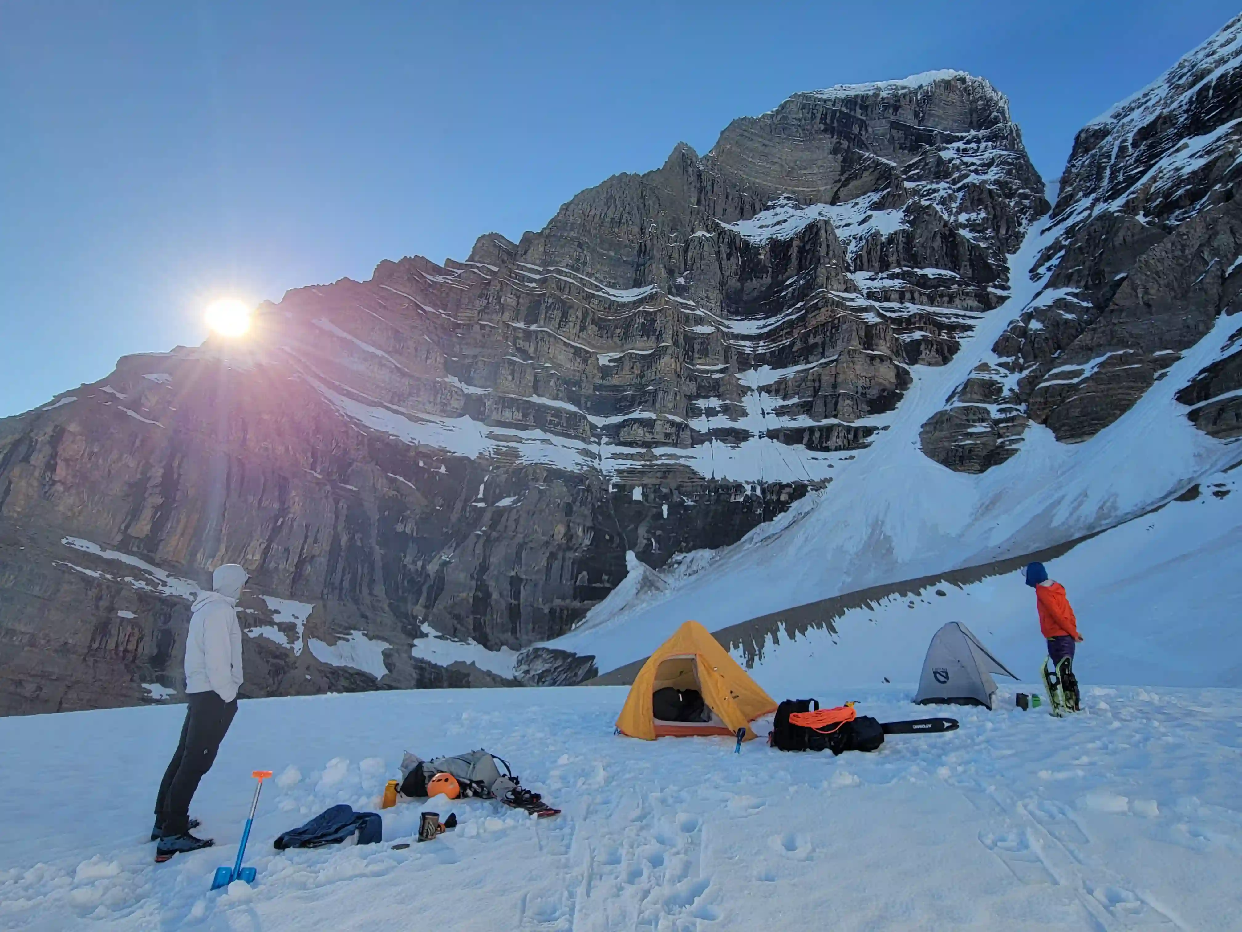
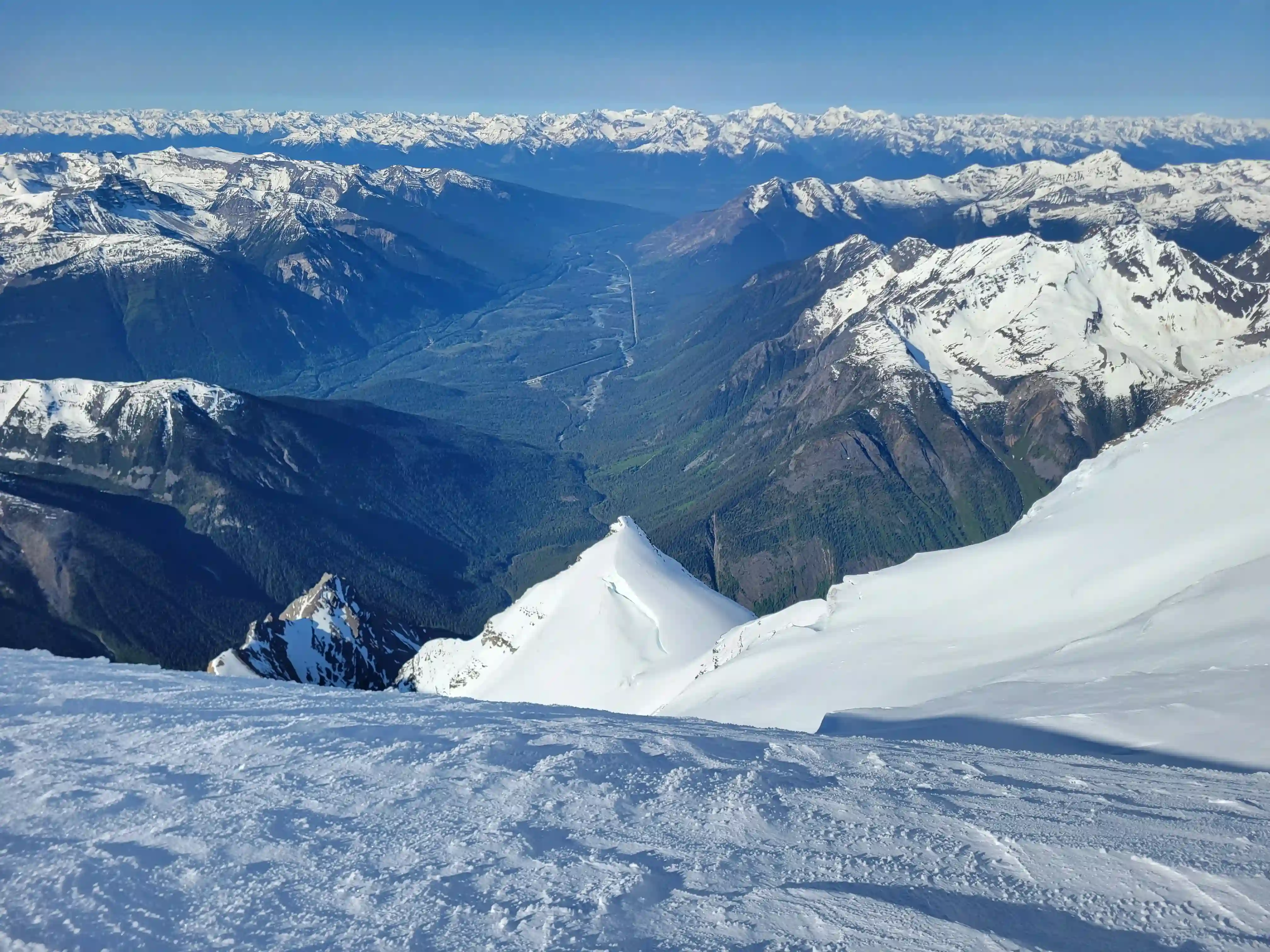
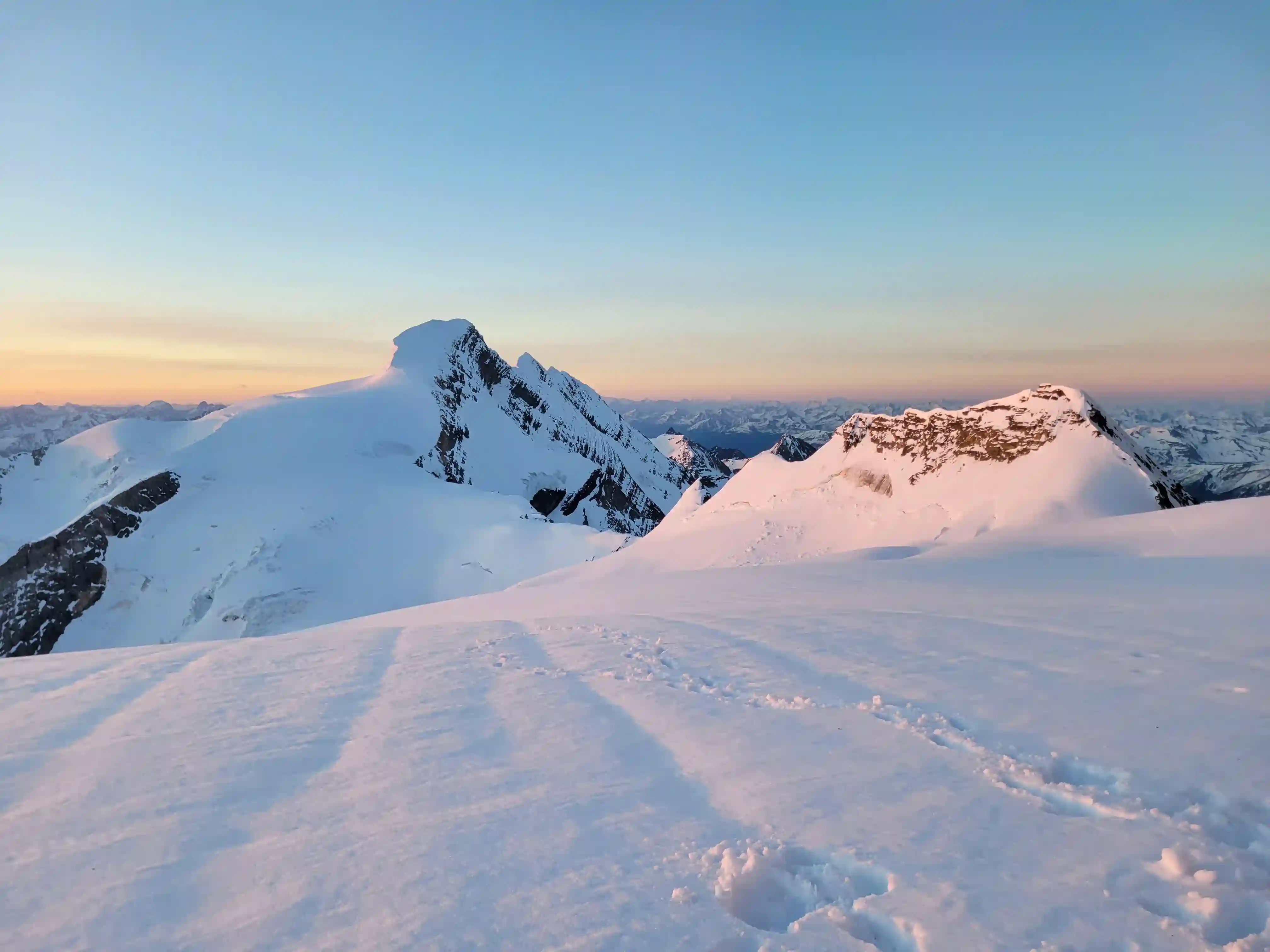
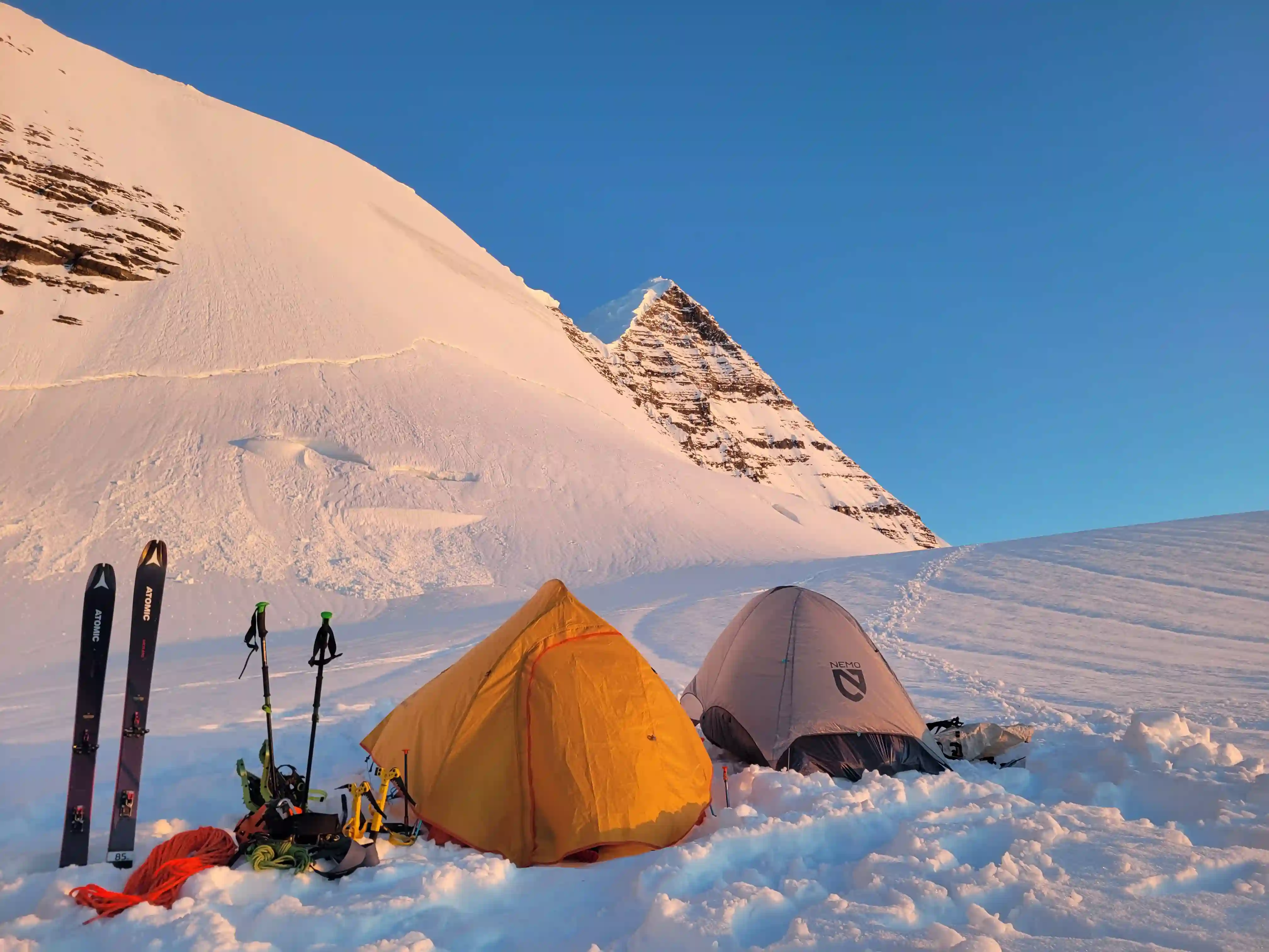
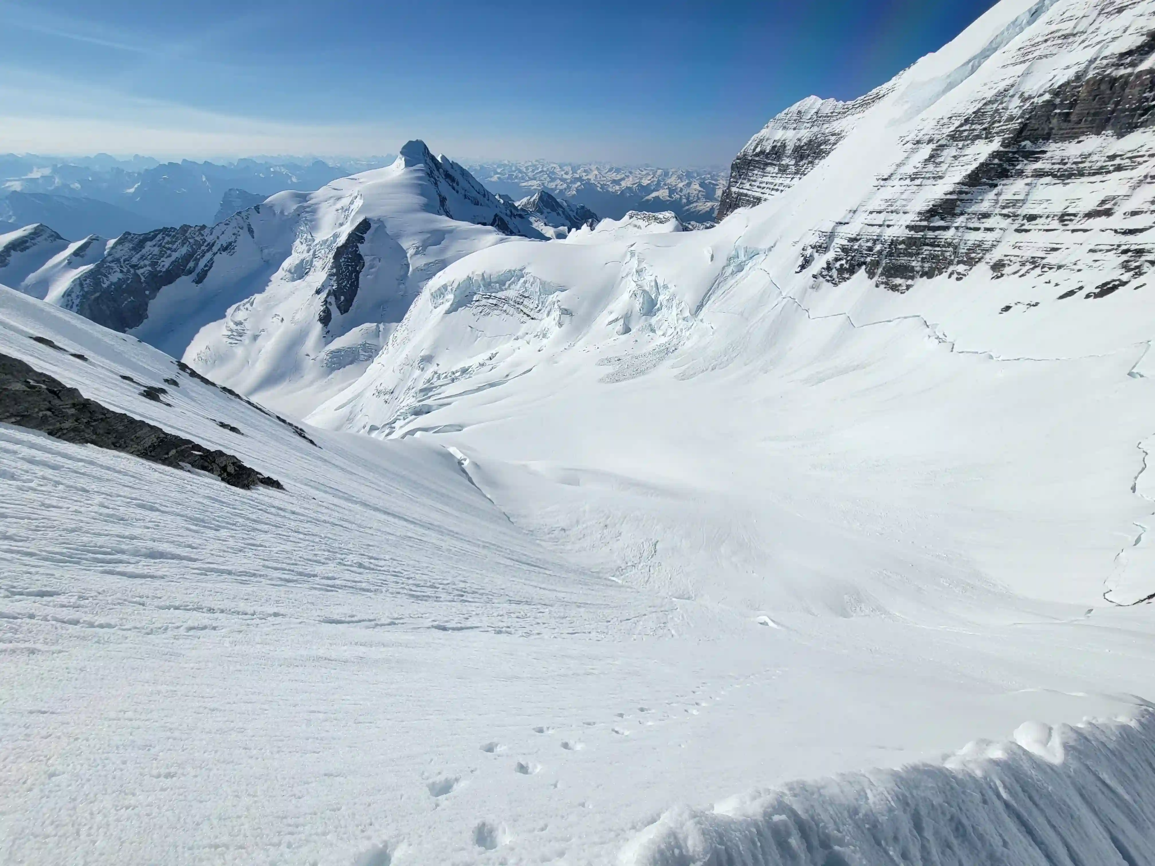
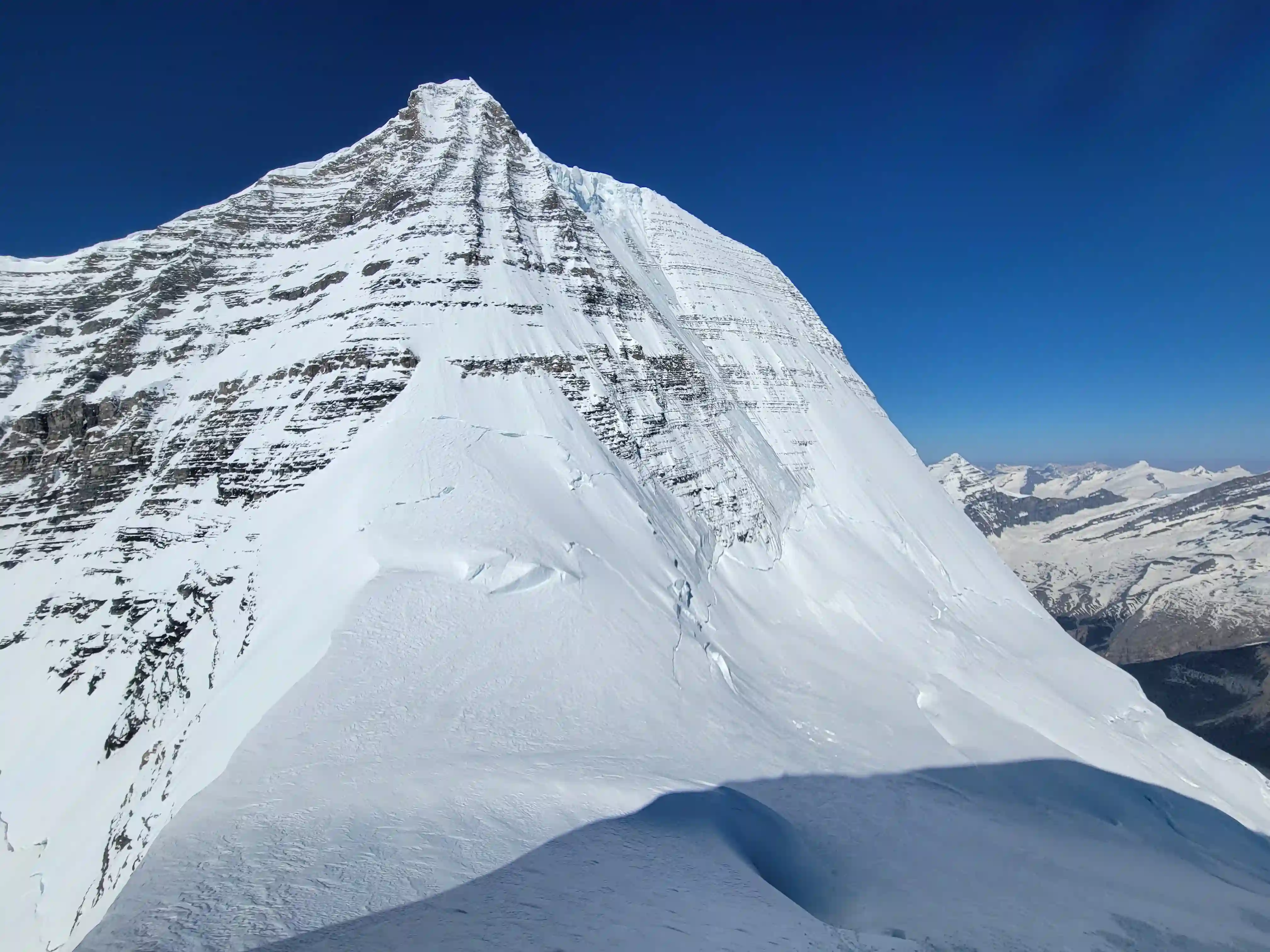
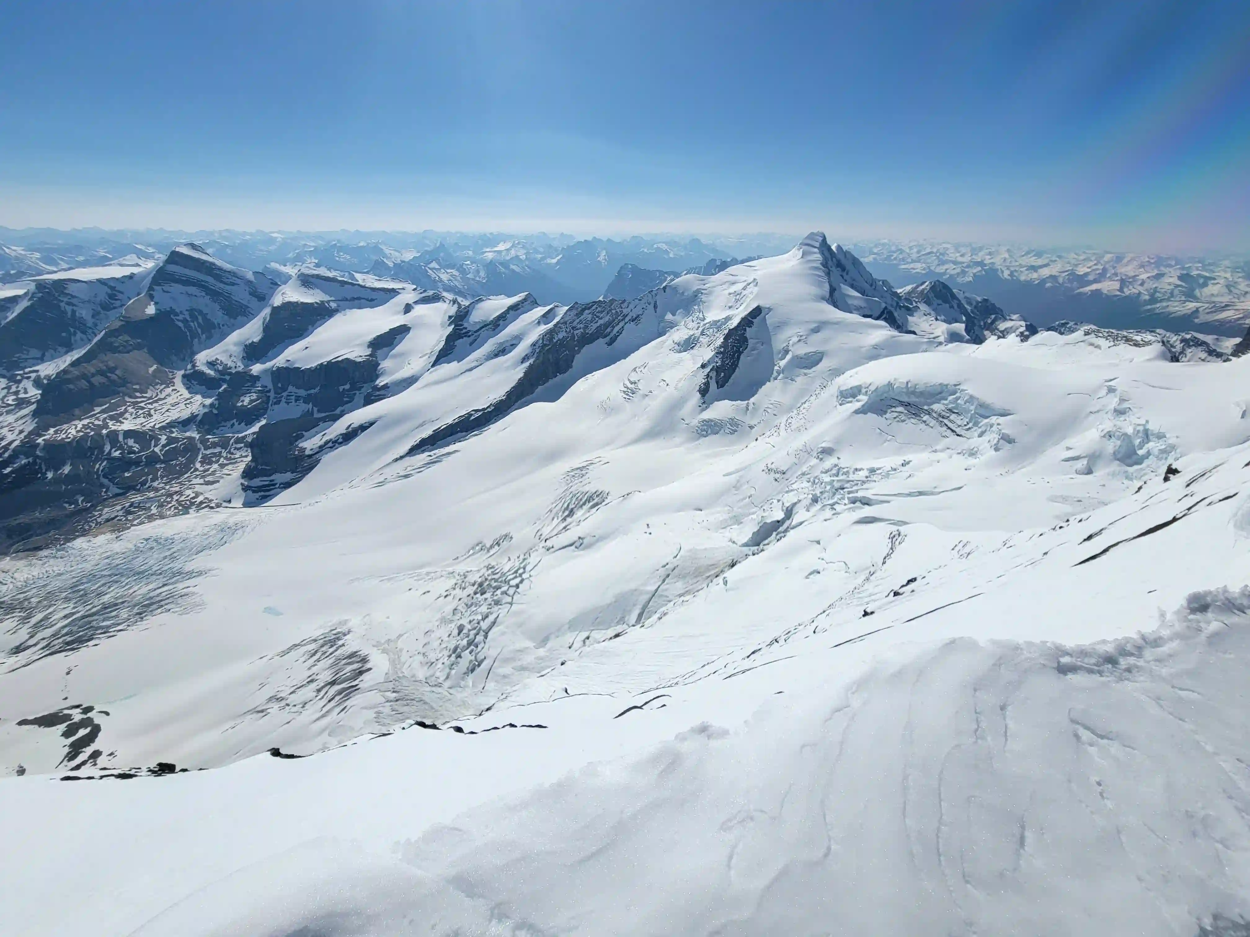
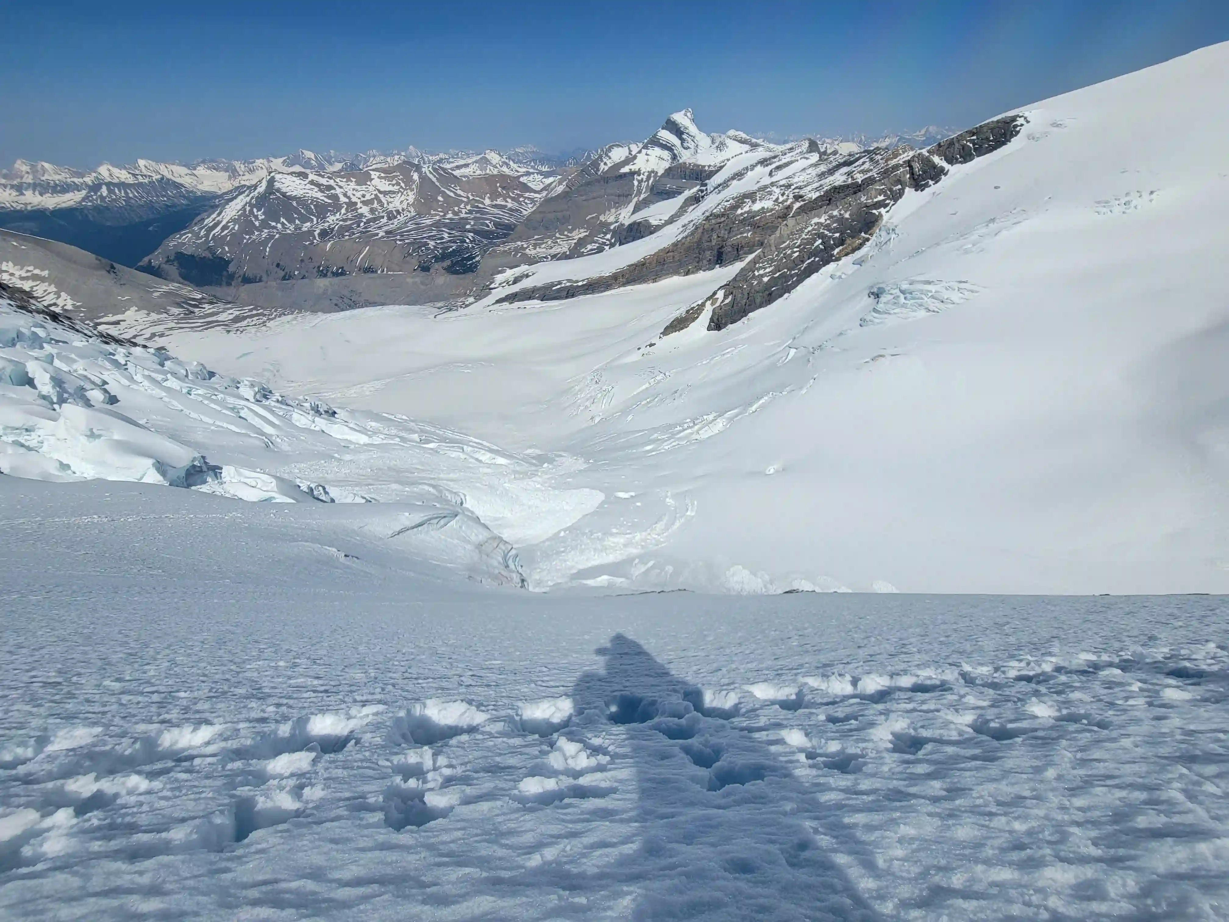
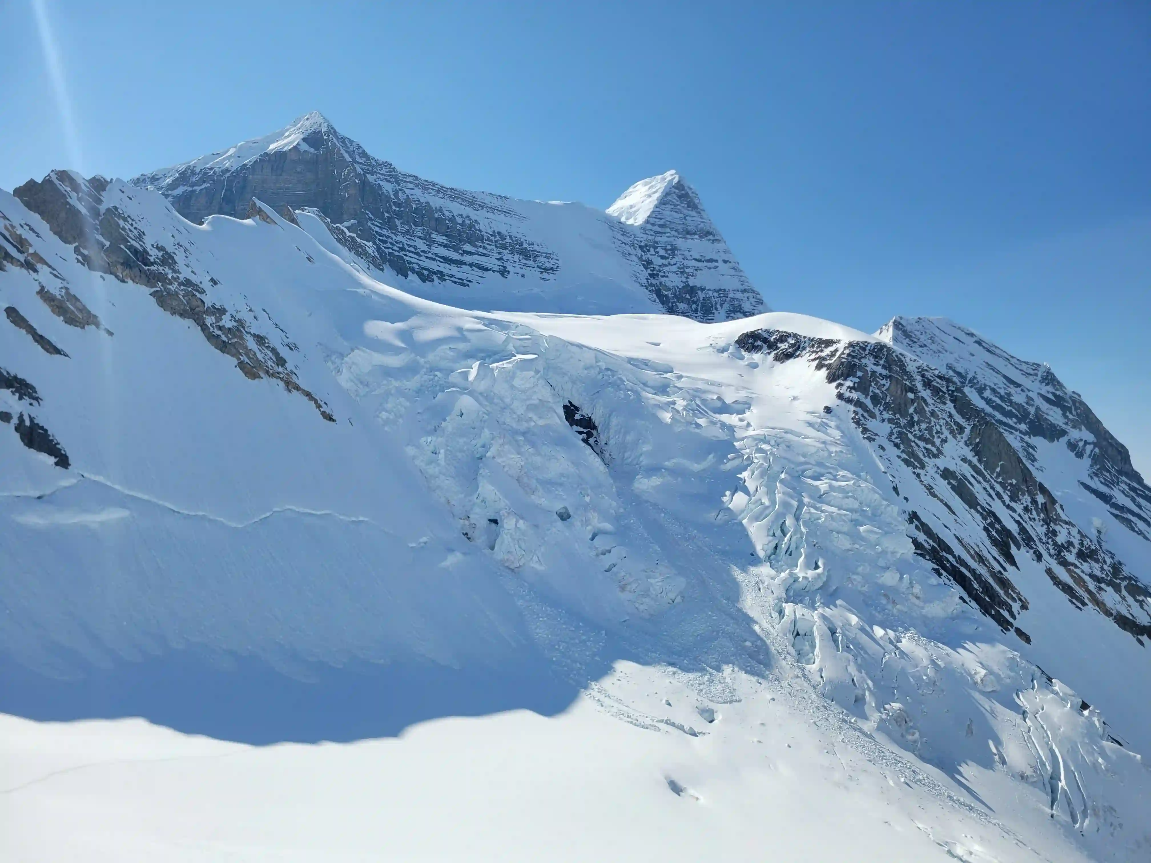
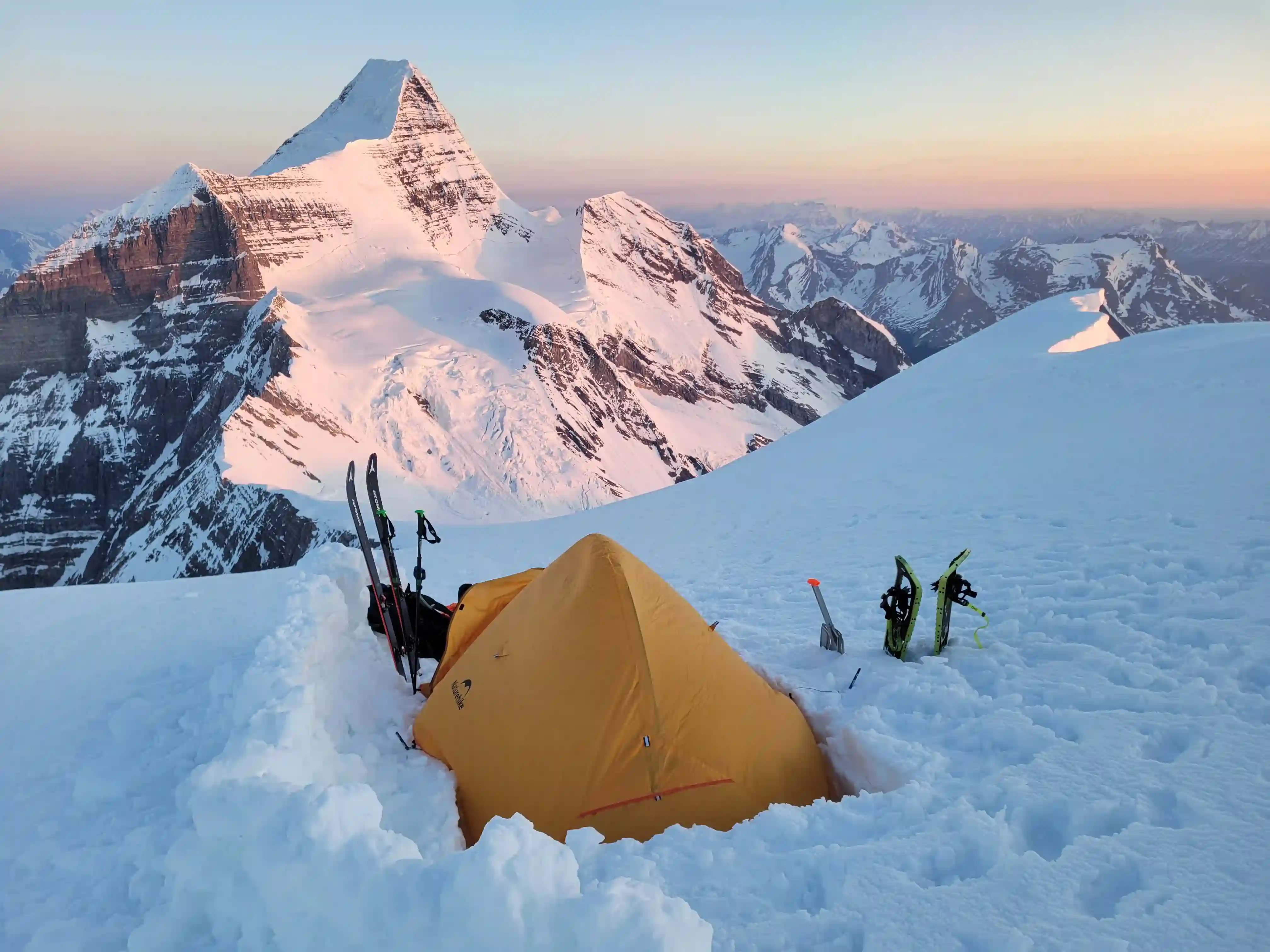
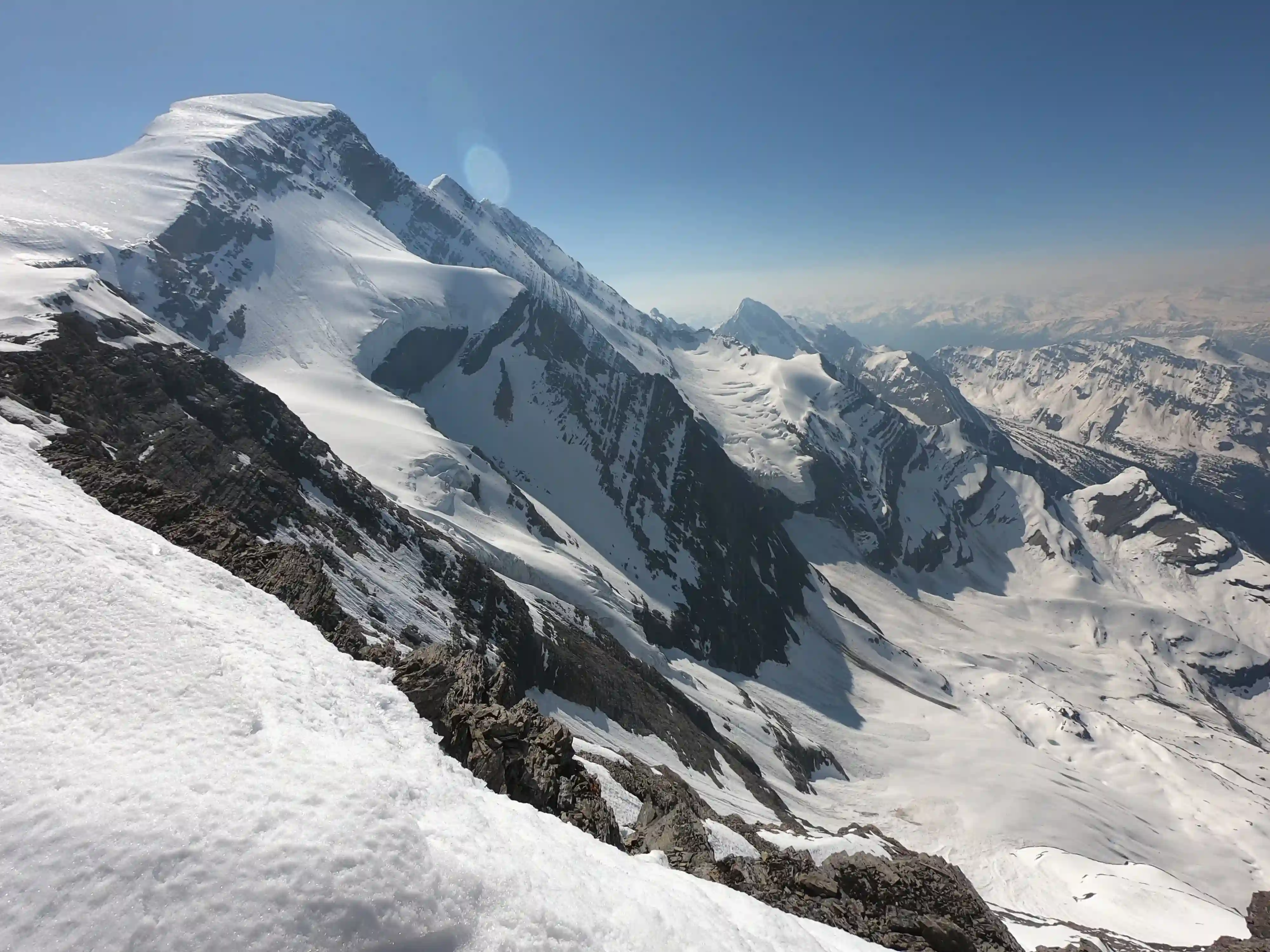
We didn't have any close calls on the way up but all of us got hit by snow / ice chunks multiple times on our way up so moving fast and keeping the head down was imperative. As we closed in on the more narrow choke point higher in the couloir the falling debris lessened and we knew we were in the home stretch. Finally topping out on the Dome Glacier and being rewarded with the views of Mount Robson, Resplendent Mountain, and the other nearby mountains in the morning light was a fitting reward for our monster effort and we were stoked to ditch most of the weight in our packs as we set up our high camp before heading for the main event.
in the avalanche runnels
had to watch out for
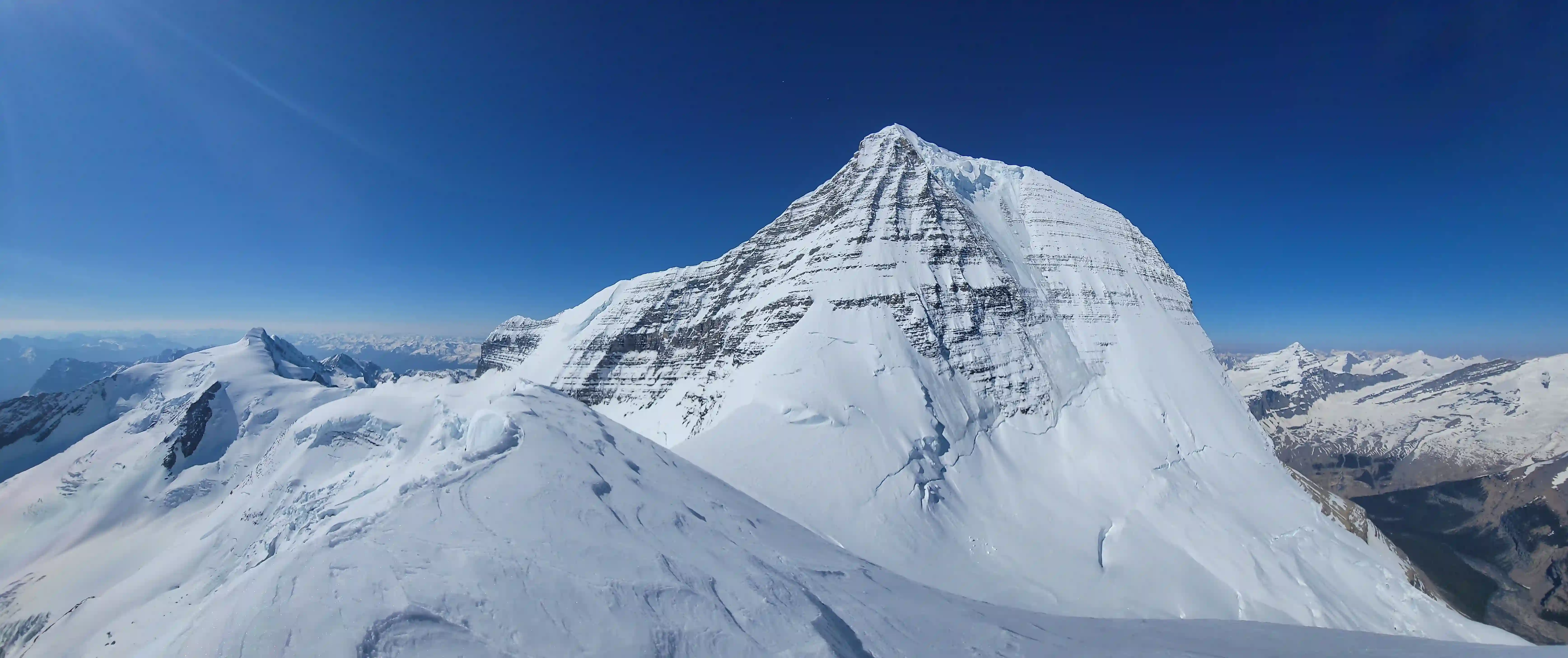
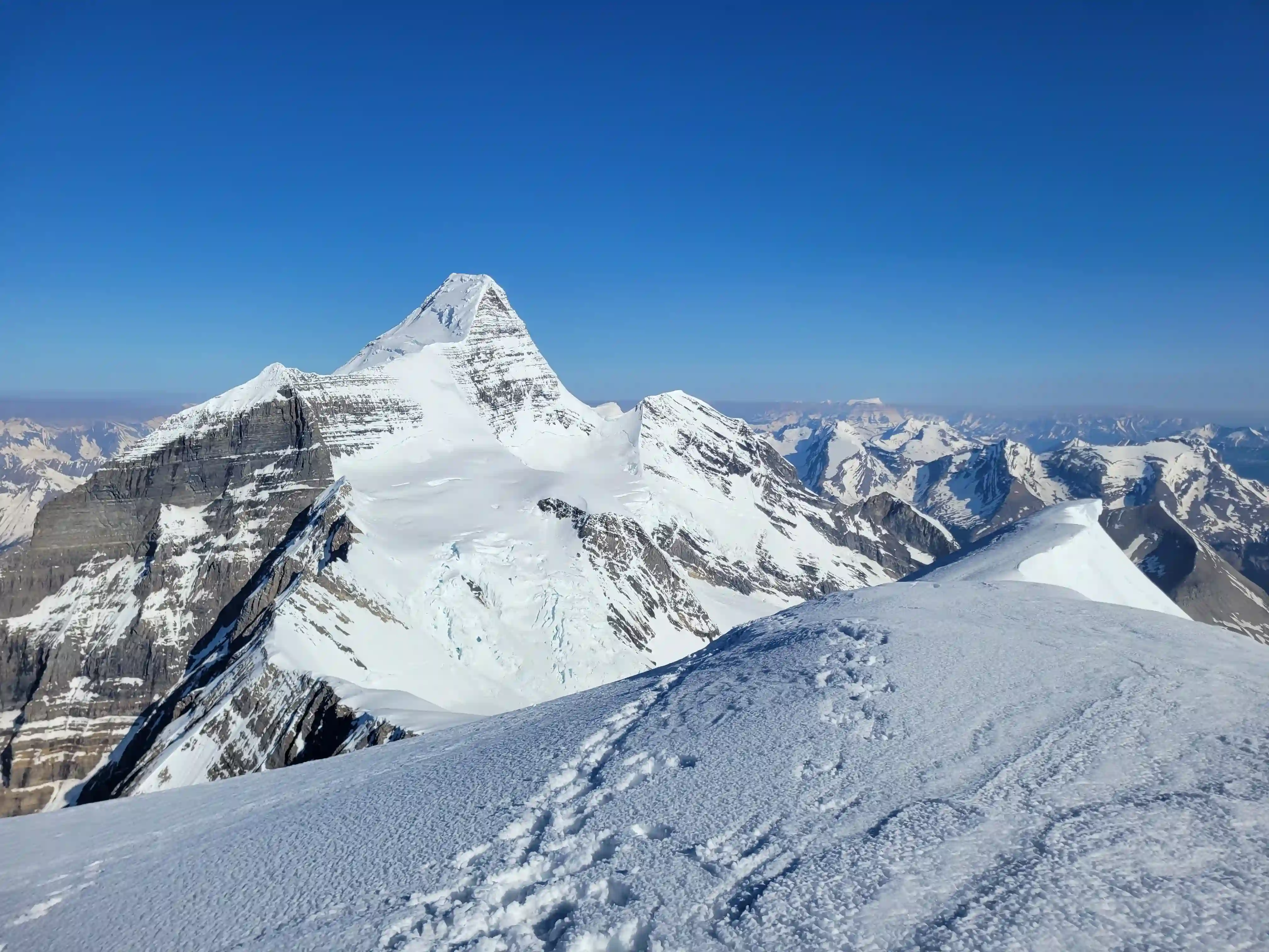
MOUNT ROBSON
3954m, 12972ft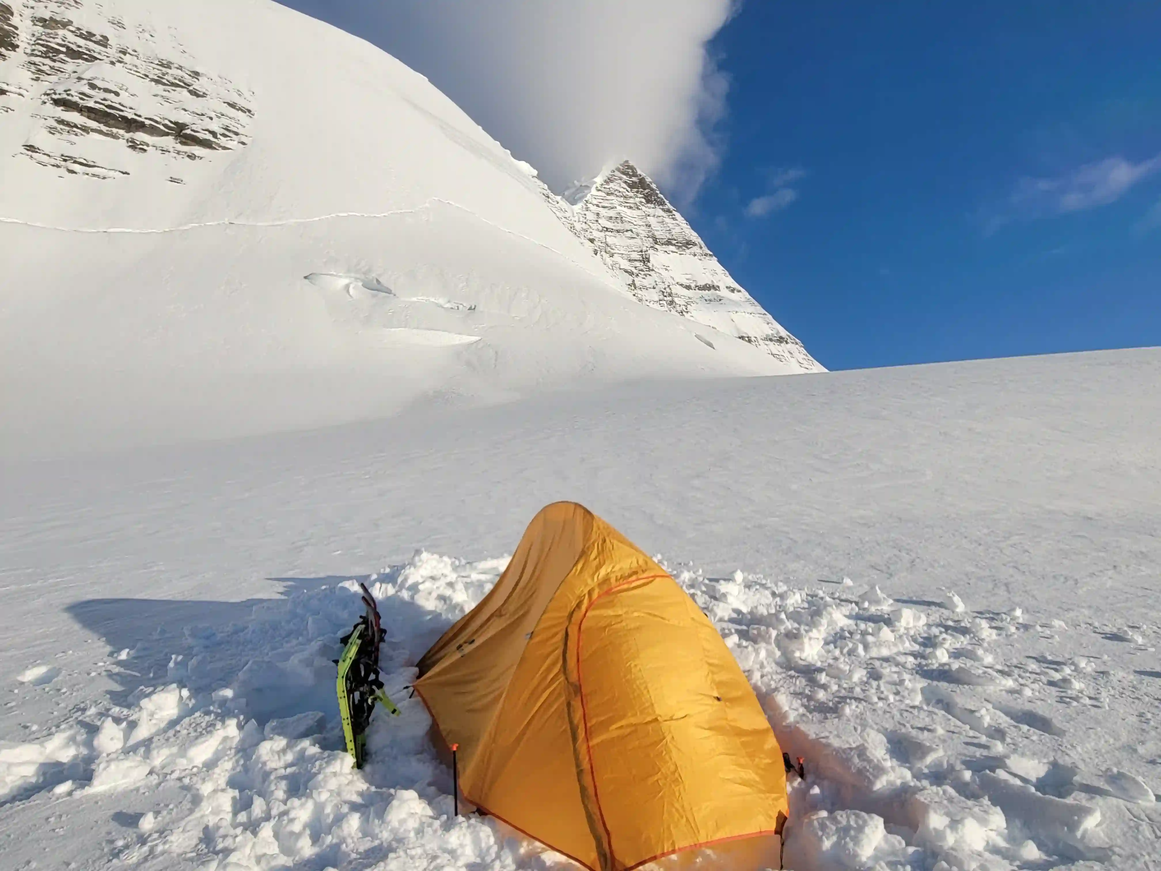
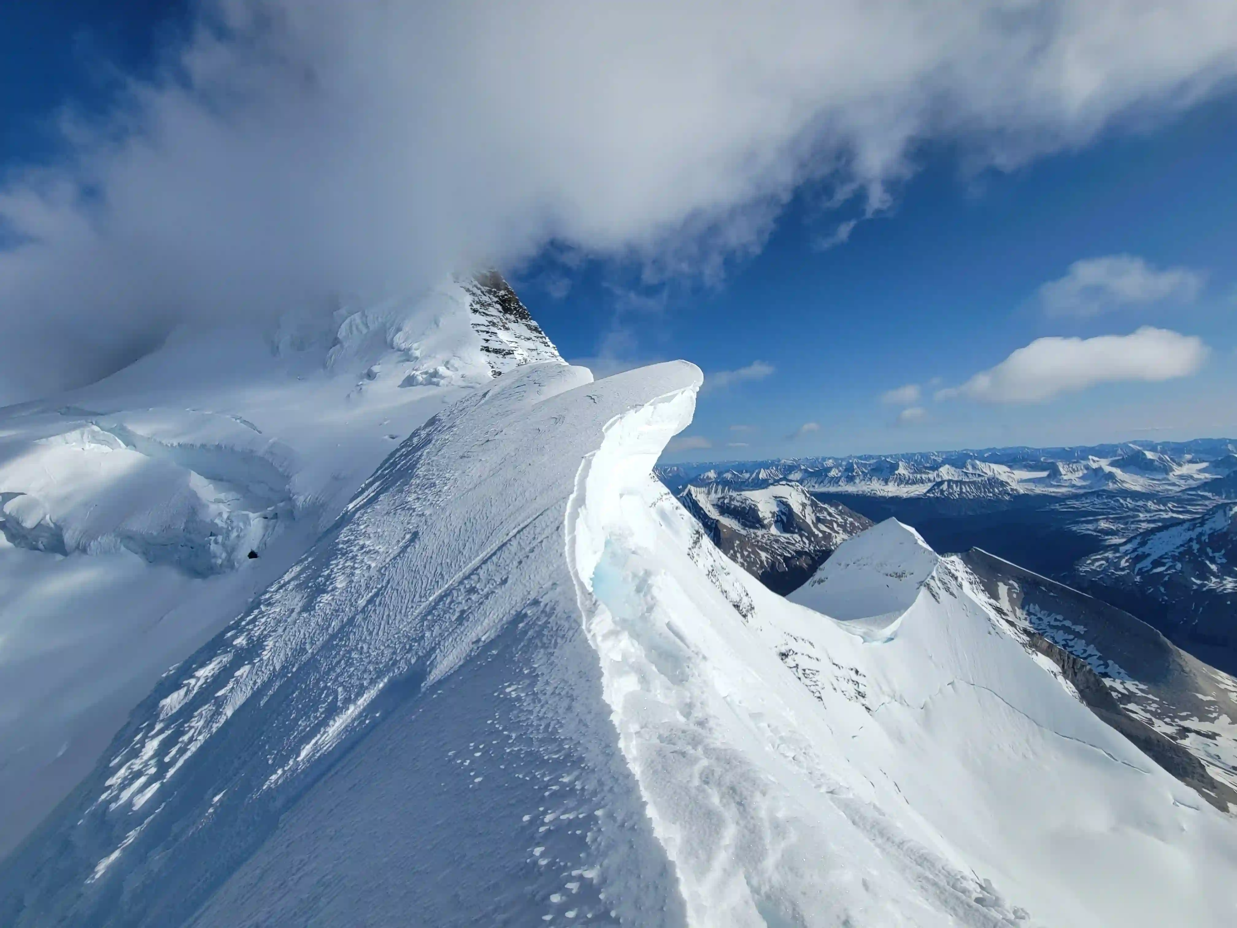
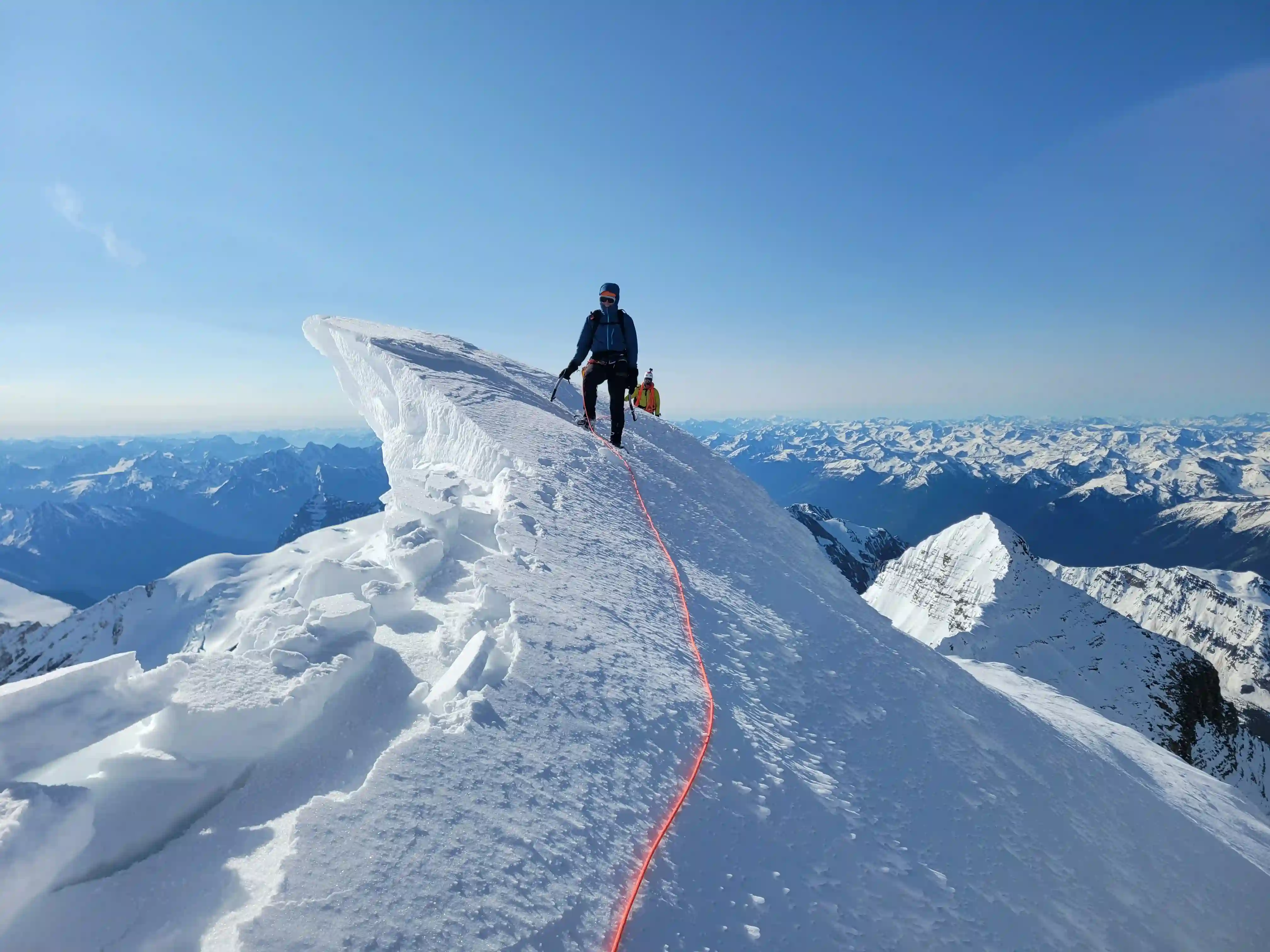
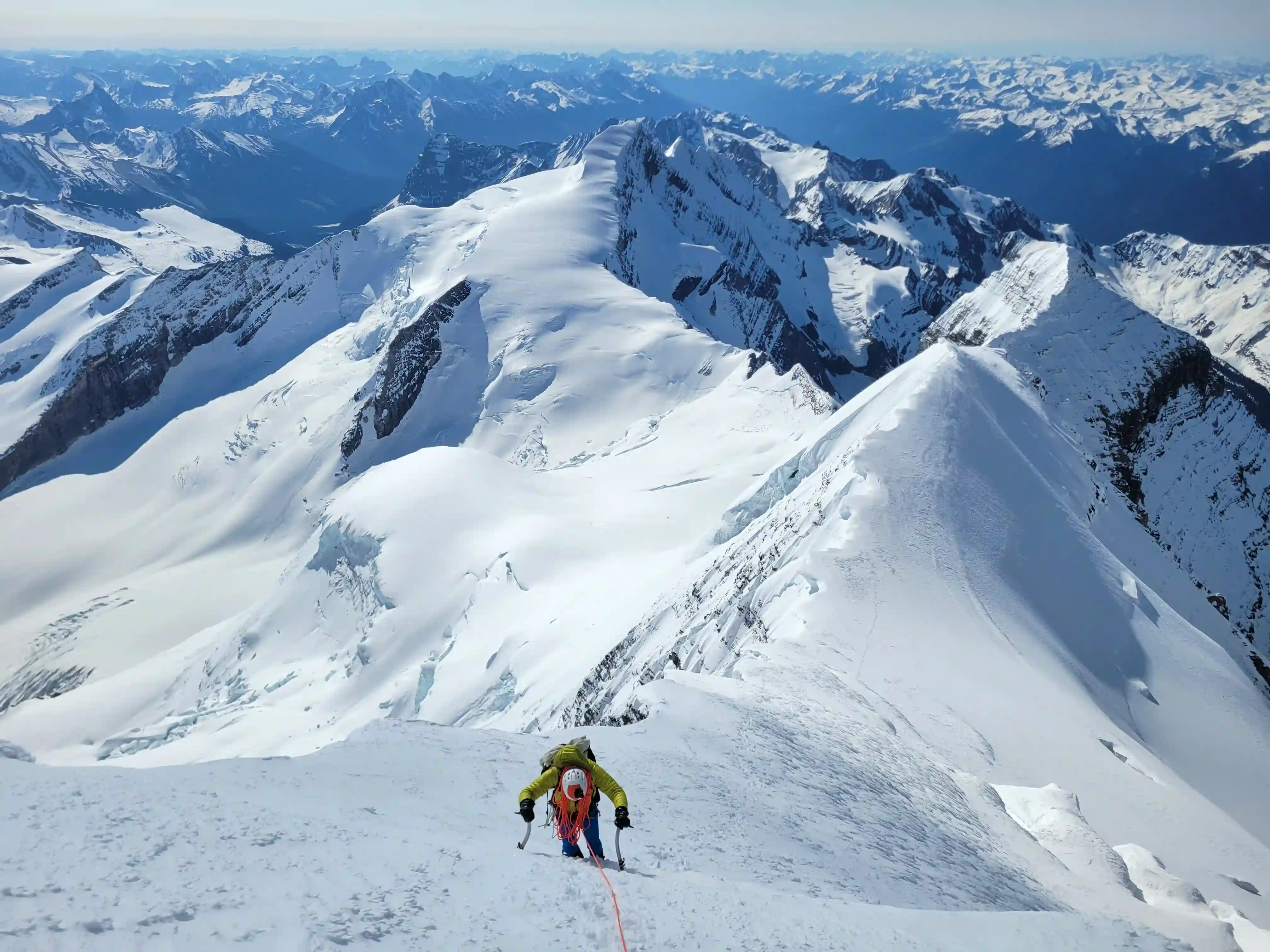
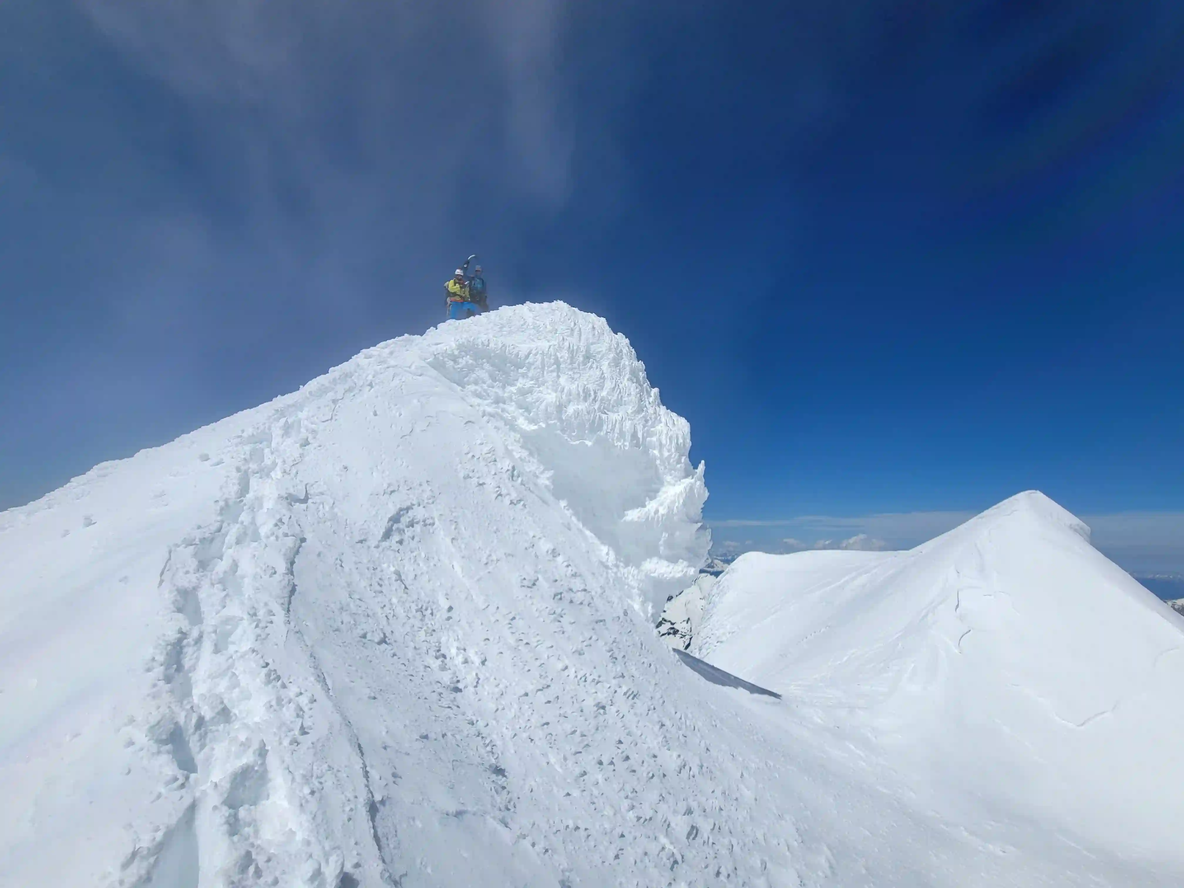
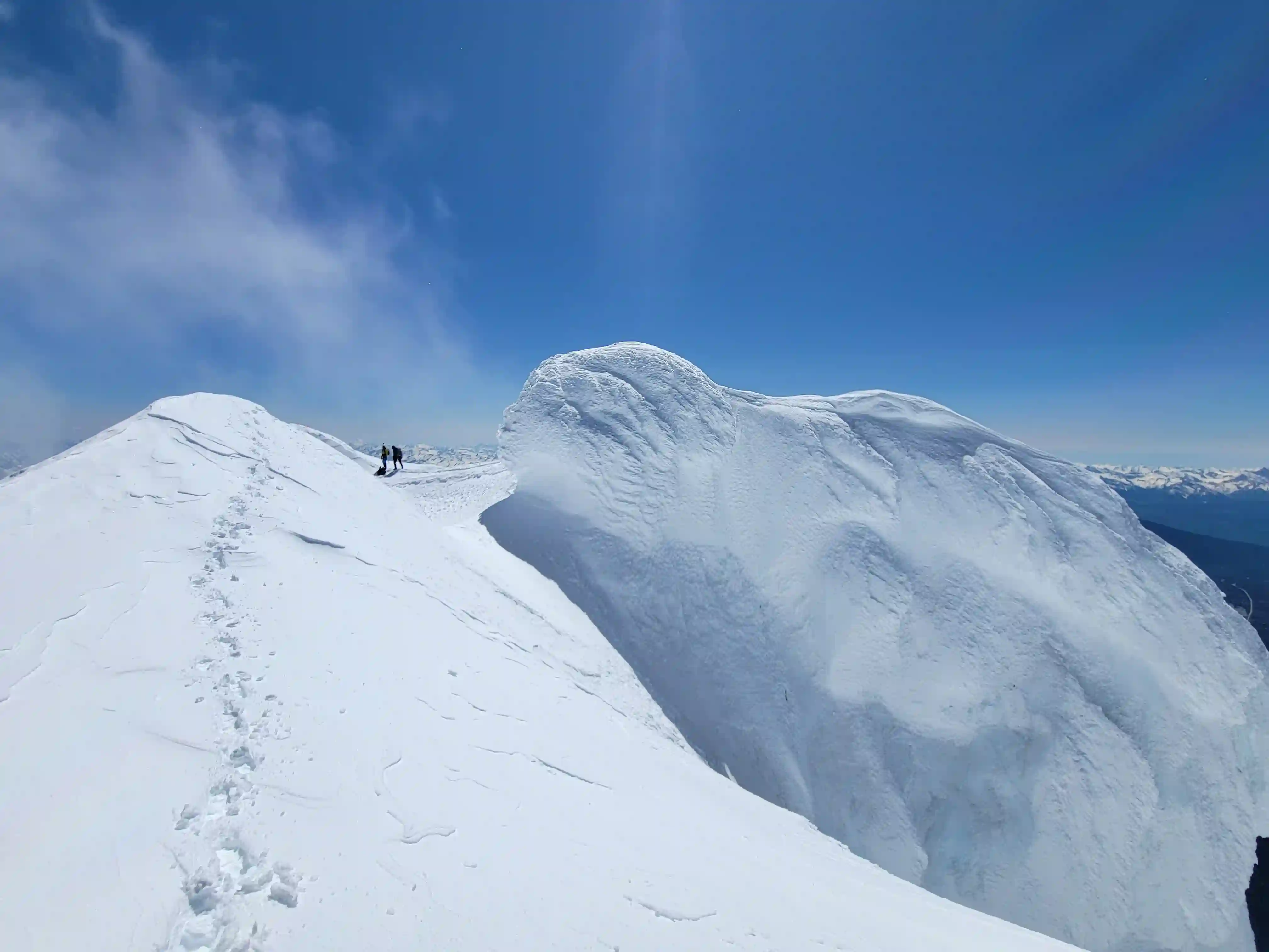
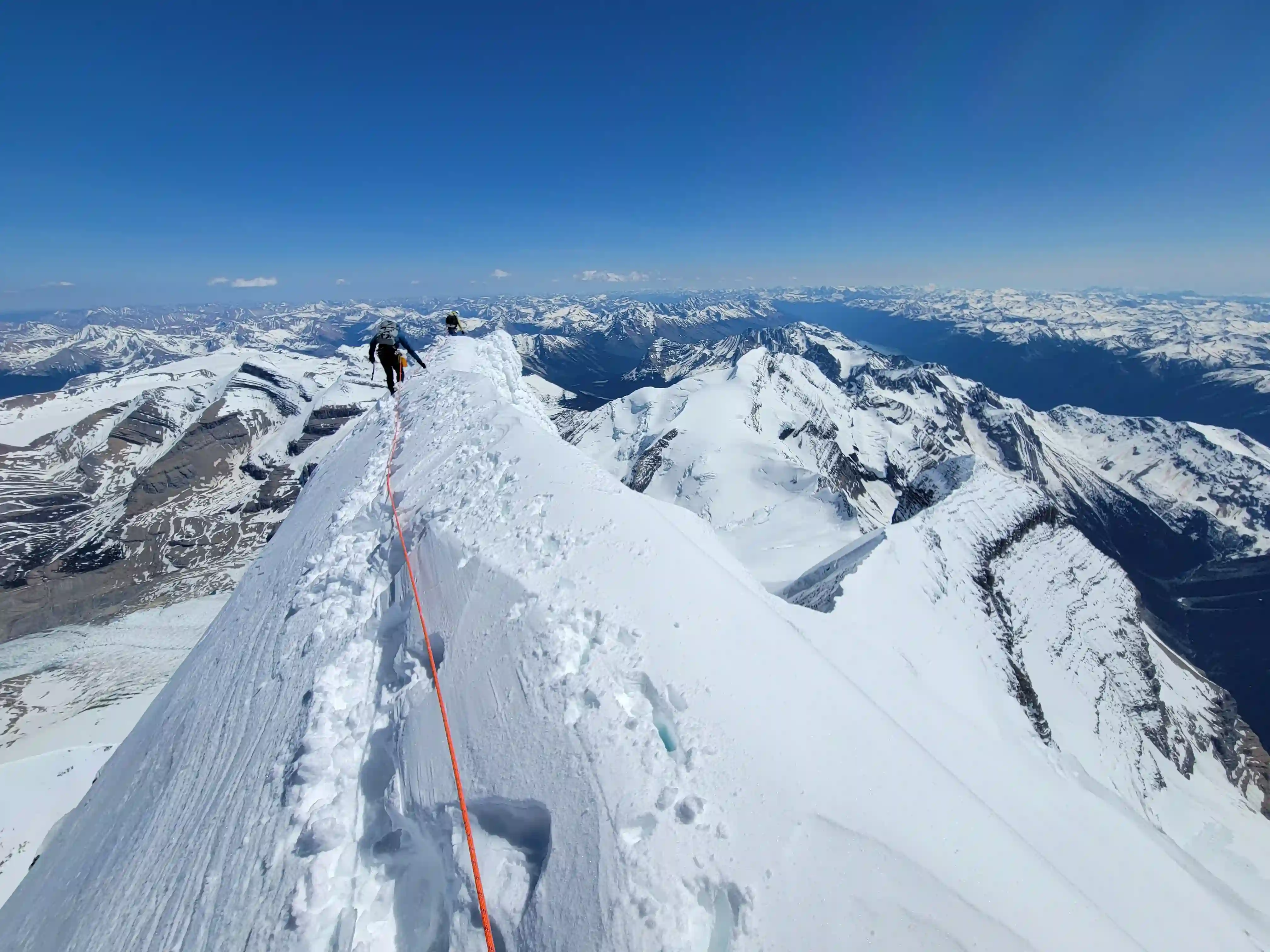
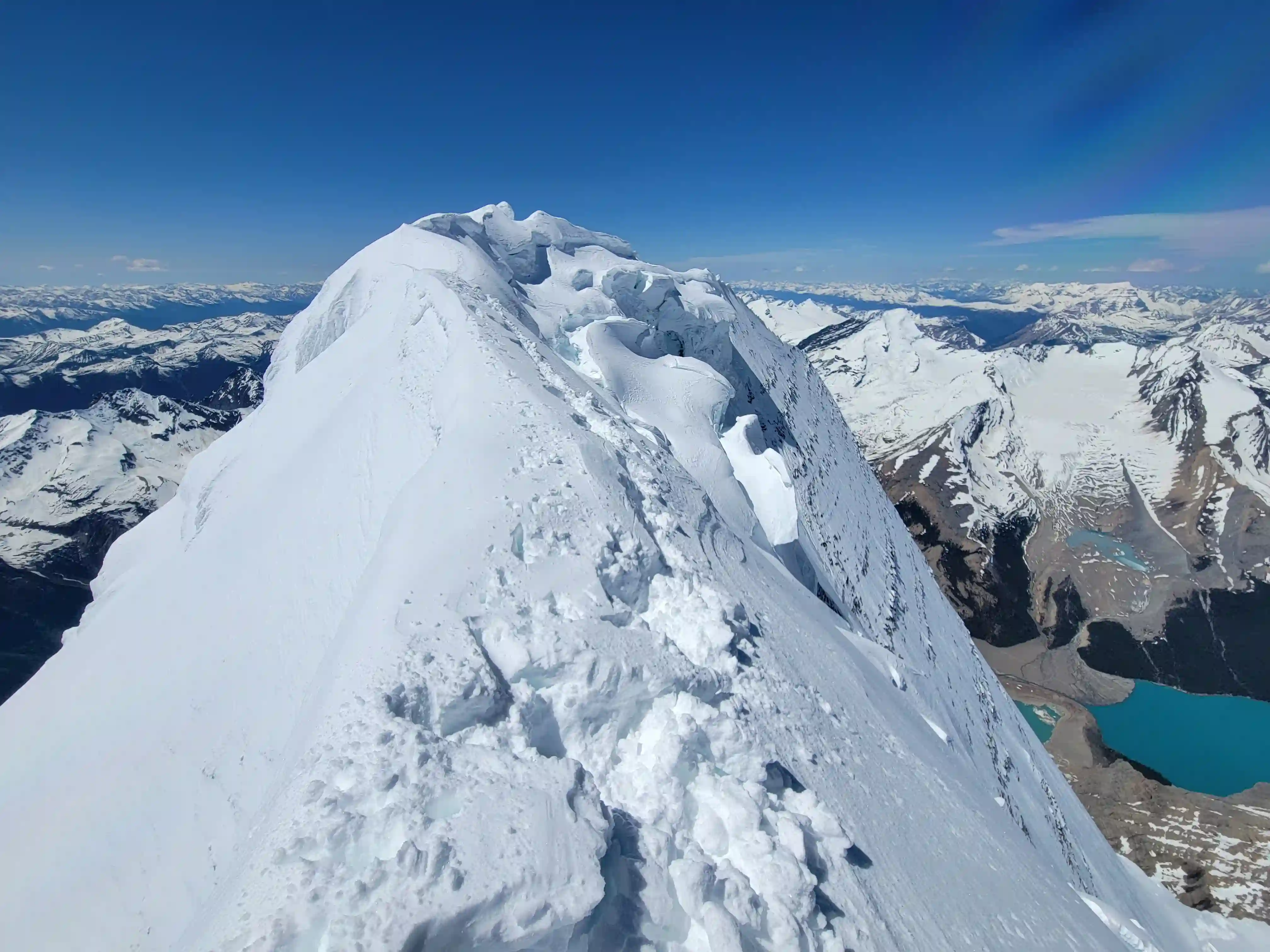
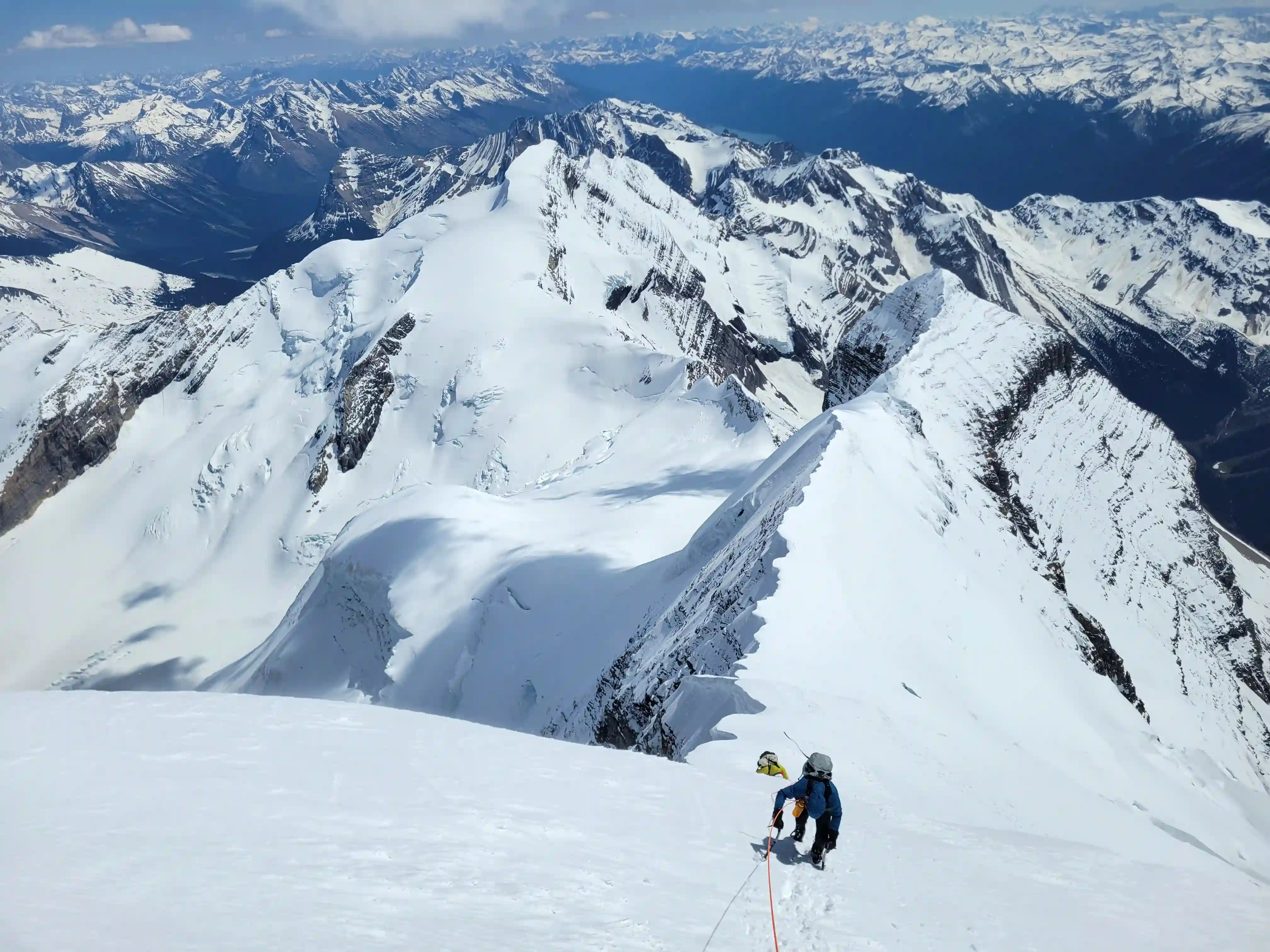
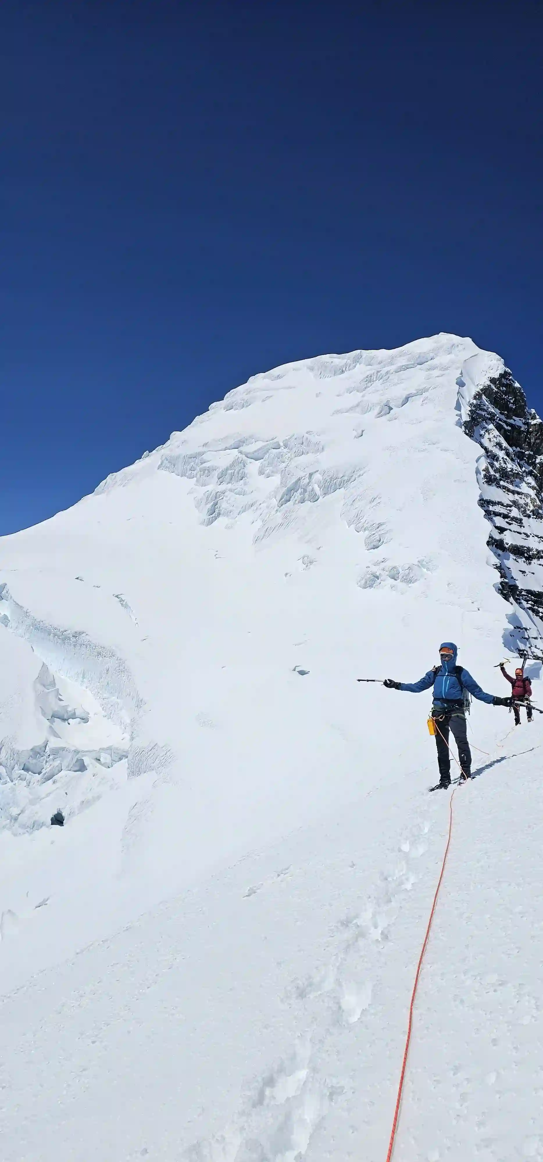
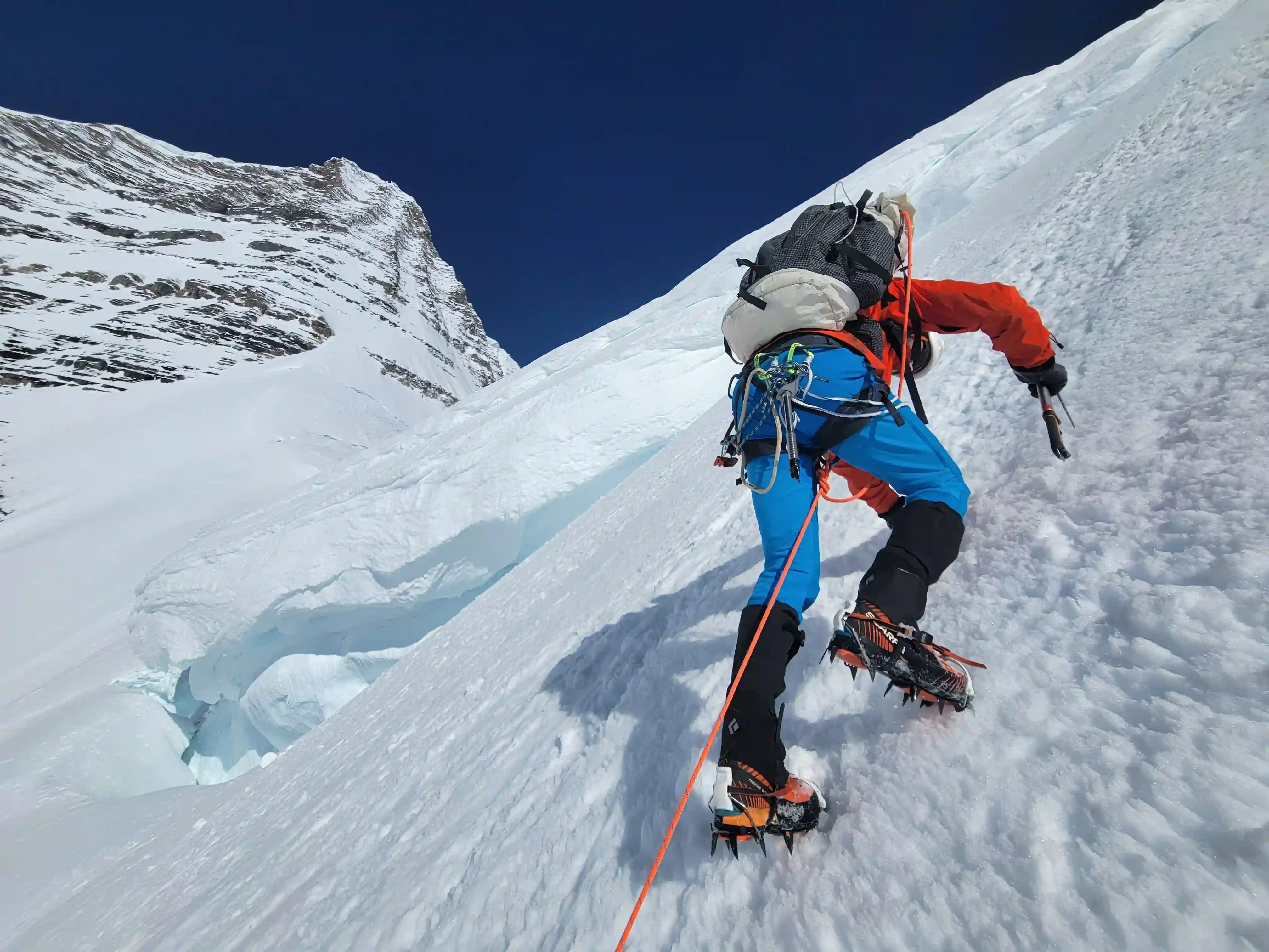
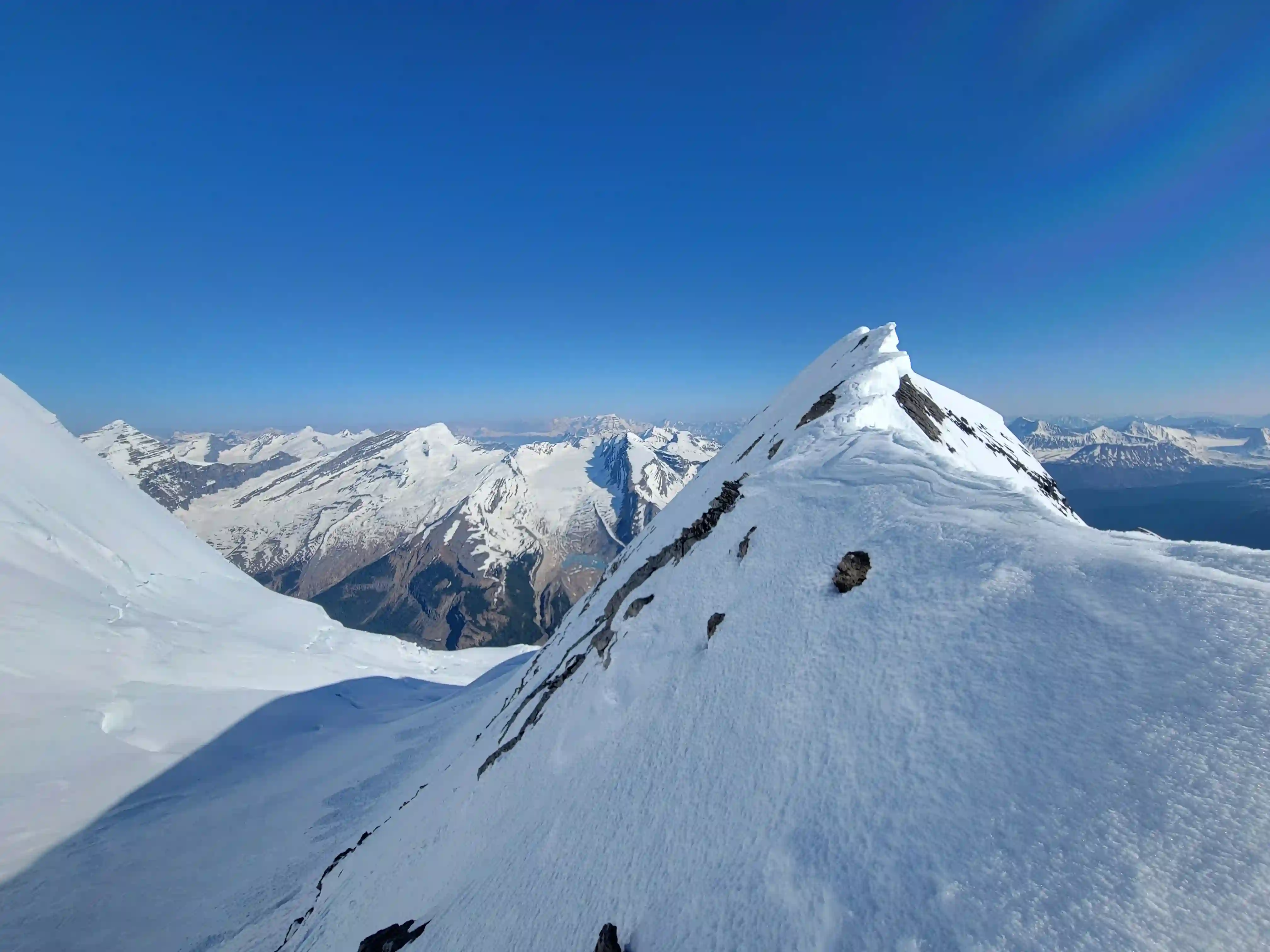
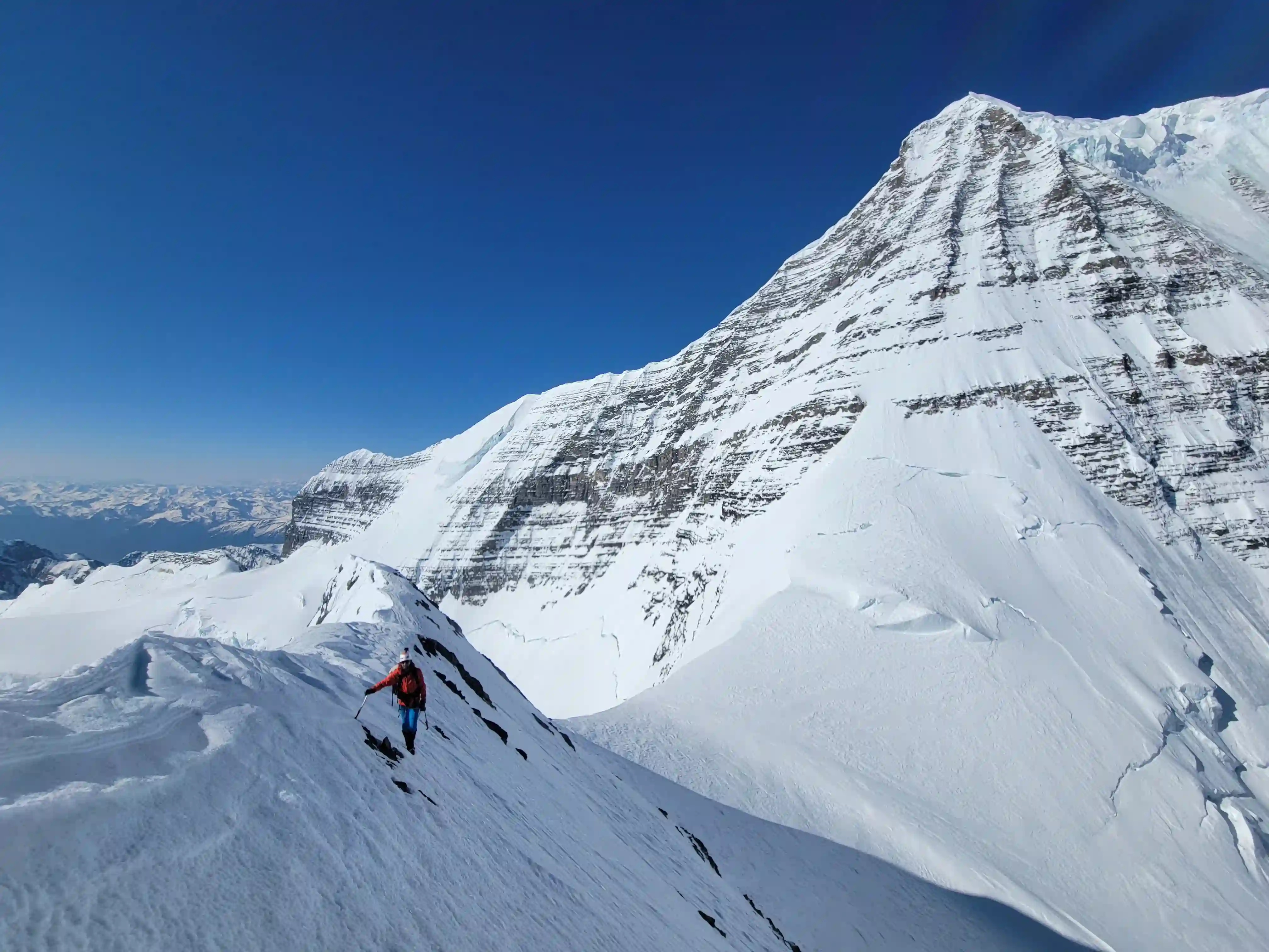
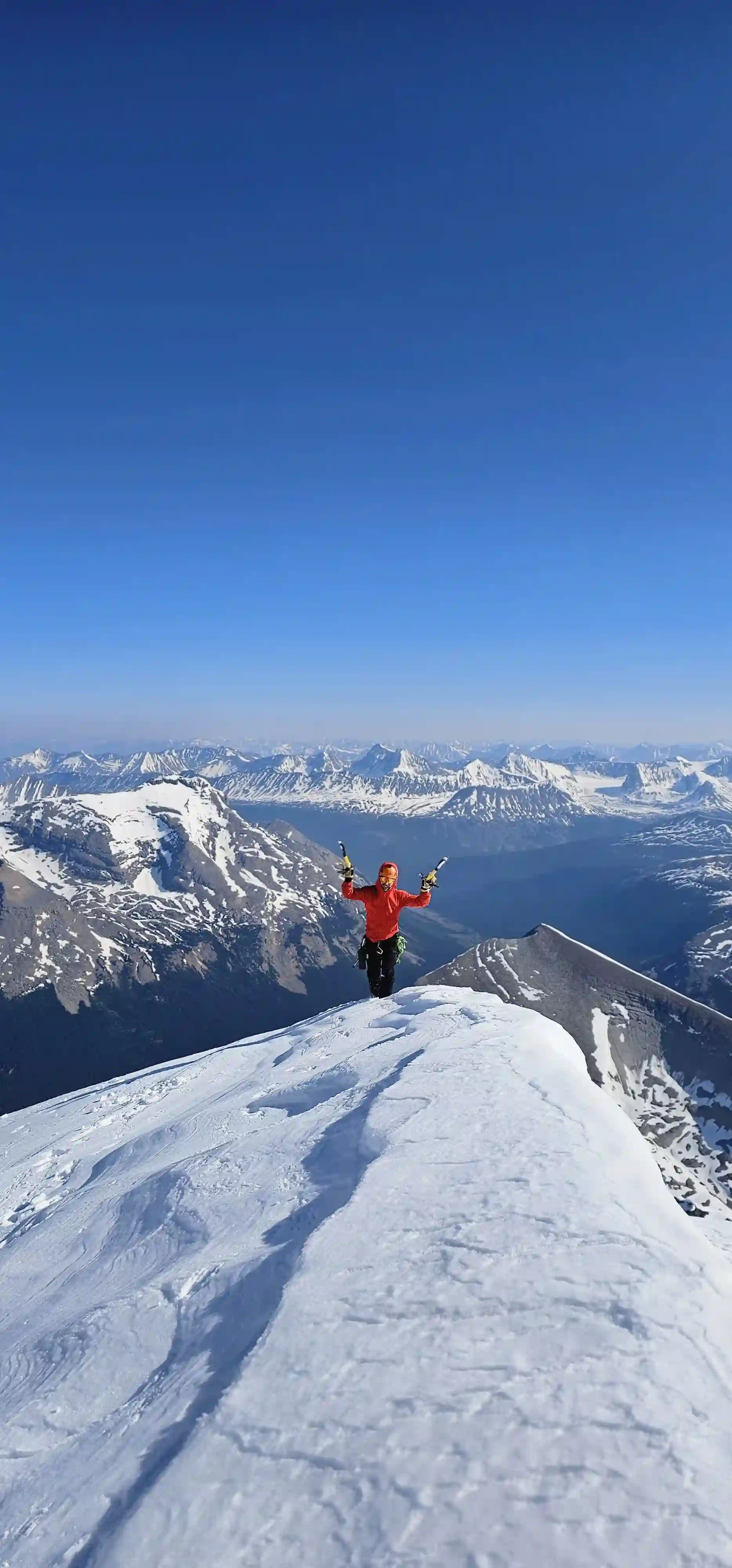
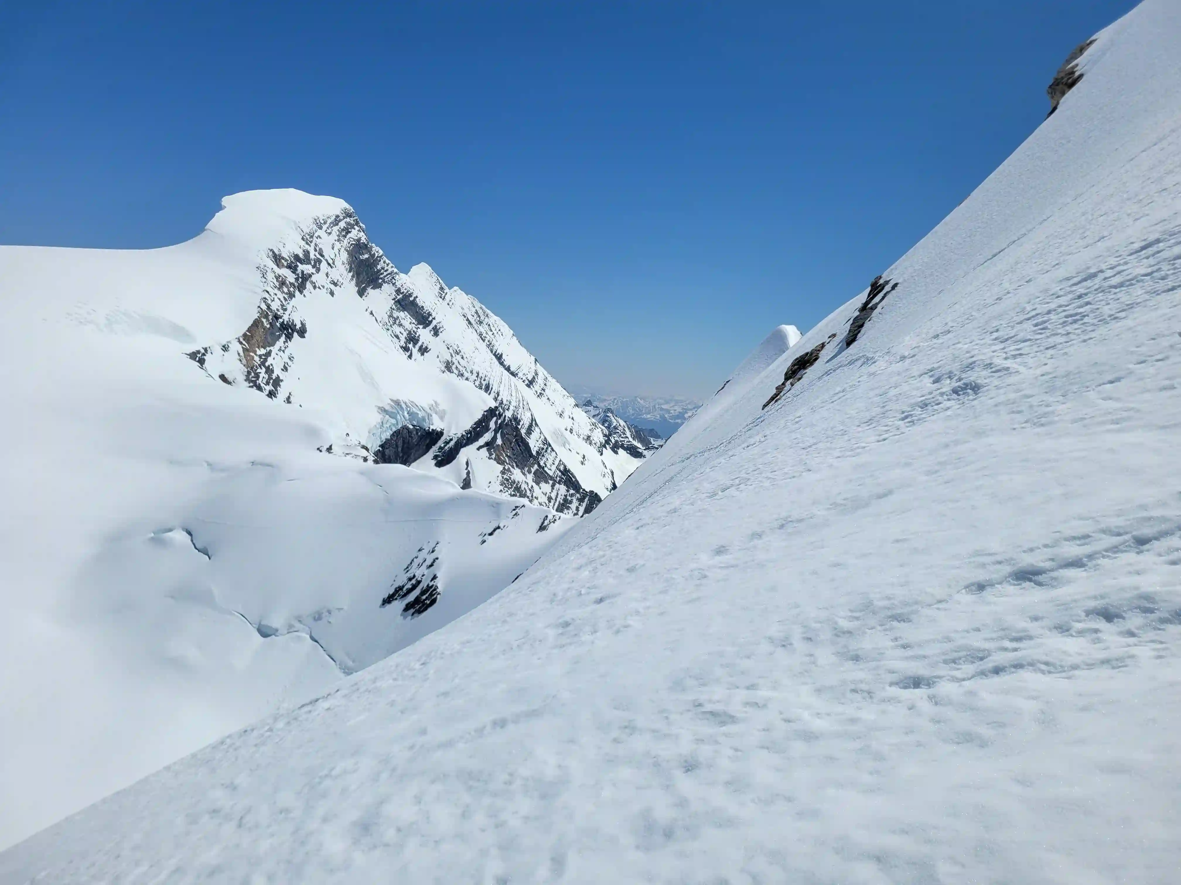
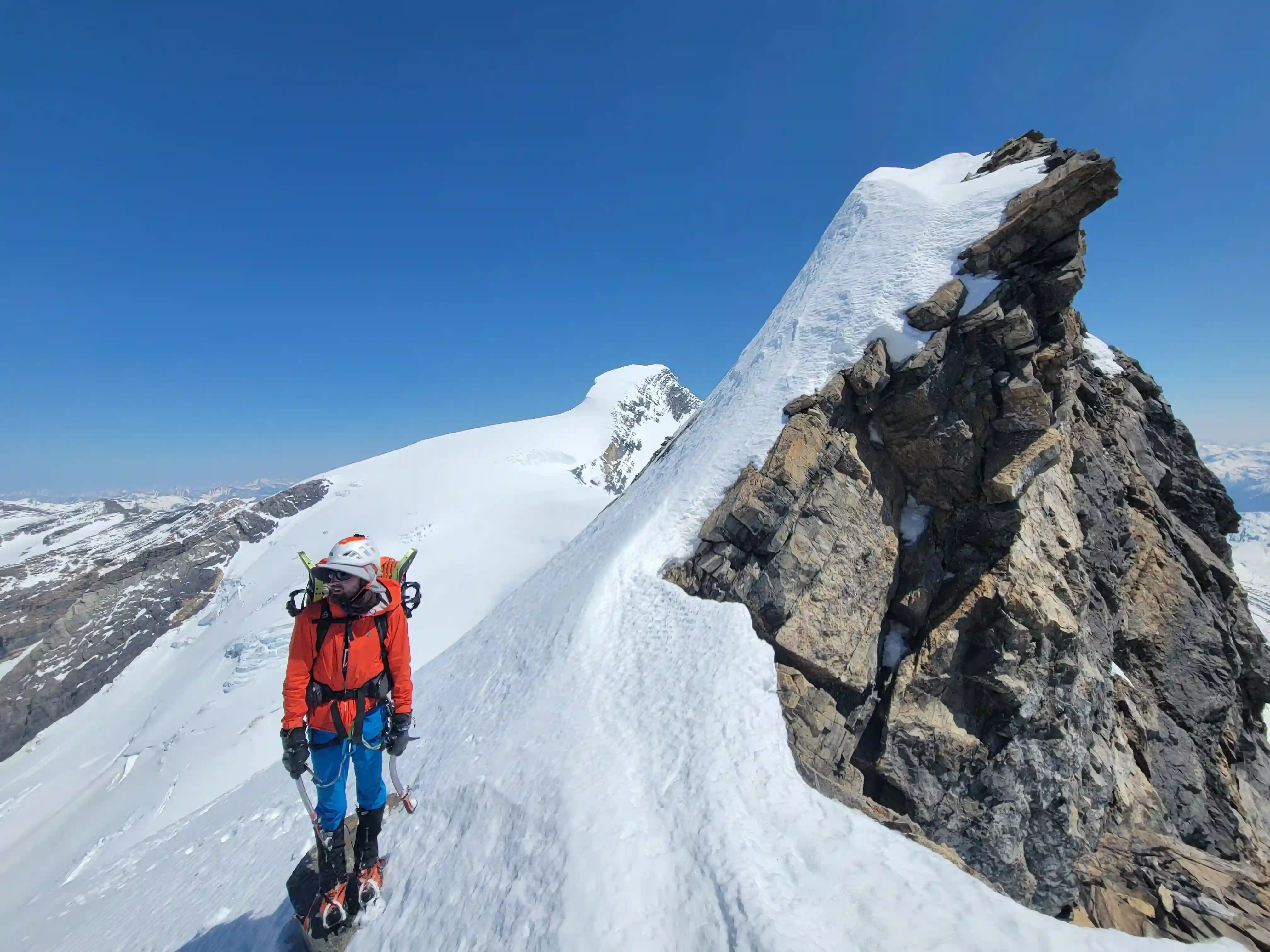
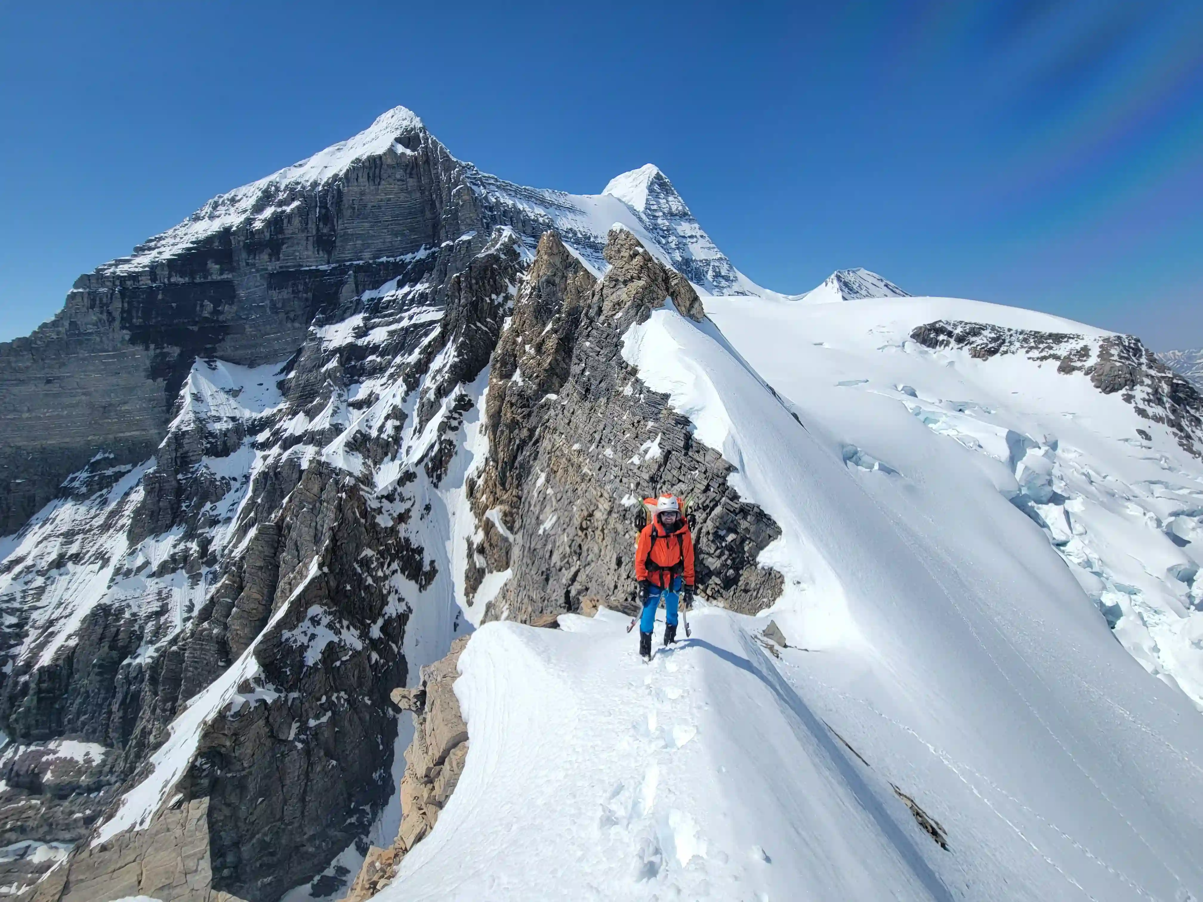
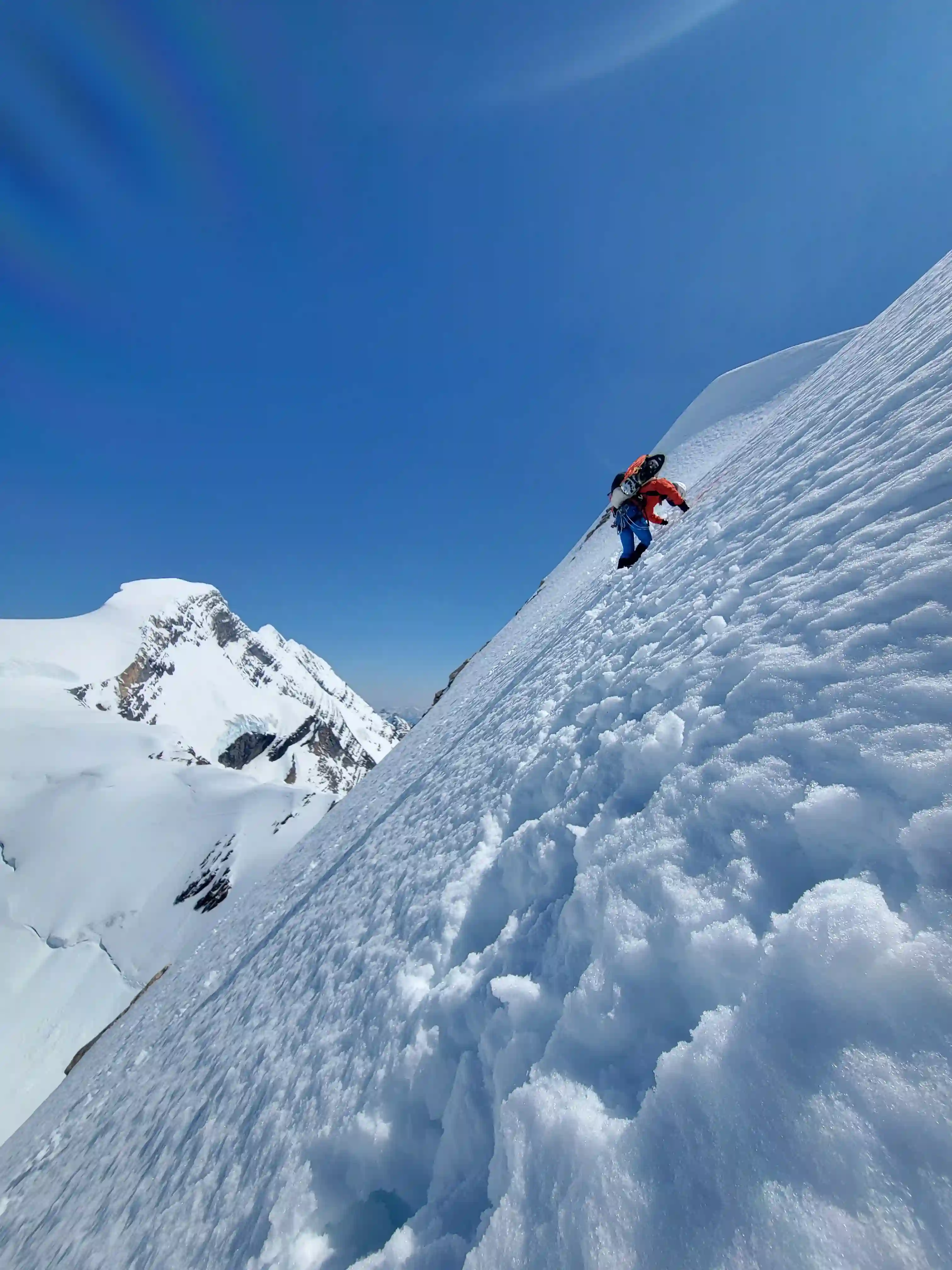
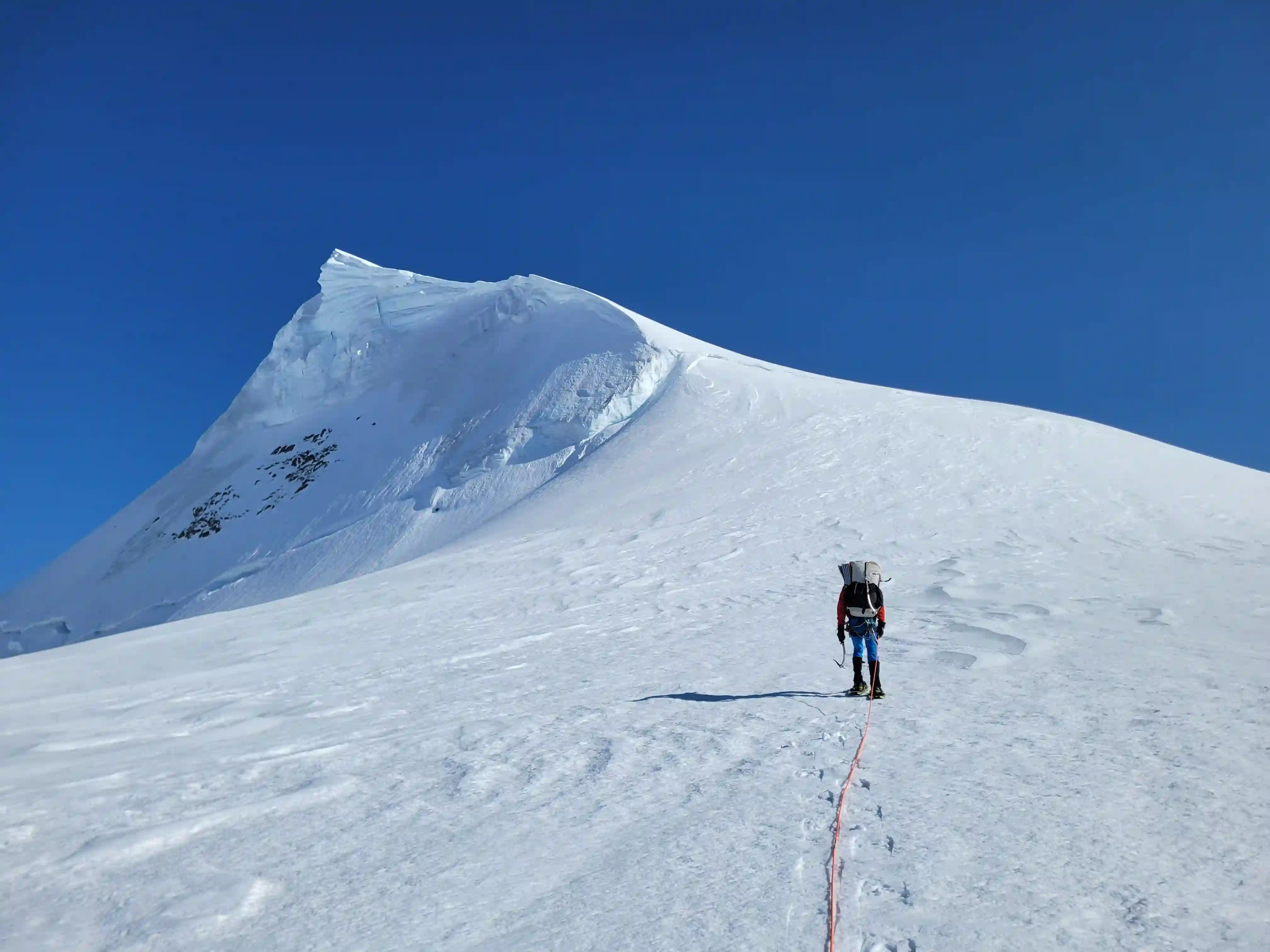
It was a bit before 7am when we left our high camp and started up the Kain Face. Conditions had already began warming a bit but the climb up the face ended up being easier than expected with us punching through to almost knee deep all the way up. After reaching the top of the Kain Face we ropes up and followed the ridge and although I was aware of how huge the cornices can be on Robson I was walking a bit too close to the edge of the ridge causing a 5-8 meter section to break off beside me. Thankfully it broke without an overhang just beneathe me so I was able to step onto solid snow without falling at all but this was a wake up call for us and we gave any potential cornices plenty of room for the rest of the trip.
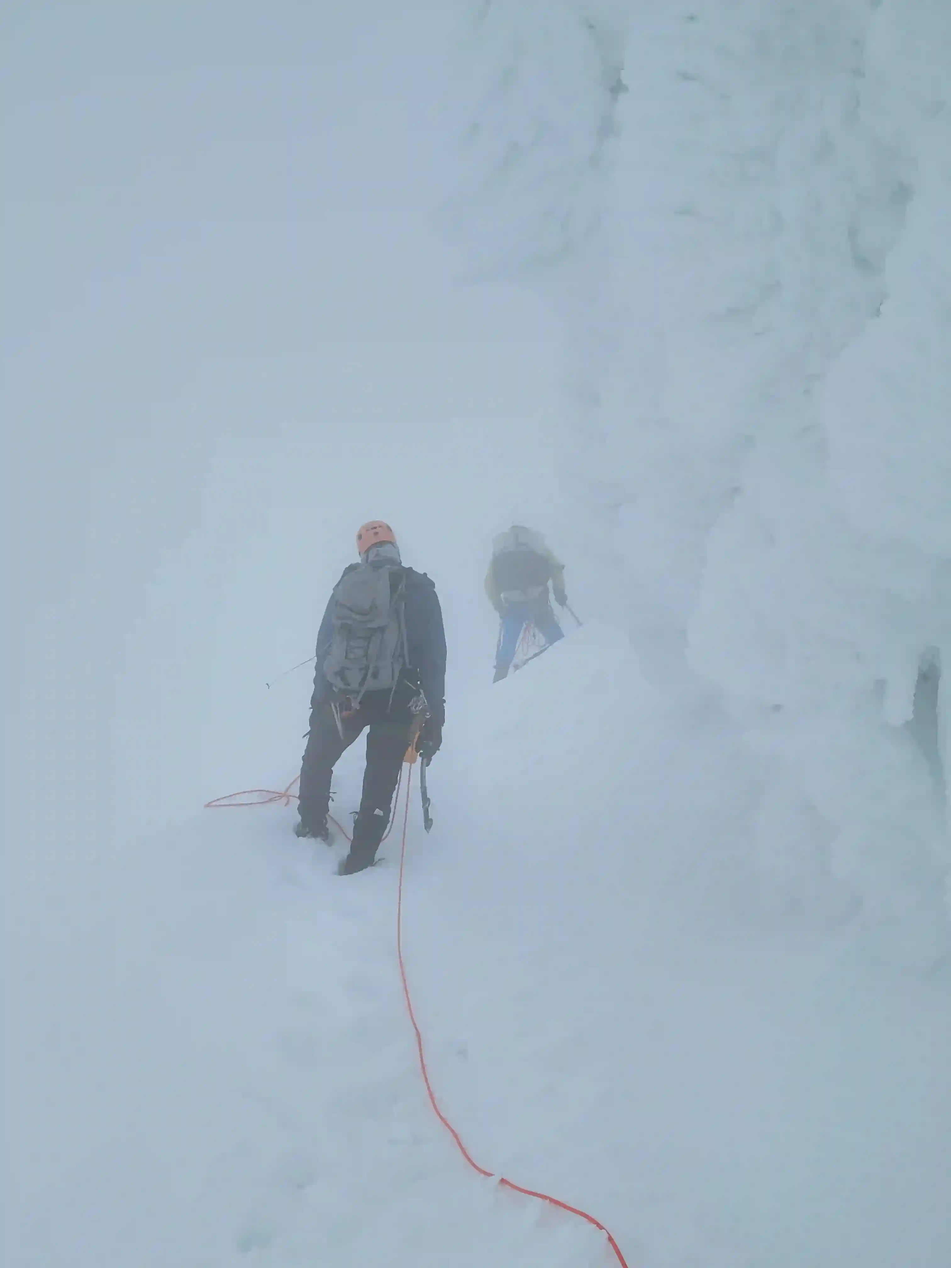
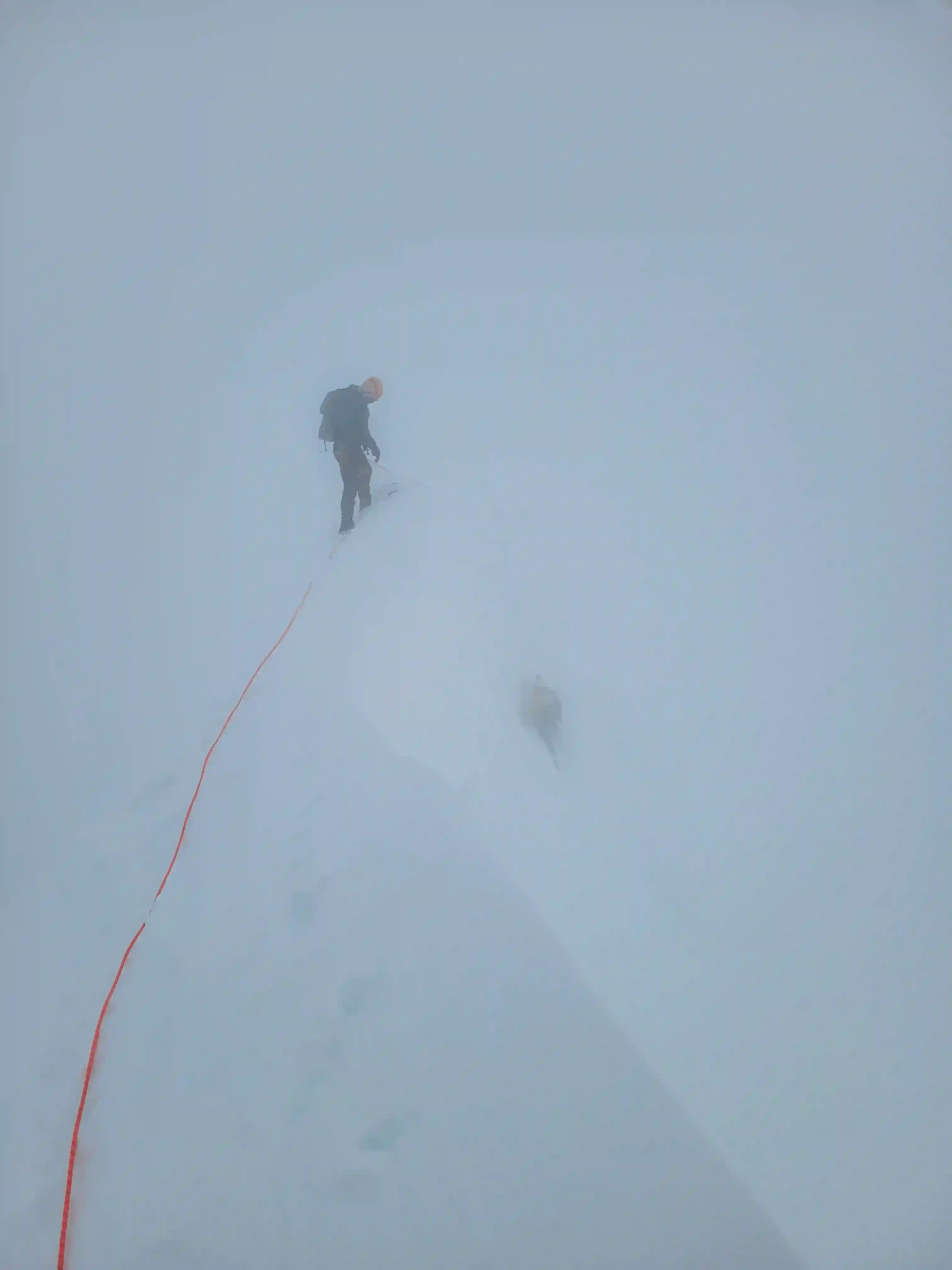
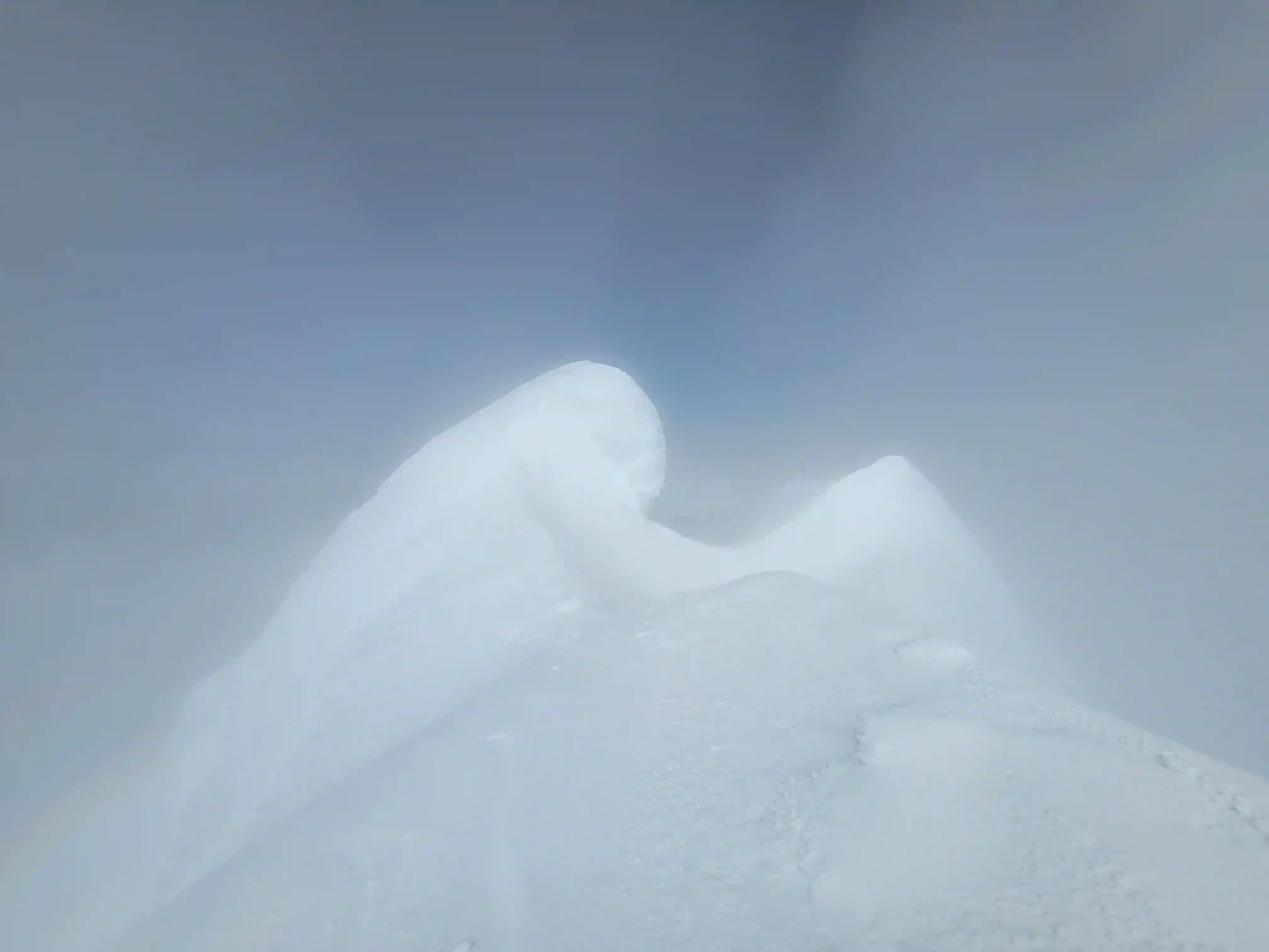
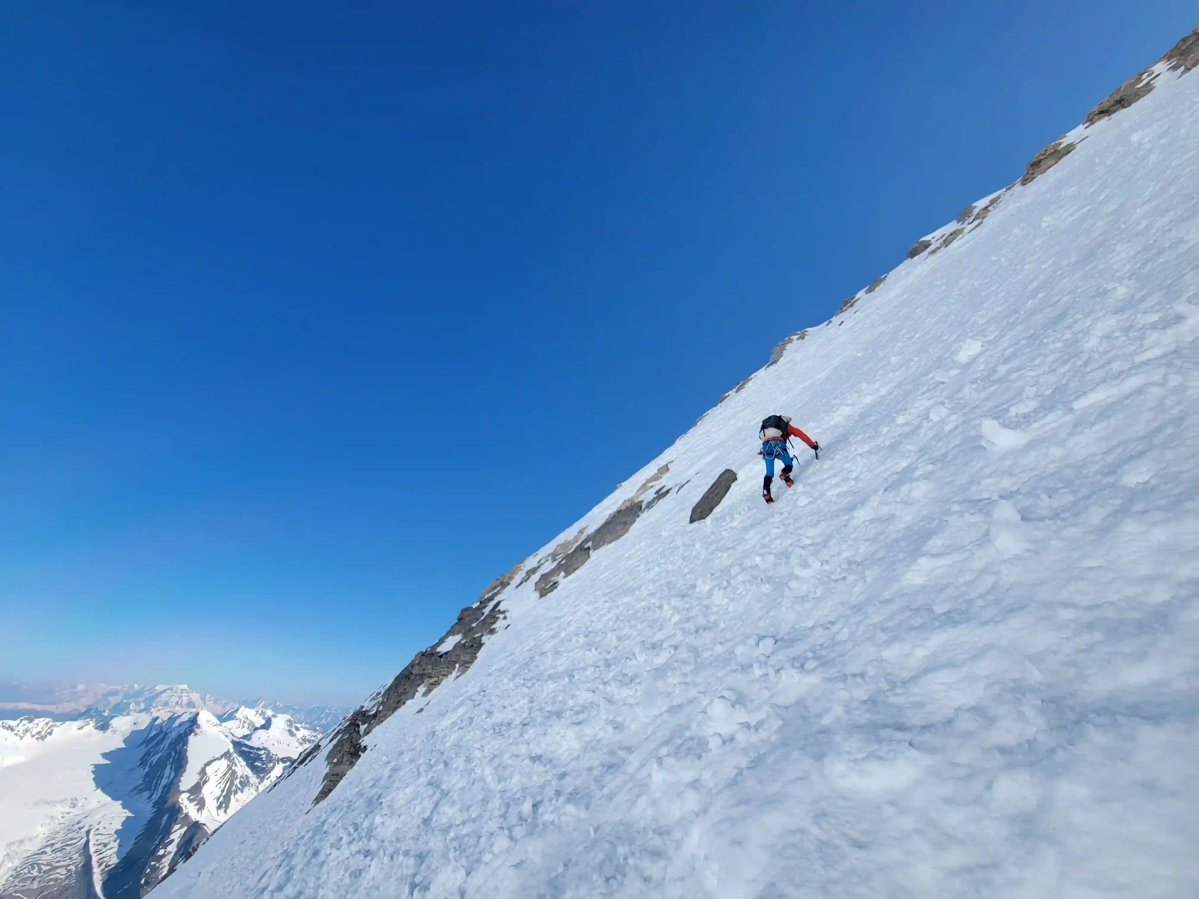
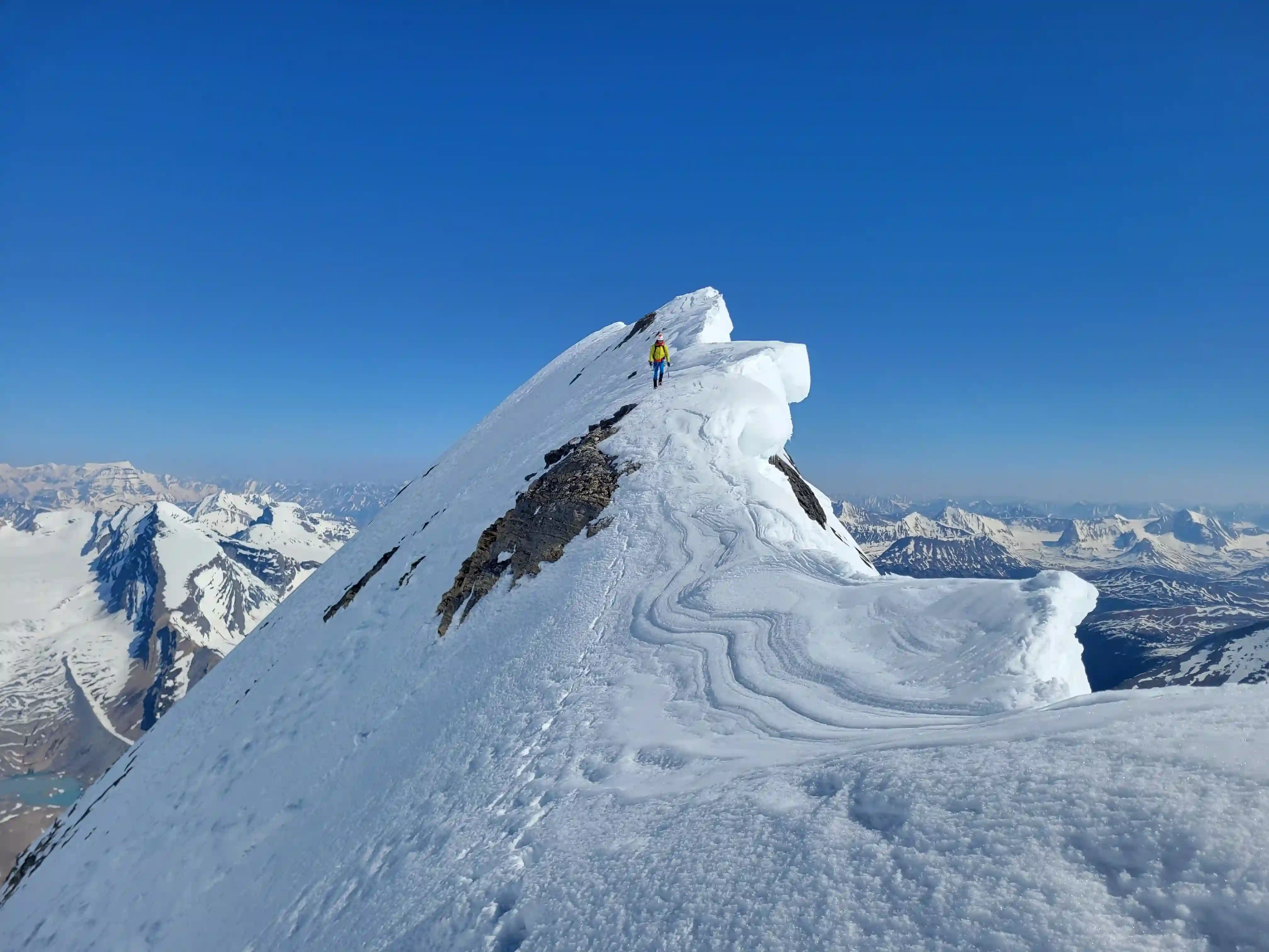
The upper SE ridge didn't feel as steep or technical as the Kain Face but it was hard work. As we climbed clouds were moving in and out and just before we reached the gargoyles just before the summit ridge we got completely socked in with near whiteout conditions making routefinding extra tough and our summit bid uncertain. Even so all three of us were extremely motivated to get it done regardless of the time it took so we didn't panic and continued working our way up until reaching another wall of gargoyle-esque terrain. I was leading and decided that since it looked doable to climb here it was best to ascend and try to get to the ridge as soon as possible to help with routefinding and to our surprise immediately above this section we were standing on the summit ridge. This is definitely not the standard route that's usually taken but it worked for us and as we followed the ridge while completely in a cloud, after gaining a few final meters of elevation the summit of Mount Robson was in sight!
up, not so much on our way down
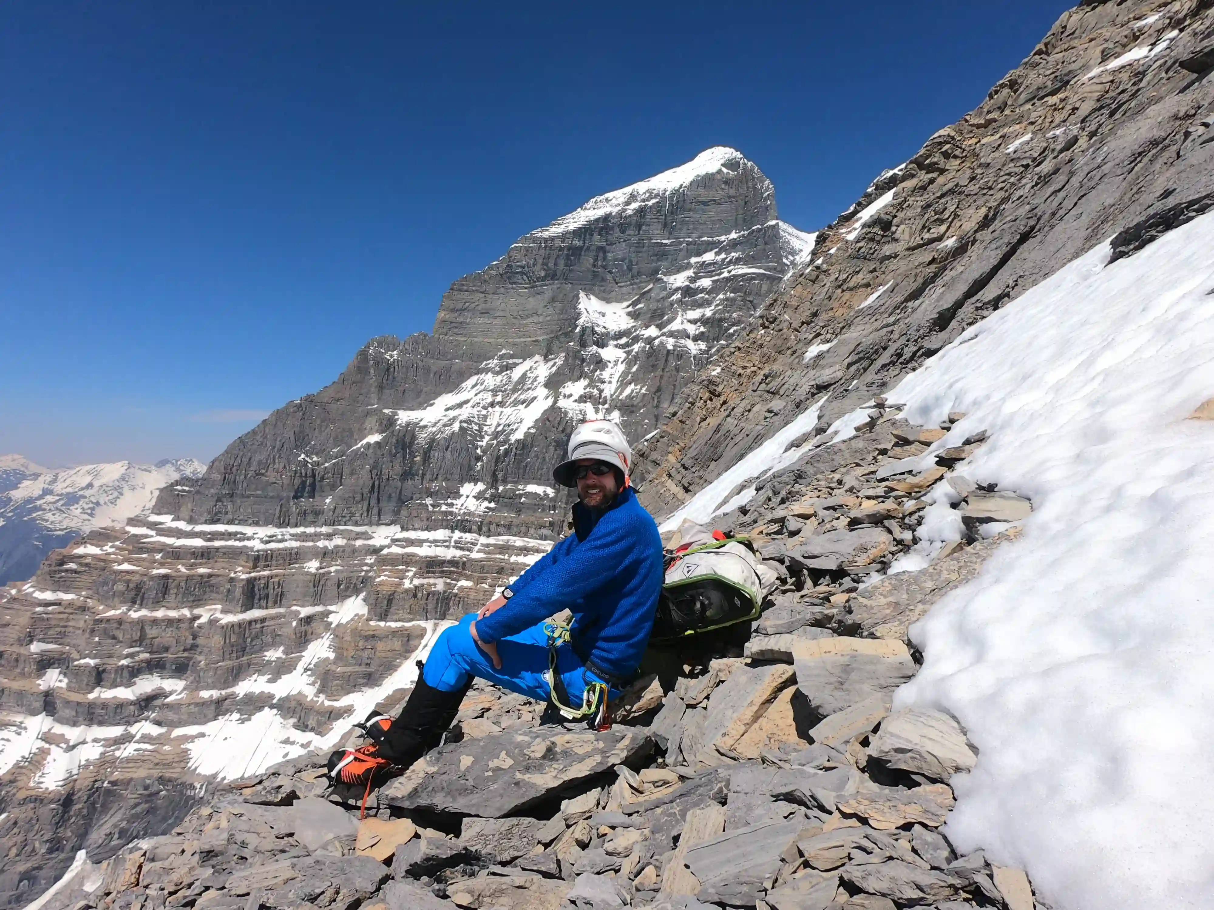
dramatic views

is the huge exposure to the left
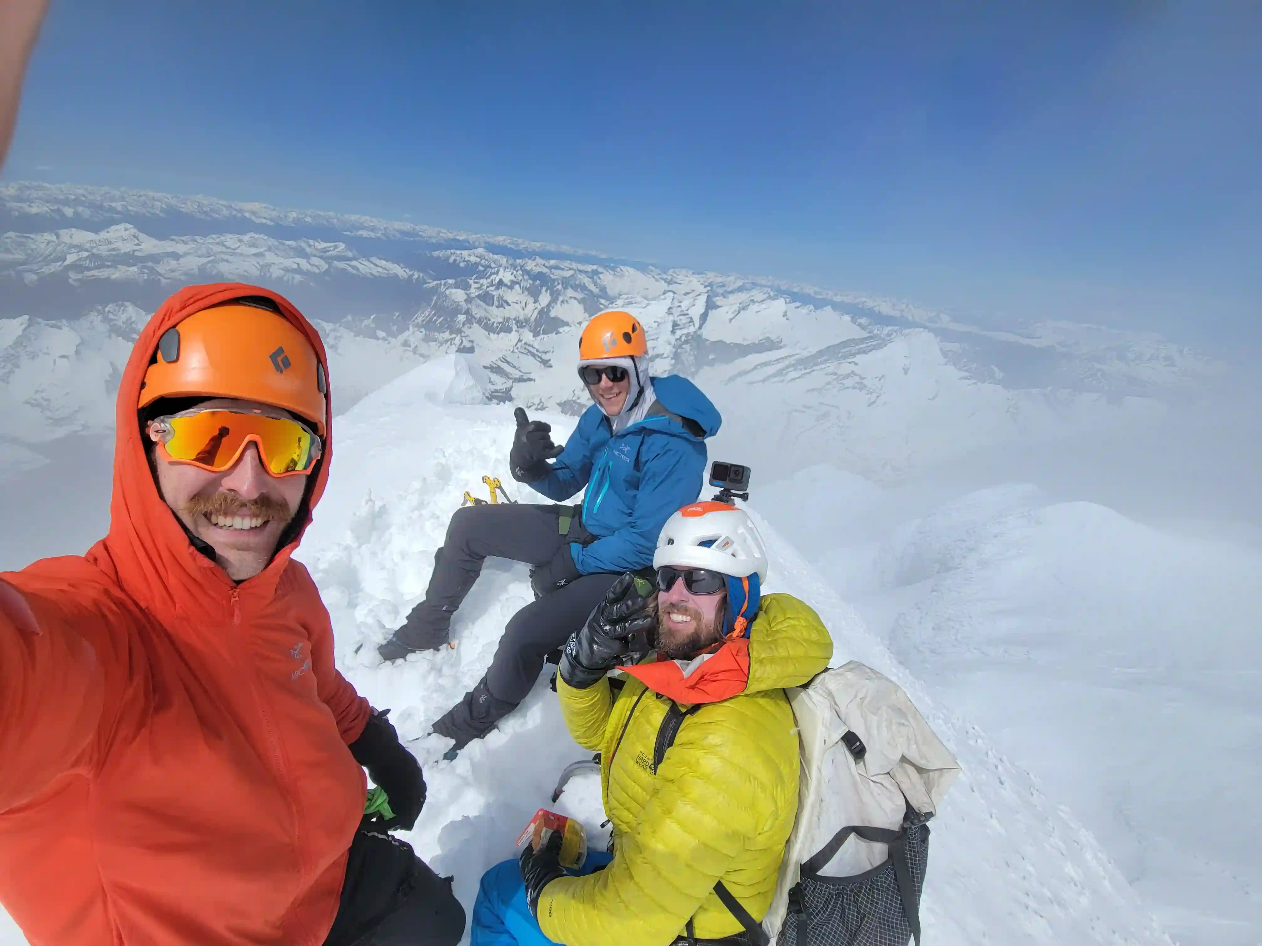

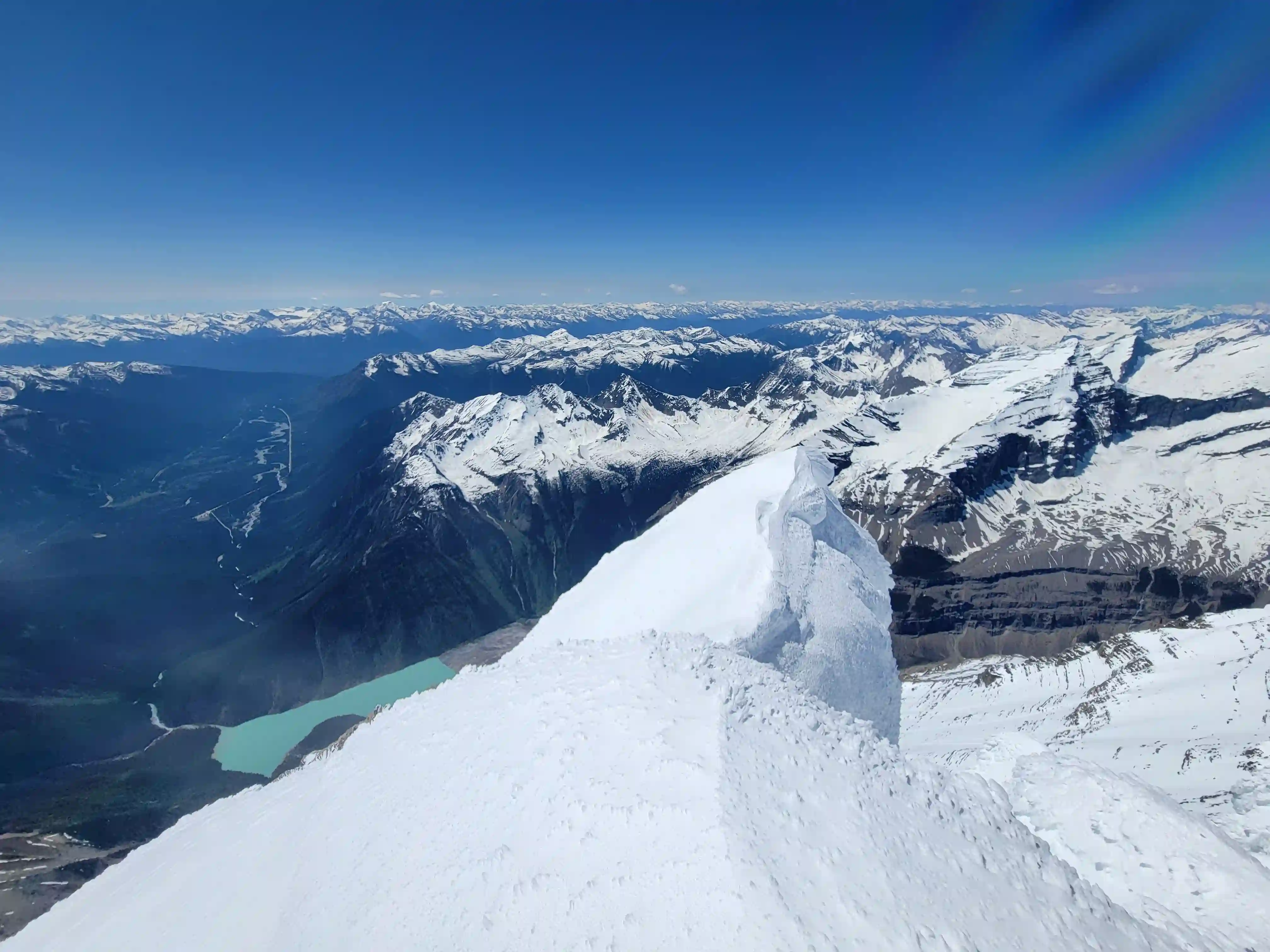
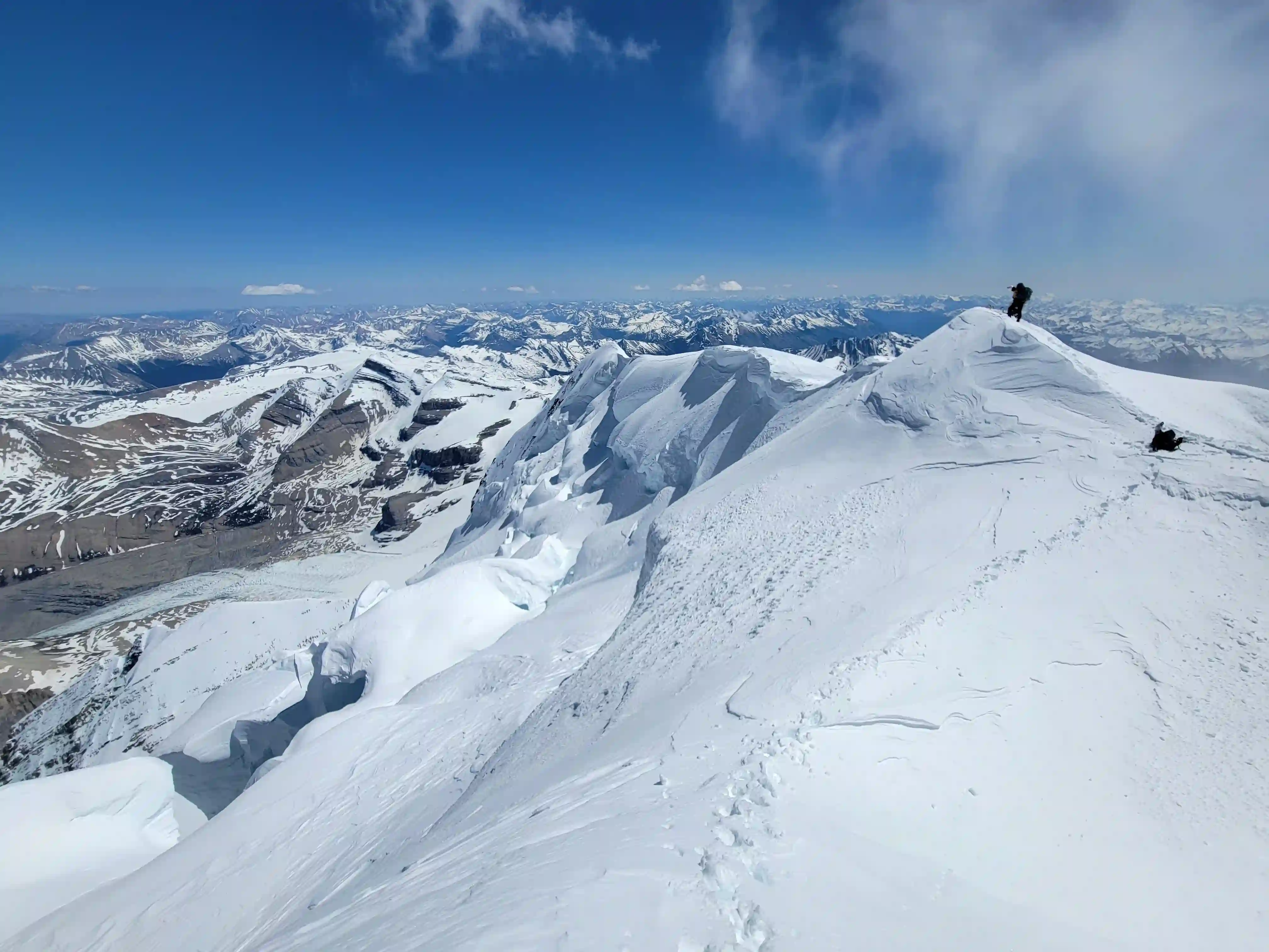
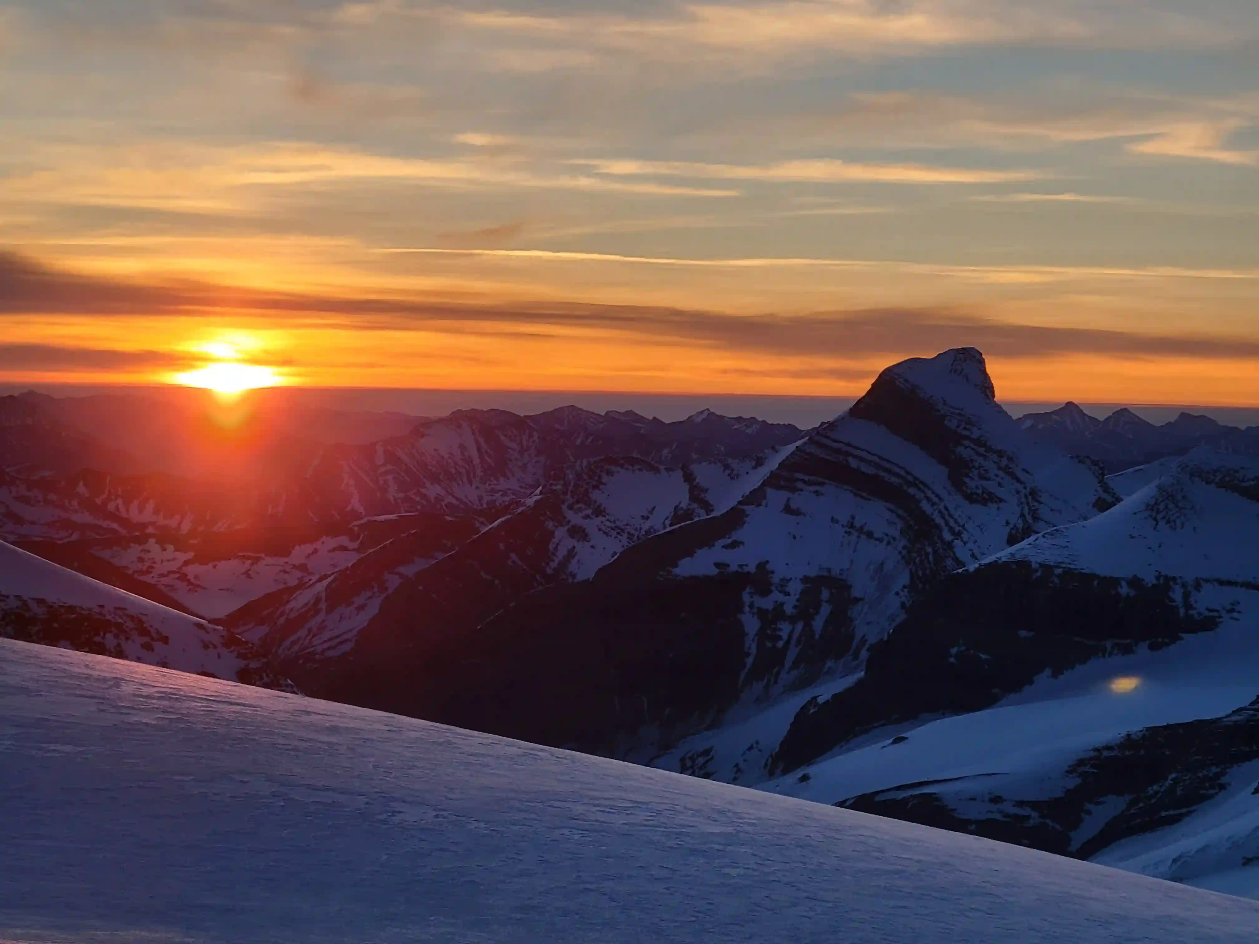
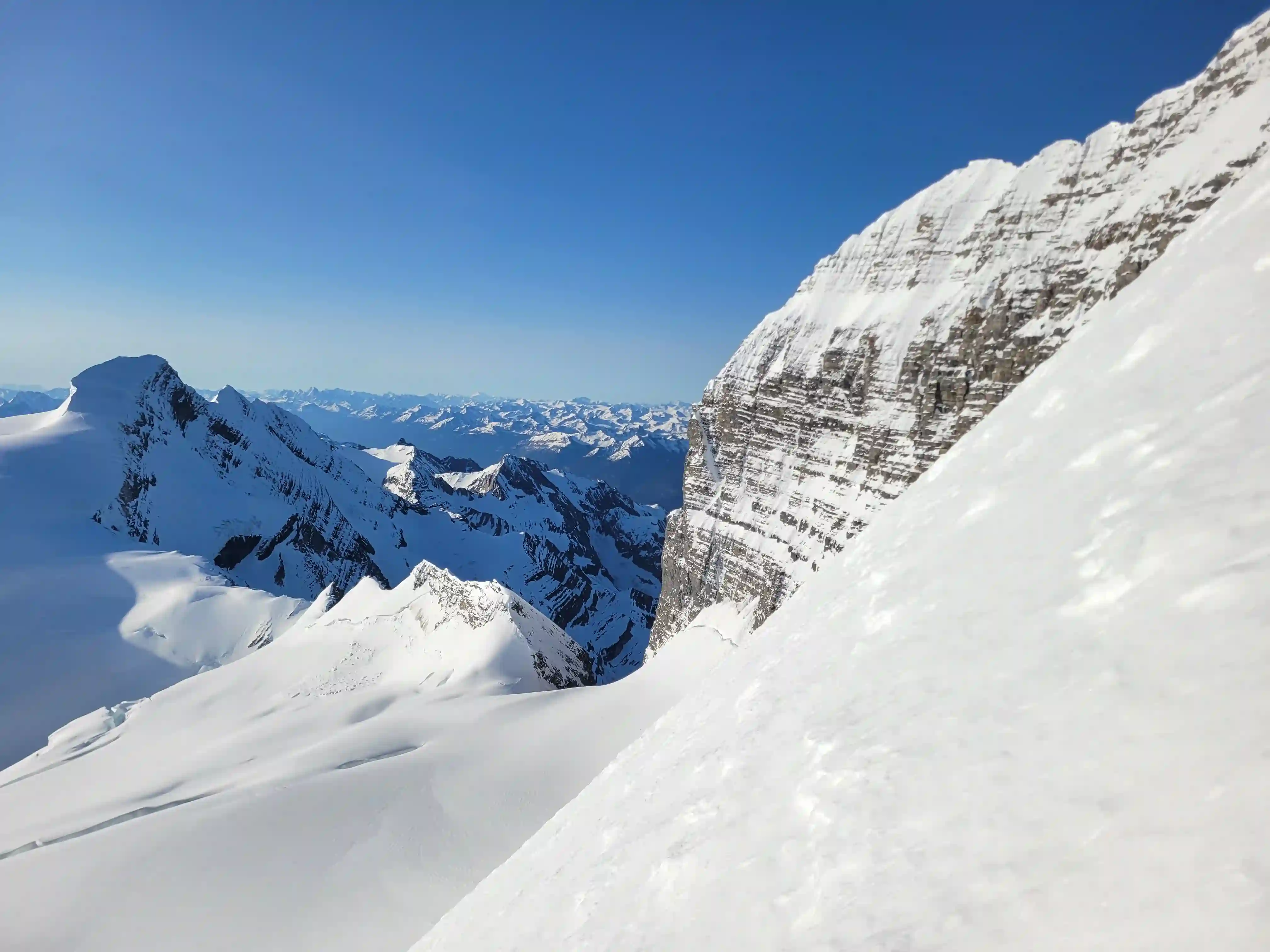
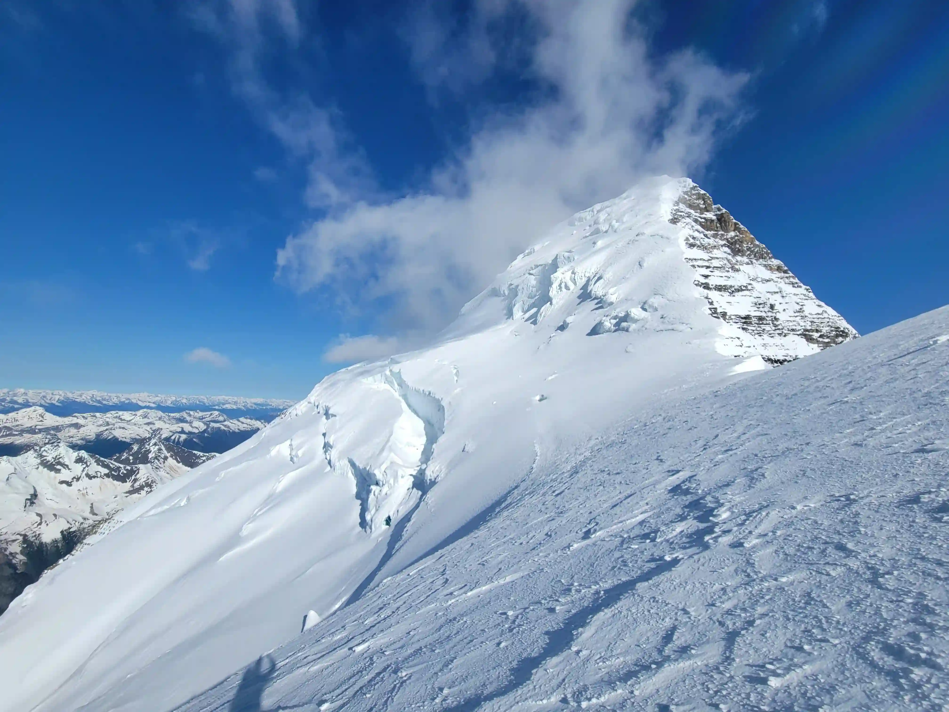
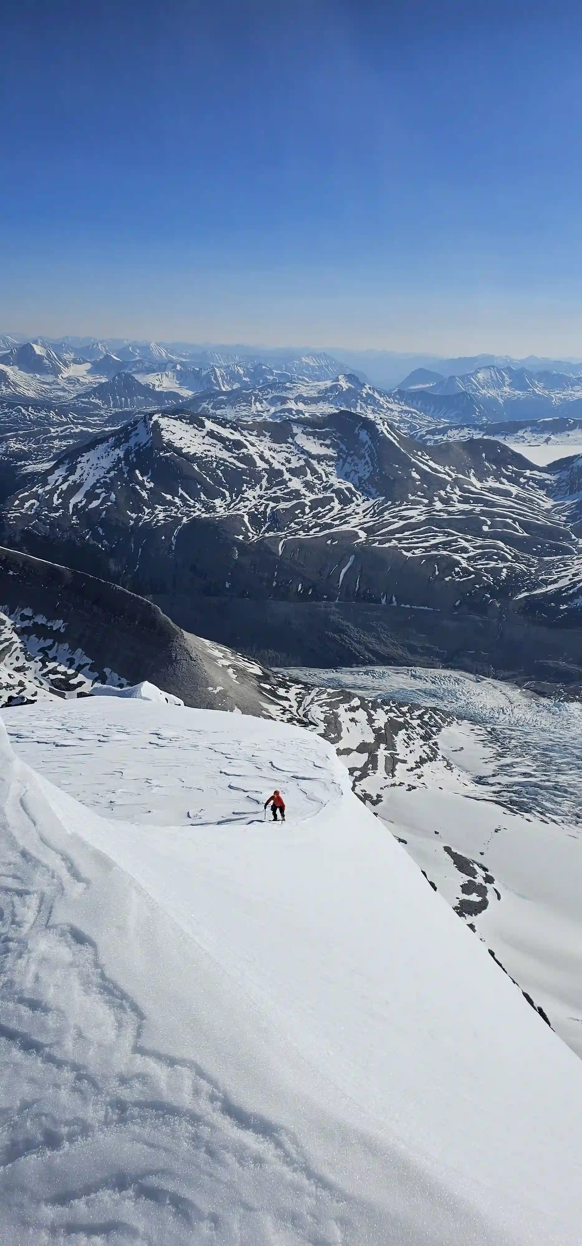
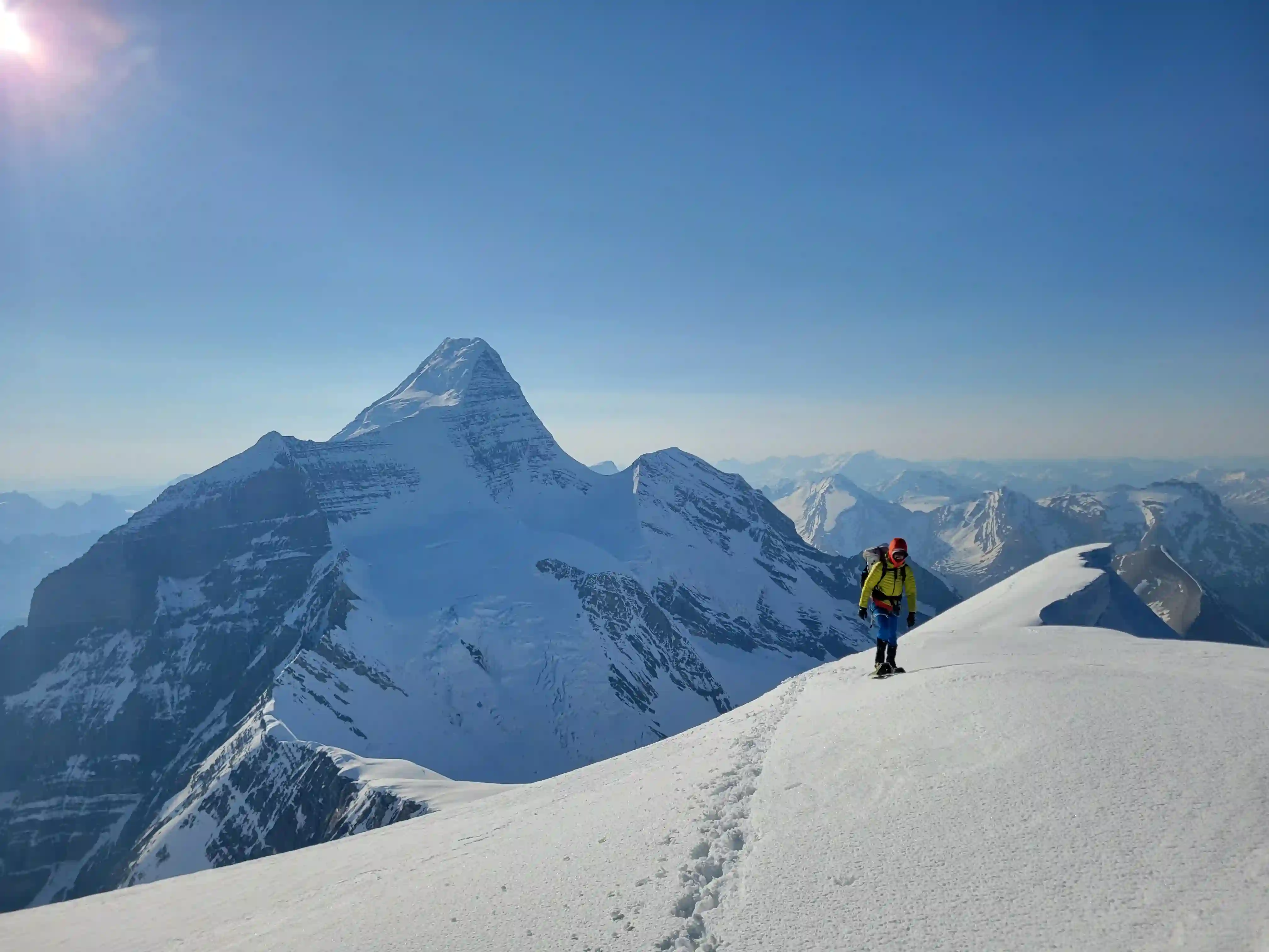
We spent quite a bit of time on the summit of Robson since we wanted to wait and see if the clouds would break and sure enough they did and we were treated to clear summit views after 30 minutes or so! The summit of Robson is pretty much the throne of the Canadian Rockies so it's a pretty wild and cool place to be and we weren't in any hurry to head down! Once we finally decided to start decending so that the snow on the Kain Face wouldn't be too isothermal by the time we got there the clouds had completely cleared and the views were far better than we expected we'd get when we were pushing for the summit.
For the upper portion of the descent on the summit ridge and SE ridge / face we had to face in on the steep sections but the snow conditions were still good so we didn't have much to worry about aside from potential crevasses and keeping our distance from the cornices and about 45 minutes after leaving the summit we made it down to the top of the Kain Face. The Kain Face on the other hand was less ideal conditions as it had been getting beaten by the sun for hours and was quite a bit less secure and steeper than the upper mountain. Nonetheless we were comfortable soloing down since our axes were able to plunge quite deep and with a consistent pace we eventually reached the bergshrund which no longer had the bridge we used to cross on the way up but jumping across it on the way down proved to be relatively straightforward and from there it was just a bit more descending on easing slopes to return to camp.
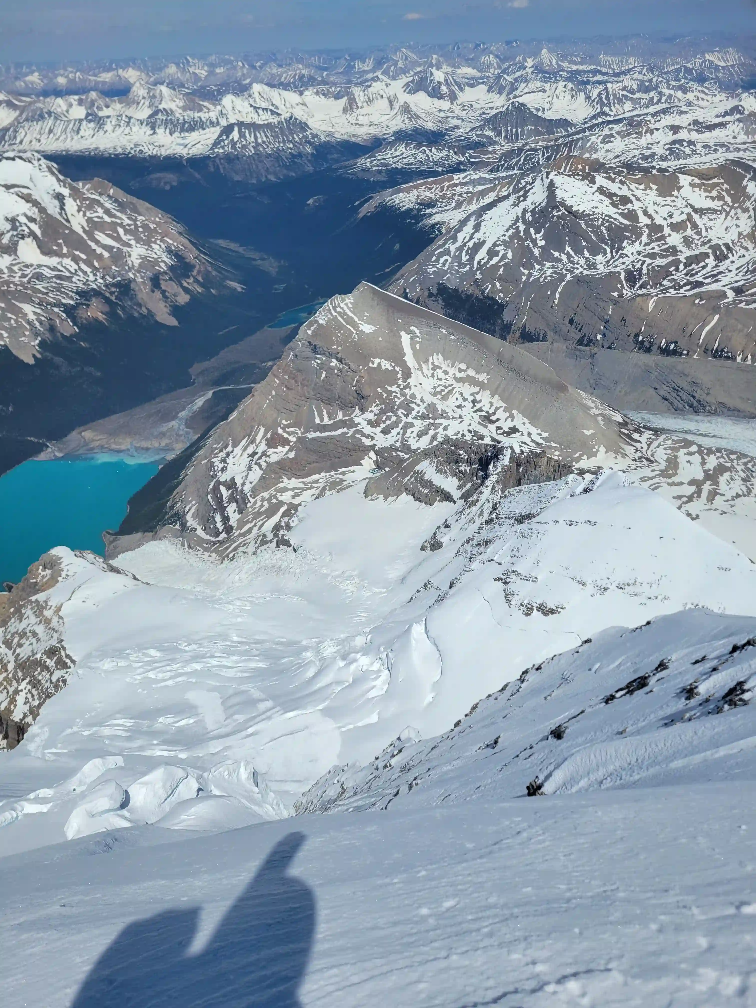
Lake at left and The Helmet at right
Into trips like this?
I'll send you an email whenever I publish a new trip report.
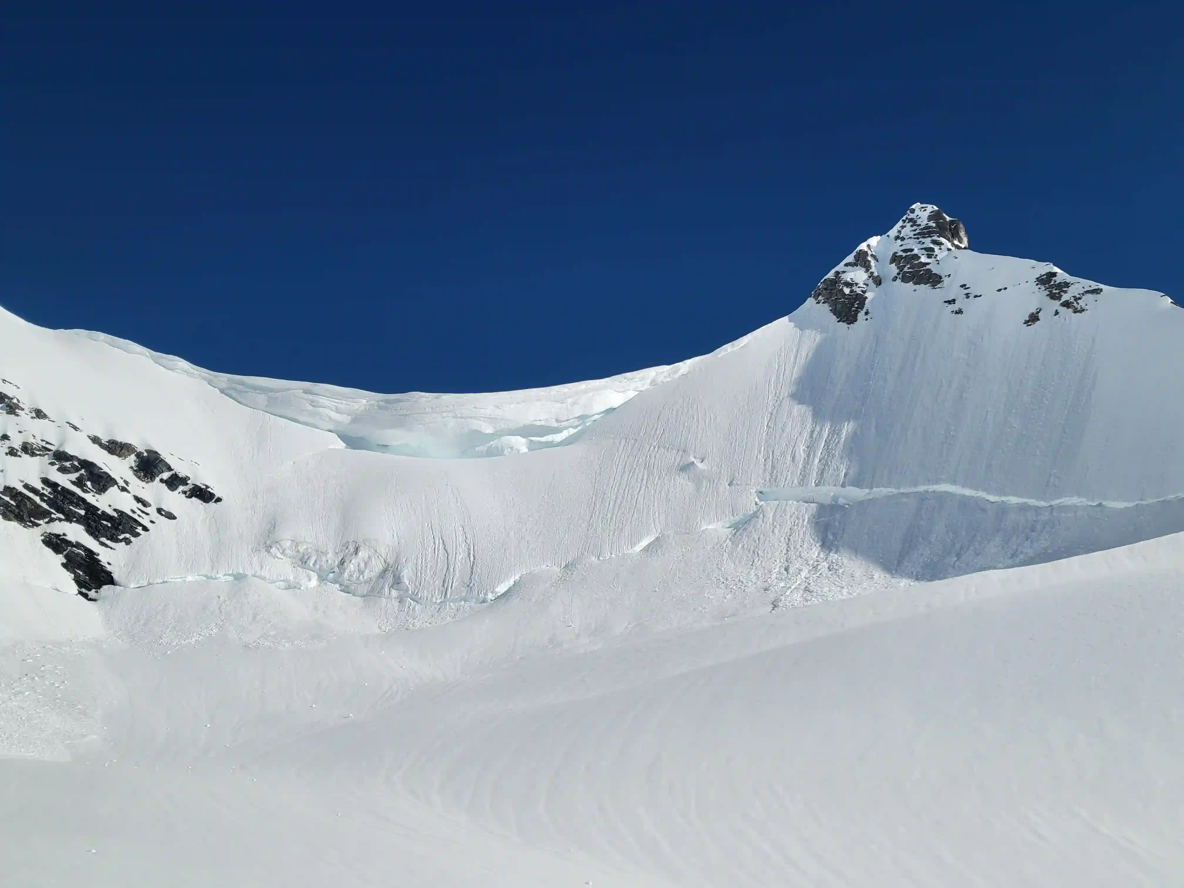
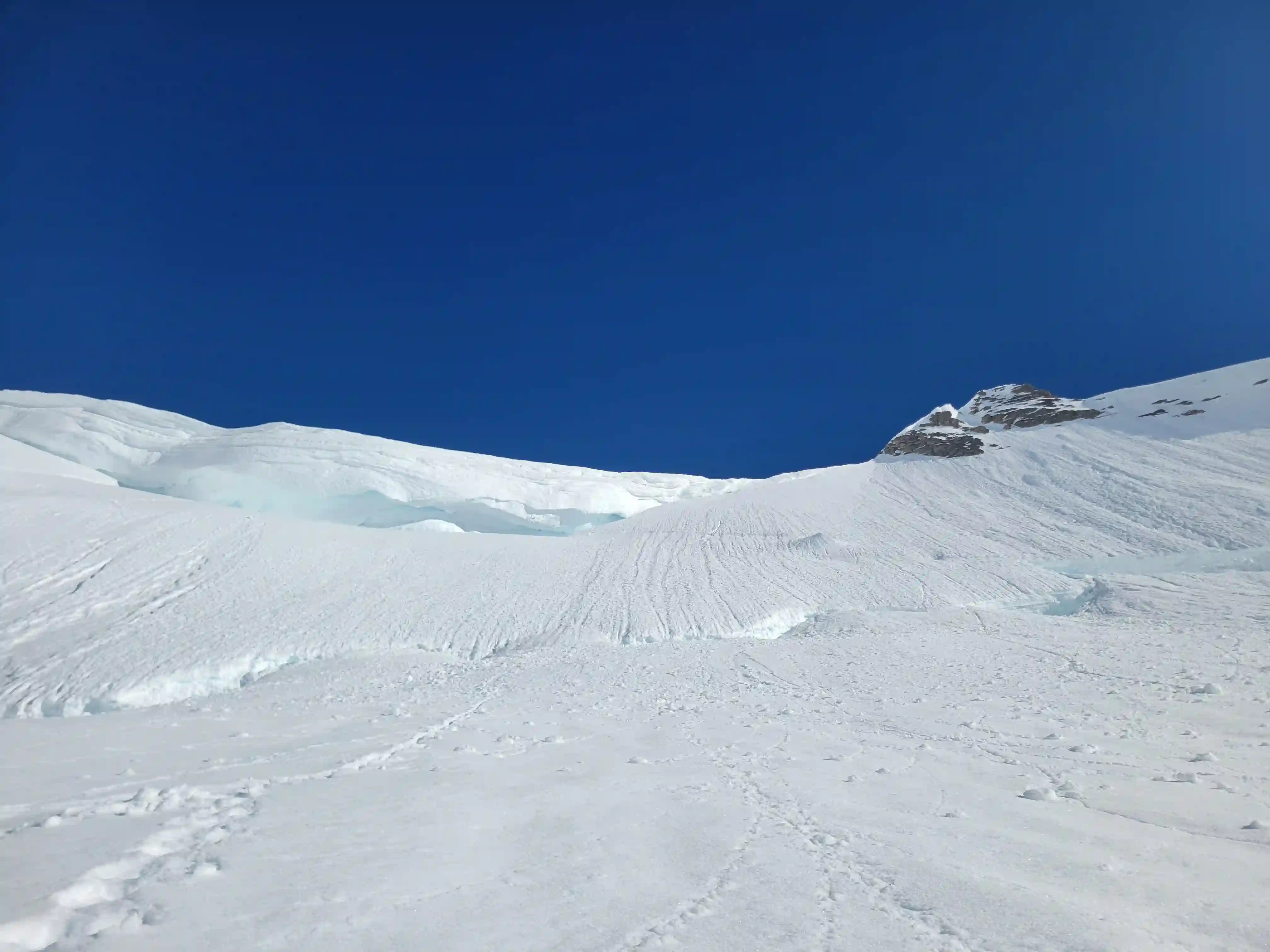
THE HELMET
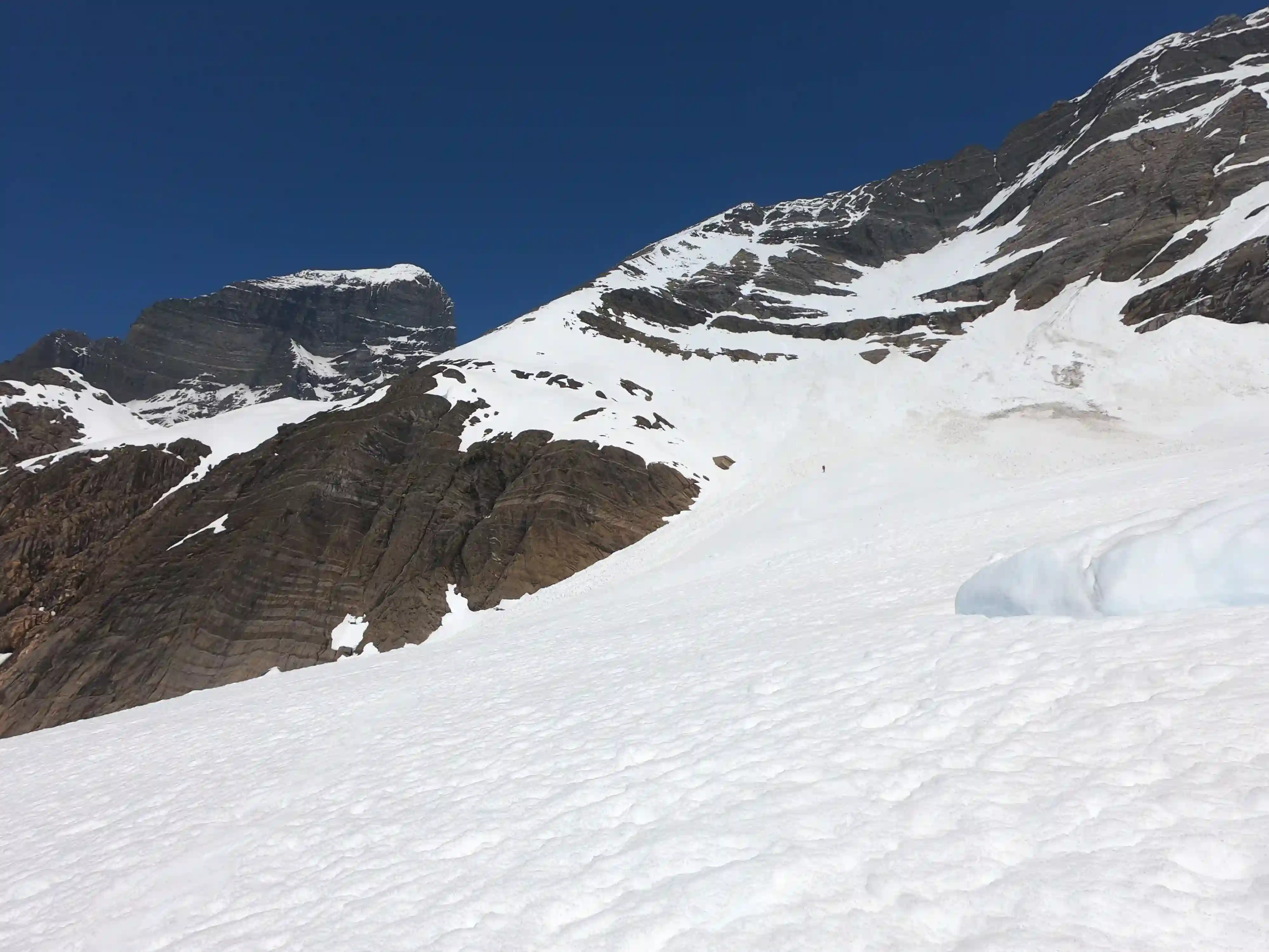
3420m, 11220ftThe next morning Darren's knee was unfortunately not feeling good so he decided to call it and went back down the couloir early in the morning while Tim and I headed for The Helmet. We weren't exactly sure how the glacial terrain leading to the Robson-Helmet col would turn out but with a bit of routefinding we ended up making short work of it and I am very surprised this route hasn't been used more for this peak. After some 35-40 degree climbing and crossing the two well bridged bergshurnd there was just a bit of elevation gain left to reach the summit ridge and just like that we were standing atop another 11000er. It took us around 4.5 hours round trip to bag The Helmet from our Dome Glacier camp so with good snow coverage in the spring I would say this is the best way to do this peak.
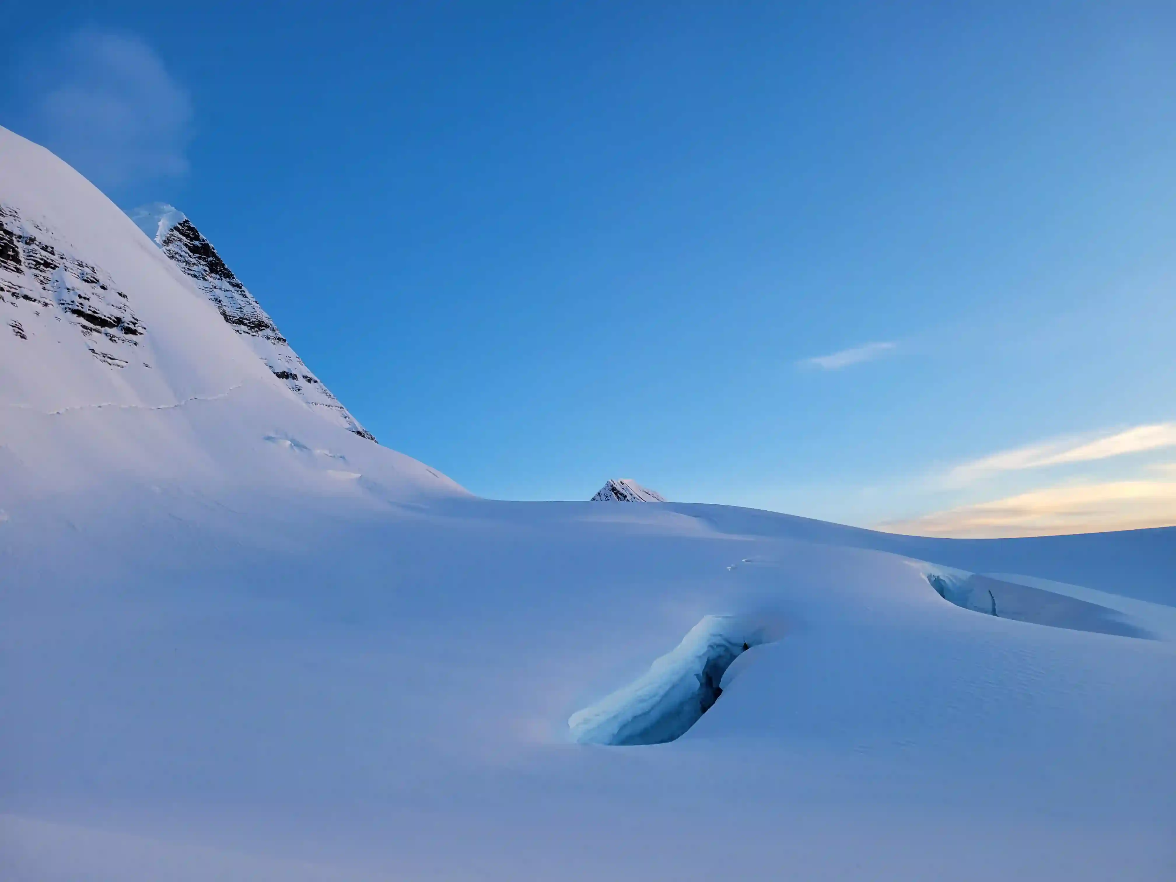
to see if there were cornices
we had to watch out for
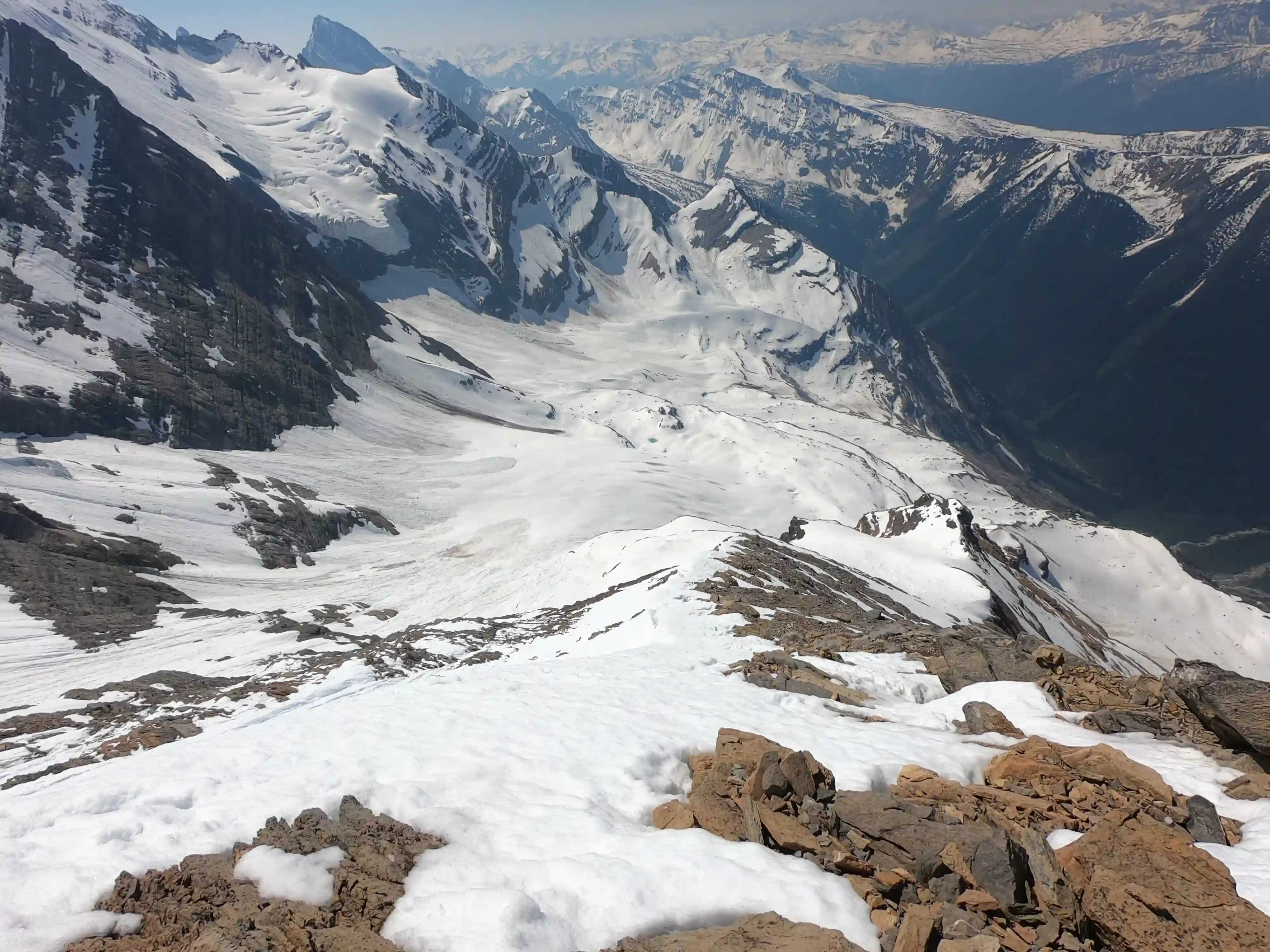
Glacier at left
Glacier
THE PATTERSON SPUR BYPASS
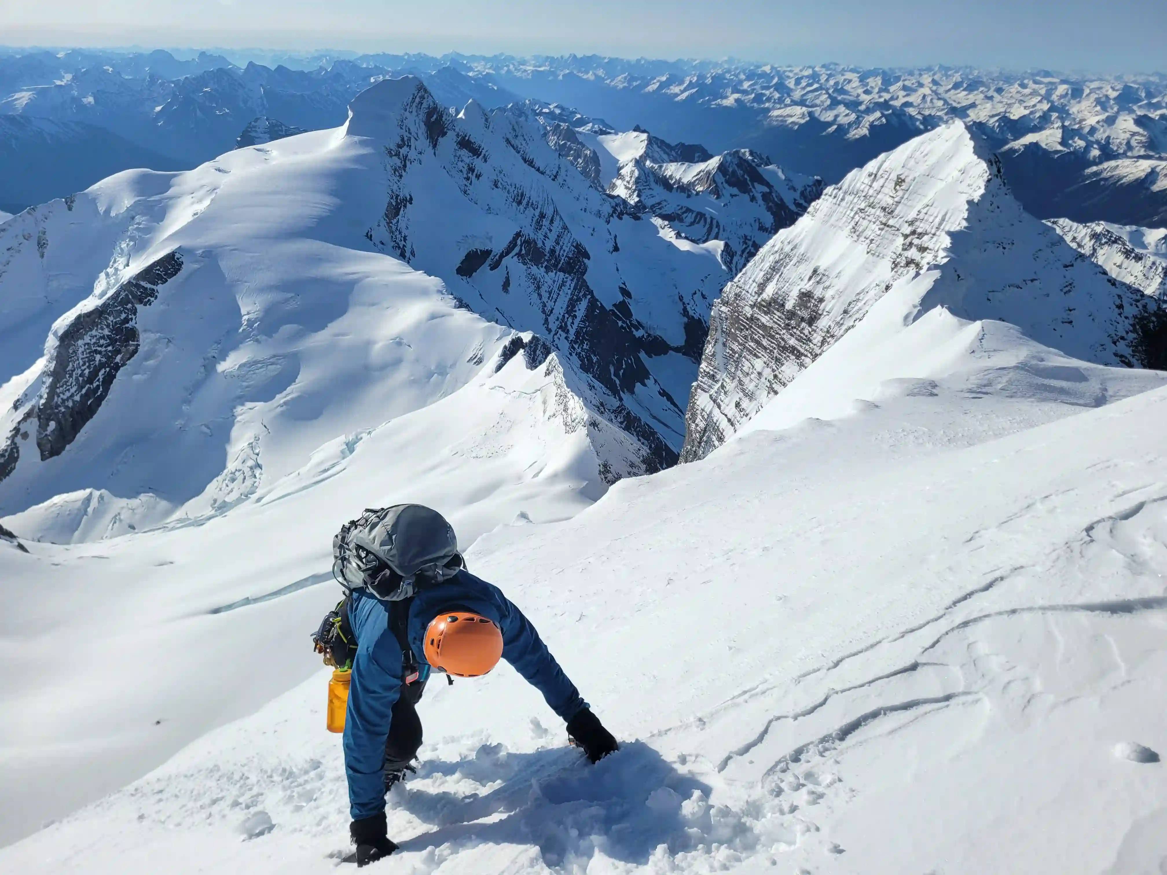
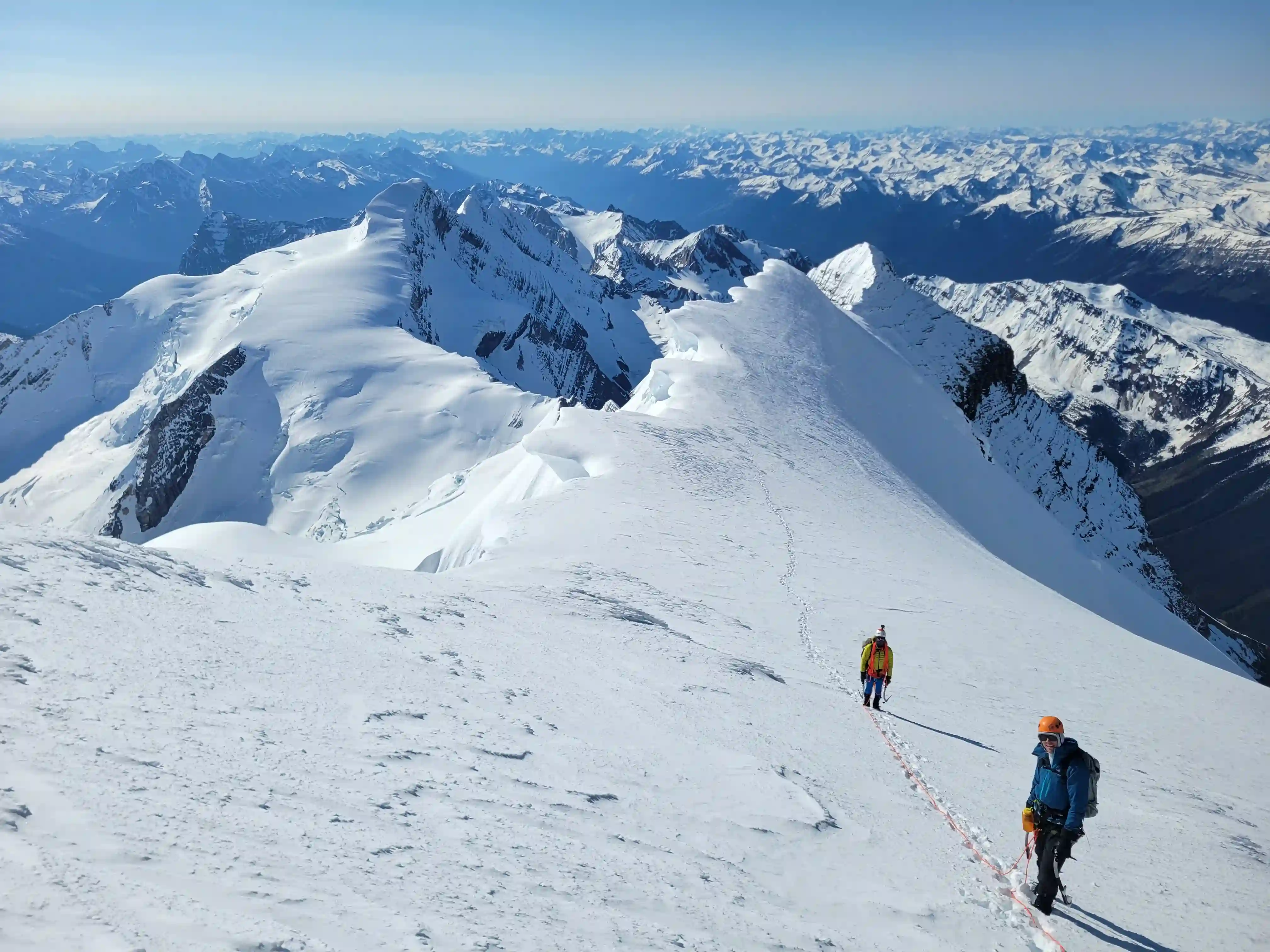
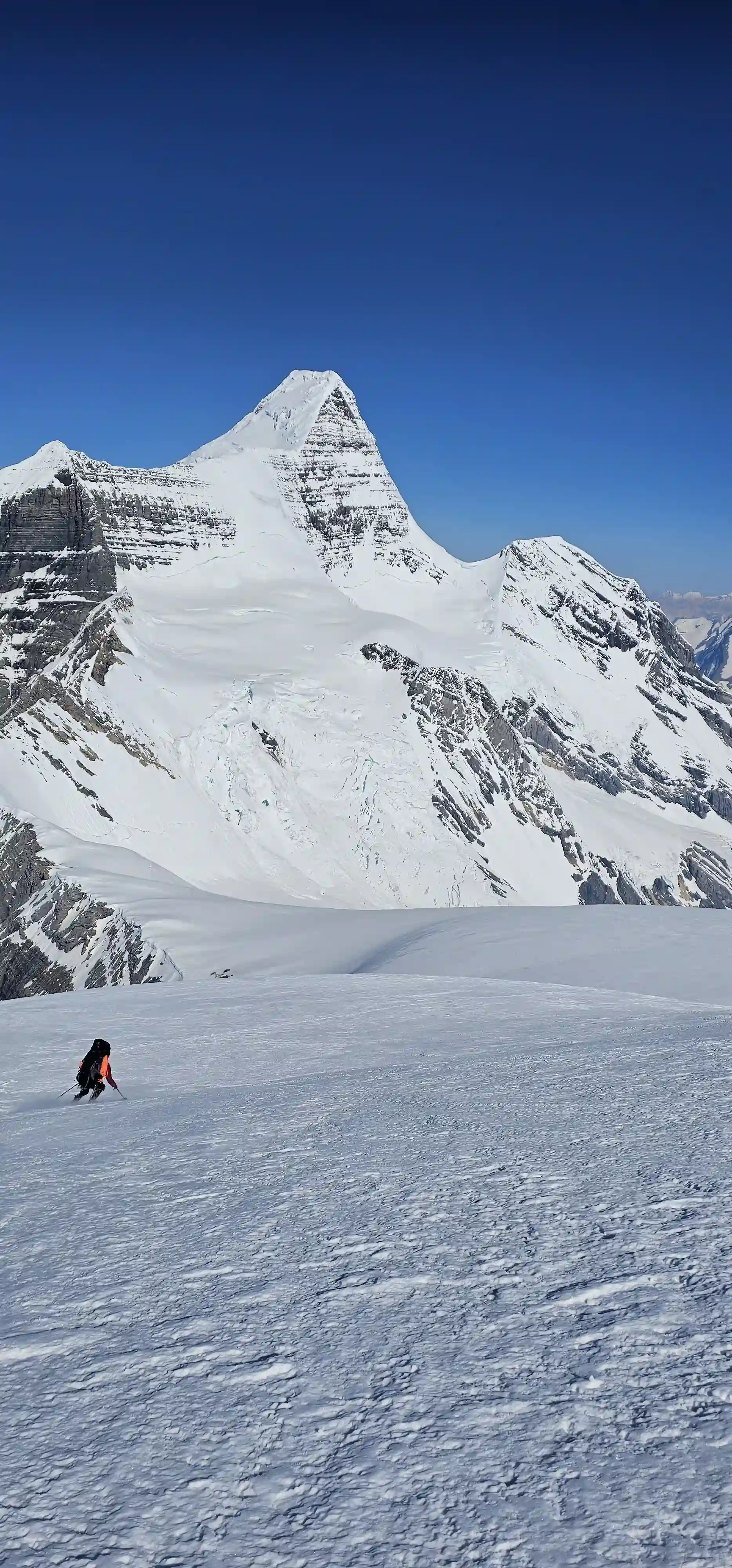
After resting for a bit and packing up camp we were headed for Resplendent Mountain. We weren't exactly sure which route we'd take to get it done, initially thinking we'd have to descend back down the couloir the next night and head back up the Patterson Spur approach route for the RR col before branching off for the peak but I recalled the Patterson Spur bypass route that was posted about on the mountains conditions report so we decided to try for that. We also decided at this point given the prime conditions that we should try for a camp at the summit of Resplendent Mountain as I had never slept on the summit before and couldn't think of a place to camp with better views so we committed to hauling the heavy packs to 3408m. There were still fresh tracks from the guides that had taken the line, and although we got off route at one point and ended up gaining the Patterson Spur to figure out where we went wrong, the bypass route was relatively straightforward and I'm surprised it doesn't get used more. There was a bergshrund near the bottom that we didn't anticipate that gave a bit of a scare when Tim plunged through waiste deep but aside from that the rest of the day wasn't technical at all with the relatively tame grade up Resplendent allowing for skinning / snowshoeing all the way to the summit!
Helmet behind
RESPLENDENT MOUNTAIN
3426m, 11240ft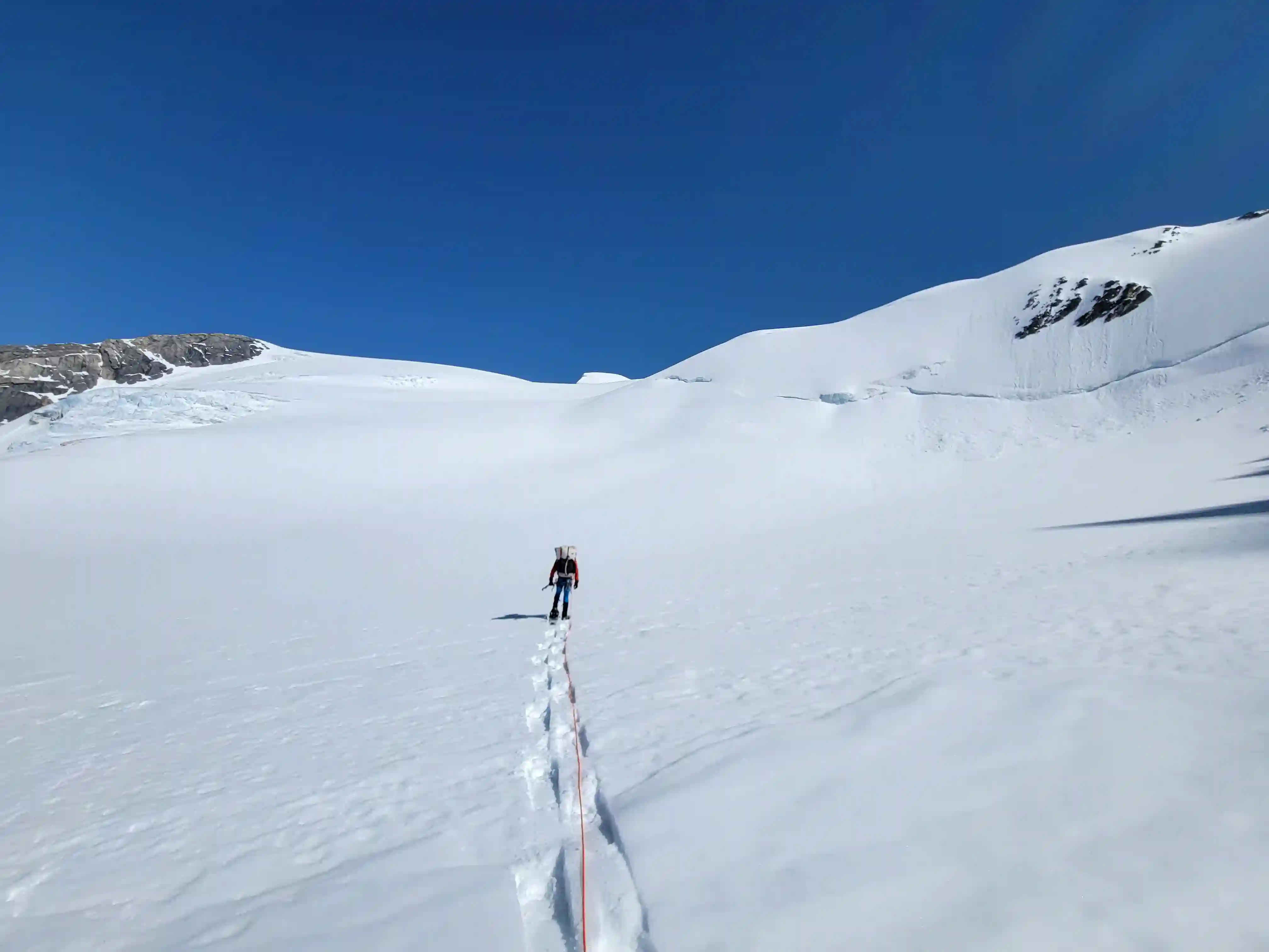
on the NE facing slope to the left and the Mouse Trap on the right

We ended up sleeping quite well on the summit of Resplendent despite what we though might have been a rough night and after a nice sleep in past 8am we packed up and were headed down by 9. The ski down Resplendent to the RR col was great and a huge payoff for bringing the skis on this trip but there were more ski turns to be had lower down. The descent from the RR col to the bench below started off tedious with lots of mixed terrain, occasional icy sections, and the added challenge of heavy packs, but after getting a bit over half way down there was a continuous snow slope we were able to follow that sped up our exit greatly.
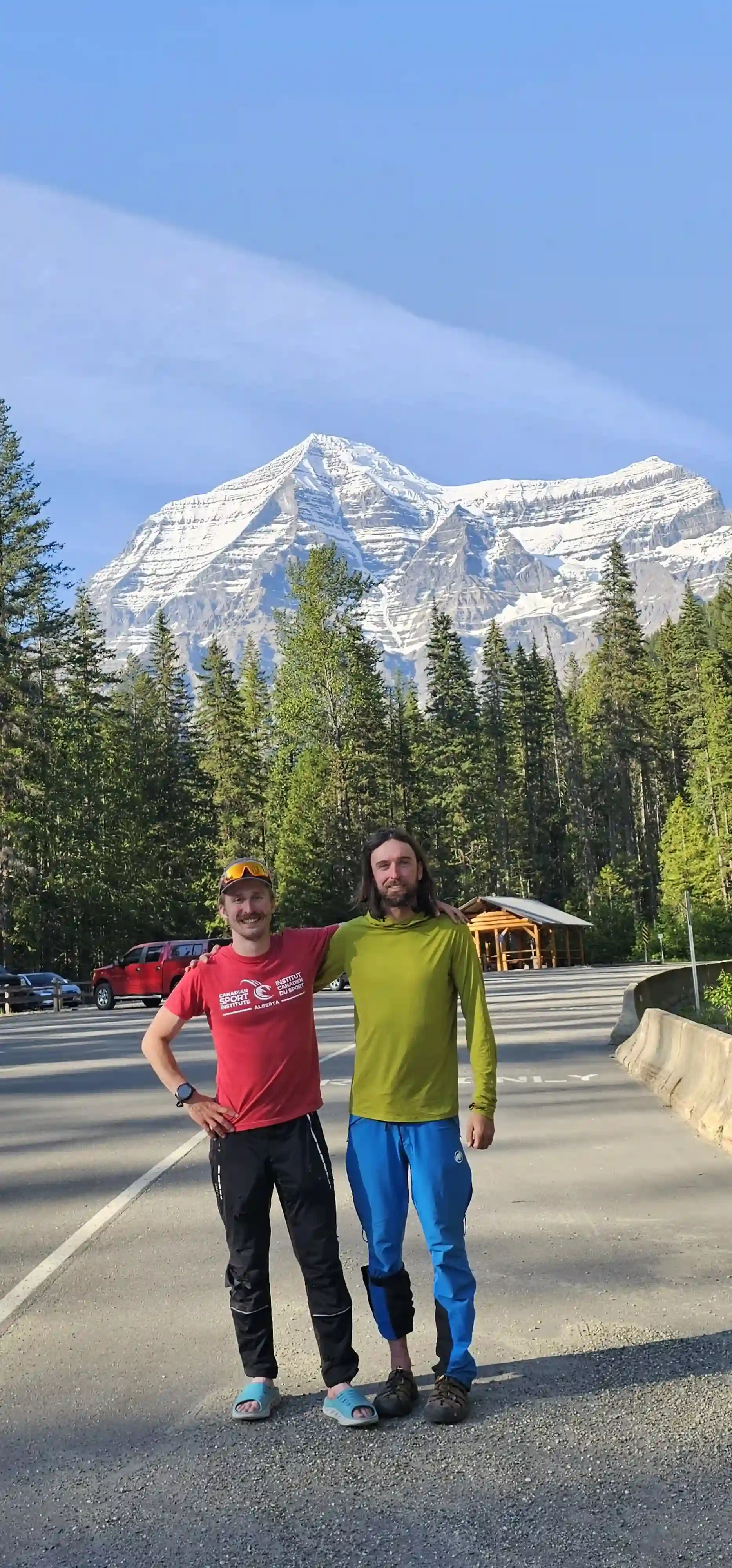
From the bench we weren't quite in the clear yet with the hands on terrain of the headwall being significantly harder on the way down with heavy packs on and routefinding giving us some troubles, but eventually we made it down the technical terrain and all that was left was trail to the parking lot. After returning to our stashed bikes the roll out was great on the legs and this is definitely the way to do it. Tim & I made it to the lot by 6pm and didn't dally long before heading to Jasper to get some food!
back to Jasper
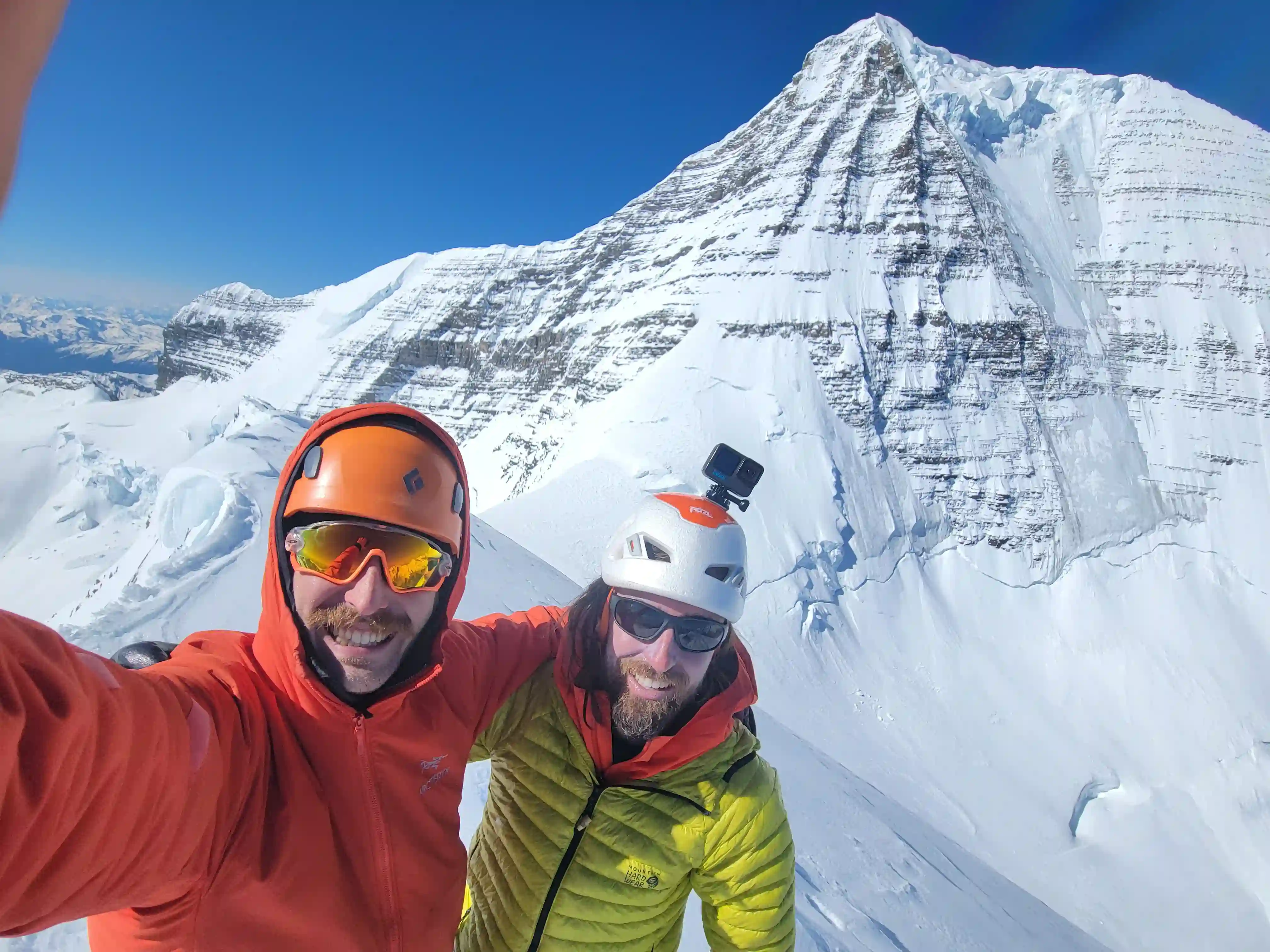
Tough to put into words how special it was to end off one of the craziest springs spent in the mountains I've ever had with a successful trip up the king of the rockies along with it's subsidiary peaks. I thought I might do Mount Robson one day but getting it done this early and in this fashion was a legendary way to end off the spring and a crazy 11000er run for me. With the addition of these 3 11000ers following this trip I reached 36/58, perfectly double what I reached in the previous spring-summer in 2024 and with the number of near perfectly timed weather windows and countless strong partners to get it all done I couldn't be happier.
There's no avoiding the various objective hazards present with an ascent of a mountain like Mount Robson regardless of the route you take so I'm stoked we were able to get it done and all get down safely. Big thanks to Darren and Tim for making such a wicked strong team, stoked we got it done boys, looking forward to the next one! Make sure to go check out Tim's
video
on our ascent of Mount Robson, some wicked footage in there!
Following this trip it was over a month and a half till I got out on my next 11ker outing with biathlon training getting quite busy but come late July there was another bluebird window that showed up near Robson so given that these can be few and far between it wasn't a difficult decision to commit to a trip for
Whitehorn Mountain!
Follow the full progression
I'm working through all 58 11000ers of the Canadian Rockies and beyond. You'll get notified when the latest climbs go live.
Other related trip reports:
Mount Fryatt |
Whitehorn Mountain ||
Mount Bryce Main & Center |
Mount King Edward |
Tsar Mountain
11000ers of the Canadian Rockies
© Haldan Borglum | Peak by Peak. All rights reserved.