Hungabee Mountain
3493m, 11457ft
August 19 2024
Hungabee Mountain sits at the end of Paradise Valley in Lake Louise and is regarded as one of the tougher rock objectives on the 11000ers of the Canadian Rockies list. While not as difficult as
Deltaform Mountain or
Mount Alberta,
its standard west ridge route involves at minimum 5.4 climbing with sustained exposure and that alongside loose rock makes for a tough objective.
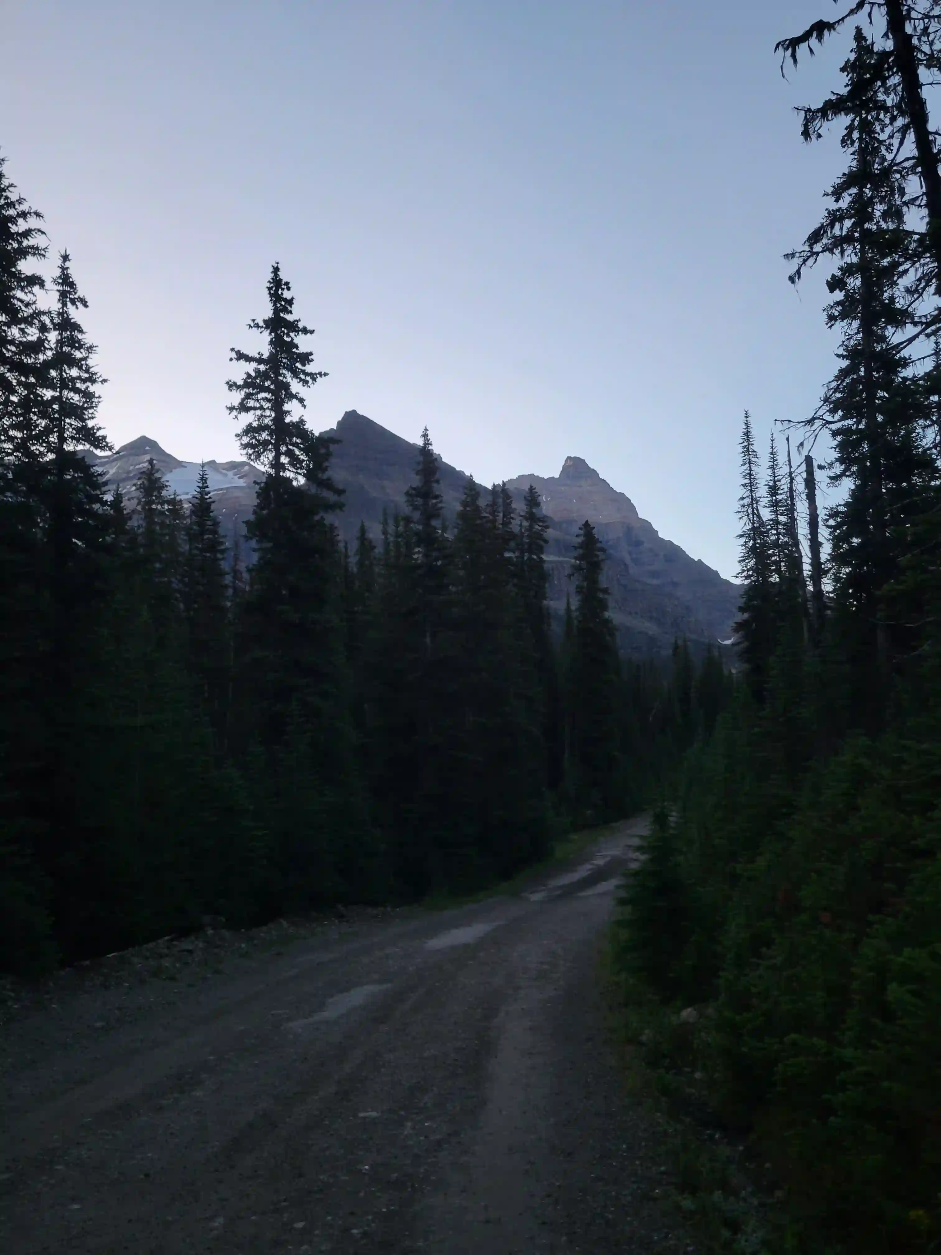
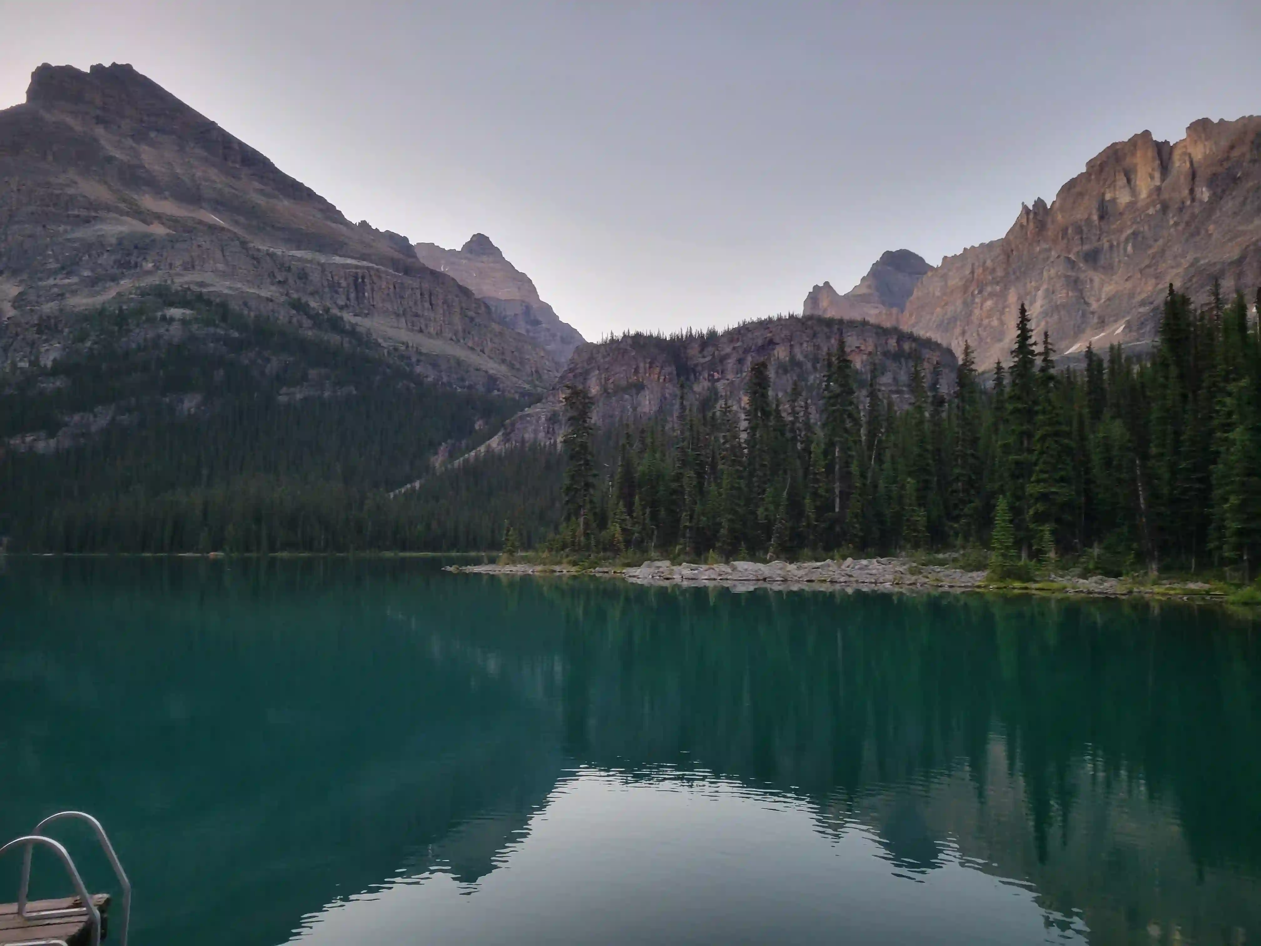
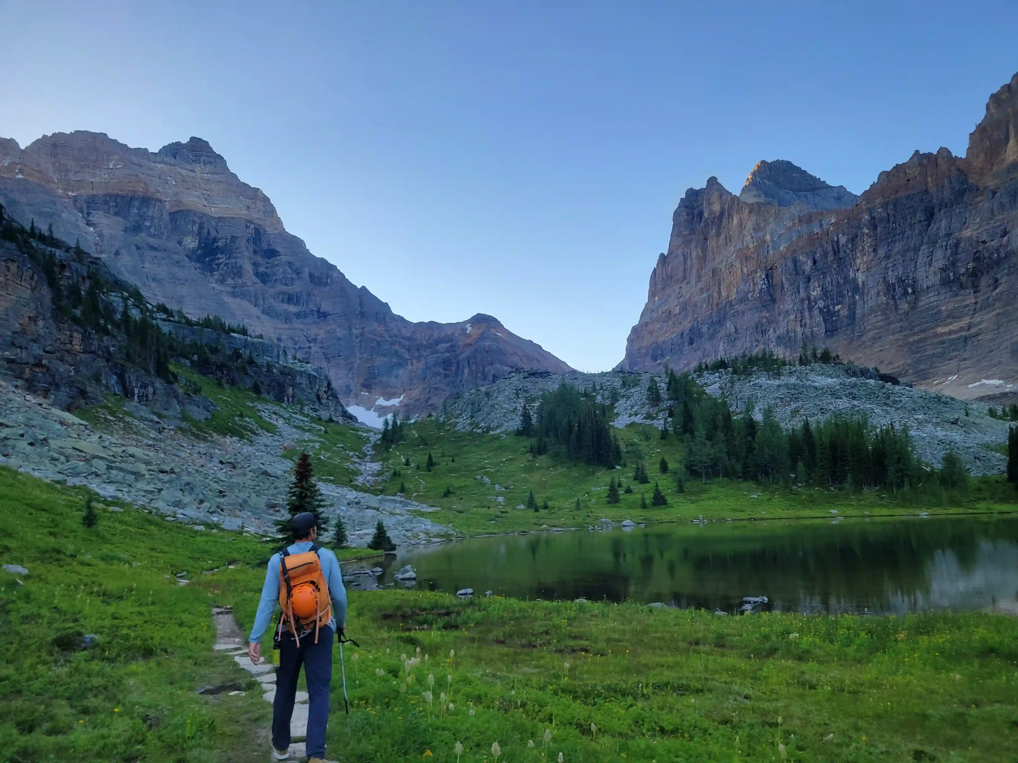
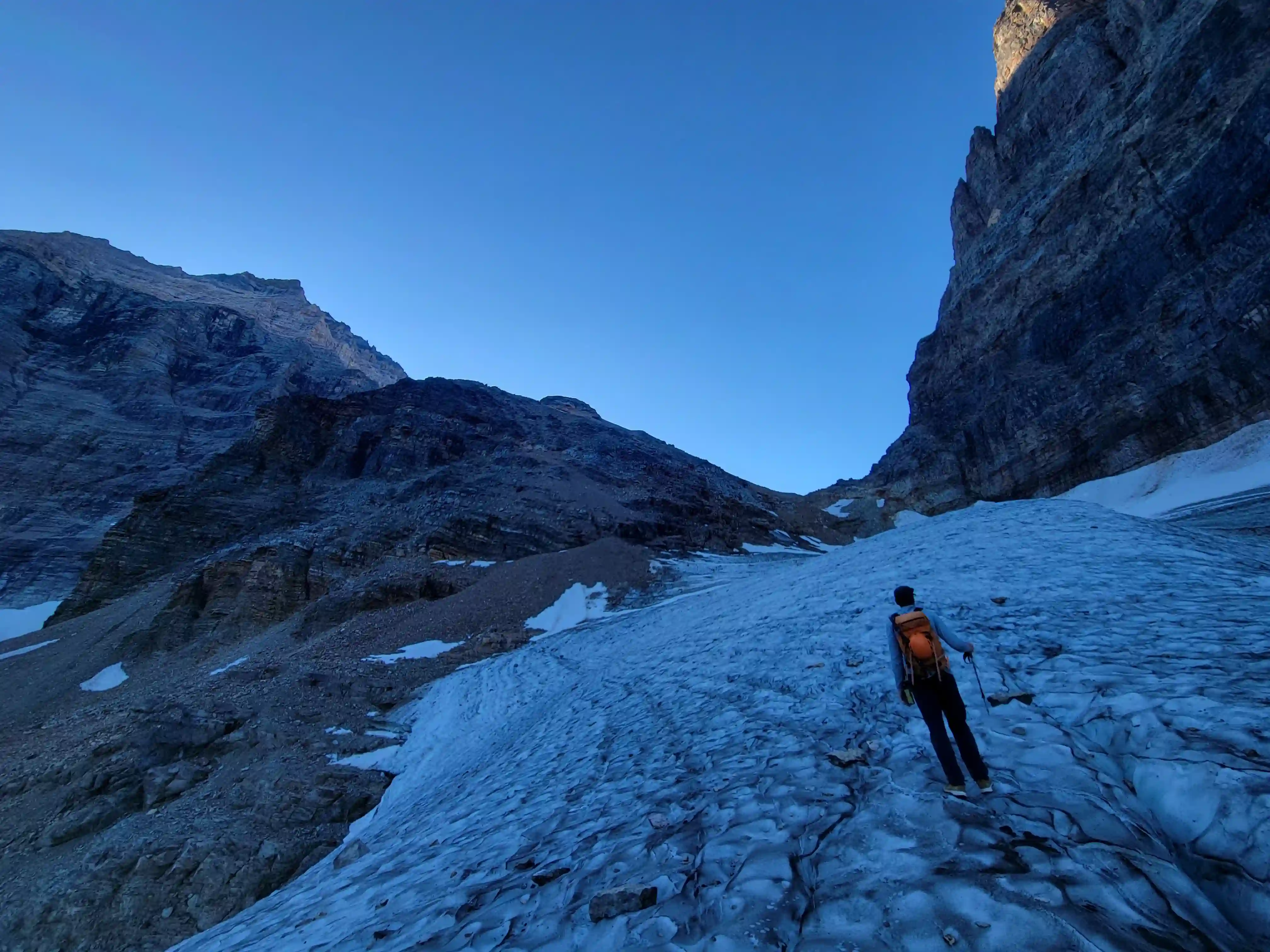
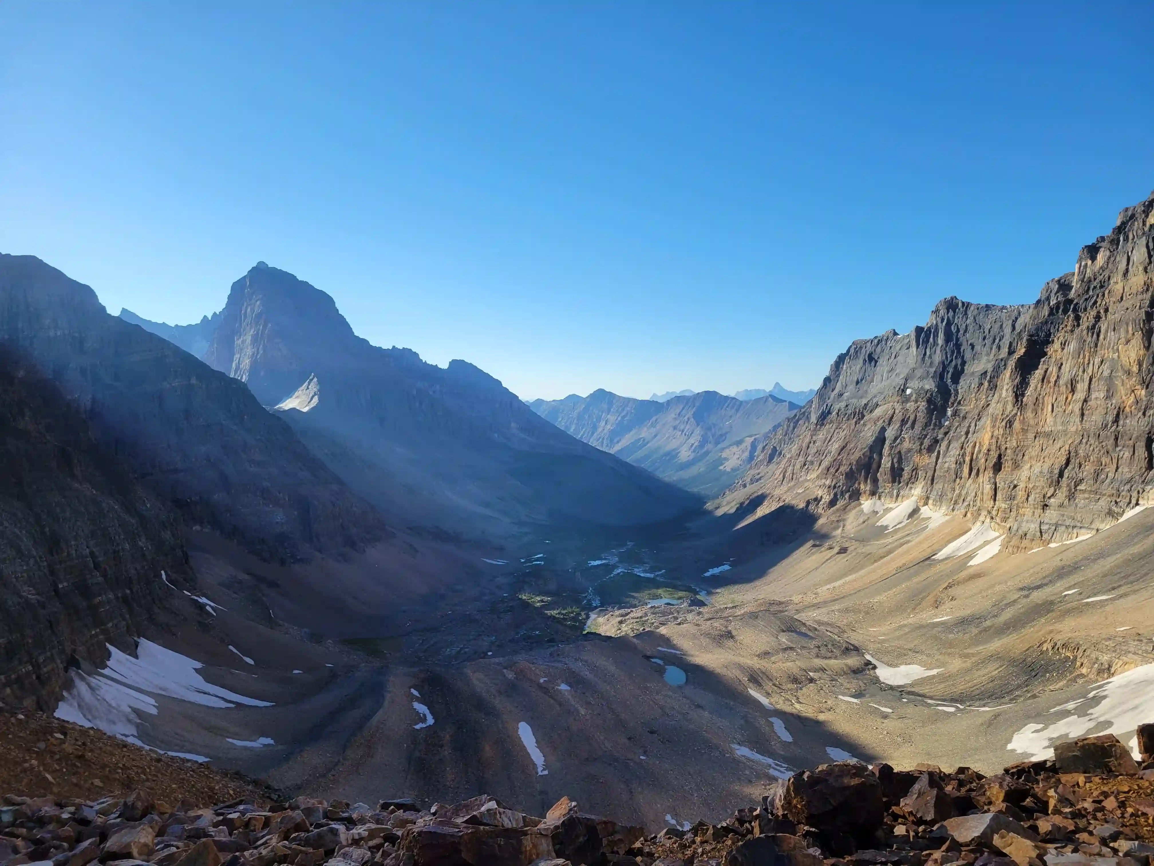
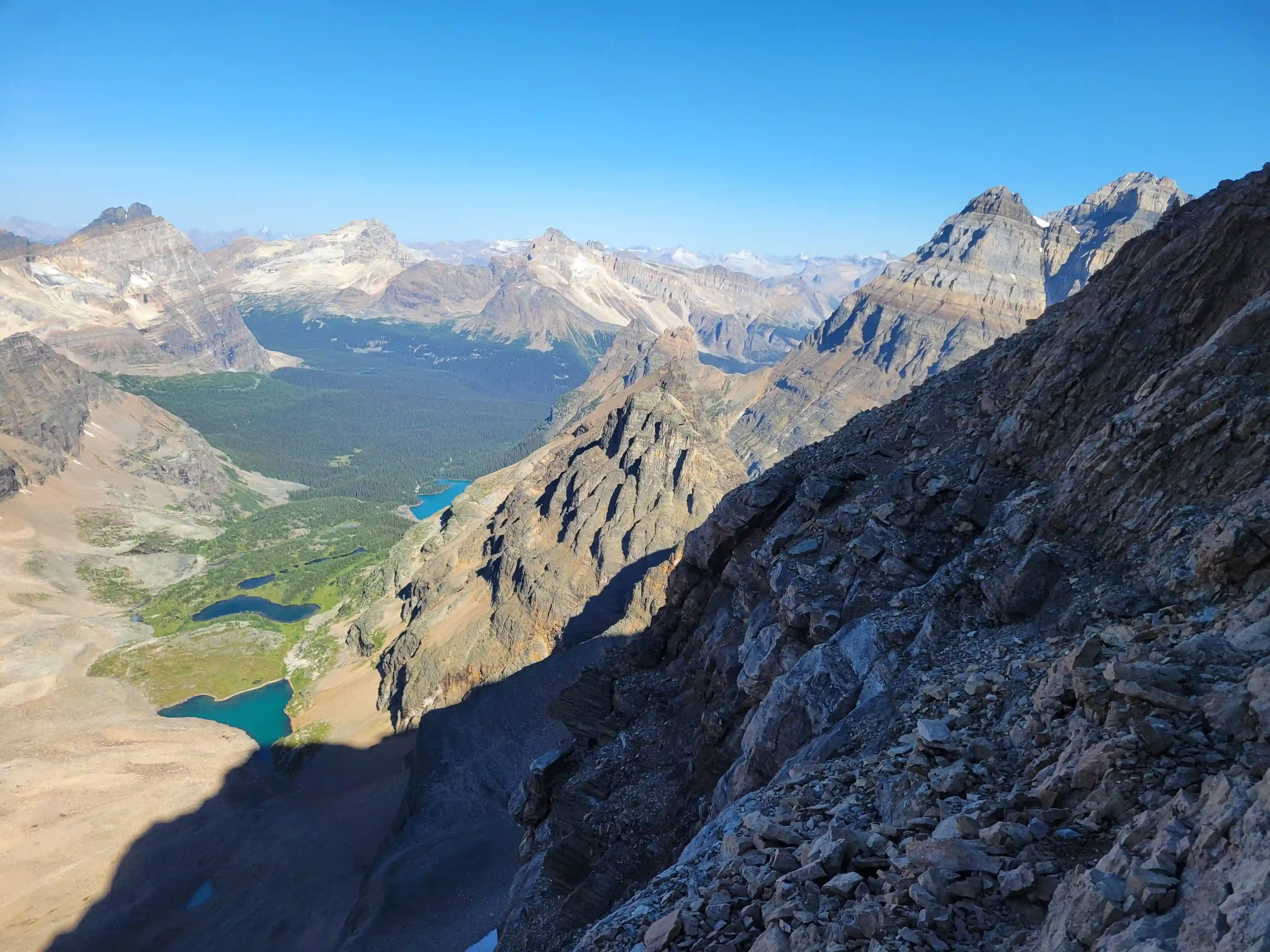
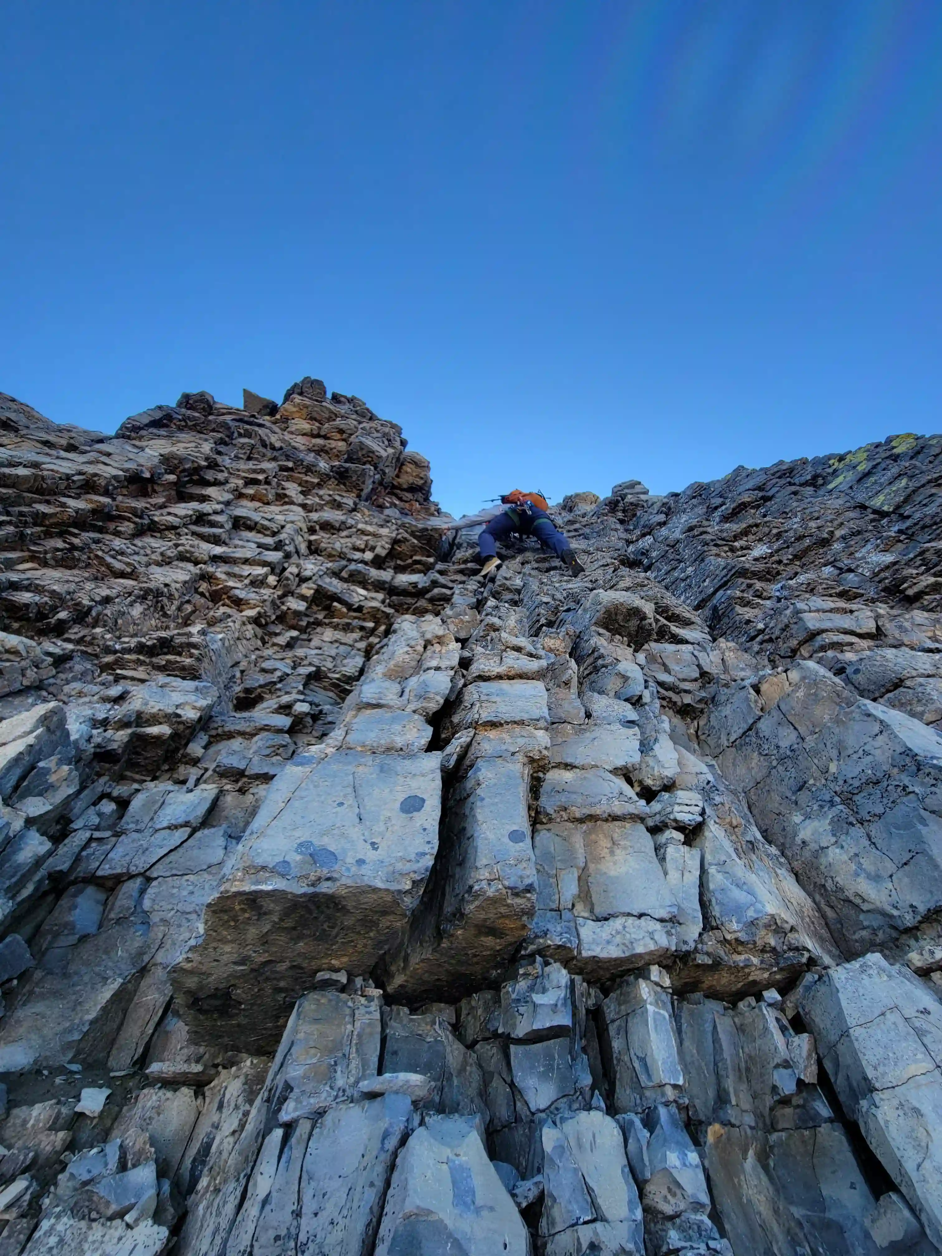
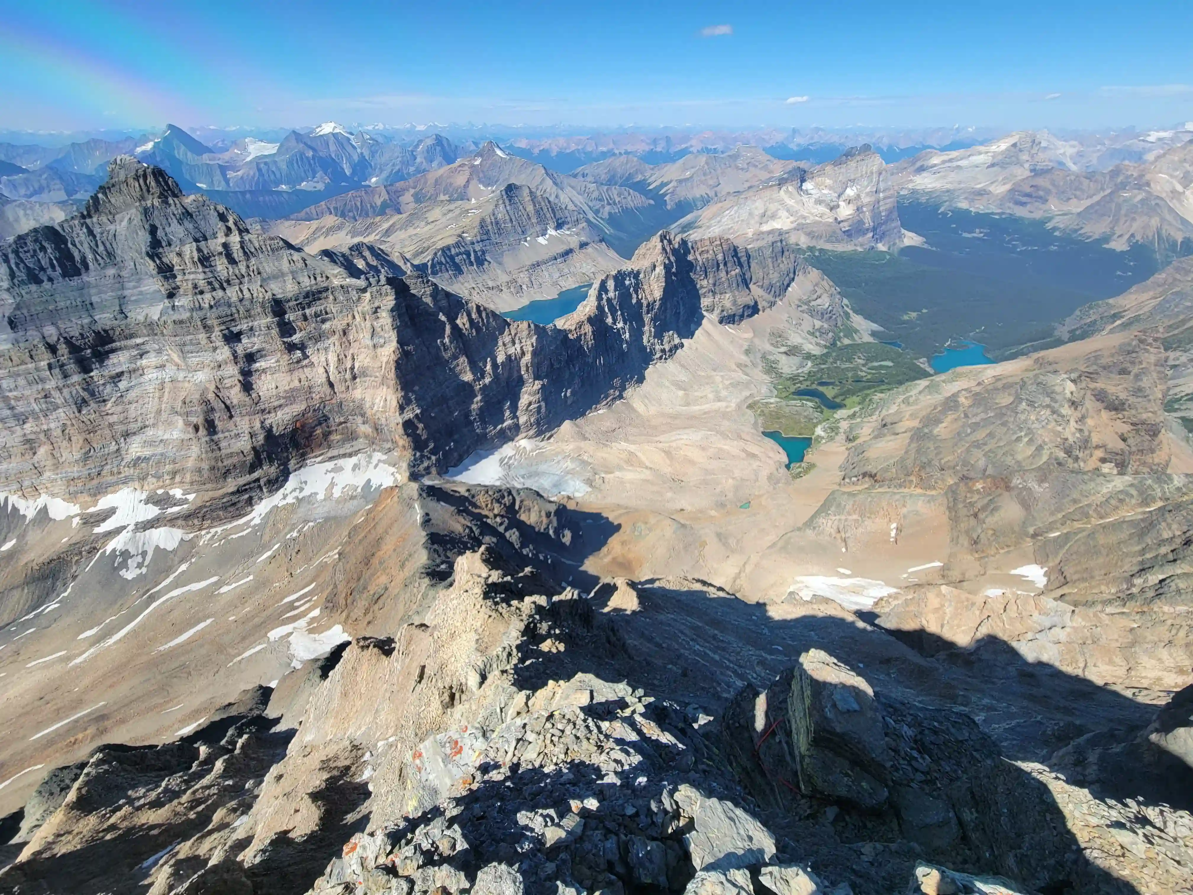
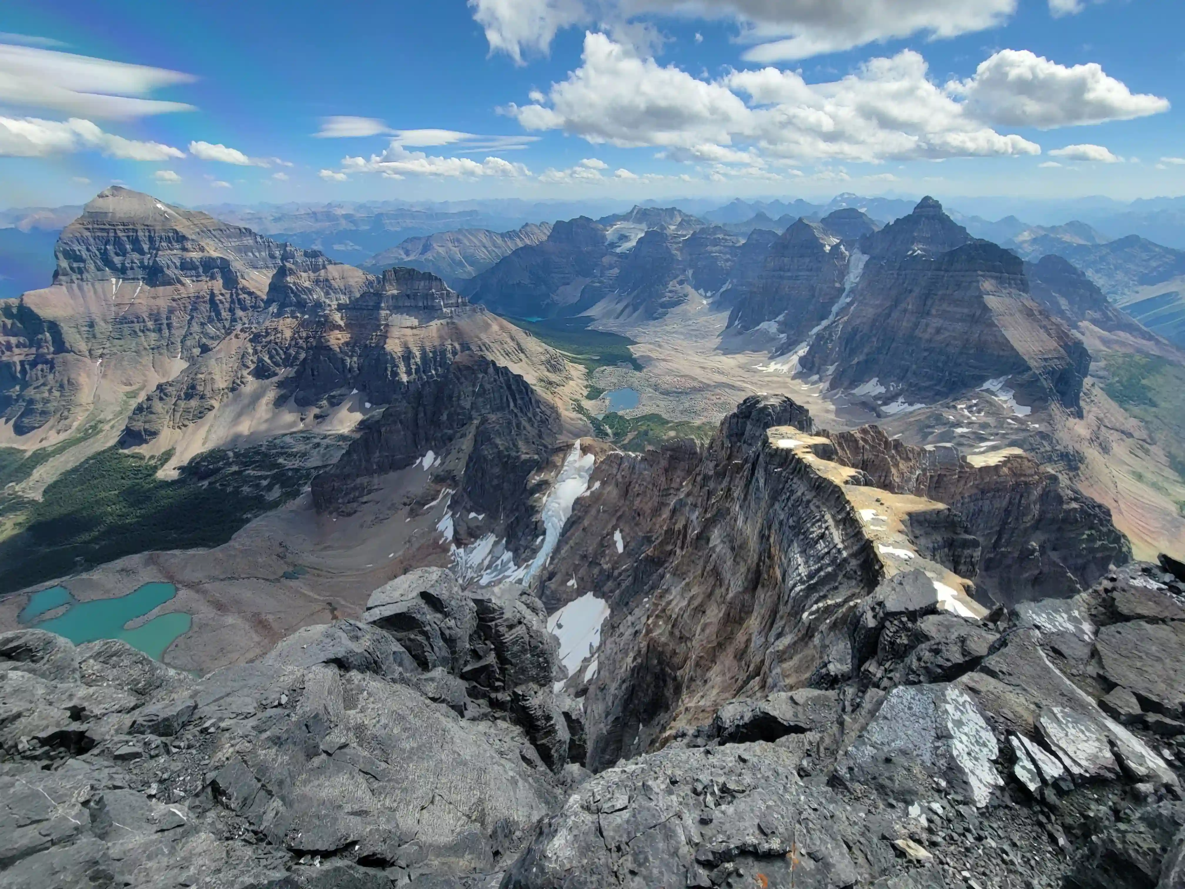
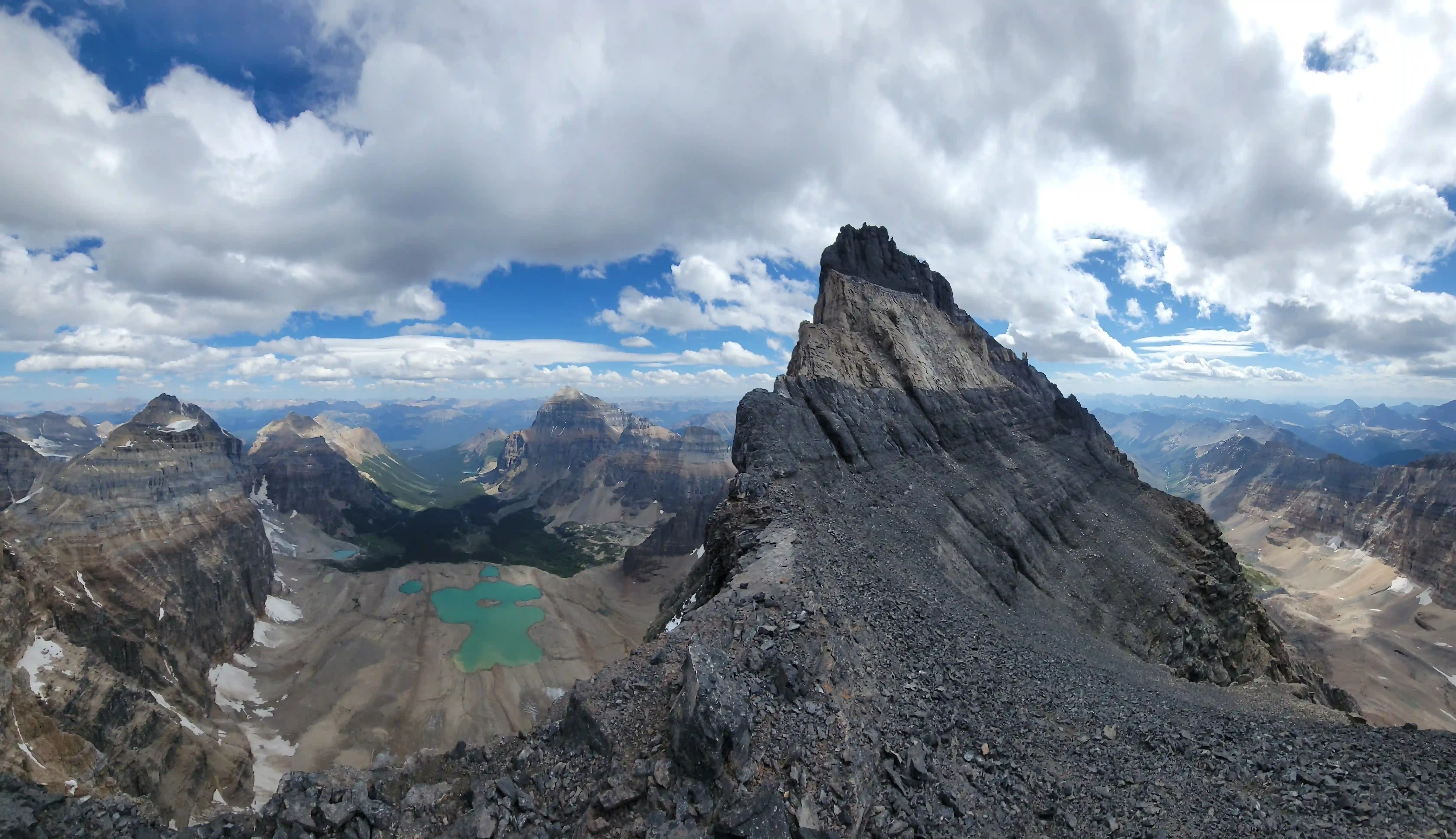
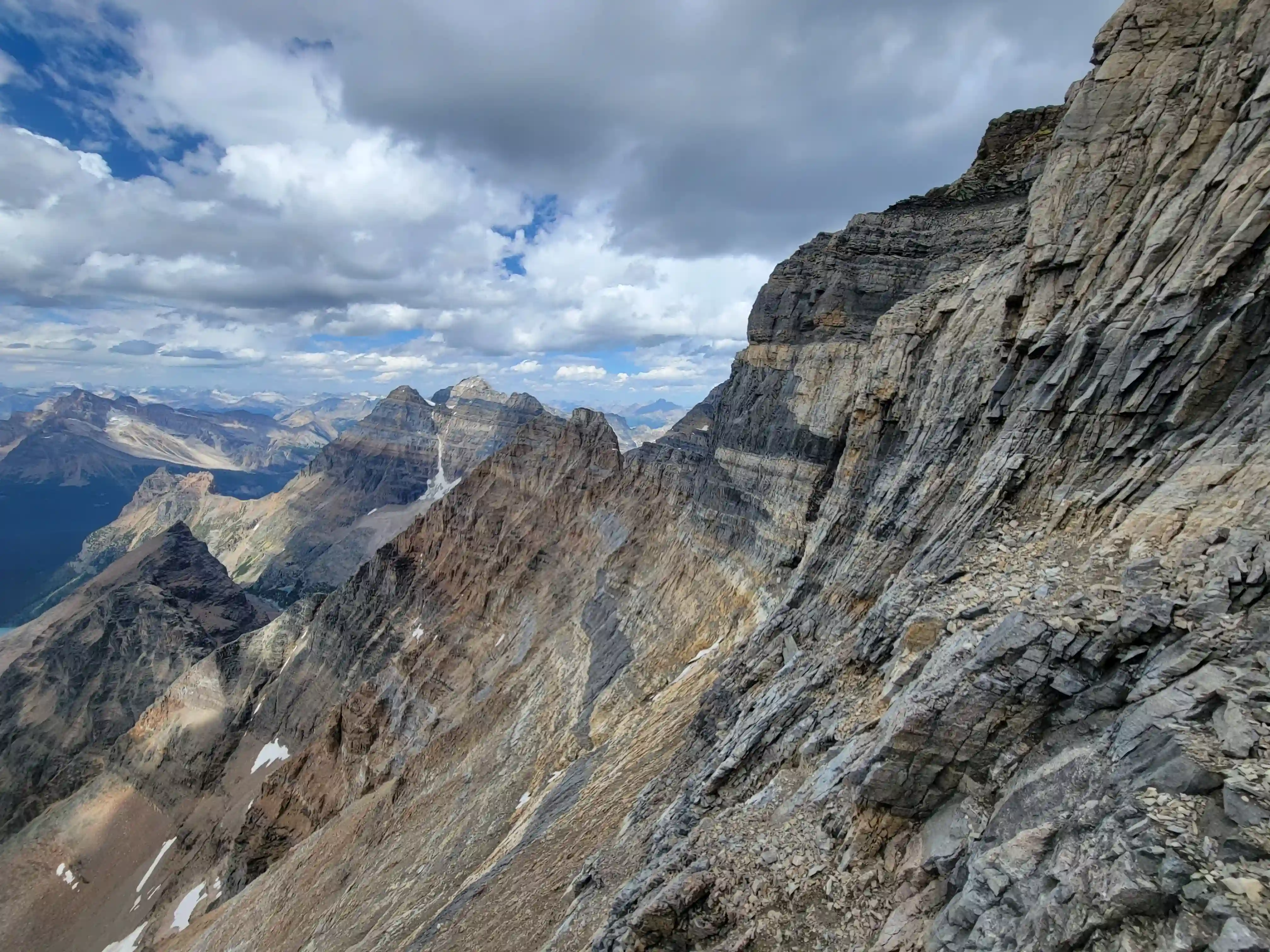
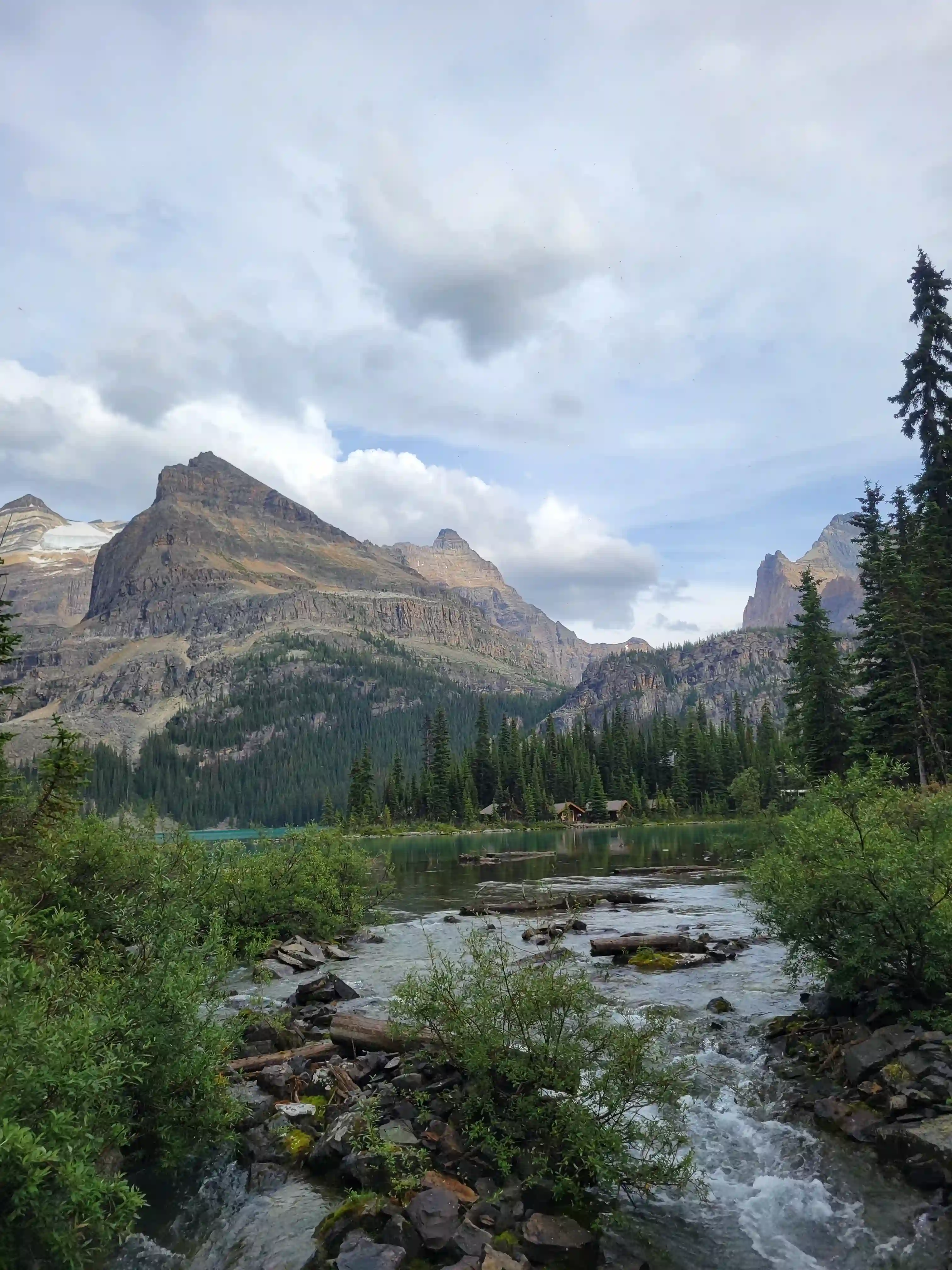
The approach for Hungabee Mountain starts at the Lake O'Hara parking lot which is 12km away from the actual lake. There is a road from the lot to the lake but personal vehicles and bicycles aren't allowed, and with the buses not starting up the road until 8:30am and the last bus heading down at 6:30pm this forces an early start and slog up the road for anyone wanting to day trip this objective without having to walk the 12km out afterwards. The redeeming quality about Hungabee is that once you arrive at Lake O'Hara the outing is quite short and enjoyable in the grand scheme of Canadian Rockies 11000ers. You cover a good chunk of the distance simply reaching the lake, leaving just the scenic trails and fun climbing sections, aside from the odd scree rubble section and the small glacier, assuming you catch the bus down.
After a few not too technical objectives together Darren and I had been looking forward to a challenging 11000er and when we scoped out good weather for Hungabee Mountain a bit less than a week out we were both excited to send big and started making plans! I ended up squeezing a trip up
Mount Temple
in the day before but that night I was packing for the mountains again and at 3am Darren and I met up in Canmore and started making our way towards Lake Louise. We ended up starting at the Lake O'Hara lot by 4:30am and reached the lake by 6:30am so although it was a slog at least we got it done in the dark while we were still half asleep.
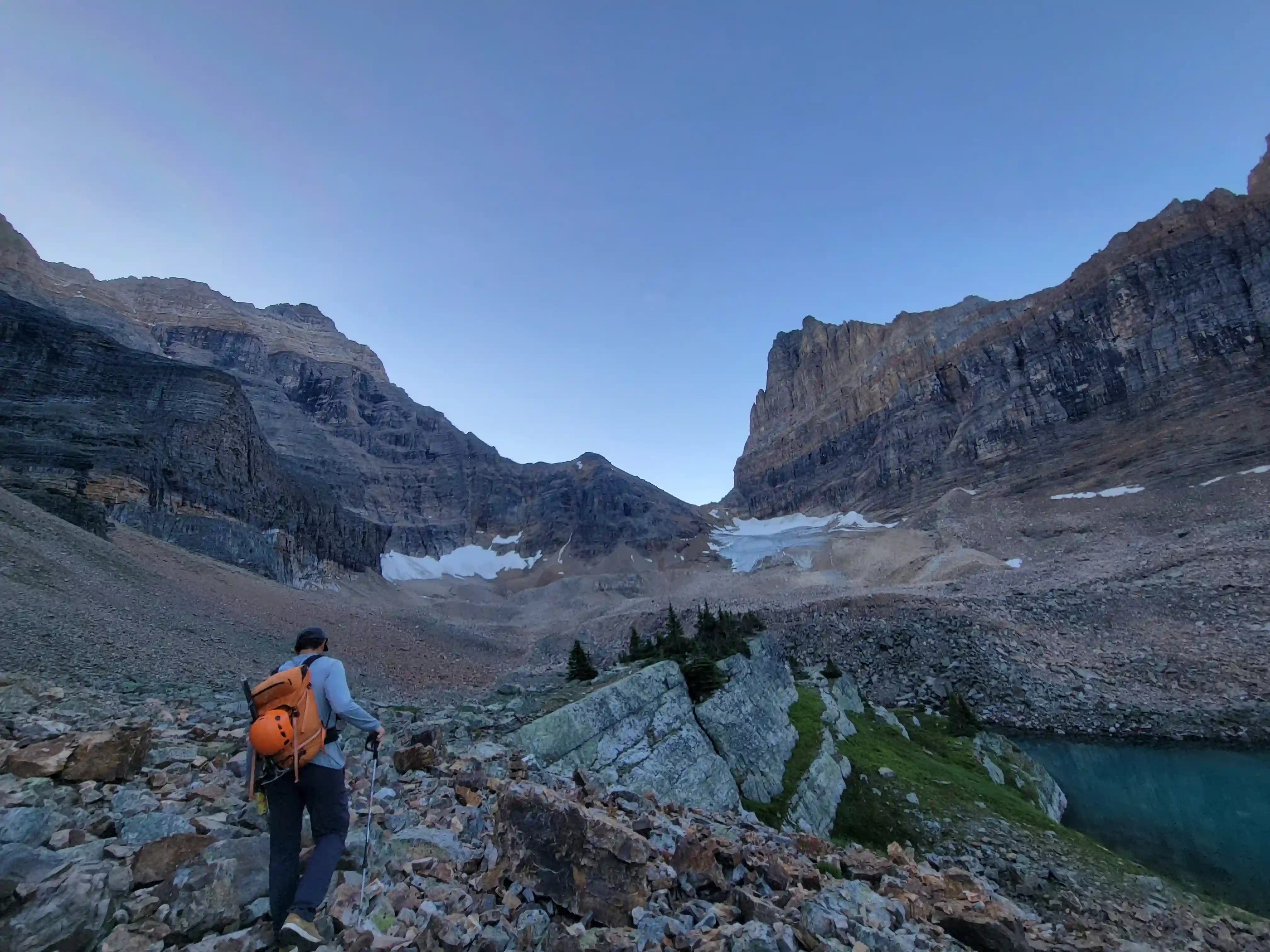
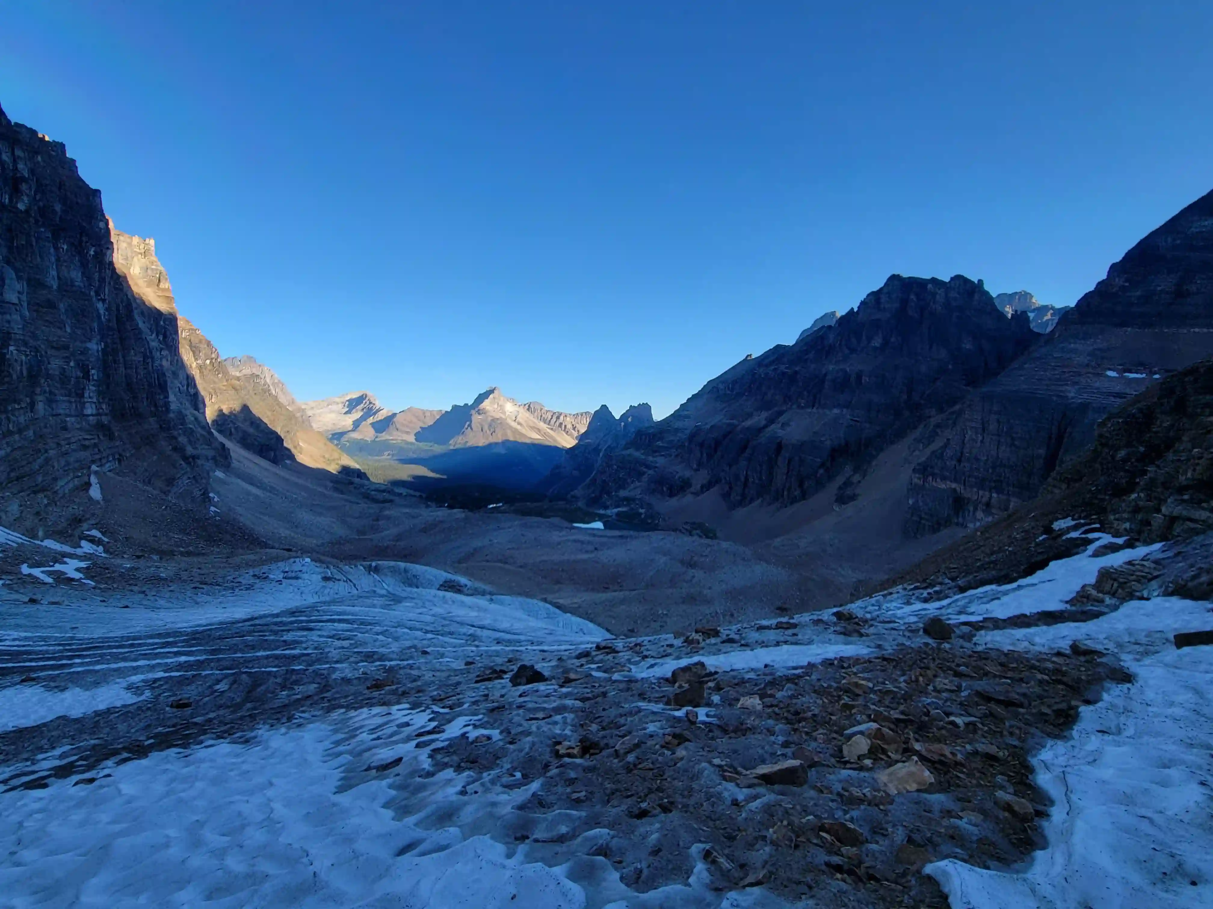
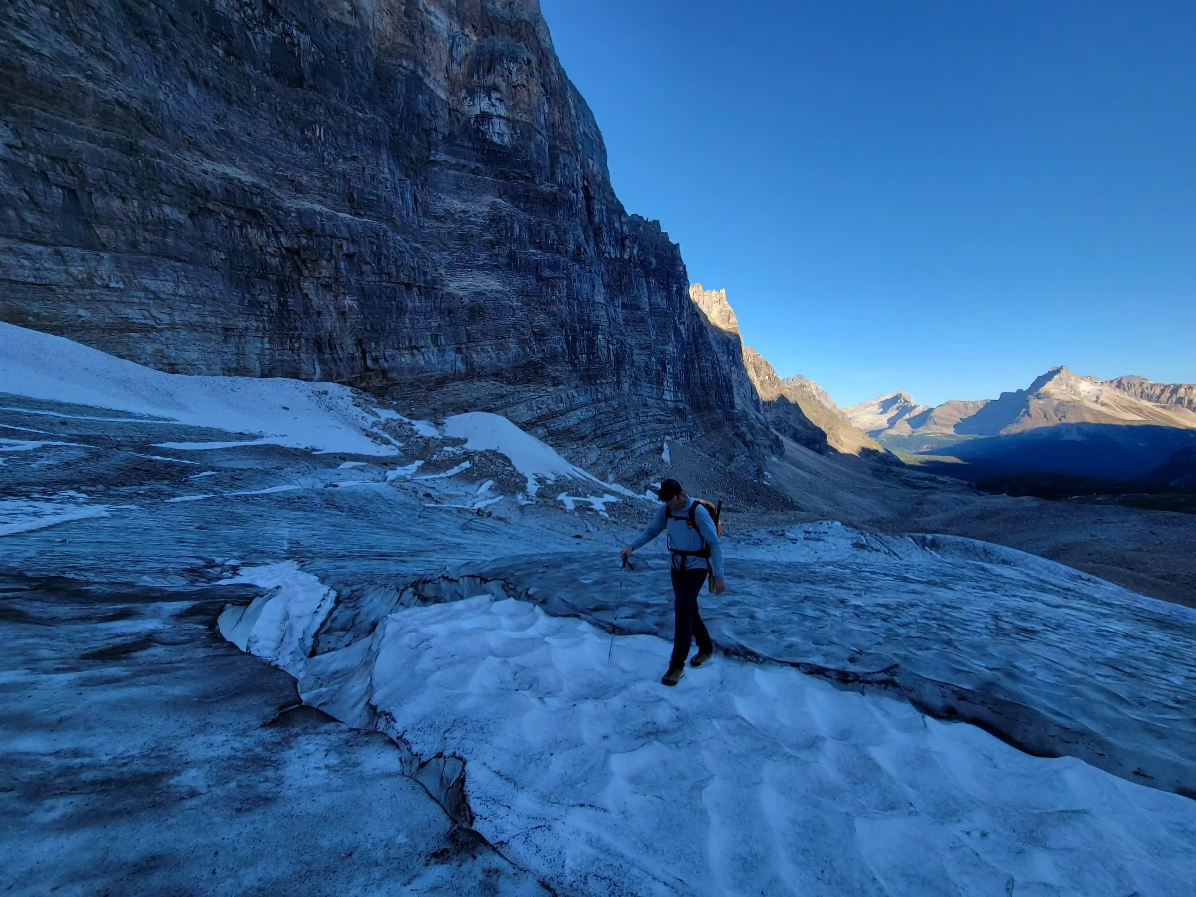
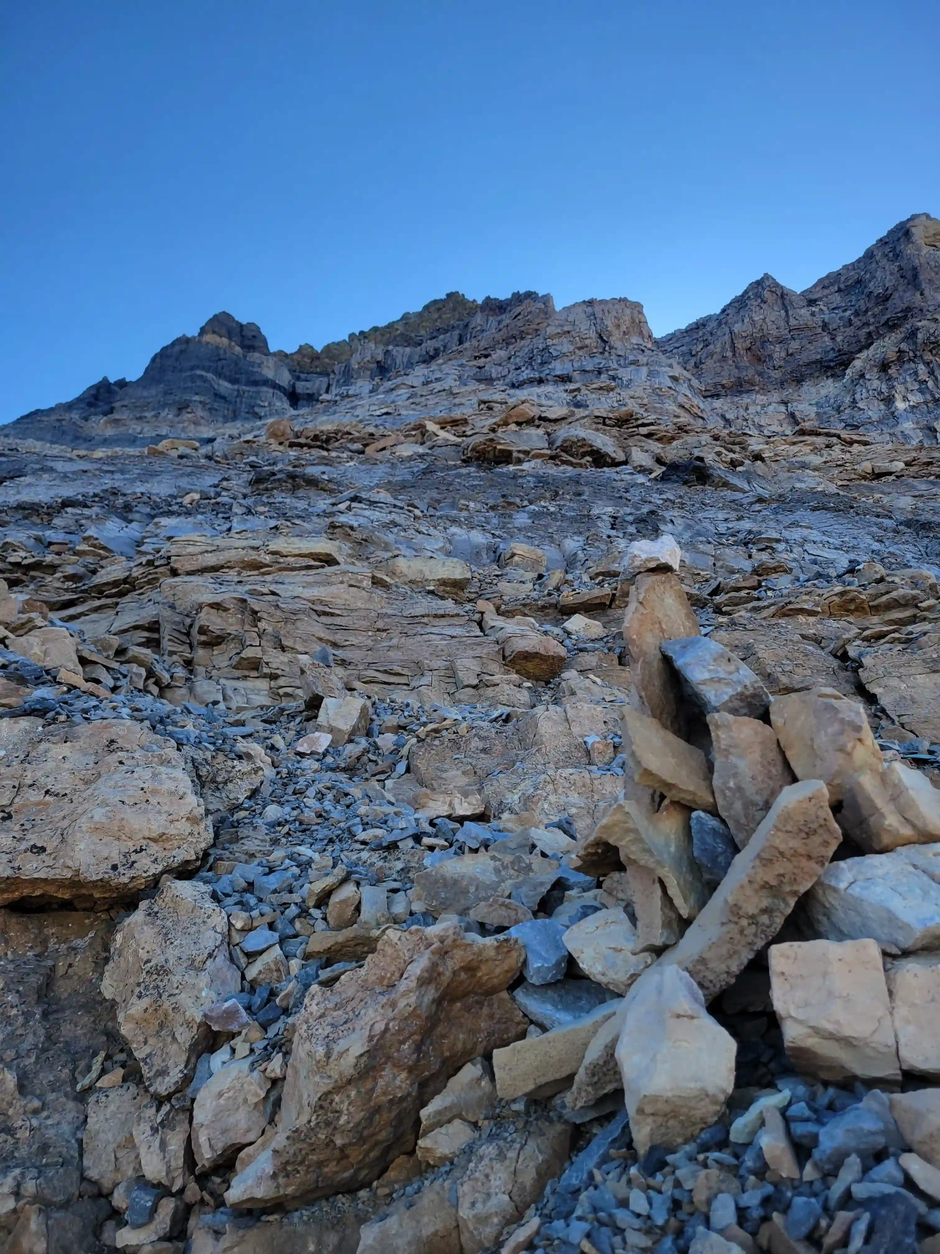
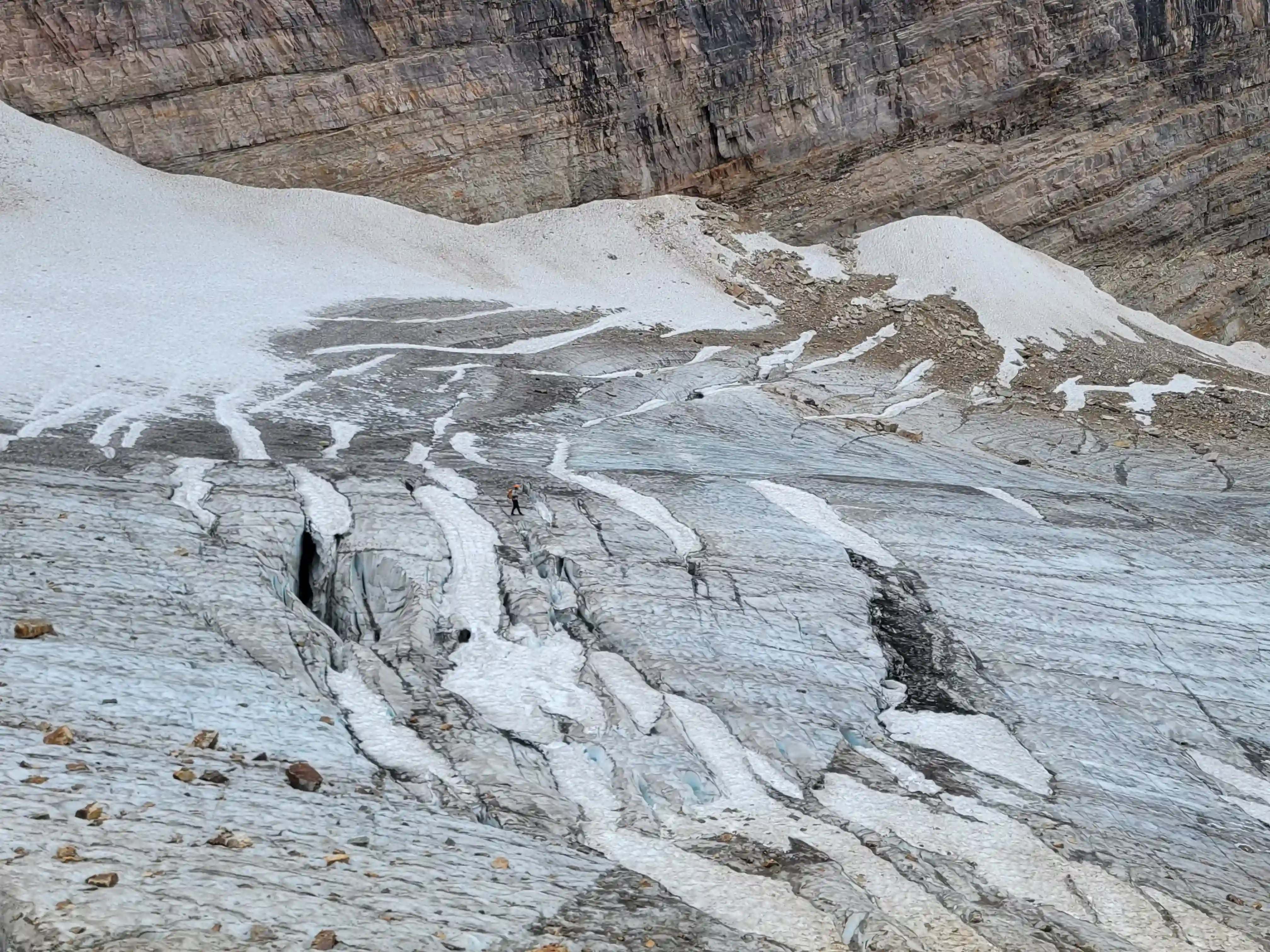
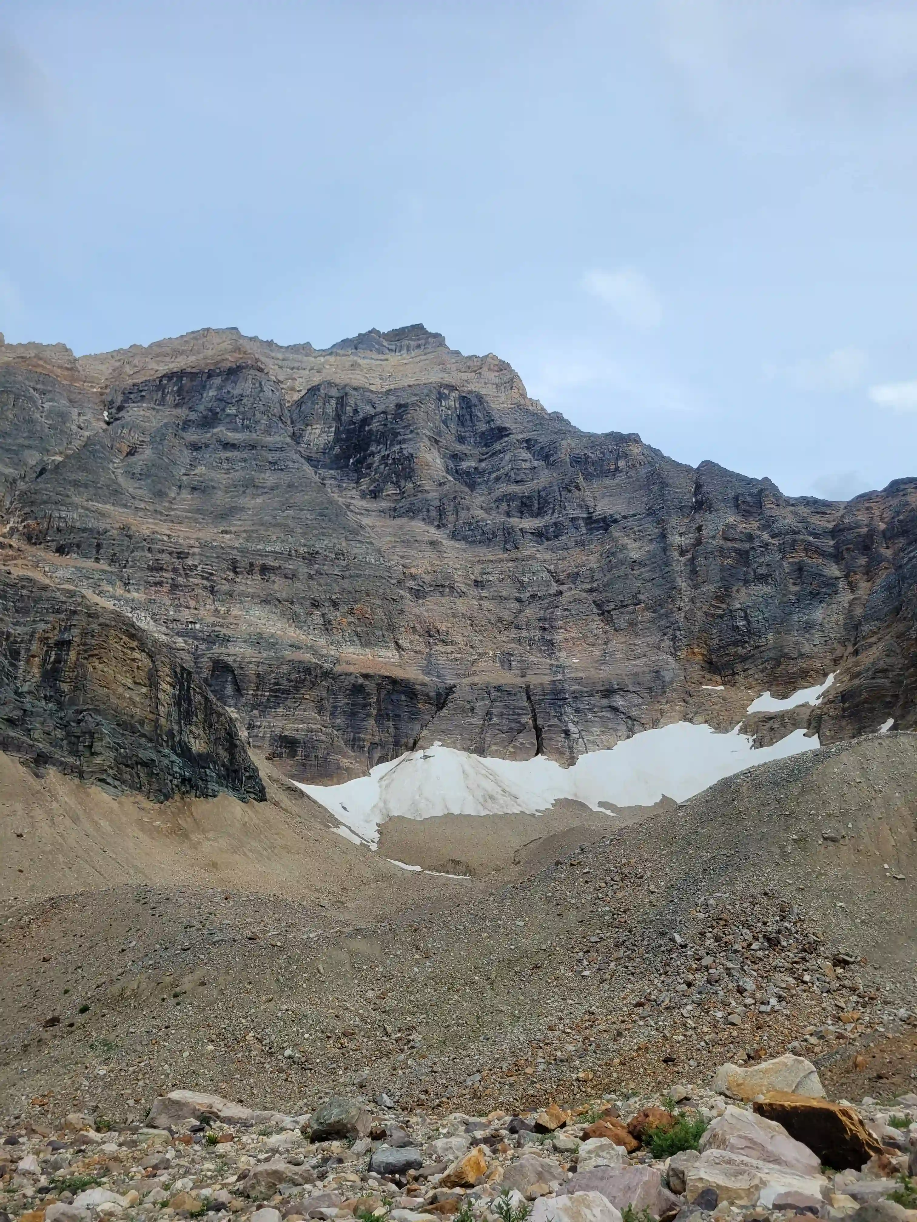
From there the remainder of the approach was quite enjoyable with great trails and excellent views of our objective as it slowly got closer. Then after passing Opabin Lake the terrain transitioned to rubble and soon after Darren and I had to decide between reaching Opabin Pass going over the glacier or going climbers left onto nasty loose terrain. Neither of us brought crampons or mountaineering boots to save weight but we decided to go over the glacier, micro spikes would have been a good idea! The glacier wasn't very steep but the initial sloped section was slick and wouldn't have been fun had we slipped on the way up. We didn't end up roping up since the glacier was exposed ice for the most part but we had to watch out for a few snowy sections that were hiding crevasses underneathe. After getting off the glacier it was just a bit of scrambling and choss left to deal with before we reached the pass and then we were gearing up for the climb!
links:
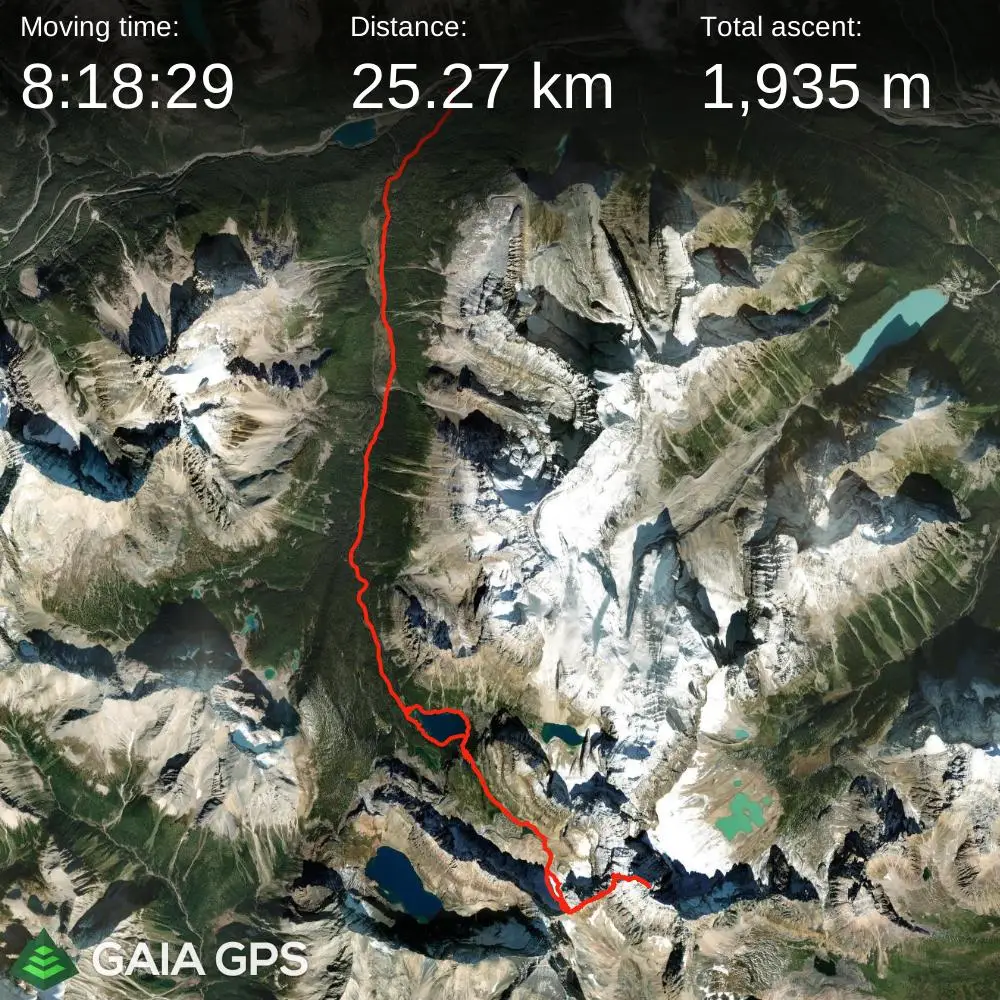
STRAVA
|
GAIA
elapsed time: 14hrs
DIFFICULTY: AD/AD+, sustained 5th class up to 5.4, glacier travel, often multiday
Use the following links to jump to:
Follow the journey
I'll send you an email when a new trip report drops.
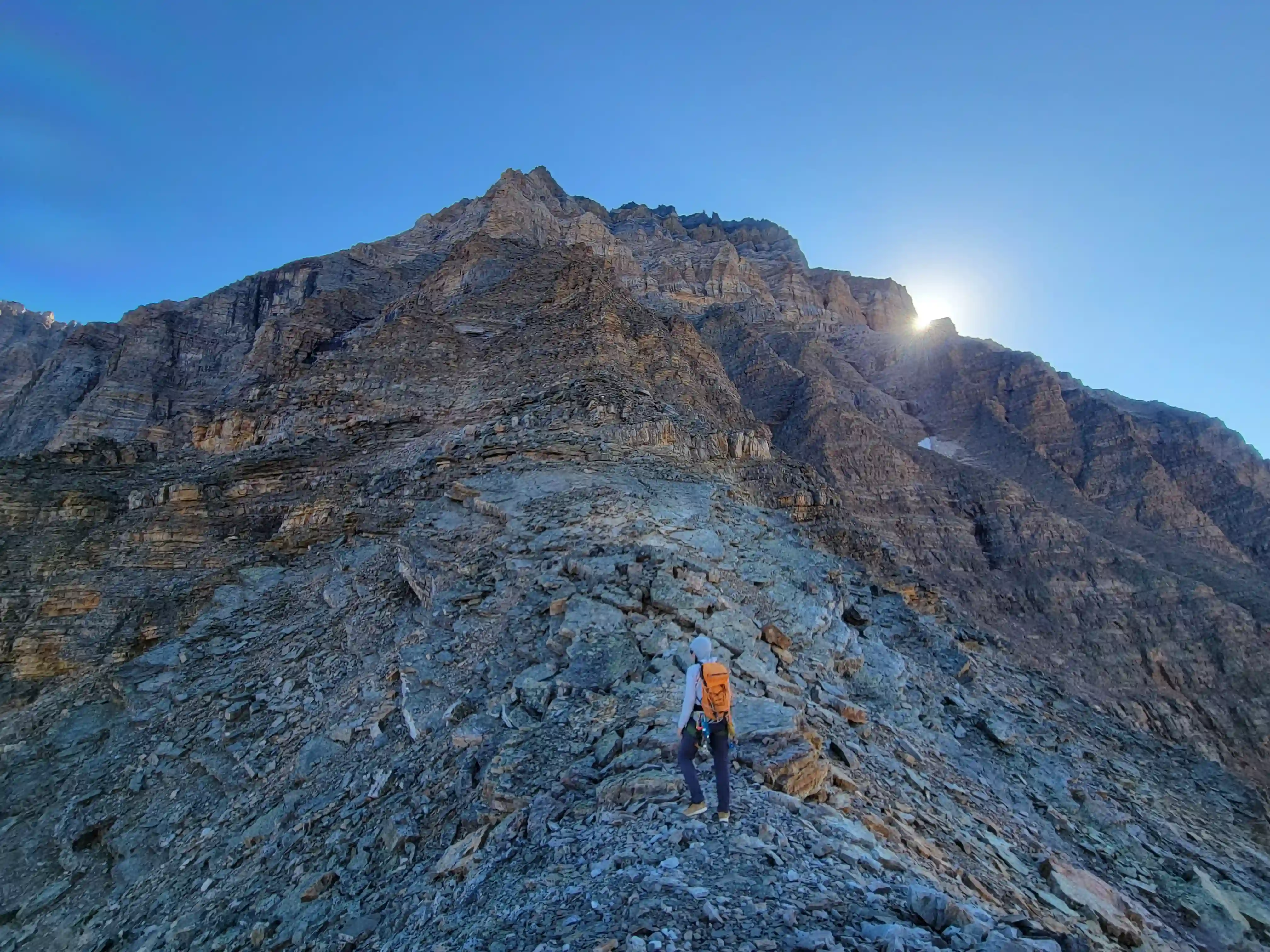
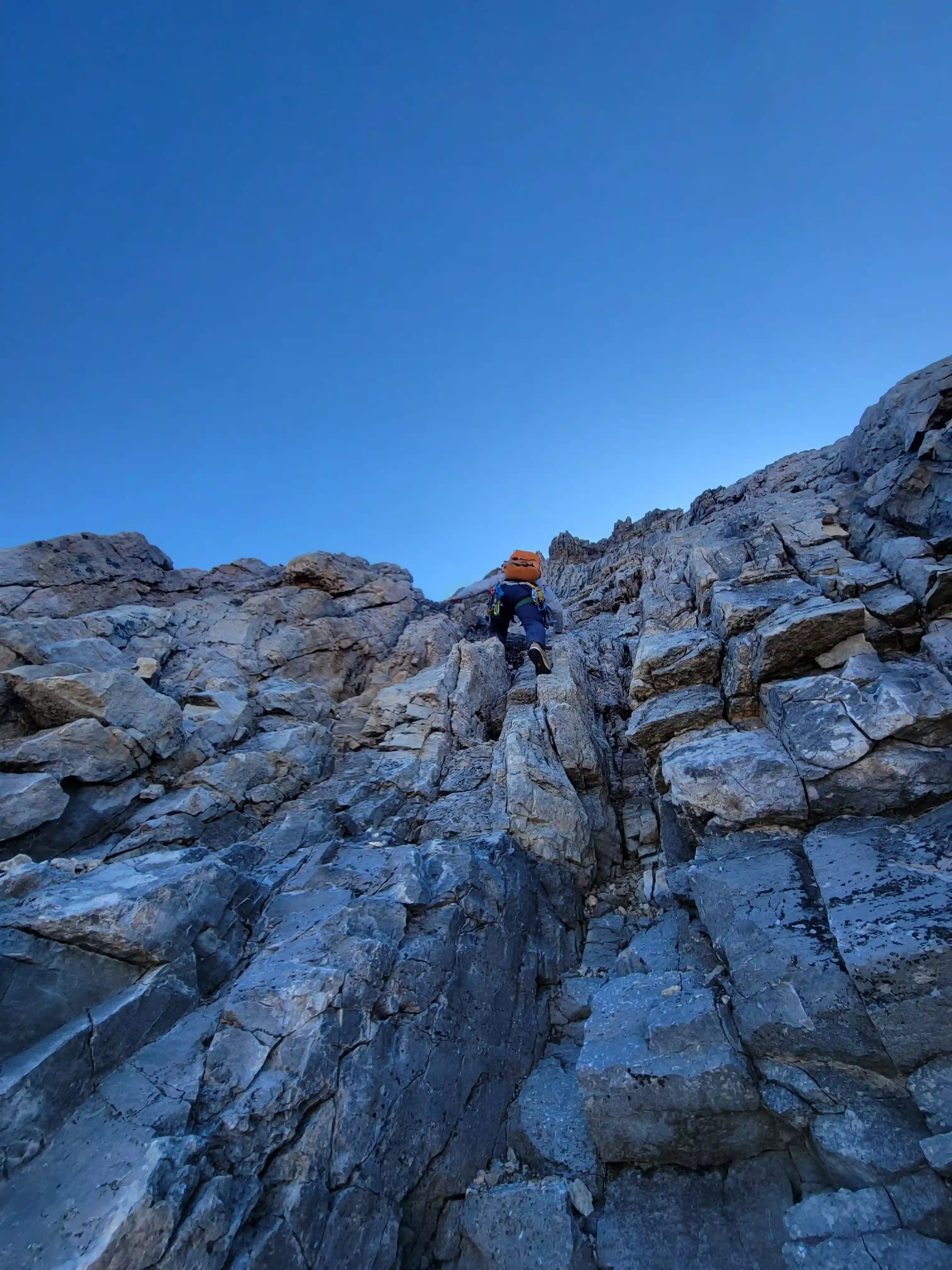
THE APPROACH
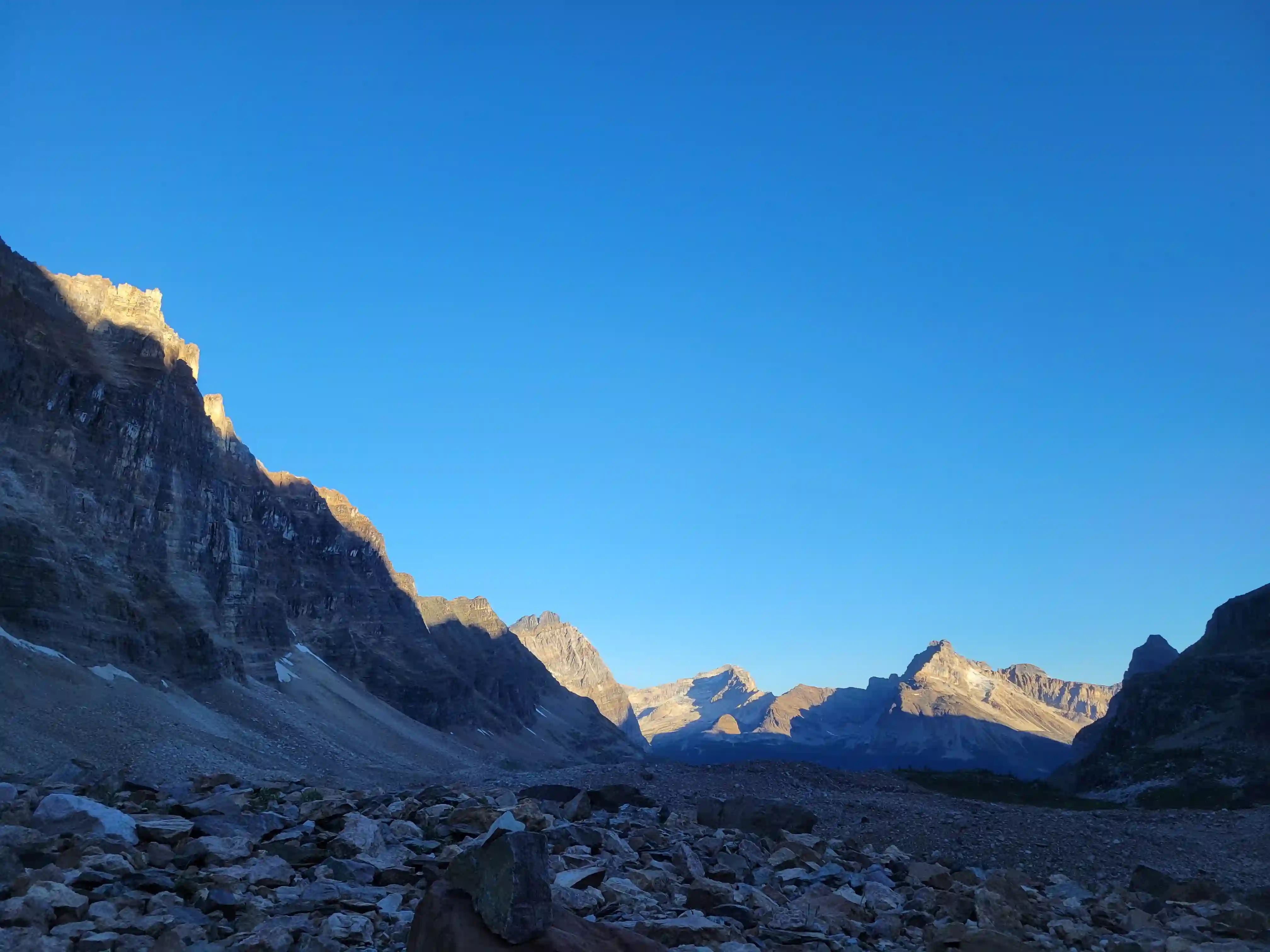
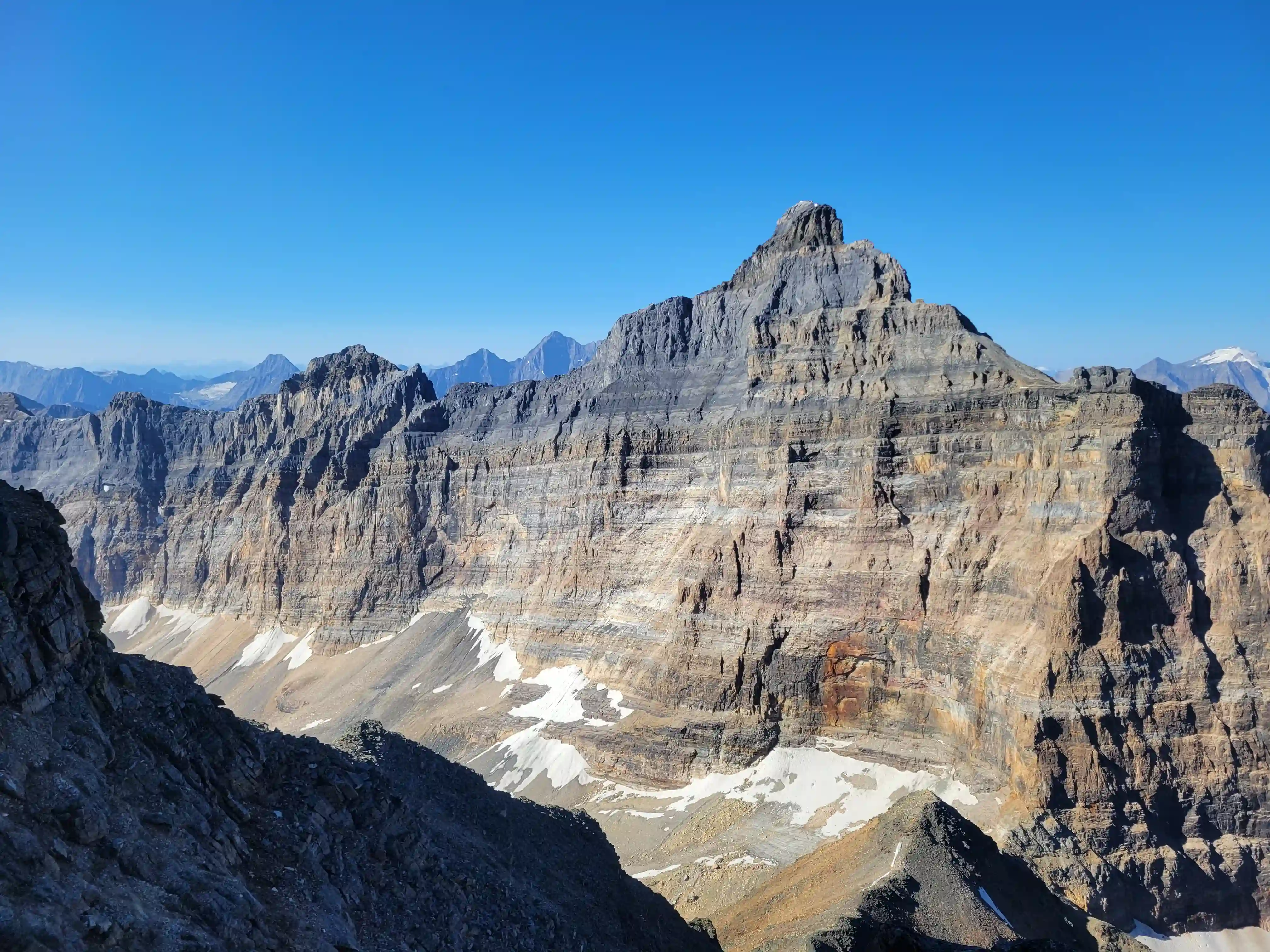
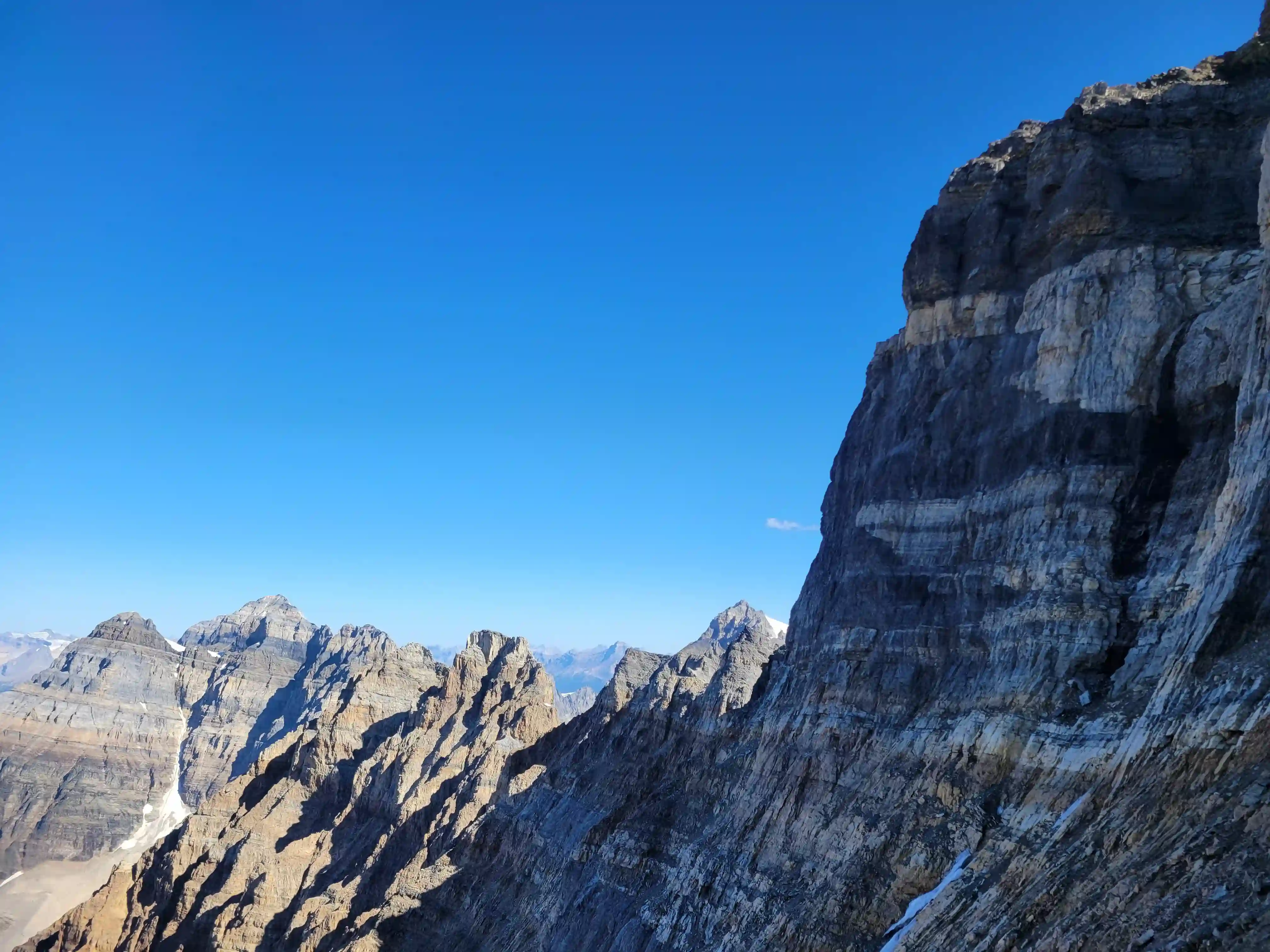
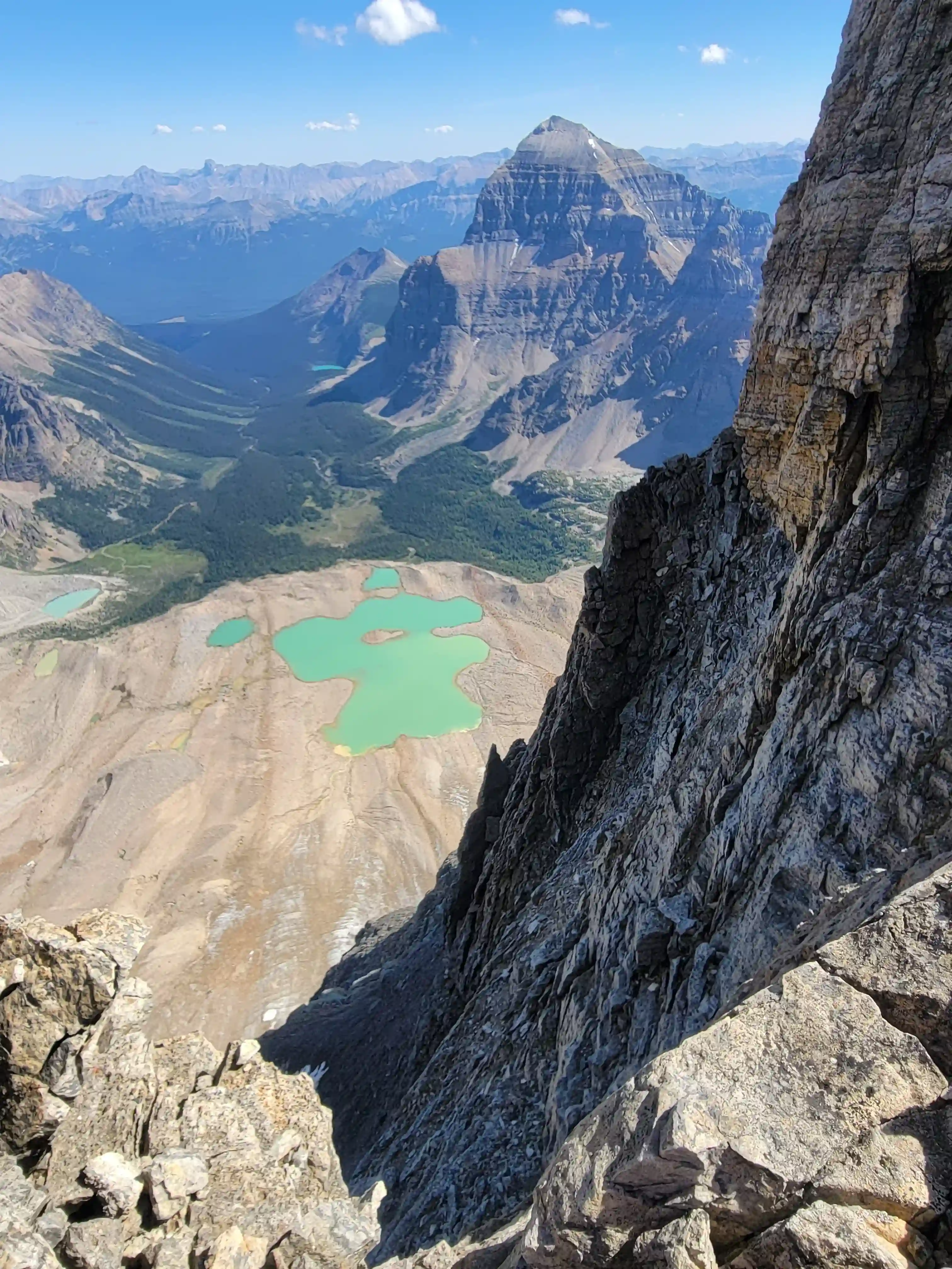
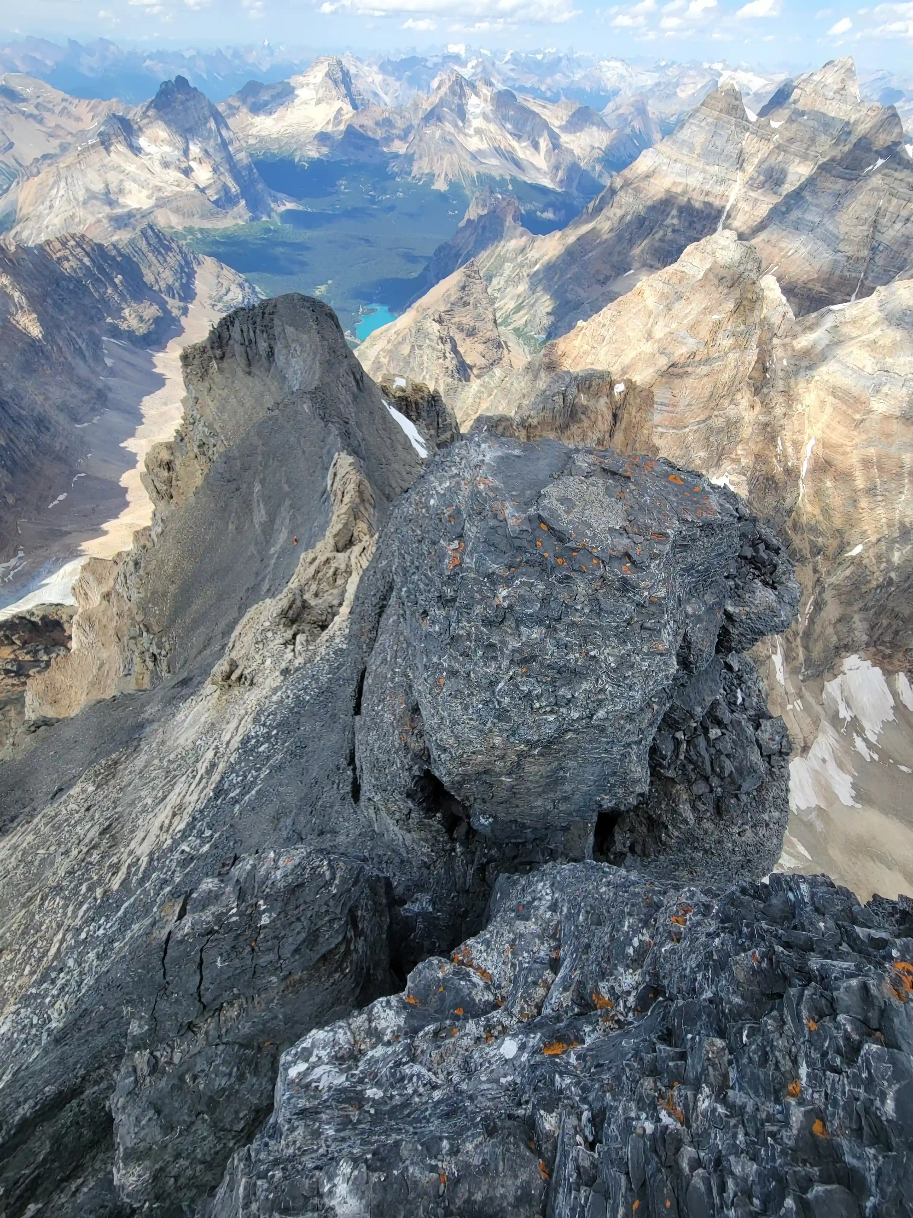
Mount Biddle towering above
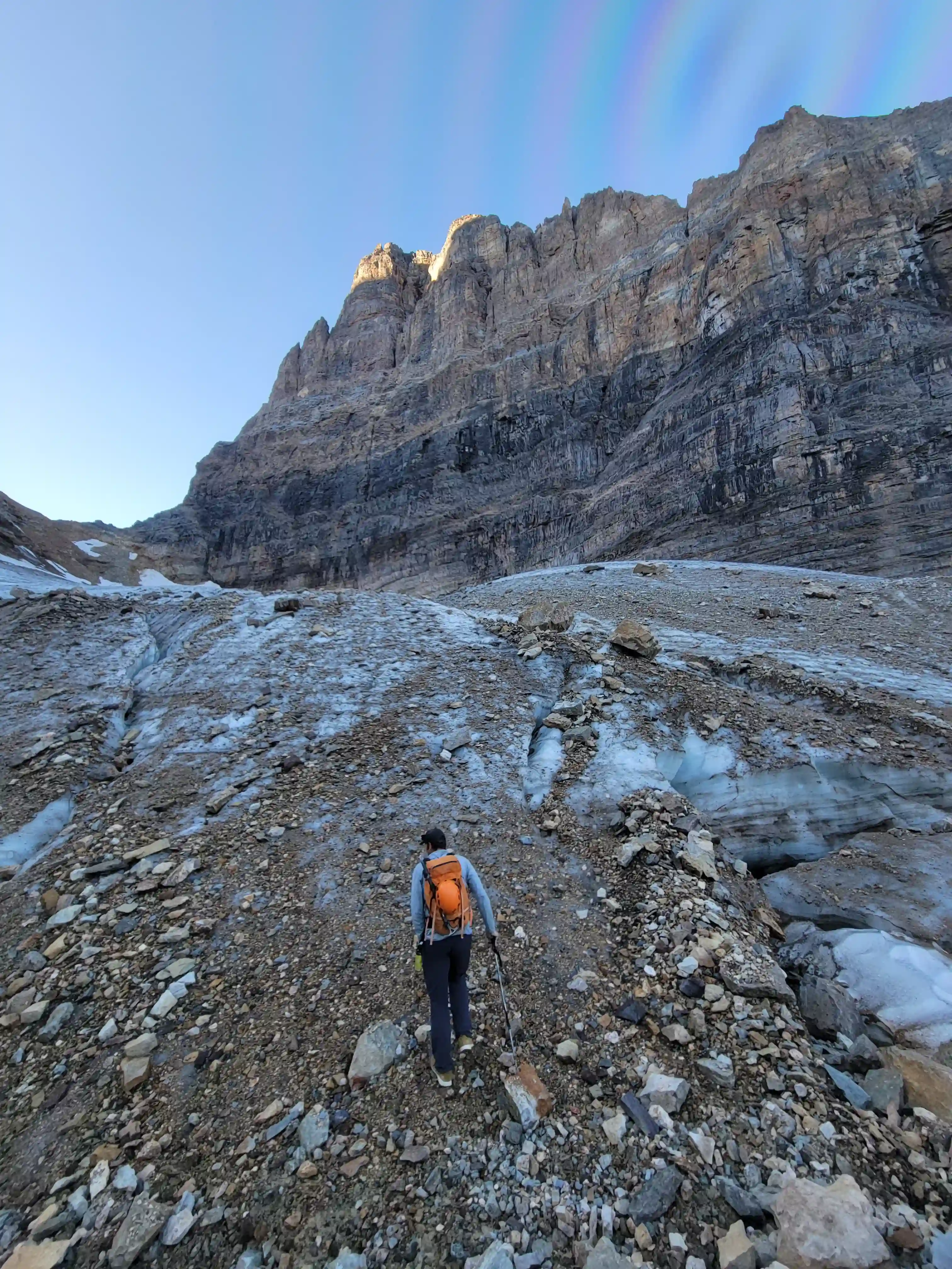
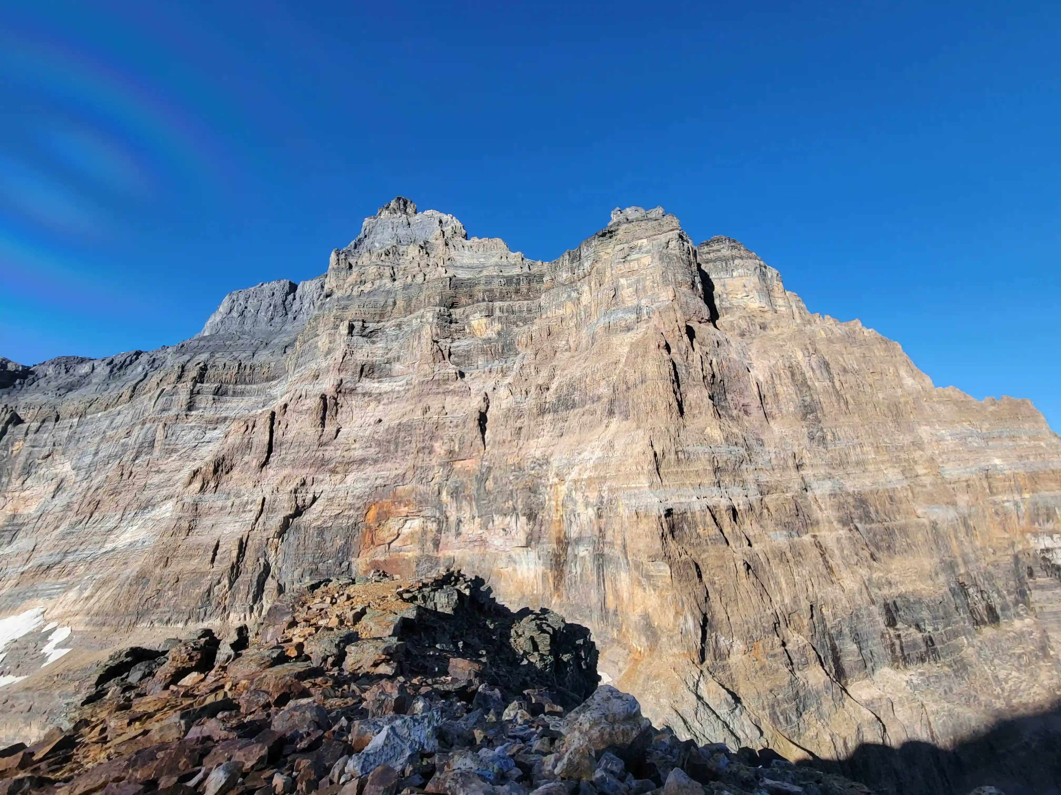
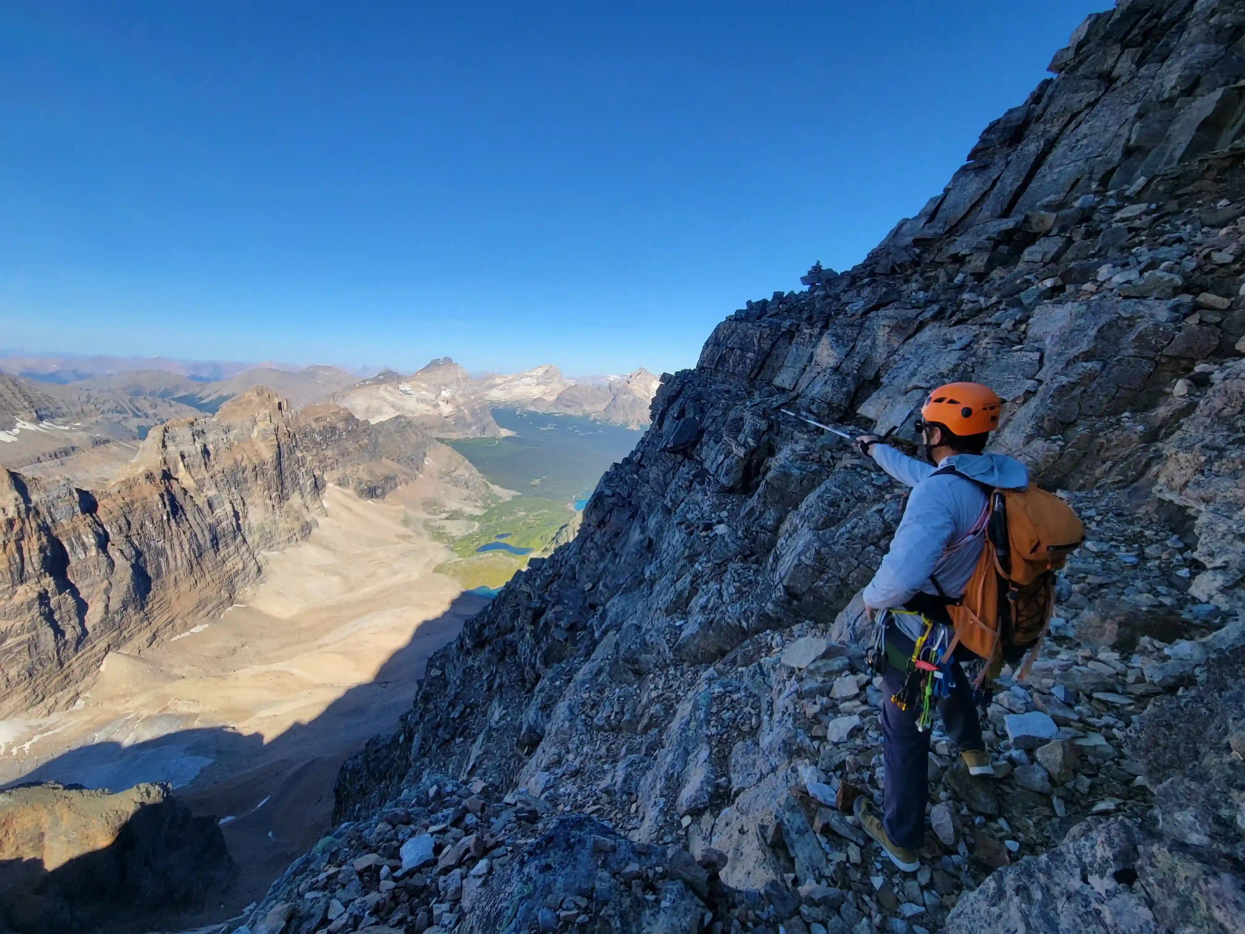
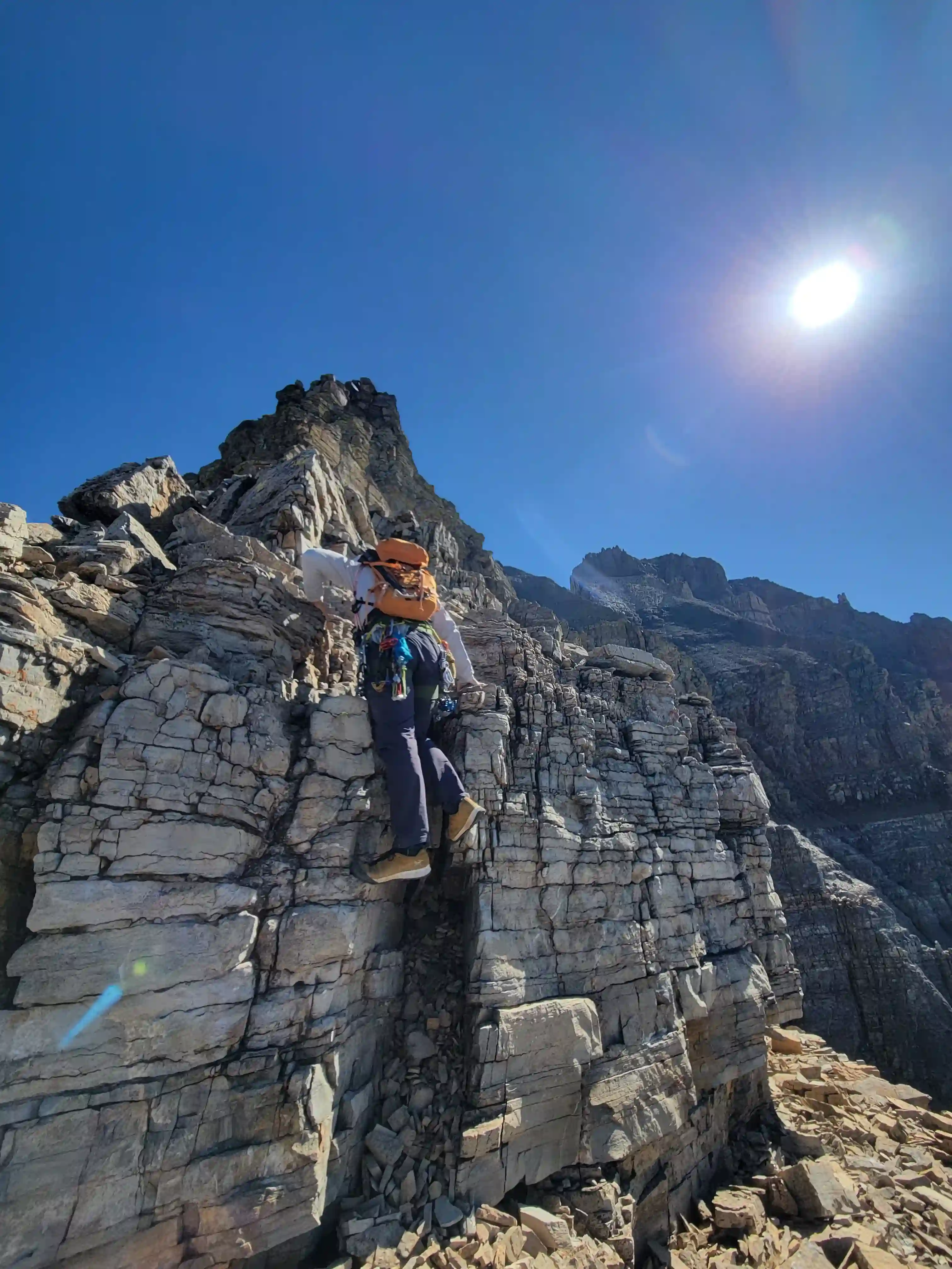
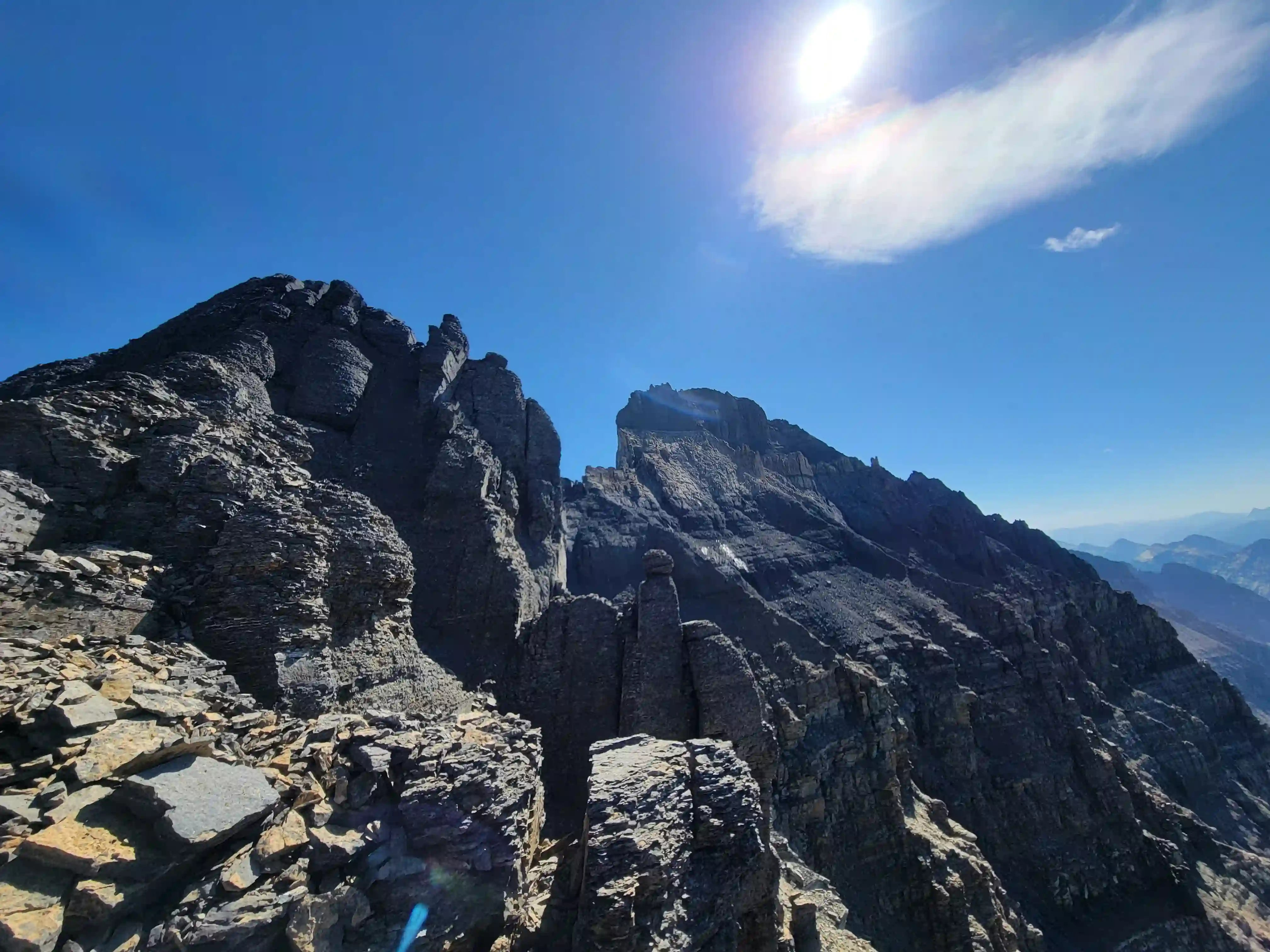
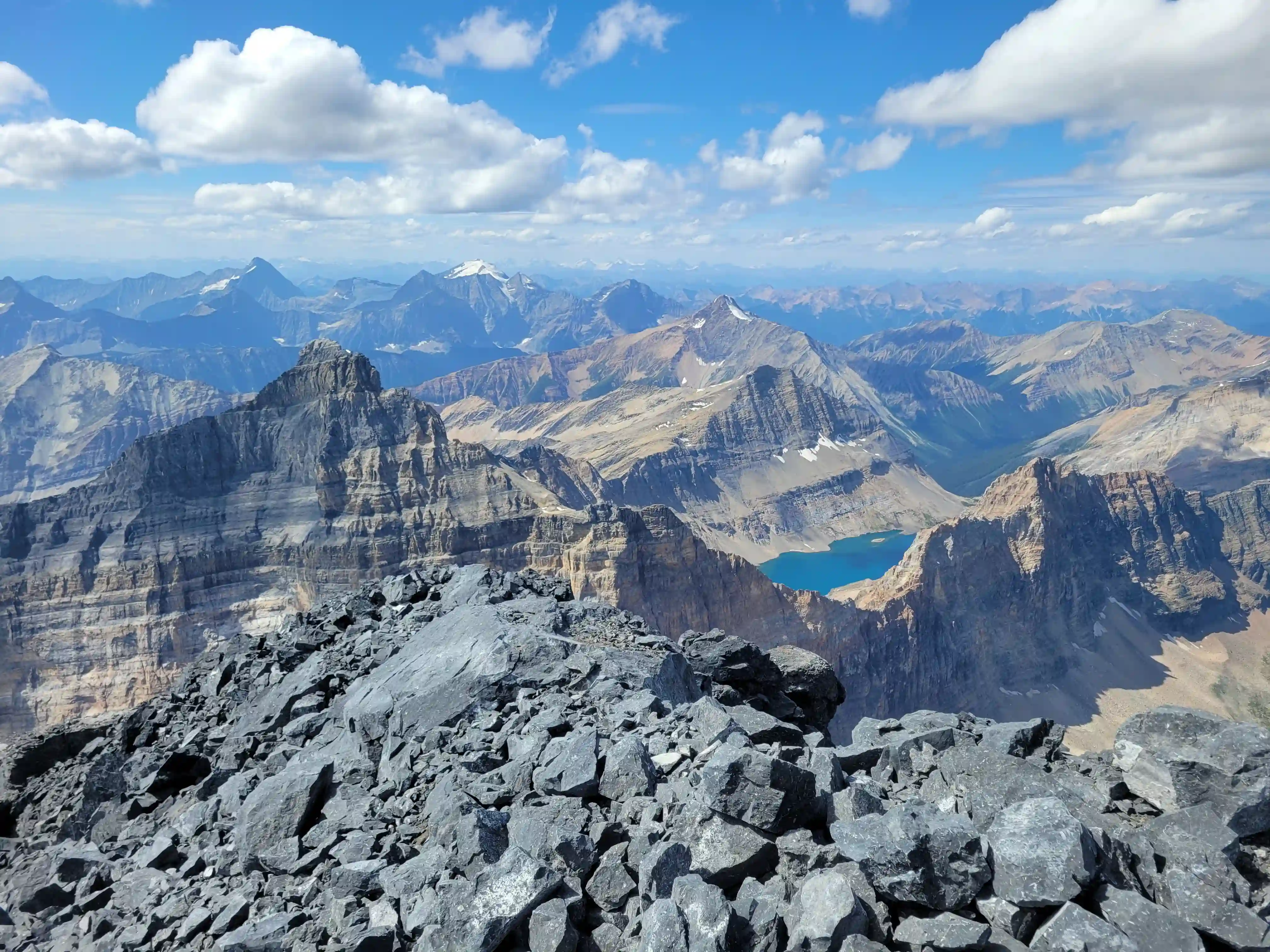
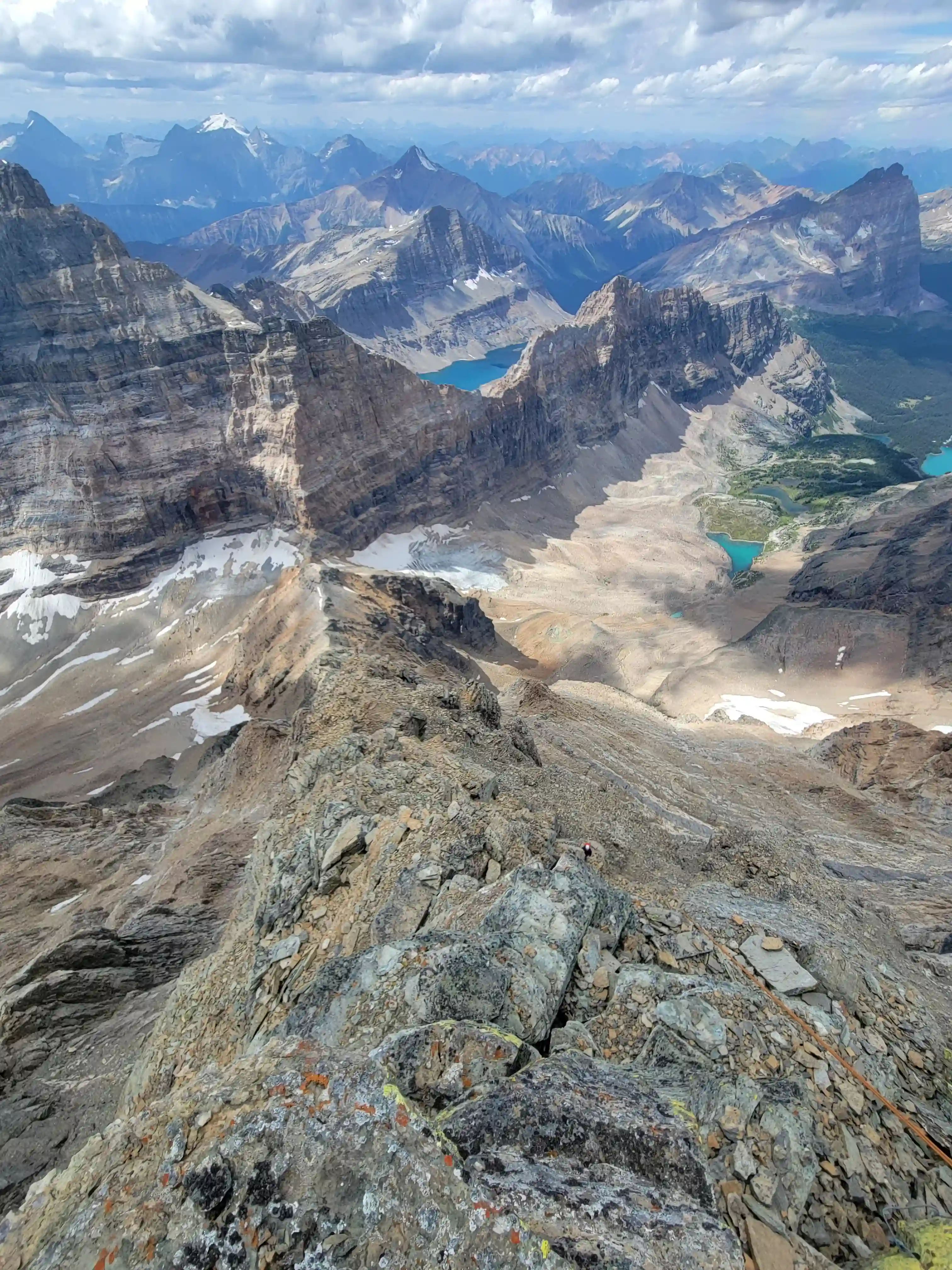
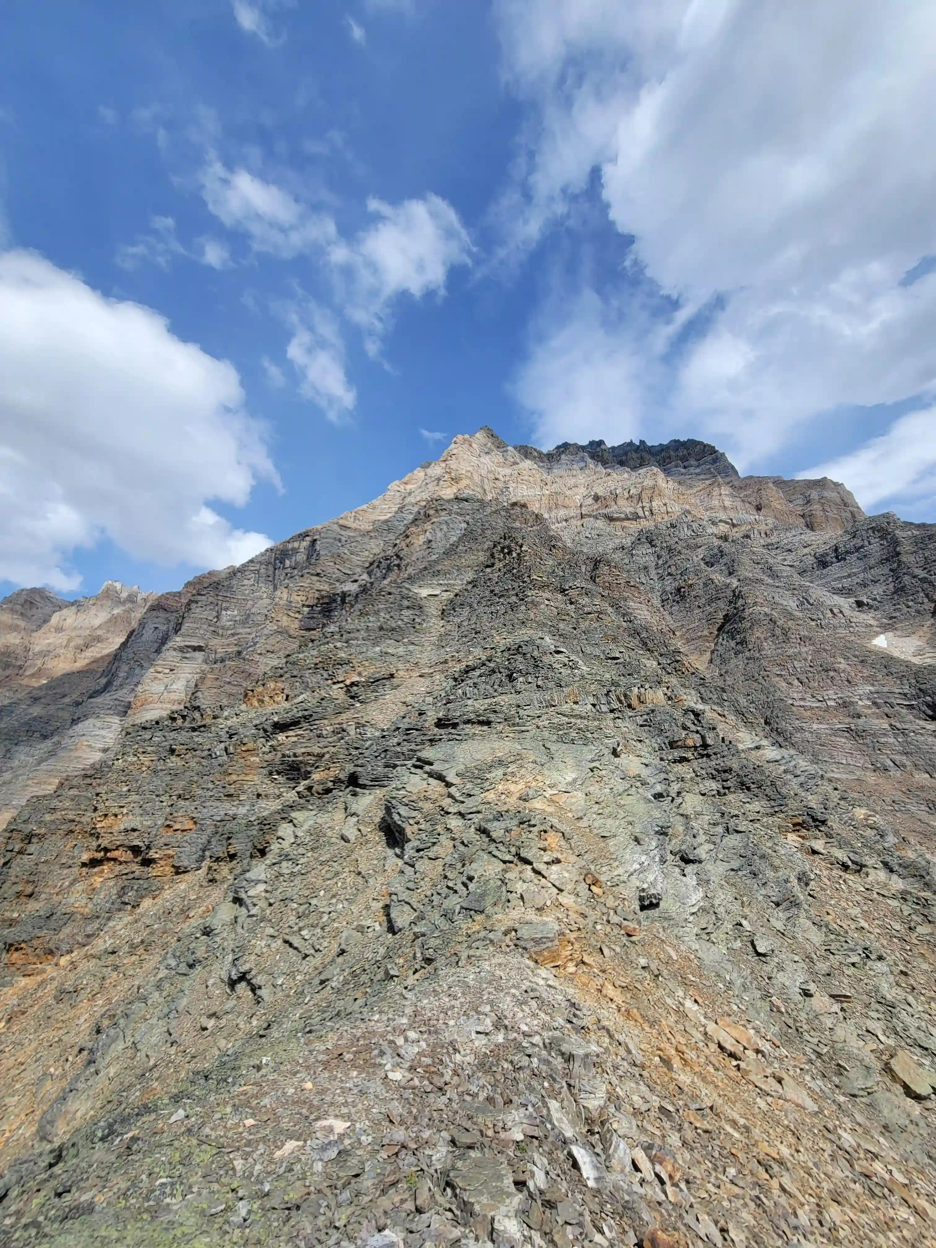
THE CLIMB
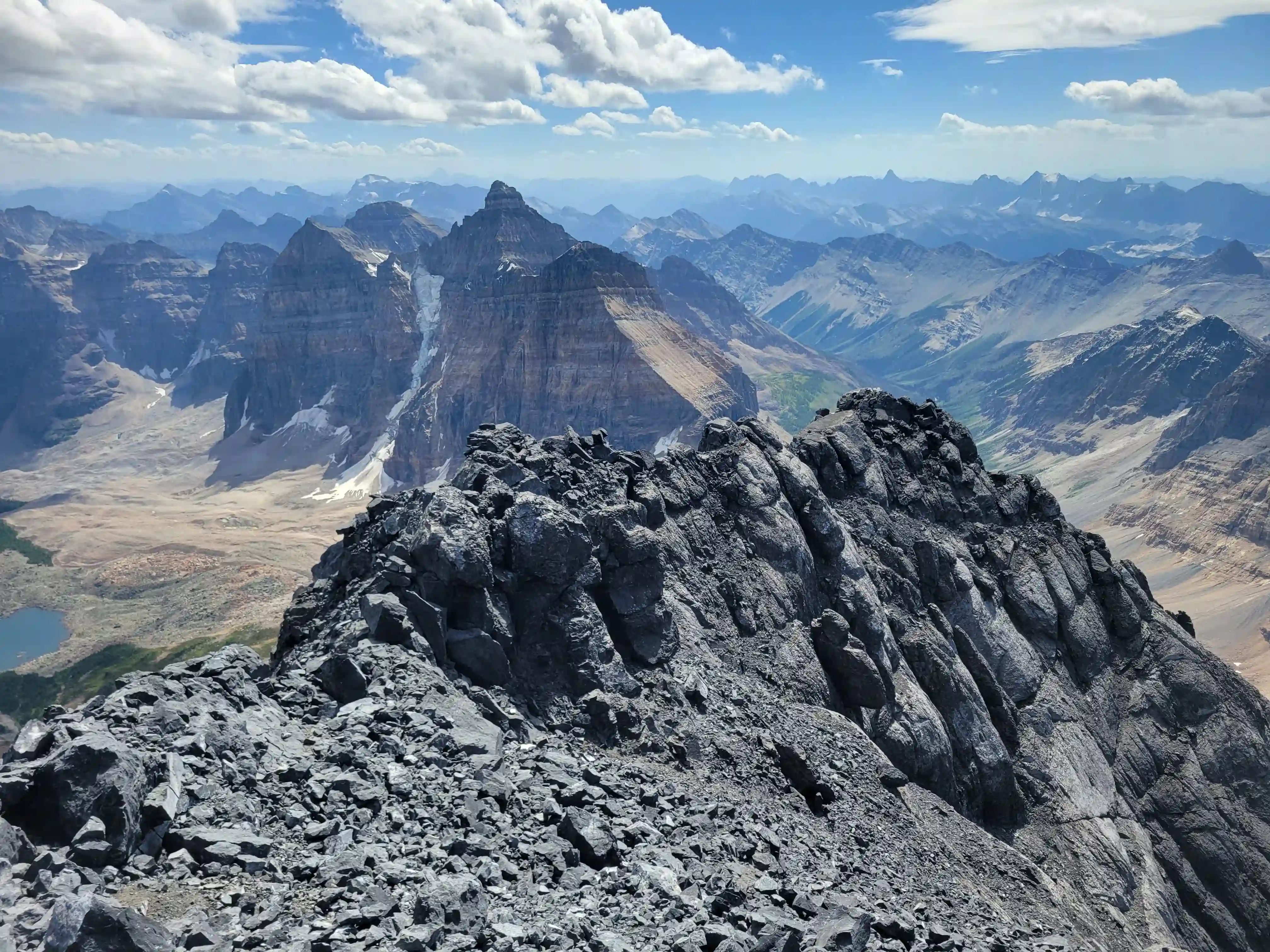
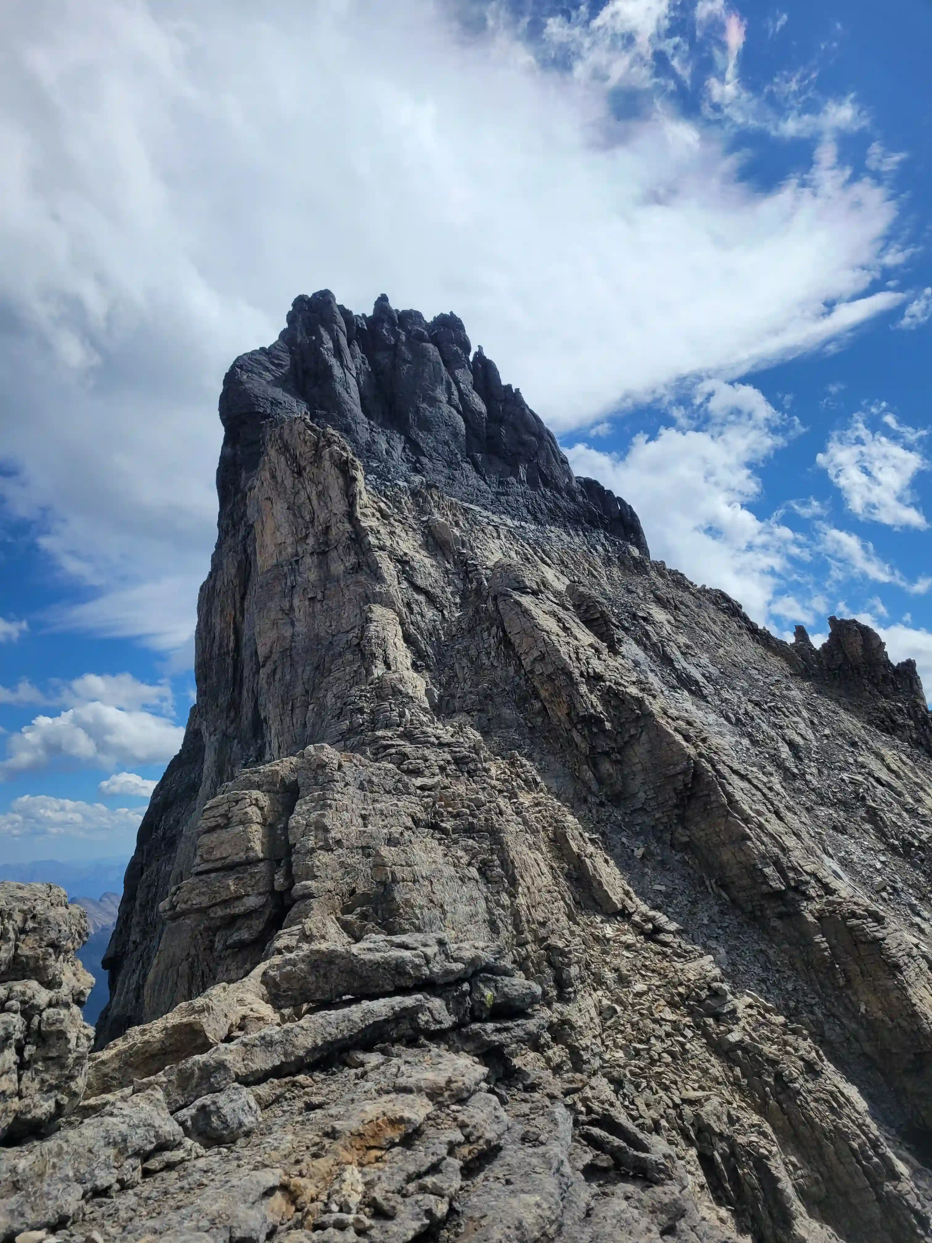
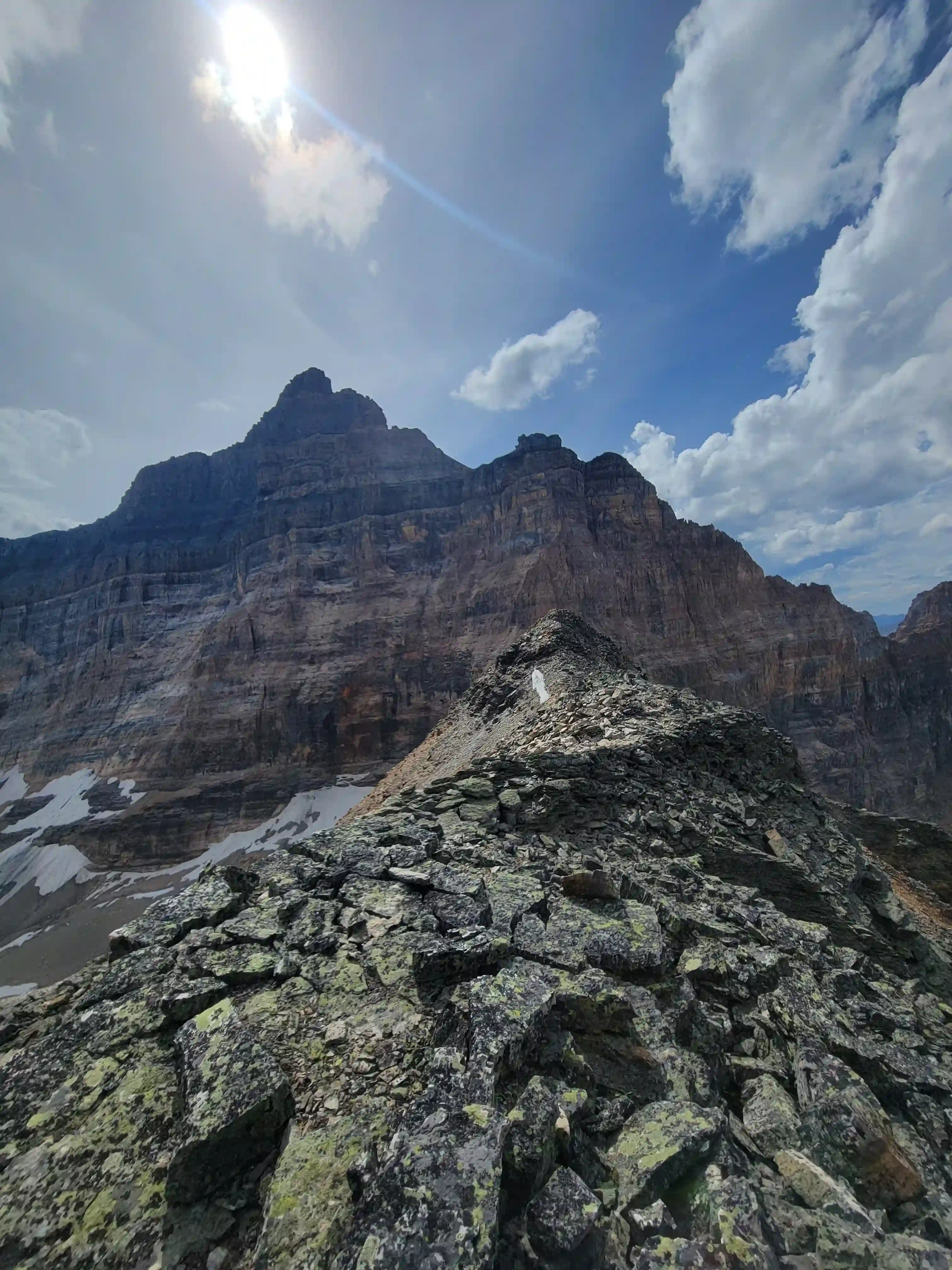
the point looking Foster Peak
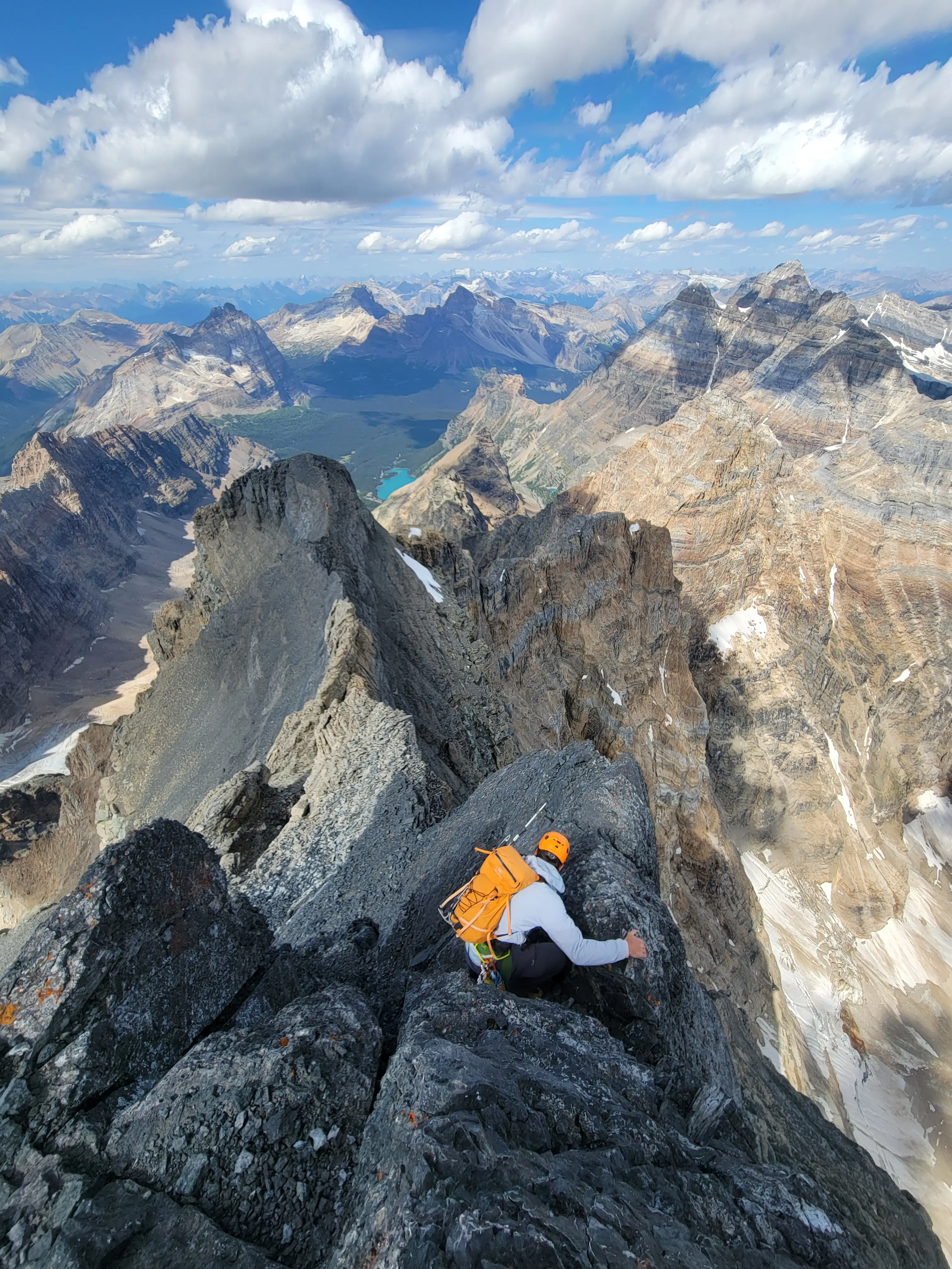
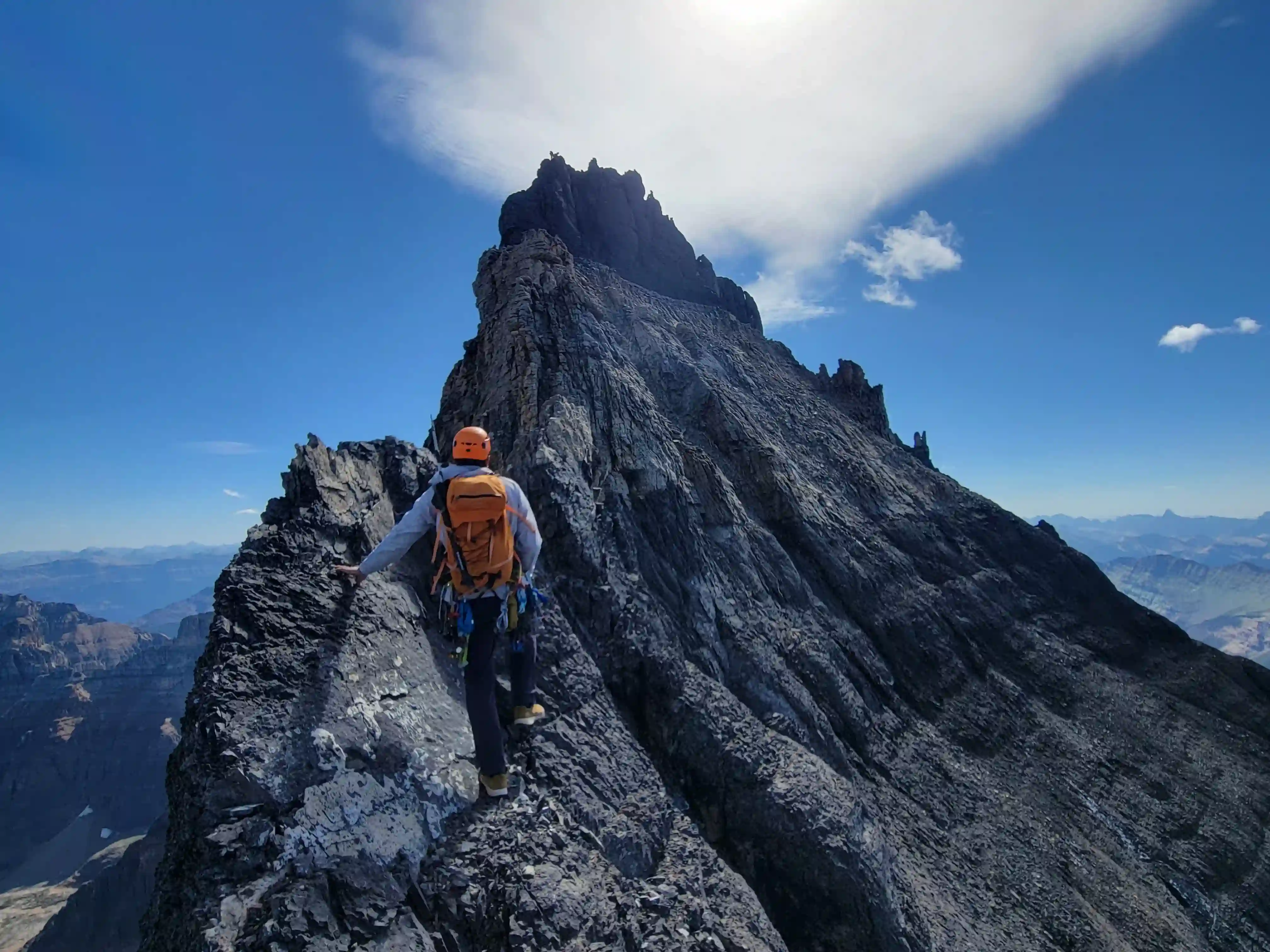
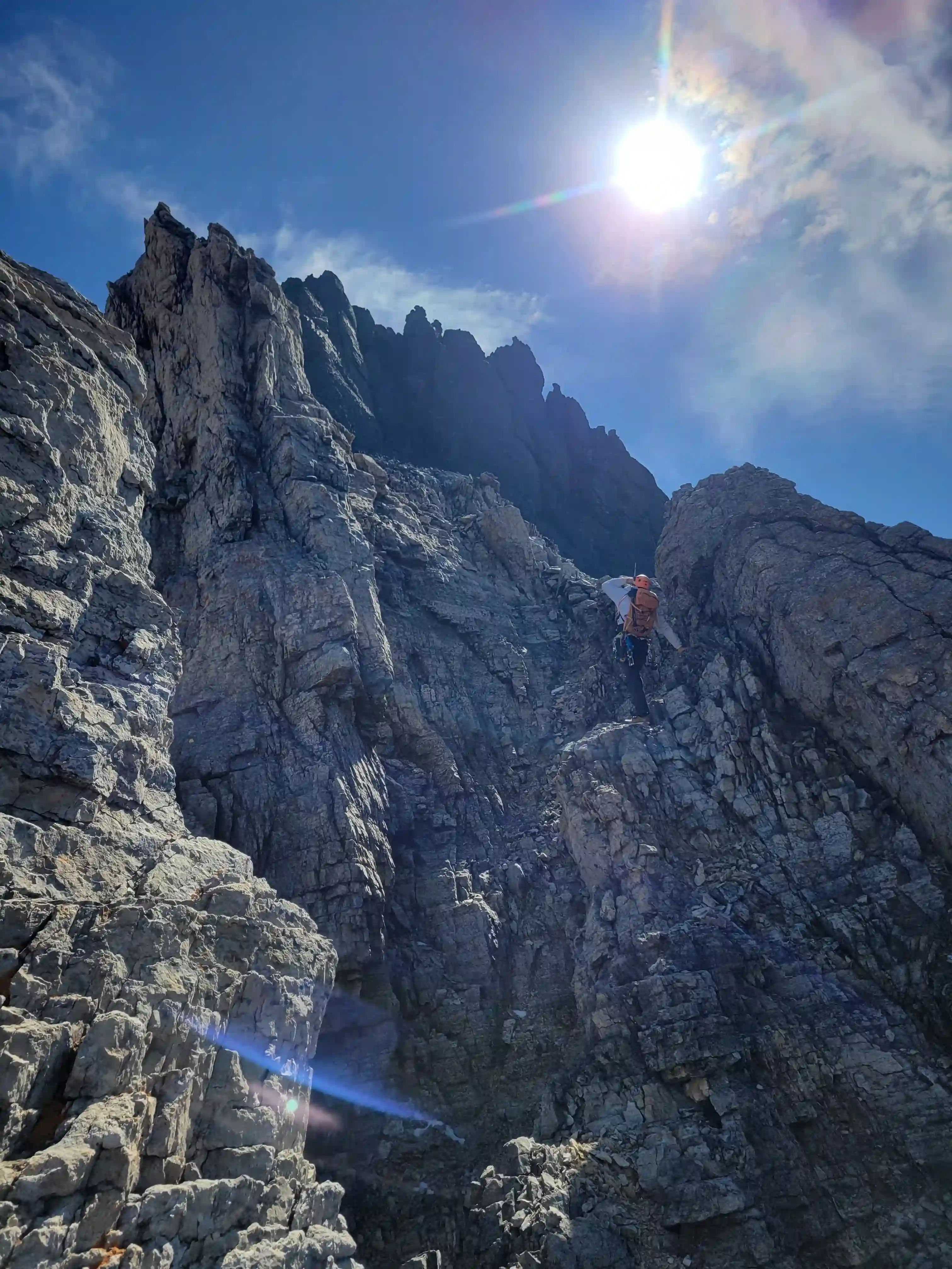
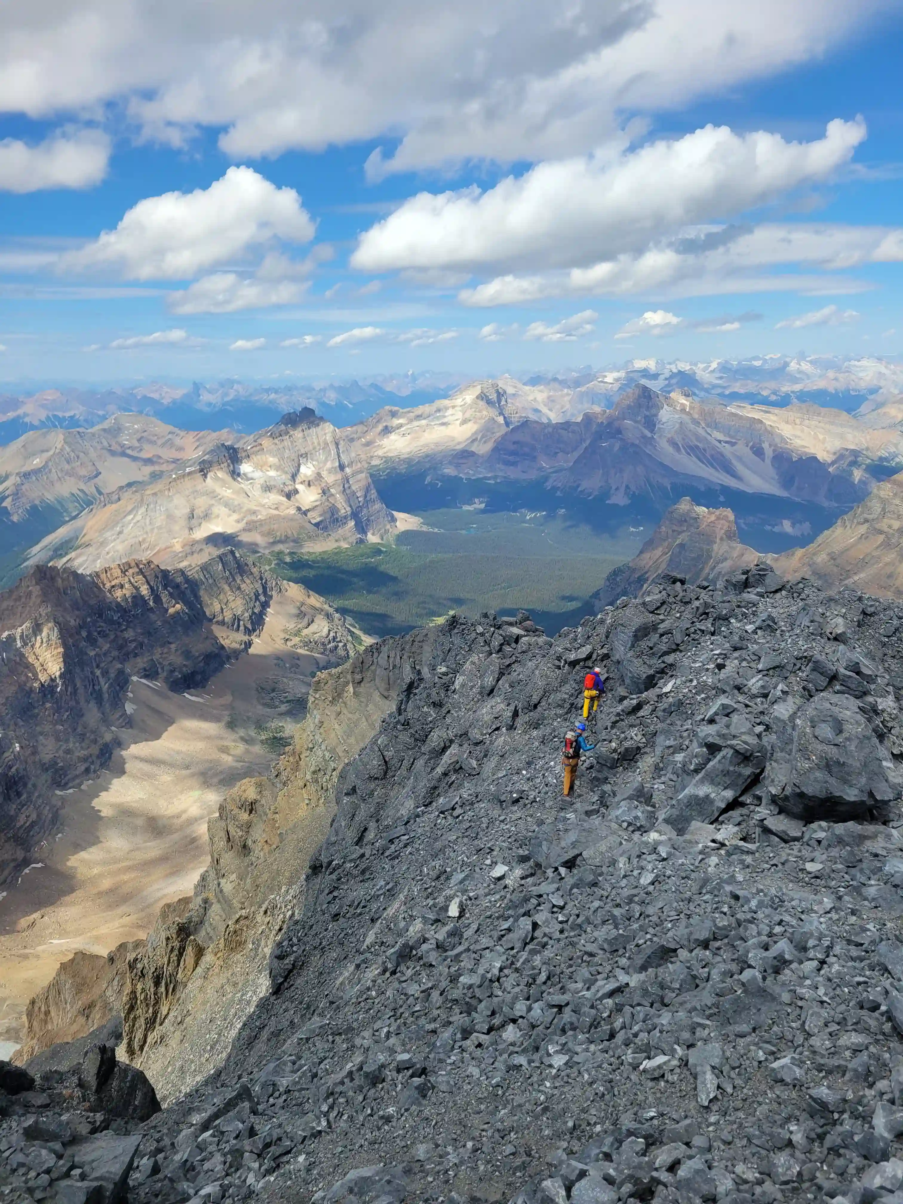
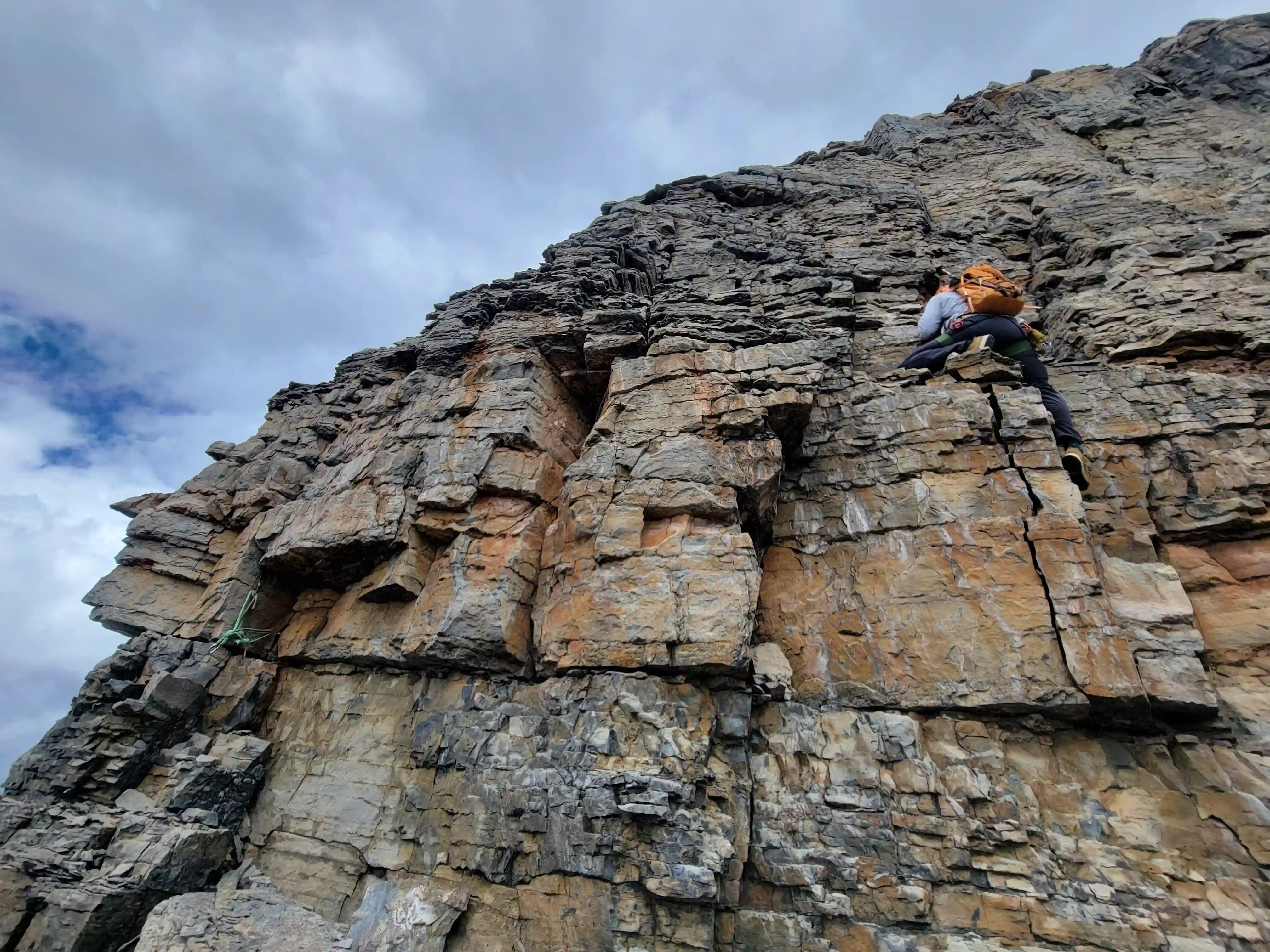
Given that Darren and I both had a wealth of scrambling and soloing low-mid 5th class experience we decided that we would start off free soloing until we reached a point where we didn't feel comfortable and then we'd rope up. The terrain starts off more tame but quickly gets serious so this served as a good warm up for us to get into the sending mentality. There was one section quite early on once we had returned to the upper west ridge where we thought it felt quite a bit harder and higher consequence than the rest of the climbing but besides that both of us were feeling great and ended up carrying the rope and all our trad gear to the summit without using any of it.
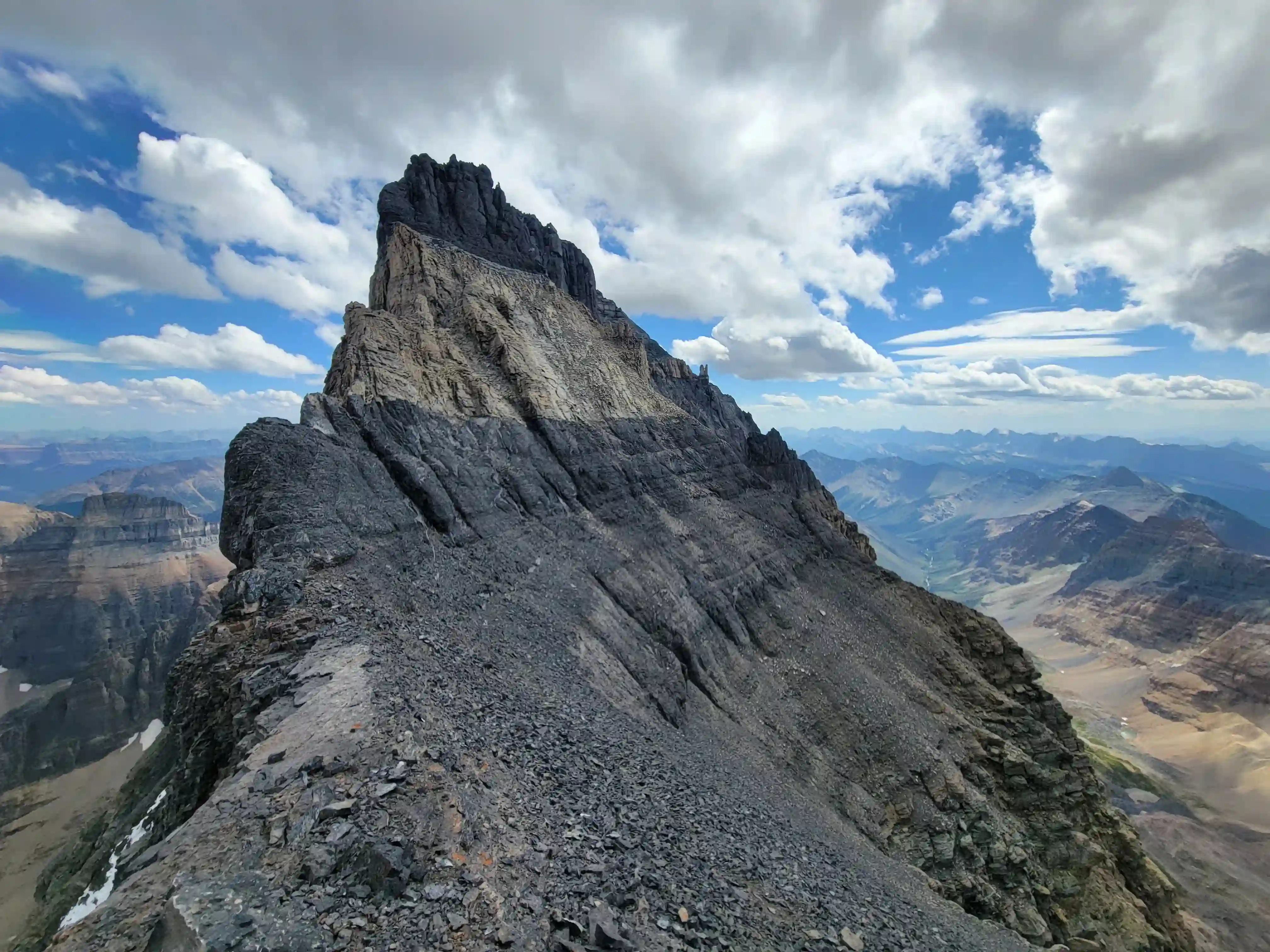
appearance! Got those two in one day along with Lefroy 3 weeks ago, note the
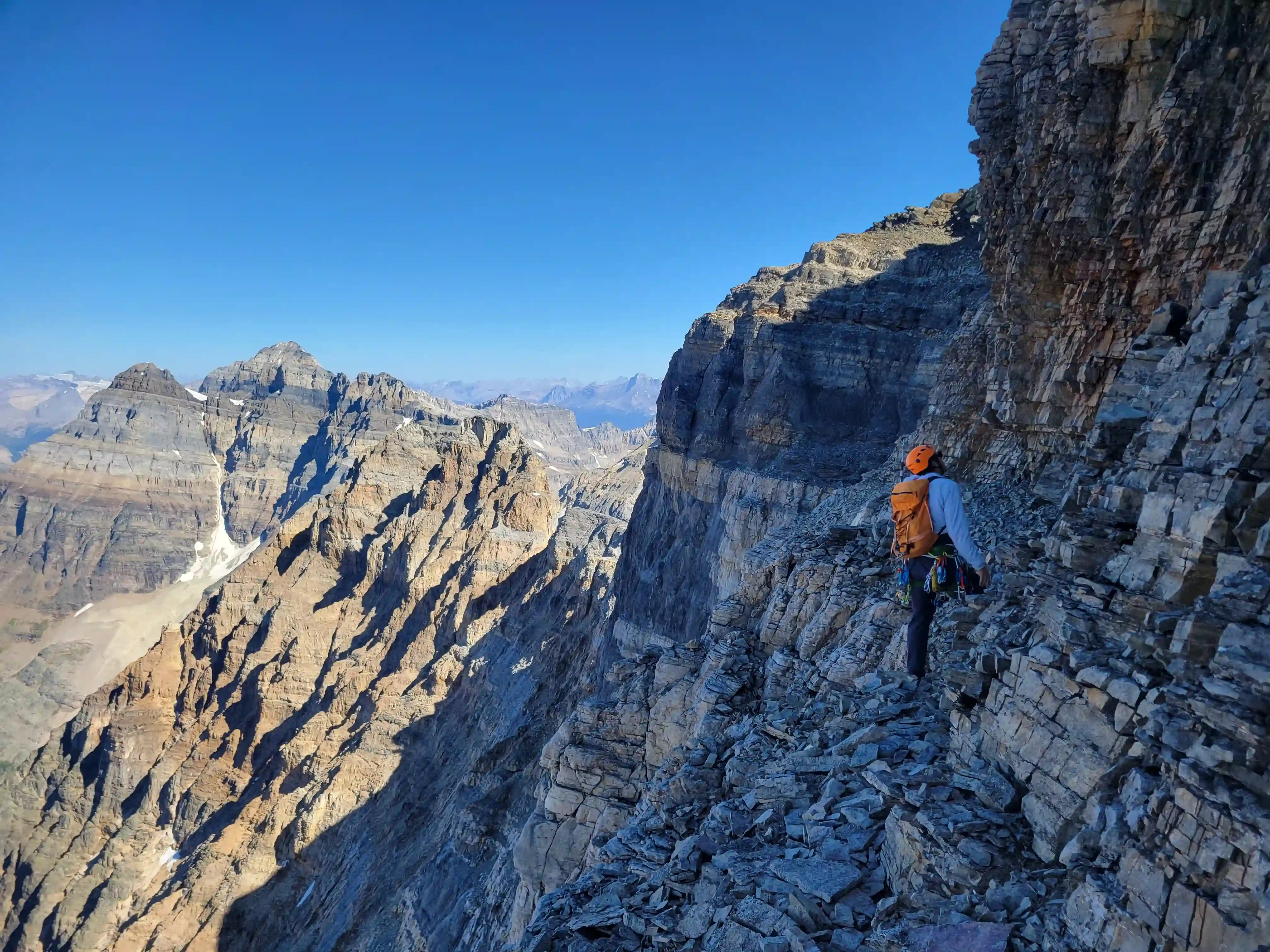
exposure below this section, no fall zone!
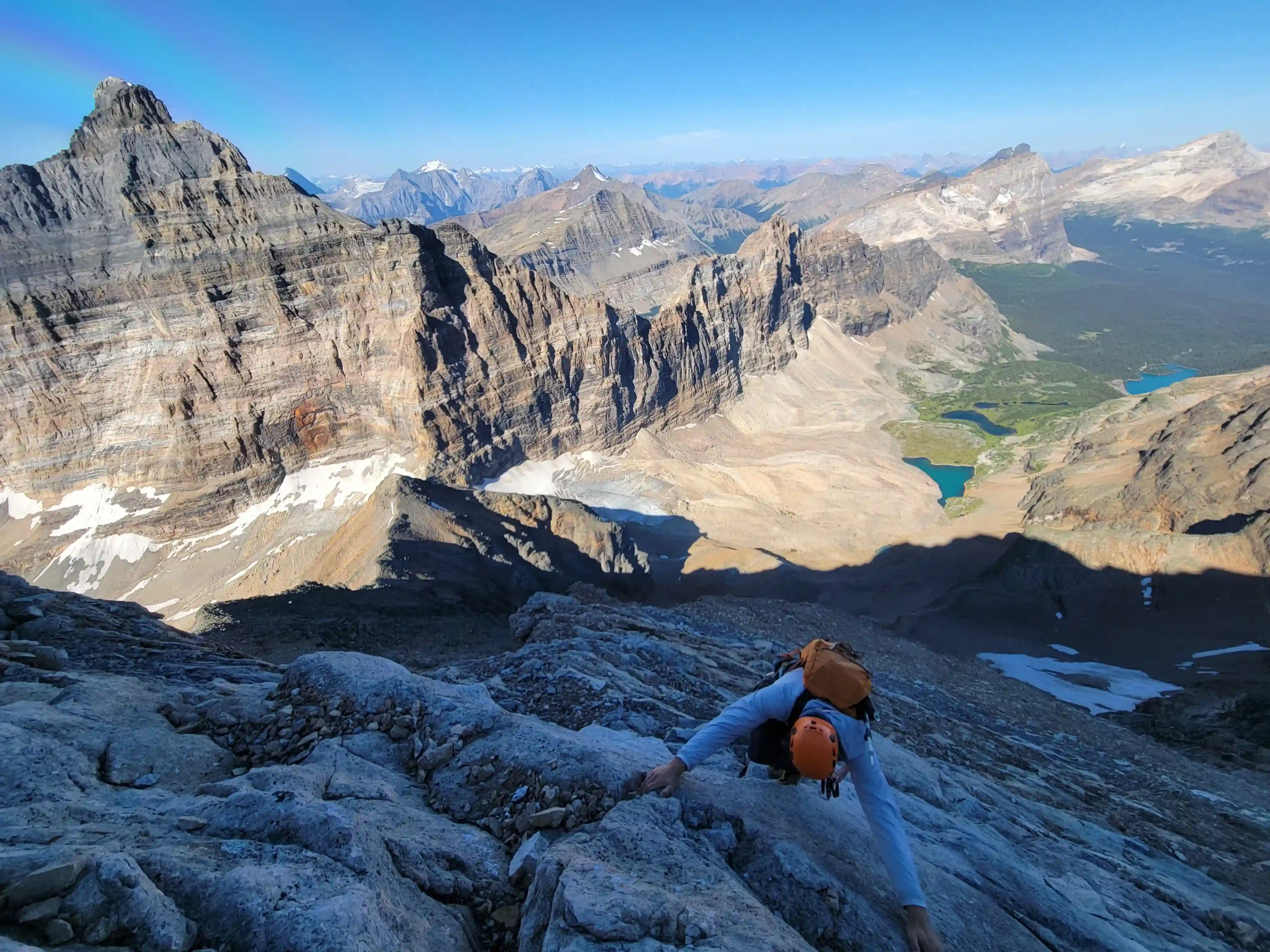
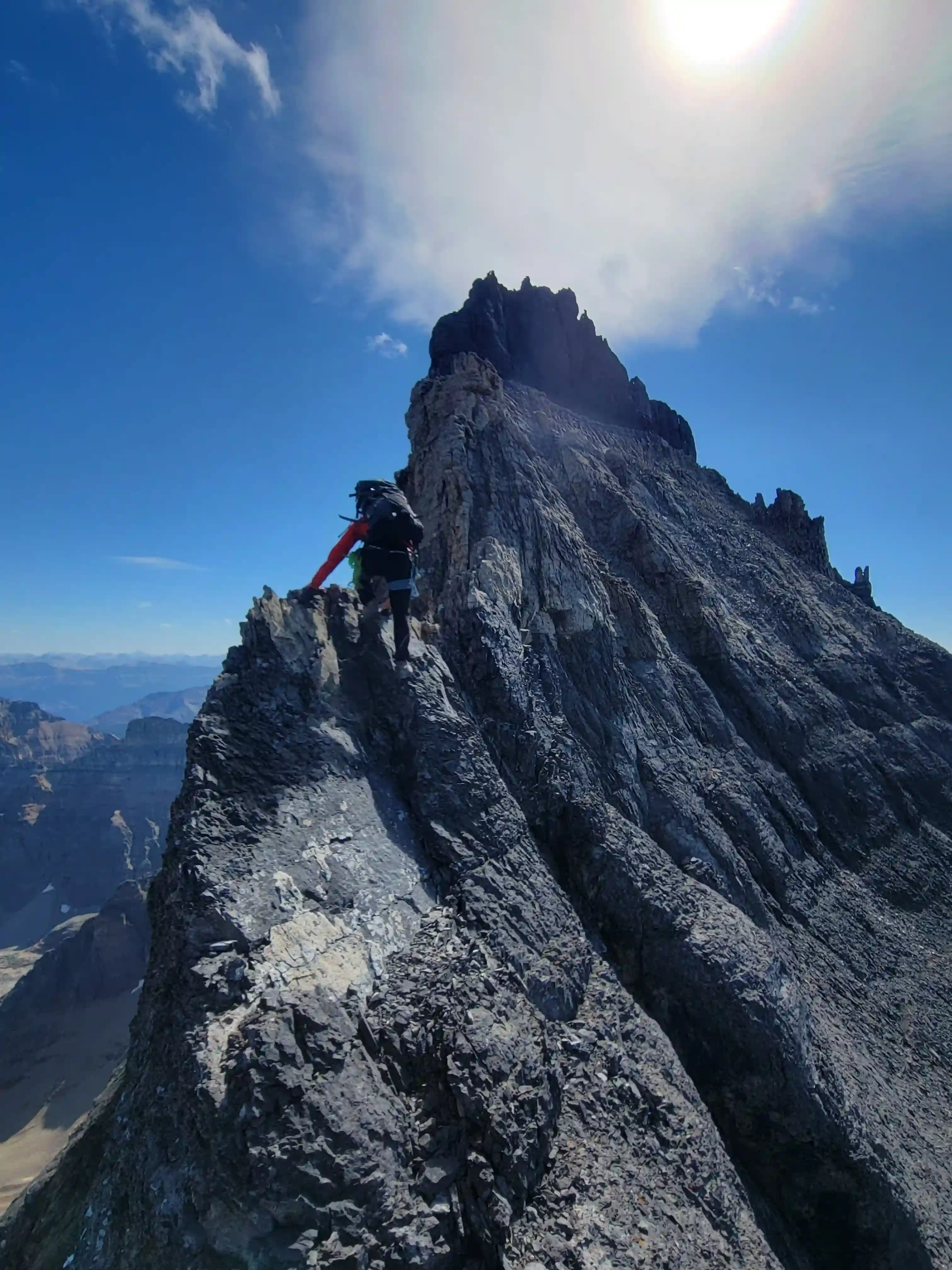
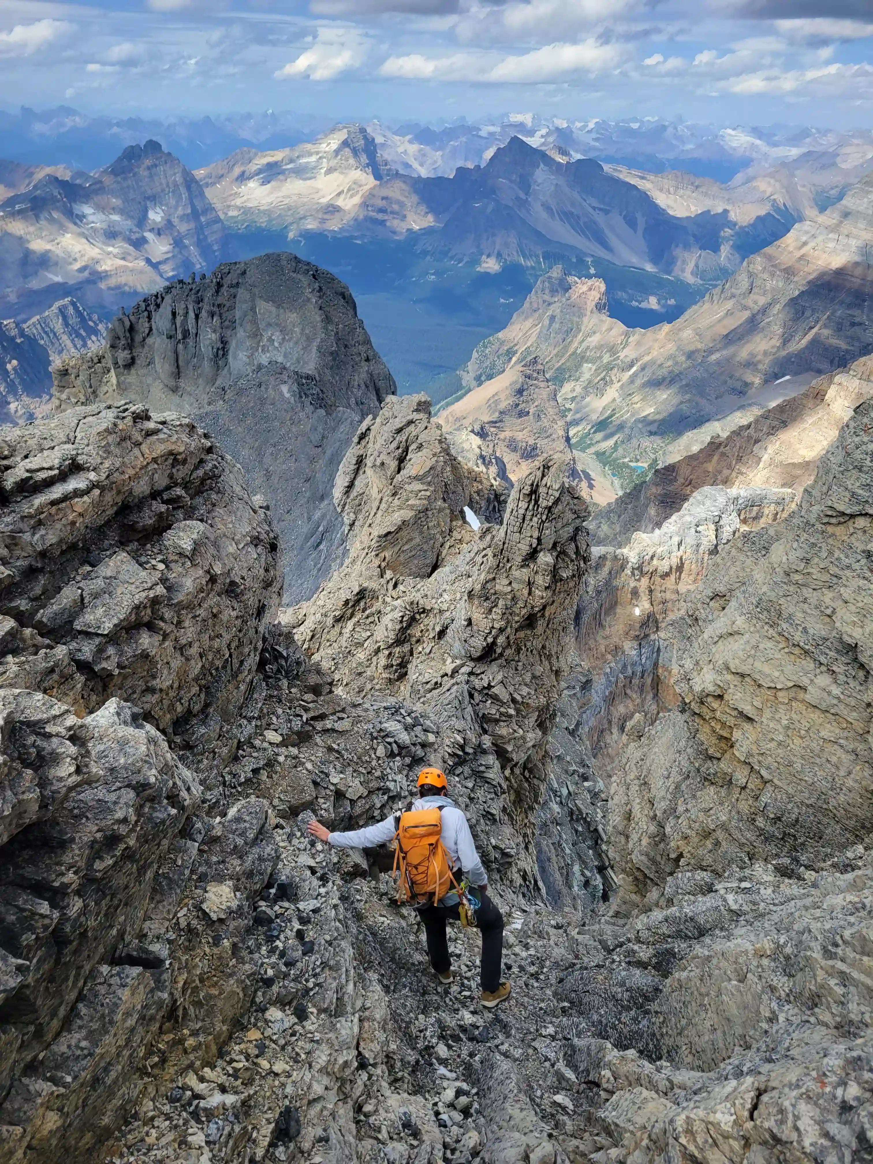
you onto the ridge
certain sections of the ridge, we went up directly right of Darren
was the crux of our ascent
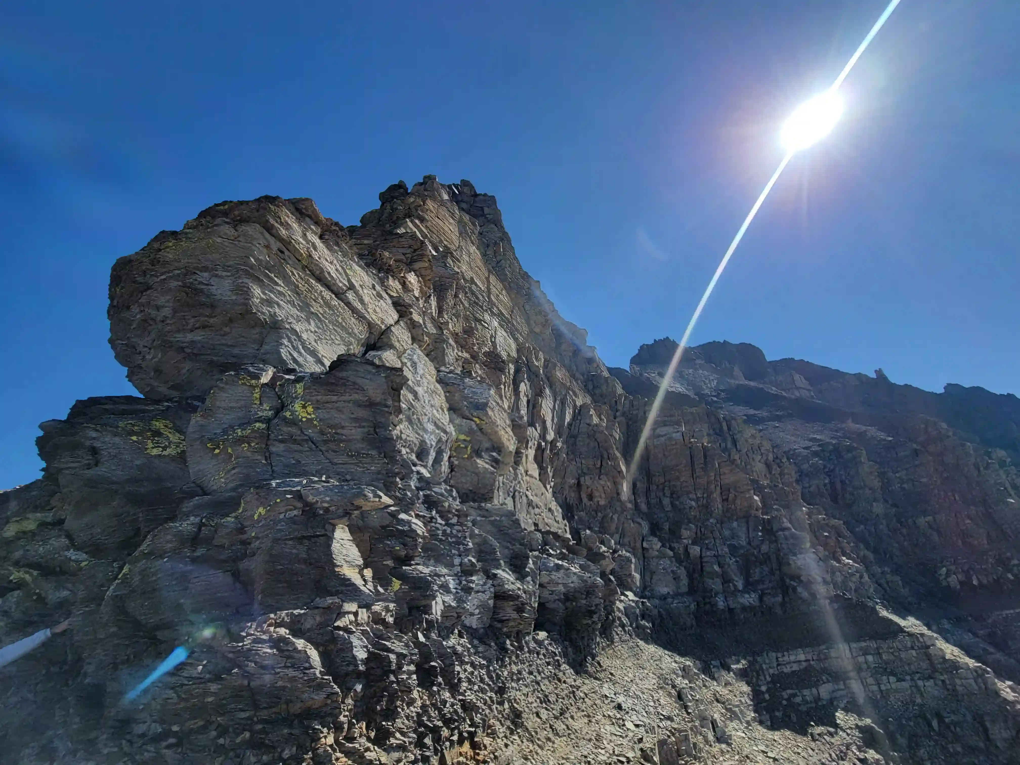
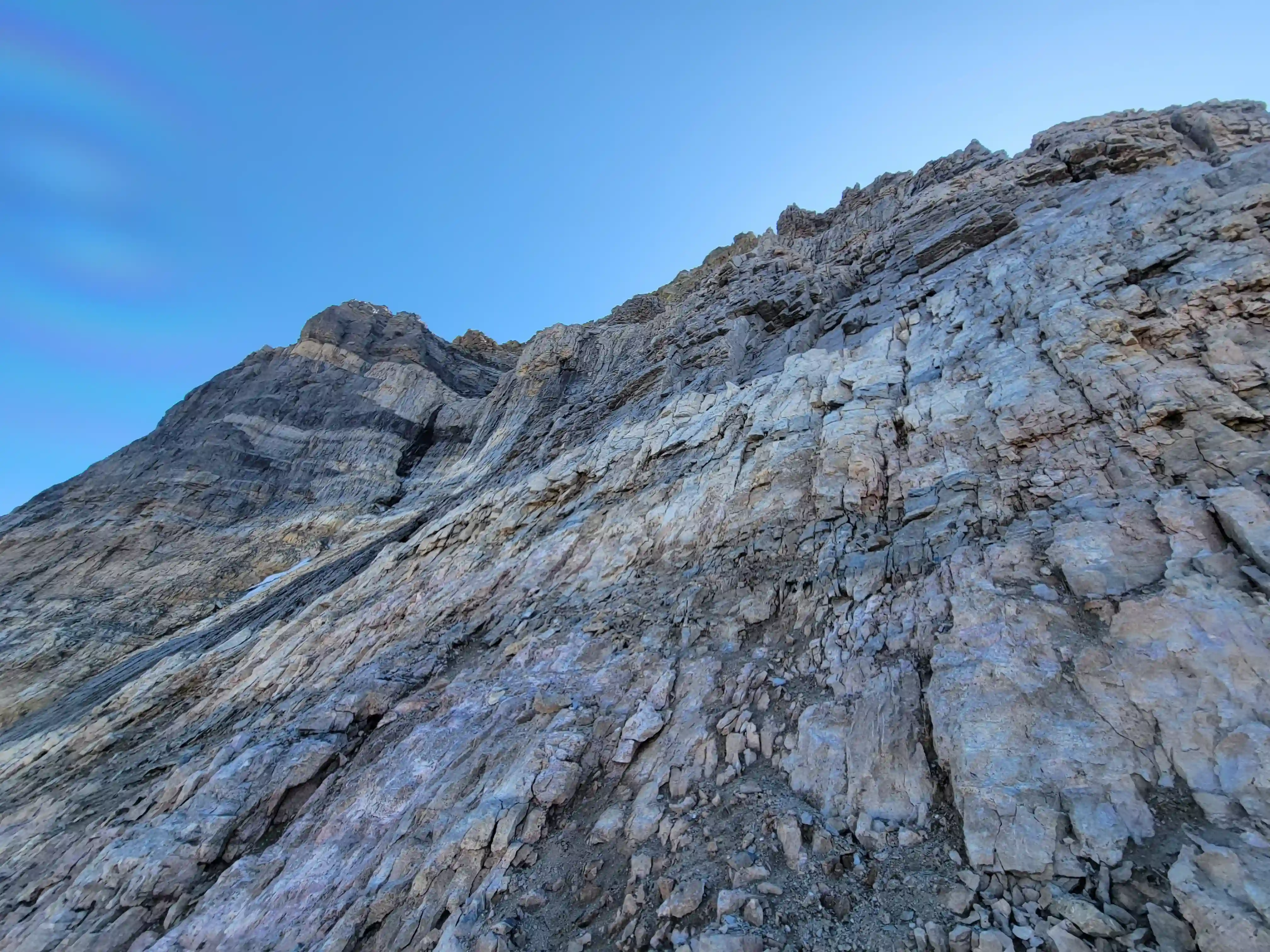
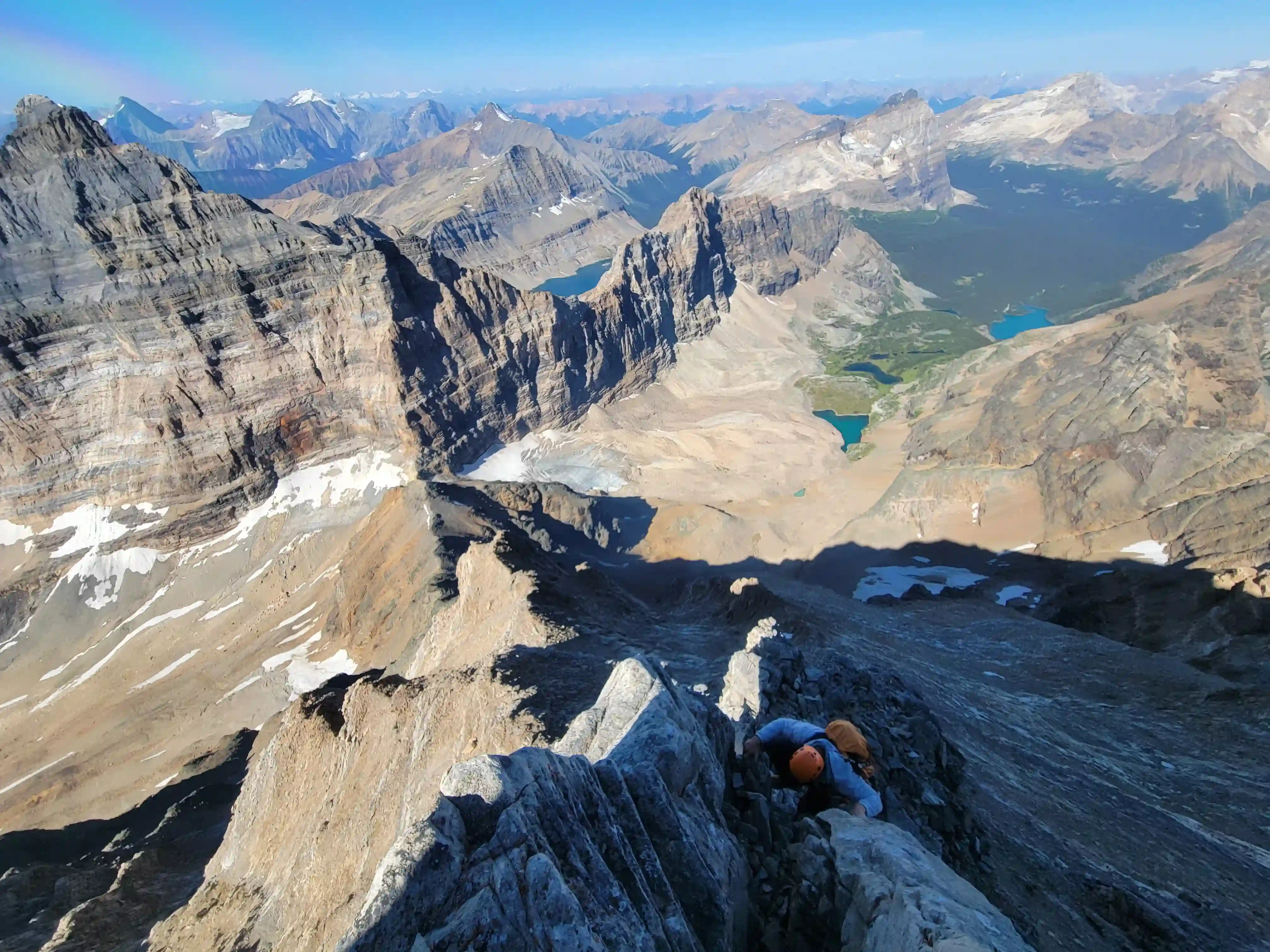
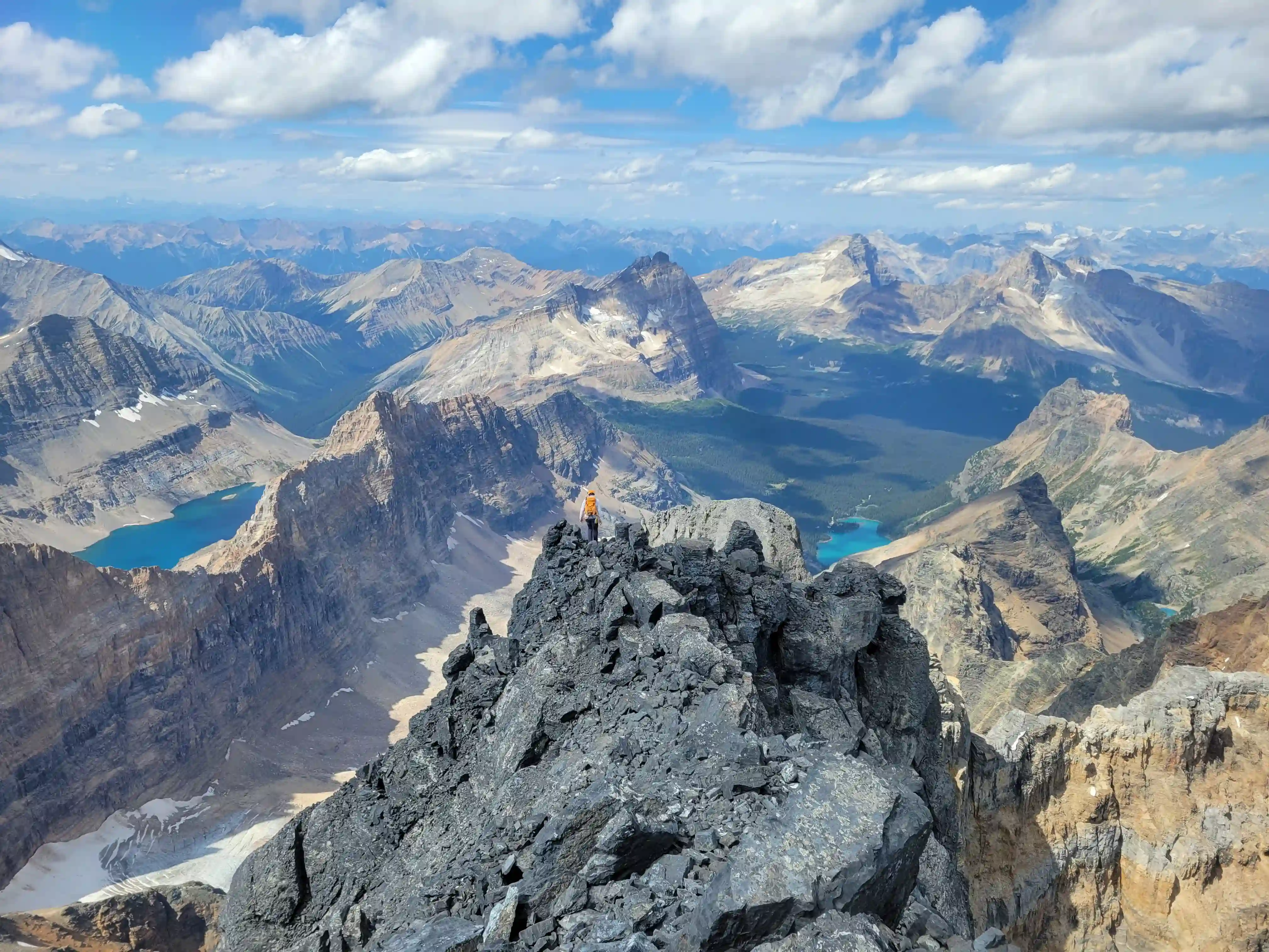
THE UPPER MOUNTAIN
THE SUMMIT
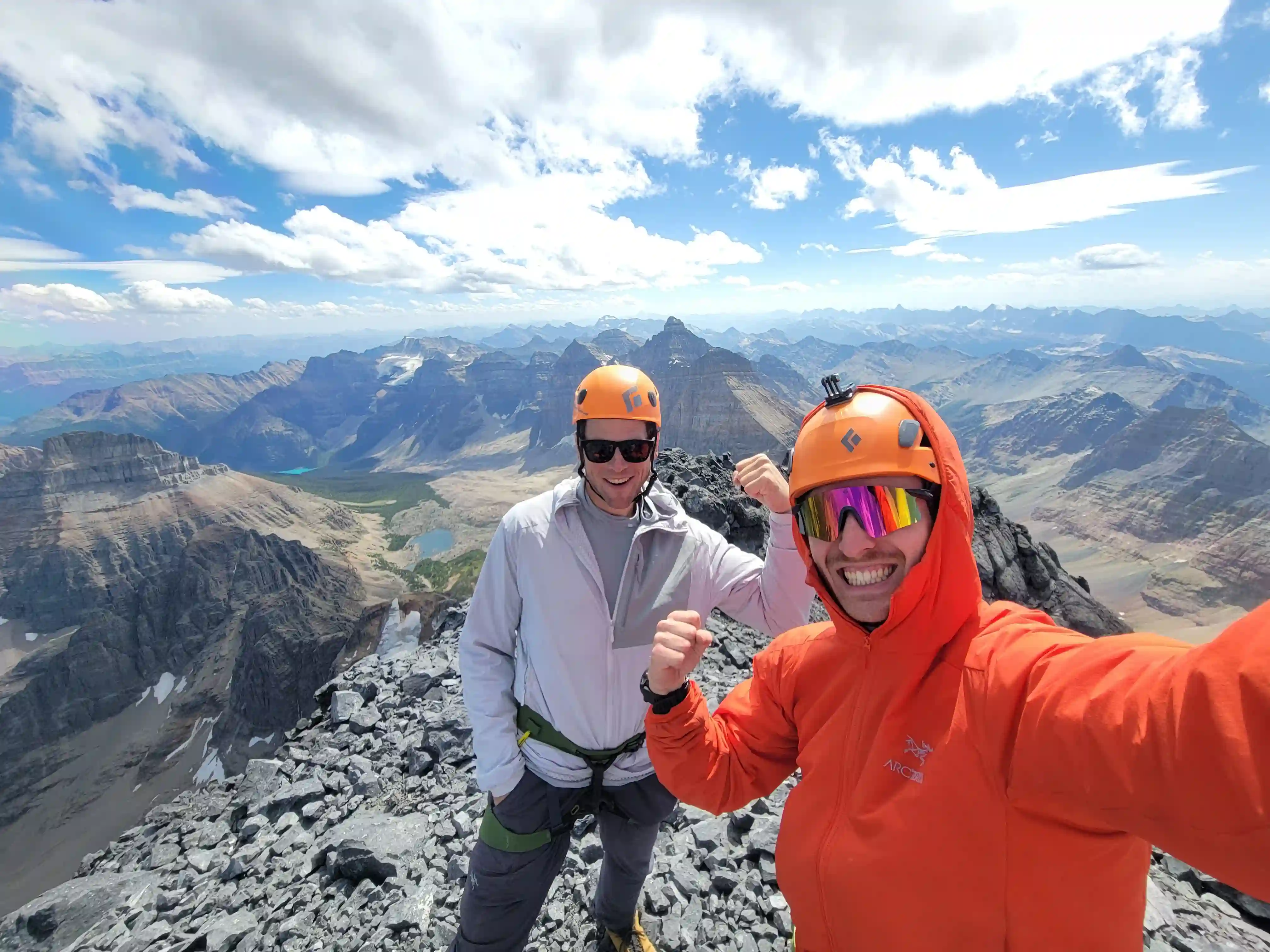
To our surprise there were a couple other climbers at the summit when we arrived, Ross & Paul who had camped near Opabin Pass the night before. They had roped up for a few sections of the climb so they started on the technical terrain a while before us but the one perk of free soloing is that it's about as efficient as it gets! After enjoying the summit and chatting for a while Ross and Paul started to head down and we followed them about 15-20 minutes later.
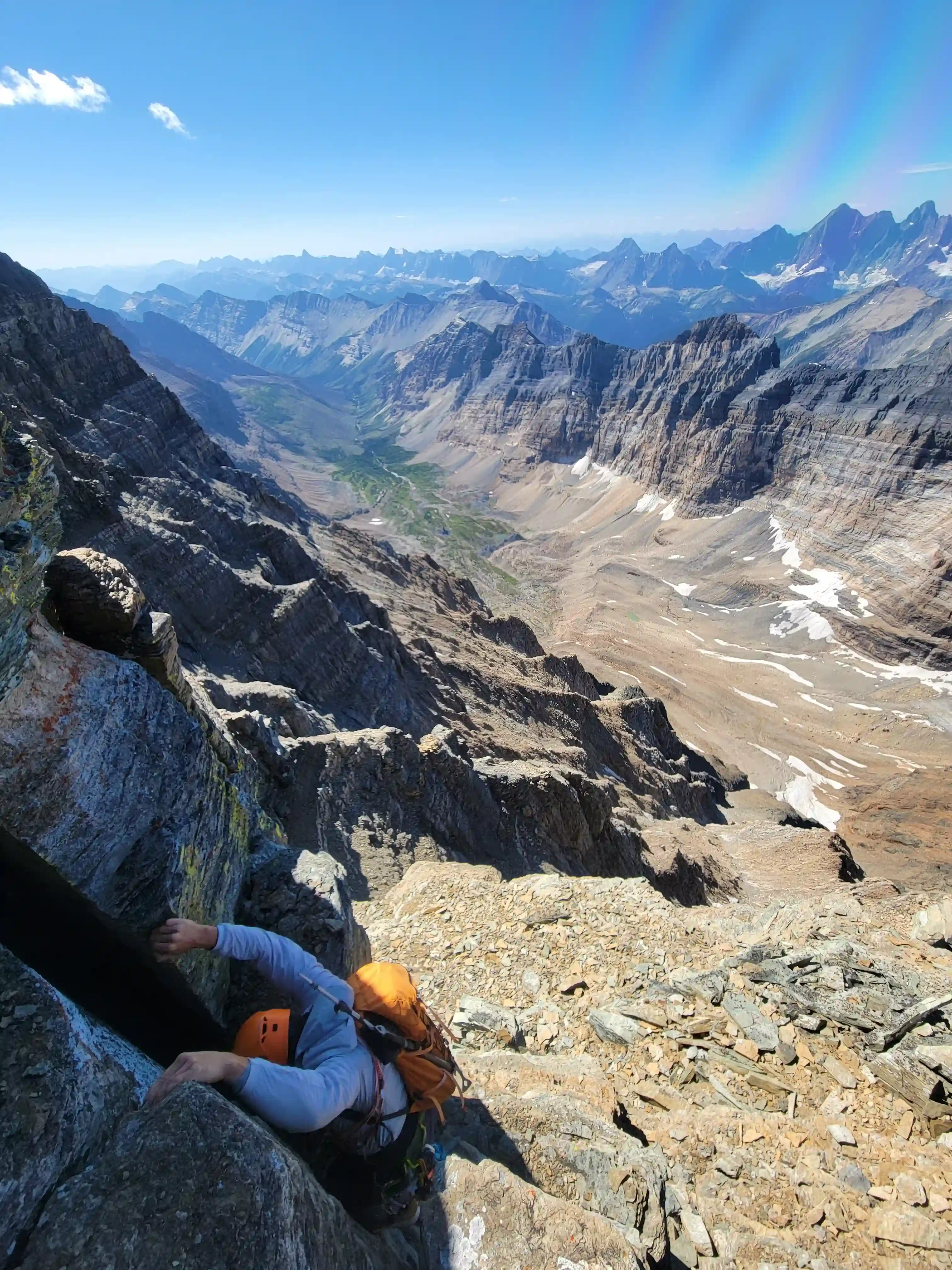
For our descent Darren and I both felt so warmed up from all the hands on terrain that we decided to downclimb everything until we felt uncomfortable and that time never came. The one crux section we were convinced we would have to rappel had another option with far less exposure on the south side of the ridge and once we were clear of that we knew we'd be leaving the rope in the pack the whole trip. We ended up catching up to Ross and Paul on the upper west ridge since they were doing rappels and once we were past them we had to watch out for rockfall caused by the rope so we didn't do much hanging around. It ended up being good that we didn't mess around with the rope because we made it back to Lake O'Hara just in time for the 6:30pm bus, the legs would not have been happy with an extra 12km walk out after an already long day!
Into trips like this?
I'll send you an email whenever I publish a new trip report.
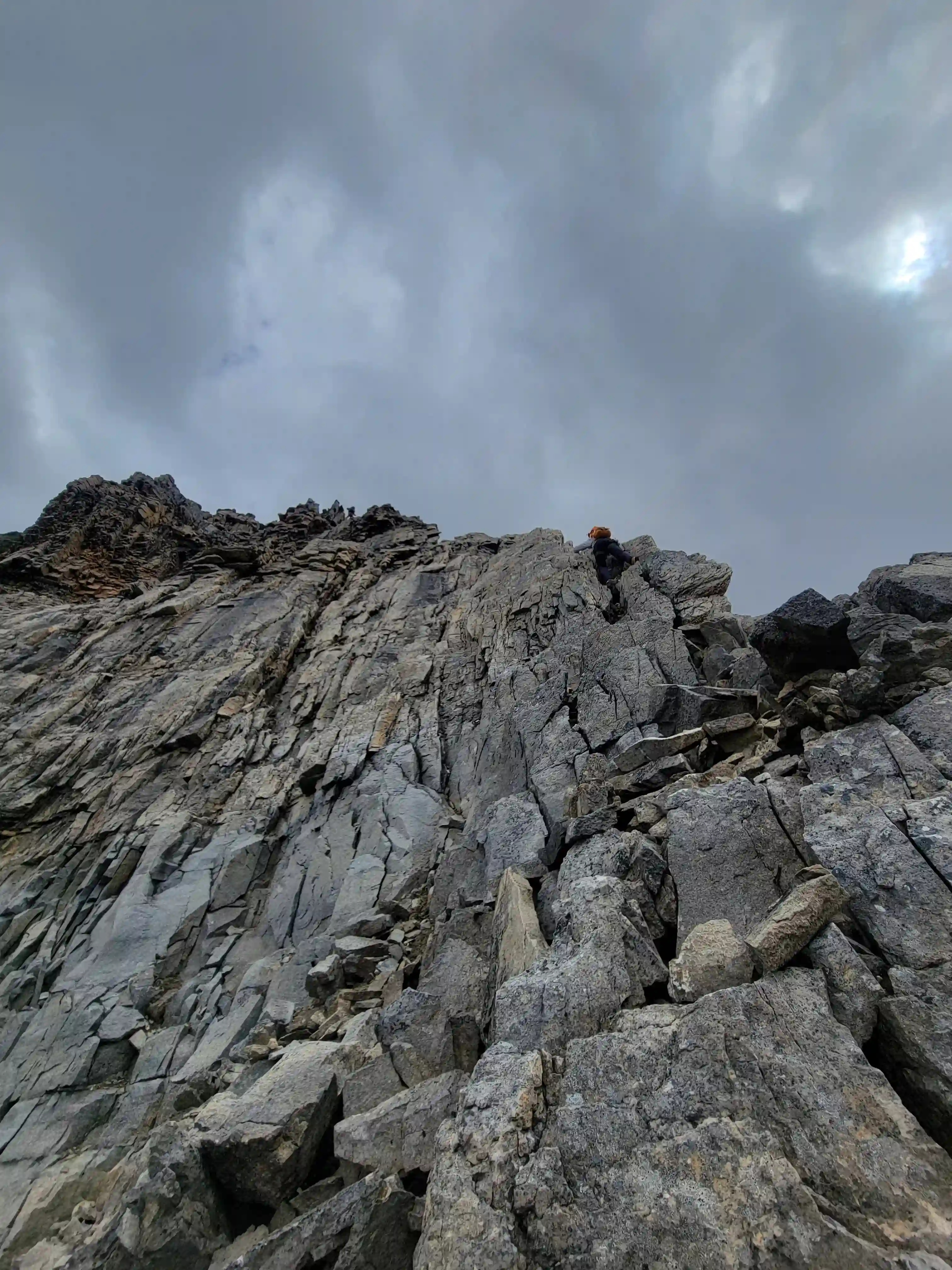
THE DESCENT

the distance
time to downclimb
I had been looking at reports and dreaming about the possibility of going for Hungabee one day for a number of years so this was an awesome outing and huge confidence booster for me for the more serious mountains the 11000ers list has to offer. I also had a bit of nervousness heading into the trip but that quickly changed to excitement, stoke, and focus once we were going for it. Hungabee Mountain is definitely a serious mountain and those that go for it should see to it that they're well prepared for the terrain that you'll encounter. This mountain has taken lives so just because we free soloed it doesn't mean that you should, we still had rope in the event we needed it so always come prepared!
After this trip I was off to Whistler for a biathlon training camp but after returning to Canmore a bit over a week later another window had showed up and Darren, me, and a few others were off for
one last objective
for the 2024 calendar year.
Follow the full progression
I'm working through all 58 11000ers of the Canadian Rockies and beyond. You'll get notified when the latest climbs go live.
Other related trip reports:
Mount Hector |
Snow Dome & Kitchener |
The Lyells ||
Mount Temple |
Mount Cline |
Mount Murchison
11000ers of the Canadian Rockies
© Haldan Borglum | Peak by Peak. All rights reserved.