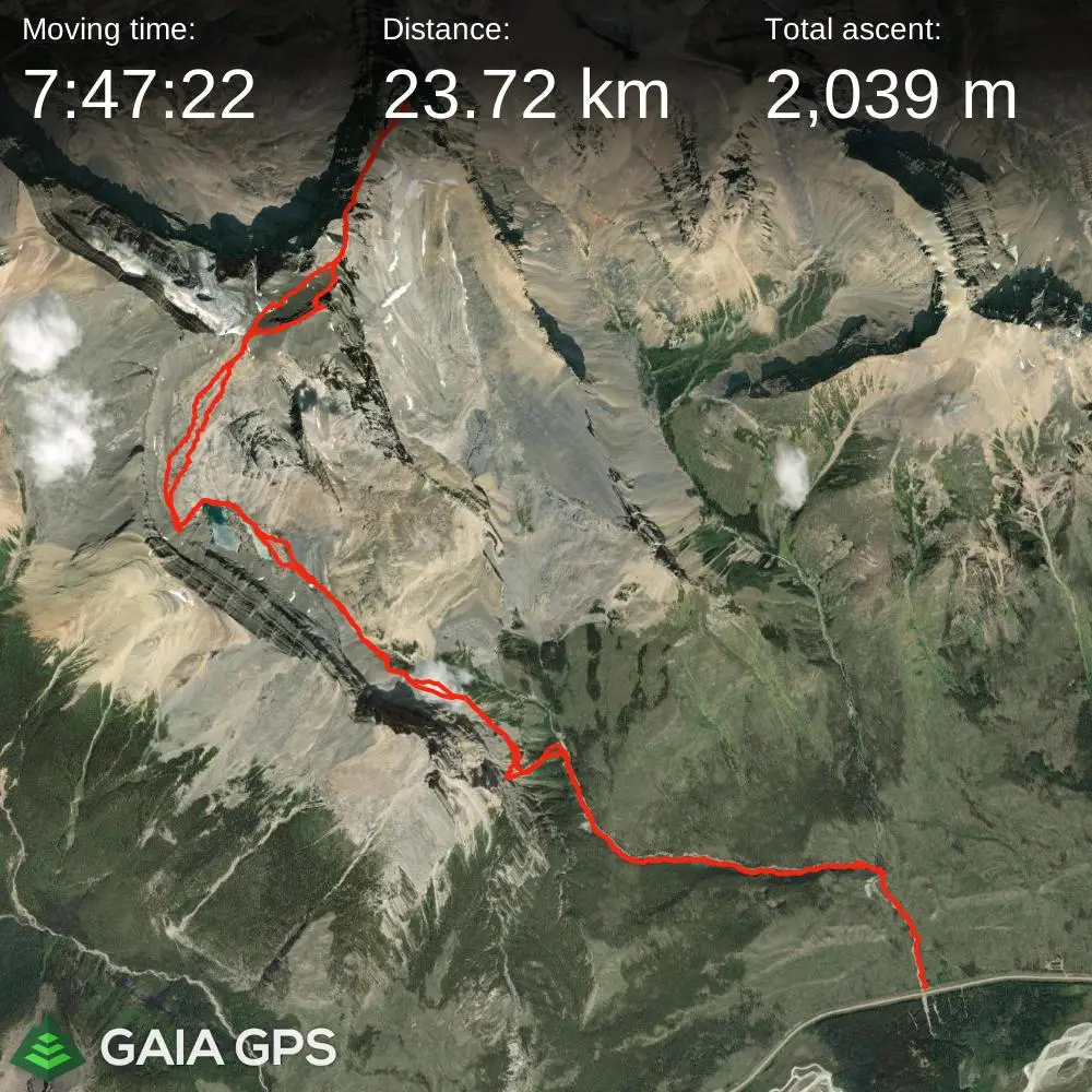
Mount Cline
3361m, 11027ft
August 11 2024
Mount Cline is one of two 11000ers located east of the Icefields Parkway and located near the Saskatchewan Crossing, the other being
Mount Murchison.
It serves as a good intro to the 11000ers of the Canadian Rockies and although it's more difficult than the easiest peaks on the list like
Mount Temple
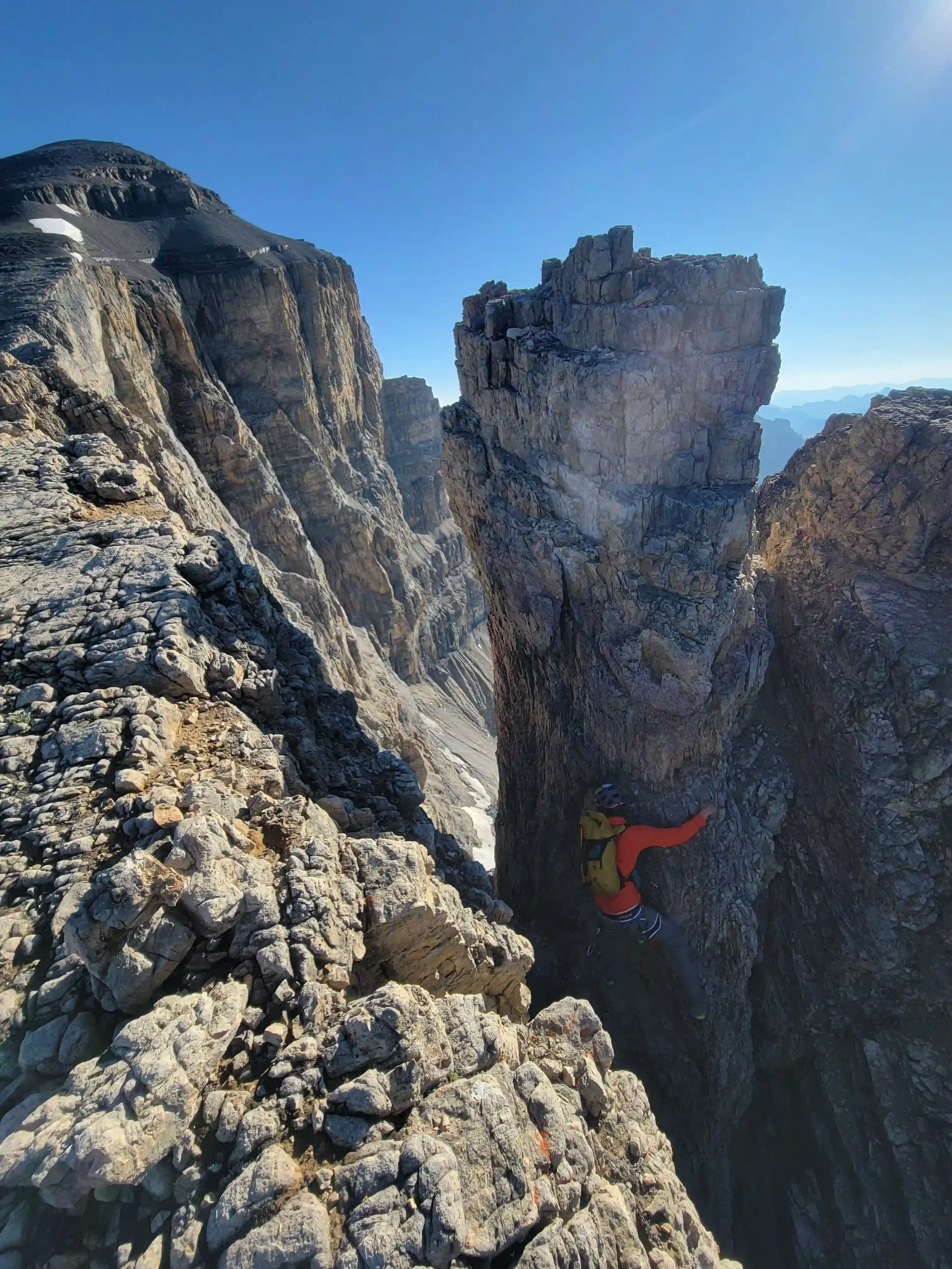
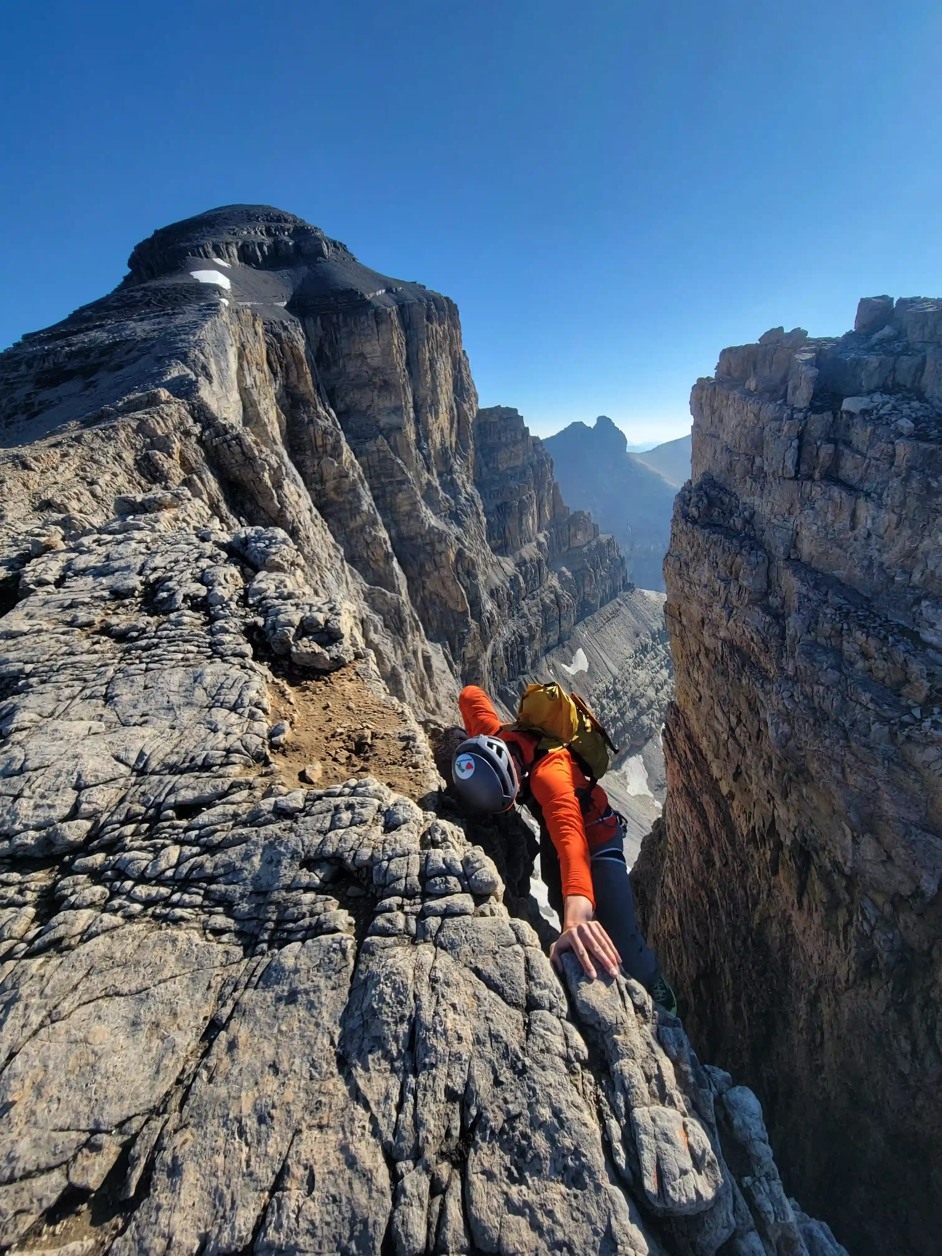
and Mount Harrison, aside from the notches near the top it's just a hike. That being said the notches go at up to 5.4 with parties often roping up for both of them, rappeling across the second notch on the way up, and belaying it on the way down so it has serious terrain and is a good stepping stone for those looking to work their way up to the tougher rock 11000ers.
Following a trip up
Mount Murchison
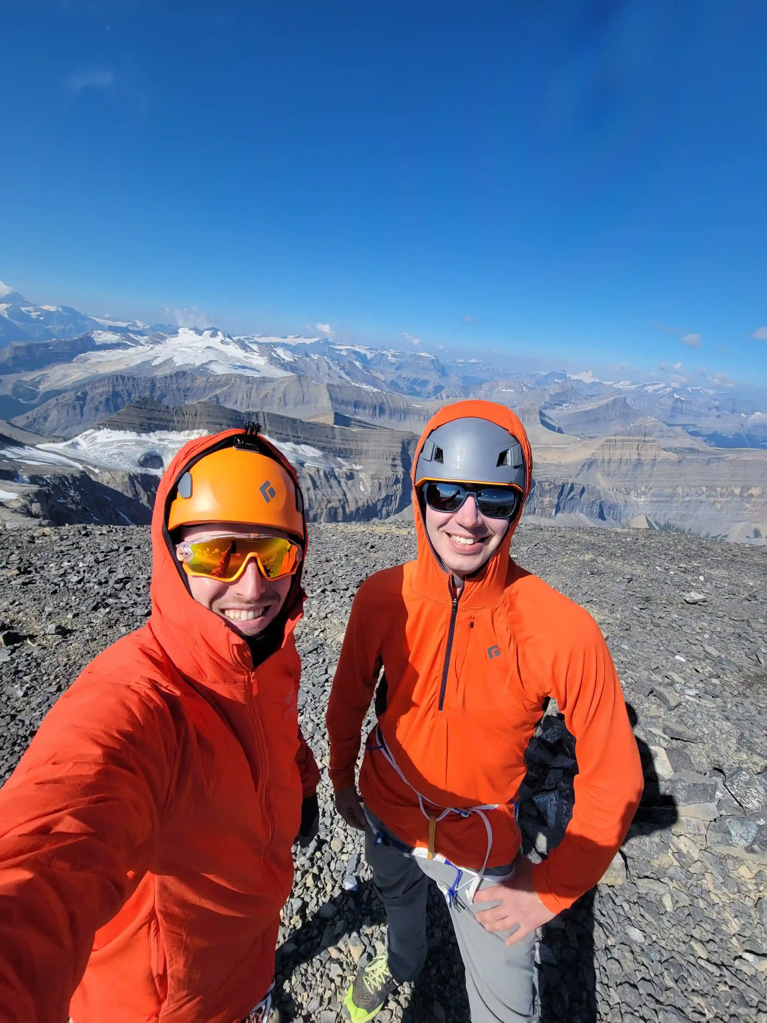
the day prior with Darren and William, Cyrus and I had made plans to go for Mount Cline and the plan was to go fast and light! It was the first time Cyrus and I had teamed up for an objective but when he mentioned he was keen on running any flat or downhill terrain I knew we'd get along well. We decided to bring a short 35m rope for the second notch in the event we wanted to rappel so we weren't truly as light as possible but aside from that we didn't pack a surplus of layers or food so that would help us to get up and down Cline in good time.

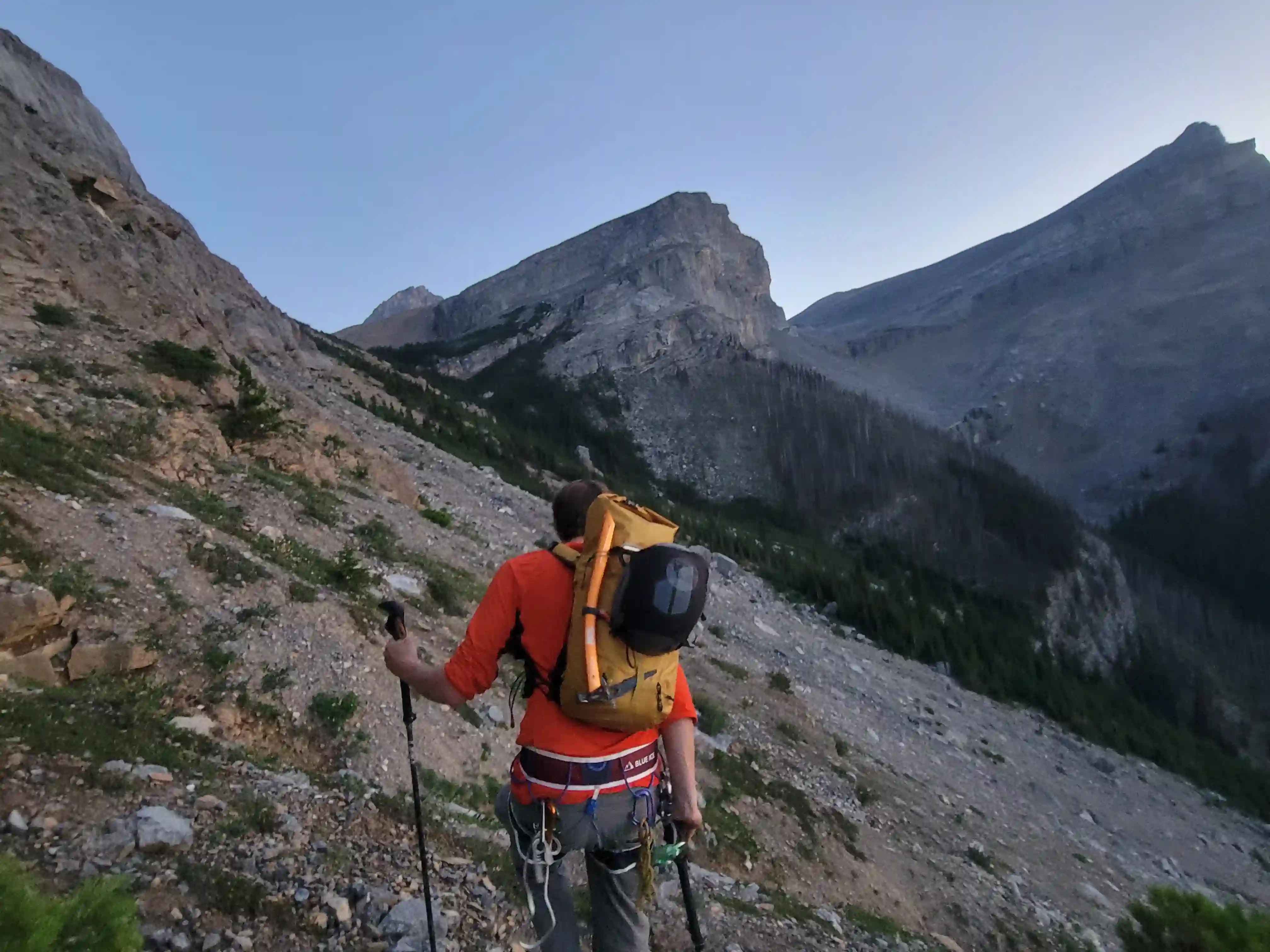
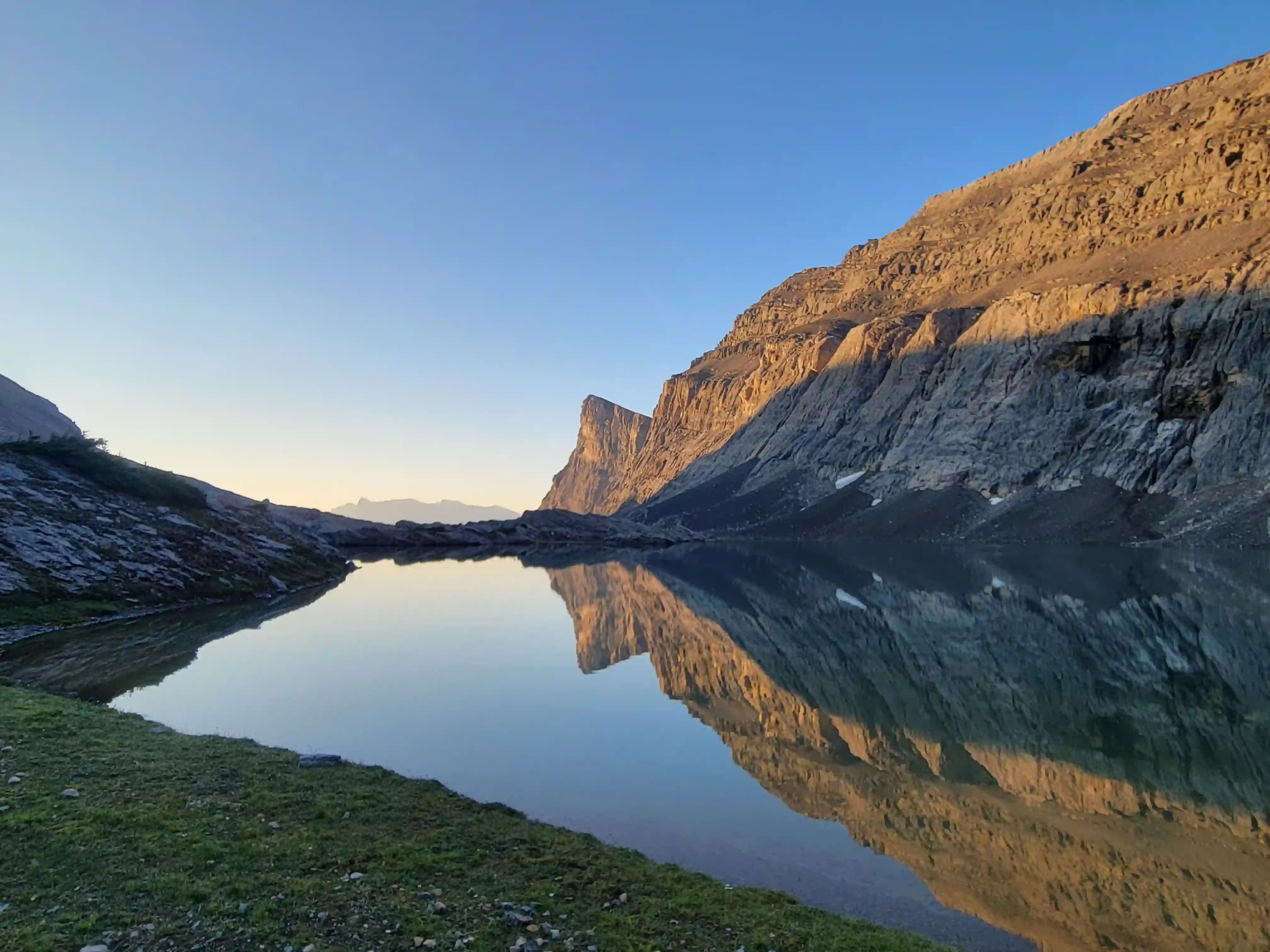
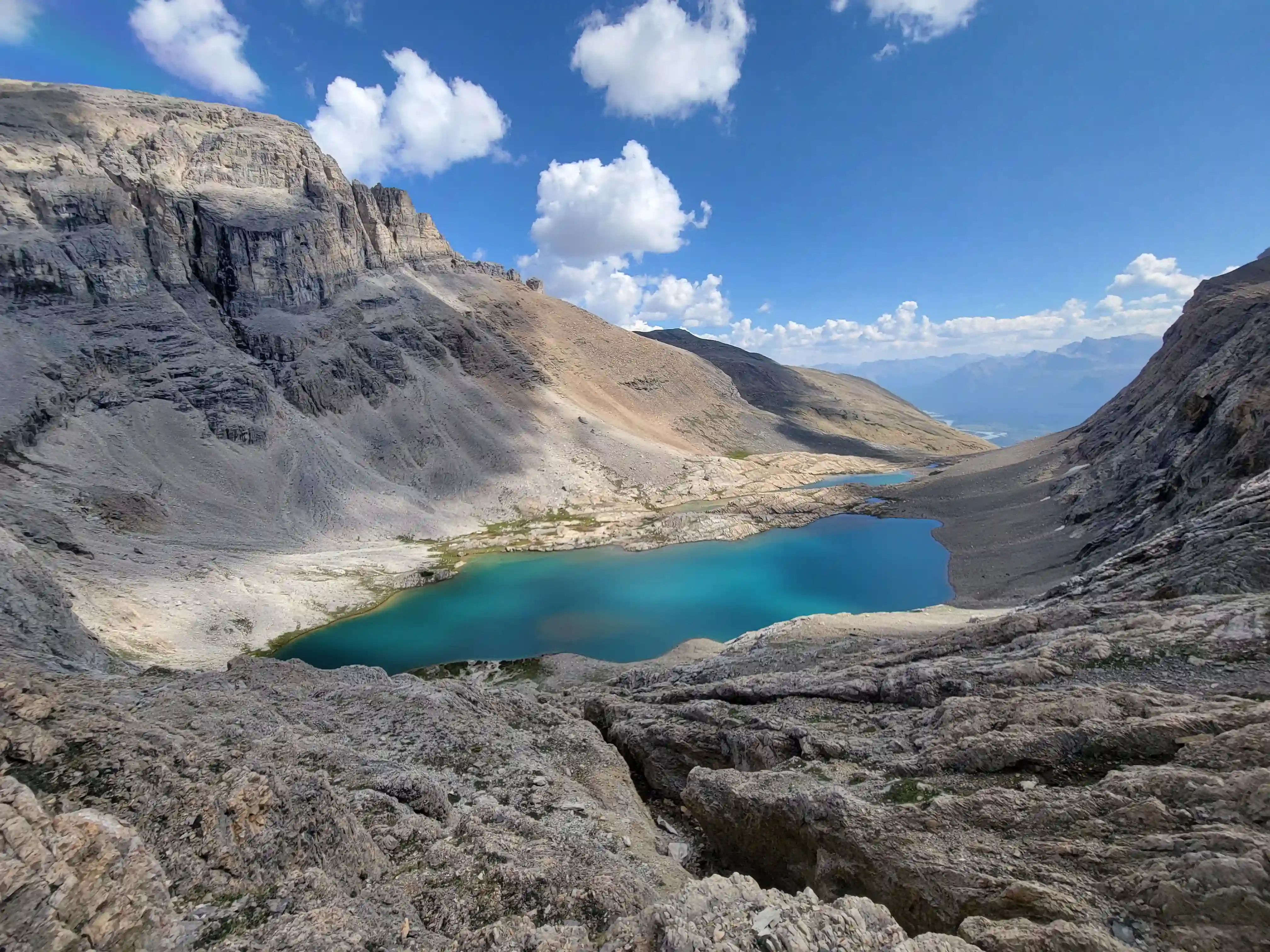
We started a bit after 4am to get a head start on the day and the approach to the lake where some groups camp ended up going pretty quickly. Where the route branches west from the river early on we took a ledge slightly higher than the main ledge that's typically used but it ended up reconnecting with the route fine and after that the terrain opened up and soon after we were greeted with the excellent views from the lake camp site.
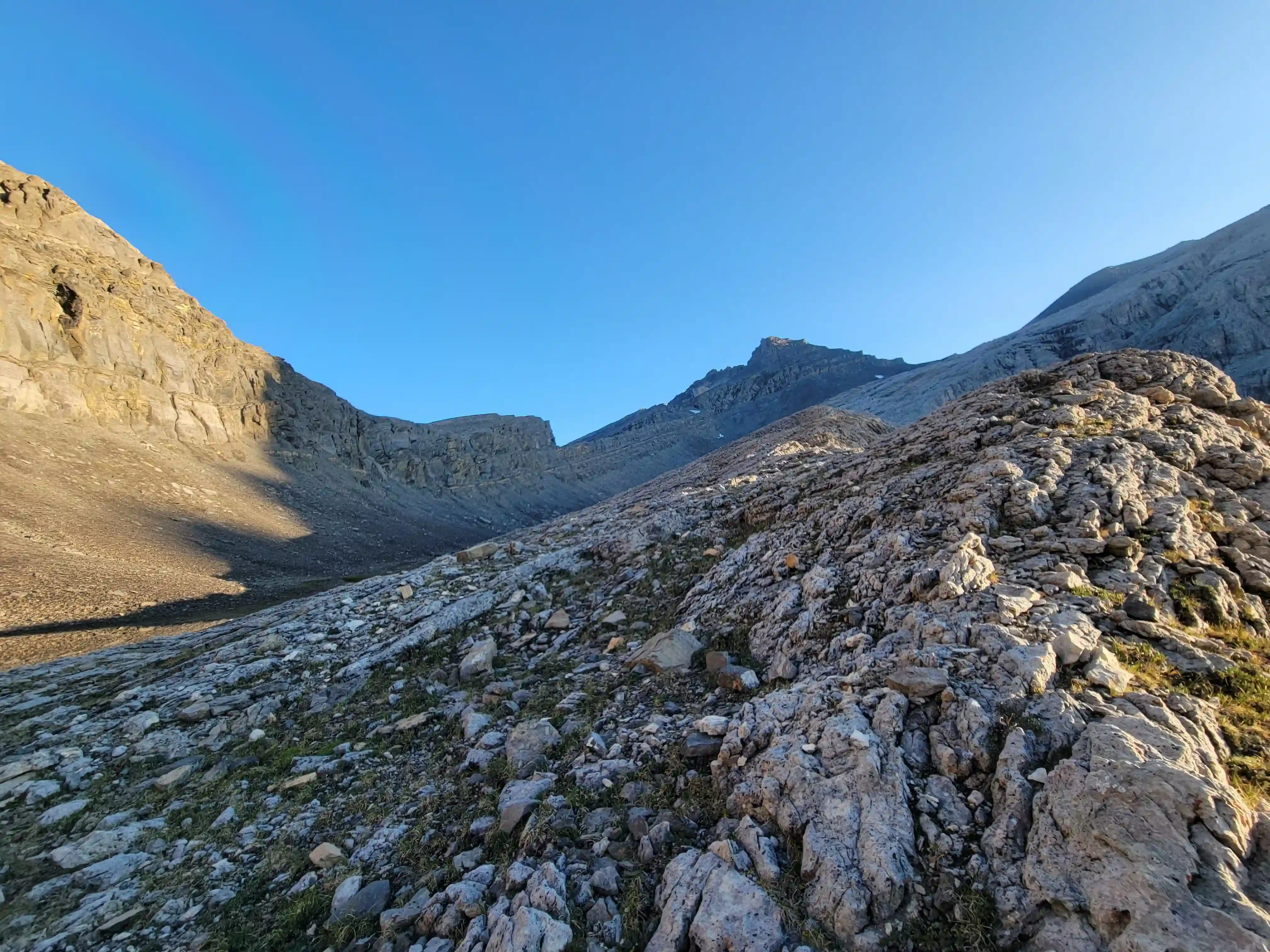
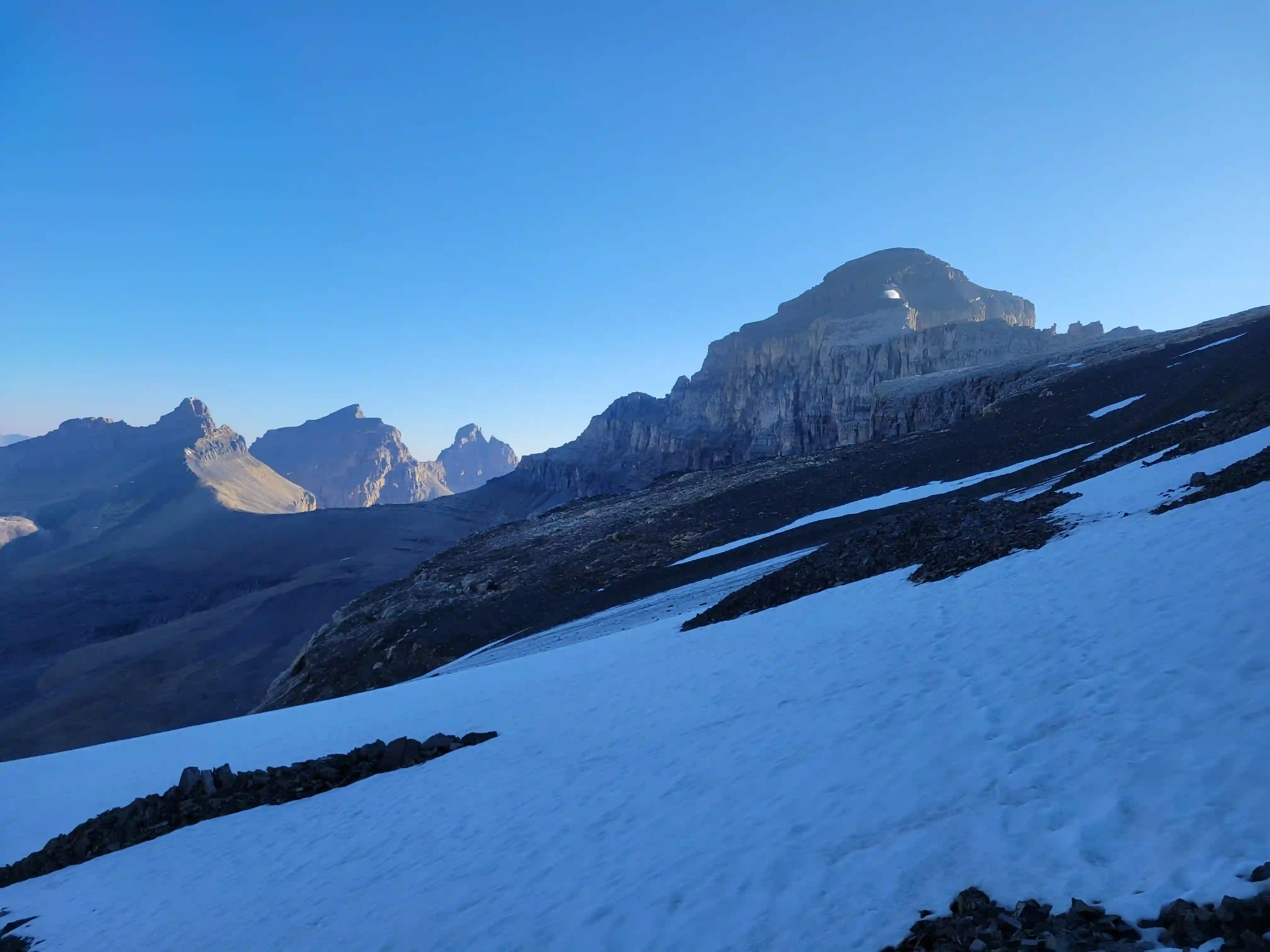
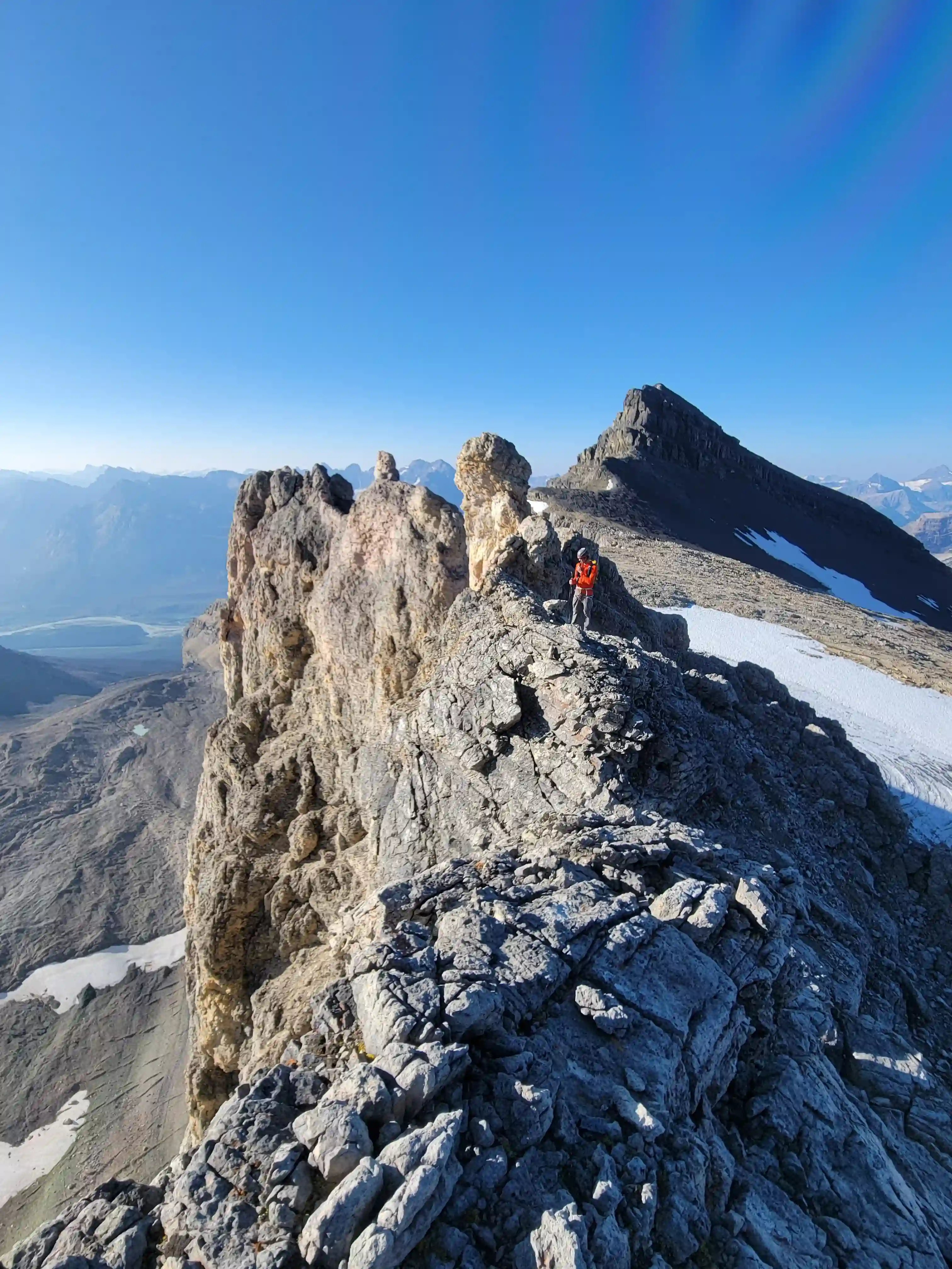
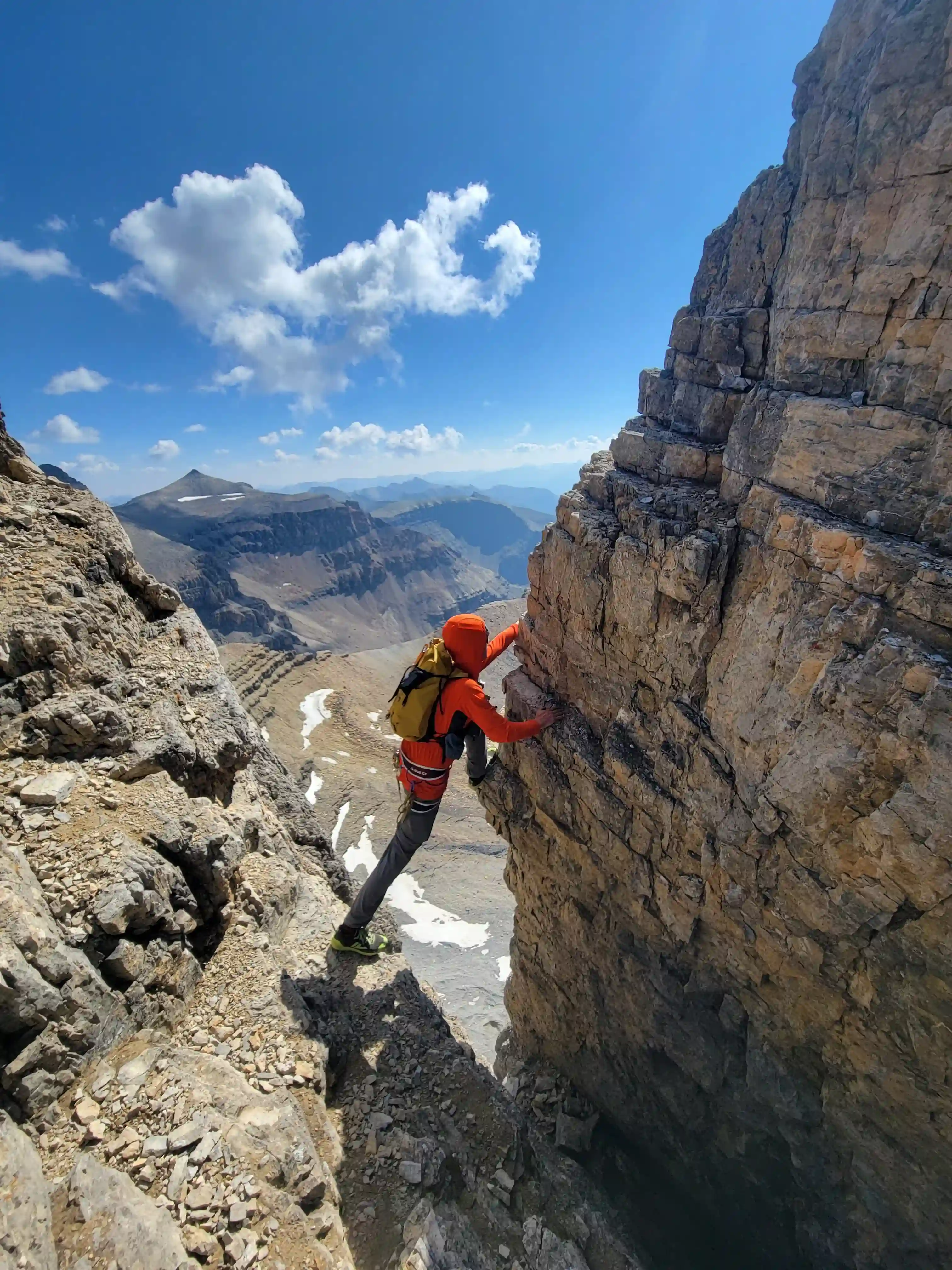
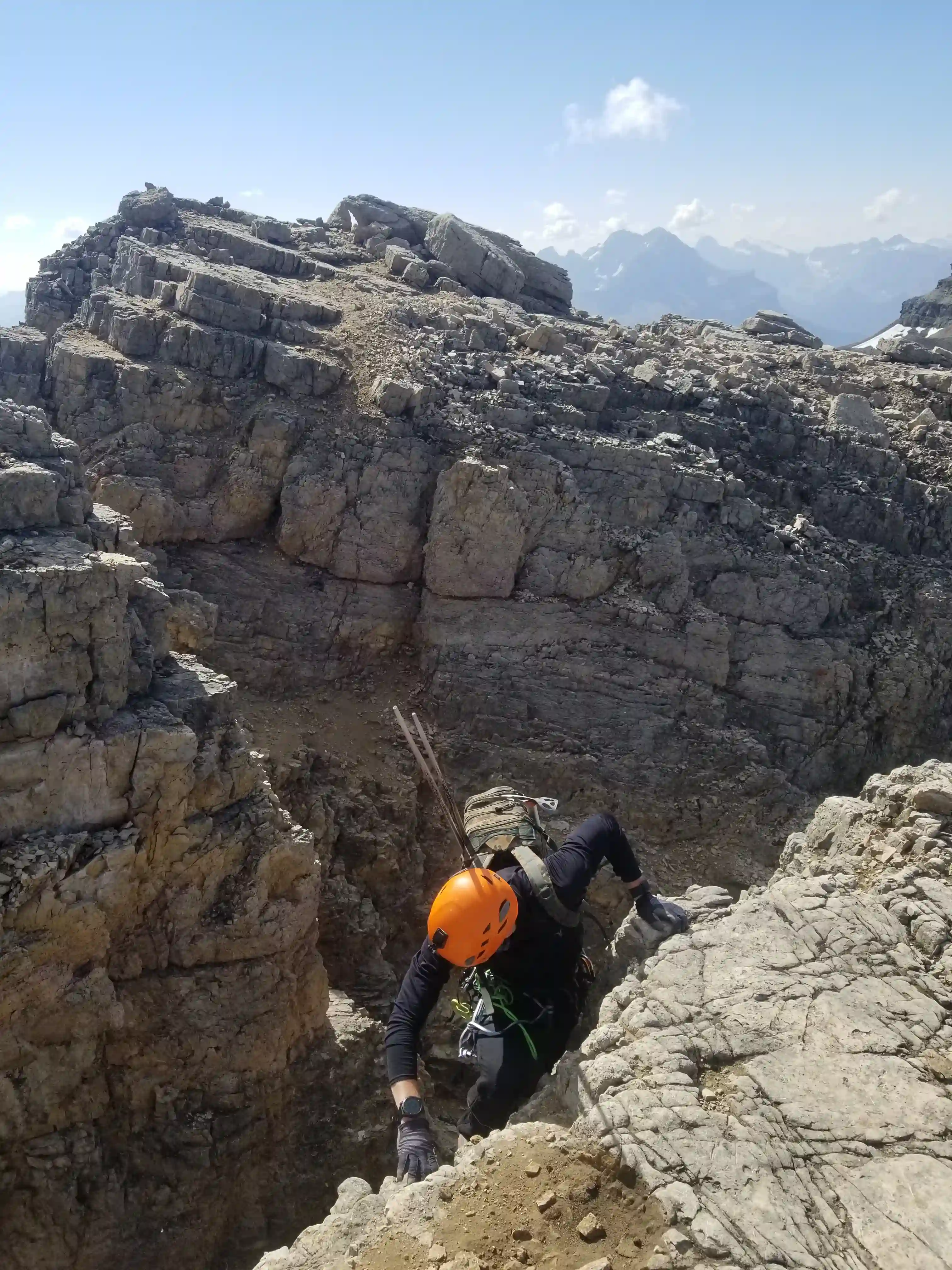
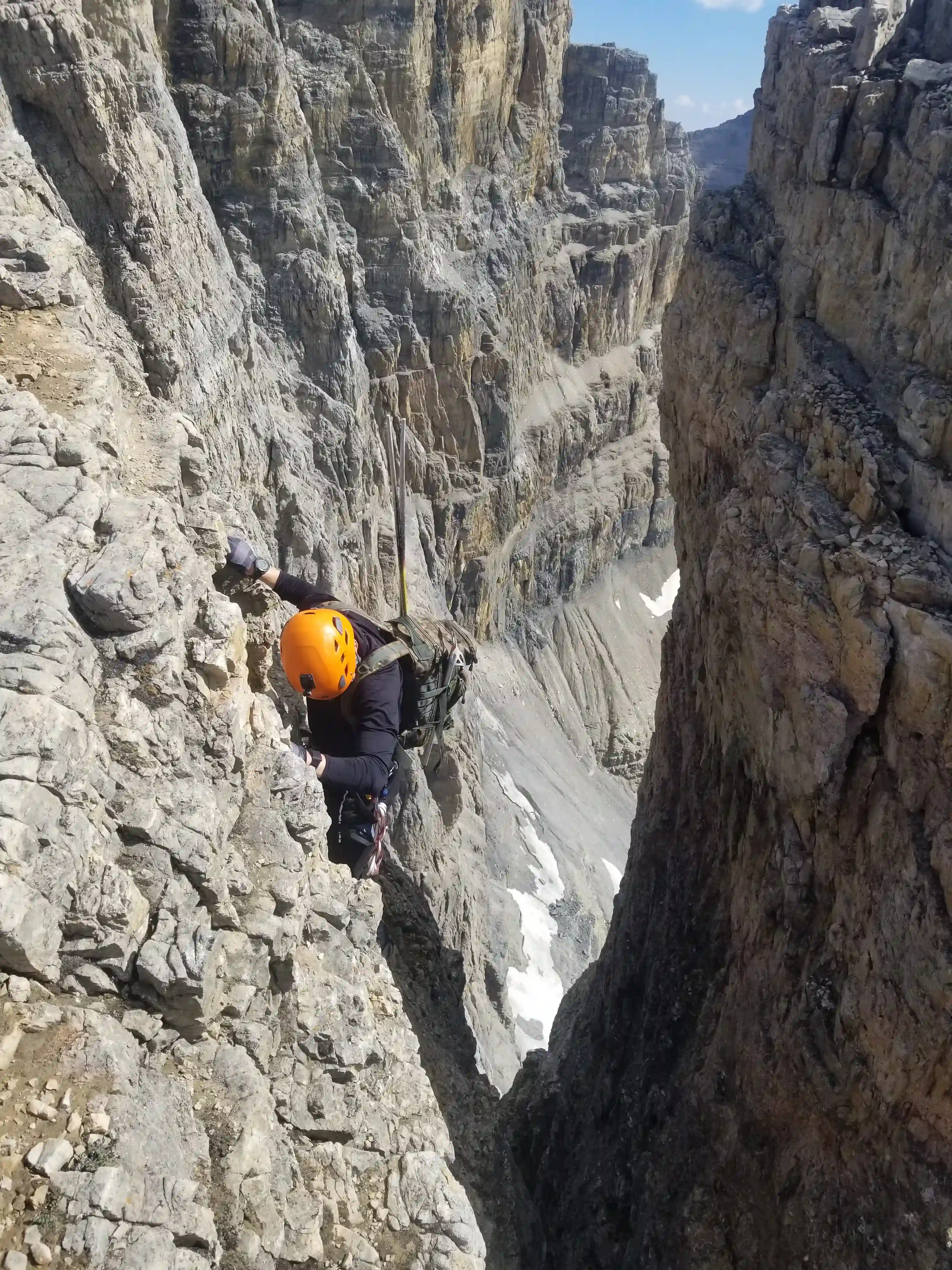
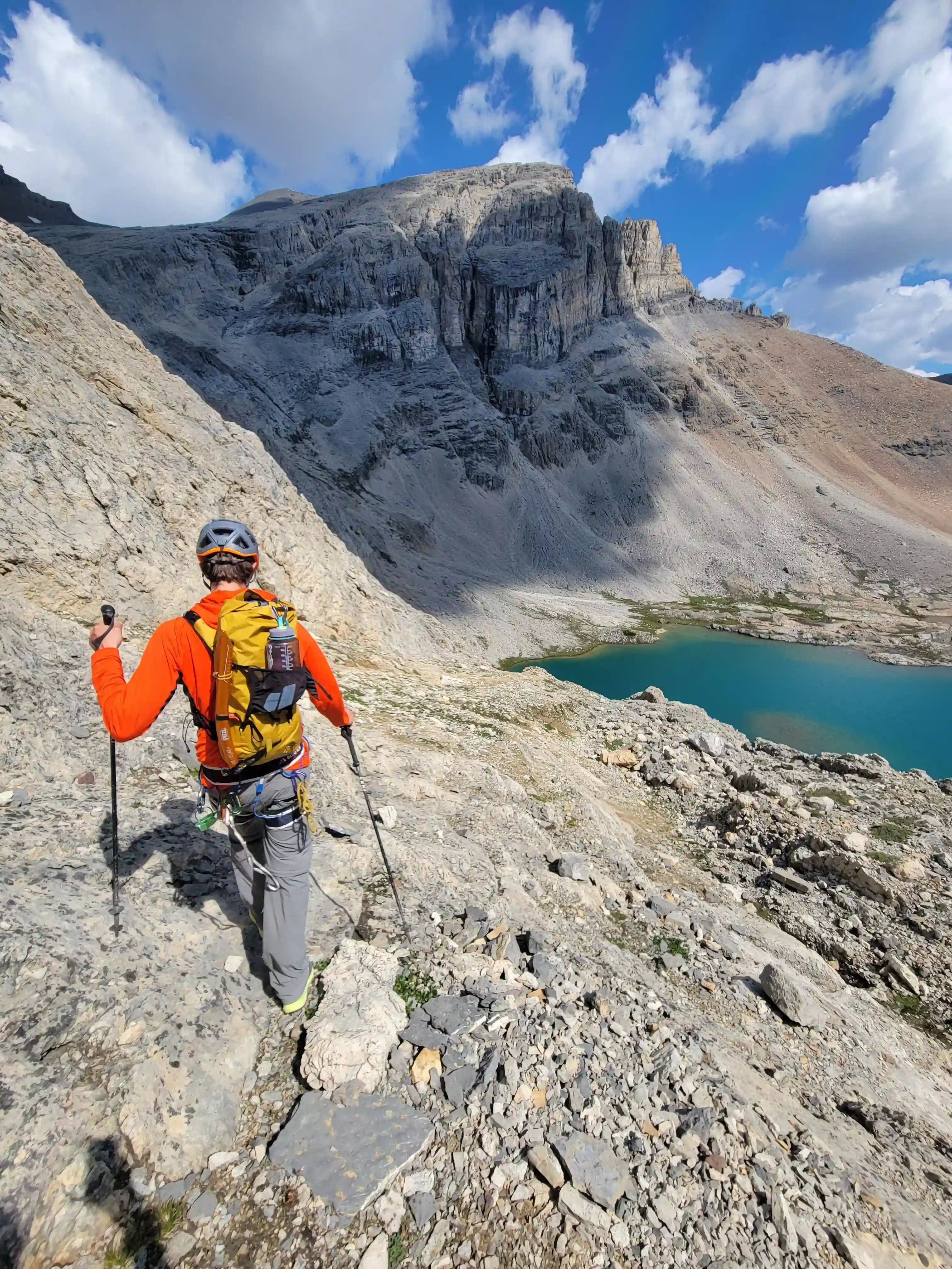
Following the lake we began gaining elevation quickly and where there's a small glacier remaining west of Mount Owen most of the snow had melted out so we could bypass tedious section on scree to the right which helped us make good time getting to Cline's ridge. After a bit of good scrambling we had arrived at the first of the notches and the fun part began, Cyrus and I both felt comfortable with the terrain so we free soloed the first notch and made our way to the second.
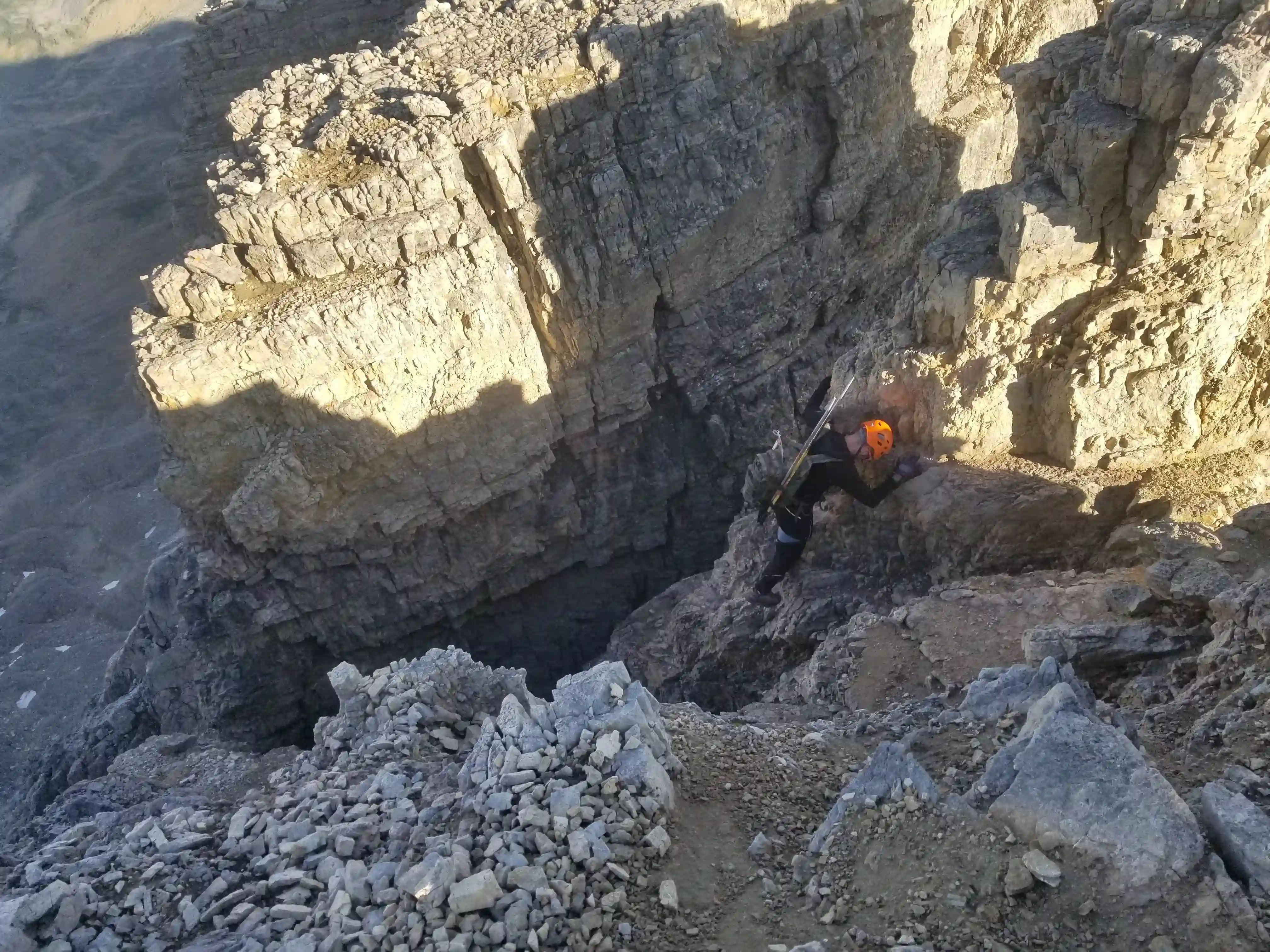
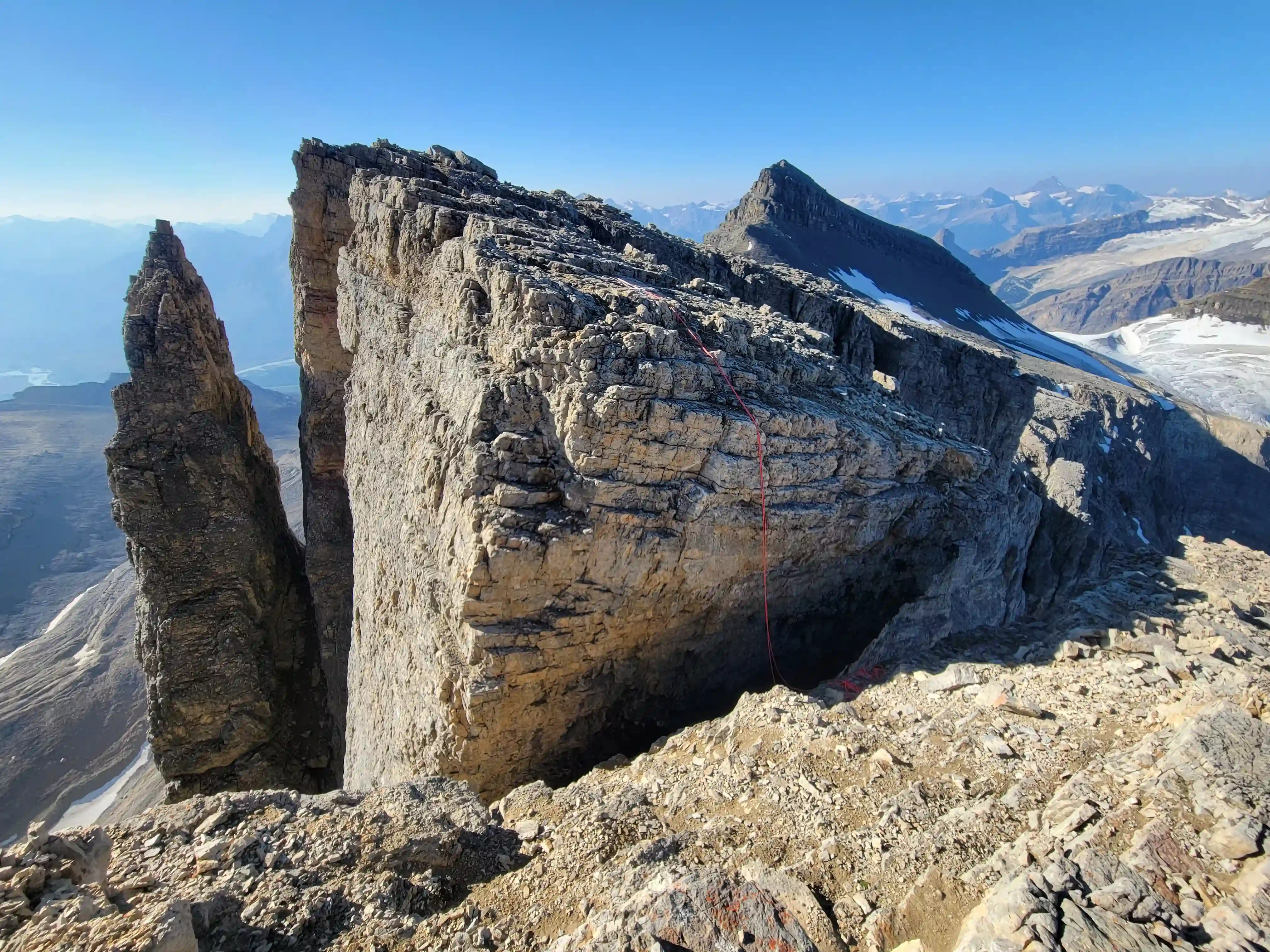
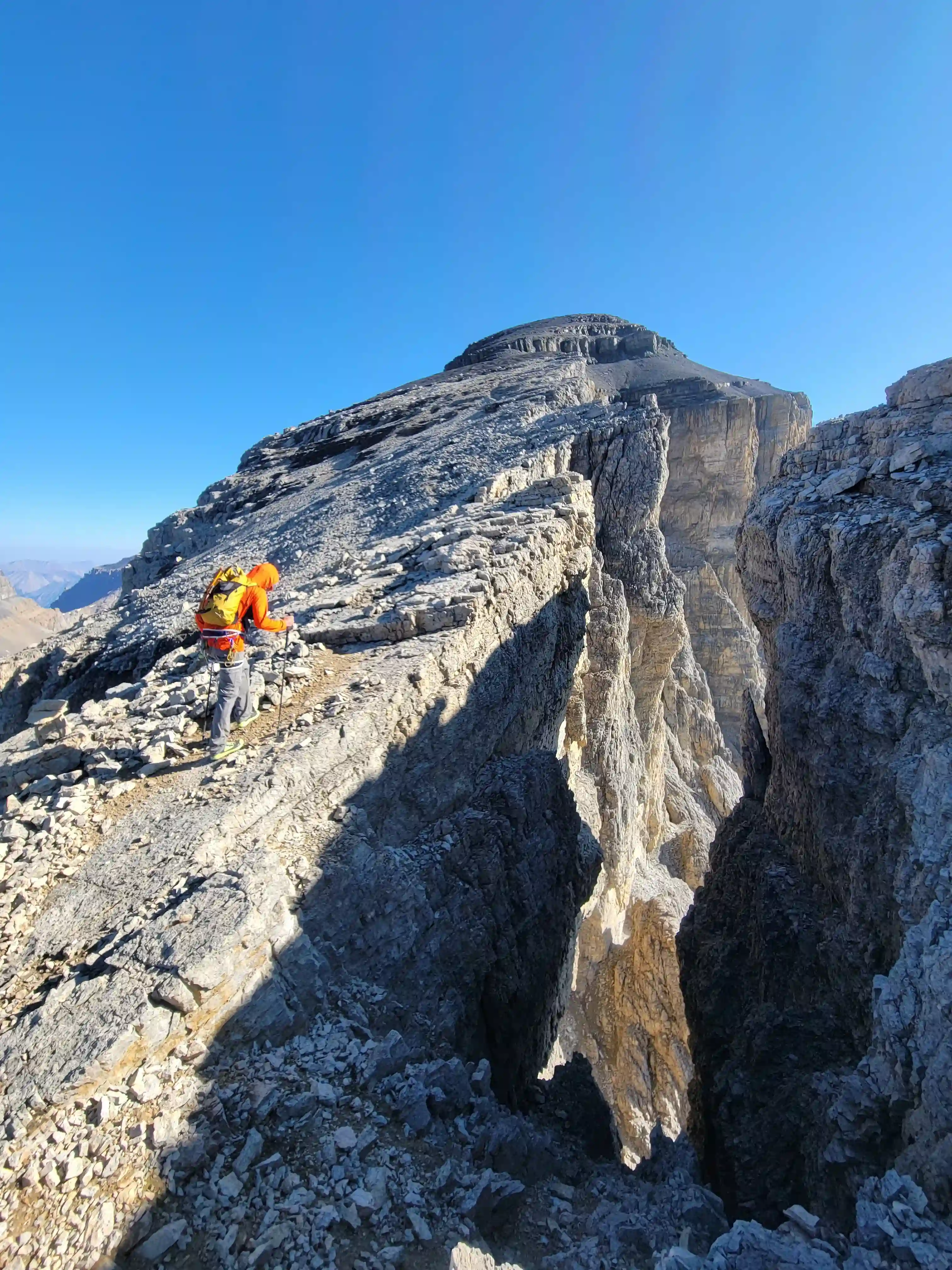
I knew that most parties rappelled the second notch but I had also heard of some people downclimbing it and some of the crazy ones jumping it, I think it's safe to say that you'd have to be a bit nuts to go for the jump option. This isn't the Mount Edith jump, pictures and videos don't necessarily do it justice but the gap is big and the other side is a few meters lower so it would be easy to have a rough landing even if you did clear the gap. We thought about downclimbing it but the last move is a big move with deadly exposure so since we had the rope anyway we decided to rappel. After that we left the rope at the notch and it was a simple hike to the summit!
links:
STRAVA
|
GAIA
elapsed time: 11.5hrs
DIFFICULTY: PD/PD+, 5th class up to 5.4
Use the following links to jump to:
Follow the journey
I'll send you an email when a new trip report drops.
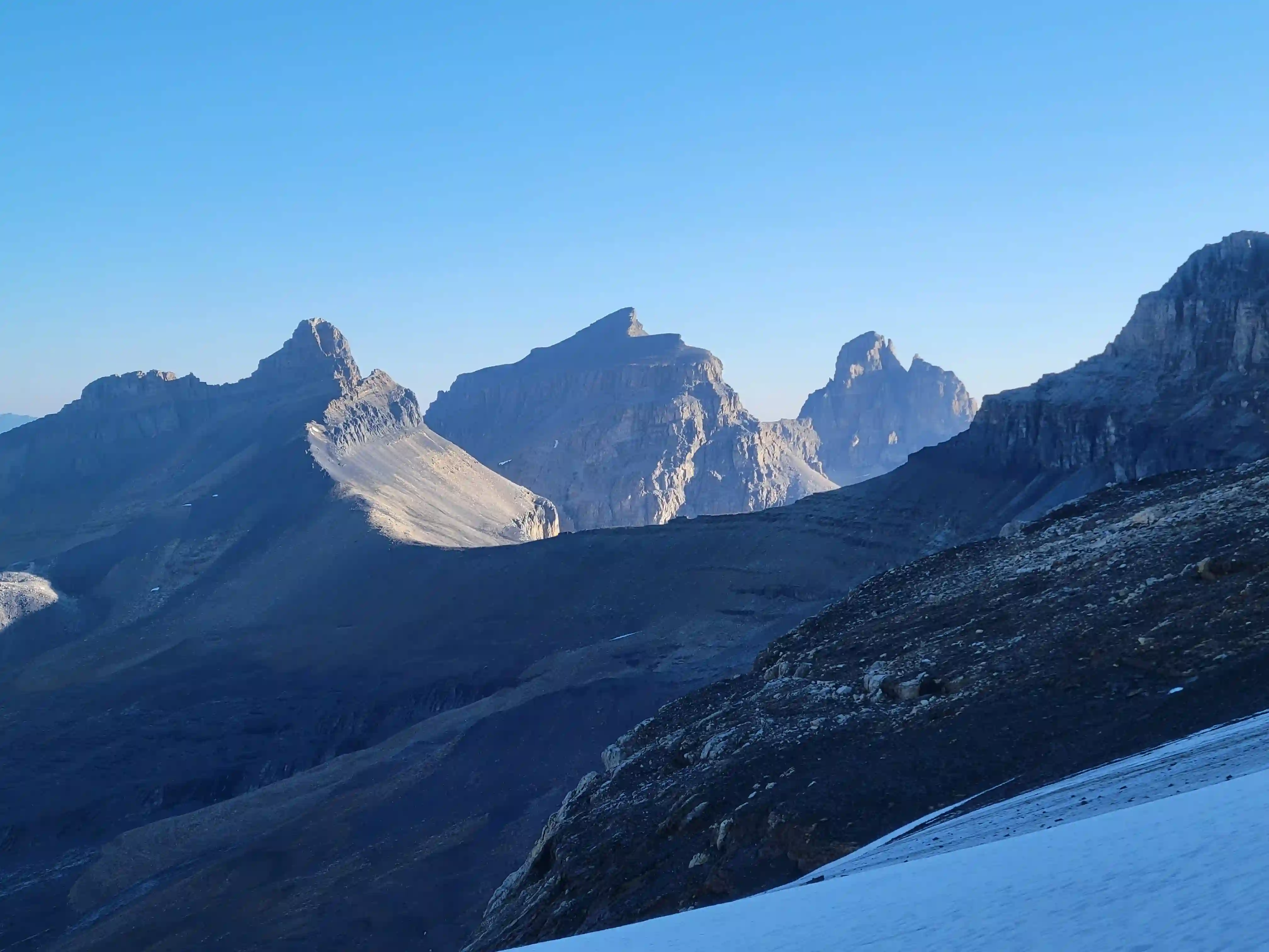
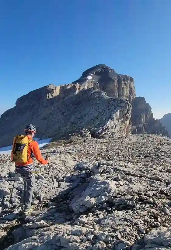
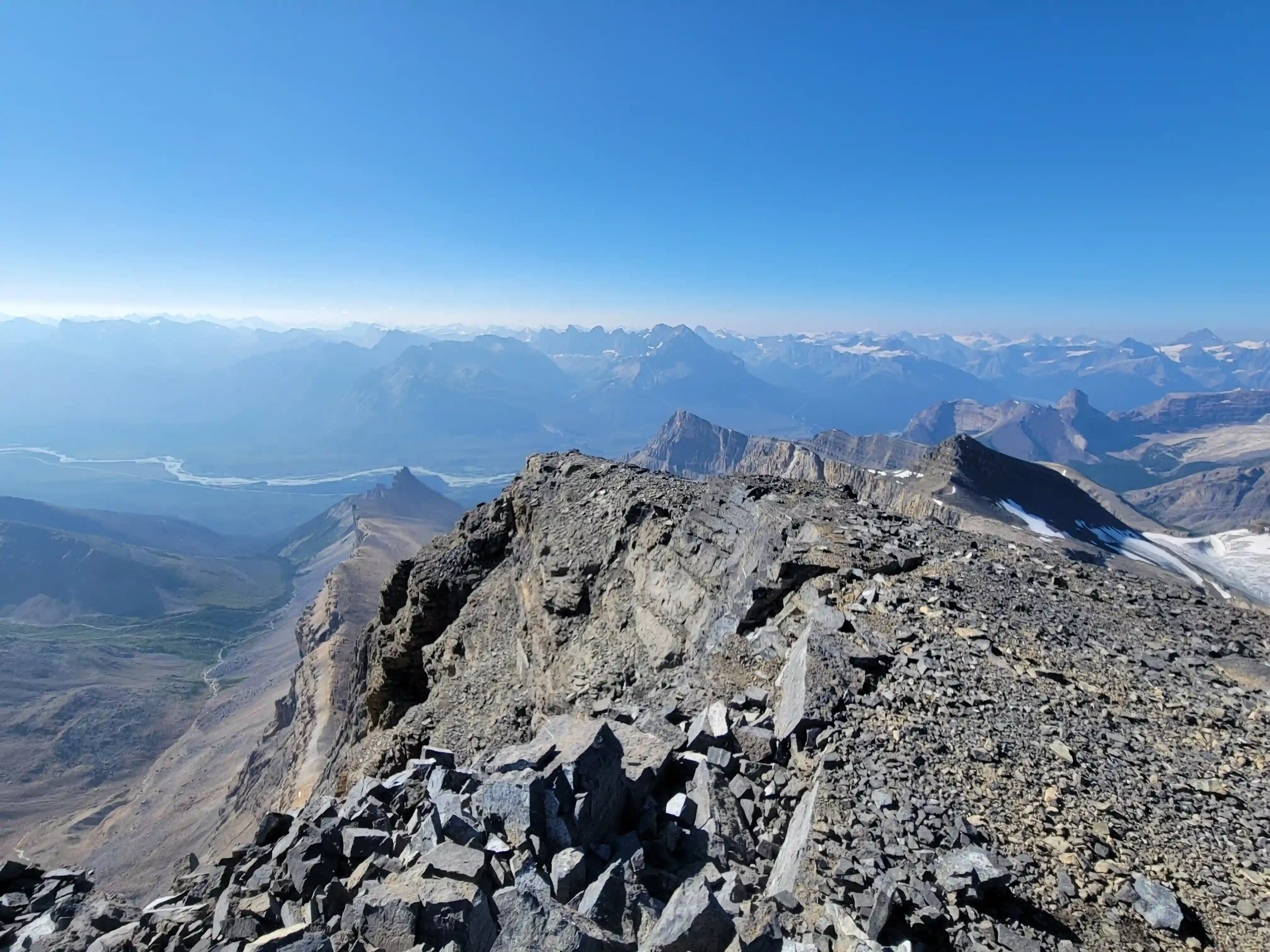
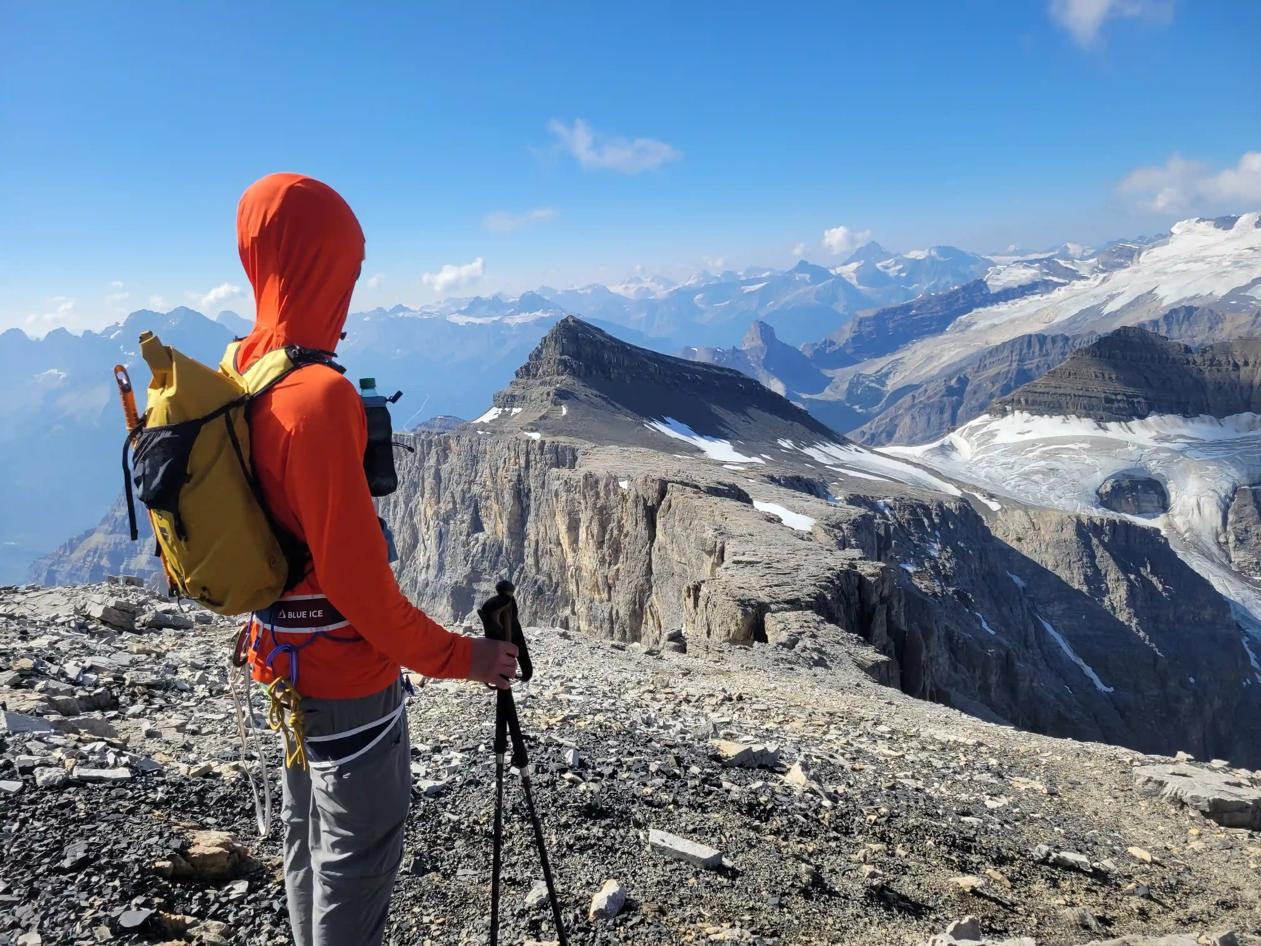
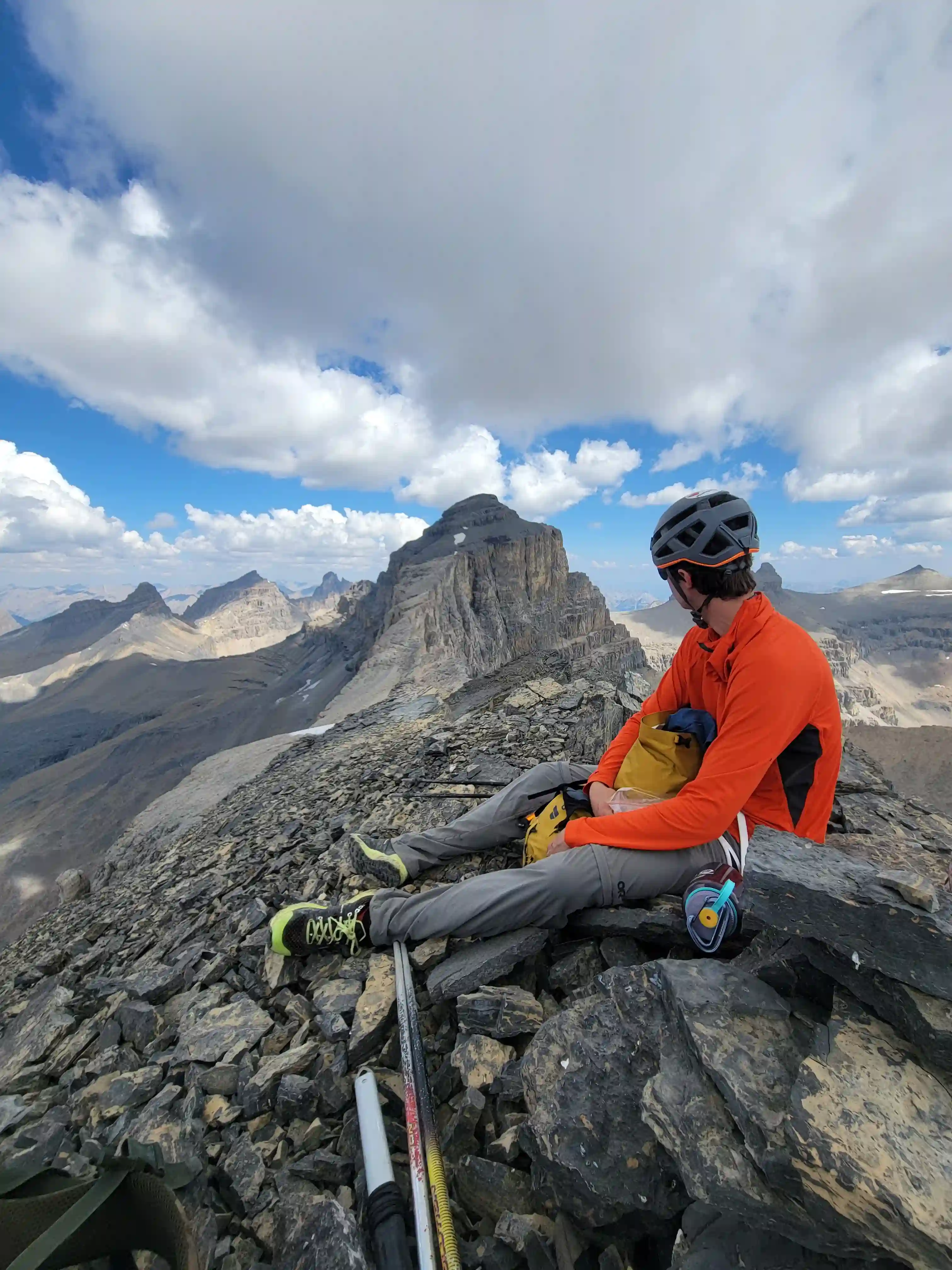
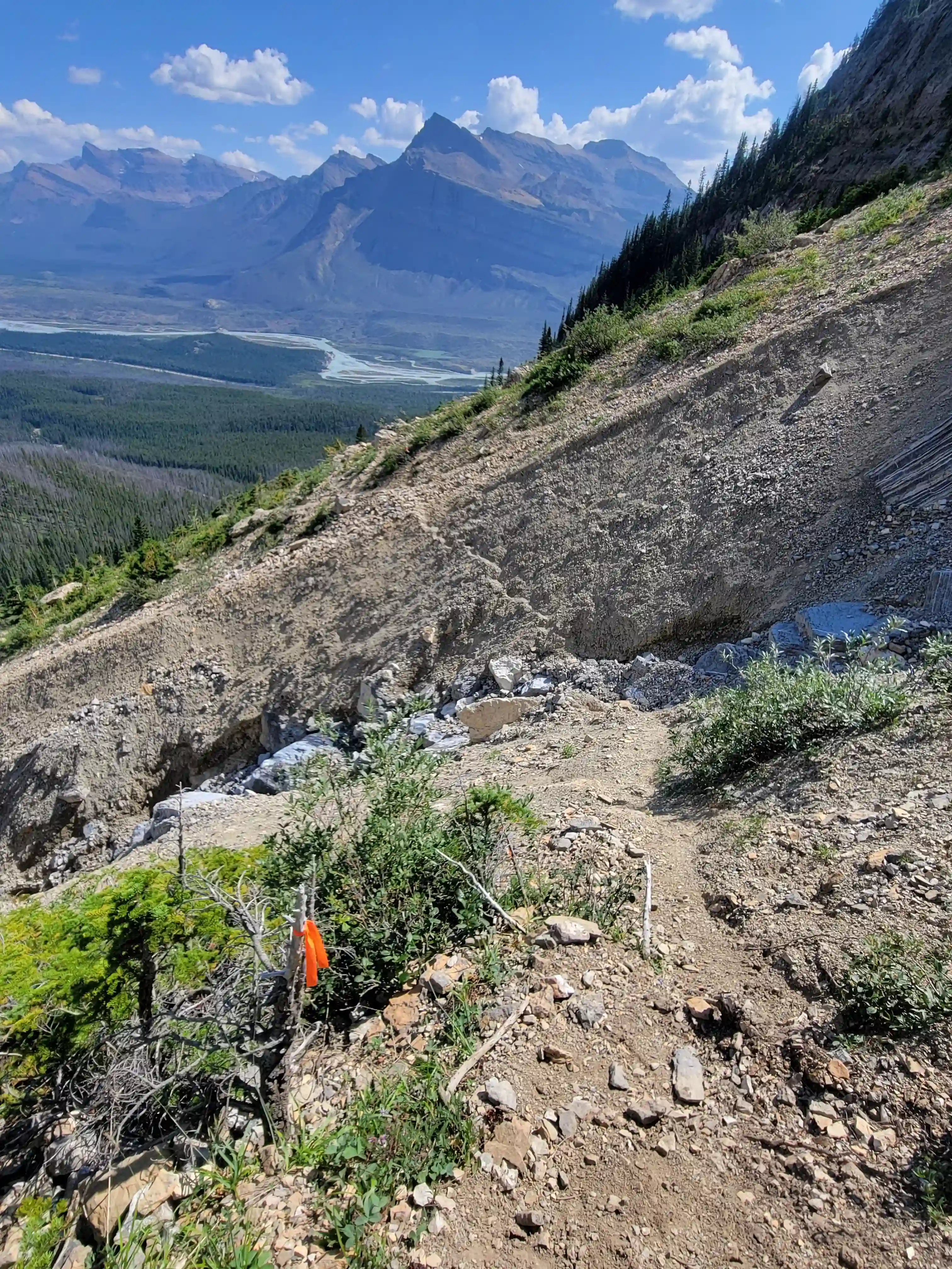
THE APPROACH
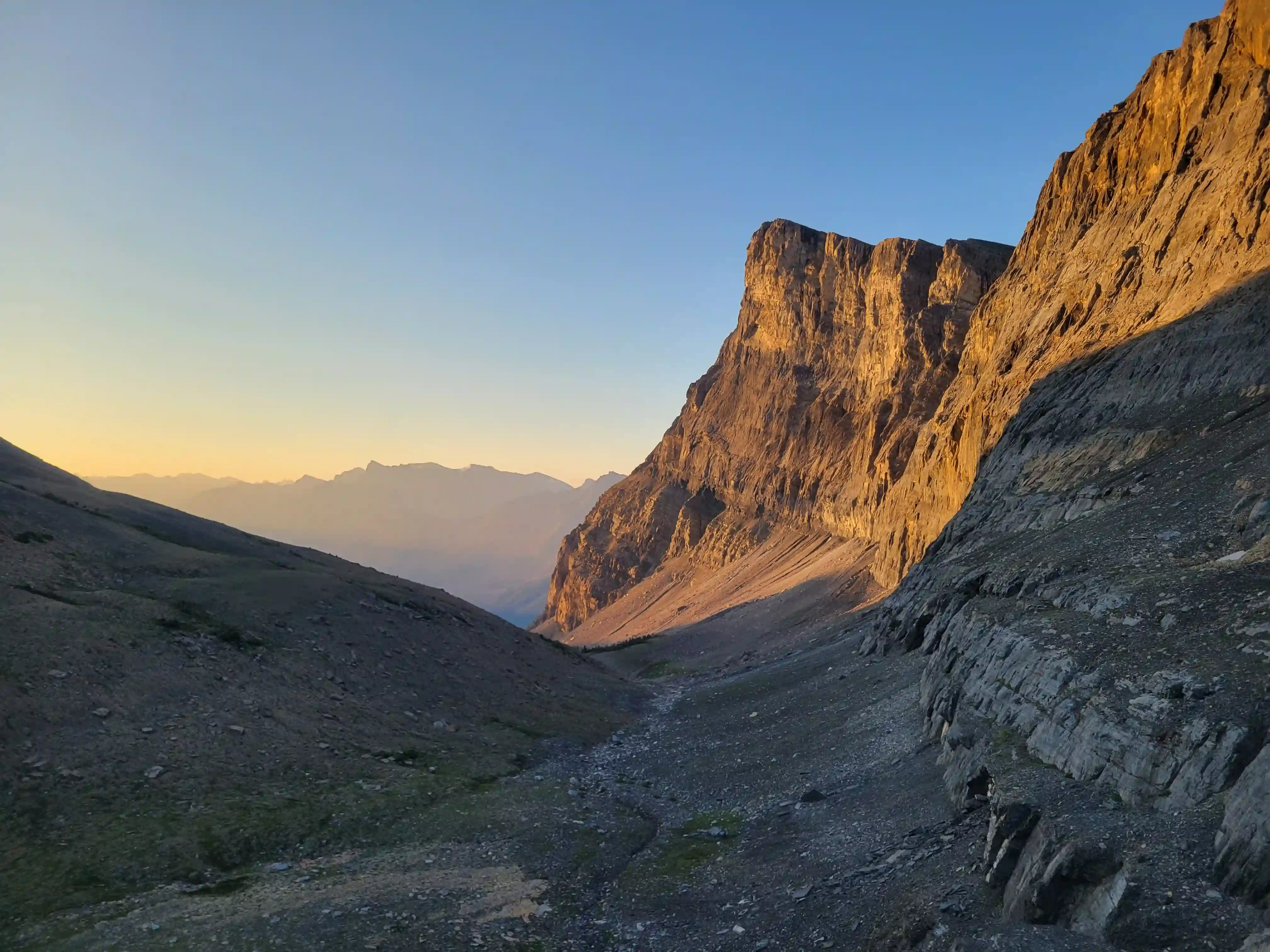
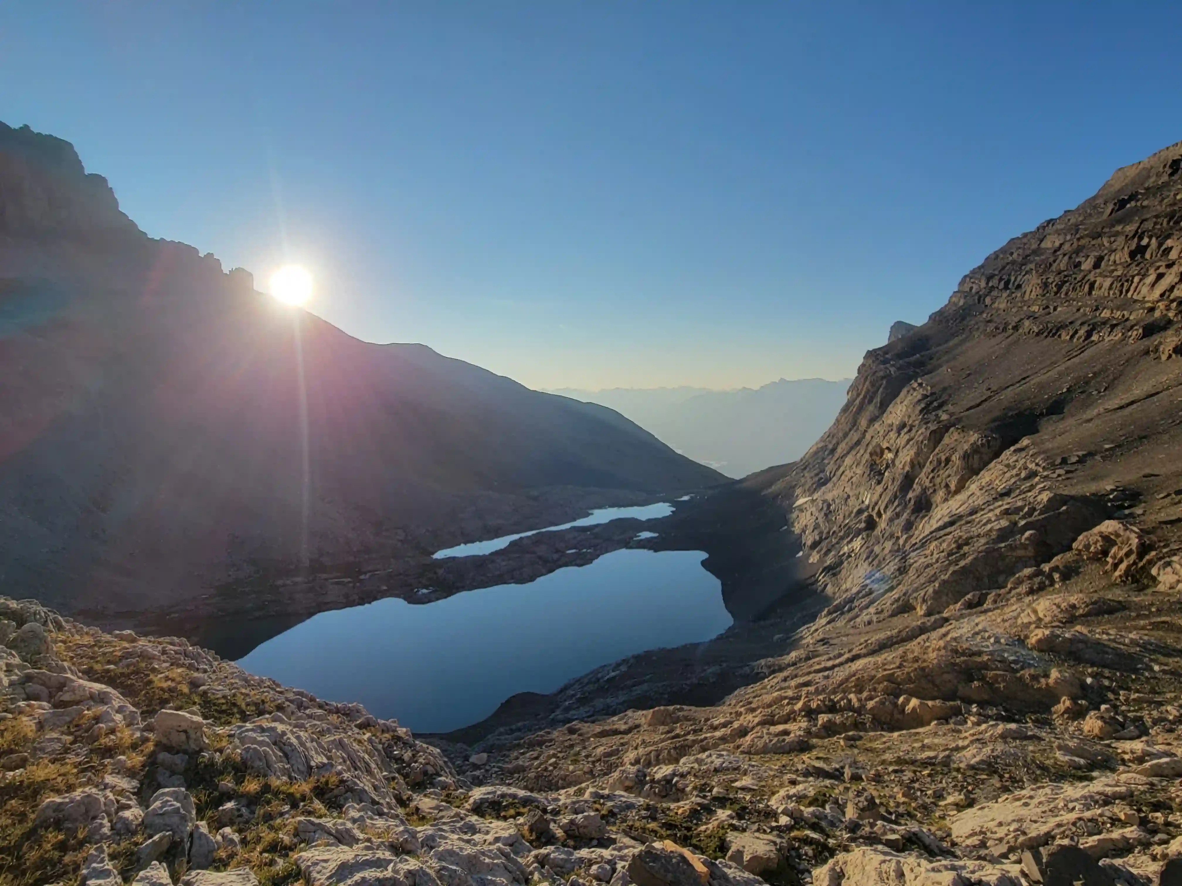
as Chephren and White Pyramid at far right
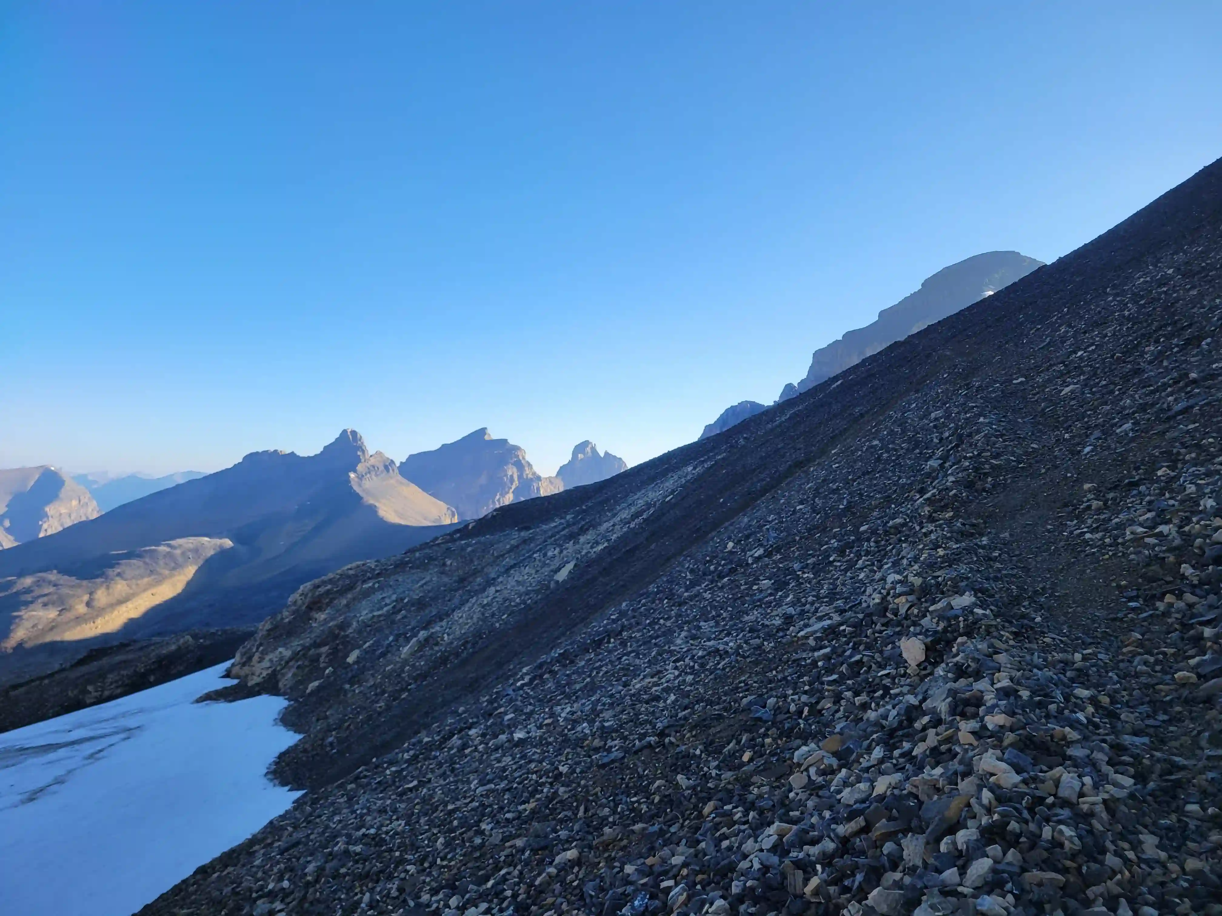
Peaks at left
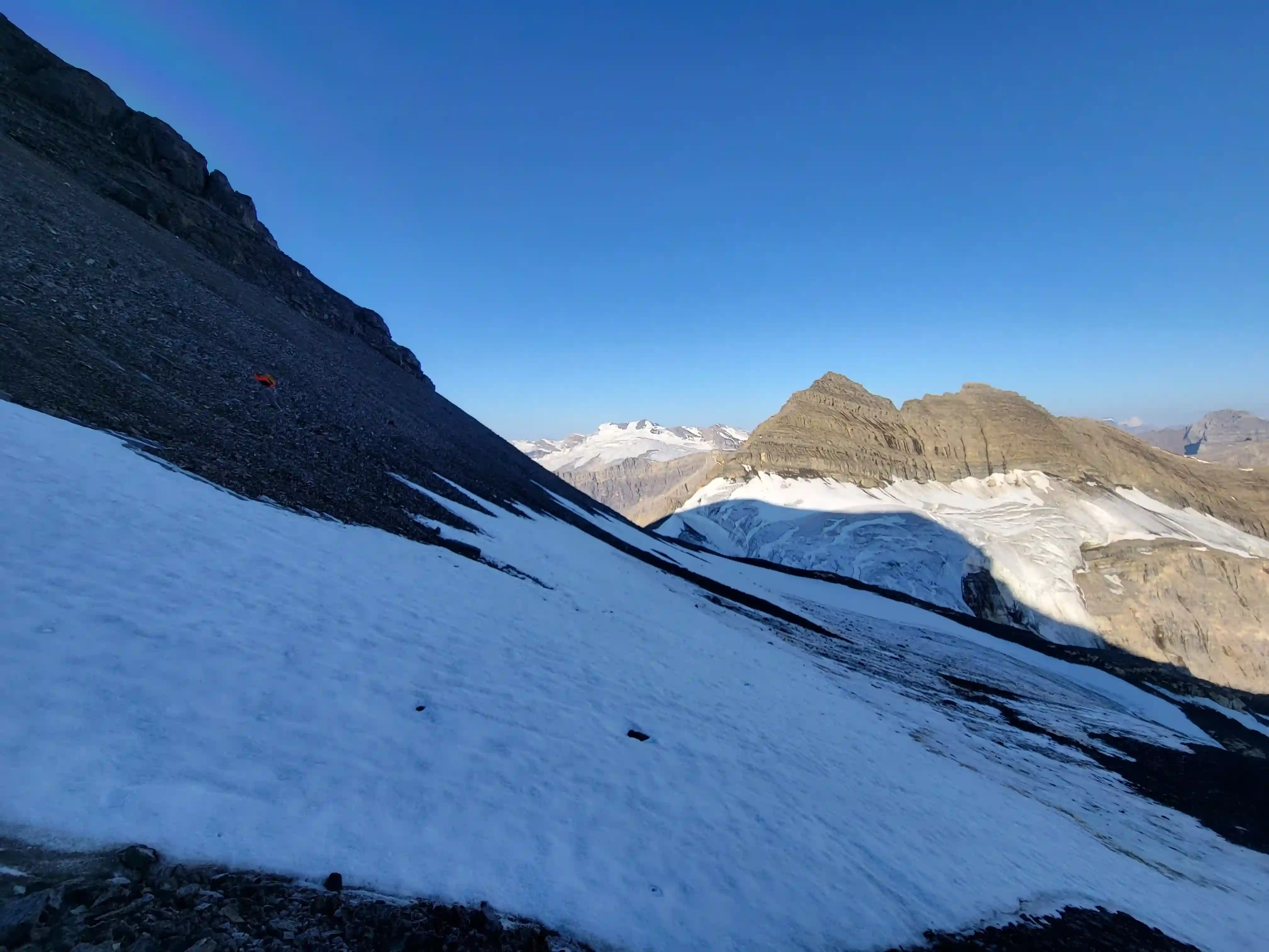
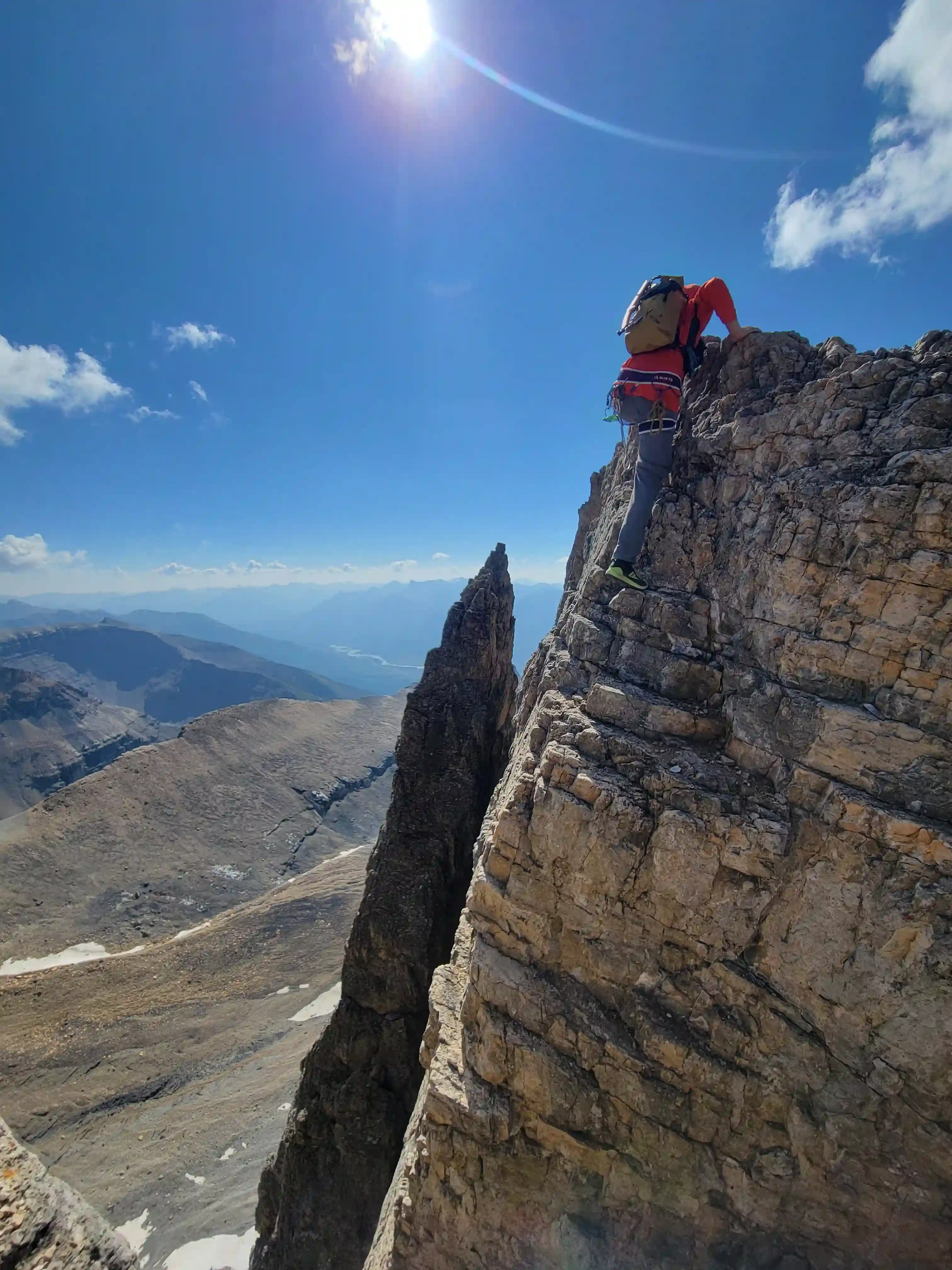
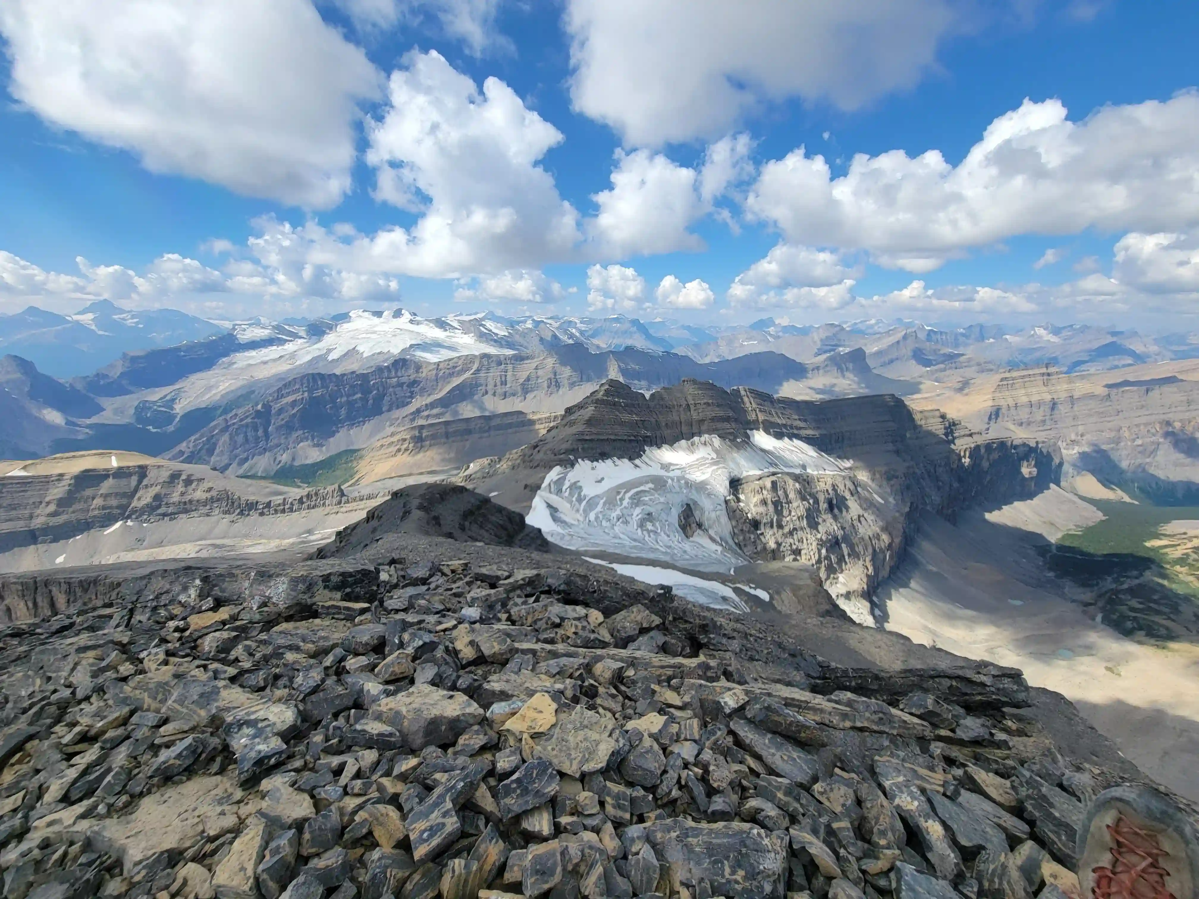
THE NOTCHES
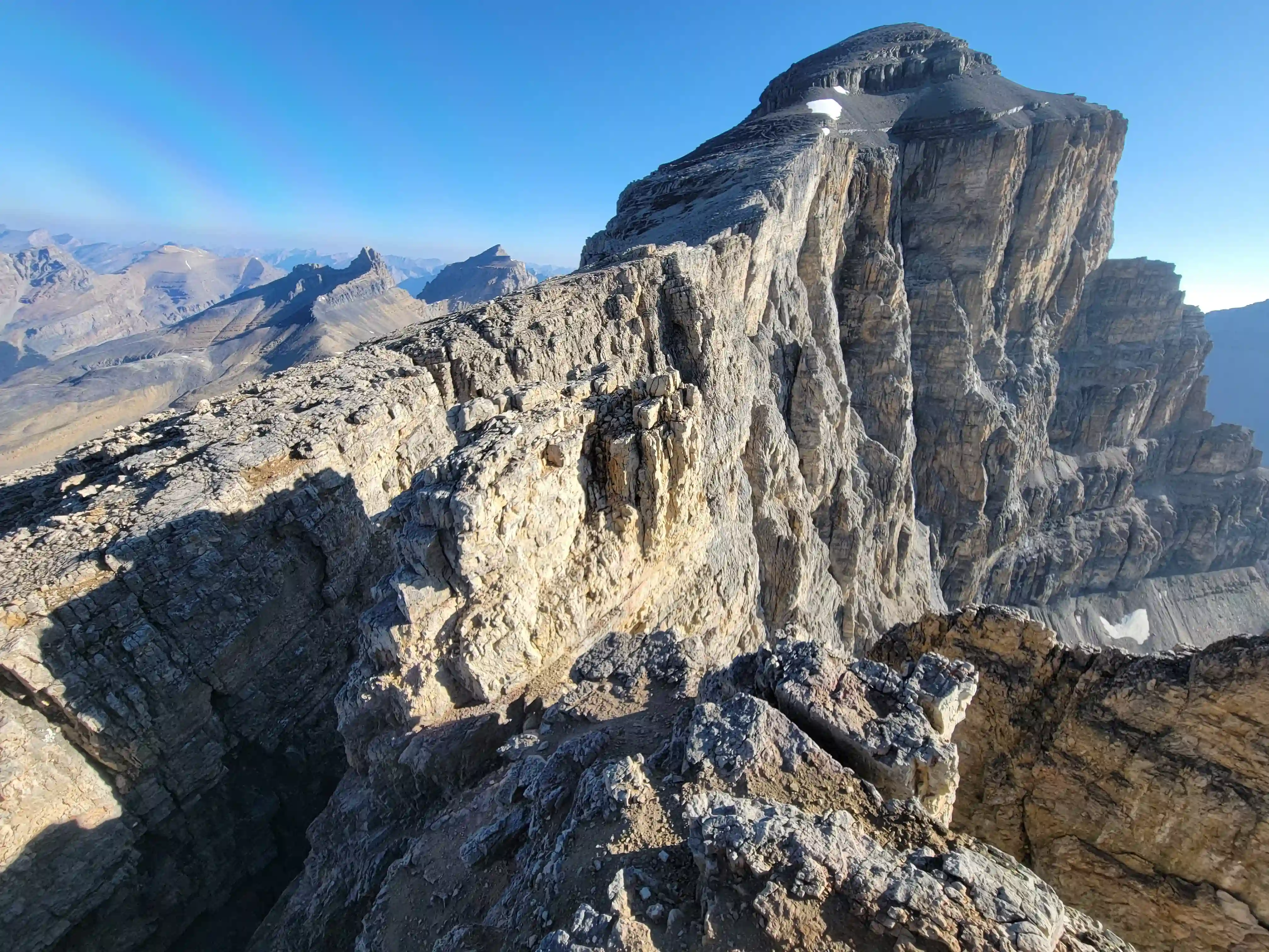
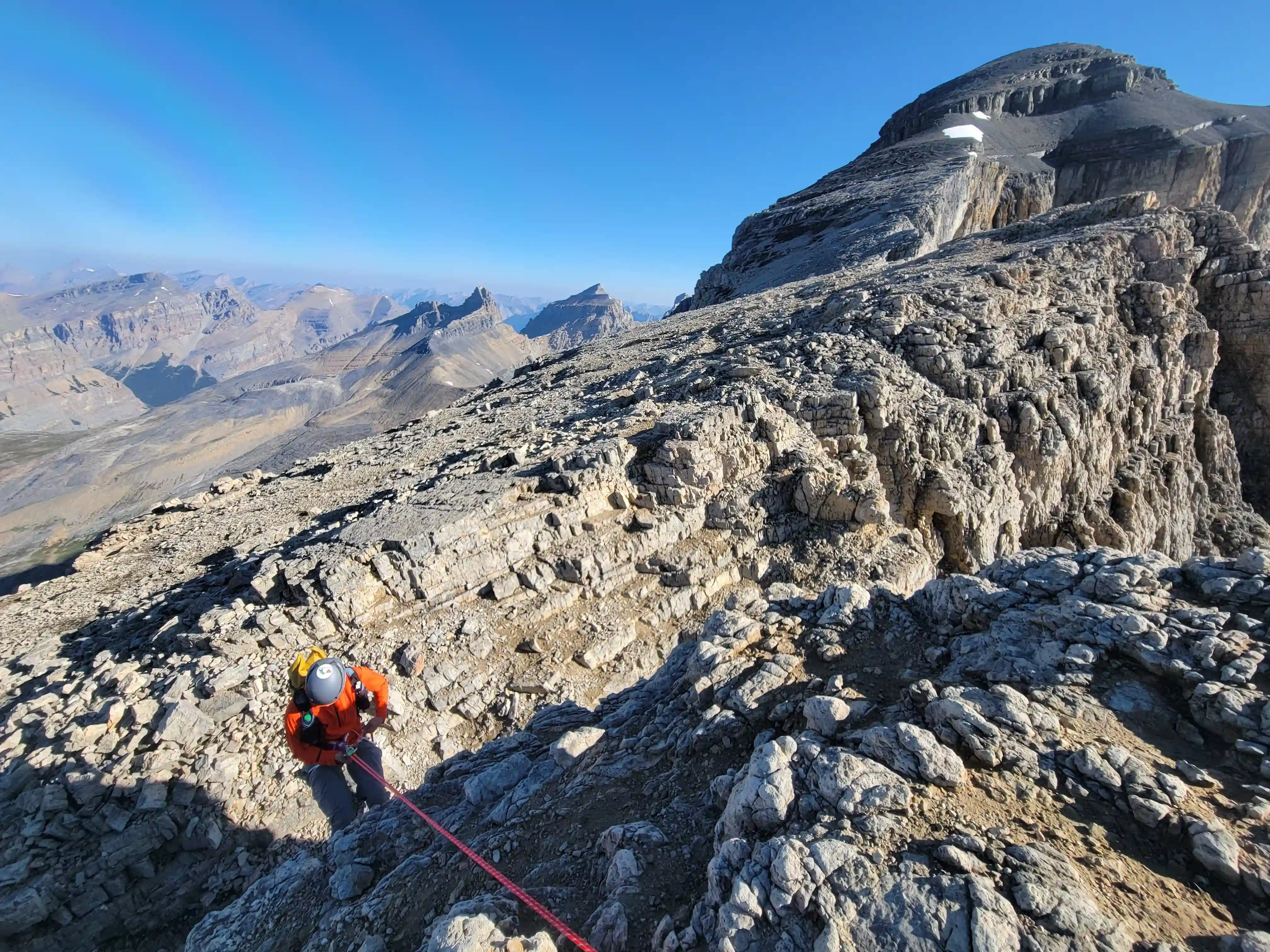
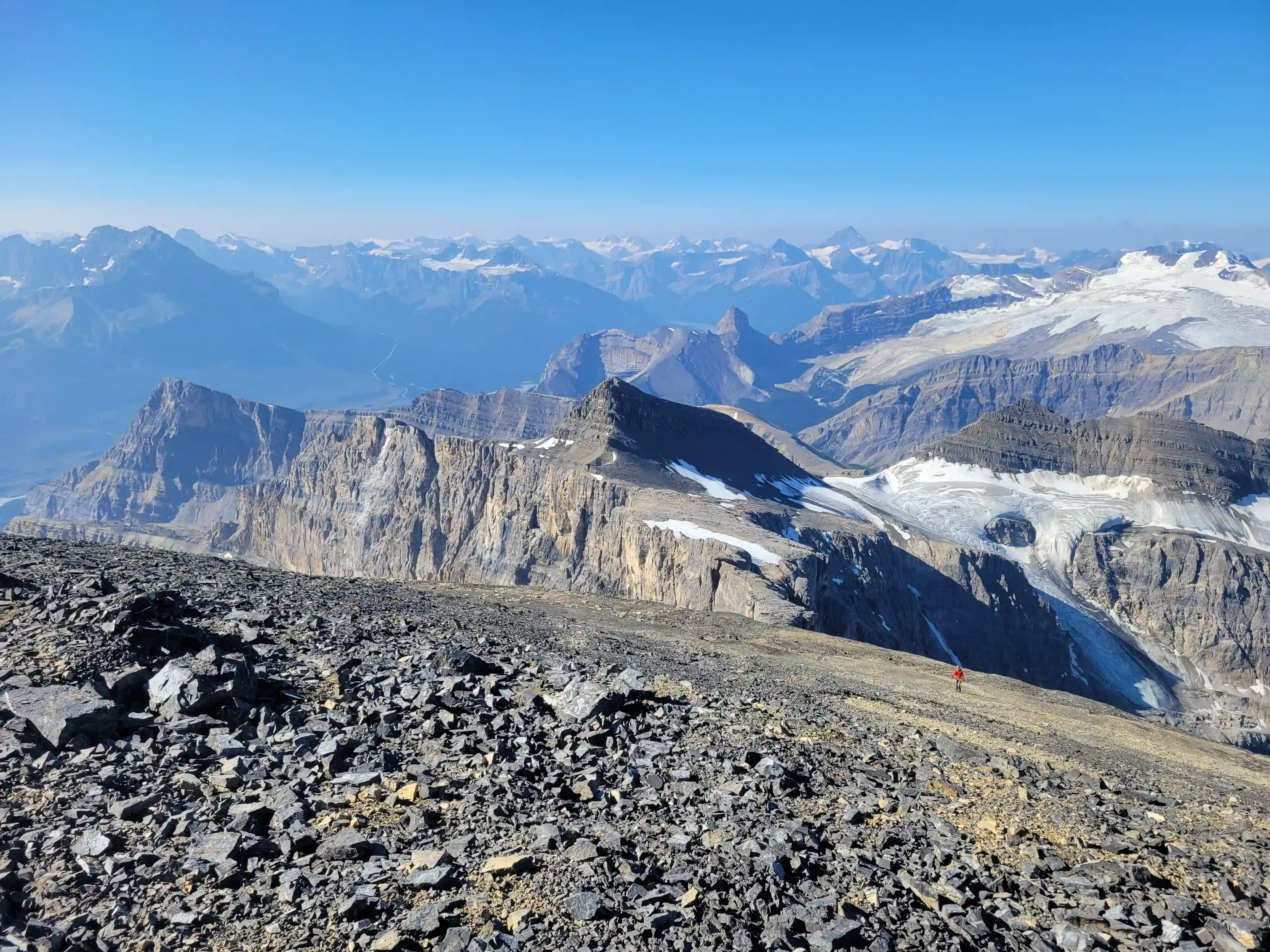
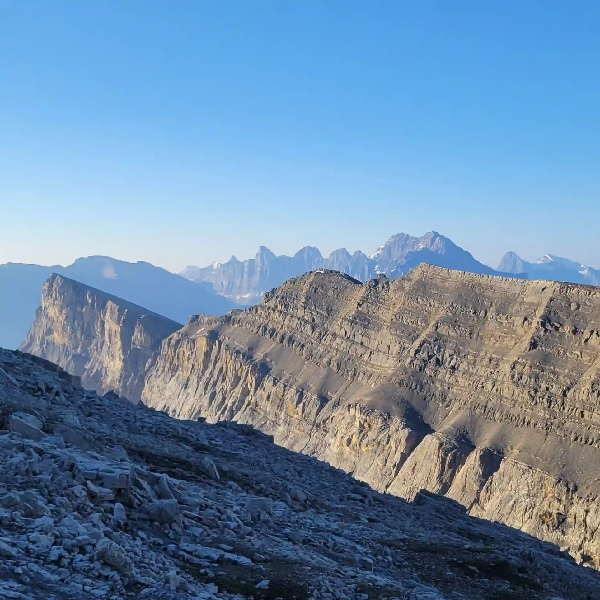
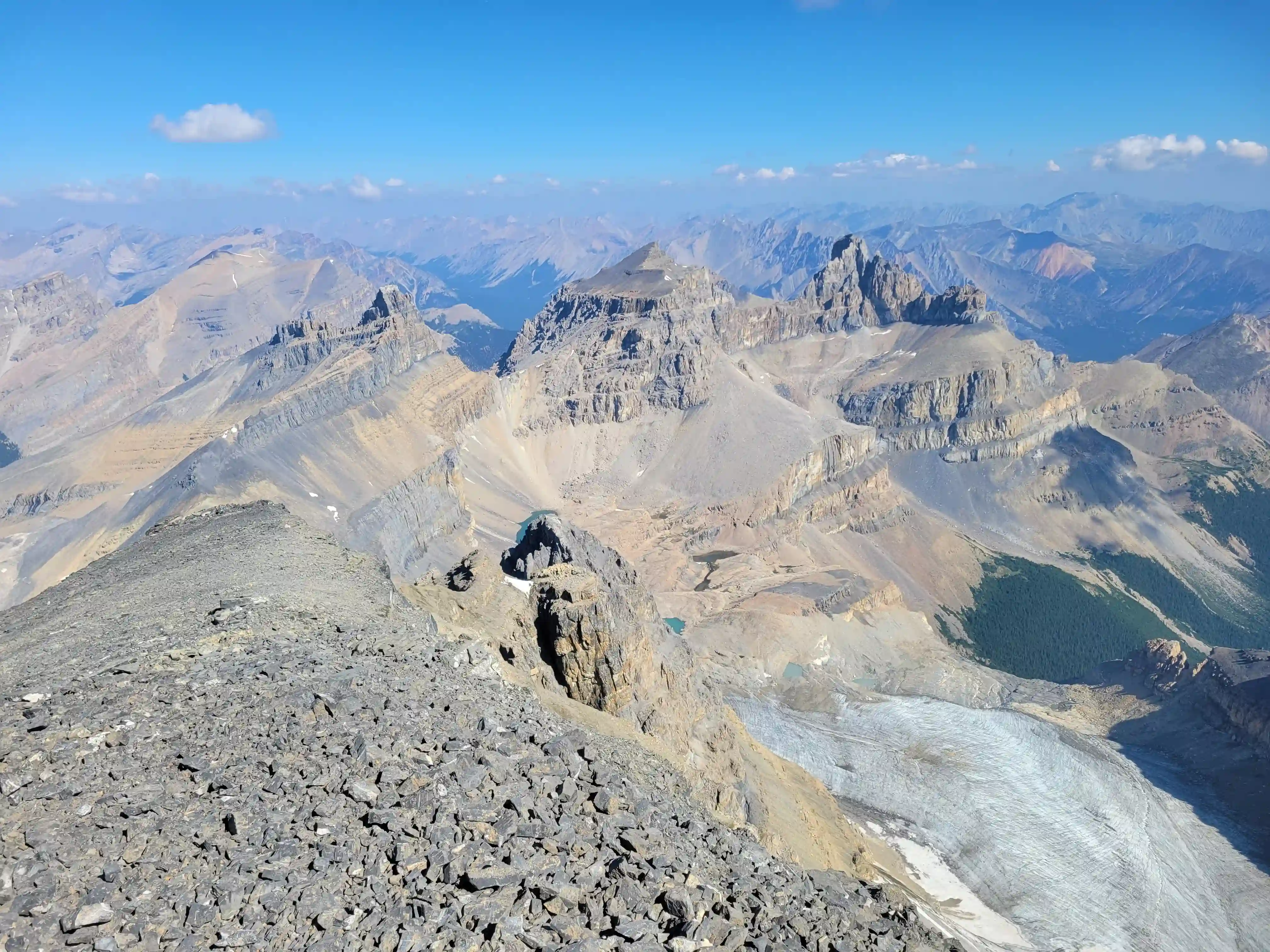
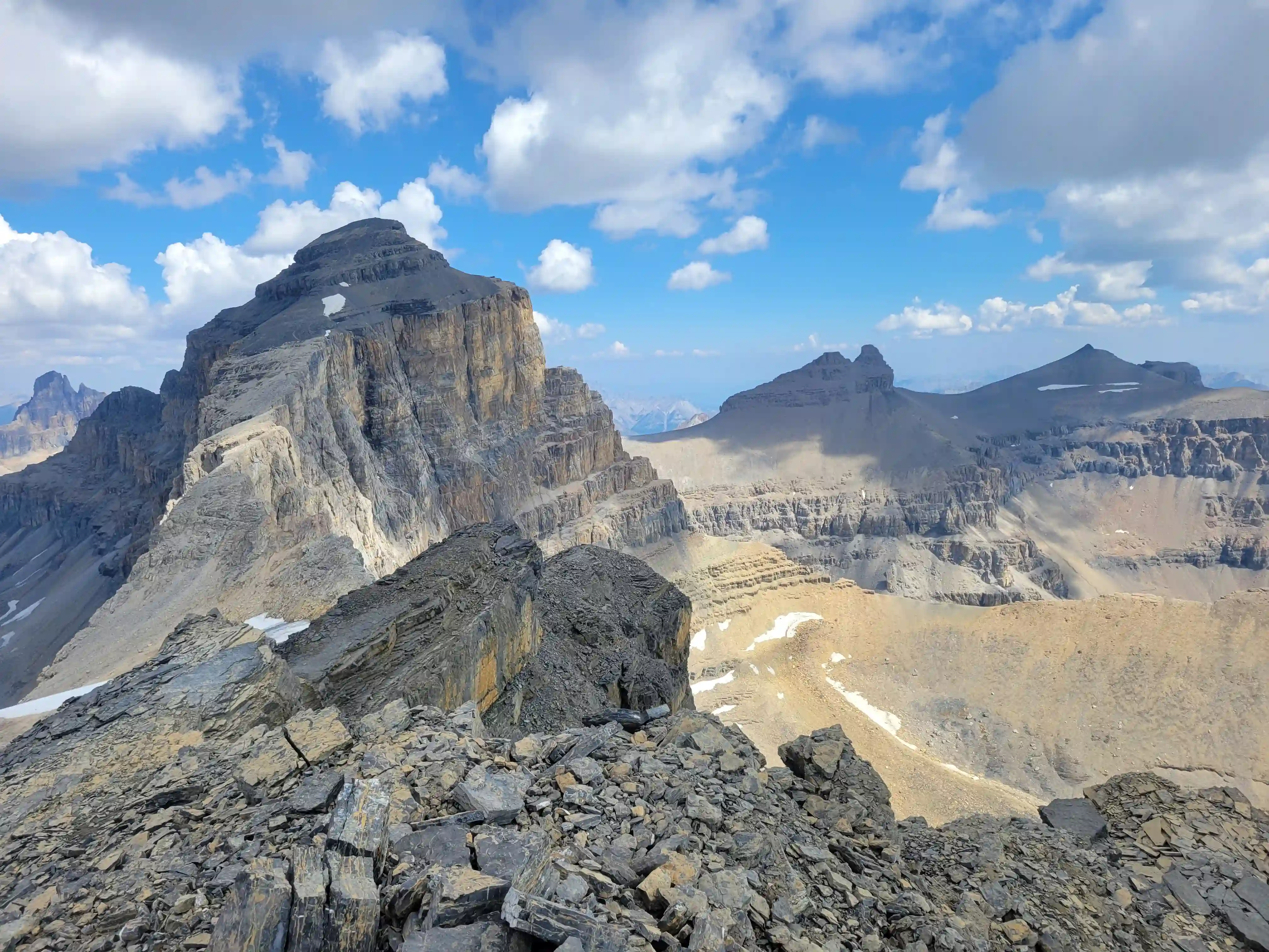
THE SUMMIT
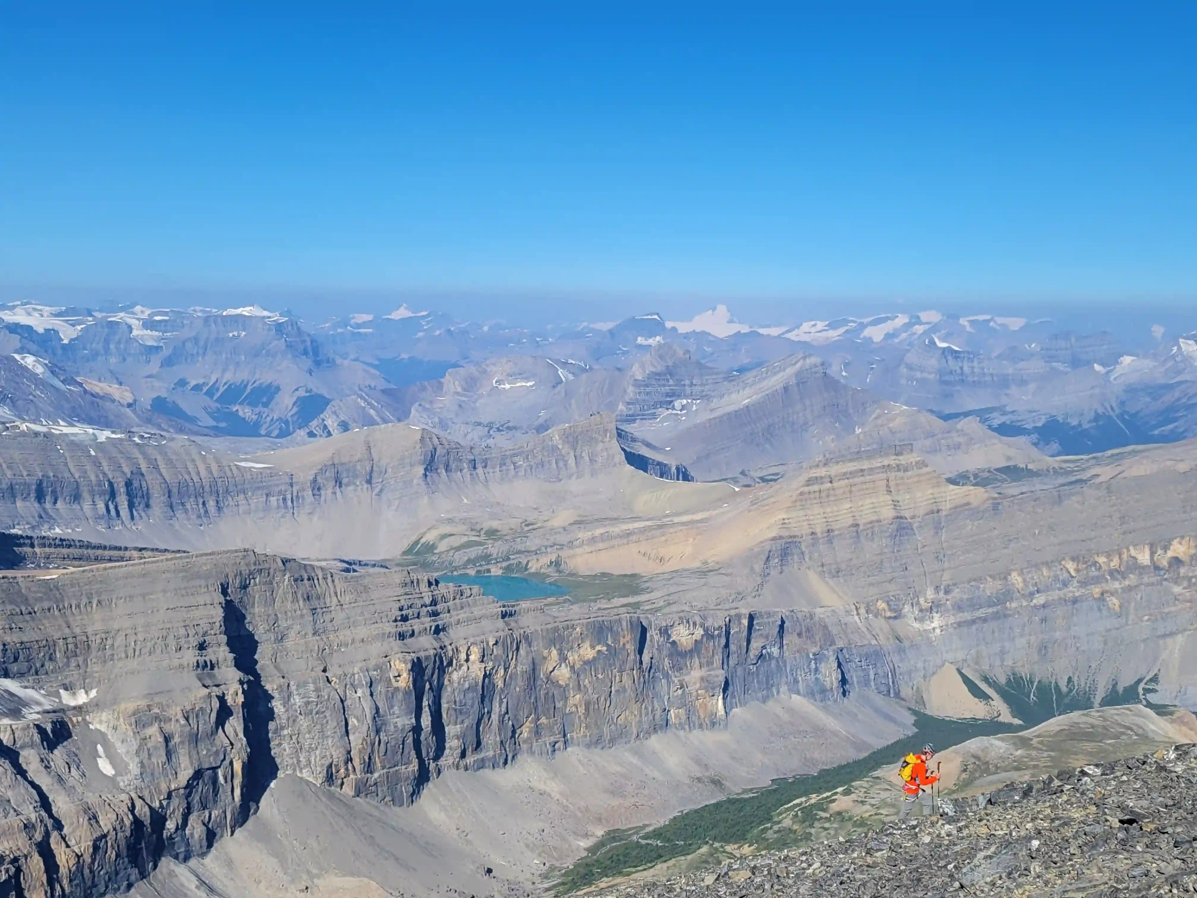
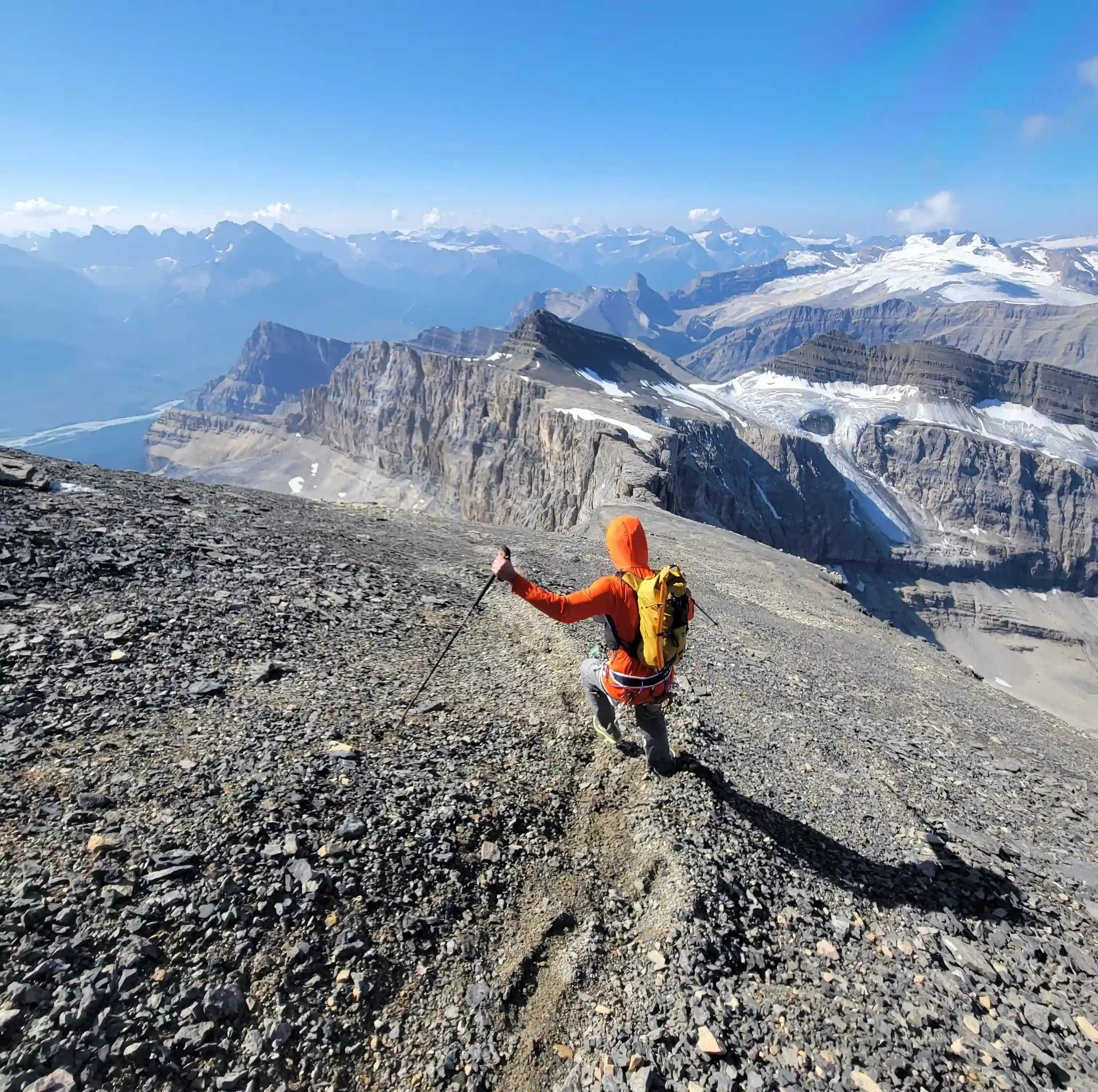
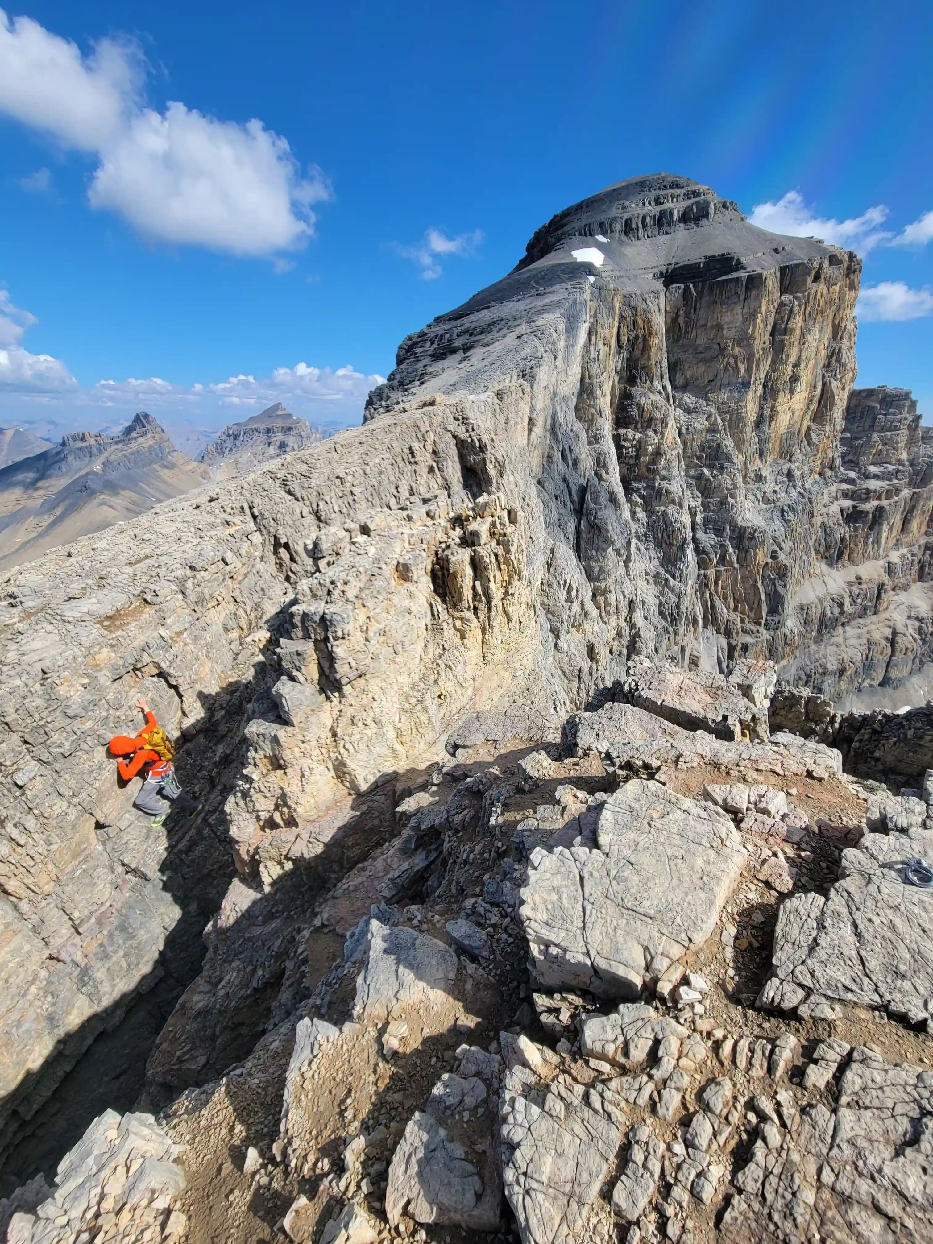
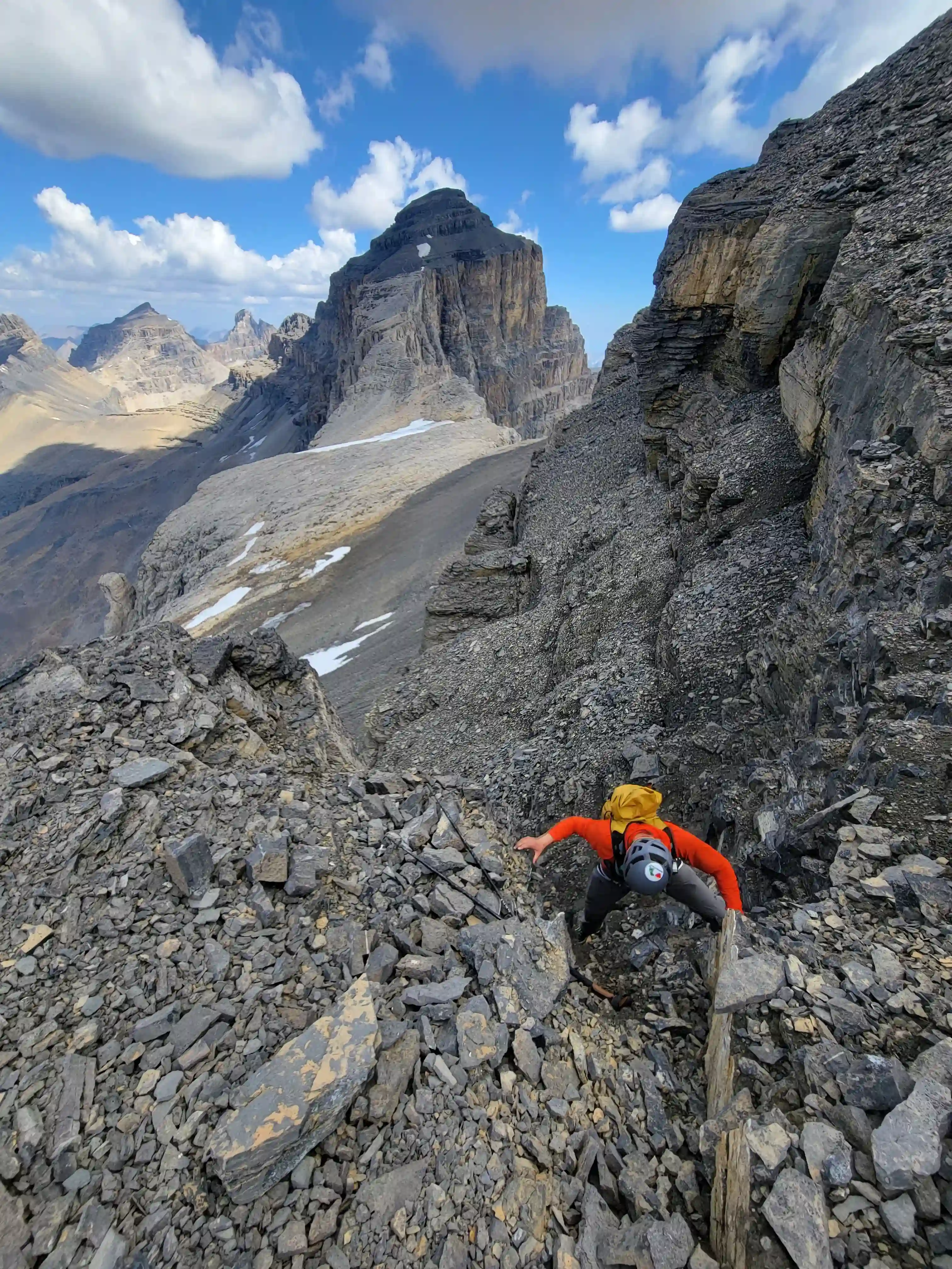
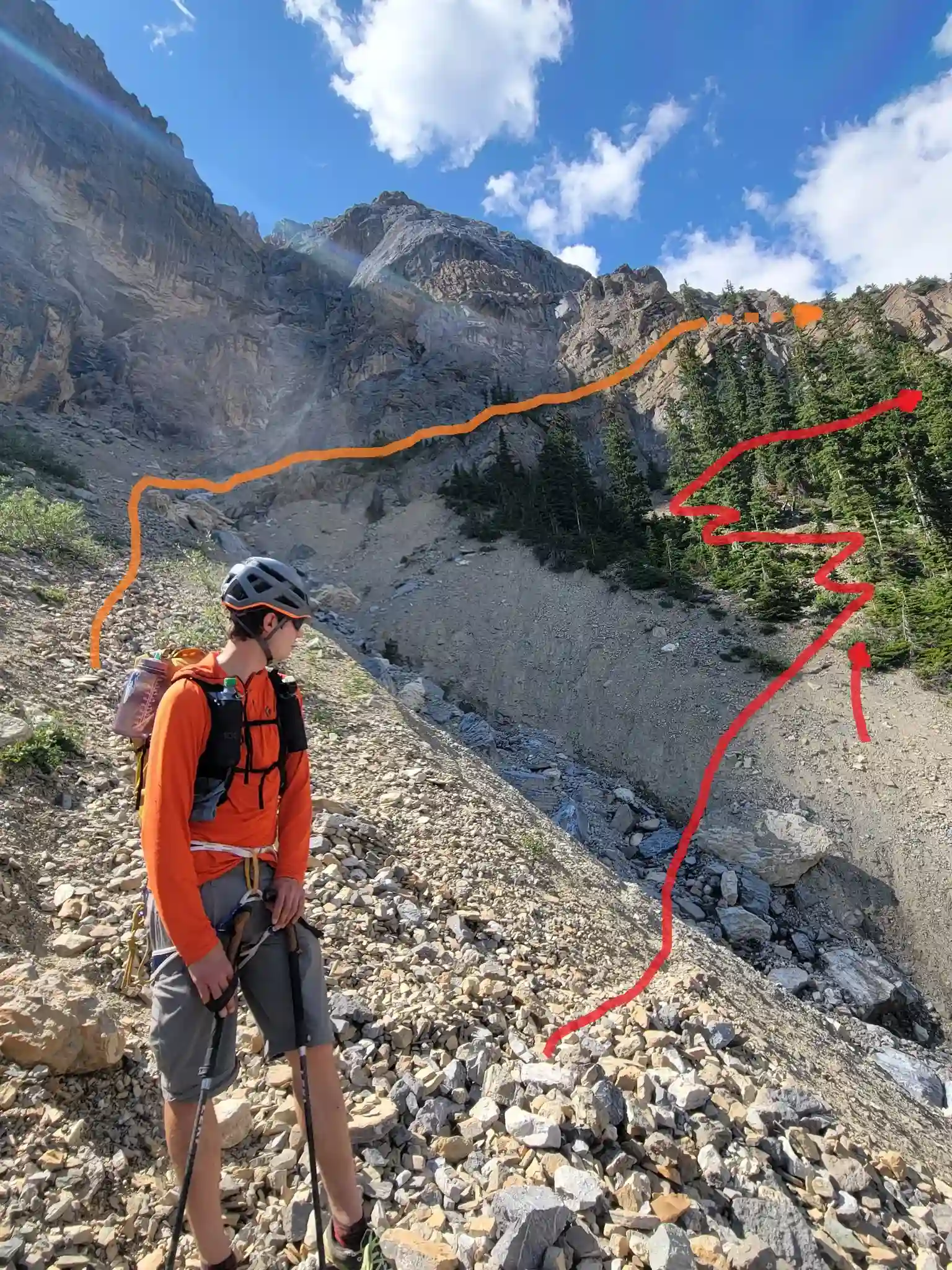
The views at the summit were great but not quite as impressive as the views of Cline on way up due to the tame nature of the top section of the mountain. After a short break Cyrus and I headed back down and it didn't take long for us to get back to the notches. Given that the second notch is a climb rather than a downclimbing on the way back we felt a lot more comfortable and ended up soloing it and did the same with the first notch. We then decided to ascend a 4th-5th class line on Mount Owen to get a bit more hands on terrain in for the day and the way down from the summit of Owen was a nice ridge followed by great boot skiing that lead us back to our ascent line. Following that we were quickly back at the lake and the exit went quite quickly, once we were back on trail we started running again and we kept good pace until we reached the trailhead.
Into trips like this?
I'll send you an email whenever I publish a new trip report.
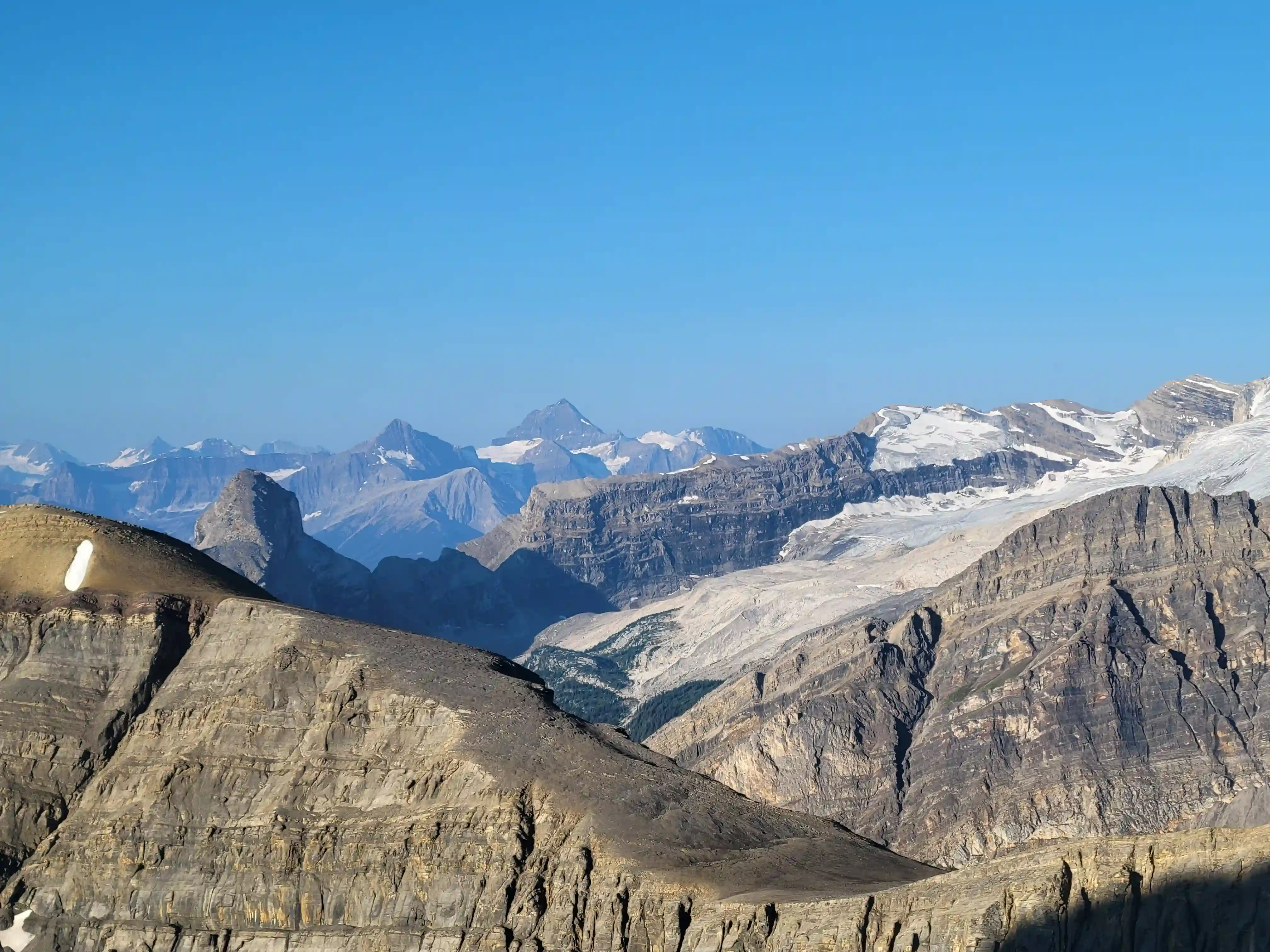
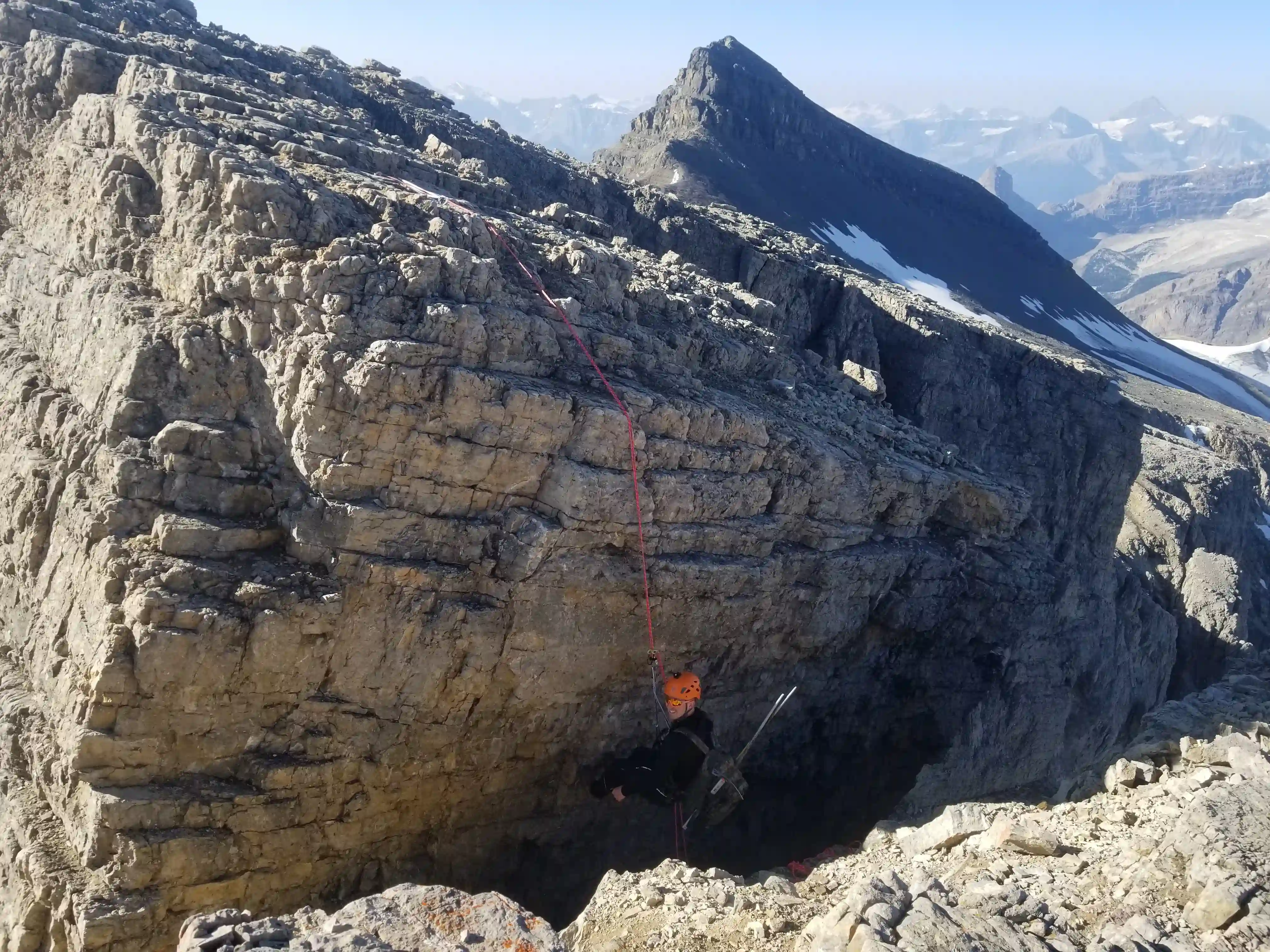
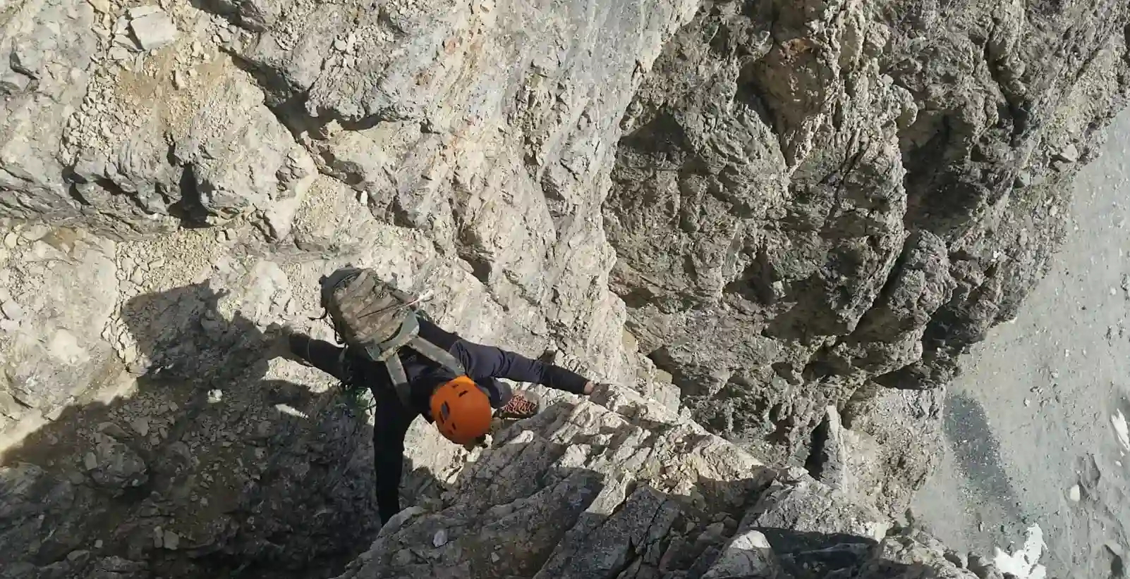
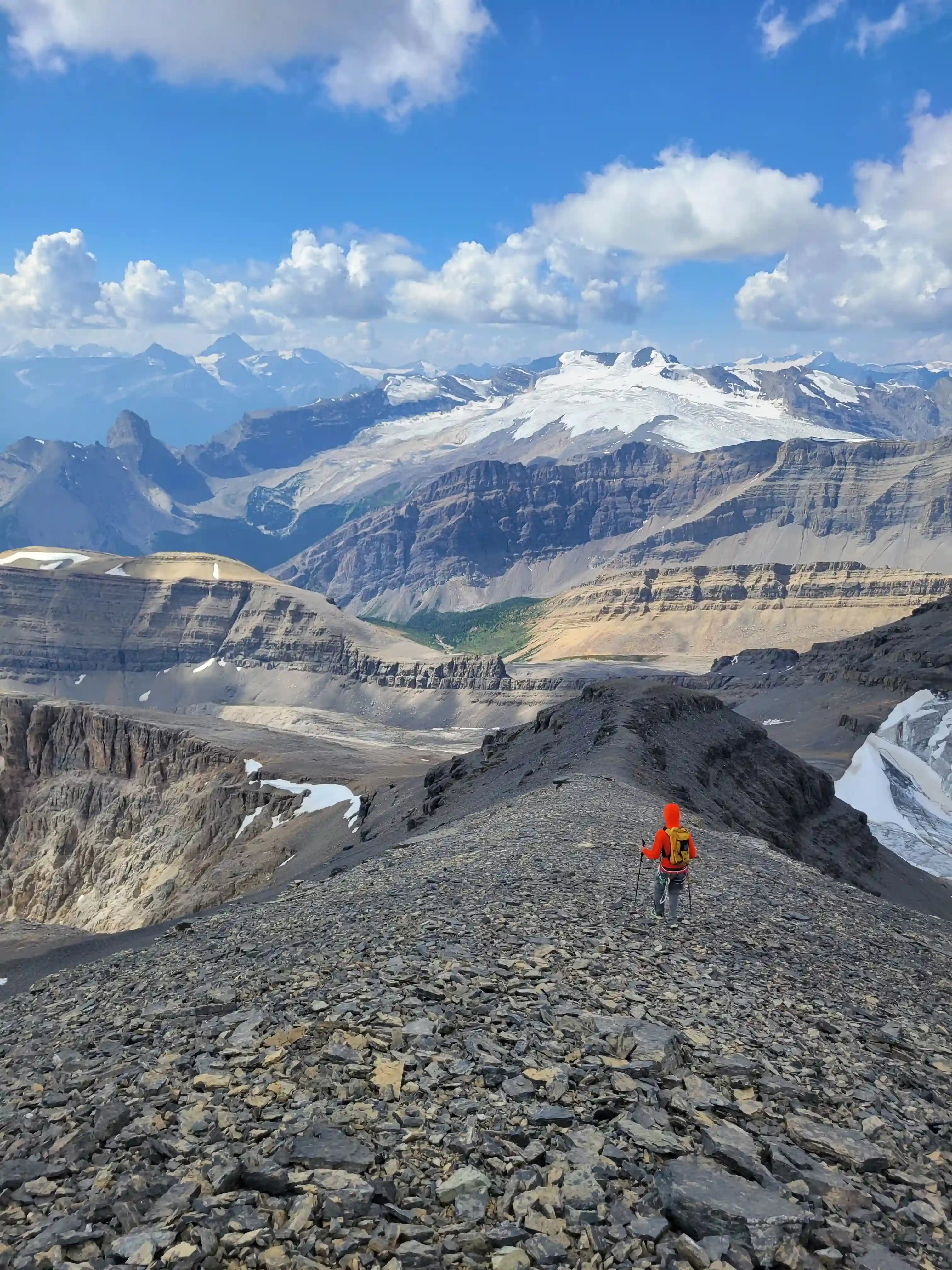
REVERSING THE NOTCHES & EXIT
second notch
Thanks to Cyrus for joining me on this one, it was a fun outing but Mount Cline ended up having less hands on sections than I expected so this is more of a trail runner / hiker's 11000er with a couple techy sections and a bit of ropework thrown in. I was definitely ready for a few days off from mountain climbing after the back to back Murchison and Cline trips but a week later when a couple solid days had shown up in the forecast it was time to get after it again with the next 11000er push.
Follow the full progression
I'm working through all 58 11000ers of the Canadian Rockies and beyond. You'll get notified when the latest climbs go live.
Other related trip reports:
The Lyells |
Hungabee Mountain |
Mount Temple ||
Mount Murchison |
Mount Sir Douglas
11000ers of the Canadian Rockies
© Haldan Borglum | Peak by Peak. All rights reserved.