Mount Sir Douglas
3406m, 11174ft
August 3 2024
Towering above the Haig Glacier and the neighboring peaks in the immediate area, Mount Sir Douglas is one of the furthest south 11000ers of the Canadian Rockies and is only bested by
Mount King George,
Mount Joffre and Mount Harrison. Although not nearly as treacherous as The Goodsirs, Sir Douglas has a bad reputation of being a particularly lose mountain adding extra difficulty to the technical terrain on its upper slopes. It's one of the more easily accessed 11000ers with great trail up to Burstall Pass that makes for an enjoyable and scenic approach and exit. Even so, due to the difficulty and somewhat hazardous nature of reaching the summit of this mountain, it is not done particularly often and is a good test piece to go for before venturing into the most technical rock 11000ers on the list.
Following Jøsiane and my huge
linkup of Lefroy, Victoria South, and Huber,
many of the big peaks were quite dry and with a clear window showing up a few days later Darren and I were keen to team up again for the first time since our
Mount Forbes
trip and check something off the list. We ended up landing on Sir Douglas and had thought about going for the east ridge route given that I had seen
Sean O'Rourke's trip report
on it the year prior but it looked a bit technical and we wanted to go for a fast and light style without the weight of all the trad gear so we decided to go with the standard west ridge route.
We were game to knock out Sir Douglas in a day so we made plans to meet in the Burstall Pass lot at 3:30am for an early start. What we didn't expect was the night before a small fire started a couple kilometers from the trailhead so it had been closed and wasn't posted about online until well into our summit day. We arrived and were immediately stopped by park rangers who explained the situation and this put a serious wrench in our plans.
With the Burstall Pass lot completely closed we had to come up with a plan B and after asking about a few of the nearby areas and whether they were affected as well we went on our way and started scheming up a plan. We each had a few peaks in mind but when I saw on AllTrails that a route behind Mount Birdwood existed that would allow us to acces Sir Douglas via Smuts Pass with a number of added kilometers we knew it could still be done! That and the fact Smuts Pass was still open was enough to convince us both to go for it and before we knew it we were mentally preparing for a much bigger day than expected!
links:
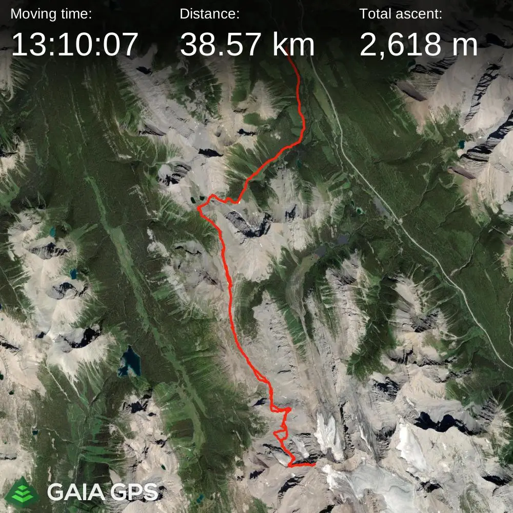
STRAVA
|
GAIA
elapsed time: 18hrs
DIFFICULTY: AD/AD+, 5th class up to 5.5, glacier travel, often multiday, steep snow / ice climbing
Use the following links to jump to:
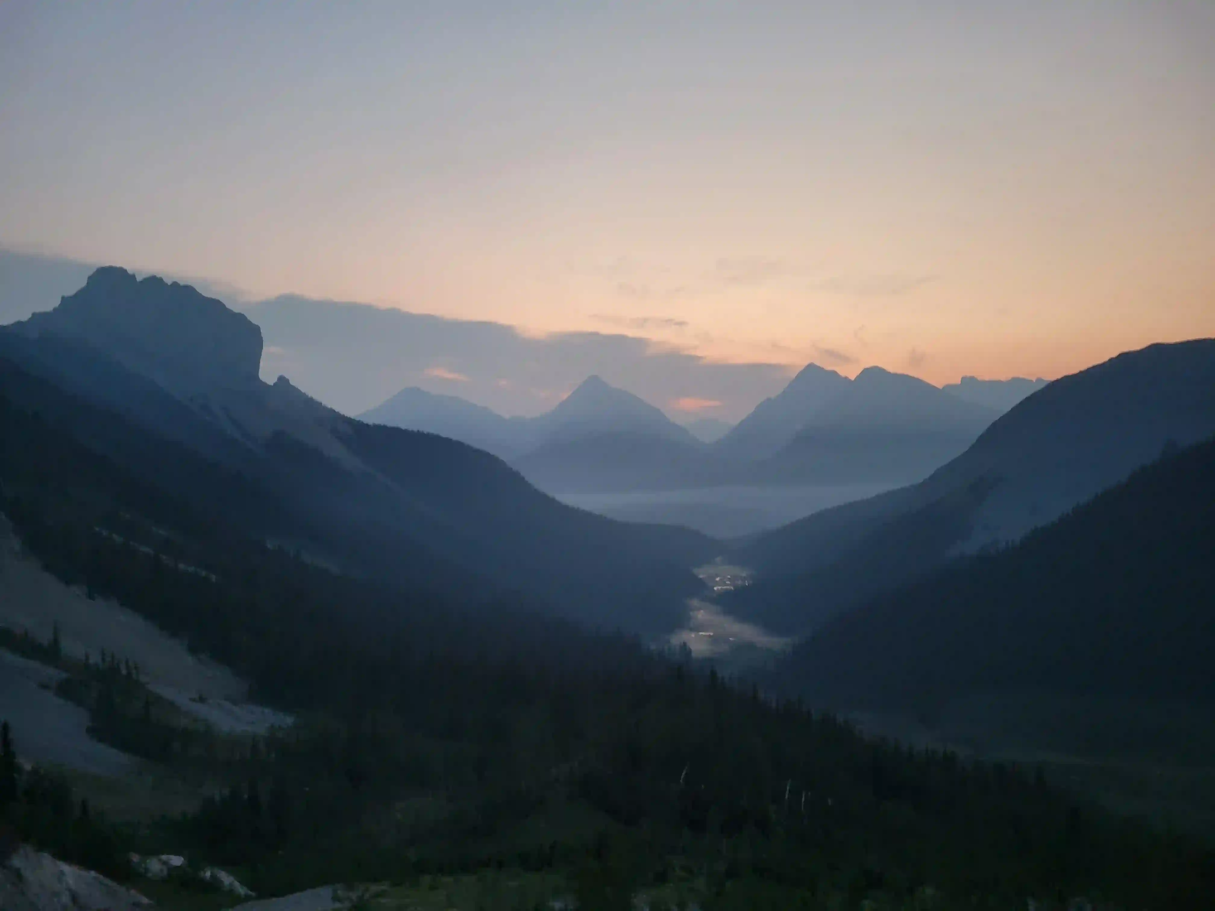
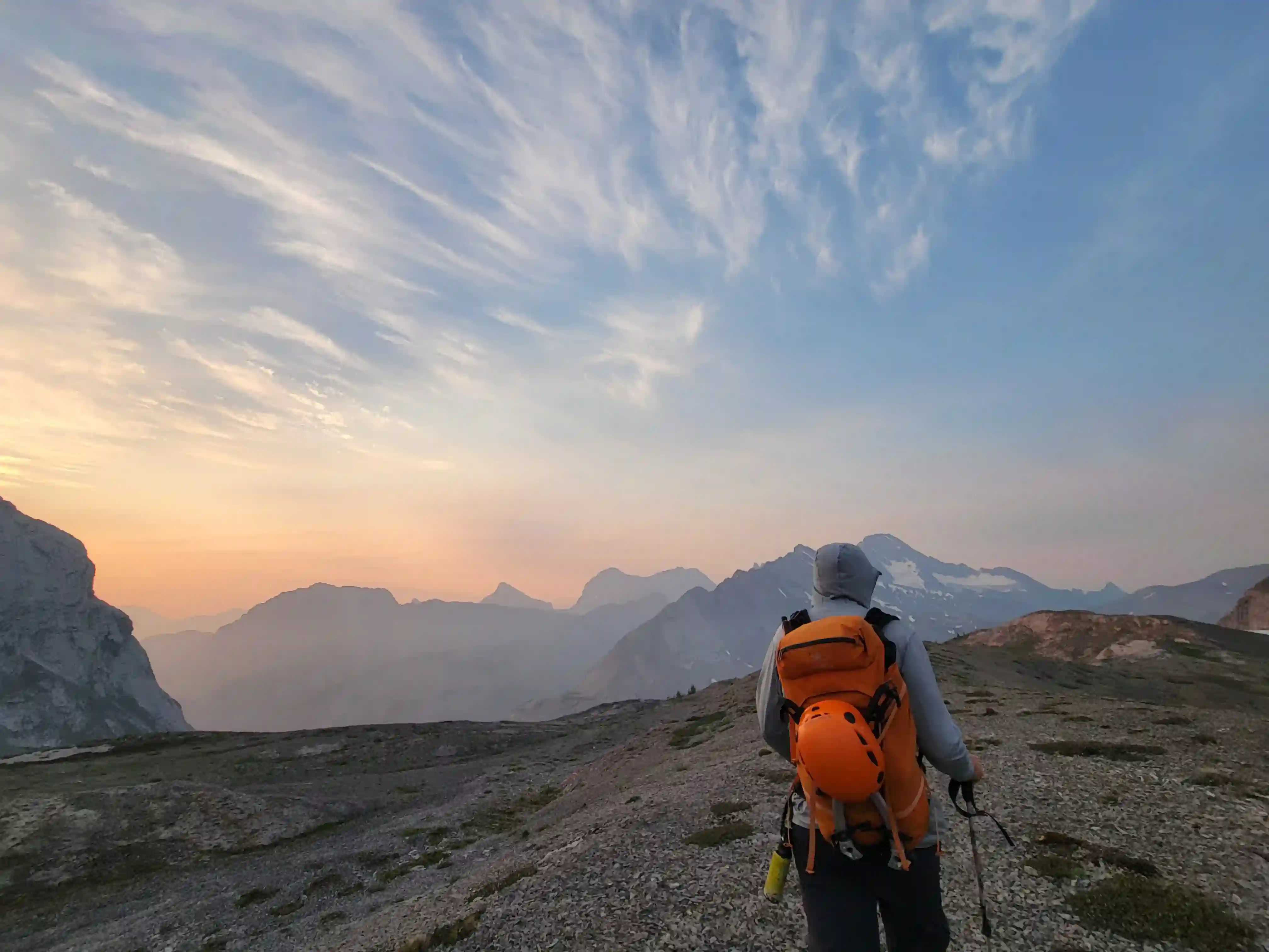
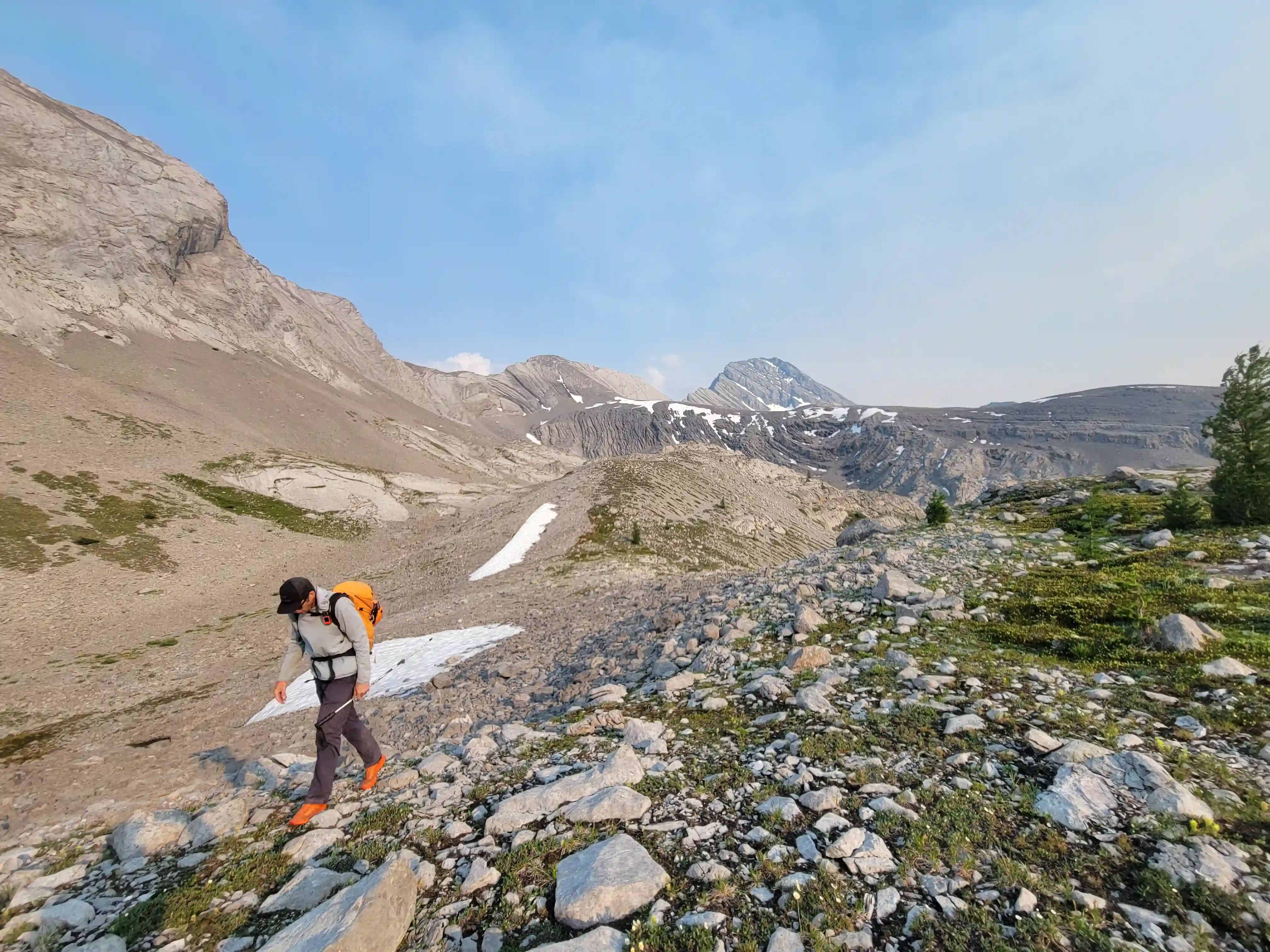
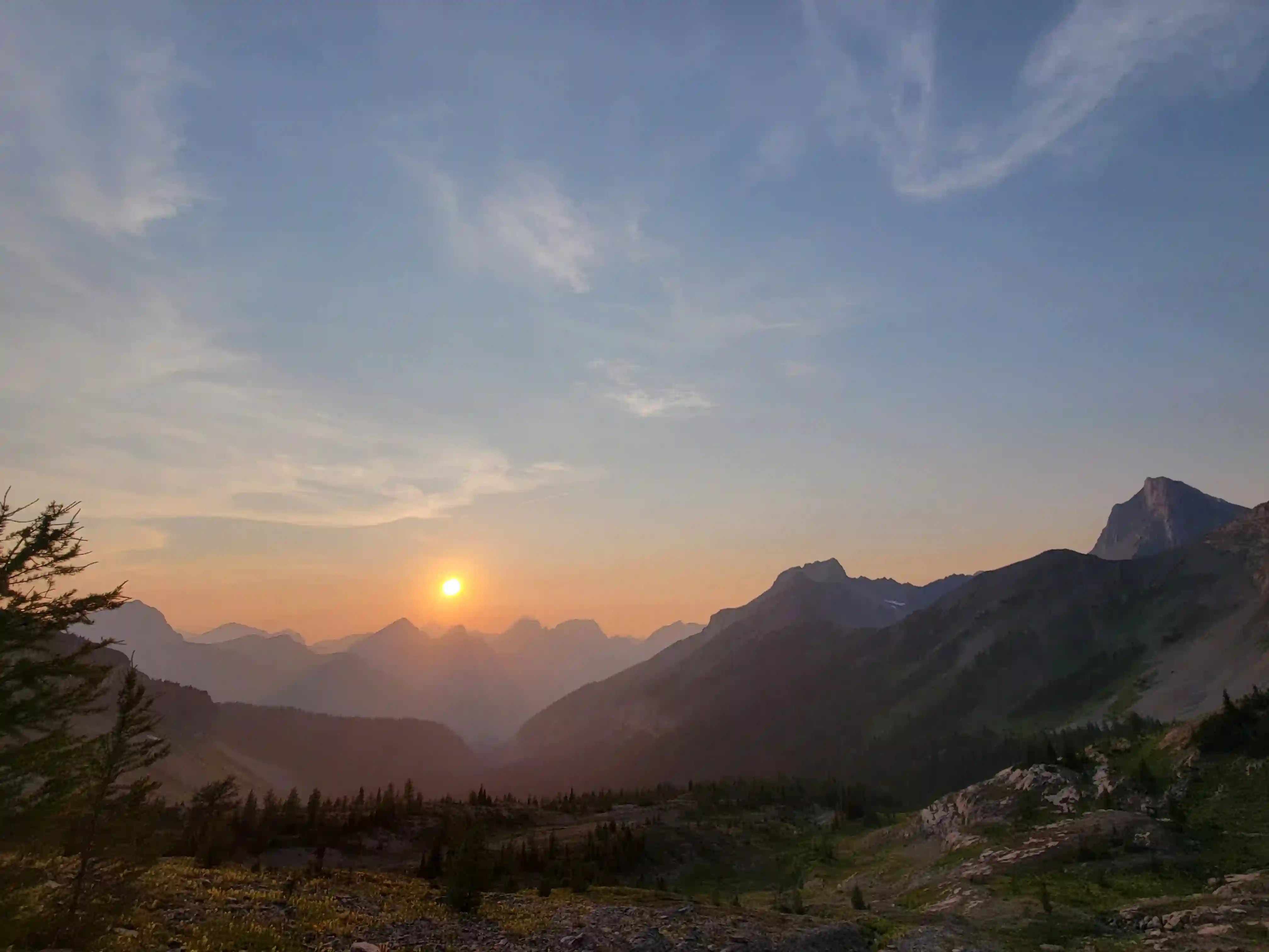
After a bit of contemplation about how much time, distance, and effort this extension would add to our day we were off and still managed to start before 4:30 in the morning! Given the much larger day than expected ahead of us we decided to go for as light packs as possible so we didn't bring a rope, harnesses, trad equipment, or glacier protection gear. The west ridge on Mount Sir Douglas goes at 5.2 so we weren't worried at all about protecting it, and the glacier is quite small and would likely be mostly dry so although a bit risky we felt comfortable soloing.
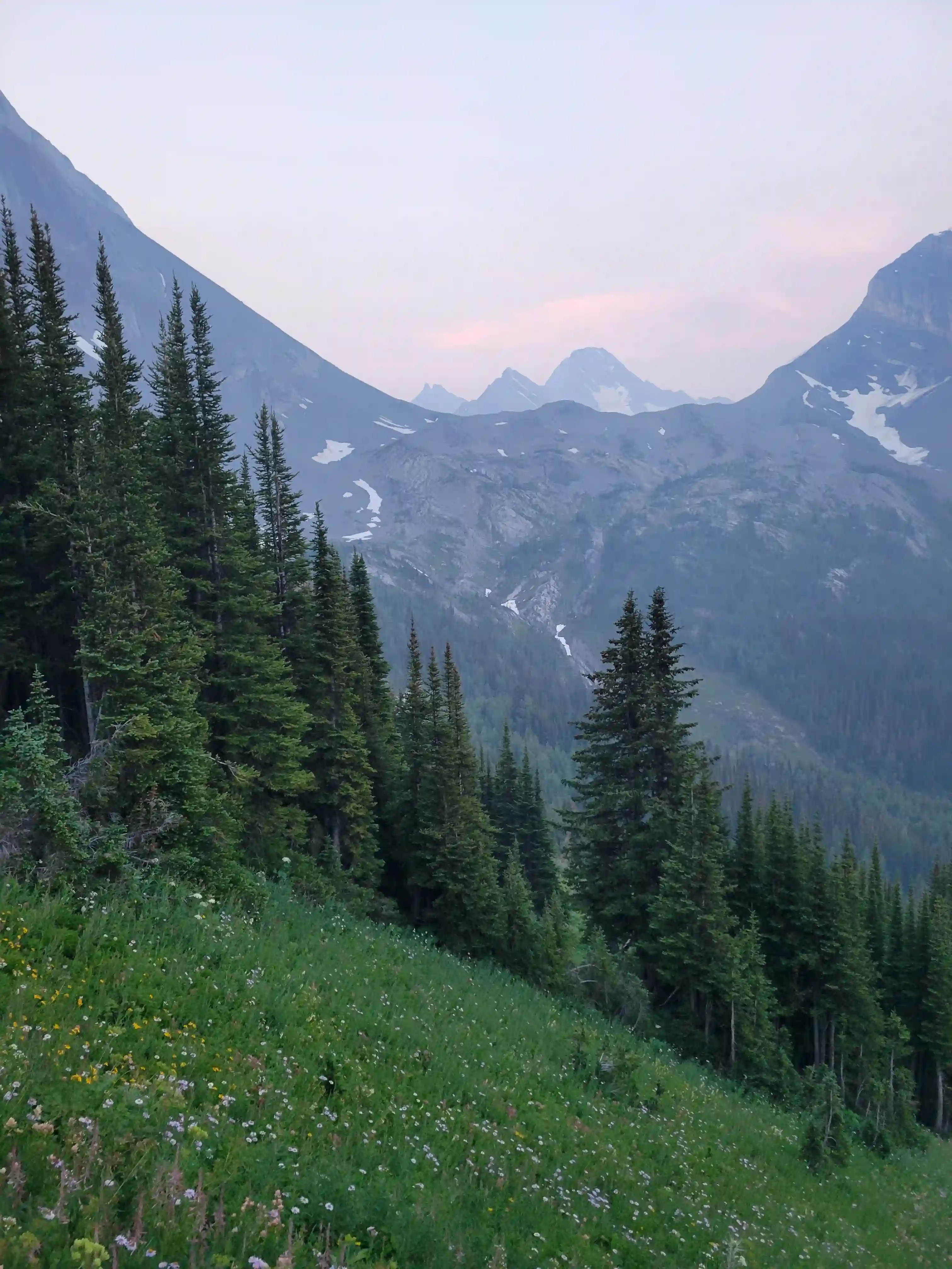
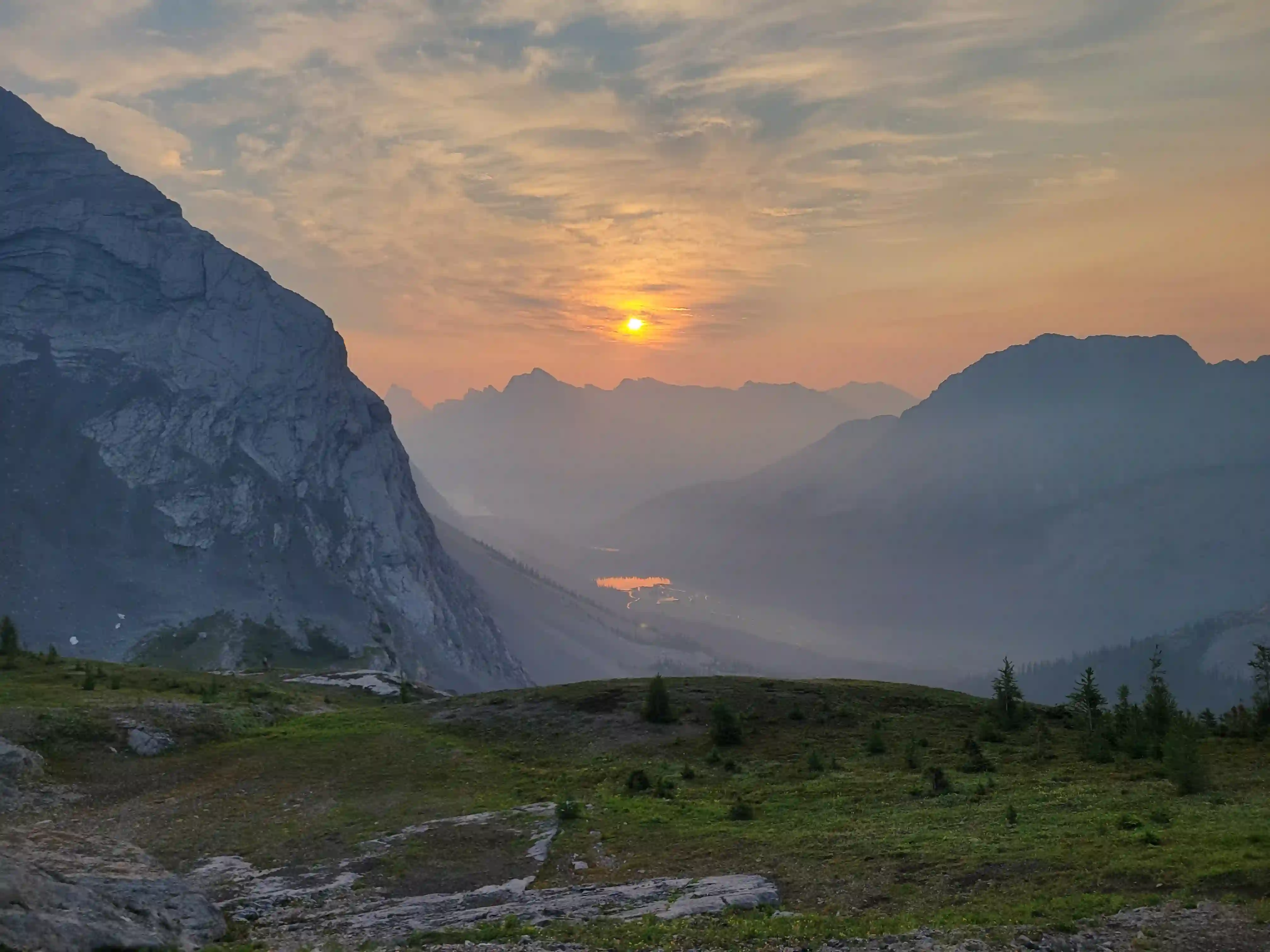
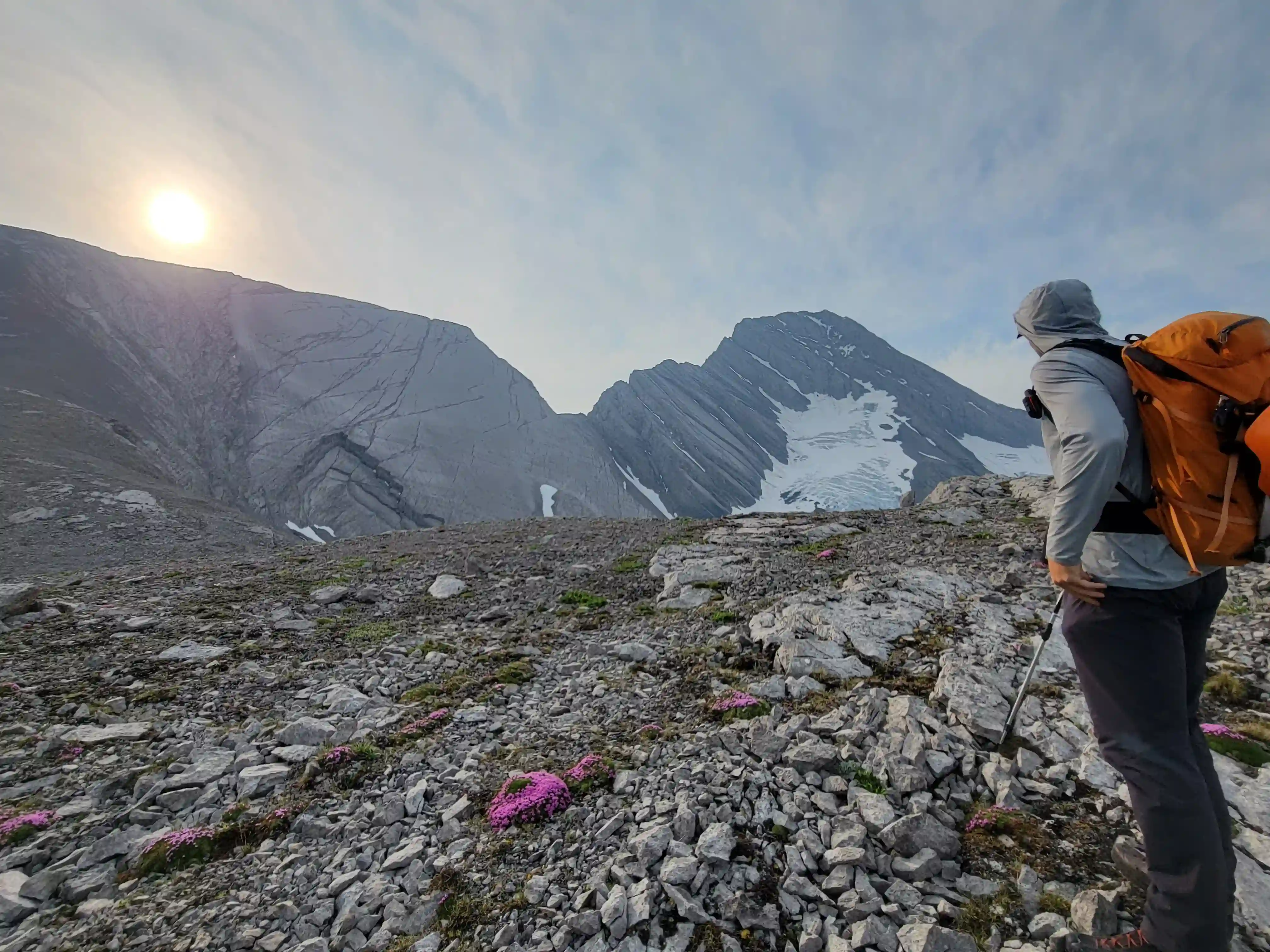
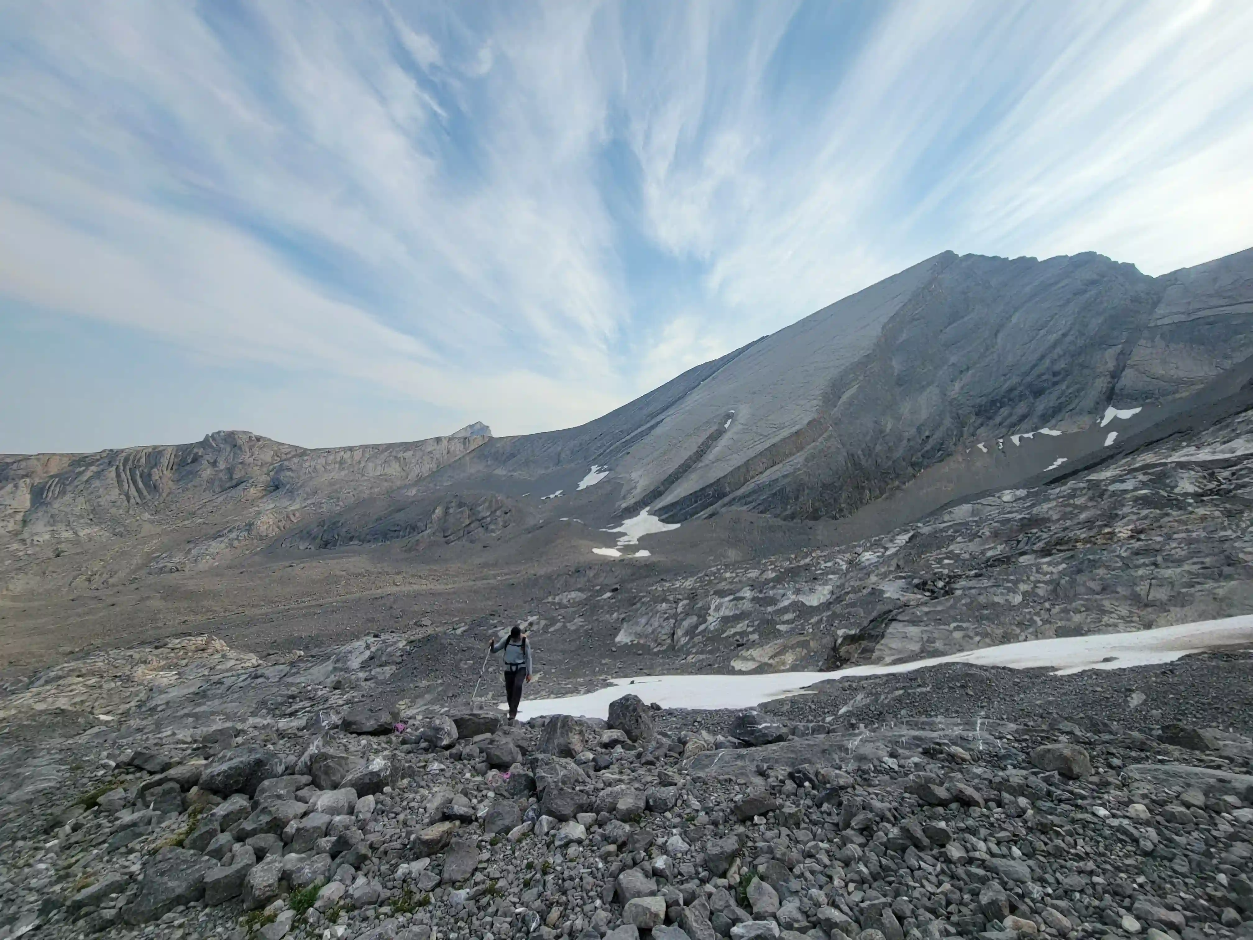
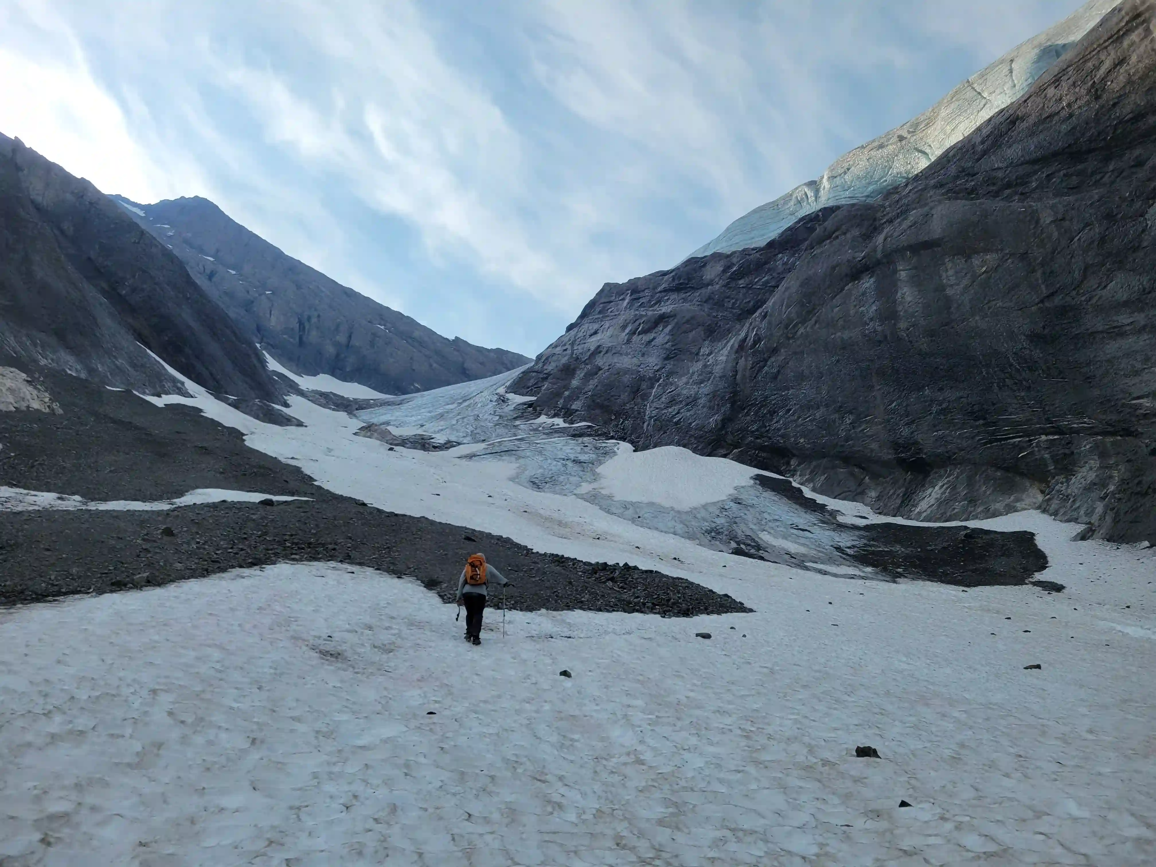
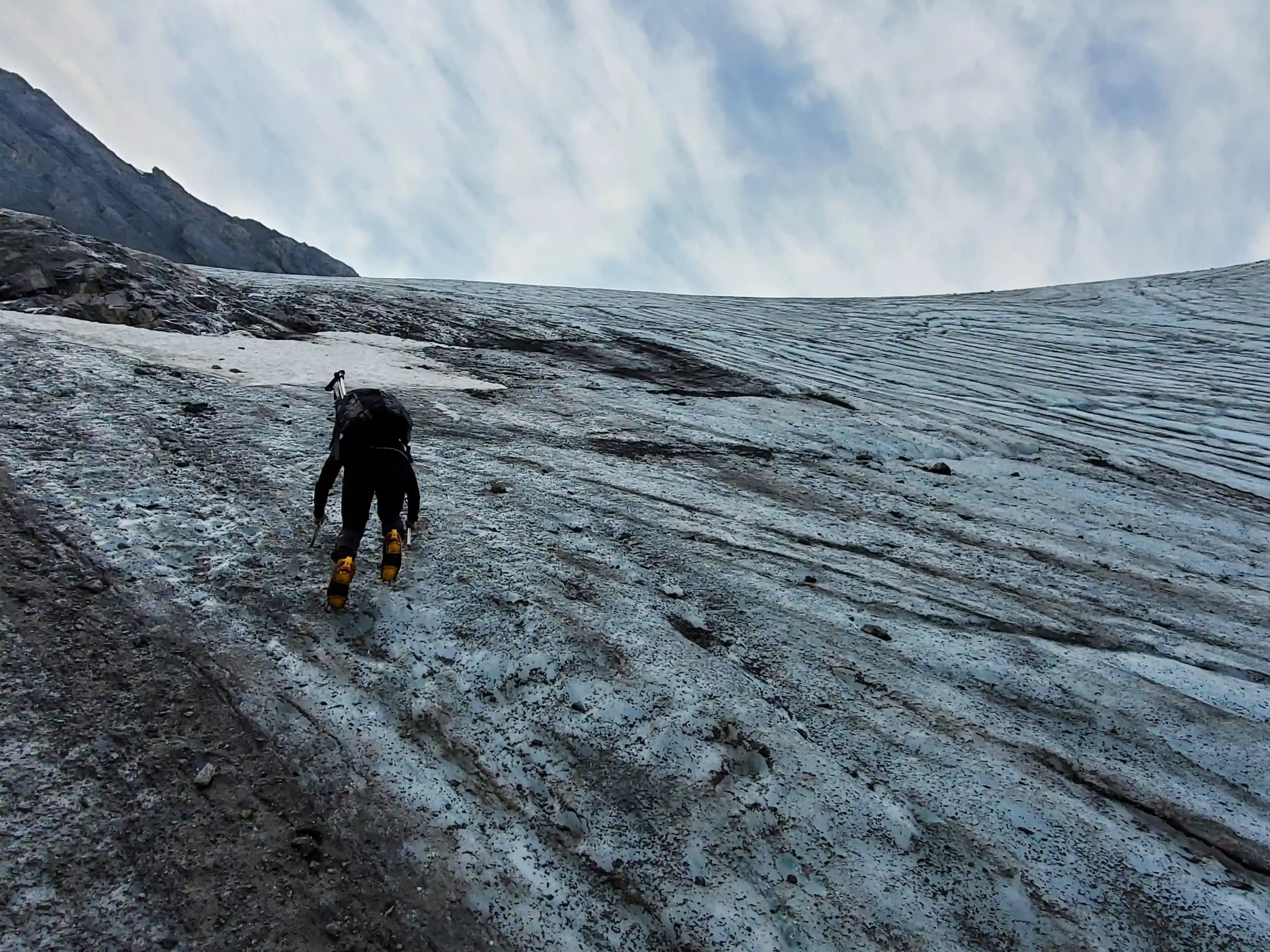
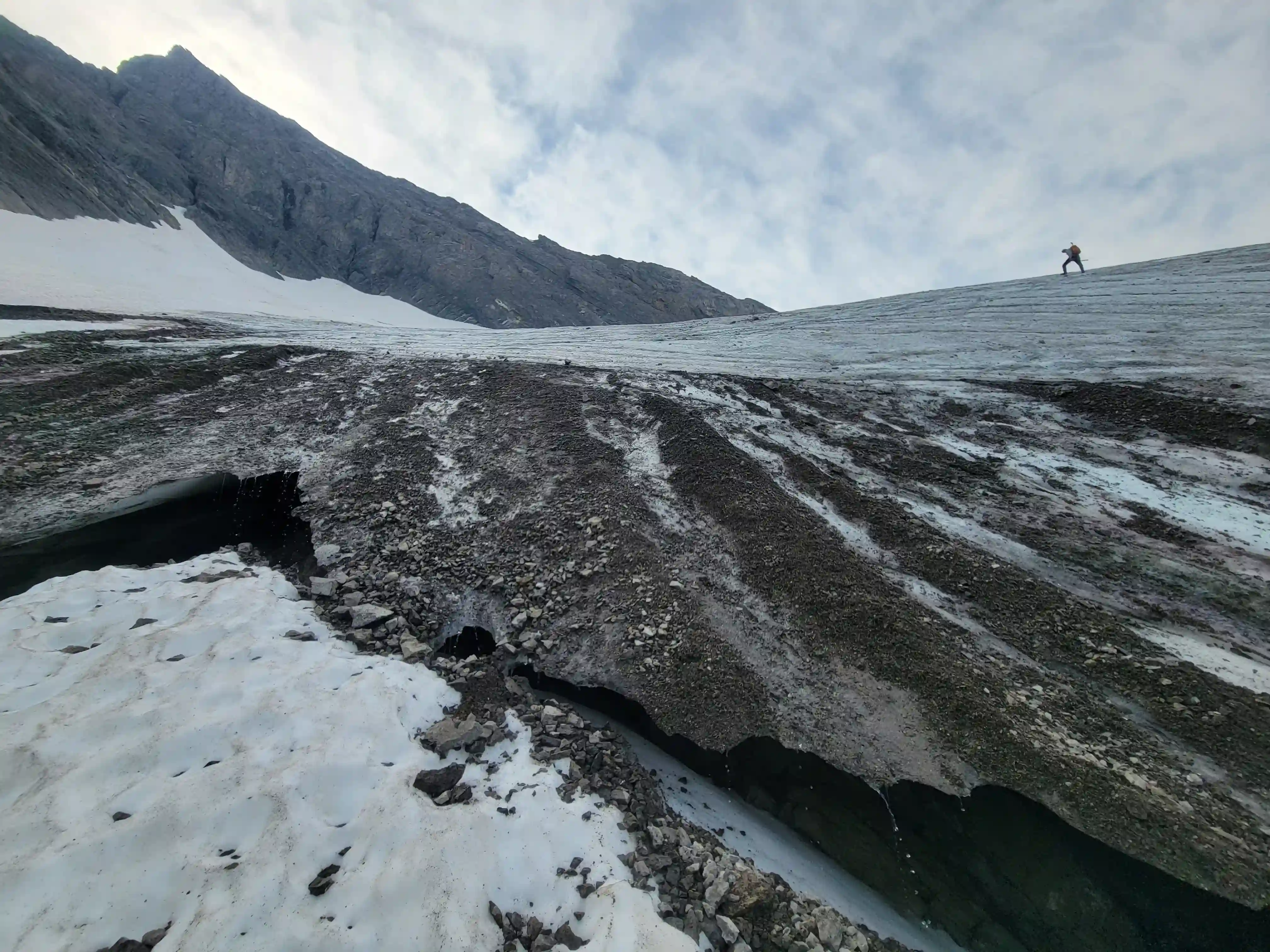
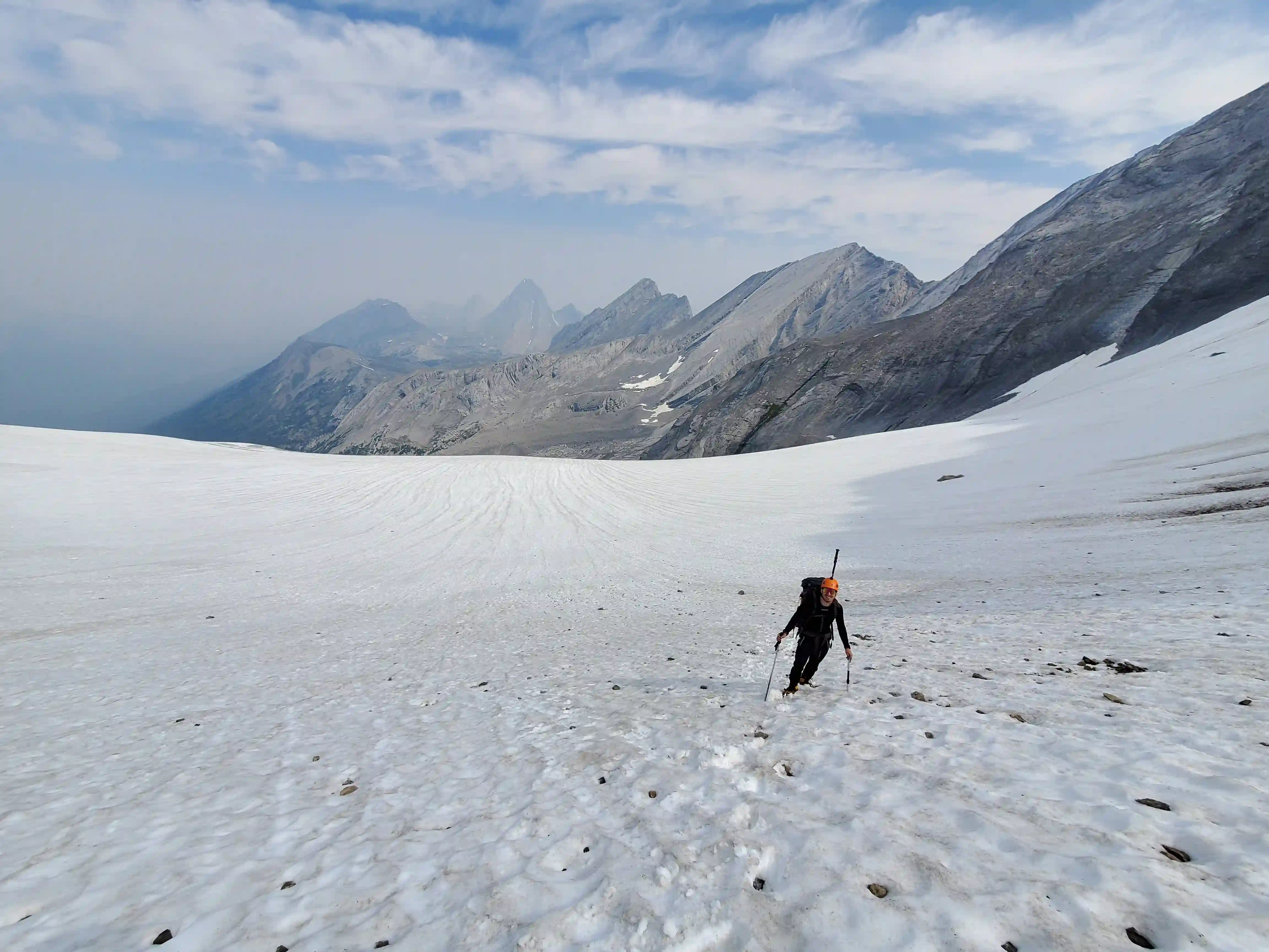
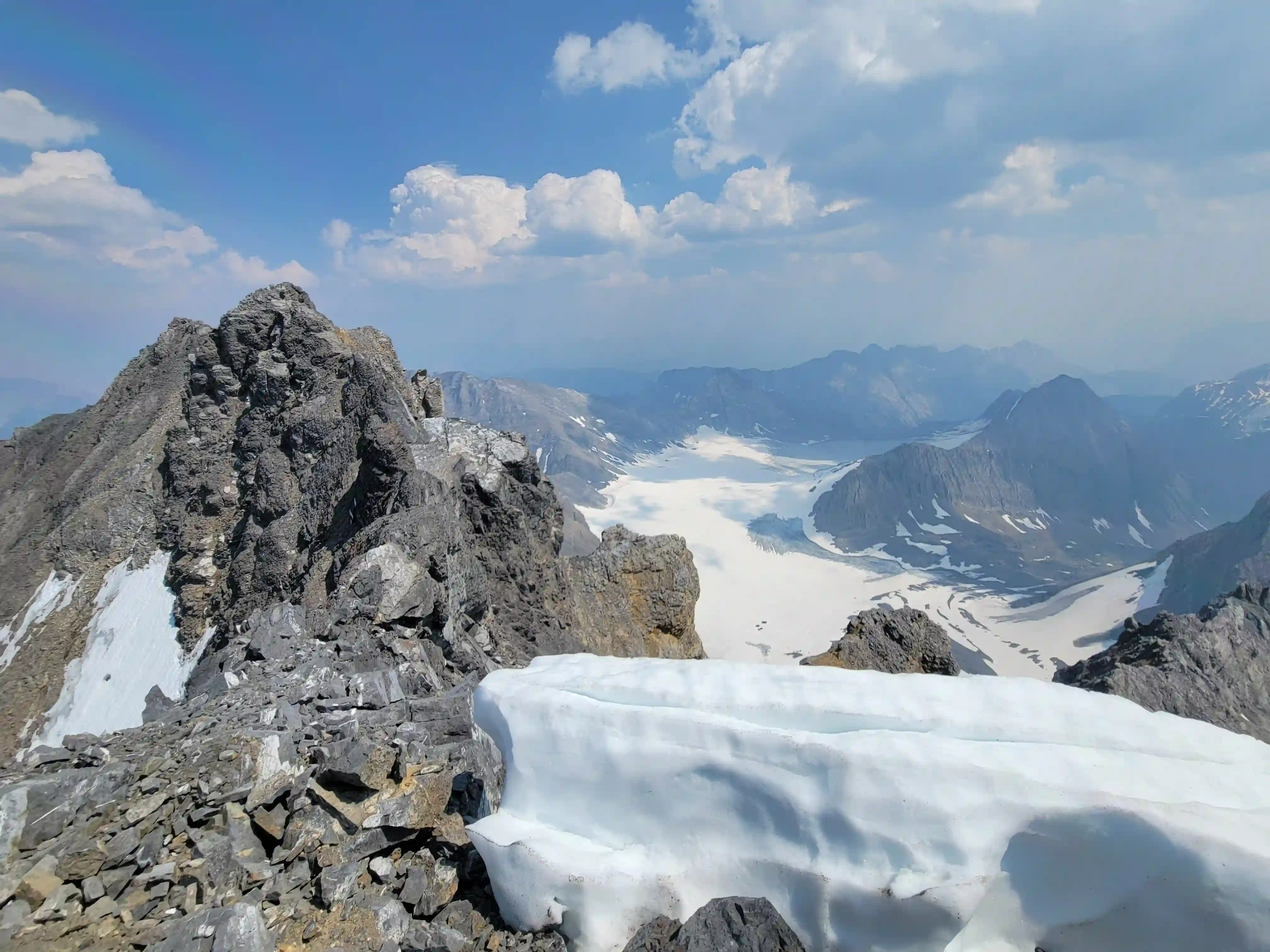
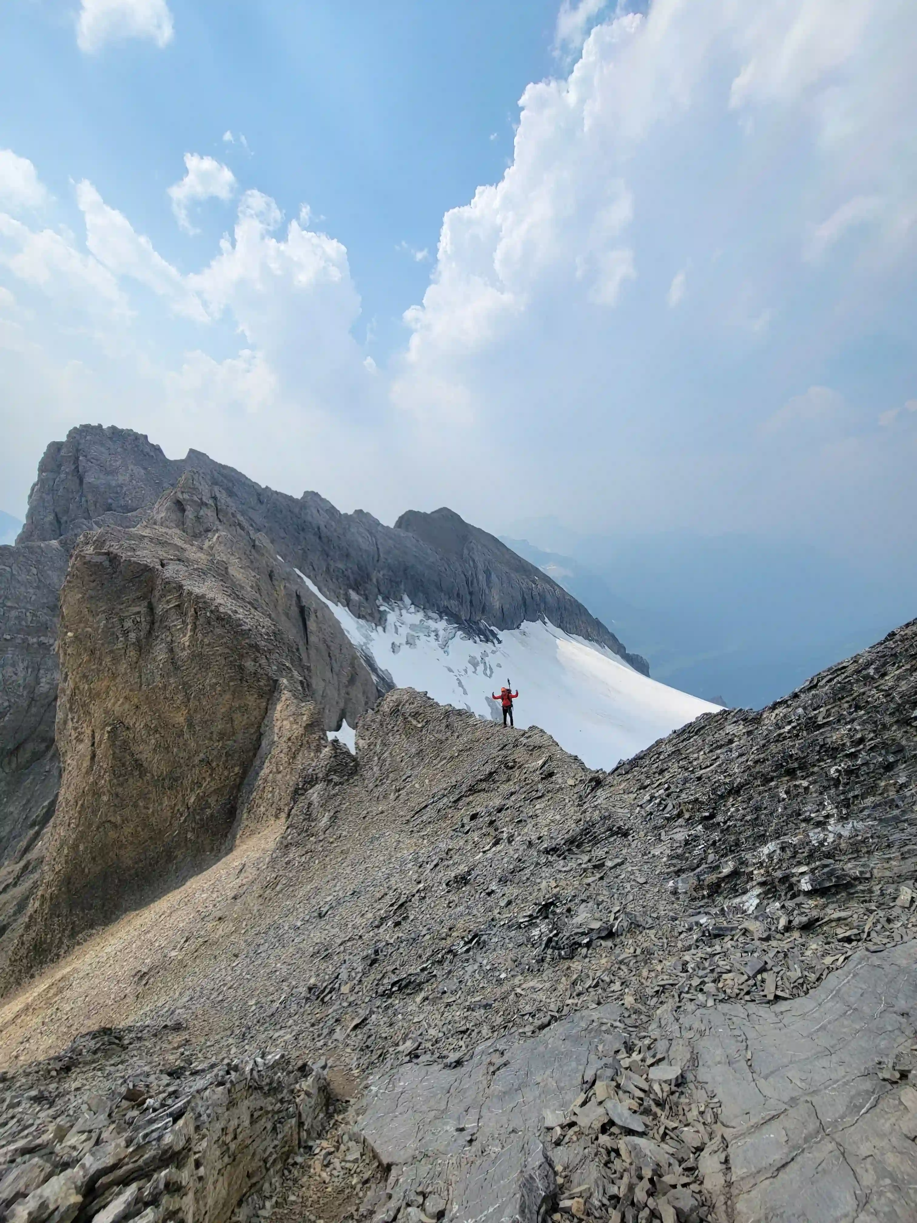
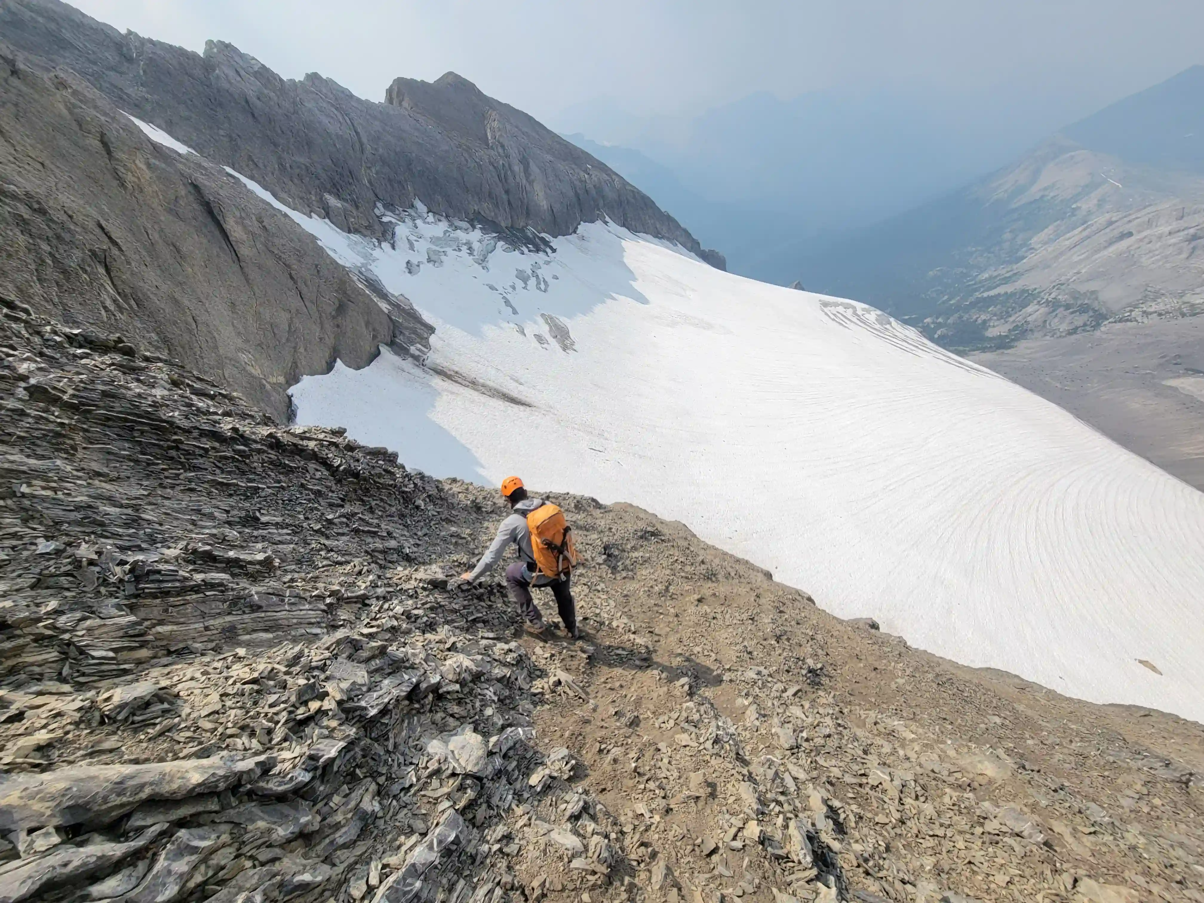
The approach ended up going by quite fast despite the extra terrain we had to cover, with the sun just starting to rise after we had already made it through Smuts Pass and around Birdwood, and by 8am we were on top of the bench overlooking Sir Douglas before having to drop elevation. The elevation loss went by quickly but we knew it would be a pain to deal with on the way back due to the lose terrain so we weren't looking forward to that. After a bit of ascending we reached some snow and the first sign of glacier so we switched to axes and crampons which we ended up keeping on all the way until we were on the rocky west ridge due to the steep transition from snow to rock and the nasty loose terrain. On the portion of glacier that still had snow remaining on top we had to be careful of holes that we couldn't see so this section was a bit sketchy without rope but the snow was supportive enough that we weren't sinking much and got past it without incident.
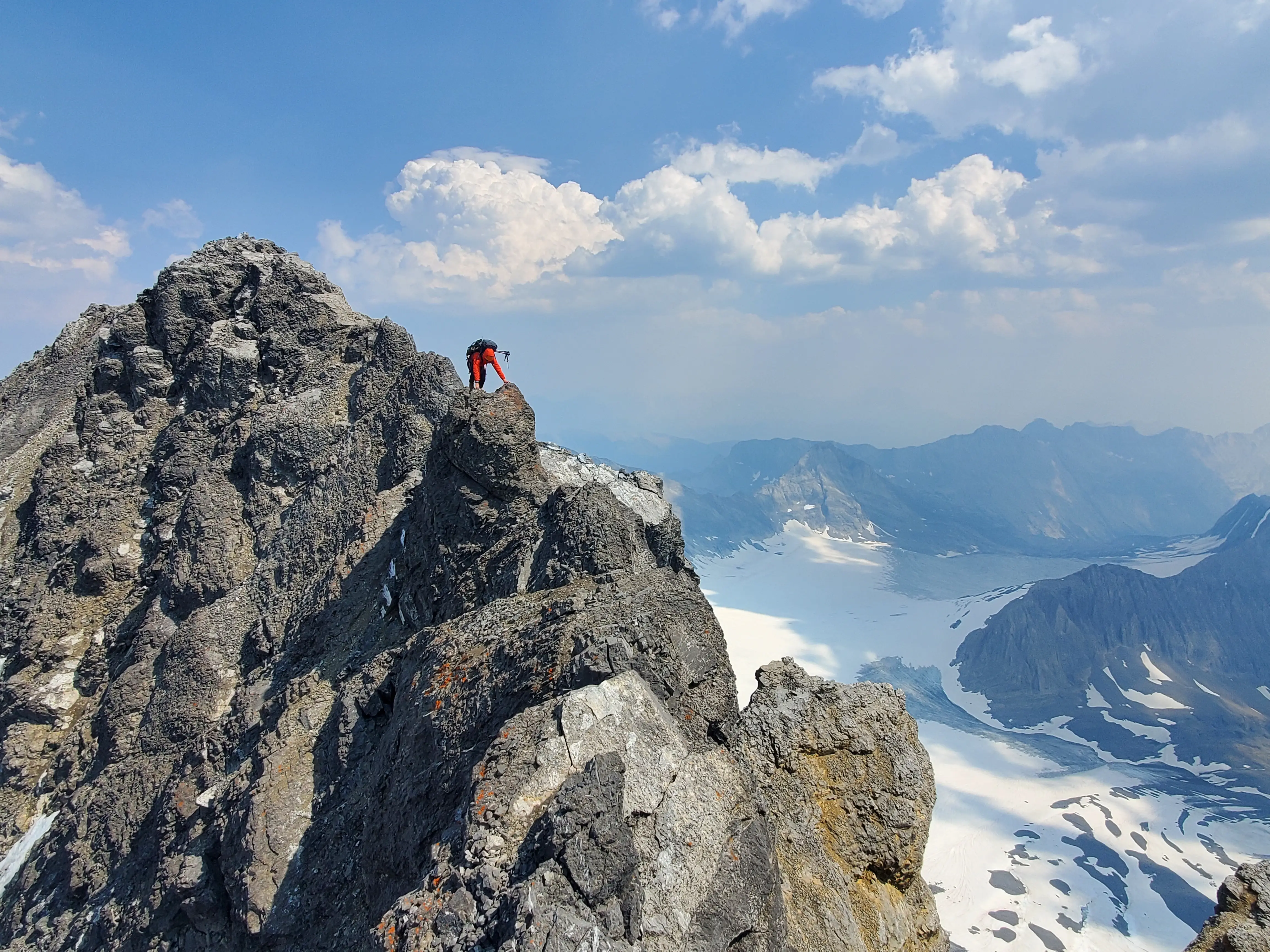
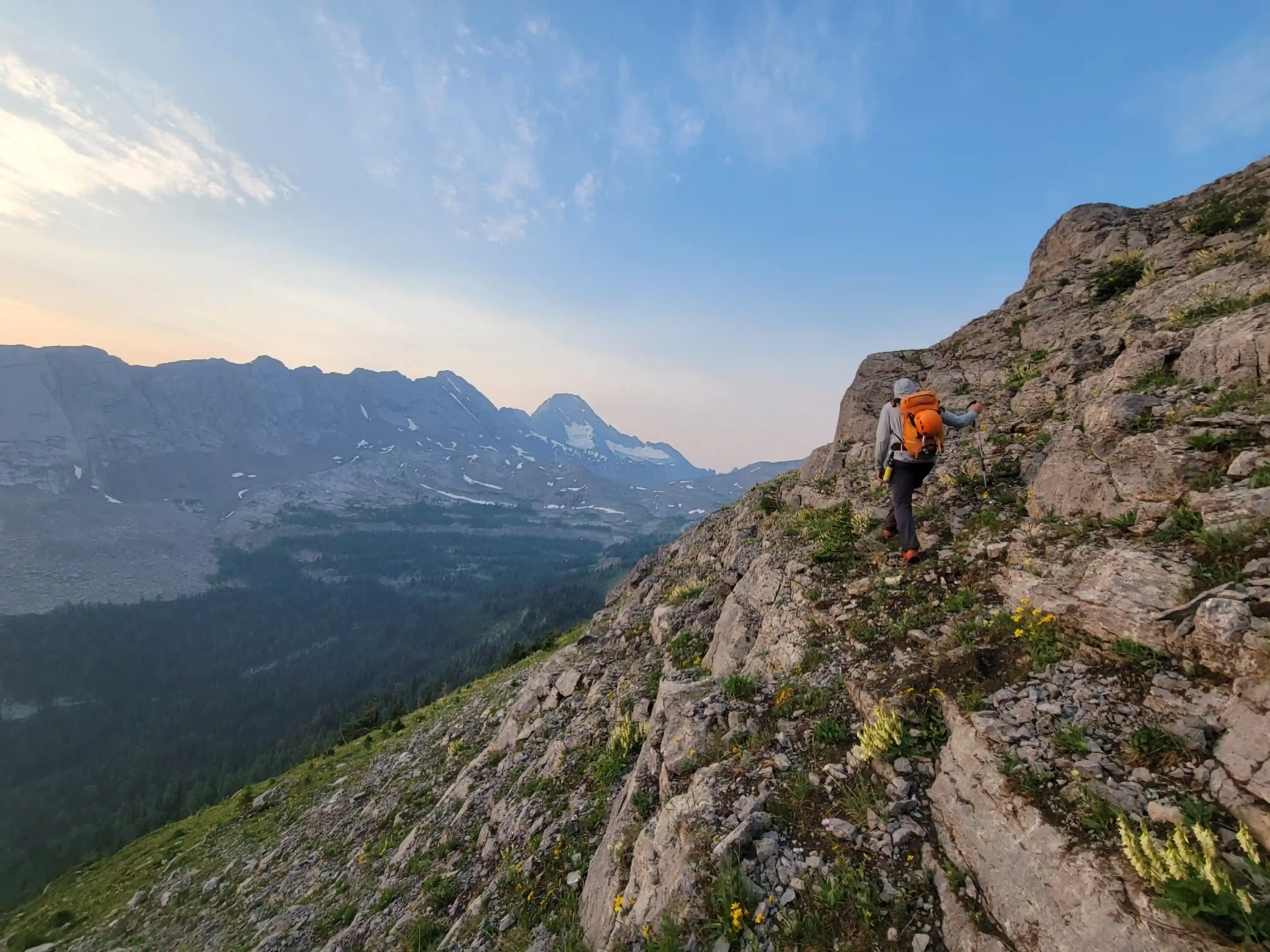
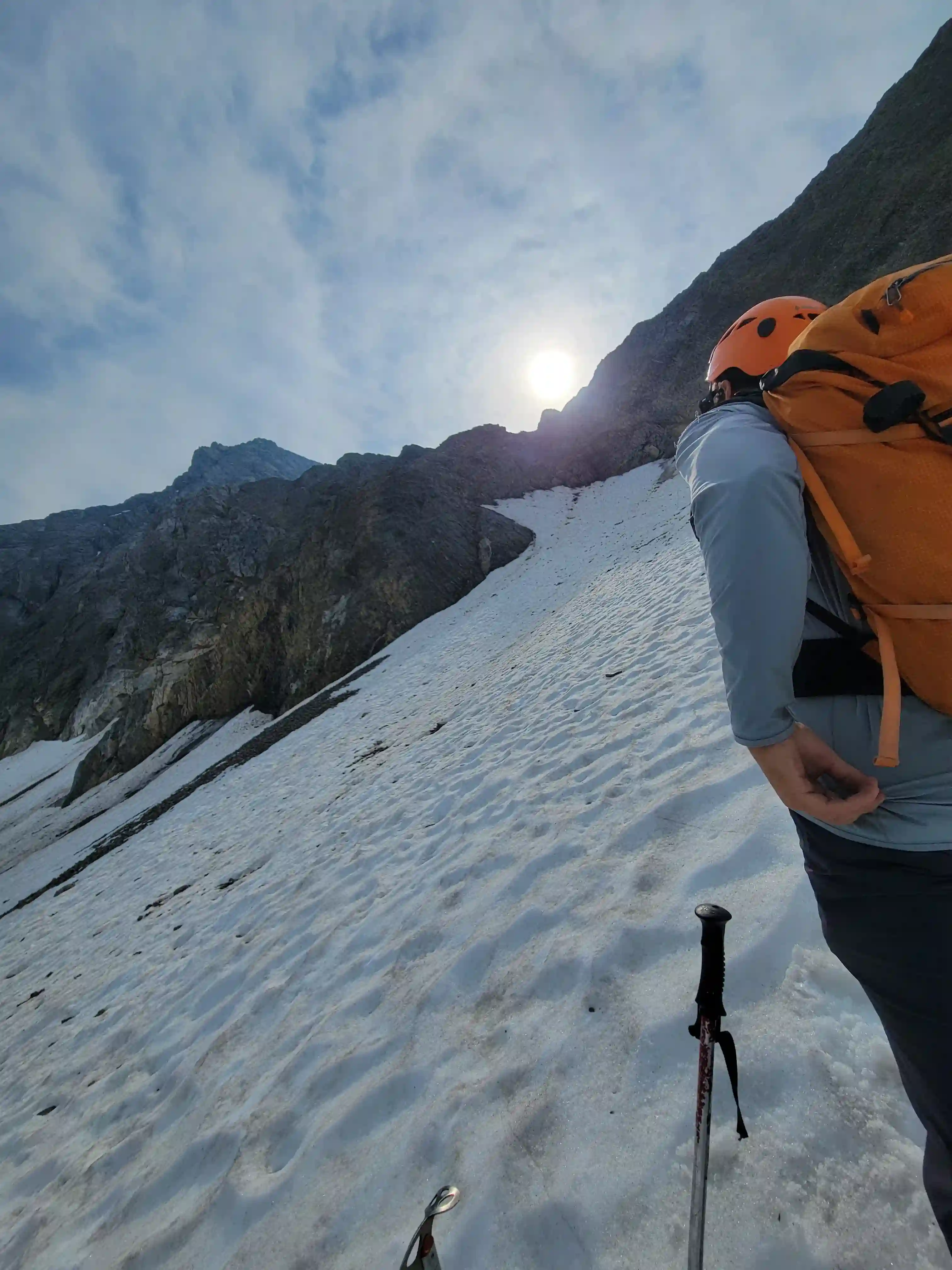
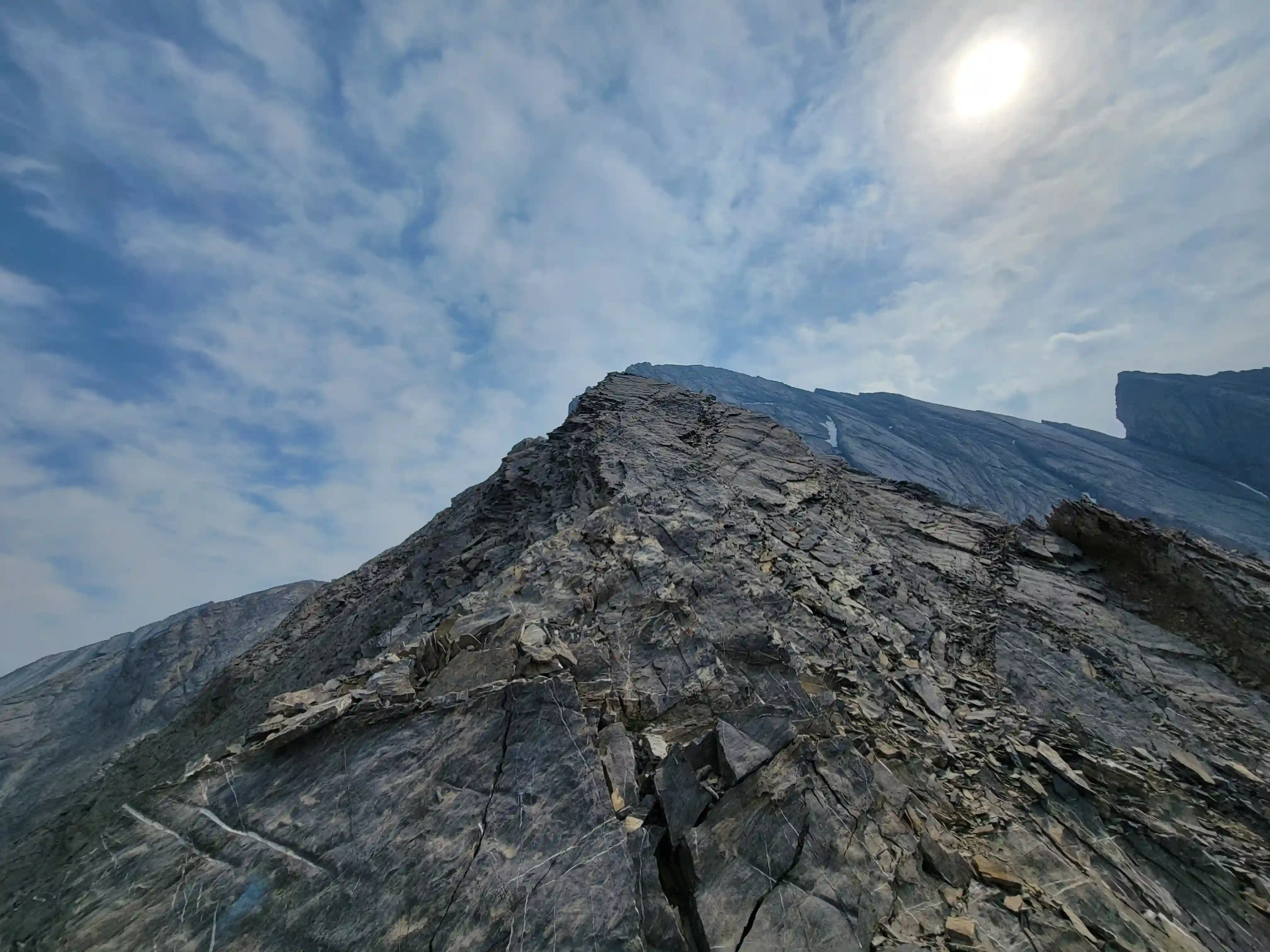
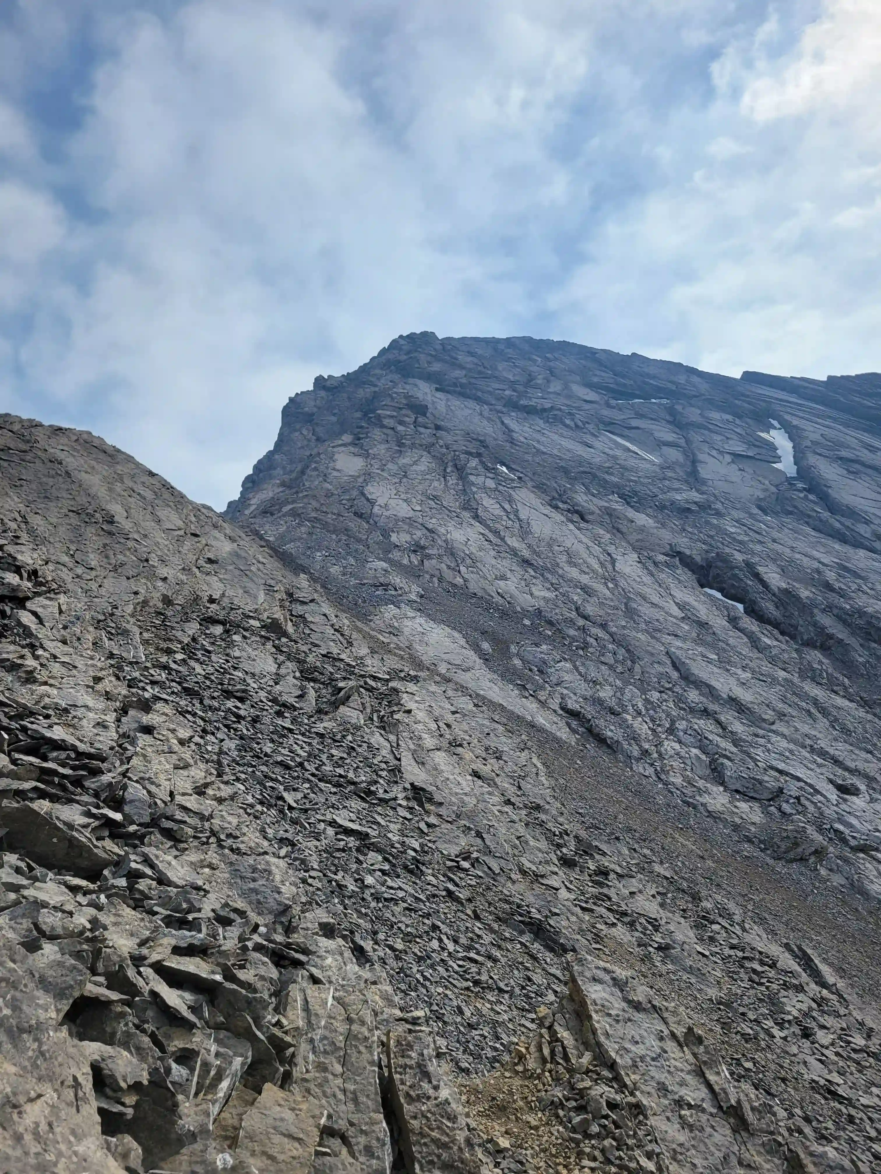
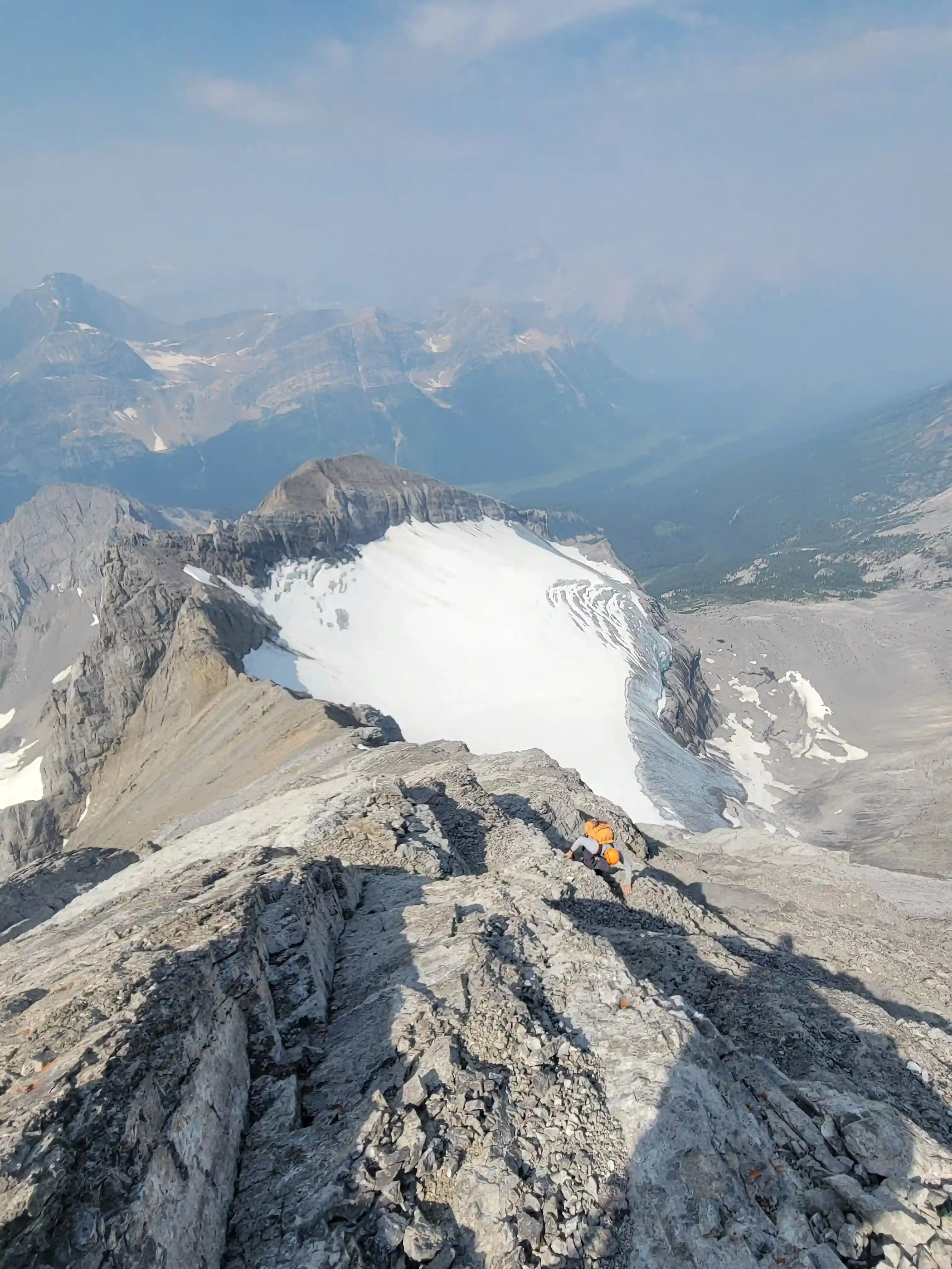
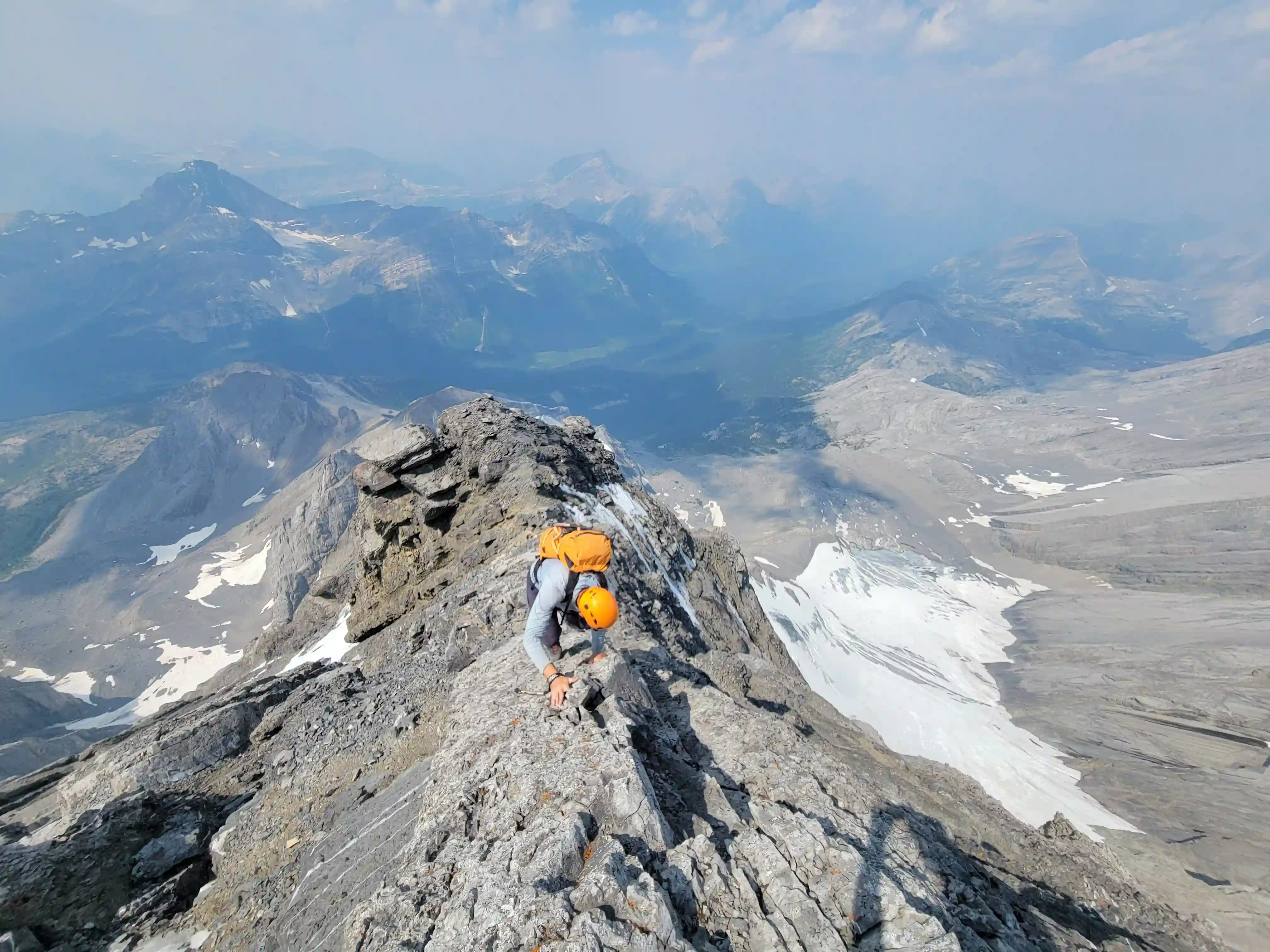
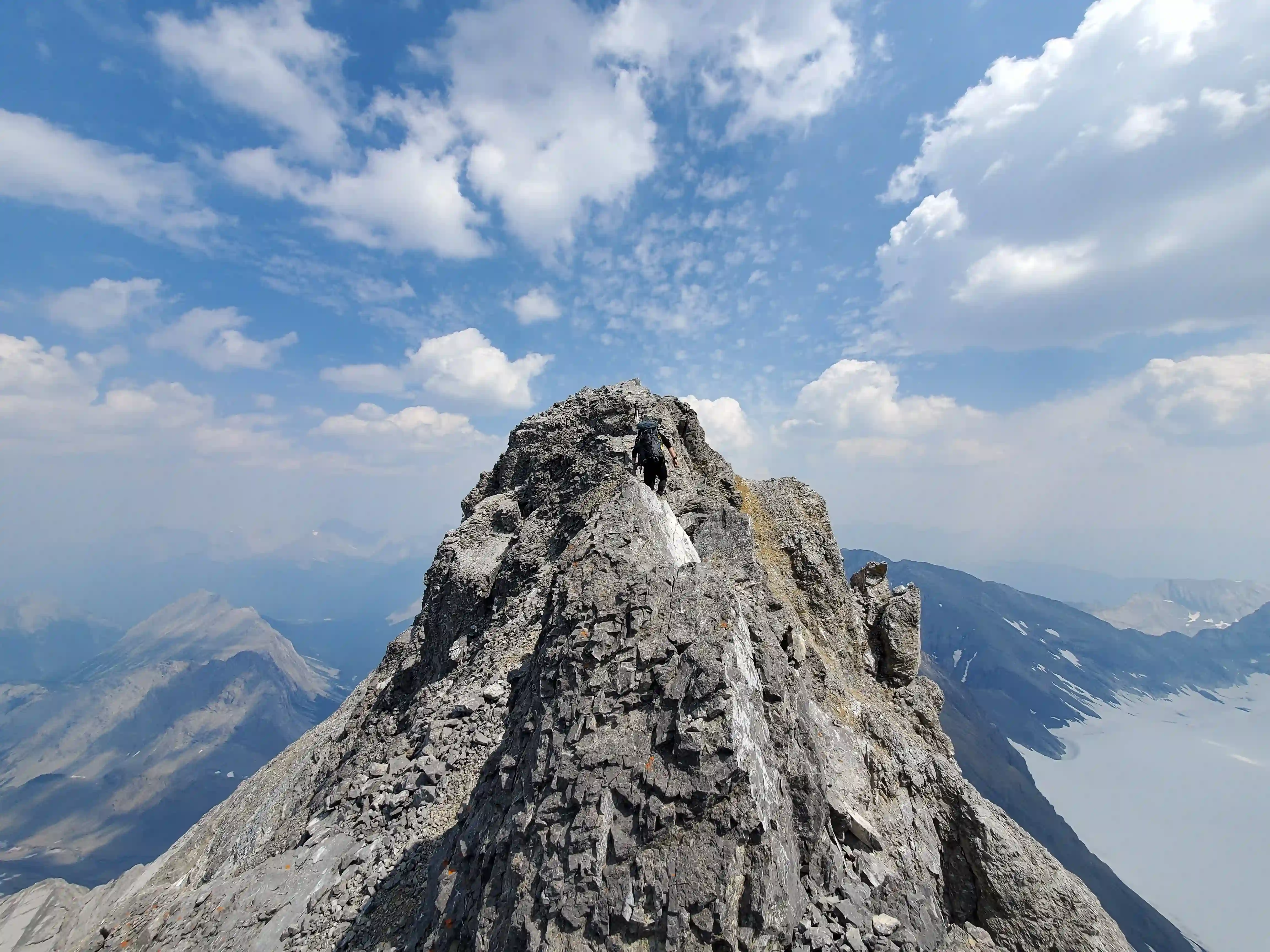
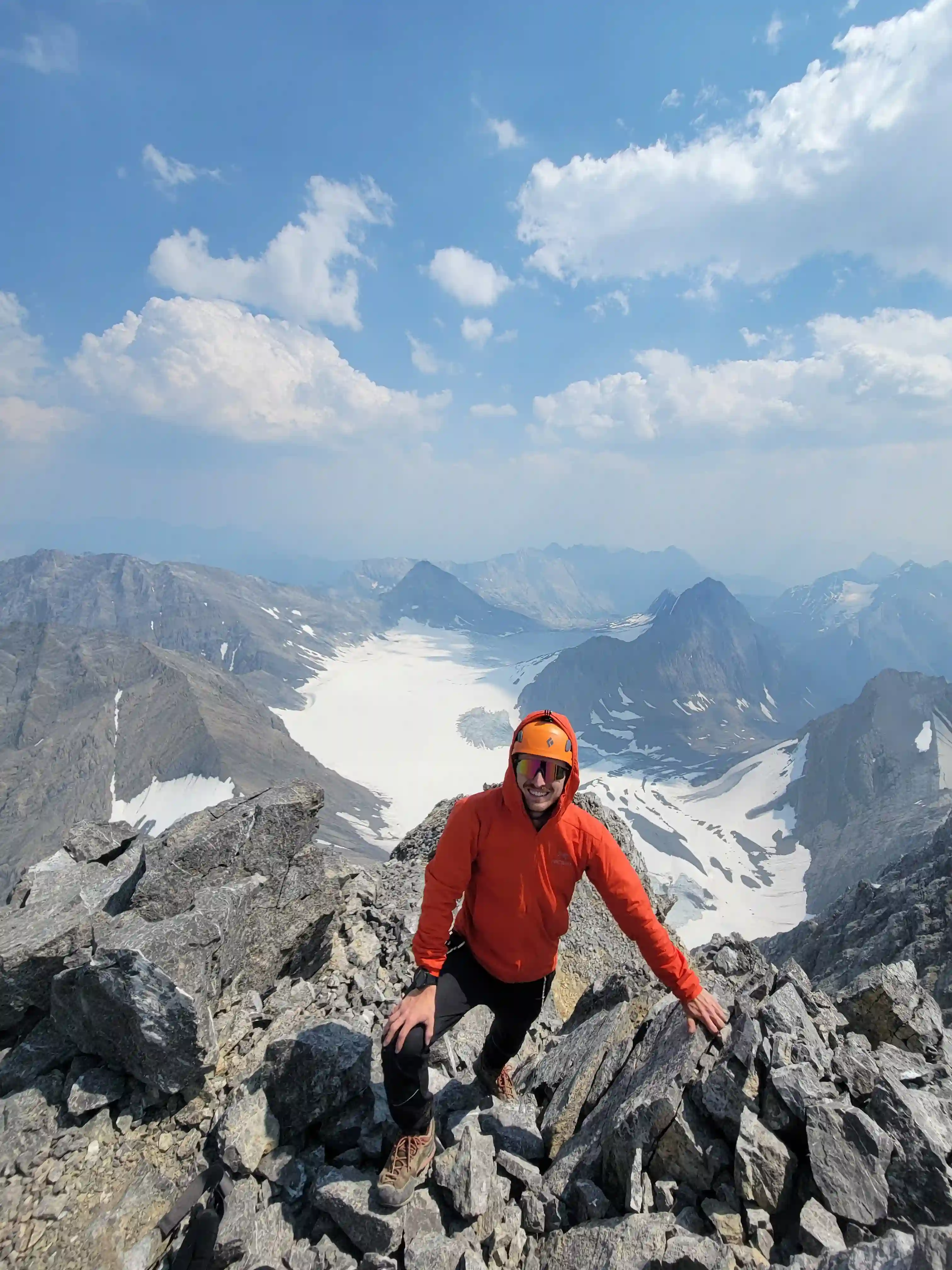
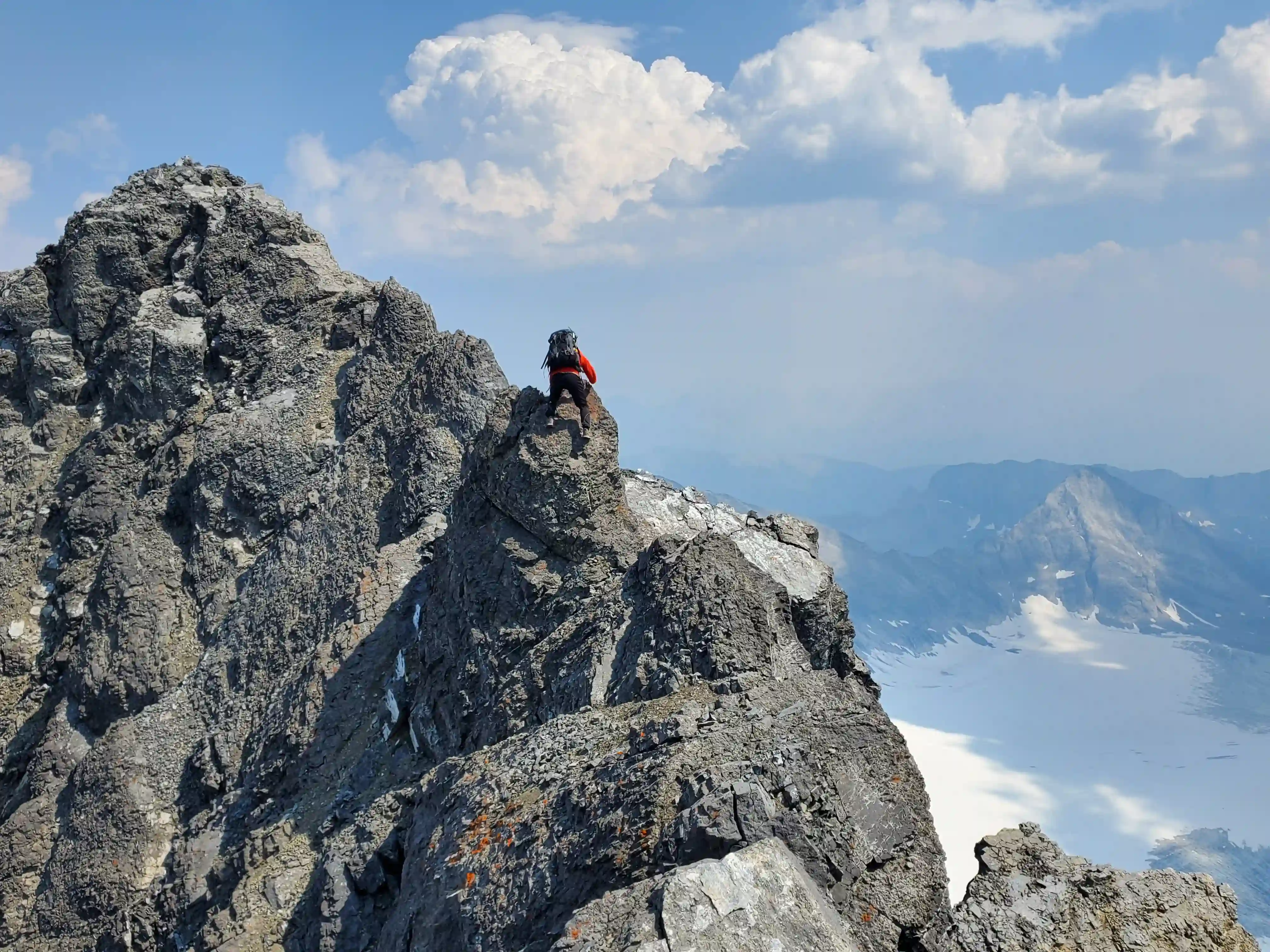
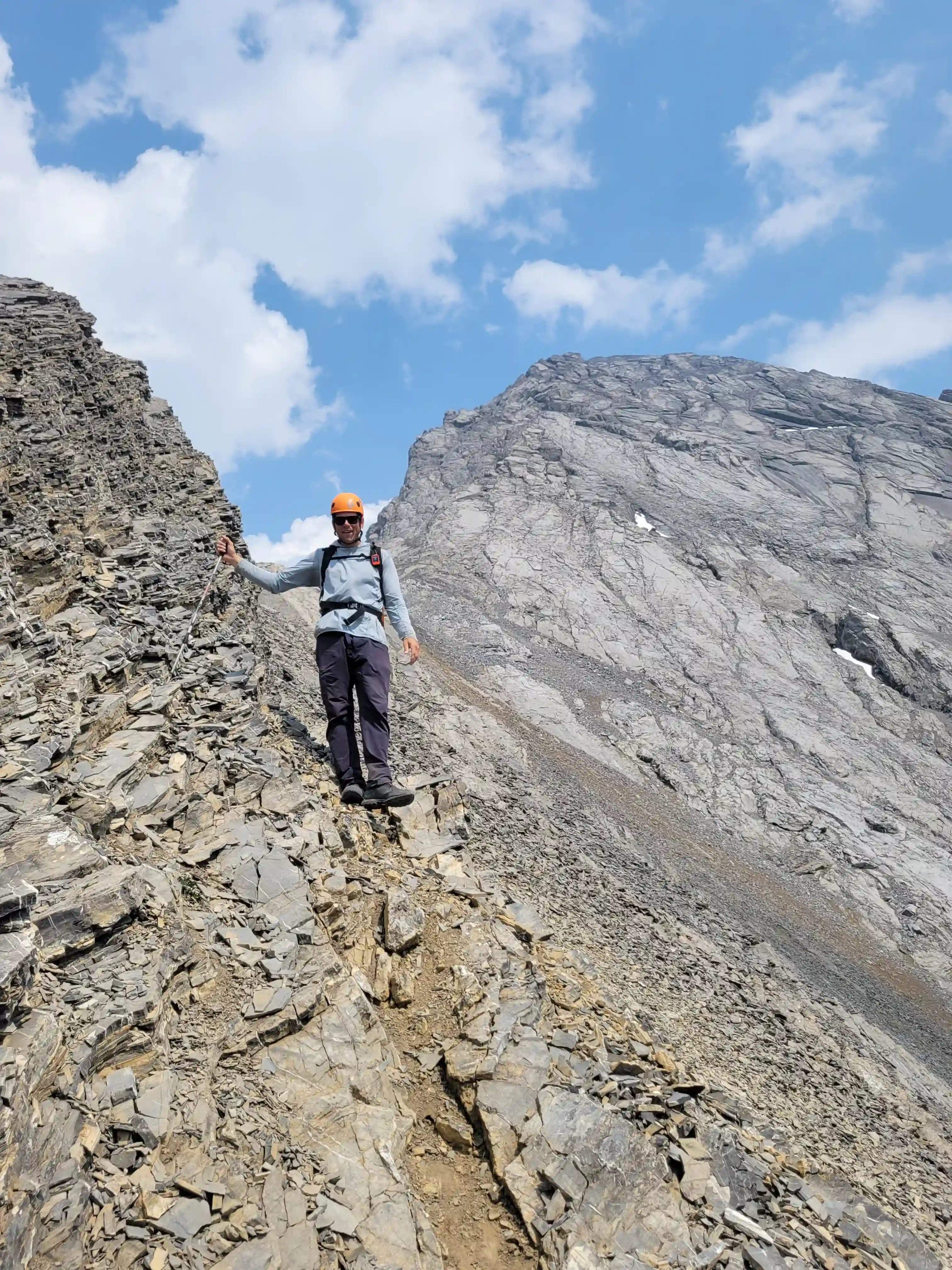
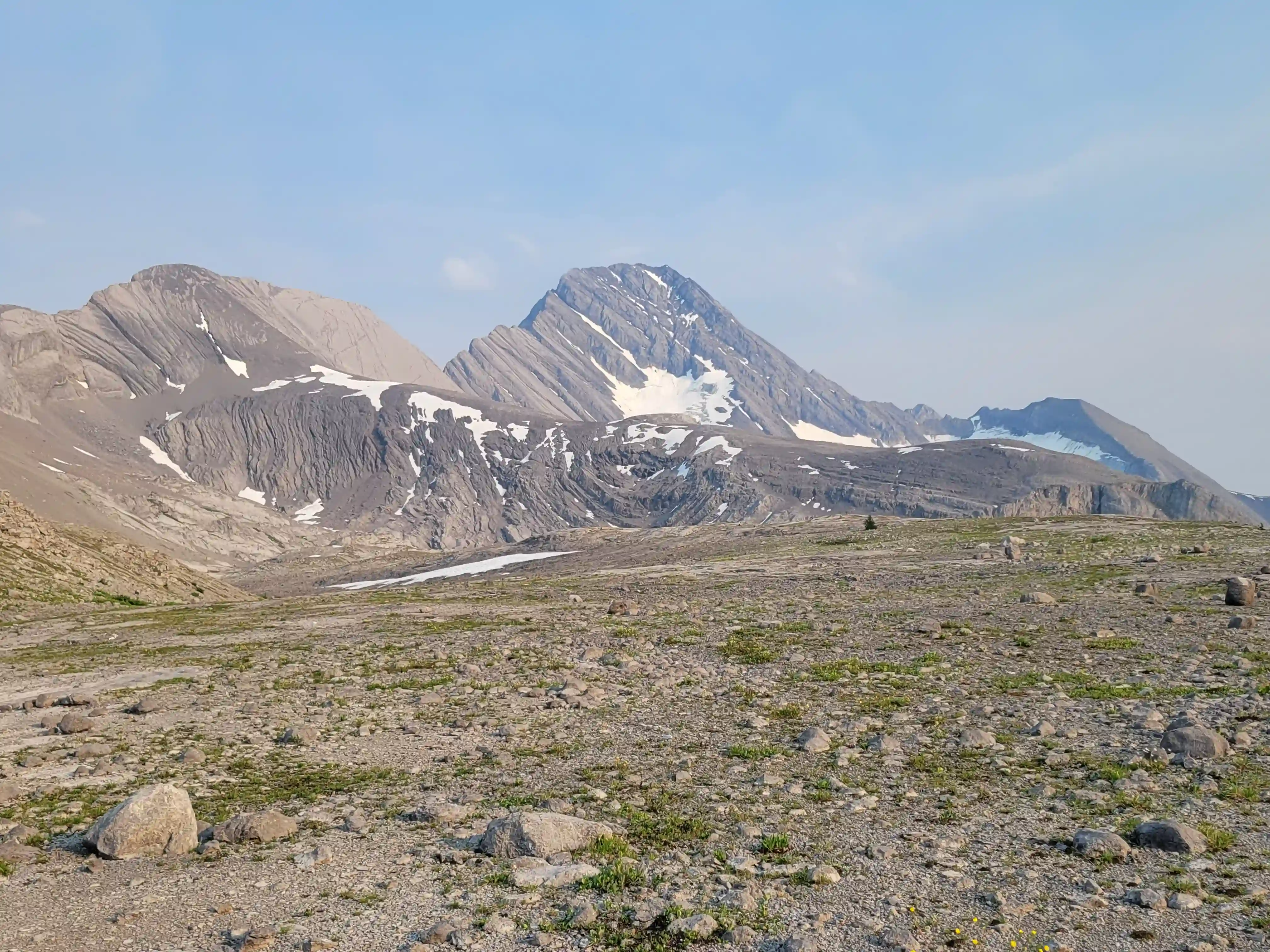
Once we were on the west ridge the fun part began and things quickly got steep! On the way up nothing ever felt particularly difficult but the sustained grade with exposure and loose rock on slab made it feel serious so we had to be cautious. After climbing for quite a while the ridge finally mellowed out and all that was left was the intimidating looking final section to reach the summit! There's a nerveracking looking pinnacle along the way that some parties have skirted onto the NW face to get around, but after a couple tricky moves to get up it it was a walk off the other side and just like that we had reached the summit!
Follow the journey
I'll send you an email when a new trip report drops.
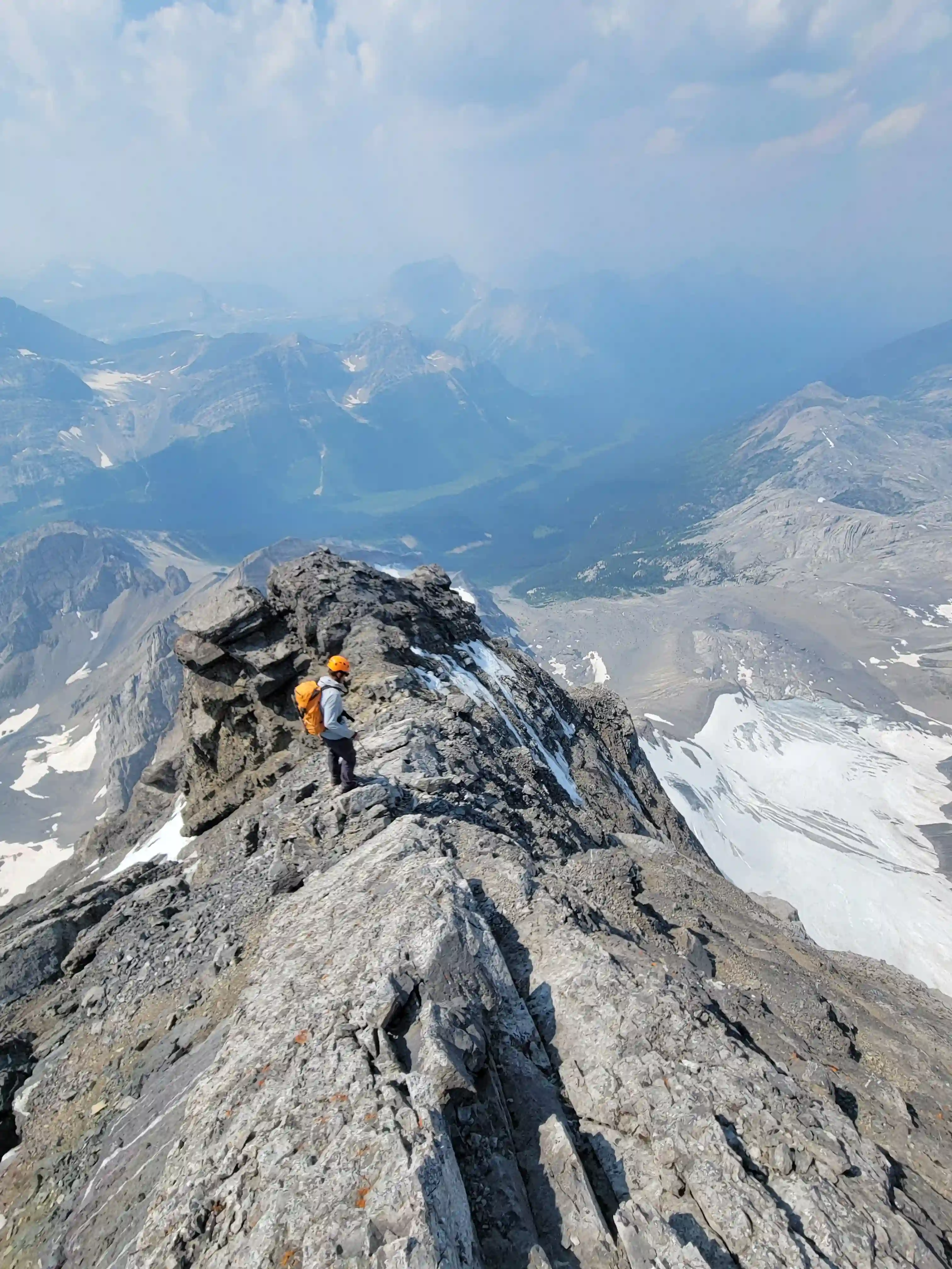
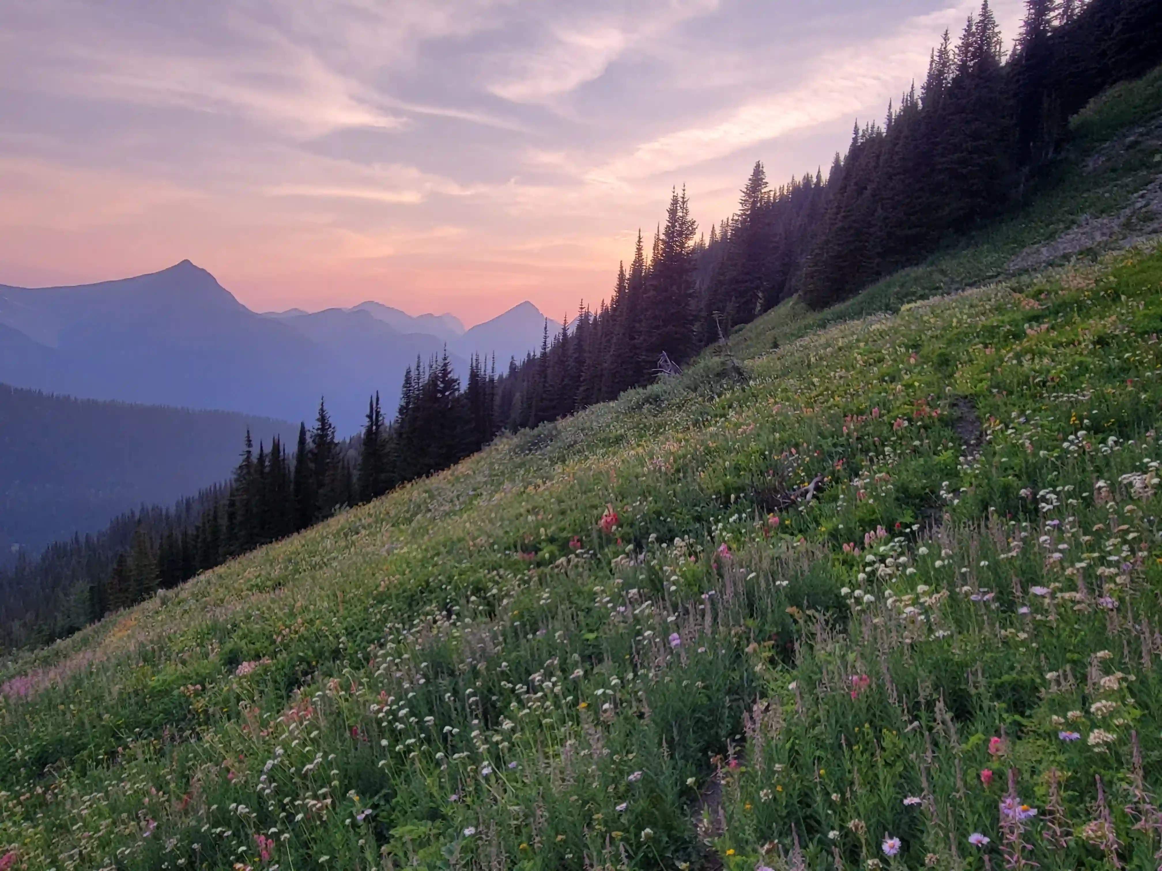
THE APPROACH
east ridge route of Sir Douglas follows the ridge from Zeke's Peak all the way up
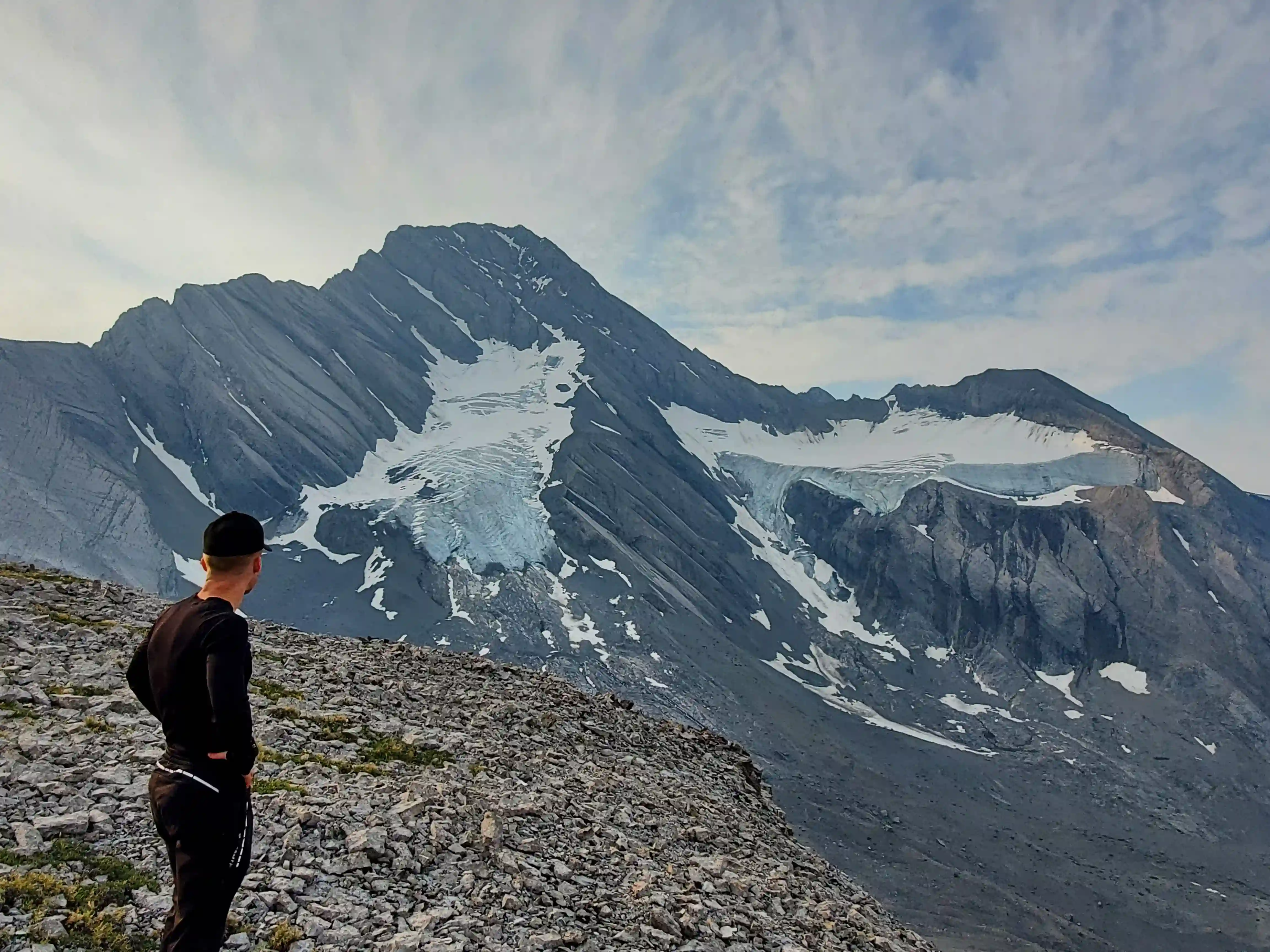
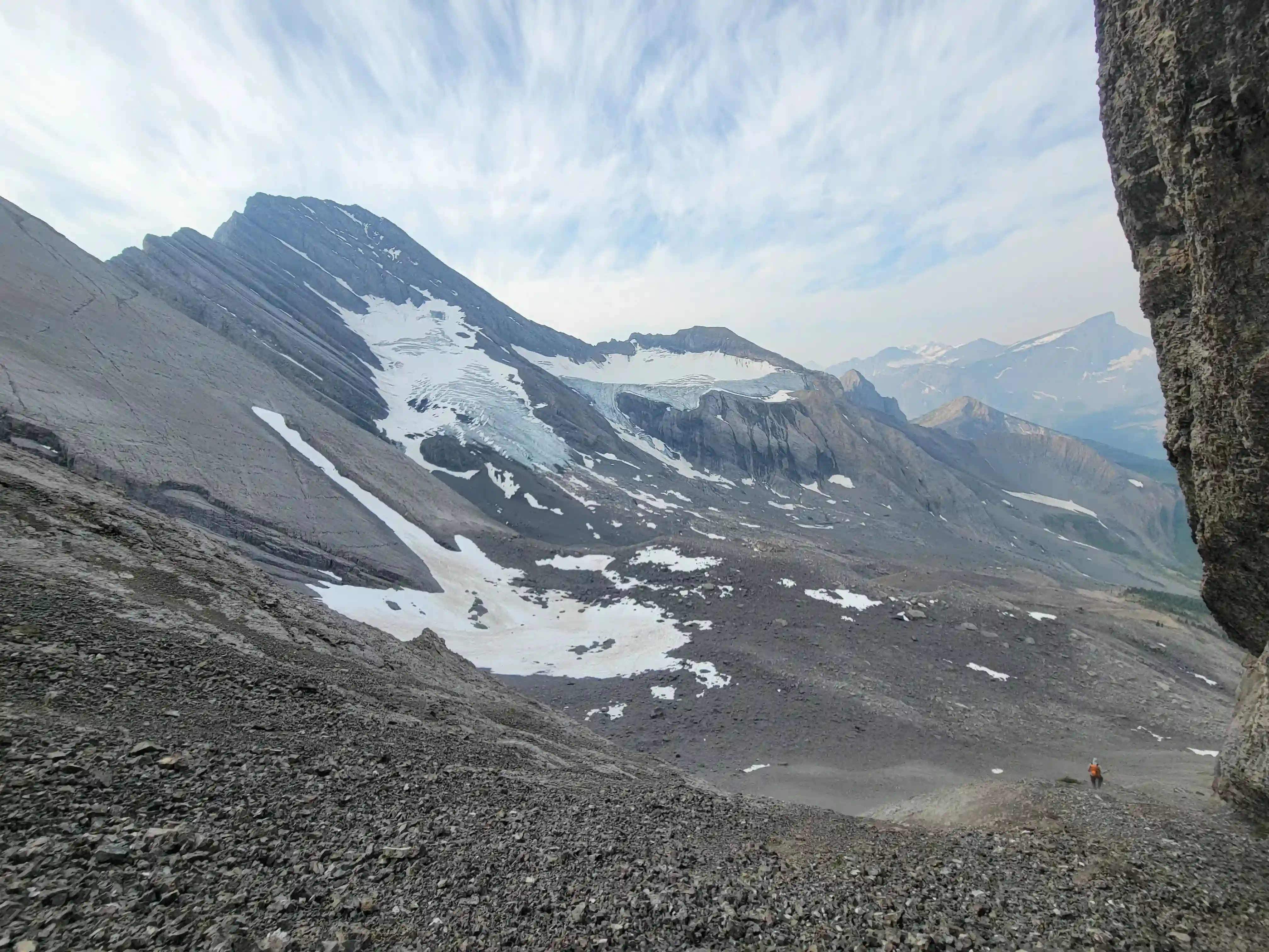
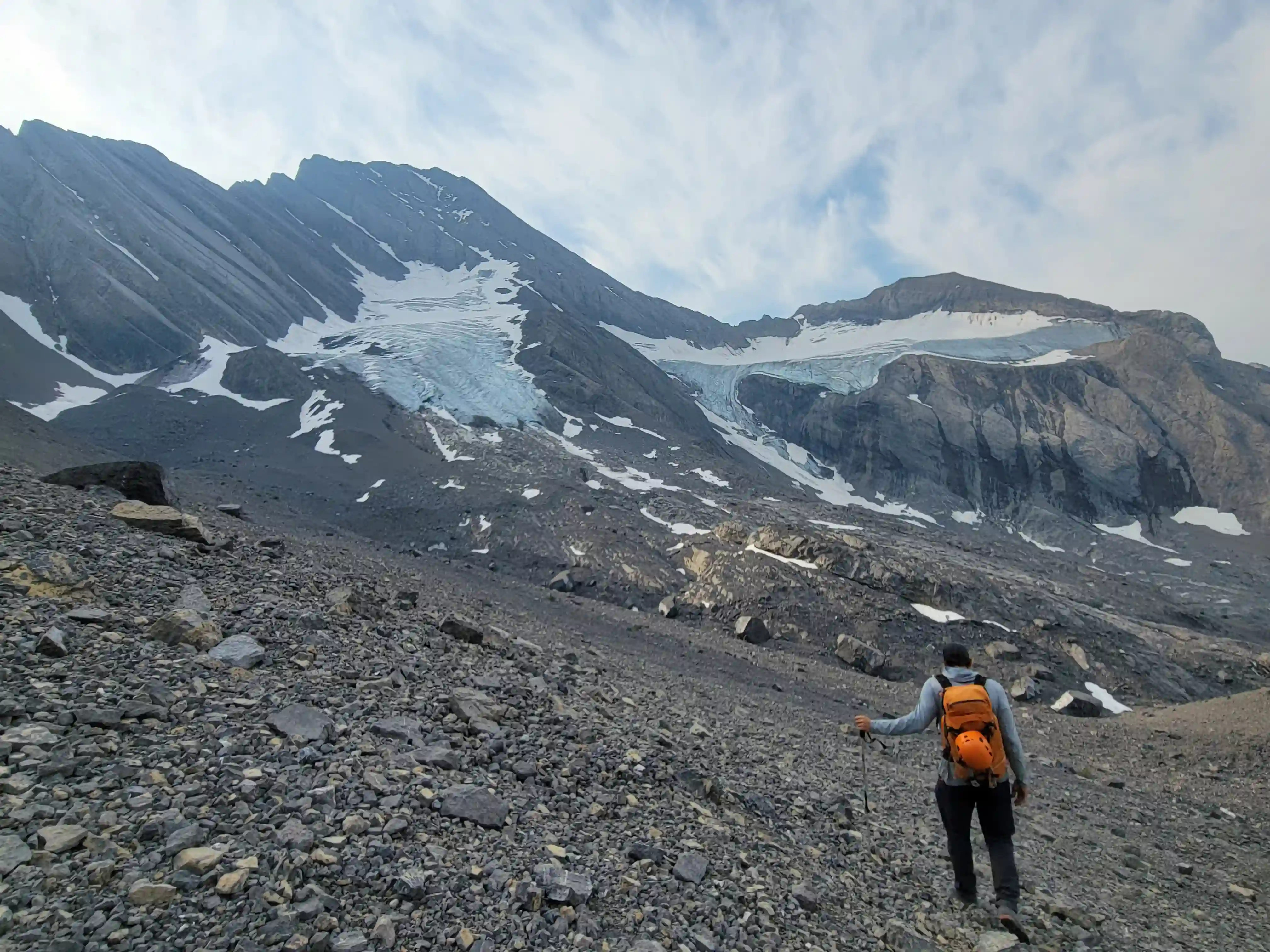
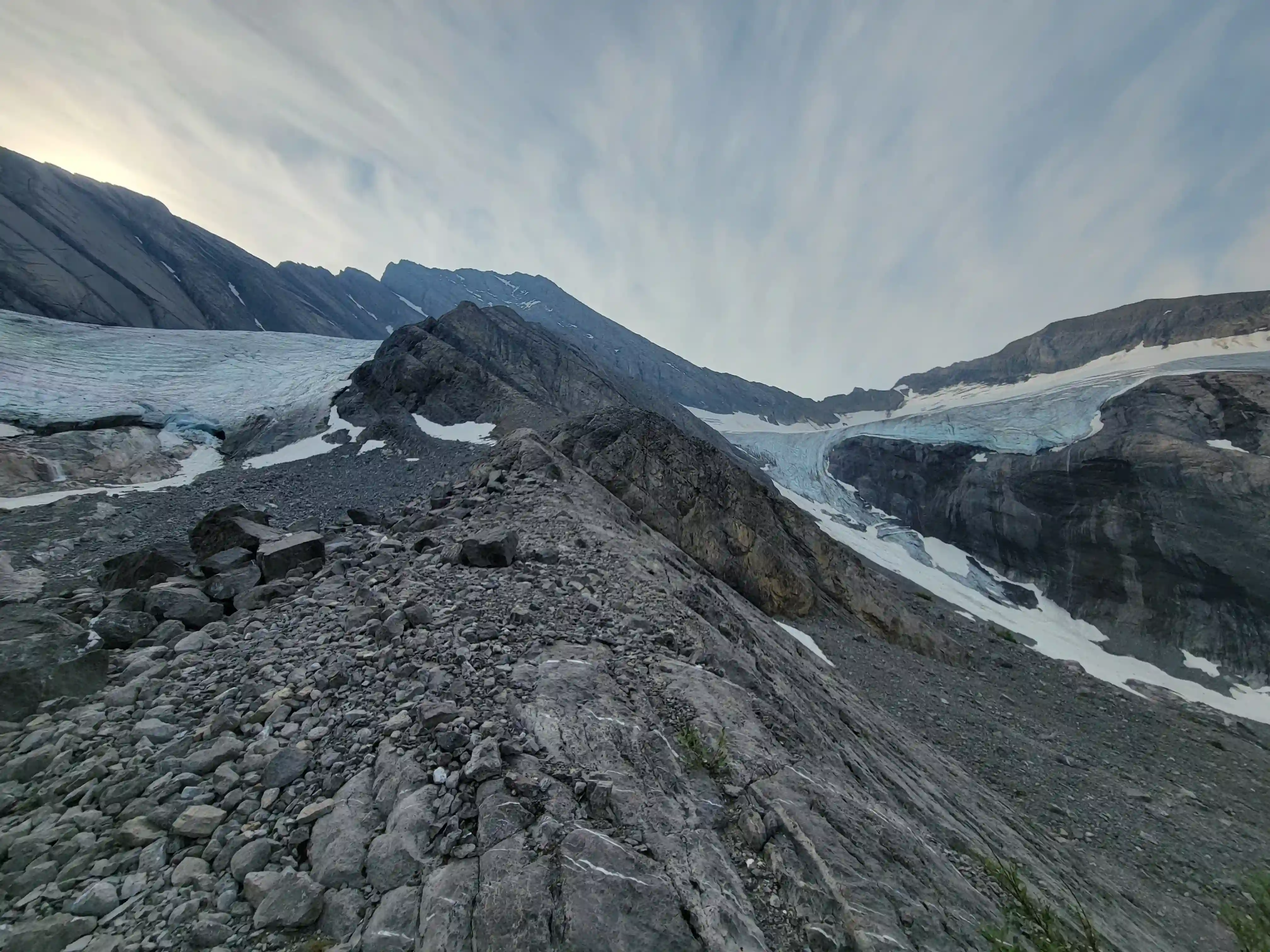
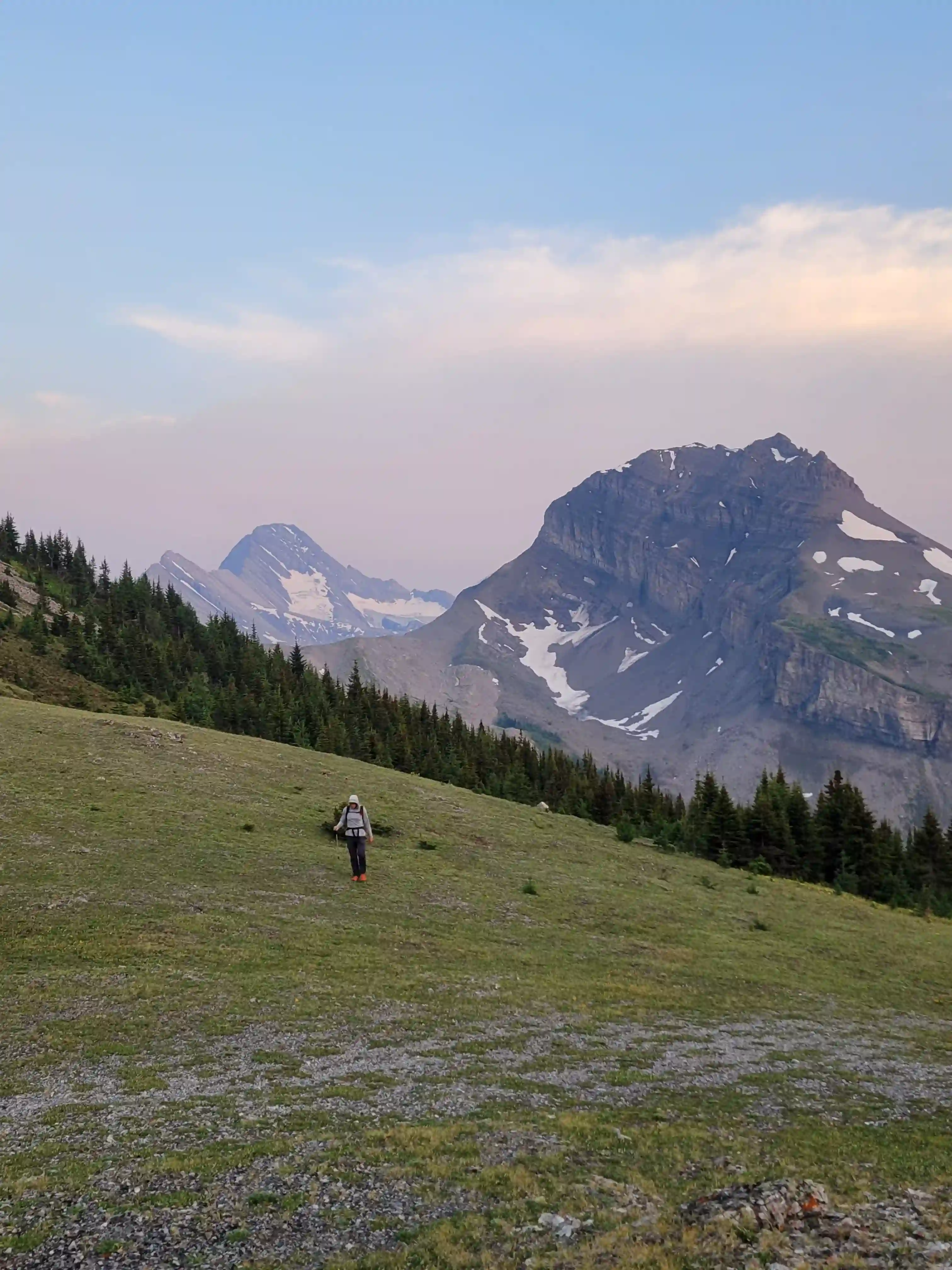
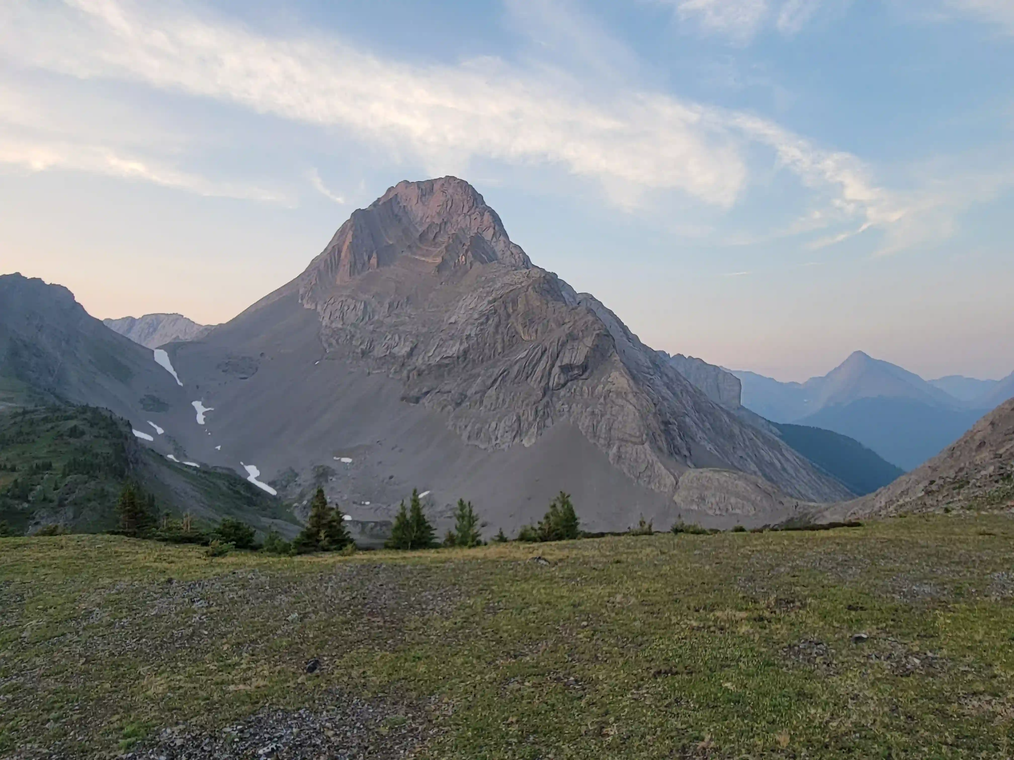
THE LOWER MOUNTAIN
snow here until getting on rock and then
headed for the ridge
THE UPPER MOUNTAIN
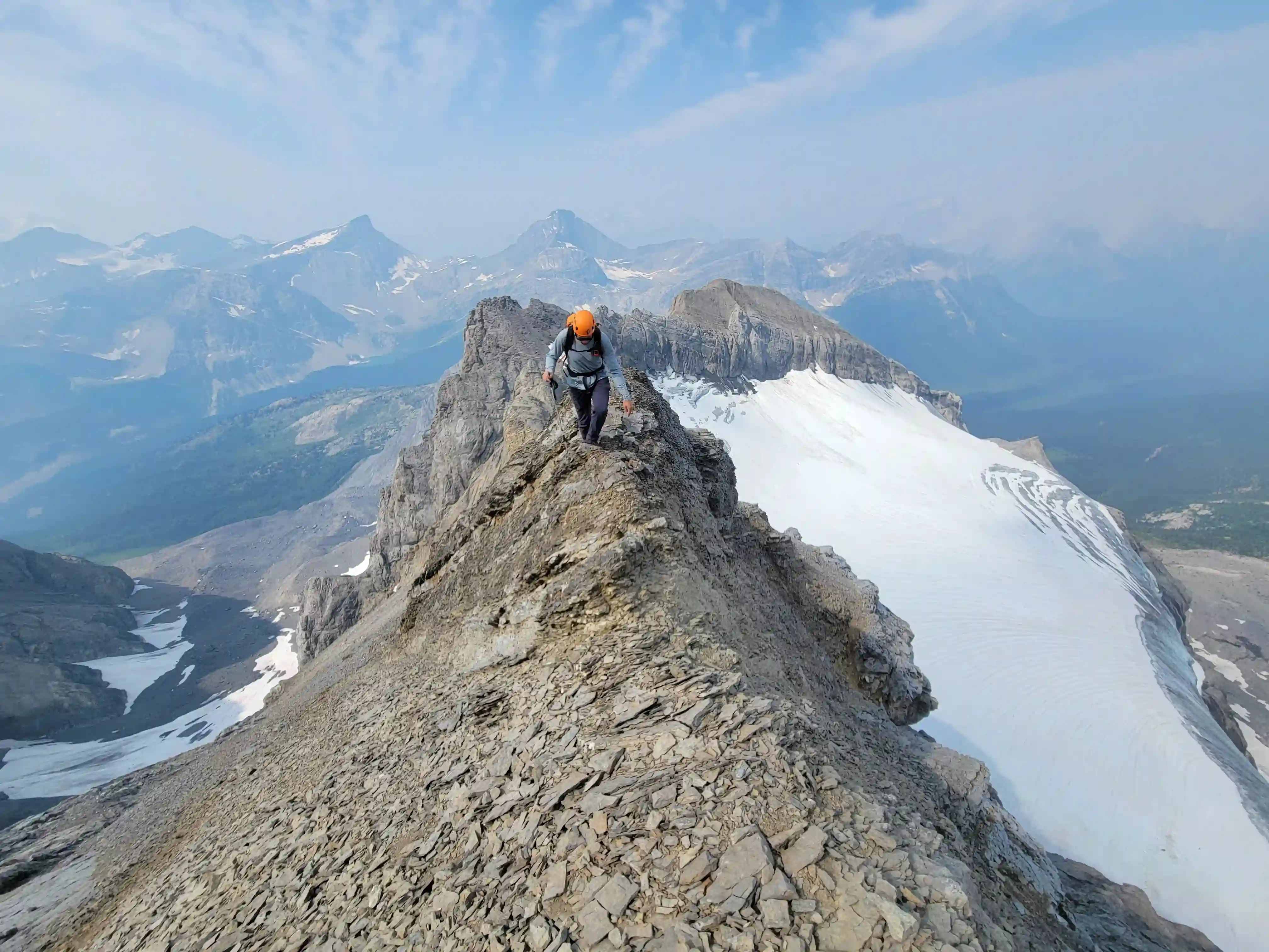
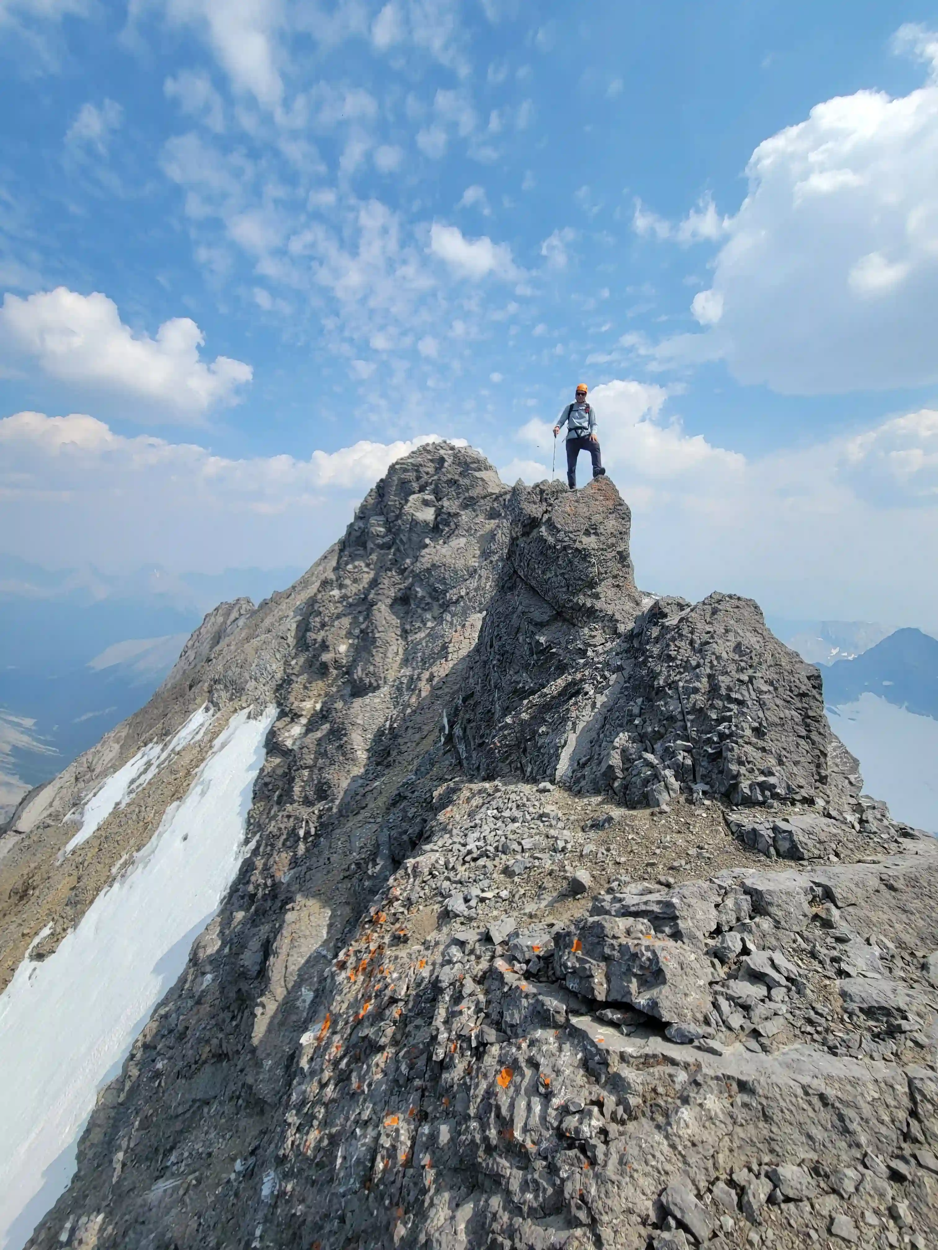
THE SUMMIT & DESCENT
Into trips like this?
I'll send you an email whenever I publish a new trip report.
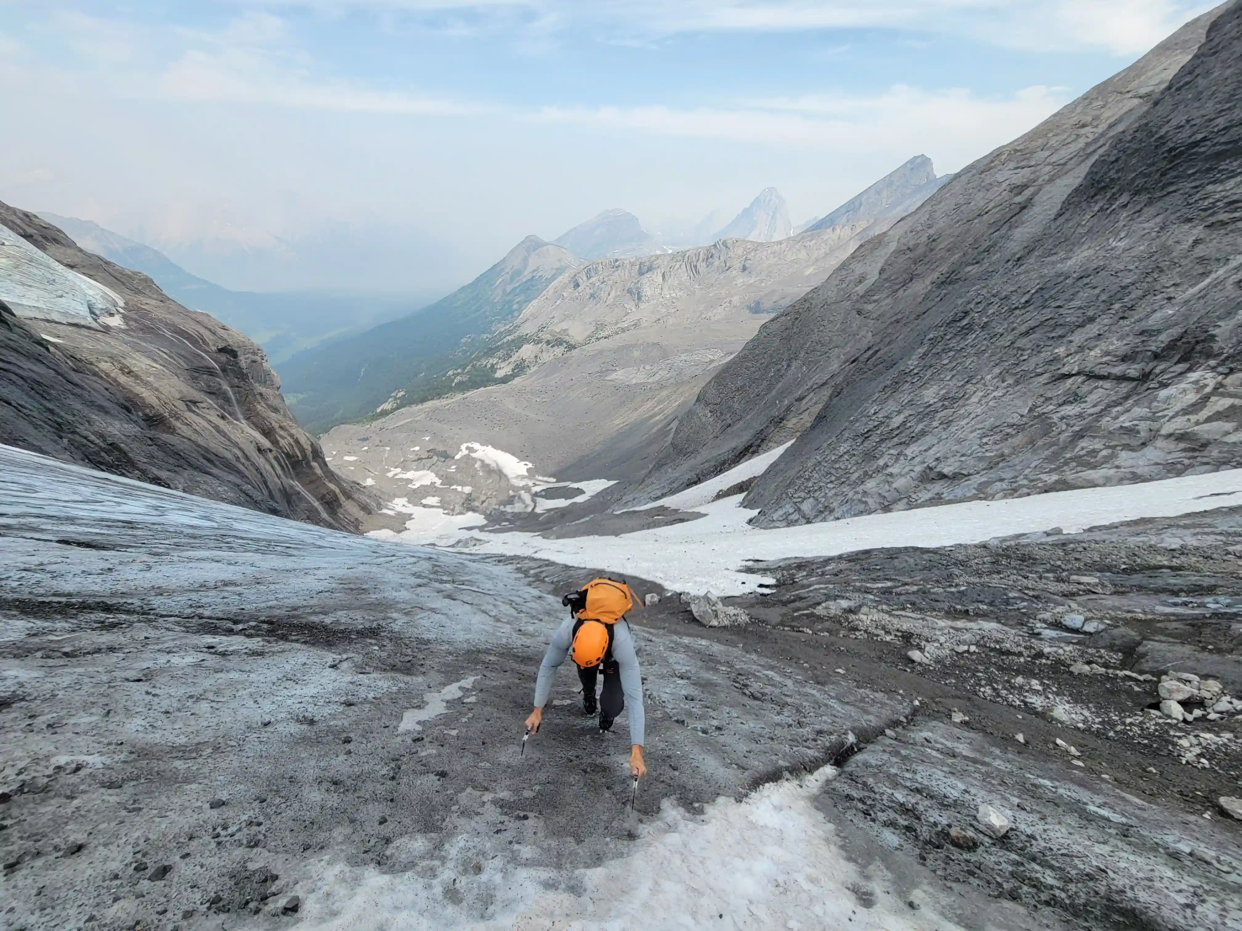
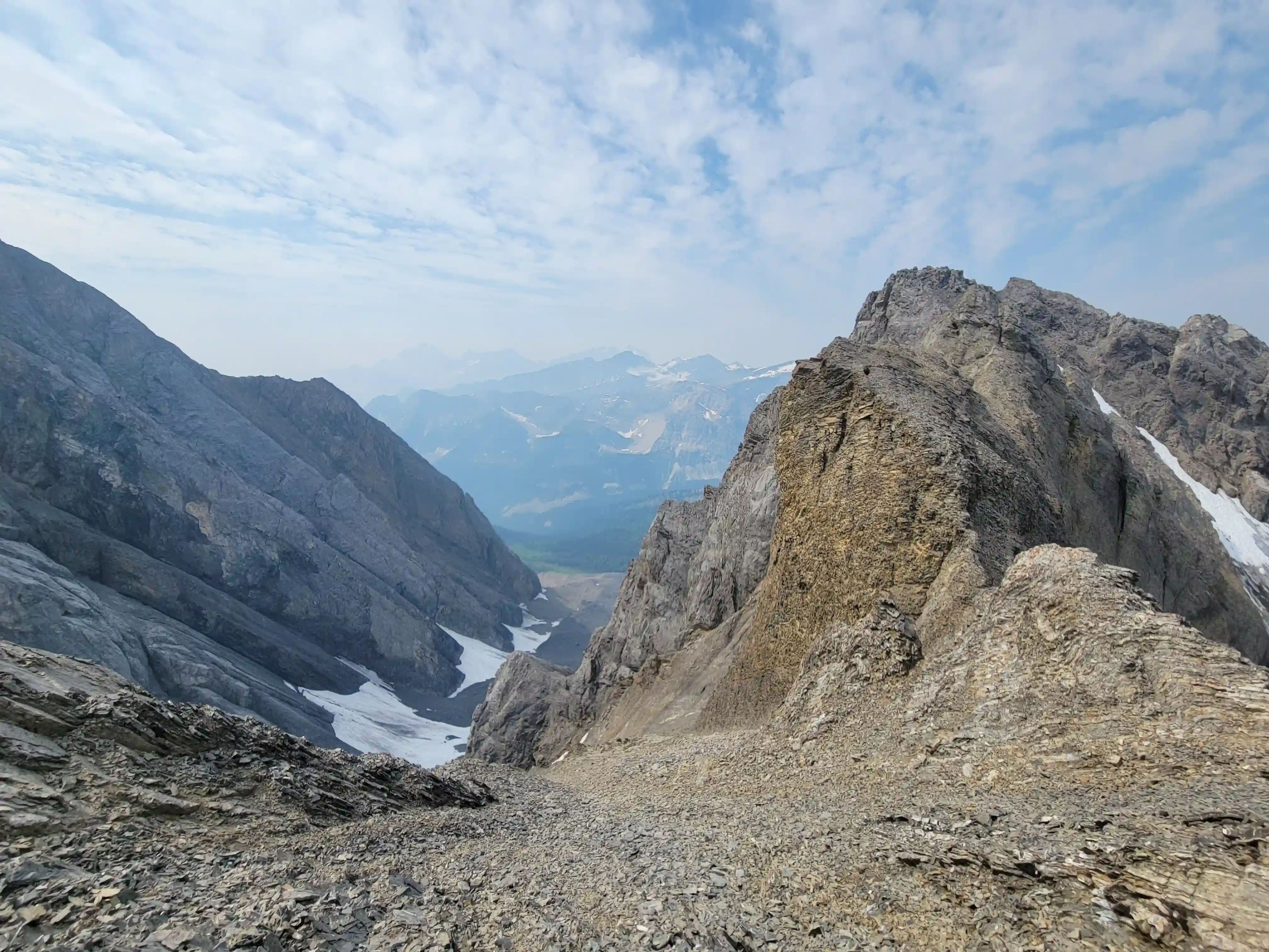
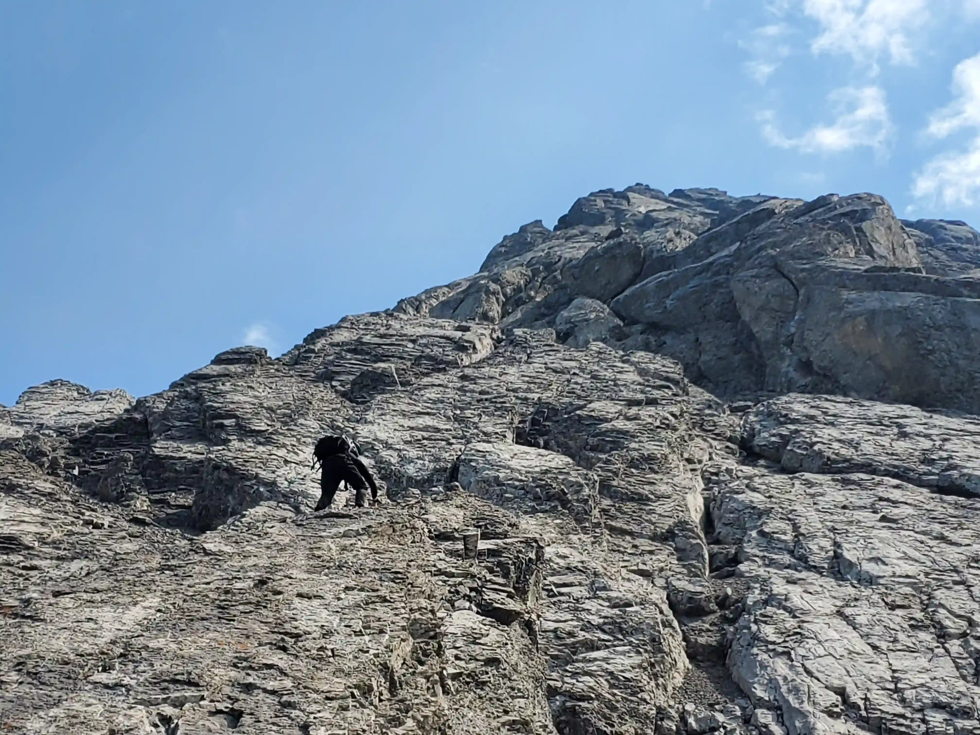
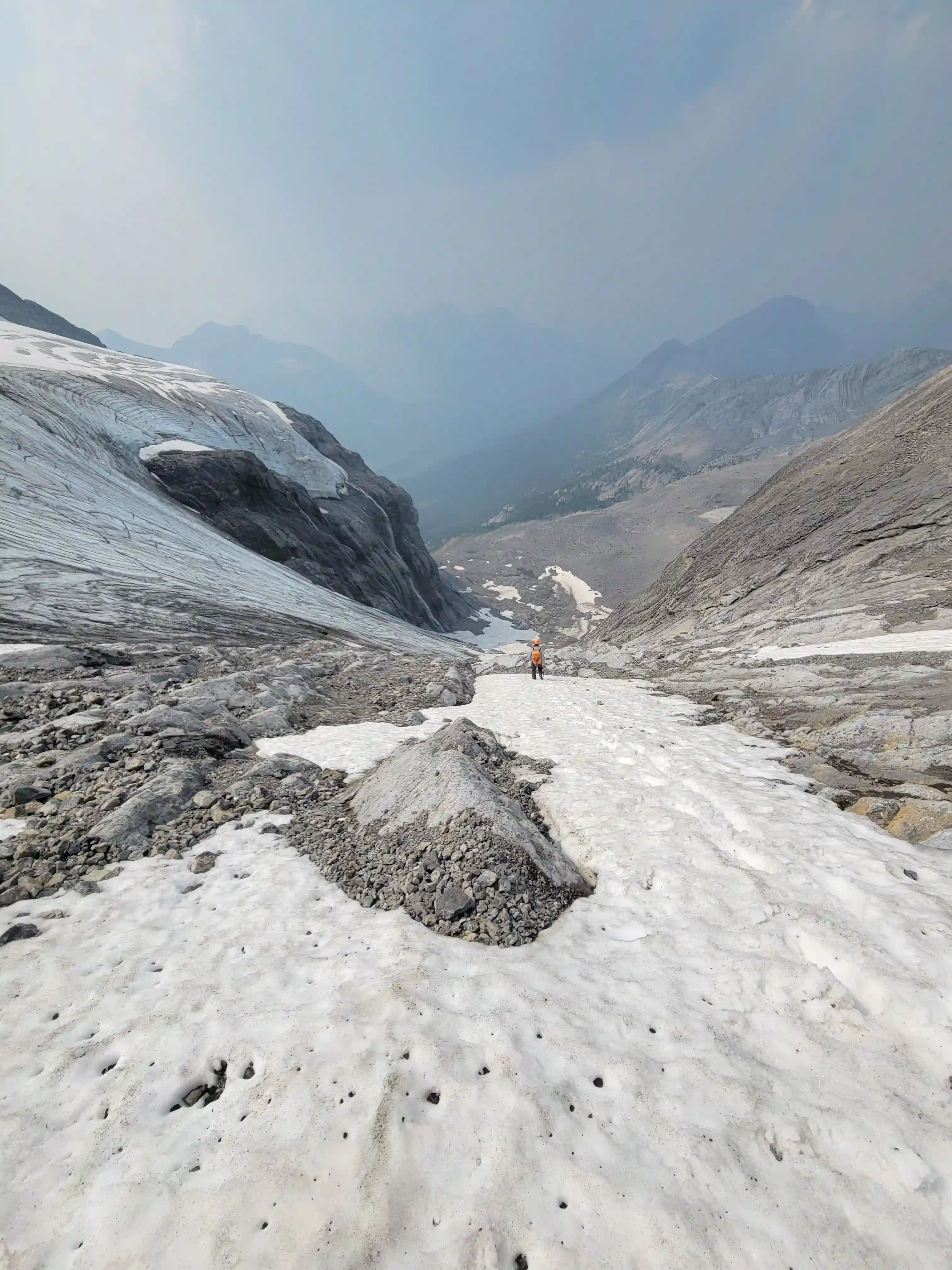
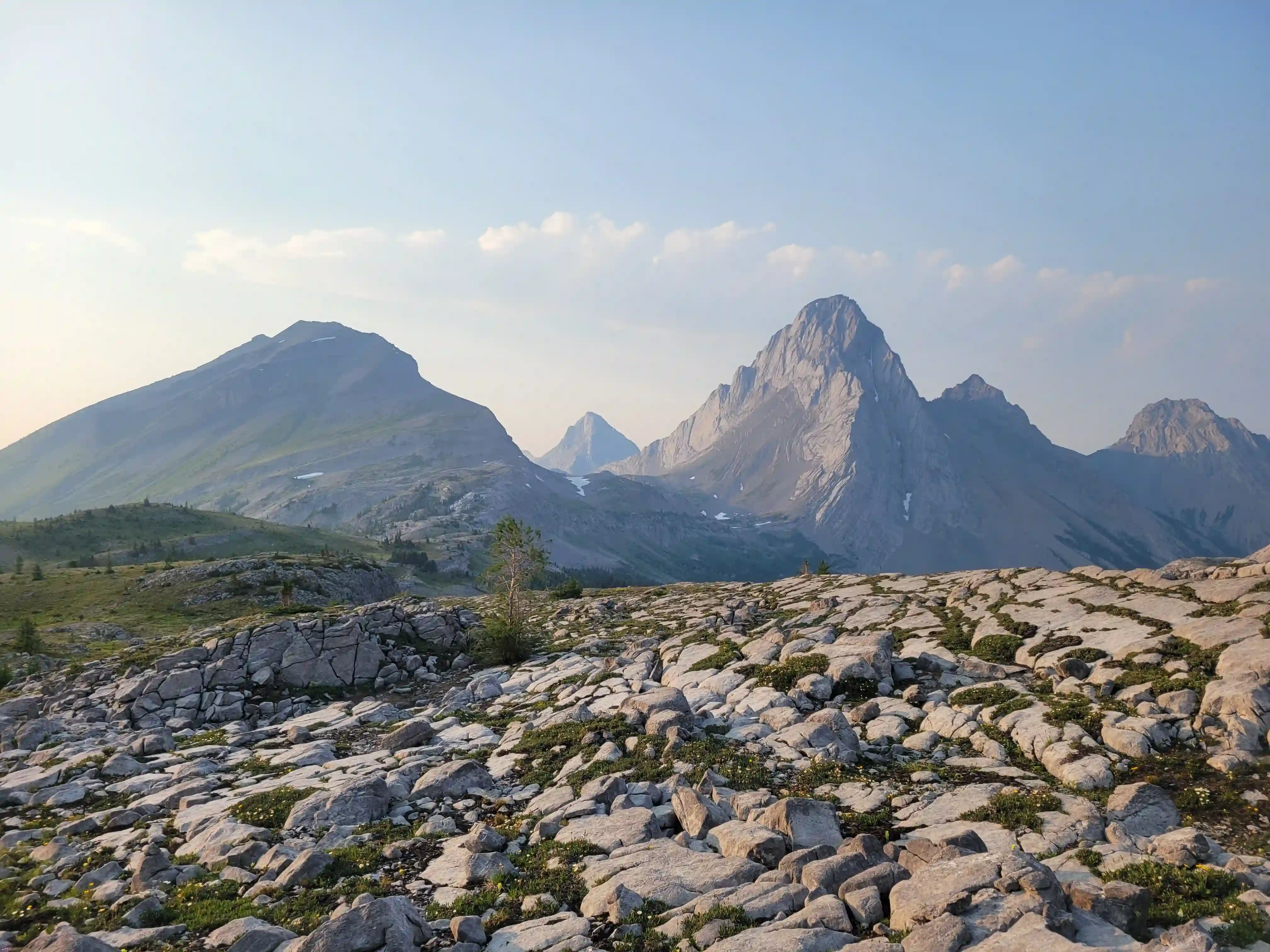
As per usual the descent ended up being trickier than the ascent and the loose rock on top of slab had us testing every step and foothold to make sure we weren't launching rocks at each other or launching ourselves down the steep slope. After returning to the low point on the west ridge and heading down towards the glacier some of the nastiest terrain of the day began and we were forced down steep, loose, and often hard packed rock as we neared the glacier with sizable exposure below. We were happy once that sketchy section was done with and felt like we were mostly in the clear with just the glacier descent, scree terrain, and the deproach remaining.
The loose scree to regain the bench was about as brutalizing as we expected with the legs already feeling it quite a bit by this point in the day, but once we were up that all that was left was the exit to Smuts Pass and then to the parking lot. The entirety of the terrain for the exit was pleasant with a sizable amount of it trailed and the rest in open meadows so it was relatively enjoyable but we were quite tired so the kilometers began to drag as we got closer to the lot.

THE LONG EXIT
Tail, & Commonwealth Peak
Mount Sir Douglas while definitely technical ended up being a lot more manageable and enjoyable than I had expected. Most of what I heard about the mountain before going for it were bad things so there was a bit of concern heading into this trip but I thought it was a cool objective and I'll definitely consider going back one day for the NW face route as a spring ascent!
Following this outing it wouldn't be long until Darren and I teamed up again, with a window showing up just a week later it was time to go for another
rocky objective on the list!
Follow the full progression
I'm working through all 58 11000ers of the Canadian Rockies and beyond. You'll get notified when the latest climbs go live.
Other related trip reports:
Mount Temple |
Mount Cline |
Mount Murchison ||
Lefroy, Victoria South, & Huber Linkup |
Mount Alexandra
11000ers of the Canadian Rockies
© Haldan Borglum | Peak by Peak. All rights reserved.